declaration o - nedlands.wa.gov.au special... · web viewmain roads wa has determined that the...
TRANSCRIPT

Minutes
Special Council Meeting
31 July 2018
Attention
These Minutes are subject to confirmation.
Prior to acting on any resolution of the Council contained in these minutes, a check should be made of the Ordinary Meeting of Council following this meeting to ensure that there has not been a correction made to any resolution.
1

Table of Contents
Declaration of Opening....................................................................................Present and Apologies and Leave of Absence (Previously Approved)...........1. Public Question Time.....................................................................1.1 Mr Alexander James, 40 Portland Street, Nedlands......................1.2 Mr Noel Youngman, 1 Colin Street, Dalkeith..................................1.3 Mr Malcolm Jacoby, 29 Jutland Parade, Dalkeith..........................1.4 Mr Petar Mrdja, 231 Bulwer Street, Perth.......................................1.5 Mr Barry Nunn, 16 Webster Street, Nedlands................................1.6 Mr Alan Nicoll, 15 Viewway, Nedlands...........................................1.7 Ms Trina Russell, 17 Kingsway, Nedlands.....................................1.8 Ms Joanna Donaldson, 80 Circe Circle South, Dalkeith.................1.9 Mr Andrew Murray, 20 Archdeacon Street, Nedlands....................1.10 Mr Guy Churchill, 67 Hardy Road, Nedlands – Nedlands
Electors Association.......................................................................1.11 Mr Steven Curtis, 18 Archdeacon Street, Nedlands.....................1.12 Mr Peter Phillips, 38 Napier Street, Nedlands..............................1.13 Ms Isla Finlay, CLE Town Planning & Design, 2 Abbotsford
Street, West Leederville...............................................................1.14 Mr Alex Stuckey, 90 Meriwa Street, Nedlands.............................1.15 Ms Emma Rose, 21 Mountjoy Road, Nedlands............................1.16 Ms Sonya Derry, 38 Napier Street, Nedlands..............................2. Disclosures of Financial Interest...................................................3. Disclosures of Interests Affecting Impartiality...............................3.1 Councillor Hodsdon – Item 5 – Draft Local Planning
Scheme No. 3...............................................................................4. Declarations by Members That They Have Not Given Due
Consideration to Papers...............................................................5. Draft Local Planning Scheme No. 3.............................................Declaration of Closure...................................................................................
2

City of Nedlands
Minutes of a special meeting of Council held at Adam Armstrong Pavilion, Beatrice Road, Dalkeith on Tuesday 31 July 2018 at 7 pm for the purpose of considering submissions to draft Local Planning Scheme No. 3.
Declaration of Opening
The Presiding Member declared the meeting open at 7 pm and drew attention to the disclaimer below.
(NOTE: Council at its meeting on 24 August 2004 resolved that should the meeting time reach 11.00 p.m. the meeting is to consider an adjournment motion to reconvene the next day).
Present and Apologies and Leave of Absence (Previously Approved)
Councillors His Worship the Mayor, R M C Hipkins (Presiding Member)Councillor I S Argyle Dalkeith WardCouncillor W R B Hassell Dalkeith WardCouncillor A W Mangano Dalkeith WardCouncillor C M de Lacy Hollywood WardCouncillor B G Hodsdon Hollywood WardCouncillor J D Wetherall Hollywood WardCouncillor G A R Hay Melvista Ward Councillor T P James Melvista WardCouncillor N W Shaw Melvista WardCouncillor N B J Horley Coastal Districts WardCouncillor K A Smyth Coastal Districts Ward
Staff Mrs L M Driscoll Acting Chief Executive OfficerMr P L Mickleson Director Planning & DevelopmentMr M A Glover Director Technical ServicesMrs N M Ceric Executive Assistant to CEO & MayorMr A Holbrook Coordinator Strategic PlanningMs J Birbeck Strategic Planning OfficerMr R Sklarski Strategic Planning Officer
Public There were 118 members of the public present.
Press The Post Newspaper representative.
Leave of Absence Councillor L J McManus Coastal Districts Ward(Previously Approved)
Apologies Mr G K Trevaskis Chief Executive Officer
Absent Nil.
3

Special Council Minutes 31 July 2018
Disclaimer
Members of the public who attend Council meetings should not act immediately on anything they hear at the meetings, without first seeking clarification of Council’s position. For example by reference to the confirmed Minutes of Council meeting. Members of the public are also advised to wait for written advice from the Council prior to taking action on any matter that they may have before Council.
Any plans or documents in agendas and minutes may be subject to copyright. The express permission of the copyright owner must be obtained before copying any copyright material.
1. Public Question Time
Any questions not related to the purpose of the meeting have been ruled out of order by the Presiding Member and will not be answered.
1.1 Mr Alexander James, 40 Portland Street, Nedlands
Question 1I would like to understand why the council has introduced the requirement of amalgamation for redevelopment knowing that this is an extremely difficult thing to actually achieve in practice?
Answer 1This is an Administration Recommendation. The Council has not made any decision on modifications to Local Planning Scheme No. 3. at this point.
Question 2I would like to know how much ratepayer money has been spent on the assessment and implementation of Local Planning Scheme No 3 (including Strategy) from very first discussion until now?
Answer 2Development of the Local Planning Strategy and draft Local Planning Scheme No. 3 has been on-going for a number of years. No assessment of the cost of this process has been made.
1.2 Mr Noel Youngman, 1 Colin Street, Dalkeith
Question 1How does the council propose to deal with the increased vehicle ownership and corresponding traffic movements in the city?
Answer 1Questions relating to the handling of traffic and parking are not the purpose of this meeting. Council does not control vehicle ownership. Increased traffic will
4

Special Council Minutes 31 July 2018
be managed in accordance with best practice as and when issues are identified.Question 2Does the council have a traffic management plan to address increased vehicle movements?
Answer 2Traffic management plans are developed in coordination with redevelopment, as local issues are identified.
Question 3Battle axe blocks have made suburbs like Floreat unattractive to live in and, in places, have added to street parking. Would the Council consider making battle axe blocks unacceptable by requiring all dwellings, on R40 and below, to have a street frontage (this could include ROW)?
Answer 3Council does not control subdivision of battle axe blocks.
1.3 Mr Malcolm Jacoby, 29 Jutland Parade, Dalkeith
Main Roads WA has determined that the road system in Nedlands, particularly Stirling Hwy, cannot cope with the extra traffic generated by even 4,400 additional dwellings, let alone 9,000 yet 6,500 are proposed for adoption.
Question 1Why has no notice been taken of Main Roads' submission?
Answer 1Staff had discussions with Main Roads both before and after they made their submission. The content of their submission has been considered in the suggested modifications for Council consideration.
Question 2Why has Main Roads WA not been requested to provide their estimate of the number of extra dwellings that the road system could accommodate as an absolute starting point for any discussion on increased density, or can we assume that Mai Roads WA do not want any increase whatsoever?
Answer 2Main Roads deal with roads not dwellings. The purpose of this meeting is for Council to consider submissions to the draft LPS3 and not to ask further questions of submitters.
5
Special Council Minutes 31 July 2018
1.4 Mr Petar Mrdja, 231 Bulwer Street, Perth
Question 1Is Council aware that our client Grange Development Consulting have undertaken modelling of the draft Scheme and that if the permitted maximum heights along Stirling Highway are 28.5m and 35.5m as of right for the Neighbourhood Centre and Mixed Use Zones, respectively, without a plot ratio requirement that areas such as Dalkeith and parts of Nedlands which are not supported by appropriate infrastructure could be retained as existing opulent establish residential areas?
Answer 1Council did not receive a submission to draft LPS3 from a Petar Mrdja or Grange Development Consulting. At this meeting Council can only consider submissions made during the submission period.
1.5 Mr Barry Nunn, 16 Webster Street, Nedlands
Question 1 I am the Convener of Nedsavers and a member of Council's Captain Stirling Hub Committee. I note that much of our considerable input has not been adopted. The Captain Stirling Neighbourhood Centre is now planned to include a significant area on the northern side of Stirling Highway. How is the considerable increase in traffic, including pedestrian crossing of the highway, to be accommodated?
Answer 1This is an Administration recommendation. The Council has not made any decision on modifications to Local Planning Scheme No. 3 at this point.
Question 2How will the proposed Aldi and Woolworths developments be accommodated in LPS3? What traffic and parking measures are to be included in a Local Development Plan?
Answer 2This is not the purpose of the meeting which is to consider submissions not possible developments.
1.6 Mr Alan Nicoll, 15 Viewway, Nedlands
Question 1The amended scheme introduces the concept of split coding, the ramifications of which are not apparent from the maps. The clause pertaining to this is contained deeply within the schedule of amendments (Clause 32.4) and
6

Special Council Minutes 31 July 2018
affected Ratepayers may not realise the implications of these split density codes. How can Council approve this amended scheme in the light of this?
Answer 1Council has not yet made any decisions on modifications to draft LPS3. Council can make modifications that were not anticipated at the time of notification in order to address submissions.
Question 2How can Council support the advertised or modified scheme when the WA Government Green Paper "Modernising WA’S Planning System" seems to have undermined the whole basis of any decisions being made?
Answer 2Council can only operate under the current legislation as it stands. It cannot anticipate possible changes to the Planning system.
Question 3 The Green Paper seems to have superseded the need for Council to vote on this amended scheme. Did Council make a submission to this important Government planning document?
Answer 3Yes, a submission was made to the Green Paper.
1.7 Ms Trina Russell, 17 Kingsway, Nedlands
Question 1Large portions of Stirling Hwy, Broadway and Hampden Rd are proposed to be coded R-AC0. The provisions of this R-code are not specified because they are dependent on the provisions of Local Development Plans which do not currently exist. In effect, this means, we have no idea what we are being committed to. How can representatives of the City of Nedlands, consider endorsing the proposed LPS3 when significant portions of the Scheme are assigned as R-AC0 which refers to Local Development Plans which don't exist?
Answer 1Council has not yet made any decisions on modifications to draft LPS3. All land within the City needs a zoning of some sort.
Question 2When and how would any Local Development Plan/s that support those areas allocated as R-AC0 be developed? What input and right of appeal would residents have in the development of these Plans?
Answer 2
7

Special Council Minutes 31 July 2018
Draft Local Development Plans have been drafted for some areas including the proposed Town Centre. LDP’s must go through a public consultation process and be approved by Council. Question 3Draft LPS 3 refers to "cash in lieu of parking" many times over. How does allowing developers to pay cash in lieu of parking in any way serve to protect the amenity of residents of the City of Nedlands?
Answer 3This question does not relate to the purpose of this meeting which is to consider submissions to the draft LPS3. Question 4There is basically no public open space in the areas proposed for the greatest areas of increased density. Why doesn’t the proposed scheme include a levy on development of high density zoned blocks so that funds can be raised to address this issue, rather than leaving the matter of developer contributions unresolved?
Answer 4This question does not relate to the purpose of this meeting which is to consider submissions to the draft LPS3.
Question 5The zoning of Broadway to R-AC-0 potentially increases the height of buildings in Broadway/Hampden Rd to over 25 metres. This is completely contrary to the wishes of residents in the areas surrounding. How does the Council explain this proposed change?
Answer 5Council has not yet made any decisions on modifications to draft LPS3, this matter is part of consideration of submissions.
1.8 Ms Joanna Donaldson, 80 Circe Circle South, Dalkeith
Question 1Many concerns have been raised in relation to the pressures increased density would place on the local primary schools and a common response is "The Department of Education has no comments or objections to Local Planning Scheme No.3". How can we be confident that the Council has duly considered the many practical concerns of Local Planning Scheme No. 3 to the local primary schools?
Answer 1The purpose of this meeting is for the Council to consider all submissions, including those relating to the primary schools, and potentially decide on modifications to the advertised draft Local Planning Scheme No. 3.
8

Special Council Minutes 31 July 2018
1.9 Mr Andrew Murray, 20 Archdeacon Street, Nedlands
Question 1Does the Council accept that the over-riding obligation in law is to provide essential information that informs genuine consultation and understanding, and that their failure to inform each property individually in plain English of what their current zoning is and what that allows, and what the proposed zoning change for their property will mean, represents a fundamental failure in due process?
Answer 1No, the Council does not accept there was a failure of process. Council is required to advertise a draft scheme in a form approved by the Planning Commission. The formal notification Council provided to residents and ratepayers was submitted to and approved by the Planning Commission. Further, Council provided additional information on the draft Scheme by way of direct letters, newspaper advertisements, community open days, dedicated website information and access to professional planning staff.
1.10 Mr Guy Churchill, 67 Hardy Road, Nedlands – Nedlands Electors Association
Question 1The Schedule of Submissions does not indicate whether the writer is an owner, resident or neither. Does the Council consider this important in assessing submissions?
Answer 1Councillors have had access to the full submissions which indicated a statement about the capacity in which the person made the submission.
Question 2The Schedule also contains duplicate submissions. What rigor has been applied to assessment of submissions, including weeding out duplicates?
Answer 2There should not be any duplicates. What may be mis-interpreted as a duplicate, is where submissions have been included for each submitter. So, where a couple from the same address has submitted separate submissions they have been included separately, even if they include the same content.
Question 3The Schedule did not contain all the points in the Nedlands Electors Association or our individual submission. Will the City be providing the Western Australian Planning Commission with each submission in its entirety,
9

Special Council Minutes 31 July 2018
so the Western Australian Planning Commission is not solely reliant on the Summery Schedule of Submissions?
Answer 3Yes.Question 4Does the Council have confidence in the assessment of submissions?
Answer 4Council has not yet expressed a view on this question.
1.11 Mr Steven Curtis, 18 Archdeacon Street, Nedlands
Question 1In section 6.2.1.6 (Stirling Hwy Precinct) of the agenda it clearly states that: transition zones [are] beyond that originally contemplated [by the planning strategy]. On what basis does the Council believe it has a mandate for doing this?
Question 2Draft LPS3 (with modifications) does not address loss of character, amenity, and conflict of size and scale within the transition zones themselves (e.g. exiting single story residence with 9m set-back versus new 16 unit, 4 storey, apartment development across 2 blocks with 2m set-back). Does the council believe that this reflects acceptable town planning principles?
Question 3Would the Council consider imposing additional set-back requirements in transition zones to align with existing dwellings i.e. 9m front set-back, 6m rear set-back, side setback of 1.5m per storey
Question 4 Would the Council consider reducing density within the transition zones?
Question 5 In the case of Archdeacon St (between Stirling Hwy and Edward Street) Council have received 27 submissions from 25 households all containing material objections to LPS3. Yet there is not even one sentence in the 686 page Agenda document which captures the fact that the Council has received a clear message against what is proposed in LPS3 by this group of residents. Is council going to listen to the voice of residents that are most impacted?
Answers 1 – 5Council has not yet made any decisions on modifications to draft LPS3, this matter is part of consideration of submissions.
Question 6 What further engagement does the Council plan to have with residents which are directly impacted by zoning changes?
10

Special Council Minutes 31 July 2018
Answer 6This depends on the final form of Local Planning Scheme No. 3 which will be decided by the Minister for Planning on recommendation from the Western Australian Planning Commission.
1.12 Mr Peter Phillips, 38 Napier Street, Nedlands
Question 1How will the lack of public open space in the West Hollywood area be addressed within this modified scheme that will result in a dramatic increase in the population within this area?
Question 2What was the process that was followed to develop the modified scheme that has resulted in the selected areas remaining at the WAPC extreme levels of re-zoning, while recommending that the majority of the City has no changes to the zoning densities?
Answers 1 & 2These questions do not relate to the purpose of this meeting which is to consider submissions to the draft LPS3.
1.13 Ms Isla Finlay, CLE Town Planning & Design, 2 Abbotsford Street, West Leederville
Question 1In relation to recommended modification no. 43 to insert Special Control Area 1 for the ‘Subiaco Strategic Water Resource Precinct’, is it the City’s intent that the interests of the Waste Water Treatment Plant be given greater priority than the interests of other landowners within the Special Control Area seeking to pursue urban development in accordance with the underlying zoning?
Answer 1Council has not yet made any decisions on modifications to draft LPS3, this matter being part of consideration of submissions.
1.14 Mr Alex Stuckey, 90 Meriwa Street, Nedlands
Question 1Noting the steep change in density between the proposed R160 lots near Stirling hwy and the lower density adjacent lots (R25), what provisions are proposed to mitigate the overlooking of the lower level neighbouring houses?
Question 2Why was a strip of R160 lots directly adjacent to existing zoning the preferred option rather than using the natural boundary of the existing lane ways, as these lane ways provide a buffer between the residential and the commercial on Stirling highway?
11

Special Council Minutes 31 July 2018
Answers 1 & 2Council has not yet made any decisions on modifications to draft LPS3, this matter is part of consideration of submissions.
1.15 Ms Emma Rose, 21 Mountjoy Road, Nedlands
Question 1Change of zoning from R10 to R160.As my block is adjacent to a proposed R160 zoning in Louise Street, what is the possible maximum number of stories that an apartment block could have, what are the specific R Code provisions applicable to apartments on 1000m2 blocks zoned R160 that will address my amenity for privacy, and protection from other adverse consequences. (Eg. How has the City addressed this issue in the amendment and what controls are in place specifically with respect to apartments?)
Answer 1Council has not yet made any decisions on modifications to draft LPS3, this matter is part of consideration of submissions.
1.16 Ms Sonya Derry, 38 Napier Street, Nedlands
Question 1Can the LPS3 scheme be re-advertised by council to allow people to have a say on these significant changes prior to the scheme being adopted by Council?
Answer 1It can. Council is yet to make this decision.
Question 2Is the council satisfied with the analysis and assessment of the public submissions?
Answer 2To be determined by Council at this meeting.
2. Disclosures of Financial Interest
The Presiding Member reminded Councillors and Staff of the requirements of Section 5.65 of the Local Government Act to disclose any interest during the meeting when the matter is discussed.
The Presiding Member advised the meeting that in the case of a planning scheme applying to the whole of the City, all Elected Members have an interest in common with all residents and ratepayers.
12

Special Council Minutes 31 July 2018
There were no disclosures of financial interest.
13

Special Council Minutes 31 July 2018
3. Disclosures of Interests Affecting Impartiality
The Presiding Member reminded Councillors and Staff of the requirements of Council’s Code of Conduct in accordance with Section 5.103 of the Local Government Act.
3.1 Councillor Hodsdon – Item 5 – Draft Local Planning Scheme No. 3
Councillor Hodsdon disclosed an impartiality interest in Item 5- Draft Local Planning Scheme No. 3. Councillor Hodsdon disclosed that he owns an apartment of Stirling Highway, and as a consequence, there may be a perception that his impartiality on the matter may be affected. Councillor Hodsdon declared that he would consider this matter on its merits and vote accordingly.
4. Declarations by Members That They Have Not Given Due Consideration to Papers
Nil.
14

Special Council Minutes 31 July 2018
5. Draft Local Planning Scheme No. 3
Council 31 July 2018Applicant City of NedlandsOfficer Aron HolbrookDirector Peter Mickleson – Planning and DevelopmentPrevious Item Item PD29.15 – OCM 26 May 2015
Item 7 – Draft Local Planning Scheme No. 3 - Special Council Minutes 13 December 2016Item PD46.17 – Council Minutes 24 October 2017Item 14.1 – Council Minutes 22 May 2018Item 14.3 – Council Minutes 26 June 2018
Attachments 1. Schedule of Submissions2. Schedule of Modifications3. Draft Local Planning Scheme 3 (modified in
accordance with the Schedule of Modifications)
Moved – Councillor ShawSeconded – Councillor Smyth
That the Recommendation to Council be adopted.(Printed below for ease of reference)
Moved – Councillor HodsdonSeconded – Councillor Wetherall
That Standing Order 9.5 Limitation of number of speeches be suspended for the purpose of allowing a Councillor to speak more than once.
Lost 3/9(Against: Mayor Hipkins Crs. Hassell Mangano
de Lacy Hay James Shaw Horley & Smyth)
The Motion was PUT and was
Lost 2/10(Against: Mayor Hipkins Crs. Argyle Hassell Mangano de Lacy Wetherall
Hodsdon Hay James & Horley)
15

Special Council Minutes 31 July 2018
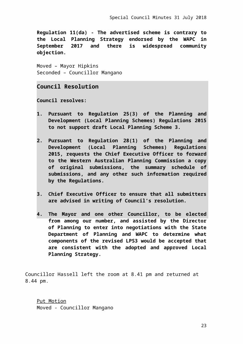
Regulation 11(da) - The advertised scheme is contrary to the Local Planning Strategy endorsed by the WAPC in September 2017 and there is widespread community objection.
Moved – Mayor HipkinsSeconded – Councillor Mangano
Council Resolution
Council resolves:
1. Pursuant to Regulation 25(3) of the Planning and Development (Local Planning Schemes) Regulations 2015 to not support draft Local Planning Scheme 3.
2. Pursuant to Regulation 28(1) of the Planning and Development (Local Planning Schemes) Regulations 2015, requests the Chief Executive Officer to forward to the Western Australian Planning Commission a copy of original submissions, the summary schedule of submissions, and any other such information required by the Regulations.
3. Chief Executive Officer to ensure that all submitters are advised in writing of Council’s resolution.
4. The Mayor and one other Councillor, to be elected from among our number, and assisted by the Director of Planning to enter into negotiations with the State Department of Planning and WAPC to determine what components of the revised LPS3 would be accepted that are consistent with the adopted and approved Local Planning Strategy.
Councillor Hassell left the room at 8.41 pm and returned at 8.44 pm.
Put MotionMoved - Councillor ManganoSeconded - Councillor Hay
That the Motion be put.Lost 2/10
(Against: Mayor Hipkins Crs. Argyle Hassell de Lacy Wetherall Hodsdon James Shaw Horley & Smyth)
Councillor Mangano left the room at 9.03 pm and returned at 9.05 pm.
16

Special Council Minutes 31 July 2018
The Motion was PUT and wasCARRIED 8/4
(Against: Crs. de Lacy Shaw Smyth & Horley)
Recommendation to Council
Council resolves:
1. Pursuant to Regulation 25(3) of the Planning and Development (Local Planning Schemes) Regulations 2015 to support draft Local Planning Scheme 3 with the proposed modifications set out in Attachment 2 – Schedule of Modifications.
2. Pursuant to Regulation 28(1) of the Planning and Development (Local Planning Schemes) Regulations 2015, requests the Chief Executive Officer to forward the advertised Local Planning Scheme 3 to the Western Australian Planning Commission with the attached schedule of submissions, schedule of proposed modifications and any other such information required by the Regulations.
3. Requests the Chief Executive Officer to ensure that all submitters are advised in writing of Council’s resolution.
1.0 Executive Summary
Draft Local Planning Scheme 3 was adopted by Council in December 2016, modified as required by the Western Australian Planning Commission in October 2017, advertised from December 2017 to March 2018 and is now presented to Council for final consideration.
Following consideration of the issues raised in the submissions, Council must decide whether to support the draft Scheme, not support the draft Scheme or support the draft Scheme with modifications to address issues raised in submissions.
The City received a total of 1,019 submissions on draft Local Planning Scheme 3 (LPS3) during the advertising period, which raised a wide range of issues. These issues have been consolidated into 17 key issues and discussed having regard to the objectives of the approved City of Nedlands Local Planning Strategy (September 2017). Modifications to the advertised Scheme have been recommended in order to address the issues raised in the submissions and bring the Scheme into alignment with the Local Planning Strategy.
A summary of the key issues and recommended changes to the Scheme is provided as follows:
1. Planning process and operation of the Scheme
17

Special Council Minutes 31 July 2018
The process for implementing a planning scheme is set by the Planning and Development (Local Planning Schemes) Regulations 2015. This process has been followed, and for the consultation component, exceeded.
The format of the Scheme has been brought into alignment with the model scheme text with standard zone-based controls supplemented by precinct specific controls where appropriate.
2. Density and transition zones
Densities have generally been reduced in the areas of Aberdare Road, west of Leura Street and west of Broadway.
Densities along Stirling Highway have generally been retained, however the juncture between higher and lower density areas has been realigned to fall within the street block rather than extending over the street. Street block ends have also been reduced in density to enable a smoother transition back to the lower density suburban areas.
3. Character, amenity and built form (including heritage)
The loss of character in areas undergoing change has been identified as a significant issue. To address this, modifications are proposed to LPS3 to introduce requirements for minimum lot sizes to be established through lot amalgamation, and a consolidated vehicle access point being required prior to any redevelopment occurring. These scheme provisions will minimise the fragmentation of building footprints and reduce the provision of individual access legs, thereby maximising the opportunity for vegetation retention, both on-site and within the verge and ensuring more coordinated development outcomes that complements the existing character and amenity of these areas.
Provisions to ensure the character of established residential areas are protected have been included through the 9m front setback requirement being further defined and reference to a Design Review Panel is included to ensure that new development meets the expectations of the City regarding built form and design.
4. Environmental factors
It is suggested that the loss of established trees, reduced open space and poor landscaping provided in new developments be resolved via mandating the amalgamation of lots to achieve an acceptable minimum lot size in order to maximise tree retention and landscaping opportunities. Introducing a requirement for landscaping plans to be submitted with development applications for new developments and modifying the definition of ‘Open Space’ in the R-Codes shall also maximise the provision of open areas for landscaping.
18

Special Council Minutes 31 July 2018
5. Traffic and Parking
The potential for higher traffic flows on the local road network arising from the expanded high-density precincts contemplated in LPS3 have been addressed by reducing residential densities to align with the Local Planning Strategy. The requirement for parking to be provided by new developments has also been reviewed and legal advice has been obtained in order to confirm the most effective way to implement parking controls, with modifications to LPS3 being proposed accordingly.
6. Demand on infrastructure, services and facilities
Submissions received from utility servicing authorities indicate that the proposed increases in density contemplated in LPS3 can be accommodated with minor upgrades, where required, to be funded by developers through standard headworks. Public Open Space is acknowledged as lacking, particularly at the local reserve level, and needs to be addressed outside of the Local Planning Scheme. The Department of Education is aware of the increase in densities contemplated by LPS3 and has no concerns or objections.
7. Local Reserves
Obsolete Reserve categories have been deleted from Scheme and the objectives of other Local Reserves updated to rectify wording errors. Nedlands Library, Dalkeith Hall and Melvista child care site rezoned to reflect surrounding zones.
8. Additional and Restricted Uses
All Restricted Uses have been removed as they are no longer considered appropriate and will allow the continued use of those sites unencumbered.
All but two Additional Use sites are also no longer required as updates to the zoning table has rendered these uses as permissible within their zones.
9. Mixed Use zone
The Mixed Use zone has been extended to apply to most of the lots abutting Stirling Highway, Broadway, Leura Street and Monash Avenue in lieu of the R160 zone, given the R160 zone is in some instances incompatible with existing uses, and the desired future development of these areas will be difficult to achieve with a residential zoning being applied.
10. Local Centre zone
19

Special Council Minutes 31 July 2018
This zone has not generally been raised as an issue, other than with respect to the provisions that apply to the zone needing to align with the standardised approach of the Scheme.
11. Neighbourhood Centre zone
This zone has been refocused around the Captain Stirling Hotel ‘Town Centre’ precinct as a combination of extending the Mixed-Use zone as noted at point 9) above, and changes to the hierarchy of centres effected through a resolution of Council in response to a Notice of Motion.
12. Light Industrial and Service Commercial zone
The Light Industrial zone has been deleted and the Service Commercial zone has been applied in its place.
13. Private Community Purpose zone
The zoning table has been updated to align with the objectives of the zone and based on submissions received, the zone has also been removed from several sites as it is no longer appropriate.
14. Special Use zone
The HBF/UWA Sports precinct and the northern portion of the Bedbrook Place precinct is to be zoned to Urban Development to facilitate structure planning to occur prior to any future redevelopment.
An R-Code for Lisle Lodge and Regent Park Estate is to be assigned to these sites to reflect the density of the site and surrounding area and mandate the requirement for a local development plan to be prepared for the Melvista Lodge site as a prerequisite for any future redevelopment.
15. Subiaco Strategic Water Resource Precinct
The Special Control Area for the Subiaco Waste Water Treatment Plant is to be reinstated as the Subiaco Strategic Water Resource Precinct.
16. Land Use definitions
Land-use definitions have been modified to generally align with the model scheme text and obsolete definitions have been removed. The Bulky goods showroom definition has been modified to address submissions received, and ensure the definition reflects the Nedlands context.
17. Zoning Table
Changes to permissibility for various use classes have been undertaken to reflect:
20

Special Council Minutes 31 July 2018
Removal of the Mixed Residential zone Expanded Mixed Use zone Refocused Neighbourhood Centre zone Replacement of Neighbourhood Centre with Local Centre zone in some
areas Removal of Additional and Restricted uses Modified objectives for various zones Submissions received
It is acknowledged a significant number of modifications are proposed to the Scheme, and that the high volume of submissions received has given rise to these modifications.
Furthermore, the proposed modifications generally reduce the extent of higher densities extending from Hampden Road, Broadway, Aberdare Road and Waratah Avenue encroaching into the established lower density areas. Densities along Stirling Highway have also been modified to ease the transition into low density areas. These proposed modifications bring LPS3 into alignment with the approved Local Planning Strategy, thereby ensuring that established character and amenity of these areas is maintained.
The support of Council for these modifications will result in a significant step towards the finalisation of a modern Scheme for the City of Nedlands.
As such it is recommended that Council support draft Local Planning Scheme 3 with modifications.
3.0 Background
The need to produce a Local Planning Scheme was the result of a review of Town Planning Scheme No. 2 in 1995. The Minister commented on the review in 1997 and advised that the review shall be given effect by way of the preparation of a new Scheme.
The history of events which resulted in the City’s endorsed Local Planning Strategy and draft Local Planning Scheme 3 are outlined in the timeline below:
January 1995 Town Planning Scheme 2 reviewedNovember 1996 Letter sent to WAPC advising of consolidation of Scheme 2
and examination into review of Scheme 2April 1997 WAPC response: Minister notes consolidation of Scheme 2
and advises that a review of Scheme 2 is desirable and shall be affected by way of the preparation of a new Scheme 3
August 1998 Council resolve to establish Planning Strategy Working Group
December 1998 Draft Strategy produced
21

Special Council Minutes 31 July 2018
February 1999 Draft Strategy presented to Council - Not adopted (noted only)
September 1999 Community precinct consultation concludesMay 2000 City commissions Local Housing Strategy & Local
Commercial StrategyDecember 2000 Local Housing Strategy & Local Commercial Strategy
completedFebruary 2001 Local Housing Strategy & Local Commercial Strategy
advertisedNovember 2001 Parts of Local Housing Strategy & Local Commercial
Strategy adopted by CouncilAugust 2002 Expression of Interest issued to prepare new Scheme &
StrategyDecember 2002 Draft Scheme 3 & Strategy completed by consultantJune 2003 Cllr workshop - multiple updates & reviewsMarch 2004 Council resolve to endorse Scheme 3 on proviso it be
referred to City’s lawyersOctober 2004 Draft Scheme 3 sent to WAPC for consent to advertiseApril 2005 WAPC require further info as no Scheme report (Local
Planning Strategy) was providedMay 2005 Local Housing & Commercial Strategies forwarded to
WAPCOctober 2005 WAPC do not grant consent to advertise - City is required
to update Housing and Commercial Strategies and more information is required around Activity Centres, housing density & diversity, Stirling Hwy, QEII/UWA.
November 2005 Housing Diversity Study commencedFebruary 2006 Stirling Hwy Redevelopment Project commencedMarch 2008 Cllr workshop - multiple updates & reviews to Scheme 3September 2008 Cllr workshop - multiple updates & reviews to Scheme 3April 2009 Letter from Minister directing the City to finalise draft
Scheme 3 & Strategy July 2009 Council resolve to adopt draft Scheme 3 for consent to
advertise following modifications and referral to City’s lawyers, WAPC & EPA
June 2010 Draft Scheme 3 & Strategy referred to WAPC as one package
March 2011 Revised Strategy sent to WAPCMay 2011 WAPC comment received on Strategy - modifications
requiredDecember 2011 Revised Strategy sent to WAPCMay 2013 Scheme 3 and Strategy 'de-coupled'December 2013 WAPC comment received on Strategy - modifications
requiredMarch 2015 WAPC comment received on Scheme - modifications
required within 42 daysMay 2015 Council resolution to seek extension to 42 days timeframe,
proceed with Strategy, not initiate any further amendments
22
Special Council Minutes 31 July 2018
to TPS2.August 2015 Planning and Development (Local Planning Schemes)
Regulations 2015 gazetted which includes a new Model Scheme Text and Deemed Scheme Text.
October 2015 Re-drafted Local Planning Strategy sent to WAPC following Council endorsement with modifications.
November 2015 WAPC letter received confirming extension to complete Local Planning Scheme 3 granted - to be delivered by 31 May 2016
November 2015 Work commences on re-drafting Local Planning Scheme 3 to comply with new Model Scheme Text.
March 2016 WAPC advises that Local Planning Strategy is certified for advertising.
March 2016 – May 2016
Local Planning Strategy advertised
August 2016 Council adopts the Local Planning Strategy.December 2016 Draft Local Planning Scheme 3 adopted by Council (to
proceed to advertise) with modifications.September 2017 Local Planning Strategy endorsed by WAPC.October 2017 WAPC advises that the Scheme has been considered and
requires modifications prior to advertisingNovember 2017 Advertising commences on draft Local Planning Scheme 3April 2018 Advertising closes on draft Local Planning Scheme 3
Consideration of submissions commences
3.1 Key Relevant Previous Council Decisions:
Item PD29.15 – OCM 26 May 2015
“Council
1. Seek an extension of the 42 day timeframe for making changes to Town Planning Scheme No.3 in order for Administration to complete the Local Planning Strategy;
2. Proceeds with the immediate and urgent completion of the Local Planning Strategy for submission to the Western Australian Planning Commission;
3. Upon completion of the Local Planning Strategy and approval for advertising, proceeds with immediate and urgent completion of Town Planning Scheme No.3 for submission to the Western Australian Planning Commission;
4. Does not initiate further amendments to Town Planning Scheme No. 2; and
23

Special Council Minutes 31 July 2018
5. To the extent that it is practicable, any existing amendments to Town Planning Scheme No. 2 that are afoot be incorporated into this process rather than pursued in isolation.”
Item 7 – Draft Local Planning Scheme No. 3 - Special Council Minutes 13 December 2016
“Council Resolution
1. Council adopts draft Local Planning Scheme No. 3 in accordance with r. 21(1) of the Planning and Development (Local Planning Schemes) Regulations 2015 and proceeds to advertise with the following modifications:
2. That 120 Montgomery Avenue Mt Claremont remain with current zoning: Public Purposes.
3. That Residential Zoning on Stirling Highway (map 4 of 5) - at least all TPS2 Residential Zoning for lots fronting Stirling Highway is to be retained in LPS3.
4. That Captain Stirling Hotel Redevelopment (map 4 of 5) - The TPS2 existing zoning of the Captain Stirling Hotel and adjoining area is to be retained in LPS3.
5. Change Office Use in the Zoning Table (page 11) to “I” in the Mixed Residential, Mixed Use and Centre Neighbourhood Zones.
6. Fast Food - Change the definitions of Fast food outlet – large, Fast food outlet – small and Lunchbar/take-away food outlet, to allow only the heating of pies and similar foodstuffs and exclude the cooking of food consumed off-premises unless an incidental use.
7. Transition Areas - Where increased density is permitted in R10 coded areas, this be limited to R35 in LPS3 to avoid conflicts of scale with neighbours and Council losing control of development approval to the JDAP.
8. Ancillary Accommodation - The TPS2 requirements for ancillary accommodation be retained in LPS3.
9. Setback and Landscaping Requirements for Non-Residential Uses - TPS2 building setbacks from boundaries for non-residential uses where adjoining residential zones and landscaping of non-residential uses be retained in LPS3.
24

Special Council Minutes 31 July 2018
10. Additional Site and Development Requirements in R10 Residential Zones - New development in R10 zones with a minimum lot area of 1,000m2 and a minimum frontage of 20m are to provide the following:
a) A minimum total open space of 65% of site b) A minimum side setback of 1.5m per storey
11. Car Parking Requirements for Non-Residential Uses - Car parking requirements for non-residential uses are to be specified, either by use class as in TPS2 or by number of bays per square metre of floor space.
12. Zoning table to be amended Aged Care Facility / Nursing Home in the Mixed Residential and Mixed Use zones from X to A.”
Item PD46.17 – Council Minutes 24 October 2017
“Council Resolution
Council instructs the Chief Executive Officer to prepare appropriate documentation for incorporation in Local Planning Scheme No. 3 to create a Town Centre Zone for land including that controlled by Woolworths and Aldi, comprising residential, retail and other non-residential uses on the south side of Stirling Highway.”
Item 14.1 – Council Minutes 22 May 2018
“Council Resolution
That, in the interest of providing:
1. progressive feedback to Administration;
2. guidance towards achieving a successful outcome expeditiously; and
3. simplifying last minute deliberations.
Council gives direction to the CEO with respect to Local Planning Scheme No. 3 (LPS3) as follows:
In accordance with submissions -
a) The Activity Centre on the north side of Waratah Avenue between Adelma and Alexander Roads shall be renamed Local Centre;
b) Neighbourhood Centre Zones, other than those renamed in a) and b) above, shall be renamed as Mixed Use Zones or, in the case of the west side of Hampden Road, Local Centre; and
c) The Light Industry Zone shall be deleted and the area concerned become a Service Commercial Zone.”
25
Special Council Minutes 31 July 2018
26

Special Council Minutes 31 July 2018
Item 14.3 – Council Minutes 26 June 2018
“Council Resolution
Council provides guidelines to the CEO in the analysis of LPS3 submissions with respect to:
1. City freehold land with potential for redevelopment;
2. Whether the scheme is to allow open car parking on lots adjoining Stirling Highway when they are redeveloped;
3. The provision of landscaping on residential and non-residential zoned lots;
4. The provision of basement and upper floor setbacks – front, side and rear – on all residential zoned lots and
5. Whether the scheme is to include developer contributions requirements as a prerequisite to significant increases in residential density.”
4.0 Regulatory Process
The Planning and Development (Local Planning Schemes) Regulations 2015 (Regulations) sets out the legislative requirements for the preparation, consultation and adoption of a Local Planning Scheme.
Following the prior Council decisions as set out above, Council has proceeded through the various regulatory steps to the point where it is now considering submissions under Regulation 25.
Under this part the local government must consider all submissions lodged within the submission period, and before the end of the consideration period must pass a resolution:
a) to support the draft scheme without modification; b) to support the draft scheme with proposed modifications to address
issues raised in the submission; orc) not to support the draft scheme.
If the local government proposes a modification to address issues raised in submissions and the local government believes the proposed modification is significant it may decide to advertise a proposed modification to the draft local planning scheme in accordance with Regulation 26.
Following re-advertising of any proposed modifications to the draft local planning scheme or if choosing not to re-advertise after passing a resolution under Regulation 25, the local government must provide the advertised scheme documents to the Commission together with:
27

Special Council Minutes 31 July 2018
a) a schedule of submissions made on the draft scheme;b) the response of the local government to each submission;c) particulars of each modification to the draft scheme proposed by the
local government in response to the submissions; d) if any proposed modification to the scheme was advertised -
(i) an explanation of the reasons for advertising the modification; and (ii) particulars of how the modification was advertised; and (iii) a schedule of submissions made on the proposed modifications;
and (iv) the recommendation of the local government in accordance with
regulation 26(7)(c) in respect of each submission;
e) a copy of the resolution passed under regulation 25(3); f) if that resolution was a resolution under regulation 25(3)(c) - a summary
of the reasons why the local government does not support the draft scheme;
g) details of any provision in the draft scheme that varies or excludes a provision set out in Schedule 1;
h) details of any provision in the draft scheme that supplements a provision set out in Schedule 2; and
i) any relevant maps, plans, specifications and particulars required by the Commission.
The schedule of submissions referred to above must include:
a) the name and address of the person making the submission; b) where it is relevant, a description of the property that is the subject of the
submission; and c) the submission or a summary of the submission.
All the documents referred to above must be provided to the Commission with 21 days of passing the resolution under Regulation 25.
The Commission must, within 120 days of receiving the documents provided to it, consider the documents and make recommendations to the Minster in respect of the draft local planning scheme.
At this point the Minister may direct the local government to advertise modifications to the draft local planning scheme or otherwise decides on the draft local planning scheme under section 87 of the Planning and Development Act.
Assuming the Minster approves the local planning scheme, the local government is to advertise the approved Scheme and ensure copies are available to the public. The scheme has full force and effect as if it were enacted by the Planning and Development Act on the day it is published in the Government Gazette.
28
Special Council Minutes 31 July 2018
5.0 Consultation
The purpose of advertising draft Local Planning Scheme 3 was to gain an understanding on the community’s views and fulfil the governing process under Regulation 22.
The engagement period commenced formally on Friday, 1 December 2017 and ran until Thursday, 29 March 2018.
Consultation via the Your Voice website, however, ran from Thursday, 23 November 2017 until Tuesday, 3 April 2018, accounting for the Easter Holiday break, resulting in a total of 130 days (82 business days) of community engagement. This period exceeded the legislative requirement of 90 days.
The City’s Community Engagement Policy states to undertake engagement using the following principles:
Citizenship We will provide for and communicate opportunities for everyone to have a genuine and meaningful say in local democracy about actions that could affect their lives.
Transparency We will ensure that the purpose and mechanisms of our engagement will be relevant, easily understood, timely and accessible by all.
Inclusion We will seek out and facilitate the involvement of all those affected or potentially affected.
Accountability We promise that all contributions will influence the alternatives developed, be reflected in our decision-making, outcomes will be communicated, and performance will be measured.
Our people We promise that our people will uphold the City values, the IAP2 Value’s and Code of Ethics, be appropriately trained and supported to deliver best practice engagement.
5.1 Opportunities for Engagement
There were numerous opportunities for people to engage with the City, such as:
Access information and updates, and provide feedback on the Your Voice Nedlands website;
Attend one of the six Public Open Days held in various locations around the City;
Provide a submission via email or hardcopy (post and dropping off at Administration); and
29
Special Council Minutes 31 July 2018
Visit the Administration Centre or contact the City by phone or email to talk to a planner.
5.2 Engagement reach and depth of participation
The City undertook comprehensive communications, as follows:
8 advertisements were placed in The Post Newspaper; 3 advertisements were placed in the monthly Nedlands News Update; 22 social media posts were put on the City’s Facebook and Twitter
accounts; An email banner was on all Officer’s emails for the main period of
engagement; A banner was placed on the front page of the City’s website with a direct
link to the Your Voice Nedlands engagement page; 3 media releases and 1 media brief was published on the City’s website;
and In addition to consultation above, 27 articles referencing LPS 3 were
posted in the media (ABC radio, television, the Western Australia, The Post Newspaper and the Western Suburbs weekly, paper and online) placed as editorial or letters to the editors by members of the public, or advertisements placed by organisations other than the City.
During the engagement period there were 8,091 visitors to the Your Voice online engagement page with 421 new registrations. 29 questions were submitted via the page and a total of 547 online submissions were received.
Approximately 306 people attended the Public Open Days.
A total of 1,019 submissions were received (547 online, 268 emails and 204 letters).
5.3 Considering submissions
In considering all 1,019 submissions the City undertook a review process whereby each submission was read in its entirety and distilled into its main points. Care was taken to ensure the main points were conveyed whilst trying to eliminate identifying details or comments that may not be suitable for reproduction in a Council reporting process.
The submission summaries were used to generate a list of issues raised by the community and an analysis of those issues was then undertaken to determine potential solutions.
These solutions were workshopped with Council and recommendations further examined to ensure they addressed the issue raised, comply with the planning framework and can be implemented appropriately.
The result is a schedule of modifications to draft Local Planning Scheme 3 that address the issues raised in the submissions.
30

Special Council Minutes 31 July 2018
Figure 1: Submission consideration process
5.4 Analysing issues
In analysing the issues raised through the submissions, the City has reflected on the planning framework, namely the Local Planning Strategy which was endorsed by the Western Australian Planning Commission in September 2017.
The Local Planning Strategy demonstrates how the City will meet the State Governments metropolitan planning strategy, Perth & [email protected] million. Perth & [email protected] million and its associated sub-regional frameworks are the key instruments for achieving a more consolidated urban form that will reduce the dependence on new urban greenfield developments to accommodate the anticipated population growth of the Perth metropolitan area. In this regard, the sub-regional framework identifies an infill target for the City of Nedlands of 4,320 dwellings to be achieved by 2050.
The Local Planning Strategy sets out the long-term strategic direction for development within the City and ultimately supports the operation of a new Local Planning Scheme, giving rationale and context for its content. The Local Planning Strategy sets out to achieve the implementation of urban growth areas and transition zones through a new Local Planning Scheme, which would classify those areas suitable for redevelopment whilst retaining and
31

Special Council Minutes 31 July 2018
maintaining the existing character of significant portions of the valued suburban areas of Nedlands.
Under the Local Planning Strategy, Urban Growth Areas are identified to contain the most intense development in the City. Multiple dwellings (apartments), commercial and mixed-use developments are anticipated to be the predominant development types in these areas being contained to properties directly adjoining Stirling Highway, Broadway, Hampden Road and Monash Avenue.
Transition zones exist immediately adjacent to urban growth areas to create a buffer between high intensity and low intensity development. This buffer will reduce the impact from the differences in built form (e.g. height, bulk, setbacks etc.). It is expected the transition zones will contain mostly residential developments of multiple dwellings (apartments) and grouped dwellings (townhouses and similar).
The specific application of the urban growth areas and transition zones is further explained in each of the precincts identified in the Strategy. LPS3 needs to be responsive to each of the precinct specific strategies in terms of identifying areas suitable for higher intensity development and the finer grain application of transition zones to appropriately interface with the existing valued residential areas.
The urban growth areas and transition zones are not delineated areas or set precincts (as could be mis-interpreted from the Strategy map) but need to be responsive to the local context as explained in the precinct specific strategies. For example, the transition zone behind Stirling Highway should be very different to the transition zone behind Broadway and it is only in reading the precinct specific strategies on how to apply the transition zones to each area that this becomes clear.
The redevelopment locations identified in the Strategy, reflected in the urban growth areas and transition zones, were carefully selected to respond to precinct specific considerations and to ensure alignment with the dwelling infill targets identified in the Central sub-regional planning framework.
It is through the lens of the Local Planning Strategy that all issues raised in the submissions have been analysed and recommendations made accordingly.
6.0 Key issues raised in submissions
Submissions and individual responses are included in the Schedule of Submissions (Attachment 1).
Using the submission consideration model explained previously, the key issues raised were categorised into broad issues that were either:
Major topics dealt with by the Scheme,
32

Special Council Minutes 31 July 2018
Items that affect significant areas of the City, Zone based issues that relate to the application of a zone its land use
and built-form provisions; or Supplementary issues regarding specific matters not captured
elsewhere.Key points have been detailed for each issue with administration comments provided in response. A detailed discussion of the issue follows, with analysis of the Strategy set out to frame how the Scheme has responded to each issue.
Recommended changes are listed with reference to the specific modification made to the Scheme.
The broad issues raised are:
1. Planning process and operation of the Scheme2. Density and transition zones 3. Character, amenity and built form (including heritage)4. Environmental factors5. Traffic and parking6. Demand on infrastructure, services and facilities
Zone based issues raised are:
1. Local Reserves2. Zoning table and land use permissibility3. Additional and Restricted Uses4. Mixed Use zone 5. Local Centre zone 6. Neighbourhood Centre zone7. Light Industry zone and Service Commercial zone8. Private Community Purpose zone9. Special Use zones10. Subiaco Strategic Water Resource Precinct11. Land use definitions
In addition to the above, a range of non-planning related comments were also raised. These comments are largely unable to be dealt with by the planning framework and have been addressed as such within the Schedule of Submissions.
Further to the above, Motions have been put to, and resolved by, Council which directs administration on how the Scheme should be written. These resolutions have been incorporated into the Scheme.
6.1 Key Issue: Planning process and operation of the Scheme
Points raised Administration Commenta) Objections to the planning
process (WAPC determination a) The planning process is controlled by
the Planning and Development Act
33

Special Council Minutes 31 July 2018
over Council, DAP’s, SAT etc)
b) Lack of consultation
c) Scheme vs non-scheme planning mechanisms
d) What can and can’t be done through the Scheme
e) Complexity of information and clarity of scheme operation
2005 (The Act) and the Regulations.
b) Extensive consultation was undertaken by the City, beyond that set out in the Regulations.
c) - d) Draft LPS3 is consistent with the model scheme text. The emphasis is on local governments developing robust planning frameworks through the local policy tools available to them.
e) The Scheme has been re-organised to operate in a more coherent fashion. Standardised clauses, consistent provisions and clear wording has been incorporated.
6.1.1 Discussion
The process for the adoption of a new planning scheme is set out by the Regulations and has been discussed in the preceding chapter titled ‘Regulatory process’.
The engagement and consultation phase embarked upon by the City was greater than that required by the Regulations. The City was keen to ensure it was able to reach as many people as possible through the consultation exercise and get as much feedback as possible. The consultation period was extended to 4 months in lieu of 3, multiple open days were held throughout the consultation period and multiple options for providing feedback were given. The consultation and engagement program has been discussed in a preceding chapter titled ‘Consultation’.A Local Planning Scheme must include the model scheme text as set out in s.257A of the Planning and Development Act 2005 and only by approval of the Minister can an exclusion or variation from the model provisions be given effect. The City is keen to ensure that draft Local Planning Scheme 3 is consistent with the model scheme text so that it has a modern planning framework with a current planning scheme.
It is recognised that in doing so the City will be moving to a significantly different planning framework than that which is currently in operation. Town Planning Scheme No. 2 was gazetted in 1985 and was not renewed or replaced to be brought in line with the first model scheme text, introduced in 1999. With the gazettal of the Regulations in 2015 comes the second model scheme text for Western Australia. So, in effect, the City is leap-frogging an entire planning scheme model and jumping ahead to a completely new model of how a planning scheme, and by extension a whole local government planning system, should operate.
34

Special Council Minutes 31 July 2018
It is no currently longer necessary, or considered appropriate, for a local planning scheme to contain all the provisions a local government seeks to implement. There is a whole suite of planning mechanisms available to the City that will enable it to further implement its planning framework. The City will need to produce a range of Local Development Plans and Local Planning Policies to give full effect to the planning outcomes that are envisaged with the implementation of a new Scheme. All these planning tools work together to deliver the intentions of the Local Planning Strategy.
A local planning scheme is a complex document by its very nature. Its purpose is to implement a component of a local planning framework and its structure and content are largely controlled by the design of the model scheme text.
The model scheme text provides for the local government to set out, in clause 32 of the Scheme, provisions relating to development that are additional to those in the R-Codes, activity centre plans, local development plans or State or local planning policies. Such provisions may relate to land use, setbacks, building height, plot ratio, open space, landscaping or other type of development provisions for a zone or defined area.
Clause 32 has been arranged to function through zone-based provisions. Similar to the advertised version of the Scheme, this approach provides a clear direction for the application of development standards. Amendments have been made to clause 32 to consolidate provisions to avoid inconsistencies and conflicts and provide clarity. Furthermore, standardised provisions have been applied for each zone including setbacks, height, plot ratio and landscaping in addition to other zone-specific requirements. The modifications made to clause 32 have satisfied submissions which raised concern with the operation and application of the clause.
In terms of the operation of clause 32, an additional provision has been applied to the Mixed Use, Local Centre and Neighbourhood Centre zones to facilitate the preparation of a Local Development Plan (LDP). The purpose of an LDP is to consider detailed site characteristics and assist in achieving coordinated, high quality, built form outcomes. The provision inserted in clause 32 provides for a standard set of requirements to apply where there is no LDP in place and for LDP provisions to prevail where one has been approved. It is noted the LDP provision was included in the advertised version of the scheme within the Private Community Purpose zone which is to be retained.
The model scheme text also provides for the local government to set out, in clause 33 of the Scheme, provisions relating to development that are additional to those covered by structure plans, activity centre plans or local development plans. Such provisions may relate to land use, setbacks, building height, plot ratio, open space, landscaping or any other type of development provision that applies to a specific area covered by a structure plan, activity centre plan or local development plan.
35

Special Council Minutes 31 July 2018
The explanatory text from the model scheme text template, indicates that clause 33 is designed to give the weight of the scheme to provisions in an approved structure plan, activity centre plan or local development plan. Where there are site specific or precinct based provisions that apply, that are considered to require the weight and effect of the Scheme, these have been moved to clause 33 and will also be contained in an applicable structure plan, local development plan or other planning tool as appropriate.Specifically, clause 33 has been amended to contain the maximum height requirements for a number of precincts where an LDP may be prepared. The heights which are proposed in clause 33 were previously within clause 32 of the advertised Scheme and are considered appropriate for the identified locations. It is considered that with the inclusion of standard zone-based provisions in clause 32 and the ability to prepare an LDP to vary these requirements, clause 33 provides the most appropriate mechanism to define parameters for future local levelopment plans in relation to height.
In reviewing the operation of the Scheme and in the attempt to remove any inconsistencies it has been noted that there are a number of land uses listed in the zoning table that are not expected to be commensurate with the aims of the Scheme, are inconsistent with the objectives of the respective zone or the intentions of the Strategy and therefore land use permissibility’s have been amended accordingly. In other instances, land uses by their own definition can not exist within the City and as such have been removed. This includes the Freeway service centre, Waste disposal facility and Waste storage facility.
6.1.2 Recommended changes to advertised Scheme
Standardise clause 32 as zone-based provisions.Standardise clause 33 as precinct specific provisions.Remove redundant land uses from zoning table and land use definitions.
6.1.3 Reference in Schedule of Modifications
Text 31 – 34 & 36Text 40Text 20 & 45
6.2 Key Issue: Density and transition zones
Points raised Administration Commenta) Objection to the extent of
rezoning.b) Objection to abrupt changes
in scale rather than gradual steps (appropriate transition).
c) Density advertised in the Kingsway, Viewway and Hillway area is inconsistent
a) Proposed densities are consistent with the adopted Local Planning Strategy in applying a transition from high to low intensity development interfacing with the existing suburban areas.
b) The application of the proposed densities ensures an adequate transition between the different land
36

Special Council Minutes 31 July 2018
with the Strategy.There has been a lack of consideration of topography (e.g. Broadway, Kingsway, Viewway) in application of the proposed densities.
d) Objection/Support for the proposed density in the Mt Claremont precinct.
e) Objection to density proposed in streets to the rear of Hampden Road (Leura, Clifton, Meriwa, Williams Road).
f) Objection to proposed density in Aberdare Road precinct.
g) Objection to proposed density in Waratah Avenue precinct.
h) Listed alternative locations for increased densities
i) Propose corner lot/low density subdivisions throughout City
uses and higher densities between the Mixed Use / Neighbourhood Centre / Local Centre zone and the Residential zone.
c) It is proposed to reduce densities along Viewway/Kingsway/Bruce Street to respond to submissions and topographical constraints which are articulated in the Local Planning Strategy.
d) Rationalising the outdated zoning mechanism (1 in 5 split coding) in Mt Claremont West was identified in the Local Planning Strategy. In response to submissions the R20 is proposed to be retained for the precinct.
e) It is proposed to reduce densities along Leura/Clifton/Meriwa Street/Williams Road to respond to submissions, having regard to the Local Planning Strategy and wider planning framework that is anticipated to be delivered.
f) It is proposed to reduce densities in the Aberdare Road precinct in response to submissions received and having regard to the Local Planning Strategy.
g) It is proposed to reduce densities in the Waratah Avenue precinct in response to submissions received and having regard to the Local Planning Strategy.
h) LPS3 identifies higher densities abutting, and in close proximity to major roads/public transport, and within local and neighbourhood centres, which is consistent with the Local Planning Strategy.
i) Introducing special provisions in LPS3 to permit corner lot subdivision throughout the City is inconsistent with the Local Planning Strategy and will result in ad-hoc planning outcomes and will not significantly assist in achieving density targets.
6.2.1 Discussion
37

Special Council Minutes 31 July 2018
6.2.1.1 Mt Claremont Precinct
This area is known as Old Mt Claremont.
Submissions received were generally split in terms of supporting or objecting to the proposed density changes in this location.
The Local Planning Strategy does not identify Mt Claremont as a growth area. The Strategy does state that the City should:
retain and enhance the character of the streetscape; and rationalise the split code and investigate appropriate density options to
deliver a desirable streetscape and residential form.
Despite not being a growth area, it was intended that density options be investigated for this area as part of rationalising the current split code that applies to this area in Town Planning Scheme No. 2 (TPS2), so some change could be considered. Removal of the split code and application of the R20 code would make it fair and equitable in comparison to the current TPS2 provision which limits the frequency of grouped dwellings occurring greater than one lot in five lots.
However, R20 throughout would need to be supported with upgrades to laneways. Both side-by-side and battle-axe subdivision arrangements would result in an increase in garages and driveways which would negatively impact the streetscape and character of the area which has been mentioned in the submissions as issues that needs to be addressed.
Controls on the configuration of new lots and access arrangements (requiring use of the laneway) would be needed to manage those impacts.
It is recommended that a Local Planning Policy be prepared to guide subdivision layout, laneway upgrades and built form provisions so that streetscape and character is managed.
6.2.1.2 Hollywood Precinct
Precinct known as Aberdare Road precinct, bound by Aberdare Road, Gairdner Drive, Verdun Street and Kitchener Road.
Most of the submissions received in this precinct are opposed to the proposed R60 density. The response rate for the area was comparatively high with a total of 54 submissions received and 131 properties affected.
Whilst some submitters acknowledged proximity to hospitals and the need for increased density as reasons for support, the majority of submissions remarked that the area was unsuitable for increased density due to traffic, amenity and infrastructure/services issues.
38

Special Council Minutes 31 July 2018
The Local Planning Strategy does not identify this area as an identified growth area, but it is contained within the QEII/UWA Specialised Centre area and partly within the 800m catchment from Shenton Park train station.
The Strategy sets out to:
ensure the appropriate treatment of Aberdare Rd and lots abutting as a transit corridor; and
consider a range of uses and accommodation types that complement the function of the QEII/UWA Specialised Centre.
The R60 density code being applied to those properties facing Aberdare Road is consistent with it being an identified transit corridor in Perth & Peel @ 3.5 million. A built form local planning policy/local development plan could be formulated to contain provisions such as setbacks and massing (particularly to protect properties to the south) and vehicle access.
The application of R60 throughout the remainder of the precinct is not supported as there is no substantive planning justification for a density increase in this area at this time. Only part of the area is within 800m of the Shenton Park station, and even less when the actual pedestrian walkable catchment is calculated. Only part of the area is within the frame area of the QEII/UWA Specialised Precinct and in accordance with SPP 4.2 – Activity Centres Policy housing supply in specialised centres should be assessed on a case-by-case basis which would be most appropriately established through an approved Specialised Centre Plan.
6.2.1.3 Waratah Avenue Precinct
This area is known as the Dalkeith Village precinct and includes surrounding residential properties.
The majority of submissions received in this area request to reduce or remove entirely the increased densities proposed on and around the Waratah Avenue Neighbourhood Centre with a minority supporting the proposed increases.
The Local Planning Strategy does not identify this area as a growth area but does identify the Waratah Avenue Centre as a Neighbourhood Centre. The Strategy sets out to:
Retain and enhance the character and streetscape of the existing residential areas, in order to protect the established character of this precinct.
Facilitate consolidation and realisation of the existing development potential for non-residential and residential purposes within the Dalkeith Neighbourhood Centre.
Facilitate increased dwelling diversity by providing for increased residential density in the immediate vicinity of the Dalkeith Neighbourhood Centre, in line with the scale of the centre.
39
Special Council Minutes 31 July 2018
The extent of the density increases in the advertised LPS3 exceeds the densities contemplated in the Strategy. In considering density around this centre, its size is important as it is directly referenced by the Local Planning Strategy. The Centre has 2,890m2 Net Lettable Area (NLA) and is not forecast to growth much beyond 3,000m2 NLA which is at the lower end of the 1,500 – 10,000m2 scale set by SPP 4.2 for Neighbourhood Centres. The Strategy does not anticipate the centre being re-evaluated or rezoned in terms of its position in the centres hierarchy, however, the Centre has been changed to a Local Centre zone in accordance with Council’s Resolution, from the Ordinary Meeting of Council held 22 May 2018, on the Motion relating to LPS3, which is further discussed in Part 7.
Regardless of the zone nomenclature applying to the commercial area, in order to realise the Strategy intentions for this precinct, a reduction in the density of the surrounding residential areas to maintain the existing low-density codes would be appropriate.
Density changes should be brought back to a more consolidated form where they are directly related to the centre itself and not several street blocks away. The provisions of the Local Centre zone should be revised to ensure the development potential of the Dalkeith Neighbourhood Centre itself is realised, whilst respecting the history of the centre and the existing controls established in TPS2.
6.2.1.4 Broadway Precinct
Land bound by Broadway, Esplanade, Bruce Street and Edward Street.
Submissions raised amenity issues, loss of character housing, issues with density around Nedlands Primary School and concern for increased traffic and safety issues. Submissions also raised the topography of the area acting as a natural transition so that additional density changes are not required when transitioning density from Broadway.
The Local Planning Strategy identifies Broadway as an Urban Growth Area and the precinct falls within the UWA-QEII catchment. Specific points include:
Broadway as a medium intensity, low to medium rise Urban Growth Area.
Provide a Transition Zone abutting Broadway to quickly lower development intensity into the surrounding precincts.
o Where applicable on Broadway, the significant east-west topography variation will function as the Transition zone.
Ensure strategic planning of the UWA-QEII Specialised Centre and its boundaries is completed in partnership with the affected local governments and State government instrumentalities.
40

Special Council Minutes 31 July 2018
The majority of this area is not indicated in the Local Planning Strategy as being within the urban growth area or a transition zone. The area is however identified as being partly within the ‘UWA-QEII immediate catchment’.
Given the direction set out in the Strategy and the number of submissions made against increasing densities in the residential streets behind Broadway (Kingsway, Viewway and Bruce Street), reducing the extent of the density changes in this area is appropriate.
The significant topographical changes between those properties facing Broadway and those directly behind acts as the transition in this instance and the extension of density to those properties behind Broadway is unnecessary.
Until such time that an Activity Centres Plan is developed for the QEII / UWA Specialised Centre, it would be premature to introduce increased densities throughout this area as advertised.
To be consistent with the Strategy, density increases should be confined to Broadway and the streets closest to Stirling Highway in the northern part of the subject area (Cooper, Clark and the northern side of Edward) and lots adjacent to the Special Use/Mixed Use sites to the south of Broadway.
Density increases proposed in LPS3 are to be retained north of Edward Street. Few submissions were received in this location, with comments largely in support of the proposed changes. The topography of Broadway north of Edward Street is relatively flat, with scope for density to the rear of the Mixed Use lots to facilitate a density transition. The transition from a R160 density on the northern side of Cooper Street, to R60 on Clarke Street and the Northern side of Edward street is appropriate into the established low density residential area south of Edward Street which is proposed to revert back to an R12.5 density.
Density increases are to be retained for the lots in the street block to the rear of Steve’s Hotel Special Use site and to the rear of the Mixed Use zoned lots immediately to the north (bound by Hillway, The Avenue and Melvista Avenue). Given this area sits at the bottom of the slope and has a relatively flat topography, the density will provide for an appropriate transition from the development on Broadway without adversely affecting the surrounding area. Few submissions were received in this location, with the majority being in support of the density changes.
6.2.1.5 Hampden Rd Precinct
Land bound by Monash Ave, Hampden Rd, Gordon St and Williams Rd.
A number of submissions raised loss of character housing as a concern resulting from the proposed density increases. Submissions also referenced a report produced for the City by Palassis Architects as part of the review of the Municipal Heritage Inventory. The report included an ‘Inventory of Potential Character Areas’ where original houses are largely intact, creating
41

Special Council Minutes 31 July 2018
streetscapes of particular character. These recommended areas include Clifton Street, Hardy Road and Williams Road within the subject area.
The Local Planning Strategy identifies Monash Avenue and Hampden Road as Urban Growth Areas with a transition zone. The subject area is also within the UWA-QEII Immediate catchment.
The specific strategies for this precinct seek to:
Plan Hampden/Broadway as a medium intensity, low to medium rise Urban Growth Area within the City of Nedlands.
Provide a Transition Zone abutting Hampden/Broadway to quickly lower development intensity into the surrounding precincts
The extent of the densities into the suburban area, beyond the growth area and transition zone are considered inconsistent with the Strategy. Given, the streetscape character value of the area and the number of submissions against upcoding these streets, it is considered appropriate to reduce the extent of the density changes in this area.
To be consistent with the Strategy, density increases should be confined to Hampden Road, Leura Street and Monash Avenue. Further, until such time that an Activity Centres Plan is developed for the QEII / UWA Specialised Centre it would be premature to introduce increased densities throughout the remainder of this area as advertised.
The zones applied to these areas have been evaluated. Council proposed a Mixed Residential zone for Hardy Road, Monash Avenue, and the eastern side of Leura Street. This zone was removed by WAPC modifications and replaced with a ‘Residential R160’ zone.
The Mixed Residential zone was intended to accommodate the existing commercial uses that operate on Leura Street and provide opportunities for other ground floor commercial activity in the area. Given Mixed Residential is no longer an option, a Mixed Use zone has been applied to Leura Street and Monash Avenue. The land use permissibility’s of the Mixed Use zone have been reviewed accordingly given its application to areas not originally contemplated in the Strategy.
6.2.1.6 Stirling Highway Precinct
Area defined by the Residential R160, R60 and R40 density codes.
Submissions have acknowledged the need for density and stated a preference for higher densities being located on or near to Stirling Highway. There was support for diversity of housing and affordability and that proposed densities will bring quality townhouses, apartments and units to Nedlands.
42
Special Council Minutes 31 July 2018
There were however, many objections to the proposed densities and extent of the transition zones, particularly the extent north of Stirling Highway. Many submissions supported using the streets as the boundary for density changes.
The impact on the character of the area and on the amenity of existing single houses (bulk, height, overshadowing, overlooking) and lack of provisions to protect amenity where also raised as major issues that needed addressing with any density increases.
The Local Planning Strategy identifies Stirling Highway as an Urban Growth Area with first and second transition zones creating a buffer between high intensity and low intensity development. Specifically, the Strategy sets out:
Within the transition zone adjoining Stirling Highway, ensure the height, scale and bulk of redevelopment smoothly integrates back into the established residential character of the area.
o Facilitate medium rise, medium density predominantly residential redevelopment within the first Transition Zone.
o Facilitate low rise, diverse residential built form within the second Transition zone.
Whilst the R160 density for the lots abutting Stirling Highway are higher than Council’s adopted Scheme, the densities are generally in keeping with the objectives of the Local Planning Strategy. These higher densities are appropriate providing that they directly abut, or transition from, Stirling Highway. There were previously areas where the density codes that have been applied did not transition smoothly. This is particularly true for some short street blocks where R160 would abut R10 on the opposite side of the street, with similar jumps in density codes occurring near the Rose Gardens particularly in Doonan Road. Density codes in these areas have been revised in order to provide a more gradual change and smooth transition.
The Strategy states ‘where the Transition Zone is adjacent to high intensity development (i.e. Stirling Highway) two ‘bands’ of transition zones will be necessary to facilitate a smooth transition from high intensity to medium intensity to low intensity development.
The Strategy identifies having a short transition back to the suburban environment and it was not intended that this transition extend as deep as what has been advertised. There are some areas that are considered to be completely beyond a natural transition zone (e.g. lots north of Bedford Street towards Carrington Street and Gordon Street). It is appropriate to maintain the established low density suburban areas in these locations and maintain low density codes.
Despite the extent of the transition zones being beyond that originally contemplated, by extending to the full length of the street block they do achieve a very clear delineation between areas of change.
43

Special Council Minutes 31 July 2018
The advertised density changes also extend over the street block and apply an increased density code to properties directly opposite. This would result in conflicting scenarios with developable properties of a higher density being directly adjacent to properties remaining at their current lower density.
In order to address the impact of density changes on adjacent properties, it is considered appropriate that densities are contained entirely within the street block rather than extending beyond the street block. Further, the application of an R40 code at the street-block ends would assist in achieving a smoother interface between density changes transitioning back to the established character of the lower density area, particularly as R40 code properties cannot be developed beyond a height of 2 storeys which is more in keeping with the 2-storey built form of the low codes that exist throughout the established areas.
6.2.2 Recommended changes to advertised Scheme
4. Rezone Aberdare Road precinct to R10 with properties facing Aberdare Road to remain as R60.
5. Rezone areas surrounding the Waratah Avenue Centres to R10 or R12.5 except for:
a. Waratah Ave (between Robert St and Alexander Rd);b. Genesta Crescent (between School Rd and Adelma Rd);c. Southern side of Philip Road (between Alexander Rd and Adelma);
andd. Alexander Road between Philip Road and Leon Road.
6. Rezone residential properties south of Edward Street to R10 and R12.5 except for Hillway, The Avenue and Esplanade between Melvista and Bessell Ave and Broadway.
7. Rezone all R160, R60 and R40 lots in the area of Hampden Rd, Hardy Rd, Williams Rd (including western side of Williams) and Gordon St to R25.
8. Rezone eastern side of Leura Street to Mixed Use R-AC0.9. Rezone Monash Ave to be Mixed Use R-AC0.10. Review land use permissibility of the Mixed Use zone.11. Rezone lots bound by Dalkeith Rd, Carrington St, Broome St and rear of
Bedford to R10.12. Use the streets as the boundaries for changes in density, thus rezone
R40 lots that extend ‘over the road’ back to appropriate density codes.13. Rezone last 2-3 lots on street block ends to R40 as the second
transition.14. Rezone No. 1 – 6 Doonan Road to R160.15. Rezone street block ends of lots at corners of Jenkins and Waroonga /
Bulima / Taylor from R160 to R60.16. Introduce minimum lot size requirements to ensure amalgamation of
sites prior to redevelopment.
6.2.3 Reference in Schedule of Modifications
44

Special Council Minutes 31 July 2018
Map 110Map 111 – 125Map 102 – 109Map 90 – 94Map 32Map 33Text 20Map 89Map 88, 92, 95 – 101Map 34 – 55 & 64 – 70 Map 62 & 63 Map 56 – 61Text 30
6.3 Key Issue: Character, amenity and built form (including heritage)
Points raised Administration Commenta) Scale of density proposed
R60, R80 R160b) Impact of redevelopment
(over-looking, over-shadowing, building bulk, height, setbacks, impact on streetscape).
c) Loss of heritage/character housing (lack of heritage protection in the Scheme).
d) Ad-hoc redevelopment – lack of coordination.
e) Stirling Highway heights – should be limited to 17.5m
a) The transition between different densities has been carefully considered having regard to the local context e.g. topography, street block length etc.
b) Impacts associated with new developments and the interface between higher and lower densities will be controlled through provisions contained within LPS3, the R-Codes, and future Local Development Plan provisions.
c) The City’s Heritage List and Municipal Inventory will be unaffected by LPS3. Additional heritage provisions in the Scheme are not proposed.
d) Coordinated development will be required to protect the character and amenity of areas proposed for increased density.
e) LPS3 contemplates a default height limit of between 11m to 14.5m for properties along Stirling Highway, with potential to increase the height to 28.5m to 35.5m subject to satisfying planning criteria set out in future local development plans and the local planning policy framework.
6.3.1 Discussion
45

Special Council Minutes 31 July 2018
The majority of submissions raised issues of character, amenity and built form with regards to the increase in density in residential areas in the City.
The Local Planning Strategy sets out that the City should retain and enhance the character and streetscape of the City’s existing residential areas whilst promoting best practice urban design principles in targeted infill areas. Maintaining and enhancing high quality streetscapes will be of the utmost importance to decision making, and developments will need to respond to the unique character of each precinct.
A significant contributor to the City of Nedlands character and streetscape amenity is the consistent application of a 9m primary street setback to buildings. It is therefore consistent with addressing issues raised and addressing the Strategy that the Scheme continues to apply a 9m primary street setback to residential buildings in the established low-density suburban environment. Clause 26 (1), (2) & (3) currently do not fulfil this requirement. Although C2.1 is varied to modify the proposed setback to 9m, the remaining deemed-to-comply provisions in relation to front setbacks of buildings (including averaging and minor intrusions etc.) would still apply. It is therefore necessary to reword these clauses to give effect to the correct interpretation of how the 9m setback should be applied. For existing low-density areas where the 9m setback currently applies under Town Planning Scheme 2, the 9m primary street setback should continue to have effect and also have effect to garages and carports. Further to this, it will be necessary to develop local planning policy to guide discretion in this area to guide future decision making.
It is clear from recent infill developments throughout the metropolitan area that the requirements of the R-codes alone are incapable of delivering quality infill in established suburbs. Development of grouped dwellings in R40 & R60 areas on traditional sized lots has caused entire sites to be cleared of vegetation and the resulting development has included high levels of site coverage, multiple-crossovers, paving to accommodate vehicular turning areas, garages dominating the streetscape and little landscaping provided. These issues have generally resulted from the subdivision of original lots into small fragmented sites in a battle-axe configuration.
In the established low-density suburbs driveways/crossovers are adequately distributed throughout the street due to the large frontages of the lots. In addition, the built and hard-stand areas they comprise make up a comparatively small percentage of the area, which allows for green-space and mature vegetation to endure within the lot and verge (street-trees).
Without adequate controls, subdivision of lots into smaller sites will result in the proliferation of driveways at the expense of the green-space areas and mature vegetation.
Within the Nedlands context, the open, green leafy nature of our suburban environment are the characteristics that the Strategy seeks to maintain, retain and enhance. To facilitate development which positively contributes to the
46

Special Council Minutes 31 July 2018
streetscape, amenity and character of the area, a combination of Scheme and Policy provisions will be implemented.
A key driver to facilitating good development outcomes is the need to consolidate land holdings, require coordinated development on larger sites and limit the number of vehicular access points. Larger, consolidated lots allow for the impacts of infill development to be more effectively managed by reducing the number of crossovers, centralising the building envelope to enable greater tree retention and increasing setbacks which in turn reduces overshadowing, overlooking and building bulk.
The Scheme will need provisions that will operate above the R-Codes to ensure that subdivision of sites is not put ahead of achieving good built outcomes. These provisions will also need to be followed should development proceed prior to the subdivision of land, so similar clauses will be required for both scenarios.
A number of Local Governments have introduced split code provisions to require consolidated access or achieve other built form requirements before a higher density code can be applied.
This approach appears to be having the desired effect and fits the Nedlands context where existing low-density codes can be supplemented by a higher split code. It will enable existing lots to continue to be enjoyed as large single lots with individual dwellings and will safeguard against poor urban design outcomes and negative impacts on streetscapes and the public realm that results from fragmented infill redevelopment.
The proposed split code provisions have been applied to the R60 and R40 densities which comprise the largest areas affecting established single residential dwellings across the City. Where vehicle access is not facilitated from a right-of-way, a minimum lot size of 1800m2 and consolidated access arrangements are required to achieve the higher density. A minimum lot size of 1800m2 requires the amalgamation of two lots in the R10 or R12.5 density and three lots in the R15 density. A large number of objections have been received from R10, R12.5 & R15 coded streets with concern for amenity, streetscape and ad-hoc development issues. The amalgamation of lots provides for coordinated development outcomes and limits the opportunities for ad-hoc development in response to these submissions.
It is noted, the split code provisions are not proposed to be applied to the R160 density (which either abut Stirling Highway or Mixed Use/Neighbourhood Centre sites). It is considered the existing lot sizes in the R160 areas are sufficient to facilitate the intended development outcomes, although the development of local planning policy to guide that intended development outcome would be appropriate.
In addition to these scheme provisions the City will also need to adopt local development plans or local planning policies to modify the R-Codes to ensure development outcomes meet the desired character of the area and satisfy the
47

Special Council Minutes 31 July 2018
expectations of the Strategy. It is anticipated that LDP’s be developed for R-AC0 coded areas and will need to include holistic built form controls, rather than just addressing R-Code requirements alone. Where standard R-Codes apply (e.g. R40, R60 or R160) an LPP will be required to augment the deemed-to-comply criteria.
Furthermore, considering the significant emphasis put on character, amenity and built form through the submissions plus the direction of the Strategy to ensure that best practice urban design outcomes are incentivised in areas experiencing change it is proposed that a Design Review Panel be established to assist in decision making on major development applications. To ensure and advice given by a Design Review Panel is given due weight and consideration by the appropriate decision maker it is appropriate to supplement the provisions of the deemed text under clause 67.
6.3.2 Recommended changes to advertised Scheme
17. Reword the 9m primary street setback to have greater effect where intended.
18. Introduce split code provisions to require lot amalgamation and consolidation of vehicle access points prior to redevelopment.
19. Introduce a reference to a Design Review Panel via entry of a supplementary provision to the deemed text
6.3.3 Reference in Schedule of Modifications
Text 24Text 30, Map 34 – 61, 64 – 87 & 126 – 133Text 47
6.4 Key Issue: Environmental factors
Points Raised Administration Commenta) Loss of trees on private
propertyb) Loss of verge treesc) Lack of landscaping
requirements in new developments
d) Lack of open space in new developments
e) Environmental impacts (wildlife, urban heat island effect, increased energy consumption, flooding).
a) The loss of tree canopy because of infill re-development is widely acknowledged as a significant negative impact of redevelopment and needs to be combated.Provisions in relation to lot amalgamation and consolidated access will assist in mitigating the need for additional crossovers and street tree removal.
b) The City has an established Street Tree Policy which will still be in effect in relation to trees in the verge.
c) Draft SPP 7 - Design WA sets a minimum percentage of a site to be landscaped as part of any future
48

Special Council Minutes 31 July 2018
development – until this Policy is gazetted, the City intends to address landscaping through Local Planning Policy and Local Development Plans.
d) Open Space as calculated by the R-Codes contemplates unintended consequences whereby a site can be fully built out and a roof top terrace used to meet the Deemed-to-comply criteria. It is considered that this is not in keeping with the intent of the Design Principles and the Scheme will need to address this issue.
e) Incentives for tree retention within private property for new developments can be addressed in Local Planning Policy.
6.4.1 Discussion
A significant number of submissions raised issues of loss of trees on private property and in the verge areas which is also discussed in the preceding chapter as part of character, amenity and built form.
Other issues raised include:
Lack of open space, landscaping and planting requirements; Overuse of existing parks and lack of parks to support increasing
density; and Environmental impacts.
The Local Planning Strategy states that the City should encourage sustainable practices that respond to the City’s physical features and climate. Maintain, protect and enhance existing key natural resources.
Specifically, the City should seek:
To encourage all facets of sustainability in existing and new development (including but not limited to; climate responsive design, effective water management and efficient resource use).
To employ and encourage sound urban water management techniques. Identify and actively maintain and enhance natural areas in the interest
of conservation via a sound management framework. To maintain, protect and enhance natural resources; and where
appropriate, encourage the retention, protection and enhancement of significant existing natural resources in new development.
From an urban design perspective, the Strategy states:
49

Special Council Minutes 31 July 2018
retain and enhance the character and streetscape of the City’s existing residential areas whilst promoting best practice urban design principles in targeted infill areas. Maintaining and enhancing high quality streetscapes will be of the utmost importance to decision making, and developments will need to respond to the unique character of each precinct.
Loss of tree canopy and landscaping on development sites was a major concern raised throughout submissions. Mature trees provide many benefits in an urban environment, such as mitigating heat island effect, providing amenity to residents, preserving neighbourhood character, and softening of building bulk and scale.The character of the City is defined by the existing mature tree canopy on both private property and the road reserve, and tree retention should be made a priority.
A scheme requirement for larger lot sizes and centrally sited multiple dwelling buildings can help mitigate the impacts such as loss of trees, overshadowing and building bulk. This contrasts with grouped dwelling battle-axe development on smaller non-amalgamated sites which sees lots being cleared of vegetation and resulting in streetscape and amenity issues.
This further reinforces the discussion and recommendations under the character, amenity and built form section and the need to include split density codes that require amalgamation and/or consolidated access prior to redevelopment.
The City has an established Street Tree Policy which will still be in effect in relation to trees in the verge. Incentives for tree retention within private property for new developments was deliberated and the ability to establish a Significant Tree Register still exists and may become preferable, however at this stage it is considered that tree retention can be addressed through Local Planning Policy in the first instance.
The draft Apartment Design SPP includes requirements relating to planting in required ‘Deep Soil Areas’ and reduction of deep zone requirements where existing tree(s) are retained. In the absence of an adopted SPP to address this issue, it is recommended the City take its own policy approach to deal with retention of trees on up-coded residential development sites.
The need to ensure adequate landscaping is included in all new developments is appropriate and should be detailed through a Local Planning Policy. The need to trigger this requirement in the Scheme may not be essential, however given the important role landscaping plays in the Nedlands context it is appropriate to include into clause 32 development requirements.
The ‘Open Space’ definition in the R-codes currently includes ‘open areas of accessible and useable flat roofs and outdoor living areas above natural ground level’. This means the site cover of a dwelling is ‘cancelled out’ for any
50

Special Council Minutes 31 July 2018
area with a roof terrace above. This enables dwellings to occupy more area than intended and increases building bulk and loss of vegetation on site.
As is intended by the objectives of Part 5.1 of the R-Codes, residential development should meet community expectations in regard to appearance, use and density; respond to the key natural and built form features of the area and the local context in terms of bulk and scale; and ensure that open space is provided on site and landscaped to established streetscaped, provides a balanced setting and relationship to buildings and provides privacy, direct sun and recreational opportunities.
The following provision is included within Town of Mosman Park Local Planning Scheme:
In the Residential zone, in areas coded R30 or less, open areas of accessible and usable flat roofs of dwellings (i.e. ‘roof terraces’ including roof gardens, roof pools, viewing platforms or other roof-top recreational use and development), that would normally be counted towards the provision of open space, are excluded from being counted towards the provision of open space.
The above provision ensures open space is calculated on the area external to the dwelling as is the intent of the objectives of the R-Codes and commensurate with community expectations for residential development and should be mimicked in LPS3.
In response to submissions regarding implementation of Scheme provisions relating to Bushfire, the Map of Bushfire Prone Areas is given statutory effect through an amendment to the Fire and Emergency Services Act 1998 and acts as an additional administrative overlay to local governments. Local governments therefore are not required to adopt the map or provisions into their local planning scheme.
In response to submissions regarding implementation of Scheme provisions with regard to flood risk, the City of Nedlands does not have any land classed as ‘floodway’ or ‘flood fringe’ which is land most at risk of flooding and inundation. The City of Nedlands does however have land within the 1 in 100 (1%) AEP (annual exceedance probability) Floodplain Development Control Area. As part of the development application process, proposals within the Floodplain Development Control Area are referred to DWER for advice. This process operates soundly under TPS2 and does not need further intervention through scheme provisions. It is noted Clause 67 (Matters to be considered by local government) of the Deemed Provisions includes consideration of ‘the suitability of the land for the development taking into account the possible risk of flooding, tidal inundation, subsidence, landslip, bushfire, soul erosion, land degradation or any other risk’ in assessment of a development application.
With regard to building design and energy efficiency, the Design WA Draft Apartment Design Policy contains provisions in relation to environmental performance with design criteria for energy efficiency, solar access, and water
51

Special Council Minutes 31 July 2018
and waste management. The City of Vincent has taken a similar approach and incorporated criteria into a Local Planning Policy similar to the draft Apartment Design policy for Environmentally Sensitive Design. It is recommended energy efficiency standards be incorporated in a Local Development Plan or Local Planning Policy.
6.4.2 Recommended changes to advertised Scheme
20. Introduce requirement for Landscaping plans to be submitted.21. Redefine how Open Space is calculated to exclude roof terraces.
6.4.3 Reference in Schedule of Modifications
Text 31 – 33 & 36Text 25
6.5 Key Issue: Traffic and Parking
Points raised Administration Commenta) Stirling Highway (traffic,
congestion, access, bottlenecks, intersections, issues for pedestrians crossing)
b) Traffic congestion around Broadway, Hampden, Monash, Aberdare etc.
c) Congestion in streetsd) Safety issues from increased
traffic (particularly surrounding schools)
e) Lack of footpaths, cycleways and public transport options
f) Increased street parkingg) Provision of sufficient parking
on-site for new developmentsh) Schedule F – Car Parking is not
an effective way to control the provision of car parking for non-residential developments
i) The number of categories for non-residential parking should be rationalised
j) A parking supply and management plan should be prepared to identify areas where cash in lieu of car parking would be appropriate
k) Vehicle pick up and drop off areas should be provided for
a) It is acknowledged that future population increases will place increased demand on existing road network however a traffic study commissioned by the City indicates that the road network is capable of supporting further development based on the density targets identified in the Local Planning Strategy subject to upgrades being undertaken to key intersections and the wider transport system in the future.
b) LPS3 identifies higher densities abutting, and near, major roads and Centres which have good access to public transport options, which is consistent with the Local Planning Strategy.
c) The City has previously commissioned a traffic assessment as part of the preparation of the Local Planning Strategy, and to this end, the City has acquired a detailed appreciation of the impact of the proposed increased densities on traffic.
d) The City works closely with the community to identify solutions to vehicle use in our streets that can
52

Special Council Minutes 31 July 2018
larger developments to accommodate ride sharing and future autonomous vehicle trends
l) Concern for traffic around Schools
adversely impact on neighbourhood quality of life and safety towards residents and visitors through its ongoing program to identify and target traffic and parking hot spots throughout the City.
e) The City’s long-term goal, as identified in the Local Planning Strategy, is to increase opportunities for residents, businesses and visitors to use cycling, walking and public transport as an optional mode of transport to assist in minimising the impacts of traffic congestion.
f) Street parking patterns can be monitored, and restriction options are available i.e. timed, paid etc.
g) All new developments are required to comply with the R-Codes and LPP’s for the provision of sufficient on-site parking for residents and visitors.
h) Clause 32 will refer to parking standards being set out in the Local Planning Policy in accordance with best practice, thus providing flexibility and certainty to consider car parking requirements on a case by case basis
i) Car parking standards should generally align with use classes set out in LPS3 to provide certainty
j) Cash in lieu options for parking has been explored and appropriate planning mechanisms will be in place once LPS3 has been finalised.
k) Options for the provision and management of car parking areas will be further explained in an LPP alongside the appropriateness of public management of car parking situated on privately owned land, autonomous and shared vehicle trends etc.
l) Reductions in densities are being proposed in some areas. These generally accord with areas that also contain schools.
53

Special Council Minutes 31 July 2018
6.5.1 Discussion
Traffic and parking congestion was a major theme in the submissions and traffic issues were raised in relation to all areas proposed for density increases.
Some specific comments by government agencies include:
Transperth:
Transperth is supportive of the increase in densities as part of the R-Code changes as modified by the WAPC.
The increases in density are generally within a walkable catchment to major transport corridors, activity centres or along local bus routes and this is conducive to the operation and growth of the Transperth network and enabling the success of active and public transport.
Main Roads:
An off-highway town centre configuration is preferred as ribbon development along the highway encourages traffic congestion, decreases capacity of the road network and reduces options for the future access to public transport.
Concerns raised regarding the potential impact upon traffic signals along the Stirling Highway as Main Roads seeks to rationalise and minimise the number of traffic lights on Stirling Highway to ensure efficiency of traffic movement, which will be detrimentally affected through the proposed densities being increased.
Department of Transport (DoT)
Reference to Schedule F – Car Parking: this approach is no longer an effective way of controlling the provision for non-residential developments.
Simplify the number of categories for non-residential parking. Allow variation to any parking standard and to encourage that
particularly when there is shared parking between various uses. Prepare a public parking supply and management plan and designate
those areas in the Scheme where the City will require and or accept cash in lieu of parking.
Require any parking provision a developer wishes to supply in excess of the minimum must be supplied as publicly managed parking unless the provision is less than 4 bays.
Establish a “park-once” principle. Consider the ability to convert 50% of proposed parking structures to
other uses once they may not be required due to the uptake of shared autonomous vehicles.
54

Special Council Minutes 31 July 2018
Consider existing demands and trends toward ride sharing and future autonomous vehicles.
It is noted that one submission sought to ensure parking controls where contained in the Scheme, which is in conflict with the above advice and best practice for these standards to be included in the local planning policy framework.
The Local Planning Strategy identifies that the City should promote a movement network that foremost enables mobility, and particularly encourages non-car modes and that land uses (particularly higher density residences) should be located with transport networks in a way that maximises efficiency.
A number of issued raised are not directly controlled by the Scheme. For example, the width of existing streets, safety issues from increased traffic, lack of footpaths, cycleways and public transport options. However, there is a responsibility as a Local Government to provide for and control some of these elements, and the planning framework is able to assist in some areas. Obtaining cash-in-lieu for car-parking and the appropriate spending of cash-in-lieu funds to assist in combating parking issues by encouraging non-car-based travel modes is one such option.
A review of the parking standards and how they are implemented through the Scheme was undertaken, and as raised in the submissions, the use of LPP to deliver more flexible and appropriate outcomes is considered appropriate.
The City will adopt a Local Planning Policy relating to parking matters and has obtained legal advice to ensure car parking standards are appropriately linked in the Scheme to local planning policy, and cash in lieu of car parking requirements can be implemented and enforced on a lawful basis. Scheme clauses are revised accordingly.
The City of Nedlands is influenced by a number of major traffic generators (UWA, QEIIMC, private schools), and by traffic flows into and out of the Perth CBD. Travel demand management, congestion, parking and accessibility will be continuing issues over the coming years. In particular, existing parking shortfalls and parking demand in centres and high-trip generating areas will need to be managed.
Motorised vehicular traffic will increase with increased development. Density has been focused on transport corridors where alternative transport modes and other amenities are located to reduce the number of car trips required.
The City has previously commissioned a traffic assessment as part of the preparation of the Local Planning Strategy, and to this end, the City has acquired a detailed appreciation of the impact of the proposed increased densities on traffic. The City is continuing to work with traffic consultants, Main Roads and major developers in managing traffic impacts.
55

Special Council Minutes 31 July 2018
The extent of the densities will be reduced as discussed previously, which will in turn reduce traffic impacts. Hampton and Broadway are two key areas where WAPC modifications proposed large increases in density which are being reduced to bring these densities into alignment with the Local Planning Strategy.
It is recommended an Integrated Transport Plan and subsequent Parking Strategy is prepared following Scheme gazettal. A Transport Plan will integrate land use and transport planning, pedestrian amenity, cyclist amenity, public transport, parking and demand management. The Parking Strategy will examine all aspects of parking (demand, management, availability) and also contain assessment for cash-in-lieu parking options.
6.5.2 Recommended changes to advertised Scheme
22. Revise clauses relating to car parking, cash-in-lieu, shared parking and laneways.
6.5.3 Reference in Schedule of Modifications
Text 27 – 29 & 60
6.6 Key Issue: Demand on infrastructure, services and facilities
Points raised Administration Commenta) Road and drainage
infrastructureb) Lack of cycleways/footpathsc) Demand on utilities (Power,
water, gas, sewer, electricity, phone, internet)
d) Developer Contributions should be required
e) Rubbish collectionf) Demand on Schoolsg) Public facilities (library, halls,
sporting facilities)h) Private facilities (shops, cafés)i) Demand and lack of provision
for additional POS, the plan doesn’t meet Liveable Neighbourhoods (minimum 10%) for POS
a) It is acknowledged that future population increases will place demand on existing road and drainage infrastructure however it is generally expected to support future development with manageable upgrading.
b) The City should prepare an Integrated Transport Plan to review its entire transport network. Footpaths and cycleways would be a component of this plan.
c) The utility providers have advised the City that the current level of utility services will support future development with manageable upgrading.
d) Developer Contributions requirements are referred to in Clause 27 of LPS3, and the City will investigate the feasibility and need to prepare a formal developer contribution plan upon approval and
56

Special Council Minutes 31 July 2018
gazettal of LPS3 when all of the scheme provisions are formalised.
e) Waste collection service will accommodate the increased densities.
f) The Department of Education has no comments or objections to LPS3.
g) The City’s Local Planning Strategy addresses the provision of community infrastructure and the retail sustainability of the City’s centres. There is no need for new community facilities but the upkeep of existing facilities is required.
h) The proposed Local/Neighbourhood Centre and Mixed Use zoned areas identified in LPS3 can accommodate new commercial uses such as shops, cafes to meet demand generated by increased population
i) The Local Planning Strategy has identified that the City lacks adequate local POS, and a POS Strategy should be prepared to identify ways to provide POS.
6.6.1 Discussion
A number of submissions have raised concerns about the provision of infrastructure services, requirements for Developer Contributions and the overuse of existing parks and lack of parks to support increasing density,
The Local Planning Strategy sets out that the City should ensure existing infrastructure and services are capable of dealing with the increase in population and changes to the environment stemming from the requirements for urban growth and intensification.
To this end, utility providers have advised the City that the current level of utility services will support future development with manageable upgrading.
Further, the City can impose development approval conditions where there is a clear connection between the proposed development and infrastructure items required. For instance, the City can require land for laneway access to be ceded by the developer, and for the laneway to be constructed at the developers cost where development abuts a major road with restricted vehicle access i.e. Stirling Highway. There are also circumstances whereby public open space (or cash-in-lieu of public open space) can also be required.
School capacity was raised as an issue; however, the Department of Education has no comment or objections to LPS3 and are aware of the
57

Special Council Minutes 31 July 2018
increased densities contemplated in LPS3 that will impact upon the current public-school network.
With regard to POS, the Local Planning Strategy acknowledges the lack of local parks within some of the established suburbs, and that any increase in population will have an impact on the use of existing POS areas, especially in areas where POS is already deficient. To this end, the Strategy identifies that a Public Open Space Strategy should be developed to manage the City’s recreation and open space assets and provide for future community needs.
Several submissions suggest that the City should implement developer contribution arrangements. However, the submissions generally lack detail beyond the concept that developer contributions may be a good idea.
Developer Contribution requirements are referred to in Clause 27 of LPS3, and the City will investigate the feasibility and need to prepare a formal developer contribution plan upon approval and gazettal of LPS3 when all the Scheme provisions are formalised.
6.6.2 Recommended changes to advertised Scheme
None proposed.
6.6.3 Reference in Schedule of Modifications
N/A
6.7 Key Issue: Local Reserves
Points raised Administration Commenta) Clause 14: Local Reserves,
under ‘Environmental Conservation’ the first dot point should be amended as follows: ‘To identify areas with biodiversity and conservation value, and to protect those areas from development or subdivision’
b) Under ‘Foreshore’ the following additional objective should be included: ‘to identify and create ecological linkages that provide connectivity between public open spaces’
c) 64-66 Melvista Avenue, Dalkeith – properties currently used for a Child Care Premises. Draft LPS 3 proposed a Civic and Community Reserve which is not supported – zoning should be
a) Error noted in the objective set out in LPS3 for Environmental Conservation reserve which is to be amended to: “subdivision and development”.
b) The Foreshore local reserve is not applied to any land within the Scheme area. Its use is obsolete and the local reserve can be removed.
c) Property rezoned Residential and Child Care land use permissibility reviewed within the zoning table – made A in accordance with planning bulletin 72/2009 Child Care Centres.
58

Special Council Minutes 31 July 2018
Residential R10 to permit the existing use and be consistent with the surrounding area
6.7.1 Discussion
The above-mentioned errors are noted and in reviewing the Scheme in its entirety it has also been noted that there are other errors contained within this section.
Wording errors are contained within the Environmental Conservation local reserve, as set out above, plus the Civic and Community local reserve and the Government Services local reserve.
The Civic and Community local reserve needs to refer to “halls”, and the Government Services local reserve need to provide for a range “of” government services.
With further investigation it is noted that some local reserves that are listed under Part 2 of the Scheme are not used within the Scheme area and are obsolete. As such, it is appropriate that local reserves for Foreshore and Car Park be removed.
It is also considered that it is not necessary for the local planning scheme to set out the Local Road and Local Distributor Road local reserves. These road hierarchies are established by Main Roads WA with the local government reviewing them on an as needs basis, usually from a local roads management perspective. This planning scheme is not designed to afford these local reserves any special provisions and as such their use is obsolete and they can be removed.
Property in Melvista was reserved as civic and community which is not supported and as such has been rezoned Residential. The Child Care land use permissibility has been reviewed within the zoning table and made ‘A’ in accordance with planning bulletin 72/2009 Child Care Centres.
6.7.2 Recommended changes to advertised Scheme
23. Delete Foreshore, Car Park, Local Distributor Road and Local Road from Scheme
24. Update local reserve objectives for Environmental Conservation, Civic and Community and Government Services local reserves.
6.7.3 Reference in Schedule of Modifications
Text 1 – 4 and Map 172 & 173Text 5 – 7
6.8 Key Issue: Zoning table and land use permissibility
59

Special Council Minutes 31 July 2018
Points raised Administration Commenta) Review zoning table in
relation to zone objectives to ensure consistency.
b) Ensure zoning table does not conflict with provisions elsewhere in the scheme.
c) Recommend zoning table changes for a defined ‘Town Centre’ zone.
d) Requests ‘Child Care Premises’ be permitted on No. 45 Carrington.
e) Recommend Bulky Goods showroom be reclassified as ‘D’ in Mixed Use zone
f) Request Serviced apartments be ‘A’ in Residential zone
a) The zoning table has been reviewed and changes made accordingly to align with the modifications made to the application of the Neighbourhood Centre, Mixed Use and Local Centre zone.
b) Land use permissibility has been reviewed and modified in response to amended provisions elsewhere in the Scheme to ensure consistency.
c) The land use permissibility within the Neighbourhood Centre zone has been reviewed in response to submissions and has been amended to provide for a wide variety of ‘Town Centre’ appropriate uses.
d) Child care premises has been made ‘A’ in the zoning table for the Service Commercial zone.
e) The Bulky goods showroom land use has been amended to be ‘D’ in the Mixed Use zone, to respond to submissions with regard to the Strategy.
f) Serviced apartments have been amended to be ‘X’ for Residential, as the use is not considered appropriate for the zone. The Mixed use and Neighbourhood Centre zones along the highway are considered most appropriate for this use.
6.8.1 Discussion
A review of the zoning table has been undertaken in response the WAPC modifications and submissions received to ensure consistency between the proposed zones, the zone objectives, the vision for the City, and proper and orderly planning.
In relation to land use permissibility within the Neighbourhood Centre, Mixed Use and Local Centre zones, modifications to the zoning table were required to ensure the zoning changes made for the various precincts aligned with the Strategy and objectives of the zones and facilitated appropriate development outcomes in these locations. Generally, the permissibility of uses has been amended to allow for more discretion in each of the zones. This is particularly appropriate for the Mixed Use zone which now covers a far greater area and in various different contexts. An example of this is the permissibility of Bulky goods showroom being amended from ‘X’ to ‘D’ in the Mixed Use zone.
60

Special Council Minutes 31 July 2018
Submissions were received in relation to the appropriateness of various land uses within the Residential zone. In response, modifications have been made to a range of permissible uses, so that they are unable to be approved unless Council has exercised its discretion following advertising, where those uses are considered to have potential impacts on the neighbourhood (such as Consulting rooms and Child care premises). Other uses have been changed to ‘X’ (prohibited) where it is considered the use is not appropriate in the Residential zone (such as Home store).
The land use permissibility within the Private Community Purpose zone has been amended to align with the objectives of the zone. A number of land uses given discretionary or incidental permissibility are not appropriate for the zone (such as Residential, Commercial vehicle parking, Office, Shop and Warehouse/storage). The changes made are considered to provide for an appropriate range of uses within the zone in accordance with the objectives.
As per the Private Community Purpose zone, land use permissibility within the Service Commercial zone has also been amended to align with the objectives of the zone.
6.8.2 Recommended changes to advertised Scheme
25. Update zoning table to align with the objectives of the zones.
6.8.3 Reference in Schedule of Modifications
Text 20
6.9 Key Issue: Additional and Restricted Uses
Points raised Administration Commenta) Review Additional and
Restricted usesa) Additional uses have been reviewed
and, in most instances, removed as the zoning table now permits those uses in the relevent zones.
b) Restricted uses have also been reviewed and removed as it is considered unnecessary to limit land use in these locations.
6.9.1 Discussion
The additional uses listed in Table 4 of the advertised Scheme are mainly as a result of the proposed Neighbourhood Centre zone that was applied to properties at the western end of Stirling Highway. Four of the ten additional uses were included to facilitate Bulky goods showrooms in the Neighbourhood Centre and Mixed Use zones which are listed as ‘X’ (not permitted) in the zoning table for both zones.
61
Special Council Minutes 31 July 2018
These additional uses are no longer required as the land use has been made discretionary in the Mixed Use zone, with the affected subject sites also being zoned Mixed Use, as discussed in subsequent sections.
In response to a submission on the permissibility of Child care premises in the Service Commercial zone, Additional uses A1 & A2 are no longer required with the use being changed to ‘A’ in the zone.
Additional use A3 is no longer required with Consulting Rooms being made ‘A’ in the Residential zone. The approval for the site does not include Medical Centre and is also no longer required.
Due to WAPC modifications prior to advertising removing the ‘Shop – large’ and ‘Shop - small’ land uses, Additional use A7 is not required. The subject site has also been changed to Mixed use which permits a shop.
In reviewing the Restricted uses, it has also become apparent that R1 – 3 are not required. The subject sites were advertised with a restricted use of aged or dependent persons dwellings. Under TPS2 the subject sites have additional uses for Aged or dependent persons dwellings. Under the R-Codes, Aged or dependent persons dwellings are given a concession on site area requirements. It is considered the R- Codes provides sufficient incentive for the sites to develop with the use and a restriction is unreasonably onerous.
The removal of the Restricted uses is therefore appropriate.
6.9.2 Recommended changes to advertised Scheme
26. Remove all Restricted uses27. Remove Additional Uses where modification has been made to the zone
and zoning table to permit the use at the subject site. 6.9.3 Reference in Schedule of Modifications
Text 22 and Map 136 – 138Text 21 and Map 1 – 6, 9, 11 – 14, 16, 26, 139 & 140
6.10 Key Issue: Mixed Use zone
Points raised Administration Commenta) Proposed residential R160
zoning is not supported along Broadway as does not reflect existing land uses and will result in non-conforming uses and is inconsistent with surrounding parcels
b) Mixed Use zoning requested to reflect current land uses
c) Proposed Additional Use provisions should be reviewed
a) Application of the mixed use zone across the City has been revised. Zone objectives, zoning permissibility and built form controls modified accordingly.
b) In relation to land along Broadway and existing commercial sites abutting Stirling Highway advertised Residential R160, modification of the proposed Residential R160 zone to Mixed Use and extending
62

Special Council Minutes 31 July 2018
to ensure they reflect uses currently in operation
d) Mixed Use zone is supported subject to either LPS3 being modified to include density or development requirements, or a Local Planning Policy being prepared
e) Active frontage requirement in Clause 32 should be modified to allow some discretion on secondary streets/corner lots
f) Proposed laneway provisions in Clause 32 should be modified to facilitate the provision of a public access easement in lieu of road widening/laneway provision
the Mixed Use zone in various locations is appropriate.
c) Land use and Additional Use provisions have been reviewed in their entirety to ensure permitted uses are appropriate for the zone and its location.
d) New developments will be controlled through the planning framework including the proposed LPS3 provisions and future Local Planning Policy and Local Development Plan provisions.
e) References to Active ground floor use and Active Frontages have been removed from the Scheme, however it is important that the Neighbourhood/Local Centre zone, and Mixed-Use zone mandate the development of non-residential uses on the ground floor.
f) It is anticipated a future ACP/LDP will provide for laneway and built form design (incl. frontage and tenancy).
6.10.1 Discussion
The Mixed Use zone has been applied to properties along Broadway and Stirling Highway which were advertised as either Neighbourhood Centre or Residential, in response to submissions, Council resolutions, and WAPC modifications.
Many existing commercial sites have been adversely affected by the WAPC modifications to remove the Mixed Residential zone from the Scheme and apply a Residential zone in its place. Due to the removal of the zone from the Scheme, it is necessary to apply a Mixed Use zone to the affected properties. Accordingly, the Mixed Use zone, its objectives, land use permissibility and provisions have been revised to accommodate the changes and facilitate a range of residential and non-residential land uses in these locations. The application of the Mixed Use zone is consistent with the Local Planning Strategy with the affected landholdings being within the Urban Growth Area.
A number of advertised Neighbourhood Centre zones along Stirling Highway have been modified to a Mixed Use zone in response to Council’s Resolution, from the Ordinary Meeting of Council held 22 May 2018, on the Motion relating to LPS3, which is further discussed in Part 7. The two areas which have been changed, being the western-most and eastern-most end of Stirling Highway support a modified Mixed Use zone given the current uses on the sites, the permissibility of the Mixed Use zone being more compatible with the
63

Special Council Minutes 31 July 2018
subject sites, and the aims of the Local Planning Strategy for the Mixed Use zone being:
Only permit additional Other Retail, bulky goods and general service commercial/industrial floorspace within areas where these uses are already well‐established.
Where practicable, encourage/incentivise the incorporation of medium/high density residential development selectively within such developments where a reasonable degree of street‐level amenity can be achieved.
Encourage/incentivise residential/mixed‐use development in all other areas along the highway – i.e. don’t permit stand‐alone showroom developments to establish in areas not yet dedicated to them.
These changes do not disrupt the Centres hierarchy established within the Local Planning Strategy as the western end of Stirling Highway was never identified as a ‘centre’ and it is recognised that other centres on the highway also exhibit some degree of highway commercial development in addition to more consolidated, centre-like, precincts.
A number of other sites along the Highway with existing commercial uses advertised as Residential R160, have been modified to a Mixed Use zone in response to submissions (e.g. Chelsea Village) which is also consistent with the Strategy, being within the Urban Growth Area.
With regard to the issue raised about the Additional Uses applied to properties in the zone, it was considered appropriate to formalise the permissible uses within the zoning table and to zone the subject land accordingly. This has resulted in changes to the zoning table to permit a wider range of land uses within the Mixed Use zone and has made the majority of additional uses redundant as discussed in part 6.9 above.
Within clause 32 for the Mixed Use zone, provisions to restrict Office and Consulting Rooms at the ground floor and references to active frontages are no longer considered appropriate. Land use restrictions in clause 32 have been lifted, with discretion for Residential at the ground floor retained. References to active frontages and tenancy depth have been removed as it is considered more appropriate to include such provisions in the local planning policy framework where requirements for visual engagement between the building and street for a ground floor tenancy can be more suitably controlled.
The provisions that apply to built form within this zone have also been refined as described in part 6.1 of this report. Clarity around the provisions that apply has been introduced so that there are standard zone based provisions, predicated on the ability for an LDP to be introduced and if necessary precinct controls introduced into clause 33 to give scheme weight to LDP precinct based provisions.
6.10.2 Recommended changes to advertised Scheme
64

Special Council Minutes 31 July 2018
28. Rezone properties on Stirling Highway, Broadway, Monash Avenue and Leura Street to Mixed Use zone.
29. Review zone objectives, zoning table and additional uses to meet Strategy objectives.
30. Standardise built form controls within clause 32 and clause 33 to be consistent with operation of the Scheme.
6.10.3 Reference in Schedule of Modifications
Map 1, 2, 5 – 8, 10 – 13, 15, 17 – 20, 22 – 24, 26 – 30, 32 & 33Text 8, 9, 20 & 21 and Map 1 – 6, 9, 11 – 14, 16 & 26 Text 31 & 40
6.11 Key Issue: Local Centre zone
Points raised Administration Commenta) Repetition and conflict between
Clause 32 provisionsb) Object to prohibiting offices and
consulting rooms at ground floor
c) Assurance sought that height limit under TPS2 will be carried over into LPS3
d) Provision to facilitate R60 development standards should either be deleted or changed to R-AC0
e) Proposed primary and secondary street setbacks are excessive and should be reduced
f) Other setback requirements should either be clarified or revert back to setback standards in TPS2
a) Provisions have been simplified within clause 32 to remove repetition and area specific provisions moved to clause 33 to avoid conflict.
b) Land use permissibility in conjunction with Clause 32 has been modified to permit Office and Consulting rooms at ground level.
c) Clause 33 provides for a maximum wall height of 10.5m and building height of 12m as per current TPS2 requirements to be applied to specific areas where appropriate
d) R-AC0 has been designated for those sites where appropriate to introduce LDP requirements. Clause 33 controls have also been introduced to ensure heights established in TPS2 are carried over into any new LDP. Where area specific controls are not required, reference to the R60 code is necessary.
e) Clause 32 provisions have been modified to facilitate built form design in keeping with Local Centre / Main Street design principles.
f) Other setbacks for the Local Centre zone are prescribed in Clause 32 or
65
Special Council Minutes 31 July 2018
alternative provisions can be considered as part of a Local Development Plan.
6.11.1 Discussion
The retail hierarchy specified in the Strategy for the City of Nedlands is as follows:
i. Neighbourhood Centresii. Local Centresiii. Other Centres/Mixed Business/Industrial Areas
Local Centre sites are not considered a priority for increasing residential density. Opportunities to increase retail floorspace for Local Centre sites will also be limited. The Strategy notes the importance of ensuring differentiation between Neighbourhood and Local Centres from a retail hierarchy perspective with Local Centres being clearly subservient to Neighbourhood Centres, and amenity being of particular importance.
In this regard, the Strategy notes:
No individual tenancy, other than a supermarket or similar should exceed 150m2 in a local centre.
Minimal off-street parking for new or established local centres of 150m2 or less is required.
Single large‐format shop/retail activities with a non‐local catchment are not considered appropriate in local centres and will not be permitted.
A mix of land uses such as offices, community services are encouraged as well as adjacent or integrated higher density residential development, despite not necessarily being required for a local centre.
The scale and character of nonretail development and uses in local centres should be consistent with the intended role of a local centre.
The Local Centre zoned sites identified in the advertised version of LPS3 align with the sites identified in the Local Planning Strategy. No change to the hierarchy or application of the zones to any sites is required. It is noted, the zoning of the Neighbourhood Centre along Waratah Avenue and Hampden Road has been changed to a Local Centre zone in response to Council’s Resolution, from the Ordinary Meeting of Council held 22 May 2018, on the Motion relating to LPS3, which is further discussed in part 7. Issues have been raised in submissions regarding the provisions that apply to the Local Centre zone. These issues relate to the operation of clause 32 including conflicting provisions present in the advertised version of the Scheme, the land use permitted within the zone, and the built form controls proposed. The first issue relating to the operation of clause 32 has been discussed under the part 6.1. As discussed previously, standardised provisions have
66

Special Council Minutes 31 July 2018
been applied to the Local Centre zone in order to provide certainty with respect to the applicable development standards. Where area specific provisions are required, the Scheme provides for an LDP to be prepared with inclusion of precinct specific height requirements specified in clause 33.
The issue of permitted land uses has been addressed by removing land use controls (beyond those prescribed in the zoning table) other than continuing to prohibit Residential from the ground floor.
Finally, the built form controls have been modified to follow a consistent format across all zones and the provisions themselves reflect main street design principles for local centres. This addresses the issues raised and ensures the existing amenity of these centres is continued rather than altered at the broad scheme level. Should more specific alternative controls be required for an individual centre, the adoption of an LDP is the appropriate mechanism by which to achieve this.
6.11.2 Recommended changes to advertised Scheme
31. Review zone objectives, zoning table and additional uses to meet Strategy objectives.
32. Standardise Additional requirements within clause 32 and clause 33 to be consistent with operation of the Scheme.
33. Insert R-Codes reference on Scheme Map.
6.11.3 Reference in Schedule of Modifications
Text 10 – 12, 20Text 32 & 40Map 141 – 154
6.12 Key Issue: Neighbourhood Centre zone
Points raised Administration Commenta) Dalkeith Hall and Nedlands
Community Centre zoning not supported - land should be zoned Neighbourhood Centre
b) The Neighbourhood Centre zone should be extended to all of the Captain Stirling Hotel precinct to reflect current development intentions, thus removing Residential R160 from these lots and replacing with Neighbourhood Centre
c) Requests focus on development of a Town Centre
d) Concerns with office being
a) Application of the Neighbourhood Centre zone across the City has been revised. Zone objectives, zoning permissibility and built form controls modified accordingly. The Local Centre zone has been applied to the Dalkeith Hall and Nedlands Community Centre consistent with the adjacent sites.
b) The Neighbourhood Centre zone is proposed to be extended to encompass some additional properties to the rear of the Captain Stirling Hotel site.
c) Land use permissibility in conjunction with Clause 32 has been modified.
67

Special Council Minutes 31 July 2018
prohibited at ground level in LPS3 given that an office current operates from the premises at ground level
e) Concerns with 1000m2
minimum site area being too restrictive
f) Request to modify extent of active frontage requirement as a proportion of overall frontage given the difficulty in delivering an active frontage across the entirety of the site
g) Laneway requirement should not be necessary as access from Waratah Avenue should be sufficient.
h) Concerns with overdevelopment of the Captain Stirling site, lack of coordination between the site and the adjacent Aldi site, traffic congestion and overshadowing.
Office and Consulting rooms at ground level no longer restricted.
d) Clauses amended to provide flexibility to develop to a high standard in keeping with the objectives of the zone irrespective of the lot size, frontage or tenancy depth.
e) References to Active ground floor use and Active Frontages have been removed from the Scheme, however it is important that the Neighbourhood/Local Centre zone, and Mixed-Use zone mandate the development of non-residential uses on the ground floor.
f) It is anticipated a future ACP/LDP will provide for built form design (incl. frontage and tenancy).
g) It is anticipated a future ACP/LDP will include laneway provisions
h) Future ACP/LDP will provide for a holistic implementable development framework to be provided for key development areas that carry the R-AC0 code.
6.12.1 Discussion
The Strategy sets out the following with regard to Centres that is pertinent to this discussion:
The retail hierarchy is as follows:
i. Neighbourhood Centresii. Local Centresiii. Other Centres/Mixed Business/Industrial Areas
The City should facilitate the maintenance and expansion of the Captain Stirling Neighbourhood Centre (and nearby civic facilities such as City of Nedlands Administration and Library) as the main Town Centre. Plan for this centre to be the largest and most complex mixed‐use activity centre in the hierarchy of centres.
The City should take a proactive role in encouraging and facilitating improvements to existing activity centres through initiatives aimed at improvements to the public domain.
68

Special Council Minutes 31 July 2018
The City should be willing to consider any development or change of use proposal that would improve the condition and/or performance of an existing local activity centre.
Encourage SPP 4.2 ‘mix of land use’ provisions, in neighbourhood and local activity centres where practicable, even though they are not specifically required for these classes of centre by SPP 4.2.
Given the revision of the Mixed Use zone and its application, discussed under part 6.10, it is appropriate to re-evaluate the Neighbourhood Centre zone and its role within LPS3. The Mixed Use and Neighbourhood Centre zones should be complementary and work harmoniously with all other zones of the Scheme to deliver on the intentions of the Strategy. Given the changes to the Mixed Use zone, the Neighbourhood Centre zone will need a new objective, land use permissibility and development control provision review.
As discussed in part 6.10, a number of sites have been changed from a Neighbourhood Centre zone to the Mixed Use zone. Given the direction of the Strategy to focus on the Captain Stirling Hotel ‘Town Centre’ as the largest and most complex centre in the City, it is appropriate that the Centre be further defined in this manner. The removal of the Neighbourhood Centre zone from other areas along Stirling Highway is therefore considered appropriate.
With regards to the application of the Neighbourhood Centre zone, a submission was received requesting the boundary of the zone to be extended to cover four additional lots to the rear of the Captain Stirling Hotel site.
Many submissions also requested focus on development of a Town Centre Node for the City and remarked that the Neighbourhood Centre zone application on the Highway stretched too far to facilitate this outcome.
A review of the Neighbourhood Centre zone has been undertaken in response to these submissions and it is considered appropriate to contract the zone to focus more closely on the existing Captain Stirling Neighbourhood Centre. This results in the two western most street blocks (bound by Mount Joy Road and Dalkeith Road, and Baird Avenue and Dalkeith Road) being rezoned to Mixed Use, and two (of the four requested) sites behind the Captain Stirling Hotel being rezoned to Neighbourhood Centre.
The Neighbourhood Centre zoned lots on the northern side of Stirling Highway (bound by Baird Avenue and Kinninmont Avenue) are proposed to be retained with this zoning in keeping with the objectives of the Local Planning Strategy. Some submissions were received suggesting that the Neighbourhood Centre zone should be confined to the southern side of the Highway. It is considered the area defined for the zone is required as a minimum to create the mixture of uses and built form outcomes envisaged by the Strategy, facilitated by the zone provisions.
69

Special Council Minutes 31 July 2018
It was not anticipated the remaining Neighbourhood Centre zoned locations in Waratah Avenue and Hampden Road be re-evaluated or rezoned in terms of their position in the centres hierarchy, however, these Centres have been changed to a Local Centre zone in accordance with Council’s Resolution, from the Ordinary Meeting of Council held 22 May 2018, on the Motion relating to LPS3, which is further discussed in part 7.
The built form controls that apply to those Centres should be cognisant of the local context which will be very different to that of other local centres in the Scheme area. Thus, the R-AC0 code that applies is still appropriate and it will be necessary to ensure the LDP provisions can have effect through reference in clause 32.
To respond to the modified application of the zone along Stirling Highway, and to address issues regarding land use, the zoning table has been revised and the zone generally designed to allow a mix of land uses as supported by the Strategy. Land use provisions within clause 32 have also been removed, with exception of Residential where it is not appropriate on the ground floor within Centres.
The Scheme has also been modified to respond to issues regarding the built form provisions. As discussed under planning process and operation of the Scheme, the same approach has been applied, in that clause 32 contains standardised built form controls with the ability for an LDP to provide for more bespoke provisions that respond to the local context to be adopted. Where appropriate, area specific LDP provisions considered to need the weight and effect of the Scheme have been moved to clause 33.
6.12.2 Recommended changes to advertised Scheme
34. Refocus zone around Captain Stirling Neighbourhood Centre.35. Rezone Dalkeith Hall to match Centre zone applicable to surrounding
properties.36. Review zone objectives, zoning table and additional uses to meet
Strategy objectives.37. Standardise built form controls within clause 32 and clause 33 to be
consistent with operation of the Scheme.
6.12.3 Reference in Schedule of Modifications
Map 8, 20 & 21Map 134Text 13 – 16 & 20Text 33 & 40
6.13 Key Issue: Light Industry zone and Service Commercial zone
Points raised Administration Commenta) Recommend deleting Light
Industry zone (amalgamate with a) The Light Industry zone has been
removed and sites zoned Service
70

Special Council Minutes 31 July 2018
Service Commercial), as few lots are zoned Light Industry. Reducing number of zones aligns with State policy.
b) The triangle lots at the intersection of Selby Street and Stubbs Terrace should be Urban Development, rather than the proposed Light Industry which does not reflect the land uses currently on site.
c) Request building height be clarified with a maximum height and guidance for the exercise of discretion where additional height is proposed.
d) Guidance in relation to car-parking standards is also required, which need to reflect the considerable diversity of land uses that are permissible within the light industry zone.
e) Zoning table permissibility’s should facilitate operation of existing land uses.
Commercial to more approximately reflect the desired character of those areas.
b) These sites have been rezoned to Service Commercial which more approximately reflects the land uses currently on site.
c) Clause 32 has been amended to apply standardised development standards.
d) Clause 32 will refer to parking standards being set out in the Local Planning Policy in accordance with best practice, thus providing flexibility and certainty to consider car parking requirements on a case by case basis
e) With the expansion of the zone, it is appropriate that its land use permissibility also be expanded.
6.13.1 Discussion
The Strategy states the following specifically in regard to Carrington Street:
The precinct has evolved from a service industrial area into a highly diverse mixed business area, which still contains many service industrial uses as well as non-industrial uses. The suggested strategy for Carrington Street is to continue to let it evolve, but to zone it “Mixed Business” or similar rather than “Light Industry” in order to more formally acknowledge the transition taking place and encourage a reasonably high standard of redevelopment.
A submission was received from a planning consultant on behalf of a landowner looking to develop in the near future. The submission stated the Light Industry zone was consistent with the characteristics of the site and thus supported the Light Industry zone for that property.
Another submission recommended the removal of the Light Industry zone from three sites in Stubbs Terrace due to the incompatibility of the land uses and existing uses on site.
Further, a submission recommended the Light Industry zone be deleted in its entirety, given the small number of effected lots and the similarity with the permitted uses in the Service Commercial zone.
71

Special Council Minutes 31 July 2018
In reviewing the zone, it is appropriate that the three sites on Stubbs Terrace be rezoned to more closely reflect their current land uses and desired future character. In this regard, the Service Commercial zone is more appropriate.
In doing so it is necessary to review the land uses permitted in the zone and redefine the zoning table, as discussed previously in the Zoning Table section.
Having reviewed the land uses, it is apparent that the only remaining Light Industry zoned site would also fit the Service Commercial zone. The intentions of the owner for this site are known and accordingly, the Service Commercial zone is not considered to be unreasonably restrictive or incompatible for the potential future development of that site.
The scheme has also been modified to respond to issues regarding the built form provisions. As discussed under part 6.1, the same approach has been applied in that clause 32 contains standardised built form controls.
Given the limited application of this zone and its relatively homogenous nature, it is considered that the Scheme through clause 32 can adequately operate for defining the built form outcomes. Should variation to these be sought, they can be applied for through the DA process and assessed accordingly.
6.13.2 Recommended changes to advertised Scheme
38. Remove the Light Industry zone and apply the Service Commercial zone.
39. Review Service Commercial zone objectives, zoning table and additional uses to meet Strategy objectives.
40. Standardise built form controls within clause 32 to be consistent with operation of the Scheme.
6.13.3 Reference in Schedule of Modifications
Text 18, 19, 34 and Map 157 & 158Text 16, 17, 19, 20, 33 and Map 139Text 34
6.14 Key Issue: Private Community Purpose zone
Points raised Administration Commenta) Request for current residential
zoning in TPS2 being retained as the proposed Private Community Purpose zone in LPS3 will not reflect future intentions
b) Request Urban Development
a) Having regard to the future intentions of the Church, carrying the current Residential R35 zone from TPS2 into LPS3 in lieu of the proposed Private Community Purpose zone is appropriate and in keeping with the surrounding context
72

Special Council Minutes 31 July 2018
zone be applied instead of proposed Private Community Purposes zone which limits the range and permissibility of land uses in the context of any future redevelopment
c) Urban Development zone will enable current use for AIM to continue, but will allow future bespoke solution through a structure plan
b) The subject site is zoned R20 in TPS2, and LPS3 proposes to assign the Private Community Purposes zone to the site which allows for land uses that are more consistent with its current and expected use
c) Development standards should be established through the LDP process in order to adequately assess the impact of any built form proposals prior to a DA being received
6.14.1 Discussion
The Private Community Purpose zone has been used to identify those sites that are privately owned and operated yet perform a community purpose, generally recreation, institutions or places of worship.
It is noted however that there are two places of worship where issues have been raised with the application of the Private Community Purpose zone. The two properties are surrounded by the Residential zone and are of the same lot size, shape and configuration as the residential properties that surround. A return of these properties to the Residential zone (as they exist in TPS2) with the same R-Code as those properties that surround would be in keeping with the character of the area, as set out in the Strategy and therefore can be supported.
The other issue raised is in relation to the application of the Private Community Purpose zone to the AIM site in Floreat. In this instance, it is not considered appropriate to rezone the site to Urban Development. The application of the Urban Development zone to this site would not be consistent with the objectives of the zone which are to require comprehensive planning.
It is considered that this site could proceed to be developed at a site-specific scale with a local development plan setting out site level development provisions. The ability to proceed to adopt a local development plan is provided for in clause 32 as discussed under 6.1.
The land use permissibility for the private community purpose zone has also been reviewed in light of its application, as discussed in the Zoning Table section, with modification made in line with the zone objectives and Strategy.
6.14.2 Recommended changes to advertised Scheme
41. Rezone Private Community Purpose sites in Waratah Ave and Watt St to Residential.
42. Update land use table in line with objectives of the zone.43. Remove R-Codes from the Scheme map.
73

Special Council Minutes 31 July 2018
6.14.3 Reference in Schedule of Modifications
Map 133 & 155Text 20Map 159 - 161
6.15 Key Issue: Special Use zone
Key Issue Points raised Administration CommentSpecial Use zone provisions
Request modifications to Special Use zone provisions to insert additional built form standards (height and setbacks) to provide more certainty on what is considered appropriate prior to preparation of Activity Centre Plan or Local Development Plan
Request additional uses to be listed in zoning provisions which are consistent with the primary use of the siteRequest Urban Development zone
Request modified definition of wall height from LPS3 to respond to site specific topography considerations
Object to proposed car parking rate for certain uses
Requested built form standards relating to height exceed height previously contemplated in currently approved masterplans.Proposed additional uses beyond those currently listed could be appropriate and consistent with the range of uses approved to date under each masterplan.
An ACP or LDP will provide the appropriate forum to consider the issue of height, particularly given the proposed wall heights being sought exceed the maximum heights set out in the currently approved masterplan.
An ACP or LDP will provide the appropriate forum to consider parking arrangements, particularly where the number of car bays proposed is at variance with LPS3 and the applicable LPP.
6.15.1 Discussion
6.15.1.1 SU 1 & SU 2 – Hollywood Hospital and Hollywood Village
The Local Planning Strategy notes that there are three hospitals located within or adjacent to the City of Nedlands (QEIIMC, Graylands Hospital and Hollywood Private Hospital) all of which are significant attractors of visitors. Medical institutions also attract a regular stream of visiting academics and professionals in addition to patients and friends and families of patients.
The Strategy sets out that, in appropriate and identified locations within the Monash Precinct, consideration should be given to a range of uses
74

Special Council Minutes 31 July 2018
(particularly knowledge-based uses) and accommodation types that complement the Health/Education/Research function of the UWA-QEII Specialised Centre on a scale that will not detract from other centres in the hierarchy.
The built form provisions being requested are in excess of those currently approved for the sites. It would be premature to insert height controls for the site without considering the built form outcomes for the entirety of the site. The most appropriate mechanism by which to do this would be through an ACP or LDP.
The submissions request the reinsertion of the LDP trigger in an expanded format in addition to detailed development standards relating to setbacks and height in the absence of an LDP being in place.
This is appropriate, however the heights and setbacks requested will be not be inserted, instead the existing approved heights and setbacks established under the current approved masterplan will be used.
Submissions also requested a broader range of incidental and discretionary use classes which are considered reasonable for the Hospital and Village sites.
6.15.1.2 SU4 & SU 5 – UWA/HBF Sporting Precinct & Bedbrook Place
A total of 6 submissions were received (all supportive of draft LPS3) from a variety of sources including landowners affected by draft LPS3 zoning changes to Special Use zone SU4/SU5 and Water Corporation as the owners of the nearby Subiaco Waste Water Treatment Plant (WWTP).
The Local Planning Strategy notes that the HBF/UWA sporting precinct (SU4) contains leisure amenities providing recreation opportunities within the City that may attract non-resident visitors, and that these facilities should be maintained and enhanced.
In terms of the Shenton Park precinct where SU5 is situated, the Local Planning Strategy provides that comprehensive planning should occur to prevent the encroachment of sensitive land uses within the Subiaco WWTP buffer, and to resolve land use, desired built form and reservations.
In relation to the SU4 zone, the landowner has suggested that the current conditions limit the development potential of the subject site and as such, it would be more appropriate to zone the precinct Urban Development. Under the deemed provisions contained in the Local Planning Scheme Regulations, any development occurring within the Urban Development zone would need to be in accordance with a Structure Plan. The Urban Development zone and concomitant Structure Plan requirement provides a more flexible approach for the consideration of future development and is considered appropriate under the circumstances. This proposed zoning is also consistent with the current ‘Development’ zoning in TPS2.
75

Special Council Minutes 31 July 2018
In relation to the SU5 zone, a portion of the precinct is the subject of a current amendment (Amendment 208) to TPS2. The proponent of the amendment has suggested some minor changes to the wording of the SU5 conditions to reflect the provisions set out in Amendment 208 notably an increase in the allowable height to from 16m to 18m and clarification of the WWTP buffer.
Various submissions received on draft LPS3 by affected landowners within the SU5 area outside of the Amendment 208 area request an Urban Development zoning in lieu of the Special Use zone based on similar reasons to the SU4 submission above. Modifying the SU5 zone (excluding the Amendment 208 area) to Urban Development will also ensure the zoning of this area is contiguous with the Urban Development zone proposed to the west and the north under draft LPS3.
Concerns regarding the SSWRP and WWTP buffer were raised, but this issue has been addressed in the preceding section.
6.15.1.3 SU 6, SU 7 & SU 8 – Lisle Lodge, Melvista Lodge and Regent Park Estate
Issues raised in submissions suggests that the Special Use zone for Lisle Lodge be expanded to adjoining properties along Adderley Street to ‘square the site’ and allow for expanded redevelopment.
The Local Planning Strategy advocates that the Nedlands community will have easy access to quality health and community facilities that are well integrated within their surrounding context. The Strategy also aims to facilitate greater diversity of accommodation types to accommodate changes in population trends.
The realignment of the SU zone for Lisle Lodge is not supported as it would give rise to the zone being expanded to properties currently developed with single houses by individual landowners who are not associated in any way with Lisle Lodge.
A potential redevelopment on this or any of these sites is however an issue as there are currently no provisions that would guide development on these sites as the WAPC required the removal of the proposed Local Development Plan trigger that Council had in the adopted draft LPS3.
Where the existing R-code is known to satisfy current and future operation of these sites it is appropriate to refer to that R-Code and allow development under the codes to proceed in that fashion. Where the future potential of the site in unknown it would be premature to insert controls for these sites without considering the built form outcomes for the entirety of the site. The most appropriate mechanism by which to do this would be through an LDP. The
76

Special Council Minutes 31 July 2018
reinsertion of the LDP trigger in a revised format will be needed for this scenario.
6.15.2 Recommended changes to advertised Scheme
44. Insert provision for Structure Plan, Local Development Plan and/or Activity Centre Plan to guide future development with additional built form controls where appropriate.
45. Show R-Code on the Scheme map for Lisle Lodge and Regent Park Estate.
46. Rezone SU4 to Urban Development.47. Rezone SU5 to Urban Development except for the area that current
Amendment 208 applies and insert provisions in SU5 in line with proposed Amendment 208.
6.15.3 Reference in Schedule of Modifications
Text 23Map 169 – 171Text 23 (g) (m) – (q) and Map 164Text 23 (h) – (k) and Map 162
6.16 Key Issue: Subiaco Strategic Water Resource Precinct
Points raised Administration CommentRequest to apply Special Control Area over Subiaco Strategic Water Resource Precinct
Request for more flexible LPS3 provisions to consider land uses falling within odour buffer
Transfer of SSWRP from Clause 33 to Special Control Area is consistent with the SPP 4.1 and the draft SPP 4.1 – Industrial Interface.
Minor modifications to the conditions applicable to the SCA will provide more flexibility whilst maintaining adequate safeguards to preclude sensitive land uses within the SSWRP.
6.16.1 Discussion
A submission received from Water Corporation seeks to reinstate a Special Control Area (SCA) in line with the Council adopted LPS3.
A submission on behalf of the CSIRO suggests some minor wording changes to the advertised form of wording for clause 33.1 which generally seeks to provide that a structure plan, activity centre plan, local development plan and/or scheme amendment proposal could provide a current odour modelling technical report which would review and confirm the boundaries of the odour buffer, thereby allowing for sensitive land uses to be introduced into the SCA precinct.
The City of Nedlands Local Planning Strategy sets out to:
77

Special Council Minutes 31 July 2018
Prevent the encroachment of sensitive land uses and residential development within the Subiaco WWTP odour buffer area.
As a priority, comprehensively plan for the precinct to resolve land use within and surrounding the Subiaco WWTP odour buffer.
o With urgency, comprehensively plan for land in proximity to the Shenton Park Hospital Redevelopment site and Lot 4 Underwood Avenue, and Bedbrook Place to resolve land use, desired built form and reservations.
Further investigation of the Water Corporation’s submission indicates that the Special Control Area provisions provide the most appropriate statutory mechanism to identify and regulate land use and development in and around the SSWRP. The appropriateness of the SCA has also been confirmed through subsequent discussions with WAPC officers. Given the direction of the Strategy, the reinstatement of the SSWRP as an SCA is appropriate and is also in line with the adopted practice for the statutory treatment of industrial buffers as set out in State Planning Policy 4.1 – Industrial Interface (this position is reinforced by draft State Planning Policy 4.1).
Whilst the submission received from the CSIRO was predicated on the retention of proposed clause 33, the suggested wording is considered to have some merit by being more responsive to the surrounding planning context. The ability to have the odour buffer assessed on a case by case basis is recognised by the EPA Guidance Statement – Environmental Assessment Guideline for Separation Distances between Industrial and Sensitive Land Uses, this the rewording of the SCA provision is appropriate and as such, the provisions under the SCA shall be adapted accordingly.
6.16.2 Recommended changes to advertised Scheme
48. Subiaco Strategic Water Resource Precinct Special Control Area be reinstated in the Scheme text and scheme maps with modifications to the Scheme text to allow for odour modelling to demonstrate the buffer area.
6.16.3 Reference in Schedule of Modifications
Text 43 and Map 165
6.17 Key Issue: Land use definitions
Points raised Administration Commenta) Bulky goods showroom definition
in LPS3 is inconsistent with Model provisions listed in the Local Planning Schemes Regulations and should be
a) It is appropriate for this definition to be reviewed given realignment of other related definitions with the model scheme text.
78

Special Council Minutes 31 July 2018
modified to be consistent with the Regulations, particularly as the specification of a 300m2 minimum area requirement is overly restrictive
b) Bulky goods showroom is listed as a prohibited use for the Mixed Use zone in LPS3 and this should be modified so that the use is discretionary
b) Bulky goods showroom as a discretionary land use in the Mixed Use zone would not be inconsistent with the Local Planning Strategy or the objectives for the Mixed Use zone as set out in LPS3, thus is appropriate as a ‘D’ use in that zone.
6.17.1 Discussion
The issue raised in relation to the bulky goods definition stems from the City’s previous attempts to ensure that fine-grain retail outlets were permitted in certain areas whilst restricting large retail outlets from being permitted in the same zones.
There were a series of retail, commercial and food outlet land use definitions that were augmented in the scheme by differentiating between outlets greater or less than 300m2 that relied on one another or were assigned separate land use definitions. These land use definitions were modified by the WAPC back to the model scheme text, except for the Bulky goods showroom definition which was permitted to be advertised. Nonetheless, the 300m2 minimum area requirement is considered unnecessary given the realignment of all the other related definitions and as such reference to an area greater than 300m2 within the definition can be removed.
If the definition was modified as set out in the model scheme text, a large shop selling retail goods and accessories would be considered a bulky goods showroom via compliance with (b)(ii) alone. Due to the definition of shop relying on firstly not being captured by the bulky goods showroom this would mean a supermarket would be classified as a bulky goods showroom and not a shop as intended.
To overcome this, the inclusion of ‘and’ in place of ‘or’ between parts (i) and (ii) means that a large shop must also sell goods that require a vehicle for the purpose of collection. It emphasises that it is the size of the good that is bulky which defines the land use.
6.17.2 Recommended changes to advertised Scheme
49. Reword land use definition for Bulky goods showroom to match the model scheme text and insert the word ‘and’ instead of ‘or’ between part (b)(i) and (b)(ii).
6.17.3 Reference in Schedule of Modifications
Text 46
79
Special Council Minutes 31 July 2018
7.0 Motions resolved by Council
Two Motions were put to Council at its May and June meetings, each adopted in different manners and containing varying instructions for Administration to follow in drafting the Scheme. The adoption Motions are listed at the beginning of this report under chapter Previous Council Resolutions and the full Motions put to Council along with their respective justifications and Administrations comment can be found in the Council Minutes.
7.1 May Council Meeting
The Motion carried from 22 May is as follows:
“Council gives direction to the CEO with respect to Local Planning Scheme No. 3 (LPS3) as follows:
1. The Activity Centre on the north side of Waratah Avenue between Adelma and Alexander Roads shall be renamed Local Centre;
2. Neighbourhood Centre Zones, other than those renamed in a) and b) above, shall be renamed as Mixed Use Zones or, in the case of the west side of Hampden Road, Local Centre;
3. The Light Industry Zone shall be deleted and the area concerned become a Service Commercial Zone.”
7.1.1 Discussion
Administration makes the following comment about the interpretation and application of the carried Motion:
Due to the wording of the second part referencing ‘other than those renamed in a) and b) above’. Part “a” refers to a motion to rename the Captain Stirling Neighbourhood Centre to Town Centre and to redefine its location to just two street blocks south of the highway. This was not carried by Council and as such the Neighbourhood Centre in that location has only been modified to address issues raised in submissions, as has been discussed under the chapter Neighbourhood Centre zone and provisions. However, by being referenced in the second part of the motion that was carried, it is excluded from being rezoned to Mixed use.
Rezoning Waratah Ave to Local Centre is not consistent with the Local Planning Strategy.
The Captain Stirling Neighbourhood Centre should remain as the most intense and complex centre for the City. The rezoning of other centres along Stirling Highway is supported and has been discussed under parts 6.11 & 6.12.
Hampden Road as a Local Centre is not consistent with the Local Planning Strategy.
80
Special Council Minutes 31 July 2018
Removal of the Light Industry zone is supported as discussed under part 6.13.
7.1.2 Changes to advertised Scheme
Due to the wording of the Motion resolved by Council the Scheme has been modified as follows:
50. The Waratah Avenue Neighbourhood Centre has been rezoned to Local Centre.
51. Neighbourhood Centre zones have been rezoned to Mixed Use except for the following:
a. Captain Stirling Neighbourhood Centre remains Neighbourhood Centre
b. Waratah Ave Neighbourhood Centre rezoned as Local Centrec. Hampden Road has been rezoned to Local Centre
52. Light Industry sites rezoned to Service Commercial
7.1.3 Reference in Schedule of Modifications
Map 135Map 31Text 19, 20 & 34 and Map 157 & 158
7.2 June Council Meeting
The Motion resolved by Council states the following:
“Council Resolution
Council provides guidelines to the CEO in the analysis of LPS3 submissions with respect to:
1. City freehold land with potential for redevelopment;2. Whether the scheme is to allow open car parking on lots adjoining
Stirling Highway when they are redeveloped;3. The provision of landscaping on residential and non-residential zoned
lots;4. The provision of basement and upper floor setbacks – front, side and
rear – on all residential zoned lots and5. Whether the scheme is to include developer contributions requirements
as a prerequisite to significant increases in residential density.”
7.2.1 Discussion
The Motion carried at Council June meeting is slightly, but importantly, different. The operative part of the motion states that it is to give guidelines rather than a directive with respect to the Scheme.
81

Special Council Minutes 31 July 2018
7.2.2 Changes to advertised Scheme
Given the guidance offered by the Motion, Administration has made the following changes to the Scheme:
53. City Library and Administration sites zoned Mixed Use as discussed under Mixed Use zone chapter. Dalkeith Hall rezoned Neighbourhood Centre as per adjoining land, however resolution on Motion from 22 May rezones entire centre Local Centre.
No scheme change made. Specific built form and design provisions are suited to LDP.
54. Clause inserted to require Landscaping to be in accordance with a Landscaping Plan for non-residential zones. Already occurs for Multiple Dwellings as a requirement of the R-Codes. Changes to Open Space requirement considered more effective for Single and Grouped developments.
Introduction of specific controls to apply to all developments that are not responsive to individual design is not appropriate. No changes made.
Clause 27 of the Scheme already reads in the Developer Contribution SPP. There are specific processes to follow in order to introduce a DCP into the Scheme. No changes made.
7.2.3 Reference in Schedule of Modifications
Map 22 & 134Text 31 – 33 & 36
8.0 Conclusion
The City has progressed through the adoption, modification and consultation of draft Local Planning Scheme 3 and is now deliberating on proposed modifications to address the issues raised in the, more than 1,000, submissions received on the Scheme.
The issues have been discussed through the prism of the Local Planning Strategy with recommended changes to the Scheme proposed so to resolve the issues and bring the scheme into alignment with the Local Planning Strategy.
It is considered that the proposed modifications to the Scheme are all appropriate in addressing the issues raised through submissions.
The support of Council for these modifications will result in a significant step towards the finalisation of a modern Scheme for the City of Nedlands.
82

Special Council Minutes 31 July 2018
Declaration of Closure
There being no further business, the Presiding Member declared the meeting closed at 9.12 pm.
83