deloraine - meander valley council odp v4... · deloraine outline development plan • april 2016...
TRANSCRIPT
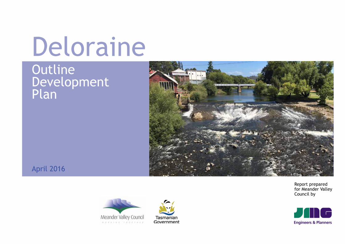
Deloraine Outline Development Plan
April 2016
Report prepared for Meander Valley Council by
DELORAINE OUTLINE DEVELOPMENT PLAN • APRIL 2016 PAGE 2
1 Introduction 3
2 The Study Area 4
3 Planning Policy Framework 8
4 Community Consultation 11
5 What People in Deloraine Value 12
6 Strategic Response 13
7 Implementation 34
Appendix A — Existing Conditions A1
Appendix B — Community Consultation Summary A13
Contents
DELORAINE OUTLINE DEVELOPMENT PLAN • APRIL 2016 PAGE 3
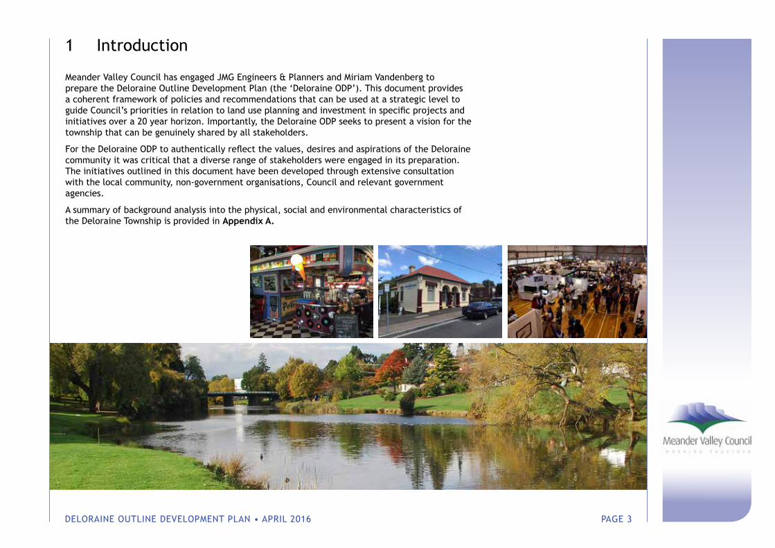
1 Introduction
Meander Valley Council has engaged JMG Engineers & Planners and Miriam Vandenberg to prepare the Deloraine Outline Development Plan (the ‘Deloraine ODP’). This document provides a coherent framework of policies and recommendations that can be used at a strategic level to guide Council’s priorities in relation to land use planning and investment in specific projects and initiatives over a 20 year horizon. Importantly, the Deloraine ODP seeks to present a vision for the township that can be genuinely shared by all stakeholders.
For the Deloraine ODP to authentically reflect the values, desires and aspirations of the Deloraine community it was critical that a diverse range of stakeholders were engaged in its preparation. The initiatives outlined in this document have been developed through extensive consultation with the local community, non-government organisations, Council and relevant government agencies.
A summary of background analysis into the physical, social and environmental characteristics of the Deloraine Township is provided in Appendix A.
DELORAINE OUTLINE DEVELOPMENT PLAN • APRIL 2016 PAGE 4
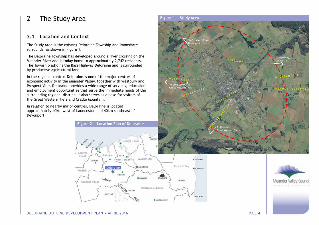
2 The Study Area
2.1 Location and Context
The Study Area is the existing Deloraine Township and immediate surrounds, as shown in Figure 1.
The Deloraine Township has developed around a river crossing on the Meander River and is today home to approximately 2,742 residents. The Township adjoins the Bass Highway Deloraine and is surrounded by productive agricultural land.
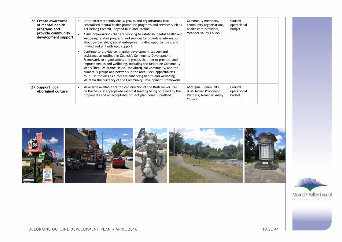
In the regional context Deloraine is one of the major centres of economic activity in the Meander Valley, together with Westbury and Prospect Vale. Deloraine provides a wide range of services, education and employment opportunities that serve the immediate needs of the surrounding regional district. It also serves as a base for visitors of the Great Western Tiers and Cradle Mountain.
In relation to nearby major centres, Deloraine is located approximately 40km west of Launceston and 40km southeast of Devonport.
W E S T E R N L I N E
W E S T E R N L I N E
B A S S H W Y
H I G
H L
A N
D L
A K
E S
R D
M E A N D E R R I V E R M E A N D E R V A L L E Y R D
To Elizabeth Town,Devonport
To Westbury,Launceston
M O L E C R E E K R D
To Mole Creek,Great Western Tiers
To Meander,Great Western Tiers
Figure 1 — Study Area
Figure 2 — Location Plan of Deloraine
DELORAINE OUTLINE DEVELOPMENT PLAN • APRIL 2016 PAGE 5
2.2 Land Use and Development Patterns
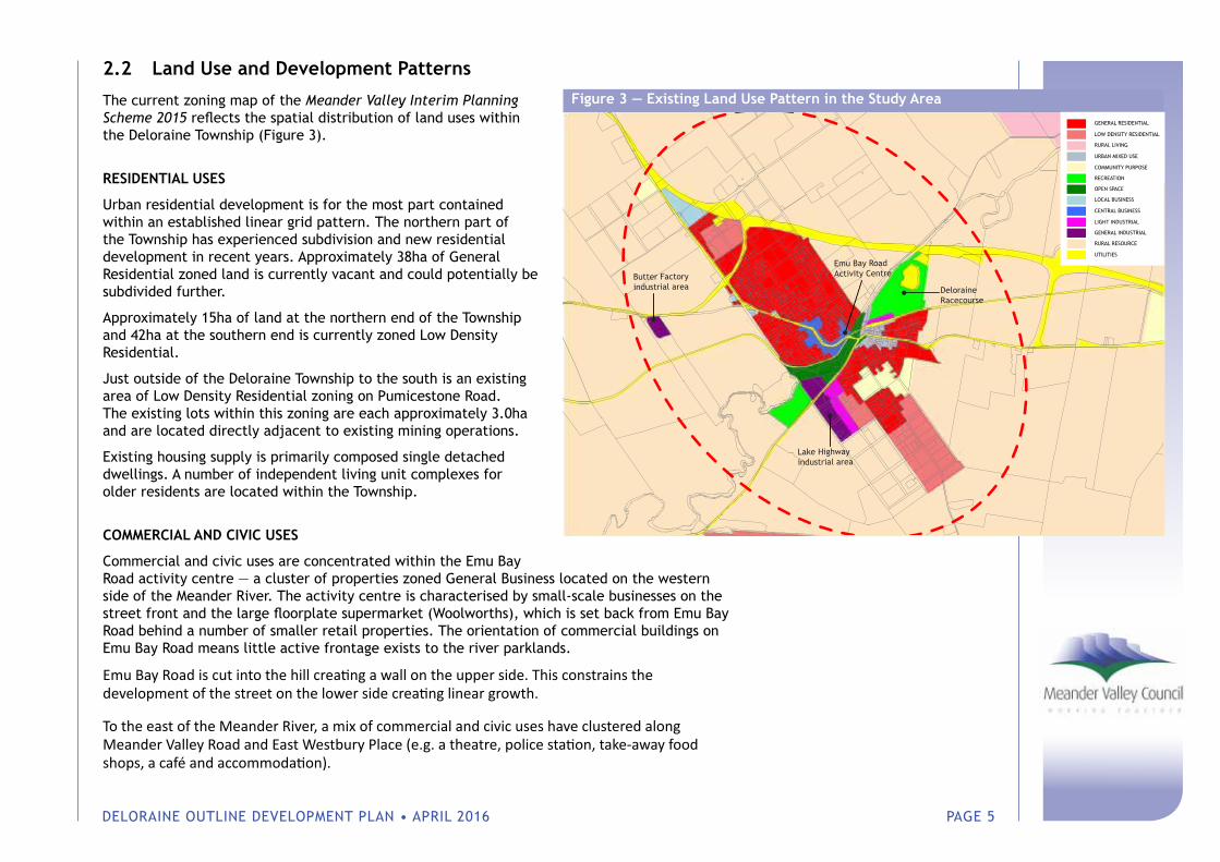
The current zoning map of the Meander Valley Interim Planning Scheme 2015 reflects the spatial distribution of land uses within the Deloraine Township (Figure 3).
RESIDENTIAL USES
Urban residential development is for the most part contained within an established linear grid pattern. The northern part of the Township has experienced subdivision and new residential development in recent years. Approximately 38ha of General Residential zoned land is currently vacant and could potentially be subdivided further.
Approximately 15ha of land at the northern end of the Township and 42ha at the southern end is currently zoned Low Density Residential.
Just outside of the Deloraine Township to the south is an existing area of Low Density Residential zoning on Pumicestone Road. The existing lots within this zoning are each approximately 3.0ha and are located directly adjacent to existing mining operations.
Existing housing supply is primarily composed single detached dwellings. A number of independent living unit complexes for older residents are located within the Township.
COMMERCIAL AND CIVIC USES
Commercial and civic uses are concentrated within the Emu Bay Road activity centre — a cluster of properties zoned General Business located on the western side of the Meander River. The activity centre is characterised by small-scale businesses on the street front and the large floorplate supermarket (Woolworths), which is set back from Emu Bay Road behind a number of smaller retail properties. The orientation of commercial buildings on Emu Bay Road means little active frontage exists to the river parklands.
Emu Bay Road is cut into the hill creating a wall on the upper side. This constrains the development of the street on the lower side creating linear growth.
To the east of the Meander River, a mix of commercial and civic uses have clustered along Meander Valley Road and East Westbury Place (e.g. a theatre, police station, take-away food shops, a café and accommodation).
Figure 3 — Existing Land Use Pattern in the Study AreaGENERAL RESIDENTIAL
LOW DENSITY RESIDENTIAL
RURAL LIVING
URBAN MIXED USE
COMMUNITY PURPOSE
RECREATION
OPEN SPACE
LOCAL BUSINESS
CENTRAL BUSINESS
LIGHT INDUSTRIAL
GENERAL INDUSTRIAL
RURAL RESOURCE
UTILITIES
Lake Highwayindustrial area
Emu Bay RoadActivity CentreButter Factory
industrial area DeloraineRacecourse
GENERAL RESIDENTIAL
LOW DENSITY RESIDENTIAL
RURAL LIVING
URBAN MIXED USE
COMMUNITY PURPOSE
RECREATION
OPEN SPACE
LOCAL BUSINESS
CENTRAL BUSINESS
LIGHT INDUSTRIAL
GENERAL INDUSTRIAL
RURAL RESOURCE
UTILITIES
Lake Highwayindustrial area
Emu Bay RoadActivity CentreButter Factory
industrial area DeloraineRacecourse
DELORAINE OUTLINE DEVELOPMENT PLAN • APRIL 2016 PAGE 6
RECREATIONAL USES
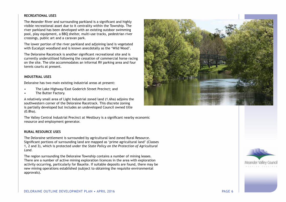
The Meander River and surrounding parkland is a significant and highly visible recreational asset due to it centrality within the Township. The river parkland has been developed with an existing outdoor swimming pool, play equipment, a BBQ shelter, multi-use tracks, pedestrian river crossings, public art and a caravan park.
The lower portion of the river parkland and adjoining land is vegetated with Eucalypt woodland and is known anecdotally as the ‘Wild Wood’.
The Deloraine Racetrack is another significant recreational site and is currently underutilised following the cessation of commercial horse racing on the site. The site accommodates an informal RV parking area and four tennis courts at present.
INDUSTRIAL USES
Deloraine has two main existing industrial areas at present:
• The Lake Highway/East Goderich Street Precinct; and• The Butter Factory.
A relatively small area of Light Industrial zoned land (1.6ha) adjoins the southwestern corner of the Deloraine Racetrack. This discrete zoning is partially developed but includes an undeveloped Council owned title (0.8ha).
The Valley Central Industrial Precinct at Westbury is a significant nearby economic resource and employment generator.
RURAL RESOURCE USES
The Deloraine settlement is surrounded by agricultural land zoned Rural Resource. Significant portions of surrounding land are mapped as ‘prime agricultural land’ (Classes 1, 2 and 3), which is protected under the State Policy on the Protection of Agricultural Land.
The region surrounding the Deloraine Township contains a number of mining leases. There are a number of active mining exploration licences in the area with exploration activity occurring, particularly for Bauxite. If suitable deposits are found, there may be new mining operations established (subject to obtaining the requisite environmental approvals).
DELORAINE OUTLINE DEVELOPMENT PLAN • APRIL 2016 PAGE 7
OTHER LAND USE CONSIDERATIONS
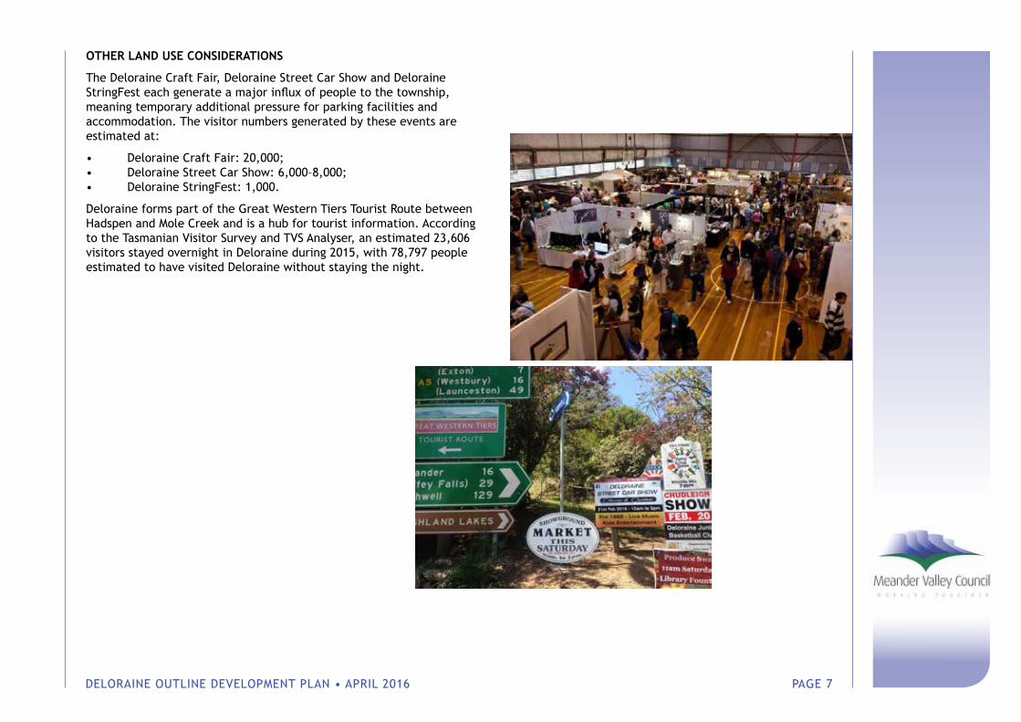
The Deloraine Craft Fair, Deloraine Street Car Show and Deloraine StringFest each generate a major influx of people to the township, meaning temporary additional pressure for parking facilities and accommodation. The visitor numbers generated by these events are estimated at:
• Deloraine Craft Fair: 20,000;• Deloraine Street Car Show: 6,000–8,000;• Deloraine StringFest: 1,000.
Deloraine forms part of the Great Western Tiers Tourist Route between Hadspen and Mole Creek and is a hub for tourist information. According to the Tasmanian Visitor Survey and TVS Analyser, an estimated 23,606 visitors stayed overnight in Deloraine during 2015, with 78,797 people estimated to have visited Deloraine without staying the night.

DELORAINE OUTLINE DEVELOPMENT PLAN • APRIL 2016 PAGE 8
3 Planning Policy Framework
The Deloraine ODP will exist in the context of a planning policy framework and must be consistent with the relevant regional land use strategy. Key strategic considerations are identified below.
3.1 Northern Tasmania Regional Land Use Strategy
The Northern Tasmania Regional Land Use Strategy 2013 (‘NTRLUS’) recognises Deloraine’s role as a ‘District Centre’ that serves the immediate needs of the surrounding regional district. This includes the provision of a wide range of services, education and employment opportunities (primarily associated with surrounding productive resources).
The NTRLUS promotes infill development within existing centres with provision of a mixture of dwelling types including traditional detached houses and multiple dwellings.
With respect to settlement patterns, the NTRLUS essentially seeks to guide the growth of urban areas whereby it makes efficient use of physical infrastructure and public transport, facilitates walkable communities, avoids land use conflict and minimises impact on environmental values. An activity centre hierarchy is identified with policies aimed at strengthening the Region’s capacity to deliver high order civic services to meet the community’s needs and support the regional economy.
Relevant policies are identified in this section of the report. It is noted that where policies are already reflected in Council’s Planning Scheme, it is not necessary to address them again through the ODP. Section 6 of this document identifies how specific ODP strategies are aligned with NTRLUS policies.
POLICY NUMBER COMMENT
REGIONAL SETTLEMENT NETWORK
RSN-P1, RSN-P2, RSN-P4, RSN-P8, RSN-P12, RSN-20
The Deloraine ODP process has considered available land supply in Deloraine, likely future demand, existing infrastructure and servicing constraints. It was found that limiting urban development to existing zoned areas (with the exception of a potential infill opportunity) is the most suitable policy at the present time and an urban growth boundary has been developed with this in mind.
The Deloraine ODP recognises the need to plan for an ageing population, to facilitate walkability, to provide a variety of housing options to meet diverse needs and has included strategies to further these goals.
DELORAINE OUTLINE DEVELOPMENT PLAN • APRIL 2016 PAGE 9
REGIONAL ACTIVITY CENTRES NETWORK
RAC-P1, RAC-P4, RAC-P5, RAC-P8, RAC-P9, RAC-P14
Deloraine is recognised as a ‘District Centre’ — an activity centre that serves the immediate needs of the surrounding regional district. This includes the provision of a wide range of services, education and employment opportunities (primarily associated with surrounding productive resources).
The Deloraine ODP seeks to support Deloraine’s function as a District Centre through strategies aimed at enhancing existing and providing new facilities to meet regional demand.
Capital works have been identified through the Deloraine ODP process that will support the viability of the Emu Bay Road commercial area through improvements to access, parking and amenity.
No new out-of-centre commercial development is proposed as part of the ODP.
REGIONAL INFRASTRUCTURE NETWORK
RIN-P3, RIN-P6 The Deloraine ODP seeks to direct new development to existing zoned areas within the township. No significant expansion of the settlement footprint is envisaged within the next 20 years. An opportunity for long term residential infill development is identified at the northern end of the township, however this is dependent on future servicing constraints being resolved (specifically the capacity of the Deloraine Waste Water Treatment Plant and water pressure limitations).
The Deloraine ODP includes strategies aimed at supporting active modes of transport within the township.
REGIONAL ECONOMIC DEVELOPMENT
ED-P2, ED-P3, ED-P4, ED-P8, ED-P9
The Deloraine ODP seeks to expand the range of recreational facilities within the township and refinement of promotion to tourists.
The NTRLUS seeks to ensure a 10 year supply of industrial land is provided. Deloraine functions as a District Centre and accommodates service industries.
The NTRLUS seeks to ensure that a 10 year supply of industrial land is provided to meet the Region’s needs. Subsequently, the Northern Tasmania Industrial Land Study (2014) was drafted that examined land supply in greater detail. The study recognised that approximately two hectares of undeveloped land exists in the West Goderich Precinct for further service industry uses and that any additional demand could be accommodated at Westbury. As such, there is not considered to be a need to specify additional industrial land in the ODP.
The Deloraine ODP includes strategies for training and education.
The ODP, through its urban growth boundary, will protect surrounding rural resource based activities from potentially conflicting land uses.
DELORAINE OUTLINE DEVELOPMENT PLAN • APRIL 2016 PAGE 10
SOCIAL INFRASTRUCTURE AND COMMUNITY
SI-P01, SI-P02, SI-P03, SI-P04, CH-P01
To ensure Deloraine can meet regional demand for sporting facilities, the ODP recommends that Council support the development of a regional recreation precinct at Alveston Drive. The proposed location is located in close proximity to residential development and local schools.
The ODP recommends that Council audit current user groups of existing facilities to ensure that they remain suitable for current needs. Housing diversity is identified as another priority, specifically in relation to the need for additional independent living units.
With respect to heritage, the ODP includes a strategy involving the inclusion of heritage precinct overlays in Council’s Planning Scheme.
REGIONAL ENVIRONMENT
BNV-P02, OSR-P01, NH-P02, LSA-P01
The Deloraine ODP promotes urban containment and is therefore consistent with the need to protect natural values.
A number of ODP strategies have been developed that seek to support and diversify the recreational use of existing public open spaces, as well as create an integrated system of tracks and trails for public use.
Significant areas within the township have been identified as flood-prone within the Planning Scheme’s overlays. Development that is recommended in the ODP is primarily associated with recreational use and will not result in significant risk to people or property.
With respect to landscape and scenic amenity of regional tourism routes, Council’s Planning Scheme includes scenic corridor provisions for all public road access points to the township. No development recommended in the Deloraine ODP is in conflict with the overlay.
3.2 Meander Valley Use and Development Strategy 2005
The Development Strategy provided a comprehensive framework to guide Council’s land use planning within Meander Valley and a basis for subsequent detailed analysis of specific areas, such as the Deloraine ODP.
In relation to business and tourism, the Development Strategy promotes the retention of Emu Bay Road as the primary retail and commercial area.
No additional residential zoned land outside of the existing serviced areas for considered necessary for the period 2004-16, unless significant unexpected demand were identified. Land between West Barrack and West Church Streets, north of Beefeater Street was identified as the preferred location for long term residential growth (this land is now zoned General Residential under the current Planning Scheme).
The Development Strategy seeks to focus industrial development at the Lake Highway/East Goderich Street Precinct and within the current zoned land at the Butter Factory Precinct (a southeastern expansion of the Lake Highway/East Goderich Street Precinct was subsequently approved in accordance with the Development Strategy).
DELORAINE OUTLINE DEVELOPMENT PLAN • APRIL 2016 PAGE 11
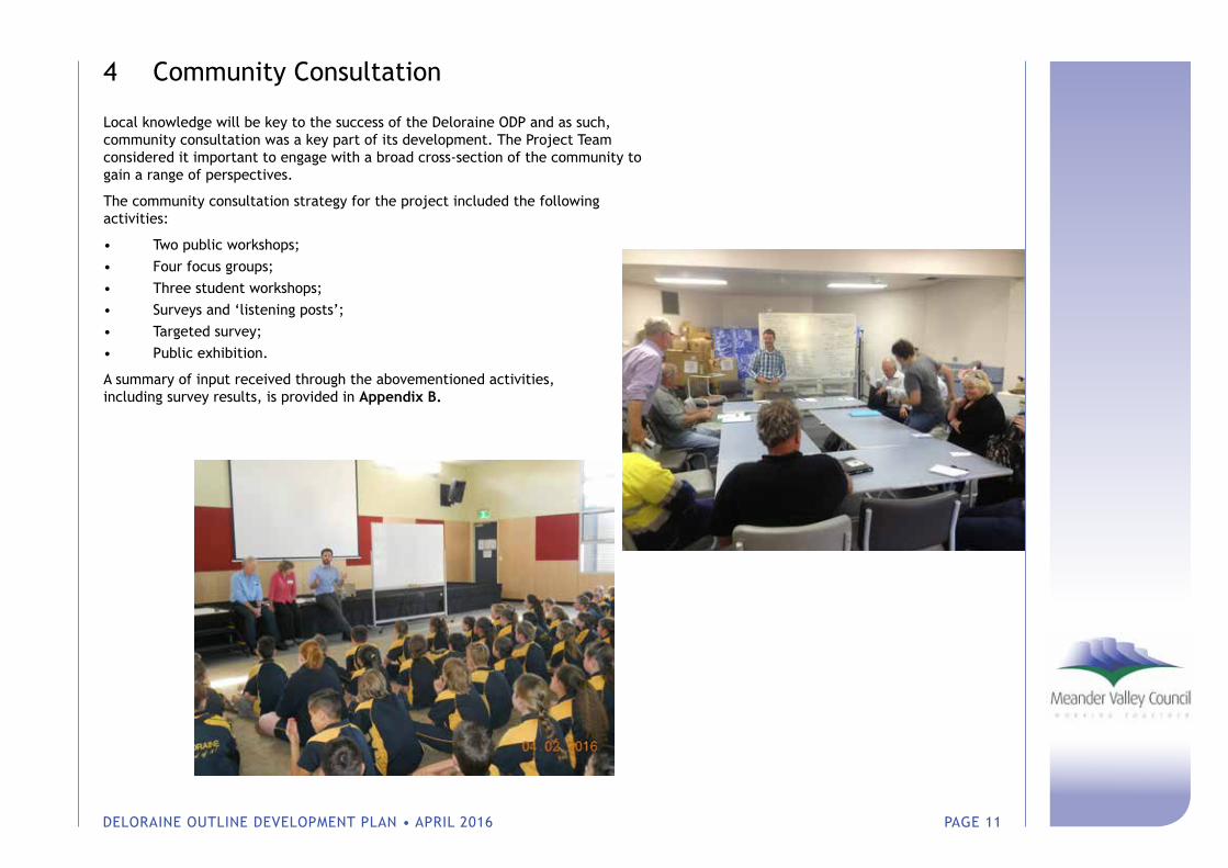
4 Community Consultation
Local knowledge will be key to the success of the Deloraine ODP and as such, community consultation was a key part of its development. The Project Team considered it important to engage with a broad cross-section of the community to gain a range of perspectives.
The community consultation strategy for the project included the following activities:
• Two public workshops;• Four focus groups;• Three student workshops;• Surveys and ‘listening posts’;• Targeted survey;• Public exhibition.
A summary of input received through the abovementioned activities, including survey results, is provided in Appendix B.
DELORAINE OUTLINE DEVELOPMENT PLAN • APRIL 2016 PAGE 12
5 What People in Deloraine Value
Consultation with the community and key stakeholder groups revealed that the Deloraine Community values:
• Diversity: The Deloraine community is made of people from many different walks of life. Its peoples are passionate, vibrant, accepting and skilled, and collectively have a ‘can do’ attitude. People are friendly and there is a strong community spirit.
• The current population size: People in Deloraine feel that the current population is ‘about right’, as it fosters a sense of inclusiveness and individual identity. They value the opportunity to live a quiet and cultured lifestyle.
• Its rural location and farming history: Deloraine is recognised as a hub for the surrounding farming district, and values its history and traditions.
• Opportunitiestoliveahealthyandfulfillinglife: Deloraine is a great place to grow up, learn and develop skills, raise a family, engage in social activities and age well.
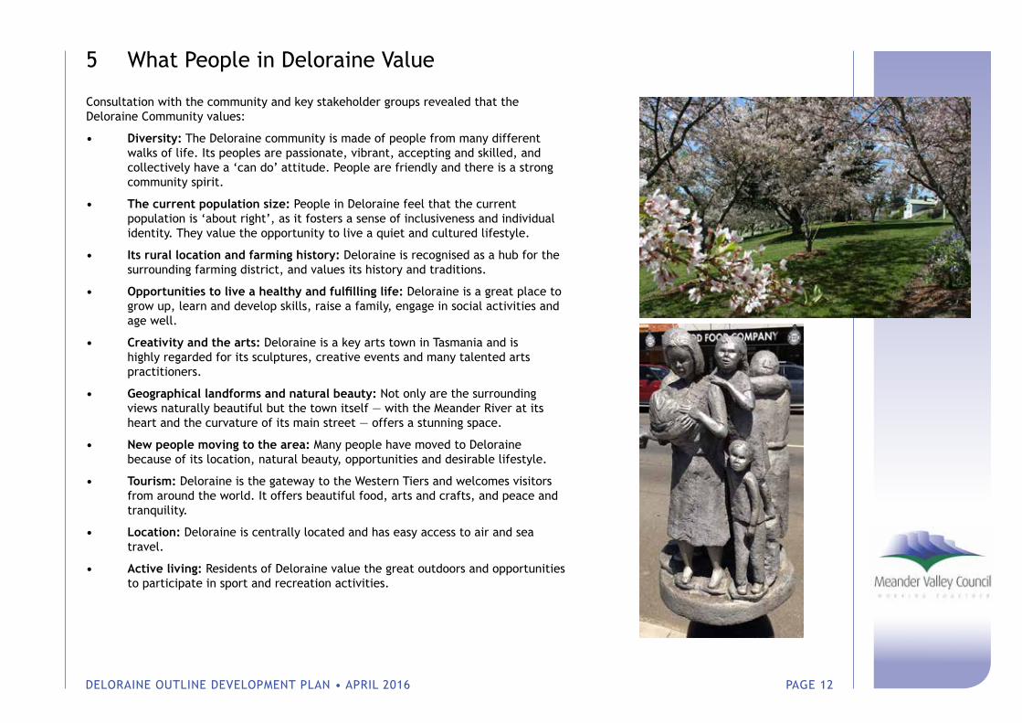
• Creativity and the arts: Deloraine is a key arts town in Tasmania and is highly regarded for its sculptures, creative events and many talented arts practitioners.
• Geographical landforms and natural beauty: Not only are the surrounding views naturally beautiful but the town itself — with the Meander River at its heart and the curvature of its main street — offers a stunning space.
• New people moving to the area: Many people have moved to Deloraine because of its location, natural beauty, opportunities and desirable lifestyle.
• Tourism: Deloraine is the gateway to the Western Tiers and welcomes visitors from around the world. It offers beautiful food, arts and crafts, and peace and tranquility.
• Location: Deloraine is centrally located and has easy access to air and sea travel.
• Active living: Residents of Deloraine value the great outdoors and opportunities to participate in sport and recreation activities.
DELORAINE OUTLINE DEVELOPMENT PLAN • APRIL 2016 PAGE 13
6 Strategic Response
The recommended strategic response is informed by the investigation and consultation that has occurred throughout this project and seeks to align with the community’s stated values.
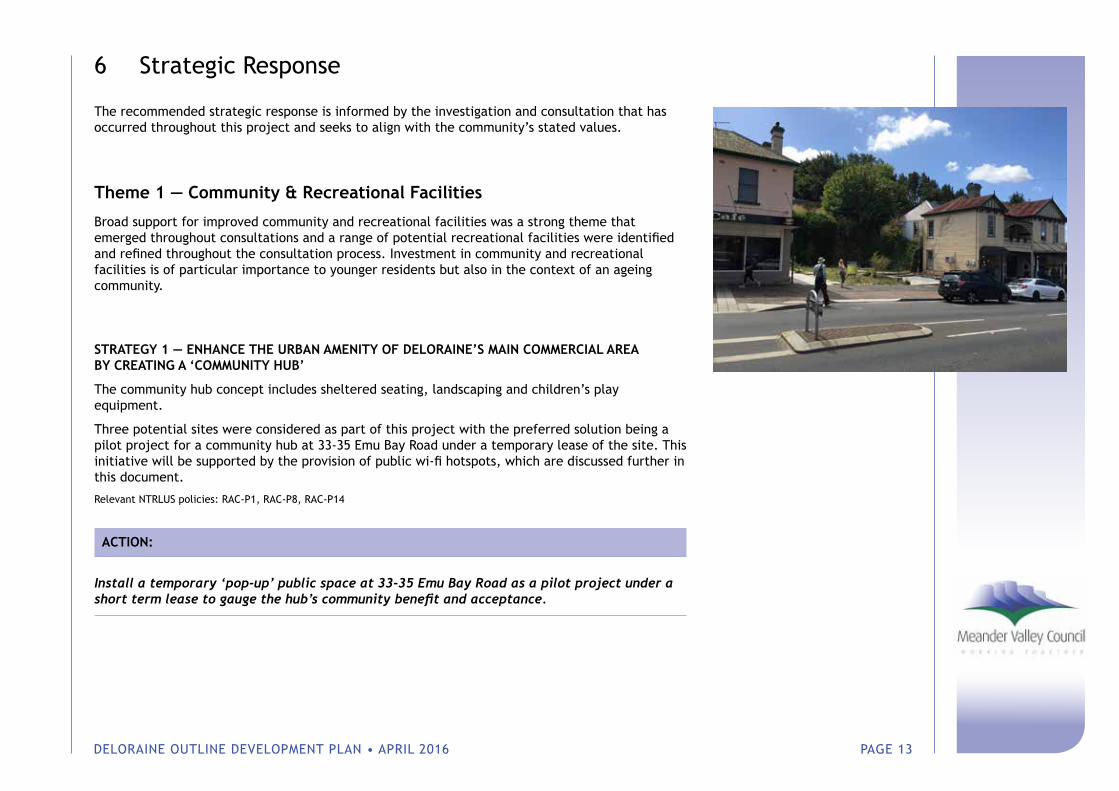
Theme 1 — Community & Recreational Facilities
Broad support for improved community and recreational facilities was a strong theme that emerged throughout consultations and a range of potential recreational facilities were identified and refined throughout the consultation process. Investment in community and recreational facilities is of particular importance to younger residents but also in the context of an ageing community.
STRATEGY 1 — ENHANCE THE URBAN AMENITY OF DELORAINE’S MAIN COMMERCIAL AREA BY CREATING A ‘COMMUNITY HUB’
The community hub concept includes sheltered seating, landscaping and children’s play equipment.
Three potential sites were considered as part of this project with the preferred solution being a pilot project for a community hub at 33-35 Emu Bay Road under a temporary lease of the site. This initiative will be supported by the provision of public wi-fi hotspots, which are discussed further in this document.
Relevant NTRLUS policies: RAC-P1, RAC-P8, RAC-P14
ACTION:
Install a temporary ‘pop-up’ public space at 33-35 Emu Bay Road as a pilot project under a short term lease to gauge the hub’s community benefit and acceptance.
DELORAINE OUTLINE DEVELOPMENT PLAN • APRIL 2016 PAGE 14
STRATEGY 2 — DEVELOP A DELORAINE-BASED REGIONAL RECREATIONAL PRECINCT AT ALVESTON DRIVE
The staged development of a regional recreation precinct at Alveston Drive will cater for regional demand for facilities and support Deloraine’s role as a District Centre. A feasibility study ought to be undertaken to outline the public costs and benefits that would derive from the project to support future applications for funding.
Relevant NTRLUS policies: RAC-P1, RAC-P4, SI-P02, SI-P03
ACTIONS:
Design & obtain planning/building approval and construct Stage 1 of the project — 3x concrete bituminous netball courts incl. fencing and single row bench seating with lighting on Council land adjacent to Deloraine Community Complex.
Undertake feasibility study (including agricultural land assessment) for Stage 2, obtain planning approval, secure land tenure and seek funding for works including extension of Gay Street and East Westbury Place, additional parking, multi-purpose conference facility, football ground and clubrooms, squash courts and renovation of Deloraine Community Complex.
Purchase land, design approve and construct Stage 2.
Develop new skate park (approximately 684sqm).
Signpost (x10 street and reassurance posts x10) ($7.5k)/ line mark 2500m of existing road (12.5k) and 1000m construct edged gravel track ($70k) link between Deloraine Community Complex and Meander River loop.
Figure 4 — Proposed Recreation Precinct
DELORAINE OUTLINE DEVELOPMENT PLAN • APRIL 2016 PAGE 15
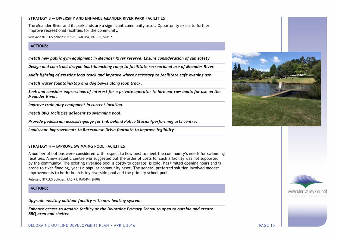
STRATEGY 3 — DIVERSIFY AND ENHANCE MEANDER RIVER PARK FACILITIES
The Meander River and its parklands are a significant community asset. Opportunity exists to further improve recreational facilities for the community.
Relevant NTRLUS policies: RIN-P6, RAC-P4, RAC-P8, SI-P02
ACTIONS:
Install new public gym equipment in Meander River reserve. Ensure consideration of sun safety.
Design and construct dragon boat-launching ramp to facilitate recreational use of Meander River.
Audit lighting of existing loop track and improve where necessary to facilitate safe evening use.
Install water fountains/tap and dog bowls along loop track.
Seek and consider expressions of interest for a private operator to hire out row boats for use on the Meander River.
Improve train play equipment in current location.
Install BBQ facilities adjacent to swimming pool.
Provide pedestrian access/signage for link behind Police Station/performing arts centre.
Landscape improvements to Racecourse Drive footpath to improve legibility.
STRATEGY 4 — IMPROVE SWIMMING POOL FACILITIES
A number of options were considered with respect to how best to meet the community’s needs for swimming facilities. A new aquatic centre was suggested but the order of costs for such a facility was not supported by the community. The existing riverside pool is costly to operate, is cold, has limited opening hours and is prone to river flooding, yet is a popular community asset. The general preferred solution involved modest improvements to both the existing riverside pool and the primary school pool.
Relevant NTRLUS policies: RAC-P1, RAC-P4, SI-P02
ACTIONS:
Upgrade existing outdoor facility with new heating system;
Enhance access to aquatic facility at the Deloraine Primary School to open to outside and create BBQ area and shelter.
DELORAINE OUTLINE DEVELOPMENT PLAN • APRIL 2016 PAGE 16
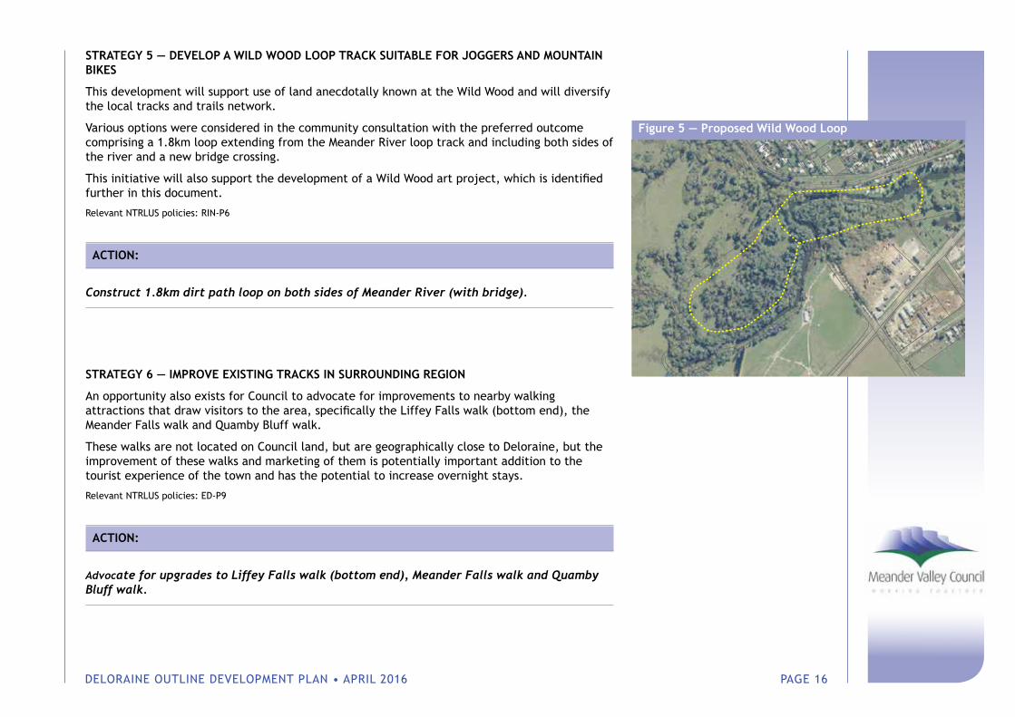
STRATEGY 5 — DEVELOP A WILD WOOD LOOP TRACK SUITABLE FOR JOGGERS AND MOUNTAIN BIKES
This development will support use of land anecdotally known at the Wild Wood and will diversify the local tracks and trails network.
Various options were considered in the community consultation with the preferred outcome comprising a 1.8km loop extending from the Meander River loop track and including both sides of the river and a new bridge crossing.
This initiative will also support the development of a Wild Wood art project, which is identified further in this document.
Relevant NTRLUS policies: RIN-P6
ACTION:
Construct 1.8km dirt path loop on both sides of Meander River (with bridge).
STRATEGY 6 — IMPROVE EXISTING TRACKS IN SURROUNDING REGION
An opportunity also exists for Council to advocate for improvements to nearby walking attractions that draw visitors to the area, specifically the Liffey Falls walk (bottom end), the Meander Falls walk and Quamby Bluff walk.
These walks are not located on Council land, but are geographically close to Deloraine, but the improvement of these walks and marketing of them is potentially important addition to the tourist experience of the town and has the potential to increase overnight stays.
Relevant NTRLUS policies: ED-P9
ACTION:
Advocate for upgrades to Liffey Falls walk (bottom end), Meander Falls walk and Quamby Bluff walk.
Figure 5 — Proposed Wild Wood Loop
DELORAINE OUTLINE DEVELOPMENT PLAN • APRIL 2016 PAGE 17
STRATEGY 7 — IMPROVE PUBLIC INTERNET ACCESS
Internet access outside of the township was identified as an issue for residents, business operators and visitors. It is understood that Meander Valley Council is working to resolve this issue and as such no specific actions need to be specified through the Deloraine ODP.
The provision of wi-fi hotspots on Emu Bay Road was suggested by local business owners as an opportunity to improve the amenity of the town centre for visitors.
Relevant NTRLUS policies: RAC-P4, RAC-P8
ACTION:
Provide additional wi-fi access points on Emu Bay Road (3 hotspots).
Theme 2 — Local Business, Tourism & the Arts
Local businesses, tourism and the arts are all interrelated and interdependent. A number of strategies have been identified to support Local Business, Tourism and the Arts.
STRATEGY 8 — UTILISE THE DELORAINE RACETRACK FOR RECREATIONAL ACTIVITIES AND EVENTS
The cessation of racing at the Deloraine Racecourse presents an opportunity for reuse of a significant area of Council-owned land.
It is acknowledged that the site is constrained to some degree by occasional flooding and the presence of the Deloraine Waste Water Treatment Plant, which limits its suitability for certain land uses. The long-term future of the WWTP is not known at this stage and may foreseeably require expansion at some stage in the future (5-20 years from now).
The site contains some existing infrastructure, including a grand stand with amenities that could be utilised for large outdoor events or concerts. The site could also accommodate a BMX track, which was identified by younger residents as a desirable facility.
A portion of Deloraine’s visitors arrive in self-contained Recreational Vehicles (RVs) and at least one major annual festival derives a significant portion of its patrons from visitors in RVs. The provision of parking facilities for RVs is a way in which Council can support visitation and overnight stays within Deloraine. The Council depot — currently located alongside the Meander River — is not dependent on this location and could be reused to assist in meeting the current shortfall in accommodation options
DELORAINE OUTLINE DEVELOPMENT PLAN • APRIL 2016 PAGE 18
during major events. Importantly, the RV parking area would not contain any facilities (except for the existing dump point) and so will not undermine the viability of existing caravan parks.
Relevant NTRLUS policy: RAC-P4
ACTIONS:
Provide temporary tent accommodation at Deloraine Racetrack for backpackers during the festival period. This should be located within approximately 100m of the grandstand utilities.
Provide a free riverside RV parking area on the current Council depot hardstand area at 6 Racecourse Drive and demolish/relocate existing depot sheds.
Design and construct a BMX track (competition grade/no lighting).
Seek EOI to hold a trial ‘picnic race’/fun animal race community event at the existing racetrack.
STRATEGY 9 — ENCOURAGE AND IMPLEMENT PUBLIC ART PROJECTS
Deloraine already has a vibrant arts and craft scene. Opportunities have been identified through the consultation process to further build on this strength by creating new opportunities for local artists.
Relevant NTRLUS policy: RAC-P8
ACTIONS:
Provide a dynamic public art exhibit by rotating works and introducing new works. Install plinths in three locations around the town so that public art can be rotated between these different locations.
Call for EOI from community members who would like to donate a sculpture that can be installed at each entry from the highway to promote Deloraine as an arts/sculpture town.
Undertake a competition for a more permanent work of art to be installed in the location. Criteria for the art to include a five-year life and able to fit a ‘standard’ size plinth so that it can be relocated to other locations in the town over time.
Provide a dynamic public art exhibit by rotating works and introducing new works. Install plinths in three locations around the town so that public art can be rotated between these different locations.
Work in partnership with key stakeholders from the arts, tourism, education and business communities to develop a new piece of public art to be located at Wild Wood.
DELORAINE OUTLINE DEVELOPMENT PLAN • APRIL 2016 PAGE 19
STRATEGY 10 — DEVELOP AN ARTIST RESIDENCY PROJECT
An artist residency program would bring artists to Deloraine, presenting an opportunity to exchange knowledge and skills with local artists. Furthermore, visiting artists will raise awareness of Deloraine by sharing their experiences when they return to their place of origin.
Relevant NTRLUS policy: RAC-P4
ACTION:
Establish an artist residency program to bring new creative talent into the community with a particular focus on involving emerging artists.
STRATEGY 11 — PROVIDE SUPPORT FOR EVENTS
Local business groups reported that it can be difficult to get new events up and running. An opportunity was identified for Council to provide further support for event promoters, which will have flow on benefits for local business.
Relevant NTRLUS policies: RAC-P4, ED-P9
ACTION:
Allocate resourcing for the facilitation, coordination and promotion of events, including provision of free access to Council owned facilities.
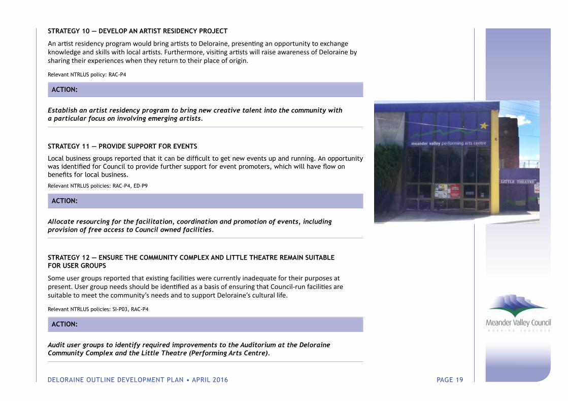
STRATEGY 12 — ENSURE THE COMMUNITY COMPLEX AND LITTLE THEATRE REMAIN SUITABLE FOR USER GROUPS
Some user groups reported that existing facilities were currently inadequate for their purposes at present. User group needs should be identified as a basis of ensuring that Council-run facilities are suitable to meet the community’s needs and to support Deloraine’s cultural life.
Relevant NTRLUS policies: SI-P03, RAC-P4
ACTION:
Audit user groups to identify required improvements to the Auditorium at the Deloraine Community Complex and the Little Theatre (Performing Arts Centre).
DELORAINE OUTLINE DEVELOPMENT PLAN • APRIL 2016 PAGE 20
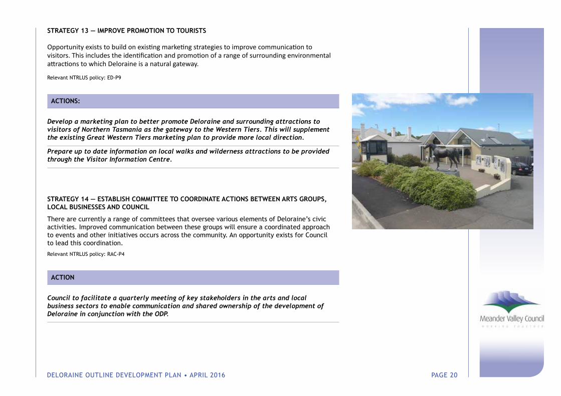
STRATEGY 13 — IMPROVE PROMOTION TO TOURISTS
Opportunity exists to build on existing marketing strategies to improve communication to visitors. This includes the identification and promotion of a range of surrounding environmental attractions to which Deloraine is a natural gateway.
Relevant NTRLUS policy: ED-P9
ACTIONS:
Develop a marketing plan to better promote Deloraine and surrounding attractions to visitors of Northern Tasmania as the gateway to the Western Tiers. This will supplement the existing Great Western Tiers marketing plan to provide more local direction.
Prepare up to date information on local walks and wilderness attractions to be provided through the Visitor Information Centre.
STRATEGY 14 — ESTABLISH COMMITTEE TO COORDINATE ACTIONS BETWEEN ARTS GROUPS, LOCAL BUSINESSES AND COUNCIL
There are currently a range of committees that oversee various elements of Deloraine’s civic activities. Improved communication between these groups will ensure a coordinated approach to events and other initiatives occurs across the community. An opportunity exists for Council to lead this coordination.
Relevant NTRLUS policy: RAC-P4
ACTION
Council to facilitate a quarterly meeting of key stakeholders in the arts and local business sectors to enable communication and shared ownership of the development of Deloraine in conjunction with the ODP.
DELORAINE OUTLINE DEVELOPMENT PLAN • APRIL 2016 PAGE 21
Theme 3 — Urban Design, Development & Infrastructure
Consideration has been given to the future spatial patterns of Deloraine based on existing conditions and demographic analysis and the policy framework provided by the NTRLUS.
The NTRLUS seeks to contain the Region’s urban settlements within urban growth boundaries that can accommodate at least 10 years and up to 20 years supply.
With respect to future residential development opportunities, there is approximately 38ha of undeveloped General Residential zoned land within the existing Township, which equates to approximately 633 new lots (assuming an average lot size of 600sqm with a gross density of 15 dwellings per hectare). Additionally, approximately 15ha of Low Density Residential land within the northern part of the Township presents a logical area for long term infill urban residential development (approximately a further 250 lots), once water pressure constraints and Waste Water Treatment Plant capacity issues are resolved.
Demographic analysis undertaken as part of the Deloraine ODP indicates that Deloraine’s population is currently declining and as such no significant demand for residential land is forecast for the next 20 years, except for independent living units.
Based on the available land supply and the current demographic, economic and social context of Deloraine, infill development opportunities are expected to meet the needs of the community for the foreseeable future. Furthermore, urban expansion outside of the current township in the short-medium term would also likely require costly developer contributions to bring forward required Waste Water Treatment Plant capacity upgrades. Consolidation — rather than expansion — of the settlement will support the efficient use of existing infrastructure, will support active modes of transport and will avoid the loss of productive agricultural land on the Township’s perimeters, consistent with the NTRLUS. As such, no expansion of the township outside of the existing urban area is considered appropriate at the current time.
The existing industrial precincts at Lake Highway/East Goderich Street and the Butter Factory have available land for development and should be retained as the Township’s key industrial locations. The Lake Highway/East Goderich Precinct has some capacity to accommodate further service industry-related development going forward. The Northern Tasmania Industrial Land Study (2014) recommended that surplus demand can be accommodated at Westbury. Should there be suitable justification of the Lake Highway/East Goderich Precinct in future however, the preferred direction would be to the southeast.
The heritage and built character of the Deloraine is an important quality of the Township, both for locals and visitors. Council has an existing incentive scheme for property owners to restore original features of heritage buildings (the Meander Valley Townscape Rate Incentive Scheme). The retention of this scheme is considered appropriate. Allocating Council funding for the restoration of original shop awnings on Emu Bay Road was discussed during consultation but was not generally supported as a community priority.
A range of urban design improvements have been identified through the consultation and investigation process that will improve accessibility for pedestrians, cyclists and vehicles within the township.
DELORAINE OUTLINE DEVELOPMENT PLAN • APRIL 2016 PAGE 22
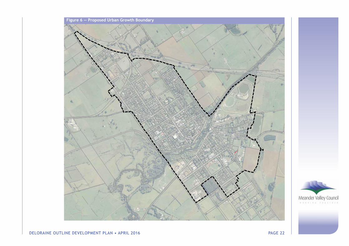
Figure 6 — Proposed Urban Growth Boundary
DELORAINE OUTLINE DEVELOPMENT PLAN • APRIL 2016 PAGE 23
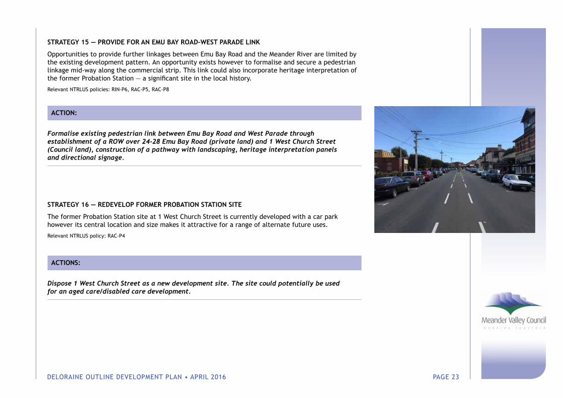
STRATEGY 15 — PROVIDE FOR AN EMU BAY ROAD–WEST PARADE LINK
Opportunities to provide further linkages between Emu Bay Road and the Meander River are limited by the existing development pattern. An opportunity exists however to formalise and secure a pedestrian linkage mid-way along the commercial strip. This link could also incorporate heritage interpretation of the former Probation Station — a significant site in the local history.
Relevant NTRLUS policies: RIN-P6, RAC-P5, RAC-P8
ACTION:
Formalise existing pedestrian link between Emu Bay Road and West Parade through establishment of a ROW over 24-28 Emu Bay Road (private land) and 1 West Church Street (Council land), construction of a pathway with landscaping, heritage interpretation panels and directional signage.
STRATEGY 16 — REDEVELOP FORMER PROBATION STATION SITE
The former Probation Station site at 1 West Church Street is currently developed with a car park however its central location and size makes it attractive for a range of alternate future uses.
Relevant NTRLUS policy: RAC-P4
ACTIONS:
Dispose 1 West Church Street as a new development site. The site could potentially be used for an aged care/disabled care development.
DELORAINE OUTLINE DEVELOPMENT PLAN • APRIL 2016 PAGE 24
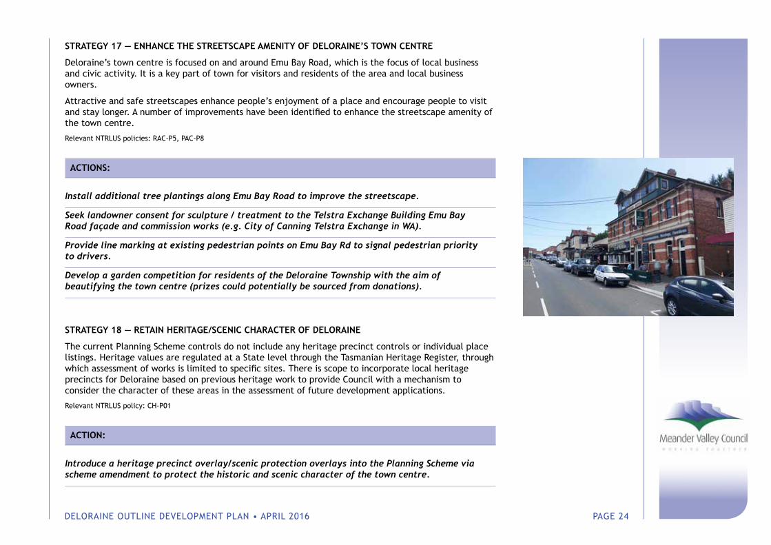
STRATEGY 17 — ENHANCE THE STREETSCAPE AMENITY OF DELORAINE’S TOWN CENTRE
Deloraine’s town centre is focused on and around Emu Bay Road, which is the focus of local business and civic activity. It is a key part of town for visitors and residents of the area and local business owners.
Attractive and safe streetscapes enhance people’s enjoyment of a place and encourage people to visit and stay longer. A number of improvements have been identified to enhance the streetscape amenity of the town centre.
Relevant NTRLUS policies: RAC-P5, PAC-P8
ACTIONS:
Install additional tree plantings along Emu Bay Road to improve the streetscape.
Seek landowner consent for sculpture / treatment to the Telstra Exchange Building Emu Bay Road façade and commission works (e.g. City of Canning Telstra Exchange in WA).
Provide line marking at existing pedestrian points on Emu Bay Rd to signal pedestrian priority to drivers.
Develop a garden competition for residents of the Deloraine Township with the aim of beautifying the town centre (prizes could potentially be sourced from donations).
STRATEGY 18 — RETAIN HERITAGE/SCENIC CHARACTER OF DELORAINE
The current Planning Scheme controls do not include any heritage precinct controls or individual place listings. Heritage values are regulated at a State level through the Tasmanian Heritage Register, through which assessment of works is limited to specific sites. There is scope to incorporate local heritage precincts for Deloraine based on previous heritage work to provide Council with a mechanism to consider the character of these areas in the assessment of future development applications.
Relevant NTRLUS policy: CH-P01
ACTION:
Introduce a heritage precinct overlay/scenic protection overlays into the Planning Scheme via scheme amendment to protect the historic and scenic character of the town centre.
DELORAINE OUTLINE DEVELOPMENT PLAN • APRIL 2016 PAGE 25
STRATEGY 19 — IMPROVE ACCESS TO EMU BAY ROAD BY RELAXING PARKING TIME LIMITATIONS
The existing one-hour parking limitation on Emu Bay Road was implemented with the aim of freeing up parking within the town centre. Local business owners have reported that this inconveniences visitors to the area who would otherwise stay longer within the town centre.
Relevant NTRLUS policy: RAC-P4
ACTION:
Extend time limitation to three hours on Emu Bay Road to encourage people to stay longer within the town centre.
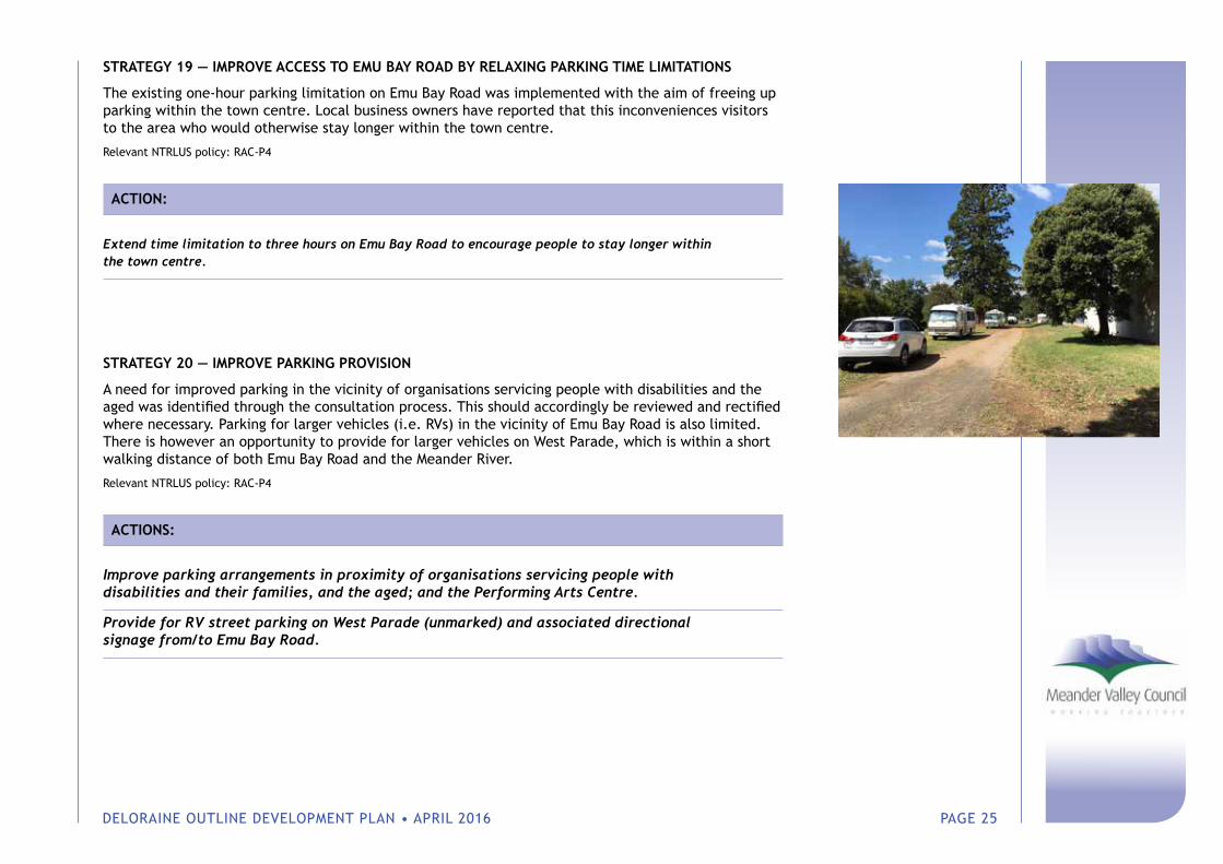
STRATEGY 20 — IMPROVE PARKING PROVISION
A need for improved parking in the vicinity of organisations servicing people with disabilities and the aged was identified through the consultation process. This should accordingly be reviewed and rectified where necessary. Parking for larger vehicles (i.e. RVs) in the vicinity of Emu Bay Road is also limited. There is however an opportunity to provide for larger vehicles on West Parade, which is within a short walking distance of both Emu Bay Road and the Meander River.
Relevant NTRLUS policy: RAC-P4
ACTIONS:
Improve parking arrangements in proximity of organisations servicing people with disabilities and their families, and the aged; and the Performing Arts Centre.
Provide for RV street parking on West Parade (unmarked) and associated directional signage from/to Emu Bay Road.
DELORAINE OUTLINE DEVELOPMENT PLAN • APRIL 2016 PAGE 26
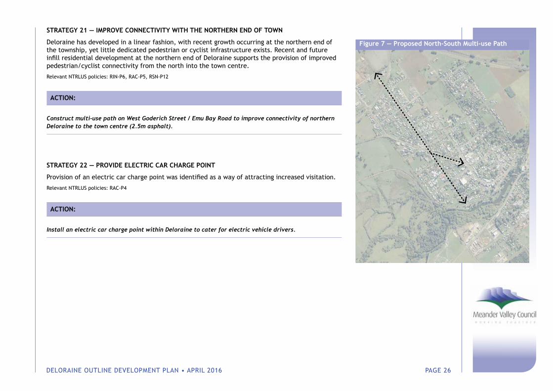
STRATEGY 21 — IMPROVE CONNECTIVITY WITH THE NORTHERN END OF TOWN
Deloraine has developed in a linear fashion, with recent growth occurring at the northern end of the township, yet little dedicated pedestrian or cyclist infrastructure exists. Recent and future infill residential development at the northern end of Deloraine supports the provision of improved pedestrian/cyclist connectivity from the north into the town centre.
Relevant NTRLUS policies: RIN-P6, RAC-P5, RSN-P12
ACTION:
Construct multi-use path on West Goderich Street / Emu Bay Road to improve connectivity of northern Deloraine to the town centre (2.5m asphalt).
STRATEGY 22 — PROVIDE ELECTRIC CAR CHARGE POINT
Provision of an electric car charge point was identified as a way of attracting increased visitation.
Relevant NTRLUS policies: RAC-P4
ACTION:
Install an electric car charge point within Deloraine to cater for electric vehicle drivers.
Figure 7 — Proposed North-South Multi-use Path
DELORAINE OUTLINE DEVELOPMENT PLAN • APRIL 2016 PAGE 27
Theme 4 — Social Infrastructure
The people of Deloraine are central to the growth and development of their town, not only in terms of the hard infrastructure outlined in this Plan but also the values they share that shape the character and culture of the town. Deloraine community members contribute the social capital that is needed to adapt, grow and develop. For the sake of simplicity, social capital can be thought of as the links, shared values and understandings that enable individuals and groups to trust each other and so work together.
Deloraine offers social infrastructure that provide a range of services for the community and important mechanisms for citizens to engage with each other, thereby building social capital. The degree of social capital influences a community’s ability to respond proactively to opportunities that are in the best interests of the community, and is inextricably linked to the quality of hard infrastructure such as buildings, transport and communication technology.
STRATEGY 23 — IMPROVE AND SUPPORT EDUCATION AND CAREER PATHWAYS
Deloraine’s school completion rates are lower than both the local government area to which it belongs, as well as Tasmania’s completion rates.
In response to the needs of young people in Deloraine, it is recommended that Council work with Deloraine High School and the local business community to identify the underlying factors that are contributing to Deloraine’s poor school completion rates. This partnership should focus on identifying opportunities to improve engagement in education and school completion rates, overcome barriers for those who are falling through the gaps, and provide pathways for career development and life-long learning. It is suggested that a collective impact1 approach could provide a using framework for this partnership to implement actions and establish agreed indicators to monitor progress.
Relevant NTRLUS policy: ED-P4
ACTION:
Working with Deloraine High School and the local business community, identify the underlying factors that are contributing to Deloraine’s poor school completion rates, and opportunities to improve engagement in education, overcome barriers for those who are falling through the gaps, and provide pathways for career development and life-long learning. Using a collective impact approach, implement actions and establish agreement indicators to monitor progress.
1 Collective impact is a framework to tackle deeply entrenched and complex social problems. It is an innovative and structured approach to making collaboration work across government, business, philanthropy, non-profit organisations and citizens to achieve significant and lasting social change.
DELORAINE OUTLINE DEVELOPMENT PLAN • APRIL 2016 PAGE 28
STRATEGY 24 — PROVIDE ACCOMMODATION FOR DISABLED RESIDENTS
It is uncertain exactly how many people are living with a disability in the subject catchment area. What is known however is that, in 2011, there were 1,110 residents of Meander Valley who required assistance with core activities. Of these, 580 (or 52%) were aged 65 years and over, equating to 18.9% of residents in this age group, compared to 18.8% for Tasmania.
Aged care service providers are responding to the needs of this older age group. But what about those who fall into the younger age brackets? In preparing the ODP, the needs of individuals living with a disability and support for their caring families was repeatedly raised.
It is noted that rollout to full implementation of the NDIS in Tasmania will commence from 1 July 2016. The lack of housing options for people with a disability has been widely reported as being a key issue for the NDIS.
There is scope for Council to support the delivery of additional disability support services through the provision of land (taking into account potential expansion to provide respite services and training facilities) and by working with stakeholders to facilitate housing supply.
Relevant NTRLUS policies: RSN-P4, SI-P01, SI-P02, SI-P04, RSN-P7
ACTIONS:
Support key stakeholders including families with children/young people/adults with disabilities and organisations representing their interests to develop a plan to meet their needs around accommodation, respite support, and training and employment opportunities.
Make land available for the construction of independent living units for persons with disabilities, factoring in possible expansion into the future to include respite/community facilities, training facilities etc.
STRATEGY 25 — IMPROVE SERVICES FOR OLDER PEOPLE
The demographic analysis undertaken as part of this project has confirmed that — similar to elsewhere in regional Tasmania — Deloraine’s population is ageing. The Township’s continual population losses in the younger working and reproductive cohorts and its gains in the older cohorts are exacerbating population ageing.
Local organisations are responding to this demographic trend. Consultations with local aged care provider, Meander Valley Life, confirm that demand for their services, in particular access to independent living units continues to grow.
DELORAINE OUTLINE DEVELOPMENT PLAN • APRIL 2016 PAGE 29
While consultations with the community did not elicit the needs of older people as a strong theme, given the evidence-base on the ageing population, it is in the interest of Council and the community to recognise and respond to this issue.
There is no doubt that an ageing population can be a valuable asset. The key for Meander Valley Council will be how to respond to this increased dependency in a way that will also reap benefits for the wider community, for example, by supporting the development of social infrastructure and services, and building workforce capacity.
Relevant NTRLUS policies: RAC-P5, SI-P01
ACTION:
Undertake an audit using the World Health Organisation’s Checklist of Essential Features for Age-friendly Cities to identify potential issues and areas for improvement. Connect with the WHO Global Age-friendly Cities Project to promote Deloraine as an age friendly town.
STRATEGY 26 — CREATE AWARENESS OF MENTAL HEALTH PROGRAMS AND PROVIDE COMMUNITY DEVELOPMENT SUPPORT
Through the ODP community consultation process, Causicare Health and Wellbeing outlined a proposal for a Recovery Centre for Deloraine. The Centre aims to provide a supportive, effective and sustainable service which can assist in supporting people with mental illness to successfully transition into the community.
It is noted that the Tasmanian Government recently released a long-term plan for mental health in Tasmania — Rethink Mental Health — Better mental health and wellbeing: A long term plan for better mental health in Tasmania 2015-2025. Several of the priorities for action outlined in Rethink Mental Health are relevant for Deloraine and the proposal for a Recovery Centre, and there is an emphasis on extending mental health support in rural communities. Any actions to enhance mental health outcomes in Deloraine therefore, should be carried in partnership with other stakeholders and with regard for existing implementation plans.
Relevant NTRLUS policies: N/A
ACTIONS:
Unite interested individuals, groups and organisations into centralised mental health promotion programs and services such as Act Belong Commit, Beyond Blue and Lifeline.
DELORAINE OUTLINE DEVELOPMENT PLAN • APRIL 2016 PAGE 30
Assist organisations that are working to establish mental health and wellbeing related programs and services by providing information about partnerships, social enterprise, funding opportunities, and in-kind and philanthropic support.
Continue to provide community development support and assistance as outlined in Council’s Community Development Framework to organisations and groups that aim to promote and improve health and wellbeing, including the Deloraine Community Men’s Shed, Deloraine House, the Aboriginal Community, and the numerous groups and networks in the area. Seek opportunities to utilise the arts as a tool for enhancing health and wellbeing. Maintain the currency of the Community Development Framework.
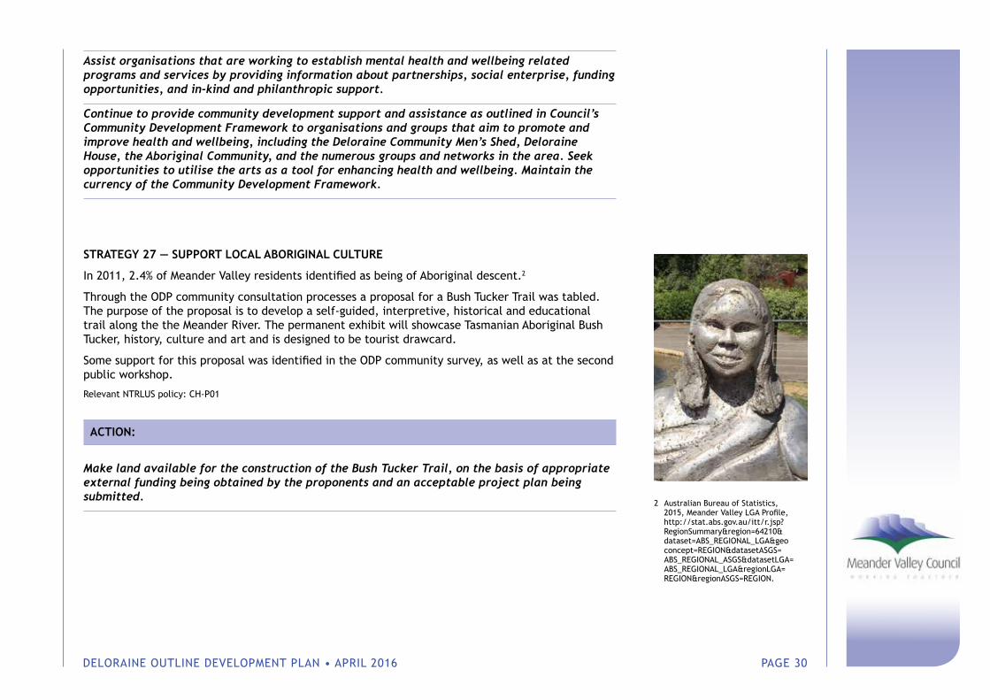
STRATEGY 27 — SUPPORT LOCAL ABORIGINAL CULTURE
In 2011, 2.4% of Meander Valley residents identified as being of Aboriginal descent.2
Through the ODP community consultation processes a proposal for a Bush Tucker Trail was tabled. The purpose of the proposal is to develop a self-guided, interpretive, historical and educational trail along the the Meander River. The permanent exhibit will showcase Tasmanian Aboriginal Bush Tucker, history, culture and art and is designed to be tourist drawcard.
Some support for this proposal was identified in the ODP community survey, as well as at the second public workshop.
Relevant NTRLUS policy: CH-P01
ACTION:
Make land available for the construction of the Bush Tucker Trail, on the basis of appropriate external funding being obtained by the proponents and an acceptable project plan being submitted.
2 Australian Bureau of Statistics, 2015, Meander Valley LGA Profile, http://stat.abs.gov.au/itt/r.jsp? RegionSummary®ion=64210& dataset=ABS_REGIONAL_LGA&geo concept=REGION&datasetASGS= ABS_REGIONAL_ASGS&datasetLGA= ABS_REGIONAL_LGA®ionLGA= REGION®ionASGS=REGION.
DELORAINE OUTLINE DEVELOPMENT PLAN • APRIL 2016 PAGE 31
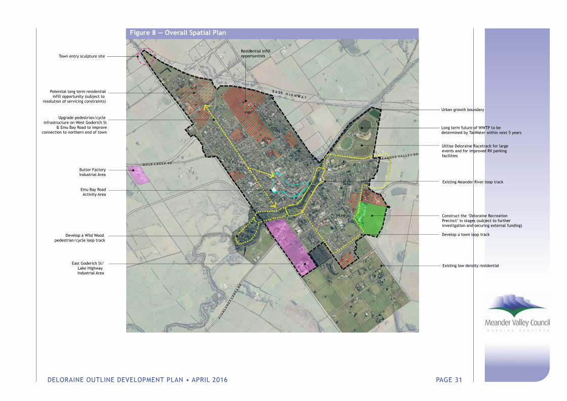
B A S S H I G H W A Y
E M U B A Y R D
Long term future of WWTP to bedetermined by TasWater within next 5 years
Utilise Deloraine Racetrack for largeevents and for improved RV parking facilities
Upgrade pedestrian/cycle infrastructure on West Goderich St
& Emu Bay Road to improveconnection to northern end of town
Construct the ‘Deloraine Recreation Precinct’ in stages (subject to further investigation and securing external funding)
Develop a town loop track
East Goderich St/Lake Highway Industrial Area
Butter FactoryIndustrial Area
Residential infill opportunities
Potential long term residentialinfill opportunity (subject to
resolution of servicing constraints)
Develop a Wild Wood pedestrian/cycle loop track
Town entry sculpture site
Existing Meander River loop track
Urban growth boundary
Existing low density residential
M E A N D E R V A L L E Y R D
M O L E C R E E K R D
H I G
H L
A N
D S
L A
K E
S R
D
Emu Bay RoadActivity Area
Figure 8 — Overall Spatial Plan
DELORAINE OUTLINE DEVELOPMENT PLAN • APRIL 2016 PAGE 32
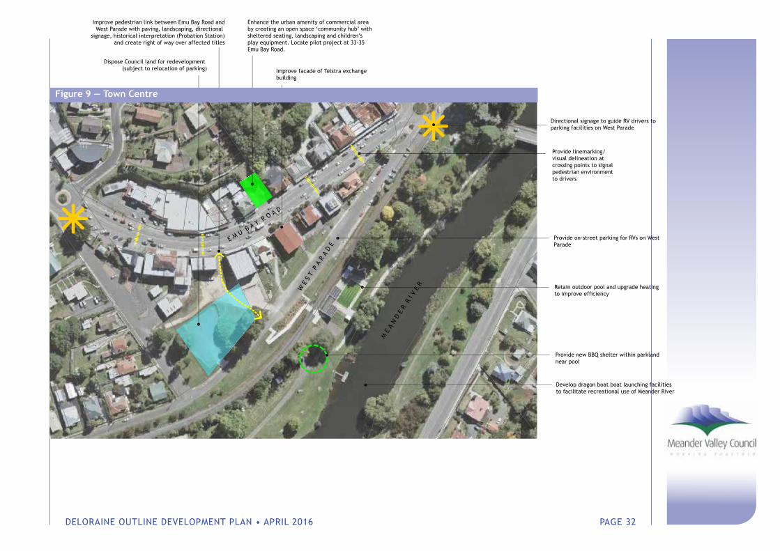
Provide linemarking/visual delineation at crossing points to signal pedestrian environment to drivers
M E
A N
D E
R R
I V
E R
W E
S T
P A
R A
D E
E M U B A Y R O A D
Retain outdoor pool and upgrade heatingto improve efficiency
Enhance the urban amenity of commercial area by creating an open space ‘community hub’ with sheltered seating, landscaping and children’s play equipment. Locate pilot project at 33-35 Emu Bay Road.
Provide new BBQ shelter within parklandnear pool
Develop dragon boat boat launching facilitiesto facilitate recreational use of Meander River
Provide on-street parking for RVs on WestParade
Improve pedestrian link between Emu Bay Road andWest Parade with paving, landscaping, directional
signage, historical interpretation (Probation Station)and create right of way over affected titles
Dispose Council land for redevelopment (subject to relocation of parking)
Directional signage to guide RV drivers to parking facilities on West Parade
Improve facade of Telstra exchange building
Figure 9 — Town Centre
DELORAINE OUTLINE DEVELOPMENT PLAN • APRIL 2016 PAGE 33
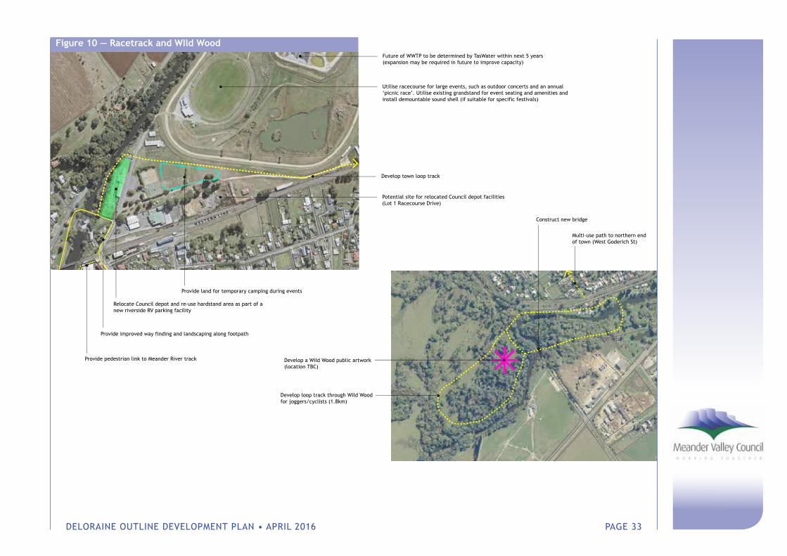
Figure 10 — Racetrack and WIld WoodFuture of WWTP to be determined by TasWater within next 5 years(expansion may be required in future to improve capacity)
Utilise racecourse for large events, such as outdoor concerts and an annual ‘picnic race’. Utilise existing grandstand for event seating and amenities and install demountable sound shell (if suitable for specific festivals)
W E S T E R N L I N E
Develop town loop track
Potential site for relocated Council depot facilities(Lot 1 Racecourse Drive)
Provide land for temporary camping during events
Relocate Council depot and re-use hardstand area as part of a new riverside RV parking facility
Provide improved way finding and landscaping along footpath
Provide pedestrian link to Meander River track
Develop loop track through Wild Wood for joggers/cyclists (1.8km)
Multi-use path to northern end of town (West Goderich St)
Construct new bridge
Develop a Wild Wood public artwork(location TBC)
DELORAINE OUTLINE DEVELOPMENT PLAN • APRIL 2016 PAGE 34
7 Implementation
A key outcome of this plan is to have defined strategies and actions which can be successfully implemented. Table 2 presents the proposed strategies, associated actions, responsible agent, indicative budgets and relative priority.
The costings provided are a guide to help the community determine the cost to benefit ratio of specific actions and alternative methods of delivery. It is important to note that if the assumptions change the costs also change and do not include land acquisition costs.
The priority levels are immediate, high, medium and low bearing in mind the Deloraine ODP has a 20-year timeframe.
• Immediate priorities are actions intended for the current or next Council budget — 1–2 years. These are generally low cost/high community benefit items;
• High priority actions are higher cost items that are important for short term delivery when budget allows — generally over 2–5 years;
• Medium priority actions are items identified as important but are not immediately critical. They are intended to be implemented over the 5-10 year period;
• Low priority actions are good ideas that have little community support or have budgets dependent on substantial external funding.
It is important to understand that list of strategies/actions is only a snapshot in time and that priorities will change according to changing budget constraints and community requirements. Thus the list of strategies/actions should be considered as a fluid component of the plan.
The following principles should be considered in implementing the Deloraine ODP:
• Visible progress: whilst the timeframe of this plan is 20 years, it is important for those who took part in the consultation phase to see the connection between the consultation and a tangible reality;
• Step change: a strategy/action can be more effectively implemented in small chunks where partial success drives full implementation;
• Opportunity ready: it is important to be ready for a funding opportunity when it arrives. An example of this is the Recreational Precinct whereby the bulk of the facility is reliant on State/Federal funding. In this example it is important ensure the budget for the feasibility assessment expended quickly to ensure the project does not miss funding opportunities which sometimes have a considerable gestation period before funding becomes available;

DELORAINE OUTLINE DEVELOPMENT PLAN • APRIL 2016 PAGE 35
• Project plans: whilst some initiatives are quite simple, many are complex and involve a number of steps and stakeholders. These require a separate project plan to assist in their implementation. A project plan should set the direction and context, establish accountabilities, outline a realistic budget and establish a means of tracking performance.
Governance and accountabilityIt is recommended that the implementation of this Outline Development Plan be managed by a single officer of Council, who is responsible for coordinating the action plans of individual strategies/actions, where required, and reporting on the progress of implementation on at least a six monthly basis to Councilors. It is also recommended that a public workshop be undertaken to update the community on the progress of implementation six months after adoption of the plan by Council and annually after that for at least five years.
DELORAINE OUTLINE DEVELOPMENT PLAN • APRIL 2016 PAGE 36
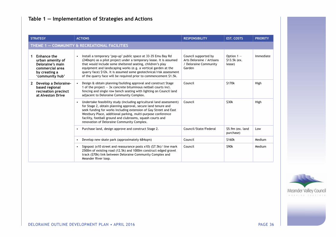
Table 1 — Implementation of Strategies and Actions
STRATEGY ACTIONS RESPONSIBILITY EST. COSTS PRIORITY
THEME 1 — COMMUNITY & RECREATIONAL FACILITIES
1 Enhance the urban amenity of Deloraine’s main commercial area by creating a ‘community hub’
• Install a temporary ‘pop-up’ public space at 33-35 Emu Bay Rd (240sqm) as a pilot project under a temporary lease. It is assumed that would include some sheltered seating, children’s play equipment and landscaping works (e.g. a vertical garden at the quarry face) $12k. It is assumed some geotechnical/risk assessment of the quarry face will be required prior to commencement $1.5k.
Council supported by Arts Deloraine / Artisans / Deloraine Community Garden
Option 1 — $13.5k (ex. lease)
Immediate
2 Develop a Deloraine-based regional recreation precinct at Alveston Drive
• Design & obtain planning/building approval and construct Stage 1 of the project — 3x concrete bituminous netball courts incl. fencing and single row bench seating with lighting on Council land adjacent to Deloraine Community Complex.
Council $170k High
• Undertake feasibility study (including agricultural land assessment) for Stage 2, obtain planning approval, secure land tenure and seek funding for works including extension of Gay Street and East Westbury Place, additional parking, multi-purpose conference facility, football ground and clubrooms, squash courts and renovation of Deloraine Community Complex.
Council $30k High
• Purchase land, design approve and construct Stage 2. Council/State/Federal $5.9m (ex. land purchase)
Low
• Develop new skate park (approximately 684sqm) Council $160k Medium
• Signpost (x10 street and reassurance posts x10) ($7.5k)/ line mark 2500m of existing road (12.5k) and 1000m construct edged gravel track ($70k) link between Deloraine Community Complex and Meander River loop.
Council $90k Medium
DELORAINE OUTLINE DEVELOPMENT PLAN • APRIL 2016 PAGE 37
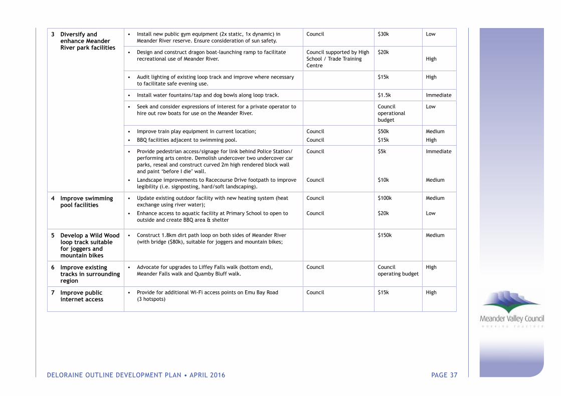
3 Diversify and enhance Meander River park facilities
• Install new public gym equipment (2x static, 1x dynamic) in Meander River reserve. Ensure consideration of sun safety.
Council $30k Low
• Design and construct dragon boat-launching ramp to facilitate recreational use of Meander River.
Council supported by High School / Trade Training Centre
$20k High
• Audit lighting of existing loop track and improve where necessary to facilitate safe evening use.
$15k High
• Install water fountains/tap and dog bowls along loop track. $1.5k Immediate
• Seek and consider expressions of interest for a private operator to hire out row boats for use on the Meander River.
Council operational budget
Low
• Improve train play equipment in current location;
• BBQ facilities adjacent to swimming pool.
Council
Council
$50k
$15k
Medium
High
• Provide pedestrian access/signage for link behind Police Station/performing arts centre. Demolish undercover two undercover car parks, reseal and construct curved 2m high rendered block wall and paint ‘before I die’ wall.
• Landscape improvements to Racecourse Drive footpath to improve legibility (i.e. signposting, hard/soft landscaping).
Council
Council
$5k
$10k
Immediate
Medium
4 Improve swimming pool facilities
• Update existing outdoor facility with new heating system (heat exchange using river water);
• Enhance access to aquatic facility at Primary School to open to outside and create BBQ area & shelter
Council
Council
$100k
$20k
Medium
Low
5 Develop a Wild Wood loop track suitable for joggers and mountain bikes
• Construct 1.8km dirt path loop on both sides of Meander River (with bridge ($80k), suitable for joggers and mountain bikes;
$150k Medium
6 Improve existing tracks in surrounding region
• Advocate for upgrades to Liffey Falls walk (bottom end), Meander Falls walk and Quamby Bluff walk.
Council Council operating budget
High
7 Improve public internet access
• Provide for additional Wi-Fi access points on Emu Bay Road (3 hotspots)
Council $15k High
DELORAINE OUTLINE DEVELOPMENT PLAN • APRIL 2016 PAGE 38
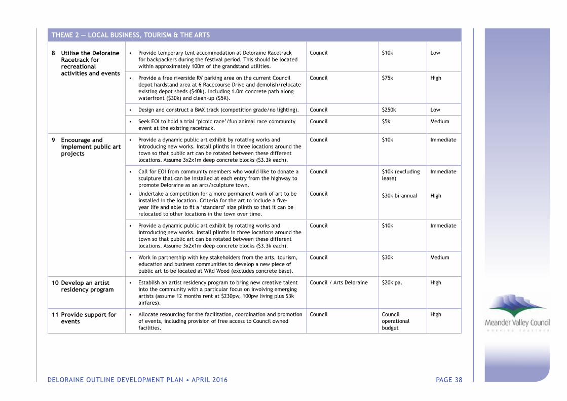
THEME 2 — LOCAL BUSINESS, TOURISM & THE ARTS
8 Utilise the Deloraine Racetrack for recreational activities and events
• Provide temporary tent accommodation at Deloraine Racetrack for backpackers during the festival period. This should be located within approximately 100m of the grandstand utilities.
Council $10k Low
• Provide a free riverside RV parking area on the current Council depot hardstand area at 6 Racecourse Drive and demolish/relocate existing depot sheds ($40k). Including 1.0m concrete path along waterfront ($30k) and clean-up ($5K).
Council $75k High
• Design and construct a BMX track (competition grade/no lighting). Council $250k Low
• Seek EOI to hold a trial ‘picnic race’/fun animal race community event at the existing racetrack.
Council $5k Medium
9 Encourage and implement public art projects
• Provide a dynamic public art exhibit by rotating works and introducing new works. Install plinths in three locations around the town so that public art can be rotated between these different locations. Assume 3x2x1m deep concrete blocks ($3.3k each).
Council $10k Immediate
• Call for EOI from community members who would like to donate a sculpture that can be installed at each entry from the highway to promote Deloraine as an arts/sculpture town.
• Undertake a competition for a more permanent work of art to be installed in the location. Criteria for the art to include a five-year life and able to fit a ‘standard’ size plinth so that it can be relocated to other locations in the town over time.
Council
Council
$10k (excluding lease)
$30k bi-annual
Immediate
High
• Provide a dynamic public art exhibit by rotating works and introducing new works. Install plinths in three locations around the town so that public art can be rotated between these different locations. Assume 3x2x1m deep concrete blocks ($3.3k each).
Council $10k Immediate
• Work in partnership with key stakeholders from the arts, tourism, education and business communities to develop a new piece of public art to be located at Wild Wood (excludes concrete base).
Council $30k Medium
10 Develop an artist residency program
• Establish an artist residency program to bring new creative talent into the community with a particular focus on involving emerging artists (assume 12 months rent at $230pw, 100pw living plus $3k airfares).
Council / Arts Deloraine $20k pa. High
11 Provide support for events
• Allocate resourcing for the facilitation, coordination and promotion of events, including provision of free access to Council owned facilities.
Council Council operational budget
High
DELORAINE OUTLINE DEVELOPMENT PLAN • APRIL 2016 PAGE 39
12 Ensure the Community Complex and Little Theatre remain suitable for user groups
• Audit user groups to identify required improvements to the Auditorium at the Deloraine Community Complex and the Little Theatre (Performing Arts Centre).
Council Council operational budget
High
13 Improve promotion to tourists
• Develop a marketing plan to better promote Deloraine and surrounding attractions to visitors of Northern Tasmania as the gateway to the Western Tiers. This will supplement the existing Great Western Tiers marketing plan to provide more local direction.
Council $10k High
• Prepare up to date information on local walks and wilderness attractions to be provided through the Visitor Information Centre.
Council $10k High
14 Establish committee to coordinate action between arts groups, local business groups and Council
• Council to facilitate a quarterly meeting of key stakeholders in the arts and local business sectors to enable communication and shared ownership of the development of Deloraine in conjunction with the ODP.
Council Council operational budget
THEME 3 — URBAN DESIGN, DEVELOPMENT & INFRASTRUCTURE
15 Provide for an Emu Bay Rd-West Parade pedestrian link
• Formalise existing pedestrian link between Emu Bay Road and West Parade through establishment of a ROW over 24-28 Emu Bay Road (private land) and 1 West Church Street (Council land), construction of pathway ($6k) with landscaping ($5k), heritage interpretation panels (2k) and directional signage ($1k).
Council $14k High
16 Redevelop former Probation Station site
• Dispose 1 West Church Street as a new development site (approximately 2400sqm but could be expanded via boundary adjustment with West Church St road reserve to 2850sqm). The site could potentially be used for an aged care/disabled care development. Alternative parking could be provided for business employees in the reserve of West Church Street.
Council N/A Low
17 Enhance the streetscape amenity of Deloraine’s town centre
• Install additional tree plantings along Emu Bay Road to improve the streetscape (assume 16 mature trees at 15m centres between roundabouts).
Council $16k Low
• Seek landowner consent for sculpture / treatment to the Telstra Exchange Building Emu Bay Road façade and commission works (e.g. City of Canning Telstra Exchange in WA).
Council $30k Medium
• Provide line marking at existing pedestrian points on Emu Bay Rd to signal pedestrian priority to drivers.
Council $3k Immediate
• Develop a garden competition for residents of the Deloraine township with the aim of beautifying the area (prizes could potentially be sourced from donations).
Council $5k (promotion and prizes)
Medium
DELORAINE OUTLINE DEVELOPMENT PLAN • APRIL 2016 PAGE 40
18 Retain heritage/scenic character of Deloraine
• Introduce a heritage precinct overlay/scenic protection overlays into the Planning Scheme via scheme amendment to protect the historic and scenic character of the town centre.
Council Council operational budget
Medium
19 Improve access to Emu Bay Road by relaxing parking time limitations
• Extend time limitation to 3 hours on Emu Bay Rd, to encourage people to stay in town centre.
Council $1k Immediate
20 Improve parking provision
• Improve parking arrangements in proximity of organisations servicing people with disabilities and their families, and the aged; and the Performing Arts Centre.
Council $5k Immediate
• Provide for RV street parking on West Parade (unmarked) and associated directional signage from/to Emu Bay Road.
Council $2k Immediate
21 Improve connectivity with the northern end of town
• Construct multi-use path on West Goderich Street/Emu Bay Road to improve connectivity of northern Deloraine to the town centre (2.5m asphalt)
Council $230k Medium
22 Provide electric car charge point
• Install an electric car charge point within Deloraine to cater for electric vehicle drivers.
Council $4k Medium
THEME 4 — SOCIAL INFRASTRUCTURE
23 Improve and support education and career pathways
• Working with Deloraine High School and the local business community, identify the underlying factors that are contributing to Deloraine’s poor school completion rates, and opportunities to improve engagement in education, overcome barriers for those who are falling through the gaps, and provide pathways for career development and life-long learning. Using a collective impact approach, implement actions and establish agreement indicators to monitor progress.
Deloraine High School, community members, business community, Meander Valley Council
$30–40k Medium
24 Provide accommodation for disabled residents
• Support key stakeholders including families with children/young people/adults with disabilities and organisations representing their interests to develop a plan to meet their needs around accommodation, respite support, and training and employment opportunities.
• Make land available for the construction of independent living units for persons with disabilities, factoring in possible expansion into the future to include respite/community facilities, training facilities etc.
Community members, key stakeholders in disability area, Meander Valley Council
Council operational budget
N/A
Immediate
High
25 Improve services for older people
• Undertake an audit using the World Health Organisation’s Checklist of Essential Features for Age-friendly Cities to identify potential issues and areas for improvement. Connect with the WHO Global Age-friendly Cities Project to promote Deloraine as an age friendly town.
Council in conjunction with local community groups
$10k Medium
DELORAINE OUTLINE DEVELOPMENT PLAN • APRIL 2016 PAGE 41
26 Create awareness of mental health programs and provide community development support
• Unite interested individuals, groups and organisations into centralised mental health promotion programs and services such as Act Belong Commit, Beyond Blue and Lifeline.
• Assist organisations that are working to establish mental health and wellbeing related programs and services by providing information about partnerships, social enterprise, funding opportunities, and in-kind and philanthropic support.
• Continue to provide community development support and assistance as outlined in Council’s Community Development Framework to organisations and groups that aim to promote and improve health and wellbeing, including the Deloraine Community Men’s Shed, Deloraine House, the Aboriginal Community, and the numerous groups and networks in the area. Seek opportunities to utilise the arts as a tool for enhancing health and wellbeing. Maintain the currency of the Community Development Framework.
Community members, community organisations, health care providers, Meander Valley Council
Council operational budget
27 Support local Aboriginal culture
• Make land available for the construction of the Bush Tucker Trail, on the basis of appropriate external funding being obtained by the proponents and an acceptable project plan being submitted.
Aboriginal Community, Bush Tucker Proponent Partners, Meander Valley Council
Council operational budget
DELORAINE OUTLINE DEVELOPMENT PLAN • APRIL 2016 PAGE 42
BibliographyAustralian Bureau of Statistics, 2015, Meander Valley LGA Profile, http://stat.abs.gov.au/itt/r.jsp?RegionSummary®ion=64210&dataset=ABS_REGIONAL_LGA&geoconcept=REGION&datasetASGS=ABS_REGIONAL_ASGS&datasetLGA=ABS_REGIONAL_LGA®ionLGA=REGION®ionASGS=REGION.
Barrett, A, Skellern, K and Whelan, J, 2007, Meander Valley Health and Wellbeing Map Project, Department of Health and Human Services, Meander Valley Council, University of Tasmania, pg. 103.
Denny, L, 2015, Annexure 1-Tasmania’s Population Challenge: 650,000 by 2050, Background Issues Paper, Prepared for the Department of State Growth, pg. 12.
EMRS, 2015, Meander Valley Council Community Satisfaction Survey Research Report 2015, Prepared for Meander Valley Council.
Eyles K, Wild A and Eversole R, 2014, Retirement Living in Tasmania, Expanding choices, informing decisions, Institute for Regional Development (UTas), pg. 113.
Keygan, A, 2015, Deloraine’s Population Profile: A demographic snapshot of growth, decline and ageing, Prepared for JMG on Behalf of Meander Valley Council
Meander Valley Community Safety Group, 2015, Valley Safe — Meander Valley Community Safety Plan 2015-2017, Prepared for Meander Valley Council.
Meander Valley Council, Annual Plan 2015-2016.
Meander Valley Council, Community Strategic Plan 2014 to 2024.
Meander Valley Council, 2004, Industrial Land Strategy.
Meander Valley Council, 2005, Land Use & Development Strategy.
Meander Valley Council, 2015, Draft Sustainable Environment Committee Action Plan.
Meander Valley Council, 2013, Tasmanian Municipal Emergency Management Plan — Meander Valley, Issue 4, Edition 2.
Meander Valley Interim Planning Scheme 2015
Northern Tasmania Development and JMG Engineers & Planners, 2013, Regional Land Use Strategy of Northern Tasmania, Version 4.0.
OECD Insights, Human Capital, www.oecd.org/insights/37966934.pdf.
Tasmanian Government, Rethink Mental Health — Better mental health and wellbeing: A long term plan for better mental health in Tasmania 2015-2025.
Treadwell Management, 2012, Deloraine and Westbury Sport and Recreation Rationalisation Study.
Yigitcanlar T, 2010, Sustainable Regional and Urban Infrastructure Development: Technologies, applications and management, Queensland University of Technology, pg. 95.
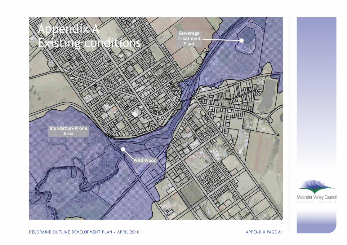
DELORAINE OUTLINE DEVELOPMENT PLAN • APRIL 2016 APPENDIX PAGE A1
Appendix A Existing conditions
DELORAINE OUTLINE DEVELOPMENT PLAN • APRIL 2016 APPENDIX PAGE A2
1 Demographic & Economic Trends
An understanding of current and future population scenarios is an important factor in planning for Deloraine’s future. Deloraine’s demographic trends and economic profile have been analysed as part of the Deloraine ODP project by population researcher and demographer Amina Keygan.
Keygan (2015) identified the following key trends:
• The top sectors for Deloraine’s population in terms of employment by industry (not location) are Health Care and Social Assistance (13%), Retail Trade (11%) followed by Agriculture, Forestry and Fishing (10%) and Manufacturing (10%).
• The top five occupations for residents were Managers (17%), Technicians and trade workers (13%), Labourers (13%), Community and personal service workers (12%), and Clerical and administrative workers (11%).
• Between 2006 and 2011 the Health Care and Social Assistance industry experienced greatest growth as an employer.
• Between 2006 and 2011 there was a slight increase in the proportion of Deloraine’s residents who worked in Launceston LGA, which suggests that Deloraine is attractive as a commuter location. In 2011 74% of Deloraine residents were employed in Meander Valley and the rate of unemployment was 5.05%.
• As elsewhere in regional Tasmania, the population of Deloraine as well as the broader Meander Valley municipality is experiencing population ageing.
• The median age of Deloraine’s population is 37.4 years, on par with the national age of 37.3, and lower than that of Tasmania as a whole (41.2).
• Interstate migration patterns continue to reflect an established pattern of younger cohorts migrating to larger centres, whilst at the same time there has been inward arrivals of older persons arriving to the State. Each of these trends exacerbates structural population ageing.
• Under a medium growth scenario, the population of Deloraine and the Meander Valley more broadly is projected to reach a state of natural decline at 2026.
At the last census in 2011 the completion rate for Year 10 education level for Deloraine (70.3%) was below that of the State (78%) and Meander Valley LGA (77%). A similar trend is seen in completion rates for Year 12: Deloraine (28%), Tasmania (36%), and Meander Valley (30%). Interestingly, residents of Deloraine and Meander Valley had a higher rate of certificate qualification (56%) than the State level (49%). In Deloraine 24.5% of the population hold a Bachelor’s degree or higher; a similar value to Meander Valley (26%), but lower than the State (34%). It is noted that more females (1260) than males (964) hold qualifications.
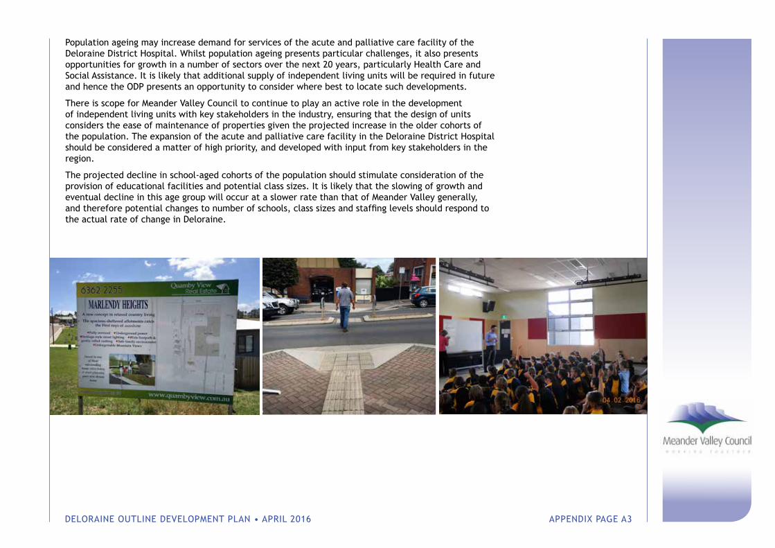
DELORAINE OUTLINE DEVELOPMENT PLAN • APRIL 2016 APPENDIX PAGE A3
Population ageing may increase demand for services of the acute and palliative care facility of the Deloraine District Hospital. Whilst population ageing presents particular challenges, it also presents opportunities for growth in a number of sectors over the next 20 years, particularly Health Care and Social Assistance. It is likely that additional supply of independent living units will be required in future and hence the ODP presents an opportunity to consider where best to locate such developments.
There is scope for Meander Valley Council to continue to play an active role in the development of independent living units with key stakeholders in the industry, ensuring that the design of units considers the ease of maintenance of properties given the projected increase in the older cohorts of the population. The expansion of the acute and palliative care facility in the Deloraine District Hospital should be considered a matter of high priority, and developed with input from key stakeholders in the region.
The projected decline in school-aged cohorts of the population should stimulate consideration of the provision of educational facilities and potential class sizes. It is likely that the slowing of growth and eventual decline in this age group will occur at a slower rate than that of Meander Valley generally, and therefore potential changes to number of schools, class sizes and staffing levels should respond to the actual rate of change in Deloraine.
DELORAINE OUTLINE DEVELOPMENT PLAN • APRIL 2016 APPENDIX PAGE A4
2 Cultural Heritage
2.1 European heritage
The township has a significant number of buildings of European heritage significance, including 25 listings on the Tasmanian Heritage Register These built elements together contribute to the township’s scenic character and distinct character.
The Meander Valley Heritage Study 2006 (Paul Davies Pty Ltd) identified three separate but related and attached heritage precincts within the township:
1 River Precinct — the area of the river itself, the weir, former crossing points, bridges and landscaped river edges form the ‘visual heart’ of the town;
2 West Deloraine — this part of the township reflects the historical mixed use development along Emu Bay Road without the intrusion of late twentieth century larger scale commercial development. West Deloraine also includes several residential areas that reflect different periods of the town’s development;
3 East Deloraine — the eastern part of the township provides a significant backdrop to the township when viewed from across the river and contains dwellings and former civic buildings of high heritage value.
The Heritage Study found that the abovementioned areas are of particular significance as they demonstrate some of the earliest development in the region and contain significant Victorian buildings that give the town much of its character.
The landscape surrounding Deloraine also includes a number of ‘unspoiled’ rural approaches that are relatively free of modern development, contributing to the historic setting of the township.
2.2 Aboriginal heritage
Aboriginal Heritage Tasmania (‘AHT’) has advised that no heritage listings on their records within the immediate vicinity of the existing township (the nearest known sites are approximately 3.0km west). AHT advised that land along the Meander River has the greatest archaeological potential and any future development proposals within this area will be assessed on a case by case basis.
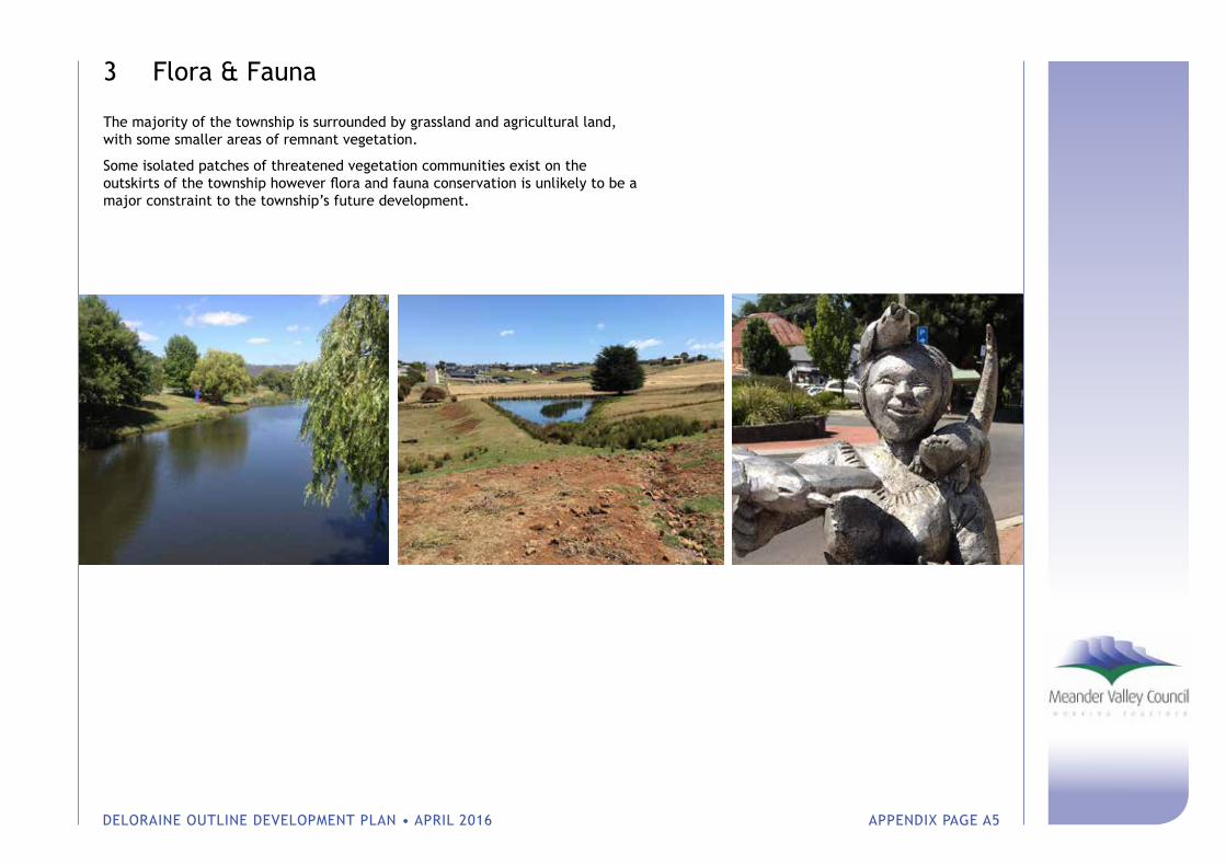
DELORAINE OUTLINE DEVELOPMENT PLAN • APRIL 2016 APPENDIX PAGE A5
3 Flora & Fauna
The majority of the township is surrounded by grassland and agricultural land, with some smaller areas of remnant vegetation.
Some isolated patches of threatened vegetation communities exist on the outskirts of the township however flora and fauna conservation is unlikely to be a major constraint to the township’s future development.
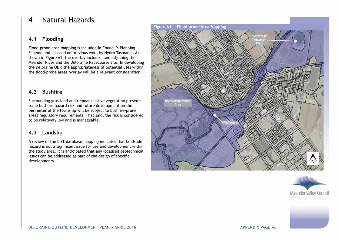
DELORAINE OUTLINE DEVELOPMENT PLAN • APRIL 2016 APPENDIX PAGE A6
4 Natural Hazards
4.1 Flooding
Flood-prone area mapping is included in Council’s Planning Scheme and is based on previous work by Hydro Tasmania. As shown in Figure A1, the overlay includes land adjoining the Meander River and the Deloraine Racecourse site. In developing the Deloraine ODP, the appropriateness of potential uses within the flood-prone areas overlay will be a relevant consideration.
4.2 Bushfire
Surrounding grassland and remnant native vegetation presents some bushfire hazard risk and future development on the perimeter of the township will be subject to bushfire-prone areas regulatory requirements. That said, the risk is considered to be relatively low and is manageable.
4.3 Landslip
A review of the LIST database mapping indicates that landslide hazard is not a significant issue for use and development within the study area. It is anticipated that any localised geotechnical issues can be addressed as part of the design of specific developments.
Figure A1 — Flood-prone Area Mapping
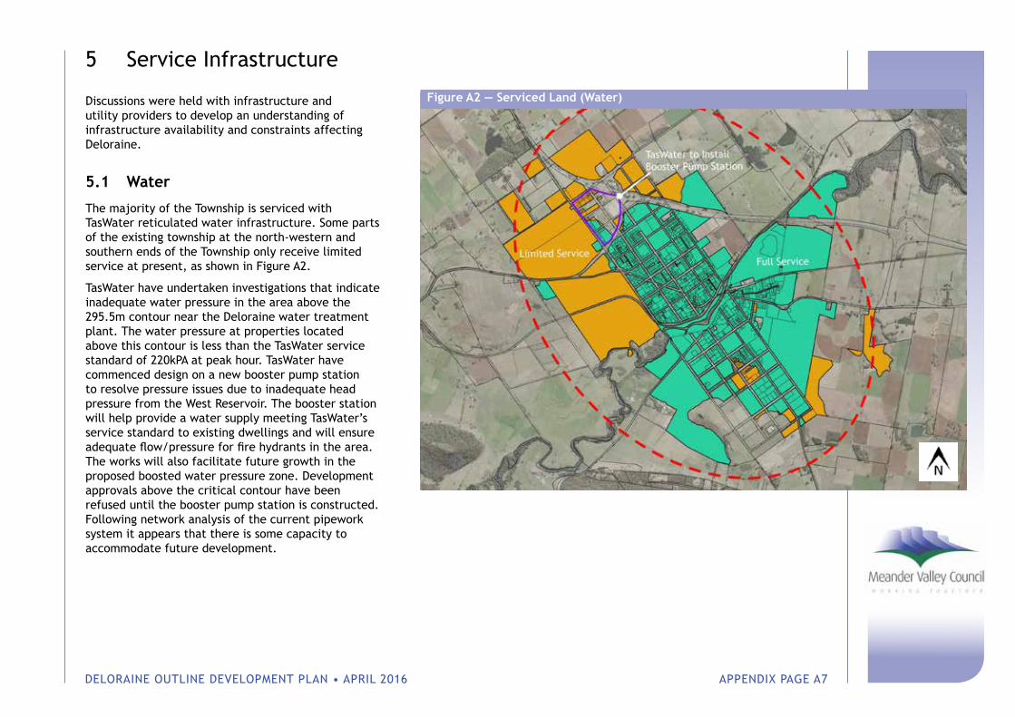
DELORAINE OUTLINE DEVELOPMENT PLAN • APRIL 2016 APPENDIX PAGE A7
5 Service Infrastructure
Discussions were held with infrastructure and utility providers to develop an understanding of infrastructure availability and constraints affecting Deloraine.
5.1 Water
The majority of the Township is serviced with TasWater reticulated water infrastructure. Some parts of the existing township at the north-western and southern ends of the Township only receive limited service at present, as shown in Figure A2.
TasWater have undertaken investigations that indicate inadequate water pressure in the area above the 295.5m contour near the Deloraine water treatment plant. The water pressure at properties located above this contour is less than the TasWater service standard of 220kPA at peak hour. TasWater have commenced design on a new booster pump station to resolve pressure issues due to inadequate head pressure from the West Reservoir. The booster station will help provide a water supply meeting TasWater’s service standard to existing dwellings and will ensure adequate flow/pressure for fire hydrants in the area. The works will also facilitate future growth in the proposed boosted water pressure zone. Development approvals above the critical contour have been refused until the booster pump station is constructed. Following network analysis of the current pipework system it appears that there is some capacity to accommodate future development.
Figure A2 — Serviced Land (Water)

DELORAINE OUTLINE DEVELOPMENT PLAN • APRIL 2016 APPENDIX PAGE A8
5.2 Sewer
The majority of the Deloraine Township is serviced with existing TasWater reticulated sewer. As shown in Figure A3, some areas at the northern and southern ends of the Township are outside of the serviced area at present.
The Deloraine Waste Water Treatment Plant (‘WWTP’) has reached maximum capacity and is reportedly operating at 219% capacity at present. TasWater has some planned works to alleviate the potential issues outlined in the above section and as listed in the Table 1.
Urban expansion outside of the existing serviced areas would be unlikely to be supported by TasWater until the existing capacity issues are resolved, which may not occur for some time. Urban expansion therefore would likely require developer contributions to bring forward WWTP upgrades.
Table 1 TasWater Planned Works — Deloraine WWTP
Timeframe Management Objectives EffluentCompliance
Short Term (1-2 years)
Reduce I&I and optimise plant process.
Non AMT discharge
Medium term (2-5 years)
Strategy for potential relocation
Non AMT discharge
Long term (5-20 years)
Implement strategy for potential relocation
Partial reuse Winter discharge
The future solution for the WWTP is currently unknown, hence it must be assumed that an expansion of the current site may be a future option that is considered by TasWater.
Figure A3 — Serviced Land (Sewer)
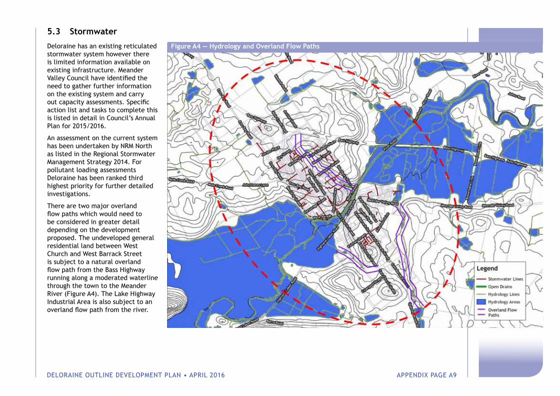
DELORAINE OUTLINE DEVELOPMENT PLAN • APRIL 2016 APPENDIX PAGE A9
5.3 Stormwater
Deloraine has an existing reticulated stormwater system however there is limited information available on existing infrastructure. Meander Valley Council have identified the need to gather further information on the existing system and carry out capacity assessments. Specific action list and tasks to complete this is listed in detail in Council’s Annual Plan for 2015/2016.
An assessment on the current system has been undertaken by NRM North as listed in the Regional Stormwater Management Strategy 2014. For pollutant loading assessments Deloraine has been ranked third highest priority for further detailed investigations.
There are two major overland flow paths which would need to be considered in greater detail depending on the development proposed. The undeveloped general residential land between West Church and West Barrack Street is subject to a natural overland flow path from the Bass Highway running along a moderated waterline through the town to the Meander River (Figure A4). The Lake Highway Industrial Area is also subject to an overland flow path from the river.
Figure A4 — Hydrology and Overland Flow Paths
DELORAINE OUTLINE DEVELOPMENT PLAN • APRIL 2016 APPENDIX PAGE A10
5.4 Roads
The Bass Highway is a State road owned and managed by the Department of State Growth (‘DSG’). DSG has advised that the State road network must be protected by:
• Ensuring adequate separation between sensitive uses, State roads and future corridors;
• Avoiding ribbon development; and
• Limiting new accesses or junctions.
DSG recognise that the Bass Highway between Deloraine and Latrobe will require upgrading however detailed planning has not been undertaken at this stage.
Existing bus services are provided by Redline, who provide services to Launceston and Devonport. Metro do not operate any services and have advised that there are no current plans to service the area.
The Great Western Tiers Cycling Trails includes cycling routes to Deloraine. These trails are promoted by the Great Western Tiers Visitor Centre who also have a podcast available for cyclists to use for each route.
5.5 Rail
The Western Line runs east-west through the Deloraine Township and is owned and managed by TasRail.
The Western Line will be improved via the Tasmanian Freight Rail Revitalisation Program, which commenced late 2015 and is due for completion in mid-2017. The program focuses on re-sleepering, re-railing and associated track upgrade works. The Western Line, from Western Junction to Railton, currently transports approximately 1.0MT per year and is projected to increase to 1.4MT by 2035. The Railton to Devonport section currently transports 2.0MT and is forecast to increase to 3MT per year.
TasRail has advised that intensification of development within 50m of the railway line is generally undesirable (as is regulated under the Road and Railway Assets Code, which forms part of the Meander Valley Interim Planning Scheme 2013). For the section of railway along the Meander River, this is of little significance as the majority of the buffer comprises existing parkland, roads and river. The corridor is likely to have more impact on future development in East Deloraine, where it adjoins a large number of properties within the General Residential Zone and Urban Mixed Use Zone.
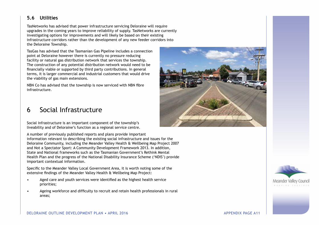
DELORAINE OUTLINE DEVELOPMENT PLAN • APRIL 2016 APPENDIX PAGE A11
5.6 Utilities
TasNetworks has advised that power infrastructure servicing Deloraine will require upgrades in the coming years to improve reliability of supply. TasNetworks are currently investigating options for improvements and will likely be based on their existing infrastructure corridors rather than the development of any new feeder corridors into the Deloraine Township.
TasGas has advised that the Tasmanian Gas Pipeline includes a connection point at Deloraine however there is currently no pressure reducing facility or natural gas distribution network that services the township. The construction of any potential distribution network would need to be financially viable or supported by third party contributions. In general terms, it is larger commercial and industrial customers that would drive the viability of gas main extensions.
NBN Co has advised that the township is now serviced with NBN fibre infrastructure.
6 Social Infrastructure
Social infrastructure is an important component of the township’s liveability and of Deloraine’s function as a regional service centre.
A number of previously published reports and plans provide important information relevant to describing the existing social infrastructure and issues for the Deloraine Community, including the Meander Valley Health & Wellbeing Map Project 2007 and Not a Spectator Sport: A Community Development Framework 2013. In addition, State and National frameworks such as the Tasmanian Government’s Rethink Mental Health Plan and the progress of the National Disability Insurance Scheme (‘NDIS’) provide important contextual information.
Specific to the Meander Valley Local Government Area, it is worth noting some of the extensive findings of the Meander Valley Health & Wellbeing Map Project:
• Aged care and youth services were identified as the highest health service priorities;
• Ageing workforce and difficulty to recruit and retain health professionals in rural areas;
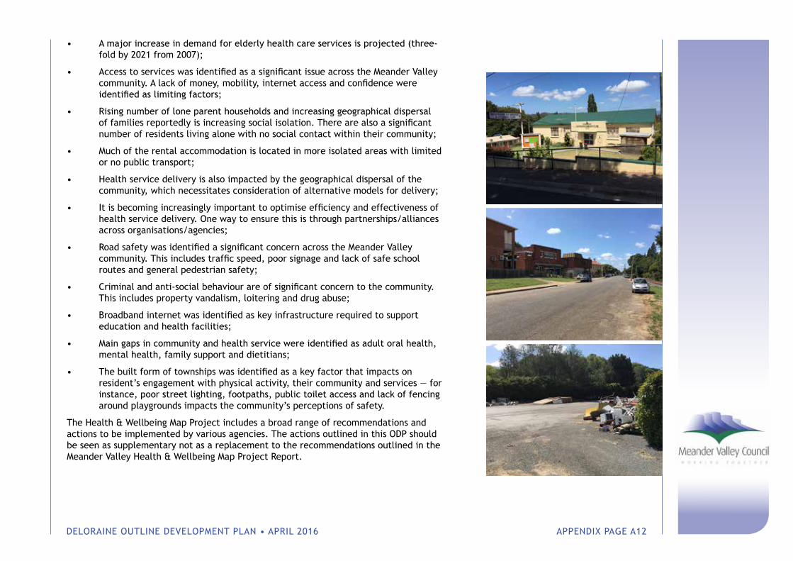
DELORAINE OUTLINE DEVELOPMENT PLAN • APRIL 2016 APPENDIX PAGE A12
• A major increase in demand for elderly health care services is projected (three-fold by 2021 from 2007);
• Access to services was identified as a significant issue across the Meander Valley community. A lack of money, mobility, internet access and confidence were identified as limiting factors;
• Rising number of lone parent households and increasing geographical dispersal of families reportedly is increasing social isolation. There are also a significant number of residents living alone with no social contact within their community;
• Much of the rental accommodation is located in more isolated areas with limited or no public transport;
• Health service delivery is also impacted by the geographical dispersal of the community, which necessitates consideration of alternative models for delivery;
• It is becoming increasingly important to optimise efficiency and effectiveness of health service delivery. One way to ensure this is through partnerships/alliances across organisations/agencies;
• Road safety was identified a significant concern across the Meander Valley community. This includes traffic speed, poor signage and lack of safe school routes and general pedestrian safety;
• Criminal and anti-social behaviour are of significant concern to the community. This includes property vandalism, loitering and drug abuse;
• Broadband internet was identified as key infrastructure required to support education and health facilities;
• Main gaps in community and health service were identified as adult oral health, mental health, family support and dietitians;
• The built form of townships was identified as a key factor that impacts on resident’s engagement with physical activity, their community and services — for instance, poor street lighting, footpaths, public toilet access and lack of fencing around playgrounds impacts the community’s perceptions of safety.
The Health & Wellbeing Map Project includes a broad range of recommendations and actions to be implemented by various agencies. The actions outlined in this ODP should be seen as supplementary not as a replacement to the recommendations outlined in the Meander Valley Health & Wellbeing Map Project Report.

DELORAINE OUTLINE DEVELOPMENT PLAN • APRIL 2016 APPENDIX PAGE A13
Appendix B Community Consultation Summary
“ We have an excellent town; it’s beautiful. We have excellent walking tracks. But we’re not telling people. We’re not telling them about us before they arrive. No one knows about us. We need good advertising for the region.”
“ The heart of Deloraine is rural. This is a farming town. Without farming you wouldn’t have the other.”
“ You’re 7km out of Deloraine and you can’t get mobile access...ABC radio coverage is poor.”
“ Good food as well as art.”
“ Arts Capital of Tasmania – that’s our identity.”
“ We are looking at the possibility of moving for the kids to continue education.” “There’s nothing...very little in
Deloraine...for independent living for children (with disabilities) as they get older...there’s very little for the carers in terms of any respite.”
“I felt there was a real community here and it was the place to move to.”
“ We’ve got all these amazing sculptures. We’ve got beautiful stuff everywhere but it’s actually not being maintained very well at the moment... it makes us look tired.”
“ We are not promoting walking trails on the Western Tiers for people to come and use them and come into the area and spend time here. We need better signage.”
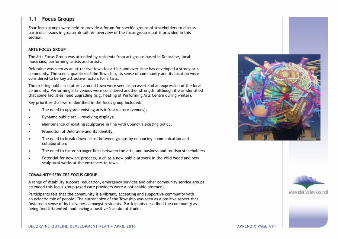
DELORAINE OUTLINE DEVELOPMENT PLAN • APRIL 2016 APPENDIX PAGE A14
1.1 Focus Groups
Four focus groups were held to provide a forum for specific groups of stakeholders to discuss particular issues in greater detail. An overview of the focus group input is provided in this section.
ARTS FOCUS GROUP
The Arts Focus Group was attended by residents from art groups based in Deloraine, local musicians, performing artists and artists.
Deloraine was seen as an attractive town for artists and over time has developed a strong arts community. The scenic qualities of the Township, its sense of community and its location were considered to be key attractive factors for artists.
The existing public sculptures around town were seen as an asset and an expression of the local community. Performing arts venues were considered another strength, although it was identified that some facilities need upgrading (e.g. heating of Performing Arts Centre during winter).
Key priorities that were identified in the focus group included:
• The need to upgrade existing arts infrastructure (venues);
• Dynamic public art — revolving displays;
• Maintenance of existing sculptures in line with Council’s existing policy;
• Promotion of Deloraine and its identity;
• The need to break down ‘silos’ between groups by enhancing communication and collaboration;
• The need to foster stronger links between the arts, and business and tourism stakeholders
• Potential for new art projects, such as a new public artwork in the Wild Wood and new sculptural works at the entrances to town.
COMMUNITY SERVICES FOCUS GROUP
A range of disability support, education, emergency services and other community service groups attended this focus group (aged care providers were a noticeable absence).
Participants felt that the community is a vibrant, accepting and supportive community with an eclectic mix of people. The current size of the Township was seen as a positive aspect that fostered a sense of inclusiveness amongst residents. Participants described the community as being ‘multi-talented’ and having a positive ‘can do’ attitude.

DELORAINE OUTLINE DEVELOPMENT PLAN • APRIL 2016 APPENDIX PAGE A15
Key priorities identified in the focus group included:
• Local employment opportunities;
• Providing services and education opportunities for young people. Currently students must travel outside the municipality to complete Years 11 and 12;
• Training opportunities for people to be employed in aged care and disability services;
• Independent living units for persons living with disabilities and respite for carers is a local need that is not currently adequately met;
• Public transport and bike pathways for all ages.
In addition to these priorities, a range of other issues were tabled. These included the need for co-location of emergency services, better promotion of existing services, the reluctance of young people to undertake voluntary roles in the community, better support from Council for new initiatives and current initiatives to enhance food security. Participants also expressed their general satisfaction in relation to health service provision, aged care services, sport and recreation opportunities, and the On-line Access Centre.
LOCAL BUSINESS & TOURISM FOCUS GROUP
The Local Business & Tourism Focus Group included a number of local business owners as well as representatives from tourism promoters.
Key priorities identified in the focus group included:
• Internet access with Wi-Fi service available for tourists and general business use;
• A community hub in centre of town would encourage people to linger in the town centre. This concept would include sheltered seating and potentially children’s play equipment and landscaping;
• Town identity — creative community, but also a wilderness gateway and sporting community. Maintaining a distinct identity was considered important to attract visitation;
• Recreational vehicle (RV) facilities were considered to be important in order to attract greater numbers of overnight stays;
• Entry treatment (sculptures) would add visual interest and could attract visitation from the Bass Highway;
• The Deloraine Racecourse presents an opportunity to re-use the land as an event precinct. This could include a sound-shell (stage), temporary camping facilities during events and RV parking facilities;
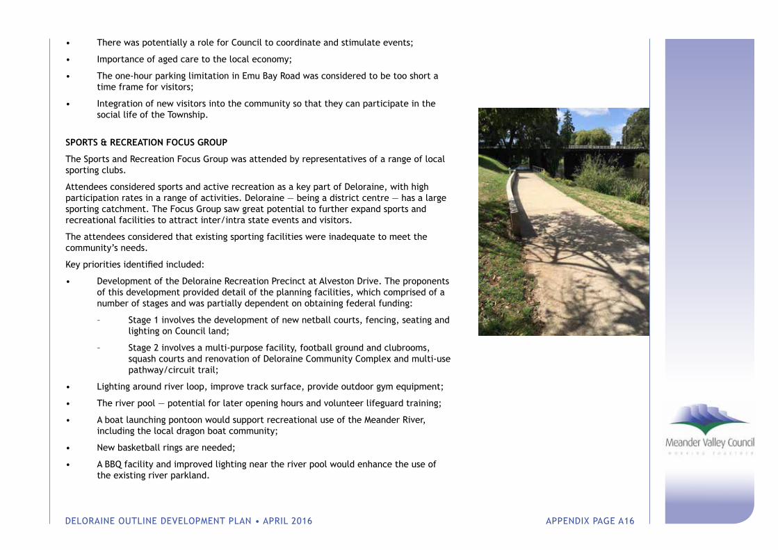
DELORAINE OUTLINE DEVELOPMENT PLAN • APRIL 2016 APPENDIX PAGE A16
• There was potentially a role for Council to coordinate and stimulate events;
• Importance of aged care to the local economy;
• The one-hour parking limitation in Emu Bay Road was considered to be too short a time frame for visitors;
• Integration of new visitors into the community so that they can participate in the social life of the Township.
SPORTS & RECREATION FOCUS GROUP
The Sports and Recreation Focus Group was attended by representatives of a range of local sporting clubs.
Attendees considered sports and active recreation as a key part of Deloraine, with high participation rates in a range of activities. Deloraine — being a district centre — has a large sporting catchment. The Focus Group saw great potential to further expand sports and recreational facilities to attract inter/intra state events and visitors.
The attendees considered that existing sporting facilities were inadequate to meet the community’s needs.
Key priorities identified included:
• Development of the Deloraine Recreation Precinct at Alveston Drive. The proponents of this development provided detail of the planning facilities, which comprised of a number of stages and was partially dependent on obtaining federal funding:
– Stage 1 involves the development of new netball courts, fencing, seating and lighting on Council land;
– Stage 2 involves a multi-purpose facility, football ground and clubrooms, squash courts and renovation of Deloraine Community Complex and multi-use pathway/circuit trail;
• Lighting around river loop, improve track surface, provide outdoor gym equipment;
• The river pool — potential for later opening hours and volunteer lifeguard training;
• A boat launching pontoon would support recreational use of the Meander River, including the local dragon boat community;
• New basketball rings are needed;
• A BBQ facility and improved lighting near the river pool would enhance the use of the existing river parkland.
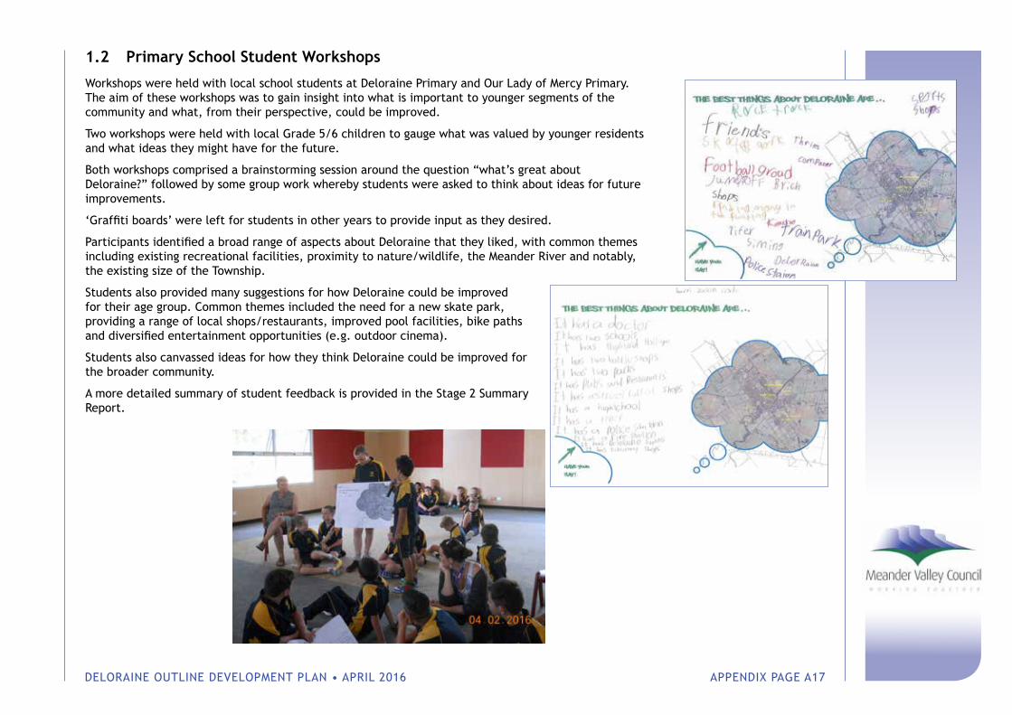
DELORAINE OUTLINE DEVELOPMENT PLAN • APRIL 2016 APPENDIX PAGE A17
1.2 Primary School Student Workshops
Workshops were held with local school students at Deloraine Primary and Our Lady of Mercy Primary. The aim of these workshops was to gain insight into what is important to younger segments of the community and what, from their perspective, could be improved.
Two workshops were held with local Grade 5/6 children to gauge what was valued by younger residents and what ideas they might have for the future.
Both workshops comprised a brainstorming session around the question “what’s great about Deloraine?” followed by some group work whereby students were asked to think about ideas for future improvements.
‘Graffiti boards’ were left for students in other years to provide input as they desired.
Participants identified a broad range of aspects about Deloraine that they liked, with common themes including existing recreational facilities, proximity to nature/wildlife, the Meander River and notably, the existing size of the Township.
Students also provided many suggestions for how Deloraine could be improved for their age group. Common themes included the need for a new skate park, providing a range of local shops/restaurants, improved pool facilities, bike paths and diversified entertainment opportunities (e.g. outdoor cinema).
Students also canvassed ideas for how they think Deloraine could be improved for the broader community.
A more detailed summary of student feedback is provided in the Stage 2 Summary Report.
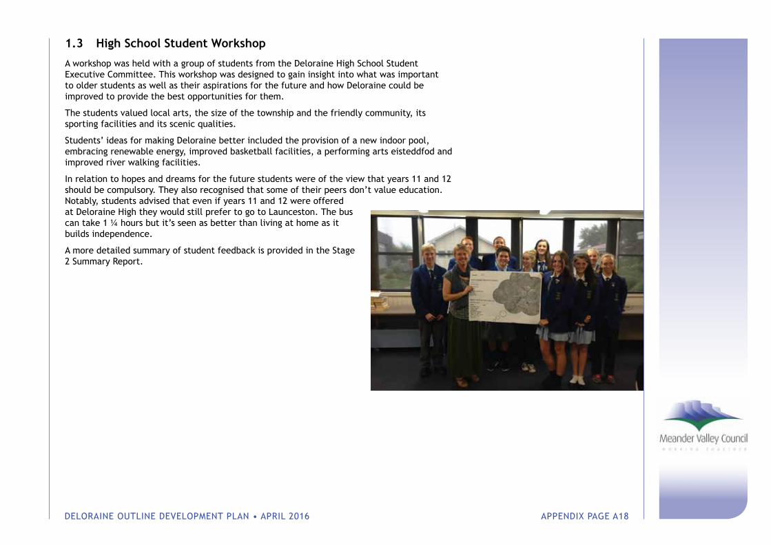
DELORAINE OUTLINE DEVELOPMENT PLAN • APRIL 2016 APPENDIX PAGE A18
1.3 High School Student Workshop
A workshop was held with a group of students from the Deloraine High School Student Executive Committee. This workshop was designed to gain insight into what was important to older students as well as their aspirations for the future and how Deloraine could be improved to provide the best opportunities for them.
The students valued local arts, the size of the township and the friendly community, its sporting facilities and its scenic qualities.
Students’ ideas for making Deloraine better included the provision of a new indoor pool, embracing renewable energy, improved basketball facilities, a performing arts eisteddfod and improved river walking facilities.
In relation to hopes and dreams for the future students were of the view that years 11 and 12 should be compulsory. They also recognised that some of their peers don’t value education. Notably, students advised that even if years 11 and 12 were offered at Deloraine High they would still prefer to go to Launceston. The bus can take 1 ¼ hours but it’s seen as better than living at home as it builds independence.
A more detailed summary of student feedback is provided in the Stage 2 Summary Report.
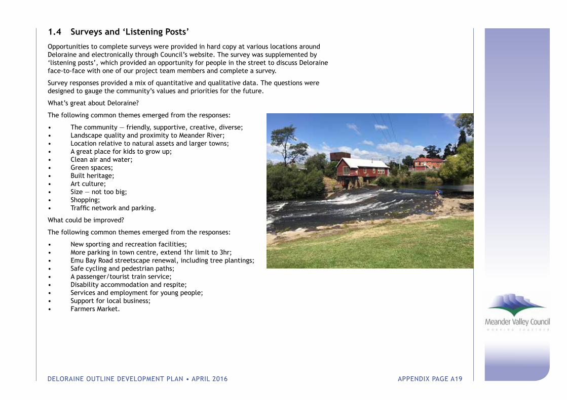
DELORAINE OUTLINE DEVELOPMENT PLAN • APRIL 2016 APPENDIX PAGE A19
1.4 Surveys and ‘Listening Posts’
Opportunities to complete surveys were provided in hard copy at various locations around Deloraine and electronically through Council’s website. The survey was supplemented by ‘listening posts’, which provided an opportunity for people in the street to discuss Deloraine face-to-face with one of our project team members and complete a survey.
Survey responses provided a mix of quantitative and qualitative data. The questions were designed to gauge the community’s values and priorities for the future.
What’s great about Deloraine?
The following common themes emerged from the responses:
• The community — friendly, supportive, creative, diverse;• Landscape quality and proximity to Meander River;• Location relative to natural assets and larger towns;• A great place for kids to grow up;• Clean air and water;• Green spaces;• Built heritage;• Art culture;• Size — not too big;• Shopping;• Traffic network and parking.
What could be improved?
The following common themes emerged from the responses:
• New sporting and recreation facilities;• More parking in town centre, extend 1hr limit to 3hr;• Emu Bay Road streetscape renewal, including tree plantings;• Safe cycling and pedestrian paths;• A passenger/tourist train service;• Disability accommodation and respite;• Services and employment for young people;• Support for local business;• Farmers Market.
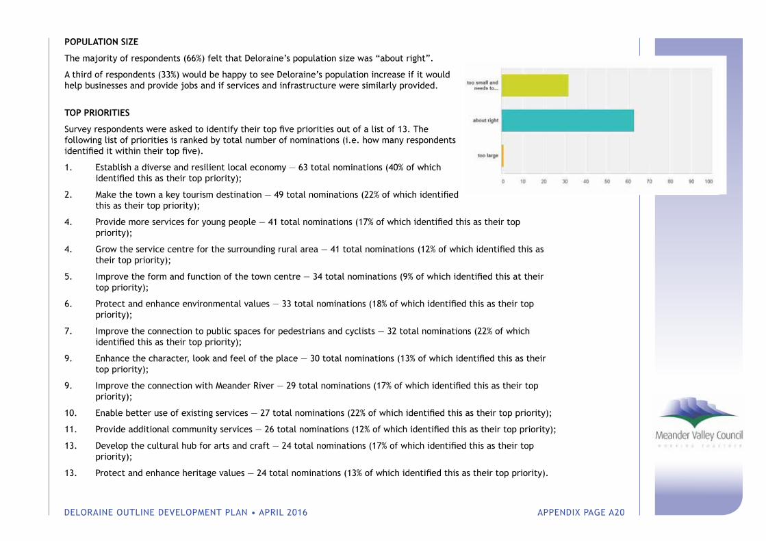
DELORAINE OUTLINE DEVELOPMENT PLAN • APRIL 2016 APPENDIX PAGE A20
POPULATION SIZE
The majority of respondents (66%) felt that Deloraine’s population size was “about right”.
A third of respondents (33%) would be happy to see Deloraine’s population increase if it would help businesses and provide jobs and if services and infrastructure were similarly provided.
TOP PRIORITIES
Survey respondents were asked to identify their top five priorities out of a list of 13. The following list of priorities is ranked by total number of nominations (i.e. how many respondents identified it within their top five).
1. Establish a diverse and resilient local economy — 63 total nominations (40% of which identified this as their top priority);
2. Make the town a key tourism destination — 49 total nominations (22% of which identified this as their top priority);
4. Provide more services for young people — 41 total nominations (17% of which identified this as their top priority);
4. Grow the service centre for the surrounding rural area — 41 total nominations (12% of which identified this as their top priority);
5. Improve the form and function of the town centre — 34 total nominations (9% of which identified this at their top priority);
6. Protect and enhance environmental values — 33 total nominations (18% of which identified this as their top priority);
7. Improve the connection to public spaces for pedestrians and cyclists — 32 total nominations (22% of which identified this as their top priority);
9. Enhance the character, look and feel of the place — 30 total nominations (13% of which identified this as their top priority);
9. Improve the connection with Meander River — 29 total nominations (17% of which identified this as their top priority);
10. Enable better use of existing services — 27 total nominations (22% of which identified this as their top priority);
11. Provide additional community services — 26 total nominations (12% of which identified this as their top priority);
13. Develop the cultural hub for arts and craft — 24 total nominations (17% of which identified this as their top priority);
13. Protect and enhance heritage values — 24 total nominations (13% of which identified this as their top priority).
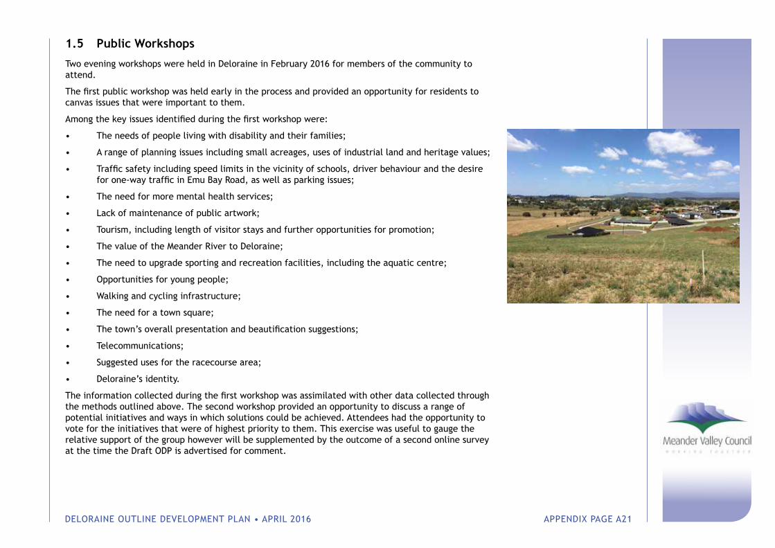
DELORAINE OUTLINE DEVELOPMENT PLAN • APRIL 2016 APPENDIX PAGE A21
1.5 Public Workshops
Two evening workshops were held in Deloraine in February 2016 for members of the community to attend.
The first public workshop was held early in the process and provided an opportunity for residents to canvas issues that were important to them.
Among the key issues identified during the first workshop were:
• The needs of people living with disability and their families;
• A range of planning issues including small acreages, uses of industrial land and heritage values;
• Traffic safety including speed limits in the vicinity of schools, driver behaviour and the desire for one-way traffic in Emu Bay Road, as well as parking issues;
• The need for more mental health services;
• Lack of maintenance of public artwork;
• Tourism, including length of visitor stays and further opportunities for promotion;
• The value of the Meander River to Deloraine;
• The need to upgrade sporting and recreation facilities, including the aquatic centre;
• Opportunities for young people;
• Walking and cycling infrastructure;
• The need for a town square;
• The town’s overall presentation and beautification suggestions;
• Telecommunications;
• Suggested uses for the racecourse area;
• Deloraine’s identity.
The information collected during the first workshop was assimilated with other data collected through the methods outlined above. The second workshop provided an opportunity to discuss a range of potential initiatives and ways in which solutions could be achieved. Attendees had the opportunity to vote for the initiatives that were of highest priority to them. This exercise was useful to gauge the relative support of the group however will be supplemented by the outcome of a second online survey at the time the Draft ODP is advertised for comment.
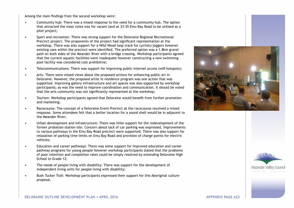
DELORAINE OUTLINE DEVELOPMENT PLAN • APRIL 2016 APPENDIX PAGE A22
Among the main findings from the second workshop were:
• Community hub: There was a mixed response to the need for a community hub. The option that attracted the most votes was for vacant land at 33-35 Emu Bay Road to be utilised as a pilot project;
• Sport and recreation: There was strong support for the Deloraine Regional Recreational Precinct project. The proponents of the project had significant representation at the workshop. There was also support for a Wild Wood loop track for cyclists/joggers however existing uses within the precinct were identified. The preferred option was a 1.8km gravel path on both sides of the Meander River with a bridge crossing. Workshop participants agreed that the current aquatic facilities were inadequate however constructing a new swimming pool facility was considered cost prohibitive;
• Telecommunications: There was support for improving public internet access (wifi hotspots);
• Arts: There were mixed views about the proposed actions for enhancing public art in Deloraine. However, the proposed artist in residence program was one action that was supported. Improving gallery infrastructure and art spaces was also supported by workshop participants; as was the need to improve coordination and communication. It should be noted that the arts community was not significantly represented at the workshop;
• Tourism: Workshop participants agreed that Deloraine would benefit from further promotion and marketing;
• Racecourse: The concept of a Deloraine Event Precinct at the racecourse received a mixed response. Some attendees felt that a better location for a sound shell would be in adjacent to the Meander River;
• Urban development and infrastructure: There was little support for the redevelopment of the former probation station site. Concern about lack of car parking was expressed. Improvements to various pathways in the Emu Bay Road precinct were supported. There was also support for relaxation of parking time limits on Emu Bay Road and provision of charge points for electric vehicles;
• Education and career pathways: There was some support for improved education and career pathway programs for young people however workshop participants stated that the problems of poor retention and completion rates could be simply resolved by extending Deloraine High School to Grade 12;
• The needs of people living with disability: There was support for the development of independent living units for people living with disability;
• Bush Tucker Trail: Workshop participants expressed their support for this Aboriginal culture proposal.
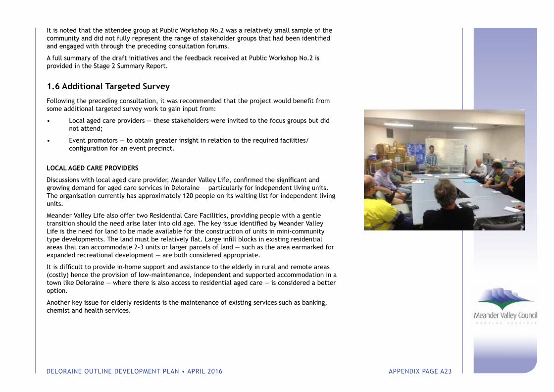
DELORAINE OUTLINE DEVELOPMENT PLAN • APRIL 2016 APPENDIX PAGE A23
It is noted that the attendee group at Public Workshop No.2 was a relatively small sample of the community and did not fully represent the range of stakeholder groups that had been identified and engaged with through the preceding consultation forums.
A full summary of the draft initiatives and the feedback received at Public Workshop No.2 is provided in the Stage 2 Summary Report.
1.6 Additional Targeted Survey
Following the preceding consultation, it was recommended that the project would benefit from some additional targeted survey work to gain input from:
• Local aged care providers — these stakeholders were invited to the focus groups but did not attend;
• Event promotors — to obtain greater insight in relation to the required facilities/ configuration for an event precinct.
LOCAL AGED CARE PROVIDERS
Discussions with local aged care provider, Meander Valley Life, confirmed the significant and growing demand for aged care services in Deloraine — particularly for independent living units. The organisation currently has approximately 120 people on its waiting list for independent living units.
Meander Valley Life also offer two Residential Care Facilities, providing people with a gentle transition should the need arise later into old age. The key issue identified by Meander Valley Life is the need for land to be made available for the construction of units in mini-community type developments. The land must be relatively flat. Large infill blocks in existing residential areas that can accommodate 2-3 units or larger parcels of land — such as the area earmarked for expanded recreational development — are both considered appropriate.
It is difficult to provide in-home support and assistance to the elderly in rural and remote areas (costly) hence the provision of low-maintenance, independent and supported accommodation in a town like Deloraine — where there is also access to residential aged care — is considered a better option.
Another key issue for elderly residents is the maintenance of existing services such as banking, chemist and health services.
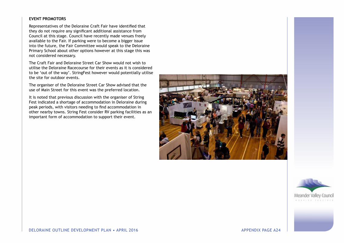
DELORAINE OUTLINE DEVELOPMENT PLAN • APRIL 2016 APPENDIX PAGE A24
EVENT PROMOTORS
Representatives of the Deloraine Craft Fair have identified that they do not require any significant additional assistance from Council at this stage. Council have recently made venues freely available to the Fair. If parking were to become a bigger issue into the future, the Fair Committee would speak to the Deloraine Primary School about other options however at this stage this was not considered necessary.
The Craft Fair and Deloraine Street Car Show would not wish to utilise the Deloraine Racecourse for their events as it is considered to be ‘out of the way’. StringFest however would potentially utilise the site for outdoor events.
The organiser of the Deloraine Street Car Show advised that the use of Main Street for this event was the preferred location.
It is noted that previous discussion with the organiser of String Fest indicated a shortage of accommodation in Deloraine during peak periods, with visitors needing to find accommodation in other nearby towns. String Fest consider RV parking facilities as an important form of accommodation to support their event.
Council Offices: 26 Lyall Street WestburyPostal Address: PO Box 102 Westbury TAS 7303
Phone (03) 6393 5300www.meander.tas.gov.au