deltas formation of river deltas. a delta is a large deposit of alluvial sediment forming a...
TRANSCRIPT

DELTASFORMATION OF RIVER DELTAS

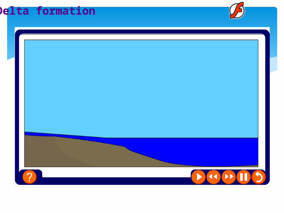
A delta is a large deposit of alluvial sediment forming a low-lying plain found at the mouth of a river.
River deltas form when a river carrying sediment reaches: (1) a body of standing water, such as a lake, sea,
ocean, or reservoir, (2) another river that cannot remove the sediment
quickly enough to stop delta formation, or (3) an inland region where the water spreads out
and deposits sediments.
What is a delta?

River deltas have been important to humans for thousands of years because of their extremely fertile soils. Major ancient civilizations grew along deltas such as those of the Nile and the Tigris-Euphrates rivers.
Apart from this, they also provide flat land for settlement.
Deltas are important ecologically as well. Fish and other wildlife thrive in deltas, many of which contain mangrove swamps, sea grass beds and mudflats.
Why study deltas?

The formation of a delta is a long and gradual process. They are created when the sediment load carried by a
stream is deposited because of a sudden reduction in stream velocity.
Deposition occurs as stream velocity drops on entering a standing body of water, thus reducing the capacity and competence of the river.
Vegetation also increases the rate of deposition by slowing down the water.
This results in deposition of the bedload and suspended load carried by the river.
How are deltas formed?
An important process aiding in the deposition of the river’s load is flocculation.
This is the process by which tiny particles in suspension like clay and silt (which under normal fresh water conditions would likely never fall out of suspension) coagulate with the salt in the water by chemical reaction and become heavy enough to ‘sink’ and be deposited.
It occurs as fresh water mixes with salt water - e.g where a river flows into the sea (then called brackish water).
How are deltas formed?
When a river meets the standing water of an ocean at the coast, it quickly loses velocity and the heaviest particles drop out.
The fine suspended load may be carried further out into the water before it settles out and sinks to the bottom.
The sediment deposited in a delta is laid down in layers or beds each containing various types of sediment. The position and composition of these beds depend on how far they were carried by the river’s flow before being deposited.
How are deltas formed?
As deposition continues the water becomes more and more shallow and eventually topset beds begin to rise above the surface of the water.
As more sediments are brought by the river to the delta, especially in times of flooding, the main river may become choked with sediment.
When this occurs, the river branches into distributaries, finding the least resistant path to the shoreline.
How are deltas formed?
When sandy deposits block the distributaries, they then become inactive, and smaller, active distributaries branch off.
As the process continues, distributaries constantly shift position across the surface of the delta.
Thus, the surface of most deltas is marked by small shifting channels that carry water and sediments away from the main river channel.
These small channels also act to distribute the stream's sediment load over the surface of the delta.
How are deltas formed?

As the river channels meander laterally across the top of the delta, the river is lengthened and its gradient is reduced, causing the suspended load to settle out in nearly horizontal beds over the delta's top (i.e. the topset beds)
Once above the surface, topset beds become an extension of the landward alluvial plain.
How are deltas formed?
Delta formation

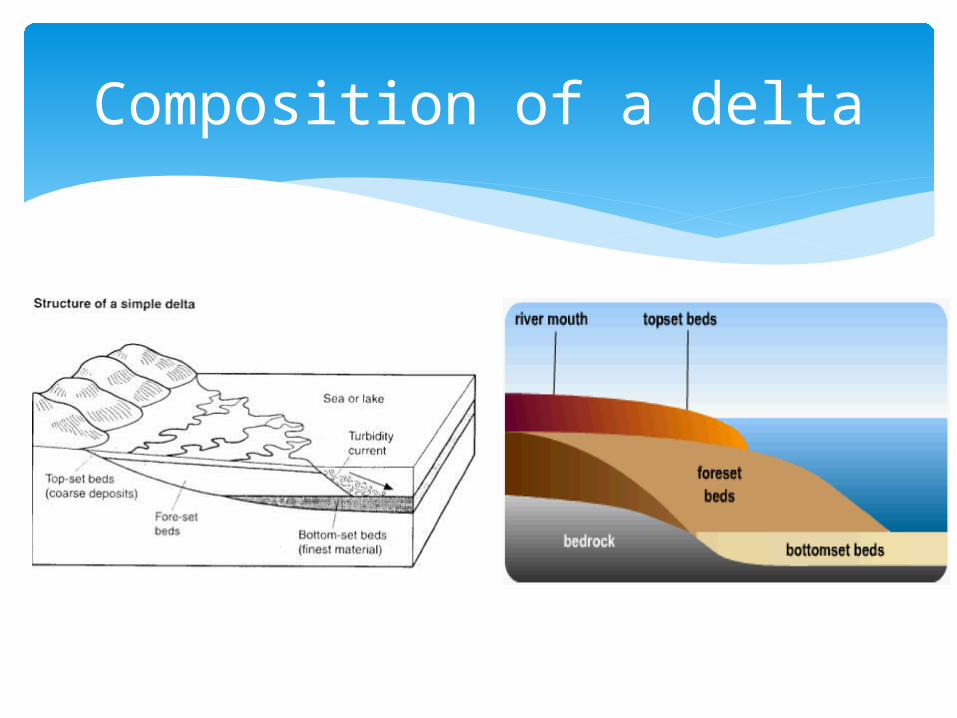
Deltaic deposits are composed of three types of depositional layers, each with different types of sediment: Bottomset beds
Foreset beds
Topset beds
Composition of a delta
Bottomset beds - Bottomset beds are nearly horizontal or flat layers of fine clay and silt that form underwater farthest from the mouth of the river and the active delta front. These are the very finest particles that travel the furthest before very low velocity/flocculation leads to their deposition.
Composition of a delta
Foreset beds – Closer to the mouth, yet still underwater, are foreset beds of sand and gravel that slope steeply down toward the bottomset beds at angles of 5 to 25 degrees. They make up the main body of deltas. The sediment particles within foreset beds consist of larger and more variable sizes, and constitute the bed load that the river moves downstream by rolling and bouncing along the channel bottom. When the bed load reaches the edge of the delta front, it rolls over the edge, and is deposited in steeply dipping layers over the top of the existing bottomset beds.
Composition of a delta

Topset beds – These are thin, horizontal layers of differing sizes - coarser sand and gravel (deposited first as the river loses energy) as well as finer material from the suspended load that are deposited on the surface of the delta on top of the foreset beds.
As a delta increases in size and advances farther out into the water, the topset beds cover the foreset beds, which in turn cover the bottomset beds.
Composition of a delta
Composition of a delta
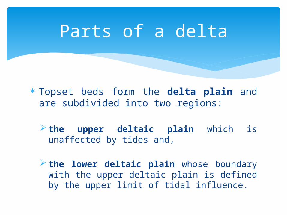
Topset beds form the delta plain and are subdivided into two regions:
the upper deltaic plain which is unaffected by tides and,
the lower deltaic plain whose boundary with the upper deltaic plain is defined by the upper limit of tidal influence.
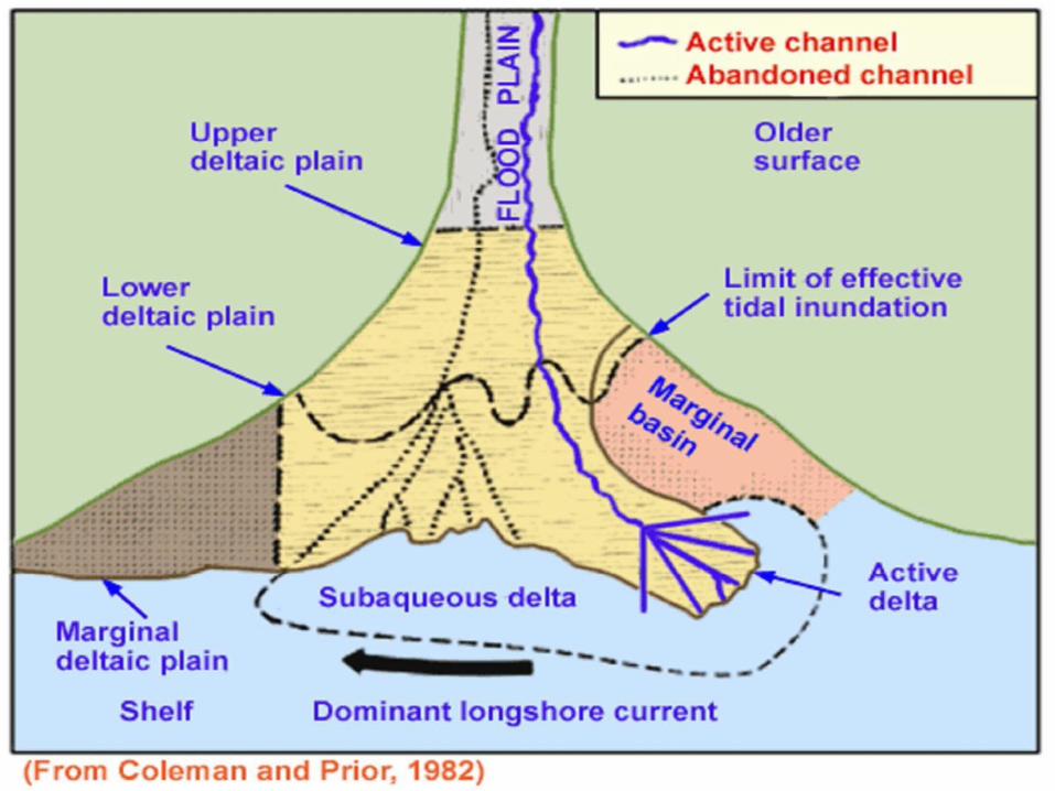
Parts of a delta

Fully formed deltas are typically made up of three parts. These parts are:
the upper deltaic plain,
the lower deltaic plain and
the subaqueous delta
Parts of a delta
Delta Plain

Upper Deltaic Plain
This is that part of the delta that is farthest inland i.e. nearest to the land.
It lies above the high tide mark and is not affected by the action of waves or tides.
It is usually the area with the least water and highest elevation.
The river or stream that forms the delta begins to divide in this area into smaller channels called distributaries, which carry sediments toward the delta's edges.
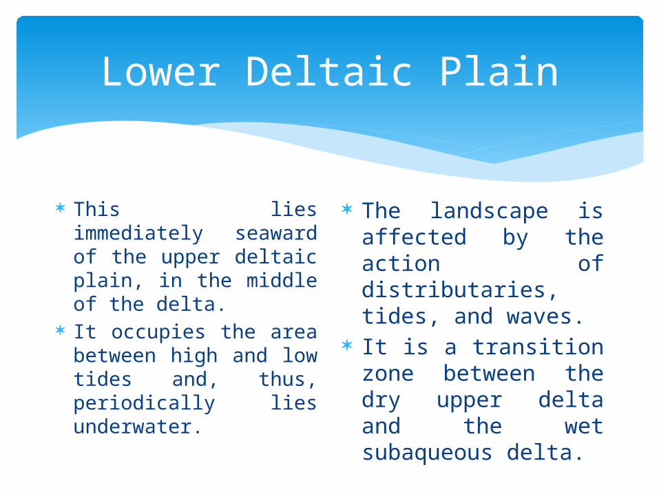
Lower Deltaic Plain
This lies immediately seaward of the upper deltaic plain, in the middle of the delta.
It occupies the area between high and low tides and, thus, periodically lies underwater.
The landscape is affected by the action of distributaries, tides, and waves.
It is a transition zone between the dry upper delta and the wet subaqueous delta.
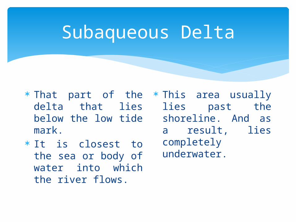
Subaqueous Delta
That part of the delta that lies below the low tide mark.
It is closest to the sea or body of water into which the river flows.
This area usually lies past the shoreline. And as a result, lies completely underwater.
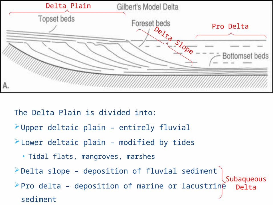
The Delta Plain is divided into:
Upper deltaic plain – entirely fluvial
Lower deltaic plain – modified by tides
• Tidal flats, mangroves, marshes
Delta slope – deposition of fluvial sediment
Pro delta – deposition of marine or lacustrine sediment
Delta Plain
Delta Slope
Pro Delta
SubaqueousDelta
Stage 1: deposition divides the river mouth into several distributaries. Spits and bars arise and lagoons are formed. The levées of the river extend into the sea via the distributaries.
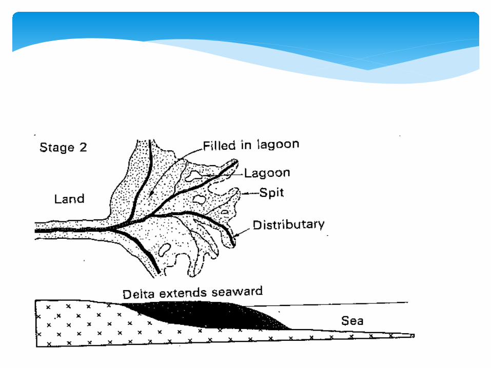
Stage 2: the lagoons begin to get filled in with sediments and become swampy. The delta begins to assume a more solid appearance.
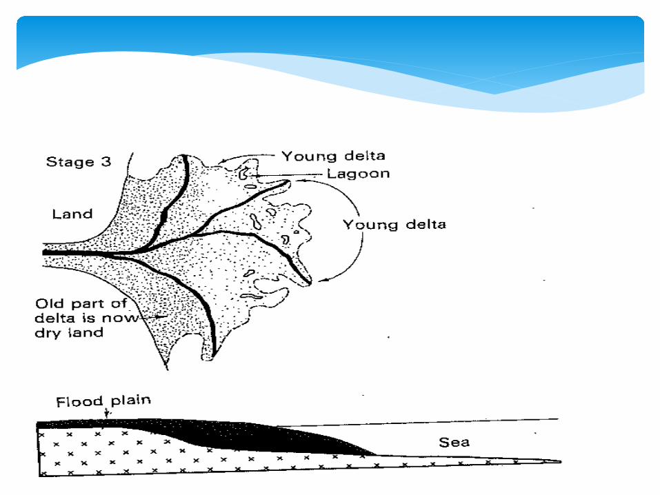
Stage 3: the old part of the delta becomes colonised with plants and its height is slowly raised as a result. Swamps gradually disappear and this part of the delta becomes dry land.
All three stages can be seen in most deltas. As a delta grows larger, the old parts merge imperceptibly with the flood plain and they no longer have the appearance of a delta.
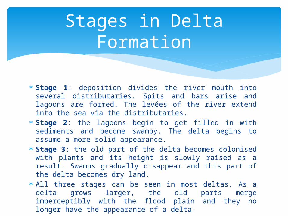
Stages in Delta Formation

Typical Conditions for Delta Formation
Deltas only form where the rate of deposition exceeds the rate of sediment removal – i.e. where the critical threshold is no longer met and the system has fallen out of dynamic equilibrium.
Not all rivers form deltas. For a delta to form, the flow of a river must be slow and steady enough for silt to be deposited and build up.
The Ok Tedi, in Papua New Guinea is one of the fastest-flowing rivers in the world. It does not form a delta as it becomes a tributary of the Fly River. (The Fly, on the other hand, does form a rich delta as it empties into the Gulf of Papua, part of the Pacific Ocean.)
A river will also not form a delta if exposed to powerful waves. The Columbia River in Canada and the United States, for instance, deposits enormous amounts of sediment into the Pacific Ocean, but strong waves and currents sweep the material away as soon as it is deposited.
Tides also limit where deltas can form. The Amazon, the largest river in the world, is without a delta. The tides of the Atlantic Ocean are too strong to allow silt to create a delta on the Amazon.
Typical Conditions for Delta Formation

Typical Conditions for Delta Formation
Active vertical and lateral erosion in the upper course to provide the extensive sediments needed for deltas to form.
The coastal area into which the river flows should be sheltered with weak currents and a small tidal range (preferably tideless).
This will result in limited wave action and little subsequent transport of sediment after deposition.

Typical Conditions for Delta Formation
The sea adjoining the delta should be shallow (e.g. on the continental shelf) or else the load will be washed away into the deep waters.
The calibre of the load should be high.
This will require a large amount of energy to keep in transport
A tug of war between land and water determines a delta's shape. It is a battle that pits the strength of a river's flow and the amount of sediment it carries against wave and tidal currents.
Deltas build outward from a coast only if the slope from the shore is gentle and ocean currents are not strong enough to carry away the sediment deposited by the river.
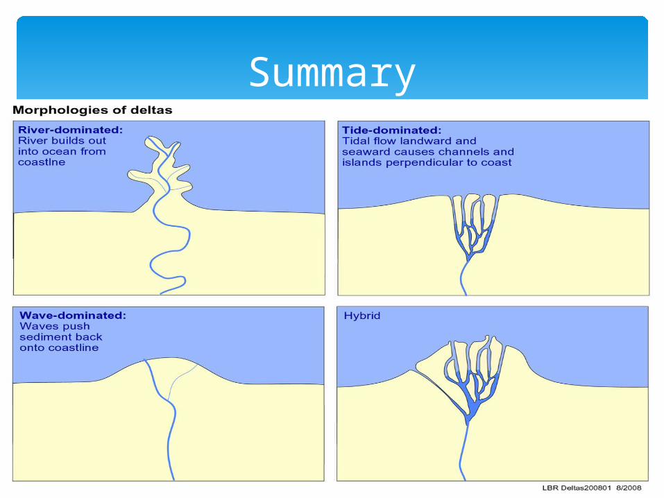
Deltas are classified either based on their shape or on what controls a river's deposition of sediment.
The deposition of sediment may be controlled by the river itself, waves or tides.
Types of Delta
Types of Deltas
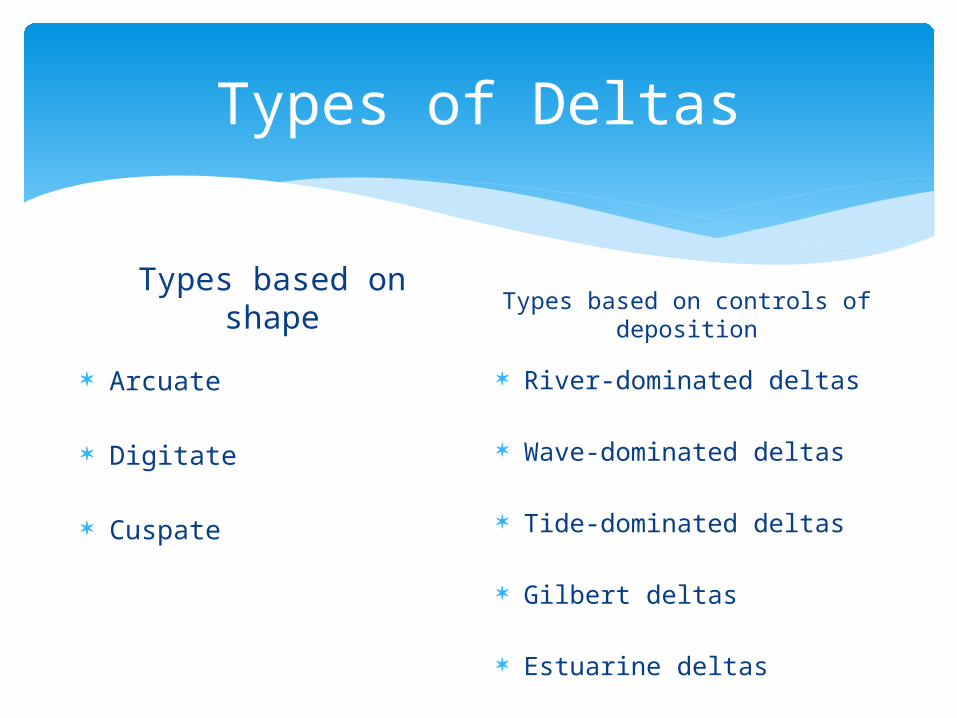
Types based on shape
Arcuate
Digitate
Cuspate
Types based on controls of deposition
River-dominated deltas
Wave-dominated deltas
Tide-dominated deltas
Gilbert deltas
Estuarine deltas
Types of Deltas based on shape
Arcuate, Digitate and Cuspate
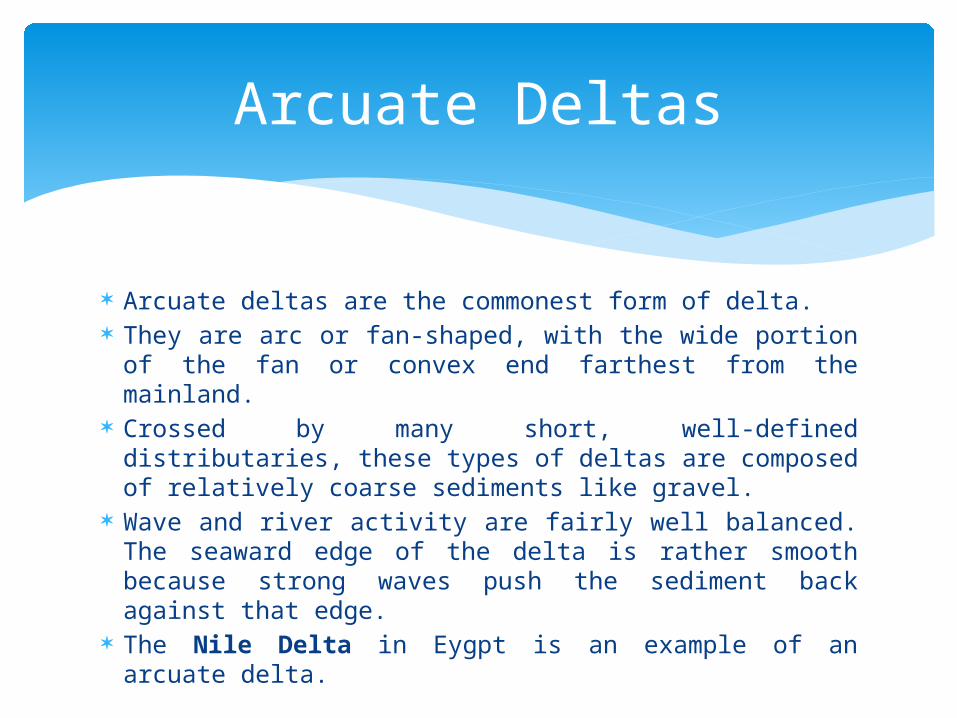
Arcuate deltas are the commonest form of delta. They are arc or fan-shaped, with the wide portion of
the fan or convex end farthest from the mainland. Crossed by many short, well-defined distributaries,
these types of deltas are composed of relatively coarse sediments like gravel.
Wave and river activity are fairly well balanced. The seaward edge of the delta is rather smooth because strong waves push the sediment back against that edge.
The Nile Delta in Eygpt is an example of an arcuate delta.
Arcuate Deltas
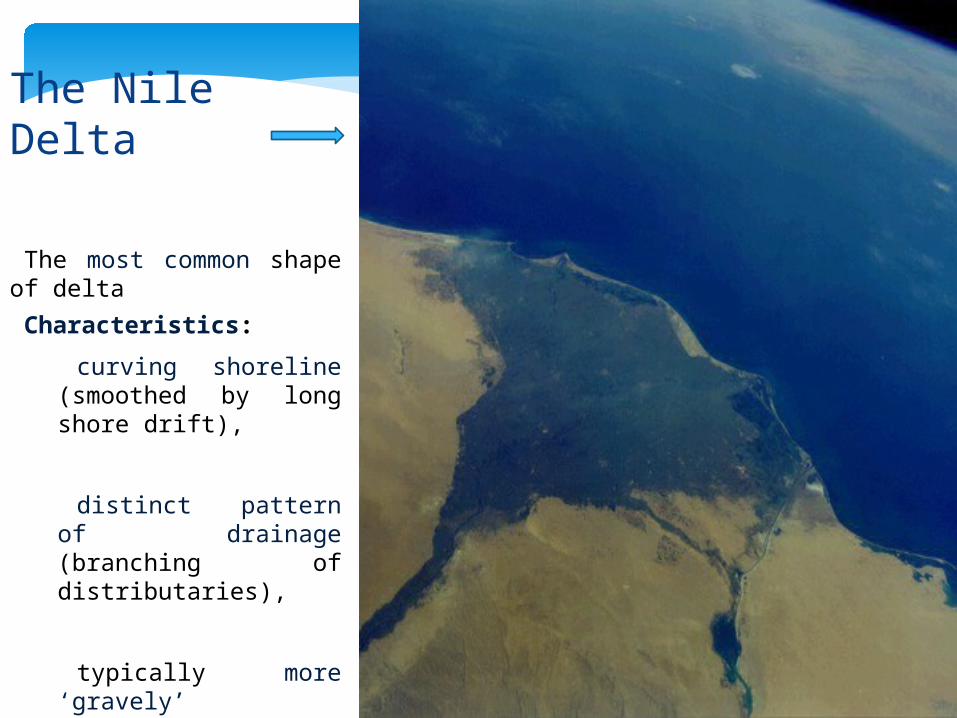
•The most common shape of delta
•Characteristics:
curving shoreline (smoothed by long shore drift),
distinct pattern of drainage (branching of distributaries),
typically more ‘gravely’ deposits .
The Nile Delta


Where the action of waves is weak and that of a river is strong, an irregular-shaped delta forms that extends out into the water well beyond the local shoreline.
Resembling the spread claws of a bird's foot, this type of delta is also called a bird's foot delta.
Fine sediments and shifting distributaries mark this river-dominated delta.
Bird's foot deltas are not common along ocean coasts because the action of ocean currents and waves is often as strong if not stronger than that of rivers.
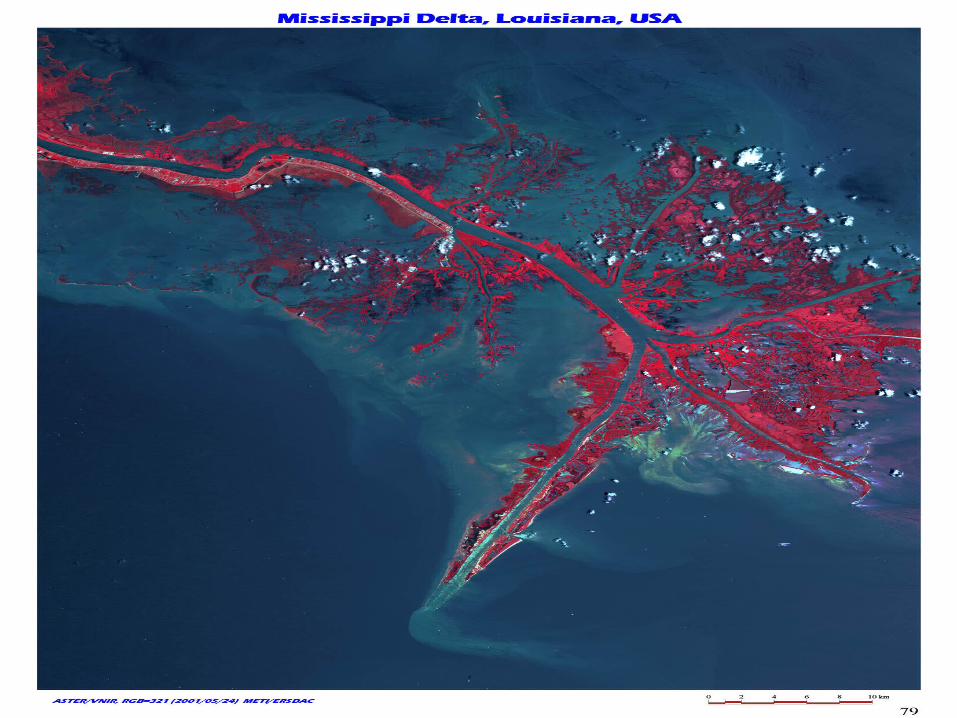
The Mississippi Delta, on the Gulf of Mexico, is a bird's foot delta.
Digitate Deltas
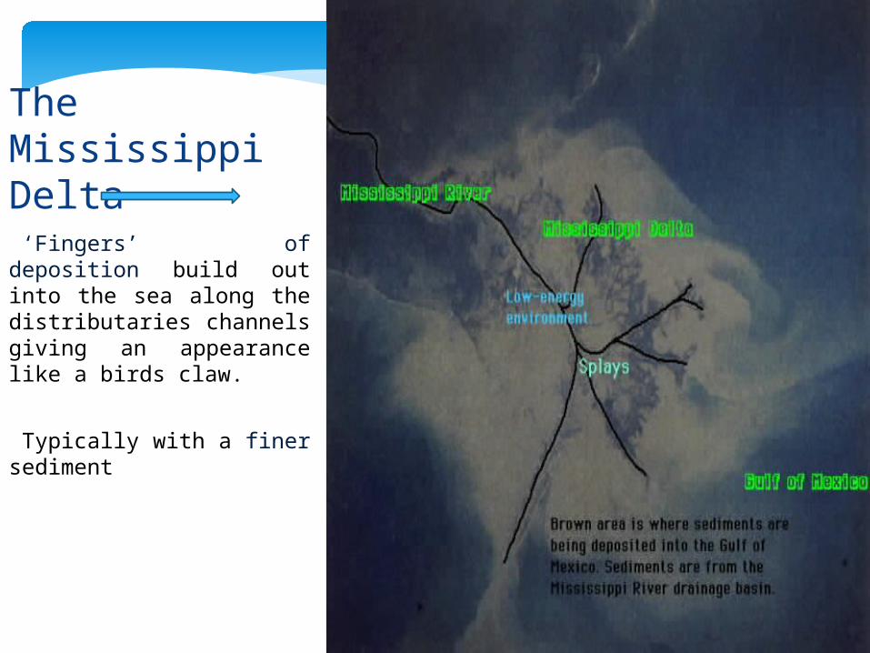
•‘Fingers’ of deposition build out into the sea along the distributaries channels giving an appearance like a birds claw.
•Typically with a finer sediment
The Mississippi Delta
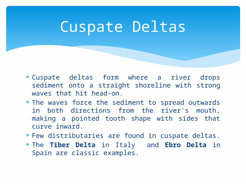
Cuspate deltas form where a river drops sediment onto a straight shoreline with strong waves that hit head-on.
The waves force the sediment to spread outwards in both directions from the river's mouth, making a pointed tooth shape with sides that curve inward.
Few distributaries are found in cuspate deltas. The Tiber Delta in Italy and Ebro Delta in Spain
are classic examples.
Cuspate Deltas
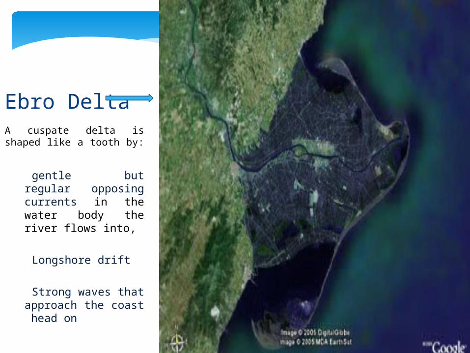
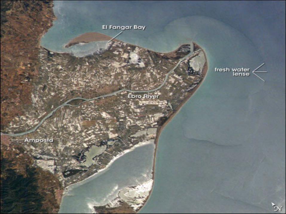
A cuspate delta is shaped like a tooth by:
gentle but regular opposing currents in the water body the river flows into,
Longshore drift
Strong waves that approach the coast head on
Ebro Delta
Types of Deltas based on control of sediment
deposition
Wave –dominated, tide-dominated, Gilbert and estuarine
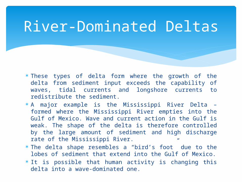
These types of delta form where the growth of the delta from sediment input exceeds the capability of waves, tidal currents and longshore currents to redistribute the sediment.
A major example is the Mississippi River Delta – formed where the Mississippi River empties into the Gulf of Mexico. Wave and current action in the Gulf is weak. The shape of the delta is therefore controlled by the large amount of sediment and high discharge rate of the Mississippi River.
The delta shape resembles a “bird’s foot” due to the lobes of sediment that extend into the Gulf of Mexico.
It is possible that human activity is changing this delta into a wave-dominated one.
River-Dominated Deltas
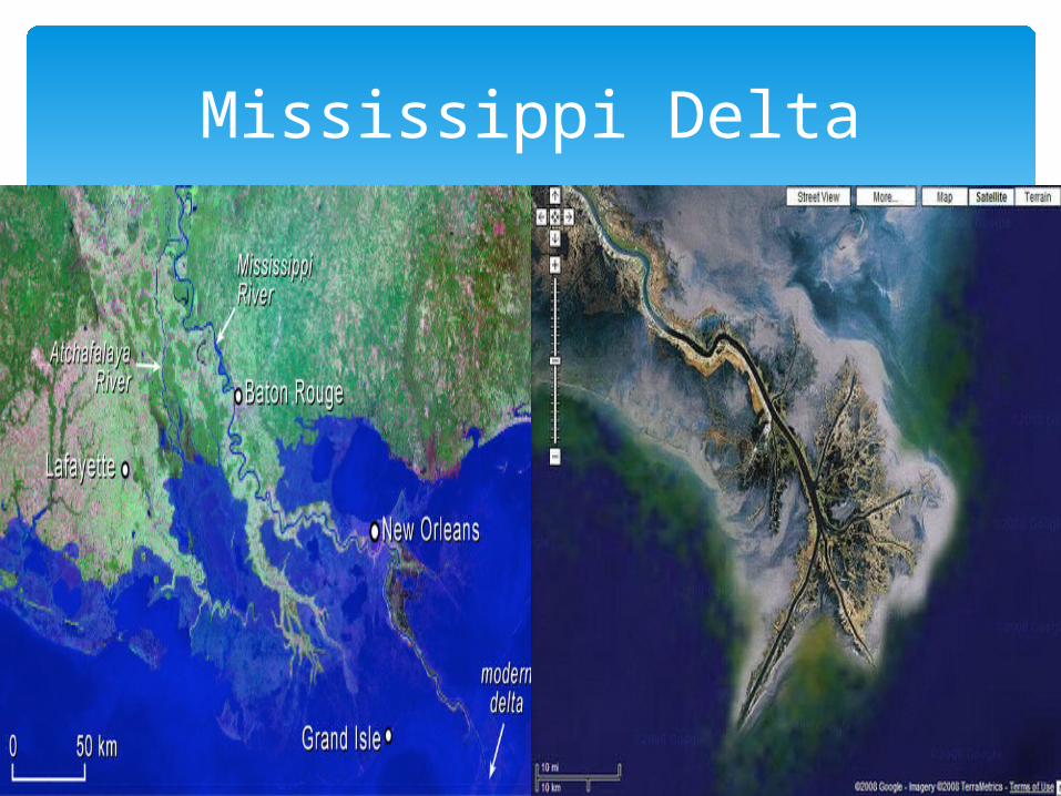
Mississippi Delta
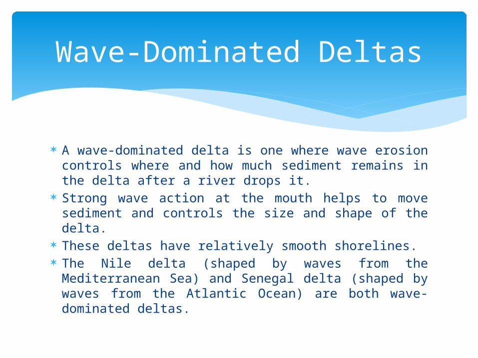
A wave-dominated delta is one where wave erosion controls where and how much sediment remains in the delta after a river drops it.
Strong wave action at the mouth helps to move sediment and controls the size and shape of the delta.
These deltas have relatively smooth shorelines. The Nile delta (shaped by waves from the
Mediterranean Sea) and Senegal delta (shaped by waves from the Atlantic Ocean) are both wave-dominated deltas.
Wave-Dominated Deltas
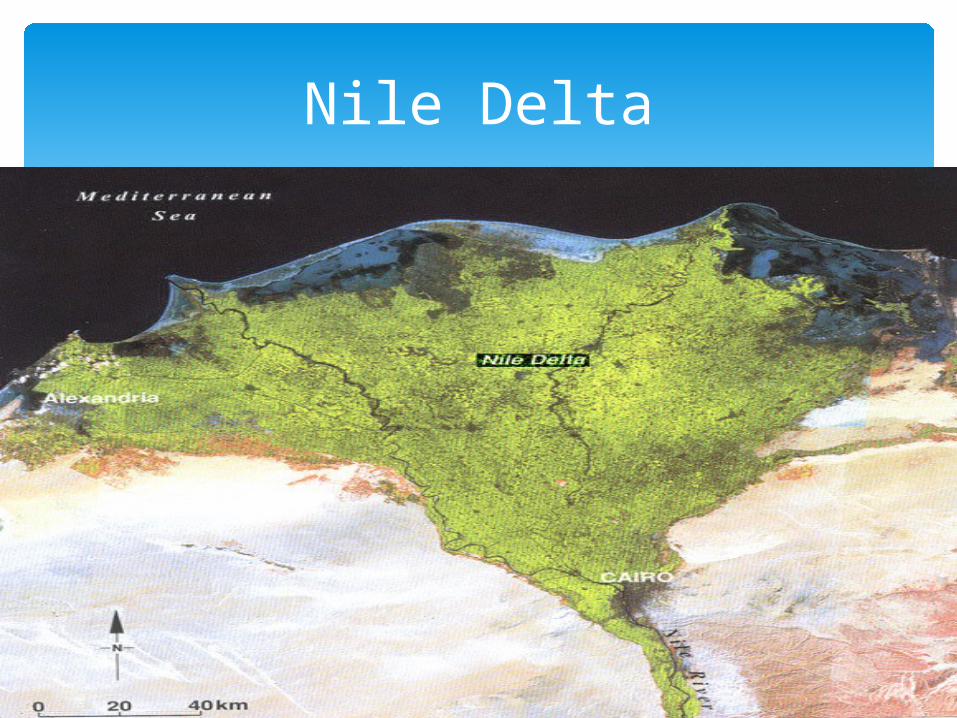
Nile Delta
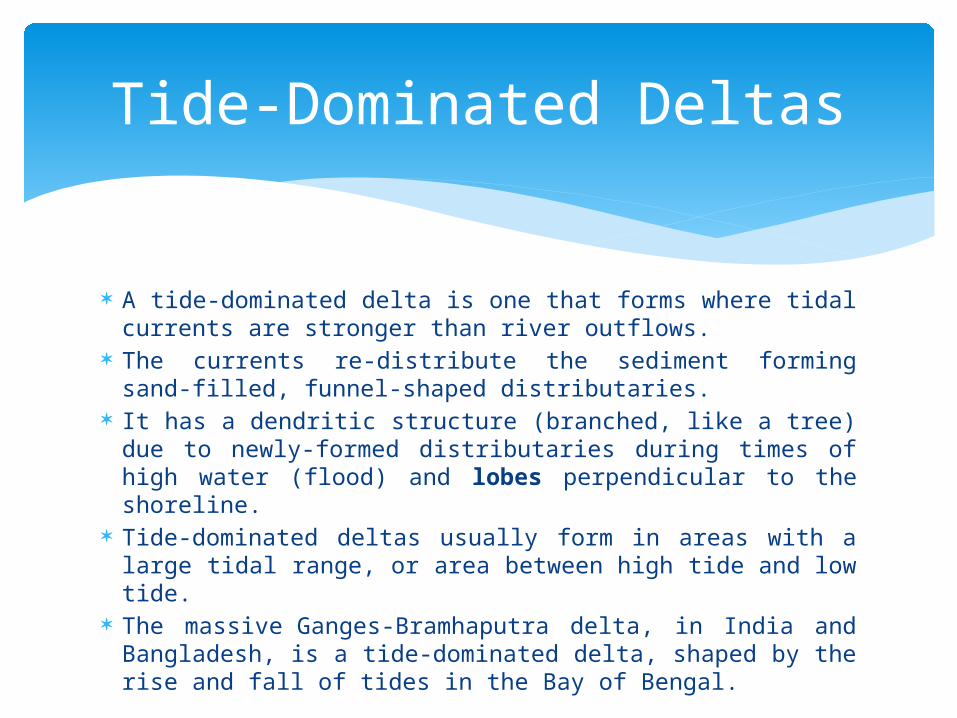
A tide-dominated delta is one that forms where tidal currents are stronger than river outflows.
The currents re-distribute the sediment forming sand-filled, funnel-shaped distributaries.
It has a dendritic structure (branched, like a tree) due to newly-formed distributaries during times of high water (flood) and lobes perpendicular to the shoreline.
Tide-dominated deltas usually form in areas with a large tidal range, or area between high tide and low tide.
The massive Ganges-Bramhaputra delta, in India and Bangladesh, is a tide-dominated delta, shaped by the rise and fall of tides in the Bay of Bengal.
Tide-Dominated Deltas
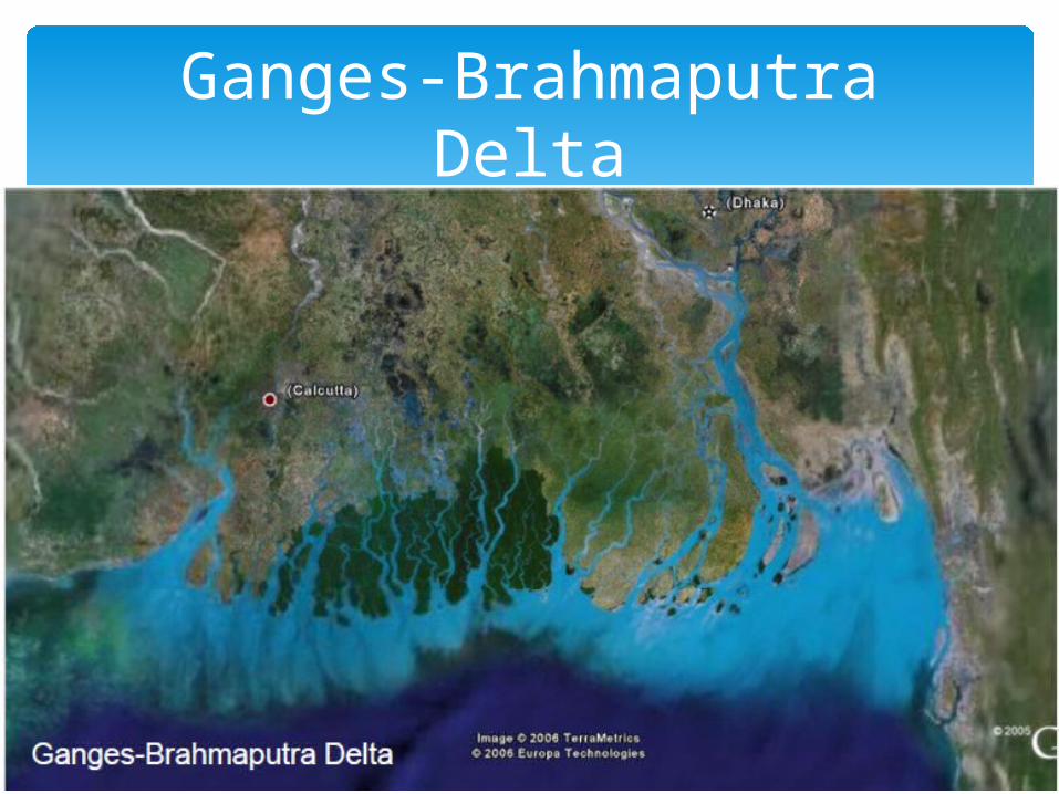
Ganges-Brahmaputra Delta
Summary
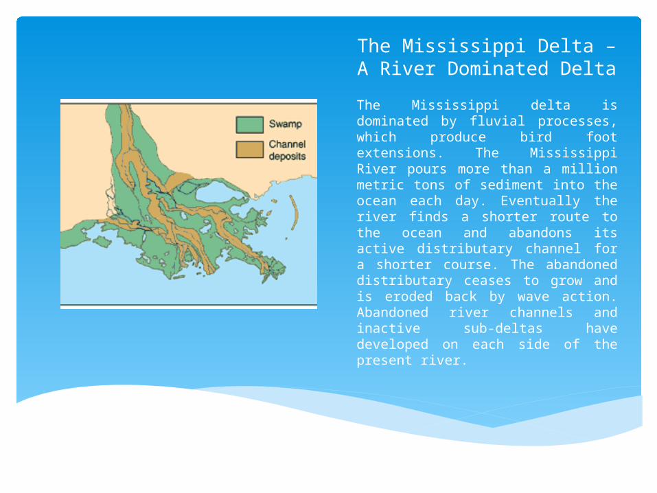
The Mississippi Delta – A River Dominated Delta
The Mississippi delta is dominated by fluvial processes, which produce bird foot extensions. The Mississippi River pours more than a million metric tons of sediment into the ocean each day. Eventually the river finds a shorter route to the ocean and abandons its active distributary channel for a shorter course. The abandoned distributary ceases to grow and is eroded back by wave action. Abandoned river channels and inactive sub-deltas have developed on each side of the present river.

The Nile Delta – A Wave Dominated Delta
The Nile delta is dominated by wave action which produces an arcuate delta front.
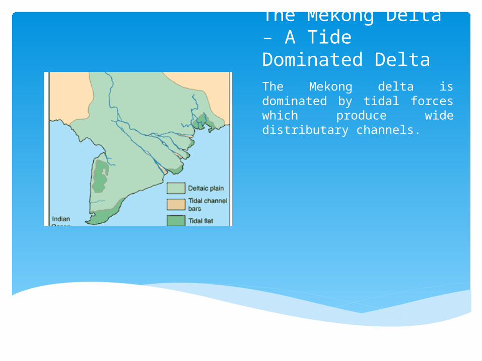
The Mekong Delta – A Tide Dominated Delta The Mekong delta is dominated by tidal forces which produce wide distributary channels.

The Niger Delta – A Hybrid DeltaThe Niger delta has formed where stream deposition, wave action, and tidal forces are about equal. An arcuate delta front and wide distributary channels are thus produced.
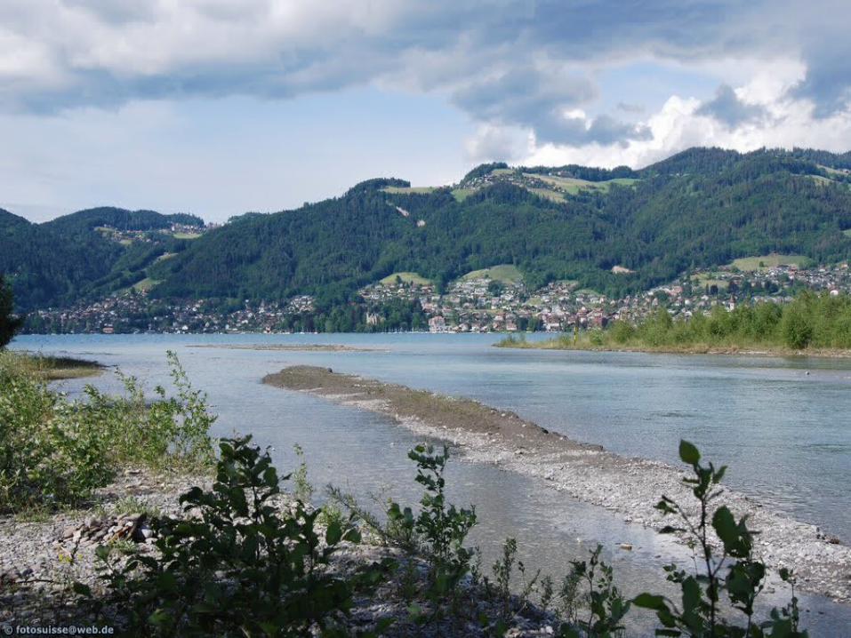
Gilbert deltas are formed as rivers deposit large, coarse sediments. Although they can form in oceans, such deltas are usually confined to rivers emptying into freshwater lakes in mountainous rivers. They are usually steeper than the normal flat plain of a wave-dominated or tide-dominated delta.
Lacustrine deltas are good examples such as the Kander River Delta in Lake Thun, Switzerland and St. Clair River Delta in Canada.
Gilbert Deltas
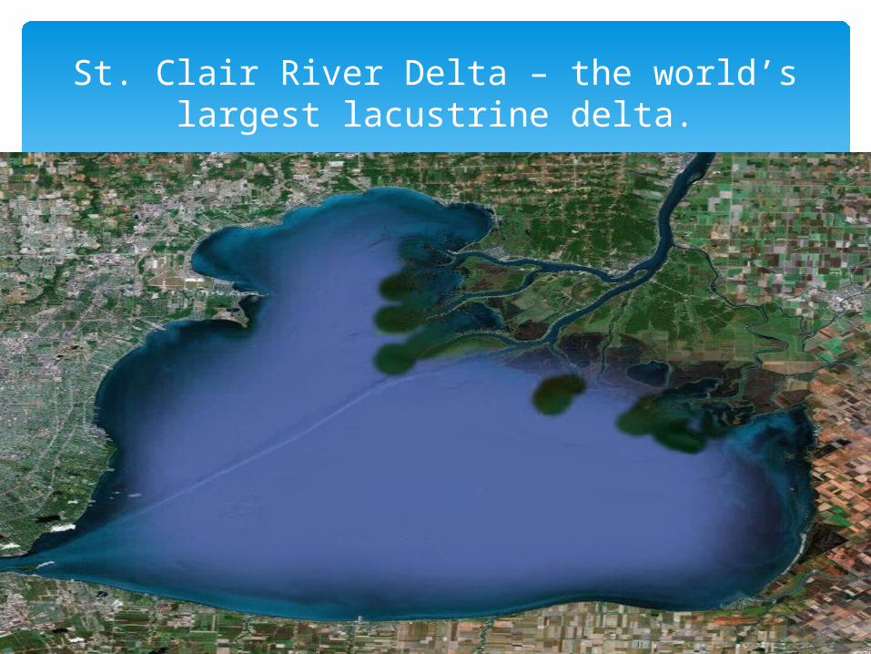
St. Clair River Delta – the world’s largest lacustrine delta.

When a river is located near coasts that have large tidal variation they do not always form a traditional delta. They instead form estuaries, or a river that meets the sea.
Estuarine deltas form as a river does not empty directly into the ocean, but instead forms an estuary.
The load is deposited along the sides of the estuary. An estuary is a partly enclosed wetland that features
a brackish water (part-saltwater, part-freshwater) habitat.
The Yellow River forms an estuary, for instance, as it reaches the Bohai Sea off the coast of northern China. The River Shannon Estuary is another example.
Estuarine Deltas

The Yenisei and Ob Rivers

Inland deltas, which empty into a plain, are extremely rare.
The Okavango delta in Botswana is probably the most well-known—and so unusual it is recognized as one of the "Seven Natural Wonders of Africa.“
Water from the Okavango River never reaches another body of water. The delta spreads water and silt across a flat plain in the Kalahari Desert before being evaporated.
Other Types of Deltas
Inverted deltas look like the opposite of a classic arcuate delta.
The distributary network of an inverted delta is inland, while a single stream reaches the ocean or other body of water.
The delta of the Sacramento-San Joaquin River in northern California is an inverted delta. The rivers and creeks of the Sacramento and San Joaquin distributary networks meet in Suisun Bay, before flowing to the Pacific Ocean through a single gap in the Coast Range, the Carquinez Strait.
Other Types of Deltas