department of archaeology the silchester environs project · dan wheeler, helen winton &...
TRANSCRIPT

Department of Archaeology
The Silchester Environs Project
Excavation and Survey 2017Michael Fulford, Catherine Barnett, Nick Pankhurst & Dan Wheeler

Simm’s Copse
Pamber Forest
Silchester
Fig. 2 LiDAR imagery showing the monuments identified in Pamber Forest © Environment Agency/ University of Reading 2015
Fig. 1 Location map © Ordnance Survey

1
The Silchester Environs Project 2017 Catherine Barnett, Olaf Bayer, Mark Bowden, David Field, Rob Fry, Paul & Neil Linford, Nick Pankhurst, Andy Payne, Krystyna Truscoe, Dan Wheeler, Helen Winton & Michael Fulford
Following the successful completion of our aerial photo and lidar survey, prospective work using geophysical surveys, earthwork reconnaissance and coring have been undertaken, helping to build a landscape-scale picture of prehistoric, but also of Roman and later life and environment around the Roman town and its underlying Iron Age predecessor, Calleva.
Excavations have been extensive, having taken place at three enclosures in Pamber Forest and three enclosures at Simm’s Copse, Mortimer West End.
Non-intrusive fieldwork this year has included further Fluxgate Magnetometer geophysical surveys by the Historic England Geophysics team on behalf of the project at Simm’s Copse and Windabout Copse, where activity areas such as storage pitting extending beyond the area excavated in summer 2016 were revealed. Ground Penetrating Radar Survey by the University team has identified the now levelled entranceways to Bullsdown hillfort and supported the measured earthwork survey in clarifying the form and phasing of this impressive hillfort.
Walkover reconnaissance by Dave Field and the Environs team has also taken place to the south of the project area, including Morgaston and Carpenter’s Woods, unpicking enigmatic features shown in the aerial survey. This work is now complete for the wooded areas and has greatly enhanced our understanding of the distribution of monuments and upstanding features, such as field boundaries and park pales, across the 143km3 study area.
The Environs team braved the February winter weather to excavate three of the five enclosures identified within Pamber Forest through interpretation of enhanced Lidar imagery. All three proved to be of Iron Age date. The excavations also produced evidence of earlier prehistoric as well as later Roman and medieval activity.
As soon as the crops were harvested in late September, the team headed to Simm’s Copse, Mortimer West End for the final fieldwork of the year. Coring along a transect from the monuments down into the nearby floodplain has enabled recovery of waterlogged sequences with preserved organic remains capable of telling us about landscape and human activity. Excavation at the site has revealed evidence of three circular, Iron Age enclosures with substantial ditches, internal posthole structures and, in one case, an entranceway with a funnel-like form.
The post-excavation analysis is underway for these sites and those excavated in 2016, including an extensive radiocarbon dating programme, with 85 results gained so far for the project, greatly enhancing our understanding of chronology of the sites relative to each other and to the town of Calleva Atrebatum and its underlying Iron Age oppidum. Examination of the pottery, plant (charcoal, seeds, pollen) and animal bones, along with the analysis of the sediments and soil, is in progress. The preliminary results are outlined below.

2
Iron Age Settlement and Woodland Management: the Pamber Forest EnclosuresDan Wheeler, Nick Pankhurst & Catherine Barnett
IntroductionThe remnants of six monuments were identified on the London Clay centred on SU 6197 6018, during the interpretation of enhanced LiDAR imagery (Figs. 1 & 2) and through walkover survey by the team in 2015. They were previously unknown, having remained hidden from conventional archaeological survey using aerial photography and field-walking due to their loca-tion within oak-hazel dominated ancient coppiced woodland. The area is protected by its designated status as a Site of Special Scientific Interest on the basis of its ecological value and sensitivity. As such, the Environs team worked closely with its custodians, the Hampshire and Isle of Wight Wildlife Trust and Natural England and its owners, the Englefield Estate to undertake all archaeological works sensitively, minimising disruption to ground nesting birds in particular, while providing archaeological and pal-aeoecological data to help better understand the sites history and support its modern-day management.
Of the six monuments found, one was a small ring ditch (probably a barrow), the others comprising rem-nants of encircling enclosure banks and ditches. Of these, the three best preserved, a pair of circular to
sub-square enclosures (Enclosures 1 and 2) and a larger D-shaped monument (Enclosure 3) were targeted for further work (Figure 4).
Excavation
Enclosure 1Enclosure 1, measuring c.75m by 60m was the most northerly of the three earthworks excavated. Despite showing on the LiDAR scan as a defined sub-rectangular shape, it was extremely difficult to discern on the ground and could not have been discovered through field-walking alone. Much of the southern and western extent of the earthwork was obscured by low scrub and fallen trees and was truncated by two converging post-Medieval woodland banks. The northern side was clearer and more easily accessible, with a shallow arc of degraded bank and ditch visible, running briefly paral-lel with the modern footpath before gently turning southwards and disappearing. Although the monument would have gradually degraded to a degree once it went into disuse, it seems that only heavy ploughing would have caused it to diminish to its current state. Fig. 3 Pamber Forest
Enclosure 1
Enclosure 2
Enclosure 3
Tr 1
Tr 2.1
Tr 2.2
Tr 2.3
Tr 3.1Tr 3.2
Fig. 4 Location map showing trench layout within enclosures 1-3

3
Trench 1The cut of the main enclosure ditch [1012], measur-ing 2.05m wide and 1.38m deep, ran roughly east-west across Trench 1 (12.5m by 3.2m) (Fig. 5). Its edges were diffuse and difficult to define during excava-tion, mostly due to the nature of the clay into which the ditch was cut, combined with winter conditions and rising groundwater. The ditch was V-shaped in profile with steep sides and a concave base. No finds were recovered from the fills of the ditch which were sampled for charcoal. On the northern side, the ditch cut through a diffuse pit or treethrow [1010] the lower fills of which contained redeposited gravel.
Hazel wood charcoal from immediately under a thin remnant of the enclosure bank on the southern side of the ditch has been radiocarbon dated to the Middle Iron Age (395-205 cal BC, SUERC-77649), giving a maximum age for its construction. However, the bank also sealed a number of small earlier features includ-ing an oblong-shaped pit, two post holes and some burnt roots. The fill of treethrow or pit [1003] and reworked oak wood charcoal in the primary fill of the monument ditch proved to be of Early Neolithic date (4035-3800, SUERC-77648, SUERC-77650).
Enclosure 2Enclosure 2 lay approximately 150m to the south-west of Trench 1. Sub-square in shape and measuring approximately 60m by 55m, this enclosure is morpho-logically similar to its neighbour but slightly smaller, with sides of roughly equal length. Most of its eastern side had been truncated by the modern trackway that bisects Pamber Forest, but the north side is traceable and becomes clearer when followed anticlockwise around to the western side. On the southern limits of the enclosure, the ground begins to fall away and
the ditch becomes hard to discern on the ground. The LiDAR survey interpretation hinted at the possibility of an entranceway on this side with a gap in both the hollow of the ditch and the rise of the bank.
Trench 2.1Trench 2.1 was placed on the western side of the enclo-sure across a part of the boundary where the remnant bank and ditch were most visible. Happily this coin-cided with an area free of both mature trees and heavy undergrowth and allowed the trench to extend to approximately 8.3m long by 3m wide.
A thin layer of buried soil (2011), 3m wide by 2.1m and 0.08m thick, lay on the natural clay in the southern end of the trench, truncated on its northern edge by the enclosure ditch. As there was seemingly no counterpart on the northern side of the ditch cut it seems likely that this was the original ground surface, perhaps representing activity that took place prior to the construction of the enclosure. No dates could be gained for the soil itself, but the presence of reworked Early Mesolithic pine charcoal (9125-8745 cal BC, SUERC-77651) hints at much earlier prehistoric human presence at the site and probably relates to this layer. At the eastern end of the trench a small tree-throw cut through this buried soil and was then sealed by the well-eroded remnant enclosure bank. This perhaps suggests vegetation clearance prior to construction of the monument.
The main enclosure ditch was recorded here as [2003] and was approximately 3.8m wide and 2.8m deep (Fig. 6). As in Trench 1, the edges of the ditch were diffuse and difficult to determine, requiring a larger, stepped slot to be excavated through them to expose them fully. The ditch was V-shaped in profile with moderately-sloped, convex sides and a flat base of ‘ankle-breaker’ type. Fills within the ditch were typically formed through low-energy silting-up of
Fig. 5 Ditch [1012]
Fig. 6 Enclosure ditch [2003] in Trench 2.1

4
the feature with a potential recut mid-way through the sequence hinting at later re-use of the enclosure. Indeed an Early Medieval radiocarbon date has been gained for holly charcoal within the upper ditch fill (2005) 425-605 cal AD (SUERC-77652). As with Enclosure 1, finds were sparse but charcoal common, providing the opportunity for environmental analysis.
Trench 2.2 Trench 2.2 was opened on the southern side of Enclo-sure 2 in an attempt to identify whether a gap within the enclosure suggested from the LiDAR scan was an entrance-way. As the ground on this side begins to slope down towards Honeymill Brook, the enclosure bank and ditch become harder to discern, with the ditch disappearing at the southernmost point. Trench 2.2 measured 5m by 2m and was hand-excavated upon the flat area where it was most likely that a break in the ditch would be found. It was immediately obvious that the ditch continued through the base of the trench and there was no entrance.
Trench 2.3 A third trench was opened within Enclosure 2, with the aim of revealing any internal features that would point to the function and date of the earthwork. The trench was intended to be relatively central to the enclosure but its location was mostly dictated by tree coverage. An initial area of 3m by 3m was opened and then extended northwards by 2.5m. A small, circular, shallow truncated feature [2205] 0.1m diameter and 0.09m deep was identified in the east of the trench. It contained charcoal, which has been radiocarbon dated to the Middle Iron age at 365-165 cal BC (SUERC-77657).
Two tree-throws were found and, in the south-west corner of (2203), a fine example of a large flint blade (SF1) with subtle retouch and denticulation working, of probable Late Mesolithic or Early Neolithic age, was recovered (Fig. 7). A sizeable pit [2211] lay in the north-east corner of the trench, half-sectioned against the eastern baulk edge. The secondary fill has been dated to the Middle Iron Age at 380-200 cal BC (SUERC-776530). A thin buried soil (c. 0.1m thick, 2203) spread across the full extent of Trench 2.3, sealing all of these features. This could be seen as a possible ground surface equivalent to (2011) in Trench 2.1, but it seems more likely that it was a later layer of disturbance caused by post-abandonment agricultural activity. This is supported by an Early Medieval radiocarbon date on willow/ poplar charcoal from the upper portion of tree-throw 2014 (995-1155 cal AD, SUERC-77661), near the location of the earlier prehistoric flintwork.
Enclosure 3Enclosure 3, approximately 450m to the south of the two previous examples, is the largest and best sur-viving of the three monuments. Measuring 90m by 65m, the remnant earthwork is sub-rectangular in shape with well-defined corners and a drop of around 1m from the top of the bank to the base of the ditch at the best-preserved parts. Interpretation of the LiDAR imagery available suggested the enclosure was bisected by a 150m long shallow depression running northeast to southwest. This was difficult to determine on the ground but could be seen as a subtle gap in the bank and ditch on each side. Even in February, the area was deep in brambles and undergrowth but tree coverage was sparse enough to allow trenches to be placed where desired.
Fig. 8 Trees in Enclosure 3
Fig. 7 Flint blade from Trench 2.3

5
Trench 3.1Trench 3.1 was placed across the best-preserved section of bank and ditch, on the western extent of the enclo-sure running east-west across the bank and ditch. The trench was extended twice towards the east, eventu-ally measuring 17.5m by 3.75m (Fig. 9)
Five tree-throws of varying sizes were cut into the natural London clay within Trench 3.1. All were roughly circular in shape with shallow concave sides and rounded bases. Although not necessarily all contemporary, their concentration points to dense woodland cover prior to the construction of the monu-ment. The largest of the examples [3027] sat directly below the enclosure bank, suggesting clearance imme-diately before monument construction.
The enclosure ditch [3003] ran north-south at the eastern end of Trench 3.1 and measured approximately 3.4m wide and 1.9m deep (Fig. 10). The ditch was gen-erally U-shaped in profile with moderately-sloped, convex sides and a concave base. Ground water quickly rose into the base of the ditch and the sequence of deposits suggested it had filled gradually until the bank was ploughed into the remnant hollow. To the west of the ditch, the associated bank comprised two distinct deposits, perhaps indicating a re-digging of the boundary during the lifetime of the monument. The
discovery of a ring gully in the eastern end of Trench 3.1 and numerous postholes proved that this enclosure was used for habitation.
Gully [3013] ran for approximately 8m in an almost perfect circular arc and was 0.41m wide and 0.3m deep (Fig. 11). A slight kink or corner on the southern side perhaps hints that the gully may have been sub-circular or sub-square. Otherwise extrapolation from the arc suggests a ring gully of 6-8m in diameter. The sides were cut steep and slightly convex with a consist-ently flat base along the entire length. No artefactual evidence of domestic activity was found within the fill and it seems likely that much of this deposit was formed of run-off from the nearby bank. The feature is interpreted as a roundhouse, perhaps one of several within the enclosure given the density of postholes in this area. The remnant bank appeared wide and degraded next to the gully.
The first secondary fill of the ditch, the basal bank deposit (3017) and the gully have all proved contem-porary, dating to the Middle Iron Age (SUERC-77658, -77659, -77662), at 400-205 cal BC.
Natural clayPost holePit [3020]Gully [3013]Ditch [3003]Tree-throwBankBuried soil
0 5 m
Fig. 9 Trench 3.1
Fig. 10 Ditch [3003]
Fig. 11 Trench 3.1 from the east

6
In the eastern end of the trench, the gully was trun-cated by sizeable pit [3020], which was packed with a substantial amount of charcoal, which had been charred in situ (Fig. 12). The pit was circular with straight, steep sides and a rounded, concave base and measured 1.44m in diameter and 0.64m deep. Burning within the pit had caused the natural clay around the edges to harden and turn a deep red colour that made the feature easily identifiable from the surface. The pit contained four fills, each containing lessening amounts of charcoal and burnt clay lumps towards the top. Laboratory analysis has distinguished substantial layers of charred (not ashed) oak, dominated by pieces cut at 15-20 years. Dates on the first and second fills are statistically indistinguishable at 125-325 cal AD (SUERC-77663, -77660), Mid-Late Roman. The evidence of even-charring, the quantity of charcoal, the single taxon represented and the rubification (reddening) of the soil indicating the burning was in-situ, together suggests this was a Roman charcoal-making feature. Some of the surrounding postholes may relate to a covering wooden structure seen in analogous 19th -20th
century modern charcoal-making stacks.
A thick buried soil sealed both the gully and pit in the eastern end of Trench 3.1. This probably represented the enclosure falling into disuse. Measuring 0.18m thick and 4.8m wide across the width of the trench, this deposit was formed from the slow degradation of the bank combined with later activity in the area such as ploughing.
Trench 3.2 Trench 3.2 was located towards the centre of the south-ern enclosure. The trench measured 6m by 6m with a 2m wide extension running south-eastwards for a further 12m to cover the shallow, linear feature seen on the LiDAR cutting through the centre of the enclosure (Fig. 13). The trench was placed as central to the enclo-sure as possible but, as before, its position was partly
dictated by avoiding mature trees and sensitive habitats.
At the southern-most point of the trench extension, a change in the colour of the clay sat within the linear feature identified from the LiDAR. The narrow slot dug into this area quickly filled with water, indicating that a spring line or high point in the watertable runs through the centre of the enclosure. There was no evi-dence of human activity within the fills of the channel but it seems likely that it would have been used as a source for water and that the enclosure may have been deliberately located to exploit it.
Pit [3112] was cut into the upper deposits of this channel and contained numerous small flint nodules. [3112] was circular in shape with steep sides, and meas-ured 0.84m in diameter and 0.34m in depth. Like the natural channel into which it was cut, this feature soon filled with groundwater and it seems likely that it was deliberately placed here to use the water-source. The presence of flint suggests some kind of domestic or industrial activity was taking place, for instance heating flints to boil water or break the flints up for use in pottery tempering. Charred oak twigwood from the primary fill of the pit has been radiocarbon dated to the Middle Bronze Age at 1600-1415 cal BC (SUERC-77667), a period repeatedly found elsewhere in the UK to be linked to the creation of boiling pits and associ-ated “burnt mounds” of waste heated flints.
A group of intercutting pits in the south of the main part of the trench indicates intense industrial
Fig. 12 Burnt pit [3020]
Natural clayPost holePitGullyBeam slotTree throwNatural channel
N
0 5 m
Natural clayPost holePitGullyBeam slotTree throwNatural channel
N
0 5 m
Fig. 13 Trench 3.2

7
or domestic activity in this area (Fig. 14). The five pits were roughly oblong in shape and, although varying slightly in size, were similar in form and content. Each pit had between two to four fills with some being almost entirely of fragmented charcoal. Because they were focussed in one area, but cut through one another, they may have been used for the same purpose before being backfilled in succes-sion– potentially for some kind of seasonal processing. No evidence was found for in situ burning within the pits so they may simply have served as refuse pits for disposal of ash from nearby fires. Two have been radio-carbon dated to the Bronze Age, but with no overlap in their date range, the results supporting the idea of successive and repeated activity of Early-Middle Bronze Age date at 1760-1620 cal BC, SUERC-77668 [3148] and of Middle Bronze Age date at 1615-1450 cal BC, SUERC-77669 [3166]. Four shallow tree-throws discovered here may relate directly to removal for fuel for the boiling pit and associated activity or to the initial Bronze Age clearance.
To the north-west in the trench extension was a small linear feature [3008] with a post hole at the end. At 0.42m wide and 0.1m deep, it ran east-west for 1.9m before disappearing under the edge of trench. The straight sides, flat base and relatively shallow depth suggest this was perhaps a beamslot rather than a gully.
A total of fourteen post holes were identified in the main body of trench 3.2. Due to their abundance and the small size of the trench, there were no obvious alignments or correlations between any of these fea-tures but some general trends can be suggested. Five of the post holes appeared in a N-S alignment, perhaps as a ninety-degree return to beamslot [3008] and post hole seen to the south. It could also be argued that a number of these post holes appear in pairs; are concen-trated together and may even form the western half of an arc that perhaps continues as a full circle to the east. A potential roundhouse structure would explain
the concentration of activity in the area. A short stretch of curvilinear gully [3167], 0.04m deep, 0.66m wide and 4m long, formed an irregular curve in the western side of the trench and may have been part of a drip gully from the roundhouse. The postholes are undated but, given their location and alignments, they might relate to Middle Bronze Age settlement.
Post-excavation analysis The finds assemblage, dominated by pottery and flint (worked and heated pieces) has been analysed. Nine fabrics were identified in the pottery assemblage recovered from 16 contexts, with flint-tempered wares dominant. Together the forms indicate a single late prehistoric, pre-1st century episode of use. The pres-ence of saucepan pots suggest some overlap with Simm’s Copse (below), in the middle-late Iron Age. The radiocarbon dates reported above confirm construction of the monuments in the middle Iron Age.
Ongoing analysis of the charcoal provides a picture of the changing woodland over the life of what is now Pamber Forest. A mixed late prehistoric deciduous woodland of hazel, oak, holly, field maple ash, horn-beam, with wetland trees such as alder and willow nearby, can be described. The occurrence of birch and probable hawthorn indicate areas and times of more open scrub. This woodland was apparently repeat-edly deforested, exploited for fuel and, by the Roman period, deliberately managed for a crop of oak used for charcoal-making. The coppiced woodland managed today as a SSSI, while ancient and relatively stable in ecological terms, has a variable and dynamic past. While preservation of the wood charcoal has been excellent, other plant macrofossils such as seeds and cereal grains have proved scarce. However, pollen analysis of ditch fills here and from nearby linear mon-uments at Little London are starting to provide us with a wider landscape view of the area, including periods of arable cultivation.
Conclusions The story of the Pamber Forest enclosures is a complex one, which spreads across the millennia. The three ditch-and-bank monuments were built in the Middle Iron Age, with Enclosure 3 used for concentrated set-tlement. However, all were built on the site of earlier human activity, that within Enclosures 1 and 2 dating to the Early Mesolithic and Early Neolithic. It is unclear whether remnants of those earlier occupations would Fig. 14 Intercutting pits

8
have been visible to the Iron Age inhabitants and played a part in their selection of site location. The Bronze Age features and spring line revealed in Trench 3.2 within Enclosure 3 would certainly have been obvious as well as the benefits of a ready water source. The targeting of Enclosure 3 for further reuse for char-coal making in the Roman period is also of interest. A hypothesis that this may have been due to presence of existing managed oak stands already established during the Iron Age will be tested through further pal-aeoenvironmental analyses.
The Simm’s Copse EnclosuresDan Wheeler, Nick Pankhurst & Catherine Barnett
Introduction to the siteThe site lies on Englefield Estate land immediately north-west of Simm’s Copse at SU64340 64170, and is situated 1.5km to the north of the Roman town of Silchester (Fig. 1). It comprises a series of circular enclosures, two of which were first identified through interpretation of aerial photography by Cornwall Archaeological Unit and Dr Richard Massey, with further elements added by Krystyna Truscoe for the Silchester Environs aerial mapping survey (Fig. 17). The Iron Age settlement and funerary enclosure at Windabout Copse excavated by the team in 2016 lies approximately 800m to the southeast and the Bronze Age barrow cemetery at Holden’s Firs 600m to the north.
The Simm’s Copse monuments lie within arable land and, although levelled by ploughing in recent centuries, the northern pair are clearly visible as cropmarks in drought years. Geophysical survey using Caesium Vapour Magnetometer and Ground Penetrating Radar systems undertaken by Historic England for the Environs project (Fig. 18) suggested the presence of two further monuments to the south, i.e. there appeared to be a minimum of four possible enclosures within the field. The results for the best-preserved (Enclosure 1, total enclosed area 3500m²) provided hints of two or more entranceways, the south-western one of which appeared to have a fun-nel-like form. A series of ten evaluation-style trenches were opened across the area in October 2017 (Fig. 16)
with the aim of characterising the enclosures and provide dating and environmental evidence.
The enclosures are located on the edge of a prom-ontory formed of Silchester gravels, which, on the southern side slopes sharply down towards the West End Brook. The opportunity was therefore taken to recover deeper sedimentary sequences in a transect from the edge of the monument complex down into the floodplain to the southwest of the site, both to contextualise the site and to recover waterlogged sequences for palaeoenvironmental analysis.
The Excavation The Copse Trench 1 Trench 1, measuring 8m by 2m, was placed over a sur-viving linear earthwork within the wooded portion area of Simm’s Copse. Discovered during a walk-over survey, this ditch runs for approximately 200m and seems to cut deliberately across a promontory created by small incised combes (dry valleys) on either side. As the ditch meets these valleys it appears to curve
Fig. 15 Overlaid Magnetometer and GPR geophysical data Simm’s Copse © Historic England Geophysics team

9
inwards following the contour of the landscape, suggesting it was a defensive boundary not unlike a cross-ridge dyke. The ditch [1008] was 2.9m wide by 0.7m deep and was flanked by a surviving bank on each side. To the northeast, deposit (1015) seemed more likely to have been the original associated bank; its flattened appearance on this side accentuated by depo-sition of colluvium from upslope that built up against it. To the southwest, a much smaller bank (1013) may also have been contemporary with a remodelling or re-cutting of the ditch that had then been topped with a post-Medieval woodland property boundary. This later bank had apparently been deliberately placed to exploit the already extant earthwork. No finds were recovered from this trench but a number of environ-mental samples were taken from the base of ditch [1008] to provide insights into its function and date.
Enclosure 1 (south-west)Seen on aerial photographs as a sub-rectangular crop-mark, the south-eastern of the two visible enclosures was defined by its substantial defensive ditch. Three trenches (Trench 2-4) were placed over this earthwork, aiming to reveal potential entrance-ways on the east and west sides and to clarify the history of the northern stretch of the rampart, which dips into a substantial combe (Fig. 16). Another (Trench 5), central to the enclo-
Fig. 16 Trenches 2, 3, 4 and 5 from the north west. © SAGES UAV Kevin White
BankDitch Trench
1
2
3
4
5
6
7
8
9
Fig. 17 Cropmark interpretation and trench locations

10
sure, focussed on potential internal structures seen as faint cropmarks and in the geophysical surveys.
Trench 2 Trench 2 was placed over a clear gap in the western ditch, thought to be a possible entranceway into the enclosure. The trench measured 11.5m by 13.5m and was aligned roughly northeast-southwest. Two rounded ditch termini were revealed, with a narrow gap between them measuring approximately 2.5m. There was no evidence of post holes or other structural features that may have controlled access into and out of the enclosure and any surfaces or paths once here were likely to have been lost through ploughing. There was no sign of this entrance being blocked or the ditches joined if, as suggested in Trench 3, the main access to the enclosure had moved to the southwest. A 4m long stretch of the southern terminus [2003] was excavated, revealing that the ditch here measured 4.1m wide and 1.85m deep (fig. 18). This was nearly twice as deep and twice as wide as what is assumed to be the same ditch seen in trenches 3 and 5, suggesting the ramparts at this point were more heavily fortified, either for defensive purposes or to create an imposing
vista for those approaching. The northern terminus was left unexcavated but could be seen clearly in plan as a mirror image of the southern example.
Trench 3 Trench 3 was located on the southwest side of the main enclosure, where the geophysical survey hinted at parallel ditches meeting the main defences to form an entranceway (Figs. 19 & 21). The trench was roughly triangular in shape with one side rounded against the edge of the woodland. It measured 23m along its longest axis and 15m at its widest. A complex of fea-tures, indicating at least two distinct phases within the enclosure, was found. The appearance of an early, unbroken defensive ditch showed that, during the earliest use of the monument, there was no access into the enclosure at this location suggesting the main, and likely sole entranceway was that seen within Trench 2. Later, the ditch was recut on the southern extent and
then turned westwards towards Simm’s Copse forming a trackway leading into the enclosure. No matching parallel ditch was found within the trench, but prob-ably exists outside of the excavated area to the north.
Central to the excavated area was a cluster of 60 post holes, concentrated within a rectangular area, roughly 8m by 7m, set perpendicular to the ‘track-way’ ditch. The pattern is indistinct, in part due to the large number and probable replacement of these features over time, but they seem to represent multiple phases of a four-sided structure. A strip of undisturbed natural geology to the northwest and southeast of this structure suggests it was flanked by the associated bank of the trackway ditch [3003] to the south and an assumed matching ditch to the north. The close proximity and orientation of the fea-tures suggest the structure was set into the banks of the trackway approach.
Fig. 20 Storage pit with burnt material at base [3165]
Fig. 18 Ditch Terminus [2003]
Fig. 19 Trench 3 looking south east

11
A concentration of large pits across what would have been the entrance trackway into the enclosure rep-resents a third phase of activity in Trench 3. Their position suggests that by the time of their digging, the approach-way had changed significantly or had been abandoned. The largest of these pits [3165] had the classic form of a storage pit with undercut sides and a lower fill of burnt, organic-rich material (Figs. 20 & 21).
Trench 4 Trench 4 (12m by 8.5m) was located centrally within the main enclosure to investigate a circular anomaly seen on the geophysics and cropmark assessment and thought to be a possible round house. An L-shaped extension (2m wide) running from the south was exca-vated to cross a possible T-shaped bank, the total area amounting to 5% of the monument interior. Not only did neither of these potential features materialise but, apart one small ditch, the trench was devoid of any
archaeological features. Closely-parallel plough scars in the south of the trench hinted that much may have been truncated, but the lack of even the base of a pit or post hole is puzzling, especially given the intensity of features within trench 3. However, if the primary use of the enclosure was related to livestock manage-ment, open space within it is to be expected.
Trench 5Trench 5 (10m by 3m) was located to explore the rela-tionship between the north side of the enclosure ditch and the small, but steep, natural hollow that runs from the top of the plateau towards the wooded area. The enclosure ditch [5003] displayed a well-defined ‘ankle-breaker’ trench at the base, similar to that seen in Trench 3, but was found to be only 2.5m and 0.9m wide here, in contrast to the width of 4.1m and depth of 1.85m at the terminus 40m to the southeast (Fig. 22). The upper portion may have been truncated by erosion and the formation of the gully at its northern edge.
North-eastern enclosureThe second large enclosure was clear on both the geo-physics and aerial interpretation of the north-eastern portion of the open field. Measuring 90m north-south and 60m east-west, this enclosure was more sub-rec-tangular in shape and had no obvious entranceways or gaps within the boundary and no discernible internal features.
Fig. 22 Enclosure ditch [5003]
Natural clayPost holePitEarly enclosure ditch Later trackway approach/enclosure ditch TreethrowArea of potential structure
0 5 m
N
3165
Fig. 21 Trench 3

12
Trench 6 Trench 6 was placed across the western boundary of this enclosure and measured 5.5m by 18m with a 2m wide extension running 8m northwards from the north-eastern corner. The enclosure ditch [6003] ran through the western edge of the trench on a roughly north-south alignment and was 2.8m wide and 1.34m deep (Fig. 23). A potential recut seen midway up the ditch was overlaid with a small primary fill, then a dark layer rich in charred remains, the result of extensive dumping of burnt material. Palaeoenviron-mental analyses and radiocarbon dating will reveal more about this material but it probably derives from a phase of clearance, re-cutting and re-use of the monument.
A number of pits, post holes and stake holes were found, as well the ends of two potential gullies. A possible alignment of three features (an elongated pit and two further pits or gully termini) seems coinci-dental as, amongst the other features, there was no patterning, potentially indicative of any structure. None of these features contained any pottery or datable material, but they indicate small-scale settle-ment within Enclosure 2.
A third, southern, enclosureTrench 9A third enclosure ditch was identified from the GPR survey but not from cropmark evidence (Figs. 15 & 17). The absence of the latter may be due to the change from gravel capping to London Clay, with consequent loss of aerial visibility. The trench measured 18m by 2m but was widened to 7m at its centre following the discovery of a considerable ditch running northeast-southwest. Ditch [9007] was as substantial as that seen in Trench 2, measuring 4.6m in width by 1.85m in depth, and must have been part of a sizeable enclo-sure of similar magnitude to those to the north. The
ditch was generally V-shaped in profile and also had a slightly tapered or ‘ankle-breaker’ base. There were three features within the enclosure: a pit, a post hole and a tree throw, but, in the absence of artefactual evidence, they add little to our understanding of the enclosure. A flint core found in the upper levels of the ditch fills was almost certainly a residual find.
Trenches 7 and 8Trenches 7 and 8 were placed over faint anoma-lies shown by the gradiometer survey. As with the previous examples, curvilinear shapes hinted at substantial ditches surrounding a large enclosure. However, the two trenches proved that these were geological phenomena, palaeochannels running downslope towards the brook.
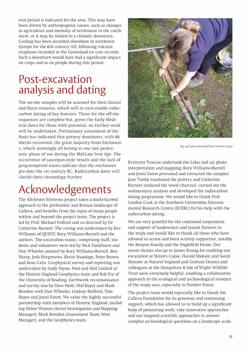
The Sedimentary Sequences Nine sedimentary sequences of 1-2m depth were taken using a powered corer along a 120m long transect downslope from Enclosure 1 to the floodplain of a tributary of the West End Brook in order to under-stand better the sedimentary setting of the site (Fig. 24). Description of the recovered cores show that the sequence to the west of the monuments is dominated by shallow colluvial deposits with occasional truncated old land surfaces formed in periods of relative stability over a loose gravel geology. This Silchester Gravel cap ended abruptly less than 25m from the western edge of the monument and was replaced by an outcrop of dessicated London Clay which continued downslope to the floodplain. Lenses of colluvium of varying thickness, deposited during erosional events upslope, overlay it until c.10m from the edge of the modern floodplain, where fine alluvial deposits, laid down by a larger former stream as overbank deposits in times of flood, replaced them. Borehole 1, on the floodplain itself, showed a 1.5m alluvial and river gravel sequence over London Clay.
Well-preserved waterlogged twigs within peat deposits gave the opportunity for radiocarbon dating the upper levels of the deposits. These proved to be of Early Medieval (8th-10th century AD) onwards and so analy-sis of the sequence cannot provide insights into the Late Prehistoric activity represented by the excavated enclosures. Oddly, similar, Early Medieval dates (6th-10th century AD) have been gained from even the base of alluvial sequences near our other Environs sites, including Pond Farm, Wood Farm and Brocas Lands. A change in hydrology causing scour then low energy riverine deposition during the Late Roman-Early Medi-
Fig. 23 Burnt material within enclosure ditch [6003]
13
eval period is indicated for the area. This may have been driven by anthropogenic causes, such as changes in agriculture and intensity of settlement in the catch-ment, or it may be related to a climatic downturn. Cooling has been recorded elsewhere in northwest Europe for the 6th century AD, following volcanic eruptions recorded in the Greenland ice core records. Such a downturn would have had a significant impact on crops and so on people during this period.
Post-excavation analysis and dating The on-site samples will be assessed for their faunal and floral remains, which will in turn enable radio-carbon dating of key features. Those for the off-site sequences are complete but, given the Early Medi-eval dates for those with potential, no further work will be undertaken. Preliminary assessment of the finds has indicated that pottery dominates, with 86 sherds recovered, the great majority from Enclosure 1, which seemingly all belong to one late prehis-toric phase of use during the Mid-Late Iron Age. The occurrence of saucepan-style vessels and the lack of grog-tempered wares indicate that the enclosures pre-date the 1st century BC. Radiocarbon dates will clarify their chronology further.
Acknowledgements The Silchester Environs project takes a multi-faceted approach to the prehistoric and Roman landscape of Calleva, and benefits from the input of many people within and beyond the project team. The project is led by Prof. Michael Fulford and co-directed by Dr Catherine Barnett. The coring was undertaken by Kev Williams of QUEST, Rory Williams-Burrell and the authors. The excavation teams, comprising staff, stu-dents and volunteers were led by Nick Pankhurst and Dan Wheeler assisted by Rory Williams-Burrell, Ben Sharp, Josh Hargreaves, Kevin Standage, Peter Brown and Rose Calis. Geophysical survey and reporting was undertaken by Andy Payne, Paul and Neil Linford of the Historic England Geophysics team and Rob Fry of the University of Reading. Earthwork reconnaissance and survey was by Dave Field, Olaf Bayer and Mark Bowden with Dan Wheeler, Lindsay Bedford, Tom Hayes and Jenni Eaton. We value the highly successful partnership with members of Historic England, includ-ing Helen Winton (Aerial Investigation and Mapping Manager), Mark Bowden (Assessment Team West Manager), and the Geophysics team.
Krystyna Truscoe undertook the Lidar and air photo interpretation and mapping; Rory Williams-Burrell and Jenni Eaton processed and extracted the samples; Jane Timby examined the pottery and Catherine Barnett analysed the wood charcoal, carried out the sedimentary analysis and developed the radiocarbon dating programme. We would like to thank Prof. Gordon Cook at the Southern Universities Environ-mental Research Centre (SUERC) for his help with the radiocarbon dating.
We are very grateful for the continued cooperation and support of landowners and tenant farmers in the study and would like to thank all those who have allowed us access and been actively supportive, notably the Benyon Family and the Englefield Estate. Our warm thanks also go to James Strang for enabling our excavation at Simm’s Copse. Harold Makant and Sarah Skinner at Natural England and Graham Dennis and colleagues at the Hampshire & Isle of Wight Wildlife Trust were extremely helpful, enabling a collaborative approach to the ecological and archaeological resource of the study area, especially in Pamber Forest.
The project team would especially like to thank the Calleva Foundation for its generous and continuing support, which has allowed us to build up a significant body of pioneering work, take innovative approaches and use targeted scientific approaches to answer complex archaeological questions on a landscape scale.
Fig. 24 Cores retrieved from Simm’s Copse

Designed & Illustrated by Daniel Wheeler
For more information about Archaeology at the University of Reading, please contact:
General Office [email protected] Tel +44 (0)118 378 8132www.reading.ac.uk/archaeology
reading.ac.uk/silchester reading.ac.uk/silchester/Excavations/Read our blog:blogs.reading.ac.uk/silchesterdigFollow us:Facebook/Silchestertwitter.com/silchexcavationyoutube.com/user/SHESvideosketchfab.com/sagesuav/collections/silchester-environs-project
Explore the town using our iPhone app! Download from iTunes or through the App Store on your iPhone. Just search for Silchester.