department of infrastructure, energy & resources · ghd | report for department of...
TRANSCRIPT
Department of Infrastructure, Energy & Resources
Launceston Traffic Study Summary Report
January 2014

GHD | Report for Department of Infrastructure, Energy & Resources - Launceston Traffic Study, 32/16648 | i
Table of contents 1. Introduction ............................................................................................................................... 2
1.1 Purpose of this Study ...................................................................................................... 2 1.2 Purpose of this report ...................................................................................................... 2 1.3 List of Terms and Abbreviations....................................................................................... 2
2. Transport Planning Context ....................................................................................................... 4 2.1 Transport Issues Paper ................................................................................................... 5
3. Option Identification and Assessment ........................................................................................ 6 3.1 Long-List Options ............................................................................................................ 6 3.2 Evaluation of Options ...................................................................................................... 8
4. Preferred Option...................................................................................................................... 11 4.1 Description .................................................................................................................... 11 4.2 Concept Design ............................................................................................................. 13 4.3 Desktop Investigations .................................................................................................. 15 4.4 Design Investigations .................................................................................................... 17 4.5 Risk ............................................................................................................................... 19 4.6 Cost Estimate ................................................................................................................ 20 4.7 Further Investigations .................................................................................................... 20
Table index Table 1 List of Terms and Abbreviations....................................................................................... 2
Table 2 Major Risk Items............................................................................................................ 19
Figure index Figure 1 Northern Region Daily Journey to Work Flows, 2006 ....................................................... 4
Figure 2 Bypass and Ring Road Options ....................................................................................... 7
Figure 3 Modelled Traffic Network ................................................................................................. 9
Figure 4 Preferred Option ............................................................................................................ 12

GHD | Report for Department of Infrastructure, Energy & Resources - Launceston Traffic Study, 32/16648 | 1
This report has been prepared by GHD for Department of Infrastructure, Energy & Resources and may only be used and relied on by Department of Infrastructure, Energy & Resources for the purpose agreed between GHD and the Department of Infrastructure, Energy & Resources as set out in section 1.2 of this report.
GHD otherwise disclaims responsibility to any person other than Department of Infrastructure, Energy & Resources arising in connection with this report. GHD also excludes implied warranties and conditions, to the extent legally permissible.
The services undertaken by GHD in connection with preparing this report were limited to those specifically detailed in the report and are subject to the scope limitations set out in the report.
The opinions, conclusions and any recommendations in this report are based on conditions encountered and information reviewed at the date of preparation of the report. GHD has no responsibility or obligation to update this report to account for events or changes occurring subsequent to the date that the report was prepared.
The opinions, conclusions and any recommendations in this report are based on assumptions made by GHD described in this report. GHD disclaims liability arising from any of the assumptions being incorrect.
GHD has prepared this report on the basis of information provided by Department of Infrastructure, Energy & Resources and others who provided information to GHD (including Government authorities), which GHD has not independently verified or checked beyond the agreed scope of work. GHD does not accept liability in connection with such unverified information, including errors and omissions in the report which were caused by errors or omissions in that information.
GHD has prepared the preliminary cost estimate set out in section 4.6 of this report (“Cost Estimate”) using information reasonably available to the GHD employee(s) who prepared this report; and based on assumptions and judgments made by GHD. The Cost Estimate has been prepared for the purpose of informing feasibility planning for this project and must not be used for any other purpose.
The Cost Estimate is a preliminary estimate only. Actual prices, costs and other variables may be different to those used to prepare the Cost Estimate and may change. Unless as otherwise specified in this report, no detailed quotation has been obtained for actions identified in this report. GHD does not represent, warrant or guarantee that the project can or will be undertaken at a cost which is the same or less than the Cost Estimate.
Where estimates of potential costs are provided with an indicated level of confidence, notwithstanding the conservatism of the level of confidence selected as the planning level, there remains a chance that the cost will be greater than the planning estimate, and any funding would not be adequate. The confidence level considered to be most appropriate for planning purposes will vary depending on the conservatism of the user and the nature of the project. The user should therefore select appropriate confidence levels to suit their particular risk profile.
2 | GHD | Report for Department of Infrastructure, Energy & Resources - Launceston Traffic Study, 32/16648
1. Introduction GHD was engaged by the Department of Infrastructure, Energy and Resources (DIER) to undertake a traffic study of Launceston, considering future road transport needs and identifying infrastructure improvement opportunities. As a key stakeholder, Launceston City Council (LCC) were also involved in identifying and evaluating options.
This Summary Report provides an overview of the project to date including the strategic transport planning context, a summary of the existing transport issues, the options identification and assessment process, and the key design features and cost estimate of the option identified as the preferred option for further development.
1.1 Purpose of this Study
The purpose of this study was to:
Identify areas of congestion in the Launceston road network with particular regard to conflict between different vehicle types;
Recognise traffic growth patterns with implications on the regional road network; and
Identify and assess potential infrastructure projects and proactively manage adverse effects.
1.2 Purpose of this report
The purpose of this report is to:
Provide a strategic context for the adoption of the preferred option; and
Consolidate into one report the features of the preferred option determined from the selection process undertaken by GHD in association with DIER and LCC.
1.3 List of Terms and Abbreviations
A brief description of the various terms and abbreviations commonly used throughout this report is provided in Table 1.
Table 1 List of Terms and Abbreviations
Term Description
CBD Central Business District
Congestion A general term for the density of traffic and the level of traffic delay associated with that density
DIER Department of Infrastructure, Energy and Resources
GHD GHD Pty Ltd
km Kilometres
km/h Kilometres per hour
LCC Launceston City Council
m Metres

GHD | Report for Department of Infrastructure, Energy & Resources - Launceston Traffic Study, 32/16648 | 3
Term Description
Mesoscopic A type of computerised traffic modelling primarily used to determine high level route choice assignment for inter-suburban trips
Microsimulation A type of computerised traffic modelling primarily used to determine individual vehicle movement characteristics and interactions within a network
P50 An estimate of costs where there is a 50% chance of the cost being less than the amount, and a 50% chance of the cost being exceeded.
P90 An estimate of costs where there is a 90% chance of the cost being less than the amount, and a 10% chance of the cost being exceeded.
Total Outturn Cost
The cost expressed in today’s dollars, adjusted for the effects of inflation
Travel time Time taken for a vehicle to navigate between two points
VHT Vehicle hours travelled. An indication of the total travel time of all vehicles across the network
VKT Vehicle kilometres travelled. An indication of the total travel distance of all vehicles across the network

4 | GHD | Report for Department of Infrastructure, Energy & Resources - Launceston Traffic Study, 32/16648
2. Transport Planning Context When planning for expansion or modification of the road network, it is important to consider the wider context that determines priorities and strategies at a regional level.
The Northern Integrated Transport Plan (NITP)1 provides a coordinated and strategic framework to recognise and address transport issues within the Northern Region over the next twenty years, with a focus on the highest priority strategies and actions which will benefit the region.
Freight volumes on the East Tamar Highway are projected to increase from 3.25 million tonnes in 2009, to 4.53 million tonnes in 2029 (2% per annum) (Source: NITP). This is significantly less than freight movement on the Bass Highway to and from the Burnie and Devonport ports.
Launceston is the major employment centre and the largest Journey to Work destination for the Northern Region (see Figure 1). A large number of trips are made from surrounding townships and population centres for employment, education, shopping and recreation.
Figure 1 Northern Region Daily Journey to Work Flows, 2006
Source: NITP, Figure 17: Map of Northern Region showing key flows of people into Launceston, 2006. ABS Census of Population and Housing 2006
There is the potential for the number of dwellings in the study area to increase by 1.3% per annum over the next 20 years. The fastest growing areas are in Legana, Waverley, St Leonards and Perth. A similar rate of growth was estimated for retail and office floor areas. Industrial land was forecast to grow at 2% per annum.
1 Draft V1.0, 17/6/2013, and Background Report February 2013
GHD | Report for Department of Infrastructure, Energy & Resources - Launceston Traffic Study, 32/16648 | 5
Based on these population and land use changes, the general level of passenger car traffic was predicted to increase by approximately 1% per annum to 2033. The largest traffic growth rates were found to be the residential growth areas of West Tamar/Legana and Waverley, with the major trip attractors being the Launceston CBD and other key retail activity centres such as Kings Meadows and Mowbray.
2.1 Transport Issues Paper
A Transport Issues Paper was prepared by Sinclair Knight Merz (SKM) in 2012. The purpose of this report was to analyse the performance of the existing transport network in and around Launceston. The analysis aimed to quantify traffic and transport issues as a basis for informed decision making.
The project focussed on technical assessments of existing traffic conditions, and made reference to traffic volume data, travel time data, crash history, various measures of congestion, and freight demand.
The report identified 4 key focus areas as follows:
North Esk River crossing
East-west connectivity
Wellington/Bathurst Street Couplet
Hobart Road
The operation of the north-south one-way couplet of Bathurst Street and Wellington Street, and the North Esk River crossing at Charles Street, were seen as key issues that affected both north-south traffic flow and formed a barrier to east-west movements through the CBD.
Hobart Road was also identified as a focus of concern, and a separate investigation into potential traffic management options to address the impacts of commercial and retail development in this corridor has been undertaken in parallel to this present study.
This project aims to alleviate issues associated with the key focus areas identified in the SKM Report.
6 | GHD | Report for Department of Infrastructure, Energy & Resources - Launceston Traffic Study, 32/16648
3. Option Identification and Assessment It is clear that in the future, pressure will grow on existing infrastructure in the corridor between the Midland Highway / Bass Highway and the East Tamar Highway. There are a range of responses available to planning for future transport needs, including:
Works on Corridor – Improving the capacity of existing infrastructure through treatments such as intersection upgrades, removal of obstructions and adjustments to on-street parking.
Alternative Transport Modes – Achieving a mode shift to public transport, cycling and other modes, or introducing car-pooling schemes and incentives for higher occupancy vehicles.
New Routes – Providing new routes to increase capacity and improve connectivity between destinations. Note that where new routes are opened, and additional capacity is created, some of this would be consumed by latent and induced demand.
While parking in the CBD remains relatively cheap, and travel time by car is faster than travelling by bus, there is little incentive for people to change their travel behaviour. Bus priority and reliability measures could be introduced on some routes, but without a significant disincentive imposed on car users, many will be reluctant to change. The options identification process therefore focussed on upgrading existing routes and providing new routes to improve capacity in the network.
3.1 Long-List Options
A Long-List of options was identified by a workshop involving representatives from DIER, Launceston City Council and GHD. The workshop identified 4 high-level options to be considered.
Eastern Bypass
Inner Ring Road
Upgrade Charles Street bridge
Reduce conflicts on the existing Couplet
As investigations into those options proceeded, a total of 14 sub-options / variations were identified for further investigation.
3.1.1 Bypass / Ring Road Options
The proposed Eastern Bypass options provide a connection between Quarantine Road or Hoblers Bridge Road in the south, and the Mowbray Link (McKenzie Street) in the north. The alignment generally remains to the east of the North Esk River.
Inner Ring Road options connect Henry Street with Forster Street, crossing the North Esk River near the Launceston Showgrounds. In some options an extension of Forster Street to the West Tamar Highway, with a new bridge over the Tamar River, was also considered.
Options that include elements of both the Eastern Bypass and the Inner Ring Road would use the existing alignment of Henry Street to connect between the two.
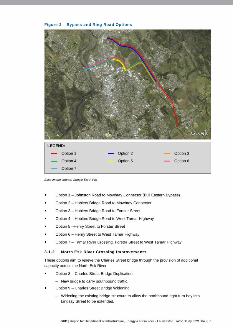
The various Bypass and Inner Ring Road options are shown in Figure 2 and described below.
GHD | Report for Department of Infrastructure, Energy & Resources - Launceston Traffic Study, 32/16648 | 7
Figure 2 Bypass and Ring Road Options
Base image source: Google Earth Pro
Option 1 – Johnston Road to Mowbray Connector (Full Eastern Bypass)
Option 2 – Hoblers Bridge Road to Mowbray Connector
Option 3 – Hoblers Bridge Road to Forster Street
Option 4 – Hoblers Bridge Road to West Tamar Highway
Option 5 –Henry Street to Forster Street
Option 6 – Henry Street to West Tamar Highway
Option 7 – Tamar River Crossing, Forster Street to West Tamar Highway
3.1.2 North Esk River Crossing Improvements
These options aim to relieve the Charles Street bridge through the provision of additional capacity across the North Esk River.
Option 8 – Charles Street Bridge Duplication
– New bridge to carry southbound traffic.
Option 9 – Charles Street Bridge Widening
– Widening the existing bridge structure to allow the northbound right turn bay into Lindsay Street to be extended.
LEGEND:
Option 1 Option 2 Option 3
Option 4 Option 5 Option 6
Option 7
8 | GHD | Report for Department of Infrastructure, Energy & Resources - Launceston Traffic Study, 32/16648
Option 10 – New St John Street Bridge
– Construction of a new bridge connecting between St John Street and Holbrook Street.
Option 11 – Ban Right Turn into Lindsay Street
– Right turn ban from Charles Street northbound into Lindsay Street.
3.1.3 Couplet Improvements
Options for improving the general flow of traffic along Bathurst and Wellington Streets were also assessed.
Option 12 – Canning Street Left In / Left Out at Bathurst Street
– Remove the traffic signals and allow left-in/left-out movements only.
Option 13 – Canning Street Left In / Left Out at Wellington Street
– Remove the traffic signals and allow left-in/left-out movements only.
Option 14 – Canning Street Left In / Left Out at Bathurst and Wellington Streets
– Implementation of both Option 12 and Option 13 to prevent through movements on Canning Street at each of these locations.
3.2 Evaluation of Options
3.2.1 Traffic Modelling
Traffic modelling was undertaken to test the traffic implications of the various options, and to inform a preliminary indication of costs and road user benefits.
A range of data was collected to inform the development of the traffic models for this project.
Origin-destination (numberplate) surveys (February 2013)
Intersection Turn Movement Counts (February 2013)
SCATS traffic signal data (February 2013)
Vehicle Classification Surveys (2007-2012, provided by Launceston City Council)
Population and Land Use Forecasts
The traffic models were used to estimate changes in Vehicle Kilometres Travelled (VKT, total distance travelled by all vehicles in the model) and Vehicle Hours Travelled (VHT, a measure of overall travel time for all vehicles in the model). The main financial benefits of road projects are generally due to savings in travel time, and savings in vehicle operating costs (which generally decrease if travel distance decreases).
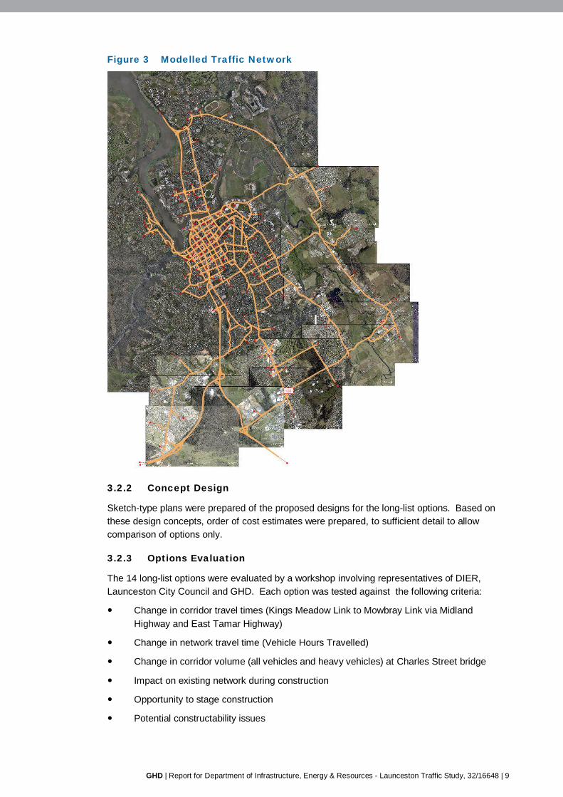
GHD | Report for Department of Infrastructure, Energy & Resources - Launceston Traffic Study, 32/16648 | 9
Figure 3 Modelled Traffic Network
3.2.2 Concept Design
Sketch-type plans were prepared of the proposed designs for the long-list options. Based on these design concepts, order of cost estimates were prepared, to sufficient detail to allow comparison of options only.
3.2.3 Options Evaluation
The 14 long-list options were evaluated by a workshop involving representatives of DIER, Launceston City Council and GHD. Each option was tested against the following criteria:
Change in corridor travel times (Kings Meadow Link to Mowbray Link via Midland Highway and East Tamar Highway)
Change in network travel time (Vehicle Hours Travelled)
Change in corridor volume (all vehicles and heavy vehicles) at Charles Street bridge
Impact on existing network during construction
Opportunity to stage construction
Potential constructability issues

10 | GHD | Report for Department of Infrastructure, Energy & Resources - Launceston Traffic Study, 32/16648
Construction Cost
Potential for environment and heritage issues
Impact on accessibility
Synergies with land use outcomes
Land acquisition, social and commercial impacts
Indicative benefit cost ratio
Bypass Options (Options 1-7)
The Full Eastern Bypass Options (1 and 2) both showed a reduced travel time (VHT) across the road network, however this was offset by an increase in total distance travelled (VKT) which increases operating costs. This resulted in a negative benefit being calculated for these options, that is, the project increased overall road user costs compared to the base case.
The modelling showed that travel times via the bypass are typically higher than via the Bathurst Street/Wellington Street couplet, and therefore, without additional incentives, the bypass is unlikely to be highly utilised by through traffic, including freight.
Options involving a new bridge over the Tamar River (Options 4, 6 and 7) resulted in substantially reduced traffic volumes on the Charles Street Bridge, including heavy vehicles. The new bridge attracted trips between the West Tamar and East Tamar Highways, as well as redirected vehicles travelling from the West Tamar Highway to the northern and eastern edges of the Launceston CBD.
A benefit which was common to almost all bypass options considered was the opportunity for project staging. Options were typically sub-options or combination options, thereby allowing for construction in parts with benefits associated with partial and full construction of the option.
Some common issues for these options which cross the North Esk floodplain included flood levels, endangered flora and fauna, and aboriginal and built heritage. Additional investigation proportionate to the scale of the option under consideration would be required for further stages of the project.
Charles Street Bridge Capacity Improvements (Option 8-11)
These options all resulted in significant improvements to the operation of the Charles and Tamar Street Bridges and the Charles Street/Lindsay Street/Goderich Street intersection.
However the impacts were highly local to the immediate surrounds and in the context of the overall traffic network, fell short of larger scale options.
The lower cost options, such as Lindsay Street Right Turn Ban, could be implemented as part of another option or alternatively, funded separately aside from this project.
Couplet Modifications (Option 12-14)
Three options were investigated which involved removing the traffic signals on Canning Street at Bathurst Street (Option 12), Wellington Street (Option 13), and both Bathurst and Wellington Street (Option 14). It would reduce Canning Street to left-in/left-out (or right-in/right-out) only at the couplet, thereby preventing through movements.
The traffic modelling shows travel time savings of up to 1 minute for vehicles travelling in both directions as a result of each of the options. However, there would be reduced accessibility to Canning Street.
GHD | Report for Department of Infrastructure, Energy & Resources - Launceston Traffic Study, 32/16648 | 11
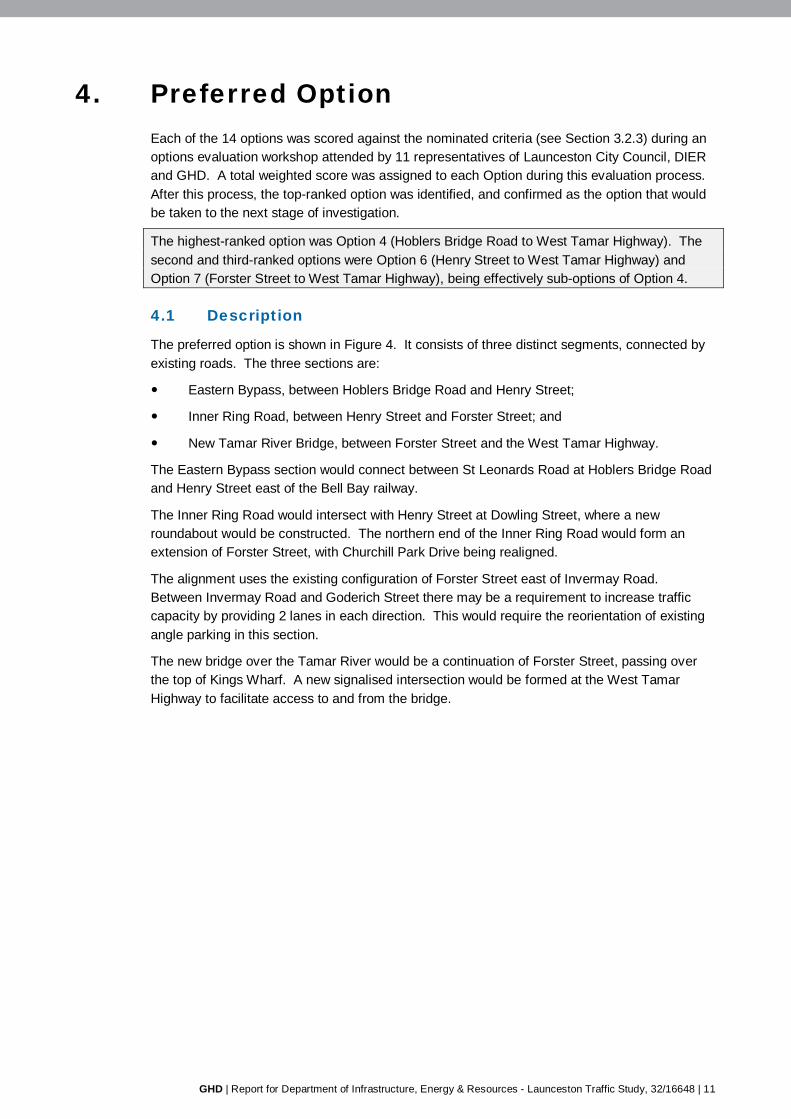
4. Preferred Option Each of the 14 options was scored against the nominated criteria (see Section 3.2.3) during an options evaluation workshop attended by 11 representatives of Launceston City Council, DIER and GHD. A total weighted score was assigned to each Option during this evaluation process. After this process, the top-ranked option was identified, and confirmed as the option that would be taken to the next stage of investigation.
The highest-ranked option was Option 4 (Hoblers Bridge Road to West Tamar Highway). The second and third-ranked options were Option 6 (Henry Street to West Tamar Highway) and Option 7 (Forster Street to West Tamar Highway), being effectively sub-options of Option 4.
4.1 Description
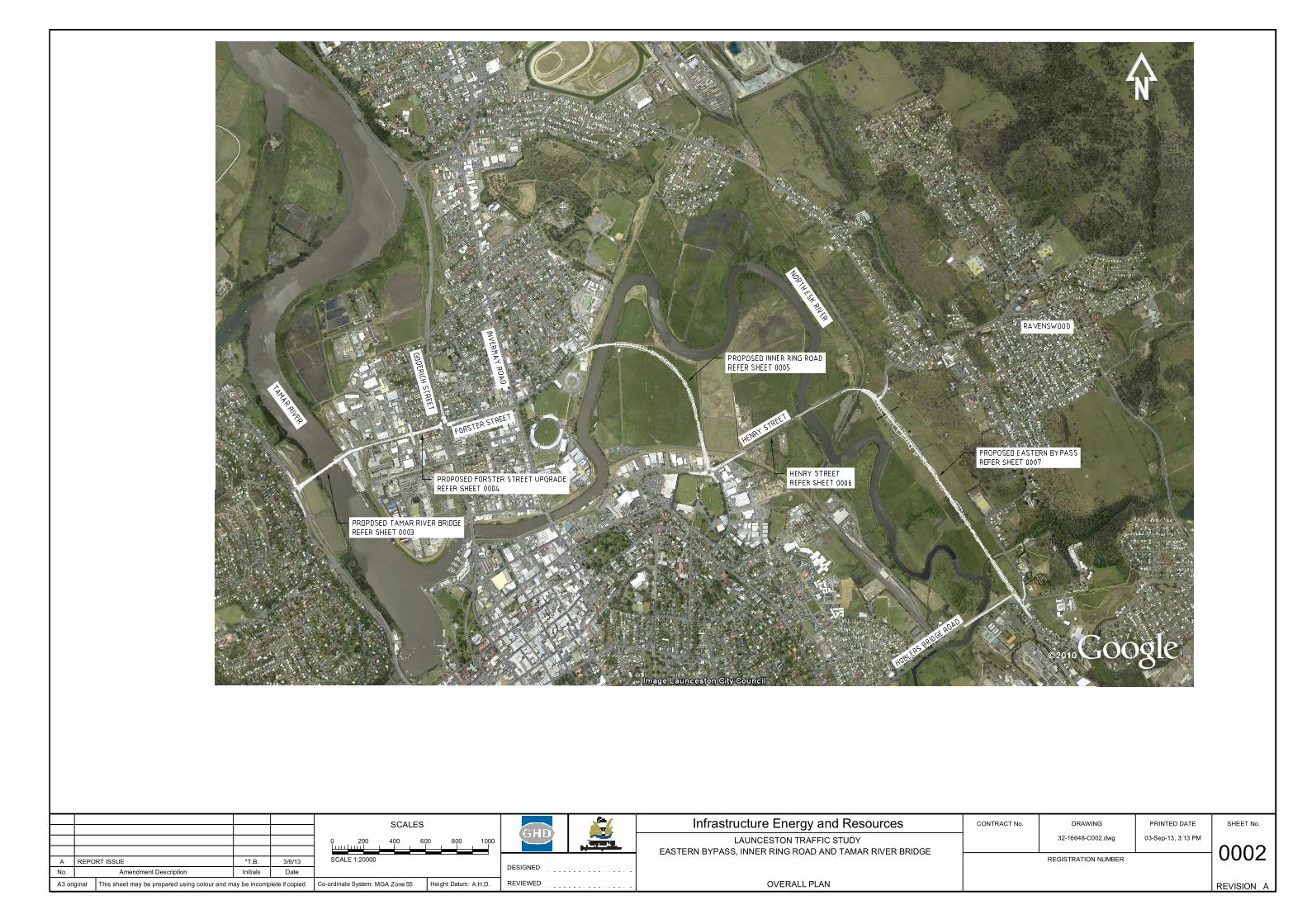
The preferred option is shown in Figure 4. It consists of three distinct segments, connected by existing roads. The three sections are:
Eastern Bypass, between Hoblers Bridge Road and Henry Street;
Inner Ring Road, between Henry Street and Forster Street; and
New Tamar River Bridge, between Forster Street and the West Tamar Highway.
The Eastern Bypass section would connect between St Leonards Road at Hoblers Bridge Road and Henry Street east of the Bell Bay railway.
The Inner Ring Road would intersect with Henry Street at Dowling Street, where a new roundabout would be constructed. The northern end of the Inner Ring Road would form an extension of Forster Street, with Churchill Park Drive being realigned.
The alignment uses the existing configuration of Forster Street east of Invermay Road. Between Invermay Road and Goderich Street there may be a requirement to increase traffic capacity by providing 2 lanes in each direction. This would require the reorientation of existing angle parking in this section.
The new bridge over the Tamar River would be a continuation of Forster Street, passing over the top of Kings Wharf. A new signalised intersection would be formed at the West Tamar Highway to facilitate access to and from the bridge.
PRINTED DATECONTRACT No.SCALES
This sheet may be prepared using colour and may be incomplete if copied
Infrastructure Energy and Resources
DateInitialsAmendment DescriptionNo.
SHEET No.DRAWING
REGISTRATION NUMBER
REVISION
03-Sep-13, 3:13 PM32-16648-C002.dwg
A3 original Co-ordinate System: Height Datum:
DESIGNED
REVIEWED
LAUNCESTON TRAFFIC STUDYEASTERN BYPASS, INNER RING ROAD AND TAMAR RIVER BRIDGE
OVERALL PLAN
0002AMGA Zone 55 A.H.D.
A REPORT ISSUE *T.B. 3/9/13
0 200 400 600 800 1000
SCALE 1:20000
GHD | Report for Department of Infrastructure, Energy & Resources - Launceston Traffic Study, 32/16648 | 13
4.1.1 Intent and Function
The preferred option provides an alternative route around the northern side of the Launceston CBD and has the following intended effects on traffic movement:
Reduction in general traffic on several key roads in Launceston including Elphin Road, Charles Street and Tamar Street bridges;
Improved travel times, particularly for movements between the West Tamar Highway and the East Tamar Highway;
Reduction of east-west movements through the Launceston CBD on Brisbane Street, York Street and Paterson Street; and
Resulting reduction in side friction on the Bathurst Street/Wellington Street couplet.
The option addresses the main issues identified in the Transport Issues Paper (SKM) as follows:
North Esk River crossing
The provision of a new Tamar River crossing removes a significant volume of traffic from the existing Charles and Tamar Street Bridges, resulting in greatly improved performance of these roads and, in particular, the heavily used intersection of Goderich Street and Lindsay Street.
East-west connectivity
The preferred option directly connects the West Tamar Highway to East Launceston via Forster Street. This alternative route relieves the existing east-west corridors through the CBD and provides improved travel times.
Wellington/Bathurst Street Couplet
The main improvements to the Wellington Street/Bathurst Street Couplet are indirect. They arise primarily as a result of reduced side friction on east-west corridors, allowing for improved service to be given to the north-south through movements.
4.2 Concept Design
4.2.1 Design Speed
Different design speeds have been adopted for the various sections of the preferred option, based on the speeds of connecting roads and the characteristics of the proposed new road.
The Eastern Bypass and Inner Ring Road sections have been designed for an 80km/hr design speed. This reflects the uninterrupted flow conditions and minimal friction from adjacent land uses that would be a feature of these sections. However traffic modelling has been based on a 60km/hr speed limit being applied to these roads.
The new Tamar River bridge has a 60km/hr design speed. Given the relatively short distance between the West Tamar Highway and Forster Street, and the steep grades of the bridge approaches, it is not feasible to design for higher speeds.
14 | GHD | Report for Department of Infrastructure, Energy & Resources - Launceston Traffic Study, 32/16648
4.2.2 Horizontal and Vertical Alignment
The horizontal alignment of the new Inner Ring Road and Eastern Bypass road sections have been designed to cater for a 80km/hr speed (although a lower speed limit may be applied). A 60km/hr design speed has been adopted for the Forster Street section and new Tamar River bridge.
The vertical alignment of the proposed new road is most critical across the North Esk River floodplain, where the road is susceptible to regular flooding. Clearance over the Tamar River is also a key issue.
The existing level of Henry Street matches the 1 in 10 year flood level, although the Henry Street bridge over the North Esk River is at the 1 in 100 year level. The proposed new bridge over the North Esk River would be at the 1 in 200 year level to minimise impacts on the adjacent flood levee. The implications of ground conditions and across the floodplain on the feasibility of providing these embankment heights require further investigation. Lightweight fill materials and extensive cross drainage are likely to be required.
It is assumed at this stage that the new bridge over the Tamar River would require an 18m clearance to the high water mark to allow for yachts and tall water craft to pass below the structure to access Kings Wharf and the Seaport marina.
4.2.3 Bridges
The proposed option includes three new bridges, crossing the Tamar River, North Esk River and Distillery Creek.
Tamar River Crossing
The Tamar River is approximately 200m wide in the vicinity of the proposed bridge, with an additional 100m width over the silt ponds. Taking into account the need to bridge over the Kings Wharf area, the proposed bridge will have a total span of approximately 460m.
It is expected that construction of piers in the river to support the bridge may not be acceptable, due to the potential for debris to gather around the piers and obstruct the outflow of floodwaters. For this reason, it is assumed that the new bridge would be constructed as either a suspension bridge or a cable stayed bridge. History and experience have shown that the latter is the more appropriate option for a bridge of this length as it is more cost effective to build.
The new bridge would require an 18m clearance to the high water mark to allow for yachts and tall water craft to pass below the structure to access Kings Wharf and the Seaport marina.
Options for a bridge of lesser clearance have been discounted due to the anticipated need to provide some form of bridge opening or lift span to cater for yacht masts and tall water craft. Provision of this type of structure would have ongoing maintenance and operational expenses, as well as requiring a different bridge type.
North Esk River Crossing
This bridge will cross the North Esk River near Churchill Park Drive. The river at this location is approximately 100 m wide and proposed bridge is envisaged to be around 120 m long.
It is proposed to provide a similar clearance over the North Esk River as that which is currently provided at the existing Charles Street and Victoria Bridges.
GHD | Report for Department of Infrastructure, Energy & Resources - Launceston Traffic Study, 32/16648 | 15
4.2.4 Rail
The proposed route crosses a railway in three locations. The line to Bell Bay passes over Henry Street immediately west of the proposed connection to the Eastern Bypass. It is proposed to use the existing Henry Street road infrastructure to minimise any impacts on the rail corridor in this location.
A branch off the Bell Bay line crosses Henry Street to the east of Dowling Street at a level crossing. The branch line and the level crossing are no longer in active use.
The Inner Ring Road would cross the same branch line north of Boland Street. Although the rail line is currently not used it is possible that TasRail will require the infrastructure to remain in place. Therefore a new rail level crossing has been assumed at this location. However, there is potential for TasRail to require a grade-separated crossing at this location, due to a preference to avoid construction of new level crossings. Consultation with TasRail is required to confirm their expectations.
4.2.5 Flood Management
Flood Levels
It will be a requirement that the proposed works will not compromise the existing flood levees around Launceston, or raise the 1 in 200 year flood level. Flood modelling is required to determine any impacts as a result of the project.
Existing Levees
A series of levees has been constructed in the past to protect low-lying areas of Launceston during flood events. Where roads pass through, rather than over, one of the levees a sliding gate arrangement can be provided. These gates can be shut during flood events to limit intrusion of floodwaters.
4.2.6 Staging Opportunities
As the proposed route comprises three new sections of infrastructure separated by existing sections of road staging of the works could be easily accommodated.
As the forecast traffic volumes on the bridge over the Tamar River are higher than the other new sections, consideration could be given to constructing the bridge as the first stage of the works.
The Inner Ring Road would be the logical next stage, based on both its natural connectivity to Forster Street, and also the forecast traffic volumes.
4.3 Desktop Investigations
4.3.1 Land Use Planning
Where the options involve new or expanded road corridors, an application for a planning permit would be required.
Use or development associated with a road is classified as ‘Utilities’ under the Interim Planning Scheme. Utilities is categorised as either ‘permitted’ or ‘discretionary’ depending on the Zone defined by the Planning Scheme.
The key statutory planning issues for each section of the proposed route are summarised below.
16 | GHD | Report for Department of Infrastructure, Energy & Resources - Launceston Traffic Study, 32/16648
Eastern Bypass, Hoblers Bridge to Henry Street
Partly corresponds with the Eastern Bypass previously identified on the maps to the Launceston Planning Scheme 1996.
Potential landslip issues for a small area to the north of Hoblers Bridge Road.
Visual impacts from surrounding areas including public land.
Impact on surrounding residential and other sensitive uses (e.g. noise).
Inner Ring Road, Henry Street to Forster Street
The corridor follows current Henry Street road alignment for ~1 km, including the existing crossing over the North Esk River (may avoid the need for a Reserve Area Assessment).
At the Dowling Street / Henry Street junction may impact on Commercial zoned land to the north, within which the road works would be prohibited (rezoning may be required).
Potential conversion of agricultural land issues.
Visual impacts from surrounding areas including public land.
Potential property impacts along Forster Street associated with any increase usage and widening (e.g. noise). There are 2 heritage listed properties along this section of Forster Street.
Dowling Street already subject to heavy vehicle usage however any increased usage has the potential to be a concern for residents.
Reserve Area Assessment required for North Esk River crossing.
Tamar River Crossing, Forster Street to West Tamar Highway
Impact on recreational values adjacent to the silt ponds.
Impact on surrounding uses (e.g. noise) particularly residential properties adjacent to West Tamar Highway.
Visual impacts from surrounding areas including surrounding public land.
Reserve Area Assessment required for Tamar River crossing.
Threatened vegetation community (Melaleuca ericifolia swamp forest) under Nature Conservation Act 2002 recorded within proposed road corridor.
4.3.2 European Heritage
Searches were undertaken on various heritage registers to gain an understanding of potential European heritage issues that may be associated with the preferred option. While it is not anticipated that the proposed route will impact directly on any heritage sites, the nature of this desktop investigation is such that it is possible that further primary and secondary research may reveal additional heritage values with relevance to the area. Further investigations are required.
4.3.3 Aboriginal Heritage
GHD sought advice from Aboriginal Heritage Tasmania (AHT) to determine assessment expectations for the project. AHT completed a search of the Tasmanian Aboriginal Site Index (TASI) for the subject site and surrounds and two sites are recorded in close proximity to the proposed route.
Previous work in the area suggests that there is a high probability of surface and potential sub-surface archaeology. Further investigations are required.
GHD | Report for Department of Infrastructure, Energy & Resources - Launceston Traffic Study, 32/16648 | 17
4.3.4 Flora and Fauna
Flora and fauna data were accessed from the Natural Values Atlas (NVA) and Protected Matters Search Tool (PMST) databases in May 2013, and used to provide initial environmental data for the proposed route.
A total of eight Nationally listed flora species and 24 State listed flora species have potential to be present in the study area. This high level desktop study is the first step in identifying flora and fauna values that may present potential risks to the proposed construction works. In order to determine the likelihood of state or federal permits being required for the construction work, further assessment work is required. The following recommendations are made:
Effort should be made to avoid or minimise impacts on the threatened community, Melaleuca ericifolia swamp scrub on the west bank of the Tamar River; and
Conduct an on-ground flora, native vegetation and fauna habitat survey to determine the presence and likelihood of significant species and communities occurring within the proposed alignment.
Depending on the outcome of the on ground flora, native vegetation and fauna habitat survey, species specific targeted surveys may be required. This may include the requirement to:
Conduct an aquatic survey for the nationally listed green and gold frog and striped marsh frog; and
Conduct a survey of eastern dwarf galaxias.
4.4 Design Investigations
4.4.1 Flood Level
The Launceston Flood Authority (LFA) is responsible for the construction and maintenance of flood levees in the Launceston area. The LFA was consulted to gain an understanding of the potential issues that will need to be addressed in the development of the proposed works. They have advised that any impact on Launceston’s current 1 in 200 year flood level or area would result in the LFA not agreeing to the proposed development. This would most likely result in any planning application not being granted by the Launceston City Council.
The LFA has advised that in the 1 in 200 year flood event, outflow down the Tamar River is the critical flow, while the North Esk River caters mainly for backflow. This has a number of potentially significant implications including:
Any obstructions in the Tamar River, including pylons and any causeway across the silt ponds could result in restrictions within the river channel causing the level of the 1 in 200 year flood to increase;
Construction of a roadway on embankment across the North Esk floodplain could also impact on flood levels, and a high level of permeability will be required. This may mean that this section of road is required to be built on an elevated structure, or with numerous culvert structures to allow for cross-drainage.
Modelling of the proposed infrastructure scheme will be required to determine if there would be any impact upon the 1 in 200 flood level. This modelling has not been undertaken at this stage.
The proposed roadway across the North Esk flood plain has been designed for the 1 in 10 year flood level. Launceston Council has indicated a willingness to accept semi-regular flooding of this route, particularly given that much of the existing road network in the area (e.g. Henry Street and Hoblers Bridge Road) is already below that level.
18 | GHD | Report for Department of Infrastructure, Energy & Resources - Launceston Traffic Study, 32/16648
4.4.2 Geotechnical
The proposed alignment for the preferred route traverses estuarine deposits to the edge of the North Esk and Tamar Rivers.
The estuarine deposits in the Launceston area are known for their soft and highly compressible characteristics. Construction over these areas may result in settlement of the new road if embankment heights are significant.
It may be feasible to use lightweight materials for road subgrade formation, which will reduce the amount of settlement that would occur. However further investigation is required to determine the depths and properties of the estuarine deposits, and determine the most appropriate construction methodology.
GHD | Report for Department of Infrastructure, Energy & Resources - Launceston Traffic Study, 32/16648 | 19
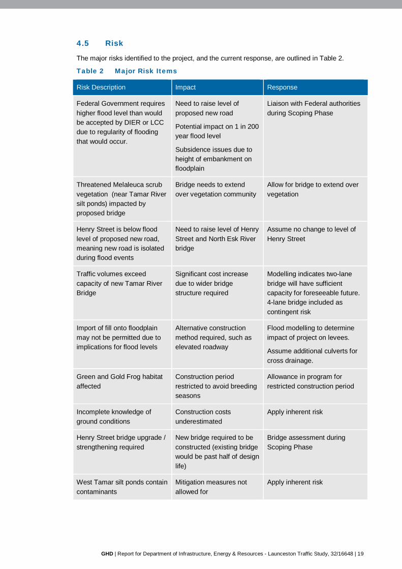
4.5 Risk
The major risks identified to the project, and the current response, are outlined in Table 2.
Table 2 Major Risk Items
Risk Description Impact Response
Federal Government requires higher flood level than would be accepted by DIER or LCC due to regularity of flooding that would occur.
Need to raise level of proposed new road
Potential impact on 1 in 200 year flood level
Subsidence issues due to height of embankment on floodplain
Liaison with Federal authorities during Scoping Phase
Threatened Melaleuca scrub vegetation (near Tamar River silt ponds) impacted by proposed bridge
Bridge needs to extend over vegetation community
Allow for bridge to extend over vegetation
Henry Street is below flood level of proposed new road, meaning new road is isolated during flood events
Need to raise level of Henry Street and North Esk River bridge
Assume no change to level of Henry Street
Traffic volumes exceed capacity of new Tamar River Bridge
Significant cost increase due to wider bridge structure required
Modelling indicates two-lane bridge will have sufficient capacity for foreseeable future. 4-lane bridge included as contingent risk
Import of fill onto floodplain may not be permitted due to implications for flood levels
Alternative construction method required, such as elevated roadway
Flood modelling to determine impact of project on levees.
Assume additional culverts for cross drainage.
Green and Gold Frog habitat affected
Construction period restricted to avoid breeding seasons
Allowance in program for restricted construction period
Incomplete knowledge of ground conditions
Construction costs underestimated
Apply inherent risk
Henry Street bridge upgrade / strengthening required
New bridge required to be constructed (existing bridge would be past half of design life)
Bridge assessment during Scoping Phase
West Tamar silt ponds contain contaminants
Mitigation measures not allowed for
Apply inherent risk
20 | GHD | Report for Department of Infrastructure, Energy & Resources - Launceston Traffic Study, 32/16648
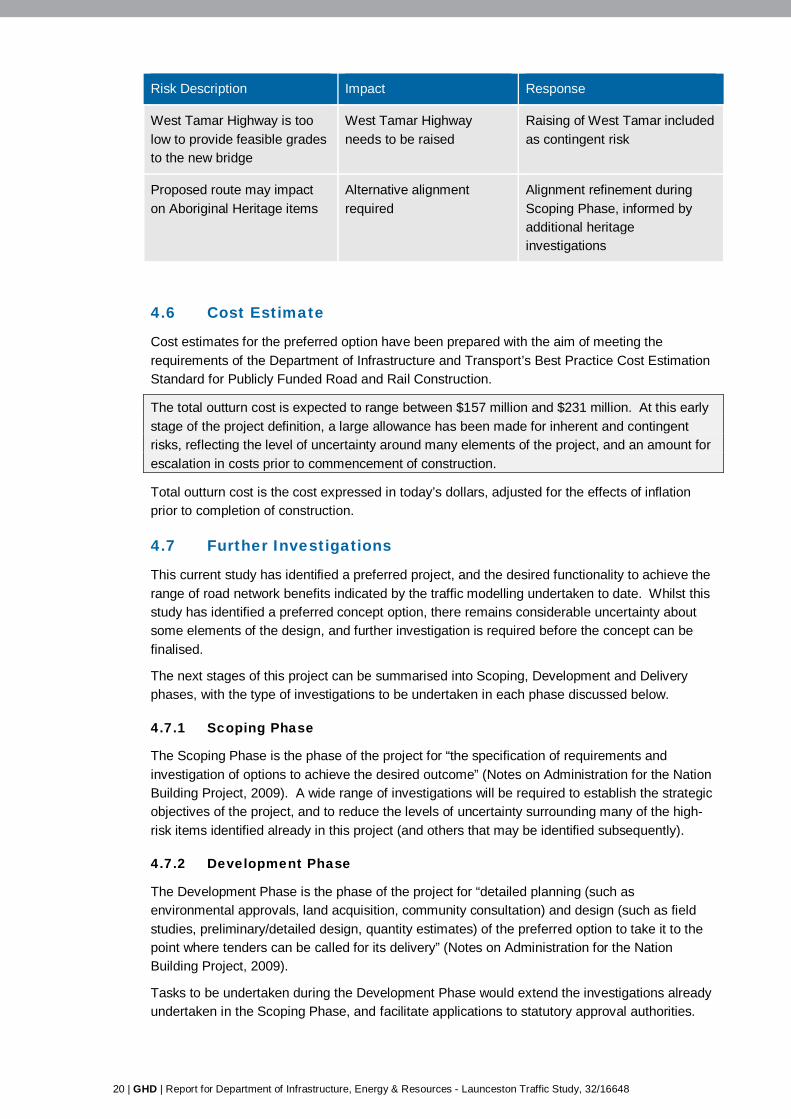
Risk Description Impact Response
West Tamar Highway is too low to provide feasible grades to the new bridge
West Tamar Highway needs to be raised
Raising of West Tamar included as contingent risk
Proposed route may impact on Aboriginal Heritage items
Alternative alignment required
Alignment refinement during Scoping Phase, informed by additional heritage investigations
4.6 Cost Estimate
Cost estimates for the preferred option have been prepared with the aim of meeting the requirements of the Department of Infrastructure and Transport’s Best Practice Cost Estimation Standard for Publicly Funded Road and Rail Construction.
The total outturn cost is expected to range between $157 million and $231 million. At this early stage of the project definition, a large allowance has been made for inherent and contingent risks, reflecting the level of uncertainty around many elements of the project, and an amount for escalation in costs prior to commencement of construction.
Total outturn cost is the cost expressed in today’s dollars, adjusted for the effects of inflation prior to completion of construction.
4.7 Further Investigations
This current study has identified a preferred project, and the desired functionality to achieve the range of road network benefits indicated by the traffic modelling undertaken to date. Whilst this study has identified a preferred concept option, there remains considerable uncertainty about some elements of the design, and further investigation is required before the concept can be finalised.
The next stages of this project can be summarised into Scoping, Development and Delivery phases, with the type of investigations to be undertaken in each phase discussed below.
4.7.1 Scoping Phase
The Scoping Phase is the phase of the project for “the specification of requirements and investigation of options to achieve the desired outcome” (Notes on Administration for the Nation Building Project, 2009). A wide range of investigations will be required to establish the strategic objectives of the project, and to reduce the levels of uncertainty surrounding many of the high-risk items identified already in this project (and others that may be identified subsequently).
4.7.2 Development Phase
The Development Phase is the phase of the project for “detailed planning (such as environmental approvals, land acquisition, community consultation) and design (such as field studies, preliminary/detailed design, quantity estimates) of the preferred option to take it to the point where tenders can be called for its delivery” (Notes on Administration for the Nation Building Project, 2009).
Tasks to be undertaken during the Development Phase would extend the investigations already undertaken in the Scoping Phase, and facilitate applications to statutory approval authorities.

www.ghd.com