department of statistics malaysia · malaysian centre for geospatial data infrastructure (macgdi)...
TRANSCRIPT
1
Department of Statistics Malaysia

22
1
2
3
4
5
Introduction
Geographic Information Systems (GIS)
Geospatial activities for 2020
Modernisation
Way Forward

3
44
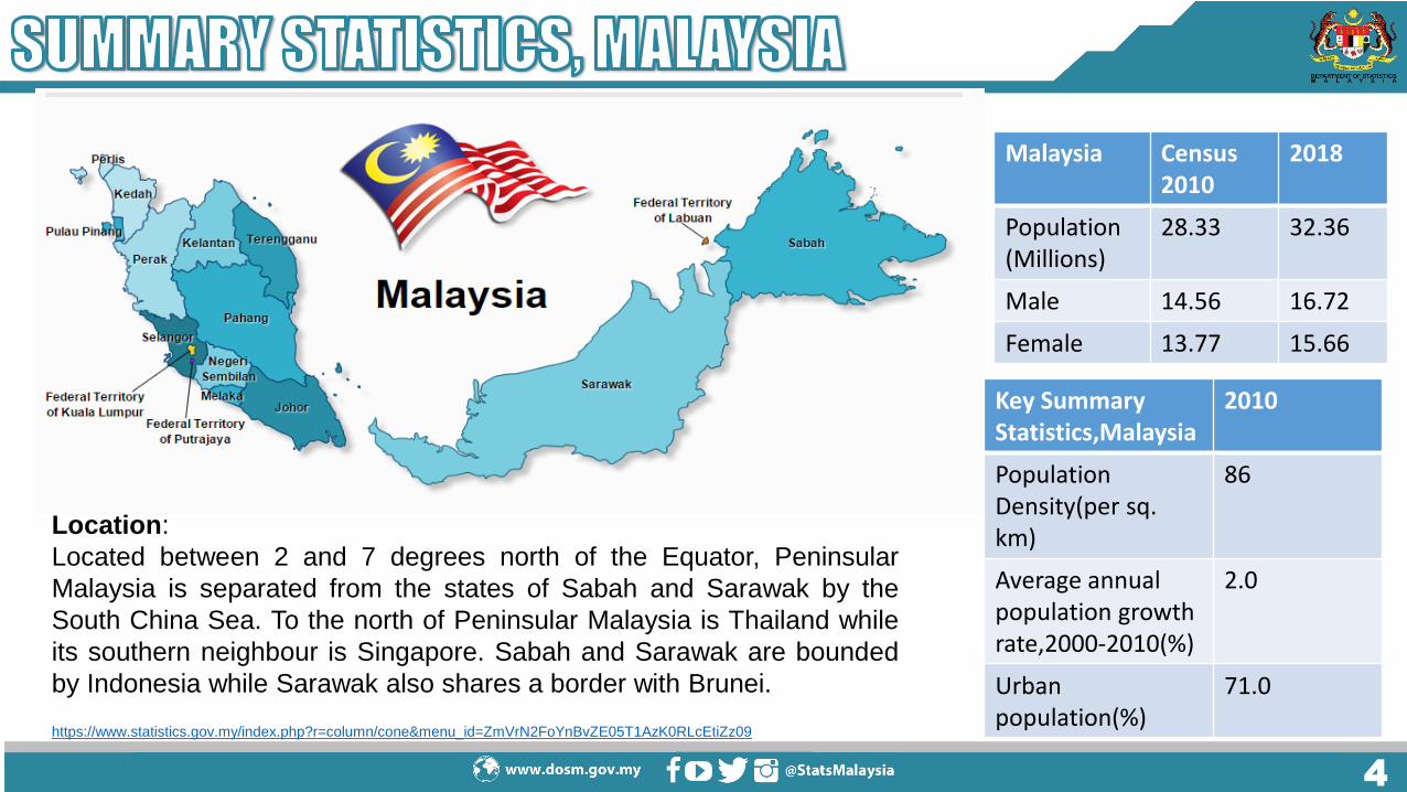
Location:
Located between 2 and 7 degrees north of the Equator, Peninsular
Malaysia is separated from the states of Sabah and Sarawak by the
South China Sea. To the north of Peninsular Malaysia is Thailand while
its southern neighbour is Singapore. Sabah and Sarawak are bounded
by Indonesia while Sarawak also shares a border with Brunei.
https://www.statistics.gov.my/index.php?r=column/cone&menu_id=ZmVrN2FoYnBvZE05T1AzK0RLcEtiZz09
Malaysia Census2010
2018
Population(Millions)
28.33 32.36
Male 14.56 16.72
Female 13.77 15.66
Key Summary Statistics,Malaysia
2010
Population Density(per sq. km)
86
Average annual population growthrate,2000-2010(%)
2.0
Urban population(%)
71.0
5

66
Established in 1949 under the Statistics
Ordinance 1949
A premier government agency under the
Ministry of Economic Affairs entrusted with
the responsibility to collect, interpret and
disseminate latest and real time statistics in
the monitoring of national economic
performance and social development.
VISION
To Become A Leading Statistical
Organisation Internationally by 2020
MISSION
Producer of National Statistics of Integrity
and Reliability 14 States DOSM 28 Operational Centres

77
Under the Statistics Act1965 (Revised –1989), the functions of DOSM [Section 2] are:
To collect and interpret statistics for the purpose of formulation or implementation of government policies….
Under Census Act 1960:
The Yang di-Pertuan Agong may, by notification in the Gazette, from time to time direct that a census to be taken throughout Malaysia of the Population, Agriculture, Trade, Labor, Industry, Commerce….
LAWS OF MALAYSIA
Act 415
STATISTICS ACT1965
(REVISED-1989)
LAWS OF MALAYSIA
REPRINT
Act 16
CENSUS ACT1960Incorporating all amendments up to 1 January 2006
Statistics Act 1965
(Revised-1989) Census Act 1960
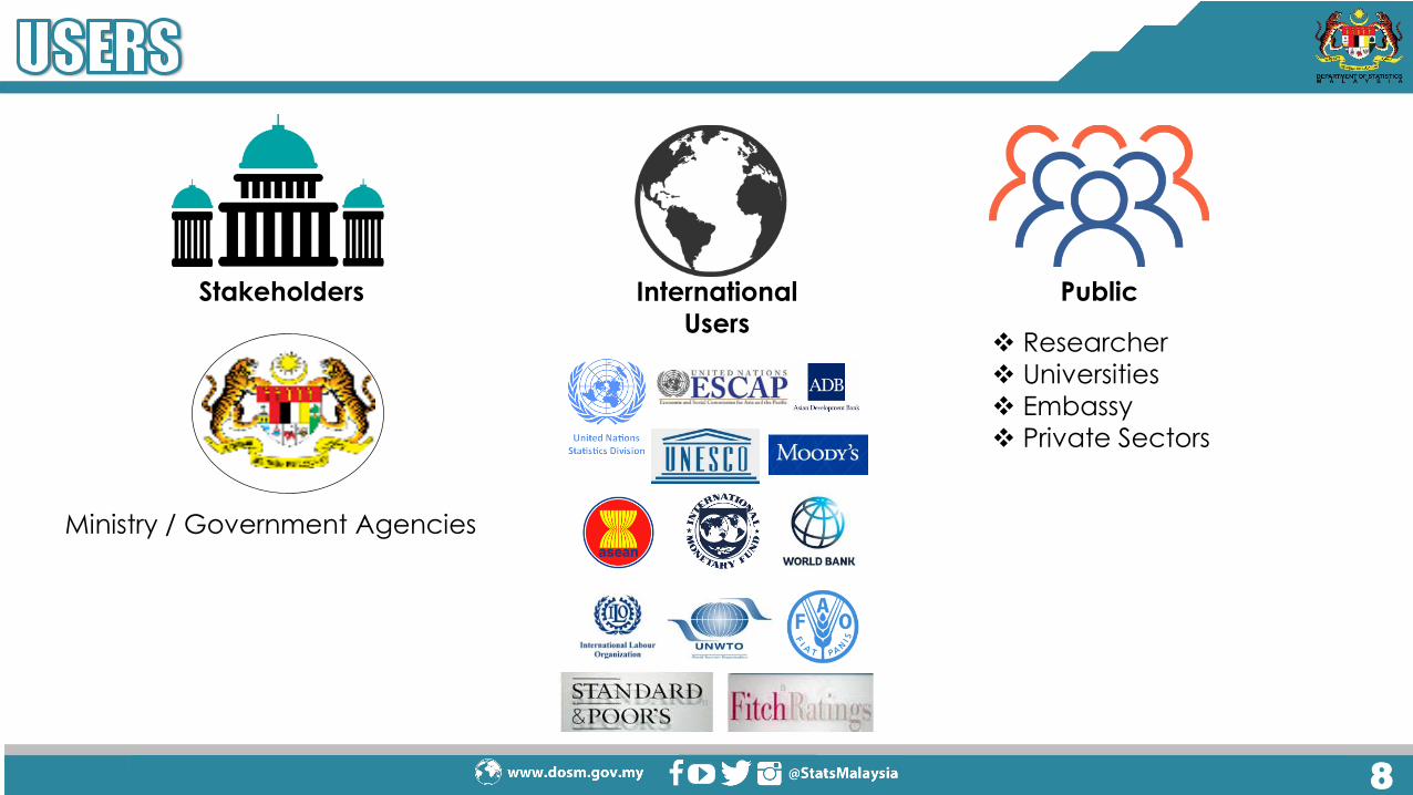
88
International
Users
Public
Researcher
Universities
Embassy
Private Sectors
Ministry / Government Agencies
Stakeholders

99
Salaries & Wages Survey Report
Current Population Estimates
Labour Force Survey Report
Household Income & Basic Amenities
Survey Report
Vital Statistics
Quarterly & Annual Gross Domestic Product
Consumer Price Index
Monthly External Trade Statistics
Index of Industrial Production, Malaysia
Domestic Tourism Survey
Balance of Payment
Statistics on Women Empowerment In Selected Domains, Malaysia Labour Productivity Social Accounting Matrix Children Statistics, Malaysia

1010
Courtesy Visit by Vice Chancellor UNITEN Thursday 04, January 2018
Courtesy visit by Monash University Malaysia Wednesday 03, January 2018
STATSBDA Development Review Tuesday, 16 January 2018
DOSM SAS Certified Data Scientist Tuesday, 16 January 2018
Courtesy Visit by Mr. James Lochhead, Consultant for Gender Mainstreaming Project Wednesday, 10 January 2018
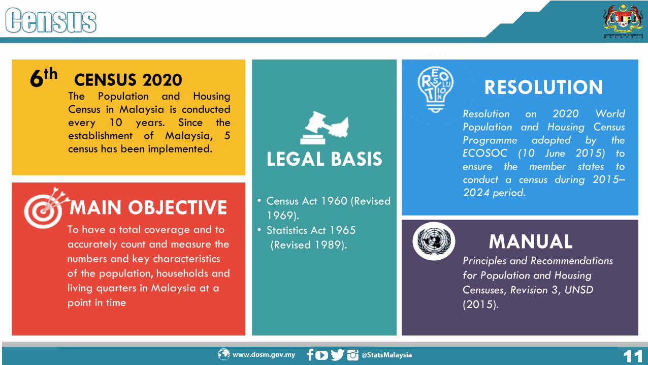
1111
To have a total coverage and to
accurately count and measure the
numbers and key characteristics
of the population, households and
living quarters in Malaysia at a
point in time
MAIN OBJECTIVE
6th
The Population and HousingCensus in Malaysia is conductedevery 10 years. Since theestablishment of Malaysia, 5census has been implemented.
CENSUS 2020
LEGAL BASIS
• Census Act 1960 (Revised
1969).
• Statistics Act 1965
(Revised 1989).
Resolution on 2020 WorldPopulation and Housing CensusProgramme adopted by theECOSOC (10 June 2015) toensure the member states toconduct a census during 2015–2024 period.
RESOLUTION
Principles and Recommendations
for Population and Housing
Censuses, Revision 3, UNSD
(2015).
MANUAL
1212
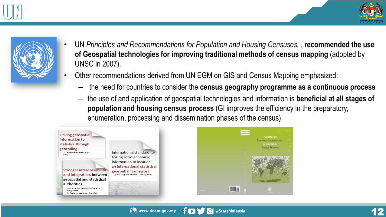
• UN Principles and Recommendations for Population and Housing Censuses, , recommended the use
of Geospatial technologies for improving traditional methods of census mapping (adopted by
UNSC in 2007).
• Other recommendations derived from UN EGM on GIS and Census Mapping emphasized:
– the need for countries to consider the census geography programme as a continuous process
– the use of and application of geospatial technologies and information is beneficial at all stages of
population and housing census process (GI improves the efficiency in the preparatory,
enumeration, processing and dissemination phases of the census)
1313
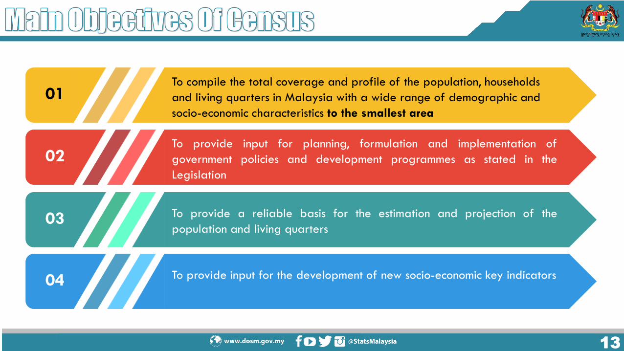
To compile the total coverage and profile of the population, households
and living quarters in Malaysia with a wide range of demographic and
socio-economic characteristics to the smallest area
01
To provide input for planning, formulation and implementation of
government policies and development programmes as stated in the
Legislation
02
To provide a reliable basis for the estimation and projection of the
population and living quarters03
To provide input for the development of new socio-economic key indicators04

1414
LIVING QUARTERS
LOCAL AREAUTILITIES
CONNECTIVITYOCCUPANCY
TYPES OF LIVING QUARTERS
HOUSEHOLD
TYPE OF HOUSEHOLD
AGRICULTURE ACTIVITIES
OWNERSHIP STATUS
POPULATION
AGE SEX ETHNICITY
MIGRATION RELIGIONMARITAL STATUS
CITIZENSHIPEDUCATION ECONOMICS

15
1616
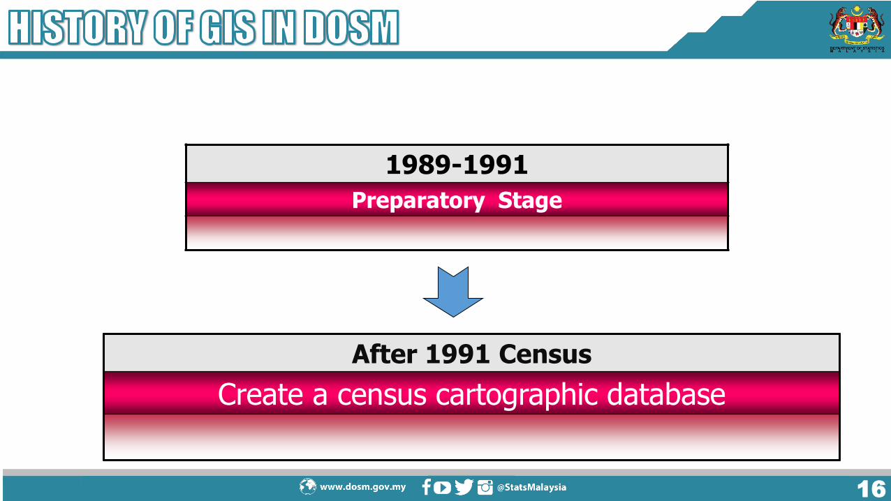
1989-1991
Preparatory Stage
After 1991 Census
Create a census cartographic database
1717
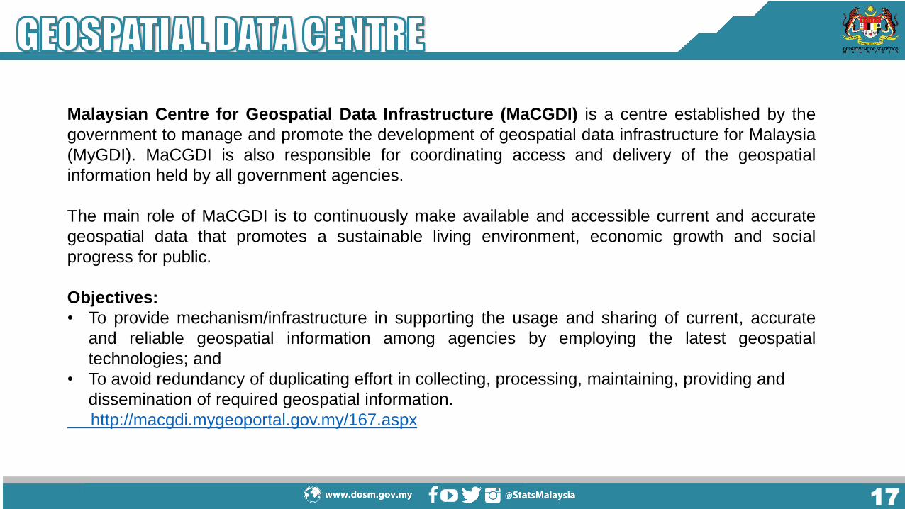
Malaysian Centre for Geospatial Data Infrastructure (MaCGDI) is a centre established by the
government to manage and promote the development of geospatial data infrastructure for Malaysia
(MyGDI). MaCGDI is also responsible for coordinating access and delivery of the geospatial
information held by all government agencies.
The main role of MaCGDI is to continuously make available and accessible current and accurate
geospatial data that promotes a sustainable living environment, economic growth and social
progress for public.
Objectives:
• To provide mechanism/infrastructure in supporting the usage and sharing of current, accurate
and reliable geospatial information among agencies by employing the latest geospatial
technologies; and
• To avoid redundancy of duplicating effort in collecting, processing, maintaining, providing and
dissemination of required geospatial information.
http://macgdi.mygeoportal.gov.my/167.aspx

1818
Framework Data refer to the coordinating data sharing within
government agencies by establish fundamental dataset of National
Geospatial Data Centre (NGDC) and State Geospatial Data
Centre (SGDC). The objective is to prevent duplication of effort in
data collection within government agencies.
MyGDI Governance
To manage the development and operation of MyGDI, a MyGDI National
Coordinating Committee (MNCC) was formed with the role of a central
policy and decision making body on matters pertaining to the
implementation, development and operations of MyGDI programmes and
MaCGDI as the coordinator

1919
Statistical AreasAdministrative Areas

2020
StatsDW
Location intelligent
Integration BI and GIS.
National Enterprise
wide Statistical
System (NEWSS)
Internal GIS Portal
Census Geodatabase
Integrating census with Statistical
boundaries
Development
• Statistical boundaries
• Vector data (topographic digital map)
Dissemination Data
Statistical boundaries
MyIPCS
Smart Listing and Smart Map
Integration Data and Map
2000 - 2007 2007 - 2009
CENSUS MAPPING & DIGITAL MAPS
2011 - 20122010 2015
2017 - 2020
2121
• Delineation and digitizing of Enumeration Block (EB) boundaries for 2020 Census by using base maps from OGA.
• Establish the centralised geodatabase and internal GIS Portal for updating maps by State Office.
• Generating census data at small area statistics or specific area for the users.
• Producing thematic maps from various sources especially on Census and other data.

2222
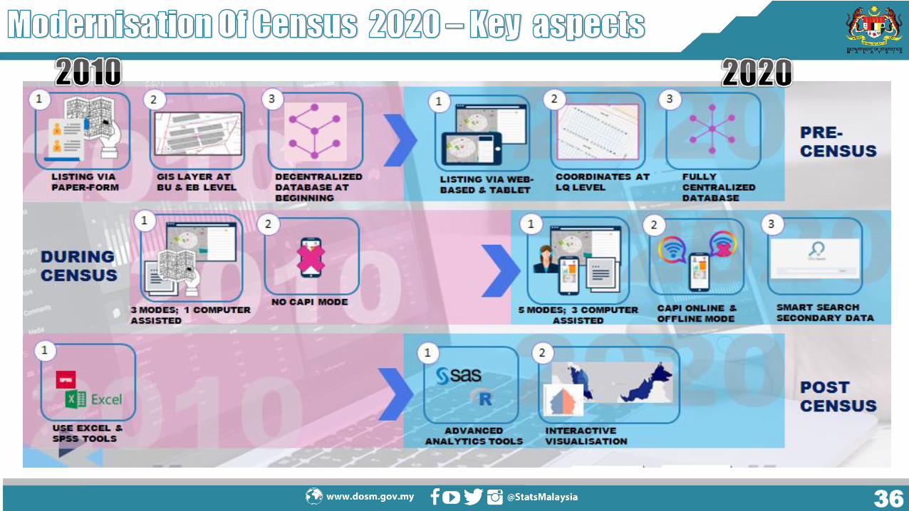
About 70% of statistical digital map were used for the 2010 census.
All the map was produced using GIS software.
EB’s map -A3 sized maps up-dated based on base map from various
resources

2323
Census geopatial database at difference levels of geography. Small area statistics from
census data which is consist of demographic data, living quarters, household, and others.

GIS internal portal; developed under National Enterprise Wide Statistical System (NEWSS).
24

Census e-Atlas developed using ArcGis Online platform- Changed to Stats Geo Portal
It shows thematic maps of selected census data.
25
26

27
2828
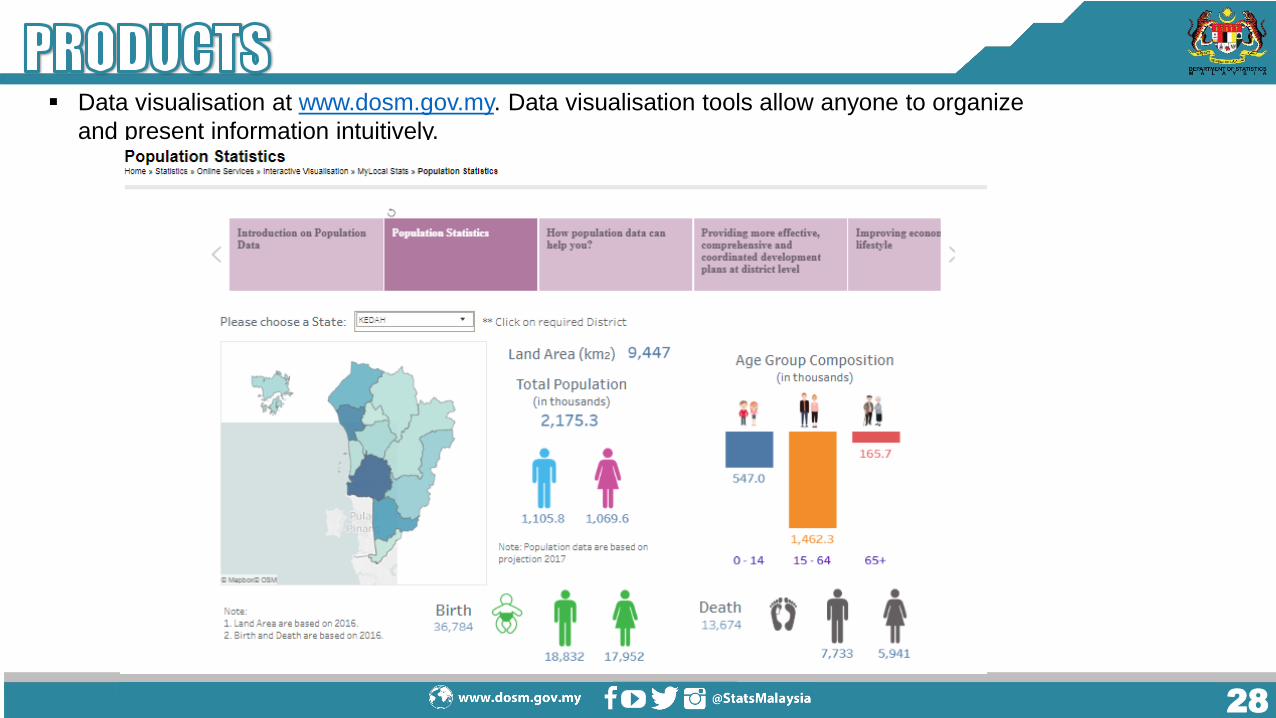
Data visualisation at www.dosm.gov.my. Data visualisation tools allow anyone to organize
and present information intuitively.

2929
Lack of expertise and technical capabilities to enhance theuse and development of GIS with the most updatedtechnology.
Need investment to purchase the most updated basemaps/software especially on raster data.
Integrating the variety of spatial data from OGA in order to create updated statistical maps.

3030
Extending the scope of census cartography to the national spatialframework.
Providing the most efficient platform for data dissemination throughGIS Portal.
Merging of household and establishment frames into the GISenvironment.
Constructing the EB geo database by using technical advances, such asRemote Sensing data, GPS.
Strengthening the collaboration with OGA/GLC for map integration,standard and quality assurance.
3131
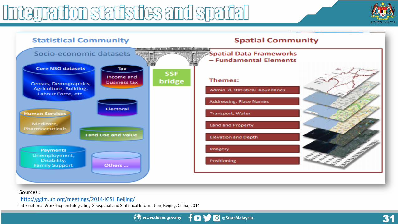
Sources :http://ggim.un.org/meetings/2014-IGSI_Beijing/
International Workshop on Integrating Geospatial and Statistical Information, Beijing, China, 2014

32

3333
StatsDigital
StatsDWStatsBDA
CAPI
CATI
e-survey
NEWSS eStatistik
MyIPCS
GIS

3434
5
6Census Portal as a
one stop centre for the
dissemination of information
pre, current and post
census
Increased data security:
Security/Risk
Modernisation of listing methods
(Reengineering Address
Canvassing/listing) :
MSAR, OSL
Increase Self-Response rate :
e-Census, MOMB, DOPU
Integrating administrative
data from OGA &
survey data :
MSAR & MSPR
Modernisation in field
work: Mobile apps, tablet
2
1
34
Malaysia Statistical Ubiquitous Learning (MySUL)
Malaysia Census Strategic Communications Plan
3535
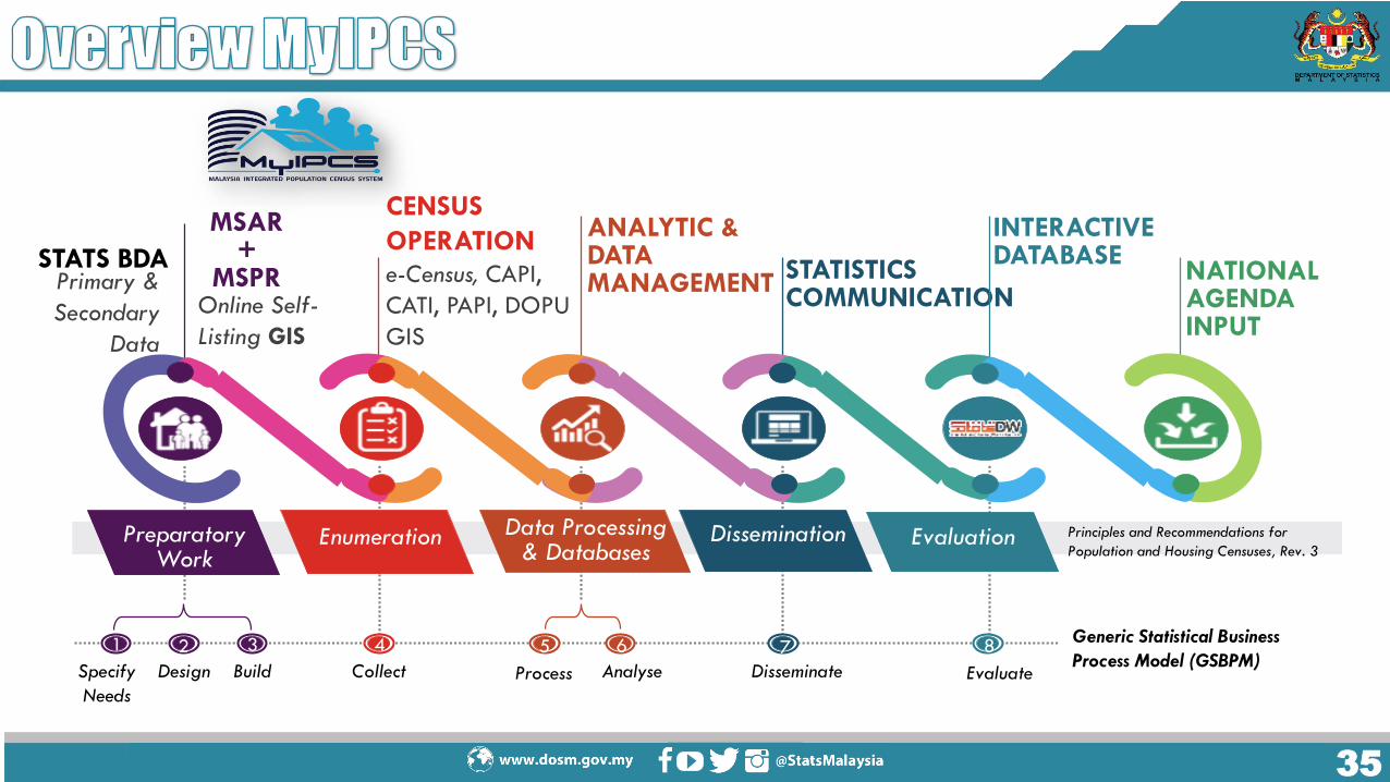
Principles and Recommendations for
Population and Housing Censuses, Rev. 3Preparatory
WorkEnumeration Data Processing
& DatabasesDissemination Evaluation
STATS BDA
MSAR+
MSPROnline Self-
Listing GIS
ANALYTIC & DATA MANAGEMENT
STATISTICS COMMUNICATION
INTERACTIVE DATABASE
NATIONAL AGENDA INPUT
Generic Statistical Business
Process Model (GSBPM)Specify
Needs
Design Build
1
Collect Process Analyse Disseminate Evaluate
2 3 4 5 6 7 8
CENSUS
OPERATION
e-Census, CAPI,
CATI, PAPI, DOPU
GIS
Primary &
Secondary
Data
3636

37

3838
ENUMERATIONPRE-ENUMERATION POST ENUMERATION2017-2019 2020 2021-2022
• Create and update statistical map• Address geocode
• Census tracking and progress monitoring during operation
• Dissemination via Web based and spatial analysis

3939
Platform
Base map
Process
PeriodPeriod
Process
Platform
Base map
2017-2019
4040
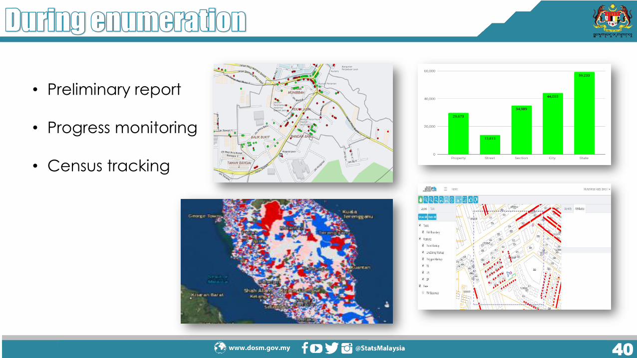
• Preliminary report
• Progress monitoring
• Census tracking

4141
• Preliminary report
• Progress monitoring
• Census tracking

42

4343
• Expand the integration of statistical and geospatial
• Strategic partnership with other agencies for the use of
high resolution of spatial data
• Advanced the use of spatial analysis & tools for official
statistics
• Extend the use of web based platform for dissemination
of geo statistics

THANK YOU
44444444