designing the coastal community of the future visioning
TRANSCRIPT
Designing the Coastal
Community of the Future
Visioning Meeting
#3
August 18, 2016
Meeting Agenda
2
1. Introduction
2. Vision 2100 Overview
3. Implementing the Vision
4. Exercise – Reviewing the Vision
5. Report-out and Wrap-up
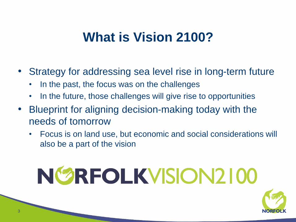
What is Vision 2100?
3
• Strategy for addressing sea level rise in long-term future
• In the past, the focus was on the challenges
• In the future, those challenges will give rise to opportunities
• Blueprint for aligning decision-making today with the
needs of tomorrow
• Focus is on land use, but economic and social considerations will
also be a part of the vision
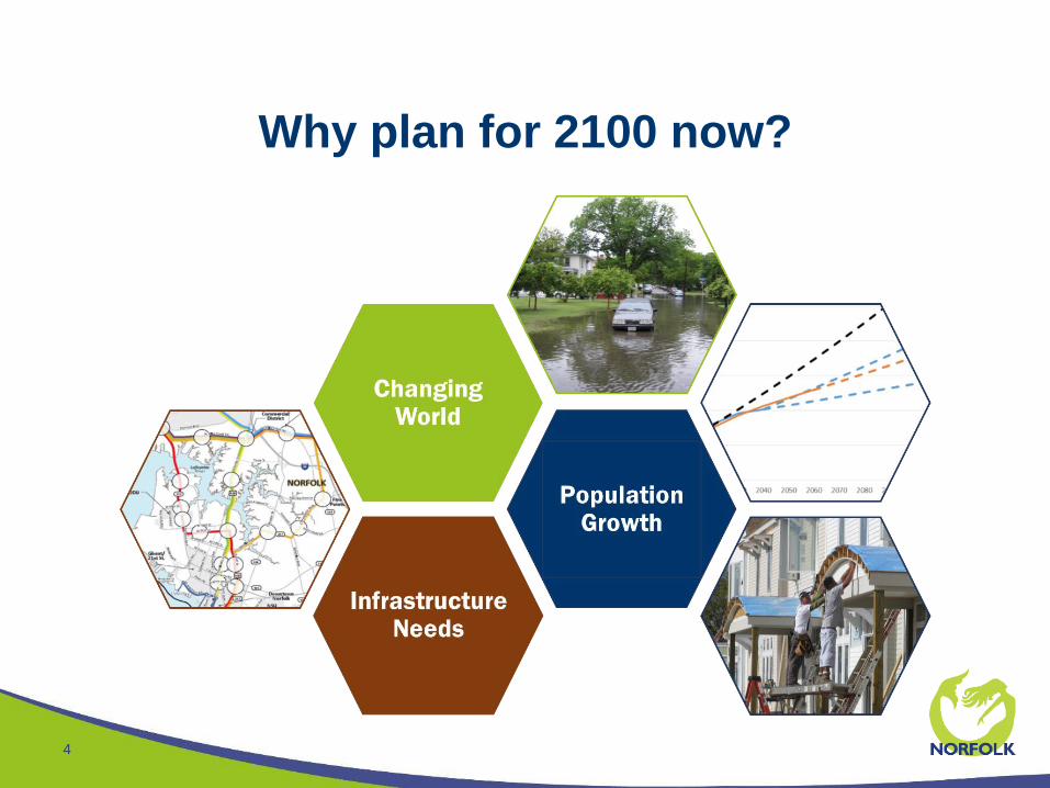
Why plan for 2100 now?
4
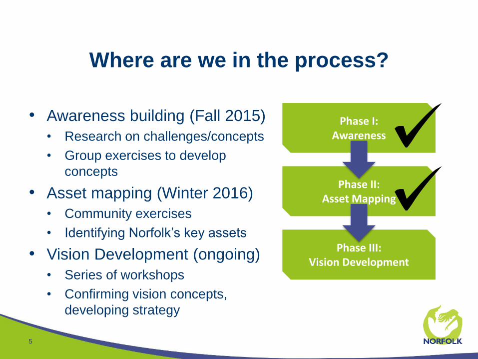
Where are we in the process?
5
• Awareness building (Fall 2015)
• Research on challenges/concepts
• Group exercises to develop
concepts
• Asset mapping (Winter 2016)
• Community exercises
• Identifying Norfolk’s key assets
• Vision Development (ongoing)
• Series of workshops
• Confirming vision concepts,
developing strategy
Phase I:Awareness
Phase II:Asset Mapping
Phase III:Vision Development
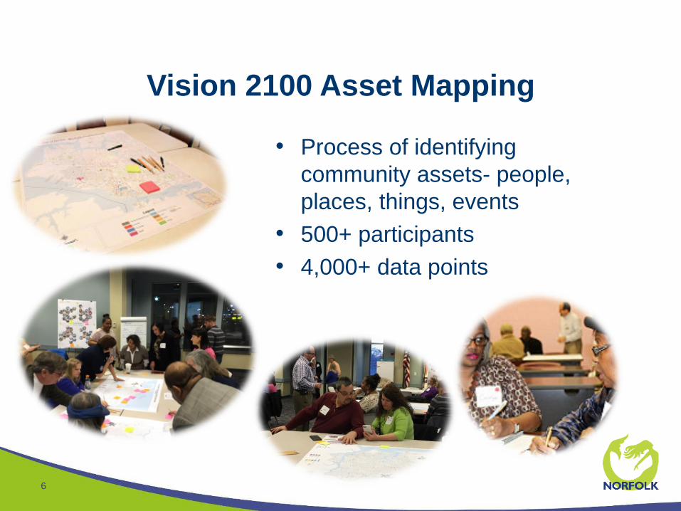
Vision 2100 Asset Mapping
6
• Process of identifying
community assets- people,
places, things, events
• 500+ participants
• 4,000+ data points
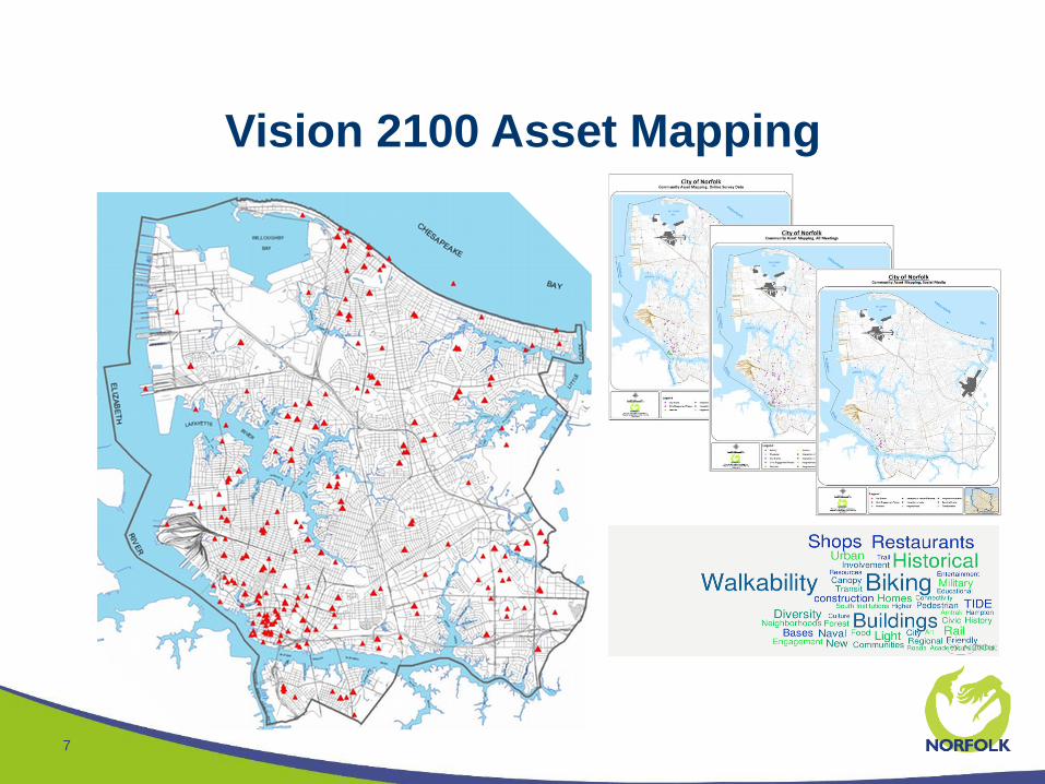
Vision 2100 Asset Mapping
7

Vision 2100 Visioning
8
• First meeting, residents identified:
• Places with economic, cultural, and identity
“community values”
• Places with “potential value”
• Transformation areas that could/should change or
stay the same
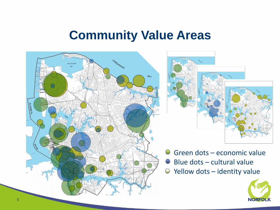
Community Value Areas
9
• Green dots – economic value• Blue dots – cultural value• Yellow dots – identity value
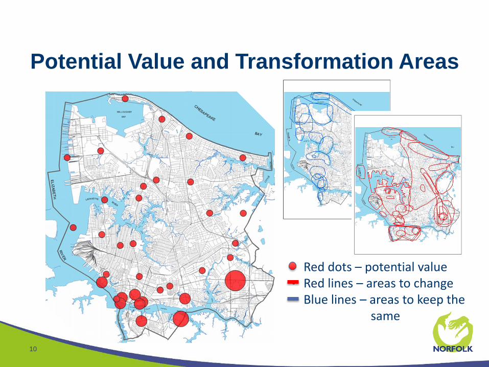
Potential Value and Transformation Areas
10
• Red dots – potential value• Red lines – areas to change• Blue lines – areas to keep the
same
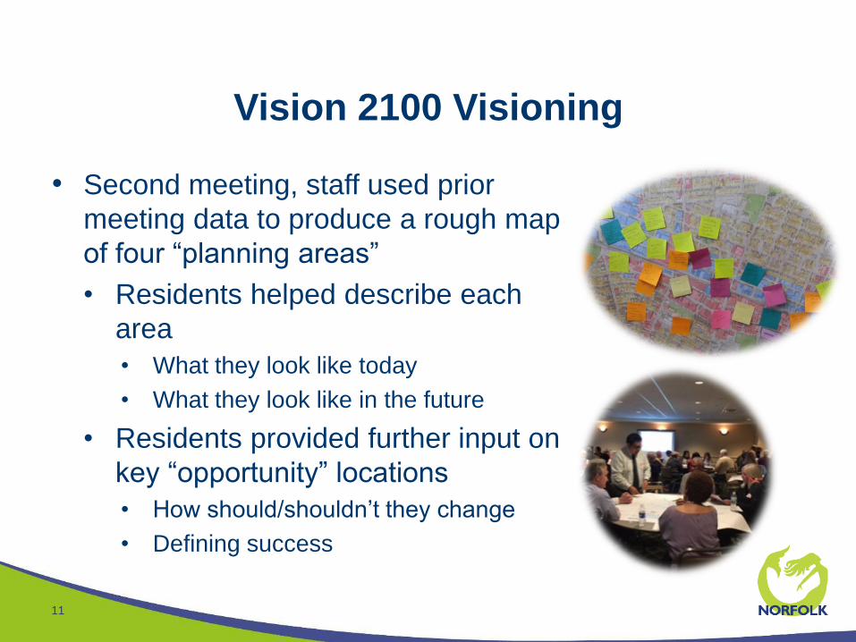
Vision 2100 Visioning
11
• Second meeting, staff used prior
meeting data to produce a rough map
of four “planning areas”
• Residents helped describe each
area
• What they look like today
• What they look like in the future
• Residents provided further input on
key “opportunity” locations
• How should/shouldn’t they change
• Defining success
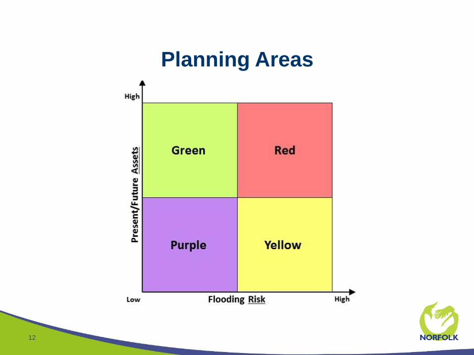
Planning Areas
12
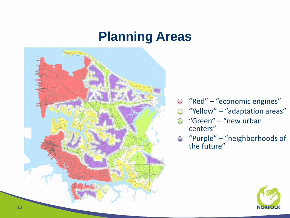
Planning Areas
13
• “Red” – “economic engines”• “Yellow” – “adaptation areas”• “Green” – “new urban
centers”• “Purple” – “neighborhoods of
the future”
The Vision 2100 “Vision”
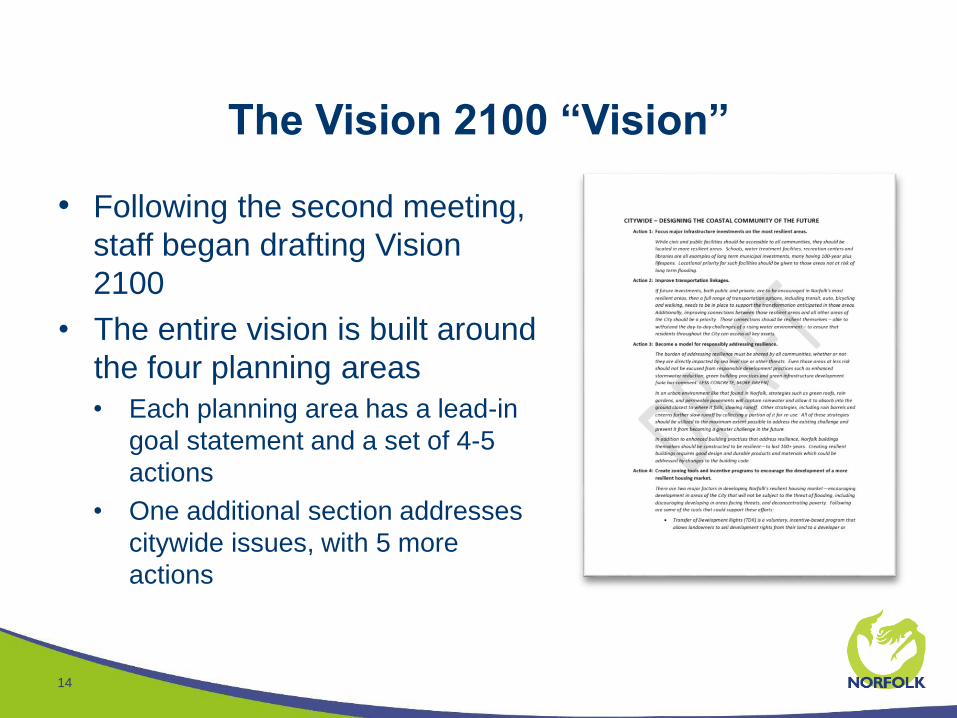
14
• Following the second meeting,
staff began drafting Vision
2100
• The entire vision is built around
the four planning areas
• Each planning area has a lead-in
goal statement and a set of 4-5
actions
• One additional section addresses
citywide issues, with 5 more
actions
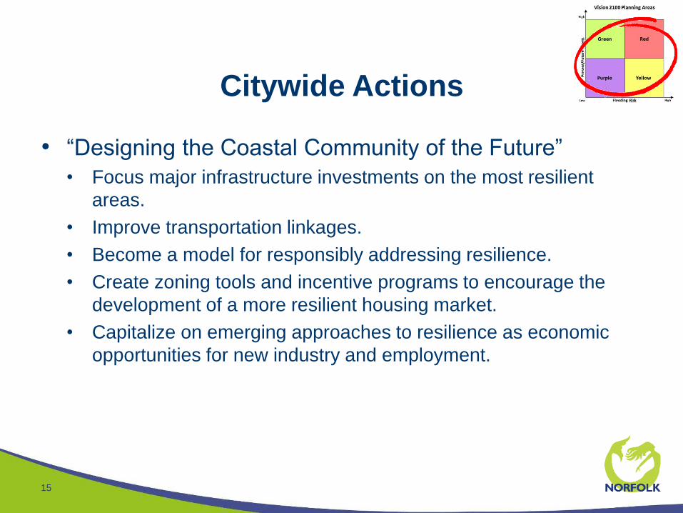
Citywide Actions
15
• “Designing the Coastal Community of the Future”
• Focus major infrastructure investments on the most resilient
areas.
• Improve transportation linkages.
• Become a model for responsibly addressing resilience.
• Create zoning tools and incentive programs to encourage the
development of a more resilient housing market.
• Capitalize on emerging approaches to resilience as economic
opportunities for new industry and employment.
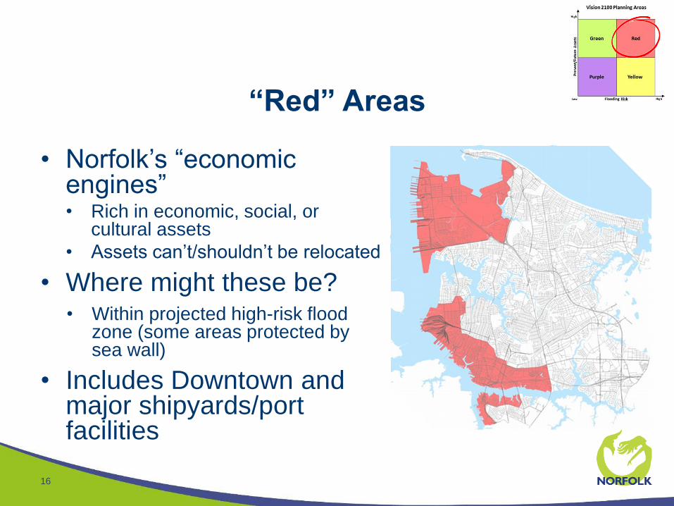
“Red” Areas
16
• Norfolk’s “economic engines”• Rich in economic, social, or
cultural assets
• Assets can’t/shouldn’t be relocated
• Where might these be?• Within projected high-risk flood
zone (some areas protected by sea wall)
• Includes Downtown and major shipyards/port facilities
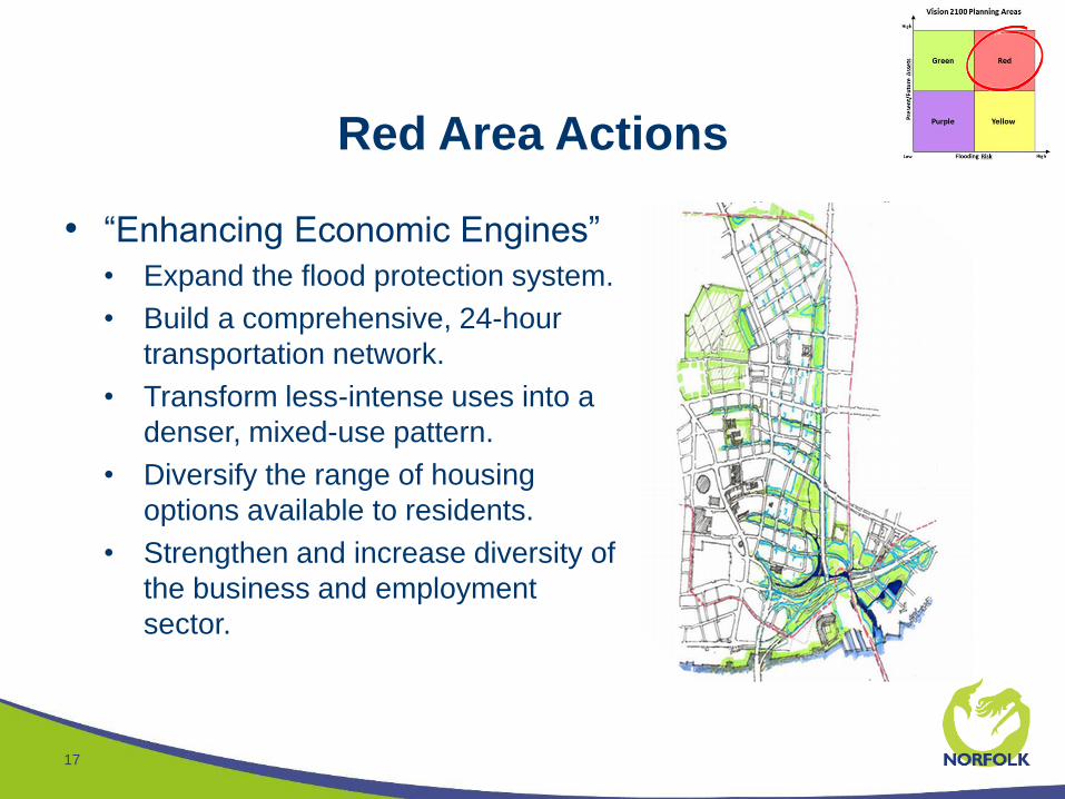
Red Area Actions
17
• “Enhancing Economic Engines”
• Expand the flood protection system.
• Build a comprehensive, 24-hour
transportation network.
• Transform less-intense uses into a
denser, mixed-use pattern.
• Diversify the range of housing
options available to residents.
• Strengthen and increase diversity of
the business and employment
sector.
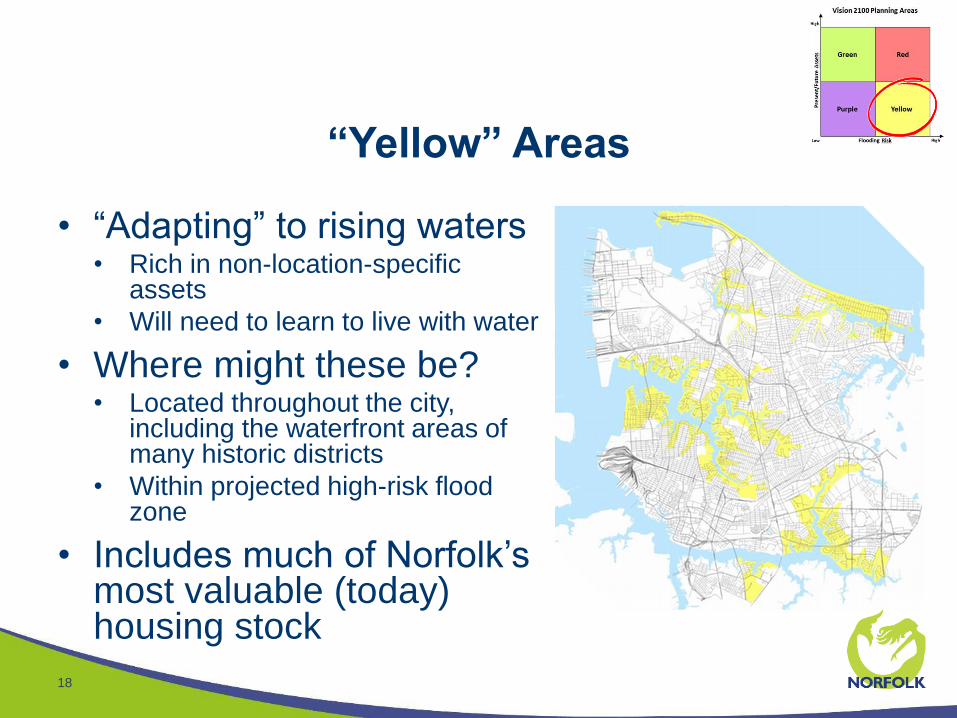
“Yellow” Areas
18
• “Adapting” to rising waters• Rich in non-location-specific
assets
• Will need to learn to live with water
• Where might these be?• Located throughout the city,
including the waterfront areas of many historic districts
• Within projected high-risk flood zone
• Includes much of Norfolk’s most valuable (today) housing stock
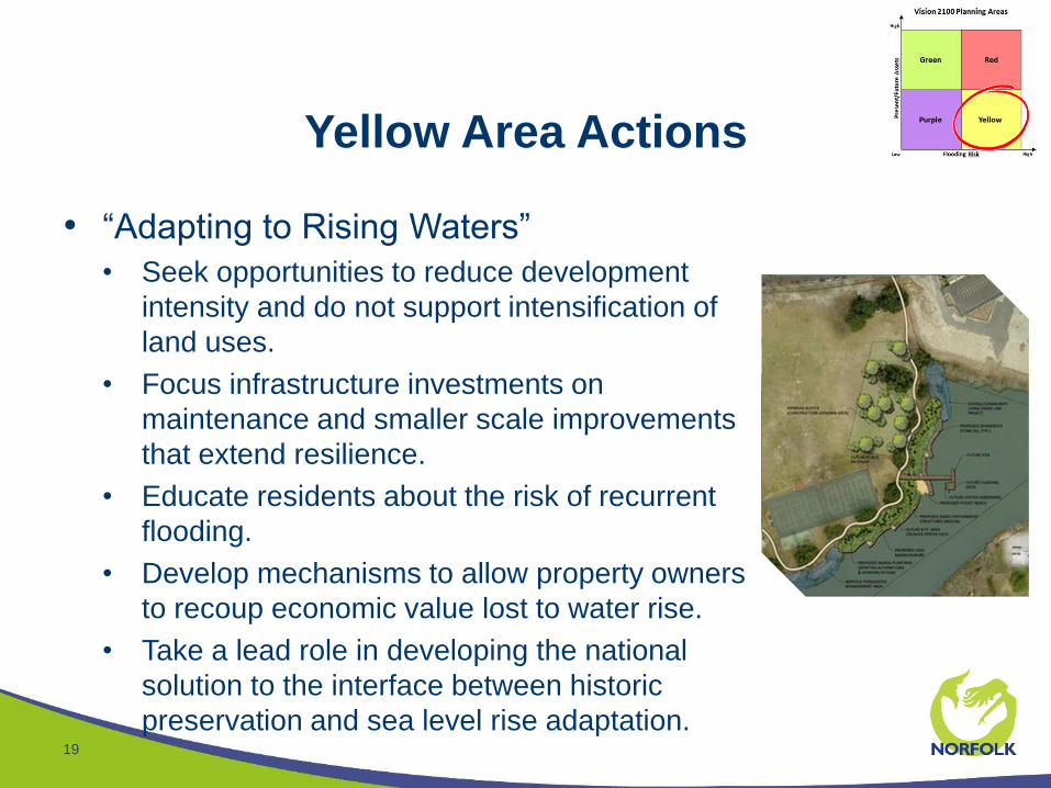
Yellow Area Actions
19
• “Adapting to Rising Waters”
• Seek opportunities to reduce development
intensity and do not support intensification of
land uses.
• Focus infrastructure investments on
maintenance and smaller scale improvements
that extend resilience.
• Educate residents about the risk of recurrent
flooding.
• Develop mechanisms to allow property owners
to recoup economic value lost to water rise.
• Take a lead role in developing the national
solution to the interface between historic
preservation and sea level rise adaptation.
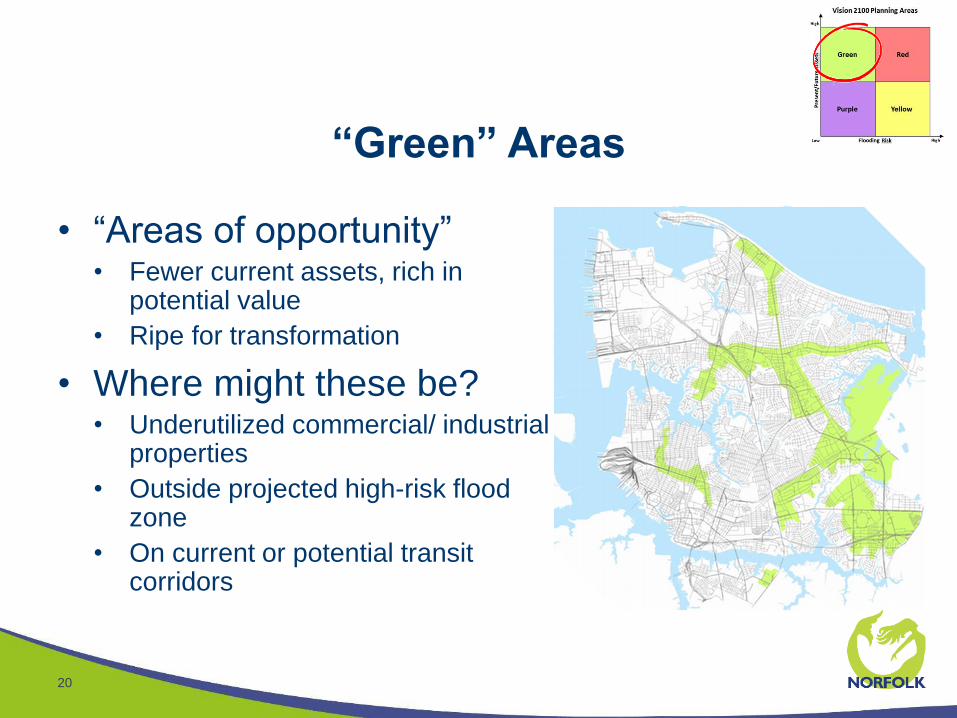
“Green” Areas
20
• “Areas of opportunity”• Fewer current assets, rich in
potential value
• Ripe for transformation
• Where might these be?• Underutilized commercial/ industrial
properties
• Outside projected high-risk flood zone
• On current or potential transit corridors
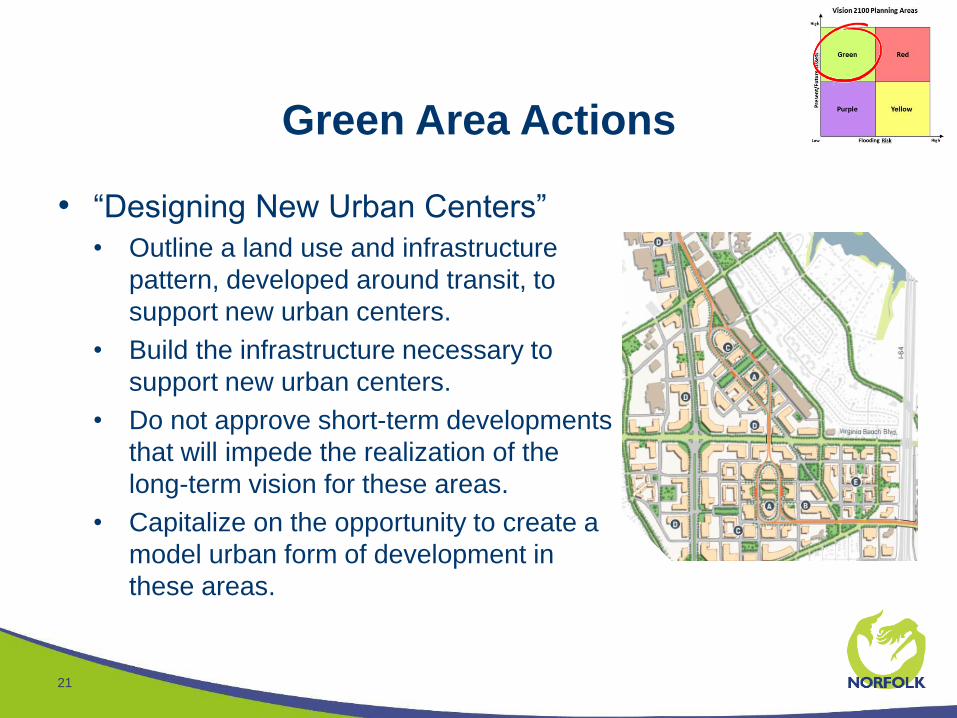
Green Area Actions
21
• “Designing New Urban Centers”
• Outline a land use and infrastructure
pattern, developed around transit, to
support new urban centers.
• Build the infrastructure necessary to
support new urban centers.
• Do not approve short-term developments
that will impede the realization of the
long-term vision for these areas.
• Capitalize on the opportunity to create a
model urban form of development in
these areas.
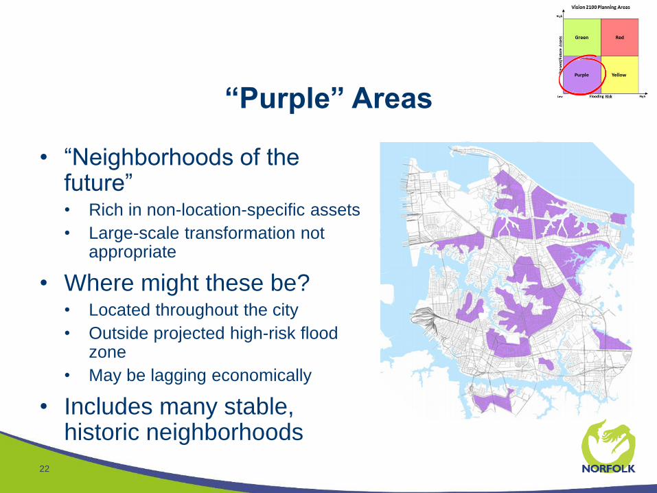
“Purple” Areas
22
• “Neighborhoods of the future”• Rich in non-location-specific assets
• Large-scale transformation not appropriate
• Where might these be?• Located throughout the city
• Outside projected high-risk flood zone
• May be lagging economically
• Includes many stable, historic neighborhoods
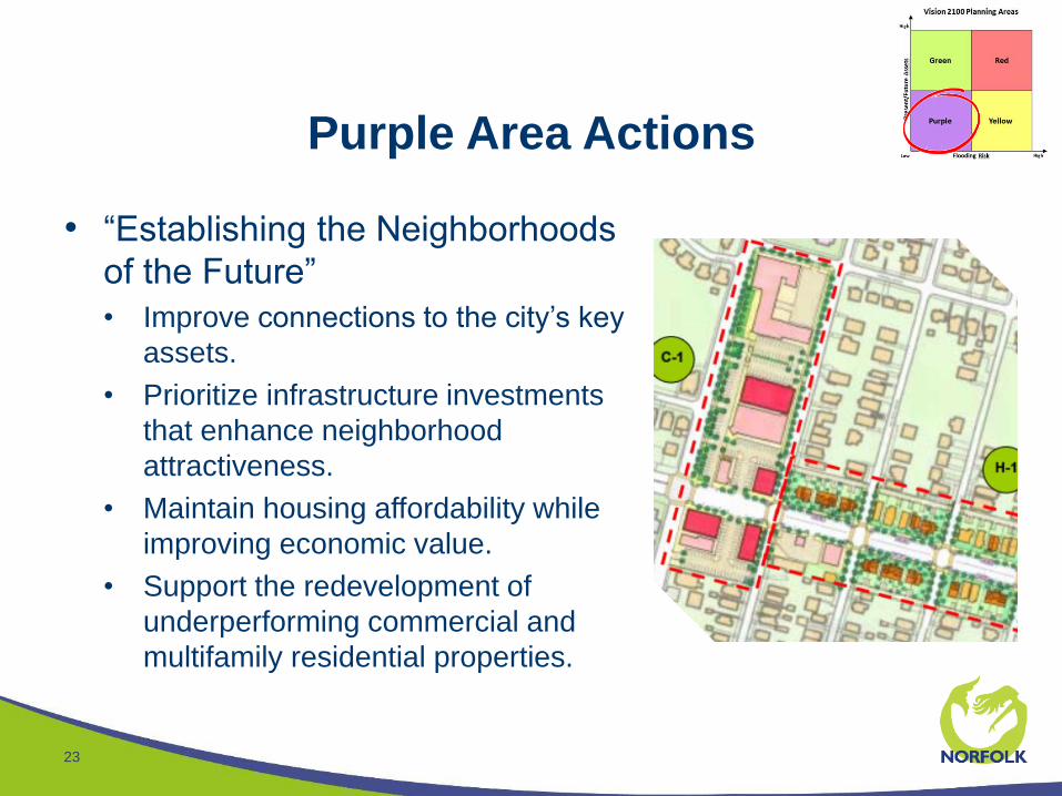
Purple Area Actions
23
• “Establishing the Neighborhoods
of the Future”
• Improve connections to the city’s key
assets.
• Prioritize infrastructure investments
that enhance neighborhood
attractiveness.
• Maintain housing affordability while
improving economic value.
• Support the redevelopment of
underperforming commercial and
multifamily residential properties.
Implementing the Vision
24
• Once complete, Vision 2100 will need to be implemented
• Two types of implementation:
• Immediate/short-term follow-up studies, code changes, etc.
• Long-term decision-making
• Several short-term efforts are already underway, others
will begin soon, led by:
• Planning
• Resilience
• Neighborhood Development
Land Use/Transportation Planning Efforts
25
• Zoning Ordinance Rewrite
• Vision 2100-inspired code changes begin here
• In process since mid-2014; anticipated completion in 2017
• Military Circle/Military Highway Study
• The first “green area” transformation plan
• In process since late 2015; anticipated completion in the fall
• Light Rail Extension Studies
• Studies of how to extend light rail to Naval Station Norfolk
• Anticipated to begin in the fall
Supporting the City’s Resilience Work
26
• USACE Norfolk Citywide Flood Risk Management Study
• HUD-NDRC Implementation – Planning & Design Phase
• Joint Land Use Study – Sea Level Rise Impact
Supporting the City’s Resilience Work
27
• Citywide Affordable Housing Study
• Affordable Housing Trust Fund
• Workforce Development Activities
• Coastal Resilience Laboratory/Accelerator
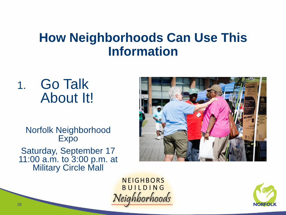
How Neighborhoods Can Use This Information
28
1. Go Talk About It!
Norfolk Neighborhood Expo
Saturday, September 17 11:00 a.m. to 3:00 p.m. at
Military Circle Mall
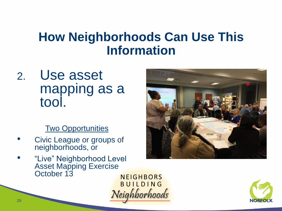
How Neighborhoods Can Use This Information
29
2. Use asset mapping as a tool.
Two Opportunities
• Civic League or groups of neighborhoods, or
• “Live” Neighborhood Level Asset Mapping Exercise October 13
How Neighborhoods Can Use This Information
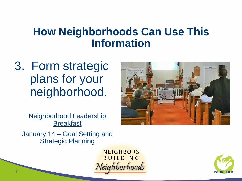
30
3. Form strategic plans for your neighborhood.
Neighborhood Leadership Breakfast
January 14 – Goal Setting and Strategic Planning
Exercise – Reviewing the Vision
31
• Five Stations around the room
• One station for each planning area
• One station for the city as a whole
• Two questions at each station
• “Which action is most important to you?”
• Place one of your dots on the most important action at each station
• “What’s right, what’s wrong, what’s missing?”
• Give use you’re answers on a sticky note
Staff Report-out
32
• At each station:
• What did we learn here tonight?
• Did we get it right?
• What might we have to change?
What’s next?
33
• Online exercise available next week
• More opportunity to help us refine the vision and strategy
• Input from this meeting and the online exercise will be used to create final draft
• Final draft available in 2-3 weeks
• Public Hearings
• Planning Commission hearing in September
• City Council hearing in October