determination of effect on essential fish habitat from · determination of effect on essential fish...
TRANSCRIPT

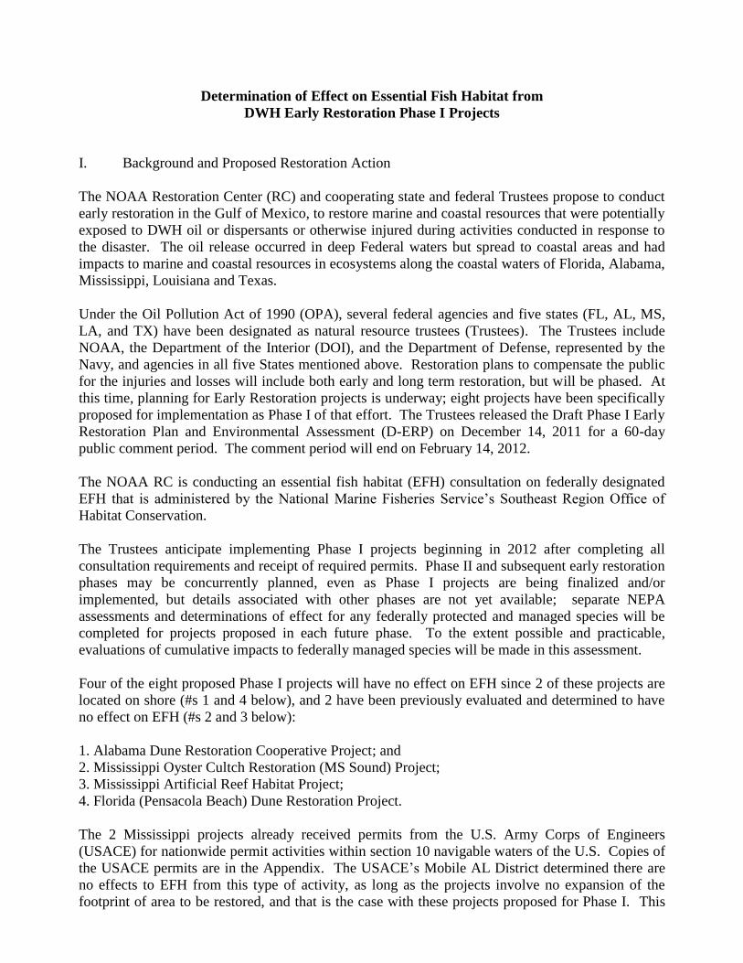
Determination of Effect on Essential Fish Habitat from
DWH Early Restoration Phase I Projects
I. Background and Proposed Restoration Action
The NOAA Restoration Center (RC) and cooperating state and federal Trustees propose to conduct
early restoration in the Gulf of Mexico, to restore marine and coastal resources that were potentially
exposed to DWH oil or dispersants or otherwise injured during activities conducted in response to
the disaster. The oil release occurred in deep Federal waters but spread to coastal areas and had
impacts to marine and coastal resources in ecosystems along the coastal waters of Florida, Alabama,
Mississippi, Louisiana and Texas.
Under the Oil Pollution Act of 1990 (OPA), several federal agencies and five states (FL, AL, MS,
LA, and TX) have been designated as natural resource trustees (Trustees). The Trustees include
NOAA, the Department of the Interior (DOI), and the Department of Defense, represented by the
Navy, and agencies in all five States mentioned above. Restoration plans to compensate the public
for the injuries and losses will include both early and long term restoration, but will be phased. At
this time, planning for Early Restoration projects is underway; eight projects have been specifically
proposed for implementation as Phase I of that effort. The Trustees released the Draft Phase I Early
Restoration Plan and Environmental Assessment (D-ERP) on December 14, 2011 for a 60-day
public comment period. The comment period will end on February 14, 2012.
The NOAA RC is conducting an essential fish habitat (EFH) consultation on federally designated
EFH that is administered by the National Marine Fisheries Service’s Southeast Region Office of
Habitat Conservation.
The Trustees anticipate implementing Phase I projects beginning in 2012 after completing all
consultation requirements and receipt of required permits. Phase II and subsequent early restoration
phases may be concurrently planned, even as Phase I projects are being finalized and/or
implemented, but details associated with other phases are not yet available; separate NEPA
assessments and determinations of effect for any federally protected and managed species will be
completed for projects proposed in each future phase. To the extent possible and practicable,
evaluations of cumulative impacts to federally managed species will be made in this assessment.
Four of the eight proposed Phase I projects will have no effect on EFH since 2 of these projects are
located on shore (#s 1 and 4 below), and 2 have been previously evaluated and determined to have
no effect on EFH (#s 2 and 3 below):
1. Alabama Dune Restoration Cooperative Project; and
2. Mississippi Oyster Cultch Restoration (MS Sound) Project;
3. Mississippi Artificial Reef Habitat Project;
4. Florida (Pensacola Beach) Dune Restoration Project.
The 2 Mississippi projects already received permits from the U.S. Army Corps of Engineers
(USACE) for nationwide permit activities within section 10 navigable waters of the U.S. Copies of
the USACE permits are in the Appendix. The USACE’s Mobile AL District determined there are
no effects to EFH from this type of activity, as long as the projects involve no expansion of the
footprint of area to be restored, and that is the case with these projects proposed for Phase I. This

determination of effect on EFH was verified by NOAA RC’s staff (J. Shenot) in a phone
conversation with USACE’s Mobile District staff (S.P. Gibson) on Feb 2, 2012.
Therefore this EFH consultation will cover only the following projects:
1. Louisiana Oyster Cultch Project;
2. Lake Hermitage Marsh Creation Project;
3. Marsh Island (Portersville Bay) Marsh Creation Project; and
4. Florida Boat Ramp Enhancement and Construction Project.
II. Federally Managed Fisheries and EFH
The Restoration Center obtained information on designated EFH in the Gulf of Mexico from the
NMFS’ EFH web site at http://www.habitat.noaa.gov/protection/efh/newInv/index.html, and from
text descriptions in Fishery Management Plans also available at that site. For all federally managed
fishery management groups listed below, the life history stages are not available for individual
species, but designated EFH and spatial data available are available for the entire group.
Shellfish (5 species)
Crabs - Stone Crab
Shrimp - Brown Shrimp, White Shrimp, Pink Shrimp, Royal Red Shrimp
Reef Fish (43 species)
Triggerfish - Gray Triggerfish
Jacks - Greater Amberjack, Lesser Amberjack, Almaco Jack, Banded Rudderfish
Wrasses - Hogfish
Snappers - Queen Snapper, Mutton Snapper, Schoolmaster, Blackfin Snapper, Red Snapper, Cubera
Snapper, Gray (mangrove) Snapper, Dog Snapper, Mahogany Snapper, Lane Snapper, Silk Snapper,
Yellowtail Snapper, Wenchman, Vermilion Snapper
Tilefish - Goldface Tilefish, Blackline Tilefish, Anchor Tilefish, Blueline Tilefish, Golden Tilefish
Groupers - Dwarf Sand Perch, Sand Perch, Rock Hind, Speckled Hind, Yellowedge Grouper, Red
Hind, Goliath Grouper, Red Grouper, Misty Grouper, Warsaw Grouper, Snowy Grouper, Nassau
Grouper, Marbled Grouper, Black Grouper, Yellowmouth Grouper, Gag, Scamp, Yellowfin
Grouper
Coastal Migratory Pelagic Fish (7 species)
Dolphin, Little Tunny, Bluefish, Cobia, King Mackerel - Gulf, Spanish Mackerel - Gulf, Cero
Mackerel
Other (1 species)
Red Drum

Additionally, a total of 21 species of federally managed highly migratory species (HMS) were
identified as having designated EFH for one or more life stages within the area of potential affect
for the proposed DWH Early Restoration Phase I activities. Not all of the federally managed
fishery species have available spatial data.
Sharks (11 species with available spatial data)
Scalloped Hammerhead Shark - Juvenile, Neonate
Spinner Shark - Juvenile, Neonate
Tiger Shark - Juvenile
Finetooth Shark - Adult, Juvenile
Atlantic Sharpnose Shark - Adult, Juvenile, Neonate
Blacknose Shark - Adult, Juvenile, Neonate
Blacktip Shark - Adult, Juvenile, Neonate
Bonnethead Shark - Adult, Juvenile, Neonate
Bull Shark - Adult, Juvenile
Great Hammerhead Shark - All
Nurse Shark - Juvenile
Other species
Blue Marlin - Juvenile
Note - The following HMS shark species (9) have no available spatial data:
Bigeye Sand Tiger Shark
Bigeye Sixgill Shark
Caribbean Sharpnose Shark
Galapagos Shark
Narrowtooth Shark
Sevengill Shark
Sixgill Shark
Smooth Hammerhead Shark
Smalltail Shark
There are no Habitat Areas of Particular Concern (HAPC) identified in the area of proposed Early
Restoration Phase I activities.
IV. Assessment of Effects to EFH
This assessment incorporates the descriptions of affected areas and environmental impacts and
analysis provided in the “Deepwater Horizon Oil Spill Draft Phase I Early Restoration Plan and
Environmental Assessment (RP-EA)”, which is available on the U.S. Department of the Interior’s
website at http://www.gulfspillrestoration.noaa.gov/restoration/early-restoration/. For an overall
vicinity map, refer to page ES-8 of the RP-EA. The specific maps for this consultation are provided
in the Appendix to this EFH Assessment.
The impacts to coastal and marine habitats from the proposed projects are described in the RP-EA,
but are summarized below.
Oyster Restoration Project

The Oyster Cultch Restoration Projects proposed in LA state waters would result in short-term
disturbances to the water column and benthic environment when the cultch materials are placed in
the water, as well as brief disruptions to benthic organism’s activities at the placement sites when
the project is implemented. The duration is expected to last only a few hours until particles have
settled. Change in the turbidity levels may vary locally depending on the clarity of the water
column prior to deployment. Although there may be temporary impacts to the existing benthic
community as a result of project implementation, the completed project is anticipated to improve
oyster production, and would have both direct and indirect net benefits to any of the life history age
groups for managed fisheries that use these reefs for foraging or shelter. Many juvenile and adult
fish and some other marine organisms are highly mobile, and since the construction activity is going
to be very detectable to any fish or wildlife in the vicinity, it is likely that these organisms would be
able to avoid the disturbance by swimming to an undisturbed area of similar habitat nearby.
The overall effect of this oyster project will be a net benefit to the benthic communities, and to the
habitat services the oyster reefs provide to biological resources dependent on them.
Marsh Creation Projects
For the marsh creation projects in LA (Lake Hermitage) and AL (Marsh Island/Portersville Bay),
the creation and enhancement of intertidal marsh would improve important essential fish habitat
functions in the projects’ vicinity.
The source of sediment materials for creating the LA marsh is the Mississippi River, and mechanical
dredging activities in the river would increase turbidity there as bottom sediments are disturbed. The
increased turbidity and disturbance from dredging activities could result in some fishery species being
displaced, but it is likely those species would relocate to adjacent areas of undisturbed habitat. Based on
the November 2011 Final Environmental Assessment prepared for the Lake Hermitage project, the net
results to EFH would be a significant benefit to federally managed fisheries. The increase in estuarine
emergent wetland would occur in currently open-water areas with deteriorated marsh. The total net gain
in marsh acreage expected is 530 acres. Within the project area, coverage by submerged aquatic
vegetation is also expected to increase. The improvements to those habitat types would benefit
postlarval/juvenile and subadult brown shrimp; postlarval/juvenile and subadult white shrimp; and
postlarval/juvenile red drum.
The creation of estuarine emergent wetlands would also result in the loss of mud bottom and estuarine
water column in the project area, since the created emergent marsh and SAV would replace those habitat
types. Loss of mud bottom EFH could result in minor negative impacts to subadult brown shrimp and
postlarval/juvenile, red drum. However, these adverse impacts would be outweighed by improvement of
the more productive types of EFH (i.e., estuarine emergent wetlands). There would also be some open-
water habitat formed within the marsh platform, as ponds and other waterbodies develop as a result of
natural marsh loss processes. Open-water habitats are expected to contain 25 percent coverage of
submerged aquatic vegetation compared to only 5 percent coverage under the No Action Alternative.
Therefore, implementing the proposed project would result in a net positive benefit to all managed
species that occur in the project area.
The AL marsh project involves creation of salt marsh along Marsh Island, a state-owned island in the
Portersville Bay area of the Mississippi Sound. It would add approximately 50 acres of salt marsh to the
existing 24 acres of Marsh Island, through the construction of a permeable segmented breakwater, the
placement of sediments and the planting of native marsh vegetation. Additionally, this project would

protect the existing salt marshes of Marsh Island, which have been experiencing significant losses due to
chronic erosion. Only conceptual information on construction and design is available now, and this
project may be subject to further analysis of essential fish habitat once specific details are available. A
general project footprint and conceptual plan was used as the basis to evaluate a range of impacts. The
site characteristics are only approximate, but can hopefully be used to begin an EFH consultation
process. It is intended that during the EFH consultation process conservation recommendations and best
management practices will be agreed to and can be incorporated into the final designs to be submitted
for permitting. Potential impacts to EFH (i.e., temporary turbidity and disturbances in the water column
and benthic environment during construction) and benefits to managed fisheries would be comparable to
the impacts and benefits for the LA marsh creation project, except the net result of the AL project will
be creating tidal salt marsh in AL compared with tidal freshwater marsh in LA.
For both marsh creation projects, many fish and some other organisms present are highly mobile, and
since the construction activity is going to be very detectable to most fish or wildlife in the vicinity,
it is likely that these organisms would be able to avoid the disturbance by swimming to an
undisturbed area of similar habitat nearby.
Boat Ramp Project
This proposed NRDA early restoration project would provide early restoration for lost human use
services of natural resources injured as a result of the Deepwater Horizon oil spill. This project is
proposed to help enhance the quality of access and boat-based recreational activities in Florida, and
includes constructing 2 new boat ramps, and enhancements to 2 existing facilities.
The Navy Point boat ramp is an existing ramp in Pensacola Bay, in a developed, residential area.
The Galvez Landing boat ramp is an existing ramp in Perdido Bay, in a residential area. The
Mahogany Mill boat ramp, in Pensacola Bay, is proposed to be built in a commercial and industrial
area. The Perdido River boat ramp is proposed to be built in a less developed area than the other
three. There are no parks or wildlife refuges near the project sites.
Both the Navy Point and Galvez Landing enhancements include upgrading deteriorated old dock
structures with new docks, which will result in moderate but temporary disturbance to the
immediate benthic areas and water column at the proposed sites. Sediments at all four proposed
locations are primarily sand bottom.
These areas already have boat traffic that creates noise, and the disturbance to fisheries is
anticipated to be minor since most of these species in the vicinity are highly mobile and able to
avoid the disturbance by moving to nearby undisturbed areas.
During construction, best management practices and boom placement along with other avoidance
and mitigation measures required by state and federal regulatory agencies would be employed to
minimize the temporary water quality and sedimentation impacts. After construction, increased
boat traffic on the river could result in minor but minimal additional impacts to existing surface
water quality. Boat wakes created by additional boat traffic should be controlled through no-wake
or speed zones to mitigate shoreline erosion on the river.
Overall, the potential impacts to coastal, marine, estuarine and riverine biological resources due to
increased human activity are expected to be minimal, and implementation of the proposed project is
not expected to result in any substantial impacts to water quality.

V. Conclusion
The NOAA Restoration Center has assessed potential impacts to EFH, and determined that the
proposed DWH Early Restoration Phase I activities would not adversely affect any EFH. The
proposed Phase I restoration will enhance natural resource services, and will restore or enhance
various types of EFH in numerous areas of the Gulf. Any disturbance to finfish and shellfish using
these habitats during construction will be insignificant and very brief. Additionally, the RC notes
that future activities from subsequent phases of Early Restoration, and/or long-term restoration
actions being considered in the planned PEIS will also require consideration of potential effects to
EFH, and will be evaluated as soon as further details become available.

Appendix

Louisiana oyster CuLtCh ProjeCt
General Project DescriPtion
The Louisiana Oyster Cultch Project involves (1) the placement of oyster cultch onto approximately 850 acres of public oyster seed grounds throughout coastal Louisiana and (2) construction of an oyster hatchery facility that would produce supplemental larvae and seed.
The Louisiana Department of Wildlife and Fisheries (LDWF) would contract for the placement of cultch material onto approximately 850 acres of public oyster seed grounds throughout coastal Louisiana, including 3-Mile Bay, Drum Bay, Lake Fortuna, South Black Bay, Hackberry Bay and Sister Lake. Cultch material consists of limestone rock, crushed concrete, oyster shell and other similar material that, when placed in oyster spawning areas, provides a substrate on which free swimming oyster larvae can attach and grow into oysters. The Louisiana Oyster Cultch Project would employ cultch planting approaches utilized by LDWF since 1917.
The second portion of the Project involves constructing hatchery improvements to help facilitate and expedite success of the cultch placement. In order to provide a supplemental source of oyster larvae and oyster seed, LDWF, in partnership with Louisiana Sea Grant, would contract to construct a new building adjacent to the existing Sea Grant oyster hatchery located at the LDWF facility on Grand Isle, Louisiana.
Hatchery operations would include broodstock maintenance, algal cultivation, larvae production, and a nursery system. Larvae produced at the hatchery can be released into the water directly over cultch material or be remotely set on oyster cultch to create oyster seed. When remotely set oysters reach approximately 1 inch in length they would be moved from the hatchery to a suitable growout area (i.e. public seed grounds). The facility is designed to produce 1 billion eyed larvae per season.
resource Benefits anD relationshiP to injury
The goal of the Louisiana Oyster Cultch Project is to produce seed-sized and sack-sized oysters on public oyster seed grounds. Oysters were exposed to oil and dispersant, as well as response activities undertaken to prevent, minimize, or remediate oiling from the Deepwater Horizon oil spill.
MethoDs anD results of offsets estiMation
For the purposes of negotiations of Offsets with BP in accordance with the Early Restoration Framework Agreement, the Trustees used Resource Equivalency Analysis to estimate Offsets for the Louisiana Oyster Cultch Project, resulting in expected production of oysters on cultch material over time. Offsets reflect estimated kilograms of oysters produced, and would be applied against oyster injuries in coastal Louisiana injured by the Oil Spill as determined by the Trustees’ total assessment of injury. The Trustees considered a number of factors in estimating oyster production, including, but not limited to, typical oyster production in the proposed project area, estimated project life span and size of the project. Total estimated Offsets for the Louisiana Oyster Cultch Project are 4,000,000 discounted kilogram-years of oyster secondary production.
estiMateD cost
The estimated cost to implement the Louisiana Oyster Cultch Project is $14,874,300.
for More inforMation contact: Jenny Kurz, Louisiana NRDA Public Information Officer, [email protected]
Project Background
General Project DescriPtion
The cities of Gulf Shores and Orange Beach, State of Alabama (Gulf State Park), and the U.S. Fish and Wildlife Service (Bon Secour National Wildlife Refuge) and the Bureau of Land Management (Fort Morgan Beach) form the largest group of coastal land owners along the Alabama Gulf Coast. These owners col-lectively own and/or manage approximately 18 to 20 miles of dune habitat. This restoration project would result in the formation of a partnership, the Coastal Alabama Dune Restoration Cooperative (CADRC), to restore natural resources that were injured by the Deepwater Horizon oil spill response efforts.
The Trustees propose to restore 55 acres of dune habitats in Alabama that were affected by the Deepwater Horizon oil spill, including response efforts, by planting native dune vegetation and installing sand fencing. The proposed project will help prevent erosion by restoring a “living shoreline,” a coastline protected by plants and natural resources rather than hard structures.
Project Details Planting:• All plants will be grown from seeds or cuttings derived
from the Alabama coast or North Florida to ensure ap-propriate genetic stocks are used in the project.
• Slow release fertilizer (osmocote 18-6-12 e.g.) will be used to ensure proper establishment of the plants.
• The plants will be installed 6” deep to ensure that sufficient moisture is available to roots, and properly covered with sand to stabilize and protect the plants.
Sand Fencing:• Protective sand fencing that lines the dune feature and
contributes to sand accumulation along the toe of the dunes will be installed for the cities of Orange Beach and Gulf Shores and on Bureau of Land Management lands.
Signage:• Informative dune restoration signage will be placed on the project area at a rate of 10 to 25
signs per mile.
Deepwater Horizon Natural Resource Damage Assessment Trustee CouncilDeepwater Horizon Natural Resource Damage Assessment Trustee CouncilDeepwater Horizon Natural Resource Damage Assessment Trustee CouncilDeepwater Horizon Natural Resource Damage Assessment Trustee CouncilDeepwater Horizon Natural Resource Damage Assessment Trustee CouncilDeepwater Horizon Natural Resource Damage Assessment Trustee CouncilDeepwater Horizon Natural Resource Damage Assessment Trustee Council
One Very GOOd Gulf restOratiOn PrOject
• For best sand stabilization and to limit wind erosion plants will be mixed in the following propor-tions: 70% Sea oats grasses; 20% Panic grasses and smooth cord grasses, and 10% Ground covers (Sea purslane, Beach Elder, White morning glories and railroad vine), and planted on 18-inch centers.
Draft Phase I Early Restoration Plan
December 2011
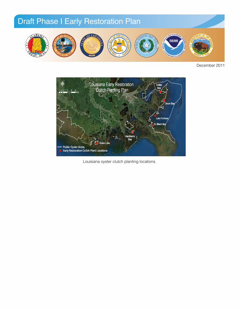
Louisiana oyster clutch planting locations.
Louisiana oyster cultch planting locations.
Project Background
General Project DescriPtion
The cities of Gulf Shores and Orange Beach, State of Alabama (Gulf State Park), and the U.S. Fish and Wildlife Service (Bon Secour National Wildlife Refuge) and the Bureau of Land Management (Fort Morgan Beach) form the largest group of coastal land owners along the Alabama Gulf Coast. These owners col-lectively own and/or manage approximately 18 to 20 miles of dune habitat. This restoration project would result in the formation of a partnership, the Coastal Alabama Dune Restoration Cooperative (CADRC), to restore natural resources that were injured by the Deepwater Horizon oil spill response efforts.
The Trustees propose to restore 55 acres of dune habitats in Alabama that were affected by the Deepwater Horizon oil spill, including response efforts, by planting native dune vegetation and installing sand fencing. The proposed project will help prevent erosion by restoring a “living shoreline,” a coastline protected by plants and natural resources rather than hard structures.
Project Details Planting:• All plants will be grown from seeds or cuttings derived
from the Alabama coast or North Florida to ensure ap-propriate genetic stocks are used in the project.
• Slow release fertilizer (osmocote 18-6-12 e.g.) will be used to ensure proper establishment of the plants.
• The plants will be installed 6” deep to ensure that sufficient moisture is available to roots, and properly covered with sand to stabilize and protect the plants.
Sand Fencing:• Protective sand fencing that lines the dune feature and
contributes to sand accumulation along the toe of the dunes will be installed for the cities of Orange Beach and Gulf Shores and on Bureau of Land Management lands.
Signage:• Informative dune restoration signage will be placed on the project area at a rate of 10 to 25
signs per mile.
Deepwater Horizon Natural Resource Damage Assessment Trustee CouncilDeepwater Horizon Natural Resource Damage Assessment Trustee CouncilDeepwater Horizon Natural Resource Damage Assessment Trustee CouncilDeepwater Horizon Natural Resource Damage Assessment Trustee CouncilDeepwater Horizon Natural Resource Damage Assessment Trustee CouncilDeepwater Horizon Natural Resource Damage Assessment Trustee CouncilDeepwater Horizon Natural Resource Damage Assessment Trustee Council
One Very GOOd Gulf restOratiOn PrOject
• For best sand stabilization and to limit wind erosion plants will be mixed in the following propor-tions: 70% Sea oats grasses; 20% Panic grasses and smooth cord grasses, and 10% Ground covers (Sea purslane, Beach Elder, White morning glories and railroad vine), and planted on 18-inch centers.
Draft Phase I Early Restoration Plan
December 2011

Lake Hermitage marsH Creation – nrDa earLy restoration ProjeCt
General Project DescriPtion
The Lake Hermitage Marsh Creation – NRDA Early Restoration Project involves the creation of marsh within a project footprint known as the “Lake Hermitage Marsh Creation Project” developed for and funded through the Coastal Wetlands Planning, Protection and Restoration Act (CWPPRA) Program. This proposal substitutes approximately 104 acres of created brackish marsh for approximately 5-6 acres of earthen terraces that would otherwise have been constructed within the CWPPRA project boundary.
The Lake Hermitage Marsh Creation Project is located within the Barataria Hydrologic Basin in Plaquemines Parish, Louisiana, to the west of the community of Pointe a la Hache, and northwest of the community of Magnolia. This basin was identified as a priority area for coastal restoration, and has been the focus of extensive study and project design and implementation.
The primary goals of the Lake Hermitage Marsh Creation base CWPPRA Project are (1) to restore the eastern Lake Hermitage shoreline to reduce erosion and prevent breaching into the interior marsh and (2) to re-create marsh in the open water areas south and southeast of Lake Hermitage.
Marsh areas would be constructed entirely within the base project’s terrace boundary. Sediment would be hydraulically dredged from a borrow area in the Mississippi River, and pumped via pipeline to create new marsh in the project area. Over time, natural dewatering and compaction of dredged sediments should result in elevations within the intertidal range which would be conducive to the establishment of emergent marsh. The 104-acre fill area would be planted with native marsh vegetation to accelerate benefits to be realized from this project.
resource Benefits anD relationshiP to injury
The Lake Hermitage Marsh Creation – NRDA Early Restoration Project would create new brackish marsh. The ecological services gained by this project are anticipated to help compensate for brackish marsh injuries or losses due to the spill. The created marsh would be constructed in the Barataria Hydrologic Basin, which was heavily impacted by the spill.
MethoDs anD results of offsets estiMation
For the purposes of negotiations of Offsets with BP in accordance with the Framework Agreement, the Trustees used Habitat Equivalency Analysis to estimate Offsets provided by the Lake Hermitage Marsh Creation – NRDA Early Restoration Project. Offsets reflect units of discounted service acre years (DSAYs) of emergent brackish salt marsh, and would be applied against emergent brackish salt marsh habitat injured by the Oil Spill in the Barataria Hydrologic Basin as determined by the Trustees’ total assessment of injury. In estimating DSAYs, the Trustees considered a number of factors, including, but not limited to, the time period that it would take for created marsh to provide different levels of ecological benefits, the time period over which the project would continue to provide benefits, and the ecological benefits of created marsh relative to existing marsh habitats that were not affected by the oil spill.
Total estimated Offsets for the Lake Hermitage Marsh Creation – NRDA Early Restoration Project are 518 DSAYs. In addition, the Trustees determined that approximately 25% of the Offsets (134 DSAYs) would be associated with highly productive marsh edge habitat, which is habitat along the land/water interface.
estiMateD cost
The estimated cost to implement the Lake Hermitage Marsh Creation – NRDA Early Restoration Project is $13,200,000.
Project Background
General Project DescriPtion
The cities of Gulf Shores and Orange Beach, State of Alabama (Gulf State Park), and the U.S. Fish and Wildlife Service (Bon Secour National Wildlife Refuge) and the Bureau of Land Management (Fort Morgan Beach) form the largest group of coastal land owners along the Alabama Gulf Coast. These owners col-lectively own and/or manage approximately 18 to 20 miles of dune habitat. This restoration project would result in the formation of a partnership, the Coastal Alabama Dune Restoration Cooperative (CADRC), to restore natural resources that were injured by the Deepwater Horizon oil spill response efforts.
The Trustees propose to restore 55 acres of dune habitats in Alabama that were affected by the Deepwater Horizon oil spill, including response efforts, by planting native dune vegetation and installing sand fencing. The proposed project will help prevent erosion by restoring a “living shoreline,” a coastline protected by plants and natural resources rather than hard structures.
Project Details Planting:• All plants will be grown from seeds or cuttings derived
from the Alabama coast or North Florida to ensure ap-propriate genetic stocks are used in the project.
• Slow release fertilizer (osmocote 18-6-12 e.g.) will be used to ensure proper establishment of the plants.
• The plants will be installed 6” deep to ensure that sufficient moisture is available to roots, and properly covered with sand to stabilize and protect the plants.
Sand Fencing:• Protective sand fencing that lines the dune feature and
contributes to sand accumulation along the toe of the dunes will be installed for the cities of Orange Beach and Gulf Shores and on Bureau of Land Management lands.
Signage:• Informative dune restoration signage will be placed on the project area at a rate of 10 to 25
signs per mile.
Deepwater Horizon Natural Resource Damage Assessment Trustee CouncilDeepwater Horizon Natural Resource Damage Assessment Trustee CouncilDeepwater Horizon Natural Resource Damage Assessment Trustee CouncilDeepwater Horizon Natural Resource Damage Assessment Trustee CouncilDeepwater Horizon Natural Resource Damage Assessment Trustee CouncilDeepwater Horizon Natural Resource Damage Assessment Trustee CouncilDeepwater Horizon Natural Resource Damage Assessment Trustee Council
One Very GOOd Gulf restOratiOn PrOject
• For best sand stabilization and to limit wind erosion plants will be mixed in the following propor-tions: 70% Sea oats grasses; 20% Panic grasses and smooth cord grasses, and 10% Ground covers (Sea purslane, Beach Elder, White morning glories and railroad vine), and planted on 18-inch centers.
Draft Phase I Early Restoration Plan
December 2011

Lake Hermitage Marsh CreationNRDA Early Restoration Increment
Lake Hermitage Marsh CreationCWPPRA Project
for More inforMation contact: Jenny KurzLouisiana NRDA Public Information [email protected]
Lake Hermitage Marsh Creation – NRDA Early Restoration Increment.
Lake Hermitage Marsh Creation CWPPRA Project.
Project Background
General Project DescriPtion
The cities of Gulf Shores and Orange Beach, State of Alabama (Gulf State Park), and the U.S. Fish and Wildlife Service (Bon Secour National Wildlife Refuge) and the Bureau of Land Management (Fort Morgan Beach) form the largest group of coastal land owners along the Alabama Gulf Coast. These owners col-lectively own and/or manage approximately 18 to 20 miles of dune habitat. This restoration project would result in the formation of a partnership, the Coastal Alabama Dune Restoration Cooperative (CADRC), to restore natural resources that were injured by the Deepwater Horizon oil spill response efforts.
The Trustees propose to restore 55 acres of dune habitats in Alabama that were affected by the Deepwater Horizon oil spill, including response efforts, by planting native dune vegetation and installing sand fencing. The proposed project will help prevent erosion by restoring a “living shoreline,” a coastline protected by plants and natural resources rather than hard structures.
Project Details Planting:• All plants will be grown from seeds or cuttings derived
from the Alabama coast or North Florida to ensure ap-propriate genetic stocks are used in the project.
• Slow release fertilizer (osmocote 18-6-12 e.g.) will be used to ensure proper establishment of the plants.
• The plants will be installed 6” deep to ensure that sufficient moisture is available to roots, and properly covered with sand to stabilize and protect the plants.
Sand Fencing:• Protective sand fencing that lines the dune feature and
contributes to sand accumulation along the toe of the dunes will be installed for the cities of Orange Beach and Gulf Shores and on Bureau of Land Management lands.
Signage:• Informative dune restoration signage will be placed on the project area at a rate of 10 to 25
signs per mile.
Deepwater Horizon Natural Resource Damage Assessment Trustee CouncilDeepwater Horizon Natural Resource Damage Assessment Trustee CouncilDeepwater Horizon Natural Resource Damage Assessment Trustee CouncilDeepwater Horizon Natural Resource Damage Assessment Trustee CouncilDeepwater Horizon Natural Resource Damage Assessment Trustee CouncilDeepwater Horizon Natural Resource Damage Assessment Trustee CouncilDeepwater Horizon Natural Resource Damage Assessment Trustee Council
One Very GOOd Gulf restOratiOn PrOject
• For best sand stabilization and to limit wind erosion plants will be mixed in the following propor-tions: 70% Sea oats grasses; 20% Panic grasses and smooth cord grasses, and 10% Ground covers (Sea purslane, Beach Elder, White morning glories and railroad vine), and planted on 18-inch centers.
Draft Phase I Early Restoration Plan
December 2011

Marsh Island (PortersvIlle Bay) restoratIon Project
General Project DescriPtion
The Marsh Island (Portersville Bay) Restoration Project involves the creation of salt marsh along Marsh Island, a state-owned island in the Portersville Bay portion of Mississippi Sound, Alabama. This project would restore approximately 50 acres of salt marsh through the placement of a permeable segmented breakwater, the placement of sediments and the planting of native marsh vegetation. Additionally, the breakwater will provide protection for the existing 24 acres of Marsh Island, which has been experiencing shoreline loss at the rate of 5-10’ per year.
ResouRce Benefits and Relationship to injuRy
The goal of the Marsh Island (Portersville Bay) Restoration Project is to create a structurally robust, emergent salt marsh designed to provide maximum salt marsh ecological benefits as soon as practicable. The restored marsh will provide compensation for salt marsh habitat services lost in Alabama due to the Oil Spill. Marshes in Mississippi Sound were oiled by the spill although the oil did not come ashore on Marsh Island itself.
Methods and Results of offsets estiMation
For the purposes of negotiations of Offsets with BP in accordance with the Framework Agreement, the Trustees used Habitat Equivalency Analysis to estimate Offsets provided by the Marsh Island Project. Offsets reflect units of discounted service acre years (DSAYs) of salt marsh, and would be applied against salt marsh habitat along the coast of Alabama injured by the Oil Spill as determined by the Trustees’ total assessment of injury. In estimating DSAYs, the Trustees considered a number of factors, including, but not limited to, anticipated protection of Marsh Island’s existing acres of marsh provided by the project, new marsh created by the project, the time period that it would take for created marsh to provide different levels of ecological benefits, the time period over which the project would continue to provide benefits, and the ecological benefits of created marsh relative to existing marsh habitats that were not affected by the oil spill. Total estimated Offsets for the Marsh Island Project are 540 DSAYs.
estiMated cost:
Construction of the Marsh Island Project would cost approximately $9,400,000.00.
foR MoRe infoRMation, contact:Alabama Department of Conservation and Natural Resources Attn: Will Brantley: (334)242-3484 or [email protected]
Project Background
General Project DescriPtion
The cities of Gulf Shores and Orange Beach, State of Alabama (Gulf State Park), and the U.S. Fish and Wildlife Service (Bon Secour National Wildlife Refuge) and the Bureau of Land Management (Fort Morgan Beach) form the largest group of coastal land owners along the Alabama Gulf Coast. These owners col-lectively own and/or manage approximately 18 to 20 miles of dune habitat. This restoration project would result in the formation of a partnership, the Coastal Alabama Dune Restoration Cooperative (CADRC), to restore natural resources that were injured by the Deepwater Horizon oil spill response efforts.
The Trustees propose to restore 55 acres of dune habitats in Alabama that were affected by the Deepwater Horizon oil spill, including response efforts, by planting native dune vegetation and installing sand fencing. The proposed project will help prevent erosion by restoring a “living shoreline,” a coastline protected by plants and natural resources rather than hard structures.
Project Details Planting:• All plants will be grown from seeds or cuttings derived
from the Alabama coast or North Florida to ensure ap-propriate genetic stocks are used in the project.
• Slow release fertilizer (osmocote 18-6-12 e.g.) will be used to ensure proper establishment of the plants.
• The plants will be installed 6” deep to ensure that sufficient moisture is available to roots, and properly covered with sand to stabilize and protect the plants.
Sand Fencing:• Protective sand fencing that lines the dune feature and
contributes to sand accumulation along the toe of the dunes will be installed for the cities of Orange Beach and Gulf Shores and on Bureau of Land Management lands.
Signage:• Informative dune restoration signage will be placed on the project area at a rate of 10 to 25
signs per mile.
Deepwater Horizon Natural Resource Damage Assessment Trustee CouncilDeepwater Horizon Natural Resource Damage Assessment Trustee CouncilDeepwater Horizon Natural Resource Damage Assessment Trustee CouncilDeepwater Horizon Natural Resource Damage Assessment Trustee CouncilDeepwater Horizon Natural Resource Damage Assessment Trustee CouncilDeepwater Horizon Natural Resource Damage Assessment Trustee CouncilDeepwater Horizon Natural Resource Damage Assessment Trustee Council
One Very GOOd Gulf restOratiOn PrOject
• For best sand stabilization and to limit wind erosion plants will be mixed in the following propor-tions: 70% Sea oats grasses; 20% Panic grasses and smooth cord grasses, and 10% Ground covers (Sea purslane, Beach Elder, White morning glories and railroad vine), and planted on 18-inch centers.
Draft Phase I Early Restoration Plan
December 2011
Marsh Island (Portersville Bay) Restoration Project, Portersville Bay, Alabama.
Marsh Island (Portersville Bay) Restoration Project, Portersville Bay, Alabama

Project Background
General Project DescriPtion
The cities of Gulf Shores and Orange Beach, State of Alabama (Gulf State Park), and the U.S. Fish and Wildlife Service (Bon Secour National Wildlife Refuge) and the Bureau of Land Management (Fort Morgan Beach) form the largest group of coastal land owners along the Alabama Gulf Coast. These owners col-lectively own and/or manage approximately 18 to 20 miles of dune habitat. This restoration project would result in the formation of a partnership, the Coastal Alabama Dune Restoration Cooperative (CADRC), to restore natural resources that were injured by the Deepwater Horizon oil spill response efforts.
The Trustees propose to restore 55 acres of dune habitats in Alabama that were affected by the Deepwater Horizon oil spill, including response efforts, by planting native dune vegetation and installing sand fencing. The proposed project will help prevent erosion by restoring a “living shoreline,” a coastline protected by plants and natural resources rather than hard structures.
Project Details Planting:• All plants will be grown from seeds or cuttings derived
from the Alabama coast or North Florida to ensure ap-propriate genetic stocks are used in the project.
• Slow release fertilizer (osmocote 18-6-12 e.g.) will be used to ensure proper establishment of the plants.
• The plants will be installed 6” deep to ensure that sufficient moisture is available to roots, and properly covered with sand to stabilize and protect the plants.
Sand Fencing:• Protective sand fencing that lines the dune feature and
contributes to sand accumulation along the toe of the dunes will be installed for the cities of Orange Beach and Gulf Shores and on Bureau of Land Management lands.
Signage:• Informative dune restoration signage will be placed on the project area at a rate of 10 to 25
signs per mile.
Deepwater Horizon Natural Resource Damage Assessment Trustee CouncilDeepwater Horizon Natural Resource Damage Assessment Trustee CouncilDeepwater Horizon Natural Resource Damage Assessment Trustee CouncilDeepwater Horizon Natural Resource Damage Assessment Trustee CouncilDeepwater Horizon Natural Resource Damage Assessment Trustee CouncilDeepwater Horizon Natural Resource Damage Assessment Trustee CouncilDeepwater Horizon Natural Resource Damage Assessment Trustee Council
One Very GOOd Gulf restOratiOn PrOject
• For best sand stabilization and to limit wind erosion plants will be mixed in the following propor-tions: 70% Sea oats grasses; 20% Panic grasses and smooth cord grasses, and 10% Ground covers (Sea purslane, Beach Elder, White morning glories and railroad vine), and planted on 18-inch centers.
Draft Phase I Early Restoration Plan
December 2011

Florida Boat ramp EnhancEmEnt and construction projEct
General Project DescriPtion
This early restoration project would entail repairing an existing boat ramp in Pensacola Bay (Navy Point Park Public Boat Ramp N30-22.8’/W087-16.9’) and constructing a new boat ramp facility in Pensacola Bay (Mahogany Mill Public Boat Ramp N30-23.9’/W087-14.9’). The project also would include repairing and modifying an existing boat ramp in Perdido Bay (Galvez Landing Public Boat Ramp N30-18.8’/W087-26.5’) and constructing a new boat ramp facility in Perdido Bay (Perdido Public Boat Ramp N30-1.4’/W087-26.7’). Finally, visitor information kiosks would be installed to provide environmental education to boaters regarding water quality and sustainable practices for utilization of marine, estuarine and coastal resources in Florida.
resource Benefits anD relationshiP to injury
The project will provide boaters enhanced access to public waterways within Pensacola Bay, Perdido Bay and offshore areas. This project will help address the reduced quality and quantity of recreational activities (e.g., boating and fishing) in Florida attributable to the Deepwater Horizon Oil Spill and response activities.
MethoDs anD results of offsets estiMation
For the purposes of negotiations of Offsets with BP in accordance with the Framework Agreement, the Trustees used monetized estimates of project benefits to estimate Offsets for the Florida Public Boat Ramp Enhancement and Construction Project, resulting in a monetary value expressed in present value year 2011 dollars. The Trustees considered a number of factors in estimating present value year 2011 dollars, including, but not limited to, initial annual value based on the economic model described in the Florida Boating Access Facility Inventory and Economic Study (Florida Fish and Wildlife Conservation Commission, 2009), estimated changes in value over time and expected partial funding from other sources. Total estimated Offsets for the Florida Public Boat Ramp Enhancement and Construction Project is $10,153,642.
estiMateD cost
The estimated cost for this project is approximately $4,406,309. This cost does not include matching funds provided by local government.
Project Background
General Project DescriPtion
The cities of Gulf Shores and Orange Beach, State of Alabama (Gulf State Park), and the U.S. Fish and Wildlife Service (Bon Secour National Wildlife Refuge) and the Bureau of Land Management (Fort Morgan Beach) form the largest group of coastal land owners along the Alabama Gulf Coast. These owners col-lectively own and/or manage approximately 18 to 20 miles of dune habitat. This restoration project would result in the formation of a partnership, the Coastal Alabama Dune Restoration Cooperative (CADRC), to restore natural resources that were injured by the Deepwater Horizon oil spill response efforts.
The Trustees propose to restore 55 acres of dune habitats in Alabama that were affected by the Deepwater Horizon oil spill, including response efforts, by planting native dune vegetation and installing sand fencing. The proposed project will help prevent erosion by restoring a “living shoreline,” a coastline protected by plants and natural resources rather than hard structures.
Project Details Planting:• All plants will be grown from seeds or cuttings derived
from the Alabama coast or North Florida to ensure ap-propriate genetic stocks are used in the project.
• Slow release fertilizer (osmocote 18-6-12 e.g.) will be used to ensure proper establishment of the plants.
• The plants will be installed 6” deep to ensure that sufficient moisture is available to roots, and properly covered with sand to stabilize and protect the plants.
Sand Fencing:• Protective sand fencing that lines the dune feature and
contributes to sand accumulation along the toe of the dunes will be installed for the cities of Orange Beach and Gulf Shores and on Bureau of Land Management lands.
Signage:• Informative dune restoration signage will be placed on the project area at a rate of 10 to 25
signs per mile.
Deepwater Horizon Natural Resource Damage Assessment Trustee CouncilDeepwater Horizon Natural Resource Damage Assessment Trustee CouncilDeepwater Horizon Natural Resource Damage Assessment Trustee CouncilDeepwater Horizon Natural Resource Damage Assessment Trustee CouncilDeepwater Horizon Natural Resource Damage Assessment Trustee CouncilDeepwater Horizon Natural Resource Damage Assessment Trustee CouncilDeepwater Horizon Natural Resource Damage Assessment Trustee Council
One Very GOOd Gulf restOratiOn PrOject
• For best sand stabilization and to limit wind erosion plants will be mixed in the following propor-tions: 70% Sea oats grasses; 20% Panic grasses and smooth cord grasses, and 10% Ground covers (Sea purslane, Beach Elder, White morning glories and railroad vine), and planted on 18-inch centers.
Draft Phase I Early Restoration Plan
December 2011
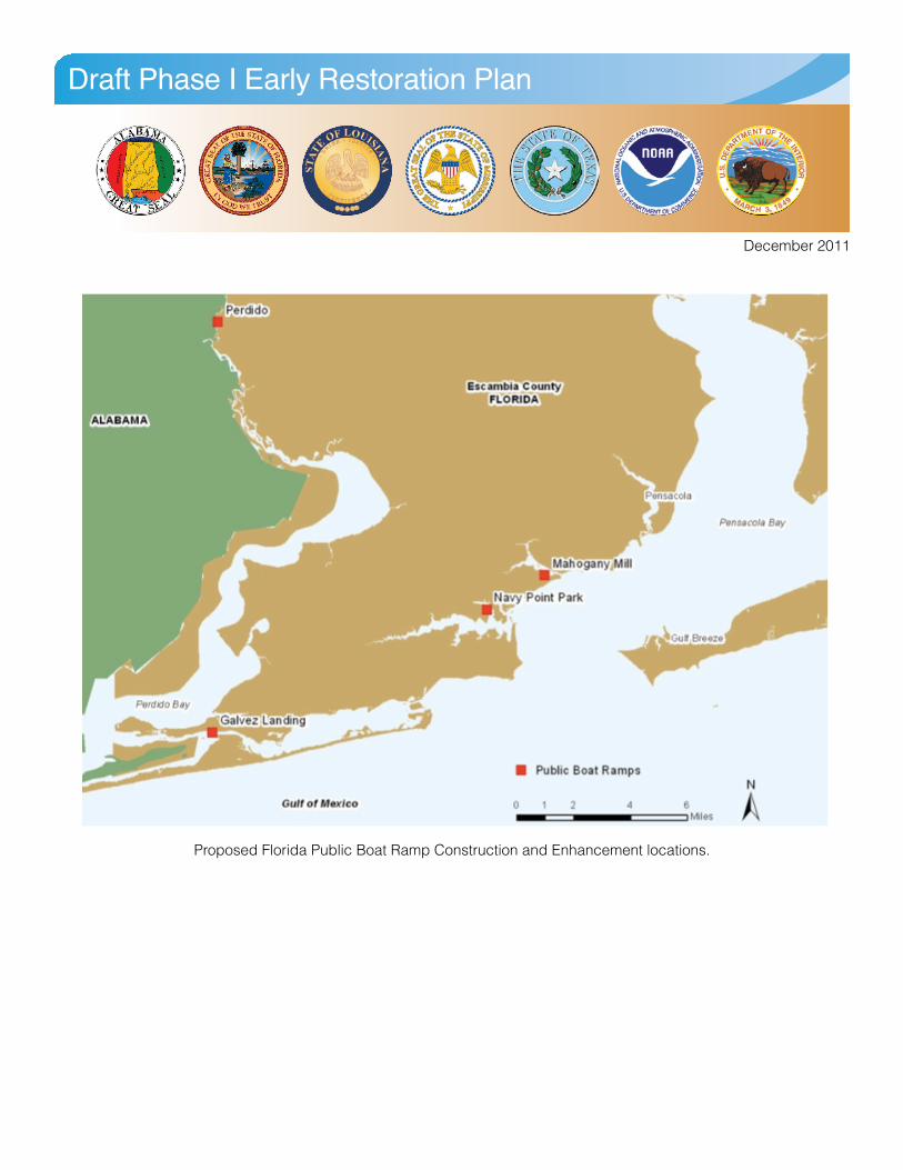
Proposed Florida Public Boat Ramp Construction and Enhancement locations.
Project Background
General Project DescriPtion
The cities of Gulf Shores and Orange Beach, State of Alabama (Gulf State Park), and the U.S. Fish and Wildlife Service (Bon Secour National Wildlife Refuge) and the Bureau of Land Management (Fort Morgan Beach) form the largest group of coastal land owners along the Alabama Gulf Coast. These owners col-lectively own and/or manage approximately 18 to 20 miles of dune habitat. This restoration project would result in the formation of a partnership, the Coastal Alabama Dune Restoration Cooperative (CADRC), to restore natural resources that were injured by the Deepwater Horizon oil spill response efforts.
The Trustees propose to restore 55 acres of dune habitats in Alabama that were affected by the Deepwater Horizon oil spill, including response efforts, by planting native dune vegetation and installing sand fencing. The proposed project will help prevent erosion by restoring a “living shoreline,” a coastline protected by plants and natural resources rather than hard structures.
Project Details Planting:• All plants will be grown from seeds or cuttings derived
from the Alabama coast or North Florida to ensure ap-propriate genetic stocks are used in the project.
• Slow release fertilizer (osmocote 18-6-12 e.g.) will be used to ensure proper establishment of the plants.
• The plants will be installed 6” deep to ensure that sufficient moisture is available to roots, and properly covered with sand to stabilize and protect the plants.
Sand Fencing:• Protective sand fencing that lines the dune feature and
contributes to sand accumulation along the toe of the dunes will be installed for the cities of Orange Beach and Gulf Shores and on Bureau of Land Management lands.
Signage:• Informative dune restoration signage will be placed on the project area at a rate of 10 to 25
signs per mile.
Deepwater Horizon Natural Resource Damage Assessment Trustee CouncilDeepwater Horizon Natural Resource Damage Assessment Trustee CouncilDeepwater Horizon Natural Resource Damage Assessment Trustee CouncilDeepwater Horizon Natural Resource Damage Assessment Trustee CouncilDeepwater Horizon Natural Resource Damage Assessment Trustee CouncilDeepwater Horizon Natural Resource Damage Assessment Trustee CouncilDeepwater Horizon Natural Resource Damage Assessment Trustee Council
One Very GOOd Gulf restOratiOn PrOject
• For best sand stabilization and to limit wind erosion plants will be mixed in the following propor-tions: 70% Sea oats grasses; 20% Panic grasses and smooth cord grasses, and 10% Ground covers (Sea purslane, Beach Elder, White morning glories and railroad vine), and planted on 18-inch centers.
Draft Phase I Early Restoration Plan
December 2011