donna nook managed realignment scheme - iema · fepa food and environment protection act 1985 ......
TRANSCRIPT
Donna Nook Managed Realignment Scheme Environmental Statement Non Technical Summary November 2009 This Non Technical Summary relates to the Environmental Statement which was compiled as part of the Environmental Impact Assessment process for the Donna Nook Managed Realignment Scheme.
Donna Nook Managed Realignment Environmental Statement - Non Technical Summary
November 2009 i
Glossary
Abbreviation / Term Definition
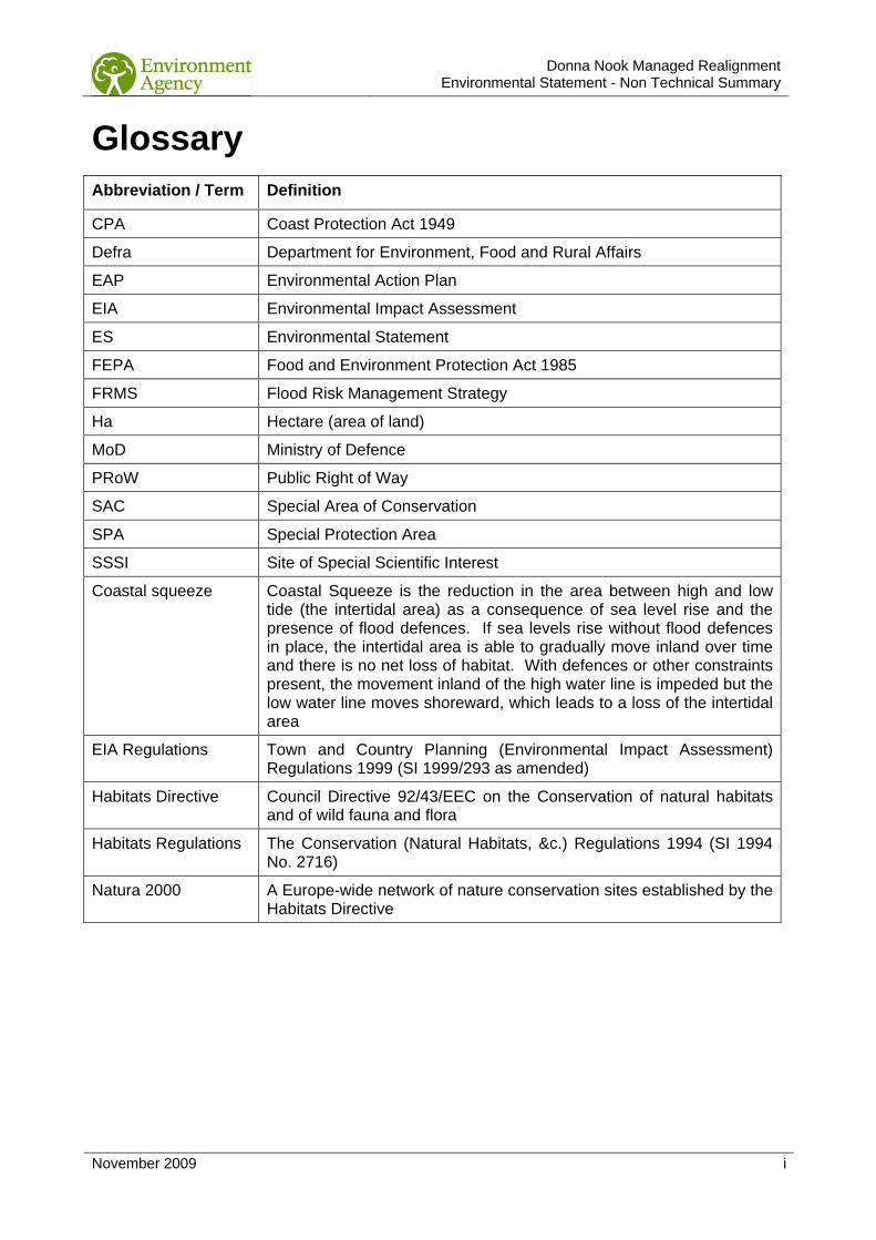
CPA Coast Protection Act 1949
Defra Department for Environment, Food and Rural Affairs
EAP Environmental Action Plan
EIA Environmental Impact Assessment
ES Environmental Statement
FEPA Food and Environment Protection Act 1985
FRMS Flood Risk Management Strategy
Ha Hectare (area of land)
MoD Ministry of Defence
PRoW Public Right of Way
SAC Special Area of Conservation
SPA Special Protection Area
SSSI Site of Special Scientific Interest
Coastal squeeze Coastal Squeeze is the reduction in the area between high and low tide (the intertidal area) as a consequence of sea level rise and the presence of flood defences. If sea levels rise without flood defences in place, the intertidal area is able to gradually move inland over time and there is no net loss of habitat. With defences or other constraints present, the movement inland of the high water line is impeded but the low water line moves shoreward, which leads to a loss of the intertidal area
EIA Regulations Town and Country Planning (Environmental Impact Assessment) Regulations 1999 (SI 1999/293 as amended)
Habitats Directive Council Directive 92/43/EEC on the Conservation of natural habitats and of wild fauna and flora
Habitats Regulations The Conservation (Natural Habitats, &c.) Regulations 1994 (SI 1994 No. 2716)
Natura 2000 A Europe-wide network of nature conservation sites established by the Habitats Directive

Donna Nook Managed Realignment Environmental Statement - Non Technical Summary
November 2009 1
Introduction, Background and Legislative Need
This Non-Technical Summary provides a brief overview of the content of the Environmental Statement that has been written to document the outcome of the Environmental Impact Assessment (EIA) of the Donna Nook Managed Realignment Scheme.
The purpose of the Donna Nook Managed Realignment Scheme is to provide a better standard of flood protection than the existing tidal defences and to create intertidal habitats to compensate for habitat losses in the outer part of the Humber Estuary. These habitat losses are the result of rising sea level, and the effect of existing flood defence embankments. The construction of a new flood defence embankment at the rear of the site and the controlled breach of the existing sea defences at Somercotes Haven Sluice (also known as Pye’s Hall Sluice) will enable the creation of an area of intertidal habitat. Within this 111 hectare (ha) intertidal area, we propose building ‘islands’ which will provide replacement little tern (Sterna albifrons) breeding habitat in order to replace losses due to erosion and coastal squeeze of habitat elsewhere in the Humber Estuary, notably the losses of breeding habitat at Easington.
The Donna Nook scheme is an integral component of the Humber Flood Risk Management Strategy (FRMS) programme of works, which was developed to maintain sustainable flood defence policies within the estuary and ensure compliance with the Habitats Regulations. Provision of compensatory intertidal habitat will enable compliance with the Habitat Regulations and thereby will enable implementation of the maintenance and improvement of flood defences proposed in the Humber FRMS. This includes over the next two to three years, bringing forward planned maintenance and improvement works along 6km of the coastline adjacent to Donna Nook.
Donna Nook is on the east coast of Lincolnshire near the village of North Somercotes. It is on the southern shore of the outer section of the Humber Estuary (see Figure 1) within an area reclaimed from the sea in the 1800s. The dunes found along the frontage, and the habitats seawards of these dunes, are designated as a Site of Special Scientific Interest (SSSI) and form part of the internationally designated Humber Estuary Special Area of Conservation (SAC), Special Protected Area (SPA) (part of the Natura 2000 network of sites) and Ramsar site.
The Humber Flood Risk Management Strategy sets the direction for managing the estuary’s flood defences to protect people, properties and agricultural land from flooding in this part of the Estuary are put in place. The overall strategy is to hold the line of existing defences where there is no justification for moving them; to identify sites where moving the defences will provide flood defence benefits and establish a programme for moving these defences. However the maintenance and improvement of coastal flood defences will result in further erosion of the estuary, coastal squeeze and consequently loss of intertidal habitat that forms part of the Natura 2000 network. The rise in sea levels that we expect to take place over the next 50 -100 years will make this situation worse.
In common with others who build in or immediately adjacent to Natura 2000 sites, we are required under the Conservation (Natural Habitats, &c.) Regulations 1994 (SI 1994 No. 2716) (‘the Habitats Regulations’), to compensate for and replace losses of designated habitats resulting from the maintenance and improvement of the coastal flood defences. If compensatory habitat is not created we will not be given permission to undertake vital flood defence works between Grimsby and Saltfleet. Our interpretation of the Habitat Regulations has been provided by Defra, who fully endorse our approach for the flood risk management of the Humber Estuary as set out in the Humber Flood Risk Management Strategy (2008) (Humber FRMS).
The realignment works at Donna Nook are subject to the Town and Country Planning (EIA) Regulations 1999 (as amended) and require a Statutory EIA. This is due to the large area of land affected by the works (150 ha), the fact that the works involve construction of a new flood defence embankment and a change of use for the land in question, from arable to intertidal habitat. We anticipate we will be able to carry out the maintenance works to the flood defences
Donna Nook Managed Realignment Environmental Statement - Non Technical Summary
November 2009 2
on adjacent sections of the coast using our Permitted Powers under The Town and Country Planning (General Permitted Development) Order 1995 (as amended).
Improvement works on the adjacent sections of the coast (such as raising and widening of embankments) will be the subject of further assessment and detailed design. It is anticipated that these subsequent phases will be the subject of EIA and Habitat Regulations Screening. Any consents that are required to carry out these works will be applied for at the appropriate time.
We have carried out a Habitats Regulations Assessment of the Donna Nook scheme in line with the Habitats Regulations requirements, which concluded that the works have the potential to have a likely significant effect on the Humber Estuary Natura 2000 and Ramsar site. Natural England has agreed with our assessment. As a result planning permission to construct the scheme is required and under the Habitats Regulations, East Lindsey District Council is required to carry out an Appropriate Assessment of the impacts of the scheme on the Humber Estuary prior to determining the planning application.
The Purpose of the Environmental Statement
The purpose of the EIA is to make sure that the significant environmental implications of the scheme are fully understood and taken into account before the applications for the consents necessary to deliver the scheme are determined. The Environmental Statement includes measures designed to minimise or remove adverse impacts of the scheme on the environment (mitigation measures). It accompanies the planning application submitted to East Lindsey District Council and also the application to the Defra Marine and Fisheries Agency for consents under the Food and Environment Protection Act (1985) (FEPA) and the Coast Protection Act (1949) (CPA).
You can view the full Environmental Statement at the East Lindsey District Council Offices and at our Manby office. Alternatively you can obtain a copy on a CD for free. Hard copies cost £250 which covers printing and postage costs. Contact John Pygott on 0113 2134831 or e-mail [email protected] if you would like to obtain a copy of the ES.
The structure of the ES is set out in Table 1.


Donna Nook Managed Realignment Environmental Statement - Non Technical Summary
November 2009 4
This page is blank intentionally

Donna Nook Managed Realignment Environmental Statement - Non Technical Summary
November 2009 5
Table 1: The Structure of the Environmental Statement
Section No. and Title Description of Contents
Section 1 - Introduction Describes the location of the site, the strategic context and background for the scheme.
Section 2 - Proposed Project Describes the scheme in general, the construction methodology as far as is known at this stage and the alternative considered.
Section 3 – Legal and Policy Context Describes the legal requirements associated with the scheme and the way the scheme aligns with national policies as well as regional and local policies.
Section 4 – Consultation
Describes the consultation that has taken place with external governmental and non-governmental organisations, internal Environment Agency functions, residents and Parish Councillors as well as how responses have been taken account of in the design of the scheme and considered as part of the EIA process.
Section 5 – EIA Methodology Sets out the methodology used to assess the various impacts of the scheme.
Section 6 – Environmental Assessment
Describes the environmental assessment of the impacts of the scheme on receptors including:
Human Population
Health Impact Assessment
Flora and Fauna
Landscape and Visual Amenity
Traffic and Transport
Historic Environment
Soil, Geology and Hydrogeology
Land Use
Use of Natural Resources and Waste Generation
Cumulative Impacts
Section 7 – Monitoring and Future Management
This section describes how we intend to check on whether what we expect to happen in terms of drainage of the site and development of wildlife habitats is happening. It also describes how we will manage such aspects in the future.
Section 8 – Environmental Enhancements
Not all of the land we own at Donna Nook will be used to create intertidal habitat. This section describes enhancements we are proposing to bring to the site in those areas to improve its value for wildlife and for the additional interest it will offer visitors to the site.
Section 9 – Summary and Conclusions The summary and conclusion of the assessment.
Section 10 – Environmental Action Plan Although included in the ES, this will form part of the contractor’s documentation with which the construction team must comply. It provides details of mitigation measures to be put in place, actions to be carried out to prevent damage to the environment, legislative requirements and also details of work that will be needed after construction work is complete.
Donna Nook Managed Realignment Environmental Statement - Non Technical Summary
November 2009 6
Description of the Managed Realignment Scheme
The proposed works at Donna Nook will provide a better standard of flood protection than the existing coastal defences. The construction of a new earth embankment around the south of the site, seaward of the historical earth embankment, together with a controlled breach of the existing sea defence at Somercotes Haven Tidal Sluice will enable an area of approximately 111 ha of intertidal habitat to be created (Figure 2.1), this will compensate for habitat losses in the outer part of the Humber Estuary.
The new defence will join with the sand dunes to the east of the site and the existing coastal flood embankment at the western end, thus forming a continuous line of defence. A new footpath will be formed on top of this embankment. The new embankment will be constructed from material excavated from within the site. The new flood embankment will provide a better standard of protection than the existing tidal defences that it replaces.
Porter’s Sluice pumping station currently pumps the river water from the Seven Towns South Eau over the historical embankment. The pumping station will be refurbished in order to pump the river water over the new higher embankment. Also the catchment area for the pumping station will be reduced as a result of the scheme.
Saltmarsh creeks will be excavated to assist with site drainage. This excavated material will be used to create little tern breeding islands. This method of construction means that material will be reused within the site, which will minimise the import of construction materials to the site and therefore traffic movements along Marsh Lane. We also propose to provide some terrestrial and freshwater habitats behind the new embankment.
The majority of the hard-standing in the existing Stonebridge car park (which is currently within the SSSI) will be removed and the area reinstated as dune habitat. Existing access points to the beach by the car park will be kept.
The breach in the existing coastal flood defences, which will be formed by removing Somercotes Haven Tidal Sluice and lowering sections of the Seven Towns South Eau’s flood banks will not be made until the rest of the works are complete and may not take place until 2011. The South Eau channel seaward of the breach will also need to be widened and the banks re-profiled. The proposed breach will be approximately 40m wide.


Donna Nook Managed Realignment Environmental Statement - Non Technical Summary
November 2009 8
This page is blank intentionally

Donna Nook Managed Realignment Environmental Statement - Non Technical Summary
November 2009 9
In association with the Donna Nook scheme the Environment Agency has also reviewed the current condition of the coastal defences between Northcoates Point and Saltfleet and identified four locations which require localised raising (Figure 3). These works will be carried out as part of the wider Humber FRMS to improve the current standard of flood protection along this section of coastline. The works are scheduled for 2010 and 2011, subject to the appropriate consents. In total the Environment Agency will improve approximately 6km of defences. Figure 3 Diagram showing proposed areas for defence maintenance and improvement
The Need for the Scheme
Long-term records confirm that habitat has been and continues to be lost across the whole estuary. The rate of loss will accelerate with climate change and sea level rise. Natural England, the Government's statutory advisor on the protection of the designated habitats, state that habitat loss is serious and action must be taken to compensate for the losses, otherwise we will not be able to continue with our strategy for flood defence improvements unless new habitat is created. Defra's position is that as part of our flood and coastal risk management work, compensatory habitat must be provided. This means that when the flood defences stop the estuary enlarging as sea levels rise, habitat losses take place as the water deepens, and we must provide new habitat of the same type. Defra has approved the Humber FRMS which sets out how we propose to achieve this. Without compensating for this loss of habitat, we will not be given permission to undertake vital flood defence works between Grimsby and Saltfleet. This will lead to these communities being at serious risk of flooding. The new habitat has to be similar to that being lost and this varies around the Estuary so the proposed creation of intertidal habitat at Donna Nook will directly compensate for the habitat loss on the part of the estuary between Grimsby and Saltfleet. The 1820 Ordnance Survey map shows that the low water line between Grimsby and Saltfleet was nearly 500metres further seaward on average than it is now. The average rate of retreat over the period is therefore about 2.5 metres per year. The Scheme also includes little tern habitat (5 ha), which will help compensate for breeding habitat that is being lost as a result of the erosion currently happening at Easington, just north of Spurn Head on the north shore of the Outer Estuary. Breeding little terns are an interest feature of, and therefore protected under, the Humber Estuary SPA.
Donna Nook Managed Realignment Environmental Statement - Non Technical Summary
November 2009 10
Consultation to Date
The Humber Estuary Flood Risk Management Scheme
We have consulted with the public on several occasions about the Humber FRMS itself and the selection of managed realignment sites. A number of documents have been produced and distributed, see Table 2, either to the general public or a selected audience.
Table 2: Consultation relating to the Humber FRMS
Topic and Title Date
Developing the Strategy
A Strategy for Flood Defence
Options Consultation Document
‘Planning for the Rising Tides’, The Humber Estuary, Consultation on managed realignment: information for landowners and tenants
‘Planning for The Rising Tides’, The Humber Estuary, Update on managed realignment
Strategy Consultation Document
The Humber Strategy
Newsletters ‘TidesNews’ #1 to #6
Newsletters ‘Humber tides news’ #1 to #3
April 1999
November 1999
June 2002
July 2003
August 2005
March 2008
July 2001 to March 2005
August 2007 to January 2008
Selection of managed realignment sites
Information for landowners and tenants
Update on managed realignment
June 2002
July 2003
Public meetings were held at different places around the estuary to coincide with publication of the main documents.
Donna Nook Managed Realignment Scheme
A Technical Advisory Group (TAG) was established to assist us in developing technical aspects and viable ecological options for the scheme that we could take to residents of the area for their input. The TAG consists of internal Environment Agency specialists and representatives from the external organisations including:
East Lindsey District Council
Natural England
Lincolnshire Wildlife Trust
Lindsey Marsh Drainage Board
Ministry of Defence - RAF Donna Nook and Defence Estates Safeguarding
National Farmers Union
Royal Society for the Protection of Birds.

Donna Nook Managed Realignment Environmental Statement - Non Technical Summary
November 2009 11
Once we had a basic design we asked for advice from local people with regard to future use of the site for and by local residents, such as the potential for its use by local colleges and schools to assist in the teaching of science, disabled access and the design and size of the car park.
Engagement with members of the public has been carried out at key stages of the Donna Nook scheme design and planning process, these being in September 2008 (when we had put together our first proposal for the site design and layout), January 2009, March 2009 and then a series of ‘drop-in’ sessions during September and October 2009 to present developments in the scheme and discuss what we were proposing to submit for planning.
Through this consultation process a number of issues have been raised by the local community, all of which have been thoroughly considered and taken account of wherever appropriate in the design of the scheme. Full details can be found in Section 4 of the Environmental Statement.
Alternatives Considered
If we were to ‘do nothing’ and not compensate for the loss of habitat then we would not be given permission to undertake vital flood defence works between Grimsby and Saltfleet. This will lead to these communities being at a serious risk of flooding. The Environmental Statement describes the main alternatives for the provision of compensatory intertidal habitat in the Outer Estuary, and considers in detail the range of flood defence options that have been investigated.
The site selection process considered other sites to create compensatory habitat in the outer estuary between Grimsby and Saltfleet. Potential sites were assessed against a series of criteria, including:
Effect on flood defences at site
Effects of geomorphology
Variety and location of habitat created
Impacts on the environment
Impacts on the community
Assets affected including grade of agricultural land
Engineering feasibility.
Of the potential options on the south shore of the Outer Estuary, Donna Nook met the criteria more effectively than the alternative site we considered at Tetney Haven or an additional site we investigated in 2009 to the west of Tetney Haven.

Donna Nook Managed Realignment Environmental Statement - Non Technical Summary
November 2009 12
Figure 4: Sites Considered as Potential Realignment Areas
Baseline Environment and Potential Impacts
Situated on the east coast of Lincolnshire within the Humber Estuary, the closest residential settlement to the proposed realignment site at Donna Nook is the village of North Somercotes, situated approximately 3km to the south. The site is reached via Marsh Lane which ends in the Stonebridge car park. Two cottages (Stonebridge Cottages) are situated immediately south of the entrance of the existing car park and a number of other properties and a sewage treatment works are located along Marsh Lane between the site and North Somercotes village.
Agriculture and tourism are the main traditional employment sectors in the local area. The Donna Nook site includes 89 hectares of grade one agricultural land which will be converted to intertidal habitat. Using this land will have no significant impact on food security regionally or nationally.
Since the 1930s the Ministry of Defence (MoD) has occupied large sections of the coast between Saltfleetby to Theddlethorpe and has an air weapons range at Donna Nook. Defence Estates Safeguarding has confirmed that the MoD has no safeguarding objections to the proposed scheme.
The site at Donna Nook is currently (and will continue to be) used by visitors and locals alike for bird watching and walking. There is a formal Public Right of Way (PRoW) that runs along the top of the sand dunes and onto the existing earth embankment. This is the eastern-most section of a PRoW that extends along the coast from Donna Nook to Cleethorpes. A new footpath will be constructed along the top of the new embankment, which will link with the coastal path that continues to Cleethorpes. The new footpath will also link with the footpath along the top of the historical embankment, creating a circular walk. Although it will still be possible to use the footpath along the dunes, it will not be possible to cross the breached area of the dunes for health and safety reasons and the existing footpath will be closed at that point.
Farm tracks within the site are currently used by horse riders, with the permission of the farmer and they can access the sand flats seawards of the existing defences via the farm track that runs through the centre of the site. This will not be possible once construction begins. The track
Tetney Haven (indicative)
Donna Nook (indicative)
Additional site (indicative)
Donna Nook Managed Realignment Environmental Statement - Non Technical Summary
November 2009 13
is to be dug up and used for construction of the little tern islands and the area will become inter-tidal.
The proposed realignment site currently consists of open agricultural fields, with a boundary network of drains, hedgerows and scrub. Seaward of the existing coastal defences are areas of coastal grassland, mudflats, saltmarsh and various types of dune. We have carried out an extensive programme of surveys of the flora and fauna on the site. The assessment of our survey results shows that no flora and fauna will be significantly adversely affected by the scheme.
We found no evidence of water voles on the area which is to be inundated, though there was evidence of this species in an area of grazing land in the western corner of the site. This area will remain as grazing marsh. The plant survey of the entire site found a number of orchids, but these are generally not within an area of the site that would be affected by the scheme. If we find any orchids or rare plants during construction, we will move them to a safe location in the dunes.
Donna Nook is a very important breeding site for grey seals which provide a major visitor attraction from October through to January for the annual seal watching season. Lincolnshire Wildlife Trust and Natural England are confident that there is no risk, at any stage, of our scheme disturbing the seal population in the Donna Nook National Nature Reserve. Due to the protected status of badgers the assessment of existing conditions and potential impacts on any badgers has been prepared as a confidential appendix to this ES. This appendix is only available to approved organisations.
The site provides an important high tide roost for brent geese and golden plover. It also supports certain types of hawk and other species of birds over the winter period. This high tide roost will be mainly lost when the area becomes intertidal. However, the impact has been assessed as not significant because the surrounding habitat is all of a similar type and quality and there is therefore adequate alternative high tide roost sites.
The farmland and associated waterbodies support a migrant and breeding bird interest and we will manage the land in advance to make it unattractive to breeding birds to minimise the risk to nests during construction.
From a landscape and visual perspective, the Donna Nook site is located within a coastal plain area of largely rich, arable farmland with narrow dykes forming regular, large-scale fields associated with scattered farm buildings. Infrequent and irregular mature tree shelterbelts provide enclosure within the landscape that also includes occasional pasture and rough grazing areas where traces of ridge and furrow can be seen. Visual impact will be greatest for the residents at Stonebridge Cottages in the short term. The completed scheme will result in a change in the views received by residents of Stonebridge Cottages in that the landscape will consist mainly of intertidal habitat rather than arable farmland.
The main access road to the site is via Marsh Lane, a single carriageway road which connects to the village of North Somercotes. Informal passing places are available along the length of the road, although the majority of the road is passable for two vehicles at slow speeds. The construction contractors will develop a traffic management plan to minimise impacts on the operation of the highway network and the safety of road users. Once the construction machinery is on site, it will remain there until the work is complete. Other than this, we anticipate that there will be no more than 20 two-way traffic movements along Marsh Lane per day (this will be mainly construction site staff entering and leaving). We propose to complete the majority of the work before the seal breeding season begins in 2010, thereby avoiding making existing traffic problems worse. As the clay and earth needed to construct the embankment will be sourced from the site, there will be no need to bring lorry loads of clay through the village.

Donna Nook Managed Realignment Environmental Statement - Non Technical Summary
November 2009 14
We will maintain public and MoD parking at the existing or new Stonebridge car park at all times during construction.
Survey work at the site included trial trenches and boreholes to establish whether the underlying clay would be suitable to use to construct the new embankment. When we were carrying out these site investigations we put in place an ‘archaeological watching brief’, i.e. an archaeologist who checks the trenches and borehole contents for signs of archaeological finds. None were discovered during these watching briefs. There are some Second World War structures on the existing coastal defence that have local historic importance but they will not be affected by the scheme. There will be permanent adverse impacts to known historic features within the managed realignment site but as all affected features are rated as ‘ungraded’ these impacts are not considered significant. Any new finds during construction will be removed and/or recorded and added to the archaeological records. Although any new finds will be disturbed, the uncovering of unknown deposits would provide new knowledge and could, therefore, be considered useful.
Underlying the topsoil of the managed realignment site at Donna Nook are four main layers – upper estuarine clay, estuarine sand, lower estuarine clay and glacial till. The chalk bedrock that underlies the whole site is a recognised aquifer; however, the substantial thickness of the glacial till acts as a barrier restricting the interaction of water from the Humber Estuary with groundwater in the chalk. Any existing boreholes uncovered will be capped. No significant impacts on soils and hydrogeology in the area are anticipated.
During construction the main adverse impacts will be: a change in the views from Stonebridge Cottages which in the short term, during construction, could be unattractive; disruption to local users of the site, construction traffic affecting Marsh Lane and the village; and temporary closures of PRoW.
During operation the main adverse impacts will be: loss of some permissive access to the area, andloss of agricultural land. The main benefits will be improved flood protection, the creation of compensatory habitat, a new car park with landscaped areas, bicycle parking facilities and improved disabled access. We are not proposing to advertise the site to the wider public however, at the request of certain residents of the village; it will be left to the community to promote the area for eco-tourism purposes if they so wish in the future.
Proposed Mitigation
The proposed mitigation measures include:
Carrying out ecological mitigation works in advance of the main construction; Careful programming of construction activities; Implementation of a traffic management plan to minimise any impacts of the construction
activities on the highway network and the safety of road users, and Preparation of an Environmental Action Plan (EAP) for the scheme.
Some early ecological mitigation is required to allow the construction programme to be met. This will include reducing the suitability of the site for nesting birds and will be achieved by cutting back marginal vegetation in the watercourses and pond and by reverting the fields to bare ground. The EAP sets out the identified environmental actions pre-construction, during construction and post-construction, including general environmental guidelines, environmental monitoring and incident reporting systems. It will also include identification of the main environmental constraints identified in the EIA process, the objectives and targets for implementing the works in accordance with good environmental practice, and monitoring and management of the site post construction.

Donna Nook Managed Realignment Environmental Statement - Non Technical Summary
November 2009 15
Enhancements
We have a statutory duty to protect and enhance the local environment wherever possible. In addition to the core objectives of the scheme which are to improve flood defences, provide intertidal habitat and replace little tern breeding habitat, the consultation and outline design processes have helped identify a number of additional enhancement opportunities to improve the biodiversity and public amenity value of the site.
The scheme will provide the following enhancements:
return the existing car park to sand dune habitat;
shallow natterjack toad breeding ponds and suitable terrestrial habitat;
improved pond margins around the edge of an existing pond;
shallow wetland scrapes between the new embankment and the historical embankment; and
grassland habitat (grazed) between the new embankment and historical embankment and retention of existing grazing marsh.
The following public amenity enhancements have been identified:
approximately 50% more formal car parking spaces at Donna Nook, including six disabled parking spaces;
cycle parking for up to 10 bicycles;
a section of the diverted PRoW will be accessible to wheelchair users;
a circular footpath around the new terrestrial habitat between the historical and new flood embankments;
visitor information and interpretation boards.
Conclusions
The Donna Nook Managed Realignment Scheme is integral to delivery of the Humber FRMS. The FRMS describes the flood defence improvement, maintenance, monitoring and managed realignment works proposed over the next 25 years and beyond around the Humber Estuary. The Humber Estuary’s intertidal areas provide a complex and highly productive ecosystem that supports a wide range of habitats and species. The estuary is recognised as one of the most important estuaries in Europe for wildlife and is designated under the EC Habitats Directive and the UK Habitats Regulations.
The Humber FRMS programme of works was developed to maintain sustainable flood defence policies within the estuary and ensure compliance with the Habitats Regulations. The Donna Nook scheme is one component of this programme of works. The main objectives of the scheme are to provide a better standard of flood protection, to provide compensatory intertidal habitats that are being lost from the south shore of the outer estuary as a result of implementing the FRMS, and to create little tern (Sterna albifrons) breeding habitat in order to replace losses due to erosion and coastal squeeze of habitat elsewhere in the Humber Estuary, notably the losses of breeding habitat at Easington. Provision of compensatory intertidal habitat will enable compliance with the Habitat Regulations and thereby will enable implementation of the maintenance and improvement of flood defences proposed in the Humber FRMS.
The Donna Nook scheme performs well against the aims and objectives to provide replacement intertidal habitat. Alternatives were considered, and Donna Nook was assessed to be the best

Donna Nook Managed Realignment Environmental Statement - Non Technical Summary
November 2009 16
option. The site is adjacent to the Humber European Marine Site and therefore maximises opportunities for ecological connectivity and enhancement of the ecological integrity of the site.
The potential adverse impacts are associated with the permanent loss of agricultural land and temporary construction activities (noise, dust, visual etc). Through the design of the scheme and the implementation of tried and tested mitigation measures including strict management of the construction programme, it is possible to address the potential temporary impacts.
The engineering feasibility of the proposals has been confirmed and the Environment Agency owns the site, therefore pending approval of relevant consents, the scheme is deliverable. The Donna Nook scheme therefore delivers both a practicable and environmentally sound solution.

Donna Nook Managed Realignment Environmental Statement - Non Technical Summary
November 2009
Would you like to find out more about us, or about your environment?
Then call us on
08708 506 506 (Mon-Fri 8-6)
or visit our website
www.environment-agency.gov.uk
incident hotline 0800 80 70 60 (24hrs)
floodline 0845 988 1188
Environment first: This publication is printed on paper made from
100 per cent previously used waste. By-products from making the pulp and paper are used for composting and fertiliser, for making cement and for generating energy.

Donna Nook Managed Realignment Environmental Statement - Non Technical Summary
November 2009
This page is blank intentionally