download slides - center for environmental excellence
TRANSCRIPT
TB
0420
0900
2AT
L
1
Understanding Flexibility in the AASHTO Green Book
A Webinar on Geometric Design

TB
0420
0900
2AT
L
2
Webinar Sponsors
• AASHTO Center for Environmental Excellence
• U.S. Department of Transportation
―Federal Highway Administration
―Federal Transit Administration
TB
0420
0900
2AT
L
3
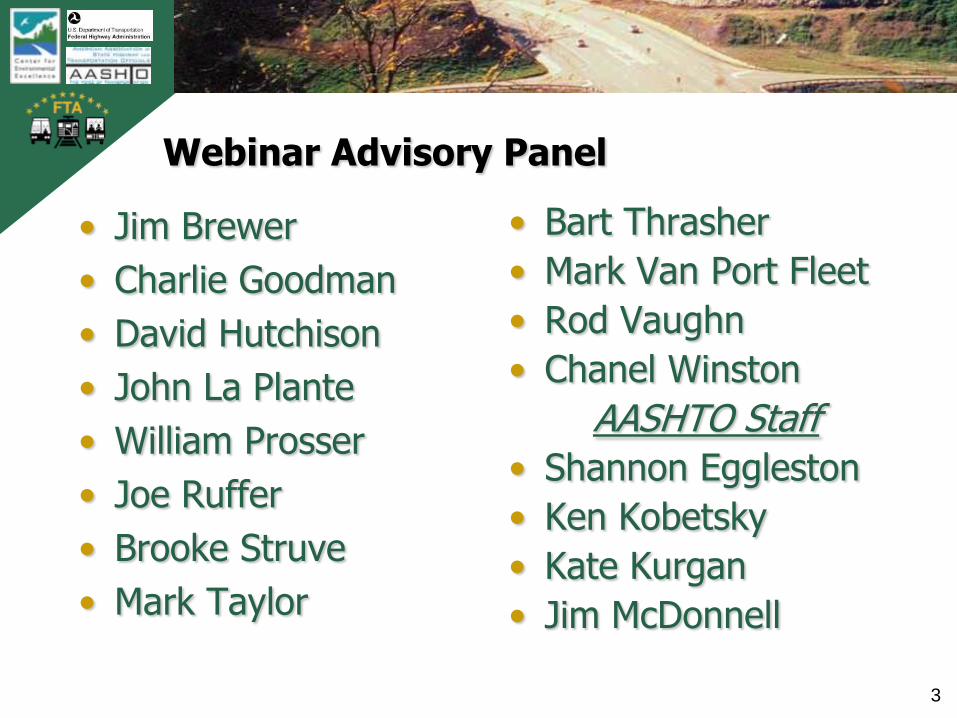
Webinar Advisory Panel
• Jim Brewer
• Charlie Goodman
• David Hutchison
• John La Plante
• William Prosser
• Joe Ruffer
• Brooke Struve
• Mark Taylor
• Bart Thrasher
• Mark Van Port Fleet
• Rod Vaughn
• Chanel Winston
AASHTO Staff
• Shannon Eggleston
• Ken Kobetsky
• Kate Kurgan
• Jim McDonnell
TB
0420
0900
2AT
L
4
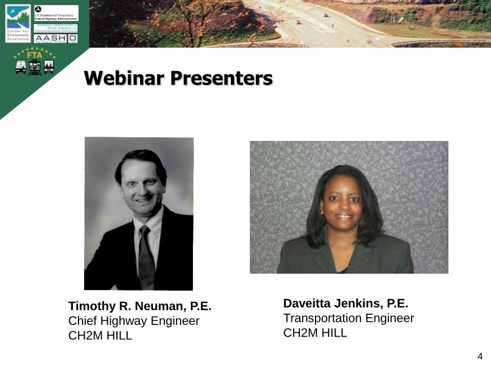
Webinar Presenters
Timothy R. Neuman, P.E.
Chief Highway Engineer
CH2M HILL
Daveitta Jenkins, P.E.
Transportation Engineer
CH2M HILL
TB
0420
0900
2AT
L
5
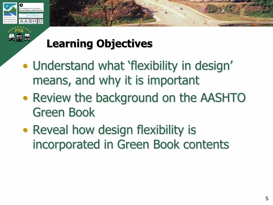
Learning Objectives
• Understand what „flexibility in design‟ means, and why it is important
• Review the background on the AASHTO Green Book
• Reveal how design flexibility is incorporated in Green Book contents

TB
0420
0900
2AT
L
6
Overview of Webinar
• Introduction and Objectives
• Background on the AASHTO Policy on Geometric Design
• The Project Development Process and Flexibility
• Highway Design Controls
10-minute Break
• Discussion of Geometric Elements
• Design Exceptions and Risk Management
• Closing Remarks
TB
0420
0900
2AT
L
7
Questions, Answers and Discussion
• How to ask questions
• Follow-up discussions
TB
0420
0900
2AT
L
8
Background on the AASHTO Policy on Geometric Design of Highways and Streets, 5th Edition
• Approved by AASHTO Standing Committee on Highways (SCOH)
• Previous editions
― 1950 (compilation of early policies)
― 1954 and 1965 (Rural Highways)
― 1957 and 1973 (Urban Highways and Arterial Streets)
― 1984, 1990, 1994, 2001
• Planned next edition -- 2010*
• Commonly referred to as „The Green Book‟
TB
0420
0900
2AT
L
9
How are contents developed?
• Subcommittee on Design and Technical Committee on Geometric Design develop draft material
• Research is commissioned and incorporated as appropriate
• Working meetings resolve technical issues and result in consensus on content
• Approval by 2/3 of state DOTs is required for acceptance and publication
TB
0420
0900
2AT
L
10
The ‘Green Book’ is continually updated to reflect the latest research
• Research proposed by state DOTs
• Standing Committee on Research (SCOR) prioritizes statements
• Competitive, peer reviewed research process (NCHRP) administered by the Transportation Research Board
TB
0420
0900
2AT
L
11
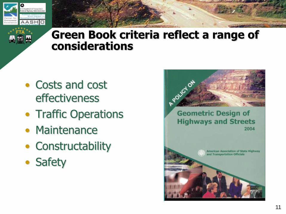
Green Book criteria reflect a range of considerations
• Costs and cost effectiveness
• Traffic Operations
• Maintenance
• Constructability
• Safety
TB
0420
0900
2AT
L
12
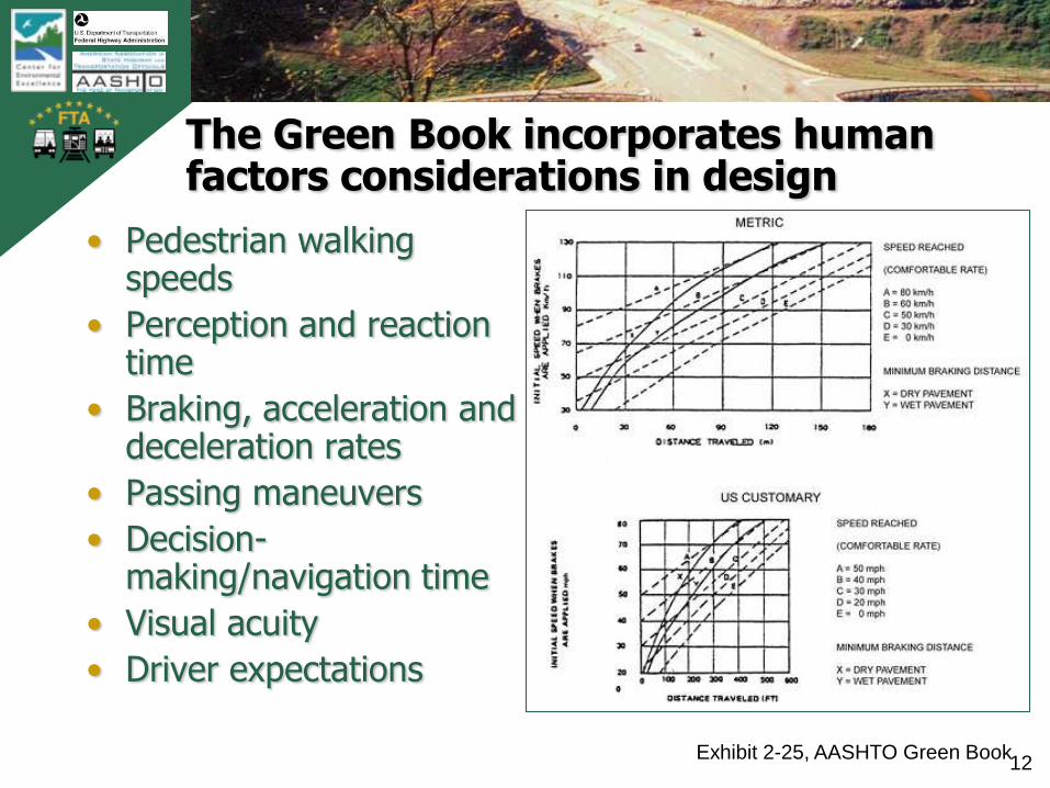
The Green Book incorporates human factors considerations in design
• Pedestrian walking speeds
• Perception and reaction time
• Braking, acceleration and deceleration rates
• Passing maneuvers
• Decision-making/navigation time
• Visual acuity
• Driver expectations
Exhibit 2-25, AASHTO Green Book
TB
0420
0900
2AT
L
13
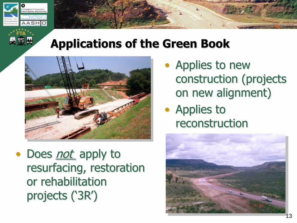
Applications of the Green Book
• Applies to new construction (projects on new alignment)
• Applies to reconstruction
• Does not apply to resurfacing, restoration or rehabilitation projects („3R‟)
TB
0420
0900
2AT
L
14
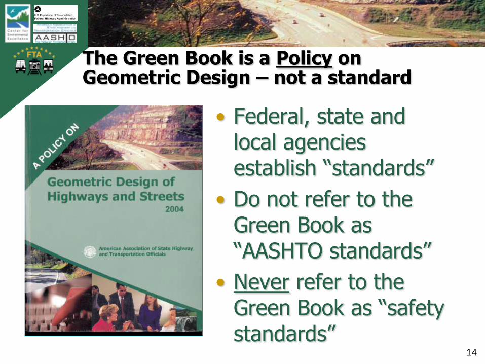
The Green Book is a Policy on Geometric Design – not a standard
• Federal, state and local agencies establish “standards”
• Do not refer to the Green Book as “AASHTO standards”
• Never refer to the Green Book as “safety standards”

TB
0420
0900
2AT
L
15
What is the flexibility in the Green Book?
• Many dimensions and values are shown as ranges
• Many criteria are described as „guidelines‟ or „typical‟
• Many concepts are not dimensioned but discussed only in functional terms
• In many cases, choices are offered for how to complete a design
• Solutions or concepts not specifically included are not precluded
• Specific solutions are not mandated
• Designer judgment is implied or explicitly suggested

TB
0420
0900
2AT
L
16
Individual state or agency policies and manuals apply
• Federal, state and local agencies may have their own design manuals and policies
• All state DOTs refer to the AASHTO Green Book
• Some states and local agencies have adopted the Green Book as their geometric design standards or design manual
• FHWA adopted the Green Book as the basis for minimum standards for the National Highway System
TB
0420
0900
2AT
L
17
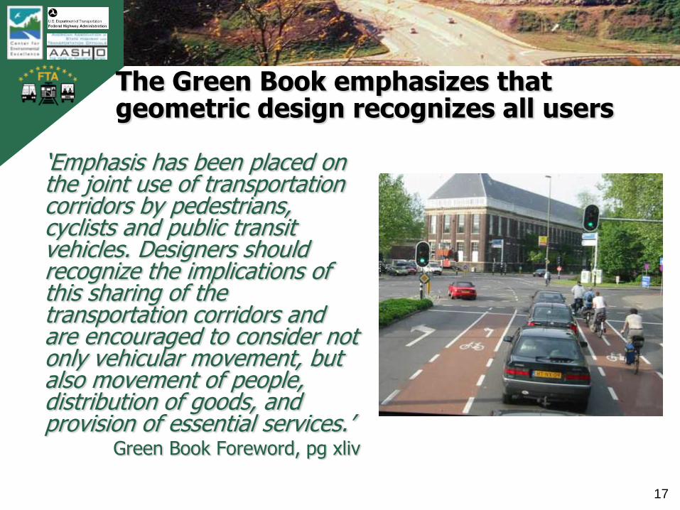
The Green Book emphasizes that geometric design recognizes all users
„Emphasis has been placed on the joint use of transportation corridors by pedestrians, cyclists and public transit vehicles. Designers should recognize the implications of this sharing of the transportation corridors and are encouraged to consider not only vehicular movement, but also movement of people, distribution of goods, and provision of essential services.‟
Green Book Foreword, pg xliv
TB
0420
0900
2AT
L
18
Know how to use the Green Book
„The intent of this policy is to provide guidance to the designer by referencing a recommended range of values for critical dimensions. It is not intended to be a detailed design manual that could supercede the need for the application of sound principles by the knowledgeable design professional. Minimum values are either given or implied by the lower value in a given range of values. The larger values within the ranges will normally be used where the social, economic, and environmental (S.E.E.) impacts are not critical.‟
Green Book Foreword, pg xliii

TB
0420
0900
2AT
L
19
Major themes of AASHTO’s ‘Guide for Achieving Flexibility in Highway Design’
• Establishing „purpose and need‟ (defining the problem) is critical to success
• Key decisions are made early in the project development process
• Design criteria are the basis for design (need to understand their background, history, use)
• Basic design controls are choices made by designers
TB
0420
0900
2AT
L
20
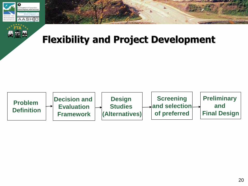
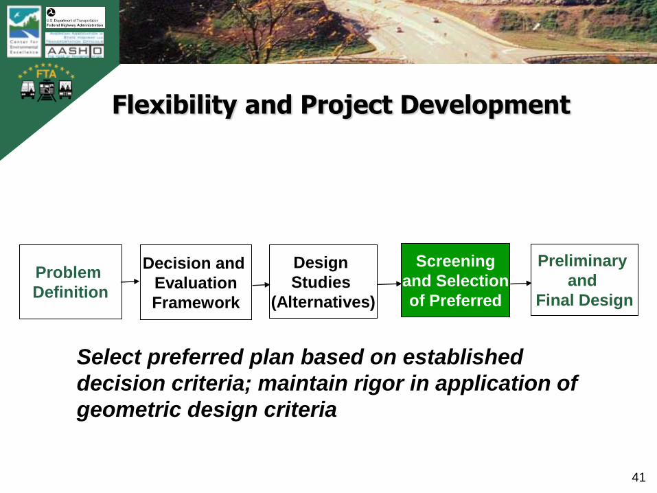
Flexibility and Project Development
Problem
Definition
Decision and
Evaluation
Framework
Design
Studies
(Alternatives)
Screening
and selection
of preferred
Preliminary
and
Final Design

TB
0420
0900
2AT
L
21
Flexibility and Project Development
Problem
Definition
Decision and
Evaluation
Framework
Design
Studies
(Alternatives)
Screening
and selection
of preferred
Preliminary
and
Final Design
Defining problems carefully during
project scoping enables flexibility
TB
0420
0900
2AT
L
22
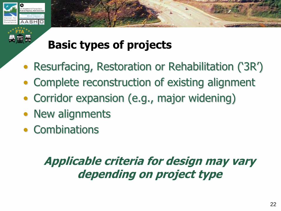
Basic types of projects
• Resurfacing, Restoration or Rehabilitation („3R‟)
• Complete reconstruction of existing alignment
• Corridor expansion (e.g., major widening)
• New alignments
• Combinations
Applicable criteria for design may vary depending on project type

TB
0420
0900
2AT
L
23
Project type should be aligned with the problem(s) being addressed
Replacement of infrastructure in disrepair
Congestion or traffic operational problems
Safety (crash prevention and/or severity mitigation)
TB
0420
0900
2AT
L
24
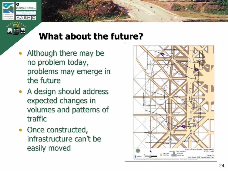
What about the future?
• Although there may be no problem today, problems may emerge in the future
• A design should address expected changes in volumes and patterns of traffic
• Once constructed, infrastructure can‟t be easily moved

TB
0420
0900
2AT
L
25
Problems should be defined in objective, quantitative terms
• Disrepair – bridge inspection ratings, pavement performance ratings
• Congestion – Level of service, hours of delay, travel time, speeds, etc.
• Safety – Crashes per mile per year, fatalities and serious injuries
Problems should be defined relative to established performance benchmarks

TB
0420
0900
2AT
L
26
Safety has two dimensions
• Nominal Safety is examined in reference to compliance with standards, warrants, guidelines and sanctioned design procedures
• Substantive Safety is the expected or actual crash frequency and severity for a highway or roadway
*Ezra Hauer, ITE Traffic Safety Toolbox Introduction, 1999
Is this road ‘safe’?

TB
0420
0900
2AT
L
27
Defining the safety problem
• Not every location is a „high-accident‟ site
• Understand types and patterns of crashes; focus on more serious crash types
• Not all „nominally unsafe‟ roads have substantive safety problems
• Substantive safety may not be a problem on any given project
TB
0420
0900
2AT
L
28
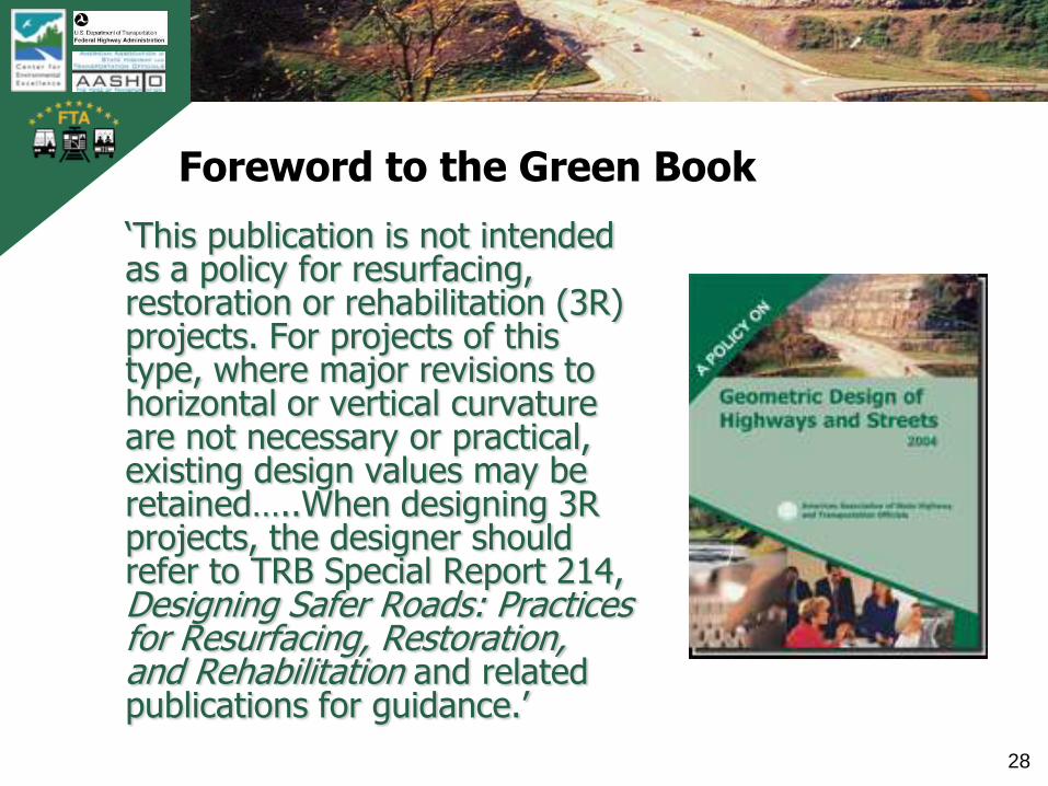
Foreword to the Green Book
„This publication is not intended as a policy for resurfacing, restoration or rehabilitation (3R) projects. For projects of this type, where major revisions to horizontal or vertical curvature are not necessary or practical, existing design values may be retained…..When designing 3R projects, the designer should refer to TRB Special Report 214, Designing Safer Roads: Practices for Resurfacing, Restoration, and Rehabilitation and related publications for guidance.‟
TB
0420
0900
2AT
L
29
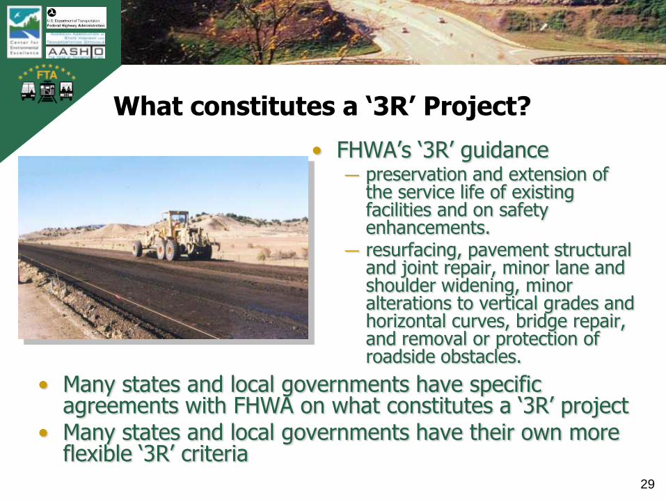
What constitutes a ‘3R’ Project?
• Many states and local governments have specific agreements with FHWA on what constitutes a „3R‟ project
• Many states and local governments have their own more flexible „3R‟ criteria
• FHWA‟s „3R‟ guidance― preservation and extension of
the service life of existing facilities and on safety enhancements.
― resurfacing, pavement structural and joint repair, minor lane and shoulder widening, minor alterations to vertical grades and horizontal curves, bridge repair, and removal or protection of roadside obstacles.
TB
0420
0900
2AT
L
30
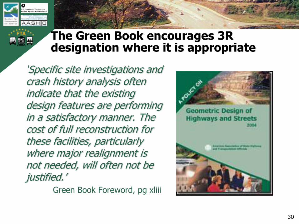
The Green Book encourages 3R designation where it is appropriate
„Specific site investigations and crash history analysis often indicate that the existing design features are performing in a satisfactory manner. The cost of full reconstruction for these facilities, particularly where major realignment is not needed, will often not be justified.‟
Green Book Foreword, pg xliii

TB
0420
0900
2AT
L
31
Defining the project type is a critical early decision in project scoping
For new alignment, or significant
change in footprint or alignment,
the Green Book applies
Designers can use even more
flexible ‘3R’ criteria for resurfacing
or simple restoration projects (e.g.,
TRB Special Report 214 or state
DOT ‘3R’ criteria)
TB
0420
0900
2AT
L
32
Flexibility and Project Development
Problem
Definition
Decision and
Evaluation
Framework
Design
Studies
(Alternatives)
Screening
and Selection
of Preferred
Preliminary
and
Final Design
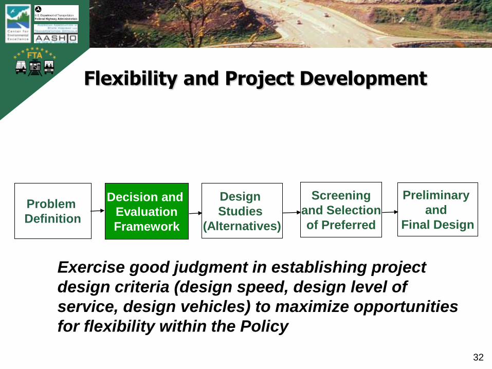
Exercise good judgment in establishing project
design criteria (design speed, design level of
service, design vehicles) to maximize opportunities
for flexibility within the Policy
TB
0420
0900
2AT
L
33
Design Controls and Designer’s Discretion
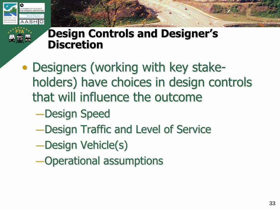
• Designers (working with key stake-holders) have choices in design controls that will influence the outcome
―Design Speed
―Design Traffic and Level of Service
―Design Vehicle(s)
―Operational assumptions

TB
0420
0900
2AT
L
34
Flexibility and Project Development
Problem
Definition
Decision and
Evaluation
Framework
Design
Studies
(Alternatives)
Screening
and Selection
of Preferred
Preliminary
and
Final Design
Be creative in solutions, engage stakeholders,
and fully study all feasible design options
TB
0420
0900
2AT
L
35
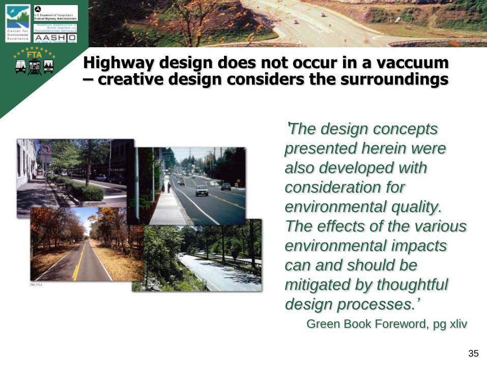
Highway design does not occur in a vaccuum – creative design considers the surroundings
„The design concepts
presented herein were
also developed with
consideration for
environmental quality.
The effects of the various
environmental impacts
can and should be
mitigated by thoughtful
design processes.’Green Book Foreword, pg xliv

TB
0420
0900
2AT
L
36
Consider all needs of the roadway users
• Vehicle types― passenger cars
― trucks (freight)
― buses and transit
• Non-motorized users― pedestrians
― bicyclists
― disabled
• Adjacent property owners and users
TB
0420
0900
2AT
L
37
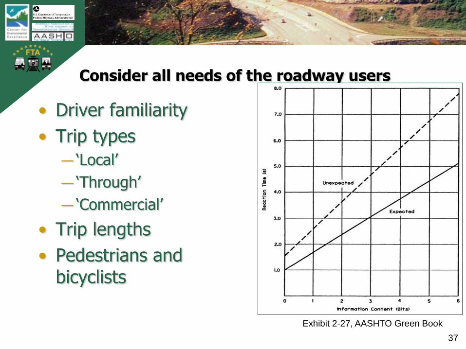
Consider all needs of the roadway users
• Driver familiarity
• Trip types
― „Local‟
― „Through‟
― „Commercial‟
• Trip lengths
• Pedestrians and bicyclists
Exhibit 2-27, AASHTO Green Book
TB
0420
0900
2AT
L
38
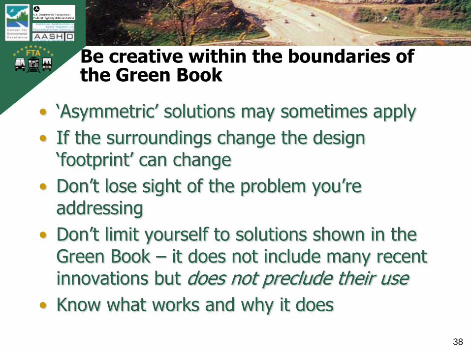
Be creative within the boundaries of the Green Book
• „Asymmetric‟ solutions may sometimes apply
• If the surroundings change the design „footprint‟ can change
• Don‟t lose sight of the problem you‟re addressing
• Don‟t limit yourself to solutions shown in the Green Book – it does not include many recent innovations but does not preclude their use
• Know what works and why it does

TB
0420
0900
2AT
L
39
Design creativity – saving a valued resource
Large, valued oak tree in
the path of a planned
arterial widening
― Plan adjusted to ‘save’ the
tree by placing it in the
median
― Split profile to protect roots
― Special irrigation system
― Special barrier design to
protect drivers and the tree
MD Rte 355
Source: NCHRP Report 480

TB
0420
0900
2AT
L
40
Design creativity -- Improving both mobility and safety by decreasing the number of lanes
• Conversion of 4-lane undivided street
• Flush median left turn lane for safety and accessibility
• Sidewalks
• Utility poles offset from traveled way
U.S. 6 through Atlantic, Iowa
Photo courtesy of Neal Hawkins and Iowa
Department of Transportation
‘Road Diets’
TB
0420
0900
2AT
L
41
Flexibility and Project Development
Problem
Definition
Decision and
Evaluation
Framework
Design
Studies
(Alternatives)
Screening
and Selection
of Preferred
Preliminary
and
Final Design
Select preferred plan based on established
decision criteria; maintain rigor in application of
geometric design criteria
TB
0420
0900
2AT
L
42
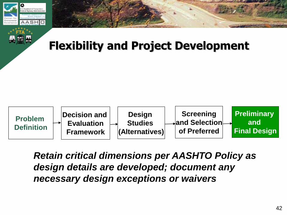
Flexibility and Project Development
Problem
Definition
Decision and
Evaluation
Framework
Design
Studies
(Alternatives)
Screening
and Selection
of Preferred
Preliminary
and
Final Design
Retain critical dimensions per AASHTO Policy as
design details are developed; document any
necessary design exceptions or waivers

TB
0420
0900
2AT
L
43
Responsibilities of designers (working with key stakeholders)
• Consider all impacts
and implications
• Apply Green Book
criteria appropriately
• Be objective
• Fully document
actions and decisions

TB
0420
0900
2AT
L
44
Design Controls
• Functional Classification
• „Givens‟ that influence what is possible or reasonable (surroundings or „context‟)
― Terrain and topography
―Natural and man-made features
― Environmental features
― Legal and regulatory controls; and agency policies
• Design Speed
• Traffic
TB
0420
0900
2AT
L
45
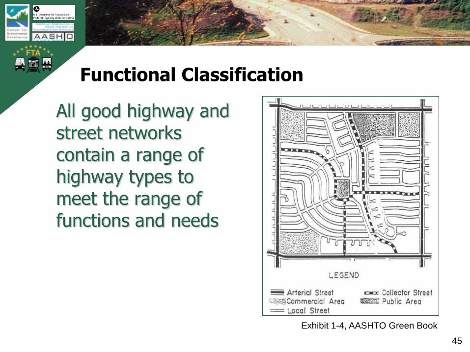
Functional Classification
All good highway and street networks contain a range of highway types to meet the range of functions and needs
Exhibit 1-4, AASHTO Green Book
TB
0420
0900
2AT
L
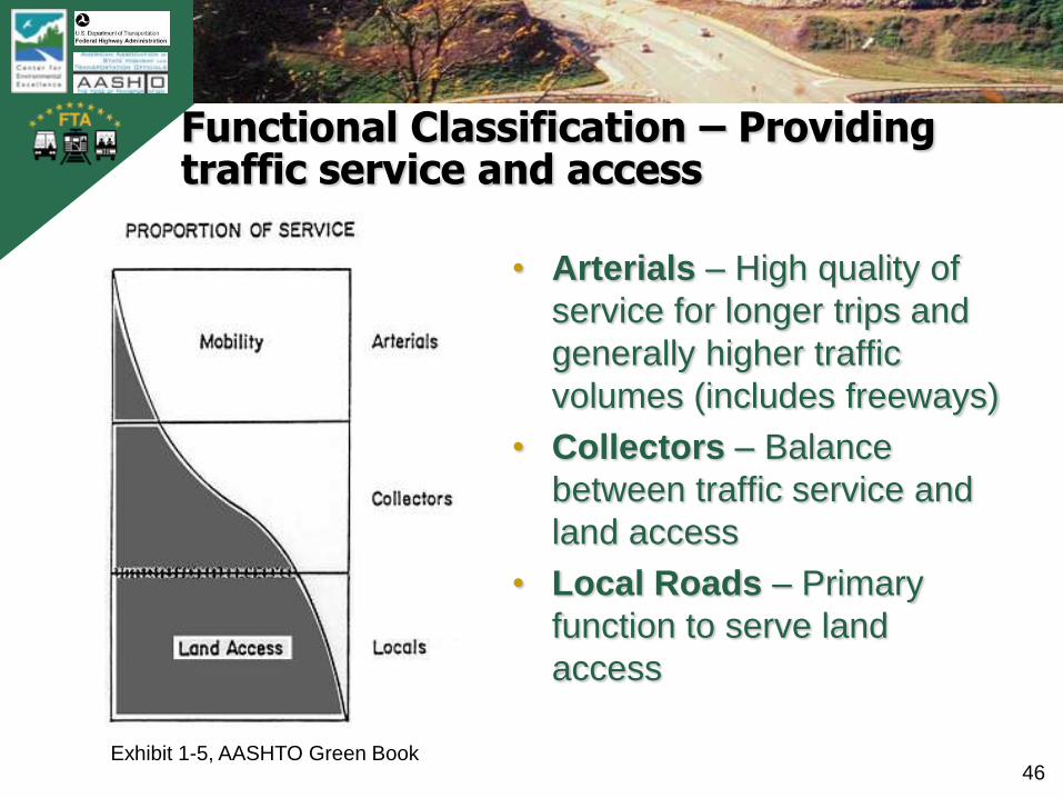
46
Functional Classification – Providing traffic service and access
• Arterials – High quality of
service for longer trips and
generally higher traffic
volumes (includes freeways)
• Collectors – Balance
between traffic service and
land access
• Local Roads – Primary
function to serve land
access
Exhibit 1-5, AASHTO Green Book
TB
0420
0900
2AT
L
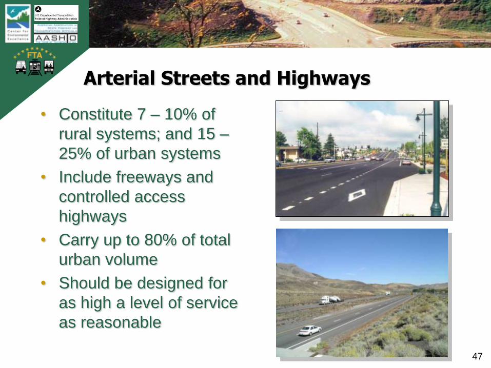
47
Arterial Streets and Highways
• Constitute 7 – 10% of
rural systems; and 15 –
25% of urban systems
• Include freeways and
controlled access
highways
• Carry up to 80% of total
urban volume
• Should be designed for
as high a level of service
as reasonable
photo showing
arterial street;
median, multiple
lanes, no parking

TB
0420
0900
2AT
L
48
Collector Streets and Highways
• Constitute 20 - 25%
of rural systems; and
5 - 10% of urban
systems
• Carry 5 – 10% of
urban volume
• Designed for a wide
range of land use
and access needs
TB
0420
0900
2AT
L
49
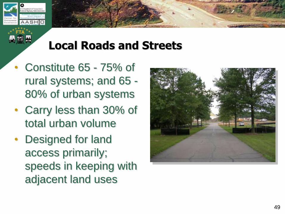
Local Roads and Streets
• Constitute 65 - 75% of
rural systems; and 65 -
80% of urban systems
• Carry less than 30% of
total urban volume
• Designed for land
access primarily;
speeds in keeping with
adjacent land uses
TB
0420
0900
2AT
L
50
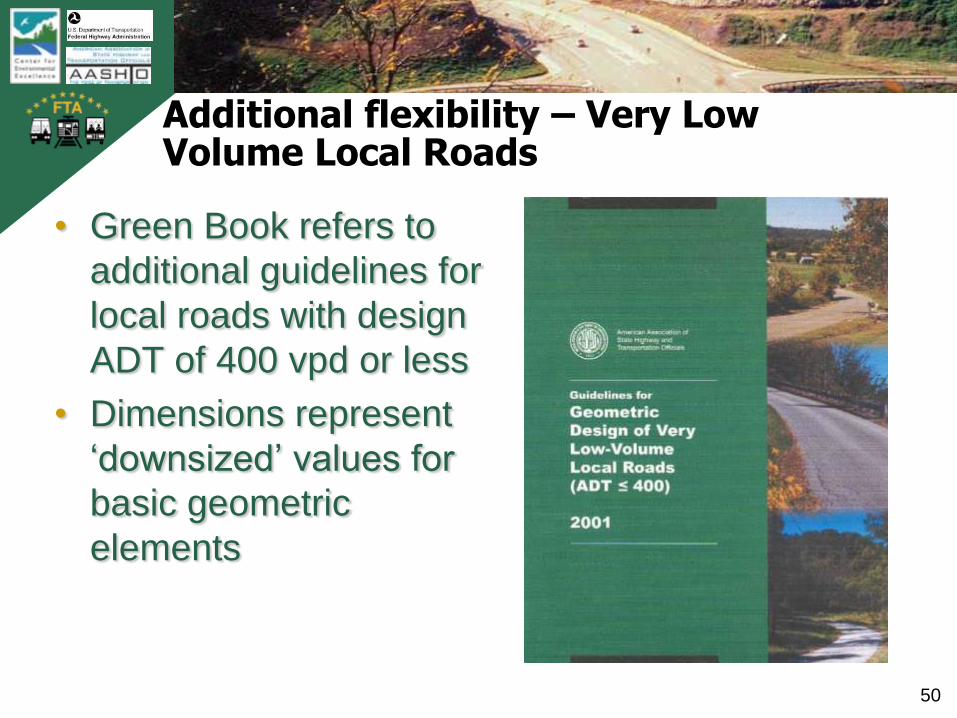
Additional flexibility – Very Low Volume Local Roads
• Green Book refers to
additional guidelines for
local roads with design
ADT of 400 vpd or less
• Dimensions represent
‘downsized’ values for
basic geometric
elements

TB
0420
0900
2AT
L
51
Topography and Environment
• Topographic Elements ― Terrain
― Subsurface conditions
• Environmental Elements― Adjoining land use
― Protected features (through both regulations and community wishes)
• Manmade Features― Historic and otherwise
significant buildings
― Development
TB
0420
0900
2AT
L
52
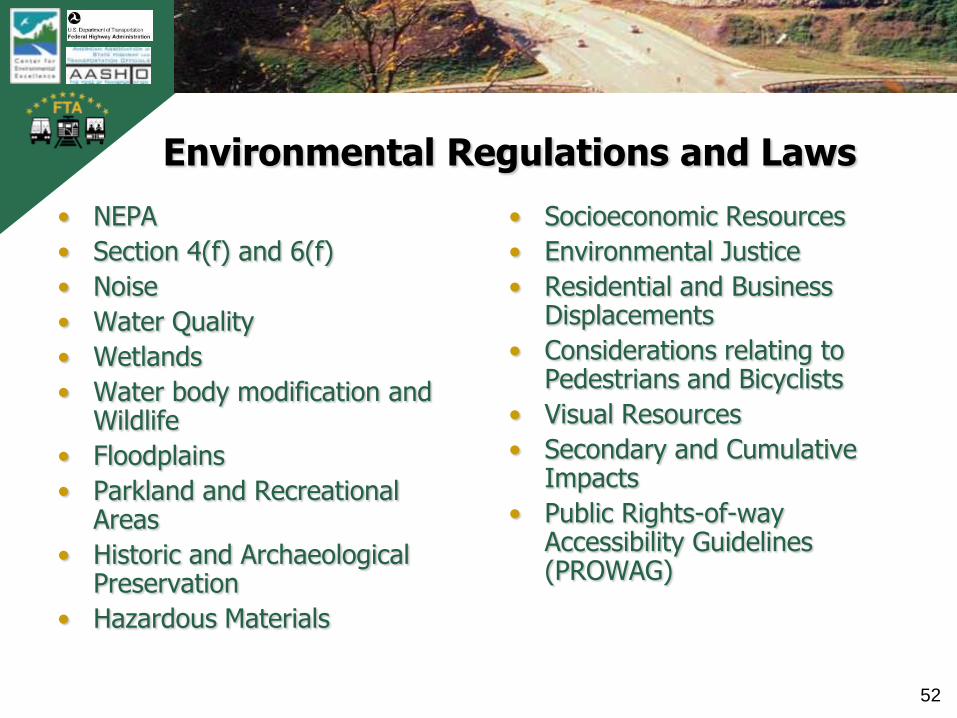
Environmental Regulations and Laws
• NEPA
• Section 4(f) and 6(f)
• Noise
• Water Quality
• Wetlands
• Water body modification and Wildlife
• Floodplains
• Parkland and Recreational Areas
• Historic and Archaeological Preservation
• Hazardous Materials
• Socioeconomic Resources
• Environmental Justice
• Residential and Business Displacements
• Considerations relating to Pedestrians and Bicyclists
• Visual Resources
• Secondary and Cumulative Impacts
• Public Rights-of-way Accessibility Guidelines (PROWAG)

TB
0420
0900
2AT
L
53
Geometric design must respect environmental controls
TB
0420
0900
2AT
L
54
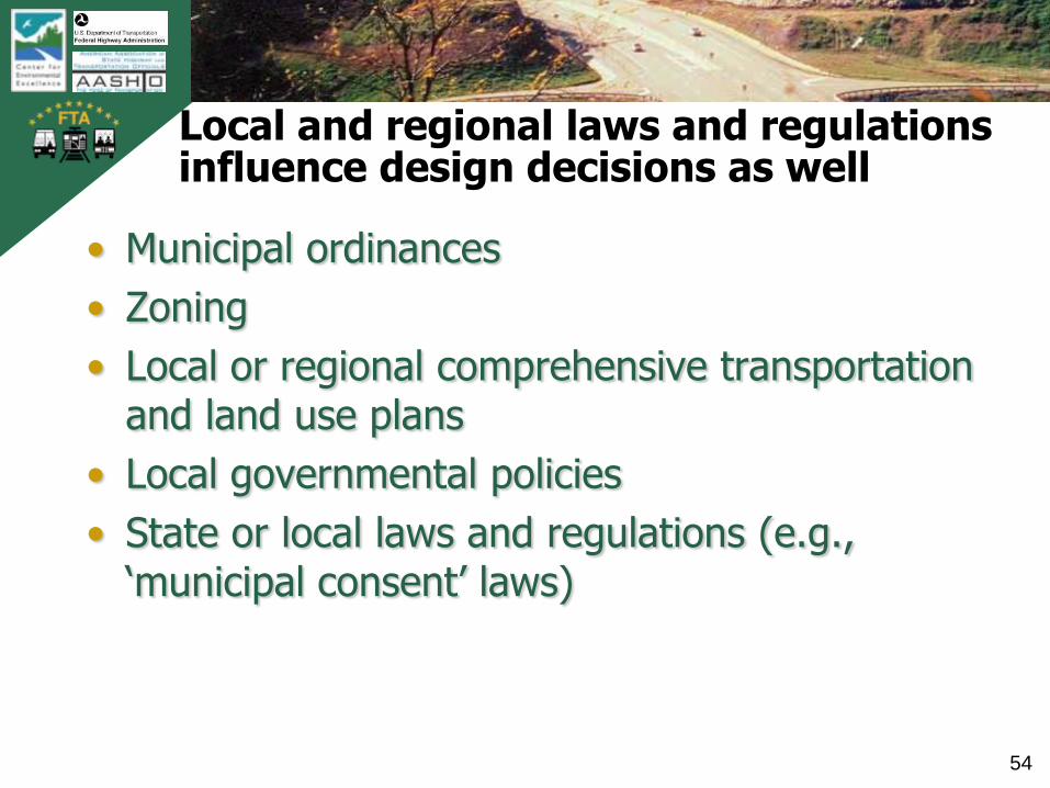
Local and regional laws and regulations influence design decisions as well
• Municipal ordinances
• Zoning
• Local or regional comprehensive transportation and land use plans
• Local governmental policies
• State or local laws and regulations (e.g., „municipal consent‟ laws)

TB
0420
0900
2AT
L
55
Design controls and designer’s discretion
• Designers (working with key stake-holders) have choices in establishing the design controls that will influence the outcome
―Design Speed
―Design Traffic and Level of Service
―Design Vehicle(s)
―Operational Assumptions
TB
0420
0900
2AT
L
56
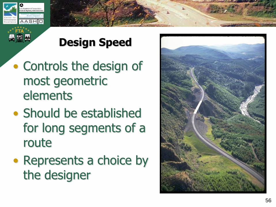
Design Speed
• Controls the design of most geometric elements
• Should be established for long segments of a route
• Represents a choice by the designer
TB
0420
0900
2AT
L
57
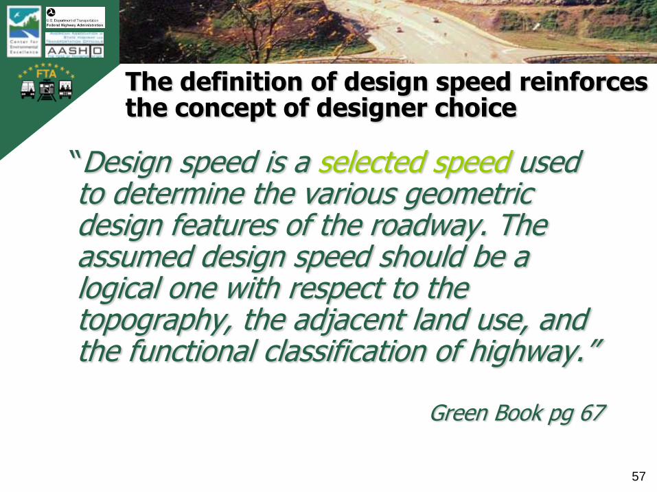
The definition of design speed reinforces the concept of designer choice
“Design speed is a selected speed used to determine the various geometric design features of the roadway. The assumed design speed should be a logical one with respect to the topography, the adjacent land use, and the functional classification of highway.”
Green Book pg 67
TB
0420
0900
2AT
L
58
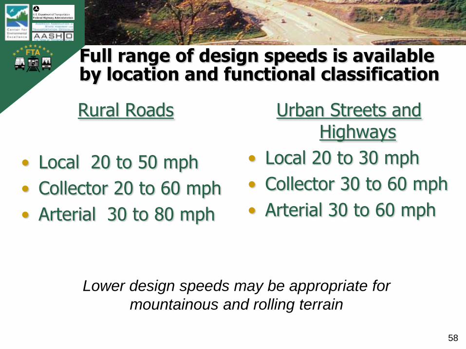
Full range of design speeds is available by location and functional classification
Rural Roads
• Local 20 to 50 mph
• Collector 20 to 60 mph
• Arterial 30 to 80 mph
Urban Streets and Highways
• Local 20 to 30 mph
• Collector 30 to 60 mph
• Arterial 30 to 60 mph
Lower design speeds may be appropriate for
mountainous and rolling terrain
TB
0420
0900
2AT
L
59
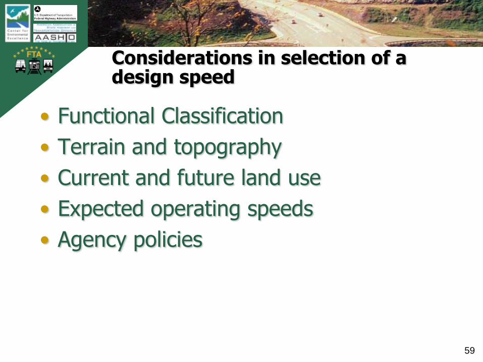
Considerations in selection of a design speed
• Functional Classification
• Terrain and topography
• Current and future land use
• Expected operating speeds
• Agency policies

TB
0420
0900
2AT
L
60
Design Hour Volume is a choice
• Rural highways – The DHV …. should generally be the 30th
highest hour of the design year.
• Urban highways –„…there is usually little difference between the 30th and 200th highest hourly volume.‟
Exhibit 2-28, AASHTO Green Book

TB
0420
0900
2AT
L
61
Participant Poll
What is the minimum required level of service for design of arterials and freeways according to the Green Book?
―Level of Service C
―Level of Service D
―Level of Service E
―There is no requirement
TB
0420
0900
2AT
L
62
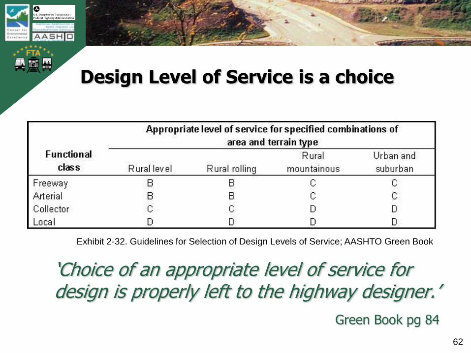
Design Level of Service is a choice
„Choice of an appropriate level of service for design is properly left to the highway designer.‟
Green Book pg 84
Exhibit 2-32. Guidelines for Selection of Design Levels of Service; AASHTO Green Book

TB
0420
0900
2AT
L
63
Principles for Acceptable Degrees of Congestion
• The highway should be so designed that, when it is carrying the design volume, the traffic demand will not exceed the capacity of the facility even during short intervals of time.
• The design volume per lane should not exceed the rate at which traffic can dissipate from a standing queue.
• Drivers should be afforded some choice of speed. The latitude in choice of speed should be related to the length of trip.
• Operating conditions should be such that they provide a degree of freedom from driver tension that is related to or consistent with the length and duration of the trip.
• There are practical limitations that preclude the design of an ideal freeway.
• The attitude of motorists toward adverse operating conditions is influenced by their awareness of the construction and right-of-way that might be necessary to provide better service.

TB
0420
0900
2AT
L
64
Selection of a design vehicle is a choice
• P – parking lot traffic
• SU – intersections of residential streets and park roads
• BUS – City street intersections with relatively few large trucks
• S-BUS – Rural highways with low volumes; subdivision streets
• WB-65 or 67 – Freeway ramp terminals, major state highway intersections, industrial facilities
TB
0420
0900
2AT
L
65
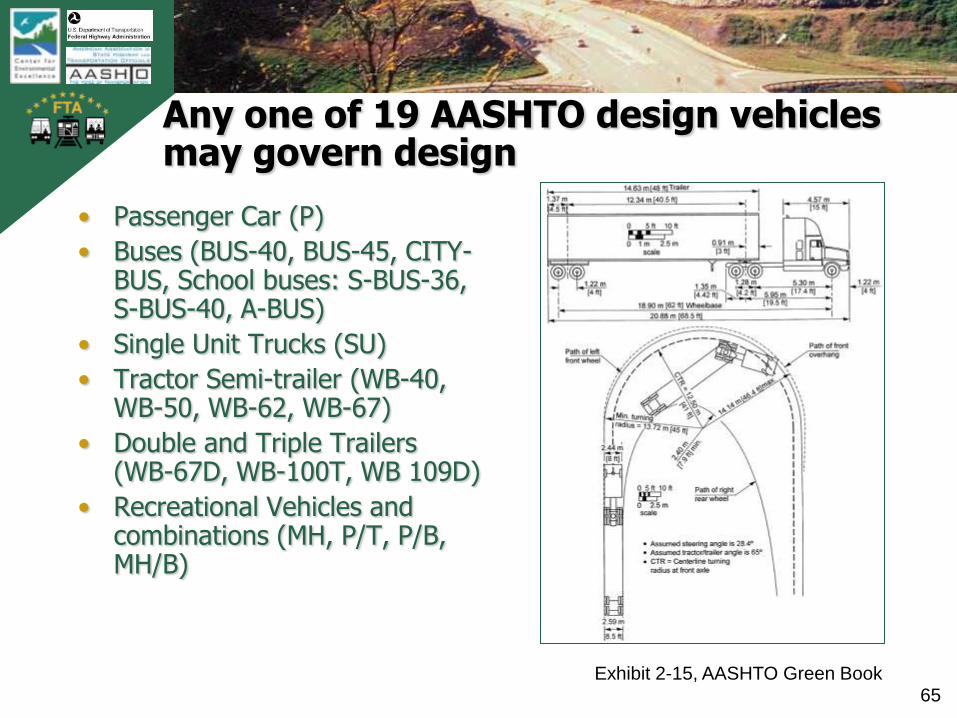
Any one of 19 AASHTO design vehicles may govern design
• Passenger Car (P)
• Buses (BUS-40, BUS-45, CITY-BUS, School buses: S-BUS-36, S-BUS-40, A-BUS)
• Single Unit Trucks (SU)
• Tractor Semi-trailer (WB-40, WB-50, WB-62, WB-67)
• Double and Triple Trailers (WB-67D, WB-100T, WB 109D)
• Recreational Vehicles and combinations (MH, P/T, P/B, MH/B)
Exhibit 2-15, AASHTO Green Book
TB
0420
0900
2AT
L
66
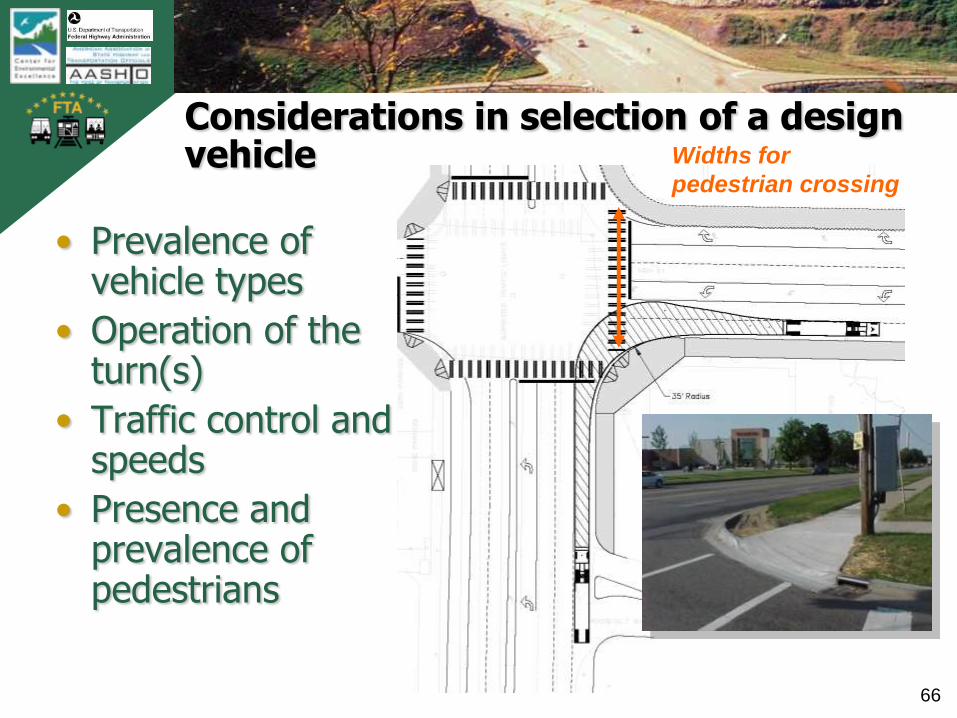
Considerations in selection of a design vehicle
• Prevalence of vehicle types
• Operation of the turn(s)
• Traffic control and speeds
• Presence and prevalence of pedestrians
Widths for
pedestrian crossing
TB
0420
0900
2AT
L
67
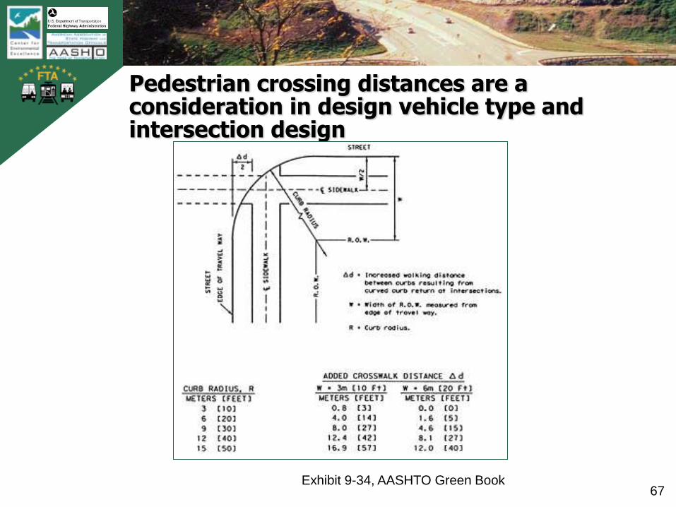
Pedestrian crossing distances are a consideration in design vehicle type and intersection design
Exhibit 9-34, AASHTO Green Book
TB
0420
0900
2AT
L
68
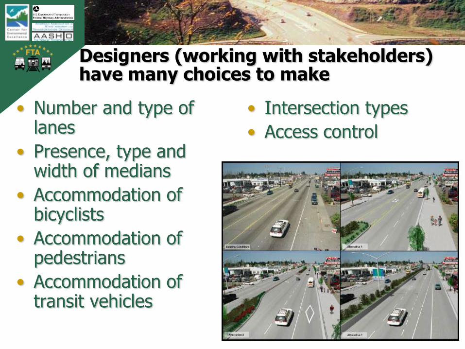
Designers (working with stakeholders) have many choices to make
• Number and type of lanes
• Presence, type and width of medians
• Accommodation of bicyclists
• Accommodation of pedestrians
• Accommodation of transit vehicles
• Intersection types
• Access control
TB
0420
0900
2AT
L
69
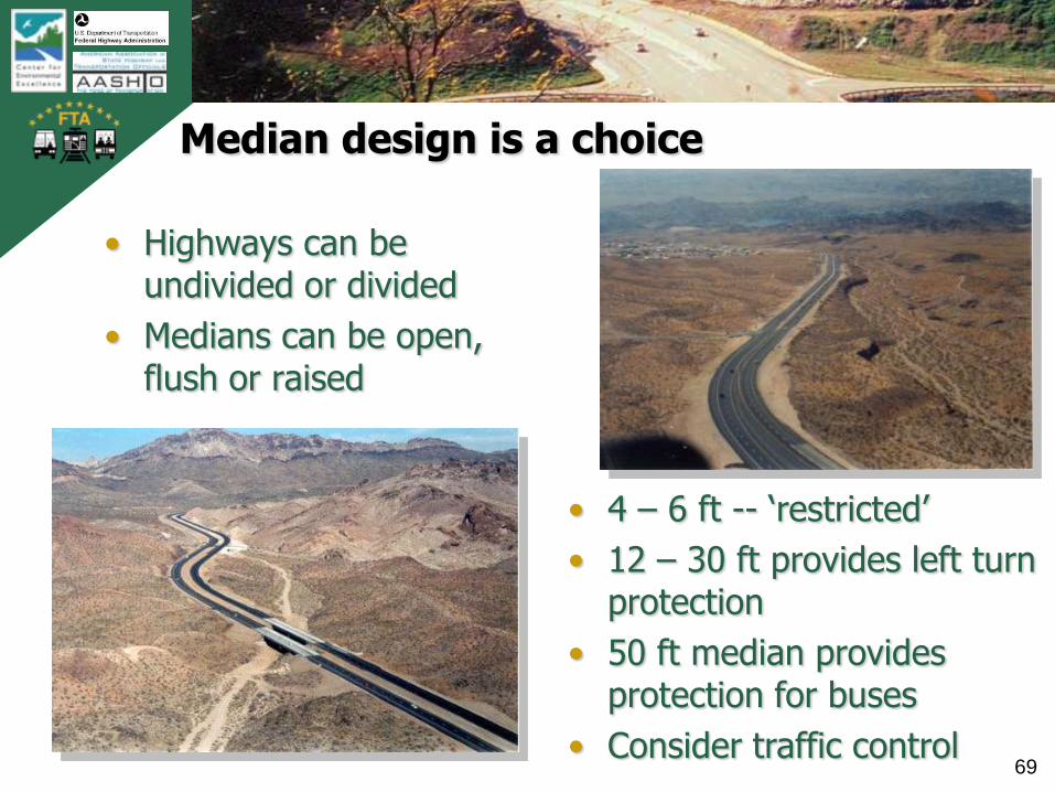
Median design is a choice
• Highways can be undivided or divided
• Medians can be open, flush or raised
• 4 – 6 ft -- „restricted‟
• 12 – 30 ft provides left turn protection
• 50 ft median provides protection for buses
• Consider traffic control

TB
0420
0900
2AT
L
70
Provision for on-street parking is a choice

TB
0420
0900
2AT
L
71
Transit and HOV or HOT accommodation is a choice
photo of bus turnout

TB
0420
0900
2AT
L
72
Provision for bicycles is a choice
• Design Options― paved shoulders
― widened lanes within the traveled way (14 ft min)
― separate lane within roadway
― separate facility (parallel or independent alignment)
The Green Book refers designers to the „AASHTO Guide for Development of Bicycle Facilities‟
TB
0420
0900
2AT
L
73
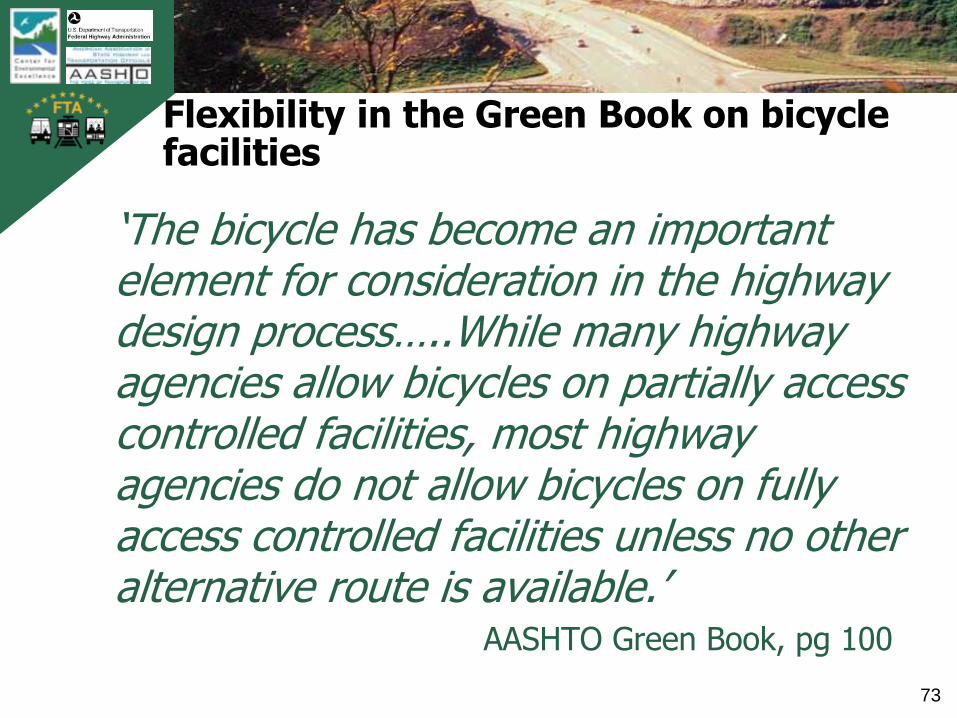
Flexibility in the Green Book on bicycle facilities
„The bicycle has become an important element for consideration in the highway design process…..While many highway agencies allow bicycles on partially access controlled facilities, most highway agencies do not allow bicycles on fully access controlled facilities unless no other alternative route is available.‟
AASHTO Green Book, pg 100

TB
0420
0900
2AT
L
74
Intersection types and features are choices

TB
0420
0900
2AT
L
75
The selection of a roundabout instead of a conventional at-grade intersection is a choice
Roundabouts first appeared in the AASHTO Green Book in the 2001 edition

TB
0420
0900
2AT
L
76
Intersection design requires many choices by the designer
• Type of traffic control
• Left and Right Turn Lanes
― Presence
― Design details (lengths,
tapers, type of control)
• Curb Return Design (Radius,
turning roadway, 3-centered
curves)
• Channelization (types,
design dimensions)
TB
0420
0900
2AT
L
77
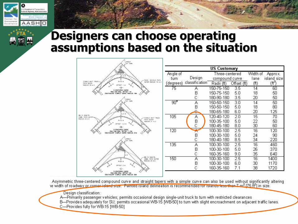
Designers can choose operating assumptions based on the situation
TB
0420
0900
2AT
L
78
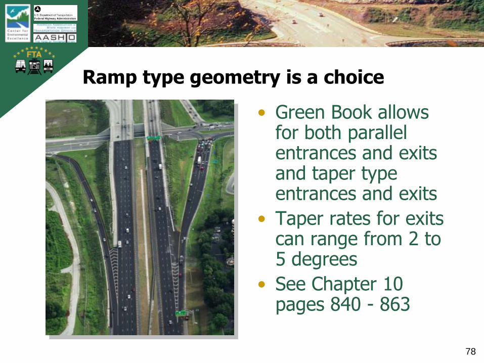
Ramp type geometry is a choice
• Green Book allows for both parallel entrances and exits and taper type entrances and exits
• Taper rates for exits can range from 2 to 5 degrees
• See Chapter 10 pages 840 - 863
TB
0420
0900
2AT
L
79
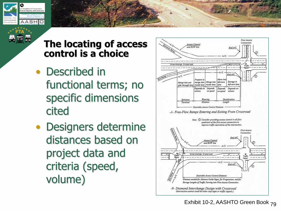
The locating of access control is a choice
• Described in functional terms; no specific dimensions cited
• Designers determine distances based on project data and criteria (speed, volume)
Exhibit 10-2, AASHTO Green Book

TB
0420
0900
2AT
L
80
Summary of flexibility in the Green Book
• Many basic design controls are choices by the designer
• Ranges in values are available for such choices
• Incorporation of basic design elements and features is a choice by the designer

TB
0420
0900
2AT
L
81
Break
• 10 minute break
• Email questions from first half of the webinar
TB
0420
0900
2AT
L
82
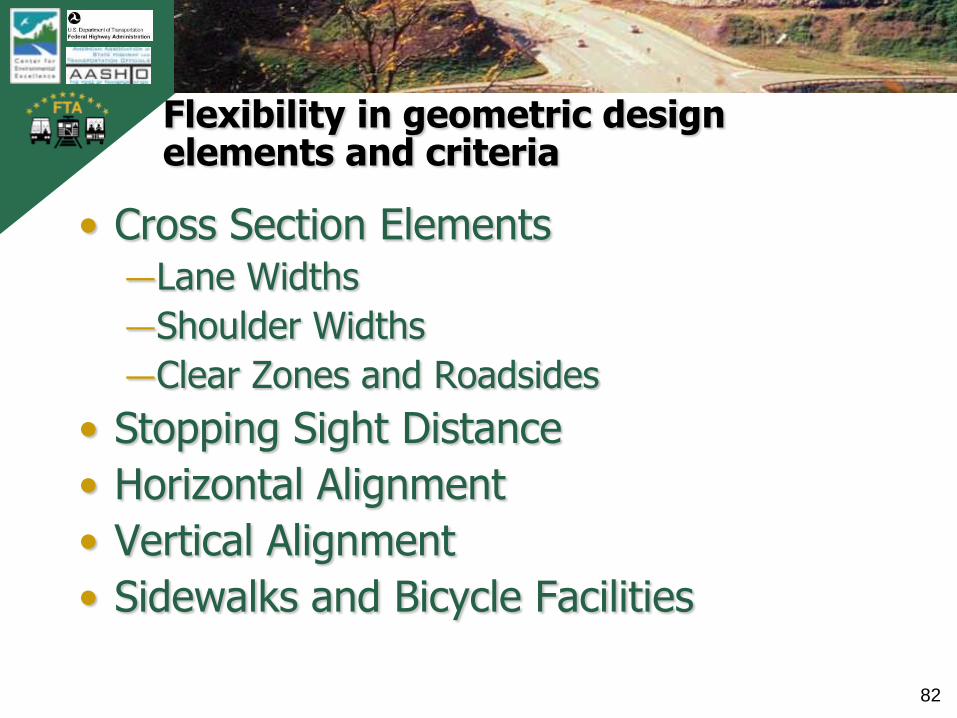
Flexibility in geometric design elements and criteria
• Cross Section Elements―Lane Widths
―Shoulder Widths
―Clear Zones and Roadsides
• Stopping Sight Distance
• Horizontal Alignment
• Vertical Alignment
• Sidewalks and Bicycle Facilities

TB
0420
0900
2AT
L
83
Lanes and lane widths
TB
0420
0900
2AT
L
84
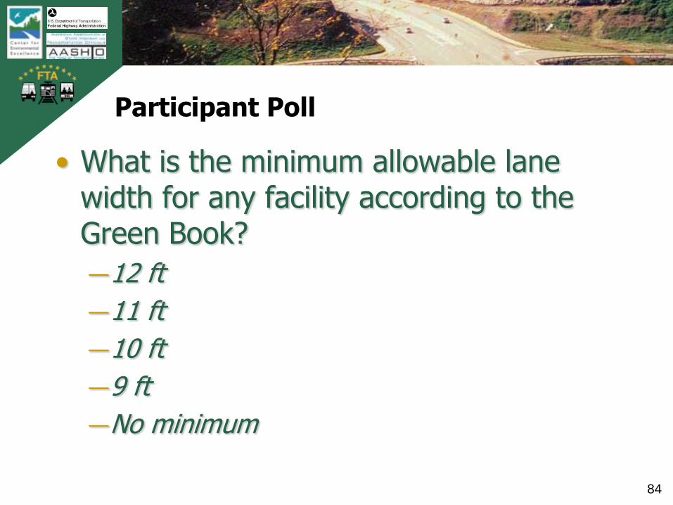
Participant Poll
• What is the minimum allowable lane width for any facility according to the Green Book?
―12 ft
―11 ft
―10 ft
―9 ft
―No minimum

TB
0420
0900
2AT
L
85
Flexibility in lane widths
„Although lane widths of 12 ft are desirable on both rural and urban facilities, there are circumstances where lanes less than 12 ft wide should be used. In urban areas where pedestrian crossings, right-of-way, or existing development become stringent controls, the use of 11-ft lanes is acceptable. Lanes 10-ft wide are acceptable on low-speed facilities, and lanes 9 ft wide are appropriate on low-volume roads in rural and residential areas.‟
TB
0420
0900
2AT
L
86
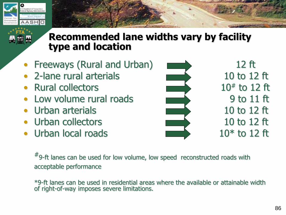
Recommended lane widths vary by facility type and location
• Freeways (Rural and Urban) 12 ft• 2-lane rural arterials 10 to 12 ft• Rural collectors 10# to 12 ft• Low volume rural roads 9 to 11 ft• Urban arterials 10 to 12 ft• Urban collectors 10 to 12 ft• Urban local roads 10* to 12 ft
#9-ft lanes can be used for low volume, low speed reconstructed roads with
acceptable performance
*9-ft lanes can be used in residential areas where the available or attainable width of right-of-way imposes severe limitations.

TB
0420
0900
2AT
L
87
2-lane rural highway lane widths based on recent research
• Widths based on crash analysis models, traffic operations and cost-effectiveness
• Lane and shoulder combine to provide effective design
• Lower widths for lower volume, lower speed roadways are appropriate
TB
0420
0900
2AT
L
88
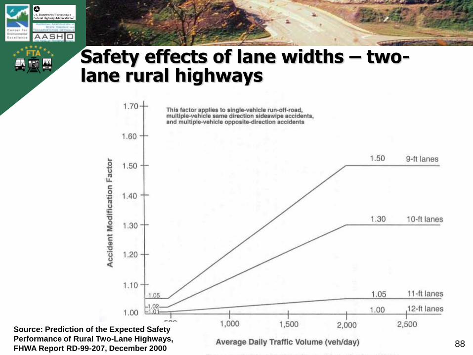
Safety effects of lane widths – two-lane rural highways
Source: Prediction of the Expected Safety
Performance of Rural Two-Lane Highways,
FHWA Report RD-99-207, December 2000
TB
0420
0900
2AT
L
89
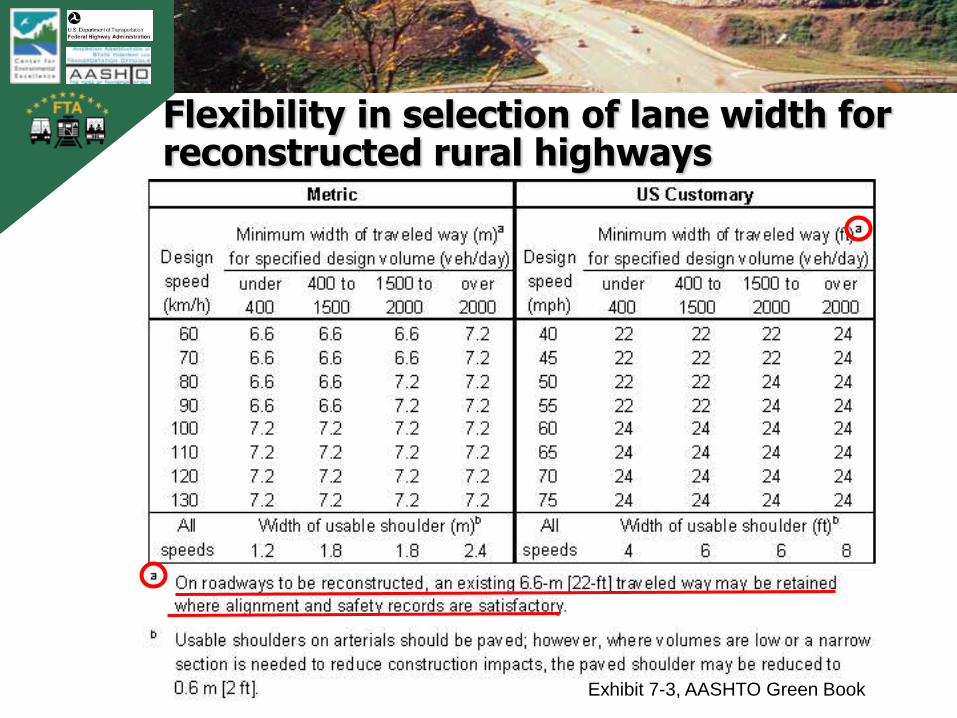
Flexibility in selection of lane width for reconstructed rural highways
Exhibit 7-3, AASHTO Green Book

TB
0420
0900
2AT
L
90
Lane widths on urban arterials
• ‘May vary from 10 to 12 ft’― 10 ft in highly restricted areas
with little or no truck traffic
― 11 ft widths ‘are used quite extensively for urban arterial street designs.’
― 12 ft widths should be used, where practical, on higher speed, free-flowing, principal arterials
A full range of lane widths is within AASHTO Policy for urban arterials
TB
0420
0900
2AT
L
91
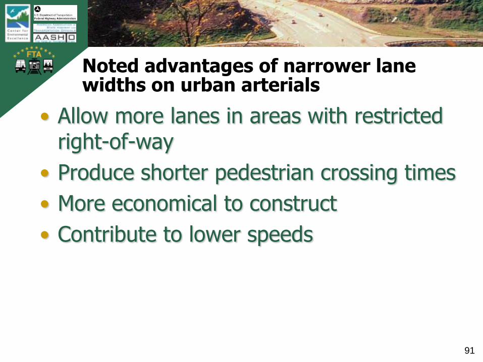
Noted advantages of narrower lane widths on urban arterials
• Allow more lanes in areas with restricted right-of-way
• Produce shorter pedestrian crossing times
• More economical to construct
• Contribute to lower speeds
TB
0420
0900
2AT
L
92
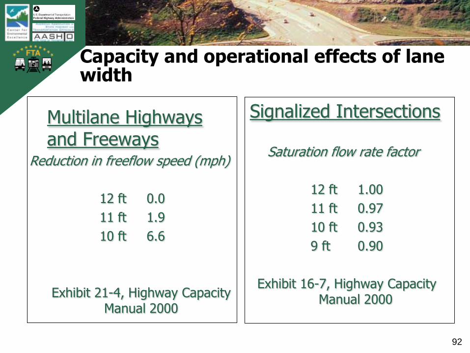
Capacity and operational effects of lane width
Multilane Highways and Freeways
Reduction in freeflow speed (mph)
12 ft 0.0
11 ft 1.9
10 ft 6.6
Exhibit 21-4, Highway Capacity Manual 2000
Signalized Intersections
Saturation flow rate factor
12 ft 1.00
11 ft 0.97
10 ft 0.93
9 ft 0.90
Exhibit 16-7, Highway Capacity Manual 2000
TB
0420
0900
2AT
L
93
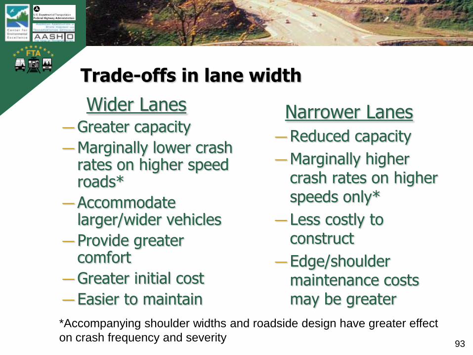
Trade-offs in lane width
Wider Lanes―Greater capacity
―Marginally lower crash rates on higher speed roads*
― Accommodate larger/wider vehicles
― Provide greater comfort
―Greater initial cost
― Easier to maintain
Narrower Lanes
― Reduced capacity
―Marginally higher crash rates on higher speeds only*
― Less costly to construct
― Edge/shoulder maintenance costs may be greater
*Accompanying shoulder widths and roadside design have greater effect
on crash frequency and severity
TB
0420
0900
2AT
L
94
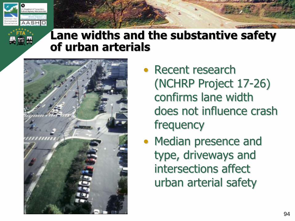
Lane widths and the substantive safety of urban arterials
• Recent research (NCHRP Project 17-26) confirms lane width does not influence crash frequency
• Median presence and type, driveways and intersections affect urban arterial safety

TB
0420
0900
2AT
L
95
Shoulders and shoulder width
TB
0420
0900
2AT
L
96
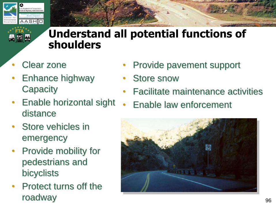
Understand all potential functions of shoulders
• Provide pavement support
• Store snow
• Facilitate maintenance activities
• Enable law enforcement
• Clear zone
• Enhance highway
Capacity
• Enable horizontal sight
distance
• Store vehicles in
emergency
• Provide mobility for
pedestrians and
bicyclists
• Protect turns off the
roadway

TB
0420
0900
2AT
L
97
Safety effects of shoulder widths on two-lane rural highways
Source: Prediction of the Expected Safety
Performance of Rural Two-Lane Highways,
FHWA Report RD-99-207, December 2000
TB
0420
0900
2AT
L
98
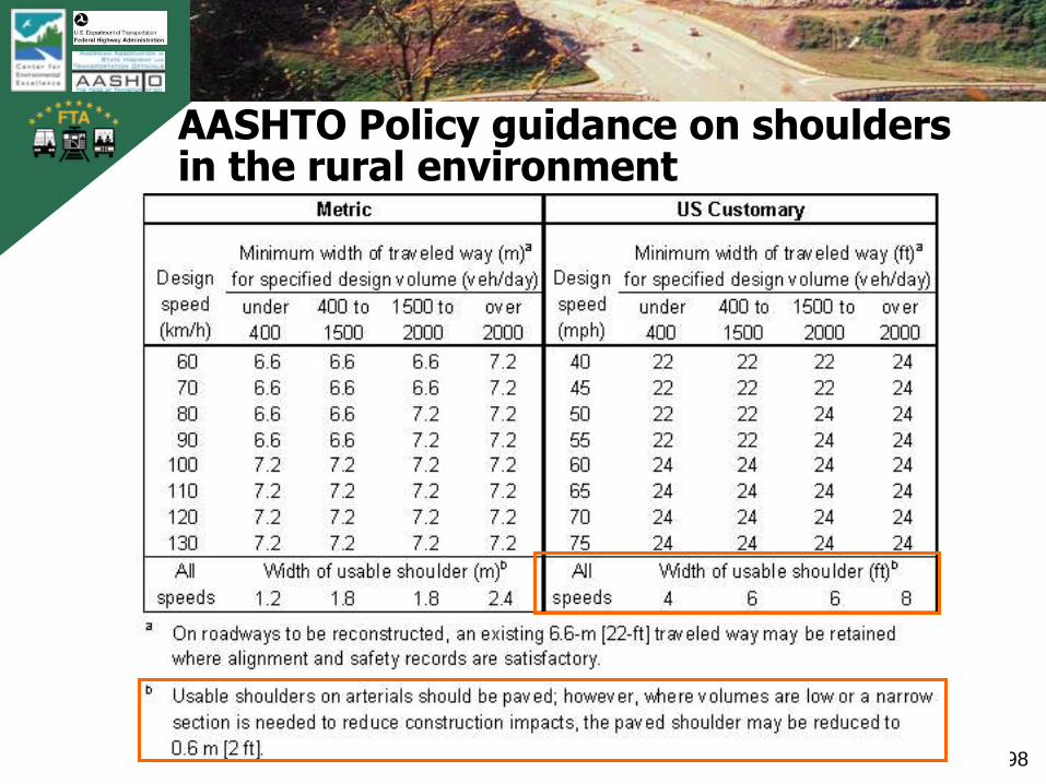
AASHTO Policy guidance on shoulders in the rural environment
TB
0420
0900
2AT
L
99
Green Book guidance on shoulders
• Shoulders are a necessary element of rural highways
• Shoulders can be paved or unpaved• „Despite the many advantages of shoulders on
(urban) arterial streets, their use is generally limited due to restricted right-of-way for traffic lanes.‟ (pg. 473)
• Shoulders are required for freeways ― four-lane freeways full right shoulder― six lane or more freeways full shoulders left and
right

TB
0420
0900
2AT
L
100
Horizontal Alignment
e + f = V2/15R
TB
0420
0900
2AT
L
101
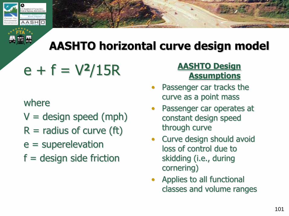
AASHTO horizontal curve design model
e + f = V2/15R
where
V = design speed (mph)
R = radius of curve (ft)
e = superelevation
f = design side friction
AASHTO Design Assumptions
• Passenger car tracks the curve as a point mass
• Passenger car operates at constant design speed through curve
• Curve design should avoid loss of control due to skidding (i.e., during cornering)
• Applies to all functional classes and volume ranges

TB
0420
0900
2AT
L
102
AASHTO design model background and assumptions for side friction factor ‘f’
• Based on research from 1930s and 1940s, updated in 2000 (Bonneson, NCHRP Report 439)
• Assumes operation on dry pavement at design speed
• Conservatively set to “provide ample margin of safety against skidding”insert exhibit 3-12
Exhibit 3-12, AASHTO Green Book
TB
0420
0900
2AT
L
103
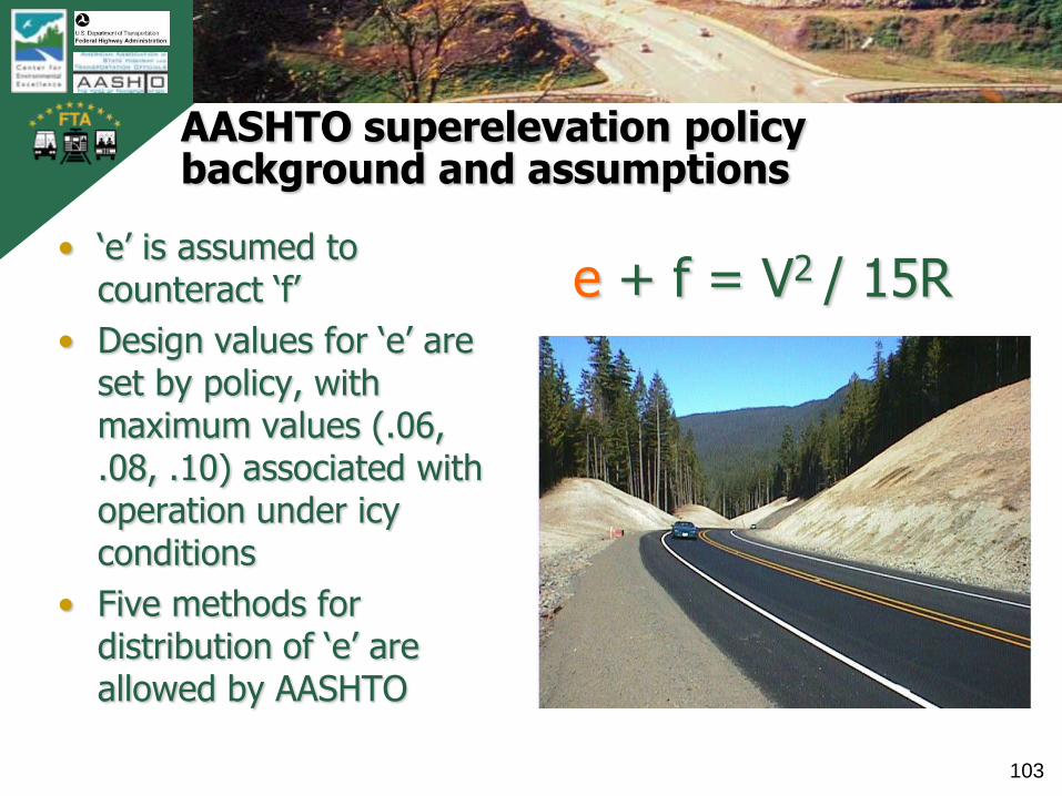
AASHTO superelevation policy background and assumptions
• „e‟ is assumed to counteract „f‟
• Design values for „e‟ are set by policy, with maximum values (.06, .08, .10) associated with operation under icy conditions
• Five methods for distribution of „e‟ are allowed by AASHTO
e + f = V2 / 15R
TB
0420
0900
2AT
L
104
Insights on AASHTO curve design model and safety
• The AASHTO Curve Model is not directly „substantive safety based‟
― It is not based on crash frequency research
― It is volume independent
• Actual operations differ from simplifying assumptions
―Most drivers „overshoot‟ curves
― Speed behavior can vary greatly
― Trucks overturn before they skid; and at speeds lower than passenger car skidding
TB
0420
0900
2AT
L
105
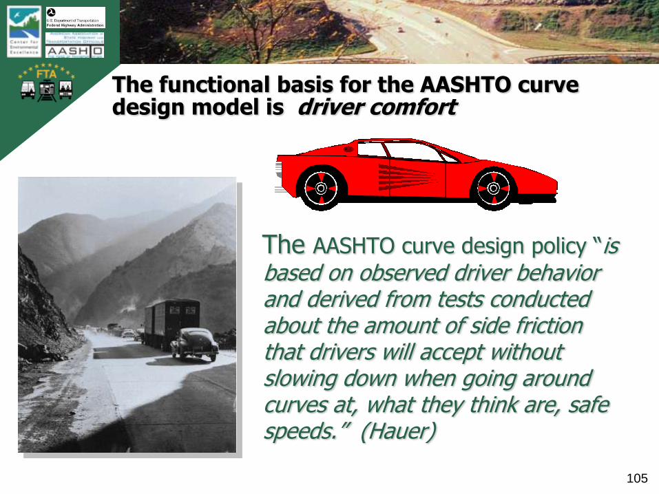
The functional basis for the AASHTO curve design model is driver comfort
The AASHTO curve design policy “is based on observed driver behavior and derived from tests conducted about the amount of side friction that drivers will accept without slowing down when going around curves at, what they think are, safe speeds.” (Hauer)

TB
0420
0900
2AT
L
106
Operations may differ from Green Book design policy assumptions
Curves driven faster
than Policy assumption
Curves driven slower
than Policy assumption
Safety and Operational Effects of Highway Design Features on Two-lane Rural Highways; A two-day NHI course

TB
0420
0900
2AT
L
107
Curves present particular safety problems to designers
2.21
3.93
6.7
0
1
2
3
4
5
6
7
8
The risk of a reported crash is about three times greater on a curve than on a tangent
(Accidents per 1 km segment--3 year timeframe)
Tangent
segments
Segments
w/curve
Curved portion
only (Curve plus
transitions)
Source: Glennon, et al,
1985 study for FHWA
TB
0420
0900
2AT
L
108
Alignment design on urban arterials reflects practical limitations
• „The alignment of an urban arterial should be developed in strict accordance with its design speed, particularly where a principal arterial is to be constructed on a new location and is not restricted by normal right-of-way constraints. There are many situations, however, where this is not practical.‟
• „Curves on low-speed, curbed arterial streets are often not superelevated.‟
AASHTO Green Book, pg 471

TB
0420
0900
2AT
L
109
Urban alignment design guidance
• „Alignment in residential areas should fit closely the existing topography to minimize the need for cuts or fills without sacrificing safety.‟ (pg 431 – collectors)
• „The alignment of local streets in residential areas should be arranged to discourage through traffic.‟ (pg 391 – urban local streets)
• „Usually, superelevation is not provided on local streets in residential and commercial areas…‟(pg 392, urban local streets)

TB
0420
0900
2AT
L
110
Flexibility in curve design per AASHTO Green Book
• Agencies can choose from a range of maximum superelevation policies
• Designers can choose any curve with radius greater than the minimum for the selected design speed (and their agency’s applicable policy for superelevation)
• Curve lengths can vary (no maximum length)
• Designers can use spiral transitions or unspiraled transitions; or compound curves
• Five methods of developing superelevation (and side friction) are available within AASHTO Policy
TB
0420
0900
2AT
L
111
Stopping Sight Distance
Sight distance is the length of the roadway that is visible to the driver. The available sight distance on a roadway should be sufficiently long to enable a vehicle traveling at or near the design speed to stop before reaching a stationary object in its path.
AASHTO Green Book, pg 110
TB
0420
0900
2AT
L
112
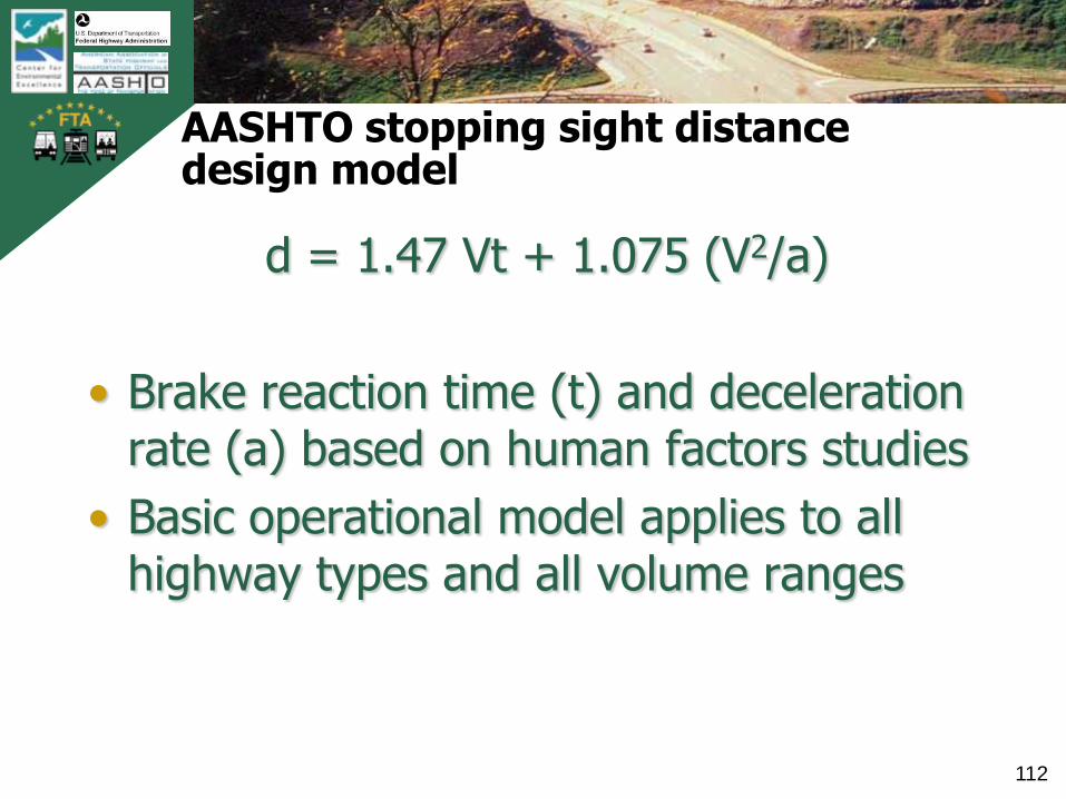
AASHTO stopping sight distance design model
d = 1.47 Vt + 1.075 (V2/a)
• Brake reaction time (t) and deceleration rate (a) based on human factors studies
• Basic operational model applies to all highway types and all volume ranges

TB
0420
0900
2AT
L
113
Evolution of stopping sight distance policy values
• 1940 – Eye height 4.5 ft, Object height 4 in., variable brake reaction time, dry pavement and design speed
• 1954 – Brake reaction time set to 2.5 sec, wet pavement, speed lower than design speed assumed
• 1965 – Eye height lowered to 3.75 ft., object height raised to 6 in.
• 1970 – „desirable‟ speed set as design speed• 1984 – Eye height lowered to 3.5 ft• 2001 – Object height raised to 24 in., design
speed assumed as minimum basis for design

TB
0420
0900
2AT
L
114
Insights on evolution of SSD Policy Values and assumptions
• Original model based on easily obtained measurements and assumptions
• Driver behavior studies prompted changes in model assumptions
• Substantive safety research prompted changes in object height
TB
0420
0900
2AT
L
115
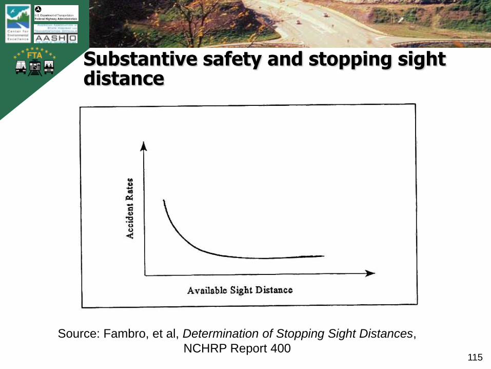
Substantive safety and stopping sight distance
Source: Fambro, et al, Determination of Stopping Sight Distances,
NCHRP Report 400

TB
0420
0900
2AT
L
116
Stopping sight distance profiles
• The amount of SSD varies along a crest vertical curve
• Stopping sight distance profiles provide useful information to improve a design
TB
0420
0900
2AT
L
117
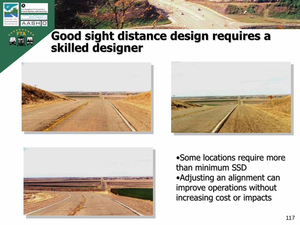
Good sight distance design requires a skilled designer
•Some locations require more than minimum SSD•Adjusting an alignment can improve operations without increasing cost or impacts
TB
0420
0900
2AT
L
118
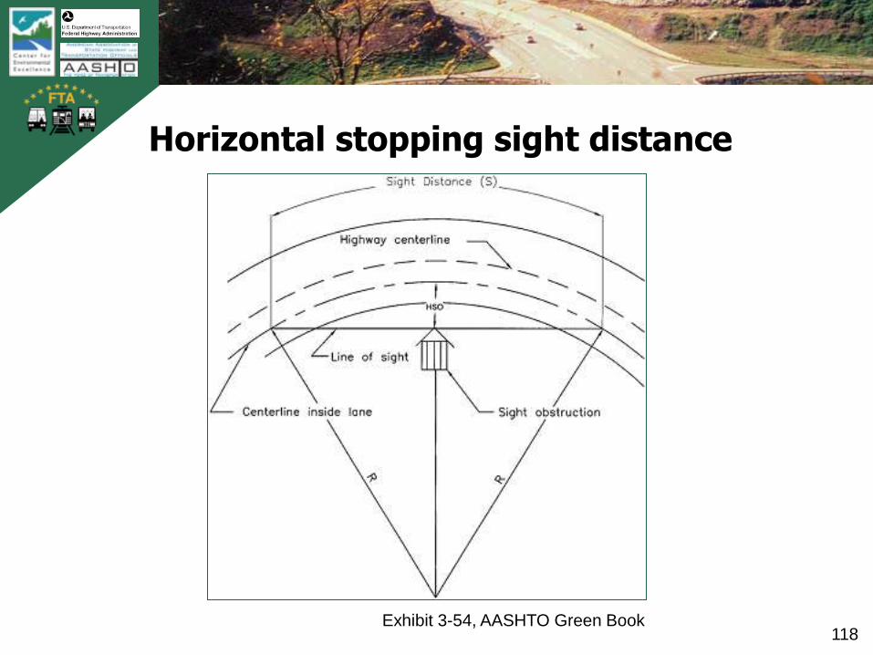
Horizontal stopping sight distance
Exhibit 3-54, AASHTO Green Book
TB
0420
0900
2AT
L
119
Stopping sight distance and design flexibility
• Minimum stopping sight distance should be provided along the entire length of roadway…..
• Careful selection of grades, vertical curves and horizontal alignment will produce minimum stopping sight distance for the selected design speed
TB
0420
0900
2AT
L
120
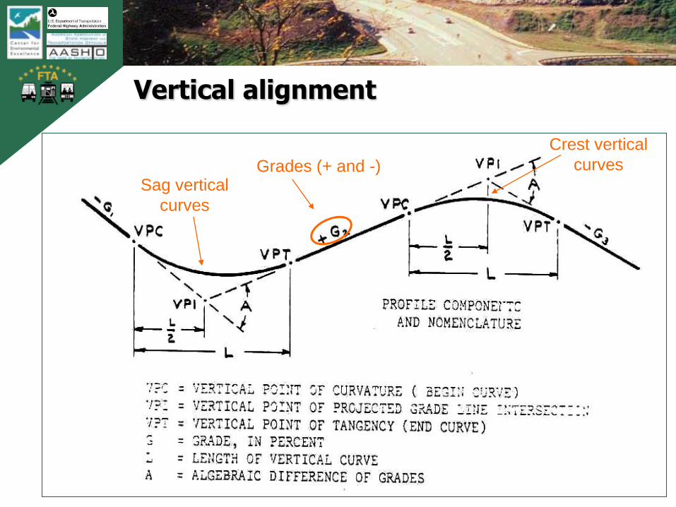
Vertical alignment
Sag vertical
curves
Crest vertical
curvesGrades (+ and -)
TB
0420
0900
2AT
L
121
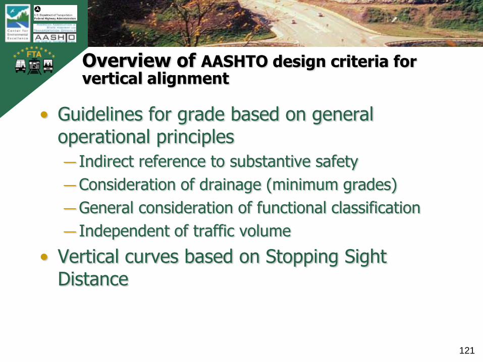
Overview of AASHTO design criteria for vertical alignment
• Guidelines for grade based on general operational principles
― Indirect reference to substantive safety
― Consideration of drainage (minimum grades)
―General consideration of functional classification
― Independent of traffic volume
• Vertical curves based on Stopping Sight Distance

TB
0420
0900
2AT
L
122
Maximum grade criteria
„reasonable guidelines for maximum grades for use in design can be established.‟― 70 mph Design Speed
• 5 percent
― 30 mph Design Speed• 7 to 12 percent
• 7 to 8 percent for „more important‟ highways
Exhibit 3-58, AASHTO Green Book

TB
0420
0900
2AT
L
123
AASHTO design criteria for vertical curvature
• Crest VC lengths based on SSD criteria
• Sag VC lengths based on―Headlight
operational model
― Comfort criterionSource: NCHRP Report 400
TB
0420
0900
2AT
L
124
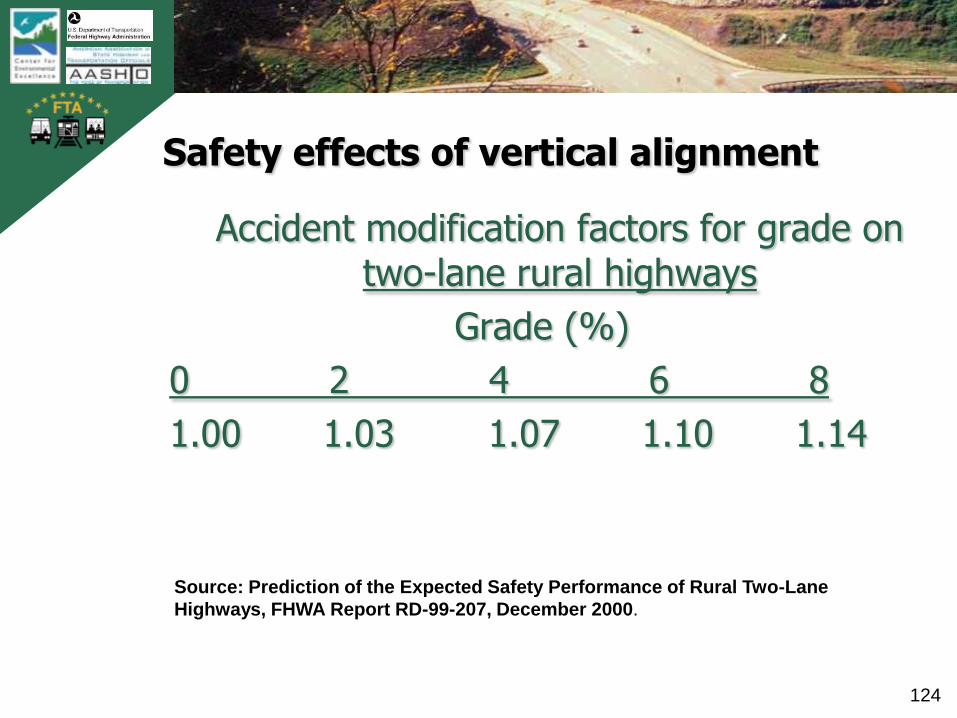
Safety effects of vertical alignment
Accident modification factors for grade on two-lane rural highways
Grade (%)
0 2 4 6 8
1.00 1.03 1.07 1.10 1.14
Source: Prediction of the Expected Safety Performance of Rural Two-Lane
Highways, FHWA Report RD-99-207, December 2000.

TB
0420
0900
2AT
L
125
Flexibility in design for vertical alignment
• Designers can choose any grades within wide ranges (0.3% to 12%) based on fundamental controls
• „The suggested design criterion for determining the critical length of grade is not intended as a strict control but as a guideline.‟ (pg.241)
• Design tools to mitigate effects of grade are suggested by the Policy (e.g., truck climbing lanes, turnouts, emergency escape ramps)
TB
0420
0900
2AT
L
126
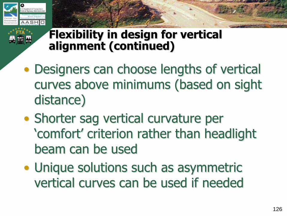
Flexibility in design for vertical alignment (continued)
• Designers can choose lengths of vertical curves above minimums (based on sight distance)
• Shorter sag vertical curvature per „comfort‟ criterion rather than headlight beam can be used
• Unique solutions such as asymmetric vertical curves can be used if needed
TB
0420
0900
2AT
L
127
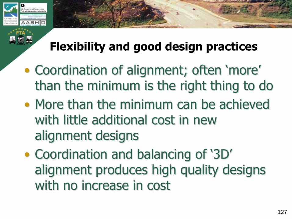
Flexibility and good design practices
• Coordination of alignment; often „more‟ than the minimum is the right thing to do
• More than the minimum can be achieved with little additional cost in new alignment designs
• Coordination and balancing of „3D‟ alignment produces high quality designs with no increase in cost
TB
0420
0900
2AT
L
128
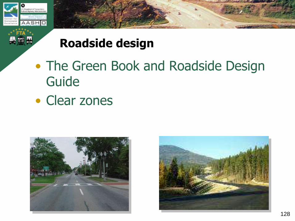
Roadside design
• The Green Book and Roadside Design Guide
• Clear zones
TB
0420
0900
2AT
L
129
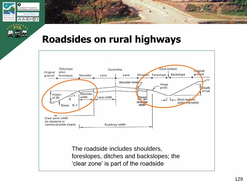
Roadsides on rural highways
The roadside includes shoulders,
foreslopes, ditches and backslopes; the
‘clear zone’ is part of the roadside

TB
0420
0900
2AT
L
130
Urban roadsides
The ‘border area’ is between the edge of pavement
and right-of-way line. It includes planting strip,
sidewalks, and space for utilities.

TB
0420
0900
2AT
L
131
Roadside design, clear zones and AASHTO Policy
• The Green Book references the AASHTO Roadside Design Guide (RDG), which is considered the primary technical reference
• Refer to the RDG where conflicts or differences appear between it and the Green Book

TB
0420
0900
2AT
L
132
Definition of clear zone from Roadside Design Guide (RDG) glossary of terms
„The total roadside border area, starting at the edge of the traveled way, available for safe use by errant vehicles. This area may consist of a shoulder, a recoverable slope, a non-recoverable
slope, and/or a clear run-out area.
The desired width is dependent upon the traffic volumes and speeds and on the roadside geometry.‟
Roadside Design Guide
TB
0420
0900
2AT
L
133
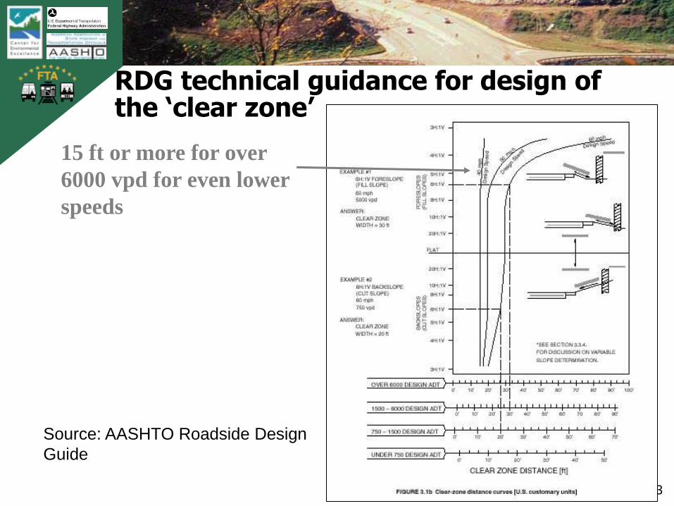
RDG technical guidance for design of the ‘clear zone’
15 ft or more for over
6000 vpd for even lower
speeds
Source: AASHTO Roadside Design
Guide

TB
0420
0900
2AT
L
134
Clear zone dimensions per the AASHTO Roadside Design Guide
Source: AASHTO Roadside Design Guide
TB
0420
0900
2AT
L
135
Participant Poll
• Is this statement true or false?
„According to the AASHTO Green Book and AASHTO Roadside Design Guide, 30-ft clear zones are required on all high speed roadways.‟

TB
0420
0900
2AT
L
136
AASHTO Policy on clear zones
“The RDG is a guide (not a standard)…”
“The concepts, designs and philosophies presented in the RDG can not, and should not, be included in their totality on every single project.”AASHTO Roadside Design Guide

TB
0420
0900
2AT
L
137
Important questions and distinctions
• What is the available clear zone (i.e., as provided by an existing condition)?―What features limit it?
―What is the substantive safety performance related to run-off-road crashes?
―What safety measures might be taken?
• What should be the selected clear zone for design?―What is achievable and practical given the
surroundings?
―What mitigation (barriers, attenuation) is appropriate?

TB
0420
0900
2AT
L
138
How does the concept of ‘clear zone’ apply to the full range of conditions designers face?
Rural Context – high speed; right-
of-way is generally available
Urban context – low to moderate
speed; relatively narrow border
area; limited available right-of-way
TB
0420
0900
2AT
L
139
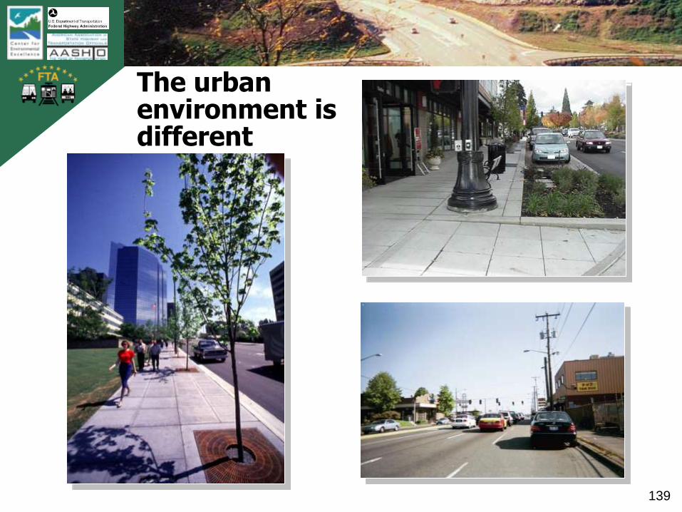
The urban environment is different
TB
0420
0900
2AT
L
140
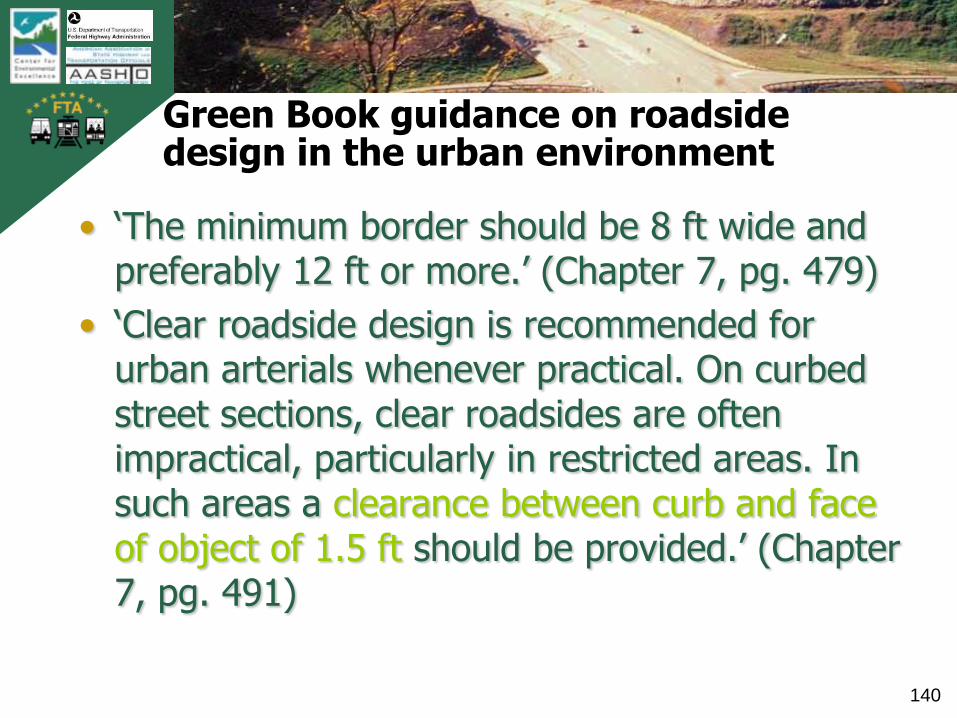
Green Book guidance on roadside design in the urban environment
• „The minimum border should be 8 ft wide and preferably 12 ft or more.‟ (Chapter 7, pg. 479)
• „Clear roadside design is recommended for urban arterials whenever practical. On curbed street sections, clear roadsides are often impractical, particularly in restricted areas. In such areas a clearance between curb and face of object of 1.5 ft should be provided.‟ (Chapter 7, pg. 491)
TB
0420
0900
2AT
L
141
Clarification on roadside design terminology and Green Book guidance
• The Green Book refers to „Horizontal Clearance‟ which is not clear zone
• Applicable minimum dimension is 1.5 ft
• FHWA has revised their terminology to use „lateral offset‟ rather than „horizontal clearance‟ to provide clarity and eliminate confusion.
TB
0420
0900
2AT
L
142
Recent research on roadside design policy
• NCHRP Project 20-7, Task 171 „Identification of Conflicts Related to Clear Zones within AASHTO Publications‟
• NCHRP Project 17-11 – „Determination of Safe/Cost Effective Roadside Slopes and Associated Clear Distances‟
• NCHRP Project 16-04 (NCHRP Report 612) – „Design Guidelines for Safe and Aesthetic Roadside Treatments in Urban Areas‟

TB
0420
0900
2AT
L
143
Both design options are consistent with Green Book and Roadside Design Policy guidance
TB
0420
0900
2AT
L
144
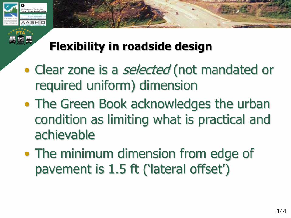
Flexibility in roadside design
• Clear zone is a selected (not mandated or required uniform) dimension
• The Green Book acknowledges the urban condition as limiting what is practical and achievable
• The minimum dimension from edge of pavement is 1.5 ft („lateral offset‟)
TB
0420
0900
2AT
L
145
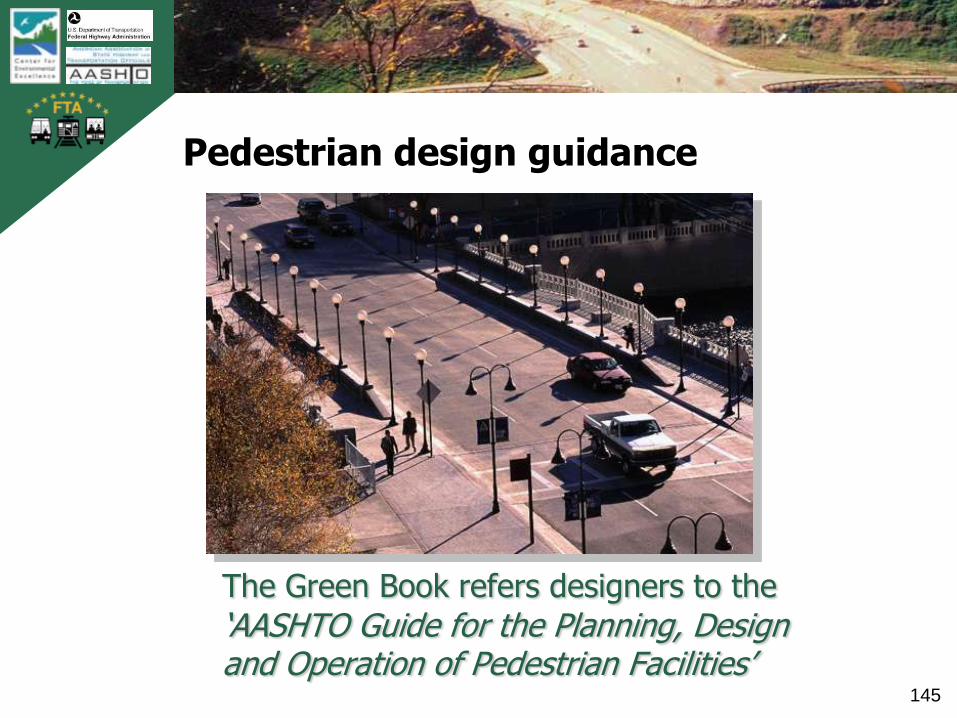
Pedestrian design guidance
The Green Book refers designers to the
„AASHTO Guide for the Planning, Design and Operation of Pedestrian Facilities‟

TB
0420
0900
2AT
L
146
Where pedestrians are prevalent, low design and operating speeds are appropriate
„Design speeds for urban arterials generally range from 30 to 60 mph. Lower speeds apply in central business districts and in more developed areas…..‟
Green Book pg 470

TB
0420
0900
2AT
L
147
AASHTO guidance on design for pedestrians
Urban Local and Collector StreetsCommercial areas „should be provided on both
sides of the street‟Residential areas „should be provided on at
least one side of the street‟Urban Arterials
Commercial areas „the entire border area usually is devoted to sidewalk‟
Residential areas „the border area should include a sidewalk and a buffer strip‟
TB
0420
0900
2AT
L
148
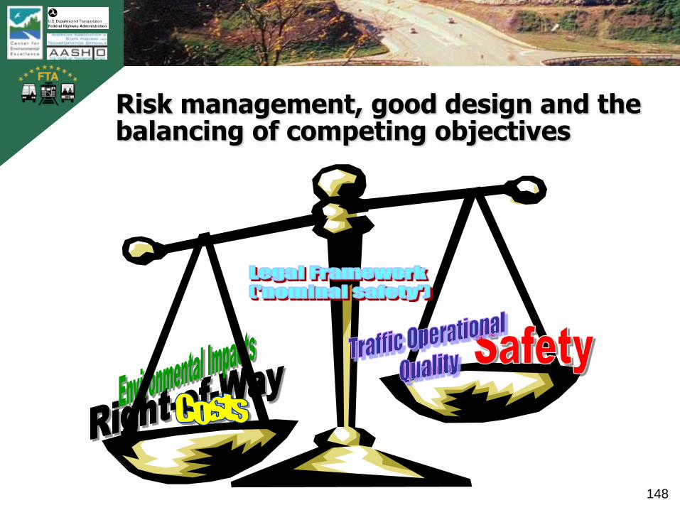
Risk management, good design and the balancing of competing objectives

TB
0420
0900
2AT
L
149
Design Exceptions
When an applicable design value or „standard‟ can not be attained, it is necessary to request a design exception*

TB
0420
0900
2AT
L
150
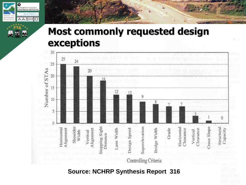
Roadway design elements requiring design exceptions (per FHWA)
• Design Speed*
• Lane width
• Shoulder width
• Normal cross slope
• Horizontal curvature
• Superelevation
• Tangent grade
• Vertical curvature
• Vertical clearance
• Stopping sight distance
• Bridge width
• Lateral offset (formerly horizontal clearance)
• Structural capacity*
TB
0420
0900
2AT
L
151
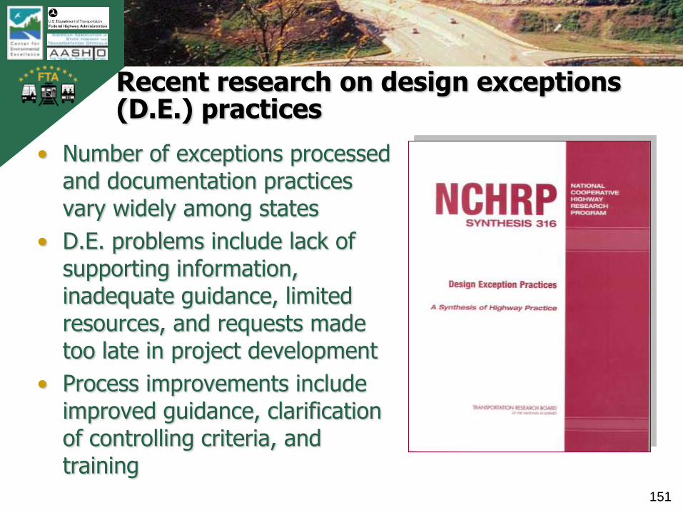
Recent research on design exceptions (D.E.) practices
• Number of exceptions processed and documentation practices vary widely among states
• D.E. problems include lack of supporting information, inadequate guidance, limited resources, and requests made too late in project development
• Process improvements include improved guidance, clarification of controlling criteria, and training
TB
0420
0900
2AT
L
152
Most commonly requested design exceptions
Source: NCHRP Synthesis Report 316

TB
0420
0900
2AT
L
153
Participant Polling
• React to the following statement:
„The use of design exceptions will always result in a degradation in safety.‟
• Agree
• Disagree

TB
0420
0900
2AT
L
154
Risk management best practices
• Understand operational and safety effects of potential design exception
• Employ proven, effective mitigation strategies
• Fully document the design exception and mitigation approach

TB
0420
0900
2AT
L
155
Perspective on design flexibility and design exceptions
• The Green Book includes considerable flexibility; applying it to its maximum value may preclude the need for design exceptions
• Design exceptions should be considered carefully, used sparingly and with caution
• Understanding functional performance and mitigating the exception is critical to success
• Documentation serves to justify the decision and manage agency risk
TB
0420
0900
2AT
L
156
Closing remarks on the Green Book and flexibility
• There is much flexibility in the Green Book• Design does not occur in a vacuum; the surroundings
matter, so one must be flexible to be successful• Understand how and when the Green Book applies;
including other design references• Understand the background of policy values to apply
them properly and optimize your design• Recognize that you as the designer have many choices• Wise, informed choices improve your chances of
success• Read and understand the text in addition to tables and
charts in the Green Book; it offers good insights
TB
0420
0900
2AT
L
157
Where to get additional information…
• Reference Materials:• AASHTO A Policy on Geometric Design of Highways and
Streets
• AASHTO Guide for Achieving Flexibility in Highway Design
• Flexibility in Highway Design, FHWA
• Mitigation Strategies for Design Exceptions, FHWA
• AASHTO Bicycle Guide
• AASHTO Pedestrian Guide
• Draft PUBLIC ROW ACCESSIBILITY GUIDE
• TRB Special Report 214

TB
0420
0900
2AT
L
158
Where to get additional information…
• Websites to Reference:i. AASHTO (www.transportation.org)
ii. Center for Environmental Excellence (http://environment.transportation.org/)
iii.FHWA Resource Center (www.fhwa.dot.gov/resourcecenter)
iv.TRB (www.trb.org)
v.Project for Public Spaces (www.pps.org)
vi.Complete Streets
vii.CSS (www.contextsensitivesolutions.org)
viii.Pedestrian and Bicycle Information Center (www.walkinginfo.org & www.bicyclinginfo.org)

TB
0420
0900
2AT
L
159
Where to get additional information…
• Additional Training Available:
• Exploring the Green Book: Basic Geometric Design (FHWA Course)
• Highway Geometric Design for Safety & Efficiency (FHWA Course)
TB
0420
0900
2AT
L
160
Where to get webinar materials
• Webinar materials will be available for downloading by end of July
• Check with the AASHTO Center for Environmental Excellence website (http://environment.transportation.org/)
• Follow-up questions please contact presenters:
TB
0420
0900
2AT
L
161
Questions and discussion