
5. ENGINEERING AND DESIGN
For the applicant; WBerksC; WokBC; RBC; RBWM; BFC; BCC; SBDC; SBC; LBHill;
LBHouns; GLA; RAC; AA; EA.
ED5.1 To what extent have the local authorities and road user bodies been involved in the
engineering and design of the project?
1. As the mainline carriageway of the M4 is operated by Highways England, there is no need to
consult the local authorities on the engineering and design of the mainline. However, these
bodies have been consulted in relation to the Scheme, as set out in the Consultation Report
(Application Document Reference 5.1), and described below. Some local authority roads
(“side roads”) are affected by the overbridge replacements and underbridge widening works
and therefore Highways England has taken additional steps to engage with them accordingly
in relation to these roads.
2. In relation to the necessary overbridge replacements and associated side road changes,
Highways England has engaged with Slough Borough Council, South Bucks District Council,
Buckinghamshire County Council and the Royal Borough of Windsor and Maidenhead
throughout the preliminary design stage, commencing in March 2013, as they are the
authorities directly affected by the proposed works. Proposals developed for the side road
realignments were forwarded to each of the local authorities relative to their administrative
boundaries. Responses to the specific proposals varied between the authorities, with Slough
Borough Council participating to the greatest extent and being content with the preliminary
proposals. User bodies were not contacted as part of the process. However, meetings were
held with some interested parish councils.
3. In addition to the direct contact made by Highways England, the local authorities have had
two opportunities to comment and agree on the proposals for the Scheme, firstly on the
information presented in the Preliminary Environmental Information Report (issued
November 2014) (http://www.highways.gov.uk/publications/m4-junction-3-to-12-smart-
motorway-consultation-documents/) during the formal consultation under s. 42 of the
Planning Act 2008, and secondly in their relevant representations on the made application, in
accordance with s.56 of the Planning Act 2008.
4. Slough Borough Council’s Relevant Representation raised general issues regarding:
4.1 Overbridge replacements; and
4.2 Diversion routes.
5. Buckinghamshire County Council’s relevant representation raised issues regarding:
5.1 Access to the bridge sites;
5.2 Severance caused by closing Old Slade Lane;
5.3 Diversion routes;
5.4 Retention of cycle route at Thames Bray;
5.5 Improvement of the Thames National Trail; and
5.6 Enabling Old Slade Lane to be used by walkers, cyclists and horse riders.

6. Royal Borough of Windsor and Maidenhead did not submit a Relevant Representation. The
GLA's Relevant Representation did not raise any concerns in relation to the engineering and
design of the Scheme.
7. Highways England has responded to the Relevant Representations as part of its submission at
Deadline I, and has also engaged with the local authorities to agree Statements of Common
Ground, as provided with Deadline II. Highways England will continue to liaise with the local
authorities during the detailed design stage.
8. At Scheme level there has been no direct contact with the road user bodies as this relationship
is managed at a higher level within Highways England. The AA and RAC meet with
Highways England on a regular basis in a number of forums. The one most relevant is the
national Survive working group. They have been briefed on the smart motorway proposals
across the network through this forum, and the Survive Best Practice Guide is being re-issued
to all recovery agents to enable them to operate safely on smart motorways.
9. Highways England has engaged with the Environment Agency ("EA") throughout the
development of the Scheme. Details of the Relevant Representation from the EA are available
via the link in item 7 above. In addition, a Statement of Common Ground has been prepared
and discussions for its agreement will continue following Deadline II.

ED5.2 What measures [(Intelligent Transport Systems [ITS] or Integrated Demand
Management [IDM])] are currently in place on M4 J3 to 12 to improve journey time
reliability, reduce congestion and increase highway capacity as recommended by the
TVMMS in 2003?
1. Since the publication of the Thames Valley Multi Modal Study in 2003, the following
systems have been provided on the M4 to improve journey time reliability, reduce congestion
and increase highway capacity:
1.1 Variable Message Signs;
1.2 Motorway Incident Detection Automatic System;
1.3 Closed Circuit Television; and
1.4 Ramp Metering.
2. However, even with these measures in place, the 2037 forecast traffic flow during peak
periods between junctions 7 to 12 eastbound and junctions 5 to 6 and junctions 7 to 8/9 of the
M4 will reach capacity without the Scheme. Forecast ratios of traffic flow to capacity without
implementation of the Scheme are shown in Table 2, Paragraph 4.3.3 of the Engineering and
Design Report ("EDR") (Application Document Reference 7.3).
3. The evidence for the benefits of the Scheme in reducing congestion can be seen in table 3 of
the EDR, which shows the reduced flow to capacity ratios with implementation of the
Scheme. It is notable that congestion will increase without the Scheme, but its implementation
is calculated to bring demonstrable benefits. This is addressed further in Highways England’s
response to question ED 5.3.

ED5.3 Does Table 2 of the applicant's EDR APP-096 take into account the use of any ITS
and/or IDM?
1. The tables in the EDR are produced using data collected in respect of 2013 traffic flows. As
such, the data represents the motorway operating with existing Ramp Metering1, Closed-
circuit television "(CCTV"), Motorway Incident Detection and Automatic Signalling
("MIDAS" – inductive loops in the road to detect slow moving, queuing or stationary traffic)
and message signs in place.
2. Table 2 of the EDR shows forecast ratios for each link without implementation of the
Scheme. Strategic traffic models, such as the M3/M4 model, do not explicitly model the
effects of motorway technology. Instead, they assign traffic on the basis of speed-flow curves
that reflect the number of traffic lanes present on a carriageway. The traffic flow forecasts
used in Table 2 (reproduced below) are taken directly from the traffic model and take no
specific account of existing ITS or IDM technology. Two years’ data are shown - 2022
(Opening Year) and 2037 (Design Year) - for the morning and evening peak periods. In each
case, without the Scheme, the number of links shaded red (where the ratio of flow to capacity
exceeds 85%, which indicates that the links are predicted to become congested) increases over
time. Similarly, the number of links where flow has reached capacity (shaded black) is also
forecast to increase. The links which are shaded yellow in Table 2 are those which are
predicted to be near to having a ratio of flow to capacity exceeding 85%. Those links shaded
green do not have capacity issues.
3. Table 2 - Forecast ratios of traffic flow to capacity without implementation of the Scheme
Morning peak-hour (07:00-08:00) Evening peak-hour (17:00-18:00)
Eastbound Westbound Eastbound Westbound
2022 2037 2022 2037 2022 2037 2022 2037
J12-J11 99.4 100.0 82.1 88.9 94.5 100.0 88.2 90.8
J11-J10 100.0 100.0 85.7 92.1 96.1 100.0 92.8 96.1
J10-J8/9 96.7 100.0 82.7 87.2 85.1 90.1 94.7 97.9
J8/9-J7 97.0 100.0 80.1 84.9 83.8 87.7 100.0 100.0
J7-J6 91.6 93.5 82.9 88.6 83.0 85.5 94.5 98.6
J6-J5 96.9 99.6 87.9 93.0 91.4 95.0 97.3 100.0
J5-J4b 74.0 76.2 73.1 75.2 75.1 78.2 80.0 82.3
J4b-J4 77.2 78.5 73.7 74.9 77.9 79.6 77.0 77.7
J4-J3 84.2 88.5 86.8 88.0 91.6 91.4 83.7 83.9
1 Ramp metering is described in paragraph 9.5.1 of the Engineering and Design Report (Application Document Reference 7.3).

Key
Capacity reached Ratio of flow to capacity >85%
Ratio of flow to capacity nearly 85%
No capacity issues
4. Over recent years other forms of technology have been introduced on the M4 between
junctions 3 and 12 to help manage traffic on this congested section. This includes Ramp
Metering, CCTV, MIDAS and message signs. However, although these measures are in place
and make a positive contribution to the management and safety of traffic, the forecast traffic
flow during peak periods in substantial areas of the Scheme will approach or exceed the
available capacity without the Scheme and the further benefits to be derived through the
provision of the additional capacity and enhanced control systems are now necessary. See
Tables 2 and 3, Paragraph 4.3.3 of the EDR.

ED5.4 Why was the Controlled All Lane Running (ALR) design chosen in preference to a
Managed Motorway (MM) with use of the hard shoulder restricted to periods of
congestion?
1. The implementation of smart motorways to increase capacity and improve performance is
outlined within paragraph 2.23 of the National Policy Statement for National Networks ("NN
NPS"). Smart motorways (previously known as managed motorways) is the generic term for
motorways where technology is combined with operating procedures to actively control
traffic flow. (The link below provides greater detail
https://www.gov.uk/government/uploads/system/uploads/attachment_data/file/363960/Englan
ds_motorways_are_getting_smart_leaflet.pdf). Techniques such as varying the speed limit,
making the hard shoulder available to traffic and ramp metering are used to make journey
times more reliable, improve traffic flow and reduce congestion. At the same time, safety is
better than that of a normal 3 lane motorway. Currently Highways England has 3 types of
smart motorway on its network:
1.1 controlled motorways (“CM”);
1.2 hard shoulder running (“HSR”) – sometimes called Dynamic Hard Shoulder running
(“DHS”); and
1.3 all lane running (“ALR”).
2. In 2008, Ruth Kelly, Transport Secretary, announced a £6 billion investment package to
improve and make better use of England's motorways and other key roads. She also published
the Command Paper 'Roads - Delivering Choice and Reliability' setting out more detail on her
innovative plans to tackle congestion, both on strategic routes and in towns and cities. (The
link to the first announcement on the then Managed Motorway programme in 2008 is
http://webarchive.nationalarchives.gov.uk/20081201222039/autoindustry.co.uk/press_release
s/17-07-08).
3. In 2009 the weakening of the UK economy resulted in an even greater need to reassess the
capital and operating cost of a typical section of smart motorways, whilst maintaining the
journey time reliability and safety benefits identified in the programme’s aims and objectives.
4. Key programme level objectives were established to reduce the estimated whole of life
scheme costs and reduce timescale for construction whilst ensuring no reduction in safety
performance compared with the baseline of a “standard” motorway.
5. The then Highways Agency utilised the momentum, learning and evidence generated by the
success of the M42 Pilot (an HSR scheme) and initial roll out of hard shoulder running on key
sections of the ‘Birmingham Box’, to reassess the hazards associated with evolving the smart
motorways design.
6. In 2010, the then Highways Agency began investigating what further changes could be made
to the technical specification in order significantly to reduce costs and timescales for scheme
delivery. The Highways Agency developed a revised smart motorway concept based upon the
permanent conversion of the hard shoulder to a running lane, using the knowledge and
experience gained from constructing and operating the M42 Pilot and Birmingham Box
schemes. The aim was to optimise the quantity of infrastructure required to operate the
motorway safely without the hard shoulder i.e. ALR, whilst continuing to deliver schemes
that tackled the problem of growing congestion and unreliable journeys. This optimised
approach required fewer overhead gantries and made greater use of cantilever gantries to

present information to drivers in a simpler way, whilst minimising the whole of life cost of
expensive infrastructure.
DHS or ALR
7. The Managed Motorways All Lane Running Generic Safety report Ref: 1039092-GSR-016,
August 2013 source: http://assets.highways.gov.uk/specialist-information/knowledge-
compendium/2011-13-knowledge-programme/MM-
ALR%20generic%20safety%20report%20final.pdf) provides further background information
to explain why the ALR design became Highways England policy as the preferred operating
solution to address congestion issues on the network.
8. The Managed Motorways All Lane Running Generic Safety report (referenced above) states:
“In January 2009 the Government announced that hard shoulder running (HSR) would be
extended to some of the busiest parts of the Highways Agency’s major road network and this
initiated the managed motorways (MM) programme. The MM concept built upon the success
of the M42 Active Traffic Management Pilot (M42 MM) scheme. IAN 111/09 “Managed
Motorways Implementation Guidance – Hard Shoulder Running (MM-HSR)” and IAN112/08
“Managed Motorways Implementation Guidance – Through Junction Hard Shoulder
Running” provide designers with guidance on the implementation of managed motorways
with dynamic hard shoulder running and the option for including through junction hard
shoulder running.
Further knowledge and experience of operating managed motorways schemes indicated that
there was scope to further reduce capital and operating costs, whilst meeting congestion
objectives and not reducing safety performance compared to the baseline.
Managed motorways all lane running (MM-ALR) has been developed by the Highways
Agency to enable a reduction in the amount of infrastructure necessary for a managed
motorway scheme, resulting in significant cost savings without a reduction in safety.
Permanent conversion of the hard shoulder to a running lane along with the ability to
dynamically control mandatory speed limits is a key aspect of MM-ALR. This removes the
complex operating regime of opening and closing a dynamic hard shoulder.”
9. Highways England's experience of operating HSR has shown that it is resource intensive (to
open and close the hard shoulder). It has a number of technology points of failure, which
means that the hard shoulder regularly cannot be opened. For example, the opening of the
hard shoulder as a running lane on an HSR scheme requires the operator to be able to view
the full length of hard shoulder. When a camera develops a technology fault and a section of
hard shoulder cannot be viewed by the operator, then the operator will not be able to open the
hard shoulder to traffic. This also results in a high maintenance burden which itself results in
more risk exposure to Highways England's workforce. All of these factors impact on the
financial and operational benefits of managed motorways. All lane running ("ALR") reduces
these risks of technology failure and to the workforce.
10. Optimising the smart motorways design, and subsequent operations, has enabled Highways
England to find a balance between designing/operating efficient schemes that provide value
for money, whilst maintaining safety above baseline levels.
11. These efficiencies have made it possible to deliver a far greater number of smart motorway
carriageway miles and deliver significant benefits more quickly than would have been
possible by replicating the heavily engineered M42 pilot scheme.

Selection of motorway technology for the M4
12. With regard to the M4 J3-12 Scheme, the operational options considered for the Scheme are
detailed in Table 4, Paragraph 5.1.11 of the Engineering and Design Report (Application
Document Reference 7.3). The options considered included dynamic use of the hard shoulder
and also the ALR concept. Paragraph 5.1.11 notes that “The four operational regime options
and design concepts were identified (Table 4), developed and reviewed, by Highways
England based on the knowledge gained from delivering Managed Motorway schemes and
incorporating the latest emerging concepts.” Paragraph 5.1.12 goes on to say that the “design
and cost assessments were undertaken in 2010 for each of the above design solutions,
although work on developing engineering options was halted pending the completion of a
traffic model and the development of a second generation Managed Motorway solution”.
13. These assessments undertaken concluded that the smart motorway solution proposed for the
M4 is the most suitable option for this stretch of motorway. It allows Highways England to
deliver the additional capacity that is required to tackle congestion by making best use of the
available road space, and avoiding the problems experienced with the HSR design.

ED5.5 The EDR APP-096 identifies a requirement for further detailed design. The possible
changes include online solutions changing to offline solutions. Section 7 of the EDR
provides a link by link description and different options for certain works are
included2. The applicant is requested to produce a schedule of those works for
which options have not been decided. The schedule should indicate whether all the
options are shown on the relevant works plan and provide the works plan reference;
provide references to the ES where the options have been considered; and indicate
the implications for land take, referring to the land plans/Book of Reference (BoR)
for each option.
1. The EDR (Application Document Reference 7.3) addresses the preliminary design, which was
complete at the time of the application and is shown on the annexes to the EDR (Application
Document Reference 7.4) and the engineering drawings and sections, (Application Document
Reference 2.5 and 2.6). It is anticipated that as detailed design progresses then some design
details may change. However, Highways England will not deviate from the Works Plans
(Application Document Reference 2.3) except as provided for in Article 6 of the draft DCO
“Power to deviate”. Where different options are awaiting detailed design decisions, then the
work boundaries on the Works Plans cover the worst case scenario which in all cases includes
sufficient area for the other options under consideration. It is important to note that the
Rochdale Envelope for the Scheme, the reasonable worst case on which it is assessed, is set
by the power of deviation and not the preliminary design. As such, it is not appropriate to
seek an exhaustive list of changes that may be made. The approach is acceptable to
Parliament, as it is adopted in the Crossrail Act 2008, which similarly relates to a linear
project.
2. Paragraph 5.2.7 of the EDR states: “During detailed design, the options will be subject to
further review following stakeholder engagement and subsequent value engineering with the
appointed contractor. This may identify benefits that could be achieved by re-considering
some of the alternatives once more details about the proposed construction of the wider
Scheme are established.” However, any such changes would be limited by the power to
deviate, within the parameters assessed in the ES and constrained by the provisions of the
DCO, as explained in response to first written question ED 5.6. Examples of details include
gantry foundations, bridge detail dimensions, siting of apparatus, etc. None of these would
affect the assessments carried out.
3. Paragraph 5.2.8 of the EDR lists certain changes which may become desirable under
particular circumstances. These are included in the table below along with a status update.
The table also lists other options currently under consideration are tabulated below. Further
changes may be identified within the power of deviation as the detailed design progresses but
at this point in time the preliminary design remains current and no such change has yet been
identified.
4. Please also refer to the response to ED9.4, which identifies various plots of land which might
be needed for temporary works dependant on condition surveys and construction
methodology.
2 No works plan references are provided in the EDR to aid the understanding of the options in relation to the parameters of the draft DCO.

Work No Description of Option Plot Nos Environmental
Statement
Reference
7a, 8c,
10c, 11c,
12e, 13c,
14c, 19c,
20c, 22c,
25
Bridges, General
EDR paragraph 5.2.8.a states: “span arrangements, if temporary works and detailed cost estimates
demonstrate significant benefits”
Update, October 2015: The form and number of spans of the proposed Old Slade Lane Overbridge (Work
No. 25) will require change if the Scheme is to accommodate the new railway forming part of Slough
International Freight Exchange (“SIFE”) development All other proposed span arrangements remain as
shown in the bridge general arrangement drawings in EDR Annex F3 (Application Document Reference
7.4)
Various plots
within current
motorway
boundary and
at side roads
4.3 to 4.11
7a, 8c,
10c, 11c,
12e, 13c,
14c, 19c,
20c, 22c,
25
Bridges, General
EDR paragraph 5.2.8.b states: “reinforced concrete abutments/wing-walls being replaced by reinforced soil
where appropriate and where a cost saving can be demonstrated”
Update, October 2015 Detailed design is still underway and this option remains a possibility. However at
this point in time the preferred abutment and wingwall types remain as shown in the bridge general
arrangement drawings in EDR Annexes F2 and F3 (Application Document Reference 7.4)
Various plots
within current
motorway
boundary and
at side roads
4.3 to 4.11
7a, 8c,
10c, 11c,
12e, 13c,
14c, 19c,
20c, 22c,
25
Bridges, General
EDR paragraph 5.2.8.c states: “online solutions changing to offline solutions if diversion routes are
considered undesirable
Update, October 2015: No change is currently proposed to the online/offline side road solutions described
in the application. However, as a ‘matter not agreed’ in the Statement of Common Ground,
Buckinghamshire Country Council requests that access is maintained while the new Old Slade Lane
Overbridge is built (Work No 25)
Various plots
within current
motorway
boundary and
at side roads
4.3 to 4.11

7a, 8c,
10c, 11c,
12e, 13c,
14c, 19c,
20c, 22c,
25
Bridges, General
EDR paragraph 5.2.8.d states “online solutions changing to offline solutions if significant costs are
associated with utility diversions and, directional drilling of services under the M4 carriageways is not
feasible”
Update, October 2015: Detail design of utility diversions has not yet commenced
Various plots
within current
motorway
boundary and
at side roads
4.3 to 4.11
18 Water and Gas Main Subway.
Assessed Option: symmetrical extension of the subway by 2.1 m to north and south. See drawing ref
514451-MUH-ST-S2-DR-UB-301334 in EDR annex F2 (Application Document Reference 7.4)
Alternative option: infill the structure to eliminate the need for future access. This option is currently being
discussed with Thames Water and would require a new, sleeved, main to be constructed through the subway
with consequential local diversions at either end of the structure. This would be easier and less costly to
construct therefore causing less disruption to motorway users. It could potentially reduce the requirement
for temporary land take and hence reduce the impact on local land use at the Myrke.
23-02, 23-03,
23-04
4.8.8 and 4.8.9
21 Water Main Subway
Assessed Option: symmetrical extension of the subway by 3.1 m to north and south See drawing ref
514451-MUH-ST-S2-DR-UB-301333 in EDR annex F2 (Application Document Reference 7.4)
Alternative option: infill the structure to eliminate the need for future access. This option is currently being
discussed with Thames Water and would require a new, sleeved, main to be constructed through the subway
with consequential local diversions at either end of the structure. This would be easier and less costly to
construct therefore causing less disruption to motorway users. It could potentially reduce the requirement
for temporary land take and hence reduce the impact on parkland and allotments.
23-34, 23-35
4.8.19
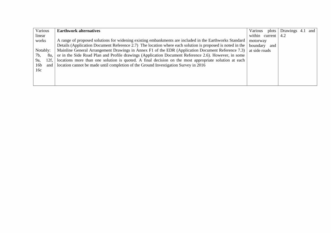
Various
linear
works
Notably:
7b, 8a,
9a, 12f,
16b and
16c
Earthwork alternatives
A range of proposed solutions for widening existing embankments are included in the Earthworks Standard
Details (Application Document Reference 2.7) The location where each solution is proposed is noted in the
Mainline General Arrangement Drawings in Annex F1 of the EDR (Application Document Reference 7.3)
or in the Side Road Plan and Profile drawings (Application Document Reference 2.6). However, in some
locations more than one solution is quoted. A final decision on the most appropriate solution at each
location cannot be made until completion of the Ground Investigation Survey in 2016
Various plots
within current
motorway
boundary and
at side roads
Drawings 4.1 and
4.2

Deadline II - Response to First Written Questions: Section 5 - Engineering and Design 13
ED5.6 Para 6.1.6 of the EDR APP-096 states that any changes to the detailed design would be
within previously assessed parameters, and that this will be secured through the
wording of the draft DCO APP-026. Please provide the references for those parts of the
draft DCO which provide this security
1. The development that may be constructed pursuant to the draft DCO is constrained by the
terms of the draft DCO in a number of way, as follows:
1.1 Article 3(1) grants development consent to Highways England, as the undertaker, for
the authorised development to be carried out and operated within the Order limits. As
such, any changes that result from the detailed design process, must be constructed
within the Order limits, which is the area assessed in the ES within which the
development would occur (see section 1.7.2 of the ES at Chapter 1 (Application
Document Reference 6.1). A common sense interpretation is also important - the
main line of the M4 will not be diverted, regardless of the limits shown for instance.
1.2 Article 3(3) provides that, subject to the power to deviate under Article 6, the
development authorised by the Order is to be constructed in the lines or situations
shown on the Works Plans and in accordance with the drawings specified in the
requirements. Consequently, the construction of the authorised development is
constrained by reference to the Works Plans and the drawings specified in
Requirement 6, subject to modification, as explained below.
1.3 The power to deviate, referenced in Article 3(3) is provided for in Article 6. This
enables Highways England, in carrying out the authorised development, to deviate
laterally and vertically to the extent provided for in Article 6. As a result of Article 6,
any changes to the detailed design must be within the limits of deviation set out in
that Article. The extent of that deviation was assessed in the ES (see section 5.10 of
the ES at Chapter 5 (Application Document Reference 6.1)). This provides the
reasonable worst case 'Rochdale Envelope'.
1.4 Requirement 3 provides that details of the layout, scale, siting, design, dimensions
and external appearance of the works listed in that requirement, which relate to the
construction of bridges, must be approved by the relevant planning authority, so far as
they do not accord with the plans listed under requirement 6, which is explained
below. This means that even if the designs differ they must be within the limits of
deviation and approved by the relevant planning authority.
1.5 Requirement 6 provides that the authorised development must be carried out in
accordance with the approved plans submitted with the application, which are listed
in that requirement. Consequently, the development is constrained by reference to
those plans, unless otherwise approved by the relevant planning authority, but within
the deviation power.
2. The development authorised by the DCO, if made, would be constrained by the power of
deviation given by Article 6 as set out in the draft DCO. As noted above, the scope of the
power of deviation was specifically considered by Highways England’s expert professional
team.
3. Effectively, the assessed, authorised Scheme is that shown on the works plans and described
in the draft DCO at Schedule 1. The design shown on the engineering drawings and sections
(Application Document Reference 2.5-2.9) is one design capable of being implemented

Deadline II - Response to First Written Questions: Section 5 - Engineering and Design 14
within the proposed Scheme and an alternative must be capable of being built within that
assessed envelope, effectively a different design within the limits of the approved Scheme.
4. Further, the development is constrained by the requirement to seek approval under
requirements 3 and 6. As explained in detail in the answer to first written question DCO8.20,
requirements 3 and 6 can only be used to allow development that has been authorised by the
DCO. It would not be lawful for an authority to authorise works going beyond the scope of
the DCO as governed by the limits of deviation shown on the Works plans and described in
Article 6 of the draft DCO. Accordingly, following the detailed design of the Scheme, it
would be impossible to authorise works that fell outside the scope of what had been assessed
in the ES, and consequently approved under the DCO.
5. It is critical to a major infrastructure project in the nature of the Scheme that am ability to
deviate and vary within assessed limits is given. Otherwise, it is not possible to refine or
improve the project and necessary changes cannot be made without a new application.
Critically this does not circumvent the variation procedures laid out by law since the powers
granted would provide the limits of the consented Scheme. Changing those limits would
demand a fresh application or an application to modify. There are two direct analogies: first,
outline planning permissions; and second, works authorised by hybrid bills. In each case, the
extent of deviation is akin to that sought here and has been found to be acceptable.

Deadline II - Response to First Written Questions: Section 5 - Engineering and Design 15
ED5.7 Are the local authorities satisfied that the solution chosen for each of the overbridges or
underbridges in their Council area are appropriate?
1. Details of the consultation that was undertaken with the local authorities is provided in the
response to first written question ED 5.1 above. That consultation included the forwarding of
the proposals developed for the side road realignments to each of the local authorities relative
to their administrative boundaries and adjacent authority interests in some cases. In relation to
the necessary overbridge replacements and associated side road changes, Highways England
has engaged with Slough Borough Council, South Bucks District Council, Buckinghamshire
County Council and Royal Borough of Windsor and Maidenhead Council throughout the
preliminary design stage, commencing in March 2013, as the authorities affected by the
proposals.
2. The level of engagement by the local authorities affected by the overbridge replacements has
been mixed. Slough Borough Council agreed to meet in relation to the overbridge
replacement proposals within its area of interest and was broadly content with the preliminary
design proposals.
3. Where on-line and off-line solutions were both technically feasible solutions, then both
options were included in the Preliminary Information Exhibitions held during 18 March 2014
to 29 March 2014. The preferred option was then presented during the statutory consultation
held between 10 November 2014 and 21 December 2014. At that stage concern was raised by
Dorney Parish Council over the online proposals for Lake End Road Overbridge and Marsh
Lane Overbridge.
4. The on-line replacement proposal for Lake End Road overbridge included the temporary
closure of Lake End Road and a temporary diversion along Marsh Lane. Following comments
received at the March 2014 Public Consultation exercise, and in consultation with
Buckinghamshire County Council, Highways England reviewed the use of each road and
changed the preferred option to off-line so that no temporary diversion would be required.
5. During the consultation, concerns that the temporary closure of Marsh Lane overbridge would
impact on bus, pedestrian and cycle routes to Dorney School were raised. Further consultation
with Buckinghamshire County Council, Dorney Parish Council and the bus operating
company concluded that Lake End Road could be used as a suitable diversion.
6. Highways England considers that the relevant stakeholders have been provided with all the
necessary information, and no other objections have been raised.

Deadline II - Response to First Written Questions: Section 5 - Engineering and Design 16
ED5.8 Has the drainage strategy for the project been agreed with the EA?
1. To date the Environment Agency ("EA") has not made any comment on the Drainage
Strategy (Application Document Reference 7.5).
2. A meeting between Highways England and the EA took place on the 25th September 2015 to
allow further discussion, with a view to agreeing matters regarding flood risk and drainage in
the Statement of Common Ground, with the EA, which is to be submitted at Deadline II.
3. At the meeting on the 25th of September 2015, the EA confirmed that, as from April 2015,
surface water drainage is the remit of the lead Local Flood Authorities and that Highways
England should liaise with them on this matter. Highways England will therefore consult with
the relevant lead local flood authorities to seek their approval of the drainage strategy for the
Scheme.

Deadline II - Response to First Written Questions: Section 5 - Engineering and Design 17
ED5.9 Is the EA satisfied that adequate compensation for any loss of floodplain can be
provided?
1. Highways England understands that, following a meeting held between HE and the EA on the
25th of September 2015, it was agreed that calculations should be completed at a selection of
sites to quantitatively prove the principle that floodplain compensation for works within the
floodplain can be achieved within the Scheme. Following consideration of the results of these
calculations by the Environment Agency, any agreement subsequently reached will be
confirmed to the Examination.
2. Highways England considers that the commitment to and principle of providing sufficient
compensation storage where works are necessary in the floodplain is established in
paragraphs 5.1.21, 5.1.22, 5.1.26, 5.1.36 and 5.1.45 of the Flood Risk Assessment
(Application Document Reference 5.3) and paragraphs 15.4.64 to 15.4.68 and Table 15.5 of
the Environmental Statement (“ES”) (Application Document Reference 6.1). The Flood Risk
Assessment (Application Document Reference 5.3) presents the results of analysis at key
worksites within the floodplain, for example at Ascot Road (River Bourne) and Monkey
Island Lane (River Thames) where works to existing overbridges are required. The
mitigation required to ensure that there would be no increase in flood risk is described in
paragraphs 15.4.64 to 15.4.66 of the ES (Application Document Reference 6.1), where it is
stated that compensatory floodplain storage volume will be created where storage losses
occur by removing and reconfiguring parts of existing embankments.
3. Since submission of the DCO application, further work has been undertaken to provide
additional information to confirm the requirements for compensation storage provision and to
verify the feasibility of its provision on a volume for volume and, where possible, level for
level basis. The results of this work have been submitted to the Environment Agency as an
appendix to the Statement of Common Ground (“SoCG”) between the EA and Highways
England and are also appended to this response as Appendix D to the responses the first
written questions at Section 4: Environment.
4. The further work is being informed by flood water level data supplied by the EA and LiDAR
topography information. A total of 45 sites (both offline and along the main carriageway) are
currently being reviewed in order to confirm whether works are necessary within the
floodplain, and to confirm the feasibility of the provision of sufficient compensation storage
at those sites identified as being in the floodplain.
5. Current assessments show that 29 of the 45 sites where widening works need to take place do
not encroach into the 1 in 100 year plus climate change floodplain (Flood Zone 3). Therefore,
works at these locations will result in no flood risk impacts and no mitigation is required. At
five of the 45 sites, the feasibility of floodplain compensation provision on a volume for
volume basis has been proven and at a further two sites with the largest volumetric
compensation requirements, provision of this storage on a level for level basis has been
demonstrated to be feasible. At the nine remaining sites, results are pending, with flood data
currently awaited from the EA for some of these sites. This will be used to further
demonstrate that flood compensation, where required, is feasible within the Scheme, verifying
the conclusion within the ES (Application Document Reference 6.1) and the Flood Risk
Assessment (Application Document Reference 5.3) that the Scheme will not increase flood
risk elsewhere.

Deadline II - Response to First Written Questions: Section 5 - Engineering and Design 18
ED5.10 Have discussions been held with the Police regarding the positioning of Police
Observation Platforms?
1. The M4 between junctions 3 and 12 currently contains a number of Police Observation
Platforms ("POPs"). Initially, Highways England proposed to remove all POPs from the
Scheme in line with Highways England Guidance (Ref: Major Projects Instruction MPI-32-
082014 - Provision of Observation Platforms on Smart Motorway Schemes (August 2014)).
However, discussions were held with Thames Valley Police and Metropolitan Police where
the two forces confirmed that they wished Highways England to retain the platforms on a
number of links on the Scheme.
2. Due to the permanent conversion of the hard shoulder to a running lane it is necessary for all
POPs to be re-located adjacent to emergency refuge areas (“ERAs"). The current POPs would
have utilised the hard shoulder to gain speed prior to joining the main carriageway, which is
not available following the opening of the Scheme. By locating the POP adjacent to the ERA
the Police can safely enter the relevant ERA and then reverse back into the POP area (freeing
up the ERA for use by breakdowns). The co-location of POPs with ERAs provides mitigation
against the public misusing the adjacent ERAs for unnecessary stops.
3. This was confirmed at the Project Safety Control Review Group (“PSCRG”) meeting held on
19th June 2014. The positioning of POPs was then agreed with the Police at a number of
meetings and subsequent discussions. This includes a meeting with Thames Valley Police on
4th November 2014 (Ref: 514451-MUH-00-ZZ-MI-OS-400122) where the observation
platforms were agreed. Minutes of this meeting are appended to this response at Appendix A.
4. The agreed locations of the proposed POPs are as follows (these POPs are shown on the
General Arrangement drawings in Annex F1 to the Engineering and Design Report
(Application Document Reference 7.4) as referred to in the table below):
Proposed Observation Platforms Location
Motorway Link-
Eastbound ("EB"),
Westbound ("WB")
Proposed POP location General Arrangement Drawing Number
J3 – J4 EB POP re-located with ERA E1-B1 514451-MUH-ML-ZZ-DR-GA-300825,
Sheet 59 of 61
J3 – J4 WB POP re-located with ERA E1-A1 514451-MUH-ML-ZZ-DR-GA-300825,
Sheet 59 OF 61
J4 – J4b WB POP re-located with ERA E2-A1 514451-MUH-ML-ZZ-DR-GA-300821,
Sheet 55 of 61
J4b – J5 EB POP re-located with ERA E3-B1 514451-MUH-ML-ZZ-DR-GA-300817,
Sheet 51 of 61
J4b – J5 WB Retain existing observation platform 514451-MUH-ML-ZZ-DR-GA-300817,
Sheet 51 of 61
J5 – J6 EB POP re-located with ERA E4-B2 514451-MUH-ML-ZZ-DR-GA-300811,
Sheet 45 of 61
J8/9 – J10 EB POP re-located with ERA E7-B1 514451-MUH-ML-ZZ-DR-GA-300796,
Sheet 30 of 61
J8/9 – J10 WB POP re-located with ERA E7-A3 514451-MUH-ML-ZZ-DR-GA-300792,
Sheet 26 of 61

Deadline II - Response to First Written Questions: Section 5 - Engineering and Design 19
Motorway Link-
Eastbound ("EB"),
Westbound ("WB")
Proposed POP location General Arrangement Drawing Number
J10 – J11 EB POP re-located with ERA E8-B1 514451-MUH-ML-ZZ-DR-GA-300782,
Sheet 16 of 61
J10 – J11 WB POP re-located with ERA E8-A2 514451-MUH-ML-ZZ-DR-GA-300782,
Sheet 15 of 61

Deadline II - Response to First Written Questions: Section 5 - Engineering and Design 20
ED5.11 EDR para 7.6.21e) App_096 states both new bridges at Huntercombe Spur will have
two lanes of traffic in each direction. Please clarify whether this means one bridge
will carry two lanes southbound and one will carry two lanes northbound.
1. Highways England confirms that the position as stated in the question is correct. The
replacement structure at junction 7 (Huntercombe Spur), will comprise two separate bridges.
The western bridge will carry two northbound lanes and the eastern bridge will carry two
southbound lanes. Details of the proposed highway cross section over the two bridges can be
seen on section 3 on sheet 2 of the General Arrangement drawing in Annex F3 of the EDR
(Drawing Number 514451-MUH-ST-S2-DR-OB-301426) (Application Document Reference
7.4).

Deadline II - Response to First Written Questions: Section 5 - Engineering and Design 21
ED5.12 EDR para 7.8.7 APP-096 please confirm there will not be ALR westwards from J4b
to J5?
1. The Engineering and Design Report (“EDR”) (Application Document Reference 7.3)
paragraph 7.8.7 states:
"In the westbound direction, TJR will not be implemented at junction 4b. The westbound slip
road from the M25 to M4 will be configured to create a lane gain so that there will be four
driving lanes from junction 4b to junction 5. This link already has four lanes and a hard
shoulder and the existing hard shoulder will be retained as far as the junction 5 exit slip road.
TJR will be provided at junction 5".
2. The westbound carriageway from junction 4b to junction 5 already has four lanes and a hard
shoulder. This configuration will be retained and all lane running (“ALR”) will not be
required.

Deadline II - Response to First Written Questions: Section 5 - Engineering and Design 22
ED5.13 EDR para 7.8.8 APP-096 refers to retention of hard shoulder and existing ERA. Is
this correct?
1. The Engineering and Design Report (“EDR”) (Application Document Reference 7.3)
paragraph 7.8.8 contains an error. The feature to be retained is a Police Observation Platform
(“POP”) not and Emergency Refuge Area (“ERA”). As the hard shoulder in this location will
be retained there is no need to remove the POP.
2. The retained POP is identified on sheet 26 of the Works Plans (Application Document
Reference 2.3), labelled in light blue at approximate chainage 18+800.


