
Assessing our untapped energy resources
Derek ReayGeological Survey of Northern Ireland
Talk Outline
Northern Ireland energy marketOil and Gas Exploration
– Description– Exploration risks
Application of Tellus data to oil and gas exploration – General– Examples
Geothermal energy resources

NI Energy Infrastructure
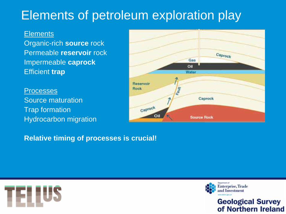
Elements of petroleum exploration playElementsOrganic-rich source rockPermeable reservoir rockImpermeable caprockEfficient trap
ProcessesSource maturationTrap formationHydrocarbon migration
Relative timing of processes is crucial!

Petroleum exploration play areas and current licences

Exploration in the Northwest Irish Carboniferous Basin
Source
Carboniferous shale
Reservoir
Carboniferous sandstone
Caprock
Carboniferous shale
Traps
1.Anticlines
2.Flower structures
3.Basin-centred gas

Flower structure from Belhavel - Castle Archdale fault system

Northeast Permo-Triassic BasinsSource: Carboniferous coal/shale
Reservoirs:
1. Carboniferous sandstones
2. Early Permian sandstones
3. Triassic SSG sandstones
Caprocks:
1. Carboniferous mudstones
2. Late Permian salt/mudstone
3. Triassic MMG salt/mudstone
Traps:
1. Tilted fault blocks
2. Anticlines
3. Fan deposits

Structural traps in the Permo-Triassic Basins
MMGSSG
LPSCMLC
MMG Mercia Mudstone Group (Caprock)
SSG Sherwood Sandstone Group (Reservoir)
LPS Lower Permian Sandstone (Reservoir)
CM Coal Measures (Source)
LC Lower Carboniferous mudstones (Source)

Exploration risks/ negative factorsSouthwest play areaLow permeability ‘tight’ reservoirIdentification of trapsTiming of migration and trap formation
Northeast play areaPoor imaging of sub-basalt structureSource rock – distribution and maturityTiming of migration and trap formationPost-migration leakage
Tellus geophysical data is used to
• Map faults – deduce structural history
• Refine mapped geological boundaries
• Identify igneous intrusions
Can also be used for
• Depth to basement modelling
• Integration with other geophysical data (seismic, gravity) to produce more realistic exploration models
Applications of Tellus data to oil & gas exploration
Total magnetic intensity• Magnetic domains
• Major lineaments
• Intrusions
• Dyke swarms

Magnetic pseudogravity•Structural domains
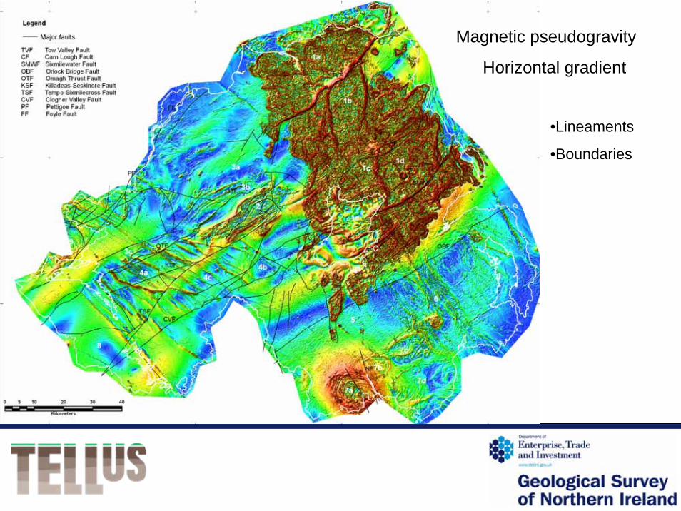
Magnetic pseudogravity
Horizontal gradient
•Lineaments
•Boundaries

Electromagnetic (EM) data• Rock units

Fermanagh – Tellus electromagnetic data and geology
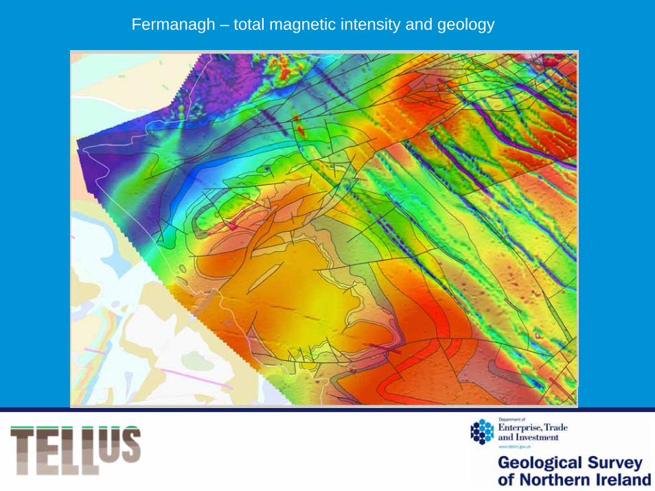
Fermanagh – total magnetic intensity and geology

EM dataTotal Magnetic intensity
RTP
Larne Basin

Underground gas storage in salt beds – Larne and Islandmagee
Larne No. 2
salt
salt
salt
300-
600-
900-
113m1700-
salt
Geology Magnetics RTP Magnetics 1st Vert. Deriv.
Caverns need to avoid faults and basalt dykes
Tellus data will improve the structural mapping in the prospective areas
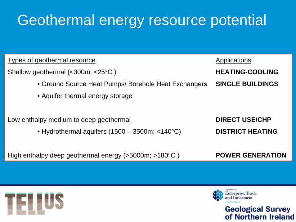
Geothermal energy resource potential
Types of geothermal resource Applications
Shallow geothermal (<300m; <25°C ) HEATING-COOLING
• Ground Source Heat Pumps/ Borehole Heat Exchangers SINGLE BUILDINGS
• Aquifer thermal energy storage
Low enthalpy medium to deep geothermal DIRECT USE/CHP
• Hydrothermal aquifers (1500 – 3500m; <140°C) DISTRICT HEATING
High enthalpy deep geothermal energy (>5000m; >180°C ) POWER GENERATION

Distribution of geothermal resources in Northern IrelandShallow geothermal
www.kyotoinhome.info/UK/heat_pumps/basic_principles.html www.downwithco2.co.uk/ground_source_heat/ground_source_heat_pumps_page.html
Ground source heat pump technology Aquifer thermal energy storage
Almost everywhere in Northern Ireland Restricted to good aquifers
This technology is supported by Government funding – e.g. Reconnect

Distribution of geothermal resources in Northern IrelandLow enthalpy geothermal energy resources
Measured and modelled temperatures at 1000m and 2500m depth (Kelly et al. 2005)
Potential resources in Rathlin, Larne and Lough Neagh sedimentary basins
1000m 2500m

Radiogenic heatCalculated from Tellus radiometric data
A = 0.337(0.74eUppm+.199eThppm+.26K%) μW/m³
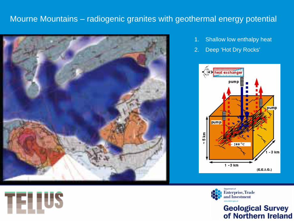
Mourne Mountains – radiogenic granites with geothermal energy potential
1. Shallow low enthalpy heat
2. Deep ‘Hot Dry Rocks’

Conclusions
Tellus geophysical (and geochemical) data can help us to:• refine 2D geological maps
• increase our understanding of geological structure and basin history
• produce 3D models of subsurface geology
These are important tools in exploration for hydrocarbons and geothermal resources
So far… qualitative and regional interpretation
Next… quantitative modelling and detailed interpretation
Acknowledgements
Thanks to Chris van Dam, Alex Donald, Mark Patton, Adrian Walker and Baz Chacksfield (BGS) for producing the Tellus images.


