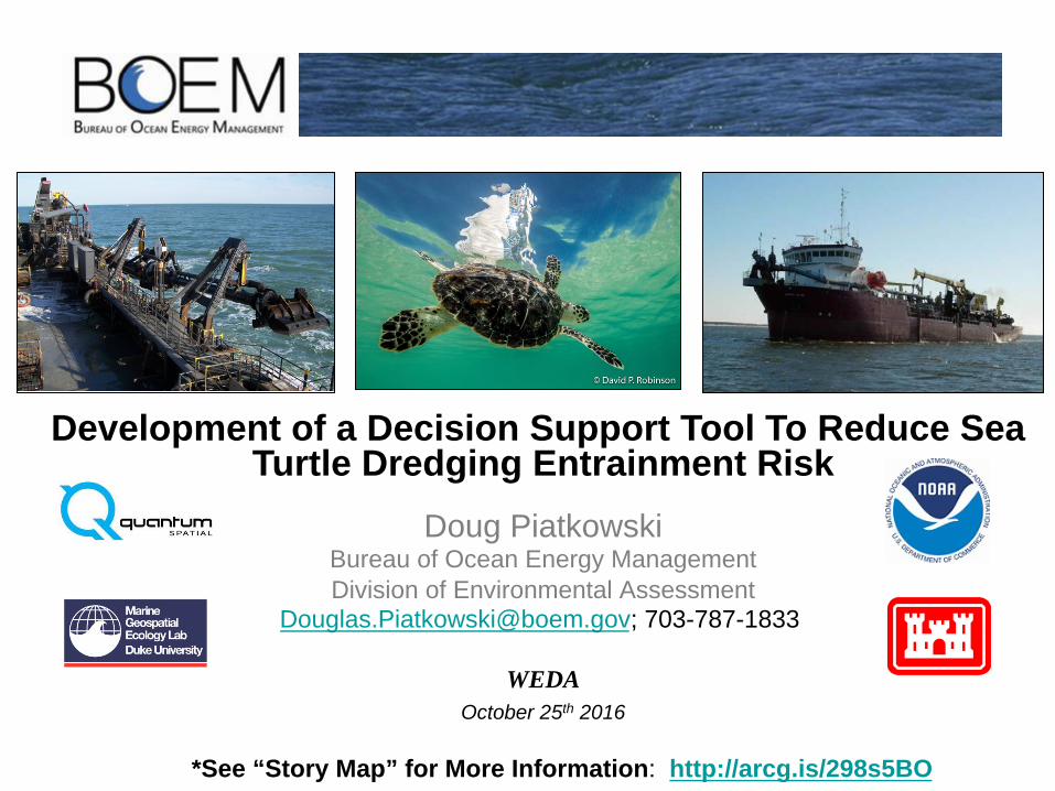
Development of a Decision Support Tool To Reduce Sea Turtle Dredging Entrainment Risk
Doug Piatkowski Bureau of Ocean Energy Management Division of Environmental Assessment
[email protected]; 703-787-1833
WEDA
October 25th 2016
*See “Story Map” for More Information: http://arcg.is/298s5BO

OUTLINE
• Background
• Study Purpose
• Study Objectives
• Scope of Work
• Industry Meeting Outcomes
• Sea Turtle Expert Meeting Outcomes
• Next Steps – Phase II
• Discussion / Questions
Source: Kristen Hart, USGS
Source: Jake Levenson, BOEM
Source: Jake Levenson, BOEM

STUDY BACKGROUND Early Collaboration

STUDY BACKGROUND Early Collaboration
• WEDA (2012, 2016) • USACE Eastern Region Dredging
Conference (2014) • SE Regional Sea Turtle Meeting
(2015 and 2016) • National Dredging Meeting (2016)
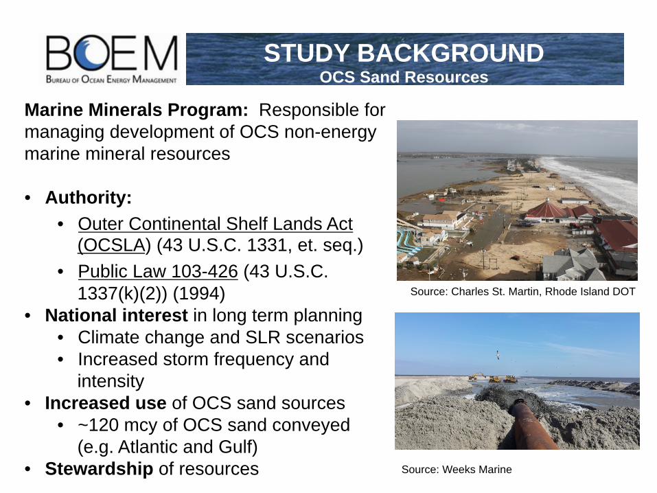
STUDY BACKGROUND OCS Sand Resources
Marine Minerals Program: Responsible for managing development of OCS non-energy marine mineral resources • Authority:
• Outer Continental Shelf Lands Act (OCSLA) (43 U.S.C. 1331, et. seq.)
• Public Law 103-426 (43 U.S.C. 1337(k)(2)) (1994)
• National interest in long term planning • Climate change and SLR scenarios • Increased storm frequency and
intensity • Increased use of OCS sand sources
• ~120 mcy of OCS sand conveyed (e.g. Atlantic and Gulf)
• Stewardship of resources
Source: Charles St. Martin, Rhode Island DOT
Source: Weeks Marine

• Established Mitigation Measures: Since the 1990’s
• Since 1996: >20 sea turtle mortalities associated OCS dredging.
• Residual Risk: Limited consideration for project specific efficacy and no risk evaluation standard
• BOEM Needs: Minimize entrainment risk through a standardized risk assessment framework
STUDY BACKGROUND History of Entrainment Risk

• Minimize adverse effects to sea turtles associated with dredging operations in the OCS through:
• Deliberate project specific planning efforts • Implementation of relevant and effective
mitigation measures
• More informed decisions could: • Minimize impacts to sea turtle species • Decrease dredging costs through reduced down-
time, increased productivity, and potential “flexibility” of environmental windows
• Develop a geographically and temporally based decision support tool for BOEM’s* use to:
• Support risk based planning • Standardized and consistent across a regional
scale to assess project-specific dredging entrainment risk within a common framework
* Opportunity to expand user base in the future
STUDY PURPOSE
Source: USGS

• Identify risk factors and authoritative data sources to support tool development
• Temporal and spatial relationship of sea turtle behavior • Borrow area design relative to efficacy of existing mitigations
STUDY OBJECTIVES
Source: Shaver et. al. 2013 Source: USACE Wilmington District
Caminada headlands
project

SCOPE OF WORK
PHASE I (2015-2016): • Literature Synthesis, Assessment of Existing Data,
and Draft report (Ongoing) • Convene Industry and Sea Turtle Technical Expert
Meetings (Completed) • Identify dredging risk factors and sea turtle
data availability: • Borrow area design considerations • Telemetry data - sea turtle distribution, abundance, and behavior
PHASE II (2016-2017): • Develop requirements • Design and Develop the DST • Stakeholder demonstration / feedback • Final Report (including meeting notes/conclusions) • Presentation of Results

INDUSTRY MEETING OBJECTIVES
• Inform participants of the study and their contributing roles as collaborative partners
• Solicit authoritative knowledge on project‐specific risk factors and rank the significance
• Solicit recommendations regarding new mitigations and/or modifications of existing mitigations to reduce entrainment risk

INDUSTRY MEETING OUTCOMES Entrainment Risks
Sea Turtle Behavior • Utilizing project areas differently (Just because turtles occur in an area does not mean they are spending time on the bottom and vulnerable to
entrainment.) • Behavior within a project area may vary depending on times of year, water temperature, etc. (i.e. predominant foraging/food resource) • Habitat differences and relationship to features
Borrow Area Footprint • Total borrow surface area acreage available relative to the total volume and associated dredge depths • Orientation perpendicular to sea / wind and length of cut to minimize number of maneuvers
Borrow Area Design • Consistent depth over borrow area • Reasonable buffer (i.e. overdepth) from unsuitable materials • Sediment Compatibility – resources with less fine material • Geotechnical analysis – even below the desired cut depth • Minimize corners
Post Dredging environment, Changed habitat use • Bathymetry and impacts to deflector efficacy • Are animals using trenches and steep slopes as habitat?
Median Grain Size • Mud vs Sand • Need more volume allotted for finer sediments
Sea Floor / Channel Bottom Profile • Rugosity / trenching / “crabbing” • Efficacy of Deflector
Other Risks: • Entrainment via trunnion port when drag arm is disengaged? • Lack of data / information about in-‐water turtles. Much more data are needed to fine tune management decisions. • Reduced production rates increase the overall time dredging • How are current practices causing problems / leading to increased risk of entrainment • Duration of project vs time of year • Relocation Trawler -‐ effort as it relates to operational run times "no trawl, no dredge"

INDUSTRY MEETING OUTCOMES Mitigations
“Tickler Chains” • 25’ chain curtain connected to drag arm ahead of deflector • Used in combination with or replacing deflector depending on project
Borrow Area Design BMPs • Surface area acreage available relative to the total volume and associated dredge depths • Orientation perpendicular to sea / wind and length of cut • Consistent depth • Educating engineers on efficient borrow area design to minimize risk (i.e., reducing sharp corners in design volume)
Flexibility for Innovation Based on Project Specific Factors • Windows based on science and operational logic • Removing deflector when conditions don’t’ promote efficacy • Support / incentivize industry innovation as it relates to drag head and turtle deflector design and utilization
Water Injections • Water jets installed ahead of dragheads
Bed Leveling • Allow for use of efficient bed leveler designs where applicable
Adjustable Ground Pressure • Pre-‐defining ground pressure to improve draghead contact with bottom in varying sediment types.
Relocation Trawling Alternatives • Non-‐capture trawling • “Tickler chains” on trawlers • Side Scan Sonar technology to assess abundance
Education • Coordinating with practitioners regarding use of DST • Promote regional collaboration in research community to support decision making
Strategic Investments to “Fine Tune” Management Decisions • Purchasing tags and regional coordination to take advantage of opportunistic tagging opportunities • Building flexibility in Biops as alternative to Section 10 permits

TURTLE EXPERT MEETING OBJECTIVES
• Inform participants of the study and their contributing roles as collaborative partners
• Solicit authoritative knowledge on sea turtle telemetry data and other spatial/temporal data layers to support the tool
• Identify significant data gaps relative to understanding sea turtle entrainment risk and opportunities to fill them

TURTLE EXPERT MEETING OUTCOMES Ongoing Research
Discerning Behavioral Patterns of Sea Turtles in the Northern GOM to Inform Management Decisions
Interagency Agreement: BOEM / USGS Objective: Tag sub-adult, juvenile, and adult sea turtles in the Northern GOM Specific goals:
• Distribution and seasonal site fidelity • Characterization of dive profiles • Characterization of habitats • Assess the population structure and
isotopic signatures • Status of abundance and distribution
Status:
• Ongoing • A total of 26 turtles tagged • Higher density ≠ higher turtle takes (i.e.,
Caminada Headlands Project)
http://www.seaturtle.org/tracking/?project_id=1205
Source: Kristen Hart, USGS (DRAFT)

Multi-Agency Initiative: NOAA, BOEM, USFWS, and Navy (ongoing / Multi-year) Objective: Assess sea turtle abundance and spatial distribution in U.S. waters of the western North Atlantic Ocean Specific goals: • Develop models and associated tools to provide
seasonal, spatially-explicit density estimates incorporating habitat characteristics
• Seasonal distribution and abundance using aerial and shipboard surveys and telemetry studies.
• Collect data on habitat use and life history, residence time, and frequency of use
Status: • Ongoing • Data - NE Atlantic loggerheads spending
significantly more of their time at the surface
Atlantic Marine Assessment Program for Protected Species (AMAPPS)
Source: Haas et al, chapter in internal NMFS report in review at NEFSC
TURTLE EXPERT MEETING OUTCOMES Ongoing Research

TURTLE EXPERT MEETING OUTCOMES Representative Turtle Information
Sea Turtle Behavior • Distribution within the water column • Relative densities/counts (within a particular area as opposed to discrete numbers) • OBIS-‐SEAMAP and/or seaturtle.org are the go to sources for turtle data (telemetry, directed surveys) • Turtle takes per unit effort (need to determine if takes occur more often on large projects or projects with long time to completions) • Potential to use nesting/bycatch data as density proxies in areas without sufficient telemetry or survey data • No large scale dataset related to turtle behavior is currently available • Habitat models currently available are outdated, new models are in development by UCF, Navy, VA Aquarium
Temperature • SST is important element to distribution • Water temperature may affect how deep and how long turtles dive (most relevant to dredging) • Photosynthetically Active Radiation (PAR) may be indicator as well (measure of solar radiation) • Need to find a source of bottom temperature since that may be a better indicator of their behavior on the bottom
Bottom Type • Navy has database of bottom types they may be willing to share. Contains combinations of best available data • Need to define habitat/bottom type preferences for turtles
Sea Floor / Bottom Profile • Geomorphology, Slope, Rugosity important indicators of sea floor use • Rugosity is the finest scale • Anecdotal evidence implies turtles prefer high rugosity areas for resting in troughs and valleys. Higher risk of entrainment when dragheads skip
over holes • High slope areas (near ledges) allow easier access to deeper water for thermoregulating.
Other Factors: • Depth – Not enough information currently to make assumptions about depth limitations • Chlorophyll-‐a – may represent pelagic foraging, but not benthic foraging so may be less important to this project • Existing Critical Habitat Designations – significant work went into these, should not be discounted • Ocean Currents

NEXT STEPS PHASE II

“Using available science, data, and dredging operational knowledge to inform decisions”
DISCUSSION / QUESTIONS
*See “Story Map” for More Information: http://arcg.is/298s5BO


