From Synergie and Oppidum
to Synopsis
M.-F. VOIDROT & A. LASSERRE-BIGORRY
EGOWS Meeting ECMWF, June 2010

2
Overview
Synergie and Oppidum : Two operational tools for forecasting at Meteo-France (and web serveurs fed mainly by Synergie batch)
Synopsis : SOA OGC Project
3
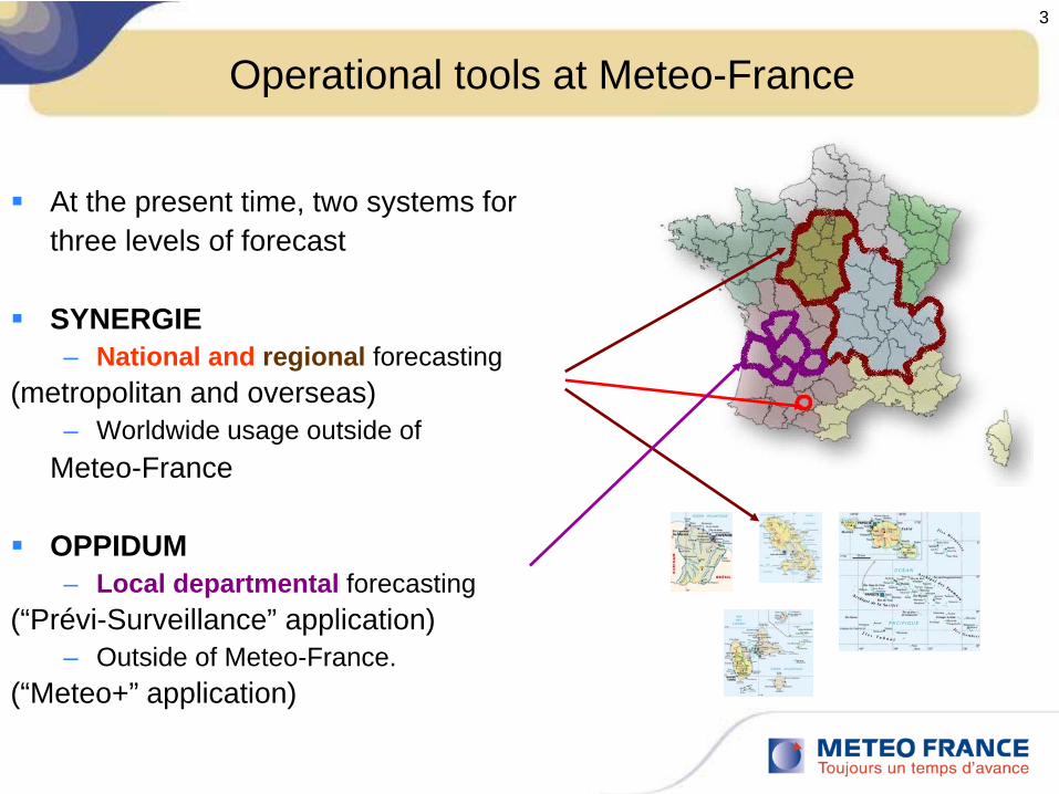
Operational tools at Meteo-France
At the present time, two systems forthree levels of forecast
SYNERGIE– National and regional forecasting
(metropolitan and overseas)– Worldwide usage outside of
Meteo-France
OPPIDUM– Local departmental forecasting
(“Prévi-Surveillance” application)– Outside of Meteo-France.
(“Meteo+” application)
24/05/10
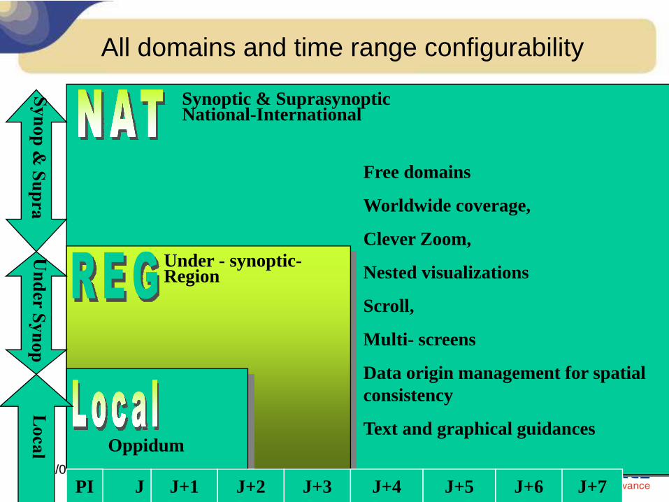
All domains and time range configurability
J J+1 J+2 J+3 J+4 J+5 J+6PI J+7
Synoptic & Suprasynoptic National-International
Free domains
Worldwide coverage,
Clever Zoom,
Nested visualizations
Scroll,
Multi- screens
Data origin management for spatial consistency
Text and graphical guidances
Under - synoptic-Region
Oppidum
5
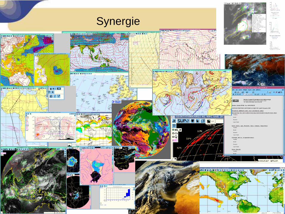
Synergie

6
Synergie : A little background
First stages of Synergie development started in 1989First operational release in 1993More than 17 operational versions since thenSeveral Operating System changesToday :
– Linux only– More than 1,5 million lines of code (C, C++, fortran…)– A sum of 180 man-year of development– A software patchwork of the best tools and libraries of Météo-France and
ECMWF – More than 120 operational clients at Météo-France (312 for all uses)– 60 servers– More than 70 operational systems in 25 other countries

7
Oppidum

8
Oppidum : A little Background
Developments started in 1996First operational release in 2001More than 7 operational releases since thenToday :
– Windows only (XP, 2003 Server)– A sum of 45 man-year of development– More than 120 operational systems in Météo-France– More than 200 operational systems in other companies
Applications (GUI) are sharing the same technical components :– Previ-Surveillance : The forecasting tool in Departmental Offices– Meteoplus : system for external usage– Meteofac : Pre-flight documentation (including automatic generation)– Aspoc+ : providing ATC with thunderstorm diagnostics
C++, C#, MFC, ILOG views, RogueWave

24/05/10
To sum up
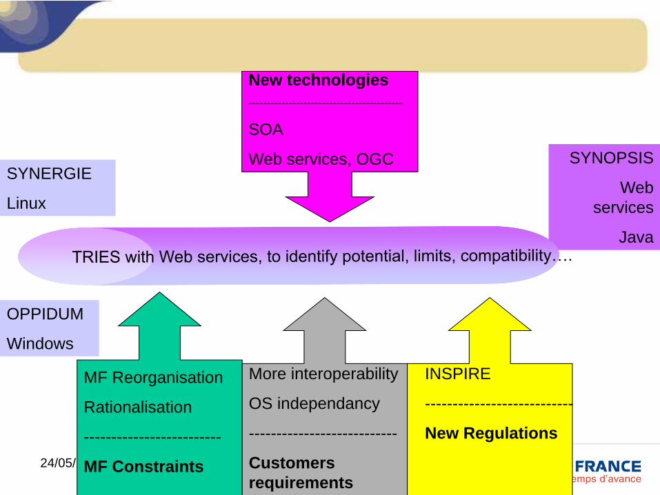
SYNERGIE
Linux
370 systems in MF
70 out of MF
OPPIDUM
Windows
120 systems in MF
200 out of MF

Towards a unique tool
Synopsis

11
Towards a unique workstation
Two systems, two platforms (Linux , Windows)Meet the needs of 3 levels of forecast (national, regional, local)They have been developed and configured for that .
ButFeatures have to be implemented on both.Strong requirement to optimize development resources at Meteo-FrancePotential reorganization : cut down from 108 to 55 offices
24/05/10
SYNERGIE
Linux
OPPIDUM
Windows
SYNOPSIS
Web services
Java
MF Reorganisation
Rationalisation
-------------------------
MF Constraints
More interoperability
OS independancy
---------------------------
Customers requirements
New technologies------------------------------------------
SOA
Web services, OGC
INSPIRE
---------------------------
New Regulations
13
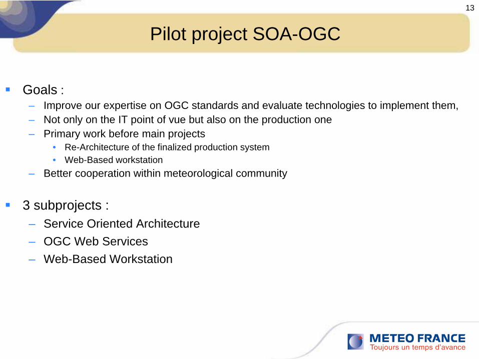
Pilot project SOA-OGC
Goals :– Improve our expertise on OGC standards and evaluate technologies to implement them, – Not only on the IT point of vue but also on the production one – Primary work before main projects
• Re-Architecture of the finalized production system • Web-Based workstation
– Better cooperation within meteorological community
3 subprojects :– Service Oriented Architecture – OGC Web Services– Web-Based Workstation

14
Service Oriented Architecture
Light Web application
Geographical information
Met Data Server
Met visualisation
Business algorithms
Other environmemt
visualisation
Environment Data Server
WMS
WCS or WFS
ESB PETALS

24/05/10
OGC OWS 7 tests

16
Towards a unique workstation (future)
18 months Pilot project from late 2008: OGC and SOA
Direction has decided to go towards :
A single workstation for “advanced forecasting” , OS independentA “light” workstation (Web-Based) for other needsSharing the same business server components …
No changes or slight ones for end-users
17
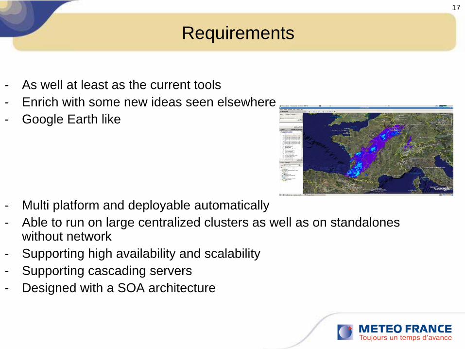
Requirements
- As well at least as the current tools- Enrich with some new ideas seen elsewhere- Google Earth like
- Multi platform and deployable automatically- Able to run on large centralized clusters as well as on standalones
without network- Supporting high availability and scalability- Supporting cascading servers- Designed with a SOA architecture

Technical choices (client side)
Not one but two technical choicesHTML / Javascript / OpenLayers for commercial websites– Quick to develop– Universal (just a browser !)– Only basic features (zooming, panning, overlays...)
Java Web Start for our internal needs– Seamless deployment– Full Access to computer ressources– Almost universal (a browser and the Java plugin)– Basic and advanced features

Technical choices (server side)
Linux 64-bit onlyFree softwaresA modular architecture

Technical choices (server side)
Programming languages :– Modern C (+ librairies from the Gnome project)
• Fast binaries and utilities, core libraries• No daemon, no threads• Each core library has a Python and Java binding
– Java• Multi-threaded daemons• Some particular servlets
– Python• Glue around Mapserver, GDAL• Scripts and web things
Technical choices (server side)
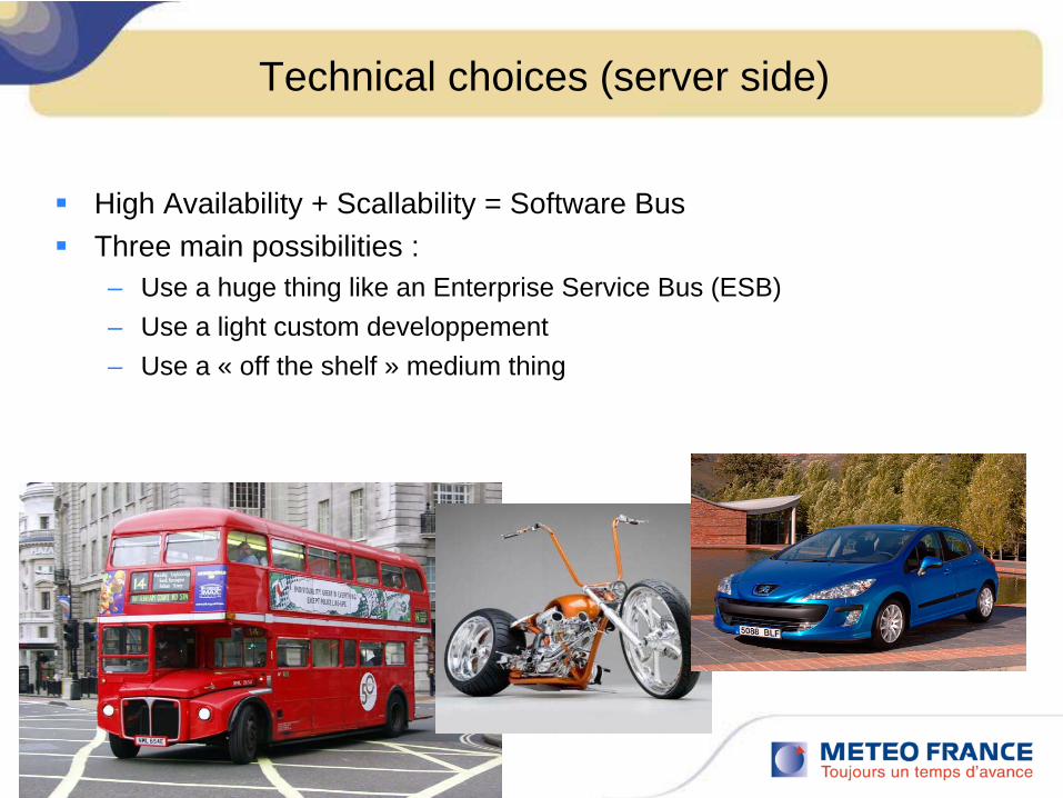
High Availability + Scallability = Software BusThree main possibilities :– Use a huge thing like an Enterprise Service Bus (ESB)– Use a light custom developpement– Use a « off the shelf » medium thing
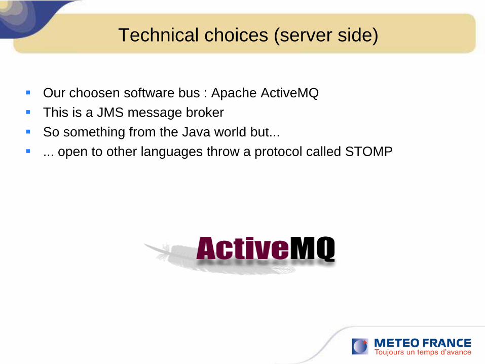
Technical choices (server side)
Our choosen software bus : Apache ActiveMQThis is a JMS message brokerSo something from the Java world but...... open to other languages throw a protocol called STOMP

Technical choices (server side)
On the « data » side, we used :– PostgreSQL + PostGIS for
• Vectors (roads, borders, rivers, nowcasting objects...)• Points (cities, lightning datas...)• Spatial indexes on satellite, radar coverages• But not for binary files (BLOB)
– WEBDAV (Apache)• Big files (satellite, radar...)• WEBDAV path is given by the database
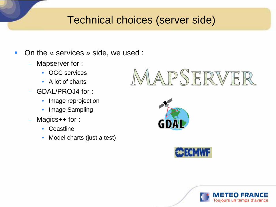
Technical choices (server side)
On the « services » side, we used :– Mapserver for :
• OGC services• A lot of charts
– GDAL/PROJ4 for :• Image reprojection• Image Sampling
– Magics++ for :• Coastline• Model charts (just a test)

25
Results of pilot project
Modification of technical architecture from Synergie to Synopsis
GUI layer GUI layer
Graphics layer
Graphics layer
Data layer Data layer
Network
Network

26
Results of pilot project : Independant Java web start client
27
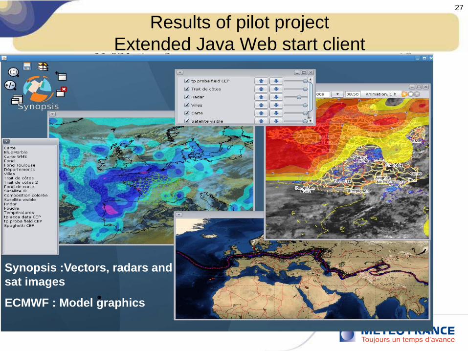
Results of pilot projectExtended Java Web start client
Synopsis :Vectors, radars and sat images
ECMWF : Model graphics

28
Results of pilot projectExtended Java Web start client
Synopsis:
-Raster background
-Cities locations
Synergie :
-Vector coastline,
-Radar
-Model output (transparency handled via java)
The mixture of GUIs shows the level of integration
Possibility to zoom move…

29
Results of pilot projectExtended Java Web start client
Synopsis:
-GUIs
Synergie :
-Obs,
-Winds model outputs

24/05/10
To sum up
SYNERGIE
OPPIDUMSYNOPSIS
WREP ?
??

31
SYNOPSIS Project or SYNERGIE-NEXT
The pilot project has been very successful and is closedThe directors have decided to do the projectThe feasability of a smooth transition has been demonstrated.A roadmap based on annual releases is been defined
The team is also been defined. It will involve people from - the production system management departement (Project manager) - the IT direction (Technical manager, developpers) , - the forecast direction (users, developpers),- probably regions
24/05/10
Interoperability is the key
The aim is not to do with a new fashion technology what we have done before and works already fine
It is not to say « we also use OGC standards ! »
We want to reach interoperability
=>A lot of cooperative work has to be made on the OGC standards!!!

Thank You


