Download - Geophysics in Soil Survey

Geophysical Methods in Soil Surveys:
Past, Present, and Future

The two most widely used geophysical methods within the Soil Survey Division:
Electromagnetic Induction (EMI)
Ground-Penetrating Radar (GPR)

In soil surveys, geophysical tools (e.g., EMI & GPR) are principally used as quality control tool to:
Determine the presence, depth, and lateral extent of diagnostic subsurface horizons, stratigraphic and lithologic layers.
Improve interpretations by providing estimates of soil map unit composition.
Characterize spatial and temporal variations in soil properties.

Early GPR SystemsFirst GPR systems were bulky and
cumbersome.
Data were displayed on oscilloscopes and/or strip-chart recorders.
Interpretations were made directly from raw data on strip charts.
Available processing techniques were very primitive.

In the mid-1990s, we transitioned from analog to digital systems
Units were increasingly lighter weight and more compact.
Less expensive.
Greater capabilities.

In the late-1990s, processing was first effectively applied to soil data.
Opened new windows of opportunity for GPR.
Data processing is the “key” to modern GPR interpretations, but is seldom effectively used by NRCS’s GPR operators.
HAGERSTOWN FINE, MIXED, SEMIACTIVE, MESIC TYPIC HAPLUDALFS

3D renditions of radar records
Have helped to improve the characterization of some subsurface features.
BismarckLoamy-skeletal, mixed, semiactive, thermic, shallow Typic Dystrudepts

GPR, GPS, & GISIn 2008, the synergism of GPR and GPS permits the collection of georeferenced data sets, which can be manipulated and displayed in GIS or other imaging software.
Greatly improves the utility of GPR in soil surveys.
Few radar operators presently have or are using these integrated technologies.
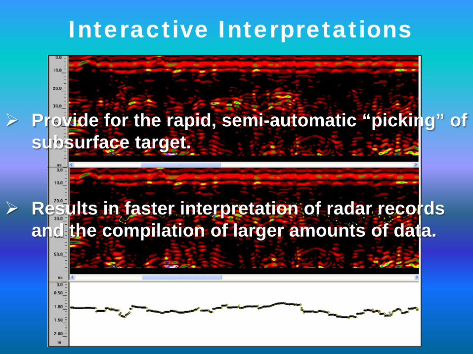
Interactive Interpretations
Provide for the rapid, semi-automatic “picking” of subsurface target.
Results in faster interpretation of radar records and the compilation of larger amounts of data.

Interactive modules allows “picked” GPR data to be exported to layer files.
To serve future user, data need to be properly stored and indexed so others
can find and use them.
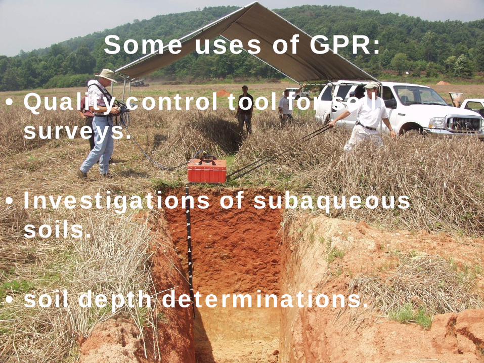
Some uses of GPR:
• Quality control tool for soil surveys.
• Investigations of subaqueous soils.
• soil depth determinations.

It all started in Florida.
In 1979, a cooperative study was conducted by the USDA-SCS, NASA,
and the Florida Department of Highways.
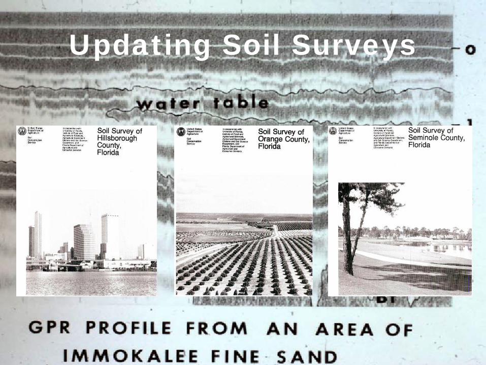
Updating Soil Surveys
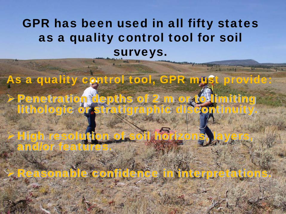
GPR has been used in all fifty states as a quality control tool for soil
surveys.
Penetration depths of 2 m or to limiting lithologic or stratigraphic discontinuity.
High resolution of soil horizons, layers, and/or features.
Reasonable confidence in interpretations.
As a quality control tool, GPR must provide:

In the conterminous USA, only 22 % of the soils are considered well suited to GPR.
About 36 % and 7 % of the soils are considered poorly suited and unsuited to GPR, respectively.
Use of GPR for soil survey investigations is limited by the medium.
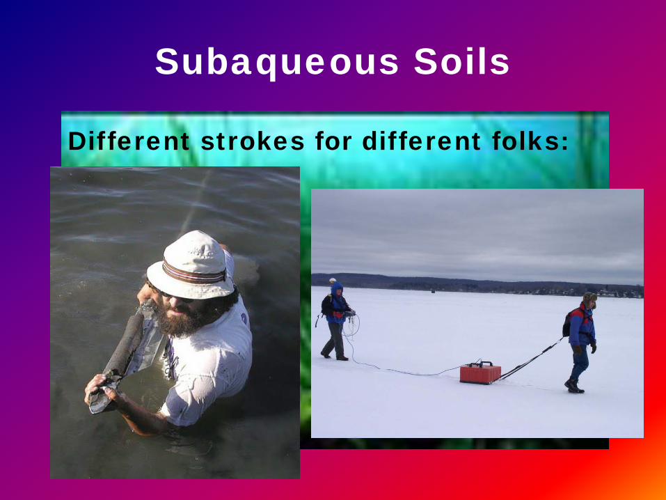
Subaqueous Soils
Different strokes for different folks:

GPR can provide data on fresh water depths, subbottom topographies,
and sediment types.
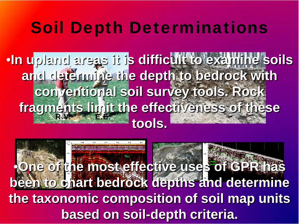
Soil Depth Determinations
•In upland areas it is difficult to examine soils and determine the depth to bedrock with
conventional soil survey tools. Rock fragments limit the effectiveness of these
tools.R.V. E.E.
•One of the most effective uses of GPR has been to chart bedrock depths and determine the taxonomic composition of soil map units
based on soil-depth criteria.

EMI
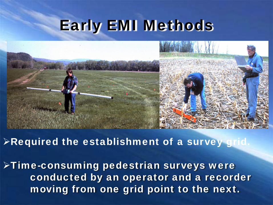
Early EMI Methods
Required the establishment of a survey grid.
Time-consuming pedestrian surveys were conducted by an operator and a recorder moving from one grid point to the next.
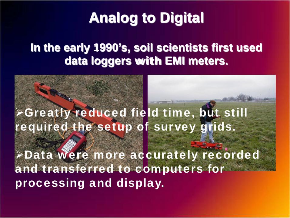
Analog to Digital
Greatly reduced field time, but still required the setup of survey grids.
Data were more accurately recorded and transferred to computers for processing and display.
In the early 1990’s, soil scientists first used data loggers with EMI meters.
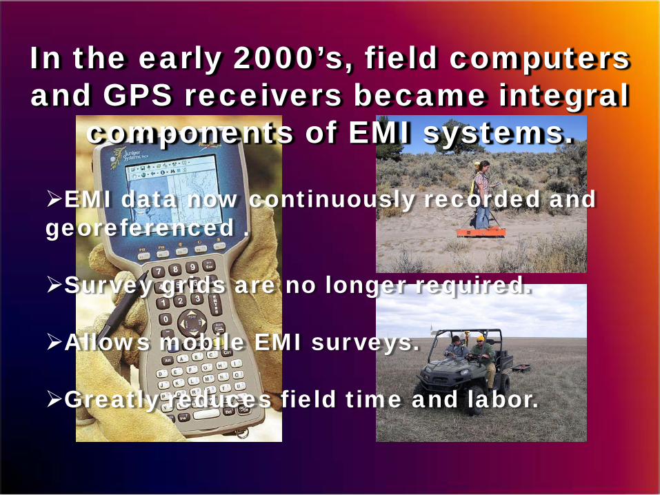
In the early 2000’s, field computers and GPS receivers became integral
components of EMI systems.
EMI data now continuously recorded and georeferenced .
Survey grids are no longer required.
Allows mobile EMI surveys.
Greatly reduces field time and labor.
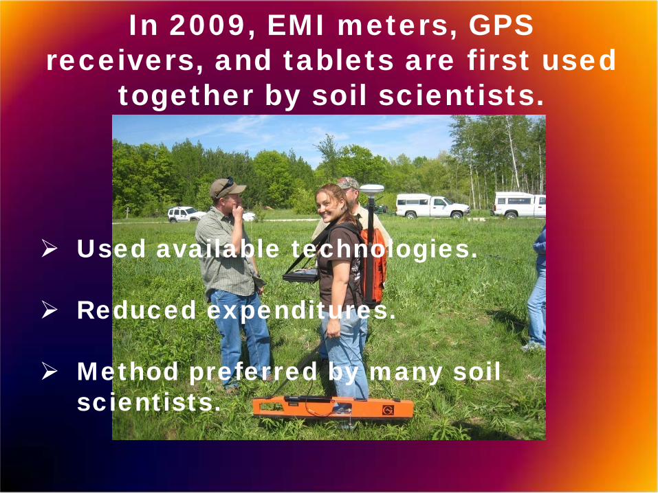
In 2009, EMI meters, GPS receivers, and tablets are first used
together by soil scientists.
Used available technologies.
Reduced expenditures.
Method preferred by many soil scientists.
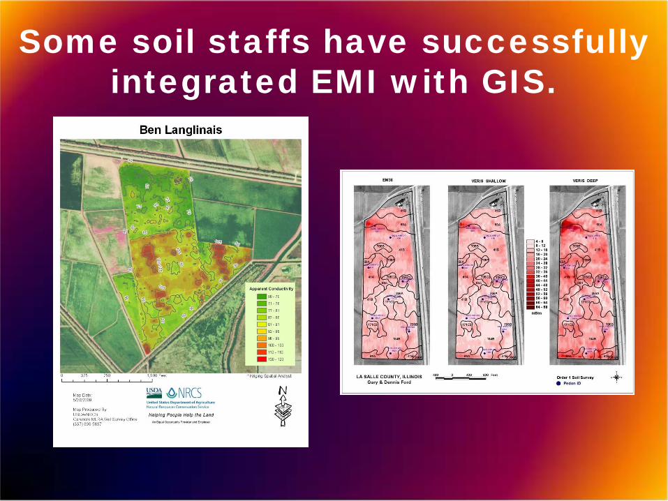
Some soil staffs have successfully integrated EMI with GIS.
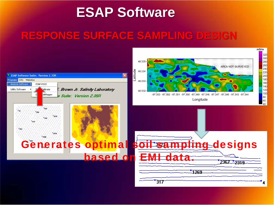
ESAP Software
Generates optimal soil sampling designs based on EMI data.
RESPONSE SURFACE SAMPLING DESIGN
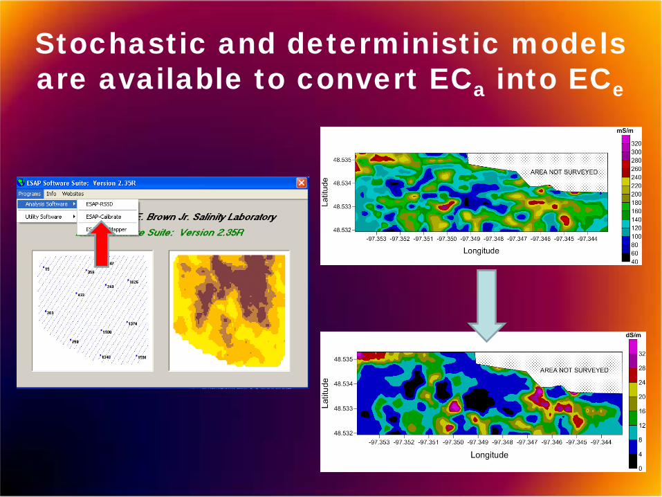
Stochastic and deterministic models are available to convert ECa into ECe

INTEGRATED ACCESSORIES ADD ADDITIONAL $$$
Field computer
GPS receiver
New software

PRICES OF EMI METERS HAVE RISEN.
EM38 meter $7,965 2002
EM38MK2-2 meter $17,200 2009
EM38DD meter $19,100 2002
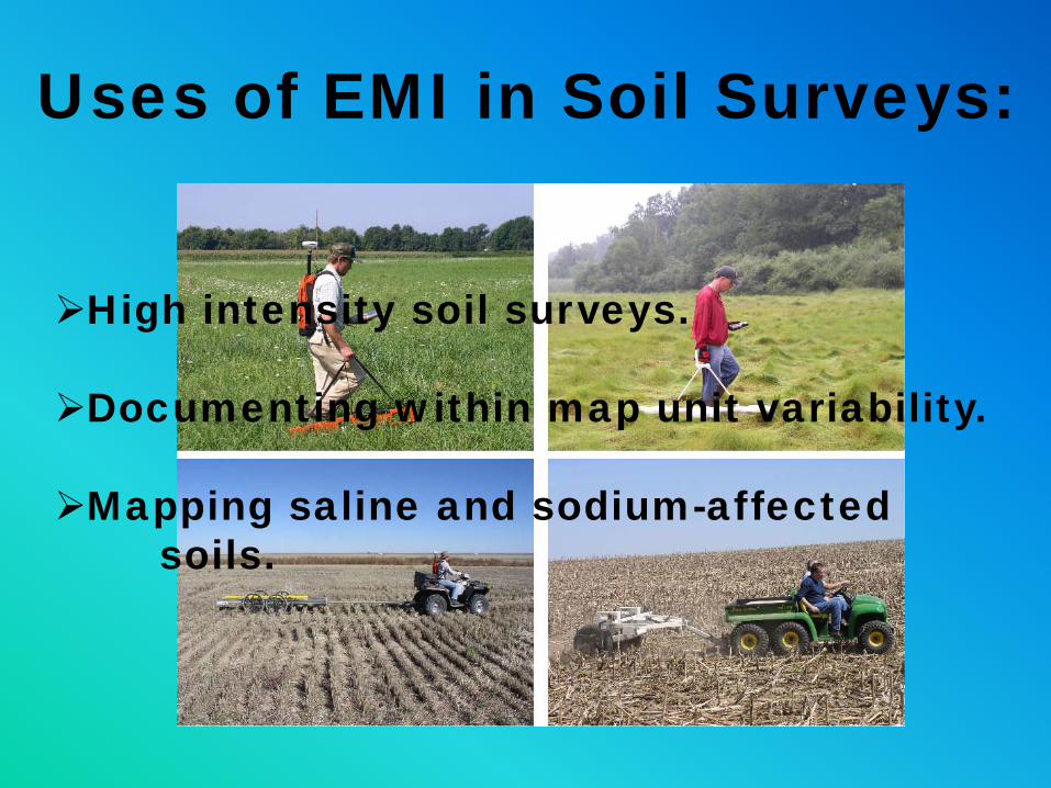
Uses of EMI in Soil Surveys:
High intensity soil surveys.
Documenting within map unit variability.
Mapping saline and sodium-affected soils.
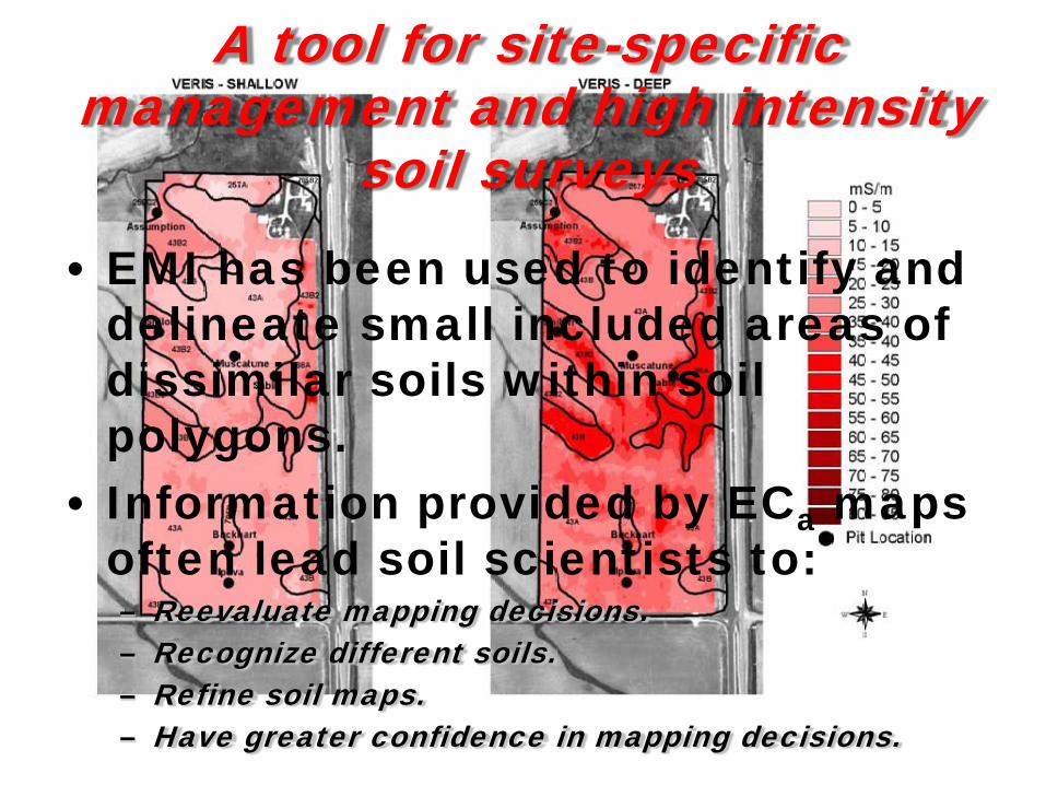
A tool for site-specific management and high intensity
soil surveys
• EMI has been used to identify and delineate small included areas of dissimilar soils within soil polygons.
• Information provided by ECa maps often lead soil scientists to:– Reevaluate mapping decisions.– Recognize different soils.– Refine soil maps.– Have greater confidence in mapping decisions.

Montgomery County, IllinoisHerrick-Biddle-Piasa silt loams, 0 to 2 % slopes
Biddle Fine, smectitic, mesic Aquic ArgiudollsDarmstadt Fine-silty, mixed, superactive, mesic Aquic Natrudalfs Harrison Fine-silty, mixed, superactive, mesic Oxyaquic ArgiudollsHerrick Fine, smectitic, mesic Aquic ArgiudollsPiasa Fine, smectitic, mesic Mollic Natraqualfs
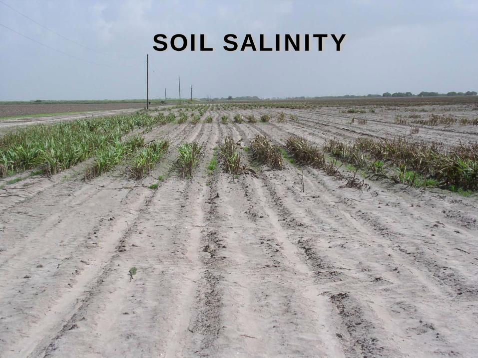
SOIL SALINITY
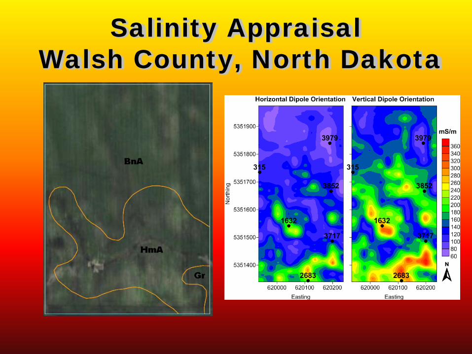
Salinity AppraisalWalsh County, North Dakota

Deterministic
Stochastic
R2 0.8780 0.8560 0.9379The correlation values indicate the stochastic calibration model’s ability to predict ECe from EMI
data at different depths.
Plots of estimated soil salinity, Walsh County, ND
0 to 30 cm
30 to 60 cm
60 to 90 cm Average
< 4 97% 65% 10% 63%4 to 8 3% 25% 59% 29%
8 to 16 0% 10% 30% 08%> 16 0% 0% 2% 0%
0 to 30 cm
30 to 60 cm
60 to 90 cm Average
< 4 88% 79% 39% 72%4 to 8 12% 20% 51% 25%
8 to 16 0% 1% 10% 03%> 16 0% 0% 0% 0%

Geophysical Methods in Soil SurveyWhere are we?
Presently twelve GPR operators in eleven states, all
with state-of-the-art GPR systems and software.
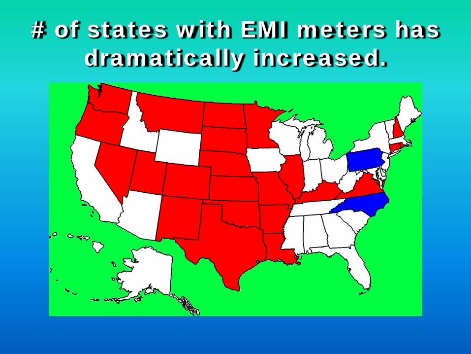
# of states with EMI meters has dramatically increased.
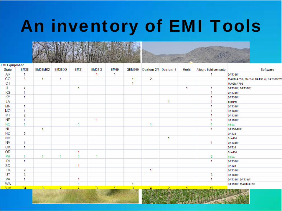
An inventory of EMI Tools
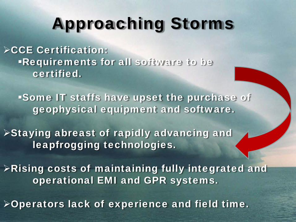
Approaching StormsCCE Certification: Requirements for all software to be
certified.
Some IT staffs have upset the purchase of geophysical equipment and software.
Staying abreast of rapidly advancing and leapfrogging technologies.
Rising costs of maintaining fully integrated and operational EMI and GPR systems.
Operators lack of experience and field time.

Present GPR and EMI systems are well suited to soil survey investigations.
We have come a long ways in thirty years. In many soils, the use of GPR and EMI to identify, characterize, and map soil features and properties offers advantages over traditional methods.
Summary:

Although there is a large number of GPR and EMI units within the Soil Survey Division:Most are under-utilized. Most operators lack sufficient experiences and
confidence and therefore do not fully exploited existing technologies.
Geophysical tools and integrated technologies are rapidly improving. Can we stay abreast and maintain our expertise?
The effective use of geophysical methods is dependent on availability of processing software programs. These programs are not CCE certified. Use and development are being severely restricted.
The effective use of geophysical methods within the Soil Survey Division may require a new order of organization and deployment.

THANK YOU


