
GOWN – Groundwater Observation Well Network Alberta Environment and Sustainable
Resource Development (AESRD)
2015
GOWN Core Programs Monitor– Groundwater Quality – Groundwater Quantity
AESRD Data Management maintains data & information in WISKI on 1262 Active and Inactive groundwater monitoring water wells & project piezometers from over 700 sites across Alberta

•360 GOWN wells have been monitored for water quality.
•AEMERA monitoring field staff sample 30 – 60 wells per year.
•GOWN Water Quality Data are housed in the Environment Management System Water Data System (EMS-WDS). New data goes directly to WDS from the labs.
•Station Metadata information and any water level readings from the GOWN Water Quality Wells are managed in WISKI.
Alberta GOWN Water Quality Program

• Over 250 observation wells are equipped with data loggers which record hourly well water levels.
• AEMERA monitoring field staff visit the wells to download the data from the loggers and upload them to WISKI.
• The groundwater level, water temperature, battery voltage and the station information are managed in WISKI.
GOWN Water Levels Program

Nov 15
46 of the Logger Stations transmit hourly data to our Edmonton office daily via the GOES Satellite into WISKI.
These are the Near Real Time (NRT) GOWN Stations

GOWN Data Uses include:
• Drought Forecasting
• Municipal, Industrial, and Agricultural studies
• Water Management Projects
• Groundwater Modeling
• Climate Studies
• Key indicators for - State of the Environment - Land Use Framework Regional Plans
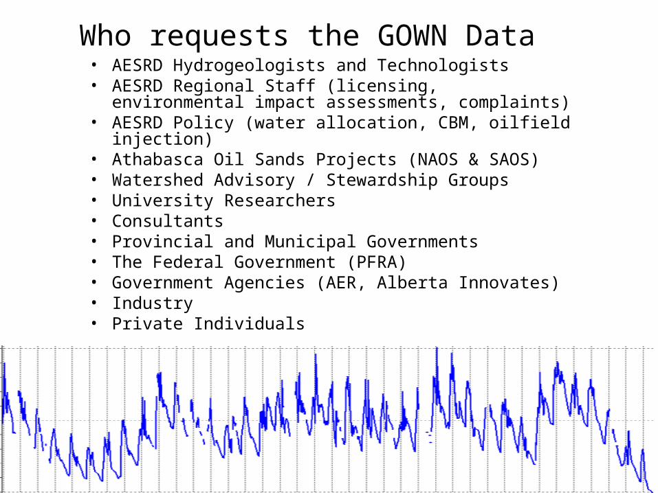
Who requests the GOWN Data• AESRD Hydrogeologists and Technologists• AESRD Regional Staff (licensing, environmental impact
assessments, complaints)• AESRD Policy (water allocation, CBM, oilfield injection)• Athabasca Oil Sands Projects (NAOS & SAOS) • Watershed Advisory / Stewardship Groups• University Researchers• Consultants• Provincial and Municipal Governments • The Federal Government (PFRA)• Government Agencies (AER, Alberta Innovates)• Industry• Private Individuals

1982 to 1996 •The majority of the observation wells were equipped with paper chart recorders that lasted 1 to 3 months between chart changes during well visits.
•The majority of the over 600 project wells and some observation wells had periodic manual readings only.
•Later a few of the wells, those in remote areas, were installed with data loggers. Data loggers could last a year or more between well visits.
Data Logger at Watino Observation Well # 369Grande Prairie Region
History of the Alberta GOWN Data Management

1982 – 2005 Digitize Hydrographs•1982 - The paper charts collected monthly from multiple GOWN wells since 1956 were accumulating and stored in multiple file cabinets. •Computers in the department were new. Alberta Environment had a new minicomputer system, the TI-990 for the Cold Lake Seismic Project. •The TI-990 together with a flatbed XY plotter were commissioned to write the first computer program to digitize the GOWN charts.
The TI990 computer itself was the height of a table and about 2.5 feet wide by 3 feet long. 80 Bytes of memory. 8 inch floppy drives. Photos from Computer History .org http://www.computinghistory.org.uk/det/11554/TI-990-System/
Flatbed XY Plotter photo from Joe’s Computer Mania http://www.classiccmp.org/hp/hp98x5if.htm
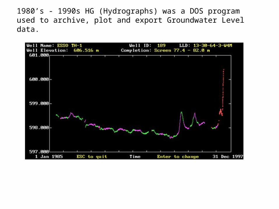
1980’s - 1990s HG (Hydrographs) was a DOS program used to archive, plot and export Groundwater Level data.

1998-2013 Observation Well Data Management was developed and used for digitizing, archiving, plotting, importing and exporting the GOWN water level data. ‘Obswell’ was used until retired by WISKI in 2013.
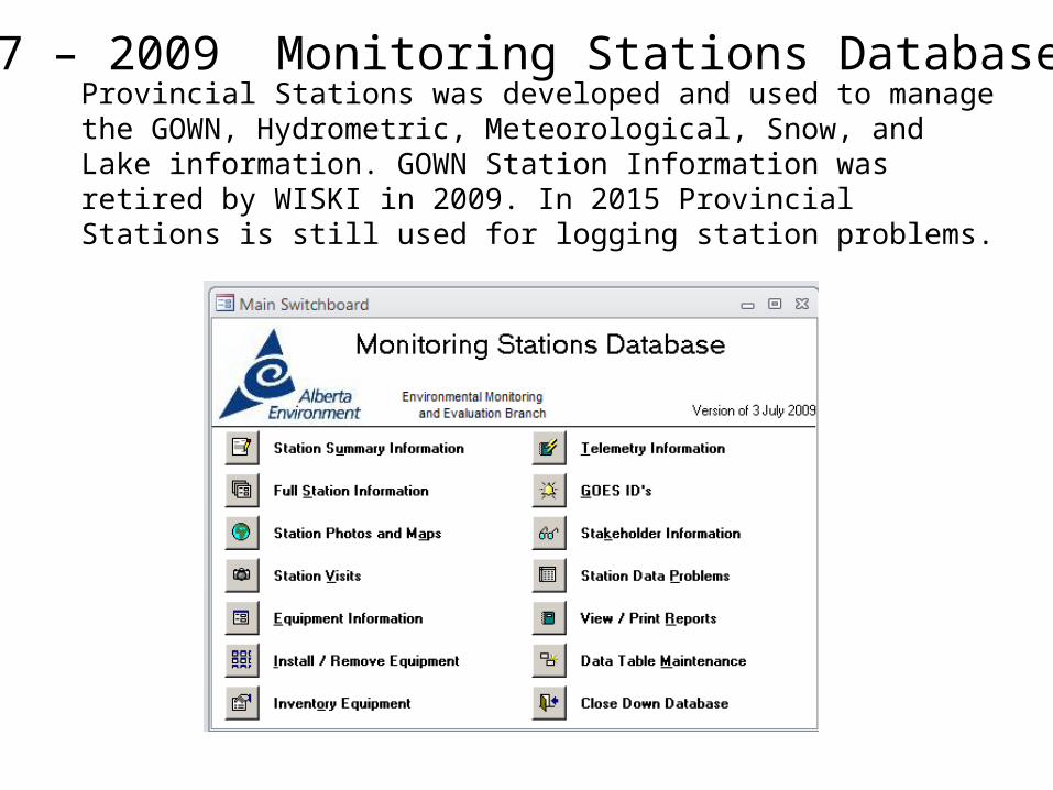
Provincial Stations was developed and used to manage the GOWN, Hydrometric, Meteorological, Snow, and Lake information. GOWN Station Information was retired by WISKI in 2009. In 2015 Provincial Stations is still used for logging station problems.
1997 – 2009 Monitoring Stations Database
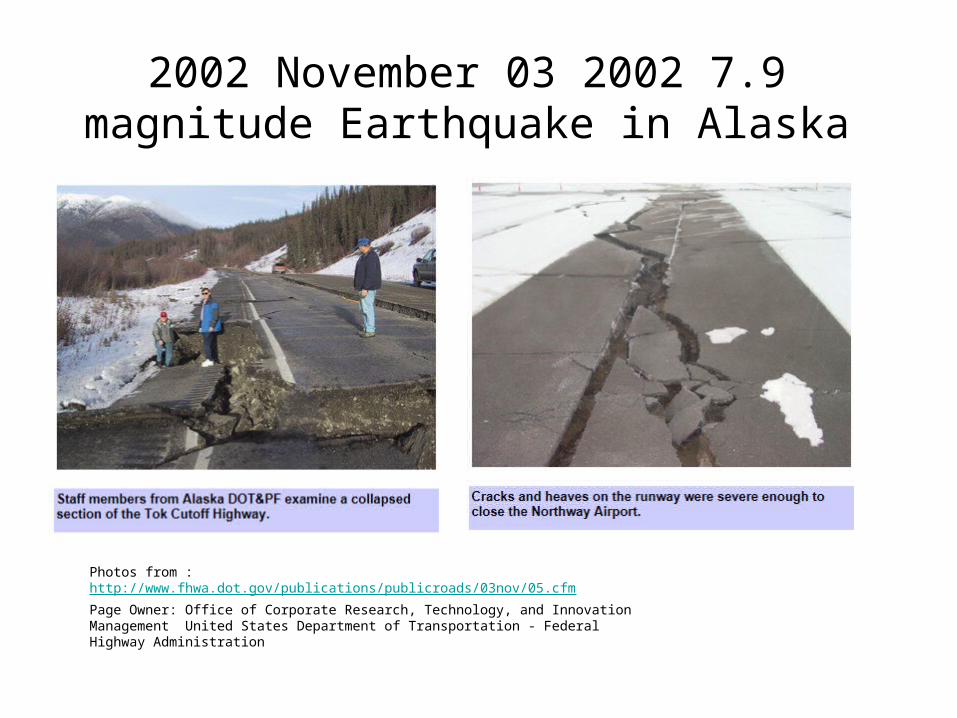
Photos from : http://www.fhwa.dot.gov/publications/publicroads/03nov/05.cfm
Page Owner: Office of Corporate Research, Technology, and Innovation Management United States Department of Transportation - Federal Highway Administration
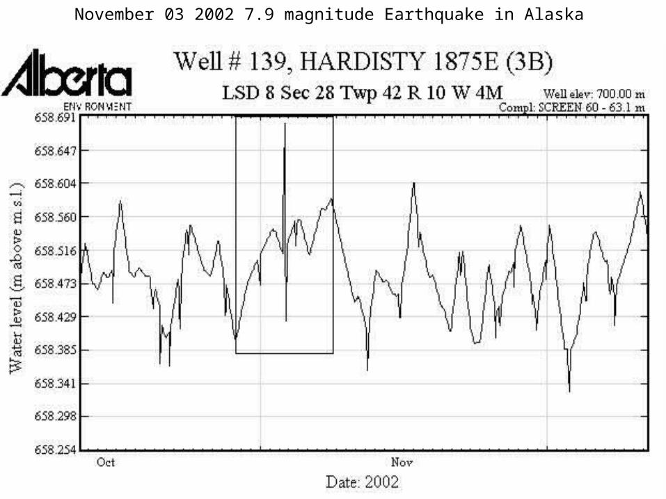
2002 November 03 2002 7.9 magnitude Earthquake in Alaska
November 03 2002 7.9 magnitude Earthquake in Alaska
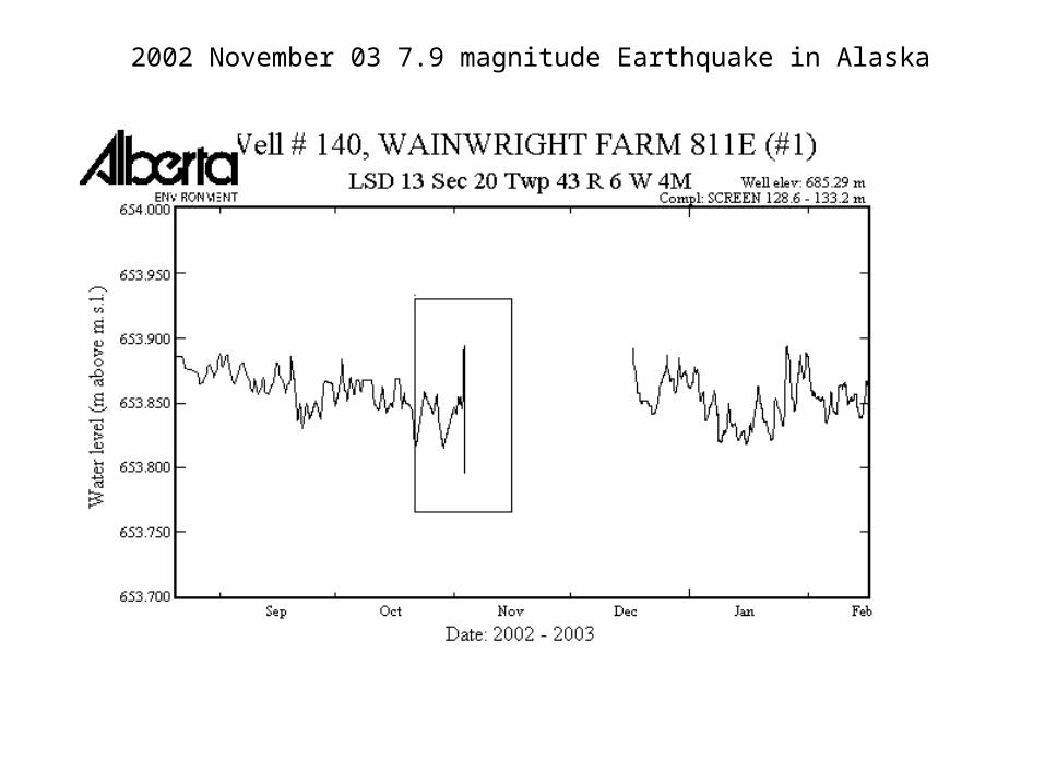
2002 November 03 7.9 magnitude Earthquake in Alaska
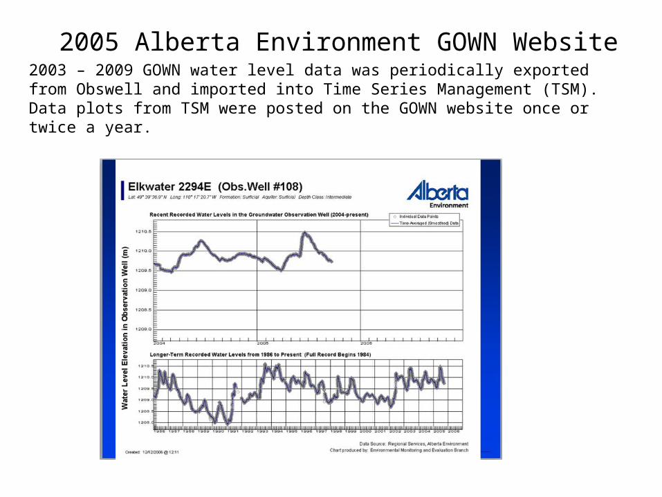
2005 Alberta Environment GOWN Website 2003 – 2009 GOWN water level data was periodically exported from Obswell and imported into Time Series Management (TSM). Data plots from TSM were posted on the GOWN website once or twice a year.

‘Metadata’ about the GOWN Stations from multiple databases and spreadsheets was merged, cleaned and harmonized into a Master Spreadsheet.
2008-2009 GOWN WISKI Project Metadata Integration and Migration
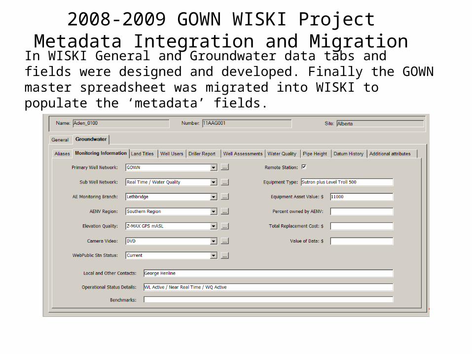
In WISKI General and Groundwater data tabs and fields were designed and developed. Finally the GOWN master spreadsheet was migrated into WISKI to populate the ‘metadata’ fields.
2008-2009 GOWN WISKI Project Metadata Integration and Migration

WISKI General Tabs are for metadata fields common to Groundwater, Hydrometric, Ice Monitoring, Meteorological, SCADA and Water
Quality stations.
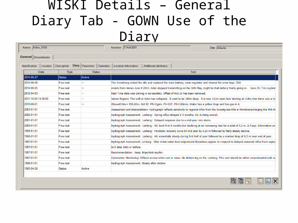
WISKI Details – General Diary Tab - GOWN Use of the Diary

In addition to the GOWN metadata stored in WISKI details GOWN has numerous information data files for each well
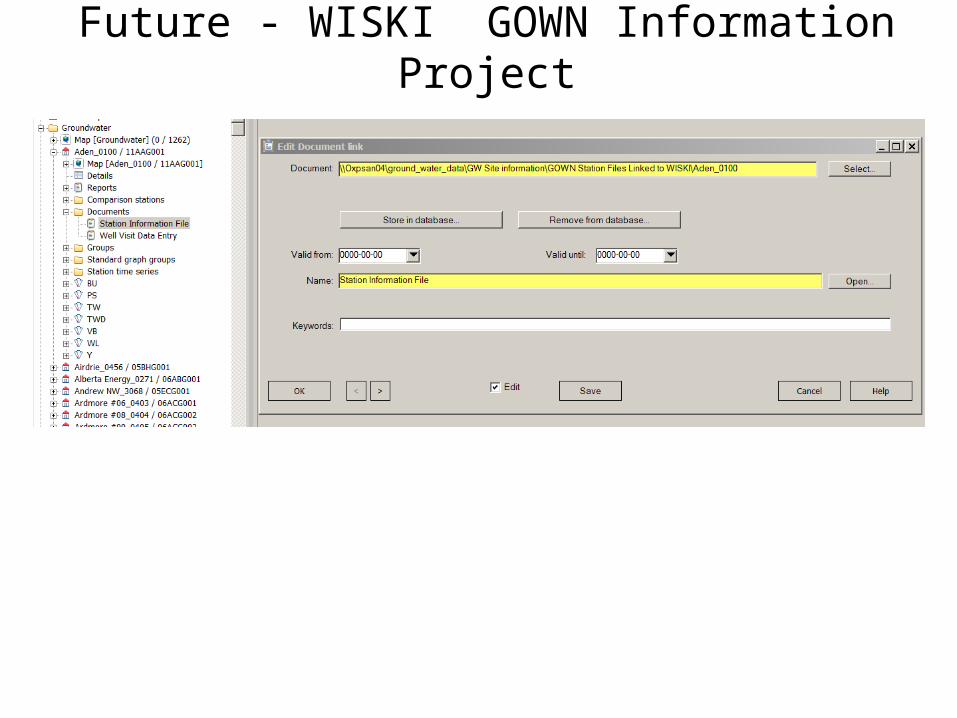
Future - WISKI GOWN Information Project

• 2009 The Obswell to WISKI Project modified the Obswell program to export the ‘raw’ groundwater level data into WISKI format
• 2010 Migrated the Inactive well level data from Obswell to WISKI
• 2010 Project Well level data migrated from TSM to WISKI
• 2010 – 2013 Manually updating WISKI from Obswell exports
2009 GOWN WISKI Project Obswell to WISKI Data Migration
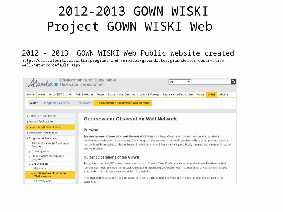
2012 - 2013 GOWN WISKI Web Public Website created http://esrd.alberta.ca/water/programs-and-services/groundwater/groundwater-observation-well-network/default.aspx
2012-2013 GOWN WISKI Project GOWN WISKI Web

WISKI Web Public Website of Groundwater Data and Information – Map View – All Active Wells
• Active, Inactive and Project Well Water Level Data are available
• Able to search for wells from maps or lists by well types

WISKI Web Public Website of Groundwater Data and Information - Table View
• Near Real Time Data is automatically uploaded daily
• Data uploaded to WISKI is available on the website the next day
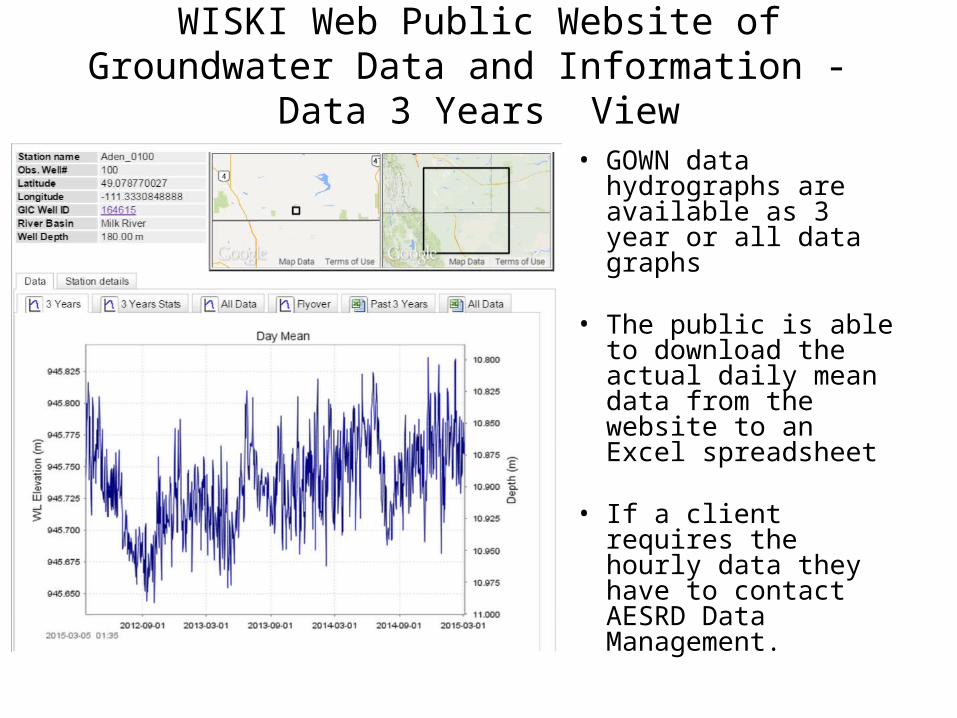
WISKI Web Public Website of Groundwater Data and Information - Data 3 Years View
• GOWN data hydrographs are available as 3 year or all data graphs
• The public is able to download the actual daily mean data from the website to an Excel spreadsheet
• If a client requires the hourly data they have to contact AESRD Data Management.
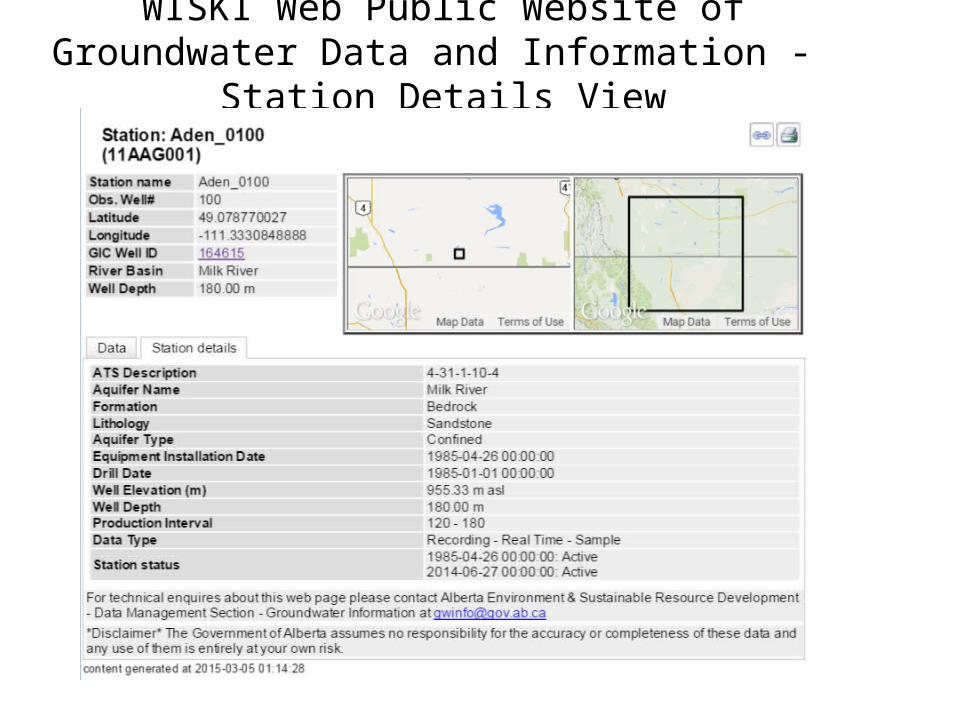
WISKI Web Public Website of Groundwater Data and Information - Station Details View
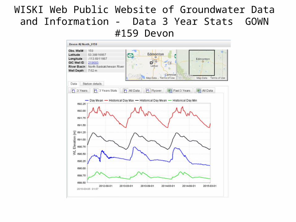
WISKI Web Public Website of Groundwater Data and Information - Data 3 Year Stats GOWN #159 Devon

GOWN Station #159 Devon #2 North

Sample of Drought Monitoring Hydrograph
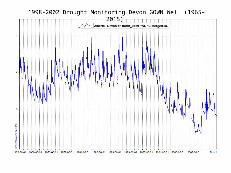
1998-2002 Drought Monitoring Devon GOWN Well (1965–2015)
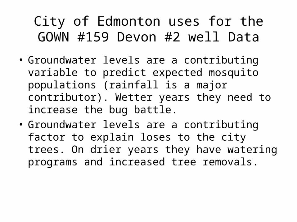
City of Edmonton uses for the GOWN #159 Devon #2 well Data
• Groundwater levels are a contributing variable to predict expected mosquito populations (rainfall is a major contributor). Wetter years they need to increase the bug battle.
• Groundwater levels are a contributing factor to explain loses to the city trees. On drier years they have watering programs and increased tree removals.

GOWN #159 Devon Well used for Mosquito prediction

Graph from the City Of Edmonton
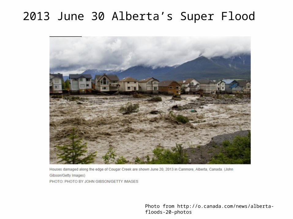
2013 June 30 Alberta’s Super Flood
Photo from http://o.canada.com/news/alberta-floods-20-photos
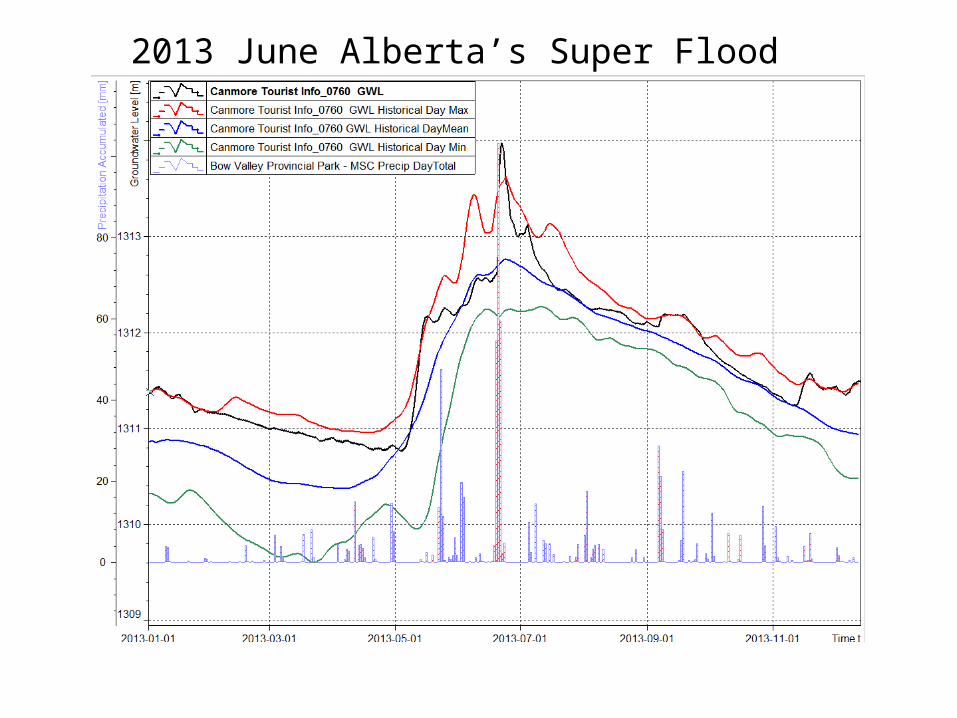
2013 June Alberta’s Super Flood

1998 – 2003 Groundwater Drought Monitoring
• 30 GOWN wells province wide were selected to monitor drought in dry years
• Wells were visited the same time each month to obtain a water level readings
• Quartiles were calculated for historical GOWN well data and compared with each current month groundwater level– Much Above Average– Above Average– Average– Below Average– Much Below Average
• Monthly Groundwater Conditions summaries prepared and submitted to the River Forecasting section for submission to the monthly Water Supply Outlook report
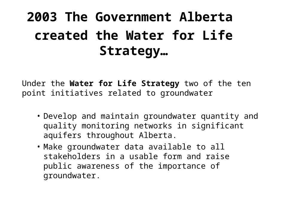
2003 The Government Alberta
created the Water for Life Strategy…
Under the Water for Life Strategy two of the ten point initiatives related to groundwater
• Develop and maintain groundwater quantity and quality monitoring networks in significant aquifers throughout Alberta.
• Make groundwater data available to all stakeholders in a usable form and raise public awareness of the importance of groundwater.
Questions?


