GTECH 201
Lecture 05
Storing Spatial Data

Leftovers from Last Session
From data models to data structures Chrisman’s spheres ANSI Sparc The role of GIScience Maps as models
Intro to GIS (the ArcGIS way)

Chrisman’s Spheres

ANSI-SPARC Model for Software Development
GIS are systems to model the world
User Model
Conceptual Model
Operational Model

GIS are Systems to Model the World
User Model – how we intuitively think
Conceptual Model
Operational Model
ANSI-SPARC Model for software development

User Model
Conceptual Model
Operational Model
ANSI-SPARC Model for software development
how we systematically define ideas
GIS are Systems to Model the World

User Model
Conceptual Model
Operational Model how we fuse systematic thinking into
a technologically defined context
GIS are Systems to Model the World

The ANSI/SPARC Model and Chrisman’s Spheres
computer science
geoinformation theory
application disciplines context discipline
spatial modeling
conceptual modelinglogical data modelingphysical data modeling
OPERATIONAL

Digital Maps as Models
• Representing a complex reality
• Continuous variation
• Spatial Data: spatial, temporal and thematic
• Data Models
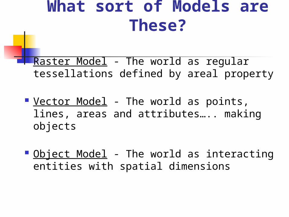
What sort of Models are These?
Raster Model - The world as regular tessellations defined by areal property
Vector Model - The world as points, lines, areas and attributes….. making objects
Object Model - The world as interacting entities with spatial dimensions

Vector Data Models
Spaghetti model
Topological models
A file of spatial data that is a just a collection of co-ordinate strings. Each entity (or piece of spaghetti) is represented by one data entry. There is no topology.
Topology refers to the spatial relationships between objects. The topological model represents spatial relationships such as:
- length - area - connectivity - contiguity

Further Reading
ANSI/SPARC model
Laurini & Thompson. Fundamentals of GIS, p.357-362
Chrisman’s Spheres
Chrisman, N. 1997. Exploring Geographic Information Systems
Key Text for Concepts
De Mers, M. 2004. Fundamentals of Geographic Information Systems. NY: John Wiley & Sons

GIS Map Organization
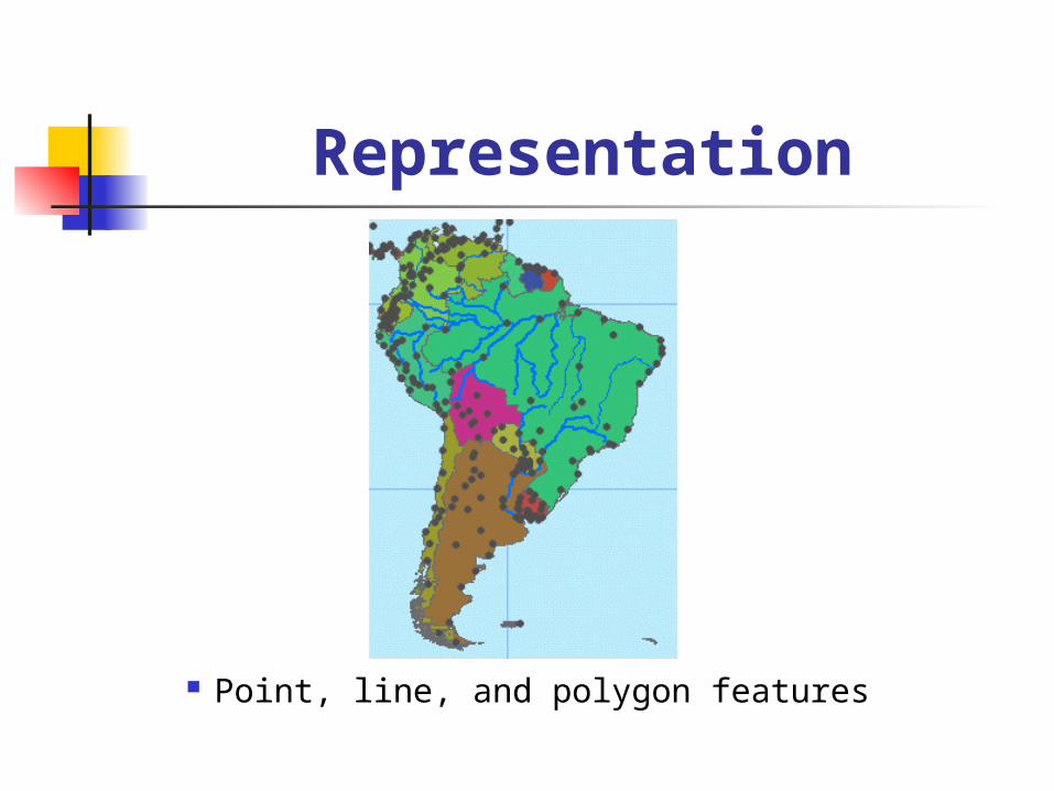
Representation
Point, line, and polygon features

Geo-Relational Principle 1

Geo-Relational Principle 2

System Architecture

ArcMap

Map Production

ArcCatalog
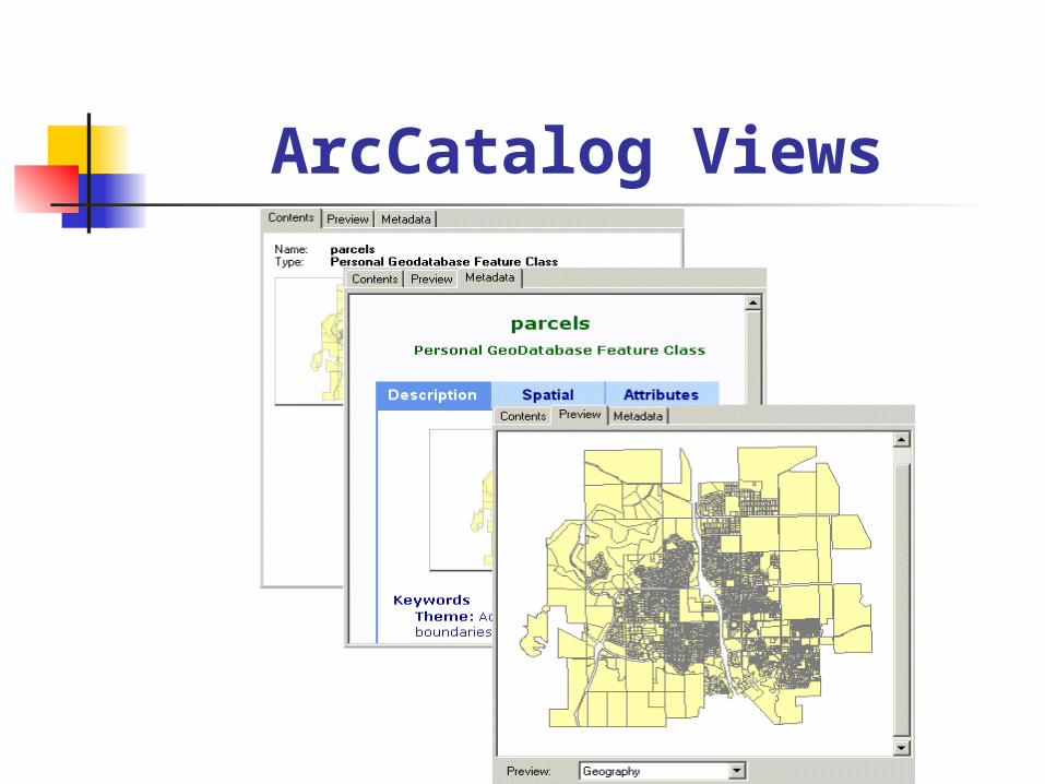
ArcCatalog Views

ArcToolbox

Metadata

Metadata in ArcGIS

Help

Maneuvering ArcGIS

Connecting to Folders
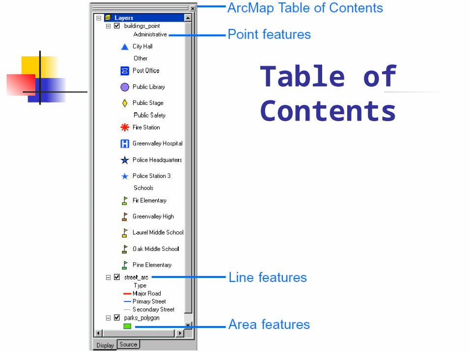
Table of Contents

Exploring a Map

MakingAppearances

MakingAppearanc
es
part 2

Localized Information

Spatial Relationships 1
Distance
Which countries contain a lake completely within their borders?Which cities are located within 25 kilometers of a river?

Spatial Relationships 2
Intersection
Which countries have a river that intersects their border?

Spatial Relationships 3 Adjacency
Which countries share a border with Russia?

Spatial Relationships 4
Containment
Which countries contain a lake completely within their borders?

GIS as a Process 1
1. Capture data
2. Store data
3. Query data
4. Analyze data
5. Display data
6. Present data

1. Ask a geographic question2. Acquire geographic data3. Explore geographic data4. Analyze geographic information5. Act on geographic knowledge
GIS as a Process 2

Summary A GIS organizes and stores information about the
world as a collection of thematic layers. Each layer contains features with the same shape and attributes, all located within a common geographic area.
Each feature is assigned a unique numerical identifier and is characterized by a unique location in space and a corresponding record in a table.
Features can be stored in a GIS as three primary shapes: points, lines, or polygons.
Features have spatial relationships with other features, and with a GIS you can find features based on their spatial relationships.
The geographic inquiry process provides a framework for solving problems with GIS.


