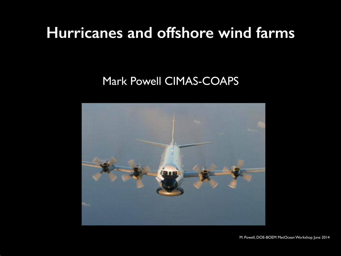
Mark Powell CIMAS-COAPS!
Hurricanes and offshore wind farms
M. Powell, DOE-BOEM MetOcean Workshop June 2014
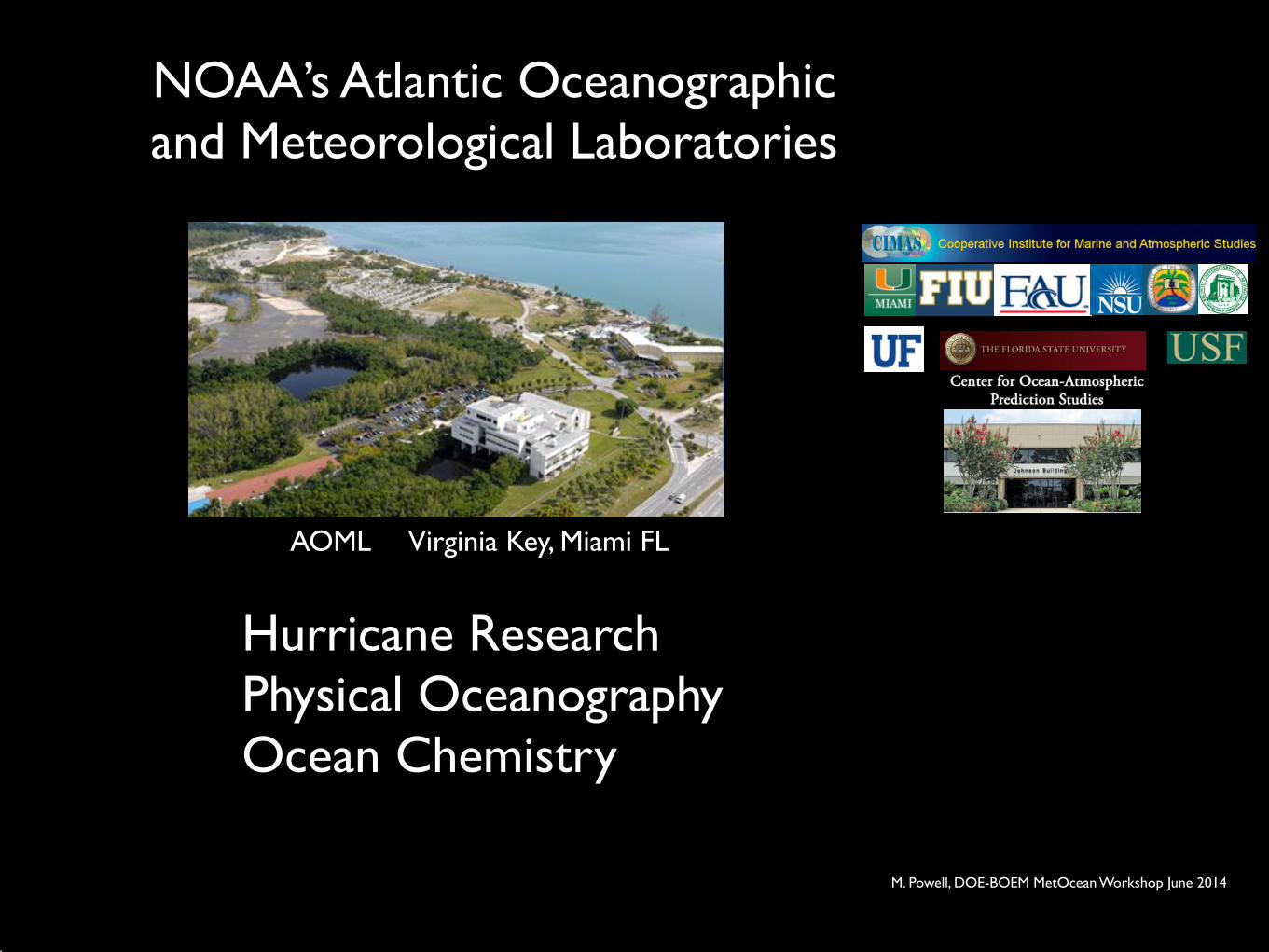
NOAA’s Atlantic Oceanographic and Meteorological Laboratories
Hurricane Research !Physical Oceanography!Ocean Chemistry
AOML Virginia Key, Miami FL
M. Powell, DOE-BOEM MetOcean Workshop June 2014
3
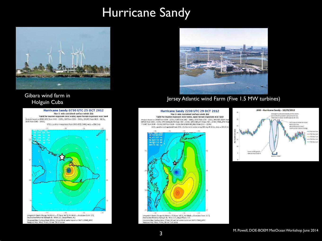
Hurricane Sandy
Gibara wind farm in Holguin Cuba
Jersey Atlantic wind Farm (Five 1.5 MW turbines)
M. Powell, DOE-BOEM MetOcean Workshop June 2014
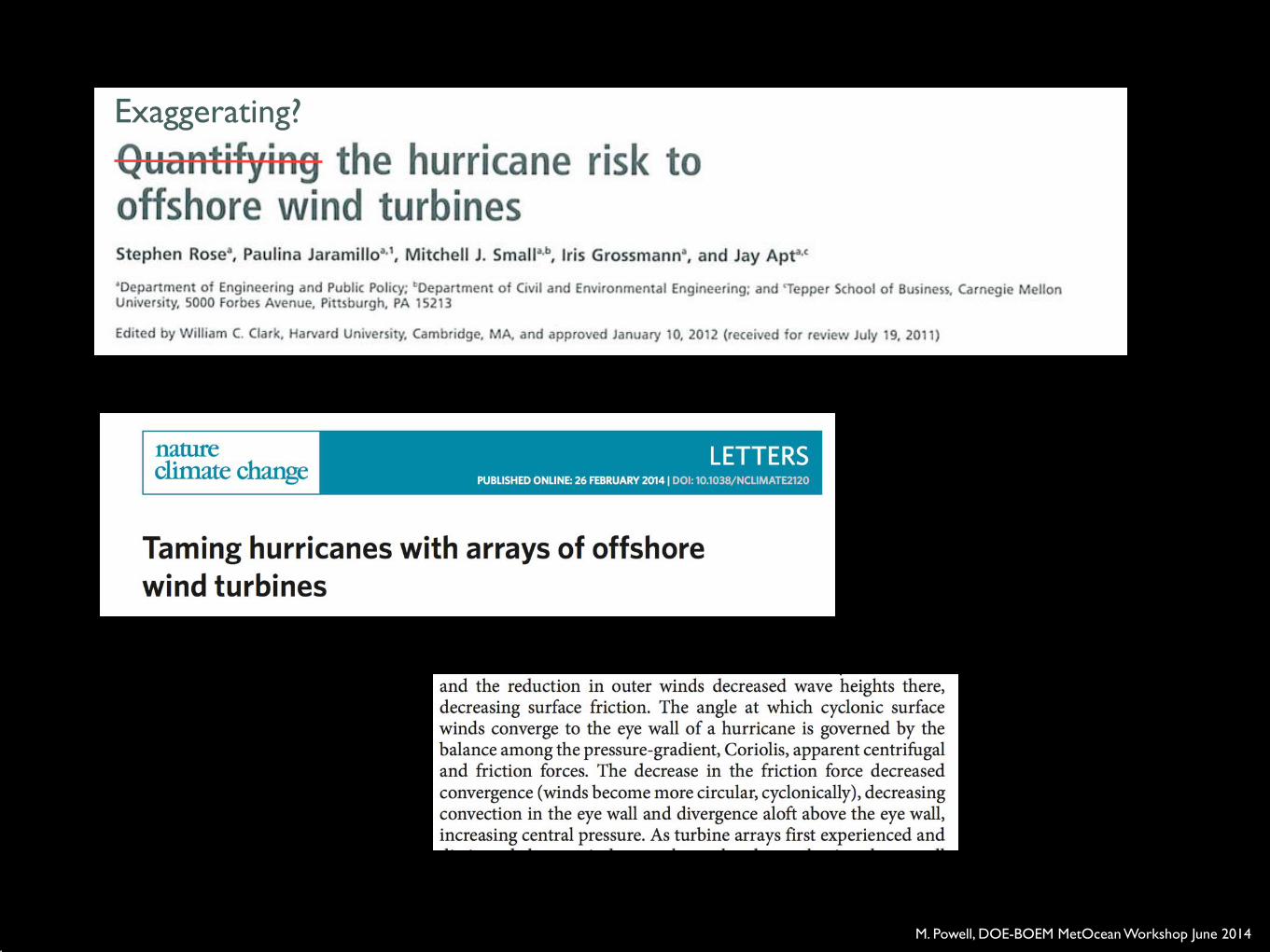
Exaggerating?
M. Powell, DOE-BOEM MetOcean Workshop June 2014
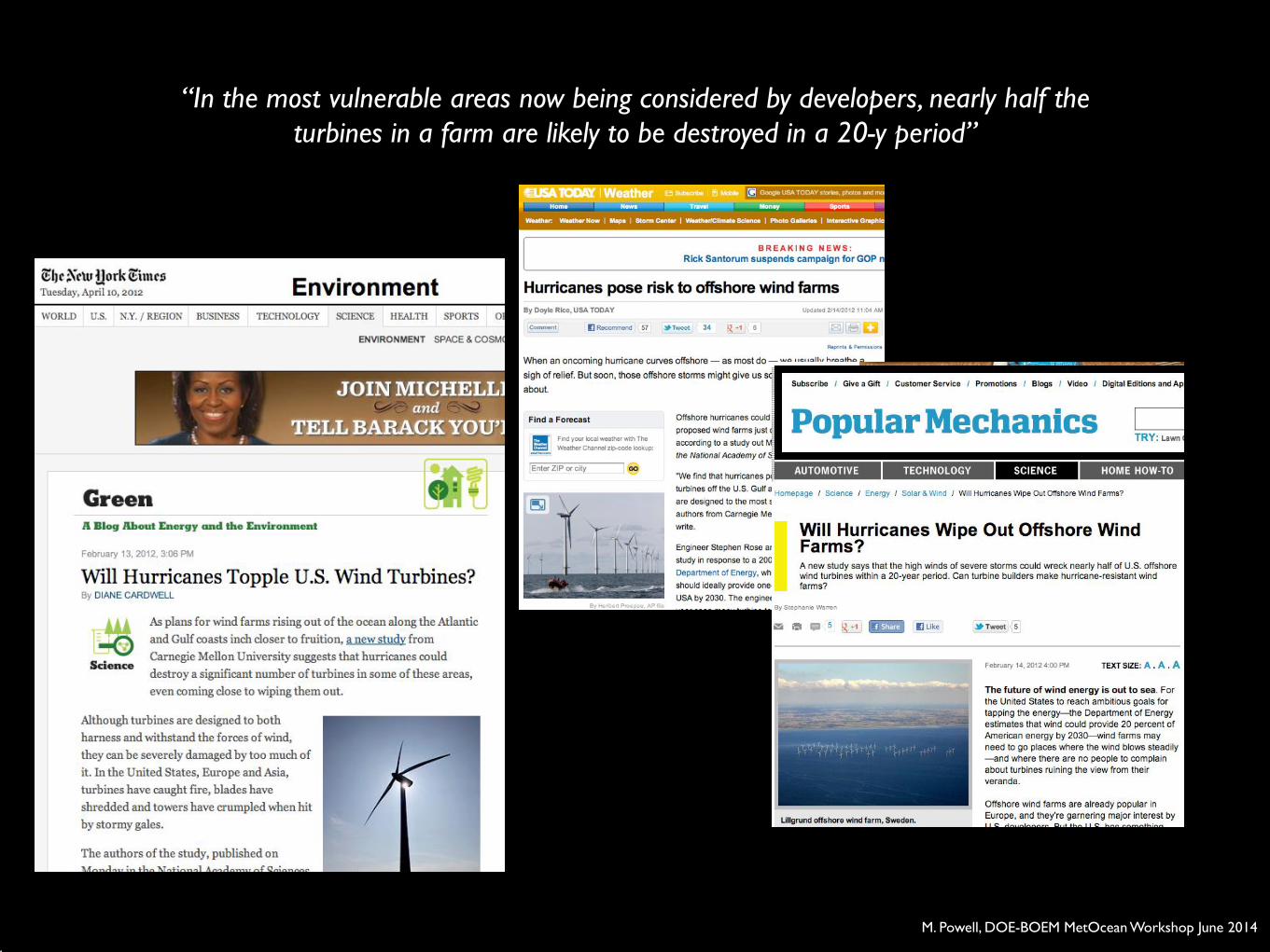
“In the most vulnerable areas now being considered by developers, nearly half the turbines in a farm are likely to be destroyed in a 20-y period”
M. Powell, DOE-BOEM MetOcean Workshop June 2014
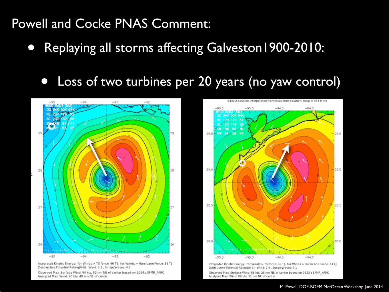
• Replaying all storms affecting Galveston1900-2010:!
• Loss of two turbines per 20 years (no yaw control)
Powell and Cocke PNAS Comment:
M. Powell, DOE-BOEM MetOcean Workshop June 2014
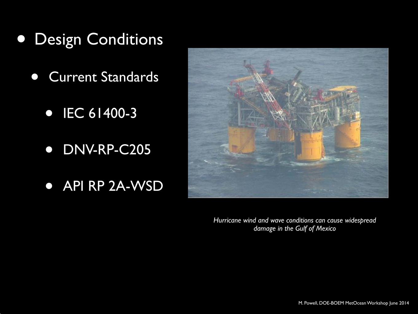
• Design Conditions!
• Current Standards!
• IEC 61400-3!
• DNV-RP-C205!
• API RP 2A-WSD
Hurricane wind and wave conditions can cause widespread damage in the Gulf of Mexico
M. Powell, DOE-BOEM MetOcean Workshop June 2014
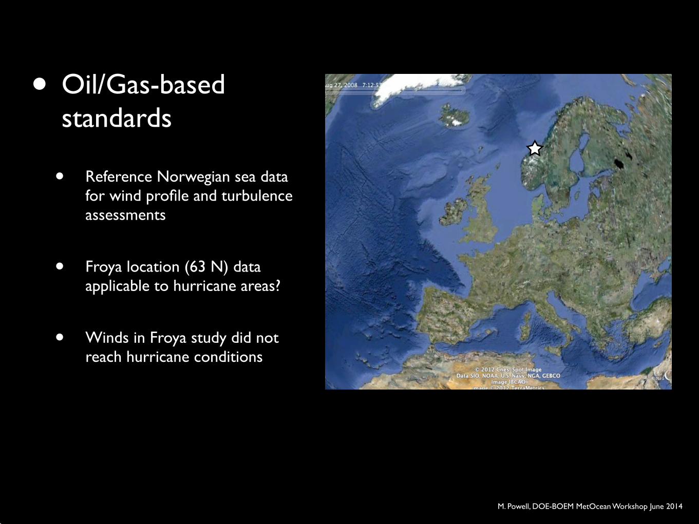
• Oil/Gas-based standards!
• Reference Norwegian sea data for wind profile and turbulence assessments!
• Froya location (63 N) data applicable to hurricane areas?!
• Winds in Froya study did not reach hurricane conditions
M. Powell, DOE-BOEM MetOcean Workshop June 2014
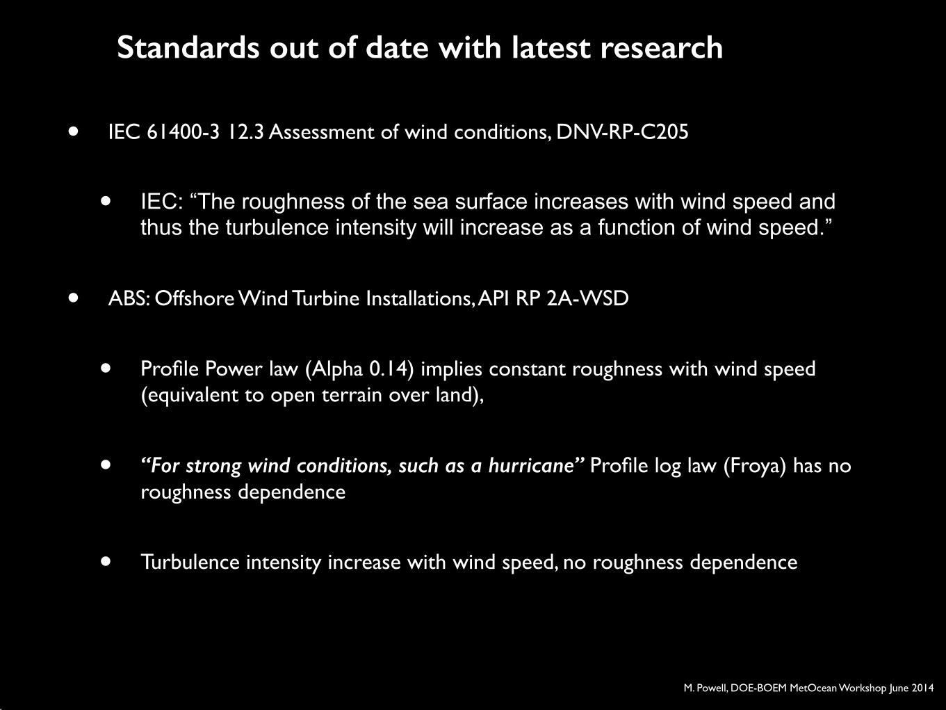
• IEC 61400-3 12.3 Assessment of wind conditions, DNV-RP-C205!
• IEC: “The roughness of the sea surface increases with wind speed and thus the turbulence intensity will increase as a function of wind speed.”!
• ABS: Offshore Wind Turbine Installations, API RP 2A-WSD!
• Profile Power law (Alpha 0.14) implies constant roughness with wind speed (equivalent to open terrain over land),!
• “For strong wind conditions, such as a hurricane” Profile log law (Froya) has no roughness dependence !
• Turbulence intensity increase with wind speed, no roughness dependence
Standards out of date with latest research
M. Powell, DOE-BOEM MetOcean Workshop June 2014
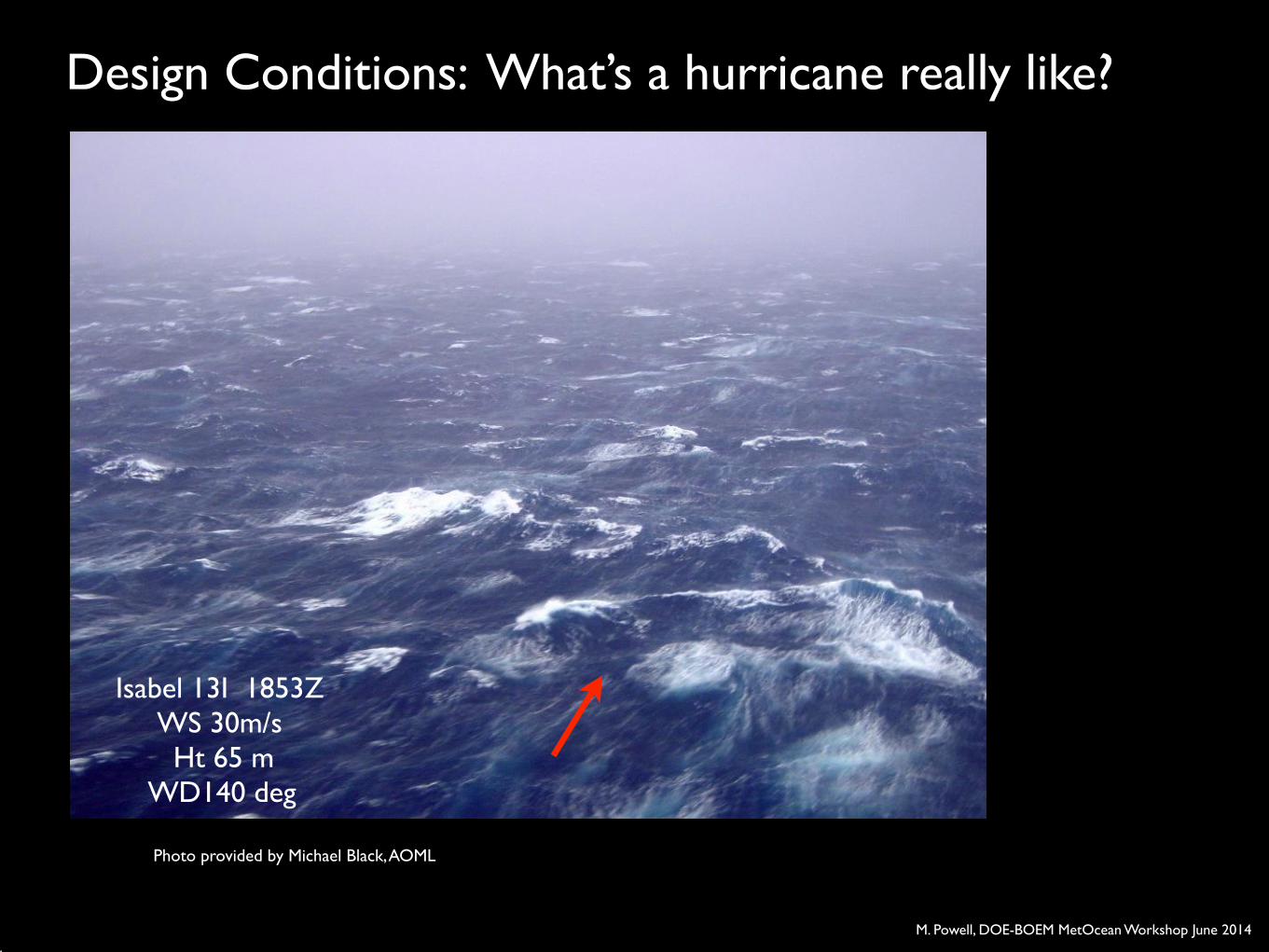
Isabel 13I 1853Z!WS 30m/s ! Ht 65 m!
WD140 deg
Photo provided by Michael Black, AOML
Design Conditions: What’s a hurricane really like?
M. Powell, DOE-BOEM MetOcean Workshop June 2014
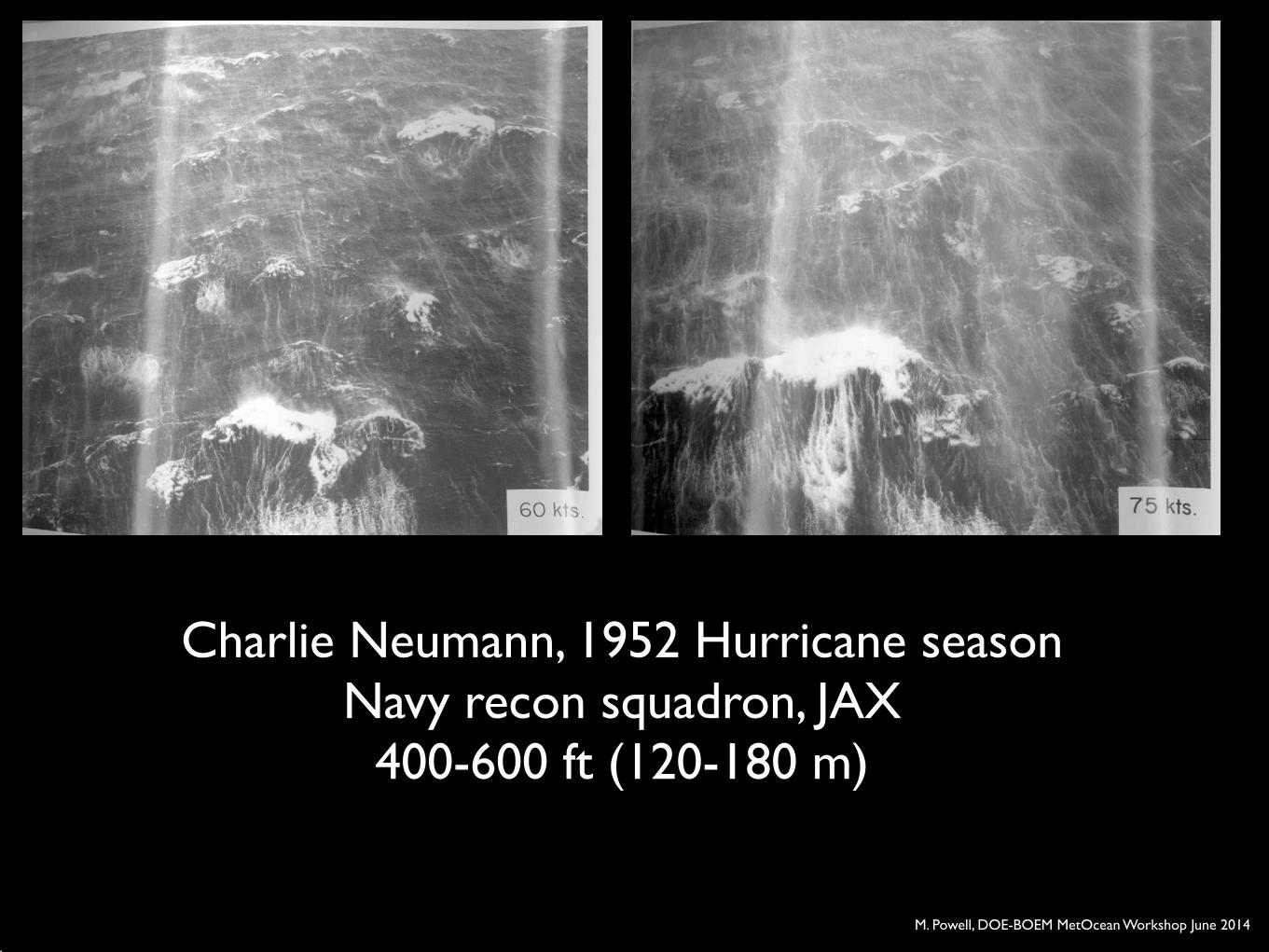
Charlie Neumann, 1952 Hurricane season!Navy recon squadron, JAX!
400-600 ft (120-180 m)
M. Powell, DOE-BOEM MetOcean Workshop June 2014
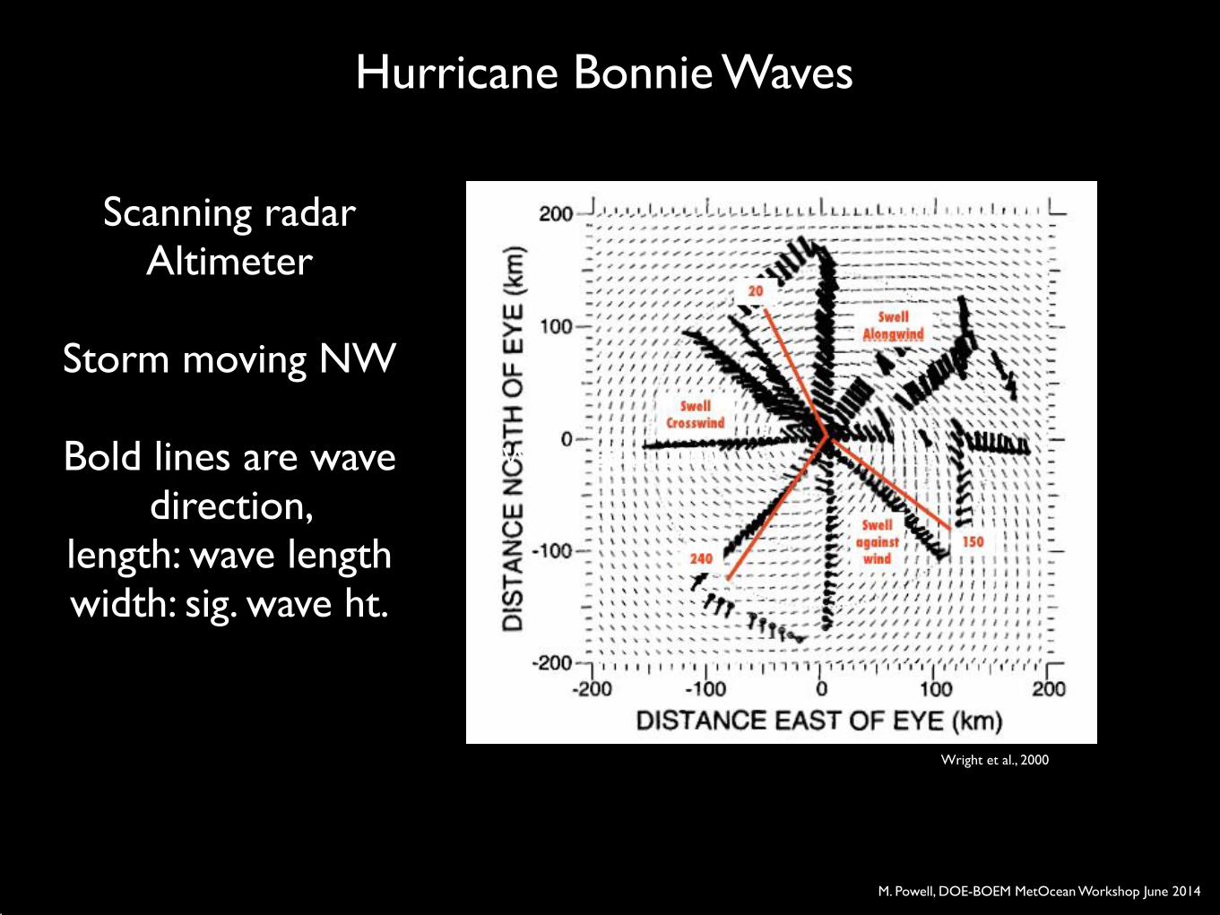
Hurricane Bonnie Waves!
Scanning radar Altimeter!
!
Storm moving NW!!
Bold lines are wave direction, !
length: wave length!width: sig. wave ht.
Wright et al., 2000
Wright et al., 2000
M. Powell, DOE-BOEM MetOcean Workshop June 2014
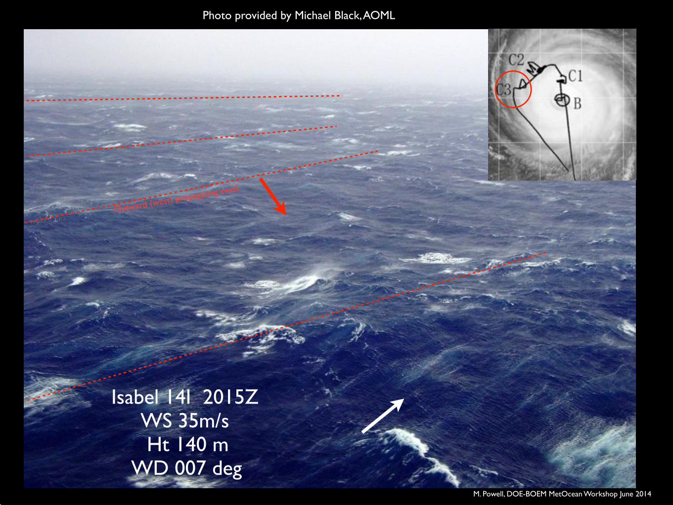
Isabel 14I 2015Z!WS 35m/s ! Ht 140 m!
WD 007 deg
Photo provided by Michael Black, AOML
Outward (west) propagating swell
M. Powell, DOE-BOEM MetOcean Workshop June 2014
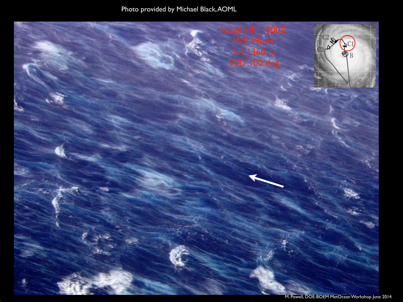
Isabel 14I 1800Z!WS 49m/s ! Ht 1360 m!
WD 100 deg
Photo provided by Michael Black, AOML
M. Powell, DOE-BOEM MetOcean Workshop June 2014
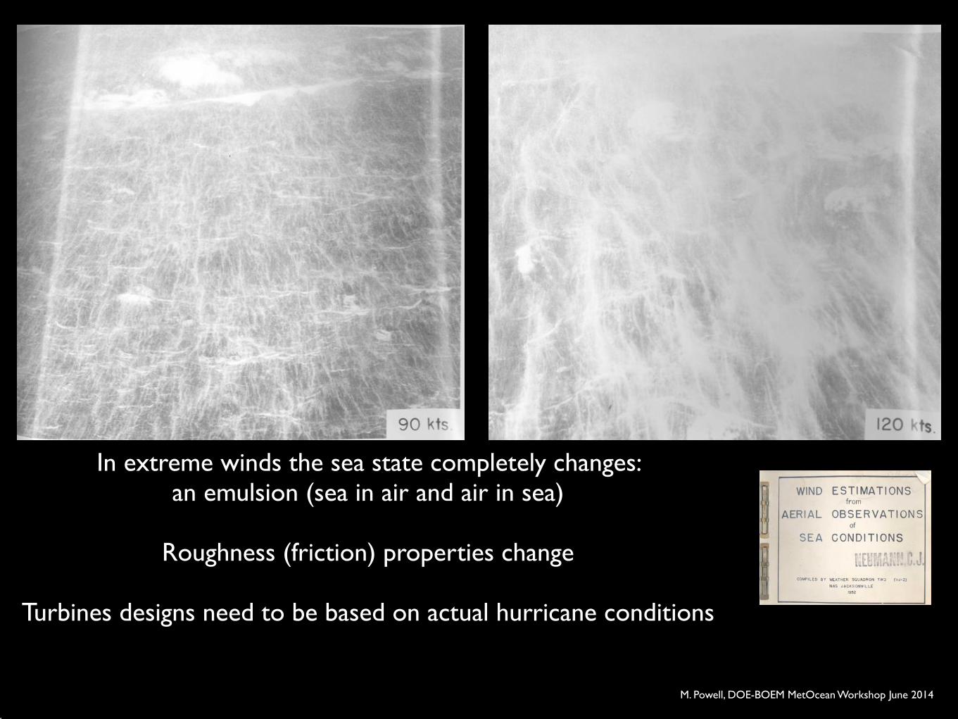
In extreme winds the sea state completely changes: !an emulsion (sea in air and air in sea)!
!
Roughness (friction) properties change!!
Turbines designs need to be based on actual hurricane conditions
M. Powell, DOE-BOEM MetOcean Workshop June 2014
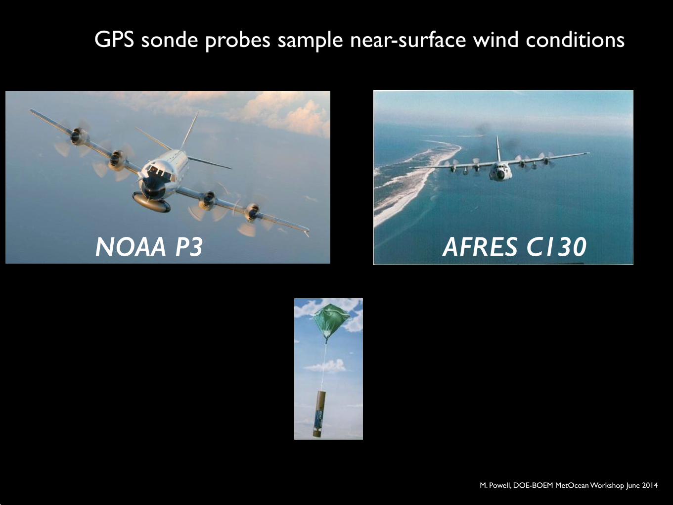
GPS sonde probes sample near-surface wind conditions
AFRES C130NOAA P3
M. Powell, DOE-BOEM MetOcean Workshop June 2014
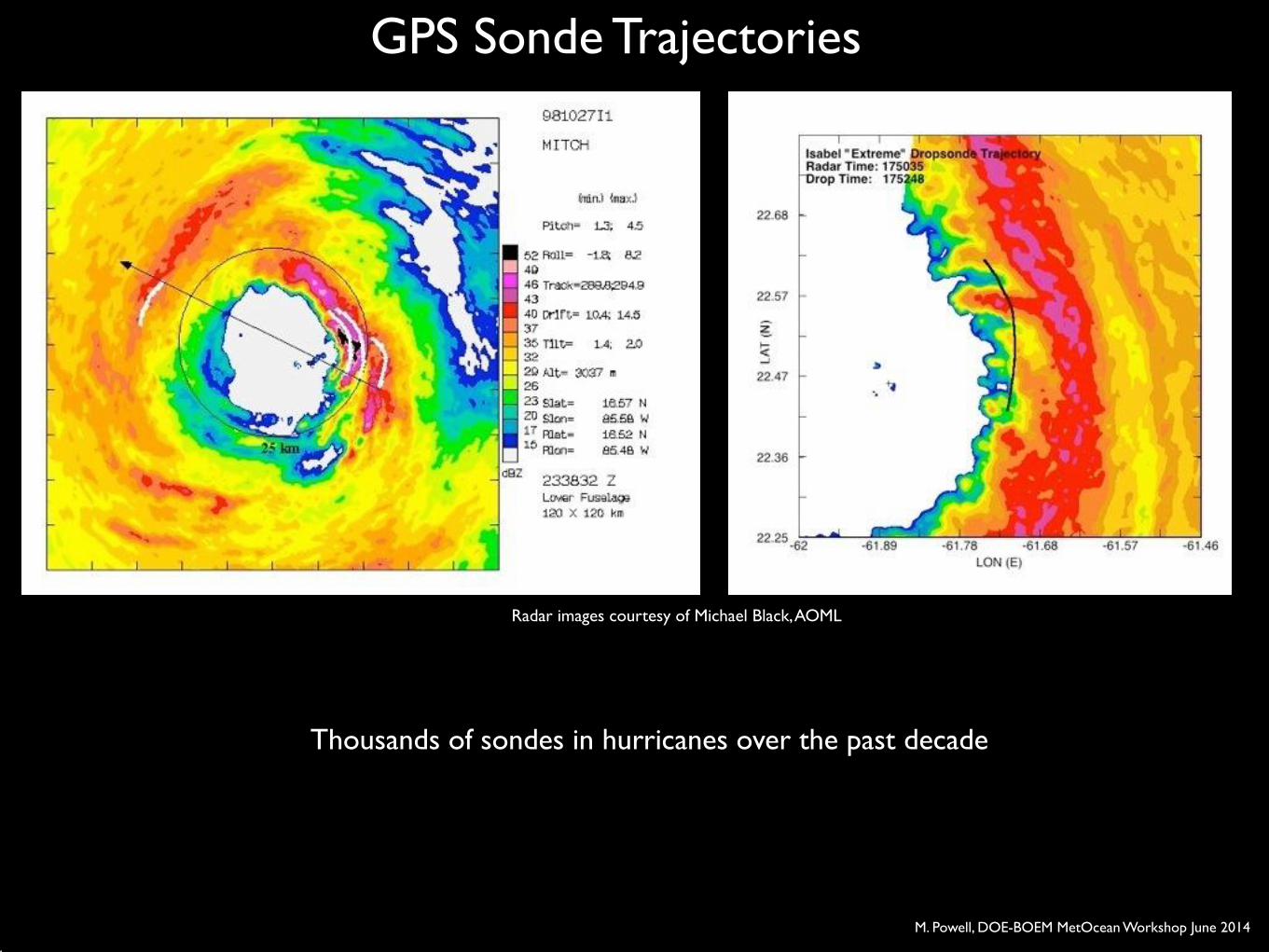
GPS Sonde Trajectories
Radar images courtesy of Michael Black, AOML
Thousands of sondes in hurricanes over the past decade
M. Powell, DOE-BOEM MetOcean Workshop June 2014
20 40 60 80
Wind Speed (m/s)
0
200
400
600
800
1000
Hei
ght (
m)
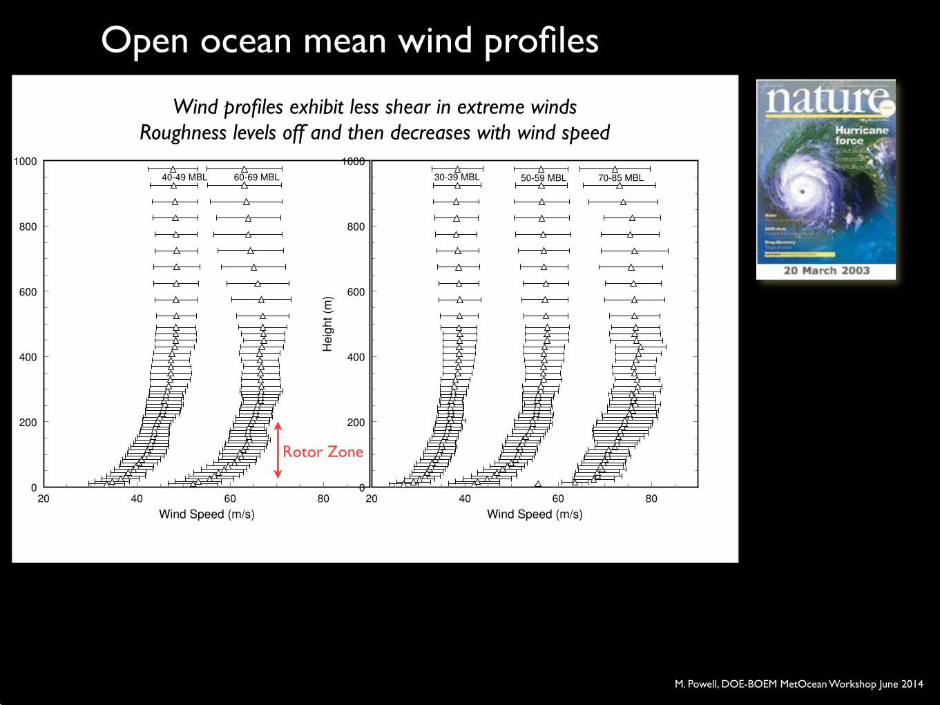
30-39 MBL 50-59 MBL 70-85 MBL
1a.
20 40 60 80
Wind Speed (m/s)
0
200
400
600
800
1000
Hei
ght (
m)
60-69 MBL40-49 MBL
1.b
Open ocean mean wind profiles
Wind profiles exhibit less shear in extreme winds!Roughness levels off and then decreases with wind speed
Rotor Zone
M. Powell, DOE-BOEM MetOcean Workshop June 2014
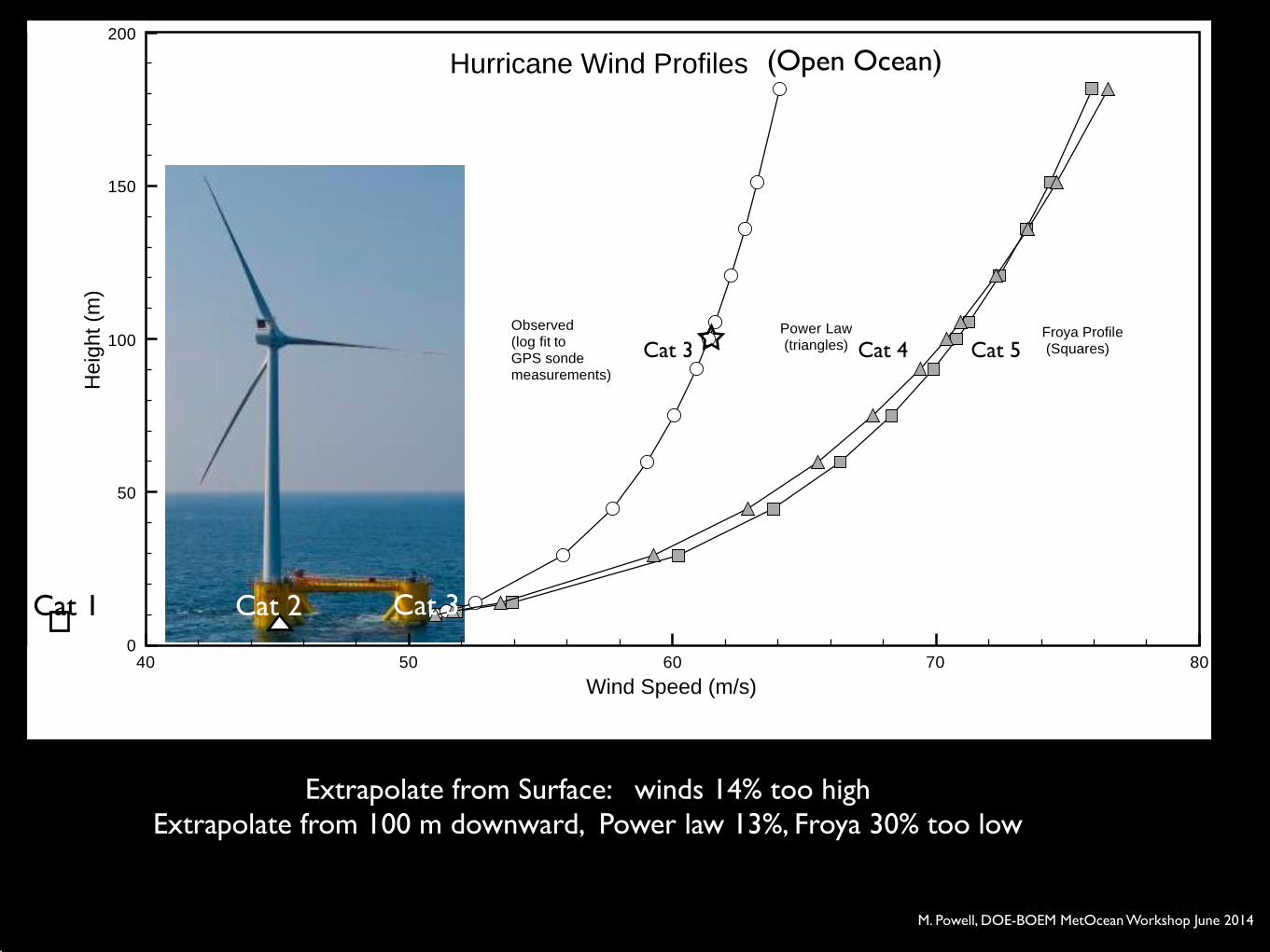
Extrapolate from Surface: winds 14% too high!Extrapolate from 100 m downward, Power law 13%, Froya 30% too low!
40 50 60 70 80
Wind Speed (m/s)
0
50
100
150
200
Hei
ght (
m)
Observed(log fit to GPS sonde measurements)
Power Law (triangles)
Froya Profile (Squares)
Hurricane Wind Profiles
M. Powell Guest Lecture MET 5534
Cat 3
Cat 3
Cat 2Cat 1
(Open Ocean)
Cat 4 Cat 5
M. Powell, DOE-BOEM MetOcean Workshop June 2014
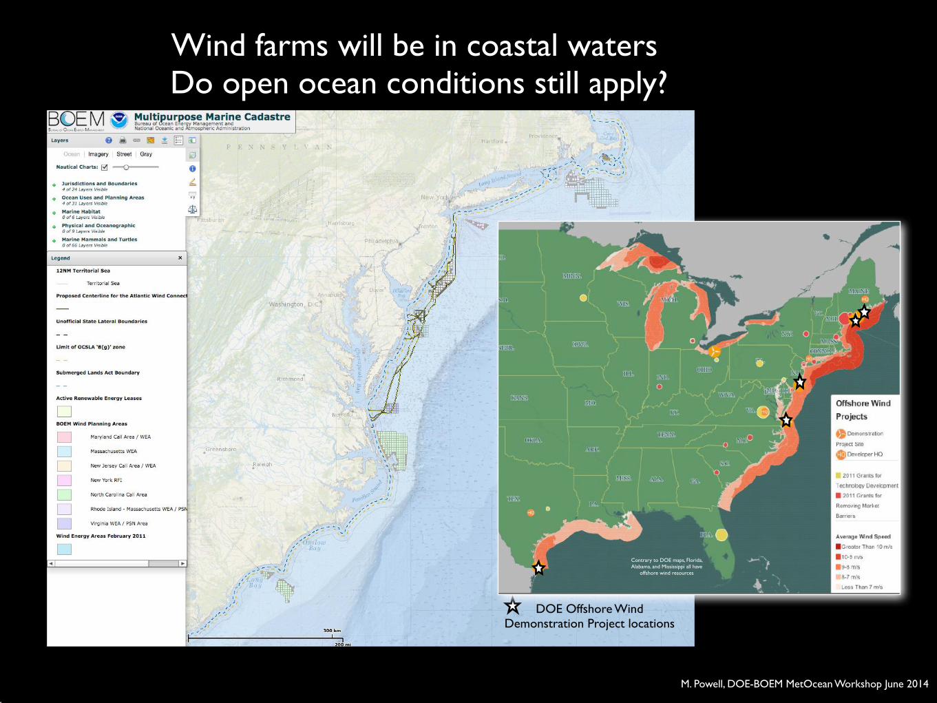
DOE Offshore Wind !Demonstration Project locations
Contrary to DOE maps, Florida, Alabama, and Mississippi all have
offshore wind resources
Wind farms will be in coastal waters ! Do open ocean conditions still apply?
M. Powell, DOE-BOEM MetOcean Workshop June 2014
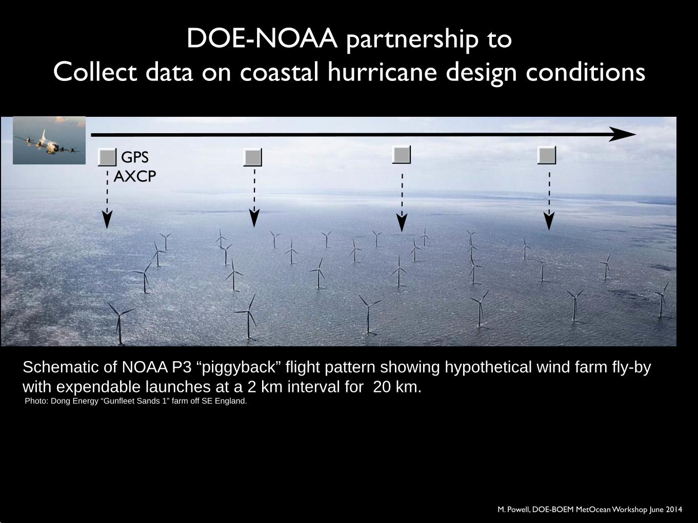
Schematic of NOAA P3 “piggyback” flight pattern showing hypothetical wind farm fly-by with expendable launches at a 2 km interval for 20 km. ! Photo: Dong Energy “Gunfleet Sands 1” farm off SE England.
DOE-NOAA partnership to!Collect data on coastal hurricane design conditions
GPS!AXCP
M. Powell, DOE-BOEM MetOcean Workshop June 2014
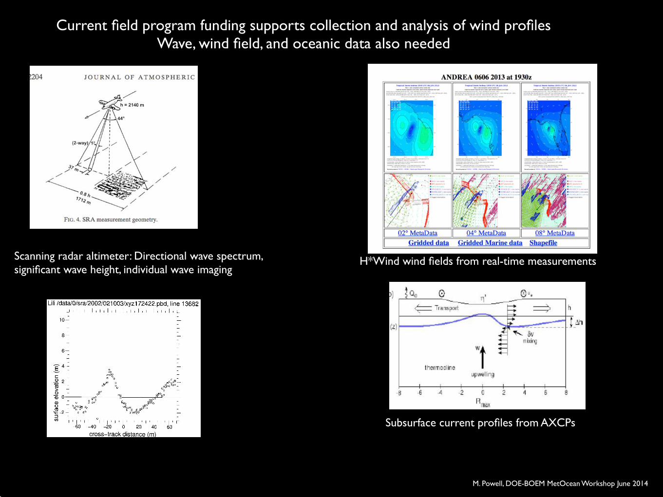
Current field program funding supports collection and analysis of wind profiles!Wave, wind field, and oceanic data also needed
!
Scanning radar altimeter: Directional wave spectrum, !significant wave height, individual wave imaging
H*Wind wind fields from real-time measurements
Subsurface current profiles from AXCPs
M. Powell, DOE-BOEM MetOcean Workshop June 2014
A comprehensive observational framework will help inform design
conditions to help make sure offshore wind farms withstand hurricanes
M. Powell, DOE-BOEM MetOcean Workshop June 2014
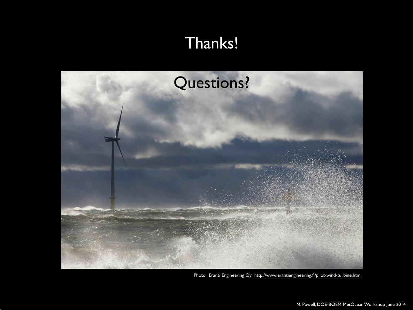
Photo: Eranti Engineering Oy http://www.erantiengineering.fi/pilot-wind-turbine.htm
Thanks!!!
Questions?
M. Powell, DOE-BOEM MetOcean Workshop June 2014


