
6
CHAPTER III THE FACTUAL BACKGROUND
19. This chapter sets out the backgroundto the 1964Stanfieldproposal,the context in which it
occurred and the subsequenthistory of discussionsrelating to the "Stanfield line."
20. This factual background is based on infonnation available to Newfoundland and Labrador
from sources in the National Archivesof Canada, from provincial archives and from other
government sources. There has not been any general discoveryof documents between the
parties.
21. What was in issue at the time of the Stanfieldproposal and later was not the division of
resource revenues between Canadaand the Atlantic Provinces,or even the management of
explorationand development,but the right to fullownershipandjurisdiction of the offshore
and its mineral resources. It was in the context of attempts to have Canada recognize
provincial ownership andjurisdiction of the offshore and its resources that interprovincial
boundaries were discussed.
I. The Constitutional Framework
22. At Confederation in 1867, Nova Scotia, New Brunswick and the Province of Canada
(consistingof OntarioandQuebec)joined to fonn the Dominionof Canada. Later,Manitoba
(1870), British Columbia (1871), Prince Edward Island (1873), Alberta (1905) and
Saskatchewan (1905) joined the Union. In 1949, Newfoundland and Labrador became the
tenth province.
23. Under the Constitution Act, 1867, the federal government had a number of specific powers
relating to the offshore: including the power to pass laws in relation to trade and commerce;

24.
25.
11.
26.
27.
7
militia,militaryandnaval serviceanddefence;beacons,buoys,lighthousesandSableIsland;
navigation and shipping; and sea coast and inland fisheries.9
Neither the territorial limits of the provinces in respect of the offshore nor interprovincial
offshore boundaries were set out in the Constitution.
The ConstitutionAct, 1867didnotprovideforextendingor changingprovincialboundaries.
This was correctedby section 3 of the ConstitutionAct, 1871underwhich Parliament could
alter provincial boundaries with the consent of the legislaturesof the provinces affected.
The Parliamentof Canadamay fromtimeto time, withthe consentofthe Legislature of any Province of the said Dominion, increase,diminish, or otherwise alter the limits of such Province,upon suchterms and conditionsas maybe agreedto by the saidLegislature,andmay, with the like consent,make provisionrespectingthe effect andoperationof any such increaseor diminutionor alterationof territoryin relation to any Province affected thereby. 10
Provincial Claims to Offshore Resources 1960 - 1964
Starting in the 1950s, the provinces became aware of the potential for oil and gas
development inthe offshoreareasandbeganto addresstheir claimsto ownershipof offshore
resources.
In the early 1960s, the four Atlantic Provinces - New Brunswick, Nova Scotia, Prince
Edward Island and Newfoundland and Labrador - began to work together to develop a
9 Constitution Act, 1867, s. 91, Statutes, # 8.
10 Constitution Act, 1871, s.3, Statutes, # 9.

8
common strategy.ll Thus, in October 1960, the provincial Ministers of Mines, meeting in
Quebec City, issued the following resolution:
The Mines Ministers unanimously agree and assert that offshoremineral rights within such distances offshorefrom provincial landsas seemsreasonableand just and consistentwith the terms of Unionpursuant to the B.N.A. Act are the resources of the province andsubject to provincialjurisdiction.12
28. On June 28, 1961, the Attorneys General of the Atlantic Provinces met in Halifax to discuss
offshore mineral resources.13 At the meeting, Prince Edward Island presented a map
outlining potential boundaries in Northumberland Strait. Newfoundland and Labrador
advisedthe otherprovincesthat it didnot havean interestin this area,but rather in a division
of the Strait of Belle Isle between Newfoundland and Labrador and Quebec.14 The
Attorneys Generalagreedthat Nova Scotiaand PrinceEdward Island would prepare a map
extending the boundariesbeyondNorthumberlandStraitup to the Straitof Belle Isle which
would then be presentedto the federalgovernmentin supportoftheir demand for ownership
of offshore resources. 15
29. A contemporaneous memorandum, written by a Newfoundland and Labrador official,
describes the work done on the boundaries:
II A draft memorandum to the federal Cabinet (February 3, 1964), Doe. # 6 provides a usefuloverview of the pre-1964 period.
12Letter from R.A. Donahoe, NS Attorney General, to Les Curtis, N&L Attorney General (June 9,1961), Doe. # 1.
13 Minutes of Meeting of AttorneysGeneralof AtlanticProvinces,Halifax, signedby B. G. Rogers,Prince Edward Island ("PEI") Director of Transportation (June 28, 1961), Doe. # 2.
14 Letter from B. G. Rogers, PEI to A. Farmer, PEI Attorney General (February 14, 1963), Doe. #4.
IS N&L memorandum (June 29, 1961),Doe. # 3.
9
Nova Scotia and P.E.!. have done considerable work on this but their
immediate object is to determine the interests of each on watersbetween their two Provinces, the idea being to draw a centre linebetween all the Provinces and that each Province should have mineral
and oil rights to that line.
P.E.!. and Nova Scotia, who have already shown on a map a linebetween their two Provinces,have agreedto extendthis line further,up to the Straitsof Belle Isleandwhen completedthey will distributecopies of this map which will define the off-shore mineral and oilrights of the several provinces. When we receive our copy it isagreed that the Province of Quebec will be consulted and asked tojoin in a request to the Federal Government to have these areasdeclaredto be Provincialrightsunder the provisionsof the BNA Act,1871 which authorized the Federal Parliament to define Provincialboundaries. 16
30. A second meetingwasheld in Halifaxon October7, 1961. At this meeting, the Nova Scotia
Departmentof Mines presentedMarineChart4490with interprovincialboundariesthereon
that went beyond Northumberland Strait. 17 According to a memorandum, written by Graham
Rogers of Prince Edward Island in 1963, the boundaries in the Northumberland Strait area
were accepted by the Attorneys General of Nova Scotia, New Brunswick and Prince Edward
Island.18 Newfoundland and Labrador did not attend these meetings.
31. In July 1964, Nova Scotia withdrew its acceptance ofthe Northumberland Strait boundaries.
The Nova Scotia Solicitor wrote:
Until such time as there has been an agreement with the FederalGovernment and the Provinces concerned with reference to the
16Supra, Note 15.
17Memorandum from B.G. Rogers, PEI to Premier Shaw, PEI (June 13, 1963), Doe. # 5. See alsoletter from B.G. Rogers, PEI, to M. Jones, NS Legal Adviser (July 6, 1964), Doe. # 8.
18 Letter trom RG. Rogers, PEI to Premier Shaw, PEI (June 13, 1963),Doe. # 5.

10
boundary question or a determinationof the issueby the Courts, I donot think it is possible to finalizeany agreementbetweenthe variousprovincesconcernedwiththeNorthumberlandStraitarea.19
Ill. The Stanfield Proposal (1964)
32. On September 23, 1964,a meeting was held between officials of New Brunswick, Nova
Scotia and Prince Edward Island to discuss offshore resources in anticipation of the
upcomingannual conferenceof theAtlanticPremiers. Newfoundlandand Labradorwas not
represented at this meeting, but received a copy of the minutes.2o The officials present
appreciatedthat formalrecognitionby the federalgovernmentof the ownershiprights of the
Atlantic Provinces was essential to the "expeditious and economic and orderly development
of offshore exploration" and undertook to make several recommendations to their respective
Premiers with respect to boundaries:
2. The meeting felt that it was desirable that the boundaries as
between the several Atlantic Coast Provinces should be agreed uponby the Provincial authorities and the necessary steps should be takento give effect to that agreement. In this respect, a plan was preparedby the Nova Scotia Department of Mines, setting forth graphicallyand by metes and bounds suggested boundary lines covering the BayofFundy, Northumberland Strait, the Gulf ofSt. Lawrence, includingthe Bay ofChaleur and the Strait of Belle Isle and Cabot Strait. These
suggested boundaries have had the tentative approval of NewBrunswick, Prince Edward Island, Newfoundland and Nova Scotiaand, it is understood, are also acceptable to Quebec. It isr~commended that these boundaries should have the more formalapproval of the several Governments concerned. It is furtherrecommended that Parliament be asked to define the boundaries as so
19 Letter from M. lones, NS Solicitor,to B. G. Rogers,PEI (July 3, 1964),Doc. # 7. See also letterfrom B.G. Rogers, PEI, to M. lones, NS (July 6, 1964), Doc. # 8.
20 Letter from l. MacDonald, NS Deputy Attorney General, to A. lohnson, N&L Deputy Ministerof Economic Development (September23,1964), Doc. # 10.

11
approved by the Provinces, under the provisionsof Section 3 of theBritish North America Act, 1871.21
33. On September 30, 1964, at the annual conference of Atlantic Premiers in Halifax, the
Premiers agreed to present a common position to the federal government consisting of:
(1) a joint statement setting out the position of the Atlantic Provinces on offshore
resources;
(2) a metes and bounds descriptionof proposed marine boundaries (ScheduleA to the
statement); and
(3) a map showing graphicallythe proposed marine boundariesbetween the provinces
ofNova Scotia,NewBrunswick,PrinceEdwardIslandandNewfoundland(Schedule
B to the statement)Y
Premier Stanfield was asked to solicit Quebec's support and to prepare a presentation
regarding the position of the provinces on offshore mineral resources to be made at the
federal-provincial conference. 23
21Minutes of officials meeting between NS, New Brunswick ("NB") and PEI (September 23, 1964),Doe. # 9.
22Joint Statement of Atlantic Provinces (September 30, 1964), Doe. # 11.
23 Letter from Premier Stanfield, NS, to Premier Lesage, QC (October 2, 1964), Doc. # 12;Memorandum entitled "Matters Discussed at the Atlantic Premiers Conference in Halifax September30, 1964 Requiring Further Action" (undated), Doe. # 13; Telegram from Premier Lesage, QC, toPremier Stanfield, NS (October 7, 1964), Doc. # 14.

34.
12
In October 1964,atthe federal-provincialconferenceinOttawa,PremierStanfield,on behalf
of the Atlantic Provinces, presented a submission to Prime Minister Pearson claiming
provincial ownershipof offshoremineral resourcesin whichhe made the following points:
(1)
(2)
(3)
(4)
The only questionsfor discussionwerethe proprietaryrights in submarineminerals
and the boundary lines betweenprovinces.
The proprietary right in mineralscontained in the submarine lands belonged to the
provinces where the submarine lands were contiguousto a province.
The orderlyexplorationand exploitationof submarineminerals was essential to the
economic developmentof the provinces.
The question of provincialboundariesneed not be discussedat length or decided at
the conference.
(5) Section 3 of the British North America Act, 1871 provided the procedure for
changingboundariesand in effectwasa matterfor agreementbetweenthe provinces
concerned. PremierStanfieldsaid: "I can say, however,that the Atlantic Provinces
have discussed this question among themselves and have agreed upon tentative
boundaries of the marine areas adjoiningthose Provinces."
(6) The tentative boundaries were set out by metes and bounds and were graphically
delineated on a map attachedto the submission.
(7) The federal governmentwas requestedto giveeffectto "the boundariesthus agreed"
through legislationpursuantto s. 3 of the BritishNorthAmerica Act, 1871. Premier
Stanfieldsaid:"It may be that beforeactual legislationis preparedthe descriptionby
metes and bounds should be reviewed and revised and the attached map, if necessary,

13
varied accordingly, but, for all practical purposes, the attached description of the
boundaries and map representthe agreementof the Atlantic Provinces."
(8) Canada was also asked to continue to assert the status of the Gulf of St. Lawrence,
Cabot Strait, Northumberland Strait and the Bay of Fundy as inland waters or
territorial waters.24
35. The metes and bounds description,attachedto the submissionas ScheduleA, was entitled
"Notes re: Boundaries of Mineral Rights as between Maritime Provincial Boundaries"
("Notes"). TheNotes definedthe boundariesbetweenNewfoundlandandNova Scotia inthe
following way:
I -Boundary of Nova Scotia
From this mutual corner the boundary with Newfoundland runssoutheasterlyto the midpoint between St. Paul Island (Nova Scotia)and Cape Ray (Newfoundland);thence to a point midway betweenFlint Island (Nova Scotia)and Grand Bruit (Newfoundland);thencesoutheasterly to Internationalwaters.
VI - Boundary of Newfoundland
Fromthe abovecommonpoint southeasterlyto the midpointbetweenSt. Paul Island and Cape Ray; thence southeasterlyto the midpointbetween Flint Island and Grand Bruit; thence S.E. to Internationalwaters.
24 Submissionon SubmarineMineralRightsbyNova Scotia,New Brunswick,PrinceEdwardIslandand Newfoundland, Federal-Provincial Conference (Oct. 14, 1964) ("Stanfield proposal"), Doe. #15; Notes on federal-provincial Conference of Prime Minister and Premiers prepared by PrivyCouncil Office (December 9, 1964), Doe. # 16.

14
The "mutual corner" referred to in the Nova Scotia description and the "common point"
referred to in the Newfoundland description were references to the midpoint between East
Point (MagdalenIslands) and Cape Anguille (Newfoundland)Y
36. The map attached to the submission as ScheduleB was entitled "Chart Showingproposed
boundaries of Maritime Provinces, Newfoundland and Quebec with primary regard to
Mineral Rights."26 It depicted a line between Newfoundland and Nova Scotia which
extended from the midpoint of a line drawn between East Point and Cape Anguille to the
midpoint of a line drawn between St. Paul Island and Cape Ray to the midpoint of a line
drawn between Flint Island and Grand Bruit. The line then proceeded about 85 nautical
miles on an approximateazimuth of 125°Y
37. On December 11, 1964,the Prime Ministerrejected the Stanfieldproposal. He advised the
Atlantic Premiers that Canada considered that offshore resources fell under federal
jurisdiction and that the question would be referred by the federal government to the
Supreme Court ofCanada.28 Although efforts were made by the Atlantic Premiers to have
the Prime Minister reconsider this decision, the die had been cast.29
38. At a federal-provincial conference in July 1965,the Prime Minister stressed that Canada
believed that the question oflegal ownershipshouldbe settledby the SupremeCourt before
25 Stanfield proPQsal,Doe. # 15.
26 See Figure 2. A true copy of the map attached as Schedule B of the Stanfield proposal is in apocket at the end of this Memorial.
27See Figure 3.
28Letterfrom Prime Minister Pearson to Premier Smallwood, N&L (December 11,1964), Doe. # 17.
29House of Commons Debates (February 22, 1965) at 11571, Doe. # 18. Letter from PremierStanfield, NS, to Prime Minister Pearson (March 25, 1965), Doe. # 19; Letter from Prime MinisterPearson to Premier Stanfield, NS (April 27, 1965), Doe. # 20.

15
any arrangements could be negotiated between the federal government and the coastal
provinces. The minutes record the followingexchangebetween Prime Minister Pearson,
Premier Shaw of Prince Edward Island and Premier Smallwood of Newfoundland and
Labrador:
116.
117.
118.
39.
Mr. Shaw statedthat the AtlanticProvinces and Quebechadreached agreementon interprovincialboundaries in the Gulfof St. Lawrence region, had subdivided the Gulf betweenthemselves, and had advised the Federal Governmentaccordingly. Thus there was no legal question involved.
The Prime Minister pointed out that adjustment of provincialboundaries without Federal participation would be anarbitrary action and he stressed that provinces do not have theconstitutional authority to adjust provincial boundariesunilaterally.
Mr. Smallwood interjected that these interprovincialboundaries in the Gulf were merely a proposal and that theprovinces had not attempted to make them law...,30
In 1967, federal officials proceeded on the assumption that there was no interprovincial
agreement on offshore boundaries. An April 1967 federal memorandum entitled "Offshore
Mineral Rights: Resolution of Federal-Provincial Conflict" reads in part:
Offshore lines of demarcation would be necessary not only todifferentiate between federal and provincial areas of interest, but alsoto delimit the areas from which each individual province wouldobtain its share of offshore revenues. These offshore 'interprovincial'lines should be finalized at the time a federal-provincial agreement ismade in order to forestall any disputes in this regard. The finaldetermination of any offshore lines that would coincide or interferewith international boundaries could be left in abeyance with the
30 Minutes of the Federal-ProvincialConference(July 21, 1965)at 27-28, Doe. # 21.

16
understanding that the federal government would negotiate the bestterms possible with the countries involved.3!
IV. The Work of the JMRC
40. In early 1968,Ministers of the AtlanticProvincesand Quebecmet to reassess their options
in the wake of the SupremeCourt of Canada's decisionin Referencere: Offshore Mineral
Rights of British Columbia, which had been handed down on November 7, 1967.32They
decided to create a steering committee to promote "uniform legislation and regulation
relative to the whole field of offshoreminerals."33Followingthe meeting,the Joint Mineral
Resources Committee ("JMRC"), made up of the Ministers of Mines of the Atlantic
Provinces and Quebec, was formallyestablishedby agreementbetweenthe provinces.34
The purpose of the Joint Mineral Resources Committee is to initiateand foster co-operation among the Provinces that are parties to theAgreement in the study of problems concerning the m,anagement ofmineral resources in the submarine areas or lands within theProvinces and in their common terrestrial border zones and to make
recommendations to the Governments of the Provinces for resolvingthe problems.35
3! Memorandum of D.G. Crosby, Director of Resource Management and Conservation Branch,Federal Department of Energy, Mines and Resources ("EMR") (April 7, 1967) at 11, Doe. # 22.
32 [1967] S.C.R. 792 ("British Columbia Offshore Reference'), Authorities, # 17. The Courtsupported the o\Vl1ershipclaim of the federal government with respect to the resources of allsubmerged lands lying seaward of the ordinary low water mark and outside of harbours, bays,estuaries and other similar inland waters.
33 Letter from Premier Camp bell, PEI, to D.W. Gallagher, Manager ofPEI Economic ImprovementCorporation (June 12, 1968). Doc. # 24.
34 The agreement was based on a draft forwarded by D. Smith, NS Minister of Mines, to M. Lane,N&L Minister of Mines, Agriculture and Resources (June 7,1968), Doc. # 23.
35 Memorandum of Agreement between Governments of Quebec, Nova Scotia, New Brunswick,Prince Edward Island and Newfoundland (July 16, 1968), Doe. # 25.

17
41. The JMRC establisheda committeeof seniorofficials(calledthe Sub-Committee),and five
technical committees. One of the technical committeeswas chargedwith "the delineation
and description of the proposed boundaries of the participating provinces" in the submarine
areas. The technical committee based its work on the Stanfield proposal, and the Notes and
the map attached to the Stanfieldproposal.36
42. The technical committee prepared a list of coordinates defining the turning points in the
Notes which each provincialmember of the technical committeewas asked to verify. F.J.
Lukins, Newfoundland and Labrador Chief Engineer, who checked the list of coordinates,
prepared a memorandum with his findings and attached a map he had received from the
technical committee. The most seawardextension of the line shown on the map ended at
Turning Point 2017 (the midpoint of a line drawn betweenFlint Island and Grand Broit).37
43. On January 16, 1969, the technical committee reported that it had determined and agreed
upon the methodology for defining the turning points described in the Notes and that the
final list of the coordinates would be forwarded to each participating province in the future. 38
The minutes record that the next steps would be a formal agreement followed by legislation
in each province:
The meeting was in agreement that once this matter was finalized toits satisfaction then it would recommend to the Joint Mineral
Resources Committee that an agreement be entered into by the
36Letter from P. Allard, Vice Chairman of JMRC, to P. Gaum, NS Minister of Mines (May 12,1969), Doc.# 33.
37 Memorandum from FJ. Lukinsto N&L Deputy Ministerof Mines (January7,1969), Doc. # 28.
38 Report of the Technical Committee on Delineation and Description of the Boundaries of theParticipating Provinces in Submarine Areas prepared by le. Smith, Chairman (January 16, 1969),Doe. # 29.

18
provinces pertaining thereto and be confirmedby legislationby theparticipating provinces.39
44. The JMRC met on January 17, 1969,and directedthat the list of co-ordinatesand the maps
showing the turning points be forwarded to Graham Walker, Legal Adviser to the Nova
ScotiaAttorneyGeneral,whowas to draftan interprovincialagreementand forwardit to the
Ministers of the participating provinces so that they could obtain the approval of their
govemments.4OApparently, no such agreementwas drawn up.
45. The final list of co-ordinateswas preparedby the technical committeebetweenJanuary 16,
1969 and May 12, 1969. The list also showed the most seaward extension of the line
between Nova Scotia and Newfoundlandas Turning Point 2017.4\
46. On May 12, 1969,Paul Allard, QuebecMinister of Natural Resources and Vice-Chairman
of the JMRC, wrote to the Ministers of Mines of the Atlantic Provinces and requested that
the following action to be taken:
1. That your Government agrees that the map enclosed herewithsetting forth the turning points with the appropriate longitudes andlatitudes delineates the boundaries between your Province and theother Provinces shown thereon.
2. That your Government agrees that the map enclosed herewithsetting forth the turning points with the appropriate longitudes andlatitudes delineates the boundaries between the other Provincesshown thereon.
39 Minutes of Meeting of Sub-committee of JMRC, Halifax (January 16, 1969), Doe. # 30.
4°Minutes of Meeting of JMRC, Halifax (January 17, 1969), Doe. # 31.
4\ List of Turning Points, Doe. # 32. See Figure 4.

19
3. That the boundariesare effectiveforallpurposes,and inparticular,mineral rights in the submarineareasarethe propertyofthe Provincewithin whose boundariesthe area is.
4. That your Governmentwill confirmthemap and theturningpointsfor the purposes set out herein by agreement.
5. That your Governmentwill confirmthe agreementby legislation.
6. That your Governmentwilljoin with the four Provincesherein inseeking legislation by the Government of Canada confirming theagreement if the Joint Mineral Resources Committee sorecommends.42
47. At the next meeting of the JMRC, on June 13, 1969,Minister Allard asked the Ministers to
respondto his letter. TheNova ScotiaMinisteragreedwiththe contentsof the letter and the
six questions asked therein. The New BrunswickMinister was not prepared to give a "yes
or no" answer to the six questions. The PrinceEdward Island representativeanswered yes
to four of the questions.43 Frederick Gover, the Newfoundland and Labrador Deputy
Minister of Mines, statedthat he had no instructionsconcerningany of the six questions in
Allard's letter.44 There was no follow-up and the agreementcontemplated in the Allard
letter was never concluded.
v. Federal Resource AdministrationProposal
48. On November 29,1968, the Prime Minister proposed to the Atlantic Provinces that Canada
retain full responsibility for regulating offshore exploration and development, but that 50%
of the revenues be placed in a common fund for distribution in accordance with mineral
42Letter from P. Allard, Vice Chairman of JMRC to P. Gaum, NS Minister of MR (May 12, 1969),Doe. # 33.
43 See letter from c.A. Miller, PEI Minister of Mines, to P. Allard, Vice Chairman of JMRC (May22, 1969), Doe. # 34.
44 Minutes of Meeting of JMRC, QuebecCity (June 13, 1969),Doe. # 35.

20
resourceadministrationlines.45 Thepurposeofthe mineralresourceadministrationlineswas
to delimit areas of federal and provincial administration. Since all revenue seaward of the
mineral resource administration lines was to be placed in a common fund for distribution,
there would be no need to drawinterprovincialboundaries. The Prime Minister's proposal
was brought to the attention of the JMRC which decided that they should first agree among
themselves as to the location of their interprovincial boundaries.46
49. In June 1969,with no interprovincialagreementin sight, the JMRC, with the exception of
New Brunswick, decided that a meeting with federal officials would be helpful, if only to
obtain clarification of the Prime Minister's proposal on mineral resource administrationY
A federal-provincial meeting was held in the summer of 1969, after which the JMRC
reconvened in September to discuss the issues arising out ofthe meeting in greater detai1.48
50. From the federal government's perspective, little progress had occurred in 1969. In
September 1969,the Prime Minister was advisedby Otto Lang, Ministerwithout Portfolio,
that the JMRC was unlikely to reach a consensus. In his letter, Minister Lang referred to the
Stanfield proposal as "an informal unapproved agreement."49
45Letterfrom Prime Minister Trudeau to Premier Robichaud (November 29, 1968), Doc.# 26;Statementby Prime Minister Trudeauin the House of Commons (December2, 1968),Doe. # 27.
46 LetterfromP.-Allard, Vice-Chairmanof JMRC, to P. Gaum, NS Minister of Mines (May 12,1969)at 3, Doe. # 33.
47 Minutes of Meeting of JMRC (June 13, 1969), Doe. # 35.
48 Report on Offshore Minerals Issue - Toronto Meeting of the JMRC (probably prepared by D.Darlington, Chief Economist, PEI Department of Mines following a September, 1969 meeting ofthe JMRC), Doe. # 36.
49 Letter from 0 .Lang, federal Minister without Portfolio, to Prime Minister Trudeau (September 22,1969) at 1, Doe. # 37.

21
51. In December 1969, the Prime Minister wrote to each of the Atlantic Premiers offering to
concludeagreementswiththemon anindividualbasis.50 This approach was rejected.51
52. After further federal-provincialmeetings in 1970, it became evident to Ottawa that the
Atlantic Provinces and Quebec had no uniform position, and to continue collective
negotiationswould notbe fruitful.52 Accordingly,the federalMinisterof Energy, Mines and
Resources initiated bilateral discussions with each of the Atlantic Provinces. By June 1971,
federal officials had determined that the Atlantic Provinces were unlikely to accept the
concept of mineral resource administration lines and that the federal government would
"have to chart a much more contentious and difficult course. "53
53. In July 1971, the federal Minister of Energy , Mines and Resources presented a Memorandum
to Cabinet outlining two revenue sharing formulas which might form the basis of a federal-
provincial arrangement.Both formulasinvolvedthe division of the seabed off the Atlantic
coast. S.S. Reisman, federal Deputy Minister of Finance, expressed the view that the
Atlantic Provinces might not be in agreement on the division.
The memorandum does not state how this will be done, thoughE.M.R. officials have indicated that the divisions of sea bed agreedto several years ago by the provinces will be used. This may be arisky assumption to make, since only Newfoundland, of the fiveeastern provinces, has the same government that was in power whenthe sea bed was unilaterallydividedby the provinces.54
50 Letter from Prime Minister Trudeau to Provincial Premiers (December 2, 1969) at 2, Doe. # 38.
51 Letter from Premier Smith to Prime Minister Trudeau(January 8, 1970),Doe. # 39; Letter fromPremier Smallwood to Prime Minister Trudeau (January 29, 1970), Doe. # 40.
52 Memorandum to federal Cabinet (June 29, 1970) at 4-6, Doe. # 41.
53 Letter from J. Austin to G. McNabb, Deputy Minister (Energy) ofEMR (June 7, 1971) at 1, Doe.# 42.
54 Memorandum from S.S. Reisman to the Minister (July 26, 1971)at 2, point 5,Doe.# 43.

22
54. In September 1971,the federalgovernmentsubmitteda new proposalto the JMRC 55 and in
October 1971, John Turner, the federal Minister of Justice, wrote to the provinces to propose
further consultations.56 No discussionstook place.
VI. The 1972 Provincial Proposal
55. In May 1972,the JMRC agreed that the five Premiers had to become actively involved in
orderto achievean agreement. Tothis end, the JMRCformulatedanumber of principles for
discussionby the Atlantic Premiersat a meetingin June 1972. The followingprinciples are
relevant:
(3) Ownership of the mineral resources in the submarine areas orlands within the provinces and in their common terrestrial borderzones is in the provinces and not in the Governmentof Canada.
(4) The Governments of the four Atlantic Provinces and the Provinceof Quebec should confirm the delineation and description of theboundaries of the said five provinces in the submarine areas and theturning points in longitude and latitude relating thereto as wasrequested by the Honorable Paul E. Allard on May 12, 1969, thenVice-Chairman of the Joint Mineral Resources CommitteeP
56. A contemporaneous New Brunswick memorandum stated that "Interprovincial boundary
lines in sub marine areas (e.g. the Gulf of St. Lawrence) must be confirmed and ratified at
the earliest convenience."58
55Minutes of Joint Meeting of JMRC and Sub-committee, Halifax (September 14, 1971), Doe. # 44.
56Letter from J. Turner to W.R. Callahan, Chairman of JMRC (October 25, 1971), Doe. # 45.
57 Minutes of Meeting of JMRC (May 24, 1972),Doe. # 46.
58 Memorandum of May 24, 1972 Meeting of the JMRC prepared by H.W. van de Poll, NBDepartment of Natural Resources (May 25, 1972), Doe. # 47.

23
57. On June 18, 1972,after a meeting of the AtlanticPremiersand the Vice Premierof Quebec,
Premier Regan wrote to Prime Minister Trudeauputting forward a common approach on
offshore ownership by the "five eastern provincesas a united group."55The communique
issued at the same time described a provincialconsensuson delineationand description of
the offshore boundaries between the five provinces in the Gulf of St. Lawrence:
1. The proposal concerning offshore mineral resources made by thegovernment of Canada on November 29, 1968, and as announced inthe House of Commons on December 2, 1968, is not acceptable to thefive eastern provinces.
2. The governmentsof the five easternProvinces have agreed to thedelineation and descriptionofthe offshoreboundariesbetween eachof these five provinces.
3. The five eastern Provinces assert ownership of the mineralresources in the seabed off the Atlantic coast and in the Gulf of St.
Lawrencein accordancewiththeagreedboundaries.56
58. On June 19, 1972, Premier Moores made a statement to the Newfoundland and Labrador
Houseof Assemblyinwhichhe reportedonthe positiontakenby the Premiers. He informed
the House that the Premiers had not attempted "to make concrete decisions on particular
problems" and that the Halifaxmeetingsservedonly "in creating a common philosophy on
the question."57
59. Prime M!nister Trudeau immediately advised Premier Regan that he was not prepared to
debate the communique and that he took particular objection to "the assertion of ownership
of the mineral resources of the seabed by the provinces and that the provincial boundaries
55Telegram from Premier Regan to Prime Minister Trudeau (June 18, 1972), Doc. # 49.
56 Joint Communique (June 18, 1972), Doc. # 48.
57 Statement by Premier Moores to the House of Assembly (June 19, 1972)at 2, Doc. # 50.

24
extend offshore in a mannerto be delineatedby provincialagreement." ThePrime Minister
also stated that work on the SupremeCourt referencewould be started.58
VII. Newfoundland and Labrador Goes its Own Way 1972-1977
60. In July 1972, Newfoundland and Labrador began to pursue a separate course from the other
Atlantic Provinces. On July 28, 1972, Premier Moores announced a new policy on offshore
mineral resources. The main feature was Newfoundland and Labrador's claim to full
ownership andjurisdictional rights over the resources of the continental shelf based on the
province's constitutional status at the time of Union in 1949.59
61. In September 1972, William Doody, Newfoundland and Labrador Minister of Mines,
Agriculture and Resources, advised petroleum companies that the province did not consider
itself bound by any federalpermit arrangements.6oMinisterDoodyalso wrote to the federal
Minister of Mines, Energy and Resources and suggested that in order not to prejudice "a
political settlement," both governments should refrain from "all acts vis-a.-vis the various
[petroleum)' companies ... which might tend to jeopardize the attainment of a political
settlement."61
62. In October 1972, Minister Doody also wrote Michael Kirby, Special Adviser to Premier
Regan, about the need to have a precise determination of the line between Nova Scotia and
58 Letter from Prime MinisterTrudeauto PremierRegan (June22, 1972)at 1,3, Doc.# 51. Seealsomemorandum to federal Cabinet (July 10, 1972), Doc. # 52. See also Record of Cabinet Decision(July 19, 1972), Doc.# 53.
59 "Pledges with Ottawa on offshore resources not binding for the province says Moores," EveningTelegram (July 29, 1972), Doc. # 54.
60 Letter from W. Doody, N&L Minister of Mines, Agriculture and Resources, to various petroleumcompanies (August 31,1972), Doc. # 55.
61 Letter from W. Doody to D. MacDonald (September 22, 1972), Doc. # 56.

25
Newfoundland and Labrador. Minister Doody suggested that the line be established
"according to scientific principles" to avoid confusion in the future.62In his reply, Kirby
agreed with Minister Doody that "the boundaries should be established as accurately as
possible" and advisedthat he intendedto askthe Nova ScotiaDepartmentof Mines to draw
a line. Kirbyadded:
As soon as this boundaryhas been drawn by our Mines Department,we can get together to discuss it. I am confident that any difficultywith regard to the boundary line can be resolved amicably.63
On November 17, 1972, Cabot Martin, Newfoundland and Labrador Legal Adviser, wrote
a reminder letter to Kirby.64 There was no response and the issue remained unresolved.
63. On May 8, 1973, the federal government prepared a new proposal on offshore mineral
resources for the Atlantic Provinces and Quebec.65 The Premiers then met and drafted a
response, dated June 19, 1973, which indicated they were prepared to discuss joint
management and revenue sharing.66 A week later, Premier Moores telephoned Premier
Regan and informed him that his Cabinetwould not support the response.67In September
62Letter from W. Doody to M. Kirby (October 6, 1972), Doe. # 57.
63 Letter from M. Kirby to W. Doody (October 17, 1972),Doe. # 58.
64Letter from C. Martin, N&L Legal Adviser, to W. Kirby (November 17, 1972), Doe. # 59.
65 Memorandum to First Ministers re: Discussions by Officials on Atlantic Offshore MineralResources Administration Arrangements (May 8, 1973), Doe. # 60.
66 Draft Proposal of Atlantic Provinces and Quebec (June 19, 1973), Doe. # 61.
67 Minutes of Meeting of Federal-Provincial Officials to Discuss East Coast Offshore MineralResource Administration (April 30, 1974) at 5, Doe. # 66.

26
1973,NewfoundlandandLabradordissociateditselffromthe otherprovincesand submitted
its ownproposalto the federalgovernment.68
64. The Newfoundland and Labrador proposal of September 1973 contained a draft federal-
provincial agreement and draft legislation. The language of these drafts unambiguously
referred to the fact that interprovincialboundariesremainedunsettled.
(ii) in this Agreement
(a) "adjacentsubmarinearea"meansallthat areaseawardofthe meanlow water mark lying off the coast of Newfoundland as defined interm 2 of the Termsof Union betweenNewfoundlandand Canadatowhich Canadaas a sovereignstatemay claimexclusiverights for thepurposeof exploringforand the exploitationofthe mineralresourcesof the seabedand subsoilthereof subjectto any lines of demarcationagreed to by the Province of Newfoundland with respect to thesubmarineareaswithinthe sphereof interestof the otherProvinces.69
65. In January 1974, the Prime Minister rejected the Newfoundland and Labrador proposal,
which he said was "diametricallyopposedto the position whichthe Governmentof Canada
has taken consistently" and was "at variance with the position taken by the other four Eastern
Provinces,whoare,I understand,preparedto negotiatewiththe GovernmentofCanada "70
66. In November 1974,NewfoundlandandLabradoradvisedthe federalgovernmentthat it was
prepared to enter into "intensive bilateral discussions" subject to certain conditions, but at
the same" time it would continue with the preparation of its legal case.71 The federal
68Letter from Premier Hatfield to Premier Moores (September 27, 1973), Doc. # 63; letter fromPremier Regan to Prime Minister Trudeau (September 28, 1973), Doc. # 64.
69 N&L Proposal, September 1973, Doc. # 62.
70 Letter from Prime Minister Trudeau to Premier Moores (January 28, 1974) at 2-3, Doc. # 65.
71 Letter from 1. Crosbie to D. MacDonald (November 29, 1974), Doc. # 69.

27
government subsequentlyproposedthat both governmentsjoin in making a referenceto the
SupremeCourt of Canada. Newfoundlandand Labradoragreed and in due course officials
met to prepare a timetable for the reference.72
VIII. Negotiations Between Canada and the Other Maritime Provinces 1974 -1977
67. On April 30, 1974,the federalgovernmentmetwithNova Scotia,PrinceEdwardIsland and
Quebec to resume discussions on the offshore.73At the meeting, Jack Austin, the federal
Deputy Minister of Energy, Mines and Resources, reviewed recent developments. He
explained that while federal officialshad previously expected the five provinces to "come
up with an agreed position," Newfoundlandand Labrador had submitted its own proposal.
Deputy Minister Austinasked MichaelKirby, SpecialAdviserto PremierRegan, to secure
confirmation in writing that Newfoundland and Labrador had "withdrawn ITomthe "East
Coast Provinces group" and had no further interest in the multilateral negotiations or their
outcome. The minutes then record the followingexchange:
Austin:[CAN] Queried whether any problems would stem fromthe withdrawal of Newfoundland, for example asregards inter-provincialboundaries.
Kirby: [NS] Indicated his understanding that there had been anagreement on boundaries among the Provinces someyears ago but that Newfoundland claimed they had nowritten evidence of Newfoundland's acceptance ofthese boundaries.
72Memorandum to federal Cabinet (July 12, 1976) at 3, Doe. # 72.
73 The designated official from New Brunswickwas unable to attend.

28
Kirby [NS]: Indicated that Nova Scotia had no evidence ofNewfoundlandagreeingonthe boundaries,but wouldsearch its files.
Austin:[CAN] Noted that absence of agreed interprovincialboundaries could raise the territorial problem andasked Mr. Smith what the legal consequences mightbe.
Smith: [CAN] Stated he was not sure of the significance of all this.Remarked that we were trying to develop anarrangement that would be legally enforceable.Suggestedthat even if Provinceshad made an earlierpolitical agreement on boundaries, this did notnecessarily mean that they were locked into thearrangement.
Austin:[CAN] Statedthat the FederalGovernmentwas not bound atall - what was involvedwas simply an arrangementamongst Provinces.74
68. In May 16, 1974, Thor Thorgrimsson, Assistant Director of Resource Management and
Conservation Branch, federal Department of Energy, Mines and Resources, prepared a
memorandum for federal officials on the issues arising out of the April 1974 meeting. He
stated that there could be no federal-provincial agreement on offshore mineral resources until
several issues were settled, including boundaries:
(d) what 'territory' will the Agreement cover? The withdrawal ofNewfoundland from the negotiations and the possible refusal of thatProvince to accept the interprovincial boundaries drawn up in 1964has raised this problem, which is essentially a problem for theProvinces.75
74Minutes of Meeting of Federal-Provincial Officials to Discuss East Coast Offshore MineralResource Administration (April 30, 1974) at 4-7, Doe. # 66.
75 Memorandum of T. Thorgrimsson (May 16,1974) at 3, Doe. # 67.

29
69. On August 13, 1974,Michael Kirby prepared a similar report for Nova Scotia officials in
which he acknowledgedthe need for an agreementabout boundaries:
10 - There are a number of technical problems which have not yetbeen resolved but which officials believe can be resolved by furthernegotiations at the officials level. These include: -
a) An agreement indicating precisely where the boundaries liebetween each of the five Eastern Provinces. This statement isrequired because the veto power over the issuance of an initialexploration permit will be held jointly by the Federal Governmentand the adjacent Province. Therefore, the territory over which theadjacentprovince has a veto must be clearlydefined.76
70. In late 1974,these federal-provincialdiscussions,whichdid not includeNewfoundlandand
Labrador, came to a standstill.
71. On September 29, 1975, Premier Regan wrote to the Prime Minister to urge that negotiations
be reopened to achieve a negotiated settlement. 77 Eventuallythe federalgovernmentagreed,
but no substantive negotiations took place until May 1976.78 At a meeting on May 12, 1976,
between federal officials and representatives of New Brunswick, Nova Scotia and Prince
Edward Island to discuss the proposed federal-provincialMemorandumof Dnderstanding
("MOD"), Nova Scotia noted that there was a controversy between Newfoundland and
Labrador and Nova Scotia about interprovincial boundaries. The minutes record the
following exchange:
MacNabb:[CAN] Noted the Provinces would have to agreeamongthemselvesas to howtheywould share
76Memorandum ofM. Kirby (August 7, 1974) at 5, Doe. # 68.
77 Letter from Premier Regan to Prime Minister Trudeau (September 29, 1975), Doe. # 70.
78 By 1976, Newfoundland and Labrador and Quebec had withdrawn from the negotiations.

30
revenues. Raised the question of the territoryto be covered by the Agreement.
Walker: [NS] Commentedthat therewouldbe only one areaof controversy,that betweenNova Scotia andNewfoundland.
MacNabb: [CAN] Remarked that it would be necessary toconsult Quebec and Newfoundland withregard to the interprovincial lines ofdemarcation.
MacLeod: [NS] Noted that Nova Scotiahad on file a telegramfrom Premier Lesage accepting theinterprovinciallinesof demarcationagreed toin 1964.79
72. In a July 12, 1976 Memorandum to Cabinet describing the proposed MOD, the federal
Minister of Mines, Energy and Resources stated that "it was important to define with
precision, probably by way of a map, the area covered by the arrangement, including the
division between the three provincesthemselves for the purposesof revenue sharing." The
memorandum specifically recognized the risks of proceeding without the consent of
Newfoundland and Labrador.
As regards determination of the 'territory' to be covered by theproposed Agreement, the Federal Government could accept the socalled "inter-provincial boundary lines" tabled on behalf of the fourAtlantic Provinces by then Premier Stanfield of Nova Scotia at theFederal-Provincial Conference of October 1964 and later reportedlysubscribed to by Quebec. However, it appears that at least certainrepresentatives of Prince Edward Island and New Brunswick are notentirely satisfied with these lines, and that the NewfoundlandGovernment does not accept them in their entirety; however federalrepresentatives have not been made aware of any suggestedalternatives in this context. It may, therefore, prove necessary toestablish new provincial revenue-sharing lines for the Agreement
79 Minutes of Meeting of Federal-Provincial Officials to Discuss East Coast Offshore MineralResources (May 12, 1976), at 13, Doc.# 71.

31
area, if necessary without the consent of the Newfoundland andperhaps Quebec Governments, accepting the risk of a judicialchallenge in this regard.80
73. In the event,Newfoundland and Labradornever consentedto the federal-provincialMOD.
IX. Memorandum of Understanding (1977)
74. On February 1, 1977,the federalgovernmentandNova Scotia,New Brunswickand Prince
Edward Island signed a Memorandumof Understandingwhich laid the groundwork for a
detailed agreement on the sharing of offshore resource revenues and a joint oil and gas
managementboard. AlthoughneitherNewfoundlandandLabradornor Quebecwereparties,
the MOU referred to "InterprovincialLines of Demarcation"which had been "agreed upon
in 1964by Nova Scotia,New Brunswickand PrinceEdward Island."
2. The Area to be covered by the Agreement will be the seabed andsubsoil seaward from the ordinary low water mark on the coasts ofNova Scotia, New Brunswick, and Prince Edward Island to thecontinental margin, or to the limits of Canada' sjurisdiction to exploreand exploit the seabed and subsoil off Canada' s coast, whichever maybe farther, and where applicable, to the Interprovincial Lines ofDemarcation agreed upon in 1964 by Nova Scotia, New Brunswickand Prince Edward Island.81
75. The "InterprovincialLines of Demarcation"were explainedin a list of "Possible Questions
and Suggested Answers," preparedfor Ministersby federal officials, as follows:
6. Q. What are the inter-provincial lines of demarcation referredto in the Memorandum of Understanding?
80 Memorandum to federal Cabinet (July 12, 1976) at 12-13, Doe. # 72.
81 Memorandum of Understanding (February 1, 1977), Doe. # 74.

32
A. These are the lines agreed upon by the four AtlanticProvinces and Quebecwhichwerepresentedonbehalf ofthefive Provinces by the then Premier of Nova Scotia, Mr.Stanfield, to the Federal-Provincial Conference held inOctober 1964.Inthat Submissiontheselineswererepresentedas inter-provincialjurisdictional boundaries.This is not thelegal sense in which they are now being utilized. Under theMemorandum of Understanding, these lines are being usedonly for the purposeof indicatingthe offshorearea in respectof which each Province will receive its share of mineralresource revenues.
7. Q. Why are there places where the interprovincial lines ofdemarcation are absent?
A. The lines as originally drawn by the five East CoastProvincesdo not extendfar enoughintwo placesto fulfill therevenue-sharingpurpose for which they will be used underthis new federal-provincialarrangement:off the mouth of theBayof Fundy;andsoutheasterlyfromCabotStrait.82
76. In May 1977,Newfoundlandand Labradorpublisheda WhitePaper which condemned the
MOU as "unacceptable."83 Attached to the White Paper were proposed regulations
governing offshore exploration. In October 1977, the Province issued the Newfoundland and
Labrador Petroleum Regulations, 1977.84
82Possible Questions and Suggested Answers Concerning the MOU to be Signed on February 1,1977, prepared by T. Thorgrimsson, Acting Director of Resource Management and ConservationBranch, EMR (January 28, 1977) at 3-4, Doc. # 73.
83 White Paper (May 1977) at 12, Doc. # 75.
84233/77 (October 24, 1977). The regulations were repealed on February 14, 1986 by the Petroleumand Natural Gas Act Regulations Repeal Regulations 25/86. See also Briefing for the Delegationof the Government of Canada: Federal - Provincial Conference of First Ministers on the
Constitution: (February 5-6 1979) at B-4, Doc # 78.

33
77. Officials from Canada, New Brunswick, Nova Scotia and Prince Edward Island met
throughout 1977and 1978to drawup a formal agreement in accordancewith the MOD.85
A meeting scheduled for September 1978 was cancelled as a result of the defeat of Premier
Regan's government and the discussions ended.86
x. Negotiations 1979 - 1982
78. In May 1979, there was a "gas show" in a well seven miles east of Sable Island and in
August 1979, Mobil Oil Canada Ltd. announced an "oil find" at the Hibernia field
approximately 175miles east of St. John's. These discoveriesmoved the Atlantic coast to
the forefront of oil and gas explorationin North Americaand brought into sharp focus the
need to resolve the dispute betweenthe federalgovernmentand provinces over ownership
of the offshore.
79. In June 1979, the federal Conservative Party came to power. Prime Minister Clark's
campaign promise had been that a Conservative government would transfer ownership of
offshore mineral resources to the coastal provinces.87 The Clark government moved quickly
on this promise and, in the fall of 1979, consultations were held separately with
Newfoundland and Labrador and with Nova Scotia.88
85Memorandum from T. Thorgrimsson to D.G. Crosby, January 31, 1978, Doc.# 76; Memorandumfrom M.A. Cohen, Deputy Minister ofEMR, to Minister, June 22, 1978, Doe. # 77.
86 Briefing Note prepared by D.G. Crosby (March 13, 1979),Doe. # 79.
87 This position was based on the September 16, 1977 "Kingston Communique", a series of policiesformulated by the federal Conservativeparty in which provincial ownership of offshore mineralresources was recognized. See Doe. # 82.
88 Letter from Prime Minister Clark to Premier Peckford (September 14, 1979), Doe. # 81; letterfrom Prime Minister Clark to Premier Buchanan (September 20, 1979), Doe. # 82.

.
34
80. In a letter to Premier Peckford dated September 14, 1979, Prime Minister Clark noted that
it would be "necessary at some stage for representatives of adjoining provinces to get
together with federal representatives to determine mineral resource delimitation lines
between provinces in offshore areas. "89
81. Federal officials recognized that, prior to any transfer of ownership, interprovincial
boundarieswouldhaveto be establishedinthe GulfofSt. LawrencebetweenNewfoundland,
Quebec, Prince Edward Island,Nova ScotiaandNew Brunswick(ifthe Gulfwas included
in the transfer) and outside the Gulf of St. Lawrence between Newfoundland and Nova
Scotia.9OThey also noted that Newfoundland and Labrador had proposed, as part of the
provincial position on constitutional change, that interprovincial boundaries should be settled
byarbitration.91
82. In March 1980,the Clarkgovernmentwas defeatedandno furtherconsultationstook place.
83. In April 1980,Nova Scotia formally repudiatedthe 1977Memorandum of Understanding
and assertedjurisdiction over offshore oil resourcesto the limit of exploitability.92In May
1980,the federalMinisterof Mines,EnergyandResourcestoldPremierBuchananthatNova
Scotia's legislative initiatives were unconstitutiona1.93
89Letter from Prime Minister Clark to Premier Peckford (September 14, 1979), Doe. # 81.
90 Draft Discussi'onPaper (November, 29, 1979)at 6, Doe. # 83. See also Offshore Resources -Options prepared by the federal Department of Justice (July 9, 1979) at 9, Doe. # 80.
91 Draft Discussion Paper (November 29, 1979),Doe. # 83.
92Memorandum to Minister of EMR (April 28, 1980), Doe. # 84; Memorandum of T.B. Smith,federal Assistant Deputy Attorney General (May 1, 1980), Doe. # 85; "N.S. bill isn't laying claimto Hibemia find," Evening Telegram (May 1, 1980), Doe. # 87.
93 "Court battle threatened over N.S. petroleum resources act," Ottawa Citizen (May 6, 1980), Doe.# 88.

35
84. In April, 1980,Newfoundlandand Labradorannouncedthat until the offshore dispute was
resolved, the provincewas preparedto use its powersto "hold up commercialproductionof
the Hibernia we11."94
85. In July 1980, the federal-provincial Continuing Committee of Ministers on the Constitution
and officials met to consider possible options to resolve the offshore resources issue. A
report prepared by the Sub-Committeeof Officialson OffshoreResources noted that there
was a fundamental disagreement between the federal and provincial governments on the
issue of ownership of offshore mineral resources. At this meeting, Newfoundland and
Labrador proposed amendments to section 109 of the Constitution Act, 1867 to the effect that
the offshore area between provinces "be that area within lines drawn by agreement in
accordance with principles of international law" and, failing agreement, by an arbitration
process. The draft constitutionalamendmentread as follows:
109.2(1) The delimitation of the area adjacent or appurtenant to eachProvince shall as between adjacent or opposite Provinces, be that area withinlines drawn by agreement in accordance with principles of international law.
109.2(2) Ifno agreement can be reached within a reasonable period of time,the Provinces concerned shall resort to arbitration, one member of theArbitration Board being chosen by each Province, and one other or twoothers in the case of an even number either by agreement of the members ofthe Board or failing agreement by the Chief Justice of the Supreme Court ofCanada.95
86. In September 1980, at a subsequent constitutional conference, the Prime Minister presented
a proposal for a joint management and revenue sharing arrangement in respect of offshore
94 House of Commons Debates (May l, 1980) at 604-605 (M. McGrath), Doc. # 86.
95 Report to Ministers from the Sub-Committee of Officials on Offshore Resources (July 24, 1980)at 1-2 and Appendix I, Doc. # 89.
36
mineral resources. ThePremiersof Newfoundlandand LabradorandNova Scotia publicly
rejected the federal proposal.96
87. However, duringthe constitutionalconferencein September1980,CanadaandNova Scotia
also met privately to work out a common position on offshore management and
administration. Later, in September 1981,their officialsbegan meeting to draft a bilateral
agreement on joint managementand revenue sharing of offshoremineral resources.97
XI. Nova Scotia Agreement (1982)
88. The Nova Scotia Agreement was signed on March 2, 1982.98 The Agreement represented
a political settlement designed to avoid the necessity for a judicial determination regarding
ownership of offshore resources. The federal government, through a cooperative
managementsystem,retainedtheultimatepowerto controlthe developmentof the resources
in the offshore area.
89. Schedule I of the Nova Scotia Agreement defined the "offshore region" covered by the
Agreement. It containedadescriptionof a linebetweenNova ScotiaandNewfoundlandand
Labrador.
From this point [midpoint between Cape Anguille and East Point] theboundary runs southeasterly to the midpoint between S1.Paul IslandWova Scotia) and Cape Ray (Newfoundland); thence to a pointmidway between Flint Island (Nova Scotia) and Grand Bruit(Newfoundland); thence southeasterly to the outer edge of thecontinental margin....
96Minutes of Federal-Provincial Relations Meeting (September 19, 1980) at 2, Doe. # 90.
97 Report by R.G. Blackburn, federal EMR (November 2, 1981), Doe. # 91.
98Canada-Nova Scotia Agreement on Offshore Oil and Gas Resource Management and RevenueSharing (March 2, 1982) ("Nova Scotia Agreement''), Doe. # 92.

.
37
ScheduleI did not use the phrase "thencesoutheasterlyto Internationalwaters" found in the
1964Stanfie1dproposal. Unlike the 1969list of Turning Points,which stopped at Turning
Point 2017, the Nova Scotia Agreement described the line as extending" southeasterly to the
outer edge of the continentalmargin."99
90. The map attached to the Nova Scotia Agreement, which was meant to show "generally" the
line described in the Agreement, was not precise. The map did not correspond with either
the Stanfieldmap, the TurningPointsmap or eventhe descriptionin theAgreement itself.100
91. Schedule I also provided that if there was a dispute with any neighbouringjurisdiction the
federal governmentcould redrawthe boundaries after consultationwith the parties.
The outer limits of the offshore areas within which this agreementapplies are as follows, provided that if there is a dispute as to theseboundaries with any neighbouring jurisdiction, the federalgovernment may redraw the boundaries after consultation with allparties concerned: ...101
92. In September 1982, Newfoundland and Labrador condemned the Nova Scotia Agreement,
in particular, its management and revenue sharing aspects. The Province viewed these as
tantamount to transferring complete control to the federal government which was
"completely inappropriateand thus inadequate"forNewfoundlandand Labrador.102 One of
the problems with the Agreement, according to a Newfoundland and Labrador analysis, was
that it lef! the boundary between provinces to be resolved by the federal government. 103
99See paragraphs 35 and 45 and Does. # 15 and # 32.
100See Figure 5.
101Schedule I, Nova Scotia Agreement, Doe. # 92.
102 Statement by W. Marshall, Minister Responsible for Energy (September 1,1982) at 2, Doe. # 94.
103 N&L Analysis of Nova Scotia Agreement (August 1982) at 43, Doe. # 93.
.
38
93. Prior to the enactmentoflegislation implementingthe Nova ScotiaAgreement, G. Booth of
Canada Oil and Gas Lands Administration, the federal agency designated to administer
offshoreactivities,askedW.V.Blackie,SurveyorGeneralandDirectorof the Legal Surveys
Division,DepartmentofEnergyMinesandResources,to plot interprovincialboundarylines
(and calculate grid areas) based on the description in the Stanfield submission.\04 Blackie
responded in November 1983that the descriptionin someplaces was vague and that he had
to makecertainassumptions. In his report,Blackiemadethe assumptionthat the description
of the southerly part of the line between Newfoundland and Labrador and Nova Scotia
contained in the Stanfie1dsubmissionwas a line having an azimuth of 135°.
It should be noted that the descriptions of boundaries in the abovedocument is subject to a certain amount of interpretation. Forinstance could the location of deflection point halfway between St.Paul Island (N.S.) and Cape Ray (Nfld.) vary by more than 1 kmdepending on whether the centre of the island or the most northerlypoint is used. This was discussed with you before calculations werecommenced and the decision was that we would work from the
deflection points previously plotted for you and shown on the NTS1:250 000 mapping submitted with your request.
The coordinates which were more or less arbitrarily accepted asdeflectionpoints are:
47°45' 56",47°24' 41",46° 55' 28",
60°23' 59"59°43' 50"59°01'02"
As stated above, these coordinates are subject to interpretation andmay vary as much as 30" in either direction.
The southerly part of the boundary between Nova Scotia andNewfoundland described as: thence south easterly to Internationalwaters (from a point midway between Flint Island (N.S.) and GrandBruit (Newfoundland), was assumed to be a line having an azimuth
\04 W.V. Blackie to G. Booth (November 24, 1983), Doe. # 97.

39
of 135°00'00" from the point having the geographic coordinates46°55'28",59°01'02."
The linesbetweendeflectionpointsand the linehavingan azimuthof135°00' 00" were then intersectedwith the boundaries of grid areasand the areas of partial grid areas were calculated.105
94. In April 1984, Blackie responded to a second request from Booth to calculate the line
between Newfoundland and Labrador and Nova Scotia specifically as it was described in
Schedule I of the Nova Scotia Agreement. Blackie recognized that the description was
"vague" and required changes:
We have plotted the offshore boundaries from the description yousupplied. However,we found the descriptionin many places vagueand have shown in red on a copy the changes that should improveit 106
95. In June 1984, Canada and Nova Scotia both enacted legislation to implement the Nova Scotia
Agreement.107 Both statutes contained the following description of the outer limit of the
offshore area between Newfoundland and Labrador and Nova Scotia:
[from the midpoint of a line drawn between East Point and CapeAnguille] thence southeasterly in a straight line to a point at latitude47° 25' 28" and longitude 59° 43' 33", being approximately themidpoint between St. Paul Island (N.S.) and Cape Ray (Nfld.);
105 Ibid.
106Letterfrom W.V. Blackie to G. Booth (April 16, 1984), Doc # 98.
107AnAct respecting the Canada-Nova Scotia Agreement on Offshore Oil and Gas ResourceManagement and Revenue Sharing, S.C. 1984, c.29, was passed by the House of Commons in June1984. An Act Respecting the Canada-Nova Scotia Offshore Agreement, S.N.S. 1984, c.2 was alsopassed by the Nova Scotia House of Assembly in June 1984. See Statutes, # 2 and # 3.

40
thence southeasterlyin a straightlineto apoint at latitude46°54' 50"and longitude59°00' 30",beingapproximatelythe midpointbetweenFlint Island (N.S.) and Grand Bruit (Nfld.);
thence southeasterlyin a straight line and on an azimuthof 135°00'00" to the outer edge of the continentalmargin...
Inexplicably, the statutes omit any reference to a dispute resolution mechanism. 108
96. Neither Canadanor Nova Scotiasoughtthe concurrenceof Newfoundlandand Labradorto
the line set out in the Nova Scotia Agreement and in the implementinglegislation.
XII. The Atlantic Accord (1985)
97. In the early 1980s, petroleum companies, anxious to avoid delays in offshore exploration,
continued to press Canada and Newfoundland and Labrador to resolve their dispute over
offshore jurisdiction. In the fall of 1981, bilateral negotiations were commenced and in
January 1982, Newfoundland and Labrador presented a formal proposal to the federal
government. 109 However, further discussionswere inconclusive.
98. In April 1982,immediatelyafteraprovincialelection, NewfoundlandandLabradorreferred
the question of offshore ownership to the Newfoundland Court of Appeal. Canada
responded by immediately referring a similar question directly to the Supreme Court of
Canada.110
108 Ibid.
109 Statement by W. Marshall, N&L Minister Responsible for Energy (September 1, 1982) at 2, Doe.# 94.
110 L. Barry, "Offshore Petroleum Agreements: An Analysis of the Nova Scotian and Newfoundlandand Labrador Experience," in 1. O. Saunders ed., Managing Natural Resources in a Federal Stateed. (Carswell: Toronto, 1986) 177, Authorities, # 22.

99.
100.
101.
102.
41
In the fall of 1982, Ottawa tried to dissuade Newfoundland and Labrador from the court
actionby proposinga federal-provincialarrangementsimilarto the Nova ScotiaAgreement,
but this offer was rejected.III
On February 17,1983, the Newfoundland Court of Appeal held that the resources of the
territorial sea belonged to Newfoundland and Labrador, while the resources of the
continental shelf did notl12 On March 8, 1984, the Supreme Court of Canada also
recognized Canada's rights over the resources of the continental shelf.l13
In September 1984, following the election of the federal Conservative government,
negotiations with Newfoundlandand Labradoron offshore issues began.I 14
On February 11, 1985, Canada and Newfoundland and Labrador signed the Atlantic
Accord.115 The Accord did not address the issue of ownership, but instead outlined a
comprehensive joint regime for the management of offshore petroleum resources and
II1 Counter-Proposal on Offshore Oil and Gas Resource Management and Revenue Sharing(September 2, 1982), Doe. # 95; Statement by Premier Peckford (October 6, 1982), Doc.# 96.
112 Reference re: Mineral and Other Natural Resources of the Continental Shelf(1983), 41 Nfld. &P.E.I.R. and 119 A.P.R. 271 at 296, Authorities, # 6.
113 Reference: re Mineral and Other Natural Resources of the Continental Shelf, [1984] 1 S.C.R.86, Authorities, # 8. The Supreme Court of Canada was not asked to express an opinion on theterritorial sea.
114In early 1984, Brian Mulroney, the Leader of the federal Opposition,promised Newfoundlandand Labrador that, ifthe Conservative party was elected, ownership ofthe offshore mineral resourceswould be transferred to the Province. After the Supreme Court had rendered its opinion, but beforethe federal election was called, Mulroney advised Premier Peckford he was no longer able to fulfillhis promise to transfer ownership, but he still recognized the right of Newfoundland and Labradorto be the "principal beneficiary" of its offshore mineral resources. See letter from B. Mulroney toPremier Peckford, June 14, 1984, Doe. # 99.
115 Atlantic Accord (February 11,1985), Doe. # 100.
103.
104.
105.
42
associated revenue sharingto be implementedby provincialandfederal legislation.Thekey
administrative agency was a joint regulatory board, the Canada-NewfoundlandOffshore
Petroleum Board.
The Atlantic Accord defined the offshore area as follows:
68. The area covered by this Accord is that area below the lowwater mark lying offthe coast of Newfoundlandand Labradorout tothe outer edge of the continental margin, coming within Canada'sjurisdiction beingnorth andeast and southofthe appropriatelines ofdemarcationbetweenNewfoundland,the adjacentprovinces,and theNorthwest Territories. 116
Under the terms of the Atlantic Accord, the federal government and Newfoundland and
Labrador agreed to introduce legislationto implementthe Accord within one year.
By January 1986, draft legislation had been prepared. The Newfoundland and Labrador draft
contained a tentative definition of the offshore area with an accompanying notation: "this
definition needs to reviewed."117In a memorandumto the Presidentof the Council, Ronald
Penney, aN ewfoundlandandLabradorlegaladviserinvolvedin the drafting, explainedthat
the line between Newfoundlandand Labrador andNova Scotia had not yet been resolved.
Thus, the Province wanted an arbitration process in the implementing legislation.
116 Ibid.
117 N&L Draft Atlantic Accord Bill, January 6,1986, Doc. # 103. "Offshore area" was defined as:
those submarine areas lying seaward of the low water mark off the province andextending, at any point as far as (1) any line prescribed by the Governor General inCouncil with the consent of the Provincial Minister...or (2) where no line isprescribed at that point, the outer edge of the continental margin or a distance of twohundred nautical miles from the baseline from the whole breadth of the territorial sea
of Canada as measured, whichever is the greater.

43
There is one further small point which is still at issue. The specificboundary lines between the offshore areas of the various provincesmust be defined in the future. The federal government wishes toauthorizea federalofficial,the SurveyorGeneralof Canada,to makethis determinationinthe absenceof provincialagreement. Wewouldprefer an arbitrationprocess. However,there is a legitimate federalconcern that an arbitration process might prejudice the St. Pierrenegotiations. I 18
106. The federal legislation implementing the Atlantic Accord contains the following description
of the "offshore area":
"offshore area" means those submarine areas lying seaward ofthe lowwater mark of the Province and extending, at any location, as far as
(a) any prescribed line, or
(b) where no line is prescribedat that location,the outer edge of thecontinentalmargin or a distanceof two hundrednauticalmiles fromthe baselines from which the breadthof the territorial sea of Canadais measured, whichever is the greater.1l9
The implementinglegislationfor theAtlanticAccordalsoprovidedfor an arbitrationprocess
as had been requested by Newfoundlandand Labrador.12O
107. A "clause by clause" annotationofthe federalimplementinglegislation,preparedby federal
officials, providesan explanationofthe drafters' intent.It wasnotedthat the "offshore area"
could not be defined since Newfoundlandand Labrador and Nova Scotia disagreed on the
line. The annotation stated:
118 Memorandum from R. Penney to W. Marshall, President ofthe Council (January 6, 1986) at 3,Doe. # 102.
119 See Statutes, # 5, s.2. The provincial implementing legislation is essentially the same. SeeStatutes, # 4, s.2.
120 See Statutes, # 4, s.6 and Statutes, #5, s.6.

44
"offshore area" The area is intended to be defined by way ofregulationssubsequentto the proclamationoflegislation. The area could not be preciselydefined in the legislation as there is, atpresent, a dispute between the provinces ofNewfoundlandand Nova Scotia in respect ofthe boundaryline betweenthe 2 provinces.121
XIII. The Nova Scotia Accord (1986)
108. Within a few months after the signing of the Atlantic Accord, Nova Scotia entered into
negotiations with the federal governmentto change the Nova Scotia Agreement in light of
the Atlantic Accord.
109. With respect to the offshore area to be covered, federal officialsproposed a definition that
mirrored Clause 68 of the Atlantic Accord:
The area covered by this Accord is that area below the low watermark lying off the coast of Nova Scotia out to the outer edge of thecontinentalmargin,comingwithinCanada'sjurisdiction being northand east and south of the appro~riatelines of demarcationbetweenNova Scotia, and the adjacent p~ovinces. 122
110. Nova Scotia officials, on the other hand!insisted on the definitionof "offshore area" found
in the Nova Scotia Agreement implemehtinglegislation. Federal officials noted:II
As Newfoundland disputes tHe seaward extension of the lineI
indicated in the 1982 Canada/Njova Scotia Agreement, discussionsI
121Federal Briefing Book, Canada-Newfoundlahd Atlantic Accord Implementation Act (Bill C-94)I
(June 16, 1986), Doe. # 107
122Extract from federal Briefing Book Prepared!for Federal-Provincial Meeting (October 15, 1985),Doe. # 101.

45
between Newfoundland and Nova Scotia may be required to resolvethe inter-provincial boundary.123
111. Successive federaldrafts of the proposedNova ScotiaAccord includedprovisionswhereby
the line between Newfoundland and Labrador and Nova Scotia could be settled by an
arbitration process. The Nova Scotia draftswere similarlyworded, but did not specify the
type of dispute resolutionor the choice of law.124
112. In May 1986, federal officials met with Nova Scotia officials to review the federal and
provincial drafts. In a briefing note prepared by federal officials, the boundary dispute was
described as follows:
Both the federal and provincial approachesto resolving a boundarydisputefirst involvethe federalgovernmentattemptingto bring abouta reconciliationby negotiation. If this fails, at such time as deemedappropriate by the federal minister, the dispute will be referred tothird-party settlement. The only substantivedifferencebetween thefederal and provincial text is that Nova Scotia's approach wouldpermit the parties jointly to settle on the procedure to resolve thedispute and the timing of invocationof the procedure. To allow thiswould be to permit Nova Scotia to tie up indefinitely a disputeinvolving another province.
The approachset out in legislationimplementingthe AtlanticAccordmaintains for the federalministerboth the ability to set the timing ofthe resolution of any dispute and the procedures for settlement. Asthe method by which any dispute is to be settled could haveimplications for Canada's international boundaries, it is
123 Extract from federal Briefing Book Prepared for Federal-Provincial Meeting (October 15, 1985),Doc. # 101.
124Federal Briefing Book: Draft Canada-NS Offshore Petroleum Resources Accord (February 13,1986), Doc. # 104; Federal Briefing Book: Draft Canada-NS Offshore Petroleum Resources Accord(April 10, 1986), Doc.# 105.

46
recommended that we hold to the approach set out in the AtlanticAccordlegislation.125
113. On August 26, 1986, Canada and Nova Scotia signed the Nova Scotia Accord, which was
modelled on the Atlantic Accord. 126 TheNovaScotiaAccordprovidedforthe creationof
the Canada-Nova Scotia Offshore Petroleum Board with powers similar to those of the
Canada-Newfoundland Offshore Petroleum Board.
114. Article 43 of the Nova Scotia Accord contained the following description of the offshore area
and the dispute resolution mechanism:
43.01 The OffshoreArea describedin the Canada-NovaScotia Oiland GasAgreement Act except for the portion thereof under UnitedStates jurisdiction in accordance with the decision of October 12,1984of the InternationalCourt of Justice in the Gulf of Maine case,shall constitute the OffshoreArea for the purposesof this Accord.
43.02 Where a dispute arises with a neighbouring province as tothe boundaries of the Offshore Area and the Government of Canada
is unable, by means of negotiation, to bring about a resolution of thedispute within a reasonable time, the dispute shall, at such time as theFederal Minister deems appropriate, be referred to an impartial personor body for settlement, as determined in accordance with Article43.03.
43.03 For the purposesof this Article, the person, tribunal or bodyto which a dispute is to be referred,the constitutionand membershipof any tribunal or body and the procedures for the settlement of ad~sputeshallbe determinedby the FederalMinisterafterconsultationwith the provinces concerned in the dispute.
43.04 Wherethe procedure for settlementof a disputepursuant tothis section involves arbitration, the arbitrator shall apply the
125 Federal Briefing Book: "Meeting with Mr. Matheson" (May 28,1986), Doc. # 106. Joel Mathesonwas the NS Minister of Mines and Energy.
126 Nova Scotia Accord (August 26, 1986), Doc. # 108.

47
principles of international law governing maritime boundarydelineation,withsuchmodificationsasthecircumstancesrequire.127
115. Thus, the 1986Nova Scotia Accord incorporated the line described in the implementing
legislation for the 1982Nova Scotia Agreement.128The Accord also provided for dispute
settlement in the event of a dispute with a neighbouringprovince over a boundary in the
offshore area.
116. At the time of the passage of the federaland provincial legislation implementing the Nova
ScotiaAccord, itwasclearthat theboundaryinthe offshoreareabetweenNewfoundlandand
Labrador and Nova Scotia had not been resolved.
XlV. Subsequent Events
117. From 1987 to 1992, there were no discussions between the federal government,
Newfoundland andLabradorandNova Scotiarelatingto the offshoreboundary betweenthe
provinces. Ottawa's energieswerefocussedonresolvingthe Canada-France (St. Pierre and
Miquelon) dispute. However, it was recognized that once this dispute was resolved,
Newfoundland and Labrador and Nova Scotia would have to settle the offshore
interprovincial boundary.
118. On March 27, 1992, federal officials met with officials from Newfoundland and Labrador
and Nova Scotia. At this meeting, a Nova Scotia official stated that the offshore boundary
with Newfoundland and Labrador was properly set out in the "Nova Scotia Accord
127Doc. # 108.
128See Figure 6.

119.
120.
121.
122.
48
legislation." NewfoundlandandLabradordidnotagree. Federalofficials suggestedthat the
three governments reconvene to discuss the matter as soon as possible.129
On June 10, 1992, the Court of Arbitration rendered its decision in the dispute between
Canada and France over the maritime boundary around St. Pierre and Miquelon.
In August 1992, the federal Minister of Energy, Mines and Resources, Jake Epp, wrote to
three resource companies holding federal permits in the area offshore Newfoundland and
Labrador to advise that the prohibition on drilling activity in the disputed waters south of
Newfoundland and Labrador and St. Pierre and Miquelon, which had been in effect since
1967, had expiredas a resultof the recentdecisionof the Courtof Arbitration. MinisterEpp
assured the companiesthat as soonas the interprovincialboundarybetweenNova Scotiaand
Newfoundland and Labrador had been agreed upon, the Canada-Nova Scotia Offshore
Petroleum Board and the Canada-NewfoundlandOffshore Petroleum Board would begin
negotiations for the conversionof their explorationpermits to exploration licences. Similar
letters were written to both boards. 130
Minister Epp also wrote to John Leefe, Nova Scotia Minister of Mines and Resources, and
Rex Gibbons, Newfoundland and Labrador Minister of Mines and Energy, to propose that
officials be designated "to immediately begin discussions regarding the determination of the
offshore boundary as provided for under the Accord ImplementationActs." 131
In October 1992, provincial officials held a meeting to discuss the offshore boundary dispute.
At the meeting, Newfoundland and Labrador officials asked Nova Scotia officials to provide
them with background information relating to the line that Nova Scotia alleged had been
129 Memorandum from P. Laracy, N&L to D. Hawkins, N&L (April 16, 1992), Doc. # 109.
130 Letters from 1. Epp to C.E. Schultz (August 6, 1992), Doc.# 110.
131 Letters from J. Epp to R. Gibbons and 1. Leefe (August 6, 1992), Doc. # 111.
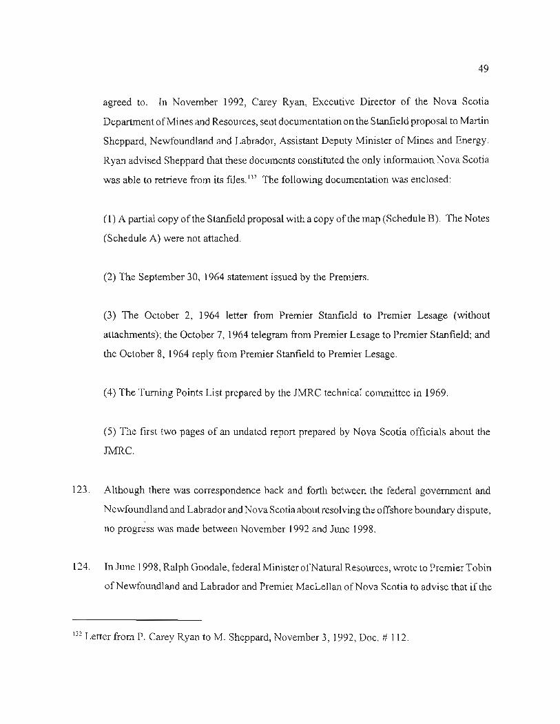
49
agreed to. In November 1992, Carey Ryan, Executive Director of the Nova Scotia
Departmentof MinesandResources,sentdocumentationon the Stanfie1dproposal to Martin
Sheppard, Newfoundland and Labrador,Assistant Deputy Minister of Mines and Energy.
Ryan advised Sheppardthat these documentsconstitutedthe only informationNova Scotia
was able to retrieve from its files.132The following documentation was enclosed:
(1) A partial copy of the Stanfield proposal with a copy of the map (Schedule B). The Notes
(Schedule A) were not attached.
(2) The September 30, 1964 statement issued by the Premiers.
(3) The October 2, 1964 letter from Premier Stanfield to Premier Lesage (without
attachments); the October 7, 1964telegram from PremierLesage to Premier Stanfield; and
the October 8, 1964reply from Premier Stanfieldto Premier Lesage.
(4) The Turning Points List prepared by the JMRC technical committee in 1969.
(5) The first two pages of an undated report prepared by Nova Scotia officials about the
JMRC.
123. Although there was correspondenceback and forth between the federal government and
NewfoundlandandLabradorandNova Scotiaaboutresolvingthe offshoreboundarydispute,--
no progress was made betweenNovember 1992and June 1998.
124. In June 1998, Ralph Goodale, federal Minister of Natural Resources, wrote to Premier Tobin
of Newfoundland and Labrador and Premier MacLellan of Nova Scotia to advise that if the
132 Letter from P. Carey Ryan to M. Sheppard, November 3, 1992, Doc. # 112.

50
two provinces could not reach an agreement acceptable to the federal government by August
31, 1998, he would exercise his authority under the implementing legislation and refer the
matter to arbitration.133
125. In August 1998, Premiers Tobin and MacLellan announced they had agreed to resolve the
issue by arbitration.134
126. On May 31, 2000, Minister Goodale issued the Terms of Reference for the arbitration.135
133Letter from R. Goodale, federal Minister ofEMR, to Provincial Premiers (June 16, 1998), Doc.# 113.
134 N&L and NS News Releases (August 6, 1998), Doc. # 114.
135 Letter from R. Goodale, federal Minister of EMR, to Provincial Premiers (May 31, 2000), Doc.# 115.


