
Scale and distance tables
Julie Beaumont

Work out dimensions from a scale drawing Work out distance using a scale on a map Take part in a scale measurement quiz
Leaners will be able to
If you are planning a journey you may need to use a road map to work out the distance you will travel. The scale of the map will be given, so that you can take measurements and convert them into distances.
(Remember that, because roads twist and turn, the answers that you get will be estimates rather than accurate figures.)
Why?
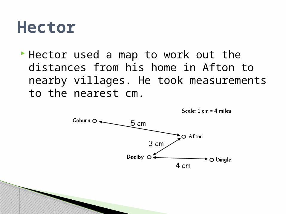
Hector used a map to work out the distances from his home in Afton to nearby villages. He took measurements to the nearest cm.
Hector
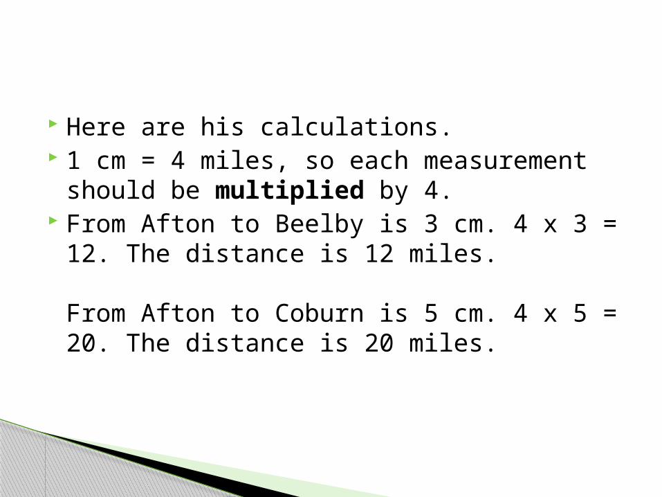
Here are his calculations. 1 cm = 4 miles, so each measurement
should be multiplied by 4. From Afton to Beelby is 3 cm. 4 x 3 = 12.
The distance is 12 miles.
From Afton to Coburn is 5 cm. 4 x 5 = 20. The distance is 20 miles.
Some journeys will take you through other villages on the way. For example if you want to go from Afton to Dingle you will have to pass through Beelby.
To find out how long the journey is you need to add the distance from Afton to Beelby (3cm) to the distance between Beelby and Dingle (4cm).
So the journey is 3 cm + 4 cm which is a total of 7cm.
From Afton to Dingle is 7cm.4 x 7 = 28 miles. The distance is 28 miles.
Read the handout and then complete the two worksheets provided.
Be prepared for a class quiz to follow!
Handout
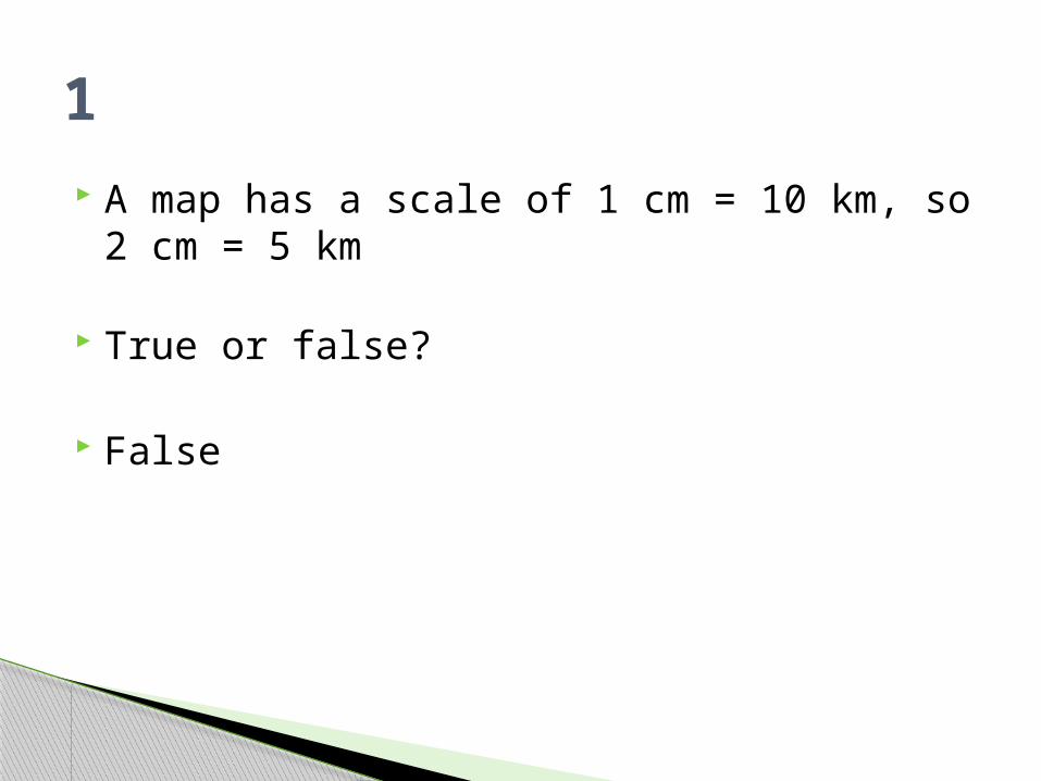
A map has a scale of 1 cm = 10 km, so 2 cm = 5 km
True or false?
False
1

The distance between two towns on a map is 10 cm. The scale is 1 cm = 2 miles, so the towns are 20 miles apart.
True or false?
True
2
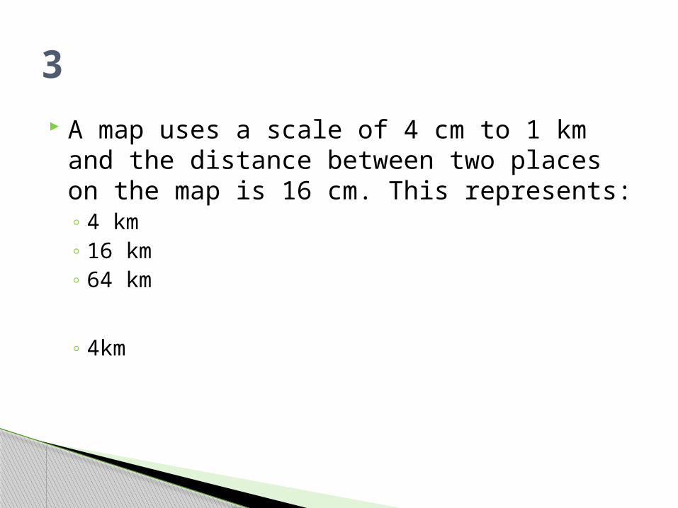
A map uses a scale of 4 cm to 1 km and the distance between two places on the map is 16 cm. This represents:◦ 4 km ◦ 16 km ◦ 64 km
◦ 4km
3
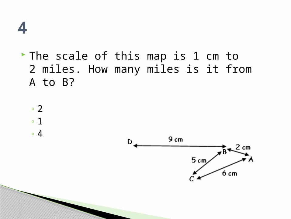
The scale of this map is 1 cm to 2 miles. How many miles is it from A to B?
◦ 2 ◦ 1 ◦ 4
4

The scale of this map is 1 cm to 5 km. How many km is it from B to C?
◦ 25 km◦ 1km
◦ 25km
5
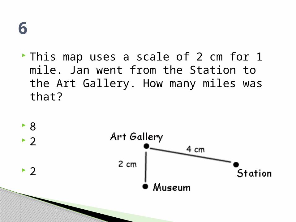
This map uses a scale of 2 cm for 1 mile. Jan went from the Station to the Art Gallery. How many miles was that?
8 2
2
6

3 cm represents 1 km on this map. Dan travelled from D to B; how far was that?
27 km 9 km 3 km
3km
7
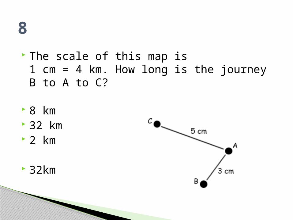
The scale of this map is 1 cm = 4 km. How long is the journey B to A to C?
8 km 32 km 2 km
32km
8
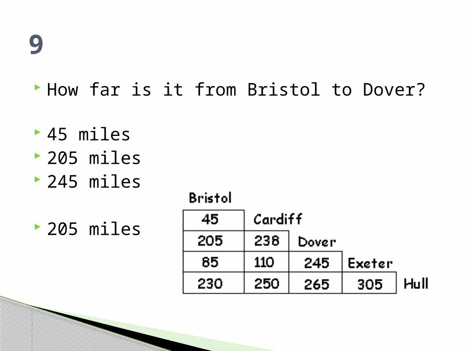
How far is it from Bristol to Dover?
45 miles 205 miles 245 miles
205 miles
9
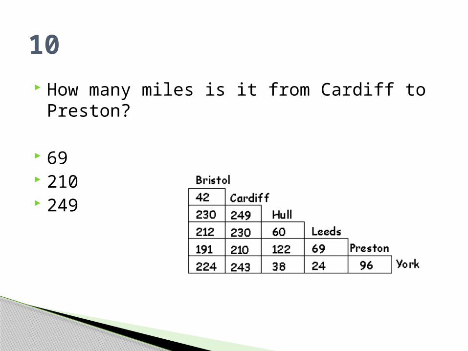
How many miles is it from Cardiff to Preston?
69 210 249
10

Val cycled from C to A , then on to B. How far was that?
4 km 8 km 32 km
32km
11
Jo used a map with a scale of 1 cm to 10 km to plan his trip. The first stage was 13 cm and the next was 17cm. So he travelled:
3 km 30km 300km
300km
12

The distance from Cardiff to Hull, then on to Leeds is 309 miles.
True or false? True
13

A return trip between Leeds and York would be:
24 miles 48 miles 96 miles
48 miles
14

Log into moodle and follow the Maps and Scale link with the FS maths course to practise skills in map reading and scale
Moodle


