
D. IVANOV ET AL.
187
Late Miocene Palaeoclimate and Ecosystem Dynamics
in Southwestern Bulgaria − A Study Based on Pollen
Data from the Gotse-Delchev Basin
DIMITER IVANOV1, TORSTEN UTESCHER2, A. RAHMAN ASHRAF3,VOLKER MOSBRUGGER4, VLADIMIR BOZUKOV1, NADEZHDA DJORGOVA1 &
EVGENIA SLAVOMIROVA1
1 Institute of Botany, Bulgarian Academy of Sciences, Acad. G. Bonchev Str., Bl. 23, BG-1113 Sofi a, Bulgaria
(E-mail: [email protected])2 Steinmann Institute, Bonn University, Nußallee 8, D-53115 Bonn, Germany
3 Institute for Geosciences, Tübingen University, Sigwartstr. 10, D-72076 Tübingen, Germany
4 Senckenberg Research Institute and Natural History Museum, Senckenberganlage 25, D-60325 Frankfurt, Germany
Received 30 April 2010; revised typescripts received 21 September 2010 & 08 December 2010; accepted 16 December 2011
Abstract: A profi le 63 m thick in the Late Miocene in the Gotse-Dechev Basin (SW Bulgaria) was sampled for pollen analysis in the Kanina opencast mine. Th e exposed sequence comprises a basal unit with brown coal-clay cycles and clayey/siliciclastic cover layers partly representing a lacustrine facies. A total of 60 pollen samples were analysed, but quantitative data are confi ned to 30 polleniferous samples.
Th e palynological analysis carried out provides data about the composition and structure of the fossil vegetation. Th e main vegetation type was a mixed mesophytic forest dominated by Carya, Fagus, Betula, Quercus, and Ulmus. Accessory elements included Magnolia, Corylopsis, Liquidambar, Eucommia, Zelkova, Ulmus, Pterocarya, Juglans, Engelhardia, Platycarya, Symplocos, Araliaceae, Vitaceae, Hedera, Cornus, and Ilex. Mid- and high-altitude vegetation elements Tsuga, Abies, Keteleeria, Cathaya, Picea, Cedrus are also present. Swamp vegetation with high proportion of Alnus, and minor percentages of Taxodiaceae, Cyrillaceae, Myrica, Planera, some Poaceae, Cyperaceae, and some ferns also existed.
Species of Platanus, Alnus, Pterocarya, Salix, Staphylea, and Liquidambar played important roles in the riparian vegetation. Th e aquatic vegetation consists of Butomus, Potamogeton, Menyanthes, Sparganium, Typha and Cyperaceae. Herbaceous palaeocoenoses had a limited distribution.
Th e climatic data reconstructed by the Coexistence Approach indicate mean annual temperatures of ca. 15.6–17.1°C. For mean annual precipitation intervals from 1096 to 1347 mm are most common. Th e narrowest coexistence intervals for the mean of the coldest month are 5 to 7.5°C. Summer temperatures were mainly between 24.7 and 26.4°C. Th e curve obtained for the means of summer temperatures illustrates some cyclic changes, partly also observed for other temperature parameters. Th e dynamics of the reconstructed data indicate that the climatic changes were probably cyclical. However, the presence of several unconformities in the sampled section does not allow an unambiguous interpretation of these data.
Key Words: Late Miocene, Bulgaria, Southeast Europe, palynology, vegetation, climate, Coexistence Approach
Güneybatı Bulgaristan Geç Miyosen Paleoiklimi ve Ekosistem
Dinamikleri – Gotse-Delchev Havzasından Polen Verilerine Dayalı Bir Çalışma
Özet: Gotse-Dechev Havzası (GB Bulgaristan) Geç Miyosen’indeki 63 m kalınlığında bir profil, Kanina açık maden ocağından polen analizi için örneklenmiştir. Yüzeyleyen istif, kahverengi kömür-kil devirselliğiyle bir temel birimi ve gölsel fasiyesi kısmen temsil eden killi/silis kırıntılı örtü katmanlarını kapsamaktadır. Toplam 60 polen örneği analiz edilmiş, fakat sayısal veriler 30 polence zengin örneklerle sınırlı kalmıştır.
Gerçekleştirilen palinolojik analizler fosil bitki örtüsünün kompozisyon ve yapısı hakkında veriler sağlamaktadır. Temel bitki örtüsü tipi, başlıca Carya, Fagus, Betula, Quercus ve Ulmus’tan oluşan karışık bir ormandır. Magnolia, Corylopsis, Liquidambar, Eucommia, Zelkova, Ulmus, Pterocarya, Juglans, Engelhardia, Platycarya, Symplocos, Araliaceae, Vitaceae, Hedera, Cornus ve Ilex içeren ikincil elementler ile orta ve yüksek rakımlarda Tsuga, Abies, Keteleeria, Cathaya, Picea, Cedrus bitki örtüsü elementleri de bulunmaktadır. Alnus’un yüksek oranı ve Taxodiaceae, Cyrillaceae, Myrica,
Planera’nın düşük yüzdeleri, birkaç Poaceae, Cyperaceae’li bataklık bitki örtüsü ve birkaç eğrelti de bulunmaktadır.
Turkish Journal of Earth Sciences (Turkish J. Earth Sci.), Vol. 21, 2012, pp. 187–211. Copyright ©TÜBİTAK
doi:10.3906/yer-1004-45 First published online 16 December 2010

PALYNOLOGY OF LATE MIOCENE IN BULGARIA
188
Introduction
Th e Late Miocene represents a time-span of remarkable climatic and environmental changes on both global and regional scales. A warm phase in the middle Miocene (MMCO) was followed by a period with declining temperatures, as evident from the analysis of stable isotopes (e.g., Zachos et al. 2001). Th e opening of the Drake Passage, appearance of the circum polar current in the Southern Hemisphere, and intensifi ed Antarctic glaciations, as well as the onset of Northern Hemisphere glaciations infl uenced the Late Miocene climate system, and led to a response of terrestrial ecosystems.
In the Balkan Peninsula the Late Miocene was characterized by large-scale palaeogeographic reorganizations that led to the appearance fresh water lakes. All these changes infl uenced the distribution of terrestrial vegetation, taxonomic composition of the fl ora, and appearance or disappearance of genera and species. Th e territory of Bulgaria, with its numerous Late Miocene freshwater basins, appears as a key region to understand the Neogene evolution of this link between Central and Eastern Europe and Asia Minor (Rögl 1998; Meulenkamp & Sissingh 2003), for it was the migration pathway and exchange route for many plant and animal species.
Recent palynological studies on the Neogene of Bulgaria elucidate the evolution of vegetation and climate (e.g., Ivanov 1995, 2003, 2010; Ivanov et al. 2002, 2007a, b, c; Hristova & Ivanov 2009; Utescher et al. 2009, etc).Th e present paper provides an analysis of Late Miocene vegetation/climate evolution based on the interpretation of palynological data using quantitative methods. Th e palynomorph assemblages
studied originate from the Gotse-Delchev Basin in
southwest Bulgaria.
Geological Settings
Th e Gotse-Delchev Basin is located in southwestern
Bulgaria, in the valley of the Mesta River (Figure
1). Th e basin margins coincide with those of the
Gotse-Delchev valley and are bounded by the Pirin
Mountains to the northwest and west, the Rhodope
Mountains to the east and northeast, and the
mountains of Slavyanka and Falakro (Bald Mountain)
to the south. Th e basin is about 22 km long, ca. 7
km wide, and has a total area of approximately 150
km2. Th e Neogene basin fi ll rests on Proterozoic
metamorphic rocks and a Palaeogene volcano-
sedimentary succession.
Neogene sediments of the Gotse-Delchev Basin
(Figure 1) have been previously studied (Bonchev
1923, 1960; Vankov 1923), but only in recent decades
have lithological and biostratigraphic subdivisions
based on detailed research been proposed (Vatsev
1980; Nenov et al. 1972; Pirumova & Vatsev 1979;
Temniskova-Topalova & Ognianova 1979; Bozhkov
et al. 1981; Temniskova-Topalova & Ognianova-
Rumenova 1983; Choleev & Baltakov 1989; Popov
1994; Ognianova-Rumenova & Yaneva 2001;
Yaneva et al. 2002). Th e fi rst detailed description
of the sediments from this basin were provided by
Nenov et al. (1972), who diff erentiated two informal
lithostratigraphic units – lower sandy-clayey
formation and upper sandy-conglomerate formation.
Vatsev (1980) introduced the now-accepted
lithostratigraphic subdivision, with the Valevitsa
Platanus, Alnus, Pterocarya, Salix, Staphyle ve Liquidambar türleri ırmak kenarı bitki örtüsünde önemli rol oynadılar.
Sucul bitki örtüsü Butomus, Potamogeton, Menyanthes, Sparganium, Typha ve Cyperaceae’den oluşmaktadır. Otsul fosil
topluluğu sınırlı dağılıma sahipti.
Birarada Olma Yaklaşımı yöntemiyle yeniden değerlendirilen iklimsel veriler 15.6–17.1°C yıllık ortalama sıcaklığı
belirtmektedir. Yıllık ortalama yağış aralığı için 1096–1347 mm en yaygın olanıdır. En soğuk ayın ortalaması için en
dar Birarada Olma Yaklaşım aralığı 5–7.5°C dir. Yaz sıcaklıkları esas olarak 24.7 ve 26.4°C arasındadır. Yaz sıcaklıkları
ortalamalarından elde edilmiş eğri, kısmen diğer sıcaklık parametrelerinde de gözlenmiş olan, birkaç devirsel değişikliği
resimlemektedir. Yeniden düzenlenen verilerin dinamiği, olasılıkla devirsel karaktere sahip olan iklimsel değişimleri
belirtmektedir. Ancak, örneklenen kesitte çok sayıda uyumsuzluğun varlığı, bu verilerin kesin bir yorumuna izin
vermemektedir.
Anahtar Sözcükler: Geç Miyosen, Bulgaristan, Güneydoğu Avrupa, palinoloji, bitki örtüsü, iklim, Birarada Olma
Yaklaşımı

D. IVANOV ET AL.
189
Gotse Delchev
Garmen
NSofia
Lazhnitsa
Koprivlen
Baldevo
OgnyanovoOgnyanovo
Mesta (N
estos) river
0 5 km
Ka-S1
A
W
E
NE
E SWMestaNestos( )
Gotse Delchev
500
400
300
200
100
0
NEW
A A A A A A
B 0 2 km
Valevitsa Formation Baldevo Formation
Nevrokop Formation pre-Neogene rocks
Pleistocene
location of the studied section - open cast mine Kanina
fault
Kornitsa
Figure 1. Th e Gotse-Delchev Basin. Schematic map (A) and section (B) (Redrawn aft er Vatsev 1980).
and Baldevo formations corresponding to the lower
sand-clay formation, and the Nevrokop Formation
corresponding to the upper sandy-conglomerate
formation. Later Vatsev & Petkova (1996) introduced
an additional lithostratigraphic unit, the Srednenska
Formation. Th us, the sediments of the Gotse-Delchev
Basin are subdivided into the following four offi cial
lithostratigraphic units (from bottom to top):
Th e Valevitsa Formation was defi ned by Vatsev
(1980). It is characterized by alluvial and deltaic
sediments represented by irregular conglomerates,
sands, and sandstones up to 200 m thick.
Th e Baldevo Formation was introduced by Vatsev
(1980). It consists of silts, silty clays, and silty sands
exposed near the villages of Baldevo, Ognyanovo,
and Garmen (Figures 1 & 2). At the bottom of the
Formation is the main coal seam, ca. 5–6 m thick.
Th e total thickness of the formation varies from 40–
50 to 100–120 m (Popov 1994; Zagorchev 1995).
Th e Nevrokop Formation introduced by Vatsev
(1980), is represented by polymictic sands,
sandstones, and conglomerates, oft en cross-bedded,
up to 500–600 m thick. Th e sediments occur in the
western part of the basin.
Th e Srednenska Formation, defi ned by Vatsev &
Petkova (1996), is represented by breccias, breccia-
conglomerates, conglomerates, and sandstones,
attaining a thickness of 30–100 m.
Th e results obtained by Bozkov et al. (1981)
suggest that the Baldevo Formation thins out to the
west and south, where the Nevrokop Formation
directly rests upon the Valevitsa Formation and thus
may be regarded as one single formation. Popov
(1994) suggested that this formation should take the
name of the Nevrokop Formation (Zagorchev 1995).
Th e Valevitsa Formation should be considered as a
member of the Nevrokop Formation. Th ere is no
palaeontological evidence for the age of the Valevitsa
Member (Valevitsa Formation), but on the basis of
its stratigraphic position a Maeotian age has been
assigned (Vatsev 1980). Fossil mammals and fl oral
remains indicate an Early to Middle Pontian age for
the sediments of the Baldevo Formation (Vatsev &
Petkova 1996). Th e analysis of diatoms suggested
a Pontian to Pliocene age for diatomaceous clays
and diatomites occurring in the upper part of the
formation (Temniskova-Topalova & Ognjanova-
Rumenova 1983, 1997; Temniskova-Topalova 1994).

PALYNOLOGY OF LATE MIOCENE IN BULGARIA
190
Detailed faunal studies carried out on the
Hadjidimovo-1 locality during the last decade
(Spassov & Ginsburg 1999; Spassov 2000, 2002;
Geraads et al. 2001, 2003, 2005; Kostopoulos et al.
2001; Hristova et al. 2002; Merceron et al. 2006)
provide new insight into the age of the sediments. Th e
taxonomic composition of the faunal complex shows
similarities with associations from several localities in
the Balkan-Iranian region and Northern Paratethys
yielding Hipparion fauna of the late Maeotian
(middle Turrolian) age (Spassov & Geraads 2004). In
particular, this complex corresponds to the boundary
of the MN11/12 zone, or even the beginning of MN12
(Spassov 2002; Spassov & Geraads 2004). i.e., the
accumulation of the Nevrokop Formation began in
the Maeotian and continued during the Pontian. In
view of the stratigraphic position of the Hadjidimovo
locality and spatial relationships with the Baldevo
Formation, the age of the latter may be defi ned as
latest Maeotian to Pontian. For upper levels with
diatomites a latest Pontian to early Pliocene age is
probable. On the basis of the stratigraphic position of
the Srednenska Formation Vatsev & Petkova (1996)
suggested a Pliocene age.
Th e evolution of the Gotse-Delchev Basin began
in the Maeotian with the deposition of coarse-grained
Figure 2. Gotse-Delchev Basin and open cast mine with the position of the studied profi le indicated.

D. IVANOV ET AL.
191
alluvial sediments belonging to the fi rst cycle of the
Nevrokop Formation. In the late Maeotian fl uviatile
sediments of a braided river system were deposited
(Spassov 2000; Yaneva et al. 2002; Tsankov et al.
2005). During this period the alluvial sediments of
the Nevrokop Formation with its rich mammal fauna
were deposited (MN 11-12 mammal zones: Spassov
2000; Tsankov et al. 2005). At the end of the Maeotian
and the beginning of the Pontian the sedimentary
facies changed. In the northeastern part of the basin
large swamps developed and the brown coal deposits
of the Baldevo Formation formed.
As a result of palaeogeographic changes and
fl ooding, the swamp environment was replaced
by a lake, and additional areas were fl ooded in
the western part of the basin. During this period
silty-clayey sediments of the Baldevo Formation
were deposited, characterized by frequent facies
changes. Around the villages of Baldevo, Garmen
and Ognyanovo diatomaceous clays and diatomite
was deposited. Th e accumulation of diatomite is
probably related to changes in the hydrology and the
temperature regime of the lake (Yaneva et al. 2002)
and took place in the late Pontian to early Pliocene
(Temniskova-Topalova & Ognianova-Rumenova
1983). Th e lake environment was later replaced by
alluvial sedimentation (cross-bedded sands and
sandstones). Sedimentation probably ended during
the Pleistocene with the deposition of coarse-grained
alluvial-fan deposits of the Srednenska Formation
(Vatsev & Petkova 1996).
Materials and Methods
Th e present study is based on the analysis of 60
samples from the Kanina open-cast mine near
the village of Ognjanovo, Gotse-Delchev District.
A measured section (Ka-S1, 63.00 m thick) was
sampled in detail in order to document sedimentary
structures and facies. Th e section runs through the
Baldevo Formation, exposed in the coal mine (Figure
2). Th e lithology of the section is shown in Figure
3. Th e section starts in the main brown coal seam,
attaining a thickness of ca. 4.2 m. Th e lignites are
partly massive or laminated and contain numerous
cuticles. Th in siliciclastic layers are intercalated at
regular intervals, getting coarser grained towards the
top of the brown coal (Figures 2 & 3). Th ese cycles of
brown coal-clay and silty-clay 1–1.5 m in thickness are
probably related to the dynamics of the hydrological
regime of the basin, refl ecting alternating paludal
and lacustrine facies conditions.
Th e interval from 4.2 to 45.0 m consists of stacks of
coarsening-upward cycles that can be interpreted as
fl oodplain deposits of a meandering river system. Th e
sequences are composed of laminated or bioturbated
clays, partly with very high organic content and with
plant cuticles, grading into silty clays, topped by
cross-bedded sandy partly gravel channels, partly
cross-bedded sands, and gravel containing drift
wood.
At 45 m a lacustrine environment occurs. Aft er
the deposition of an organic clay containing plant
cuticles, about 1 m thick, ca. 12 m of diatomites
and diatomitic clays were deposited, with a sandy
channel intercalated at 54.5 m. Th e section ends with
stacked fl uvial channel deposits. Th e geometry of
these sandy channels is well exposed in the open cast,
and the lack of fi ne-grained siliciclastic components
points to a shift of the fl uvial system into a braided-
river type. Th e thickness of the diatomites is highly
variable in the open cast. Locally the horizon has
been completely removed by the palaeoriver. Th e
diatomitic clays and diatomites contain a very rich,
diverse leaf fl ora.
Th e samples analysed were collected from the
section at various levels and processed to study
the pollen content. For palynology samples were
taken from every single layer, or at an average of
ca. 50 cm aft er homogenizing the sediment. Each
sample contained homogenized bulk material of a
single layer or 50 cm of sediment where lithology is
consistent, of ca. 10–20 cm where lithology changes
rapidly, or at ca. 1.0 m in sands and sandy clays. Th e
intervals from 21.0 to 23.5 m and 30.0 to 31.5 m were
not sampled because these parts of the profi le could
not be accessed in the open cast mine.
Th e samples were processed according to the
standard technique for disintegrating Cenozoic
sediments, which includes successive treatment by
hydrochloric acid (HCl), hydrofl uoric acid (HF),
potassium hydroxide (KOH), and heavy liquid
separation (ZnCl2) and were stored in glycerin.

PALYNOLOGY OF LATE MIOCENE IN BULGARIA
192
Fe-minerals
gravelsand, cross bedding
clay, C rich, bioturbation, leavesorg
silt
clay, fine laminar bedding
brown coal / clay contents
brown coal, roots, cuticles,siderite concretions, mollusks, wood.
clay, Fe concretions
0
5
10
15
20
25
30
35
40
45
50
55
60
Depth
(m
)
Lit
holo
gy
7,246
Tort
onia
nM
essin
ian
Ple
isto
cene
Neo
gen
e
1,806
Zancle
an
Pia
ce
nzia
n-G
ela
sian-
StandardChrono-
stratigraphy
Holocene
Lower
Middle
Upper
5,332
Pil
ocene
Epoch
Peri
od
Magneto
Zones
Pola
rity
11
10
8
9
7
6
5
3
4
2
1
0
Age
Ma
()
Pannonia
n
Kim
err
ian
Akts
chagyli
an
Dacia
nR
om
ania
n
3 6,
Pontian6,1P
ont-
ian
Palu
din
ian l
ayers
Chersonian
Maeotian
Sta
ge
5,3
Upper
Middle
Lower
Pannonia
nB
asin
Fore
carp
a-
thia
n B
asin
Euxin
ian
Basin
RegionalStages
2 588,
0 781,
0 13,
Quate
rnary
ATNTS2004Gradstein
et al. (2004)
Upper
Mio
cene
?
?
Figure 3. Lithological column of the studied section.

D. IVANOV ET AL.
193
Unfortunately, 5 samples were entirely devoid
of pollen, while 25 others contained pollen in low
concentrations (with fewer than 100 grains counted).
To minimize statistical errors and to avoid wrong
interpretations, we omitted these 25 pollen spectra
from our interpretation of the vegetation and
palaeoclimate. Th e 30 remaining samples contained
enough pollen/spore content to interpret vegetation
and climate evolution. On the basis of pollen/spore
counts of these 30 pollen spectra percentage pollen
diagrams were plotted (Figures 4 & 5) showing the
palynological record of the complete section. Th e
percentage of each palynomorph taxon identifi ed in
the pollen spectra was calculated with respect to the
total sum of arboreal (AP) and non-arboreal (NAP)
pollen (AP+NAP= 100%). Local elements (L), such
as spores and aquatic plants, were calculated on the
basis of the sum AP+NAP+L= 100%. Th e total pollen
sum for each sample is shown graphically in the
pollen diagram (Figure 5). In addition, a synthetic
pollen diagram was plotted (Suc 1984; Jiménez-
Moreno et al. 2005; Figure 6), in which pollen taxa
have been arranged in diff erent groups on the basis of
ecological criteria to clearly show temporal changes
in vegetation.
Tracing the changes in the percentage values of the
diff erent pollen curves revealed the distinct pollen
zones in the section studied. Diff erentiation of the
pollen zones is based on sediments with a specifi ed
fossil content or specifi c palaeontological characters
(characteristic pollen complexes, type and frequency
of palynomorphs), which distinguish them from the
neighbouring sediments (Gordon & Birks 1972). Th e
pollen zones presented for each core were regarded
as Local Pollen Zones (LPZ), indexed by letters and
digits. Numerical zonation of the pollen diagrams
was used as an auxiliary means for diff erentiation of
LPZs (Birks 1974; Birks & Birks 2006), with the help
of cluster analysis in grouping the palynological data
obtained. Th e mathematical calculations and cluster
analysis were carried out with the help of CONISS
soft ware (Grimm 1987).
To reconstruct quantitative palaeoclimatic
data we applied the Coexistence Approach (CA)
(Mosbrugger 1995; Mosbrugger & Utescher 1997),
a method based on climatic requirements of all
Nearest Living Relatives known for fossil fl ora. Th e
CA provides quantitative data for various climatic variables, and has been successfully applied to the Neogene microfl oral records (e.g., Ivanov et al. 2002, 2007a, b; Bruch et al. 2004; Syabryaj et al. 2007). Th e method was applied to a total of 30 samples, and 4 diff erent variables were calculated: mean annual temperature (MAT), temperature of the coldest month (CMT), temperature of the warmest month (WMT), and mean annual precipitation (MAP). In addition to the coexistence intervals the curve connecting interval means is shown. When there is more than one coexistence interval per sample, the mean of all intervals has been calculated. Curves based on means do not represent the ‘real’ values but express the overall trends of climatic change. Pross et al. (2000) outlined the signifi cance of the means of the CA intervals. Following these considerations, means were used to visualize climatic variability and evolution.
Palynological Subdivision
Local Pollen Zone GD-1 (Fagus-Carya-Betula): 1.55−15.10 m
Th is zone is characterized by the highest average content of Fagus, represented mainly by values from 8% to12%, with a maximum of 20.2% at 2.50 m, and Carya, represented mainly by values from 5% to 7%, occasionally higher (10.1%), or lower (2–3%). Th e pollen of Betula appears regularly with constant values (1 to 4%). Pinus diploxylon type is presented with values from 30 to 50%, while Pinus haploxylon type /Cathaya is less abundant (with a maximum of 20–22%), and tends to decrease in the upper part of the zone. Th e pollen of Tsuga is not represented in the lower part of the zone (main coal seam) but reaches up to 7–10% in the upper part. Local elements in that zone are represented by higher values, mainly due to the representatives of Laevigatosporites (Th elypteridaceae/Polypodiaceae) and Osmunda with maxima respectively of 54 and 70% (Figures 4 & 5).
Local Pollen Zone GD-2 (Cedrus-Pinus-Abies): 28.95−36.20 m
Th is zone is characterized by an increased average content of Cedrus, (6–11%, maximum of 17% at

PALYNOLOGY OF LATE MIOCENE IN BULGARIA
194
56.7
556.2
5
52.7
552.2
551.7
5
50.2
0
46.0
545.9
0
38.5
0
37.7
537.2
536.8
036.2
0
35.4
5
34.5
0
33.7
533.3
5
32.7
532.2
531.7
531.5
0
30.0
029.7
529.2
528.9
5
26.7
5
17.9
0
15.1
014.8
014.5
514.1
0
13.0
512.6
0
4.7
0
2.8
02.5
02.3
01.9
01.5
51.2
50.7
50.2
5
20
40
60
80
Pinus
dip
loxy
lon
20
Pinus
hap
loxy
lon/
Cat
haya
Abies
Picea
20
Ced
rus
Ketel
eeria Ts
uga
hete
roph
ylla
type
Tsug
a ca
nade
nsis
type
Tsug
a sp
.cf
. Pod
ocar
pus
Sequo
ia Ericac
eae
Betul
a Car
pinu
s be
tulu
s
Cor
ylus C
ornu
s Que
rcus
20
Fagus
Acer
Cas
tane
aU
lmus
Zelko
va Fraxi
nus Tilia
Cyr
illace
aePar
rotia Eucom
mia 2
0
Car
ya
Ptero
cary
aJu
glan
s Engel
hard
ia
Ree
vesi
aBux
usSym
ploc
osSap
otac
eae
Aralia
ceae
Anaca
rdia
ceae
Ole
acea
eC
eltis
05
10
15
20
25
30
35
40
45
50
55
Depth (m)
Lithology
Samplem()
Ka-S
1,
Kanin
a,G
ots
e-D
elc
hev
Basi
n
Zone
GD
-1
GD
-2
GD
-3
Fig
ure
4.
Per
cen
tage
sp
ore
s-p
oll
en d
iagr
am o
f th
e st
ud
ied
sec
tio
n K
a-S1
, Kan
ina,
Go
tse-
Del
chev
Bas
in.

D. IVANOV ET AL.
195
Taxo
diac
eae
Gly
ptos
trobu
s
Sciad
opity
s 20
40
Alnus
Nys
sa Myr
ica Sal
ixLi
quid
amba
r
Che
nopo
diac
eae
Poace
ae Aster
oide
ae
Cen
taur
ea
Artem
isia
Plant
ago
Car
yoph
ylla
ceae
Ros
acea
eTha
lictru
mApi
acea
eLo
nice
ra Lam
iace
ae
Dip
sace
aeC
yper
acea
e
Typh
a Sparg
aniu
m
20
40
60
Laev
igat
ospo
rites
20
40
60
80
Osm
unda
Polyp
odiu
m
Leio
trile
tes
Verru
cato
spor
ites
Echin
atis
poris
Cor
ruga
tosp
orite
s
Ret
itrile
tes 2
04
0
Botry
ococ
cus
Pedia
stru
m
Spiro
gyra 2
0
NAP
1000
2000
Po
llen
su
m
Ka-
S1, K
anin
a, G
ots
e-D
elch
ev b
asin
, co
nti
nued
0510
15
20
25
30
35
40
45
50
55
1,0
2,0
Tota
l sum
of s
quar
es
CO
NIS
SZ
one
GD
-1
GD
-2
GD
-3
Depth (m)
Fig
ure
5.
Per
cen
tage
sp
ore
s-p
oll
en d
iagr
am o
f th
e st
ud
ied
sec
tio
n K
a-S1
, Kan
ina,
Go
tse-
Del
chev
Bas
in. C
on
tin
uat
ion
.

PALYNOLOGY OF LATE MIOCENE IN BULGARIA
196
56.75
51.75
50.20
46.0545.90
38.50
37.7537.2536.80
36.20
35.45
34.50
33.7533.35
32.7532.2531.7531.50
30.0029.7529.2528.95
26.75
17.90
15.1014.8014.5514.10
13.0512.60
4.70
2.802.502.301.901.55
0.25
20 20 40 20 40 60 80 20 20
Sam
ple
m()
P. h
aplo
xylo
nan
d C
athay
a
0
5
10
15
20
25
30
35
40
45
50
55
Dep
th (
m)
Lit
holo
gy
Pola
rity
norm
al
rever
se
Mega-m
eso
therm
icel.
Meso
therm
ic e
lem
ents
(warm
tem
pera
te)
Pin
us
and P
inaceae
Meso
-mic
roth
erm
icel.
(mid
-alt
itude t
rees)
Mic
roth
erm
icele
ments
(hig
h-a
ltit
ude t
rees)
Xero
phit
es
Herb
s
Ste
ppe e
lem
ents
?
?
?
Ka-S , anina mine Gotse-Delchev Basin1 K ,
Figure 6.

D. IVANOV ET AL.
197
Figure 6. Synthetic pollen diagram. Pollen taxa have been arranged in diff erent groups on the basis of ecological criteria to clearly
manifest temporal changes in vegetation (acc. Suc 1984; Jiménez-Moreno et al. 2005).
- Mega-mesothermic elements: Taxodiaceae, Taxodium, Symplocos, Engelhardia, Platycarya, Myrica, Sapotaceae,
Distylium, Hamamelis, Corylopsis, Castanea-Castanopsis type, Cyrillaceae-Clethraceae, Reevesia, Th eaceae, Alangium,
Chloranthaceae, Parthenocissus, Araliaceae, Arecaceae and others;
- Pinus haploxylon type and Cathaya;
- Mesothermic elements (warm temperate): Quercus, Carya, Pterocarya, Carpinus betulus, Carpinus orientalis, Ostrya,
Parrotia, Eucommia, Juglans, Zelkova, Ulmus, Tilia, Acer, Liquidambar, Alnus, Salix, Populus, Rhus, Celtis, Platanus, Nyssa,
Ilex, Lonicera, Caprifoliaceae, Vitaceae, Fraxinus, Betula, Sequoia, Fagus, Hedera, Ilex, Tilia and others;
- Pinus and Pinaceae indet.;
- Microthermic elements (high-altitude trees): Tsuga, Cedrus, Sciadopitys; Abies, Picea, Keteleeria;
- Xerophites: Quercus ilex-coccifera type; Olea type (Oleaceae), Caesalpiniaceae, Pistacia, Rhus and others;
- Herbs: Poaceae, Chenopodiaceae, Asteroideae, Cichorioideae, Centaurea, Plantago, Brassicaceae, Lamiaceae, Valerianaceae,
Polygonaceae, Knautia (Dipsacaceae), Rosaceae, Malvaceae, Geraniaceae, Erodium, Caryophyllaceae and others;
- Steppe elements: (Artemisia, Ephedra).
35.45 and 36.20 m). Percentages of the Pinus pollen rise signifi cantly, and the P. diploxylon type reaches up to 65–70%. Meanwhile, the P. haploxylon type /Cathaya shows a slight tendency to decrease, and values of 5–6% are most common, occasionally up to 10–11%. Abies increases slightly – up to 2–3%, in contrast to the rest of profi le (1% or even single pollen grains). Tsuga, Betula, Carya, Ulmus, and Alnus have lower values. As a whole the mesothermic elements registered a slight decrease in their values in the pollen spectra of this zone (Figure 6). Spore plants are poorly presented with about 1% or less. Herbaceous plants (NAP) generally increased upwards and registered two maxima: 11.3% at 28.95 m and 4% at 35.45 m. An increased abundance of fresh water algae is characteristic for the upper part of the zone, mainly due to the increased proportion of Botryococcus (with a maximum of 32.3% at 33.35 m).
Local Pollen Zone GD-3 (Carya-Betula−Alnus): 36.80−51.75 m
In this zone Pinus dominated, and P. diploxylon type maintained a high average of about 55–65% (Figures 4 & 5). P. haploxylon type /Cathaya tends to increase in the lower part of the zone (up to 18.7%), followed by decrease towards the top. Carya pollen shows a percentage increase and ranges chiefl y between 3 and 4 % with a peak of 7.2%. Betula generally increases upwards to 2–4% but has values of 7.9% at 50.20 m. Pollen of Alnus increases from 1% (bottom) up to 3–10% and a maximum of 17.8% at 50.20 m. A general decrease was observed in the quantities
of Cedrus, Abies, Picea, Carya, and Fagus. Spore plants and herbs (NAP) are poorly represented. Th e green alga Botryococcus is represented by constant quantities of 3–8%.
Also present are deciduous broad-leaved trees such as Ulmus, Betula, and Juglans (Figures 4 & 5).
Th e dendrogram obtained from the cluster analysis confi rmed in general the distinct diff erentiation of the diff erent zones in the profi le (Figure 5). At the top of LPZ GD-2, there is greater similarity in the group of three pollen spectra to the cluster of LPZ GD-3. At the beginning of LPZ GD-1 part of the pollen spectra from a coal-bearing layer is very clearly separated. Th is is due to the specifi city of pollen complexes and high abundance of spore plants. Th e separation of this cluster can be considered as an indication of the subdivision of a separate pollen zone, but at this stage of our knowledge, such subdivision is not safe enough due to the small number of samples and the presence of barren samples or those with low pollen content.
Flora, Vegetation and Climate Analysis
Late Miocene Vegetation in the Gotse-Delchev Area
Material from the Gotse-Delchev Basin had already been the subject of palynological pilot studies by Ivanov (1995) and Ivanov & Slavomirova (2000). Based on the analysis of 11 samples from the Kanina open-cast coal mine and outcrops near the villages of Lazhnitsa and Kornitsa, the authors identifi ed 88 palynomorph taxa. In this study 18 spore and pollen taxa have also been identifi ed, so the total pollen
PALYNOLOGY OF LATE MIOCENE IN BULGARIA
198
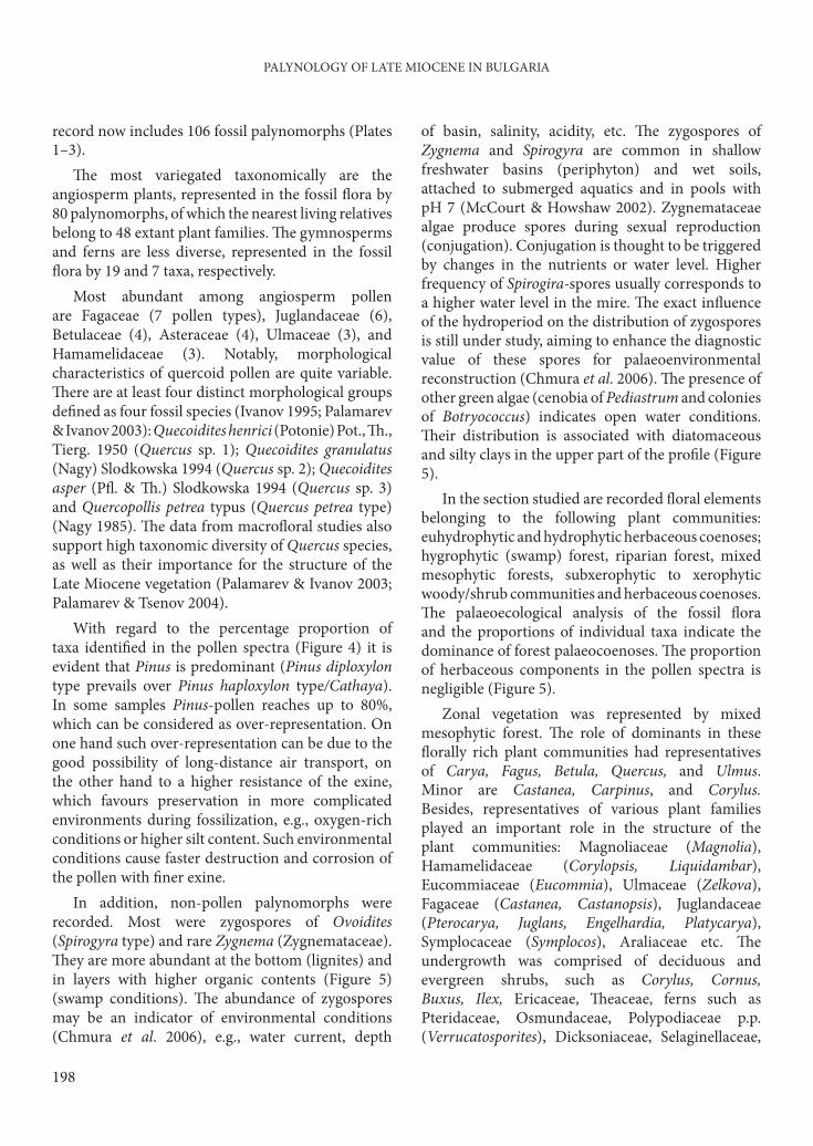
record now includes 106 fossil palynomorphs (Plates 1–3).
Th e most variegated taxonomically are the angiosperm plants, represented in the fossil fl ora by 80 palynomorphs, of which the nearest living relatives belong to 48 extant plant families. Th e gymnosperms and ferns are less diverse, represented in the fossil fl ora by 19 and 7 taxa, respectively.
Most abundant among angiosperm pollen are Fagaceae (7 pollen types), Juglandaceae (6), Betulaceae (4), Asteraceae (4), Ulmaceae (3), and Hamamelidaceae (3). Notably, morphological characteristics of quercoid pollen are quite variable. Th ere are at least four distinct morphological groups defi ned as four fossil species (Ivanov 1995; Palamarev & Ivanov 2003): Quecoidites henrici (Potonie) Pot., Th ., Tierg. 1950 (Quercus sp. 1); Quecoidites granulatus (Nagy) Slodkowska 1994 (Quercus sp. 2); Quecoidites asper (Pfl . & Th .) Slodkowska 1994 (Quercus sp. 3) and Quercopollis petrea typus (Quercus petrea type) (Nagy 1985). Th e data from macrofl oral studies also support high taxonomic diversity of Quercus species, as well as their importance for the structure of the Late Miocene vegetation (Palamarev & Ivanov 2003; Palamarev & Tsenov 2004).
With regard to the percentage proportion of taxa identifi ed in the pollen spectra (Figure 4) it is evident that Pinus is predominant (Pinus diploxylon type prevails over Pinus haploxylon type/Cathaya). In some samples Pinus-pollen reaches up to 80%, which can be considered as over-representation. On one hand such over-representation can be due to the good possibility of long-distance air transport, on the other hand to a higher resistance of the exine, which favours preservation in more complicated environments during fossilization, e.g., oxygen-rich conditions or higher silt content. Such environmental conditions cause faster destruction and corrosion of the pollen with fi ner exine.
In addition, non-pollen palynomorphs were recorded. Most were zygospores of Ovoidites (Spirogyra type) and rare Zygnema (Zygnemataceae). Th ey are more abundant at the bottom (lignites) and in layers with higher organic contents (Figure 5) (swamp conditions). Th e abundance of zygospores may be an indicator of environmental conditions (Chmura et al. 2006), e.g., water current, depth
of basin, salinity, acidity, etc. Th e zygospores of Zygnema and Spirogyra are common in shallow freshwater basins (periphyton) and wet soils, attached to submerged aquatics and in pools with pH 7 (McCourt & Howshaw 2002). Zygnemataceae algae produce spores during sexual reproduction (conjugation). Conjugation is thought to be triggered by changes in the nutrients or water level. Higher frequency of Spirogira-spores usually corresponds to a higher water level in the mire. Th e exact infl uence of the hydroperiod on the distribution of zygospores is still under study, aiming to enhance the diagnostic value of these spores for palaeoenvironmental reconstruction (Chmura et al. 2006). Th e presence of other green algae (cenobia of Pediastrum and colonies of Botryococcus) indicates open water conditions. Th eir distribution is associated with diatomaceous and silty clays in the upper part of the profi le (Figure 5).
In the section studied are recorded fl oral elements belonging to the following plant communities: euhydrophytic and hydrophytic herbaceous coenoses; hygrophytic (swamp) forest, riparian forest, mixed mesophytic forests, subxerophytic to xerophytic woody/shrub communities and herbaceous coenoses. Th e palaeoecological analysis of the fossil fl ora and the proportions of individual taxa indicate the dominance of forest palaeocoenoses. Th e proportion of herbaceous components in the pollen spectra is negligible (Figure 5).
Zonal vegetation was represented by mixed mesophytic forest. Th e role of dominants in these fl orally rich plant communities had representatives of Carya, Fagus, Betula, Quercus, and Ulmus. Minor are Castanea, Carpinus, and Corylus. Besides, representatives of various plant families played an important role in the structure of the plant communities: Magnoliaceae (Magnolia), Hamamelidaceae (Corylopsis, Liquidambar), Eucommiaceae (Eucommia), Ulmaceae (Zelkova), Fagaceae (Castanea, Castanopsis), Juglandaceae (Pterocarya, Juglans, Engelhardia, Platycarya), Symplocaceae (Symplocos), Araliaceae etc. Th e undergrowth was comprised of deciduous and evergreen shrubs, such as Corylus, Cornus, Buxus, Ilex, Ericaceae, Th eaceae, ferns such as Pteridaceae, Osmundaceae, Polypodiaceae p.p. (Verrucatosporites), Dicksoniaceae, Selaginellaceae,

D. IVANOV ET AL.
199
and liana forms of Vitaceae (incl. Parthenocissus) and Hedera.
Th e palynological data obtained indicate that the vegetation was vertically diff erentiated. Mid- and/or high-altitude forests were spread on the slopes of the surrounding mountains. Th ey constituted a mixed coniferous forest vegetation belt. Th e dominant species in these forests were species of genera Picea, Tsuga, Abies, Keteleeria, Cathaya, Cedrus, cf. Podocarpus and Juniperus. Some fl owering plants, such as Corylus, Betula, Fagus, Carpinus, and Pterocarya were also part of the above-mentioned plant communities.
In the lower peripheral parts of the basin swamp forests (hydrophytic forest palaeocoenoses) developed in marshy areas fl ooded during all or most of the vegetative period. Dominant in these specifi c communities were species of Alnus, while Taxodiaceae (Glyptostrobus, Taxodium) had a limited distribution and were less important. Accompanying species were representatives of Cyrillaceae, Myrica, Planera, Poaceae, and Cyperaceae. Th e formation of this community type was strongly infl uenced by palaeogeographic changes and the development of swampy environments in periods with low water level in the basin. When swamp habitats were most widespread, hydrophytic forest palaeocoenoses were the main source of organic materials in forming peat.
Th e riparian forests, containing species of the genera Platanus, Carya, Alnus, Ulmus, Ostrya, Pterocarya, Juglans, Salix, Staphylea, and Liquidambar, formed communities in relatively restricted areas, mostly close to lakes and along the river systems. Th eir distribution depended on the dynamics of the river system in the study area (Choleev & Baltakov 1989). Th is type of plant community was closely linked to the swamp forests, as their components are mutually penetrated and mixed.
In open water areas of the palaeobasin, communities of aquatic plants were developed (euhydrophytic and hydrophytic herbaceous coenoses), which are represented in pollen spectra by Butomus, Potamogeton, Menyanthes, Nuphar, Sparganium, Typha, and Cyperaceae. Typical hydrophytes like Brassenia, Euryale, Aldrovanda, Nuphar, Alisma. and Proserpinaca and helophyte species of Scirpus, Dulichium, Diclodocarya, and
Decodon identifi ed as fruits/seeds found in the main coal seam have to be included here (Palamarev et al. 2002). In close interaction with the communities of the marsh and aquatic vegetation were representatives of the Polypodiaceae/Th elipteridaceae and Osmunda, as their distribution was related directly to changes in the basin water regime. Th e algal fl ora of the basin consists of Botryococcus, Pediastrum, Spirogyra, and Zygnema, recorded in the pollen spectra (see above).
Herbaceous plant communities had a very restricted distribution, obvious from their low percentages in the spectra (Figure5). Th ey included representatives of the Apiaceae, Lamiaceae, Caryophyllaceae, Plantago, Dipsaceae, Poaceae, Asteroideae, Cichorioideae, Artemisia, Centaurea, and Chenopodiaceae. Semixerophytes/xerophytes (e.g, Celtis, Pistacia, Chenopodiaceae, Artemisia) were also present in the fossil fl ora. Th ey indicate the existence of open sandy and/or rocky shore facies and slopes near the rivers and lake, which were suitable habitats for them. Palaeocarpological data also indicate the presence of drier habitats occupied by Ostrya and Rubus (Palamarev et al. 2002).
Vegetation Evolution in the Kanina Profi le
Information about the vegetation during the formation of the main brown coal seam from our section is limited because only some of the samples contain enough spores and pollen (Figures 4 & 5). Th ese brown coals have a characteristically high importance of spore plants. Laevigatosporites and Osmunda have the highest percentages (54 and 70%, respectively) during the whole period studied. Apparently they were also important in forming peat. A specifi c distribution pattern of these ferns is expressed by alternation of both types of spores with high percentages: trilete Osmunda spores corresponding to low quantities of monolete Laevigatosporites, and vice versa. Th is relationship was also observed in the interval from 14.10 to 15.10 m (Figure 5), when change of sedimentation took place and organic-rich clays, fi ne laminated clays, a thin coal layer (ca. 20 cm), and laminated clays were deposited, i.e. a change in environment from lacustrine to swamp and back. Both pterodophytes grow in wet and swampy places under diff erent edaphic conditions and inundation regimes, and

PALYNOLOGY OF LATE MIOCENE IN BULGARIA
200
their diff erent ecology is refl ected by these changes. Th e changing proportions of these pteridophyte spores resemble the cyclic change in peat-bog vegetation described from the Pontian sediments of the Staniantsi Basin, W. Bulgaria (Utescher et al. 2009). Th e main components of the peat-bog vegetation were representatives of Laevigatosporites and Osmunda, showing similar alternation.
In the middle part of the section studied (LPZ GD-2) vegetation change was recorded, connected with decreasing percentages (of representatives) of the following genera: Engelhardia, Carya, Fagus, Ulmus, and Betula. Th e group of mega-mesothermic components is also less prominent (Figure 6); the group of micro-mesothermic components increases (altitudinal trees). Pollen of Cedrus and Abies are more abundant. A slight increase in the percentages of the non-arboreal pollen (NAP) was recorded in this part of the profi le. Th ese data indicate vegetation response to slight changes in environmental conditions, probably expressed by changes in precipitation.
In the upper part of the profi le KaS1 (LPZ GD-3) an opposite trend was observed – a decreasing proportion of components of the altitudinal coniferous forests (Cedrus and Abies), and increased amounts of Carya and Betula, as Fagus tends to reduce its percentage in the pollen spectra. Th e mega-mesothermic fl oral elements remained scarce. An increase of warm temperate components occurred, with cool-temperate ones simultaneously decreasing.
Climate Reconstruction
Th e climatic data calculated for 30 palynomorph samples from section Ka-S1 are shown in Figure 7, where they are plotted together with the lithological profi le. As shown by the analysis, microfl oras provide well defi ned coexistence intervals in almost all samples for the temperature variables and mean annual precipitation. Less precise data and unspecifi c coexistence intervals were obtained for only a few pollen spectra with low taxonomic resolution (Figure 7).
Th e contemporary climate in the Gotse-Delchev valley (SW Bulgaria) is characterized by the following parameters: mean annual temperature (MAT) 11.4°C (11.0°C), temperature of the coldest month
(CMT) –0.2°C (–0.2°C), temperature of the warmest month (WMT) 21.7°C (21.2°C), and mean annual precipitation (MAP) 695 mm, according to data from the meteorological station at Gotse Delchev, 511 m above sea level (Stringmeteo 2006–2009a, b).
Data obtained from the studied sections Ka-S1 (Figure 7) illustrate the dynamics of climatic conditions during sedimentation. Cases of non-specifi c coexistence intervals up to a range of about 8–9°C for temperature and over 1000 mm of precipitation are relatively rare, and only for some of the analyzed microfl oras. One of the explanations for their occurrence is poor taxonomic composition of the fl ora and/or insuffi cient pollen content registered in these spectra. Th e wider CA-intervals occur mainly in coal-bearing sediments and probably are associated with the preservation potential of fossil palynomorphs. Th us climatic changes during the formation of the brown coal cannot be excluded as a reason for the fl oral changes observed.
CA-intervals for mean annual temperature most frequently range between 15.6 (15.7) and 17.1°C (Figure 7). Th ese are both the highest and the most precise values obtained for this parameter, with the smallest width of coexistence range. Wider intervals obtained for mean annual temperatures range from 11.6–17.1°C to 18.4°C. Single cases provide lower temperatures (e.g., 13.6–15.8°C at 42.1 m) or non-specifi c intervals (e.g., 4.4–17.1°C at 13.05 m).
Th e calculated values for the mean temperature of the coldest month were mainly in a relatively narrow range of 5 to 7.5°C (Figure 7). Th e upper limit of this climatic parameter is constant and usually not more than 7.5°C, with the exception of coal samples and layers with coal-bearing sediments, where wider CA-intervals result. Th e lower limit of the winter temperatures (CMT) shows a greater variability than the upper. As mentioned above, in most cases the lower limits of the CA intervals are 5°C, but in some cases 3.8°C or 0.6–0.9°C are obtained. Exceptions, with a lower limit at –0.3°C, could be regarded as the most unusual (with the greatest width) coexistence intervals.
Th e most common coexistence intervals for the temperature of the warmest month range from 24.7 to 26.4°C and from 24.7 to 26.8°C, respectively (Figure 7). Wider CA-intervals were again obtained for

D. IVANOV ET AL.
201
0102030405060
510
1520
Depth (m)
Lithology
MA
T[°
C]
CM
T [
°C
]W
MT
[°C
]M
AP
[m
m]
Ka-S
,anin
a m
ine
Gots
e-D
elc
hev
Basi
n1
K,
1520
2530
400
1000
1600
-50
515
10P
oll
en
Zone
GD
-1
GD
-2
GD
-3
Fig
ure
7.
Dyn
amic
s o
f m
ain
cli
mat
e p
aram
eter
s: m
ean
an
nu
al t
emp
erat
ure
(M
AT
), t
emp
erat
ure
of
the
cold
est
mo
nth
(C
MT
), t
emp
erat
ure
of
the
war
mes
t m
on
th (
WM
T),
mea
n a
nn
ual
pre
cip
itat
ion
(M
AP
). I
n a
dd
itio
n t
o t
he
coex
iste
nce
inte
rval
s th
e cu
rve
lin
kin
g th
eir
mid
dle
val
ues
is s
ho
wn
. Ver
tica
l do
tted
lin
es in
dic
ate
rece
nt
valu
es
of
clim
ate
par
amet
ers.

PALYNOLOGY OF LATE MIOCENE IN BULGARIA
202
samples from the main coal seam and for the interval with organic-rich clays and brown coals (14.10–15.10 m). Quantitative data obtained for the values of summer temperatures may characteristically indicate that they show considerable variability, especially with respect to the estimated lower limit of the CA intervals. In addition to the above-mentioned values of the WMTs, intervals with lower limits at 19.3°C, 20.2°C, 21.7°C, or 23.6°C frequently occur. Such high variability of summer temperatures is rarely observed in palaeoclimatic reconstruction (e.g., Utescher et al. 2009). As usual, this climate parameter is one of the most constant. Probably palaeogeography and local environment was a prerequisite for specifi c climatic conditions in the Gotse-Delchev Basin and greater dynamics of the WMT. Th e curve connecting CA interval means of summer temperatures (WMT) displays cyclicity in the dynamics of temperature (Figure 7). Th ese cycles were also observed in both the other temperature records (MAT and CMT), but are not so well expressed.
Th e results for mean annual precipitation recorded show signifi cant variability. Th e narrowest CA-intervals for MAP range from 1096 to 1347 mm. Among wider intervals of 823–1347 mm they occur most frequently in the profi le studied. Also non-specifi c coexistence intervals were obtained, with a width exceeding 1000 mm, for example 422–1520 mm and 471–1520 mm. Th ese wide coexistence intervals occur in the brown coals (Figure 7).
Th e dynamics of the climate parameters in the profi le studied show changes in climatic conditions in the region of the Gotse-Delchev Basin that are probably cyclical in nature, but they cannot be confi rmed with certainty because of interruptions in the pollen record: e.g., the absence of pollen (or their scarcity) in part of the coal-bearing or sandy sediments is due to taphonomic reasons. However, the main trends in climate dynamics can be drawn with great confi dence.
Data from the basal part of the profi le (Figure 7: LPZ GD-1) point to the existence of a variable climate, with signifi cant variations in temperature and precipitation. A climatic cycle is present at the depth interval from 1.55 to 2.8 m, where a change of the peat bog vegetation was observed: e.g., reconstructed climatic parameters indicate warm
and humid climate conditions for depth level 1.9 m, slightly cooler and drier conditions between 2.3 and 2.5 m (decrease of the lower limits of CA intervals causing lower means of all climatic parameters studied), and a return to a warm and humid climatic phase at depth level 2.8 m. Such cyclic changes and alternations of warm and humid with cool and dry climatic phases was observed between 12.6 and 15.1 m in the section, where alternations of brown coal and clay occur. Th ese cycles have a sediment thickness of around 1.0–1.3 m and probably were forced by precession, similar to the cycles described from a Pontian paludal to lacustrine sequence in the Staniantsi Basin, W Bulgaria (Utescher et al. 2009).
Aft er these fl uctuations and instability a period of warm and humid climatic conditions followed (Figure 7: LPZ GD-2), with only one deviation when the temperature decreased at 33.35–34.5 m followed by a warmer climate. Subsequent cooling of the climate, not connected to a signifi cant decline in rainfall, was established at the beginning of LPZ GD-3 (Figure 7). Th e cooling is best expressed by the curve showing means of summer temperatures (WMT) and includes pollen fl ora in the range from 37.75 to 45.9 m. Th is colder period ended with the restoration of a warm and humid climate.
Conclusion
Th e palynological analysis carried out on brown coal and the sediments above the coal horizon exposed in the open-pit mine provides data about the composition and structure of the fossil vegetation. Th e ratios between main fl oral elements and the composition of the fossil fl ora are palaeoecologically analysed and discussed. Th e main plant palaeocommunities that existed during fossilization are characterized as follows: Mixed mesophytic forests dominated by Carya, Fagus, Betula, Quercus, and Ulmus formed the widespread zonal vegetation in the lowland and hilly areas surrounding the basin. A signifi cant role in these forests was played species of Magnolia, Corylopsis, Liquidambar, Eucommia, Zelkova, Ulmus, Castanopsis, Pterocarya, Juglans, Engelhardia, Platycarya, Symplocos, Araliaceae, Vitaceae (incl. Parthenocissus), Hedera, Cornus, Ilex, Ericaceae, Th eaceae, Pteridaceae, Osmundaceae, and Polypodiaceae. Vegetation components from

D. IVANOV ET AL.
203
the mid- and higher altitudes such as Tsuga, Abies, Cathaya, Keteleeria, Picea, Cedrus, cf. Podocarpus and Juniperus are also present. Palynological data provide evidence for the existence of a swamp vegetation with a high proportion of Alnus and minor percentages of Taxodiaceae (Glyptostrobus, Taxodium), Cyrillaceae, Myrica, Planera, Poaceae, Cyperaceae, and some ferns (Osmunda and Polypodiaceae/Th elipteridaceae).
Species of Platanus, Carya, Alnus, Ulmus, Ostrya, Pterocarya, Juglans, Salix, Staphylea, and Liquidambar played important roles in the riparian vegetation. Th e aquatic vegetation of the lake system consisted of Butomus, Potamogeton, Menyanthes, Sparganium, Typha, and Cyperaceae. Herbaceous palaeocoenoses had a limited distribution – herbaceous plants (Apiaceae, Lamiaceae, Poaceae, Asteroideae, Cichorioideae, Dipsaceae, Artemisia, and Chenopodiaceae) are well represented in all pollen spectra, but in comparatively low quantities.
Th e climatic data reconstructed by the Coexistence Approach indicate mean annual temperatures of ca. 15.6–17.1°C. Mean annual precipitation was commonly between 1096 and 1347 mm, but wider intervals of 823–1347 mm also occurred. Th e narrowest coexistence intervals for coldest month
mean are 5 to 7.5°C, but in some cases the lower limit
can go down to 3.8°C or even 0.6–0.9°C. Summer
temperatures were between 24.7–26.4°C and 24.7–
26.8°C, respectively. Especially, the curve obtained
for the summer temperature means shows cyclic
changes, partly also observed for other temperature
parameters. Th e dynamics of the reconstructed data
indicate that climatic changes in the late Miocene of
SW Bulgaria were cyclical. However, the presence of
several unconformities in the sampled section does
not allow an unambiguous interpretation of these
data.
Acknowledgements
We are grateful to H.E. Wright (University of
Minnesota, USA) for revising the English. Our sincere
thanks go to anonymous referees who improved an
earlier version of the manuscript by their comments
and suggestions. Th is work is a contribution to the
international program ‘Neogene Climate Evolution
in Eurasia – NECLIME’. Th e fi nancial aid of the
Projects 436 Bul. 113/139/0-1 / AS 103/3-1 (DFG,
Germany) and B-1525 (NSF, Bulgaria) is gratefully
acknowledged.
Birks, H.H. & Birks, H.J.B. 2006. Multi-proxy studies in
palaeolimnology. Vegetation History and Archaeobotany 15,
235–251.
Birks, H.J.B. 1974. Numerical zonations of Flandrian pollen data.
New Phytologist 73, 351–358.
Bonchev, G. 1923. Petrography of the Mesta River valley in Bulgaria.
Annuaire de l’Université de Sofi a, Faculté de physique et
mathématiques 19, 271–304 [in Bulgarian].
Bonchev, Е. 1960. Geology of Bulgaria II. Tertiary and Quaternary.
Nauka i izkustvo, Sofi a [in Bulgarian].
Bozkov, I., Van, V. & Pishtalov, S. 1981. Geologic and geoelectric
features of Neogen Sediments in the southern part of Mesta
Depression. Review of Bulgarian Geological Society 42, 269–274
[in Bulgarian with English abstract].
Bruch, A., Utescher, T., Olivares, C.A., Dolakova, N., Ivanov,
D. & Mosbrugger, V. 2004. Middle and Late Miocene spatial
temperature patterns and gradients in Europe – preliminary
results based on palaeobotanical climate reconstructions.
Courier Forschungsinstitut Senckenberg 249, 15–27.
Chmura, G.L., Stone, P.A. & Ross, M.S. 2006. Non-pollen
microfossils in Everglades sediments. Review of Palaeobotany
and Palynology 141, 103–119.
Choleev, I. & Baltakov, G. 1989. Basic features of the Late Cenosoic
evolution of the Mesta valley system on Bulgarian territory.
Geographica Rhodopica 1, Sofi a University Press, 14–17.
Geraads, D., Spassov, N. & Kovachev, D. 2001. New
Chalicotheriidae (Perissodactyla, Mammalia) from the late
Miocene of Bulgaria. Journal of Vertebrate Paleontology 21,
296–606.
Geraads, D., Spassov, N. & Kovachev, D. 2003. Palaeoreas
lindermayeri (Wagner, 1848) from the upper Miocene of
Bulgaria, and a revision of the species. Geodiversitas 25, 405–
415.
Geraads, D., Spassov, N. & Kovachev, D. 2005. Giraffi dae
(Artiodactyla, Mammalia) from the late Miocene of Kalimantsi
and Hadjidimovo, SouthWestern Bulgaria. Geologica Balcanica
35, 11–18.
Gordon, A. & Birks, H.J.B. 1972. Numerical methods in Quaternary
palaeoecology. I. Zonation of pollen diagrams. New Phytologist
71, 961–979.
Grimm, E.C. 1987. CONISS: a Fortran 77 program for stratigraphically
constrained cluster analyses by the method of incremental sum
of squares. Computers and Geosciences 13, 13–35.
References

PALYNOLOGY OF LATE MIOCENE IN BULGARIA
204
Hristova, V. & Ivanov, D. 2009. Palynological analysis of the
Late Miocene sediments from the Sofi a Basin (SW Bulgaria).
Phytologia Balcanica 15, 305–315.
Hristova, L., Kovachev, D. & Spassov, N. 2002. Hipparion
brachypus Hensel, 1862 from Hadjidimovo, Southwestern
Bulgaria (Late Miocene). Comptes rendus de l’Académie bulgare
des Sciences 56, 77–84.
Ivanov, D. 1995. Palynological data on fossil fl ora from the village
of Ognjanovo (Southwestern Bulgaria). Phytologia Balcanica
1, 3–14.
Ivanov, D. 2003. Palynological data on the Miocene fl ora and
vegetation of the Sandanski Graben. Phytologia Balcanica 9,
197–206.
Ivanov, D. 2010. Palaeoclimate reconstructions for the Late Miocene
in the Southeast Bulgaria using pollen data from the Tundzha
Basin. In: Christofides, G., Kantiranis, N., Kostopoulus,
D.S. & Chatzipetros, A.A. (eds), Proceedings of the XIX
CBGA Congress, Th essaloniki, Greece. Scientifi c Annals, School
of Geology, Aristotle University of Th essaloniki, Special Volume
100, 269–278.
Ivanov, D., Ashraf, A.R., Mosbrugger, V. & Palamarev, E.
2002. Palynological evidence for Miocene climate change in
the Forecarpathian Basin (Central Paratethys, NW Bulgaria).
Palaeogeography, Palaeoclimatology, Palaeoecology 178, 19–37.
Ivanov, D., Ashraf, A.R. & Mosbrugger, V. 2007a. Late
Oligocene and Miocene climate and vegetation in the Eastern
Paratethys area (northeast Bulgaria), based on pollen data.
Palaeogeography, Palaeoclimatology, Palaeoecology 255, 342–
360.
Ivanov, D., Ashraf, A.R., Utescher, T., Mosbrugger, V. &
Slavomirova, E. 2007c. Late Miocene vegetation and climate
of the Balkan region: Palynology of the Beli Breg Coal Basin
sediments. Geologica Carpathica 58, 367–381.
Ivanov, D., Bozukov, V. & Koleva-Rekalova, E. 2007b. Late
Miocene fl ora from SE Bulgaria: vegetation, landscape and
climate reconstruction. Phytologia Balcanica 13, 281–292.
Ivanov, D. & Slavomirova, E. 2000. New palynological data on
the Late Miocene fl ora and vegetation in Gotse-Delchev Basin
(Southwestern Bulgaria). Review of Bulgarian Geological
Society 61, 39–46 [in Bulgarian with English abstract].
Jiménez-Moreno, G., Rodriguez-Tovar, F.J., Pardo-Iguzquiza,
E., Fauquette, S., Suc, J.-P. & Muller, P. 2005. High-
resolution palynological analysis in late early–middle Miocene
core from the Pannonian Basin, Hungary: climatic changes,
astronomical forcing and eustatic fl uctuations in the Central
Paratethys. Palaeogeography, Palaeoclimatology, Palaeoecology
216, 73–97.
Kostopoulos, D., Spassov, N. & Kovachev, D. 2001. Contribution
to the study of Microstonyx: the Bulgarian case. Geodiversitas
23, 411–437.
McCourt, R.M. & Howshaw, R.W. 2002. Encyclopedia of Algal Genera,
a venture of the Phycological Society of America and AlgaeBase.
http://www.algaebase.org.
Merceron, G., Zazzo, A., Spassov, N., Geraads, D. & Kovachev,
D. 2006. Bovid paleoecology and paleoenvironments from the
Late Miocene of Bulgaria: evidence from dental microwear
and stable isotopes. Palaeogeography, Palaeoclimatology,
Palaeoecology 241, 637–654.
Meulenkamp, J.E. & Sissingh, W. 2003. Tertiary palaeogeography
and tectonostratigraphic evolution of the Northern and
Southern Peri-Tethys platforms and the intermediate domains
of the African-Eurasian convergent plate boundary zone.
Palaeogeography, Palaeoclimatology, Palaeoecology 196, 209–
228.
Mosbrugger, V. 1995. New Methods and approaches in Tertiary
palaeoenvironmental research. Abhandlungen des Staatlich
Museums für Mineralogie und Geologie Dresden 41, 41–52.
Mosbrugger, V. & Utescher, T. 1997. Th e coexistence approach –
a method for quantitative reconstructions of Tertiary terrestrial
palaeoclimate data using plant fossils. Palaeogeography,
Palaeoclimatology, Palaeoecology 134, 61–86.
Nagy, E. 1985. Sporomorphs of the Neogene in Hungary. Geologica
Hungarica, Ser. Palaeontologica 47, 1–471.
Nenov, T., Slavov, I. & Stoykov, S. 1972. Th e Pliocene and
Quaternary in the Gotse Delchev valley and main stages in its
neotectonic evolution. Review of Bulgarian Geological Society
33, 195–204 [in Bulgarian with English abstract].
Ognianova-Rumenova, N. & Yaneva, M. 2001. New data
about Baldevo formation, Gotse Delchev Basin, based on
sedimentological and biostratigraphical evidences. Geologica
Balcanica 31, 160–162.
Palamarev, E. & Ivanov, D. 2003. A contribution to the Neogene
history of Fagaceae in the Central Balkan area. Acta
Palaeobotanica 43, 51–59.
Palamarev, E. & Tsenov, B. 2004. Genus Quercus in the Late
Miocene fl ora of Baldevo Formation (Southwest Bulgaria):
taxonomic composition and palaeoecology. Phytologia
Balcanica 10, 147–156.
Palamarev, E., Bozukov, V. & Ivanov, D. 2002. Late Neogene fl oras
from Bulgaria: vegetation and palaeoclimate estimates. Acta
Universita Carolinae - Geologica 46, 57–63.
Pirumova, L.G. & Vatsev, M. 1979. Neogene diatoms in the Gotse
Delchev Kettle (Bulgaria). Vestnik Moskovskogo universiteta 4,
38–42 [in Russian].
Popov, N. 1994. Analysis of Postalpinian Basins in Bulgaria and
Adjacent Areas (Stratigraphy, Palaeogeography and Correlation
of the Neogene in Bulgaria). Report on Project 235/92, National
Science Fund, Sofi a, p. 65 [in Bulgarian].
Pross, J., Klotz, S. & Mosbrugger, V. 2000. Reconstructing
palaeotemperatures for the Early and Middle Pleistocene
using the mutual climatic range method based on plant fossils.
Quaternary Science Reviews 19, 1785–1799.
Rögl, F. 1998. Palaeogeographic considerations for Mediterranean
and Paratethys seaways (Oligocene to Miocene). Annalen des
Naturhistorischen Museums in Wien 99 A, 279–310.

D. IVANOV ET AL.
205
Spassov, N. 2000. Th e Turolian Hipparion-fauna and the character of
the environment in the Late Miocene of West Bulgaria. Review
of Bulgarian Geological Society 61, 47–60.
Spassov, N. 2002. Th e Turolian Megafauna of West Bulgaria and the
character of the Late Miocene ‘Pikermian biome’. Bollettino
della Societa Paleontologica Italiana 41, 69–81.
Spassov, N. & Geraads, D. 2004. Tragoportax Pilgrim, 1937 and
Miotragocerus Stromer, 1928 (Mammalia, Bovidae) from the
Turolian of Hadjidimovo, Bulgaria, and a revision of the late
Miocene Mediterranean Boselaphini. Geodiversitas 26, 339–
370.
Spassov, N. & Ginsburg, L. 1999. Tapirus balkanicus nov. sp.,
nouveau tapir (Perissodactyla, Mammalia) du Turolien de
Bulgarie. Annales de Paléontologie 85, 265–276.
Stringmeteo 2006–2009a. Climate data for selected Bulgarian
stations (1961–1990, ‘Monthly Bulletin of NIMH’). www.
stringmeteo.com.
Stringmeteo 2006-2009b. Climate data for selected Bulgarian
stations (‘Climate Reference Book’ – temp. 1931–1970, precip.
1931–1985). www.stringmeteo.com.
Suc, J.-P. 1984. Origin and evolution of the Mediterranean vegetation
and climate in Europe. Nature 307, 429–432.
Syabryaj, S., Utescher, T., Molchanoff, S. & Bruch, A.A. 2007.
Vegetation and palaeoclimate in the Miocene of Ukraine.
Palaeogeography, Palaeoclimatology, Palaeoecology 253, 153–
168.
Temniskova-Topalova, D. 1994. Miocene Diatom Flora, Evolution,
Palaeontology and Biostratigraphy. DSc Th esis, Sofi a University,
Sofi a-Bulgaria [in Bulgarian].
Temniskova-Topalova, D. & Ognjanova, N. 1979. New for
Bulgaria Pliocene freshwater Diatoms. Fitologija 12, 52–62 [in
Bulgarian with English abstract].
Temniskova-Topalova, D. & Ognjanova-Rumenova, N. 1983.
Diatoms of freshwater Neogene diatomites in the Gotse
Delchev region. Fitologija 22, 29–45 [in Bulgarian with English
abstract].
Temniskova-Topalova, D. & Ognjanova-Rumenova, N. 1997.
Description, comparison and biostratigraphy of the nonmarine
Neogene diatom fl oras from Southern Bulgaria. Geologica
Balcanica 27, 57–81.
Tsankov, T., Spassov, N. & Stoyanov, K. 2005. Neogene–Quaternary
Palaeogeography and Geodynamics of Middle Struma River
Valley Area (S.-W. Bulgaria). South-West University ‘N. Rilski’,
Blagoevgrad [in Bulgarian with English abstract].
Utescher, T., Mosbrugger, V., Ivanov, D. & Dilcher, D.L.
2009. Present-day climatic equivalents of European Cenozoic
climates. Earth and Planetary Science Letters 284, 544–552.
Vankov, L. 1923. Geological researches in the southwest Th race and
east Macedonia. Le Revue de l’Academie Bulgare des Sciences 25,
113–185 [in Bulgarian].
Vatsev, М. 1980. Lithostratigraphy of Neogene sediments from
Gotse Delchev valley. Annual of the Higher Institute of Mining
and Geology 25, 103–115 [in Bulgarian with English abstract].
Vatsev, M. & Petkova, А. 1996. New data on the stratigraphy of
the Neogene in the Gotse Delchev Basin (Southwest Bulgaria).
Annual of the University of Mining and Geology 41, 13–20 [in
Bulgarian with English abstract].
Yaneva, M., Ognyanova, N. & Nikolov, G. 2002. Paleoecological
development of Gotse Delchev Basin during the Neogene, SW
Bulgaria. In: Proceedins of International Scientifi c Conference in
Memory of Prof.D. Yaranov, Geographical Institute of Bulgarian
Academy of Sciences, 36–47 [in Bulgarian].
Zachos, J., Pagani, M., Sloan, L., Thomas, E. & Billups, K. 2001.
Trends, rhythms, and aberrations in global climate 65 Ma to
present. Science 292, 686–693.
Zagorchev, I. 1995 (ed). Pirin - Geological Guidebook. Academic
Publishing House, Sofi a.

PALYNOLOGY OF LATE MIOCENE IN BULGARIA
206
Plate 1
Fossil palynomorphs from the Gotse-Delchev Basin, Open cast mine Kanina
Figures 1–4. Polypodiaceae / Th elypteridaceae (Laevigatosporites)
Figures 5, 6. Echinatisporis sp.
Figures 7–10. Osmunda sp.
Figures 11–13. Ginkgo sp.
Figures 14, 15. Cathaya sp.
Figure 16. Cedrus sp.
Figure 17. Pinus diploxylon type
Figures 18, 19. Tsuga canadensis type
Figure 20. Abies sp.

D. IVANOV ET AL.
207

PALYNOLOGY OF LATE MIOCENE IN BULGARIA
208
Plate 2
Fossil palynomorphs from the Gotse-Delchev Basin, Open cast mine Kanina
Figures 1, 2. Tsuga cf. heterophylla type
Figures 3, 4. Tsuga sp.
Figures 5, 6. Taxodiaceae
Figures 7, 8. Taxodiaceae (Glyptostrobus)
Figures 9, 10. Taxodiaceae (Taxodium?)
Figures 11, 12. Taxodiaceae
Figures 13, 14. Corylus sp.
Figures 15, 16. Carpinus betulus type
Figures 17, 18. Betula sp.
Figures 19, 20. Carpinus orientalis/Ostrya type
Figures 21, 22. Alnus sp.
Figures 23, 24. Ulmus sp.
Figures 25, 26. Castanea sp. 1
Figures 27, 28. Castanea sp. 2
Figures 29–31. Quercus sp. 1
Figures 32–35. Quercus sp. 2
Figures 36–39. Fagus sp.

D. IVANOV ET AL.
209

PALYNOLOGY OF LATE MIOCENE IN BULGARIA
210
Plate 3
Fossil palynomorphs from the Gotse-Delchev Basin, Open cast mine Kanina
Figures 1–4, 7–8. Carya sp.
Figure 5. Juglans sp.
Figure 6. Pterocarya sp.
Figures 9, 10. Pterocarya sp. – corroded pollen grain
Figures 11–14. Engelhardia sp.
Figures 15, 16. cf. Platycarya
Figures 17–19. Caprifoliaceae
Figures 20, 21. Staphylea sp.
Figures 22, 23. Symplocos sp.
Figure 24. Spirogira sp.
Figures 25, 26. Ilex sp.
Figures 27, 28. Salix sp.
Figures 29, 30. Tilia sp.
Figures 31, 32. Nymphaeaceae (cf. Nuphar)
Figures 33, 34. Asteroideae
Figures 35. Poaceae (Bambusoideae).

D. IVANOV ET AL.
211


