Download - Petrotech 2007 AOA Geophysics Inc Integrity Oil Services Specialists in Applied Geophysics
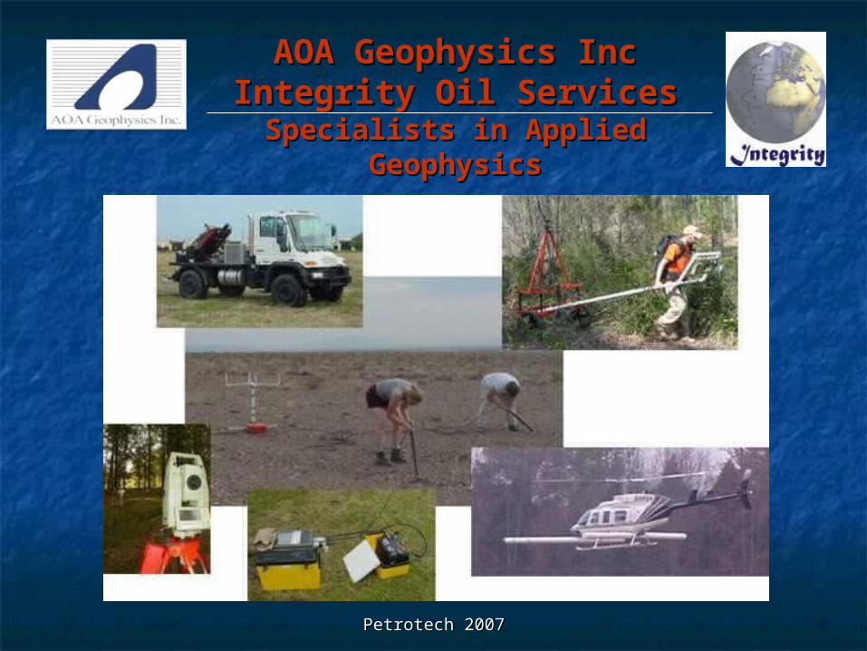
Petrotech 2007Petrotech 2007
AOA Geophysics IncAOA Geophysics IncIntegrity Oil ServicesIntegrity Oil Services
Specialists in Applied Specialists in Applied GeophysicsGeophysics
Petrotech 2007Petrotech 2007
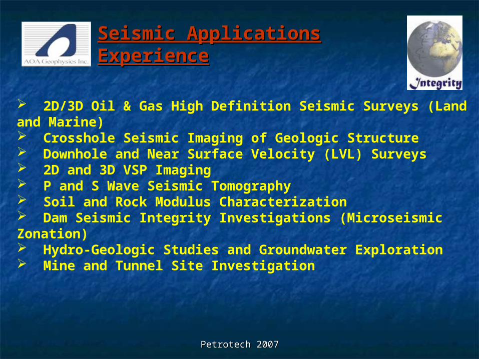
2D/3D Oil & Gas High Definition Seismic Surveys (Land and Marine) Crosshole Seismic Imaging of Geologic Structure Downhole and Near Surface Velocity (LVL) Surveys 2D and 3D VSP Imaging P and S Wave Seismic Tomography Soil and Rock Modulus Characterization Dam Seismic Integrity Investigations (Microseismic Zonation) Hydro-Geologic Studies and Groundwater Exploration Mine and Tunnel Site Investigation
Seismic Applications Seismic Applications ExperienceExperience
Petrotech 2007Petrotech 2007
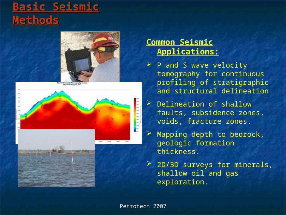
Basic Seismic Basic Seismic MethodsMethods
Common Seismic Applications:
P and S wave velocity tomography for continuous profiling of stratigraphic and structural delineation
Delineation of shallow faults, subsidence zones, voids, fracture zones.
Mapping depth to bedrock, geologic formation thickness.
2D/3D surveys for minerals, shallow oil and gas exploration.
Petrotech 2007Petrotech 2007
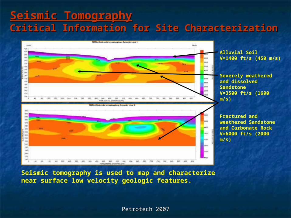
Seismic TomographySeismic TomographyCritical Information for Site CharacterizationCritical Information for Site Characterization
Seismic tomography is used to map and characterize near surface low velocity geologic features.
Alluvial SoilV=1400 ft/s (450 m/s)
Severely weathered and dissolved Sandstone V=3500 ft/s (1600 m/s)
Fractured and weathered Sandstone and Carbonate RockV=6000 ft/s (2000 m/s)
Petrotech 2007Petrotech 2007
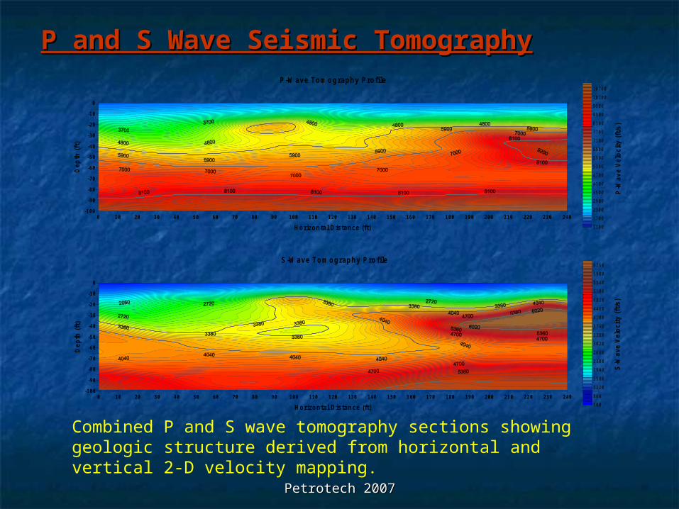
P and S Wave Seismic TomographyP and S Wave Seismic Tomography
0 10 20 30 40 50 60 70 80 90 100 110 120 130 140 150 160 170 180 190 200 210 220 230 240
Horizontal Distance (ft)
-100
-90
-80
-70
-60
-50
-40
-30
-20
-10
0
De
pth
(ft
)
1100
1700
2300
2900
3500
4100
4700
5300
5900
6500
7100
7700
8300
8900
9500
10100
10700
P-W ave Tomography Profile
P-W
ave
Ve
loc
ity
(ft/
s)
0 10 20 30 40 50 60 70 80 90 100 110 120 130 140 150 160 170 180 190 200 210 220 230 240
Horizontal Distance (ft)
-100
-90
-80
-70
-60
-50
-40
-30
-20
-10
0
Dep
th (
ft)
500
860
1220
1580
1940
2300
2660
3020
3380
3740
4100
4460
4820
5180
5540
5900
6260S-W ave Tomography Profile
S-W
ave
Vel
oc
ity
(ft
/s)
Combined P and S wave tomography sections showing geologic structure derived from horizontal and vertical 2-D velocity mapping.
Petrotech 2007Petrotech 2007
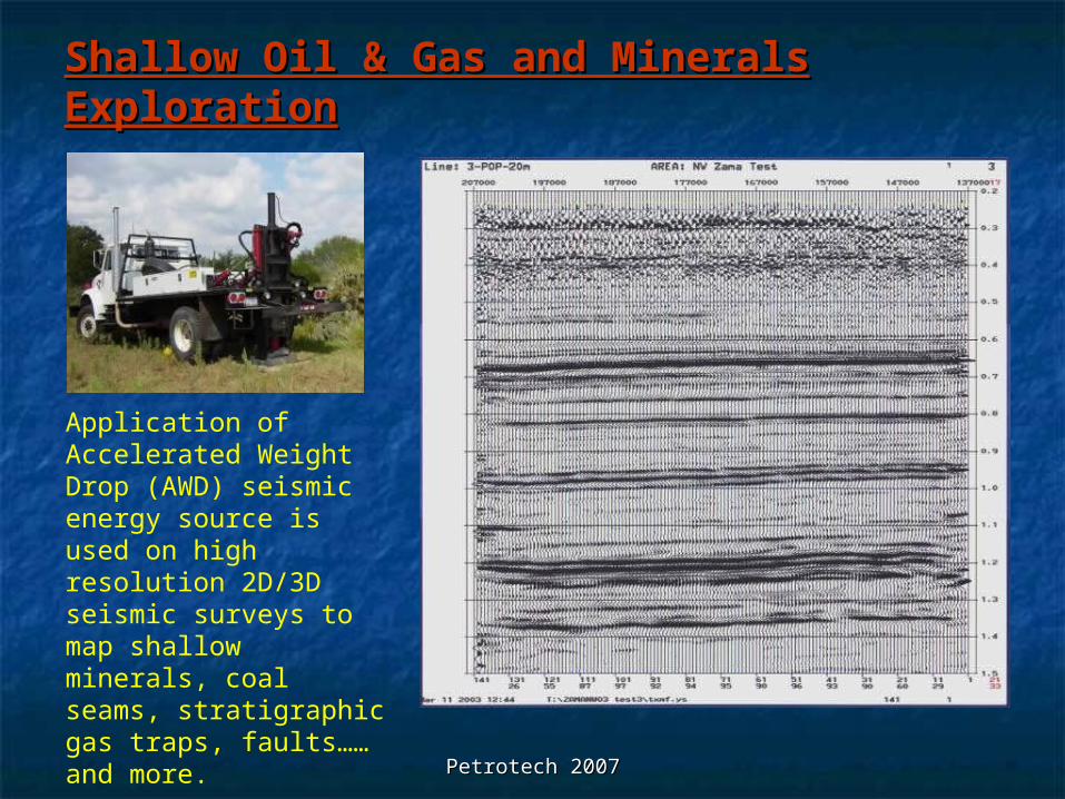
Shallow Oil & Gas and Minerals Shallow Oil & Gas and Minerals ExplorationExploration
Application of Accelerated Weight Drop (AWD) seismic energy source is used on high resolution 2D/3D seismic surveys to map shallow minerals, coal seams, stratigraphic gas traps, faults……and more.
Petrotech 2007Petrotech 2007
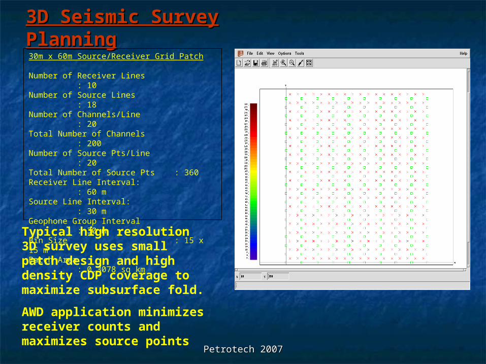
3D Seismic Survey 3D Seismic Survey PlanningPlanning30m x 60m Source/Receiver Grid Patch
Number of Receiver Lines : 10Number of Source Lines : 18Number of Channels/Line : 20Total Number of Channels : 200Number of Source Pts/Line
: 20Total Number of Source Pts : 360Receiver Line Interval: : 60 mSource Line Interval: : 30 mGeophone Group Interval : 30 mBin Size : 15 x 15 mPatch Area : 0.3078 sq km
Typical high resolution 3D survey uses small patch design and high density CDP coverage to maximize subsurface fold.
AWD application minimizes receiver counts and maximizes source points
Petrotech 2007Petrotech 2007
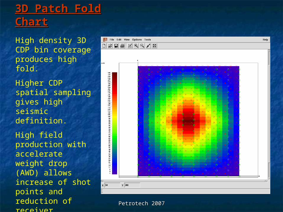
3D Patch Fold 3D Patch Fold ChartChart
High density 3D CDP bin coverage produces high fold.
Higher CDP spatial sampling gives high seismic definition.
High field production with accelerate weight drop (AWD) allows increase of shot points and reduction of receiver positions.
Petrotech 2007Petrotech 2007
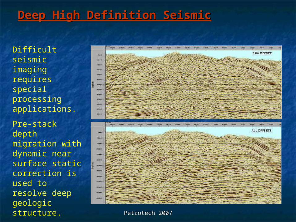
Deep High Definition SeismicDeep High Definition Seismic
Difficult seismic imaging requires special processing applications.
Pre-stack depth migration with dynamic near surface static correction is used to resolve deep geologic structure.
Petrotech 2007Petrotech 2007
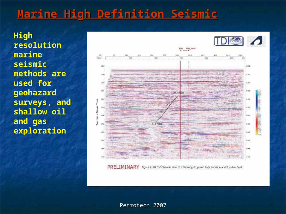
Marine High Definition SeismicMarine High Definition Seismic
High resolution marine seismic methods are used for geohazard surveys, and shallow oil and gas exploration
Petrotech 2007Petrotech 2007
AOA and Integrity Oil Services AOA and Integrity Oil Services Combined Geophysical ServicesCombined Geophysical Services
Geophysical and Geologic Consulting for Seismic Methods
Site Studies and Evaluation for Survey Planning Comprehensive Survey Design, Planning, and
Logistics Support Seismic Data Acquisition Seismic Data Processing, Analysis, and Interpretation
Petrotech 2007Petrotech 2007
AOA and Integrity Oil Services ContactsFinn B. Michelsen, PG
Director of Applied GeophysicsAOA Geophysics, Inc.2500 Tanglewilde Ave.Suite 120Houston, TX 77063Office – (713) 532-2624 Cell – (832) 366-4168Fax – (713) [email protected]
Arindom GangulyManaging Director Integrity Oil ServicesA651, Sushant Lok, Phase IGuraon, Haryana 122009IndiaOffice – (+91) 124 2577476 Cell – (+91) 98 9952 6266Fax – (+91) 124 [email protected]


