
POST GRADUATE SEMESTER BASED COURSE FRAMEWORK Department of Geography, Kumaun University, NAINITAL
(From July 2013 onwards)
Field Surveys will normally be conducted in other physiographic regions rather than the Himalaya.
* 750 Marks for Term-end Examinations.
** 25 Marks allotted for Internal Assessment by Submitting Two Assignments for Evaluation.
*** GMP = Geography Master Programme.
SEMESTER – II
Core Course
(Major)
(i) Advanced Geomorphology (GMP-CCM-i) 201 75+25=100
(ii)Urban Environment and Planning (GMP-CCM-ii) 202 75+25=100
(iii) Evolution and Development of Geographical Thought (GMP-CCM-iii) 203 75+25=100
Elective
Course
(iv-a) Remote Sensing Applications(GMP-EC-i))
OR
(iv-b) World Regional Geography (GMP-EC-ii)
OR
(iv-c) Bases of Hydrology (GMP-EC –iii))
204
205
206
75+25=100
75+25=100
75+25=100
Core Course
(Minor)
(i) Term Paper (GMP-CCm-i))
(ii) Seminar/ Presentation (GMP-CCm-ii)
207
208
25
25
Practical (i) Quantitative Techniques and Cartographic Representation of Geographical Data (GMP-P-i) &
(ii) Field Survey (GMP-P-ii)
209
210
80
20
(iii)
(iv)

SEMESTER – II
Code : 201 (GMP-CCM – i)
ADVANCED GEOMORPHOLOGY
Paper – First
Term End Exam. Marks : 75 Time: 03 Hours
Internal Assessment Marks : 25 (by submitting two assignments for evaluation)
Total Marks : 100
Unit – I Conceptual Base:
Nature, Scope, Trends and Development of Geomorphology; Classical Landscape
Evolution / Development Theories: (W.M. Davis, W. Penck, L.C. King, Hack);
Recent Trends in Geomorphology
Uni t – II Processes and Landforms:
Tectonic processes and tectonic landforms both large and small scales; Drainage
patterns and systems, Periglacial processes and landforms; Glacial processes and
landforms, Arid processes and landforms, Fluvial processes and landforms, Karst
Topography;
Unit – III Landscape Evolution:
Radiocarbon dating, tree-ring dating (Dendrochronology), and Lichenometry.
Interruptions in the evolution of landforms: Polycyclic landforms
Unit – IV Theories and Techniques:
Theories of Hill-slope Evolution; Erosion Surfaces; Geomorphic Mapping
Techniques; Systems and Models in Geomorphology.

Unit – V Applied Geomorphology:
Geomorphic Hazards and Mitigation Measures; Geomorphology in Civil
Engineering; Geomorphology and Groundwater Studies; Soil and Geomorphology;
Application of geomorphology in agriculture and resource Management.
Books Recommended:
1. Bloom, A.L. (1978) : A Systematic Analysis of late Cenozonic Landforms, Englewed
Cliffs, M.J. Prentice Hall.
2. Condle, K.C. (1989) : Plate Tectonics and Crustal Evolution. Pergamon Press. New York.
3. Chorley, R.J. (ed.) : Spatial Analysis in Geomorphology, London, Metheun.
4. Chorley, R.J. , S.A. Schum and D.E. Sugden (1985): Geomorphology, London
5. Coats, D.R. (1981. edt.). Geomorphology and Engineering, George Allen and Unwin,
London.
6. Cooke, R.U. and J.C. Doornkamp (1974) : Geomorphology in Environmental Management, Oxford
University Press.
7. Embleton, C. and J. Thornes : Processes in Geomorphology, London, Edward Arnold.
8. Garner, H.F. : The Origin of Landscape – A Synthesis of Geomorphology, Oxford University Press,
London, 1974.
9. Goudie, A. (ed.) (1990): Geomorphological Techniques. London, George Unwin and Hyman.
10. Hart, M.G. (1986) : Geomorphology : Pure and Applied, George Allen and Unwin, London.
11. Holmes, A. : Principles of Physical Geology, 3rd Edn. London . Nelson. 1978.
12. King, C.A. M. : Techniques in Geomorphology : London : Edward Arnold.
13. Leopold, L.B. : Fluvial Processes in Geomorphology.
14. Lobeck, A.K. : Geomorphology.
15. Ollier, C.D. : Weathering, Edinburgh : Oliver and Royd.
16. – do - : Tectonics and Landforms. London: Methuen.
17. Pitty, A.F. : Geomorphology and Rural Settlement in India.
18. Scheidegner, A.E. : Theoretical Geomorphology. Berlin : Springer – Verlag.
19. Sharma, V.K. : Process in Geomorphology (Mc Graw Hill).

20. Small, R.J. : A Text Book on the Study of Landforms.
21. Thorn, C.E. : Introduction to Theoretical Geomorphology.
22. Thornbury, W.D. : Principles of Geomorphology. New York : Wiley (1969).
23. Twidale, C.R. : Analysis of Landforms. New York : Wiley.
24. Worcester, P.G. : A Text Book of Geomorphology.

SEMESTER – II
Code: 202 (GMP-CCM-ii)
URBAN ENVIRONMENT AND PLANNING
Paper – Second
Term End Exam Marks : 75 Time: 03 Hours
Internal Assessment Marks : 25 (by submitting two assignments for evaluation)
Total Marks : 100
Unit – I Theoretical Base:
Basic concepts, meaning, scope of urban geography and planning, Significance of
urban development planning in geography. Evolution of urban centres and
Urbanization. Recent trends of urban growth with special reference to developing
countries, Urban sprawl and its steering factors, Satellite towns.
Unit –II Morphology and Functions:
Urban morphology, Urban land use analysis and classification, Urban landscape.
Functions of urban centres, Functional classifications of towns with special
reference to India and Uttarakhand.
Unit – III Central Place System:
Towns as central places, Central places theory, Centrality and hierarchy of urban
centres, Urbanization and regional development.
Unit – IV Urban Environmental Problems:
Environmental problems of urbanizations, Carrying capacity of urban settlements,
Urbanization and global environmental change, Assessment of natural risks of
urban growth with particular reference to developing countries, India and High
mountains.
Unit – V Urban Planning and Management:
Concept and approaches of urban development, Landscape ecology and
sustainable urban development, urban land use planning, management of natural
risks of urban growth in Uttarakhand, Application of remote sensing and
Geographic Information System in Urban Development Planning.

Books Recommended:
1. Alam, S.M. (1964) : Hyderabad – Secunderabad Twin Cities, Asia Publishing House, Bombay.
2. Berry, B.J.L. and Horton, F.F. (1970) : Geographic Perspective on Urban Systems, Prentice Hall,
Englewood Cliffs, New Jersey.
3. Carter (1972) : The Study of Urban Geography, Edward Arnold Publishers, London.
4. Chorley, R.J.O. , Hagett P. (ed.) (1966) : Models in Geography, Methuen, London.
5. Dickinson, R.E. (1964) : City and Region, Routledge, London.
6. Dwyer, D.J. (ed.) (1971) : The City as a Centre of Change in Asia, University of Hongkong Press,
Hongkong.
7. Gibbs, J.P. (1961) : Urban Research Methods, D. Van Nostrand Co. Inc., Princetown, New Jersey.
8. Hall, P. (1992) : Urban and Regional Planning, Routledge, London.
9. Hauser, Philip M. and Schnore Leo F. (ed.) (1965) : The Study of Urbanisation, Wiley, New York.
10. James, P.E. and Jones, C.F. (eds.) (1954) : American Geography, Inventory and Prospect,
Syracuse University Press, Syracuse.
11. Kundu, A. (1992) : Urban Development and Urban Research in India, Khanna Publication.
12. Meyor, H.M. and Kohn, C.F. (eds) (1955) : Readings in Urban Geography, University of Chicago
Press, Chicago.
13. Mumford, L. (1958) : Culture of Cities, McMilan and Co., London.
14. Nangia, Sudesh (1976) : Delhi Metropolitan Region : A Study in Settlement Geography, Rajesh
Publication.
15. Rao, V.L.S.P. : Urbanisation in India : Spatial Dimensions, Concept Publishing Co., New Delhi.
16. Rao, V.L.S.P.(1979) : The Structure of an Indian Metropolis : A Study of Bangalore, Allied
Publishers, Bangalore.
17. Singh, K. and Steinberg F. (eds.) (1998) : Urban India in Crisis, New Age Interns, New Delhi.
18. Smailes, A.E. (1953) : The Geography of Towns, Hutchinson, London.
19. Tewari, Vinod K. , Jay A. Weinstein, VLS Prakasa Rao (editors) (1986) : Indian Cities : Ecological
Perspective Concept.

SEMESTER II
Code : 203 (GMP-CCM – iii)
EVOLUTION AND DEVELOPMENT OF GEOGRAPHICAL THOUGHT
Paper – Third
Term End Exam.Marks : 75 Time: 03 Hours
Internal Assessment Marks : 25 (by submitting two assignments for evaluation)
Total Marks : 100
Unit – I Basic Concepts:
Geography as the study of areal differentiation, Man-environment relationship
and spatial organization; The measure of significance in geography, Time and
genesis in Geography; Divisions and branches of geography and development
of the main branches, Methods and approaches of Geography.
Unit – II Development of Geographical Thoughts:
Emergence of Geography as a scientific discipline: Contributions of Indian, Greek,
Roman and Arab Geographers; Contributions of founders of Modern Geography:
Impact of Explorations and discoveries; Contributions of German (Richthofen,
Ratzel), French (Vidal de La Blache) and Anglo-American Geographers (Hartshorne,
Huntington and Davis).
Unit – III Contemporary Trends:
Qualitative Paradigms and Changing Paradigms in Geography; Behavioral
Revolution; Marxism, Radicalism and Welfare approach. Unit – IV Nature of Dichotomies in Geography:
Physical and Human Geography; Systematic and Regional Geography, Determinism
and Possibilism, Modernism and Post Modernism, Post Structuralism and Post
Colonialism
Unit – V Recent Trends in Geography:
Modern Techniques and Concepts in Geography: Remote Sensing, systems
approach and Geographic Information System.
Books Recommended:
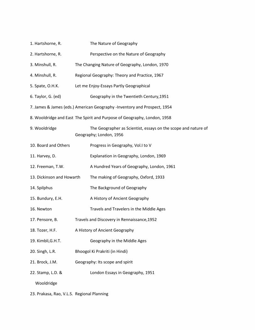
1. Hartshorne, R. The Nature of Geography
2. Hartshorne, R. Perspective on the Nature of Geography
3. Minshull, R. The Changing Nature of Geography, London, 1970
4. Minshull, R. Regional Geography: Theory and Practice, 1967
5. Spate, O.H.K. Let me Enjoy-Essays Partly Geographical
6. Taylor, G. (ed) Geography in the Twentieth Century,1951
7. James & James (eds.) American Geography -Inventory and Prospect, 1954
8. Wooldridge and East The Spirit and Purpose of Geography, London, 1958
9. Wooldridge The Geographer as Scientist, essays on the scope and nature of
Geography; London, 1956
10. Board and Others Progress in Geography, Vol.I to V
11. Harvey, D. Explanation in Geography, London, 1969
12. Freeman, T.W. A Hundred Years of Geography, London, 1961
13. Dickinson and Howarth The making of Geography, Oxford, 1933
14. Spilphus The Background of Geography
15. Bundury, E.H. A History of Ancient Geography
16. Newton Travels and Travelers in the Middle Ages
17. Pensore, B. Travels and Discovery in Rennaissance,1952
18. Tozer, H.F. A History of Ancient Geography
19. Kimbli,G.H.T. Geography in the Middle Ages
20. Singh, L.R. Bhoogol Ki Prakriti (in Hindi)
21. Brock, J.M. Geography: Its scope and spirit
22. Stamp, L.D. & London Essays in Geography, 1951
Wooldridge
23. Prakasa, Rao, V.L.S. Regional Planning

24. Daysh, G.H.J. Essay in Regional Planning
25. Dickinson, R.E. City and Region- A Geographical Interpretation
26. Dickinson, R.E. The Makers of Modern Geography,1969
27. Dickinson, R.E. Geography as Ecology
28. Stamp, L.D. Applied Geography
29. Singh, R.L.(ed.) Applied Geography
30. William Bunge Theoretical Geography
31. Haggett and Chorley Models in Geography, London, 1967
32. Cooke, F.D. & Johnson Trends in Geography
33. Haggett, Peter Geography: A Modern Synthesis, New york, 1975
34. James, P.E. All Possible Worlds-A History of Geographical Ideas, 1980
35. Helt Jensen, A. Geography: Its History and Concepts
36. Dikshit, R.D. Geographical Thought, Prentice Hall, India, 1997
37. Adhikari, S. Fundamentals of Geographical Thought, Chaittanya, Allahabad
38. Haggett, P. & Chorley Models in Geography, London, 1969
39. Chatterjee, S.P. Fifty Years of Science in India: Progress of Geography,
Calcutta, 1964
40. Kuhn, T.S. The Structure of Scientific Revolution: Chicago, 1962
41. Cole & King Quantitative Geography; Techniques, Theories in Geography,
JWS, 1968
42. Smith, D.M. Human Geography: A Welfare Approach; London, 1977
43. Richard Peet Modern Geographical Thought: Badewell; 1998
44. Thomas & Hugget Modeling in Geography, HRP,1980
45. R.de Souza (eds.) Reflections on Richard Hartsorn’s The Nature of Geography,
AAG,1989
46. Harvey & Holly (eds.) Themes in Geographic Thought, Rawat, 1969
47. Charlls Gore Regions in Question, Mathur, London, 1984

48. Berry Markble (eds.) Spatial Analysis, Prentice Hall, 1968
49. Singh, Jagdish HkkSxksfyd fpUru ds ewyk/kkj]Kkuksn;]1995
50. Husain, Majid Evolution of Geographical Thought, Rawat, 2001
52. Johnston, Hauer & Regional Geography, London, 1990

SEMESTER – II
Code : 204 (GMP-EC – i)
REMOTE SENSING APPLICATIONS
Paper – Fourth (a)
Term End Exam. Marks : 75 Time : 03Hours
Internal Assessment Marks : 25 (by submitting two assignments for evaluation)
Total Marks : 100
Unit – I Bases of Remote Sensing:
Definition, interaction of Electro-Magnetic Radiation (EMR) with atmosphere and
earth surface. Sensors and remote sensing data products..
Unit – II Aerial Photographs and Photogrammetry:
Types of aerial photos, fundamentals of air photographs interpretation. Geometry
of aerial photographs: tilt and relief displacement.
Unit – III Digital Image Processing:
Restoration; Enhancement and Classification: supervised and unsupervised
Unit – IV Thermal and Microwave Remote Sensing:
Types; Characteristics; utilization in geographical studies
Unit – V Remote Sensing Applications:
Application of Remote Sensing in terrain evaluation, land use and forest resource
inventory.
Books Recommended:
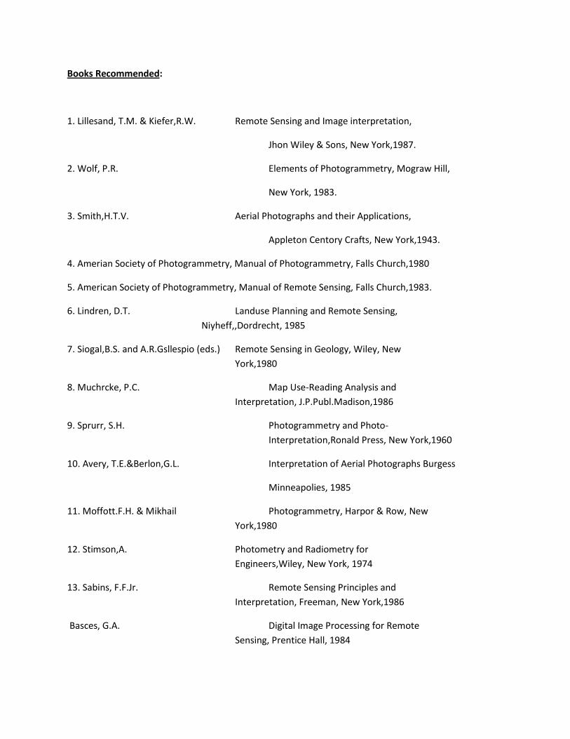
1. Lillesand, T.M. & Kiefer,R.W. Remote Sensing and Image interpretation,
Jhon Wiley & Sons, New York,1987.
2. Wolf, P.R. Elements of Photogrammetry, Mograw Hill,
New York, 1983.
3. Smith,H.T.V. Aerial Photographs and their Applications,
Appleton Centory Crafts, New York,1943.
4. Amerian Society of Photogrammetry, Manual of Photogrammetry, Falls Church,1980
5. American Society of Photogrammetry, Manual of Remote Sensing, Falls Church,1983.
6. Lindren, D.T. Landuse Planning and Remote Sensing,
Niyheff,,Dordrecht, 1985
7. Siogal,B.S. and A.R.Gsllespio (eds.) Remote Sensing in Geology, Wiley, New
York,1980
8. Muchrcke, P.C. Map Use-Reading Analysis and
Interpretation, J.P.Publ.Madison,1986
9. Sprurr, S.H. Photogrammetry and Photo-
Interpretation,Ronald Press, New York,1960
10. Avery, T.E.&Berlon,G.L. Interpretation of Aerial Photographs Burgess
Minneapolies, 1985
11. Moffott.F.H. & Mikhail Photogrammetry, Harpor & Row, New
York,1980
12. Stimson,A. Photometry and Radiometry for
Engineers,Wiley, New York, 1974
13. Sabins, F.F.Jr. Remote Sensing Principles and
Interpretation, Freeman, New York,1986
Basces, G.A. Digital Image Processing for Remote
Sensing, Prentice Hall, 1984
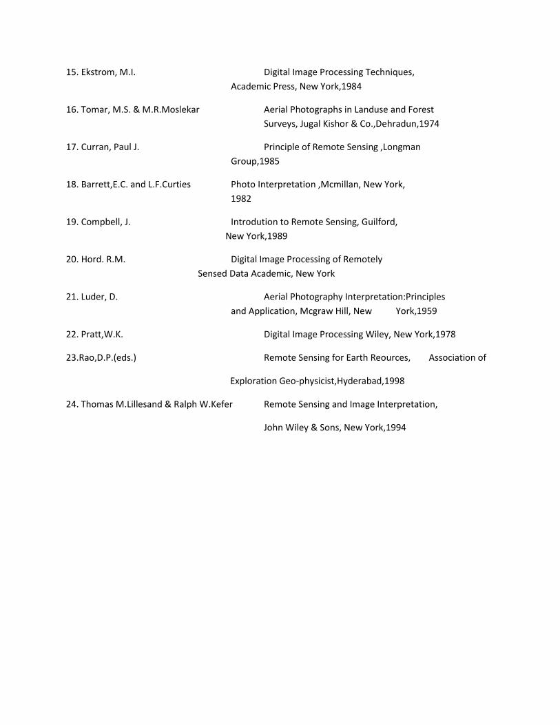
15. Ekstrom, M.I. Digital Image Processing Techniques,
Academic Press, New York,1984
16. Tomar, M.S. & M.R.Moslekar Aerial Photographs in Landuse and Forest
Surveys, Jugal Kishor & Co.,Dehradun,1974
17. Curran, Paul J. Principle of Remote Sensing ,Longman
Group,1985
18. Barrett,E.C. and L.F.Curties Photo Interpretation ,Mcmillan, New York,
1982
19. Compbell, J. Introdution to Remote Sensing, Guilford,
New York,1989
20. Hord. R.M. Digital Image Processing of Remotely
Sensed Data Academic, New York
21. Luder, D. Aerial Photography Interpretation:Principles
and Application, Mcgraw Hill, New York,1959
22. Pratt,W.K. Digital Image Processing Wiley, New York,1978
23.Rao,D.P.(eds.) Remote Sensing for Earth Reources, Association of
Exploration Geo-physicist,Hyderabad,1998
24. Thomas M.Lillesand & Ralph W.Kefer Remote Sensing and Image Interpretation,
John Wiley & Sons, New York,1994

SEMESTER – II
Code : 205 (GMP-EC – ii)
WORLD REGIONAL GEOGRAPHY
Paper – Fourth (b)
Term End Exam. Marks : 75 Time: 03 Hours
Internal assessment Marks : 25 (by submitting two assignments for evaluation)
Total Marks : 100
Unit – I Conceptual Base:
Regional Geography: Concepts, Approaches, Methods and Significance; Major
World Regions and blocks ( of macro, meso and micro levels) on various
delimitation bases specially with reference to Natural, Political, Economic, Trade
and Development Regionalization.
Unit – II Natural Regions of the World:
Physical Regions, Vegetation Regions, Climatic Regions, Bio-geographical Regions
and Biomes
Unit – III Resource and Cultural Regions:
Resource Regions, Population Regions and Cultural Regions of the world
Unit – IV Economic Regions:
Agricultural Regions of the World; Industrial Regions of the World;
Micro Agro-Industrial Regions of USA, Japan and China.
Unit – V Regional Planning and Development:
Important concepts, approaches and methods of Regional Development and their
application with special reference to Uttarakhand
Books Recommended:
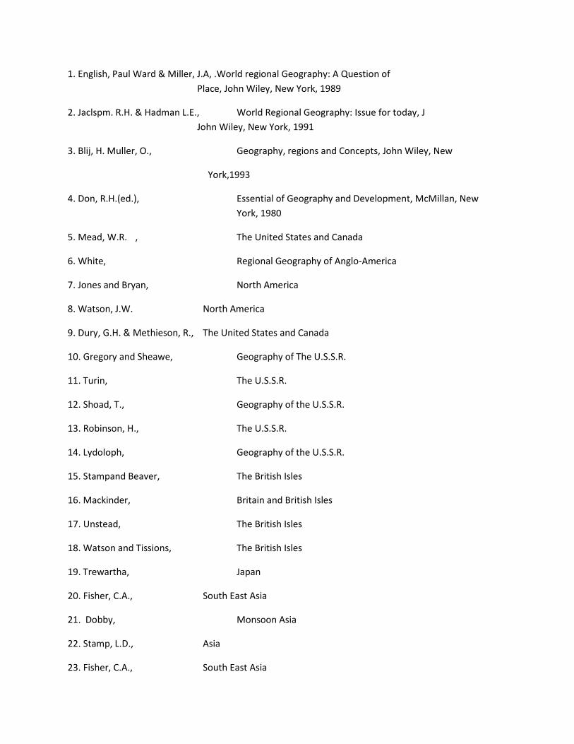
1. English, Paul Ward & Miller, J.A, .World regional Geography: A Question of
Place, John Wiley, New York, 1989
2. Jaclspm. R.H. & Hadman L.E., World Regional Geography: Issue for today, J
John Wiley, New York, 1991
3. Blij, H. Muller, O., Geography, regions and Concepts, John Wiley, New
York,1993
4. Don, R.H.(ed.), Essential of Geography and Development, McMillan, New
York, 1980
5. Mead, W.R. , The United States and Canada
6. White, Regional Geography of Anglo-America
7. Jones and Bryan, North America
8. Watson, J.W. North America
9. Dury, G.H. & Methieson, R., The United States and Canada
10. Gregory and Sheawe, Geography of The U.S.S.R.
11. Turin, The U.S.S.R.
12. Shoad, T., Geography of the U.S.S.R.
13. Robinson, H., The U.S.S.R.
14. Lydoloph, Geography of the U.S.S.R.
15. Stampand Beaver, The British Isles
16. Mackinder, Britain and British Isles
17. Unstead, The British Isles
18. Watson and Tissions, The British Isles
19. Trewartha, Japan
20. Fisher, C.A., South East Asia
21. Dobby, Monsoon Asia
22. Stamp, L.D., Asia
23. Fisher, C.A., South East Asia
24. Laborde, Australia, New Zealand and Pacific Islands
25. Taylor, Australia
26. Stamp, L.D., Africa
27. Shahman, South America
28. Saklani,P.S.(ed.), Tectonic Geology of the Himalaya, 1978
29. Singh, R.L., India: A Regional Geography, 1971
30. Nityanand & K.Kumar, The Holy Himalaya
31. Valdiya, K.S,. Land and People, 1988
32. Bose, S.C., Land and People of the Himalaya, Calcutta,1968
34. Singh O.P.(ed.), The Himalaya: Nature, Man and Culture, 1983
35. Joshi, S.C. et.al, Kumaun Himalaya, Nainital, 1983
37. Joshi, S.C., Uttaranchal: Environment & Development
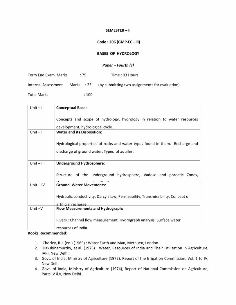
SEMESTER – II
Code : 206 (GMP-EC - iii)
BASES OF HYDROLOGY
Paper – Fourth (c)
Term End Exam. Marks : 75 Time : 03 Hours
Internal Assessment Marks : 25 (by submitting two assignments for evaluation)
Total Marks : 100
Books Recommended:
1. Chorley, R.J. (ed.) (1969) : Water Earth and Man, Methuen, London. 2. Dakshinamurthy, et.al. (1973) : Water, Resources of India and Their Utilization in Agriculture,
IARI, New Delhi. 3. Govt. of India, Ministry of Agriculture (1972), Report of the Irrigation Commission, Vol. 1 to IV,
New Delhi. 4. Govt. of India, Ministry of Agriculture (1974), Report of National Commission on Agriculture,
Parts IV &V, New Delhi.
Unit – I Conceptual Base:
Concepts and scope of hydrology, hydrology in relation to water resources
development, hydrological cycle . Unit – II Water and its Disposition:
Hydrological properties of rocks and water types found in them. Recharge and
discharge of ground water, Types of aquifer.
Unit – III Underground Hydrosphere:
Structure of the underground hydrosphere, Vadose and phreatic Zones,
Underground water classification. Unit – IV Ground Water Movements:
Hydraulic conductivity, Darcy’s law, Permeability, Transmissibility, Concept of
artificial recharge. Unit –V Flow Measurements and Hydrograph:
Rivers : Channel flow measurement, Hydrograph analysis; Surface water
resources of India.

5. Govt. of India, Ministry of Energy and Irrigation (Dept. of Irrigation, 91980), Rashtriya Barh Ayog, Report- National Commission on Floods, Vol. I & II.
6. Gregory, K.J. and Walling De (1973) ) : Drainage Basin Form and Processes, Edward Arnold, London.
7. Jackson, P.J. (1977) : Climate, Water and Agriculture in the Tropics, London. 8. Law, B.C. (ed.) (1968) : Mountains and Rivers of India, 21, G.C. National Committee for
Geography, Calcutta. 9. Linslay, R.K. et.al. (1958) : Hydrology for Engineers, Mc Graw Hill. 10. Rao, K.L. : India’s Water Wealth, Orient Longman.
SEMESTER-II
Code -207(GMP-CCm-i) Term paper
Total marks allotted for Term paper : 25
Evaluation by external examiner : 10
Evaluation by internal examiner : 10
Viva-voci examination : 05
(by both the examiners)
Guide lines for Term Papers
The student will be required to select the topic and the area to write a term paper with the
help of the supervisor allotted to them by the Department. The term paper may be written
on some pertinent topic of contemporary geographical interest and based on the
secondary information gathered from the census and other statistical records published by
the Government from time to time. It may however be based on primary data if the
supervisor and students would like to conduct some questionnaire based survey at local
and regional levels. The size of the paper should normally range between 20 to 30 pages.
The term paper will be evaluated by a panel of examiners appointed by the convener of
the BOS Geography. The viva-voci examination will be conducted by both the external
and internal examiners. The term paper should be submitted to the Department at least
one week before the commencement of the Theory Examinations.
SEMESTER-II
Code -208(GMP-CCm-ii) Seminar
The students will be required to select any one of the topics allotted by the Department.
The topic will be related to the discipline already studied by students in the same
semester as core or elective courses. The assessment of the presentation of the
students/examinees will be done by external and internal examiners appointed by the
convener/Head of the Department/University.

SEMESTER – II
PRACTICAL
Code: 209 & 210 (GMP - P-i & P-ii): QUANTITATIVE TECHNIQUES AND
CARTOGRAPHIC REPRESENTATION OF GEOGRAPHICAL DATA
(Pi); AND FIELD SURVEY (Pii)
Term End Exam : Marks : 60 Time: 04 Hours
Record Work : Marks : 10
Viva - Voce : Marks : 10
Field Survey : Marks : 20 (Survey Camp will be organized in the supervision of
minimum two Teachers as allotted to them by the
Department; i.e., the field survey will be organized by
the Department for Ten days).
Total Marks : 100
Unit – I Sampling Theories: Basic concepts of probability. Test of significance: ‘t’ test, Chi
square test.
Unit – II Measures of dispersion: Variability, Range, Mean deviation, Quartile deviation,
Standard deviation, Karl Pearson’s Co-efficient of Correlation, Spearson’s rank
correlation method. Regression analysis.
Unit – III Nature and Scope and Development of Cartography; Cartographic representation
of geographical data by (a) dots (b) proportional squares and (c) circles methods.
Unit – IV Representation of climatic data: Climatograph, climograph, hythergraph and
water balance graph.

Unit – V Representation of economic data: Agricultural land use & production and
industrial data. Representation of population data: Growth, distribution and
employment.
Books Recommended:
1. Singh, R.L. & Singh, R.P.B. Elements of Practical Geography (English &
Hindi)
2. Singh,L.R. & R.Singh Mapwork and Practical Geography (Hindi &
English)
3. Misra, R.P. & A.Ramesh Fundamental of Cartography, New Delhi, 1986
4. Monkhouse, F.J. Maps and Diagrams, Methuen, London, 1971
5. Robinson, A.H. Elements of Cartography
6. Raise, E. Principles of Cartography
7. Birch, T.W. Maps: Topographical and Statistical
8. Garnett, A. A Geographical Interpretation of Topographical
Maps
9. Derk, C.L. & Brown, U.S. Interpretation of Topographical and Geological
Maps
10. Goopson &Morris A Contour Dictionary
11. Holmes Practical Map Reading
12. Gregory, S. Statistical Methods and the Geographers (Hindi &
English
13. Toyne & Newby Techniques in Human Geography
14. Agrawal, C.S. & Garg,P.K. Textbook on Remote Sensing, Wheeler, 2000
15. Cracknell,A.P. Introduction to Remote Sensing, T.& F. London, 1990
16. Curran, P.J. Principles of Remote Sensing, Longman, 1985
17. Star, J. and Estes,J. GIS-An Introduction , Prentice Hall, 1990
18. Mark, S. Monmorier Computer_ Assisted Cartography, Prentice Hall,1982


