
St. Francis Dam Disaster
Melissa Schlothan15 February, 2007
Environmental GeologyDr. Sarah Gray
http://web.umr.edu/~rogersda/st_francis_dam/046.jpg

Outline
• Geography and Geology• Background• Impacts• Disaster Management and Response• Why did the St. Francis Dam fail?• What happened to the community?• Recommendations• Lessons

Geography
• Located 40 miles NE of Los Angeles– In city of Santa Clarita– Developing city
• Agriculture, electricity (Edison), mostly immigrants
• Inside San Francisquito Canyon

Castaic Lake
St. Francis Dam
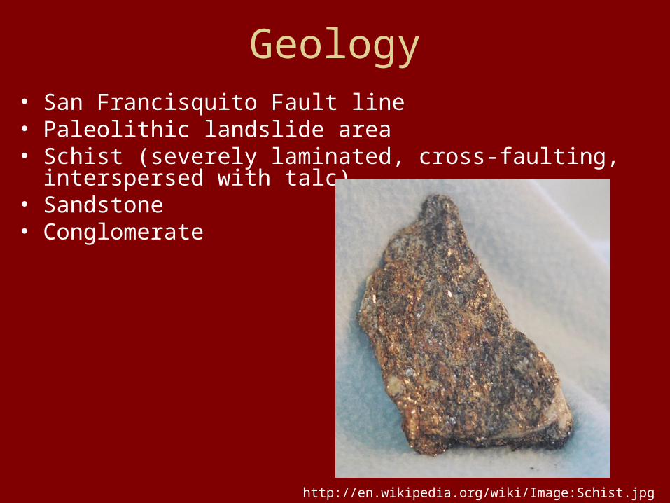
Geology• San Francisquito Fault line• Paleolithic landslide area• Schist (severely laminated, cross-faulting, interspersed with
talc)• Sandstone• Conglomerate
http://en.wikipedia.org/wiki/Image:Schist.jpg

http://wps.prenhall.com/esm_keller_envgeology_8/0,7260,264377-,00.html

Background• Designed by William Mulholland, Dept. of Power
and Water• 1924 – construction began
– Originally • Capacity: 30,000 acre-feet• 180 ft high, 600 ft long
– 1st change• 10ft height increase• Capacity: 32,000 acre-feet
– 2nd change (July 1925)• 10ft height increase• Capacity: 38,000 acre-feet• Wing dyke added (600ft long)
• 1926 – construction completeWilliam Mulhollandhttp://web.umr.edu/~rogersda/st_francis_dam/reassessment_of_st_francis_dam_failure.pdf

St. Francis Dam Construction
http://web.umr.edu/~rogersda/st_francis_dam/reassessment_of_st_francis_dam_failure.pdf
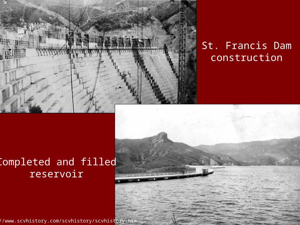
Completed and filledreservoir
St. Francis Damconstruction
http://www.scvhistory.com/scvhistory/scvhistory.htm

• 1926-1928– Cracks developing in dam and abutments
• Mulholland investigates and dismisses
– 7 March 1928• Reservoir fills to capacity• More leaks develop• Mulholland investigates and dismisses
– 12 March 1928• East side of reservoir roadbed sagging 1 – 5 feet• More leaks and cracks• Mulholland and assistant inspect and dismiss
Evidence of leakshttp://www.scvhistory.com/scvhistory/scvhistory.htm

• 12 March 1928 – Dam fails 11:57 pm– 12 bill gallons of water– 18 mi/hr initially, 5 mi/hr into Pacific– Traveled 55 miles to the Pacific Ocean
• Took 5 ½ hrs
Dam after failurehttp://www.scvhistory.com/scvhistory/scvhistory.htm

View of water entering Pacific Ocean
http://web.umr.edu/~rogersda/st_francis_dam/Mapping%20the%20St%20Francis%20Dam%20Outburst%20Flood%20with%20GIS.pdf
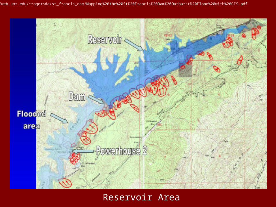
Reservoir Area
http://web.umr.edu/~rogersda/st_francis_dam/Mapping%20the%20St%20Francis%20Dam%20Outburst%20Flood%20with%20GIS.pdf

Flood path
http://web.umr.edu/~rogersda/st_francis_dam/Mapping%20the%20St%20Francis%20Dam%20Outburst%20Flood%20with%20GIS.pdf

Impacts
• Deaths: 450 estimated– Many found downstream– Tent residents of unknown count
• +900 homes destroyed
• 1,200 buildings damaged
• 10 bridges knocked out
• Power lost in multiple cities
• Crops, businesses and livestock affected

Overturned railroad tracks
Debris and overturned cars
http://www.scvhistory.com/scvhistory/scvhistory.htm

Flood path
Damaged highway
http://www.scvhistory.com/scvhistory/scvhistory.htm

Damaged pecan fields
Broken electric poleshttp://www.scvhistory.com/scvhistory/scvhistory.htm
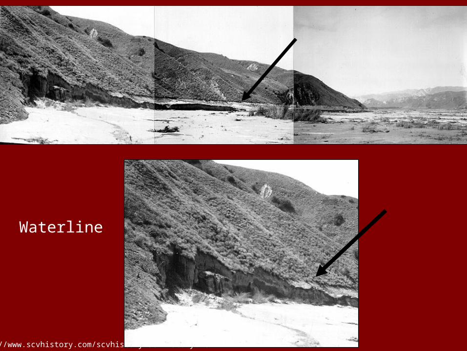
Waterline
http://www.scvhistory.com/scvhistory/scvhistory.htm

Disaster Management
• Awareness and preparedness– No disaster plan
• No one ever thought it would break
– Mulholland was aware of cracks/leaks and maximum capacity
• Dismissed them because said, “This is typical for a concrete dam of this size.”

Disaster Response
• Immediate response by Red Cross– Set up national fund drive– 100’s of volunteers– Provided:
• Search and rescue• Care for injured/needy• Clearing debris and dying or dead people and
animals
– Total spent: $237,190
http://news.softpedia.com/images/news2/1-Week-After-Katrina-The-American-Red-Cross-Is-Setting-A-Record-Relief-Pace-2.jpg

• Los Angeles County– Took full responsibility for event– $1 million set aside for programs and funds– “Council of Fourteen”– Continued work on clean-up
• 1,000’s volunteers and 100’s tractors utilized
– Completed in 90 days

Reconstruction Phases I and II
• Mulholland Dam– Reinforced with rocks and earth on face
• Built like St. Francis• Fears of similar dam break
• Bouquet Reservoir – 1934– 15 miles west of Palmdale– Part of L.A. Aqueduct system
• Castaic Dam – 1973– Near Castaic– Hydroelectric power plant

Why did the dam fail?
• Major reasons:– Rock Formations
• Conglomerate: expands with water
• Schist: badly laminated, interspersed with talc
– Fault line– Erosion
• from running water at cracks along sides
– Paleolithic landslide
http://wps.prenhall.com/esm_keller_envgeology_8/0,7260,264377-,00.html

Why did the dam fail?• Cracks
– Created when conglomerate on side swelled when wet causing the dam to rise and crack
• Construction– Underground base missing steps
• Tilting– from extra capacity unaccounted for with
increased height
• Sabotage theory– Previous unrest about taking water into
aqueduct from Owens River Valley

How was the community affected?• Many people lost jobs
– Edison electric power plants ruined– Agriculture crops devastated
• Agriculture devastated– 7,900 acres
• Citrus, walnuts, apricots, grapes, alfalfa, pecans
• Tent residents– Lost jobs and displaced
• Rebuild homes and businesses– Took very long for people to get back on their
feet

Recommendations
• Warning system needed– You can never be too careful, the risk of
failure will always be there no matter the confidence
• More response by police force– Efficiency needed with system of
communication
• Reservoir shouldn’t have been built there– The geography is extremely dangerous

Lessons
• More geological knowledge of area
• Complete reinforcement for changes is always needed

Sources
• http://www.scvhistory.com/scvhistory/scvhistory.htm• http://en.wikipedia.org/wiki/San_Francisquito_Canyon• http://web.umr.edu/~rogersda/st_francis_dam/lessons_le
arned_from_the_st_francis_dam_failure(geostrata_mar-apr_2006).pdf
• http://web.umr.edu/~rogersda/st_francis_dam/reassessment_of_st_francis_dam_failure.pdf
• http://web.umr.edu/~rogersda/st_francis_dam/Mapping%20the%20St%20Francis%20Dam%20Outburst%20Flood%20with%20GIS.pdf
• Outland, Charles F. Man – Made Disaster: the story of St. Francis Dam. Glendale, California: The Arthur H. Clark Company, 1963.


