Unmanned Aerial Vehicles (UAV’s)
Unmanned Underwater Vehicles (UUV’s)
and Swarms
Joseph T. Wunderlich, Ph.D.
Unmanned Aerial Vehicles (UAV’s)
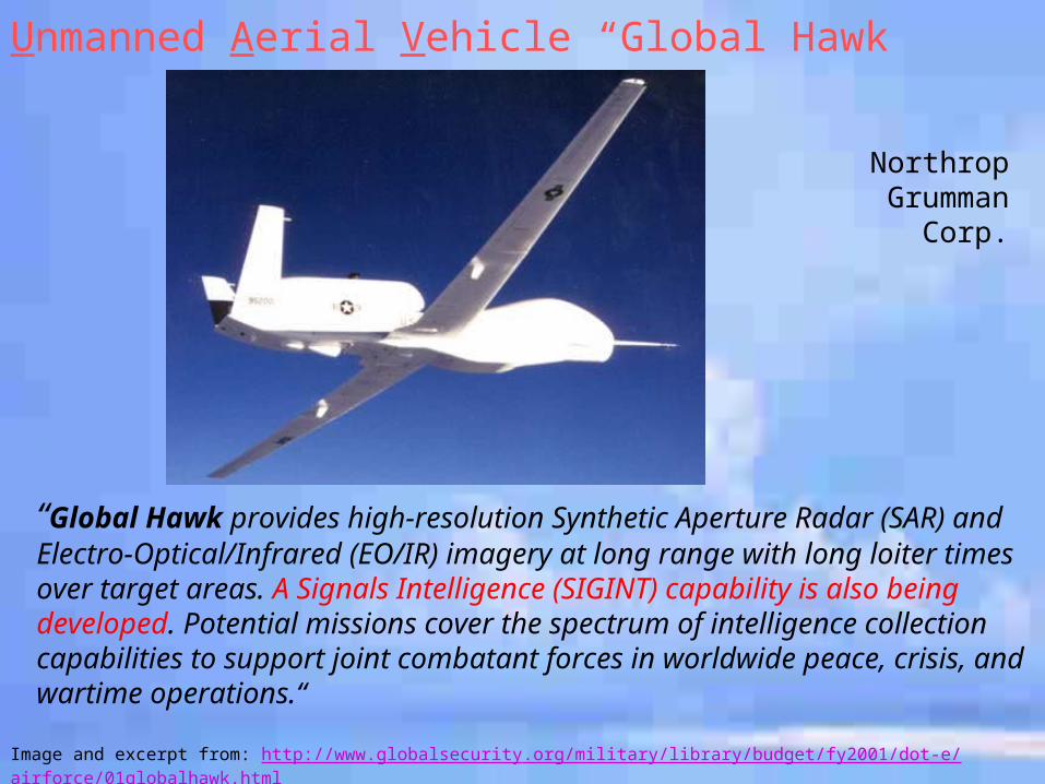
Image and excerpt from: http://www.globalsecurity.org/military/library/budget/fy2001/dot-e/airforce/01globalhawk.html
“Global Hawk provides high-resolution Synthetic Aperture Radar (SAR) and Electro-Optical/Infrared (EO/IR) imagery at long range with long loiter times over target areas. A Signals Intelligence (SIGINT) capability is also being developed. Potential missions cover the spectrum of intelligence collection capabilities to support joint combatant forces in worldwide peace, crisis, and wartime operations.“
Unmanned Aerial Vehicle “Global Hawk”
Northrop Grumman Corp.
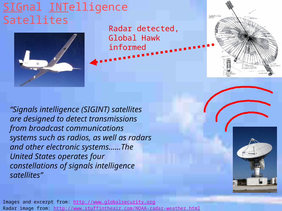
Images and excerpt from: http://www.globalsecurity.orgRadar image from: http://www.stuffintheair.com/NOAA-radar-weather.html
“Signals intelligence (SIGINT) satellites are designed to detect transmissions from broadcast communications systems such as radios, as well as radars and other electronic systems……The United States operates four constellations of signals intelligence satellites”
Radar detected, Global Hawk informed
SIGnal INTelligence Satellites
Images and excerpt from: http://www.globalsecurity.orgRadar image from: http://www.stuffintheair.com/NOAA-radar-weather.html
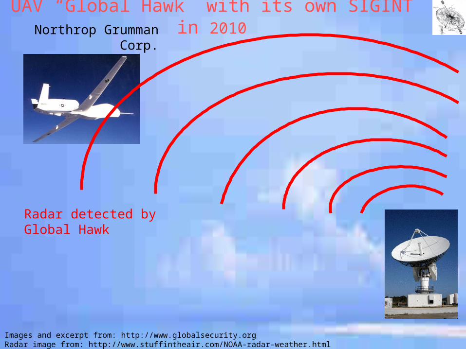
UAV “Global Hawk” with its own SIGINT in 2010Northrop Grumman Corp.
Radar detected by Global Hawk
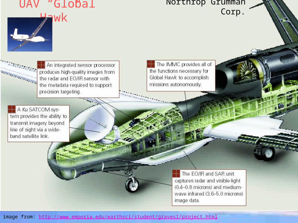
UAV “Global Hawk”
image from: http://www.emporia.edu/earthsci/student/graves1/project.html
Northrop Grumman Corp.
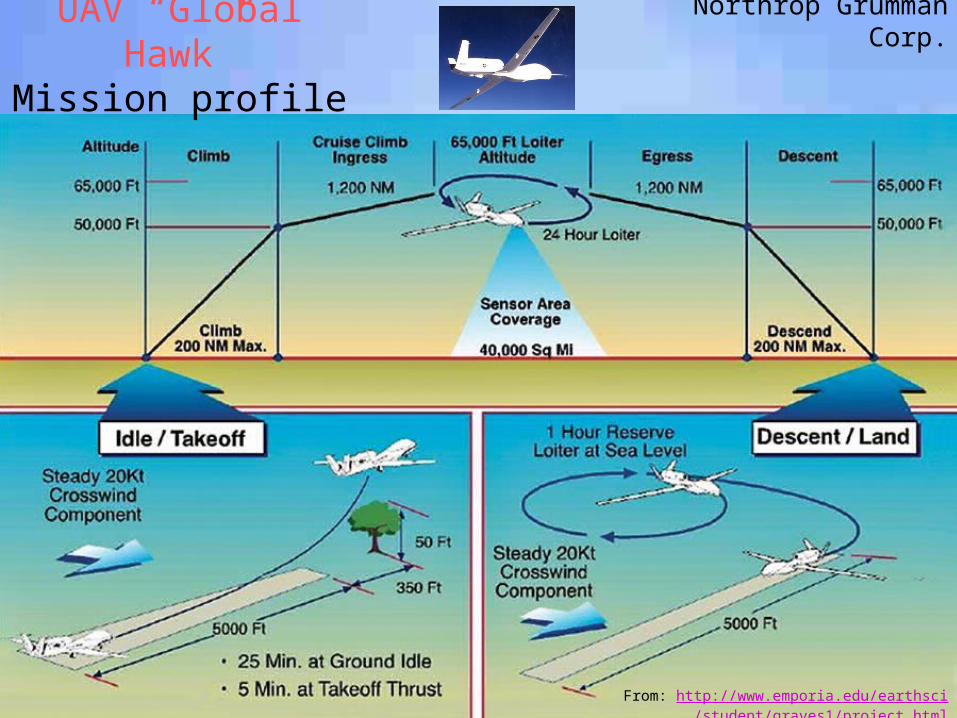
UAV “Global Hawk”Mission profile
From: http://www.emporia.edu/earthsci/student/graves1/project.html
Northrop Grumman Corp.
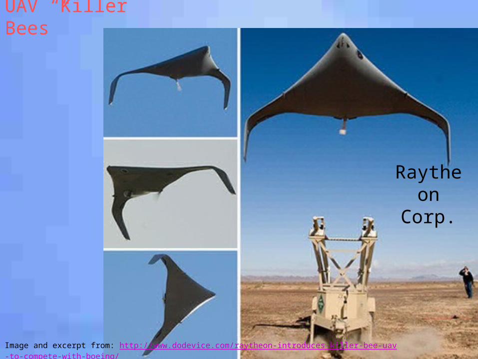
Image and excerpt from: http://www.dodevice.com/raytheon-introduces-killer-bee-uav-to-compete-with-boeing/
UAV “Killer Bees”
Raytheon Corp.
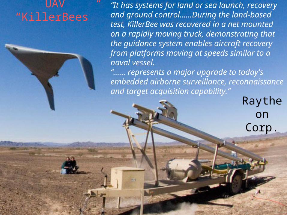
Images and excerpt from: http://www.intell.rtaf.mi.th/newsdetail.asp?id=50858
“It has systems for land or sea launch, recovery and ground control……During the land-based test, KillerBee was recovered in a net mounted on a rapidly moving truck, demonstrating that the guidance system enables aircraft recovery from platforms moving at speeds similar to a naval vessel.“…… represents a major upgrade to today's embedded airborne surveillance, reconnaissance and target acquisition capability.”
UAV “KillerBees”
Raytheon Corp.
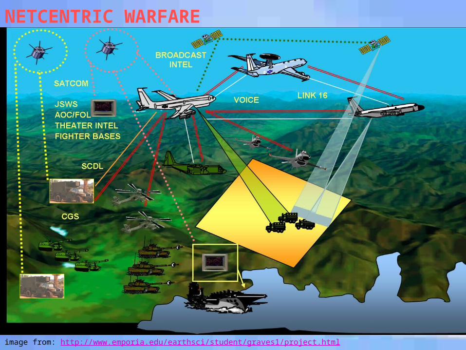
NETCENTRIC WARFARE
image from: http://www.emporia.edu/earthsci/student/graves1/project.html
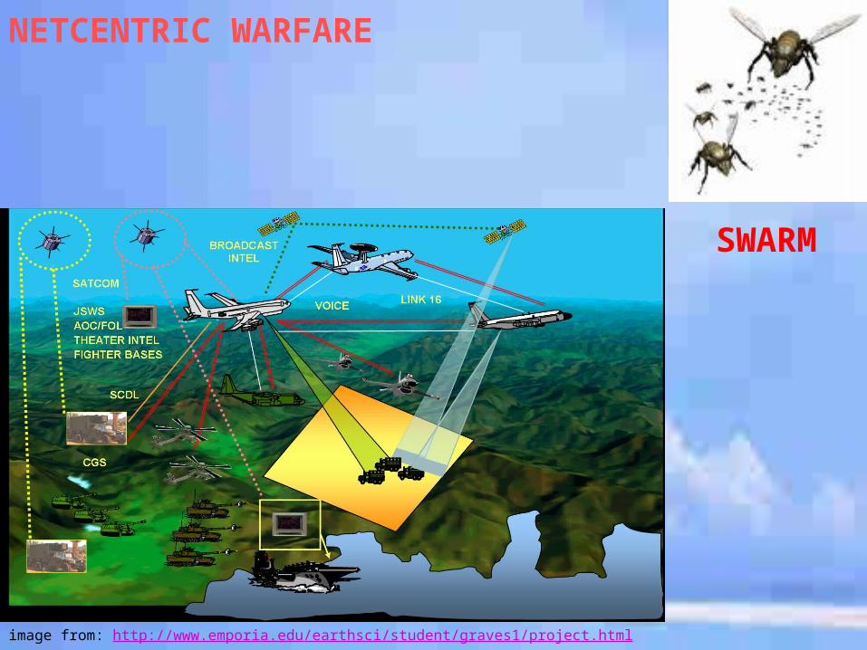
NETCENTRIC WARFARE
image from: http://www.emporia.edu/earthsci/student/graves1/project.html
SWARM
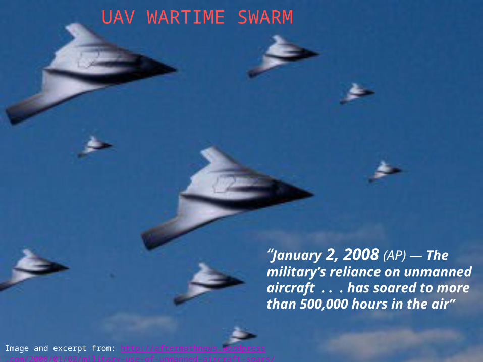
Image and excerpt from: http://aftermathnews.wordpress.com/2008/01/02/military-use-of-unmanned-aircraft-soars/
“January 2, 2008 (AP) — The military’s reliance on unmanned aircraft . . . has soared to more than 500,000 hours in the air”
UAV WARTIME SWARM
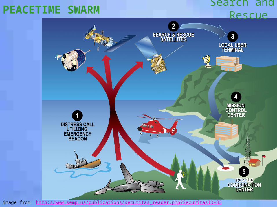
PEACETIME SWARM
image from: http://www.semp.us/publications/securitas_reader.php?SecuritasID=33
Search and Rescue
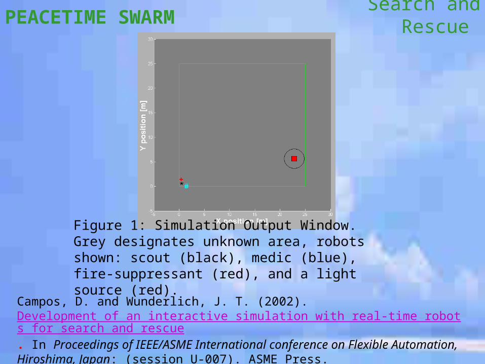
PEACETIME SWARM Search and Rescue
Campos, D. and Wunderlich, J. T. (2002). Development of an interactive simulation with real-time robots for search and rescue. In Proceedings of IEEE/ASME International conference on Flexible Automation, Hiroshima, Japan: (session U-007). ASME Press.
Figure 1: Simulation Output Window. Grey designates unknown area, robots shown: scout (black), medic (blue), fire-suppressant (red), and a light source (red).
Unmanned Underwater Vehicles (UUV’s)
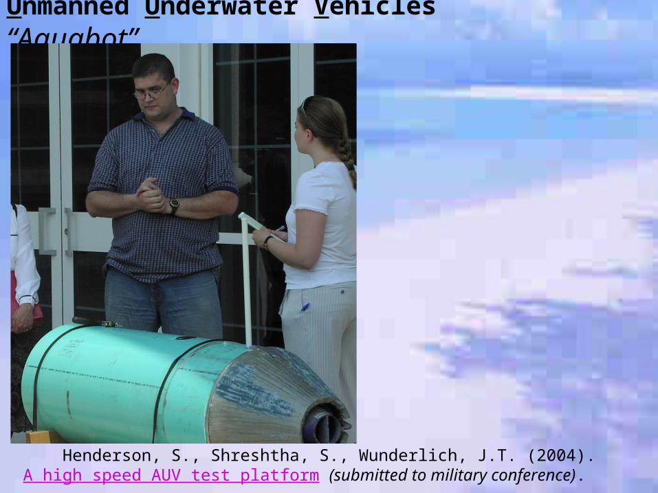
Unmanned Underwater Vehicles “Aquabot”
Henderson, S., Shreshtha, S., Wunderlich, J.T. (2004). A high speed AUV test platform (submitted to military conference).
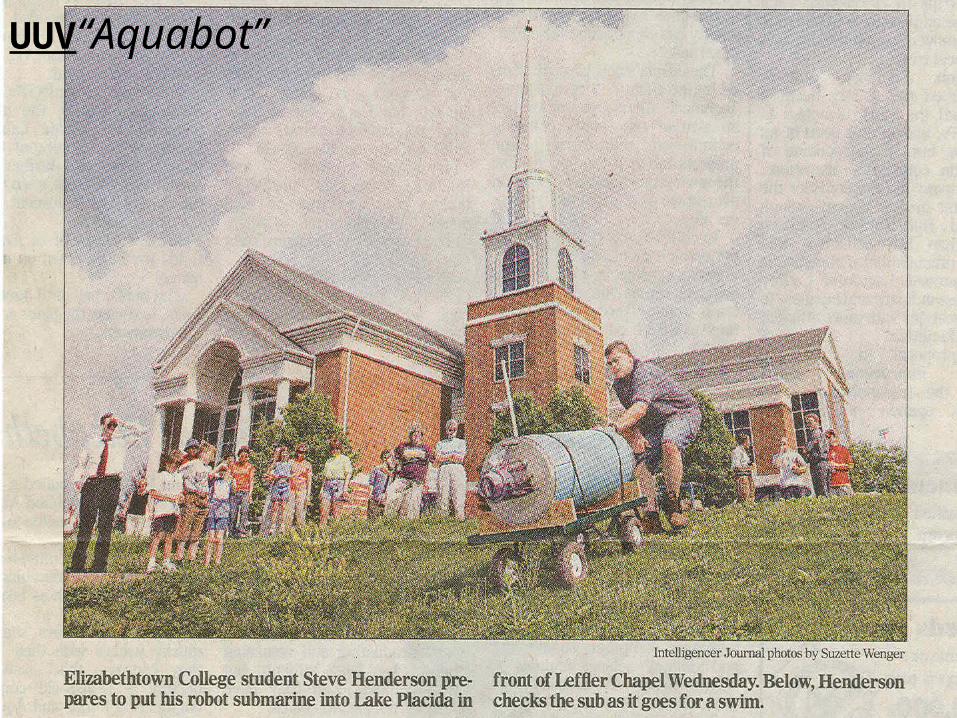
UUV“Aquabot”
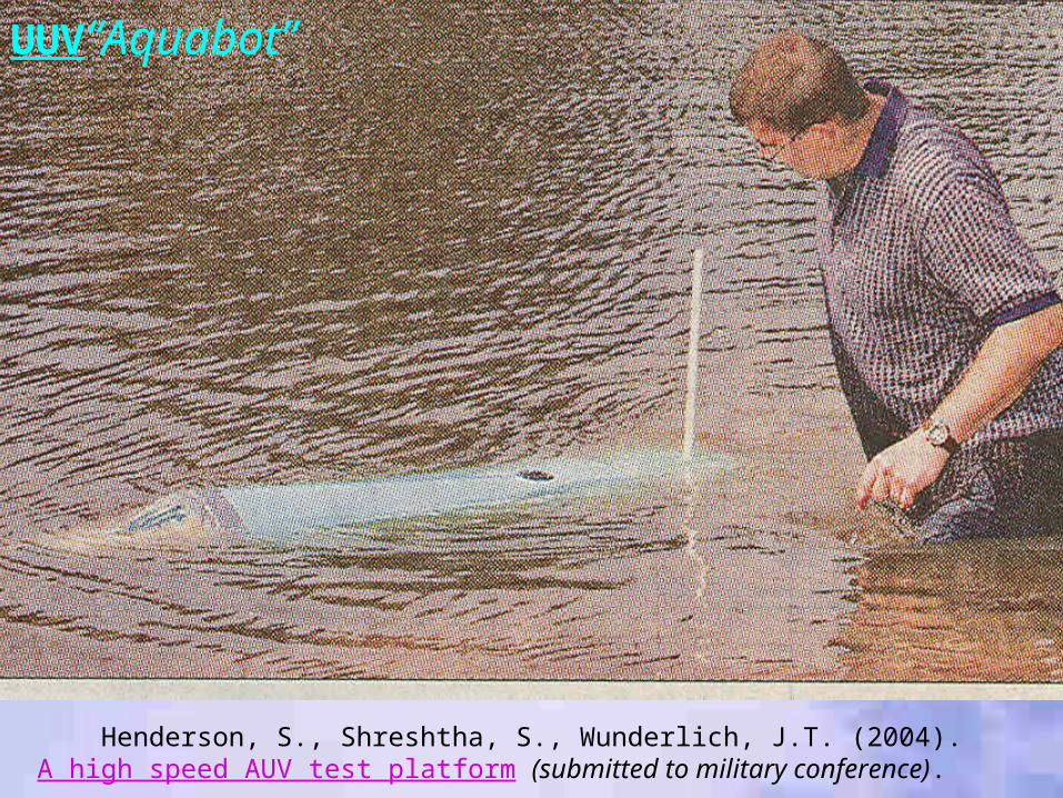
UUV“Aquabot”
Henderson, S., Shreshtha, S., Wunderlich, J.T. (2004). A high speed AUV test platform (submitted to military conference).
Unmanned Underwater Vehicles
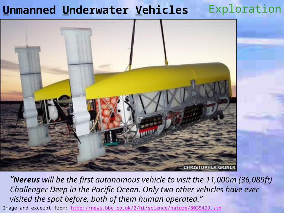
Image and excerpt from: http://news.bbc.co.uk/2/hi/science/nature/8035499.stm
“Nereus will be the first autonomous vehicle to visit the 11,000m (36,089ft) Challenger Deep in the Pacific Ocean. Only two other vehicles have ever visited the spot before, both of them human operated.”
Exploration
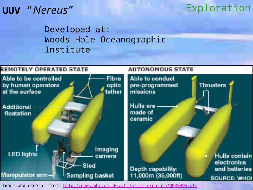
Image and excerpt from: http://news.bbc.co.uk/2/hi/science/nature/8035499.stm
ExplorationUUV “Nereus”
Developed at:Woods Hole Oceanographic Institute
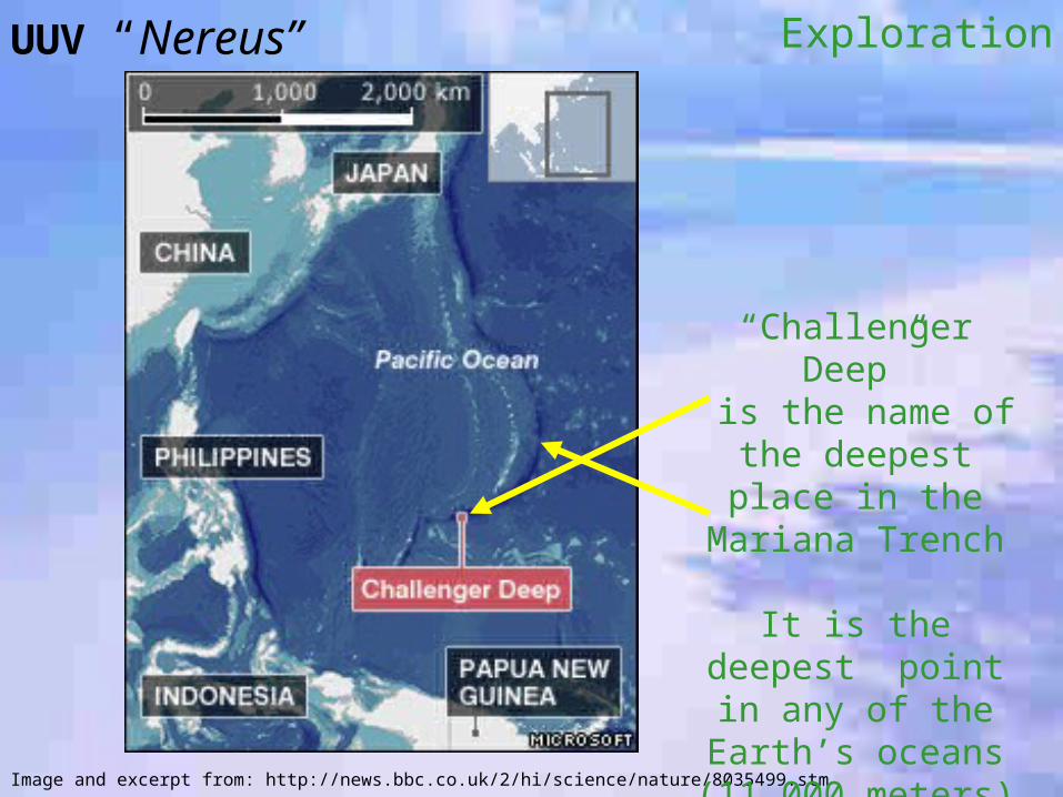
Image and excerpt from: http://news.bbc.co.uk/2/hi/science/nature/8035499.stm
ExplorationUUV “Nereus”
“Challenger Deep” is the name of the
deepest place in the Mariana Trench
It is the deepest point in any of the
Earth’s oceans(11,000 meters)
(36,000 feet)
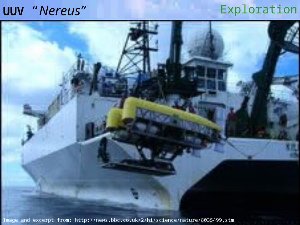
Image and excerpt from: http://news.bbc.co.uk/2/hi/science/nature/8035499.stm
ExplorationUUV “Nereus”
UUV “Nereus”
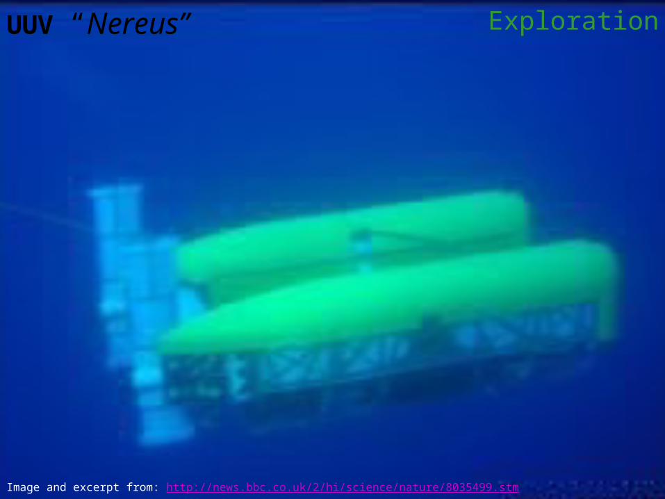
Image and excerpt from: http://news.bbc.co.uk/2/hi/science/nature/8035499.stm
Exploration
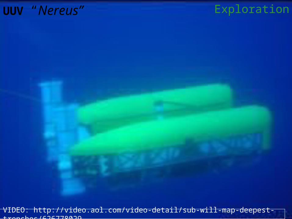
UUV “Nereus”
VIDEO: http://video.aol.com/video-detail/sub-will-map-deepest-trenches/626778029
Exploration
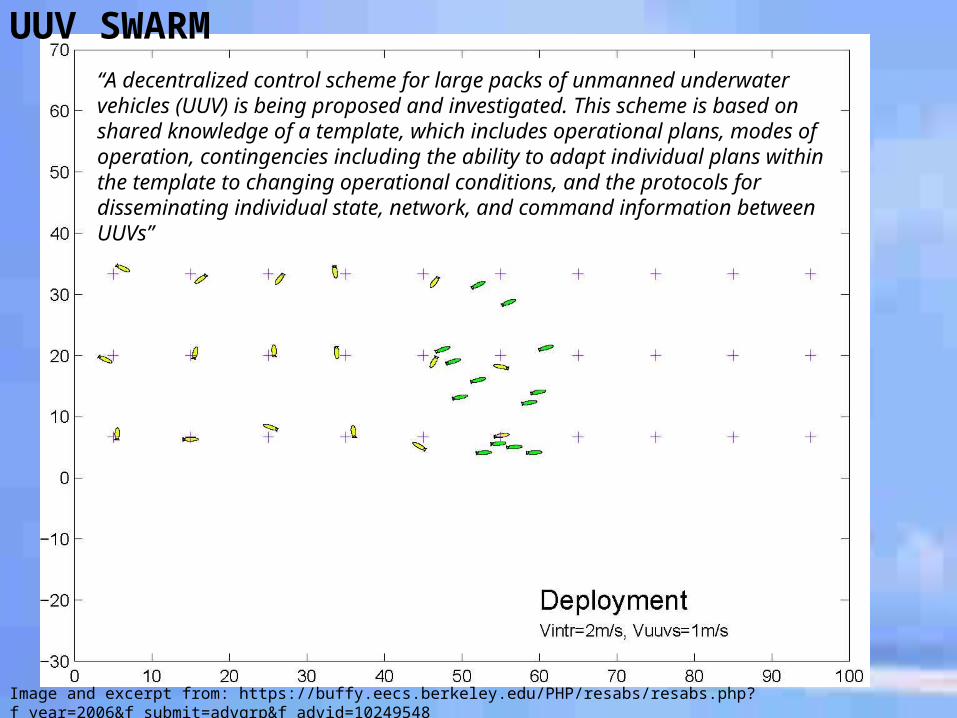
UUV SWARM“A decentralized control scheme for large packs of unmanned underwater vehicles (UUV) is being proposed and investigated. This scheme is based on shared knowledge of a template, which includes operational plans, modes of operation, contingencies including the ability to adapt individual plans within the template to changing operational conditions, and the protocols for disseminating individual state, network, and command information between UUVs”
Image and excerpt from: https://buffy.eecs.berkeley.edu/PHP/resabs/resabs.php?f_year=2006&f_submit=advgrp&f_advid=10249548
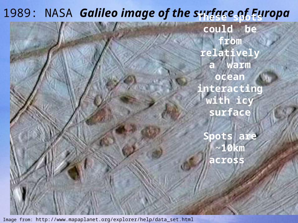
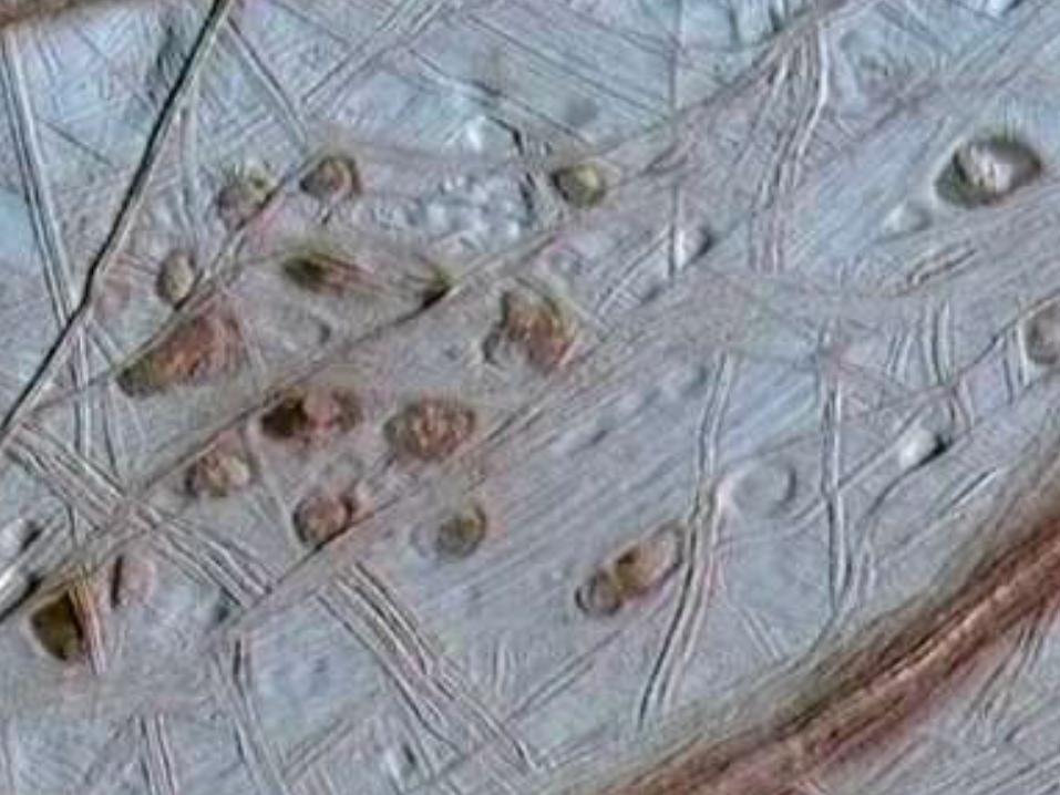
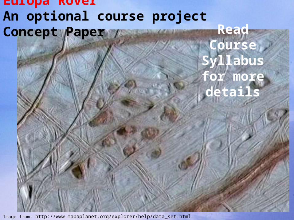
1989: NASA Galileo image of the surface of Europa
These spots could be from
relatively a warm ocean interacting
with icy surface
Spots are ~10km across
Image from: http://www.mapaplanet.org/explorer/help/data_set.html
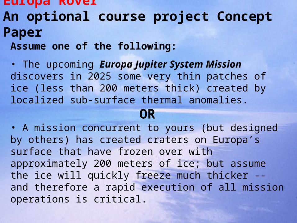
Europa RoverAn optional course project Concept Paper
Assume one of the following:
• The upcoming Europa Jupiter System Mission discovers in 2025 some very thin patches of ice (less than 200 meters thick) created by localized sub-surface thermal anomalies.
OR• A mission concurrent to yours (but designed by others) has created craters on Europa’s surface that have frozen over with approximately 200 meters of ice; but assume the ice will quickly freeze much thicker -- and therefore a rapid execution of all mission operations is critical.
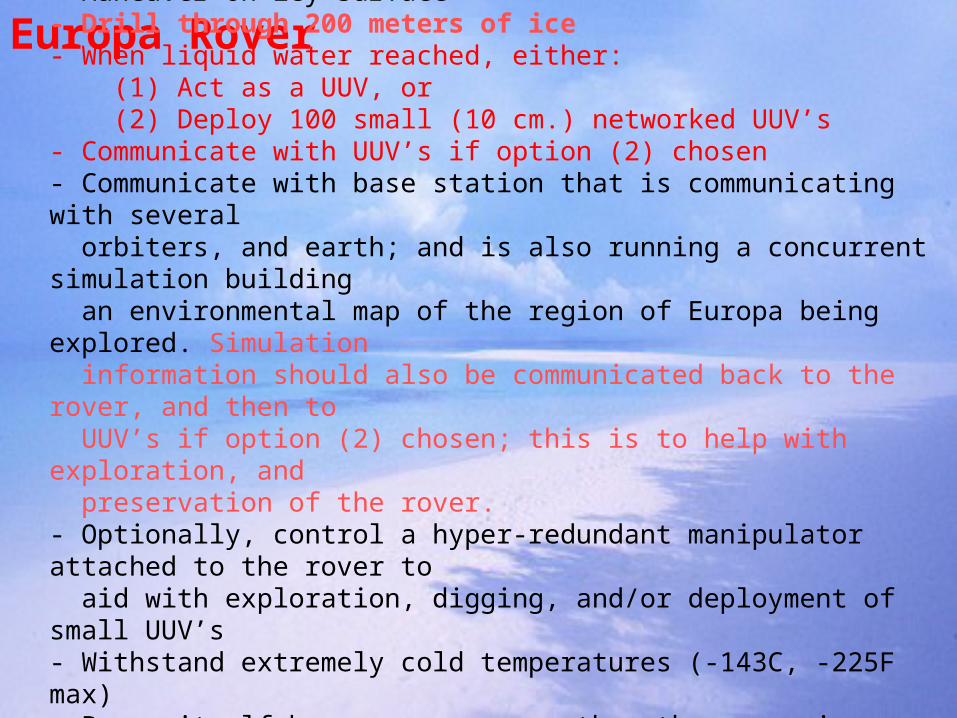
Europa RoverYour rover must be able to:
- Maneuver on icy surface- Drill through 200 meters of ice - When liquid water reached, either: (1) Act as a UUV, or (2) Deploy 100 small (10 cm.) networked UUV’s- Communicate with UUV’s if option (2) chosen- Communicate with base station that is communicating with several orbiters, and earth; and is also running a concurrent simulation building an environmental map of the region of Europa being explored. Simulation information should also be communicated back to the rover, and then to UUV’s if option (2) chosen; this is to help with exploration, and preservation of the rover.- Optionally, control a hyper-redundant manipulator attached to the rover to aid with exploration, digging, and/or deployment of small UUV’s- Withstand extremely cold temperatures (-143C, -225F max)- Power itself by energy source other than sun since incident solar radiation reaching Europa is minimal; propose a means of powering the rover.
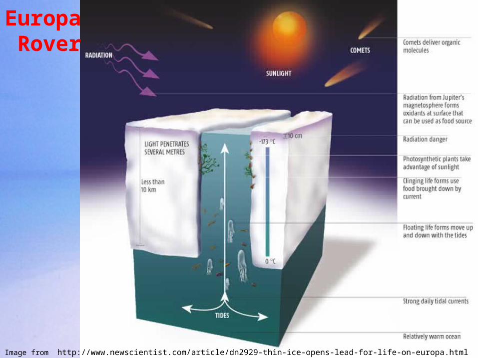
Europa Rover
Image from http://www.newscientist.com/article/dn2929-thin-ice-opens-lead-for-life-on-europa.html
ReadCourse
Syllabusfor more details
Europa RoverAn optional course project Concept Paper
Image from: http://www.mapaplanet.org/explorer/help/data_set.html