
4-1DOWNTOWN SPECIFIC PLAN
CHAPTER 4
URBAN DESIGN CONCEPT

CITY OF RIVERSIDE
4 URBAN DESIGN CONCEPT
4-2

4-3DOWNTOWN SPECIFIC PLAN
The purpose of this Chapter is to describe the overall urban design concept for the Downtown SpecificPlan. This Chapter is organized as follows:
4.1 Introduction4.2 Elements of the Urban Design Framework
4.1 INTRODUCTION
In order to achieve the Vision for the future of Downtown, an urban design concept was developedfor the Downtown, which is illustrated in Figure 4A, Urban Design Framework. This map reflectsthe major Land Use Districts that are the heart of Downtown, the major axial connections, entrypoints, open spaces, and the important connection of the Downtown to the Riverside Marketplace.The map also identifies the major historic, cultural and civic elements that make Downtown Riversidean important cultural, art and historic center that attracts both residents and visitors to the area. Figure4B further expands these elements through identification of the wide range of cultural and public artresources available in Downtown Riverside today, which provide the overall artistic texture of theRaincross District. Nearly all of these resources are located in the Raincross District, along MainStreet and Mission Inn Avenue.
4.2 ELEMENTS OF THE URBAN DESIGN FRAMEWORK
4.2.1 Downtown Districts
As illustrated in Figure 4A, the heart of the Downtown is focused around two adjacent Land UseDistricts: the Raincross District, with its unique cultural, arts and civic environment; and the JusticeCenter with its concentration of county, state and federal judicial facilities. These Districts are describedin detail in Chapters 6 & 7. Daytime activity in the Raincross District will be generated, in part, by thelarge employment base in the Justice Center through supportive and complementary land uses, attractivestreetscapes, and pedestrian connections to link the two Districts. One of Downtown Riverside’sgreatest potentials rests in strengthening pedestrian and parking relationships between the JusticeCenter and Raincross District Districts to generate more activity in the area. The thousands of employeesin the Justice Center represent one of the important market segments for restaurants, shops and newresidential units in the Raincross District.
Surrounding the Raincross District and Justice Center Districts are lower intensity Land Use Districtscomprised of smaller scale offices, neighborhood commercial serving uses, and historic residentialneighborhoods. The strong residential component of the districts and the proximity to the RaincrossDistrict also provides market support for more activity-generating retail uses in Downtown.
CITY OF RIVERSIDE
4 URBAN DESIGN CONCEPT
4-4
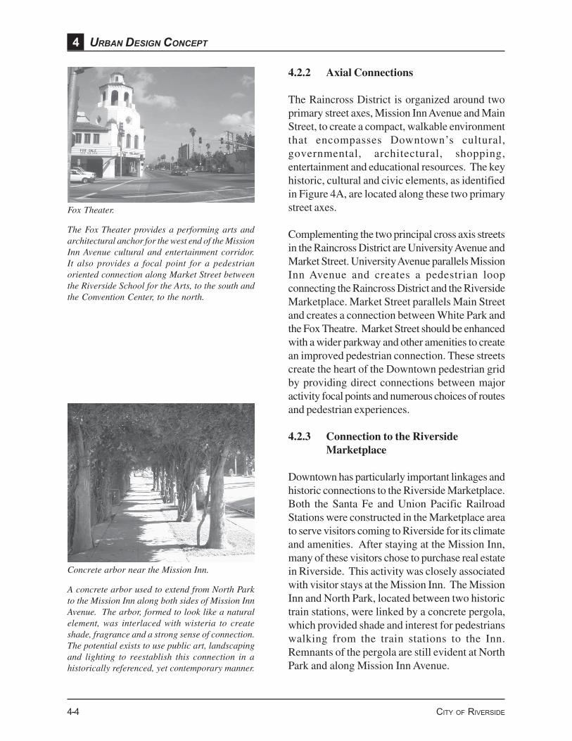
Fox Theater.
The Fox Theater provides a performing arts andarchitectural anchor for the west end of the MissionInn Avenue cultural and entertainment corridor.It also provides a focal point for a pedestrianoriented connection along Market Street betweenthe Riverside School for the Arts, to the south andthe Convention Center, to the north.
Concrete arbor near the Mission Inn.
A concrete arbor used to extend from North Parkto the Mission Inn along both sides of Mission InnAvenue. The arbor, formed to look like a naturalelement, was interlaced with wisteria to createshade, fragrance and a strong sense of connection.The potential exists to use public art, landscapingand lighting to reestablish this connection in ahistorically referenced, yet contemporary manner.
4.2.2 Axial Connections
The Raincross District is organized around twoprimary street axes, Mission Inn Avenue and MainStreet, to create a compact, walkable environmentthat encompasses Downtown’s cultural,governmental, architectural, shopping,entertainment and educational resources. The keyhistoric, cultural and civic elements, as identifiedin Figure 4A, are located along these two primarystreet axes.
Complementing the two principal cross axis streetsin the Raincross District are University Avenue andMarket Street. University Avenue parallels MissionInn Avenue and creates a pedestrian loopconnecting the Raincross District and the RiversideMarketplace. Market Street parallels Main Streetand creates a connection between White Park andthe Fox Theatre. Market Street should be enhancedwith a wider parkway and other amenities to createan improved pedestrian connection. These streetscreate the heart of the Downtown pedestrian gridby providing direct connections between majoractivity focal points and numerous choices of routesand pedestrian experiences.
4.2.3 Connection to the RiversideMarketplace
Downtown has particularly important linkages andhistoric connections to the Riverside Marketplace.Both the Santa Fe and Union Pacific RailroadStations were constructed in the Marketplace areato serve visitors coming to Riverside for its climateand amenities. After staying at the Mission Inn,many of these visitors chose to purchase real estatein Riverside. This activity was closely associatedwith visitor stays at the Mission Inn. The MissionInn and North Park, located between two historictrain stations, were linked by a concrete pergola,which provided shade and interest for pedestrianswalking from the train stations to the Inn.Remnants of the pergola are still evident at NorthPark and along Mission Inn Avenue.

Stra
tegi
c Pa
rkin
g Si
tes
Maj
or O
pen
Spac
esK
ey P
edes
tria
n Li
nkag
es
Free
way
Und
erpa
ss C
onne
ctio
ns
Key
His
toric
, Cul
tura
l, an
d C
ivic
Ele
men
ts
Reg
iona
l Ent
ry P
oint
sLo
cal E
ntry
Poi
nts
Just
ice
Cen
ter D
istr
ict
Rai
ncro
ss D
istr
ict
View
Cor
ridor
- Cou
rthou
se fr
om M
arke
t Stre
et- M
arke
t Stre
et to
Mis
sion
Inn
Figu
re 4
AU
rban
Des
ign
Fram
ewor
kD
ownt
own
Spec
ific
Plan
LEG
END
His
toric
Mag
nolia
Str
eet C
orrid
orU
rban
Hik
ing
Trai
l
Con
vent
ion
Cen
ter H
otel
Con
vent
ion
Cen
ter
Fox
Thea
ter
Mis
sion
Inn
Mai
n Li
brar
yM
unic
ipal
Aud
itoriu
mR
iver
side
Art
Mus
eum
Pack
ing
Hou
se (R
esta
uran
t)Sa
nta
Fe R
ailro
ad S
tatio
nU
nion
Pac
ific
Rai
lroad
Sta
tion
Mun
icip
al M
useu
m
City
Hal
lPr
opos
ed P
erfo
rmin
g A
rts
Scho
ol
Con
vent
ion
Cen
ter a
nd H
otel
Exp
ansi
on
Cou
nty
Cou
rtho
use
432 5 6 7 8 9 10 13 1412111 15
10TH
ST
14TH
ST
UNIV
ERSI
TY A
VE
MIS
SIO
N IN
N AV
E4TH
ST
5TH
ST
6TH
ST
1ST
ST
RUSS
ELL
ST
WILSHIRE ST
MAIN ST
ORANGE STLEMON ST
VINE ST
REDWOOD DR
LOCUST ST
LAK
E E
VAN
S
FAIR
MO
UN
T PA
RK
LIME ST
METROLINK RAIL
91 FWY
60 F
WY
MARKET ST
To Mou
ntR
ubid
oox
4
32 5
67
8
9 1011
14
1211
15
13
13


22
56
4
3
21
8
7 910
1112
1314
1715
16
2021
2324
2526
2728
2930
32
31
3334
1819
35
36
27
3229 33 3530 31 34 36
2120 2422 23 26 27 2819 25
14 1510 11 12 13 1716 18
321 4 5 6 7 8 9
Figu
re 4
BC
ultu
ral a
nd P
ublic
Art
Res
ourc
esD
ownt
own
Spec
ific
Plan
Loca
l Her
os in
stal
latio
n/M
issi
on In
n M
useu
m
Fox
Thea
ter
Cer
amic
Tile
Inse
ts/P
edes
trian
Mal
l
Riv
ersi
de H
isto
ry W
alk
Uni
on P
acifi
c E
ngin
e C
ar/
Mar
ket S
treet
Fairm
ount
Mon
umen
t E
ntry
& S
igna
ge/
Fam
ous
Wat
er B
uffa
lo/
Fairm
ount
Ros
e G
arde
n/Fa
irmou
nt B
and
She
ll
“Not
ion
of Id
eal G
over
nmen
t”/C
alifo
rnia
Mob
ile/P
ublic
Art
Pav
ers/
“Vis
ions
of t
he L
ocal
Sce
ne” M
oral
s/C
al. T
ower
s
Dos
an A
hn C
hang
-Ho
Mem
oria
l Scu
lptu
re
Set
h Th
omas
Clo
ck
Riv
ersi
de C
ount
y C
ourth
ouse
De
Anz
a S
culp
ture
Riv
ersi
de B
alle
t Arts
Bui
ldin
g/R
iver
side
Arts
Cou
ncil
Boy
Sco
ut S
culp
ture
Met
al M
obile
Scu
lptu
re
Whi
te P
ark
Clo
ud F
ount
ain
Mis
sion
Inn
Mus
eum
/C
hine
se P
avili
onS
undi
alR
iver
side
Dic
kens
Fes
tival
/M
issi
on In
n Av
e
Riv
ersi
de M
useu
m o
f Art
UC
R C
alifo
rnia
M
useu
m o
f Pho
togr
aphy
Dr.
Mar
tin L
uthe
r Kin
g Jr
. Scu
lptu
re
“Riv
ersi
de T
ripod
”, Ja
mes
Ros
etti/
Civ
ic C
ente
r
Sis
ter C
ity T
empl
e S
culp
ture
/C
ivic
Cen
ter
Per
gola
and
City
Col
ony
Mar
ker/
Civ
ic C
ente
r (P
ublic
Res
troom
s)
Civ
ic C
lock
Tow
er F
ount
ain/
Civ
ic C
ente
r Cou
rthou
se
War
Mon
umen
t and
Mem
oria
l Wal
l/C
ivic
Cen
ter
Sor
opto
mis
t Ros
e G
arde
n/C
ourth
ouse
Law
n
Det
entio
n C
ente
r Scu
lptu
re
City
Rai
ncro
ss L
ight
Sta
ndar
ds
“Saf
e in
His
Arm
s” S
culp
ture
His
toric
Sig
nage
/Mur
als
Met
rolin
k P
ublic
Art/
Citr
us L
abel
Mur
als
Riv
ersi
de M
unic
ipal
Mus
eum
/W
omen
’s C
hris
tian
Tem
pera
nce
Uni
on F
ount
ain
Per
gola
s/M
issi
on In
n Av
e/R
iver
side
Mun
icip
al A
udito
rium
Gra
nt E
lem
enta
ry
Sch
ool F
ount
ain
Chi
nato
wn
His
toric
Site


4-9DOWNTOWN SPECIFIC PLAN
Santa Fe Railroad Station structure in foreground.Packing House Structure in background.
The historic packing house, train station andother structures around North Park have, or are,being restored for restaurant, entertainment andcommercial use. This concentration of historicstructures and vibrant activity creates the easterlyanchor for the Mission Inn Avenue cultural andentertainment corridor.
Looking east along Mission Inn Avenue betweenDowntown and the Riverside Marketplace.
The construction project associated with thewidening of the 91 freeway presents anopportunity to effectively link Downtown and theRiverside Marketplace using the freeway andunderpasses. Public art, lighting, andlandscaping are key ingredients to creating thisvital connection.
Former and current packinghouses and theIronworks building also form an important part ofthe network of the special historical and architecturalelements to be experienced as a part of visitingDowntown area. The packinghouses, listed in theNational Register of Historic Places, are an integralpart of the citrus history of Riverside. The IronWorks building is also listed on the NationalRegister because it housed the company whichinvented and manufactured the equipment used forthe citrus industry in Riverside and elsewhere.
The relatively recent Metrolink Station, located inthe Marketplace area, creates another importantlinkage with Downtown. The Metrolink trainsprovide access to Orange County, San Diego andLos Angeles from Riverside. This linkage couldbecome increasingly important with therevitalization of Downtown and the growth of theJustice Center in particular. The proximity of theJustice Center to North Park provides theopportunity for pedestrian, bicycle, taxi and shuttlebus connections between the Metrolink Station, theMarketplace and Downtown.
The Riverside Marketplace also is a part of the link,along University Avenue, between the Universityof California at Riverside (UCR) and Downtown.This linkage is one of both physical appearance andland use. The physical streetscape linkage is animportant part of the experience of students, facultyand visitors to UCR. The land use linkage isimportant both in terms of providing residential usesto create a more active downtown and in terms ofproviding needed housing supply and living choicesfor upper division students, as well as faculty, atUCR.
The 91 Freeway was constructed subsequent to thedevelopment of the historic elements along MissionInn Avenue and creates a barrier betweenDowntown and the Riverside Marketplace. Thecurrent widening of the 91 Freeway presents anopportunity for the City to work with Caltrans tobridge this divide by creating an inviting pedestrian
CITY OF RIVERSIDE
4 URBAN DESIGN CONCEPT
4-10
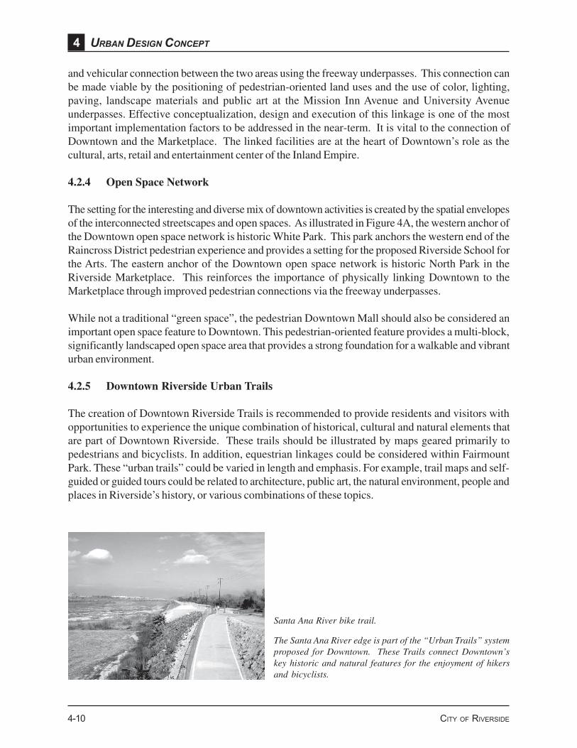
Santa Ana River bike trail.
The Santa Ana River edge is part of the “Urban Trails” systemproposed for Downtown. These Trails connect Downtown’skey historic and natural features for the enjoyment of hikersand bicyclists.
and vehicular connection between the two areas using the freeway underpasses. This connection canbe made viable by the positioning of pedestrian-oriented land uses and the use of color, lighting,paving, landscape materials and public art at the Mission Inn Avenue and University Avenueunderpasses. Effective conceptualization, design and execution of this linkage is one of the mostimportant implementation factors to be addressed in the near-term. It is vital to the connection ofDowntown and the Marketplace. The linked facilities are at the heart of Downtown’s role as thecultural, arts, retail and entertainment center of the Inland Empire.
4.2.4 Open Space Network
The setting for the interesting and diverse mix of downtown activities is created by the spatial envelopesof the interconnected streetscapes and open spaces. As illustrated in Figure 4A, the western anchor ofthe Downtown open space network is historic White Park. This park anchors the western end of theRaincross District pedestrian experience and provides a setting for the proposed Riverside School forthe Arts. The eastern anchor of the Downtown open space network is historic North Park in theRiverside Marketplace. This reinforces the importance of physically linking Downtown to theMarketplace through improved pedestrian connections via the freeway underpasses.
While not a traditional “green space”, the pedestrian Downtown Mall should also be considered animportant open space feature to Downtown. This pedestrian-oriented feature provides a multi-block,significantly landscaped open space area that provides a strong foundation for a walkable and vibranturban environment.
4.2.5 Downtown Riverside Urban Trails
The creation of Downtown Riverside Trails is recommended to provide residents and visitors withopportunities to experience the unique combination of historical, cultural and natural elements thatare part of Downtown Riverside. These trails should be illustrated by maps geared primarily topedestrians and bicyclists. In addition, equestrian linkages could be considered within FairmountPark. These “urban trails” could be varied in length and emphasis. For example, trail maps and self-guided or guided tours could be related to architecture, public art, the natural environment, people andplaces in Riverside’s history, or various combinations of these topics.

4-11DOWNTOWN SPECIFIC PLAN
A shorter trail could focus on the historic Mission Inn Avenue/Main Street axis. Longer trails couldinclude the Mission Inn Avenue/Main Street axis as their focus, while extending west to encompassDowntown’s natural elements including Mount Rubidoux, Fairmount Park and the Santa Ana River.The trails could take a variety of routes through Downtown’s historic neighborhoods.
One example of a Downtown Riverside Trail is illustrated in Figure 4A, Urban Design Framework.The concept for this route is a loop which includes:• The historical, architectural and cultural elements of the Mission Inn Avenue/Main Street axis,
including the Mission Inn, Riverside Museum of Art, Riverside Municipal Museum, MunicipalAuditorium, the Fox Theater, and the UCR Museum of Photography;
• Historic residential neighborhoods;• The natural features that border Downtown, including Fairmount Park, Lake Evans and the Santa
Ana River.
4.2.6 Strategic Parking Sites
A key to preserving the historic structures and fabric of the Raincross District, as well as enhancingthe pedestrian experience of Downtown, is the location of strategically placed, user friendly, publiclyowned parking structures. These structures should be located so as to serve the uses located alongboth of the cross axes described above. These structures can provide parking which can serve as anincentive for rehabilitation and new construction through favorable pricing of spaces for developersand/or users. Potential sites for parking structures that are strategically located to serve the RaincrossDistrict and have the potential for redevelopment are identified in Figure 4A.
CITY OF RIVERSIDE
4 URBAN DESIGN CONCEPT
4-12
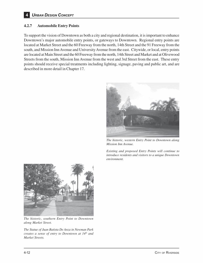
The historic, western Entry Point to Downtown alongMission Inn Avenue.
Existing and proposed Entry Points will continue tointroduce residents and visitors to a unique Downtownenvironment.
The historic, southern Entry Point to Downtownalong Market Street.
The Statue of Juan Batista De Anza in Newman Parkcreates a sense of entry to Downtown at 14th andMarket Streets.
4.2.7 Automobile Entry Points
To support the vision of Downtown as both a city and regional destination, it is important to enhanceDowntown’s major automobile entry points, or gateways to Downtown. Regional entry points arelocated at Market Street and the 60 Freeway from the north, 14th Street and the 91 Freeway from thesouth, and Mission Inn Avenue and University Avenue from the east. Citywide, or local, entry pointsare located at Main Street and the 60 Freeway from the north, 14th Street and Market and at OlivewoodStreets from the south, Mission Inn Avenue from the west and 3rd Street from the east. These entrypoints should receive special treatments including lighting, signage, paving and public art, and aredescribed in more detail in Chapter 17.


