
VFR Research - R. Hudson
Precipitation

VFR Research - R. Hudson
Precipitation
• Measurement
• Types of precipitation
• Precipitation distribution– seasonal– regional– topographic controls
• Basin average precipitation

VFR Research - R. Hudson
Total PrecipitationTotal Precipitation = rain + snow
Current standard: 16” diameter PVC standpipe gauge– 1-2 metres gauge height– charged with antifreeze to melt snow falling
into the gauge– circulating pump– pressure transducer measures gauge depth– depth recorded by a data logger

VFR Research - R. Hudson
Rainfall
Current and past standard for measuring rain only is the tipping bucket rain gauge– rain is funnelled into a collector mechanism
that tips back and forth when a specific volume of rain is received
– each tip activates a reed switch, number of tips are counted by a recorder
– usually calibrated to 1.0, 0.5 or 0.25 mm rain

VFR Research - R. Hudson
SnowfallSnow is measured as water equivalent
in units of depth (mm or cm).
• AES method at manned sites: limited capacity, manually operated shielded gauges– usually emptied daily– water equivalent of snow caught in gauge is
measured either by weighing or by melting the snow and measuring in a graduated cylinder

VFR Research - R. Hudson
Precipitation gauge sitingAll precipitation gauges experience
undercatch– wind exacerbates gauge undercatch:
• causes ppt to fall at an angle less than 90o
– this affects rain and snow equally
• the gauge will deform the wind field, creating updrafts and flow acceleration over the gauge orifice that inhibits ppt from falling in the gauge
– this mostly affects snow, but can affect rain if gauge is poorly sited
– if possible, gauge should be in sheltered site
VFR Research - R. Hudson
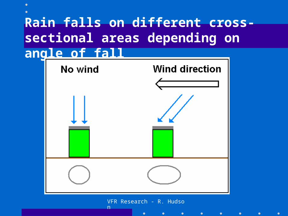
Rain falls on different cross-sectional areas depending on angle of fall

VFR Research - R. Hudson
Effect of rainfall angle on catch
• Vertical rain sees a circular cross-section on the gauge– true “as calibrated” precipitation catch
• Angular rain sees an elliptical cross-section with a larger area than true area of the orifice– a function of the angle at which the rain falls– catch ratio = orifice area/area of ellipse

VFR Research - R. Hudson
Proper siting of a precip. gauge
VFR Research - R. Hudson
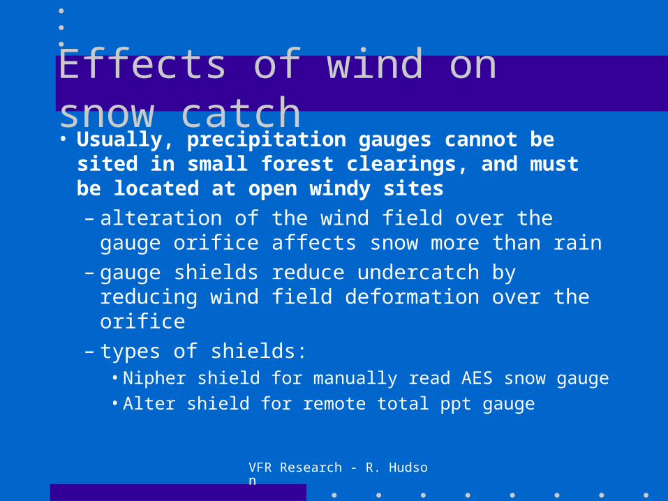
Effects of wind on snow catch• Usually, precipitation gauges cannot be
sited in small forest clearings, and must be located at open windy sites– alteration of the wind field over the gauge orifice
affects snow more than rain– gauge shields reduce undercatch by reducing
wind field deformation over the orifice– types of shields:
• Nipher shield for manually read AES snow gauge
• Alter shield for remote total ppt gauge

VFR Research - R. Hudson
What causes precipitation?
Primary cause of precipitation: lifting of moisture laden air
• As elevation increases, pressure decreases– Boyle’s law: at constant temperature, as
pressure increases, the volume decreases– Charles’ law: at constant pressure, as
temperature changes, volume changes

VFR Research - R. Hudson
Types of precipitation
Ppt is typed according to the lifting mechanism that generates it
• Cyclonic: lifting due to convergence into a low pressure cell– typical winter rains in coastal B.C.– wide spread, low to moderate intensity
• Frontal: lifting of warm air over colder, denser air at frontal surface

VFR Research - R. Hudson
Fronts
– warm front: warm air advances over cold air• wide spread - 300 to 500 km ahead of front due to
low slope of front (1/100 to 1/300)
• continuous, low to moderate intensity
– cold front: cold air advances under warm• more localized and more rapid lifting due to steeper
frontal surface (1/50 to 1/150)
• much higher intensities than warm front and less uniform

VFR Research - R. Hudson
Convective / Orographic
• Convective: lifting of unstable air that is warmer than surrounding air due to uneven surface heating– thunder storms– spotty and highly variable in intensity
• Orographic: mechanical lifting over mountains– very important in B.C. - controls climate

VFR Research - R. Hudson
Precipitation distribution• Rain vs. snow
– simply a function of temperature, governed by season and elevation
• Spatial distribution– topographic control of precipitation
• local vs. regional
• Seasonal distribution
• Rainfall intensity-duration
VFR Research - R. Hudson
Precipitation distribution
• In B.C., the most important effects are frontal and orographic– highest intensity storms on the coast are frontal,
but the orographic effect works in conjunction with the front to produce very high volume and intensity of rainfall
– orography generally defines B.C.’s climate and biogeoclimatic zonation

VFR Research - R. Hudson
Local orographic effects
0 400 800 1200 1600 2000Elevation (metres above sea level)
0
500
1000
1500
2000
2500
Mea
n A
nn
ual
Pre
cip
itat
ion
(m
m)
Sunshine Coast
Penticton Creek
Russell Creek (fall-spring)

VFR Research - R. Hudson
Rain shadow effect
• Moist air is forced over mountain barriers by westerly air flow
• Ppt falls on windward (i.e., west) side of mountain range while the leeward (eastern) side is warmer and drier– strongest contrast in B.C. is the transition from
the wet west side of the Coast mountains to the Fraser Valley

VFR Research - R. Hudson
Seasonal distribution
0
100
200
300
400
To
tal M
on
thly
Pp
t. (
mm
)
0
100
200
To
tal M
on
thly
Pp
t. (
mm
)
J F M A M J J A S O N D
Upper Penticton Creek
Russell Creek

VFR Research - R. Hudson
Rainfall intensity-duration• USA standard intensity criteria
– Light: up to 2.5 mm/hour– Moderate: 2.6 to 7.6 mm/hour– Heavy: over 7.6 mm/hour
• For a given storm, maximum insensity in mm/hour is inversely proportional to duration– temporal distribution of rain during a storm is
not uniform

VFR Research - R. Hudson
Types of Precipitation networks
• Operational networks– Hydro– MOE– AES– Fire weather
• Research networks– Density of network depends on purpose of
research and resources

VFR Research - R. Hudson
There are multiple networks...• Hydro: monitoring for dam and
reservoir management• Highways: monitoring for road
conditions– e.g., Sea to Sky highway, there is a series of
remote snow gauges at upper elevations to monitor snow and weather conditions to assess debris flow/avalanche hazard along the highway

VFR Research - R. Hudson
Networks...
• AES: mostly low elevation, volunteer manned on a daily basis
• Fire weather: MOF and forest industry network to assess forest fire risk– seasonally monitored (April - October)– remote, a range of elevations

VFR Research - R. Hudson
Networks...• MOE: mostly remote, high elevation
– in conjunction with snow courses– runoff forecasting– jointly operated with WSC
• Research networks– tend to be denser than operational networks– localized, specific to research objectives
• Actual network density unknown


