eastern shore ground search and rescue presents. advanced gps course #1
TRANSCRIPT
EASTERN SHORE GROUND EASTERN SHORE GROUND SEARCH AND RESCUESEARCH AND RESCUE
PRESENTSPRESENTS
ADVANCEDADVANCED
GPS COURSE #1GPS COURSE #1
NOTE ON GPS USENOTE ON GPS USE
GPS GPS enhancesenhances, not , not replacesreplaces traditional map andtraditional map and compass compass navigation.navigation.
NOTE ON CLASS EXAMPLESNOTE ON CLASS EXAMPLES
Classroom examples are based on the Garmin Classroom examples are based on the Garmin GPSMAP60 and GPSMAP76.GPSMAP60 and GPSMAP76.
Team units will be provided for use during classTeam units will be provided for use during class..
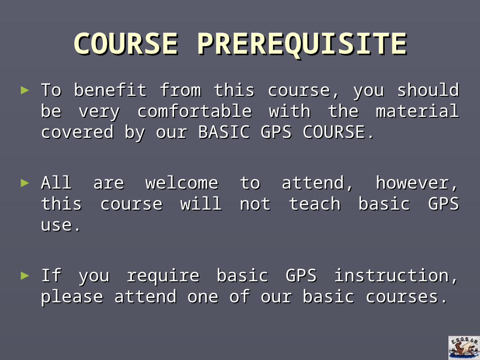
COURSE PREREQUISITECOURSE PREREQUISITE
► To benefit from this course, you should be very To benefit from this course, you should be very comfortable with the material covered by our comfortable with the material covered by our BASIC GPS COURSE.BASIC GPS COURSE.
► All are welcome to attend, however, this course All are welcome to attend, however, this course will not teach basic GPS use.will not teach basic GPS use.
► If you require basic GPS instruction, please If you require basic GPS instruction, please attend one of our basic courses.attend one of our basic courses.
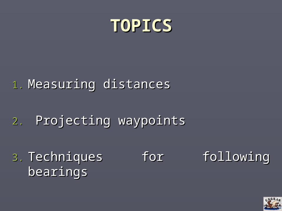
TOPICSTOPICS
1.1. Measuring distancesMeasuring distances
2.2. Projecting waypointsProjecting waypoints
3.3. Techniques for following bearingsTechniques for following bearings
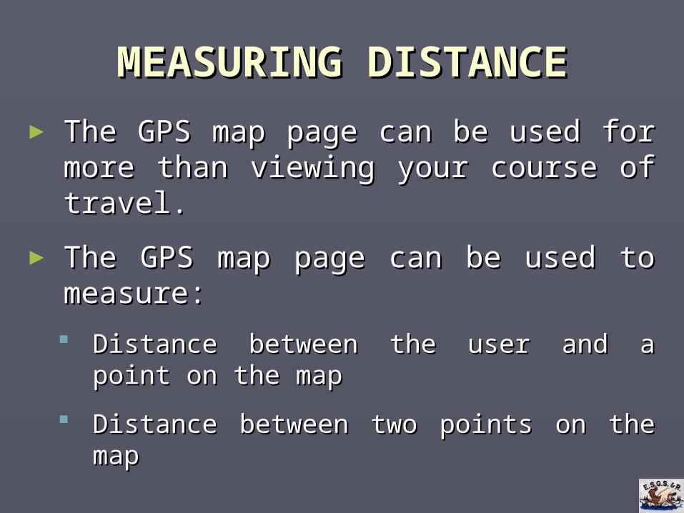
MEASURING DISTANCEMEASURING DISTANCE
► The GPS map page can be used for more than The GPS map page can be used for more than viewing your course of travel.viewing your course of travel.
► The GPS map page can be used to measure:The GPS map page can be used to measure:
Distance between the user and a point on the mapDistance between the user and a point on the map
Distance between two points on the mapDistance between two points on the map
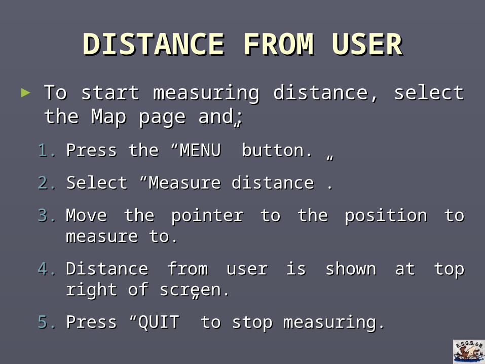
DISTANCE FROM USERDISTANCE FROM USER
► To start measuring distance, select the Map To start measuring distance, select the Map page and:page and:
1.1. Press the “MENU” button.Press the “MENU” button.
2.2. Select “Measure distance”.Select “Measure distance”.
3.3. Move the pointer to the position to measure to.Move the pointer to the position to measure to.
4.4. Distance from user is shown at top right of screen.Distance from user is shown at top right of screen.
5.5. Press “QUIT” to stop measuring.Press “QUIT” to stop measuring.
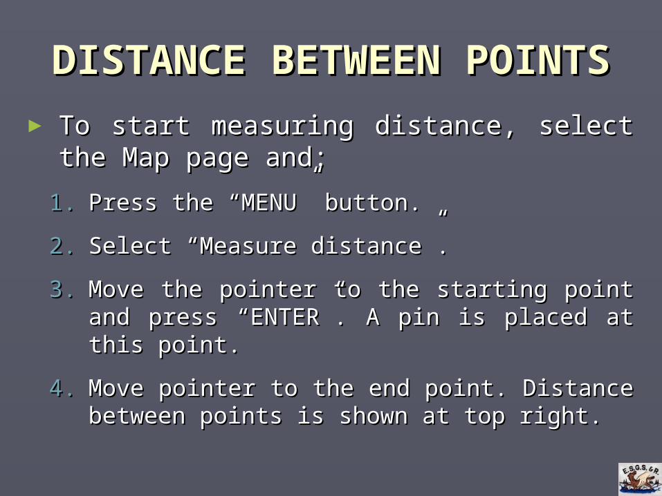
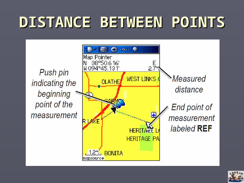
DISTANCE BETWEEN POINTSDISTANCE BETWEEN POINTS
► To start measuring distance, select the Map To start measuring distance, select the Map page and:page and:
1.1. Press the “MENU” button.Press the “MENU” button.
2.2. Select “Measure distance”.Select “Measure distance”.
3.3. Move the pointer to the starting point and press Move the pointer to the starting point and press “ENTER”. A pin is placed at this point.“ENTER”. A pin is placed at this point.
4.4. Move pointer to the end point. Distance between Move pointer to the end point. Distance between points is shown at top right.points is shown at top right.
DISTANCE BETWEEN POINTSDISTANCE BETWEEN POINTS
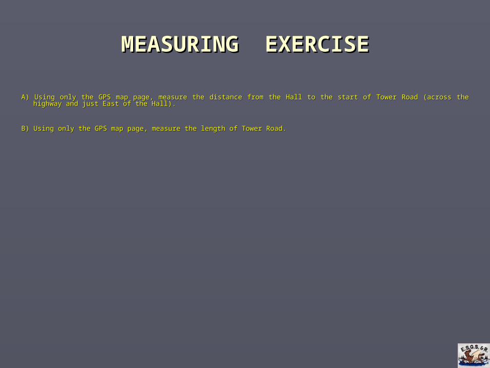
MEASURING EXERCISEMEASURING EXERCISE
A) A) Using only the GPS map page, measure the distance from the Hall to the start of Tower Road (across the highway and just East of the Hall).Using only the GPS map page, measure the distance from the Hall to the start of Tower Road (across the highway and just East of the Hall).
B) B) Using only the GPS map page, measure the length of Tower Road.Using only the GPS map page, measure the length of Tower Road.
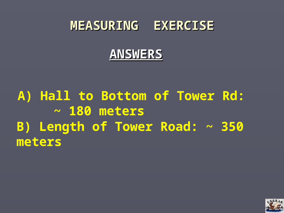
MEASURING MEASURING EXERCISEEXERCISE
ANSWERSANSWERS
A) Hall to Bottom of Tower Rd: ~ 180 metersB) Length of Tower Road: ~ 350 meters
PROJECTING A WAYPOINTPROJECTING A WAYPOINT
► A projected waypoint is a waypoint that is A projected waypoint is a waypoint that is created based on the distance and bearing from created based on the distance and bearing from an existing waypoint. an existing waypoint.
► Projected waypoint = Projected waypoint = bearingbearing + + distancedistance from from an an existing waypointexisting waypoint..
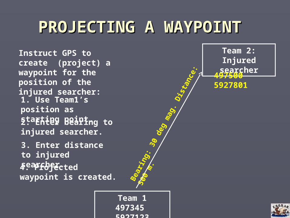
PROJECTING A WAYPOINTPROJECTING A WAYPOINT
Team 1497345 5927123
Team 2:Injured searcher
Bea
ring
: 30
deg
mag
. Dis
tanc
e: 5
00 m
.
Instruct GPS to create (project) a waypoint for the position of the injured searcher:
2. Enter bearing to injured searcher.
1. Use Team1’s position as starting point.
3. Enter distance to injured searcher.
4. Projected waypoint is created.
497500 5927801
PROJECTING A WAYPOINTPROJECTING A WAYPOINT
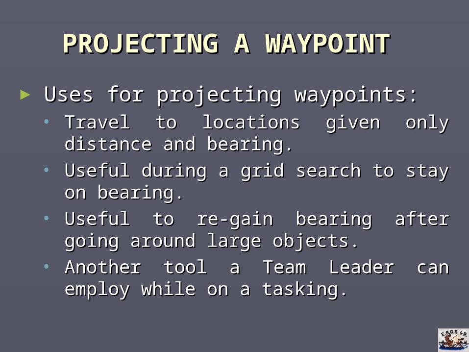
► Uses for projecting waypoints:Uses for projecting waypoints:• Travel to locations given only distance and bearing.Travel to locations given only distance and bearing.
• Useful during a grid search to stay on bearing.Useful during a grid search to stay on bearing.
• Useful to re-gain bearing after going around large Useful to re-gain bearing after going around large objects.objects.
• Another tool a Team Leader can employ while on a Another tool a Team Leader can employ while on a tasking.tasking.
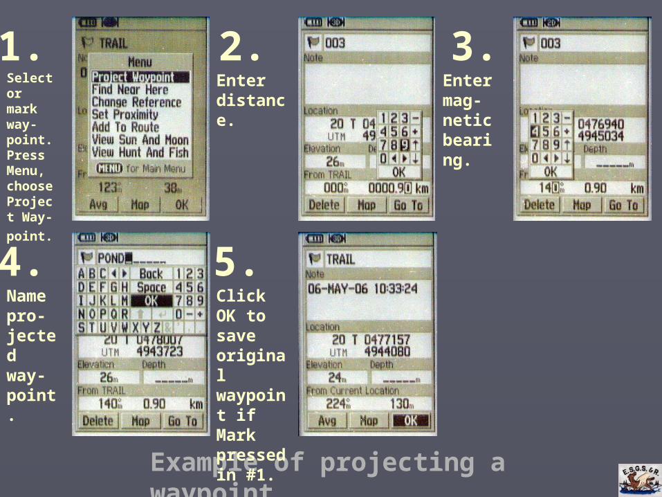
Example of projecting a waypoint
1. 2.
4.
3.
5.
Select or mark way-point. Press Menu, choose Project Way-
point.
Enter distance.
Enter mag-netic bearing.
Name pro-jected way-point.
Click OK to save original waypoint if Mark pressed in #1.
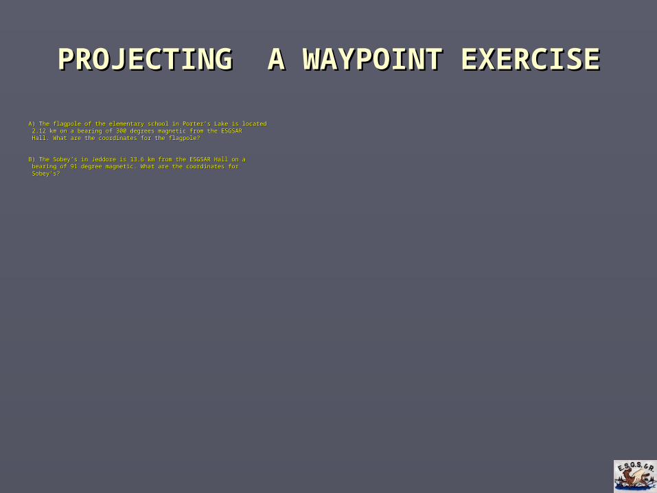
PROJECTING A WAYPOINT EXERCISEPROJECTING A WAYPOINT EXERCISE
A) The flagpole of the elementary school in Porter’s Lake is locatedA) The flagpole of the elementary school in Porter’s Lake is located 2.12 km on a bearing of 300 degrees magnetic from the ESGSAR2.12 km on a bearing of 300 degrees magnetic from the ESGSAR Hall. Hall. What are the coordinates for the flagpole?What are the coordinates for the flagpole?
B) The Sobey’s in Jeddore is 13.6 km from the ESGSAR Hall on aB) The Sobey’s in Jeddore is 13.6 km from the ESGSAR Hall on a bearing of 91 degree magnetic. What are the coordinates forbearing of 91 degree magnetic. What are the coordinates for Sobey’s?Sobey’s?
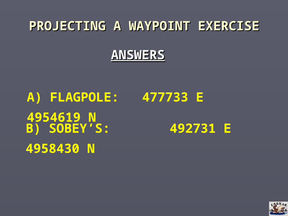
PROJECTING A WAYPOINTPROJECTING A WAYPOINT EXERCISE EXERCISE
ANSWERSANSWERS
A) FLAGPOLE: 477733 E 4954619 N
B) SOBEY’S: 492731 E 4958430 N
FOLLOWING BEARINGSFOLLOWING BEARINGS
► The Basic GPS course teaches you how to The Basic GPS course teaches you how to navigate to a waypoint by taking the most navigate to a waypoint by taking the most efficient route.efficient route.
► In most cases, the most efficient route is NOT a In most cases, the most efficient route is NOT a straight line.straight line.
► Taking the most efficient route usually involves Taking the most efficient route usually involves avoiding swamps, creeks, ponds, bogs, etc.avoiding swamps, creeks, ponds, bogs, etc.
FOLLOWING BEARINGSFOLLOWING BEARINGS
► When one is required to follow a bearing (to When one is required to follow a bearing (to travel in a straight line), following the most travel in a straight line), following the most efficient route is often not possible.efficient route is often not possible.
► The required method for following a bearing is The required method for following a bearing is to use a magnetic compass.to use a magnetic compass.
FOLLOWING BEARINGSFOLLOWING BEARINGS
► Given typical woods in our search area, Given typical woods in our search area, following a bearing with a high degree of following a bearing with a high degree of accuracy can be very challenging.accuracy can be very challenging.
► A GPS can be used in conjunction with a A GPS can be used in conjunction with a compass to minimize drifting off a bearing.compass to minimize drifting off a bearing.

FOLLOWING BEARINGSFOLLOWING BEARINGS
► These GPS functions can assist with following a These GPS functions can assist with following a bearing:bearing:
Compass Pointer:Compass Pointer: Can indicate if the user has Can indicate if the user has drifted left or right of a bearing.drifted left or right of a bearing.
Compass “Off Course” field:Compass “Off Course” field: Displays the distance Displays the distance in meters one has drifted from a bearing.in meters one has drifted from a bearing.
Map “Go To” lineMap “Go To” line: Can be configured to show the : Can be configured to show the user’s location in relation to a bearing.user’s location in relation to a bearing.
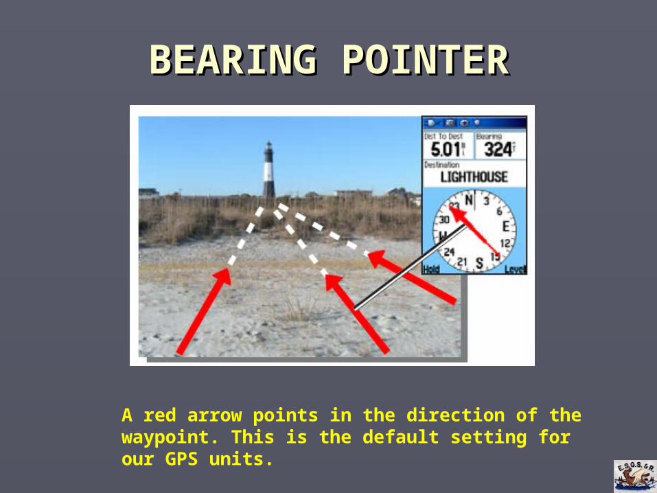
BEARING POINTERBEARING POINTER
A red arrow points in the direction of the waypoint. This is the default setting for our GPS units.
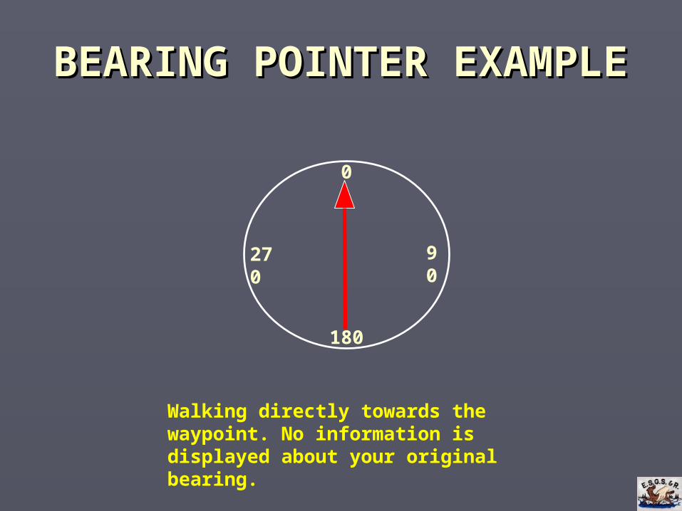
BEARING POINTER EXAMPLEBEARING POINTER EXAMPLE
0
180
90270
Walking directly towards the waypoint. No information is displayed about your original bearing.
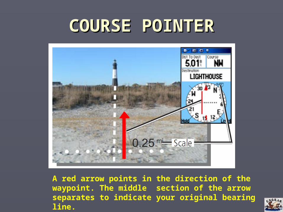
COURSE POINTERCOURSE POINTER
A red arrow points in the direction of the waypoint. The middle section of the arrow separates to indicate your original bearing line.
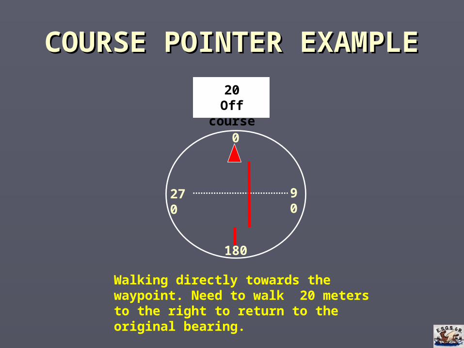
COURSE POINTER EXAMPLECOURSE POINTER EXAMPLE
20Off course
0
180
90270
Walking directly towards the waypoint. Need to walk 20 meters to the right to return to the original bearing.
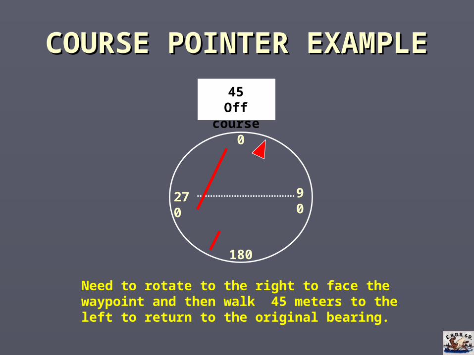
COURSE POINTER EXAMPLECOURSE POINTER EXAMPLE
90
45Off course
0
180
270
Need to rotate to the right to face the waypoint and then walk 45 meters to the left to return to the original bearing.
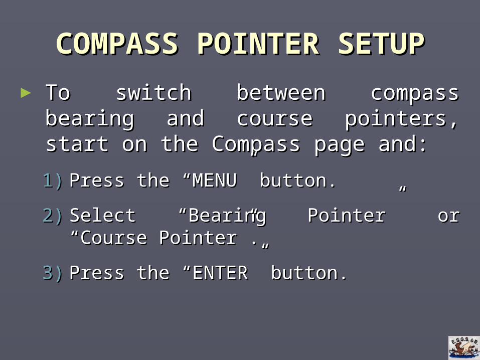
COMPASS POINTER SETUPCOMPASS POINTER SETUP
► To switch between compass bearing and course To switch between compass bearing and course pointers, start on the Compass page and:pointers, start on the Compass page and:
1)1) Press the “MENU” button.Press the “MENU” button.
2)2) Select “Bearing Pointer” or “Course Pointer”.Select “Bearing Pointer” or “Course Pointer”.
3)3) Press the “ENTER” button.Press the “ENTER” button.
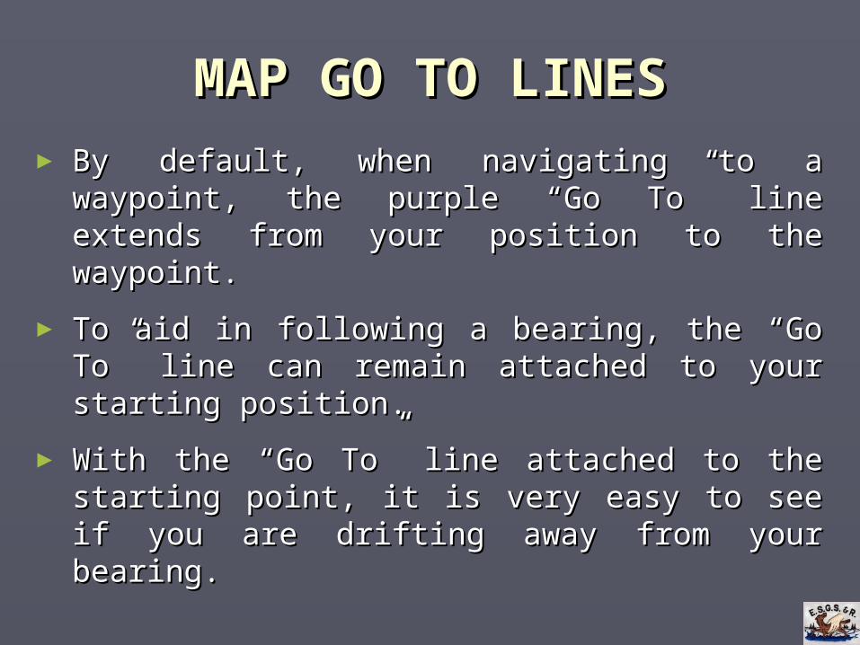
MAP GO TO LINESMAP GO TO LINES
► By default, when navigating to a waypoint, the By default, when navigating to a waypoint, the purple “Go To” line extends from your position purple “Go To” line extends from your position to the waypoint.to the waypoint.
► To aid in following a bearing, the “Go To” line To aid in following a bearing, the “Go To” line can remain attached to your starting position.can remain attached to your starting position.
► With the “Go To” line attached to the starting With the “Go To” line attached to the starting point, it is very easy to see if you are drifting point, it is very easy to see if you are drifting away from your bearing.away from your bearing.
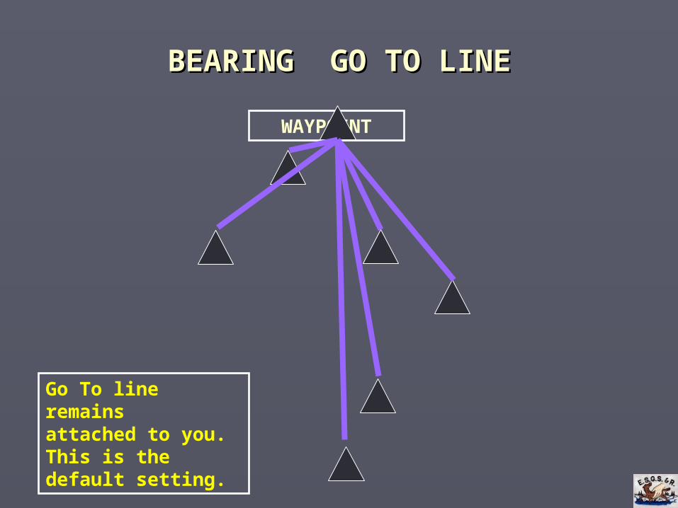
BEARING GO TO LINEBEARING GO TO LINE
WAYPOINT
Go To line remainsattached to you. This is the default setting.
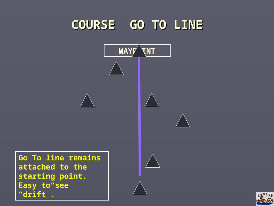
COURSE GO TO LINECOURSE GO TO LINE
WAYPOINT
Go To line remains attached to the starting point. Easy to see “drift”.
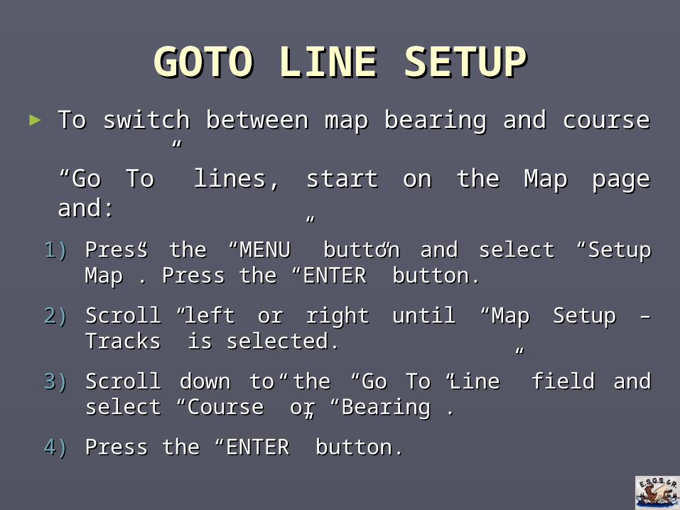
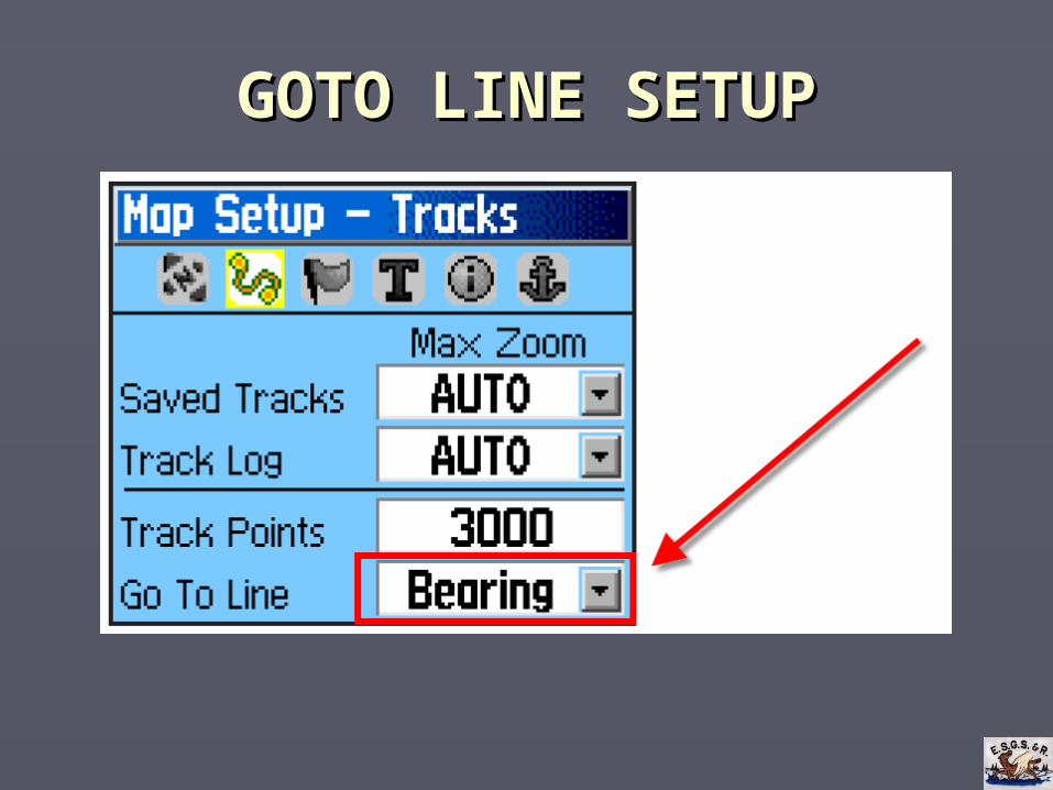
GOTO LINE SETUPGOTO LINE SETUP► To switch between map bearing and course To switch between map bearing and course
“Go To” lines, start on the Map page and:“Go To” lines, start on the Map page and:
1)1) Press the “MENU” button and select “Setup Map”. Press the “MENU” button and select “Setup Map”. Press the “ENTER” button.Press the “ENTER” button.
2)2) Scroll left or right until “Map Setup – Tracks” is Scroll left or right until “Map Setup – Tracks” is selected.selected.
3)3) Scroll down to the “Go To Line” field and select Scroll down to the “Go To Line” field and select “Course” or “Bearing”.“Course” or “Bearing”.
4)4) Press the “ENTER” button.Press the “ENTER” button.
GOTO LINE SETUPGOTO LINE SETUP
USING GPS WITH BEARINGSUSING GPS WITH BEARINGS
► Turn on Map page’s “Course” goto line.Turn on Map page’s “Course” goto line.
► Turn on Compass page’s “Course” pointer.Turn on Compass page’s “Course” pointer.
► Before starting off on a bearing, enter end point Before starting off on a bearing, enter end point as a waypoint and set GPS to GOTO it.as a waypoint and set GPS to GOTO it.
► Use map and compass pages to determine drift Use map and compass pages to determine drift and advise the compass person how to adjust and advise the compass person how to adjust the line of travel.the line of travel.
USING GPS WITH BEARINGSUSING GPS WITH BEARINGS
► If there is no defined end waypoint – as in a If there is no defined end waypoint – as in a grid search:grid search:
Project a waypoint beyond the distance of the grid Project a waypoint beyond the distance of the grid boundary and set the GPS to GOTO it. boundary and set the GPS to GOTO it.
• For example, if the grid is 300 meters long, project a For example, if the grid is 300 meters long, project a waypoint for 300 or more meters.waypoint for 300 or more meters.
Project a new waypoint each time you line up to Project a new waypoint each time you line up to start a new line through the search grid.start a new line through the search grid.
FOLLOWING A BEARING EXERCISEFOLLOWING A BEARING EXERCISE
1. Enter a waypoint for the Superstore at Porters Lake:1. Enter a waypoint for the Superstore at Porters Lake:477703 E 4954479 N477703 E 4954479 N
2. Set your GPS’ map and compass screens to the COURSE pointers. Set the map page zoom level to 50 or less.2. Set your GPS’ map and compass screens to the COURSE pointers. Set the map page zoom level to 50 or less.
3. Stand at the flagged stake at the back of the hall parking lot3. Stand at the flagged stake at the back of the hall parking lot and follow the instructions on the “Following a Bearing and follow the instructions on the “Following a Bearing Exercise” handout.Exercise” handout.

QUESTIONS QUESTIONS AND COMMENTSAND COMMENTS
END OF COURSEEND OF COURSE
THANK-YOU FOR ATTENDING