ecology and long-term land-use, palaeoecology and ... journal of biodiversity science, ecosystem...
TRANSCRIPT
This article was downloaded by: [Universitetbiblioteket I Trondheim NTNU]On: 04 December 2012, At: 04:15Publisher: Taylor & FrancisInforma Ltd Registered in England and Wales Registered Number: 1072954 Registered office: MortimerHouse, 37-41 Mortimer Street, London W1T 3JH, UK
International Journal of Biodiversity Science,Ecosystem Services & ManagementPublication details, including instructions for authors and subscription information:http://www.tandfonline.com/loi/tbsm21
Ecology and long-term land-use, palaeoecology andarchaeology – the usefulness of interdisciplinarystudies for knowledge-based conservation andmanagement of cultural landscapesKari Loe Hjelle a , Sigrid Kaland b , Mons Kvamme a , Trond Klungseth Lødøen c & BrithNatlandsmyr a da University Museum of Bergen – The Natural History Collections, University of Bergen,Post Box 7800, N-5020, Bergen, Norwayb University Museum of Bergen – The Cultural History Collections, University of Bergen,Post Box 7800, N-5020, Bergen, Norwayc University Museum of Bergen – Section for Cultural Heritage Management, University ofBergen, Post Box 7800, N-5020, Bergen, Norwayd Department of Biology, Post Box 7803, N-5020, Bergen, NorwayVersion of record first published: 30 Nov 2012.
To cite this article: Kari Loe Hjelle , Sigrid Kaland , Mons Kvamme , Trond Klungseth Lødøen & Brith Natlandsmyr(2012): Ecology and long-term land-use, palaeoecology and archaeology – the usefulness of interdisciplinary studies forknowledge-based conservation and management of cultural landscapes, International Journal of Biodiversity Science,Ecosystem Services & Management, 8:4, 321-337
To link to this article: http://dx.doi.org/10.1080/21513732.2012.739576
PLEASE SCROLL DOWN FOR ARTICLE
Full terms and conditions of use: http://www.tandfonline.com/page/terms-and-conditions
This article may be used for research, teaching, and private study purposes. Any substantial or systematicreproduction, redistribution, reselling, loan, sub-licensing, systematic supply, or distribution in any form toanyone is expressly forbidden.
The publisher does not give any warranty express or implied or make any representation that the contentswill be complete or accurate or up to date. The accuracy of any instructions, formulae, and drug dosesshould be independently verified with primary sources. The publisher shall not be liable for any loss, actions,claims, proceedings, demand, or costs or damages whatsoever or howsoever caused arising directly orindirectly in connection with or arising out of the use of this material.
International Journal of Biodiversity Science, Ecosystem Services & ManagementVol. 8, No. 4, December 2012, 321–337
Ecology and long-term land-use, palaeoecology and archaeology – the usefulnessof interdisciplinary studies for knowledge-based conservation and management of culturallandscapes
Kari Loe Hjellea*, Sigrid Kalandb , Mons Kvammea, Trond Klungseth Lødøenc and Brith Natlandsmyra,d
aUniversity Museum of Bergen – The Natural History Collections, University of Bergen, Post Box 7800, N-5020 Bergen, Norway;bUniversity Museum of Bergen – The Cultural History Collections, University of Bergen, Post Box 7800, N-5020 Bergen, Norway;cUniversity Museum of Bergen – Section for Cultural Heritage Management, University of Bergen, Post Box 7800, N-5020 Bergen,Norway; dDepartment of Biology, Post Box 7803, N-5020 Bergen, Norway
Natural and cultural heritage management is dependent on knowledge about present species and habitats and presenceof cultural heritage sites, respectively. Knowledge about long-term development helps to identify factors explaining bothbiodiversity and cultural heritage and to predict future changes based on changes in, for example, climate or grazing regimes.In the present interdisciplinary study, vegetation surveys, pollen analysis from a bog and soil profiles within archaeologicallocalities, archaeological test-excavations and historical data have been combined to elucidate cultural landscape develop-ment in an upland landscape of Erdalen in Stryn, western Norway. Activity in what is now the summer farm area started in theBronze Age, followed by clearance and grazing in the Early Iron Age. After a period of reduced activity, most of the valleyseems to have been utilised for summer farming in the Late Iron Age and first part of the Medieval Period. A regressionperiod, probably related to the Black Death, is followed by new activity with extensive woodland clearings from the seven-teenth century, whereas recent changes have resulted in increased tree cover. The investigations show a close relationshipbetween land-use practices, presence of grassland species and vascular plant species richness. They also show the impor-tance of continued management for existence of semi-natural habitats in the future, and for the visibility of archaeologicalsites.
Keywords: archaeology; cultural landscape development; long-term ecology; habitat conservation; palaeoecology; summerfarming
Introduction
Landscape conservation areas and national parks inNorway are established with the aim to protect species,landscapes and cultural heritage for the future (NorwegianNature Diversity Act of 19 June 2009). Permanent impacton natural or cultural heritage is prohibited in the nationalparks, unless this impact is essential for fulfilling theprotection aim. Within nature conservation the aim hasoften been to maintain natural vegetation communitiesor re-establish what is believed to be natural vegetation,without considering the history of the present vegeta-tion (cf. Birks 1996; Willis and Birks 2006; van Leeuvenet al. 2008; Birks 2012). Moreover, the consequences ofprotection in relation to previous management are notalways considered. Included in landscape conservationareas and national parks are upland landscapes: areasdeveloped through generations of activities such as graz-ing, wood-cutting and haymaking, resulting in semi-naturalhabitats which are today threatened by forest succes-sion. The DYLAN project (http://www.vm.ntnu.no/dylan/;Solem et al. 2012) aims to develop a new frameworkfor the management of natural and cultural heritage inupland Landscape Conservation Areas (LCA) in Norway,with focus on knowledge of long-term natural and cultural
*Corresponding author. Email: [email protected]
variability in these landscapes. This article presents theresults of interdisciplinary studies in one of four studyareas within the DYLAN project: the mountain valleyErdalen in western Norway protected for its natural andcultural heritage values. The aims of the study are to(1) survey today’s extent of and recent changes withinsemi-natural habitats, (2) study the distribution of vas-cular plants within the semi-natural habitats regardingspecies richness, indicators of traditional land-use andother grassland species, (3) identify the history of thesesemi-natural habitats and periods of human activity and(4) study relationships between grazing pressure and veg-etation through time. By this we aim to explore the greatpotential of long-term perspectives on natural heritage con-servation, and to point at contributions from natural her-itage conservation for the management and conservationof cultural heritage.
Management of natural and cultural heritage, respec-tively, is undertaken by different governmental institutionsand is usually seen as two separate areas of conserva-tion and research, and rarely discussed in joint approaches(Lowenthal 2005; Skår et al. 2008, but see Speed et al.2012). In protection and conservation of natural heritage,biodiversity preservation is a crucial objective as expressed
ISSN 2151-3732 print/ISSN 2151-3740 online© 2012 Taylor & Francishttp://dx.doi.org/10.1080/21513732.2012.739576http://www.tandfonline.com
Dow
nloa
ded
by [
Uni
vers
itetb
iblio
teke
t I T
rond
heim
NT
NU
] at
04:
15 0
4 D
ecem
ber
2012
322 K.L. Hjelle et al.
by The United Nations Convention on Biological Diversity(http://www.cbd.int/). Species threatened by extinctionhave often been the main issue of biodiversity conserva-tion (e.g. Kålås et al. 2010) and protection of the species’habitats is essential to halt today’s loss of biodiversity.Hence, vulnerable and threatened habitats have becomethe focus of, for example, the EU’s habitats directive, andNorway’s recent Nature Diversity Act (2009).
Cultural heritage management focuses on the auto-matic protection of archaeological monuments and sitespredating 1537, standing structures originating from theperiod 1537–1649 and Sami monuments and sites morethan 100 years old (Norwegian Cultural Heritage Act1978). Following the Norwegian Cultural Heritage Act(1978: Mandatory inquiry §9), archaeological surveys andexcavations are carried out prior to developments. Withinthis process, palaeobiological studies are normally car-ried out in collaboration with archaeology with the aim ofacquiring information about human activity and economyin the past. In most cases, less focus are directed towardsthe recent vegetation development on the heritage sites.
There is an increasing awareness of the importance oflong-term trends in ecology for understanding today’s veg-etation and species richness. This includes time scales thatgo beyond those available through vegetation surveys, andinformation is gained through palaeoecological methods(e.g. Davis 1994; Birks 1996; Foster et al. 2003; Willisand Birks 2006; Froyd and Willis 2008). The importanceof combining palaeoecology, archaeology and history tounderstand cultural landscape development is well known(e.g. Berglund 1991; Gaillard et al. 2009; Odgaard andRømer 2009) and is also recognized as important for con-servation and management (e.g. Lindbladh and Bradshaw1995; Willis et al. 2004; Hanley et al. 2008).
To understand the vegetation changes taking placetoday and predict possible future vegetation changes inErdalen, a combined investigation of ecology, palaeoecol-ogy, history and archaeology has been carried out. In thisarticle, special attention is given to the palaeobotanicaldata, which both connect ecology with long-term changesand put archaeology into a landscape perspective. By this,we hope to be able to understand interactions between thepeople and nature through time. Based on our studies, wewill give some recommendations for conservation of nat-ural and cultural heritage in a protected upland landscapesuch as Erdalen.
Materials and methods
Introduction to the study area and summer farming
In this article, we study the valley Erdalen, situated inthe local authority district of Stryn in JostedalsbreenNational Park (see Figure 1a), to demonstrate comprehen-sive knowledge obtained by an interdisciplinary collabora-tion through field work, analysis and interpretation of data.Erdalen was incorporated into Jostedalsbreen National
Park in 1998 with the aim of protecting a glacier andits surroundings from the lowland to the mountains, andto protect cultural heritage and cultural landscapes. It isacknowledged that the protected valley is highly influencedby human land use. As a result of plans for developinghydropower in the mountains surrounding Erdalen, archae-ological surveys and pollen analytical investigations werecarried out in the 1970s and 1980s (Bolstad and Kvamme1980; Kvamme and Randers 1982). These initial investi-gations did not result in further studies since the plans fordevelopment were abandoned and Jostedalsbreen NationalPark was established (1990), but several archaeologicalsites were recorded and pollen analysis gave indicationsof grazing in the valley in prehistoric times. Althoughnot documented so far, evidence from adjacent areas maysuggest that the earliest human activity in the Erdalen val-ley dates back to the Stone Age. Due to the presence ofartefacts with a western Norwegian coastal origin in thealpine areas above Erdalen, it has been argued that the ear-liest use of the valley took place in the Mesolithic, in aperiod that predates the new formation of the Jostedalenglacier c. 6000 cal BP (Nesje and Kvamme 1991). Themain argument is derived from finds of tools of diabaseand rhyolite in the alpine area that have a provenancein quarries in western Norway, dated to the Mesolithicand Early Neolithic periods, respectively (Randers 1986).It is far from clear how frequently the valley was usedor why the mountain areas were used by people with apotential coastal origin. During the Late Neolithic, a set-tlement expansion into the fjord areas of western Norwayis seen (Diinhoff 1999; Hjelle et al. 2006). Cereal cul-tivation in the main valley has been dated to this timeperiod (Soltvedt 2000), and the utilisation of other moun-tain areas for grazing in the Late Neolithic and BronzeAge is documented through pollen data and bone remainsof sheep/goat (Kvamme et al. 1992; Hufthammer 1995;Hjelle et al. 2006). This early agrarian settlement has, sofar, not been recorded in Erdalen.
In the 1980s also vegetation surveys were carried out,but with little attention paid to the summer farm areas ofErdalen (Meyer 1984). In this article, we have focusedon semi-natural habitats of the traditional cultural land-scape and the management of these habitats today andthrough time. These habitats are now becoming rare allover Europe due to intensified agriculture or, in con-trast, agricultural abandonment (Fremstad and Moen 2001;Stoate et al. 2001; Jansen et al. 2009). In Norway, out-lying hay meadows and pastures used in the past werenot ploughed or fertilized. These low-productive, semi-natural grasslands are now seen as endangered (Lingaardand Henriksen 2011), and are in urgent need of protection.For example, 45% of the alpine red-listed vascular plantspecies in Norway mainly occur in semi-natural grasslands(Kålås et al. 2006). Losvik (1993) studied hay meadowsin western Norway, and recorded a number of vascularplant species growing almost exclusively in unfertilizedsites. These species can be used as indicators of areas with
Dow
nloa
ded
by [
Uni
vers
itetb
iblio
teke
t I T
rond
heim
NT
NU
] at
04:
15 0
4 D
ecem
ber
2012

International Journal of Biodiversity Science, Ecosystem Services & Management 323
Figure 1. Map of the study area Erdalen in Stryn municipality, western Norway, with the investigated sites marked: (a) the farms in thelower Erdalen valley in relation to the summer farm and the limit of the National park. Areas having outlying hay meadows are marked,(b) the position of the bog pollen diagram and the plots for vegetation survey, and (c) the bog and the archaeological sites.
little or no fertilization and may also provide habitats forother species which are now rare or vulnerable due to thechanged land use. The relative abundance of these andother grassland plants provides a way to interpret recentand historic species composition with regard to land-usetype and intensity, an approach that we use in the presentinvestigation.
Within the traditional farming system, from prehistorictimes to about 1950, summer farming provided an impor-tant source of fodder for the livestock. The Gulating lawfrom the eleventh century states that ‘nobody was allowedto have more cows on pasture than he could feed over thewinter’ (GT 81), indicating that the supply of winter fod-der was the limiting factor for the number of livestock. Themain hay harvest in Norway around 1850 was still outly-ing hay meadows, and additionally also leaves of deciduoustrees had to be used (Gjerdåker 2004: 252). The Gulatinglaw also states that ‘horn shall meet horn and hoof meethoof’ (GT 48, 86), in other words, grazing land were heldin common and the summer farm area was under joint own-ership. In addition, the laws of 1604 and 1687 demonstratethat the old rules for grazing and mountain dairy farm-ing were followed, even to the beginning of the twentieth
century. The desired result for the farmer was to get abalance between infields with cultivation and fodder pro-duction, and outfields with grazing and fodder harvest(Gjerdåker 2004: 252).
Nature and culture in the study area
The Erdalen study area is located within JostedalsbreenNational Park, in a NW–SE-oriented valley to the north ofthe glacier (Figure 1). Farms are located in the lower lyingnorth-western part of the valley, whereas the National Parkand our study area start from ∼350 m a.s.l. and includethe summer farms. Erdalen has two summer farm areas:Storesætra (with buildings owned by the farms Erdal,Berge and Rygg) and Vetledalsseter (with buildings ownedby the farms Tjellaug and Greidung). The right to usegrazing land is based on old practice and common lawand is organised in farming associations (‘seterlag’) withjoint grazing areas. The two summer farm areas are found∼500 m a.s.l., surrounded by open grass-dominated pas-tures and separated by open forest on river banks andglacial outwash plains (‘sandur’). The valley bottom is sur-rounded by mountains reaching ∼1800 m a.s.l., with steep
Dow
nloa
ded
by [
Uni
vers
itetb
iblio
teke
t I T
rond
heim
NT
NU
] at
04:
15 0
4 D
ecem
ber
2012

324 K.L. Hjelle et al.
Figure 2. The investigated summer farm areas: Storesætra (to the left) and Vetledalsseter (to the right). The big boulders at both summerfarms make natural rock shelters.
mountain slopes with screes and boulders. Colluviums arecontinuously developing providing opportunities for light-demanding species to establish. Below the forest limit,which goes up to 600–700 m a.s.l., the vegetation isdeciduous forest dominated by birch (Betula) and greyalder (Alnus incana). These open vegetation types are alsograzed. The nearest climate station, 201 m a.s.l., has amean July temperature of 13.5◦C and a mean January tem-perature of –1◦C (Aune 1993). The mean annual precipita-tion is 1137 mm (Førland 1993). The proximity of Erdalento the glacier causes considerably lower temperatures andhigher precipitation at the summer farms.
The 13 buildings at the summer farm at Storesætra liein two rows at the bottom of the mountain slope, withgables facing the main pasture (Figure 2a). Generally thehouses are 3–4 m by 6–7 m and divided into two rooms.The inner room or living room, with fire place for cheeseproduction, is built of logs, while the outer room with theentrance is built from a framework construction. Severalhouses are dug into the slope with a stone-built byrebelow the house. Others have small free-standing stave-built byres. The roofs were traditionally covered with birchbark and grass turf, but today most have roofing in mod-ern materials. The five buildings at Vetledalsseter are ofthe same type. Based on the surveys of the standing build-ings (Borchgrevink 1978), it is clear that they are standardbuilt with more or less fixed sizes. The buildings wereconstructed following a tradition from prehistoric times;a building technique with stave/post or timber joint con-struction which continued until the end of the nineteenthor early twentieth century (Brekke and Schjelderup 1997).
Prehistoric cultural remains from the farms in Erdalen,which can inform about the permanent settlement, areonly documented from the farms Erdal and Rygg (Fett1961). The finds were discovered at the end of the nine-teenth and early twentieth centuries due to cultivation ofnew areas. From these two farms, four Viking gravesand several axes and spears were found. The quality ofthe finds, together with material from the inner area ofOppstrynsvatnet, demonstrates that people were economi-cally and socially strong. The well-equipped female gravesindicate that women had the same responsibility for farmsas men, whereas the full set of weapons indicates that thefarmer was a free man with all social rights. A votivedeposit from the Bronze Age at one of the farms (Fett 1961)
indicates human activity in the area at this early stage.Several rock art sites from the same period have also beenfound further down the Stryn valley and out along the fjordwhich might indicate the importance of the inner fjord andlower valleys from the Bronze Age.
The cultural landscape in the study area mainly reflectssummer farming with its buildings and pastures (Figure 2).Summer farming gave an essential supply of livestockfodder, and in Erdalen, grazing and winter fodder har-vest took place. The activity at the summer farm alsoincluded cheese production and use of the forest for fire-wood. Summer farming ended c. 1960 and the area is todayused for grazing by modern cattle breeds (mainly ‘NorskRødt Fe’) during summer time (∼250 cattle in July andAugust).
The roads to the summer pasture start at Greidung andfollow the east side of the valley (Figure 1a). The path fol-lows slopes, naked rock and bogs, and is well adapted tothe local landscape. In problematic areas, the path is builtup with stones and slabs. Due to the many landslides at thewestern side of Erdalen, the farmers have built strong stonefences as protection for cattle and sheep. The geographi-cal position of Jostedalsbreen, covering a large mountainarea from west to east, has resulted in a long tradition oftransportation between valleys on each side of the glacier.
Interdisciplinary approaches
The interdisciplinary approach includes comparisonsbetween present and past vegetation by using the sameclassification of vegetation and pollen data. The vegetationsurveys are based on transects that cross the archaeologicalsites and the pollen core site. Pollen samples taken fromsoil profiles within archaeological contexts further con-nect the bog pollen diagram with archaeology. The recentnatural and cultural history is elucidated by synthesisingvegetation as illustrated by aerial photos with data on his-toric land use. The main methods used are described below(for further details, see Hjelle et al. (2012)).
Vegetation survey and mapping
The recent vegetation changes were studied at two levels:vegetation maps and vegetation plots. By showing the rela-tionship between open areas and woodlands at two points in
Dow
nloa
ded
by [
Uni
vers
itetb
iblio
teke
t I T
rond
heim
NT
NU
] at
04:
15 0
4 D
ecem
ber
2012

International Journal of Biodiversity Science, Ecosystem Services & Management 325
time, the maps are meant to detect a possible reforestationin the study area. Sampling of vegetation plots impliesstudies at a more detailed level, suitable to detect remnantsof unfertilized, semi-natural grasslands.
The vegetation around the summer farms in Erdalenwas surveyed by recording vascular plants in plots of twosizes, ‘cover-plots’ (2 × 2 m) where cover of each species(%) was recorded, and ‘presence-plots’(1 × 1 m) wheremerely the presence of species was recorded. The mainpasture areas at both summer farms were surveyed bycover-plots placed at regular intervals along two transectscrossing the pasture area and continuing into the surround-ing vegetation. Open and forested vegetation outside themain pasture areas were surveyed more briefly by samplingin presence-plots. Ideally, these plots should be placed atregular intervals along extensions of the former transects,but this was impossible due to the scarcely accessible ter-rain and steep hills in the area. Instead, each plot wasplaced after a fixed number of steps when walking fromthe pasture area towards one of the peaks surroundingthe valley, continuing as far up as regarded secure, andalso along the river banks between the two summer farms.Additionally, randomly selected check points for red-listedspecies (Kålås et al. 2010) were recorded as presence-plots and included in the study. A total of 19 cover-plotsand 66 presence-plots were recorded in July and August2009 and 2010.
In the presentation and analyses of data, the speciesare classified as grassland species and other species. Thegrassland species are divided into ‘traditional species’(species not tolerant to fertilization) and ‘trivial species’(species indifferent to fertilization or dependent on highnutrient supply), both according to Losvik (1993) (Table 1).A dominance of traditional species in an area indicatessemi-natural grassland habitat with little or no fertiliza-tion, and hence areas where vulnerable grassland speciesmay survive.
The relationships between open areas and woodlandsof Erdalen in 1967 and 2005 were mapped based on digi-tised and rectified aerial photos (1967) and Ortho photos(2005). The lines between the different vegetation unitswere manually drawn, resulting in polygons reflecting areaswith similar vegetation. Minimum size of a polygon equalsthe area covered by approximately three tree crowns. Thepolygon feature was converted to a raster data set (reso-lution 5 × 5 m), and pixels of similar units were merged.Percentage cover of each map unit was calculated basedon number of pixels covered. The map production andanalyses were performed using ArcGIS 9.3.1 (ESRI©).
Historical data
Information on the land use since the 1960s was obtainedfrom the land owners, from the local authority district ofStryn and from literary sources (Berge 1959; Borchgrevink1978; Berge 1989). Data for 1939–1959 originated fromthe Norwegian censuses of agriculture, obtained fromThe National Archives of Norway, and data on livestock
Table 1. Recorded traditional and trivial species according toLosvik (1993) and the corresponding pollen type.
Plant species recorded Pollen type
Traditional speciesAchillea millefolium Achillea typeAjuga pyramidalis Not in pollen assemblagesBistorta vivipara Not in pollen assemblagesCampanula rotundifolia CampanulaCarex pallescens CyperaceaeCarex pilulifera CyperaceaeEuphrasia spp Euphrasia typeFestuca vivipara PoaceaeGeranium sylvaticum GeraniumHieracium Pilosella - group Asteraceae CichorioideaeHypericum maculatum HypericumLeontodon autumnalis Asteraceae CichorioideaeLotus corniculatus LotusLuzula multiflora Not in pollen assemblagesPotentilla erecta Potentilla typePrunella vulgaris PrunellaRhinanthus minor RhninanthusSuccisa pratensis SuccisaVeronica chamaedrys,
V officinalisVeronica
Trivial speciesAgrostis capillaris PoaceaeAlchemilla vulgaris coll. AlchemillaAnthoxanthum odoratum PoaceaeAvenella flexuosa PoaceaeCaltha palustris CalthaCardamine pratensis BrassicaceaeCerastium fontanum Cerastium fontanum grCirsium palustre Cirsium typeDeschampsia cespitosa PoaceaeFestuca ovina, F. rubra PoaceaeMontia fontana Not in pollen assemblagesNardus stricta PoaceaePoa pratensis PoaceaeRanunculus acris, R. repens Ranunculus acris typeRumex acetosa, R. acetosella Rumex acetosa typeRumex acetosella Rumex acetosella typeRumex longifolius Rumex longifolius typeSagina procumbens Not in pollen assemblagesSilene vulgaris Silene dioica typeStellaria graminea Cerastium cerastoides grStellaria graminea, Cerastium
fontanumCerastium type
Taraxacum spp. Asteraceae CichorioideaeTrifolium repens Trifolium type, T. repens typeVeronica serpyllifolia VeronicaViola palustris Not in pollen assemblages
1657–1868 from Aaland (1973), originally from the firstproperty registers of Norway.
The agricultural censuses and the property registers arerecordings by the public authorities. As the first propertyregisters of Norway were meant as a basis for tax assess-ment, it can be argued that the farmers deliberately mighthave reported too low numbers of their livestock. On theother hand, this would be difficult in a small place wherethe circumstances are quite transparent. Several agree-ments set up before 1900 aimed to limit the number ofsheep and goats in the summer farm area. Hence, the
Dow
nloa
ded
by [
Uni
vers
itetb
iblio
teke
t I T
rond
heim
NT
NU
] at
04:
15 0
4 D
ecem
ber
2012
326 K.L. Hjelle et al.
number of these livestock in the summer farm area in thefirst part of the twentieth century is uncertain. Informationon the land use in 1998 and 2008 was confirmed by thefarmers interviewed in this study.
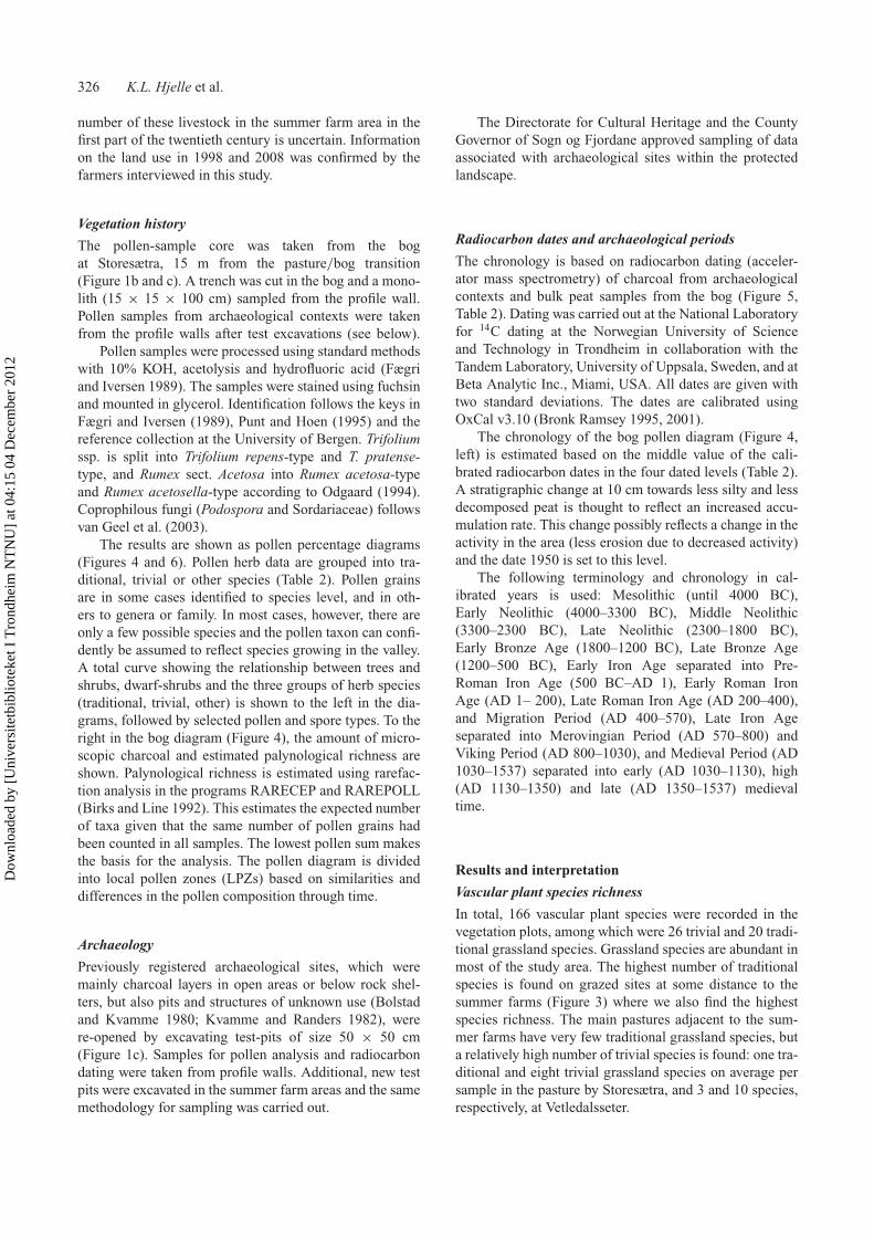
Vegetation history
The pollen-sample core was taken from the bogat Storesætra, 15 m from the pasture/bog transition(Figure 1b and c). A trench was cut in the bog and a mono-lith (15 × 15 × 100 cm) sampled from the profile wall.Pollen samples from archaeological contexts were takenfrom the profile walls after test excavations (see below).
Pollen samples were processed using standard methodswith 10% KOH, acetolysis and hydrofluoric acid (Fægriand Iversen 1989). The samples were stained using fuchsinand mounted in glycerol. Identification follows the keys inFægri and Iversen (1989), Punt and Hoen (1995) and thereference collection at the University of Bergen. Trifoliumssp. is split into Trifolium repens-type and T. pratense-type, and Rumex sect. Acetosa into Rumex acetosa-typeand Rumex acetosella-type according to Odgaard (1994).Coprophilous fungi (Podospora and Sordariaceae) followsvan Geel et al. (2003).
The results are shown as pollen percentage diagrams(Figures 4 and 6). Pollen herb data are grouped into tra-ditional, trivial or other species (Table 2). Pollen grainsare in some cases identified to species level, and in oth-ers to genera or family. In most cases, however, there areonly a few possible species and the pollen taxon can confi-dently be assumed to reflect species growing in the valley.A total curve showing the relationship between trees andshrubs, dwarf-shrubs and the three groups of herb species(traditional, trivial, other) is shown to the left in the dia-grams, followed by selected pollen and spore types. To theright in the bog diagram (Figure 4), the amount of micro-scopic charcoal and estimated palynological richness areshown. Palynological richness is estimated using rarefac-tion analysis in the programs RARECEP and RAREPOLL(Birks and Line 1992). This estimates the expected numberof taxa given that the same number of pollen grains hadbeen counted in all samples. The lowest pollen sum makesthe basis for the analysis. The pollen diagram is dividedinto local pollen zones (LPZs) based on similarities anddifferences in the pollen composition through time.
Archaeology
Previously registered archaeological sites, which weremainly charcoal layers in open areas or below rock shel-ters, but also pits and structures of unknown use (Bolstadand Kvamme 1980; Kvamme and Randers 1982), werere-opened by excavating test-pits of size 50 × 50 cm(Figure 1c). Samples for pollen analysis and radiocarbondating were taken from profile walls. Additional, new testpits were excavated in the summer farm areas and the samemethodology for sampling was carried out.
The Directorate for Cultural Heritage and the CountyGovernor of Sogn og Fjordane approved sampling of dataassociated with archaeological sites within the protectedlandscape.
Radiocarbon dates and archaeological periods
The chronology is based on radiocarbon dating (acceler-ator mass spectrometry) of charcoal from archaeologicalcontexts and bulk peat samples from the bog (Figure 5,Table 2). Dating was carried out at the National Laboratoryfor 14C dating at the Norwegian University of Scienceand Technology in Trondheim in collaboration with theTandem Laboratory, University of Uppsala, Sweden, and atBeta Analytic Inc., Miami, USA. All dates are given withtwo standard deviations. The dates are calibrated usingOxCal v3.10 (Bronk Ramsey 1995, 2001).
The chronology of the bog pollen diagram (Figure 4,left) is estimated based on the middle value of the cali-brated radiocarbon dates in the four dated levels (Table 2).A stratigraphic change at 10 cm towards less silty and lessdecomposed peat is thought to reflect an increased accu-mulation rate. This change possibly reflects a change in theactivity in the area (less erosion due to decreased activity)and the date 1950 is set to this level.
The following terminology and chronology in cal-ibrated years is used: Mesolithic (until 4000 BC),Early Neolithic (4000–3300 BC), Middle Neolithic(3300–2300 BC), Late Neolithic (2300–1800 BC),Early Bronze Age (1800–1200 BC), Late Bronze Age(1200–500 BC), Early Iron Age separated into Pre-Roman Iron Age (500 BC–AD 1), Early Roman IronAge (AD 1– 200), Late Roman Iron Age (AD 200–400),and Migration Period (AD 400–570), Late Iron Ageseparated into Merovingian Period (AD 570–800) andViking Period (AD 800–1030), and Medieval Period (AD1030–1537) separated into early (AD 1030–1130), high(AD 1130–1350) and late (AD 1350–1537) medievaltime.
Results and interpretation
Vascular plant species richness
In total, 166 vascular plant species were recorded in thevegetation plots, among which were 26 trivial and 20 tradi-tional grassland species. Grassland species are abundant inmost of the study area. The highest number of traditionalspecies is found on grazed sites at some distance to thesummer farms (Figure 3) where we also find the highestspecies richness. The main pastures adjacent to the sum-mer farms have very few traditional grassland species, buta relatively high number of trivial species is found: one tra-ditional and eight trivial grassland species on average persample in the pasture by Storesætra, and 3 and 10 species,respectively, at Vetledalsseter.
Dow
nloa
ded
by [
Uni
vers
itetb
iblio
teke
t I T
rond
heim
NT
NU
] at
04:
15 0
4 D
ecem
ber
2012

International Journal of Biodiversity Science, Ecosystem Services & Management 327
Table 2. Radiocarbon dates (accelerator mass spectrometry) from archaeological sites and bog pollen diagram from Erdalen. Site type‘rock shelter’ refers to natural boulders.
Site (pollen) Site type Uncalibrated Calibrated Species Lab reference
V1 Rock shelter 190 ± 35 Y. than AD1640 Betula TRa-1731V1 (sample 23) Rock shelter 2465 ± 35 BC770–410 Betula TRa-1732V2A Charcoal layer 170 ± 25 AD1660–1900 Betula TRa-1733V2Aa Charcoal layer 200 ± 50 AD1630–1960 T-3839V2B Charcoal layer 310 ± 25 AD1490–1650 Betula TRa-1734V2C Pit 185 ± 25 Y. than AD1650 Betula TRa-1735V2C Pit 220 ± 25 Y. than AD1640 Betula TRa-1736V2C Pit 1400 ± 25 AD600–665 Betula TRa-1737V2Ca Pit 1170 ± 50 AD710–990 T-4230V3A Pit 1570 ± 30 AD420–560 Betula TRa-1738V3A Pit 1625 ± 30 AD350–540 Betula TRa-1739V3B Pit 1320 ± 30 AD650–780 Betula TRa-1740V3B Pit 1510 ± 20 AD460–610 Betula TRa-1741V3Ba Pit 1490 ± 50 AD430–650 T-4229V3C (sample 1,2) Charcoal layer 115 ± 25 Y. than AD1960 Betula TRa-1742V3D (sample 20) Charcoal layer 1660 ± 30 AD250–530 Betula TRa-1743V5 Rock shelter 160 ± 30 AD1660–1960 Betula TRa-1744V6 Rock shelter 135 ± 30 AD1680–1935 Betula TRa-1745S1 (sample 15) Rock shelter 130 ± 30 AD1670–1950 Betula TRa-1746S1 (sample 17) Rock shelter 1575 ± 30 AD410–560 Betula TRa-1747S1a Rock shelter 2070 ± 40 BC200–20AD T-4231S2 Rock shelter 135 ± 30 AD1670–1950 Betula TRa-1748S3B Rock shelter 2325 ± 35 BC510–230 Betula TRa-1750S3C (sample 22) Rock shelter 1845 ± 30 AD80–240 Betula TRa-1751S3Ca Rock shelter 410 ± 80 AD1390–1660 T-4232S4A (sample 7) Charcoal layer 150 ± 30 AD1680–1960 Betula TRa-1752S4A (samples 9, 10) Charcoal layer 200 ± 30 Y. than AD1665 Betula TRa-1753S6 Charcoal layer 1015 ± 30 AD1080–1150 Betula TRa-1754S6 Charcoal layer 1070 ± 25 AD890–1020 Betula TRa-1757S6 Charcoal layer 1135 ± 30 AD780–990 Betula TRa-1756S6 Charcoal layer 1225 ± 30 AD680–890 Betula TRa-1755S7 Charcoal 1425 ± 30 AD575–660 Betula TRa-1758S8 (sample 21) Charcoal layer 1960 ± 30 AD40–130 Betula TRa-1759S9 Possible house 690 ± 30 AD1260–1390 Betula TRa-1760
Pollen diagram Dated material29.5–31.5 cm 1250 ± 60 AD650-900 Bulk Beta-30070338.5–40.50 cm 1850 ± 50 AD50-330 Bulk Beta-30070462–64 cm 3540 ± 70 BC2120-1680 Bulk Beta-300706
Notes: The dates are calibrated using OxCal v.3.10 (Bronk Ramsey 1995, 2001) and are given with two standard deviations. Analysed pollen samples inthe dated level are marked (see Figure 6).aConventional dates carried out in 1980–1981 (Kvamme and Randers 1982).
Figure 3. The total number of species and number of traditional and trivial grassland species recorded. The bars show averages withstandard deviations as lines, of samples grouped together according to their location and tree cover. See Figure 1 for locations.
Dow
nloa
ded
by [
Uni
vers
itetb
iblio
teke
t I T
rond
heim
NT
NU
] at
04:
15 0
4 D
ecem
ber
2012

328 K.L. Hjelle et al.
Vegetation development and human activity on along-term time scale
The long-term vegetation development from c. 2000 BCuntil today is reflected in the pollen diagram from the bog.The diagram is divided into seven pollen zones, reflectingthe main development in the local vegetation (Figure 4).The radiocarbon dates (Figure 5) indicate the presence ofpeople in the valley from c. 700 cal BC until present day.The archaeological sites in the valley include nine rockshelters below large boulders, two charcoal pits, nine open-air sites with charcoal layers and cultural layers (one site),the remains of a possible house and a stone structure thatmight be a dwelling feature (Table 2). Pollen samples areanalysed from seven of these sites (Figure 6).
The rock shelters (Figure 2) are in their naturalstate and were probably used repeatedly for short-termoccupation. This is supported by test excavations withinthe sheltered area which reveal charcoal layers most likelyoriginating from small fire places. The stratigraphy associ-ated with the two charcoal pits reveals repeated use, mostlikely associated with food preparation or food production(cooking pits). This could both be linked to summer farm-ing or to the processing of occasional prey from huntingin nearby areas. The pit contents were sieved, but did notreveal any bones or other remains, such as slag or cinder,that could have indicated any type of activity, for example,metal work. The size of these structures seems to excludethe production of charcoal and/or tar. Most of the open-air sites with charcoal are probably associated with eitherfire places (e.g. camp fires) made by herders or summerfarmers, or refuse from cooking pits, where the pit struc-ture is no longer visible on the surface. The cultural layer
is associated with the dwelling feature at Storesætra, andsequenced in several levels indicating repeated use. Thecontent is charcoal, mixed with soil of a fat consistency.It is likely that this is a midden from a temporary dwellingsite, or quite likely a summer farm.
In relation to the archaeological test-excavations,pollen samples from the soil profiles are taken from layersunder, in and above layers with observed charcoal. Pollensamples from archaeological contexts may reflect the veg-etation at the sites and in the nearby surroundings, butcan also reflect pollen transported and deposited by humanactivity (e.g. from plant remains such as hay or branchesstored at rock shelters) or by animals (e.g. pollen in thewool of sheep or in dung). These sources may be identi-fied when extremely high values of some taxa are observedin the pollen assemblage, as was the case for a few sam-ples in Erdalen (S1, S3C), or when special taxa are present.In many cases, however, the anthropogenic sources maybe difficult to identify. Pollen preservation in archaeolog-ical contexts may be poor, resulting in high amounts ofcorroded pollen grains and over-representation of resis-tant pollen and spore types (Dimbleby 1985; Bunting andTipping 2000; Tipping 2000). This is the case for the sam-ples from site V3C and V3D (pollen samples 1, 2, 20).In such cases, presence of a pollen type indicates the pres-ence of that species in the vegetation, but nothing can besaid about its abundance in the vegetation or the vegeta-tion community. There is also the issue that an absence ofpollen taxa does not mean that the taxa were absent.
The main results from the bog pollen diagram(Figure 4), archaeology (Table 2, Figure 5) and on-sitepollen analysis (Figure 6) are summarised below.
Figure 4. Pollen diagram from the bog at Storesætra. Black curves show percentages, grey the percentages ×10. Stratigraphy: peat0–10 cm, silty peat 10–24 cm, peat with some silt 24–31 cm and dark peat 31–65 cm.
Dow
nloa
ded
by [
Uni
vers
itetb
iblio
teke
t I T
rond
heim
NT
NU
] at
04:
15 0
4 D
ecem
ber
2012

International Journal of Biodiversity Science, Ecosystem Services & Management 329
Figure 5. Radiocarbon dates from archaeological contexts. Sites named ‘V’ refers to Vetledalsseter and ‘S’ to Storesætra. For details,see Table 2.
Bronze Age and Pre-Roman Iron Age (1800 BC–AD 1);limited evidence of human activity (sites V1 and S3B)
Pollen diagram
LPZ-1 has high values of tree pollen, indicating an opendeciduous forest dominated by birch (Betula) and alder(Alnus), and relatively high values of elm (Ulmus) androwan (Sorbus). The understory comprises dwarf-shrubs(e.g. heather (Calluna), bilberry (Vaccinium)), herbs (e.g.meadowsweet (Filipendula), cow-wheat (Melampyrum),nettle (Urtica)) and continuous registrations of threetrivial taxa: grasses (Poaceae), sorrels (Rumex acetosa-type) and meadow buttercup (Ranunculus acris-type).Traditional taxa such as tormentil (Potentilla-type),ribwort plantain (Plantago lanceolata) and yarrow(Achillea-type) are recorded. Microscopic charcoal valuesare low.
Archaeology
Activity at two open rock shelters, one at Storesætra andone at Vetledalsseter.
On-site pollen
High values of grasses, meadow buttercup and sorrels atV1, indicating grazing.
Roman Iron Age and Migration Period (AD 1–570);extensive evidence of human activity (sites S1, S3C, S8,V3A, V3B, V3C and V3D)
Pollen diagram
The highest birch (Betula) pollen values are found at thebeginning of LPZ-2, followed by a rapid reduction and
Dow
nloa
ded
by [
Uni
vers
itetb
iblio
teke
t I T
rond
heim
NT
NU
] at
04:
15 0
4 D
ecem
ber
2012

330 K.L. Hjelle et al.
Figure 6. Pollen samples from soil profiles within archaeological contexts. Black bars show percentages, grey the percentages ×10.Sites named ‘V’ refers to Vetledalsseter and ‘S’ to Storesætra. For dating of the sites, see Table 2. Stratigraphy of analysed layers: V3C:peat with charcoal 5–10 cm below surface; S4A: peat 0–6 cm (pollen samples 3, 4), decomposed silty peat 6–9 cm (pollen sample 5),charcoal-rich peat 9–18 cm (pollen samples 6, 7), clay and silt 18–25 cm (pollen sample 8), decomposed peat 25–27 cm (pollen samples9, 10); S1: silty peat 2–8 cm (pollen samples 11, 12), grey silt 8–14 cm (pollen sample 13), brown silt with charcoal lenses 14–23 cm(pollen samples 14–16), charcoal 23–26 cm (pollen sample 17), decomposed silty peat 26–44 cm (pollen samples 18, 19); V1: clay andsilt with charcoal 2–18 cm below surface; S3C: charcoal 7–12 cm below surface; S8: charcoal 8–11 cm below surface; V3D: peat rich incharcoal 7–13 cm below surface.
general opening up of the forest. A marked decrease inelm (Ulmus) indicates pollarding and fodder collection.Continuously increasing percentages of microscopic char-coal and grasses (Poaceae), higher values of the bilberrygroup (Vaccinium) than in zone 1 and presence of sev-eral trivial and traditional grassland species all indicateincreased human activity and grazing.
Archaeology
Human activity both at open sites and rock shelters atStoresætra and Vetledalsseter.
On-site pollen
High values of grasses and several trivial species at twosites at Storesætra (S3C, S8), and trivial and traditionalspecies and dung spores present at Vetledalsseter (V3D),show the existence of pastures in both areas. A decrease intree pollen at S1 (from sample 18 to 17) indicates openingof the forest.
Merovingian Period (AD 570–800); some evidence ofhuman activity (sites V2C, V3B, S6 and S7)
Pollen diagram
LPZ-3 shows a succession of heather (Calluna) and birch(Betula) encroachment. Grasses (Poaceae), meadow but-tercup (Ranunculus acris-type), sorrels (Rumex acetosa-type) and microscopic charcoal are all reduced. Thereis a distinct increase in peat mosses (Sphagnum) andsome increase in meadowsweet (Filipendula) and willow
(Salix). LPZ-3 reflects a period of less utilisation ofthe area.
Archaeology
Human activity at Storesætra and Vetledalseter in the LateIron Age.
Viking Period and early to high Medieval Period(AD 800–1350); summer farming activity (sites S1,S6 and S9)
Pollen diagram
In LPZ-4, a reduction in birch (Betula) and expansionof grasses (Poaceae) and several traditional and trivialgrassland species take place. In the upper part of thezone (high medieval), grasses completely dominate thepollen record, and traditional and trivial grassland speciesare recorded. Palynological richness is at its highest inthis zone, but shows a decrease in the upper grass-dominated part. Charcoal has high values with a maximumaround 40%.
Archaeology
A dwelling feature with massive cultural layers, S6,indicates more permanent activity than in the previousperiod, probably related to summer farming and exploita-tion of secondary products. S9, dated to the high medievalperiod and found in the pasture in front of the summerfarm buildings, is a more elaborate house structure thanS6, having marked stone walls and a partial stone floor.
Dow
nloa
ded
by [
Uni
vers
itetb
iblio
teke
t I T
rond
heim
NT
NU
] at
04:
15 0
4 D
ecem
ber
2012

International Journal of Biodiversity Science, Ecosystem Services & Management 331
On-site pollen
One pollen sample, completely dominated by grasses, fromS1 (sample 16) may indicate hay storage in this period.
Late Medieval Period (AD 1350–1537); reduced activity
Pollen analysis
In LPZ-5, expansions of peat mosses (Sphagnum), sedges(Cyperaceae) and birch (Betula) take place. There is adecrease in grasses (Poaceae), but they still have relativelyhigh values. Trivial and traditional herbs are present, butonly low values of microscopic charcoal.
Archaeology
No evidence.
Post-Medieval Period (AD 1537–1950); extensive use ofthe valley (sites S1, S2, S4A, V1, V2A, V2B, V2C, V3C,V5 and V6)
Pollen diagram
LPZ-6 has an increase in microscopic charcoal anda decrease of trees (mainly birch (Betula)). Grasses(Poaceae) regain high values and a varied herb florais present with traditional and trivial herb species.Palynological richness is high. Sedges (Cyperaceae)increase continuously during the zone. At the top of thezone, dwarf-shrubs have high values, as well as parsley fern(Cryptogramma crispa).
Archaeology
Charcoal layers of up to 10 cm thickness are found in theupper part of the profile at many sites, reflecting human
activity in the sixteenth to twentieth centuries both atStoresætra and Vetledalsseter.
On-site pollen
Clearance of birch (Betula), alder (Alnus), rowan (Sorbus)and hazel (Corylus) indicated at S4A. Grasses and trivialspecies dominate at other sites (S1, V3C). High values ofdung-indicator fungal spores are found in the most recentsamples from S1 (samples 12, 11) and S4A (samples 4, 3).At Vetledalsseter, trivial species indicate grazing and thick-walled pollen grains of birch and alder indicate burning.
Recent time (1950–present day); summer farming ended,grazing continued
Pollen diagram
In LPZ-7, tree pollen increases, indicating forest expan-sion, which is also documented in increased tree cover inaerial photos (Figure 7). Sedges increase, whereas mostother herb and grass pollen display a marked reductionin this zone. Trivial herbs dominate in the pasture atStoresætra.
The two maps of Erdalen in 1967 and 2005 show a markeddecline in open areas at Storesætra and Vetledalsseter,respectively, during this time period (Figure 7). It alsoshows that the tree cover has increased from 10% to 25%to more than 75% on the south-west facing slopes in thevalley as a whole. In the same period, we see a decreasein the number of sheep and goats grazing in the valley,with a near-absence of these animals in the last 10 years(Figure 8).
Summer farming with dairy cattle ended c. 1960, andwith this also the utilisation of the forest for winter fod-der and firewood. In the twentieth century, both summer
Figure 7. Vegetation cover in Erdalen in 1967 and 2005. Digital maps and recent Ortho photos were made available through ‘Norwaydigital’, and digital versions of the photos from 1967 were bought from The Norwegian Mapping Authority.
Dow
nloa
ded
by [
Uni
vers
itetb
iblio
teke
t I T
rond
heim
NT
NU
] at
04:
15 0
4 D
ecem
ber
2012

332 K.L. Hjelle et al.
Figure 8. Number of horses (before 1900), cattle, sheep andgoats owned by farmers in Erdalen (separated in Storesætra andVetledalsseter). Restrictions were made on the number of goatsand sheep allowed on Storesætra and the exact number grazingin Erdalen is unclear. The sheep used pastures in a neighbouringvalley after 1838, but it was not until 1978 (when a new road wasbuilt) that this valley became easily accessible for the farmers inErdalen and sheep grazing in Erdalen ended.
farming, with butter and cheese production, and milk pro-duction, where milk was transported down to the mainfarms daily, were carried out (Berge 1989). Until 1960,dairymaids stayed at the summer farm from 24 June tothe beginning of September. Butter and cheese (Norwegian‘gammelost’) were produced, especially in the beginning ofthe summer when the milk production was at its highest.
We have no information on the volume of winter foddercollected, but according to Berge (1989), birch branchesand twigs were collected in the mountain sides behindStoresætra, dried and thereafter put on stacks during sum-mer, before it was transported down to the valley in winter.From some areas, the dried branches were taken directlyto the farms. Firewood was collected in the same area andwas needed during the months when people stayed at thesummer farms. Some firewood was also brought down tothe farms, but according to the land owners the amount offirewood taken out after 1950 is low. The rights to the forestin the summer farm area were divided between the farmsin 1729 (Borchgrevink 1978; Berge 1989), indicating theimportance of the wood. Also outlying hay meadows arementioned in 1729. Grass was cut and hay meadows existedon several small places in the steep mountain sides, alsobehind the buildings at Storesætra and above the pathbetween Storesætra and Vetledalsseter (Berge 1959, 1989,cf. Figure 1a). The hay was dried and transported to thefarms. Hay-cutting in the summer farm area came to an endbefore 1940. Although hay production has been important,the large grassland at Storesætra used as pasture today wasalso reserved for cattle grazing in earlier times. In 1877,
Table 3. Taxes from the different farms in 1625/1626.
Farm Tax
Erdal 5 lauper 21/4 pund butterRygg 5 pund butter, 2 sheepBerge 71/2 pund butterTjellaug 51/2 pund butterGreidung 2 lauper butter
Note: 1 lauper = 15.4 kg, 1 pund = 0.5 kg.
agreements between the users stated that only cattle shouldgraze in the summer farm areas of Erdalen. An exceptionwas the upper farm, Greidung, where each holding couldhave 20 goats in the valley (Register of Mortgages forStryn). The number of goats grazing in Erdalen differedthrough time (cf. Figure 8). Although they were kept (andmilked) at the main farm, they grazed in the mountain sidesalso above the summer farm area in Erdalen through thewhole summer. Goat grazing came to an end in 2006, witha gradual decrease in the number of animals from 1980(information from landowner).
In 1838, the farmers in Erdalen bought a neighbouringvalley as pasture land. From 1896, Tjellaug and Greidungshould only use Vetledalsseter and sheep were allowed tograze in Vetledalen and in the mountains above the treeline (cf. Figure 8). There are also some uncertainties in thenumber of sheep in the valley altogether and some of thesheep owned by the farmers at Storesætra may have grazedalso in Erdalen.
The importance of cows and milk production inErdalen is reflected in the agreements from 1877 and1896 as well as in the taxes from the seventeenth century(Table 3), mainly given in butter.
When a new road was finished in 1978, the animalscould easily be transported to the neighbouring valley,resulting in nearly only cattle grazing in Erdalen.
Discussion
Utilisation of the valley in a long-term perspective
So far the earliest signs of human activity in the studyarea are dated to the Bronze Age. It is likely, however,that temporary sites from the Mesolithic or Neolithic mightbe recognised in the future. Short-term visits produce lit-tle waste and hardly influence the vegetation, but mightreflect long-term traditions of importance for the under-standing of later pastoral activity in the inland areas ofwestern Norway, in general, and Erdalen, in particular.
The pollen diagram from the bog shows the devel-opment from c. 2000 BC at Storesætra. The following2000 years are characterised by dynamic fluctuations in thedeciduous forest of birch (Betula), some rowan (Sorbus),alder (Alnus) and elm (Ulmus). Some cultural indicators,such as nettle (Urtica), sorrel (Rumex acetosa-type) andmeadow buttercup (Ranunculus acris-type) were presentat that time, indicating grazing by domesticated animals
Dow
nloa
ded
by [
Uni
vers
itetb
iblio
teke
t I T
rond
heim
NT
NU
] at
04:
15 0
4 D
ecem
ber
2012
International Journal of Biodiversity Science, Ecosystem Services & Management 333
and some human activity. Development of grazed veg-etation communities is indicated in the pollen samplesfrom Vetledalsseter and supports an earlier investigationat Seltuftene, farther up in the valley (Kvamme 1988).Although it is not known which activity charcoal in a rockshelter is related to – visits with the purpose of huntingand grazing are both possible – it is interesting that the firstcharcoal dates at both Vetledalsseter and Storesætra coin-cide with changes in the pollen record that indicates thepresence of domesticated animals. Moreover, this is in linewith evidence of grazing in mountain areas east of Erdalen(Prescott 1991; Kvamme et al. 1992; Hufthammer 1995),and it is reasonable to interpret the signs of human activ-ity in Erdalen from this period as reflecting an agriculturalsociety in the lower part of Erdalen that used the mountainsfor grazing during summer time.
An increased and probably more regular use of thearea with forest clearance is seen in the Roman Iron Age.An open pasture/meadow existed between the bog andsummer farm houses, and grazing indicators in S3C as wellas a reduction in tree pollen in S1 reflect utilisation of alarge area already at that time (Figure 1c). The dry areawas probably cleared and grazed, whereas the bog was stillpartly forested and covered by alder (Alnus).
For a short time during the Merovingian Period,increasing occurrences of heather (Calluna) and birch(Betula) with reduced registrations of charcoal and grassesindicate less utilisation of the Storesætra area and proba-bly the whole valley, although radiocarbon dates from foursites show that some activity took place. This phase ofreduced activity is followed by extended activity, reflectedboth in palaeobotanical and archaeological data from theViking and early/high medieval periods. The area close toor in the bog became more open than before and a peakin species richness seems to have developed, probably asa result of a mosaic of natural communities, pastures andpossibly also hay meadows. The dominance of grasses insamples from the high medieval may be an indication thatmowing took place (cf. Hjelle 1999). This may be sup-ported by a pollen sample from site S1, probably from thistime period, which has extremely high values of grasses.Hay may have been stored under the boulder until it wasbrought to the lowland. Site S6, a deep pit found withina stone structure has four dates between AD 800 and AD1000 (Table 2). It probably reflects a dwelling feature andindicates a change towards a more permanent use of thearea. At several of our sites there are undated charcoal lay-ers above the layers dated to the Early Iron Age, whichmight be from the Viking Period or medieval time, indicat-ing the presence of additional sites from these time periods.A house remain dated to the thirteenth century is from thesame time period as a previously dated house remain atSeltuftene (Kvamme and Randers 1982). Altogether, theLate Iron Age and the first part of the medieval period seemto be times of intensive use of the valley. This is connectedto a well-developed farming community in the lower partof Erdalen, probably resulting in development of summerfarming in Erdalen.
A period of reforestation and reduced usage of thearea (LPZ-5) probably reflects population decrease follow-ing the Black Death (c. AD 1350) and no archaeologicalsites are dated to the late medieval period. Later on, thepollen diagram indicates new clearance with high values ofcharcoal which may be connected to several charcoal lay-ers from the late sixteenth to the early twentieth centuries.Increased activity in this period and utilisation of a largerarea, including forest clearance near S4A (Figure 1c), canprobably be connected to the historical use of the sum-mer farms. High values of grasses and meadow/pastureplants by the rock shelter, S1, also indicate storage of hay.Gathering of hay and leaf fodder from the outlying areaswas important and necessary in order to feed the animalsover the winter. Leaf fodder from twigs of birch was col-lected from the summer farm areas in recent times (Berge1989) and elm (Ulmus) has been collected by the farmsin the valley (Helle and Clemetsen 1993). The decrease ofelm in the bog pollen diagram (Figure 4) in the Early IronAge probably reflects pollarding. This is further supportedby an increase in elm simultaneous with the decreasedactivity in the area around AD 600, followed by a new elmdecrease simultaneous to the extensive use in the follow-ing Viking Period. The value of leaf fodder is seen in thefodder equivalents, where one unit of subsistence fodderrepresents 1 kg barley or 2.2 kg leaf fodder (Helland 1901;Timberlid 1988: 38). Generally, this fodder became lessimportant in the twentieth century, but the open vegetationin Erdalen reflected in the pollen data from the seven-teenth to the twentieth centuries and aerial photos from1967 probably reflect the use of multiple resources fromthe outfields which provided firewood and extra fodder andthereby security for the farming community.
Thick layers rich in charcoal have been dated to theseventeenth century or later at several sites. These layersprobably reflect several phases of burning which is fur-ther supported by a high degree of deformation of pollengrains, a character that has been connected to clearanceby burning (Andersen 1993). Charcoal found in some ofthe rock shelters is dated to the most recent centuries andmay indicate the use of rock shelters for storage of char-coal. It is, however, not clear which purpose this potentialstorage had.
Grazing-dependent vegetation types in time and space
Based on the pollen data, it is reasonable to concludethat grassland plants were not common vegetation fea-tures in Erdalen prior to the introduction of domesticatedanimals in the valley. The vegetation investigations showthat the number of species differs within grazed communi-ties today. Both the highest number of traditional speciesand the highest total number of species were found in sitesat some distance from the main pasture areas, where thegrazing pressure was probably lower than in the main pas-tures by the farm houses. Vandvik and Birks (2004) founda similar pattern in Røldal, western Norway. The low num-ber of traditional plant species near the summer farms
Dow
nloa
ded
by [
Uni
vers
itetb
iblio
teke
t I T
rond
heim
NT
NU
] at
04:
15 0
4 D
ecem
ber
2012

334 K.L. Hjelle et al.
in Erdalen today is probably caused by the use of thesepastures as resting areas for the cattle and the resultingfertilization of the grasslands. This supports earlier investi-gations, showing high species richness of vascular plants insemi-natural habitats in European agricultural landscapescompared to fertilized habitats (Billeter et al. 2008).
In earlier times, with different livestock species andbreeds, the situation may have been different, as sug-gested by the high diversity of pollen types in the VikingPeriod and early medieval time. The Old Norse breedsof cattle and sheep used a high proportion of woodyplants in their diet (Steinheim et al. 2005; Sæther et al.2006). From the early twentieth century, changes in thebreeds took place (Gjerdåker 2004) and the old livestockbreeds might have had different impact on the vegeta-tion in Erdalen than the livestock grazing there today.The traditional livestock breeds were lighter than modernbreeds; for example, cows from the old west Norse cattle(‘vestnorsk fjordfe’) weighed on average 250 kg in 1900,compared to 550 kg for the most common modern breedin Norway today (Våre gamle husdyrraser 2007). Since theold breeds were smaller than the modern breeds, they pro-duced less and needed less fodder. A cow gave ∼500 litresof milk (equals about 20 kg butter) a year or maximum800 litre in the medieval time (Myhre and Øye 2002) and1320 litre in 1900 (Statistics Norway 1994), compared to∼7000 litre a year from a modern cow today (StatisticsNorway 2012).
Increasing reforestation in Erdalen is visible between1967 and 2005 (Figure 7). The pasture areas around thesummer farmstead were still relatively open in 2005, par-ticularly in Storesætra. The most obvious explanation forthis is that cattle grazing in the valley today prefer the eas-ily accessible areas in the valley bottom, at the same time asgrazing by sheep and goats have ceased (cf. Figure 8). Thismeans a change from a feeding strategy with a high pro-portion of woody species to a more graminoid-dominateddiet (Bjor and Graffer 1963; Nedkvitne et al. 1995). Goatsare able to transform shrubs and woodland to open land(Wehn et al. 2011) and they utilize a wider area than sheepand cattle (Nedkvitne et al. 1995; Natlandsmyr and Austad2005). This livestock must have played an important rolein keeping large parts of Erdalen rather open. However,also hay-cutting and utilization of the forest have come toan end. Cutting of firewood stopped when summer farm-ing with milk production stopped, and some years earlier,winter fodder harvest had ended. Altogether, this musthave had an effect on the reforestation. Red deer (Cervuselaphus) has become abundant in west Norway after thedecrease in livestock grazing in outland areas (Austrheimet al. 2008). In Erdalen, an increase took place from the1990s, and in 1998, 28 red-deer were shot (Dybwad 2001).Some impact from red deer is most likely taking place alsoin Erdalen, but it is obvious from the landscape changesthat grazing by red deer does not replicate the formerimpact of sheep and goats.
To sum up, the present situation in Erdalen seemsto reflect on a smaller scale the broader scale situation
in Europe. Some important challenges maintaining semi-natural habitats are the intensification of agricultural landuse in some areas, while marginal areas experience refor-estation due to reduced use (Stoate et al. 2001; Hodgsonet al. 2005; Niedrist et al. 2009).
Long-term perspective on management and conservation
Recently, we have witnessed a raised awareness of theimportance of human-influenced semi-natural habitats forprotection of biodiversity. In an upland landscape likeErdalen, cultural and natural heritage is highly intercon-nected; our data show a connection between the presence oftraditional species in the most species-rich areas in Erdalentoday and in the pollen data in periods when archaeologi-cal data document high human activity. Moreover, speciesrichness of vascular plants tends to peak in areas withopen semi-natural grasslands supposed to have lower graz-ing pressure than at the main summer farm pasture wherethe cattle are resting and leaving dung. Hence, our studysupports the importance of human-influenced semi-naturalhabitats for protection of species richness (Billeter et al.2008; Lingaard and Henriksen 2011).
The interdisciplinary approach of the present investi-gation has made it possible to broaden earlier knowledgeof the land-use history of the valley, to complement exist-ing data on plant species richness and to show how pastvegetation dynamics can guide possible future vegetationchanges. Most of the cultural heritage is related to the pas-toral use of the valley, including grazing, hay-making andthe collection of leaf fodder and firewood, where mainlythe grazing is visible today. Hence, the cultural heritageand past and present types of vegetation are interrelated.
As the cultural landscape of the valley has developedover more than 2000 years, a pertinent question is whethera management strategy should aim to maintain the land-scape from a specific period of time. It may be arguedthat the landscape made over the last 200 to 300 yearsis the best documented because we have written sourcesabout livestock types and numbers, we know the state ofthe buildings and some of the vegetation types were proba-bly not that different from those still present at the summerfarms. On the other hand, it may be argued from the pollendata that the diversity of vegetation types was higher dur-ing Late Iron Age and early medieval time. The distributionand types of cultural heritage at these times may indicatea somewhat different use of the valley compared to later,although it is also possible that houses from these periodswere situated in the same place as the houses today andthe documented house remains reflect utilisation of a largerarea.
When it comes to conservation and management, itmay not be constructive to focus on one particular periodof time. A successful plan of management should con-sider the total effect of past land use over time and try tomaintain the overall heritage of the valley by optimisingthe diversity of habitats and vegetation and avoid dam-age or encroachment of the cultural heritage. Compared to
Dow
nloa
ded
by [
Uni
vers
itetb
iblio
teke
t I T
rond
heim
NT
NU
] at
04:
15 0
4 D
ecem
ber
2012

International Journal of Biodiversity Science, Ecosystem Services & Management 335
the present-day management based solely on cattle graz-ing, this may require the re-introduction of sheep and somegoats, in addition to the cattle. Traditional breeds of live-stock have proved to have a more varied grazing habit andcould preferably be used instead of the modern breeds keptby farmers today. Another type of traditional use of the val-ley is hay-making that could be re-introduced to some ofthe meadows where it was likely carried out in the pastas well as small-scale cutting of firewood. Hay-makingimplies, however, a management which is not easily carriedout within a modern farming community.
For the management of cultural heritage, grazing haskept the vegetation open and thereby also the visibil-ity of rock shelters which have been used for more than2000 years. Moreover, archaeological sites documented30 years ago are easily recognised and even descriptionsof details on a local level are still highly valid due tohardly any overgrowth. The situation therefore seems tobe rather stable, judging from the perspective of the lastthree decades. The question is whether this might changein the near future due to, for example, changes in the cli-mate and the intensity of grazing. Today, there seems tobe a high level of consensus among the farmers in thelower Erdalen community to keep up the more or less tra-ditional grazing by sheep/goats and cattle (cf. Fagerheimet al. 2011). There are some restrictions in the use of goatsand sheep today, leaving some areas to be dominated bycattle grazing. If grazing by cattle is intensified, the qualityof the more fragile archaeological sites, such as the pitsor house remains, could be reduced since heavy tram-pling animals might impact the soil and turf. Protectionof archaeological sites therefore points in the same direc-tion as biodiversity protection: mixed livestock grazing ispreferable to exclusive cattle grazing. Maintenance of habi-tats through nature management is therefore important alsofor cultural heritage management.
In this study, the upland valley and summer farm areaswere analysed through different disciplinary approaches,including vegetation ecology and palaeoecology, as wellas archaeology and more recent cultural history. Theinterdisciplinary approach encompasses discussions andco-ordination throughout the study, including combinedfield work. Such joint discussions and deliberationsare vital for the resulting conclusions and managementrecommendations.
AcknowledgementsWe are grateful to Beate Helle for help with illustrations, to CathyJenks for linguistic corrections, to two anonymous reviewers andthe editors, Gunnar Austrheim and Gunhild Setten, for valuablecomments to earlier versions of the article, and to the farmersfor valuable information. The article presents results from theDYLAN project (project number 190044/S30) financed by TheResearch Council of Norway, Miljø 2015.
ReferencesAaland J. 1973. Nordfjord frå gamle dagar til no. Dei einskilde
bygder Innvik-Stryn. Sandane: Solglimt tr. (a committee).678 p.
Andersen ST. 1993. Early- and Middle-Neolithic agriculture inDenmark: pollen spectra from soils in burial mounds of thefunnel beaker culture. J Eur Arch. 1(1):153–180.
Aune B. 1993. Temperaturnormaler, normalperiode 1961–1990[Standard temperature, standard period 1961–1990]. Oslo:Det Norske Metereologiske Institutt.
Austrheim G, Solberg EJ, Mysterud A, Daverdin M, Andersen R.2008. Hjortedyr og husdyr på beite i norsk utmark i perioden1949–1999 NTNU Rapport Zoologisk Serie 2.
Berge K. 1959. Utslåttar. In: Loen OA, editor. Årbok forNordfjord. Sandane (Norway): Nordfjord Sogelag og FirdaUngdomslag.
Berge JJ. 1989. Sæter og sæterdrift her i Erdal. Håndskrevettekst gitt tilgjengelig av sønnesønnen Johan J Berge[Unpublished].
Berglund B, editor. 1991. The cultural landscape during6000 years in southern Sweden – The Ystad project.Ecological Bulletins 41. Copenhagen (Denmark):Munksgaard.
Billeter R, Liira J, Bailey D, Bugter R, Arens P, Augenstein I,Aviron S, Baudry J, Bukacek R, Burel F, et al. 2008.Indicators for biodiversity in agricultural landscapes: a pan-European study. J Appl Ecol. 45(1):141–150.
Birks HJB. 1996. Contributions of Quaternary palaeoecology tonature conservation. J Veg Sci. 7(1):89–98.
Birks HJB. 2012. Ecological palaeobiology and conservationbiology: controversies, challenges, and compromises. Int JBiodiv Sci Ecosyst Serv Manage. doi:10.1080/21513732.2012.701667
Birks HJB, Line JM. 1992. The use of rarefaction analysis forestimating palynological richness from Quaternary pollen-analytical data. The Holocene. 2(1):1–10.
Bjor K, Graffer H. 1963. Beiteundersøkelser på skogsmark.Forskn Forsk Landbruket. 14(2):121–365.
Bolstad G, Kvamme M. 1980. Kulturhistoriske registreringeri Breheimen 1980. Arkeologiske Rapporter 1. HistoriskMuseum, Universitetet i Bergen.
Borchgrevink A-BØ. 1978. Etnologisk feltarbeid i Oppstrynsommeren 1974. Oslo: Institutt for Folkelivsgranskning,Universitetet i Oslo [Unpublished].
Brekke NG, Schjelderup H. 1997. Hus på Vestkysten gjennom4000 år. Stavanger (Norway): Norsk Kulturråd.
Bronk Ramsey C. 1995. Radiocarbon calibration and anal-ysis of stratigraphy: the OxCal program. Radiocarbon.37(2):425–430.
Bronk Ramsey C. 2001. Development of the radiocarbon programOxCal. Radiocarbon. 43(2A):355–363.
Bunting MJ, Tipping R. 2000. Sorting dross from data: pos-sible indicators of post-depositional assemblage biasing inarchaeological palynology. In: Bailey G, Charles R, WinderN, editors. Human Ecodynamics. Oxford (UK): Oxbow. AEASymposia No. 19. p. 63–69.
Davis MB. 1994. Ecology and palaeoecology begin to merge.Trends Ecol Evol. 9(10):357–358.
Diinhoff S. 1999. Træk af det vestlandske jordbrugs historiefra sen stenalder til tidlig middelalder. Arkeo nr. 1-1999:14–28.
Dimbleby JW. 1985. The palynology of archaeological sites.London (UK): Academic Press.
Dybwad T. 2001. Skjøtselsplan for Bødalen, Erdalen ogSunndalen i Jostedalsbreen nasjonalpark. Fylkesmannen iSogn og Fjordane Rapport nr. 1.
Fægri K, Iversen J. 1989. Textbook of pollen analysis. 4th rev. ed.Fægri K, Kaland PE, Krzywinski K. Chichester (UK): JohnWiley and Sons.
Fagerheim W, Brattli T, Austrheim G. 2011.Landskapsvernområder 2030. Strategisk dialogprosessmed aktive brukere fra fire Landskapsvernområder i fjellet.NTNU Norges Teknisk-Naturvitenskapelige Universitet,Vitenskapsmuseet, Rapport Botanisk Serie 2014.
Dow
nloa
ded
by [
Uni
vers
itetb
iblio
teke
t I T
rond
heim
NT
NU
] at
04:
15 0
4 D
ecem
ber
2012

336 K.L. Hjelle et al.
Fett P. 1961. Stryn prestegjeld. Førhistoriske minne i Fjordane.Bergen: Historisk Museum, Universitetet i Bergen.
Førland EJ. 1993. Nedbørnormaler, normalperioden 1961–1990.Oslo (Norway): Det Norske Metereologiske Institutt Rapport39.
Foster D, Swanson F, Aber J, Burke I, Brokaw N, Tilman D,Knapp A. 2003. The importance of land-use legacies toecology and conservation. Bioscience. 53(1):77–88.
Fremstad E, Moen A, editors. 2001. Truete vegetasjonstyper iNorge. NTNU Vitenskapsmuseet Rapport Botanisk Serie.4:1–231.
Froyd CA, Willis KJ. 2008. Emerging issues in biodiversity andconservation management: the need for a palaeoecologicalperspective. Quaternary Sci Rev. 27(17–18):1723–1732.
Gaillard M-J, Dutoit T, Hjelle K, Koff T, O’Connell M. 2009.European cultural landscapes: insights into origins and devel-opment. In: Krzywinski K, O’Connell M, Küster H, edi-tors. Cultural landscapes of Europe. Bremen (Germany):Aschenbeck Media. p. 35–44.
Gjerdåker B. 2004. Continuity and modernity 1815–1920. In:Almås R, editor. Norwegian agricultural history. Trondheim(Norway): Tapir Academic Press. p. 236–293.
Hanley N, Davies A, Angelopoulos K, Hamilton A, RossA, Tinch D, Watson F. 2008. Economic determinants ofbiodiversity change over a 400-year period in the Scottishuplands. J Appl Ecol. 45(6):1557–1565.
Helland A 1901. Norges land og folk. Topografisk-StatistiskBeskrivelse: Nordre Bergenhus Amt.
Helle T, Clemetsen M. 1993. Kulturlandskap og kulturmarkstypari Stryn kommune. Høgskulen i Sogn og Fjordane Rapport 24.
Hjelle KL. 1999. Modern pollen assemblages from mown andgrazed vegetation types in western Norway. Rev PalaeobotPalyno. 107(1–2):55–81.
Hjelle KL, Hufthammer AK, Bergsvik KA. 2006. Hesitanthunters: a review of the introduction of agriculture in westernNorway. Environ Archaeol. 11(2):117–170.
Hjelle KL, Kaland S, Kvamme M, Lødøen B, NatlandsmyrB. 2012. Kulturlandskapsutvikling i Erdalen ogSunndalen, Jostedalsbreen nasjonalpark, Sogn og Fjordane.Sluttrapport fra DYLAN-prosjektet. Bergen (Norway):Universitetsmuseet i Bergen, Universitetet i Bergen.
Hodgson JG, Grime JP, Wilson PJ, Thompson K, Band SR.2005. The impacts of agricultural change (1963–2003) on thegrassland flora of Central England: processes and prospects.Basic Appl Ecol. 6(2):107–118.
Hufthammer AK. 1995. Tidlig husdyrhold i Vest-Norge.In: Bergsvik KA, Nygaard S, Nærøy AJ, editors.Steinalderkonferansen i Bergen 1993. Arkeologiske Skrifter8. Bergen (Norway): Universitetet i Bergen. p. 203–219.
Jansen J, Losvik M, Roche P. 2009. Vulnerability and resilienceof cultural landscapes. In: Krzywinski K, O’Connell M,Küster H, editors. Cultural landscapes of Europe. Bremen(Germany): Aschenbeck Media. p. 55–66.
Kålås JA, Viken Å, Bakken T, editors. 2006. Norwegian red list.Trondheim, Artsdatabanken.
Kålås JA, Viken Å, Henriksen S, Skjeseth S, editors. 2010.The 2010 Norwegian red list for species. Oslo (Norway):Norwegian Biodiversity Information Centre.
Kvamme M. 1988. Pollen analytical studies of mountain sum-mer farming in Western Norway. In: Birks HH, Birks HJB,Kaland PE, Moe D, editors. The cultural landscape – past,present and future. Cambridge: Cambridge University Press.p. 349–367.
Kvamme M, Berge J, Kaland PE. 1992. Vegetasjonshistoriskeundersøkelser i Nyset-Steggjevassdragene. ArkeologiskeRapporter 17. Historisk Museum, Universitetet i Bergen.
Kvamme M, Randers K. 1982. Breheimenundersøkelsene 1981.Arkeologiske Rapporter 3. Bergen (Norway): HistoriskMuseum, Universitetet i Bergen.
Lindbladh M, Bradshaw R. 1995. The development and demise ofa medieval forest-meadow system at Linnaeus birthplace insouthern Sweden – implications for conservation and foresthistory. Veg Hist Archaeobot. 4(3):153–160.
Lingaard A, Henriksen S, editors. 2011. Norsk rødliste for natur-typer 2011. Trondheim: Artsdatabanken.
Losvik MH. 1993. Total species number as a criterion for con-servation of hay meadows. In: Bunce RGH, Ryszkowski L,Paoletti MG, editors. Landscape ecology and agroecosys-tems. Boca Raton (FL): Lewis Publishers. p. 105–111.
Lowenthal D. 2005. Natural and cultural heritage. Int J HeritageStud. 11(1):81–92.
Meyer OB, editor. 1984. Breheimen-Stryn. Konsesjon-savgjørende botaniske undersøkelser. Botanisk InstituttRapport 34. Universitetet i Bergen.
Myhre B, Øye I. 2002. Norges landbrukshistorie I. 4000 f. Kr.- 1350 e. Kr. Jorda blir levevei. Oslo (Norway): Det NorskeSamlaget.
Natlandsmyr B, Austad I. 2005. Kystgeitene på Selje. Beitebruk,vegetasjon og landskap. NNR 13/2005. Avd. for ingeniør- ognaturfag. Høgskulen i Sogn og Fjordane.
Nature Diversity Act. 2009. Act of 19 June 2009 No. 100. [cited2012 Oct 24]. Available from: http://www.regjeringen.no/en/doc/laws/Acts/nature-diversity-act.html?id=570549
Nedkvitne JJ, Garmo TH, Staaland H. 1995. Beitedyr i kultur-landskapet. Oslo. 183 pp.
Nesje A, Kvamme M. 1991. Holocene glacier and climate vari-ations in western Norway: evidence for early Holoceneglacier demise and multiple neoglacial events. Geology.19(6):610–612.
Niedrist G, Tasser E, Lüth C, Dalla Via J, Tappeiner U. 2009.Plant diversity declines with recent land use changes inEuropean Alps. Plant Ecol. 202(2):195–210.
Norwegian Cultural Heritage Act. 1978. Act of 9 June1978 No. 50. [cited 2012 Oct 24]. Available from: http://www.regjeringen.no/en/doc/Laws/Acts/Cultural-Heritage-Act.html?id=173106.
Odgaard BV. 1994. The Holocene vegetation history of northernwest Jutland, Denmark. Opera Bot. 123:1–171.
Odgaard B, Rømer JR, editors. 2009. Danske landbrugslandsk-aber gennem 2000 år: Fra digevoldninger til støtteordninger.Århus (Denmark): Aarhus Universitetsforlag.
Prescott C. 1991. Late Neolithic and Bronze Age developmentson the periphery of southern Scandinavia. Nor Archaeol Rev.24(1):35–48.
Punt W, Hoen PP. 1995. The Northwest European pollenflora 7. Caryophyllaceae. Rev Palaeobot Palynol. 88(1–4):82–272.
Randers K. 1986. Breheimenundersøkelsene 1982–1984. I:Høyfjellet. Arkeologiske Rapporter 10, Historisk museum,Universitetet i Bergen.
Sæther NH, Sickel H, Norderhaug A, Sickel M, Vangen O. 2006.Plant and vegetation preferences for a high and a moderateyielding Norwegian dairy cattle breed grazing semi-naturalmountain pastures. Anim Res. 55(5):367–387.
Skår M, Swensen G, Dervo BK, Stabbetorp O. 2008. Diversityin a Norwegian agrarian landscape: integrating biodiversity,cultural and social perspectives into landscape management.Int J Biodiv Sci Manage. 4(1):15–31.
Solem T, Aune EI, Daverdin M, Hassel K, Stenvik L, Tretvik AM,Øien D-I, Austrheim G. Forthcoming 2012. Long-term landuse and landscape dynamics in Budalen, central Norway. IntJ Biodiv Sci Ecosys Serv Manage.
Soltvedt E-C. 2000. Carbonised cereal from three Late Neolithicand two Bronze Age sites in western Norway. EnvironArchaeol. 5:49–62.
Speed JDM, Austrheim G, Birks HJB, Johnson S, Kvamme M,Nagy L, Sjögren P, Skar B, Stone D, Svensson E, et al.Forthcoming 2012. Natural and cultural heritage in mountain
Dow
nloa
ded
by [
Uni
vers
itetb
iblio
teke
t I T
rond
heim
NT
NU
] at
04:
15 0
4 D
ecem
ber
2012

International Journal of Biodiversity Science, Ecosystem Services & Management 337
landscapes: towards an integrated valuation. Int J Biodiv SciEcosys Serv Manage.
Statistics Norway 1994 [Internet]. Historisk statistikk; [cited 2012Sep]. Available from: www.ssb.no/histstat/hs1994.html
Statistics Norway Farming [Internet]. [cited 2012 Sep].Available from: http://www.ssb.no/emner/10/04/10/jordbruk-en/
Steinheim G, Nordheim LA, Weladii RB, Gordon IJ, Ådnøy T,Holand Ø. 2005. Differences in choice of diet between sheepbreeds grazing mountain pastures in Norway. Acta Agr ScandA-A Sci. 55(1):16–20.
Stoate C, Boatman ND, Borralho RJ, Carvalho CR, de Snoo GR,Eden P. 2001. Ecological impacts of arable intensification inEurope. J Environ Manage. 63(4):337–365.
Timberlid JA. 1988. Driftsendringar i jordbruket som årsak tilforsuring av norske vassdrag? Ein samanliknande studie avutmarksbruket på Vest- og Sørlandet i perioden 1850–1980.[Changes in agricultural management practices as a causeof acidification of Norwegian watercourses? A compar-ative study of farming in outlying fields in Westernand Southern Norway 1850–1980]. Økoforsk Rapport. 14:1–354.
Tipping R. 2000. Pollen preservation analysis as a necessity inHolocene palynology: In: Huntley JP, Stallibrass S, editors.
Taphonomy and interpretation. Oxford (UK): Oxbow. AEASymposia No. 14. p. 23–33.
Vandvik V, Birks HJB. 2004. Mountain summer farms in Røldal,western Norway – vegetation classification and patterns inspecies turnover and richness. Plant Ecol. 170(2):203–222.
van Geel B, Buurman J, Brinkkemper O, Schelvis J, AptrootA, van Reenen G, Hakbijl T. 2003. Environmental recon-struction of a Roman Period settlement site in Uitgeest (TheNetherlands), with special reference to coprophilous fungi.J Archaeol Sci. 30(7):873–883.
van Leeuwen JFN, Froyd CA, van der Knaap WO, Coffey EED,Tye A, Willis KJ. 2008. Fossil pollen as a guide to conserva-tion in the Galápagos. Science. 322(5905):1206.
Våre gamle husdyrraser. Vestlandsk fjordfe, 2007. Ås (Norway):Norsk Genressurssenter.
Wehn S, Pedersen B, Hanssen SK. 2011. A comparison ofinfluences of cattle, goat, sheep and reindeer on vegeta-tion changes in mountain cultural landscapes in Norway.Landscape Urban Plann. 102(3):177–187.
Willis KJ, Birks HJB. 2006. What is natural? The need for along-term perspective in biodiversity conservation. Science.314(5803):1261–1265.
Willis KJ, Gillson L, Brncic TM. 2004. How “virgin” is virginrainforest? Science. 304(5669):402–403.
Dow
nloa
ded
by [
Uni
vers
itetb
iblio
teke
t I T
rond
heim
NT
NU
] at
04:
15 0
4 D
ecem
ber
2012