ecuador!insight! socialstudiesseries ... - mayaediciones.com filestudents! may! choose one of! the...
TRANSCRIPT
ECUADOR INSIGHT
SOCIAL STUDIES SERIES
book two
By: Consuelo Páez Salvador
TEACHER’S GUIDE
ECUADOR INSIGHT DIDACTIC GUIDE GENERAL INTRODUCTION
The Ecuadorian student who works with ECUADOR INSIGHT becomes able to transmit his/her sense of national identity in the English language and crafts a sound background of the country he/she comes from. Little can the command of the English language mean if the speaker is not able to describe Ecuador’s rich geography and biological diversity; promote its numberless unique touristic attractions accompanied by their characteristic ethnic groups, gastronomy, traditional rites -‐ celebrations, and oral traditions. Ecuador is the birthplace of renowned philosophers and artists whose legacy must be transmitted to the young generations. The contents and activities of ECUADOR INSIGHT focus on such aspects.
ECUADOR INSIGHT presents the TOURISTIC POTENTIAL of all the twenty four Ecuadorian provinces. Its didactic units are grouped by regions; The Northern Coast: Esmeraldas, Manabi and Santo Domingo de los Domingo de los Tsachilas open the textbook. Unit 2 comprises the provinces of the Southern Coast: Guayas, Santa Elena, Los Rios and El Oro. The Highlands is divided into three groups; the Northern Highlands with Carchi, Imbabura and Pichincha. The Central Highland accounts for Cotopaxi, Tungurahua, Bolivar, and Chimborazo. We have Cañar, Azuay and Loja in the Southern division. The Ecuadorian Amazon is split in two groups: The Northern block with Sucumbios, Napo, and Orellana. The provinces of Pastaza, Morona Santiago, and Zamora Chinchipe are described in the southern block. The Insular Region stands
individually. Skillful artwork enhances ECUADOR INSIGHT’s colorful content.
Every Unit of ECUADOR INSIGHT provides BASIC information on the geography, ecological areas, ethnic resources, population data, and touristic attractions of each province. A colorful segment of “Identity” closes the reading. The Units are unfolded in six consecutive sections: Reading, Highlight Points, A Touch of Identity, Progress Check, and Projects. The Reading and Identity texts are the basis of each Unit. The ASSESSMENT parts that follow are: 1) the HIGHLIGHT POINTS questionnaire is meant to be answered as a self-‐evaluation activity; and2) the PROGRESS CHECK items should be answered as an open-‐book evaluation. The LANGUAGE IN USE section develops pronunciation, vocabulary building, sentence building, creative writing, translation practice and hyphenation among others. For consultation purposes, students may refer to the APPENDIX Section which includes a VOCABULARY GLOSSARY for every Unit with its corresponding translation; A Chart of Irregular Verbs arranged by pronunciation; a list of Transitional Words and Phrase valuable for the Creative Writing assignments, and a Civic-‐Folkloric Calendar. It is evident that ECUADOR INSIGHT is a textbook that provides wide scenarios of Ecuadorian identity in developing the four language skills.
By far, ECUADOR INSIGHT’S most dynamic proposal is the PROJECTS Section. This INTERACTIVE space seeks to reinforce, consolidate, and expand the Unit information through up-‐dated methodology like multiple-‐intelligences, learning styles, cross-‐curricular activities, cooperative learning, the development of COMPETENCES, and critical thinking.
Students may choose one of the ten projects every unit brings. Among them we have: designing statistics charts; holding contests, power-‐point presentations, debates, interviews, fashion shows, food and flower fairs; producing poster designs, relief maps; personifying renowned Ecuadorian figures; role playing ecological protests; creating poetry, producing videos, enacting legends dramatization, etc. It is advisable that the teacher read, ahead of time, the list of projects in order to guide selection. This Section has been conceived under the principles of multiple intelligences and learning styles. Thus, the visual learner may prefer to do power-‐point presentations or posters. The auditory pupil will probably go for the musical option and the kinesthetic will take up contests or dramatization. The logical – mathematical will most likely prefer the numerical choices, and so forth. Another aspect to take into account is that some Projects are independent; ideal for the intra-‐personal learner who prefers to work alone and this should be respected, while others demand GROUP WORK. The teacher should limit the size of the groups and the time of each presentation. In order to aid the Evaluation process, a photocopiable RUBRIC format is included at the end of the present Teacher’s Guide.
TIME factors to take into account for the planning of ECUADOR INSIGHT rank from the level of language command the Reading Section demands, to the way to approach the Reading Section, the manner to work out the Assessment Sections, and the procedure to present the Projects. ECUADOR INSIGHT requires an Intermediate command of the English language. The content of ECUADOR INSIGHT is a complement of the Language Syllabus of any regular intermediate
English program. The book is designed to be covered in 70 yearly periods, in other words, two weekly hours or some 9 hours per Unit. As the presentation of the Projects is the most time-‐consuming area, you may want to have the class PRE-‐SELECT “one” and prepare it while doing the textbook work; or, the class may choose to work on JUST ONE PROJECT. Another option is to limit the number of students taking part in the expositions. Regarding the Reading Section, the class can PRE-‐READ it. For this purpose, the Unit Vocabulary Glossary comes in handy. About one hour should be destined in class to DISCUSS the Unit content. The section “A Touch of Identity” deserves to be enjoyed with the whole group. Highlight Points may well be assigned for homework. Progress Check and Language in Use may be done in class as pair-‐work except for part C of Progress Check which is the Creative Writing part of the Unit. The rest of the time should be used for the presentation of the Projects.
ECUADOR INSIGHT, like no other book in the country’s market of education textbooks develops critical thinking skills, the linguistic competence of the English language, and a strong sense of Ecuadorian identity.
At the moment, the Ministry of Education is strongly promoting a scholarship program to study abroad, in the best universities of the world, for the best Ecuadorian students. Therefore, the time is ripe to undertake a language project that will empower young Ecuadorians with successful linguistic competence that goes beyond learning the syntax and vocabulary of the English language. This can lead to a mastery of “intercultural communicative competence”. (J.C. Richards)
LANGUAGE SKILLS SCOPE
OF ECUADOR INSIGHT
ECUADOR INSIGHT thoroughly develops the four language skills: listening, speaking, reading and writing .
LISTENING. The fact of hearing someone reading out loud brings about listening awareness of the pronunciation, rhythm, stress and intonation patterns. Listening time provides listening for gist and details as well as inferring meaning from context. Emphasis is placed on meaning rather than translation. ECUADOR INSIGHT includes pronunciation exercises and projects to create poetry or songs.
SPEAKING. This ability focuses on features needed to convey messages in the English language, including the practice and production of stress, rhythm, intonation, reduction of sounds and pronunciation contrasts. Oral practice entails vocabulary building through a process of identifying resemblances of word choice, expanding root words into prefixed and suffixed varieties, and discriminating cognates. Formal communicative functions demand adjustment to conversational expressions. The speaker becomes able to produce formal and informal messages applying grammar rules and addressing different audiences such as the teacher, classmates or a group of guests. The outcome is the production of communicative competence. There is no better scenario than the projects of ECUADOR INSIGHT in achieving these skills.
READING: this area of the language is approached in three stages: pre-‐reading, while-‐reading, and post reading. The initial stage links the colorful artwork with the predictions of content and vocabulary based on such analysis. The reading
passages develop a variety of reading skills: use of the unit vocabulary glossary, guessing the meaning of words from context, predicting, skimming, scanning, making inferences, paraphrasing information, vocabulary building, and understanding idiomatic expressions. The reading process allows the reader to verify predictions, understand explicit and abstract ideas, identify main and secondary ideas, and reading for specific purposes. The post-‐reading stage implies relating described areas with personal experience, expanding target information with on-‐line tourist portals and tourist promotion printed material, and writing summaries. ECUADOR INSIGHT includes several exercises to verify reading comprehension and this Guide provides an easy to follow Answer Key.
WRITING: the ability to write is based on developing the command to write sentences and link them into paragraphs which later support the main idea of a composition or an essay. The writer must take many things into consideration: handwriting, spelling, punctuation, hyphenation, lexis, text cohesion, coherence, purpose, paragraphing, audience, length, tone, presentation and syntax. A storm of ideas comes at the beginning. The next step is to focus the intended purpose and select proper vocabulary. Then there needs to be an outline with a hierarchy of ideas. It is important to announce to the class the importance of researching and collecting updated information. Finally, the writer produces several drafts for self-‐editing where word choice is highly important and verification of the outline planning becomes a must. Every Unit of ECUADOR INSIGHT has two questions to be answered as essays.

DIDACTIDE GUIDE
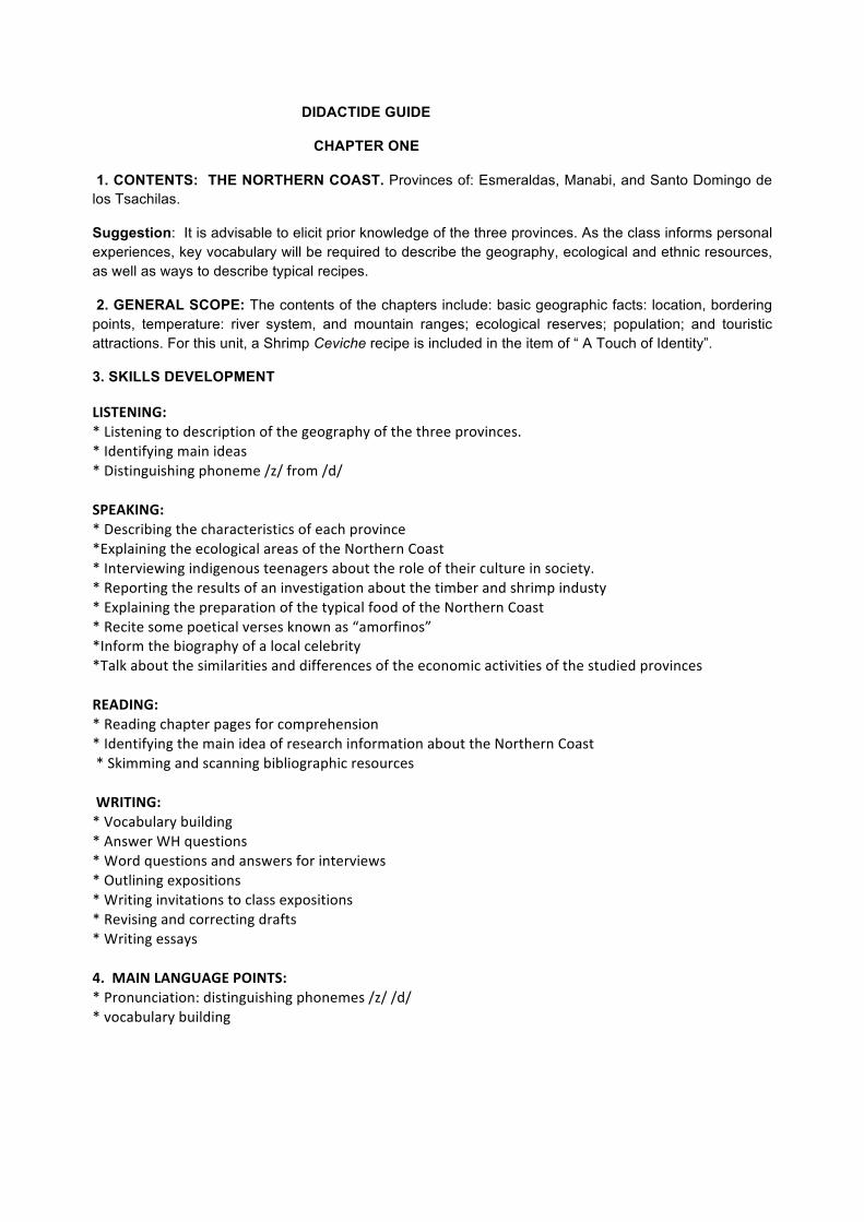
CHAPTER ONE
1. CONTENTS: THE NORTHERN COAST. Provinces of: Esmeraldas, Manabi, and Santo Domingo de los Tsachilas.
Suggestion: It is advisable to elicit prior knowledge of the three provinces. As the class informs personal experiences, key vocabulary will be required to describe the geography, ecological and ethnic resources, as well as ways to describe typical recipes.
2. GENERAL SCOPE: The contents of the chapters include: basic geographic facts: location, bordering points, temperature: river system, and mountain ranges; ecological reserves; population; and touristic attractions. For this unit, a Shrimp Ceviche recipe is included in the item of “ A Touch of Identity”.
3. SKILLS DEVELOPMENT
LISTENING: * Listening to description of the geography of the three provinces. * Identifying main ideas * Distinguishing phoneme /z/ from /d/ SPEAKING: * Describing the characteristics of each province *Explaining the ecological areas of the Northern Coast * Interviewing indigenous teenagers about the role of their culture in society. * Reporting the results of an investigation about the timber and shrimp industy * Explaining the preparation of the typical food of the Northern Coast * Recite some poetical verses known as “amorfinos” *Inform the biography of a local celebrity *Talk about the similarities and differences of the economic activities of the studied provinces READING: * Reading chapter pages for comprehension * Identifying the main idea of research information about the Northern Coast * Skimming and scanning bibliographic resources WRITING: * Vocabulary building * Answer WH questions * Word questions and answers for interviews * Outlining expositions * Writing invitations to class expositions * Revising and correcting drafts * Writing essays 4. MAIN LANGUAGE POINTS: * Pronunciation: distinguishing phonemes /z/ /d/ * vocabulary building
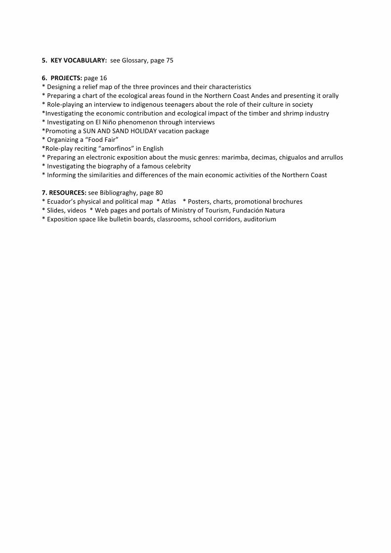
5. KEY VOCABULARY: see Glossary, page 75 6. PROJECTS: page 16 * Designing a relief map of the three provinces and their characteristics * Preparing a chart of the ecological areas found in the Northern Coast Andes and presenting it orally * Role-‐playing an interview to indigenous teenagers about the role of their culture in society *Investigating the economic contribution and ecological impact of the timber and shrimp industry * Investigating on El Niño phenomenon through interviews *Promoting a SUN AND SAND HOLIDAY vacation package * Organizing a “Food Fair” *Role-‐play reciting “amorfinos” in English * Preparing an electronic exposition about the music genres: marimba, decimas, chigualos and arrullos * Investigating the biography of a famous celebrity * Informing the similarities and differences of the main economic activities of the Northern Coast 7. RESOURCES: see Bibliograghy, page 80 * Ecuador’s physical and political map * Atlas * Posters, charts, promotional brochures * Slides, videos * Web pages and portals of Ministry of Tourism, Fundación Natura * Exposition space like bulletin boards, classrooms, school corridors, auditorium
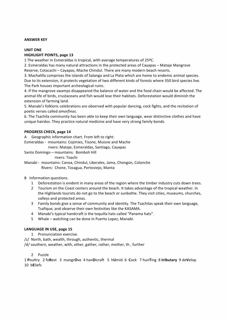
ANSWER KEY UNIT ONE HIGHLIGHT POINTS, page 13 1 The weather in Esmeraldas is tropical, with average temperatures of 25ºC. 2. Esmeraldas has many natural attractions in the protected areas of Cayapas – Mataje Mangrove Reserve, Cotacachi – Cayapas, Mache Chindul. There are many modern beach resorts. 3. Machalilla comprises the islands of Salango and La Plata which are home to endemic animal species. Due to its extension, it protects vegetation of two different kinds of forests where 350 bird species live. The Park houses important archeological ruins. 4. If the mangrove swamps disappeared the balance of water and the food chain would be affected. The animal life of birds, crustaceans and fish would lose their habitats. Deforestation would diminish the extension of farming land. 5. Manabi’s folkloric celebrations are observed with popular dancing, cock fights, and the recitation of poetic verses called amorfinos. 6. The Tsachila community has been able to keep their own language, wear distinctive clothes and have unique hairdos. They practice natural medicine and have very strong family bonds. PROGRESS CHECK, page 14 A Geographic information chart. From left to right: Esmeraldas -‐ mountains: Cojimies, Tisone, Muisne and Mache rivers: Mataje, Esmeraldas, Santiago, Cayapas Santo Domingo – mountains: Bomboli Hill rivers: Toachi Manabi -‐ mountains: Canoa, Chindul, Liberales, Jama, Chongon, Colonche Rivers: Chone, Tosagua, Portoviejo, Manta B Information questions.
1 Deforestation is evident in many areas of the region where the timber industry cuts down trees. 2 Tourism on the Coast centers around the beach. It takes advantage of the tropical weather. In
the Highlands tourists do not go to the beach or sunbathe. They visit cities, museums, churches, valleys and protected areas.
3 Family bonds give a sense of community and identity. The Tsachilas speak their own language, Tsafique, and observe their own festivities like the KASAMA.
4 Manabi’s typical handcraft is the toquilla hats called “Panama hats”. 5 Whale – watching can be done in Puerto Lopez, Manabi.
LANGUAGE IN USE, page 15
1 Pronunciation exercise. /z/ North, bath, wealth, through, authentic, thermal /d/ southern, weather, with, other, gather, rather, mother, th , further
2 Puzzle 1 Poultry 2 foRest 3 mangrOve 4 hanDicraft 5 hUmid 6 Cock 7 hunTing 8 trIbutary 9 deVelop 10 bEliefs
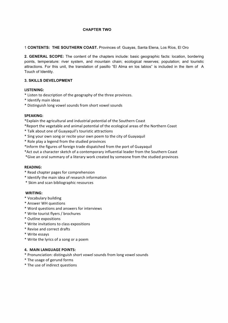
CHAPTER TWO
1 CONTENTS: THE SOUTHERN COAST. Provinces of: Guayas, Santa Elena, Los Ríos, El Oro
2. GENERAL SCOPE: The content of the chapters include: basic geographic facts: location, bordering points, temperature: river system, and mountain chain; ecological reserves; population; and touristic attractions. For this unit, the translation of pasillo “El Alma en los labios” is included in the item of A Touch of Identity.
3. SKILLS DEVELOPMENT
LISTENING: * Listen to description of the geography of the three provinces. * Identify main ideas * Distinguish long vowel sounds from short vowel sounds SPEAKING: *Explain the agricultural and industrial potential of the Southern Coast *Report the vegetable and animal potential of the ecological areas of the Northern Coast * Talk about one of Guayaquil’s touristic attractions * Sing your own song or recite your own poem to the city of Guayaquil * Role play a legend from the studied provinces *Inform the figures of foreign trade dispatched from the port of Guayaquil *Act out a character sketch of a contemporary influential leader from the Southern Coast *Give an oral summary of a literary work created by someone from the studied provinces READING: * Read chapter pages for comprehension * Identify the main idea of research information * Skim and scan bibliographic resources WRITING: * Vocabulary building * Answer WH questions * Word questions and answers for interviews * Write tourist flyers / brochures * Outline expositions * Write invitations to class expositions * Revise and correct drafts * Write essays * Write the lyrics of a song or a poem 4. MAIN LANGUAGE POINTS: * Pronunciation: distinguish short vowel sounds from long vowel sounds * The usage of gerund forms * The use of indirect questions
5. KEY VOCABULARY: see Glossary, page 75-‐76 6. PROJECTS: page 24 * Prepare a chart of the agricultural and industrial potential of the Southern Coast Provinces. * Investigate the vegetable and animal potential of one of the ecological destinations of the Southern Coast and presenting it orally *Create a tourist brochure promoting the studied Provinces *Make a modeling clay map showing Guayaquil’s tourist attractions * Create a song, painting or poem expressing your feelings about a city or Province of the studied area *Role play a legend from the Southern Coast *Investigate the figures of foreign trade dispatched from the port of Guayaquil and report findings Orally *Role-‐play a character sketch of a contemporary influential leader of the Southern Coast. * Prepare BINGO cards to match provinces with mountains, rivers, and ecological areas and have the class play the game * Share with classmates the summary a literary work by an author of the Southern Coast. 7. RESOURCES: see Bibliograghy, page 80 * Ecuador’s physical and political map * Atlas * Posters, charts, promotional brochures * Slides, videos * Web pages and portals of Ministry of Tourism, Fundación Natura * Exposition space like bulletin boards, classrooms, school corridors, auditorium
ANSWER KEY UNIT TWO HIGHLIGHT POINTS – page 20
1 The Guayas River has an important commercial role in the region. 2 Santa Elena keeps archeological ruins of the Valdivia Culture. 3 Guayaquil is a commercial port. It has a dynamic pace of life. Different ethnic groups have
settled in the city. 4 The Highland volcanoes originate a complex network of rivers which drain the Coast, especially
Los Rios Province. PROGRESS CHECK – page 22 A Chart of the Main cities – from left to right Presence of a river network (several rivers connected to a major one) : YES only for Babahoyo. Capital city: Babahoyo yes/ Guayaquil yes/ Machala yes/ Zaruma No/ Salinas Yes Rich in mineral resources: YES in Guayaquil, Zaruma and Salinas International trade center: YES only in Guayaquil and Machala High urban population: YES in Guayaquil and Machala B INFORMATION DIAGRAM -‐ From left to right Guayaquil’s historic attractions: museums, monuments, cathedral, City Hall, Historic Park Cultural attractions: artistic presentations at the Civic Plaza, theaters; in Las Peñas neighborhood, Santa Ana Hill, El Carmen Hill, parks; exhibitions at art galleries Commercial attractions: Rio Guayas Malecon, Estero Salado Malecon, modern shopping malls, handicraft markets LANGUAGE IN USE -‐ PAGE 23
1 Pronunciation exercise – Odd pronunciation: Chapel, site, sew, said Near, lagoon, hour, under
2 Gerund Chart -‐ check mark for yes as indicated Before touring: noun yes Go sailing: verb form yes Passing several: noun yes Dating back: noun yes Floating design: adjective yes Enjoy traveling: verb form yes
Surfing contest: adjective yes Fishing industry: adjective yes After seeing: noun yes
3 Sentence Building 1 Do you know / Would you mind telling me / Could you please tell me how I can get from Machala to Vinces? 2 Do you know / Would you mind telling me / Could you please tell me what agricultural potential Peninsula de Santa Elena has?
3 Do you know / Would you mind telling me / Could you please tell me When the International Banana Festival takes place?
4 Do you know / Would you mind telling me / Could you please tell me when the Spaniards founded Babahoyo? 5 Do you know / Would you mind telling me / Could you please tell me
why Puyango Petrified Forest attracts many ecologists
CHAPTER THREE
1 CONTENTS: THE NORTHERN HIGHLANDS. Provinces of: Carchi, Imbabura, and Pichincha
2. GENERAL SCOPE: The content of the chapters include: basic geographic facts: location, bordering points, temperature: river system, and mountain chain; ecological reserves; population; and touristic attractions. The section “A Touch of Identity” includes an explanation of Oswaldo Guayasamin’s mural in the auditorium of Asamblea Nacional.
3. SKILLS DEVELOPMENT
LISTENING: * Listen to the geographical description of the three provinces * Identify main ideas SPEAKING: *Report the bibliography of a prominent man or woman from the provinces of the Northern Highlands *Role play the personality of one of the most recent political, cultural or sports figures of the provinces of the Northern Highlands * Role play a market day in Otavalo giving emphasis to bargaining skills *Prepare a chart showing the distances of the touristic attractions in one of the provinces of the Northern Highlands * Inform the findings of an investigation of a folkloric celebration of one the provinces of the Northern Highlands *Prepare a collage of the protected areas of the Northern Highland Provinces and report its important facts to the class *Choose a legend of the studied provinces for dramatization *Explain a relief map of the Northern Highlands Provinces * Play the game “Find someone who …” to match characteristics of the three provinces READING: * Read chapter pages for comprehension * Identify the main idea of research information * Skim and scan bibliographic resources WRITING: * Vocabulary building * Answer WH questions * Write tourist flyers / brochures * Outline expositions * Write invitations to class expositions * Revise and correct drafts * Write essays * Write creative works like poems or the lyrics of a song 4. MAIN LANGUAGE POINTS: * Translating bargaining expressions
* Pronunciation: distinguish short vowel sounds from long vowel sounds * The usage of gerund forms 5. KEY VOCABULARY: see Glossary, page 76 6. PROJECTS: page 32 * Prepare an oral report on the biography of a prominent citizen of the Northern Highland Provinces. * Role play the personality of a recent political, cultural or sportive celebrity. *Role play a market day in Otavalo. *Prepare a chart showing the distances of the touristic attractions in one of the provinces of the Northern Highlands. * Investigate the origins of a folkloric celebration of one the provinces of the Northern Highlands and inform the results. *Prepare a collage of the protected areas of the Northern Highland Provinces and report its important facts to the class. *Choose a legend of the studied provinces for dramatization. *Build a relief map of the Northern Highlands Provinces. *Write an ecological letter to an international organization in an effort to stop a big construction project in an area of a protected area of the Northern Highlands. * Play the game “Find someone who …” to match characteristics of the three provinces. 7. RESOURCES: see Bibliograghy, page 80 * Ecuador’s physical and political map * Atlas * Posters, charts, promotional brochures * Slides, videos * Web pages and portals of Ministry of Tourism, Fundación Natura * Exposition space like bulletin boards, classrooms, school corridors, auditorium
ANSWER KEY
UNIT THREE HIGHLIGHT POINTS – page 28
1 The weather in Carchi is cold with average temperatures of 10 to 12ºC. 2 Cochasqui ruins are an evidence of the scientific knowledge the pre-‐Inca cultures had. 3 El Chota Valley is different from other Highland places because of its hot temperature and its
introduced Afro-‐Ecuadorian population. 4 Imbabura’s leading production activities are textile production, agriculture, tourism, and mineral
extraction. 5 Pichincha has the ecological areas of Cayambe – Coca, Antisana, Pululahua Geobotanic Reserve,
Pasochoa Wildlife Refuge, Mindo – Nambillo protected forests; colonial constructions in Quito’s Historic Center; warn surrounding valleys, cultural events, live performances, etc.
PROGRESS CHECK – page 30 A Northern Highlands diagram Province of Carchi: natural characteristics: irregular topography, cold weather, many lakes, Cultural characteristics: play traditional sports: paddle ball; observe Holy Innocents Commercial characteristics: commerce with Colombia, agricultural potential Weather advantages: cold temperatures good for frailejon vegetation Attractions: Topiary garden, lakes, El Angel Museums: Carlos Emilio Grijalva, David Paltan Artistic displays: pre-‐Incan pottery and household tools Location: Tulcan, San Gabriel Advantages: different collections, culture identification Province of Imbabura: natural characteristics: mild temperatures, mostly valleys, lakes Cultural characteristics: Atahualpa’s birth place, folkloric celebrations: Inti Raymi, Commercial characteristics: textile market, tourism, agriculture potential Weather advantages: moderate temperatures Attractions: Lakes, villages, Cotacachi – Cayapas Ecological Reserve, Intag Cloudforest , Condor Park Museums: Archeology & Etnography, Religious, de las Culturas Artistic displays: pre-‐Incan pottery collections/ colonial art/ outfits, musical instruments, tools Location: Imbabura/ Imbabura/ Cotacachi (de las Culturas) Advantages: different collections, culture identification/ painting and sculpture collections/ Lively displays Province of Pichincha: natural characteristics: surrounded by mountains, cold temperatures, Cultural characteristics: country’s political seat/ important historic centre/ live arts Commercial characteristics: convention center, handicraft markets, modern shopping malls, Weather advantages: moderate cold temperatures in Quito, warm valleys Attractions: forests, Middle of the World monument, Quito’s historic center, protected areas Museums: archeology; colonial & modern art; religious, on site museums Artistic displays: pre-‐Incan pottery collections/traditional paintings & sculptures/ XX century art/ Archeological sites Location: Banco Central Museum, Casa de la Cultura, churches/ Rumipamba – La FLorida Advantages: guided tours, free admission or low fee, classified collections
ANSWER KEY UNIT THREE PROGRESS CHECK – page 30 B) Numbering tourist destinations 1 Volcan Chiles 2 San Gabriel 3 El Chota 4 Ibarra 5 Cotacachi 6 Cayambe – Coca 7 Guayllabamba 8 Pasochoa Reserve LANGUAGE IN USE – page 31
1 Patchwork mountains. From left to right CAPS (manufactured with plastic elements) / BRIDGES (not a natural formation but a construction) OTAVALO (not in Carchi)/ SURFING (aquatic sport not practiced on lakes but on the sea) Kayaking ( sport practiced on rivers)/ jogging (exercise, not entertainment)/ Pancakes (fried preparation) / dolphin (not a mountain animal)/ Doughnuts (not an agricultural product) / corn flakes (not a dairy product) 2. Sentence translation 1 How much does this cost? 2 You’re going to charge me a little less, aren’t you? 3 How much will that be if I take three? 4 OK. Now you’ve got a steady client. 5 There you are, Sir. Be sure to come back.
CHAPTER FOUR
1 CONTENTS: THE CENTRAL HIGHLANDS. Provinces of: Cotopaxi, Tungurahua, Chimborazo and Bolivar
2. GENERAL SCOPE: The content of the chapters include: basic geographic facts: location, bordering points, temperature: river system, and mountain chain; ecological reserves; population; and touristic attractions. The section “A Touch of Identity” includes an explanation of the traditional festivity “Mama Negra”.
3. SKILLS DEVELOPMENT
LISTENING: * Listen to the geographical description of the three provinces * Identify main ideas SPEAKING: *Give an oral presentation of a collage of the different indigenous groups of the Central Highlands * Explain a relief map of the mountains, rivers, and valleys of the Central Highlands *Talk about a prominent figure of the Central Highlands * Do an audio recording for the publicity of an “Ideal Tour of the Central Highlands” * Describe the typical clothing of the Central Highlands *Inform the class about the flower market potential of the Central Highlands *Prepare an oral report on one of the local main folkloric celebrations *Address the class with information about the food processing industry * Role play a “Treasure Hunting” expedition in search of Atahualpa’s treasure hidden in Llanganates. READING: * Read chapter pages for comprehension * Identify the main idea of research information * Skim and scan bibliographic resources WRITING: * Vocabulary building * Answer WH questions * Write tourist flyers / brochures * Outline expositions * Write invitations to class expositions * Revise and correct drafts * Write essays 4. MAIN LANGUAGE POINTS: * Translating bargaining expressions * Pronunciation: distinguish short vowel sounds from long vowel sounds * The usage of gerund forms 5. KEY VOCABULARY: see Glossary, page 76
6. PROJECTS: page 40 *Prepare a collage of the different indigenous groups of the Central Highlands Provinces. * Make a relief map of the mountains, rivers, and valleys of the Central Highlands. *Research the biography of a prominent figure of the Central Highlands. * Do an audio recording for the publicity of an “Ideal Tour of the Central Highlands”. * Organize a “Typical Outfit Festival” and describe it with the ethnic groups the clothing belongs to, festivities they observe, eating habits, and traditions. *Prepare a “Flower Fair” using fresh and dry flowers that grow in the area. Inform the class about the flower market potential of the Central Highlands. *Prepare an oral report on one of the local main folkloric celebrations. *Prepare a collage of the different kinds of fruit that grow in the Central Higlands. Include facts about the food processing industry. * Role play a “Treasure Hunting” expedition in search of Atahualpa’s treasure hidden in Llanganates. 7. RESOURCES: see Bibliograghy, page 80 * Ecuador’s physical and political map * Atlas * Posters, charts, promotional brochures * Slides, videos * Web pages and portals of Ministry of Tourism, Fundación Natura * Exposition space like bulletin boards, classrooms, school corridors, auditorium
ANSWER KEY UNIT FOUR HIGHLIGHT POINTS – page37
1 The province of Bolivar displays pre-‐hispanic techniques used to exploit salt in Salinas. In addition you can see archeological sites in Chillanes and San Miguel.
2 Main celebrations of the central highland provinces: Mama Negra: Latacunga, Cotopaxi; Fruit & Flower Carnival – Ambato-‐ Tungurahua; Diablada de Pillaro – Pillaro, Tungurahua, Guaranda’s Carnival – Guaranda, Bolivar, Holy Week – Riobamba, Chimborazo.
3 Ambato’s Carnival is observed without water fights as in the rest of the country. They arrange colorful parades, cultural events, street dancing, fireworks, and bull fights.
4 Bolivar has contrasting climates; in the mountains the average temperature is 12ºC , in the lowlands it is 12ºC.
5 Foreign investment in the Central Highlands is trying to stop migration by promoting economic projects in agriculture, food – processing, crafts, etc.
PROGRESS CHECK -‐ page 38 A Economic resources chart – from left to right Food processing: yes in the four provinces Metallurgy: yes in Tungurahua Textile manufacturing: yes in Cotopaxi and Tungurahua Dairy production: yes in the four provinces Tagua crafts: yes in Chimborazo Timber: yes in the four provinces Mineral extraction: yes in the four provinces B) SENTENCE BUILDING
1 When you visit Cotopaxi you will find that the weather is cold. 2 If you are in Latacunga at the beginning of November, you are likely to join the Mama Negra
celebration. 3 Since Quichua is the native language, you will hear the peasants of the central Highlands
speaking it. 4 Because Carnival is a holiday there is a four – day vacation. 5 If you want to go fishing in the central Highlands you should go to Chimborazo lakes:
Ozogoche and Colta. LANGUAGE IN USE – page 39
1 Sense chart – from left to right Latacunga: see: Mama Negra/ hear: town music/ touch: flowers/ eat: chugchucara, allullas/ smell: fritada Ambato: see: Carnival parade/ hear: dance music/ touch: fruit& flowers/ eat: llapingacho, bread, fruit/ smell: flowers & fruit Baños: see: waterfalls, mountains, extreme sports/ hear: running water, foreign languages/ touch: plants, handicrafts/ eat: taffy, sugar cane/ smell: taffy Guaranda: see: Carnival/ hear: people singing/ touch: water balloons/ eat: chiguiles/ smell: coffee Riobamba: see: market/hear: Quichua spoken/ touch: tagua crafts/ eat: cheese/ smell: pasture Pillaro: see: Diablada/ hear: masked devils/ touch: masks/ eat: traditional food/smell: fireworks
2 Nutrition Pyramid – left side Cheese 3, guaytambo 6, barley 8, sausages 4, sugar cane 1, capuli 6, giant beans 7, potatoes 5, Roasted pork 4, quinoa 8, radishes 5, taffy 1
right side: membrillo 6, allullas 8, avocado 6, melloco 5, eggnog 3, chochos 7, barley flour 8, ice cream 1, guinea pig 4, chicken 4
CHAPTER FIVE
1 CONTENTS: THE SOUTHERN HIGHLANDS. Provinces of: Cañar, Azuay, and Loja
2. GENERAL SCOPE: The content of the chapters include: basic geographic facts: location, bordering points, temperature: river system, and mountain chain; ecological reserves; population; and touristic attractions. The section “A Touch of Identity” outlines the profile of national heroes from the past and present living idols like Jefferson Perez.
3. SKILLS DEVELOPMENT
LISTENING: * Listen to the geographical description of the three provinces * Identify main ideas SPEAKING: *Talk about the indigenous groups of the Southern Highlands informing their main economic activities, population, social leaders, and cultural life. *Interview a Museum director or representative of Casa de la Cultura Ecuatoriana about the participation of young Ecuadorians in the preservation of the country’s cultural heritage. * Give an oral exposition based on a chart of the agricultural and industrial potential of the Southern Highlands Provinces. *Conduct a panel discussion on the causes and consequences of migration. * Give an oral report of the handicrafts produced in Cañar, Azuay, and Loja. *Prepare an electronic presentation about the last Census population data of the studied area. *Promote a class discussion to consider a petition letter asking government authorities not to carry out a massive construction project that would affect an ecological reserve of the Southern Provinces. *Explain the potential medicinal plants that Podocarpus National Park have. * Play the game “Find someone who …” to match characteristics of the three provinces * Explain the distances of some main touristic attractions and the city of Cuenca. *Explain how to prepare the most representative dishes of the Southern Highlands Provinces in a “Food Fair”. READING: * Read chapter pages for comprehension * Identify the main idea of research information * Skim and scan bibliographic resources WRITING: * Vocabulary building * Answer WH questions * Word questions and answers for interviews * Write tourist flyers / brochures * Outline expositions * Write invitations to class expositions * Revise and correct drafts * Write essays
4. MAIN LANGUAGE POINTS: * Word hyphenation *Sentence building 5. KEY VOCABULARY: see Glossary, page 77 6. PROJECTS: page 48 *Prepare a chart of the indigenous groups of the Southern Highlands showing their location, main economic activities, population, social leaders, and cultural life. *Prepare an interview to a Museum director or representative of Casa de la Cultura Ecuatoriana about the participation of young Ecuadorians in the preservation of the country’s cultural heritage. *Make a chart of the agricultural and industrial potential of the Southern Highlands Provinces. *Conduct a panel discussion on the causes and consequences of migration. *Conduct a panel discussion on the causes and consequences of migration. * Display a collage of the handicrafts produced in Cañar, Azuay, and Loja. *Prepare an electronic presentation about the last Census population data of the studied area. *Promote a class discussion to consider a petition letter asking government authorities not to carry out a massive construction project that would affect an ecological reserve of the Southern Provinces. *Research the medicinal plants available in Podocarpus National Park. Explain their healing potential with a colorful chart. 7. RESOURCES: see Bibliograghy, page 80 * Ecuador’s physical and political map * Atlas * Posters, charts, promotional brochures * Slides, videos * Web pages and portals of Ministry of Tourism, Fundación Natura * Exposition space like bulletin boards, classrooms, school corridors, auditorium * Video book “Asi dicen mis abuelos” translated from Spanish into English, French, German, Kichua, Tsafi, Huaorani
ANSWER KEY UNIT FIVE HIGHLIGHT POINTS – page 45
1 The weather in most of Cañar province is cold. 2 Migration out of the country has disintegrated the families. 3 Four rivers drain Cuenca: Tomebamba, Yanuncay, Machangara, and Tarqui. 4 In Cuenca they observe: Carnival, Corpus Christi, and Pase del Niño. 5 The high level of education of Saraguro leaders has improved the quality of life. 6 Loja is famous for humanists, writers, historians, musicians, and artists.
PROGRESS CHECK -‐ page 46 Azuay – Representative: chola cuencana/ Economic activities: toquilla hats, jewelry, tires, ceramics International athletes: Rolando Vera, Jefferson Perez, Rolando Saquipay Minerals: gold, silver, copper, lead, marble Loja – Economic activities: education, mineral extraction, agriculture/ Ethnic group: Saraguro Minerals: gypsum, coal, / Musicians: Alfredo & Edgar Palacios, Salvador Bustamante, Segundo Cueva Celi LANGUAGE IN USE – page 47 1 Hyphenation: e-‐col-‐o-‐gic-‐al, pil-‐grim-‐age, moun-‐tain, fer-‐tile, rep-‐re-‐sen-‐ta-‐tive, in-‐de-‐pend-‐ence, mu-‐se-‐ums, in.dig.e-‐nous, en-‐vi-‐ron-‐ment, peace-‐ful, mi-‐rac-‐u-‐lous , lon.gev-‐i-‐ty , her-‐i-‐tage, pre-‐vail, min-‐er-‐al, ter-‐ri-‐to-‐ry
Crossword puzzle 1 silver 2 minerals 3 gold 4 FURNITURE 5 pasture 6 education 7 tires 8 pottery 9 tubers 10 basketry
CHAPTER SIX
1 CONTENTS: THE NORTHERN ECUADORIAN AMAZON. Provinces of: Sucumbios, Napo and Orellana
2. GENERAL SCOPE: The content of the chapters include: basic geographic facts: location, bordering points, temperature: river system, and mountain chain; ecological reserves; population; and touristic attractions. The section “A Touch of Identity” includes the legend of JUMANDI.
3. SKILLS DEVELOPMENT
LISTENING: * Listen to the geographical description of the three provinces * Identify main ideas SPEAKING: *Explain the characteristics of an ecological area of your choice in an electronic exposition or in a “mini-‐documentary” *Address your class with facts about transportation facilities available at present and in the past in the studied area *Role-‐play an interview with indigenous teenagers about their lifestyle. Encourage the class to take part and draw conclusions with your own lifestyle and theirs *Explain the post cards used for a “Post Card Contest” depicting the natural attractions of Sucumbios, Napo or Orellana *Have the class spot hidden pictures of animals of the Amazon drawn on a poster *Deliver an oral report of the results of an interview to a public figure from the Ecuadorian Amazon about the future of the protected areas and the expanding oil industry activities *Dramatize a community protest against a housing project, a timber industry, or an oil company *Explain the most important characteristics tours to the Northern Ecuadorian Amazon offer *Create an artistic expression about the studied area. Share the song, poem, chant, rap, cartoon or painting in class READING: * Read chapter pages for comprehension * Identify the main idea of research information * Skim and scan bibliographic resources WRITING: * Vocabulary building * Answer WH questions * Word questions and answers for interviews * Write tourist flyers / brochures * Outline expositions * Revise and correct drafts * Write essays * Write creative works like poems or the lyrics of a song
4. MAIN LANGUAGE POINTS: * Word hyphenation *Sentence building 5. KEY VOCABULARY: see Glossary, page 77 6. PROJECTS: page 56 *Prepare a collage or an electronic exposition of an ecological area of your choice showing its different habitats. * Register in a chart facts about transportation facilities available at present and in the past in the studied area. *Role-‐play an interview with indigenous teenagers about their lifestyle. Encourage the class to take part and draw conclusions with your own lifestyle and theirs. * For classroom display, make a chart of the major products derived from petroleum. *Organize a “Post Card Contest.” Explain the post cards depicting the natural attractions of Sucumbios, Napo or Orellana. *Prepare a “Hidden Picture” poster showing the shapes of animals of the Amazon. *Prepare an interview to a public figure from the Ecuadorian Amazon about the future of the protected areas and the expanding oil industry activities. *Dramatize a community protest against a housing project, a timber industry, or an oil company *Surf the net and look for information about the most relevant information tours to the Northern Ecuadorian Amazon include. *Create an artistic expression about the studied area. Share the song, poem, chant, rap, cartoon or painting in class. 7. RESOURCES: see Bibliograghy, page 80 * Ecuador’s physical and political map * Atlas * Posters, charts, promotional brochures * Slides, videos * Web pages and portals of Ministry of Tourism, Fundación Natura * Exposition space like bulletin boards, classrooms, school corridors, auditorium * Video book “Asi dicen mis abuelos” translated from Spanish into English, French, German, Kichua, Tsafi, Huaorani, and sign language
ANSWER KEY UNIT SIX HIGHLIGHT POINTS, page 53 1 The Andes mountain range drains water on the Amazon basin. As the altitude of the mountains drops, different climatic floors originate. 2 Black rivers have little soil sediment.
3 Oil exploration is the leading economic activity in the Northern Ecuadorian Amazon. 4 The natives work as tour guides and offer stays in their communities. 5 The timber industry depends on trees, especially fine-‐wood trees. Protection comes from the
declaration of protected areas. 6 People transport themselves by canoe on the navigable rivers of the region and by small planes.
PROGRESS CHECK – page 54 A Water course chart Sucumbios: Aguarico, Sucumbios, Cuyabeno Napo: Napo, Quijos, Tena, Yasuni Orellana: Yasuni, Tiputini, Cononaco B Ecological Areas chart – from left to right Cuyabeno: Sucumbios/ 200 tree species/ pink dolphins, manatees, caimans Limoncocha: Sucumbios/ primary vegetation/ caiman, anaconda, 460 bird species Cofan-‐Bermeo: Sucumbios/ 53,000 acres of timber land, 2,000 acres of protected forest/monkeys, river turtles, caimans, dolphins, wild cats Sumaco: Napo/ abundant vegetable & timber areas/ jaguar, armadillo, bear, tiger Napo Galeras: Napo/ primary forest/, bird species, amphibians, jaguar, armadillo, bear, tiger Yasuni: Orellana/ primary forest/ 500 bird species, 173 mammal species, 62 snake species, 100 amphian species LANGUAGE IN USE – page 55 Poster discussion points It’s a bird-‐watching trip. Transportation is offered to and from Papallacta (by motor car). Advantages: asphalted road, good scenery. Disadvantages: foggy area, too many curves Native guides are offered to explore the area and English speaking naturalists will explain the scientific aspects. The trip in February allows visitors to be part of a feast day on February 12th.
CHAPTER SEVEN
1 CONTENTS: THE SOUTHERN ORIENTE. Provinces of:Pastaza, Morona Santiago, and Zamora Chinchipe
2. GENERAL SCOPE: The content of the chapters include: basic geographic facts: location, bordering points, temperature: river system, and mountain chain; ecological reserves; population; and touristic attractions. The section “A Touch of Identity” includes the translation of the Hymn to the Oriente.
3. SKILLS DEVELOPMENT
LISTENING: * Listen to the geographical description of the three provinces * Identify main ideas SPEAKING: *Explain a geographical map, made of modeling clay, of the Southern Oriente Provinces. *Report the evolution of the cities like: Puyo, Shell, Mera; San Juan Bosco, Logroño, Macas, Gualaquiza; Zamora, Yangaritza or Yanzatza by means of an electronic presentation. *Inform the class about the timber industry in the Southern Oriente Provinces. *Give an oral report about the engineering aspects of the Baños-‐Puyo road. *Talk about one of the cities of the studied area focusing on: population facts, touristic attractions, and economic importance. * Tell your class the common elements that appear in the lyrics of the anthems written for the hymns of the different provinces of the Southern Oriente. *Brief your class with the role the indigenous group “Achuar” had in the last territorial confrontation with Peru. *Role-‐play a “shaman” curing a visitor. *Role-‐play a possible political campaign speech offering integration and educational programs, ecological projects, and economic alternatives. READING: * Read chapter pages for comprehension * Identify the main idea of research information * Skim and scan bibliographic resources WRITING: * Vocabulary building * Answer WH questions * Outline expositions * Write tourist flyers / brochures * Revise and correct drafts * Write essays * Write creative works like poems or the lyrics of a song 4. MAIN LANGUAGE POINTS: * Double letters *Affixes: prefixes & suffixes * ”Language chunks”

*Sentence building 5. KEY VOCABULARY: see Glossary, page 77 6. PROJECTS: page 64 7. RESOURCES: see Bibliograghy, page 80 * Ecuador’s physical and political map * Atlas * Posters, charts, promotional brochures * Slides, videos * Web pages and portals of Ministry of Tourism, Fundación Natura * Exposition space like bulletin boards, classrooms, school corridors, auditorium * Video book “Asi dicen mis abuelos” translated from Spanish into English, French, German, Kichua, Tsafi, Huaorani, and sign language
ANSWER KEY UNIT SEVEN HIGHLIGHT POINTS – page 60 1 Southern Amazon cities originally settled in colonial times are: Sucua, Santiago de Mendez, San Juan Bosco, Gualaquiza, and Zamora. 2 There are large deposits of gold, silver, and coal. 3 Natural medicine and agriculture are popular activities among natives of the Southern Amazon. 4 Colonizing policies are diminishing the number of the native population. They stop using their own language and observing their own religious rituals. 5 Transportation is carried out by boat but also by small planes and motor cars. 6 Ecotourism is an attitude of tourists to respect nature and protect it. Eco tourists are concerned about not harming the environment, the protection of animal and vegetable species. Traditional tourism is the industry that takes tourists around to enjoy traditional destinations with outstanding hotel accommodations and no concern about the impact of their activity on the community. PROGRESS CHECK – page 61 A Answers go from let to right. Pastaza: Achuar, Quichuas/ Llanganates National Park, Fatima Wildlife Center, Curaray Waterfall Morona: Shuar & Achuar / Sangay, Upano Valley, Cueva de los Tayos, Wakambe Caves, Mamanguy thermal springs, Yaupi lagoon, waterfalls Zamora: Shuar/ Rivers Zamora and Bombuscara, Puyopungo Lake, Chuwitayos Caves, Palhinia Greenhouse B Job chart – from left to right Botanist: forest, green house, wild refuge/ record plants cycles, observes reactions, records interaction with insects/ works with a diversity of species/ outdoor work: effects of sun, wind, rain Tourist guide: tourist places/ accompany visitors around an area, explain main facts, describe attractions, serves as an interpreter and a facilitator/ away from home and friends, constantly on the move Farmer: rural areas/ makes the land produce/ covers personal needs for food, production always has demand/ unstable prices for crops, harmful chemicals, adverse weather conditions Gold seeker: Nambija, Zaruma, Portovelo/ looks for gold in rivers and soil inside caves/ gold is well paid in the market/ mineral extraction uses harmful chemicals Hunter: forest/ makes traps, shoots at animals/ works in groups of hunters/ may be attacked by animals LANGUAGE IN USE – page 62 1 Spelling: mammals, cinnamon, missionary, patterns, village, butterflies, irrigation, successful 2 Prefixes: im immigrant, eco ecosystem, a across, ad adventure, in inhabit, bio biotechnology Suffixes: ity diversity, al tropical, ern eastern, ful colorful, ly previously, tion construction 3 Language chunks – from left to right. LEFT: I’m planning to visit the Amazon basin. This last group of tourists had never heard of bio-‐fuels before. Have you already booked in a hotel? I just loved traveling by boat. RIGHT: I really wish I could show you around when you come. I don’t understand why you’re leaving ahead of time.
ANSWER KEY UNIT SEVEN Language in Use – page 63 What about going for a swim in the river? Not far from here there’s a beautiful waterfall where we can go. 4 Sentence building Our friends had a travel agent arrange a tour for them. Someone might have found my video camera. If the environmentalists hadn’t filed a law suit against oil companies, the air and the rivers would continue being polluted. The guide can’t have forgotten to come for us. If we hadn’t taken our flashlights along, we couldn’t have seen anything in the Tayos Cave.
CHAPTER EIGHT
1 CONTENTS: THE INSULAR REGION: The Galapagos Islands
2. GENERAL SCOPE: The content of the chapters include: basic geographic facts of the major islands: location, temperature; ecological reserves: wildlife; urban population; and touristic attractions. The section “A Touch of Identity” includes the translation of the well known song “A mi lindo Ecuador”.
3. SKILLS DEVELOPMENT
LISTENING: * Listen to the geographical description of the three provinces * Identify main ideas SPEAKING: *Describe a geographical map of the Galapagos Islands identifying the names in Spanish and English *Role-‐play a legend of the Galapagos Islands *Inform the class a contrastive proposal to visit the Islands based on a tour offered on the internet and a tour organized by a local travel agency. *Make an audio recording promoting your own “Ideal Tour” *Give an oral presentation of a collage of a chosen island *Encourage the class to take part in the outline of a letter to an international conservation organization to eliminate predators like wild dogs, goats, or wasps. *Interview a foreign student who has visited the Galapagos Islands. Find out his/her good and bad impressions about the trip. Inform the results to the class. READING: * Read chapter pages for comprehension * Identify the main idea of research information about the Insular Region * Skim and scan bibliographic resources WRITING: * Vocabulary building * Answer WH questions * Word questions and answers for interviews * Outline expositions * Write tourist flyers / brochures * Revise and correct drafts * Write essays 4. MAIN LANGUAGE POINTS: * Vocabulary building *Sentence building * Interpreting signs * Translation practice 5. KEY VOCABULARY: see Glossary, page 77
6. PROJECTS: page 71 *Construct a map of the islands using modeling clay and describe it to the class. *Role-‐play a legend of the Insular Region. *Compare the proposal of tourist packages promoted by local travel agencies and over the internet. *Make an audio recording promoting your own “Ideal Tour”. * Organize a “Poster Contest” for the preservation of the islands. *Prepare a collage or an electronic exposition of a chosen Island. Give an oral presentation of the animal life, vegetable species available, climatic zones, and touristic attractions. * Make the necessary arrangements to start “pen or key pal” correspondence with school teenagers from the Insular region and your school. *Encourage the class to take part in the outline of a letter to an international conservation organization to eliminate predators like wild dogs, goats, or wasps. *Interview a foreign student who has visited the Galapagos Islands. Find out his/her good and bad impressions about the trip. Inform the results to the class. *Design a puzzle of the islands using cardboard for classmates to put it together. 7. RESOURCES: see Bibliograghy, page 80 * Ecuador’s physical and political map * Atlas * Posters, charts, promotional brochures * Slides, videos * Web pages and portals of Ministry of Tourism, Fundación Natura * Exposition space like bulletin boards, classrooms, school corridors, auditorium
ANSWER KEY UNIT EIGHT HIGHLIGHT POINTS -‐ page 67
1 Factors like marine currents, altitude, and geological aspects affect the weather in Galapagos. 2 The islands are different from each other because they have unique vegetable and animal habitats. 3 Tourism, scientific research and agriculture are typical activities of the inhabited islands. 4 Continental immigrants and Europeans have settled the islands. 5 The islands offer natural habitats where endemic species interact freely. 6 The Galapagos Islands are part of Ecuador’s sovereign territory. The young generations have the
right to see, study, and inherit the wonderful habitats of this Archipielago. PROGRESS CHECK -‐ page 68 A Galapagos Wildlife chart – by category Plants: mangrove, myrtle, thorny plants, cacti, lichens, salt bushes Reptiles: turtles, snakes, iguanas, lizards Fish: spades, rays, sharks, pufferfish, damselfish, snappers, Birds: penguins, albatrosses, pelicans, cormorans, finches Mammals: dolphins, sea lions, fur seals, whales B Information sentences Puerto Baquerizo Moreno is the capital of the Galapagos Islands. In the past people used to travel to the Islands by boat. Nowadays, most people get there by plane. Charles Darwin Research Station is located in Puerto Ayora, Santa Cruz Island. The Spanish clergyman Friar Tomas de Berlanga was the first traveler to call the islands “enchanted”. Charles Darwin’s careful observation of animal behavior led him to his theory of “The Survival of the Fittest”. LANGUAGE IN USE – page 69 Vocabulary building chart. From left to right. Sail – sailor/ sailing/ sail/ -‐-‐-‐ Science – scientist/ scientific/ -‐-‐-‐-‐ / scientifically Reproduction – reproducer/ reproductive – reproducible/ reproduce/ -‐-‐-‐-‐ Isolation – isolationism/ isolable/ isolate/ -‐-‐-‐ Attraction – attractiveness/ attractive/ attract/ attractively Increase -‐ increaser/ increasing – increasable/ increase/ increasingly -‐-‐-‐ / capable/ able/ capably ALTERNATIVE Traveler/ traveling/ travel/ -‐-‐-‐ Signs interpretation Do not uproot the plants. Do not take the plants. Walk inside the trails. Do not throw garbage/ waste. Ideal to take pictures. Do not touch the animals.
ANSWER KEY UNIT EIGHT Language in Use -‐ page 70 Tourist essentials Vocabulary –Health – related matters: sea sickness tablets, stomach pills, pain killers, band aids Boat trip: light clothing, wind breaker, sun cap, sun glasses, life savers, goggles Snorkeling: wet suit, snorkel tube, mouth piece, mask, swimming fins Scuba diving: wet suit, compressed air tank, hose regulator, swimming fins, timer, belts Island touring: sturdy boots, sun cap, long sleeved shirt, insect repellent, note pad, goggles Translation I’m so thirsty. (I’m dying of thirst.) This food tastes delicious. Can you give me a second helping, please? I should have brought insect repellent for the walks. If I had put on a long-‐sleeved shirt I wouldn’t have been bitten by the mosquitoes.