el mapa de teozacoalco: an early colonial guide to ... · el mapa de teozacoalco: an early colonial...
TRANSCRIPT

FAMSI © 2003: Stephen L. Whittington El Mapa de Teozacoalco: An Early Colonial Guide to Cultural Transformations
Research Year: 2002 Culture: Mixtec Chronology: Early Colonial Location: Oaxaca, México Site: San Pedro Teozacoalco
Table of Contents Abstract Resumen Final Report Table 1. Descriptions of Sites Found in 2000 and 2002 List of Figures Sources Cited
Abstract
Using El Mapa de Teozacoalco, an early Colonial map and genealogy, as a guide, archaeological settlement pattern survey in 2002 continued and expanded fieldwork begun in 2000 in a 30 x 70 km mountainous area inhabited by the Mixtec people around San Pedro Teozacoalco, Oaxaca, México. The project is addressing interrelated issues:

association of Mixtec and Spanish place names on El Mapa with archaeological sites, natural features, and extant settlements and the testing of postulated continuities and discontinuities between settlements during different time periods. The project is producing data on changes in settlement characteristics that accompanied major cultural transformations in Mesoamerica.
Resumen
Guiado por El Mapa de Teozacoalco, un mapa colonial antiguo, el estudio arqueológico durante el año 2002, continuo y expandió el trabajo de campo empezado en el año 2000 en un área montañosa de 30 km. por 70 km. cerca del pueblo de San Pedro Teozacoalco en la Mixteca Alta, Oaxaca, México. El proyecto está estudiando cuestiones interrelacionadas: la asociación de nombres de lugares mixtecas y españoles en El Mapa con sitios arqueológicos, los rasgos característicos naturales y los poblados existentes y el probar de continuidades y discontinuidades postuladas entre los poblados del período diferentes. El proyecto está produciendo información relacionada a transformaciones principales en la ancestral sociedad mesoamericana.
Submitted 04/21/2003 by: Stephen L. Whittington Museum of Anthropology Wake Forest University [email protected]
Final Report
Guided by El Mapa de Teozacoalco, an early Colonial map associated with one of a series of texts known as Relaciones Geográficas (Anders et al. 1992a, 1992b; Benson Latin American Collection 2000; Caso 1949, 1960), archaeological survey partially funded by the Foundation for the Advancement of Mesoamerican Studies, Inc., has begun to produce data related to changes in settlement characteristics associated with cultural transformations in one area of the Mixteca Alta around the town of San Pedro Teozacoalco. This work has begun to fill a 2,100 square km blank on the archaeological map. The project is one of the first applications of survey to exploration of a mapa from the Mixteca Alta.
El Mapa de Teozacoalco was drawn about 1580 using conventions of both European map-making and Mixtec codex-painting. It shows natural features, human constructions, and boundary markers related to the Colonial municipality of Teozacoalco and probably
2
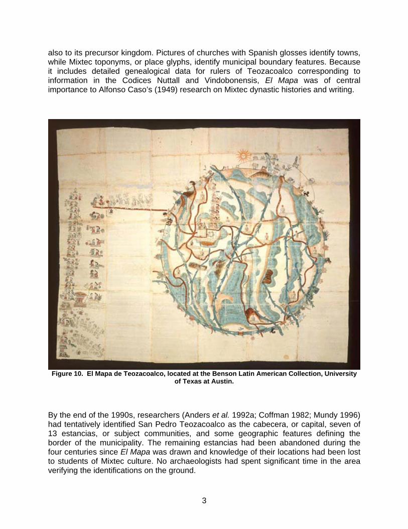
also to its precursor kingdom. Pictures of churches with Spanish glosses identify towns, while Mixtec toponyms, or place glyphs, identify municipal boundary features. Because it includes detailed genealogical data for rulers of Teozacoalco corresponding to information in the Codices Nuttall and Vindobonensis, El Mapa was of central importance to Alfonso Caso’s (1949) research on Mixtec dynastic histories and writing.
Figure 10. El Mapa de Teozacoalco, located at the Benson Latin American Collection, University
of Texas at Austin.
By the end of the 1990s, researchers (Anders et al. 1992a; Coffman 1982; Mundy 1996) had tentatively identified San Pedro Teozacoalco as the cabecera, or capital, seven of 13 estancias, or subject communities, and some geographic features defining the border of the municipality. The remaining estancias had been abandoned during the four centuries since El Mapa was drawn and knowledge of their locations had been lost to students of Mixtec culture. No archaeologists had spent significant time in the area verifying the identifications on the ground.
3

Balkansky et al. (2000) reviewed archaeological work that had occurred in the Mixteca Alta by the end of the 1990s. Their review demonstrated an absence of work within the region covered by El Mapa de Teozacoalco south of their large Central Mixteca Alta Settlement Pattern Project Survey area.
During February 2000, the late David Shoemaker and I undertook preliminary exploration of the area depicted on El Mapa (Shoemaker 2000). We visited 29 sites dating from 500 B.C. to the Colonial period and defined the northern third of the old municipality’s boundary. The survey made it clear that many other sites remained to be located and explored. During April 2002, Nancy Gonlin and I led a team that visited and recorded 35 new sites. We also revisited 12 sites from 2000. The locations of 16 sites that could not be visited because of lack of time were recorded. Archaeological surveys in 2000 and 2002 provided verification of identifications of Teozacoalco and ten estancias, and produced new data on previously unidentified settlements and border markers (Table 1).
Byland and Pohl’s (1994) archaeological survey of the Tilantongo and Jaltepec regions, which revealed sites corresponding to places depicted in Mixtec codices, was the model for the project. In the process of searching for communities and features that appear on El Mapa we learned the locations of earlier sites that do not appear there.
Team members traveled by pickup truck to remaining present-day towns identified as former estancias, recorded associated archaeological remains, and located abandoned estancias and natural and man-made features that define the boundary of the municipality. We contacted municipal authorities and learned the locations of sites and Mixtec and Spanish names of settlements and geographic features. In the company of guides representing the municipal authorities, we visited sites described to us and ones known from the previous season. We recorded the location of each site, determined with a GPS device, on topographic maps and INAH site registration forms. We sketched maps of sites, collected ceramic and obsidian artifacts from the ground surface, and documented each site photographically. The ceramics found on the ground during survey are related to ceramics from other parts of Oaxaca whose chronologies are well defined (Lind 1987), so we used them to determine the antiquity of sites.
Patterns in the location and characteristics of sites within the survey region have begun to emerge. Many of these patterns are similar to what has been encountered in other survey regions in the Mixteca Alta. Nearly all of the sites have a Postclassic component, so temporal patterns remain difficult to identify at this time.
One set of sites is on mountain peaks. Often these sites are near or overlook existing towns. They typically have monumental architecture at the highest point of the mountain, with heavily terraced slopes surrounding the peak.
Iglesia Gentil is the site with the largest concentration of monumental architecture encountered to date (Figure 1). It overlooks the town of San Pedro Teozacoalco from the top of Cerro Amole, which is marked with a red cross on El Mapa. The extent of the site is 260 m x 225 m. There are more than 38 mounds, the tallest 5 m high. The major
4

feature of the mountain top is a large I-shaped ball court. Other important constructions are an acropolis-like area at the north end of the site and a large pyramid and palace-like structure in the south area. The steep slopes of the top third of the mountain are densely covered with settlements and terraces. An ancient road runs around the mountain at the bottom of the densely settled area.
Figure 1. Plan of mountain peak site Iglesia Gentil. An acropolis-like area is at the north end, next
to an I-shaped ball court. A palace-like structure and pyramid are to the south.
Another set of sites is located on mountain ridges. These sites typically have one or more plazas surrounded by large structures and impressive, apparently defensive walls positioned at some distance from the site core (Figure 2). There are sometimes residential areas and terraces surrounding the plazas.
Steep mountain slope sites are on the upper slopes of Cerro Amole, are related to the large site on the peak, and include concentrations of significant architectural features (Figure 3). Between them are almost continuous areas of terraces.
Gentle mountain slope sites are located around the base of Cerro Amole and other mountains. Their relationship to sites located at higher altitudes is not certain, and they may be more closely associated with sites below them. Some have relatively large mounds surrounding plazas, but others are agglomerations of structures without clear organization. Five estancias and one other settlement shown on El Mapa but lying outside of Teozacoalco’s territory are on gentle mountain slopes.
5
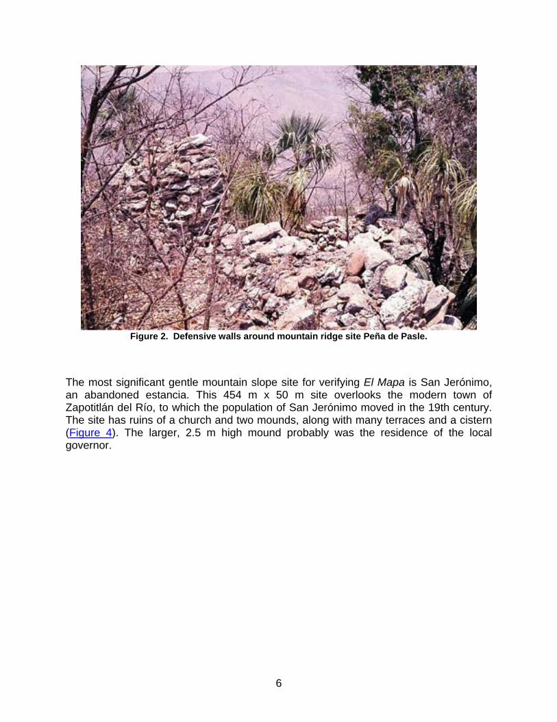
Figure 2. Defensive walls around mountain ridge site Peña de Pasle.
The most significant gentle mountain slope site for verifying El Mapa is San Jerónimo, an abandoned estancia. This 454 m x 50 m site overlooks the modern town of Zapotitlán del Río, to which the population of San Jerónimo moved in the 19th century. The site has ruins of a church and two mounds, along with many terraces and a cistern (Figure 4). The larger, 2.5 m high mound probably was the residence of the local governor.
6
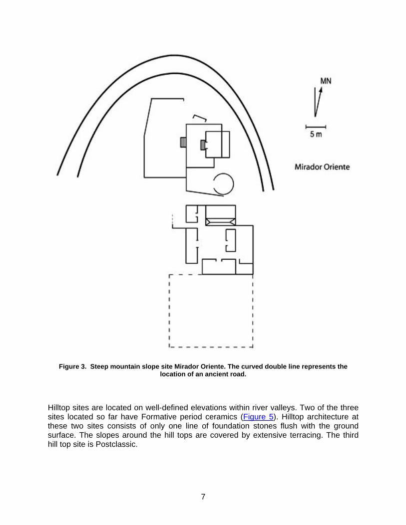
Figure 3. Steep mountain slope site Mirador Oriente. The curved double line represents the
location of an ancient road.
Hilltop sites are located on well-defined elevations within river valleys. Two of the three sites located so far have Formative period ceramics (Figure 5). Hilltop architecture at these two sites consists of only one line of foundation stones flush with the ground surface. The slopes around the hill tops are covered by extensive terracing. The third hill top site is Postclassic.
7
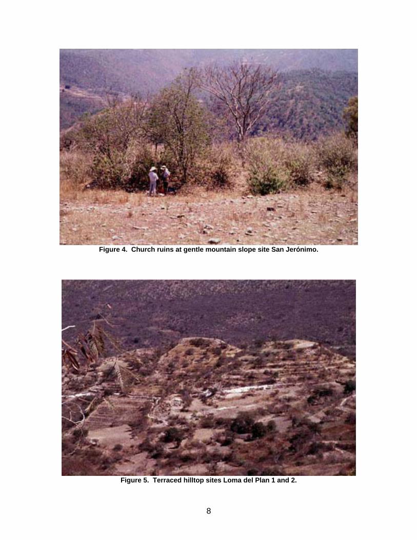
Figure 4. Church ruins at gentle mountain slope site San Jerónimo.
Figure 5. Terraced hilltop sites Loma del Plan 1 and 2.
8

Elevated flat terrain sites are located in relatively level areas between mountain ranges on one side and river valleys on the other where extensive agricultural land is available. San Pedro Teozacoalco and some of the estancias from El Mapa that were never abandoned are elevated flat terrain sites. Two earlier sites have also been found in this terrain. Recent construction and reused ancient structures complicate defining pre-Hispanic settlement patterns in continuously-occupied towns.
The foundation of the ruler’s palace shown on El Mapa still exists in the center of San Pedro Teozacoalco as a 50 cm high 28 m x 26 m mound (Figure 6). A small stairway ascends the mound at one corner. The modern church is located precisely where El Mapa shows a church adjacent to the palace. Deep sewer trenches dug around the town’s central plaza during 2002 recovered only a few artifacts, including Formative and Postclassic ceramics, and did not reveal any buried constructions. Terraces and stone walls of uncertain antiquity exist throughout the modern town.
Figure 6. Ruins of palace in San Pedro Teozacoalco with modern houses on top. The edge of the
mound is to the right of the truck. Ancient stairs are to the right of the mound’s corner.
Rolling terrain sites are located in areas of uneven topography distant from mountains. Site characteristics are diverse, and include a sherd scatter, a large single mound site, and the most extensive site found to date. The latter site extends 6.7 km from north to
9

south and consists of hundreds of Postclassic terraces, an unknown number of stone beehive-like structures, some apparently used as kilns or ovens and others possibly inhabited, and square houses and towers (Figure 7). Closely-spaced parallel terraces running perpendicular to the slope cover expanses of the site and are interspersed with U-shaped structures. The terraces may have been used in maguey horticulture. A border toponym in the form of a labyrinth on El Mapa appears to correspond to the site.
Figure 7. Beehive-like structure at rolling terrain site Maze.
Alluvial land sites are located directly adjacent to rivers and alluvial land. They are notably rare in the areas surveyed to date. Only one of the four sites located dates to pre-Hispanic times. The others are primarily Colonial and two appear on El Mapa. One of these is San Francisco Cahuacua, a continuously-occupied estancia. Another is the abandoned estancia of San Juan, where the stone, brick, and mortar ruins of the walls, floor, columns, and vaulted roof of a church lie in an alluvial pocket of the Río Minas (Figure 8).
Caves used by humans exist in cliffs adjacent to rivers and in mountainsides. Most are natural, although some are of human construction. Ten to 15 gold mines are located near the abandoned estancia of San Juan on the Río Minas and probably date to the Colonial period. Finally, two petroglyphs of unknown antiquity showing animals with four legs are located high on an overhanging cliff.
10

Figure 8. Church ruins at alluvial land site San Juan.
We submitted 30 pieces of obsidian to Northwest Research Obsidian Studies Laboratory for x-ray fluorescence trace element characterization and obsidian hydration dating. Results indicate that obsidian should be useful for obtaining relative dates within local areas and, after appropriate climatological data can be gathered in the future, for obtaining absolute dates across the entire area of El Mapa. The obsidian is from four distant sources: the Pachuca source in Hidalgo, another source (2) probably related to Pachuca, a source (1) very similar to Pico de Orizaba in Veracruz near the Puebla border, and a source (3) similar to Paredon (Figure 9). Obsidian came from multiple sources at most sites where multiple obsidian samples were tested. Once temporal control of obsidian hydration rates is established and samples from more sites are tested, the spatial distribution of obsidian from each source across the study area should help us evaluate changes in trade networks through time.
We do not claim that the survey undertaken in 2000 and 2002 was either systematic or full-coverage. Rather, it was an emic survey focused on exploring and verifying an exceptional Colonial mapa, in which a Mixtec artist and a Colonial administrator apparently collaborated to produce a detailed, first-hand picture of the locations of human settlements, geographic and cultural features, and the boundaries of a municipality as they existed around 1580. Project goals were to verify the existence and location of settlements and geographic and cultural features within the territory of the
11
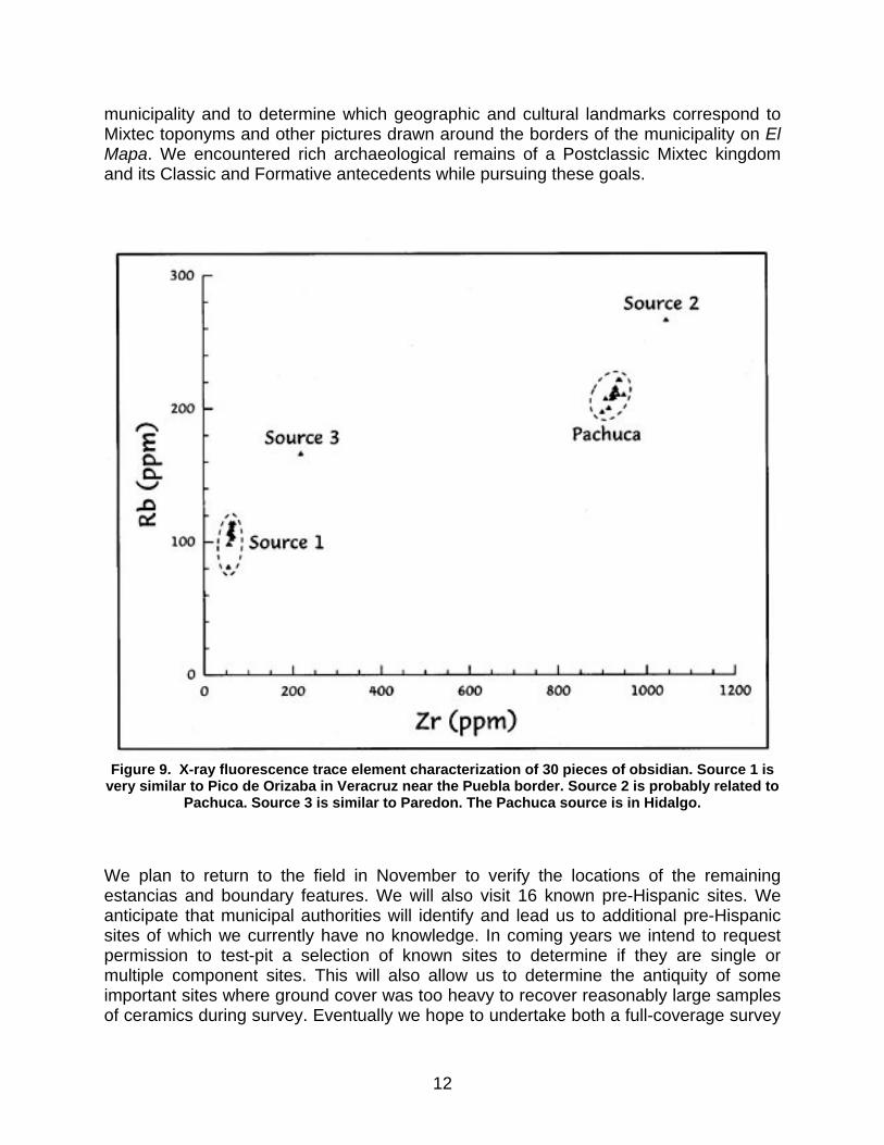
municipality and to determine which geographic and cultural landmarks correspond to Mixtec toponyms and other pictures drawn around the borders of the municipality on El Mapa. We encountered rich archaeological remains of a Postclassic Mixtec kingdom and its Classic and Formative antecedents while pursuing these goals.
Figure 9. X-ray fluorescence trace element characterization of 30 pieces of obsidian. Source 1 is
very similar to Pico de Orizaba in Veracruz near the Puebla border. Source 2 is probably related to Pachuca. Source 3 is similar to Paredon. The Pachuca source is in Hidalgo.
We plan to return to the field in November to verify the locations of the remaining estancias and boundary features. We will also visit 16 known pre-Hispanic sites. We anticipate that municipal authorities will identify and lead us to additional pre-Hispanic sites of which we currently have no knowledge. In coming years we intend to request permission to test-pit a selection of known sites to determine if they are single or multiple component sites. This will also allow us to determine the antiquity of some important sites where ground cover was too heavy to recover reasonably large samples of ceramics during survey. Eventually we hope to undertake both a full-coverage survey
12

modeled on the neighboring Central Mixteca Alta Settlement Pattern Project and extensive excavations at the large mountaintop site above San Pedro Teozacoalco.
Our archaeological project based on El Mapa de Teozacoalco most obviously has potential to provide insights into the Postclassic-Colonial cultural transition. We can already see that Spanish administrators apparently placed Colonial settlements in carefully selected locations, either on top of or adjacent to Postclassic Mixtec settlements with access to expanses of raised or alluvial agricultural land and water. Many Postclassic settlements seem to have been abandoned, probably because of population concentration for administrative purposes, depopulation due to the effects of European infectious diseases, or both. Settlements we opportunistically encounter in exploring the area of El Mapa have potential to provide insights into earlier cultural transitions by revealing the changing importance of defensive locations and constructions, the concentration and dispersal of population, and the expansion and contraction of trade networks. The insights about cultural transitions provided by this project will not necessarily be new or unique to the area of El Mapa, but they will relate to insights coming from other areas and will help to provide a more complete picture of the history and prehistory of the Mixteca Alta and Mesoamerica as a whole.
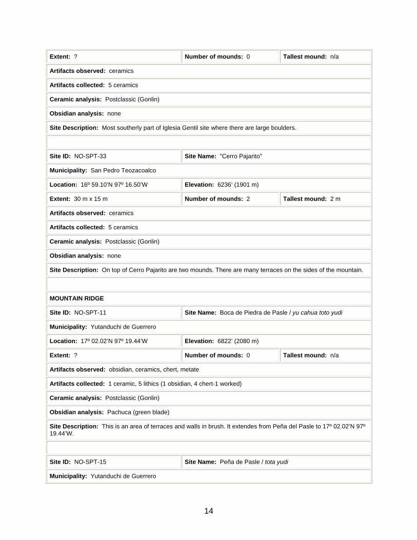
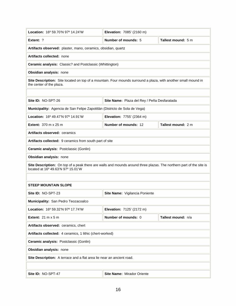
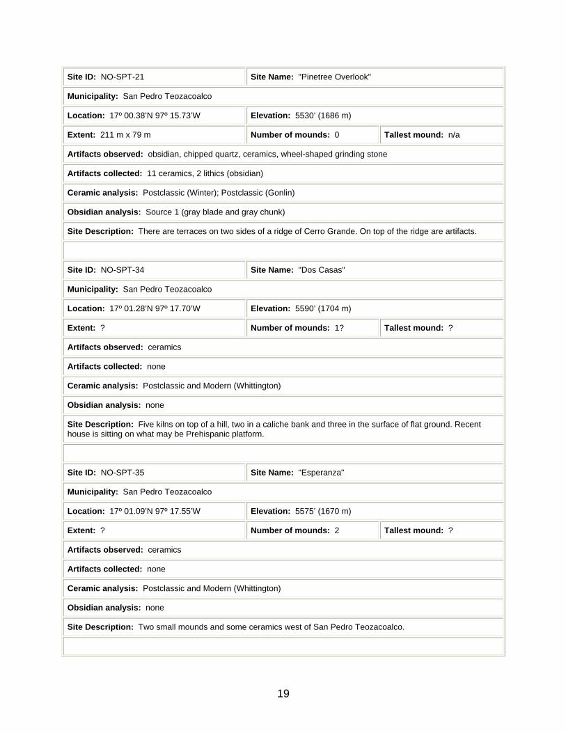
Table 1. Descriptions of Sites Found in 2000 and 2002.
(Site names in quotation marks are project designations. Site names lacking quotation marks are local designations. Site names in italics are transliterations of Mixtec designations.)
MOUNTAIN PEAK
Site ID: NO-SPT-7 Site Name: "Cerro Amole" / Iglesia Gentil
Municipality: San Pedro Teozacoalco
Location: 16º 59.18’N 97º 17.51’W Elevation: 7760’ (2366 m)
Extent: 260 m x 225 m Number of mounds: 38+ Tallest mound: 5 m
Artifacts observed: 5 metates, obsidian, ceramics, chert, 3 stone sculptures, worked stone
Artifacts collected: 47 ceramics, 2 lithics (1 obsidian, 1 chert)
Ceramic analysis: ? (Winter); Postclassic (Gonlin)
Obsidian analysis: Source 1 (gray blade)
Site Description: There are 25 mounds north of a ball court. South of the court are more than 11 mounds. The tallest is 5 m high. An I-shaped ball court is in the center of the site.
Site ID: NO-SPT-16 Site Name: "Iglesia Gentil-Boulders"
Municipality: San Pedro Teozacoalco
Location: 16º 59.18’N 97º 17.51’W Elevation: ?’ (? m)
13
Extent: ? Number of mounds: 0 Tallest mound: n/a
Artifacts observed: ceramics
Artifacts collected: 5 ceramics
Ceramic analysis: Postclassic (Gonlin)
Obsidian analysis: none
Site Description: Most southerly part of Iglesia Gentil site where there are large boulders.
Site ID: NO-SPT-33 Site Name: "Cerro Pajarito"
Municipality: San Pedro Teozacoalco
Location: 16º 59.10’N 97º 16.50’W Elevation: 6236’ (1901 m)
Extent: 30 m x 15 m Number of mounds: 2 Tallest mound: 2 m
Artifacts observed: ceramics
Artifacts collected: 5 ceramics
Ceramic analysis: Postclassic (Gonlin)
Obsidian analysis: none
Site Description: On top of Cerro Pajarito are two mounds. There are many terraces on the sides of the mountain.
MOUNTAIN RIDGE
Site ID: NO-SPT-11 Site Name: Boca de Piedra de Pasle / yu cahua toto yudi
Municipality: Yutanduchi de Guerrero
Location: 17º 02.02’N 97º 19.44’W Elevation: 6822’ (2080 m)
Extent: ? Number of mounds: 0 Tallest mound: n/a
Artifacts observed: obsidian, ceramics, chert, metate
Artifacts collected: 1 ceramic, 5 lithics (1 obsidian, 4 chert-1 worked)
Ceramic analysis: Postclassic (Gonlin)
Obsidian analysis: Pachuca (green blade)
Site Description: This is an area of terraces and walls in brush. It extendes from Peña del Pasle to 17º 02.02’N 97º 19.44’W.
Site ID: NO-SPT-15 Site Name: Peña de Pasle / tota yudi
Municipality: Yutanduchi de Guerrero
14

Location: 19º 02.04’N 97º 19.34’W Elevation: 6886’ (2099 m)
Extent: 43 m x 14 m Number of mounds: 2 Tallest mound: 2.5 m
Artifacts observed: ceramics, obsidian, chert, metate
Artifacts collected: 11 ceramics, 3 lithics (2 obsidian, 1 chert)
Ceramic analysis: Postclassic (Gonlin)
Obsidian analysis: Pachuca (2 green blades)
Site Description: There are two mounds with a plaza in an east-west line on top of a hill. The mounds are 2.5 m high.
Site ID: NO-SPT-54 Site Name: Tranga Piedra de Pasle / trangá tota yudi
Municipality: Yutanduchi de Guerrero
Location: 17º 02.05’N 97º 19.30’W Elevation: 6841’ (2085 m)
Extent: ? Number of mounds: 0 Tallest mound: n/a
Artifacts observed: metate
Artifacts collected: none
Ceramic analysis: none
Obsidian analysis: none
Site Description: Two stone walls with a height of 2.5 m in places appear to surround the Peña de Pasle site.
Site ID: NO-SPT-55 Site Name: Tranga de la Cumbre
Municipality: Yutanduchi de Guerrero
Location: 17º 02.02’N 97º 18.88’W Elevation: 6735’ (2053 m)
Extent: ? Number of mounds: 0 Tallest mound: n/a
Artifacts observed: none
Artifacts collected: none
Ceramic analysis: none
Obsidian analysis: none
Site Description: A stone wall with a height of 2.5 m in places appears to surround the Peña de Pasle site and Cerro la Cumbre.
Site ID: NO-SPT-40 Site Name: Cumbre del Rayo
Municipality: San Miguel Piedras
15
Location: 16º 59.70’N 97º 14.24’W Elevation: 7085’ (2160 m)
Extent: ? Number of mounds: 5 Tallest mound: 5 m
Artifacts observed: plaster, mano, ceramics, obsidian, quartz
Artifacts collected: none
Ceramic analysis: Classic? and Postclassic (Whittington)
Obsidian analysis: none
Site Description: Site located on top of a mountain. Four mounds surround a plaza, with another small mound in the center of the plaza.
Site ID: NO-SPT-26 Site Name: Plaza del Rey / Peña Desfaratada
Municipality: Agencia de San Felipe Zapotitlán (Districto de Sola de Vega)
Location: 16º 49.47’N 97º 14.91’W Elevation: 7755’ (2364 m)
Extent: 370 m x 25 m Number of mounds: 12 Tallest mound: 2 m
Artifacts observed: ceramics
Artifacts collected: 9 ceramics from south part of site
Ceramic analysis: Postclassic (Gonlin)
Obsidian analysis: none
Site Description: On top of a peak there are walls and mounds around three plazas. The northern part of the site is located at 16º 49.63’N 97º 15.01’W
STEEP MOUNTAIN SLOPE
Site ID: NO-SPT-23 Site Name: Vigilancia Poniente
Municipality: San Pedro Teozacoalco
Location: 16º 59.32’N 97º 17.74’W Elevation: 7125’ (2172 m)
Extent: 21 m x 5 m Number of mounds: 0 Tallest mound: n/a
Artifacts observed: ceramics, chert
Artifacts collected: 4 ceramics, 1 lithic (chert-worked)
Ceramic analysis: Postclassic (Gonlin)
Obsidian analysis: none
Site Description: A terrace and a flat area lie near an ancient road.
Site ID: NO-SPT-47 Site Name: Mirador Oriente
16

Municipality: San Pedro Teozacoalco
Location: 16º 59.35’N 97º 17.32’W Elevation: 7286’ (2221 m)
Extent: 75 m x 55 m Number of mounds: 16+ Tallest mound: 4 m
Artifacts observed: mano
Artifacts collected: none
Ceramic analysis: none
Obsidian analysis: none
Site Description: An ancient road on Cerro Amole makes a curve around three sides of a structure on top of a platform and two plazas. There are more than 16 structures. The largest mound has evidence of looting.
Site ID: NO-SPT-48 Site Name: Entrada Principal
Municipality: San Pedro Teozacoalco
Location: 16º 59.37’N 97º 17.55’W Elevation: 7300’ (2225 m)
Extent: 7 m x 5 m Number of mounds: 1 Tallest mound: 2 m
Artifacts observed: none
Artifacts collected: none
Ceramic analysis: none
Obsidian analysis: none
Site Description: One terrace and two constructions are on the sides of an ancient road on Cerro Amole.
Site ID: NO-SPT-49 Site Name: Mirador Principal
Municipality: San Pedro Teozacoalco
Location: 16º 59.41’N 97º 17.70’W Elevation: 7200’ (2195 m)
Extent: 375 m x 22 m Number of mounds: ? Tallest mound: ?
Artifacts observed: metate
Artifacts collected: none
Ceramic analysis: none
Obsidian analysis: none
Site Description: An ancient road makes a curve around two sides of buildings and terraces on a ridge of Cerro Amole.
Site ID: NO-SPT-50 Site Name: "Calle"
17

Municipality: San Pedro Teozacoalco
Location: 16º 59.35’N 97º 17.71’W Elevation: 7207’ (2197 m)
Extent: 4 m x ? Number of mounds: 0 Tallest mound: n/a
Artifacts observed: ceramics, chert
Artifacts collected: none
Ceramic analysis: none
Obsidian analysis: none
Site Description: An ancient road runs over the ridges of Cerro Amole. There are stone walls on the outer edge of the road.
GENTLE MOUNTAIN SLOPE
Site ID: NO-SPT-14 Site Name: "Milpa" / Jarro
Municipality: San Pedro Teozaocoalco
Location: 17º 00.48’N 97º 15.60’W Elevation: 5728’ (1746 m)
Extent: 85 m x 40 m Number of mounds: 3 Tallest mound: 3.25 m
Artifacts observed: ceramics, 2 manos, metate, obsidian, hammerstone
Artifacts collected: 58 ceramics, 5 lithics (obsidian)
Ceramic analysis: Postclassic (Winter); Postclassic (Gonlin)
Obsidian analysis: Source 1 (gray blade), Pachuca (2 green blades)
Site Description: Three mounds are located around a plaza. There is an area defined by terraces to the south.
Site ID: NO-SPT-19 Site Name: "Rocas"
Municipality: San Pedro Teozacoalco
Location: 17º 00.40’N 97º 16.01’W Elevation: 5764’ (1757 m)
Extent: 161 m x 114 m Number of mounds: 1 Tallest mound: 1 m
Artifacts observed: ceramics, chert
Artifacts collected: 11 ceramics
Ceramic analysis: Postclassic (Winter); Postclassic (Gonlin)
Obsidian analysis: none
Site Description: The site has one mound 1 m high near the road and terrace walls on the north side.
18
Site ID: NO-SPT-21 Site Name: "Pinetree Overlook"
Municipality: San Pedro Teozacoalco
Location: 17º 00.38’N 97º 15.73’W Elevation: 5530’ (1686 m)
Extent: 211 m x 79 m Number of mounds: 0 Tallest mound: n/a
Artifacts observed: obsidian, chipped quartz, ceramics, wheel-shaped grinding stone
Artifacts collected: 11 ceramics, 2 lithics (obsidian)
Ceramic analysis: Postclassic (Winter); Postclassic (Gonlin)
Obsidian analysis: Source 1 (gray blade and gray chunk)
Site Description: There are terraces on two sides of a ridge of Cerro Grande. On top of the ridge are artifacts.
Site ID: NO-SPT-34 Site Name: "Dos Casas"
Municipality: San Pedro Teozacoalco
Location: 17º 01.28’N 97º 17.70’W Elevation: 5590’ (1704 m)
Extent: ? Number of mounds: 1? Tallest mound: ?
Artifacts observed: ceramics
Artifacts collected: none
Ceramic analysis: Postclassic and Modern (Whittington)
Obsidian analysis: none
Site Description: Five kilns on top of a hill, two in a caliche bank and three in the surface of flat ground. Recent house is sitting on what may be Prehispanic platform.
Site ID: NO-SPT-35 Site Name: "Esperanza"
Municipality: San Pedro Teozacoalco
Location: 17º 01.09’N 97º 17.55’W Elevation: 5575’ (1670 m)
Extent: ? Number of mounds: 2 Tallest mound: ?
Artifacts observed: ceramics
Artifacts collected: none
Ceramic analysis: Postclassic and Modern (Whittington)
Obsidian analysis: none
Site Description: Two small mounds and some ceramics west of San Pedro Teozacoalco.
19
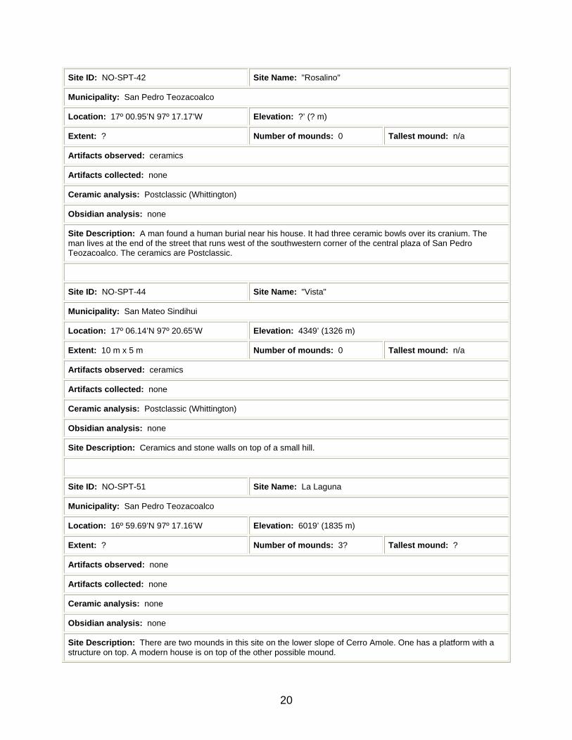
Site ID: NO-SPT-42 Site Name: "Rosalino"
Municipality: San Pedro Teozacoalco
Location: 17º 00.95’N 97º 17.17’W Elevation: ?’ (? m)
Extent: ? Number of mounds: 0 Tallest mound: n/a
Artifacts observed: ceramics
Artifacts collected: none
Ceramic analysis: Postclassic (Whittington)
Obsidian analysis: none
Site Description: A man found a human burial near his house. It had three ceramic bowls over its cranium. The man lives at the end of the street that runs west of the southwestern corner of the central plaza of San Pedro Teozacoalco. The ceramics are Postclassic.
Site ID: NO-SPT-44 Site Name: "Vista"
Municipality: San Mateo Sindihui
Location: 17º 06.14’N 97º 20.65’W Elevation: 4349’ (1326 m)
Extent: 10 m x 5 m Number of mounds: 0 Tallest mound: n/a
Artifacts observed: ceramics
Artifacts collected: none
Ceramic analysis: Postclassic (Whittington)
Obsidian analysis: none
Site Description: Ceramics and stone walls on top of a small hill.
Site ID: NO-SPT-51 Site Name: La Laguna
Municipality: San Pedro Teozacoalco
Location: 16º 59.69’N 97º 17.16’W Elevation: 6019’ (1835 m)
Extent: ? Number of mounds: 3? Tallest mound: ?
Artifacts observed: none
Artifacts collected: none
Ceramic analysis: none
Obsidian analysis: none
Site Description: There are two mounds in this site on the lower slope of Cerro Amole. One has a platform with a structure on top. A modern house is on top of the other possible mound.
20

Site ID: NO-SPT-52 Site Name: "Cristina"
Municipality: San Pedro Teozacoalco
Location: 16º 59.45’N 97º 17.12’W Elevation: 6218’ (1895 m)
Extent: ? Number of mounds: ? Tallest mound: ?
Artifacts observed: none
Artifacts collected: none
Ceramic analysis: none
Obsidian analysis: none
Site Description: Lines of stones and walls on the side of Cerro Amole.
Site ID: NO-SPT-53 Site Name: Plaza Ratón
Municipality: San Pedro Teozacoalco
Location: 16º 59.57’N 97º 17.28’W Elevation: 6280’ (1914 m)
Extent: ? Number of mounds: ? Tallest mound: ?
Artifacts observed: none
Artifacts collected: none
Ceramic analysis: none
Obsidian analysis: none
Site Description: In the forest on the side of Cerro Amole are walls of terraces and buildings.
Site ID: NO-SPT-8 Site Name: Cañada de Mecate / nu da zho
Municipality: Yutanduchi de Guerrero
Location: 17º 02.93’N 97º 19.31’W Elevation: 5340’ (1628 m)
Extent: 65 m x 25 m Number of mounds: 3 Tallest mound: 4 m
Artifacts observed: obsidian, ceramics, chert
Artifacts collected: 27 ceramics, 3 lithics (2 obsidian, 1 chert)
Ceramic analysis: Postclassic and Colonial (Gonlin); and Modern (Whittington)
Obsidian analysis: Pachuca (green blade), Source 1 (gray blade)
Site Description: Three mounds are on a ridge. There are terraces to the north, south and west.
21
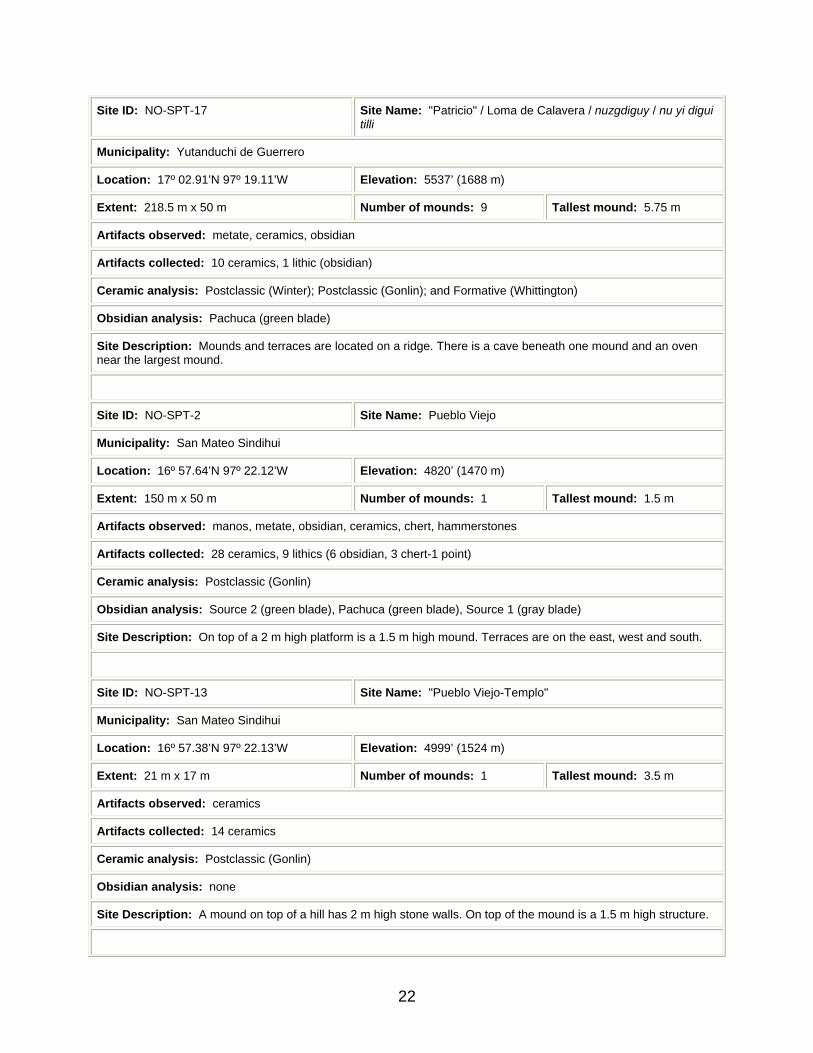
Site ID: NO-SPT-17 Site Name: "Patricio" / Loma de Calavera / nuzgdiguy / nu yi digui tilli
Municipality: Yutanduchi de Guerrero
Location: 17º 02.91’N 97º 19.11’W Elevation: 5537’ (1688 m)
Extent: 218.5 m x 50 m Number of mounds: 9 Tallest mound: 5.75 m
Artifacts observed: metate, ceramics, obsidian
Artifacts collected: 10 ceramics, 1 lithic (obsidian)
Ceramic analysis: Postclassic (Winter); Postclassic (Gonlin); and Formative (Whittington)
Obsidian analysis: Pachuca (green blade)
Site Description: Mounds and terraces are located on a ridge. There is a cave beneath one mound and an oven near the largest mound.
Site ID: NO-SPT-2 Site Name: Pueblo Viejo
Municipality: San Mateo Sindihui
Location: 16º 57.64’N 97º 22.12’W Elevation: 4820’ (1470 m)
Extent: 150 m x 50 m Number of mounds: 1 Tallest mound: 1.5 m
Artifacts observed: manos, metate, obsidian, ceramics, chert, hammerstones
Artifacts collected: 28 ceramics, 9 lithics (6 obsidian, 3 chert-1 point)
Ceramic analysis: Postclassic (Gonlin)
Obsidian analysis: Source 2 (green blade), Pachuca (green blade), Source 1 (gray blade)
Site Description: On top of a 2 m high platform is a 1.5 m high mound. Terraces are on the east, west and south.
Site ID: NO-SPT-13 Site Name: "Pueblo Viejo-Templo"
Municipality: San Mateo Sindihui
Location: 16º 57.38’N 97º 22.13’W Elevation: 4999’ (1524 m)
Extent: 21 m x 17 m Number of mounds: 1 Tallest mound: 3.5 m
Artifacts observed: ceramics
Artifacts collected: 14 ceramics
Ceramic analysis: Postclassic (Gonlin)
Obsidian analysis: none
Site Description: A mound on top of a hill has 2 m high stone walls. On top of the mound is a 1.5 m high structure.
22

Site ID: NO-SPT-20 Site Name: "Esteban"
Municipality: San Mateo Sindihui
Location: 17º 01.92’N 97º 20.50’W Elevation: 5295’ (1614 m)
Extent: 4 m x 4 m Number of mounds: 1 Tallest mound: 0.1 m
Artifacts observed: ceramics, mano, chert
Artifacts collected: 8 ceramics
Ceramic analysis: Classic? and Postclassic (Gonlin)
Obsidian analysis: none
Site Description: Two lines of stones form a corner of a small house.
Site ID: NO-SPT-27 Site Name: Santa Cruz
Municipality: Zapotitlán del Río
Location: 16º 51.96’N 97º 14.66’W Elevation: 5258’ (1603 m)
Extent: 125 m x 27 m Number of mounds: 1 Tallest mound: 1.5 m
Artifacts observed: metates, ceramics, obsidian, glass
Artifacts collected: 52 ceramics, 1 lithic (obsidian), 1 glass
Ceramic analysis: Postclassic (Gonlin); and Modern (Whittington)
Obsidian analysis: Source 3 (gray blade)
Site Description: A mound is on top of a small mountain. Terraces and two stone walls are to the west. Possibly corresponds to estancia of Santa Cruz.
Site ID: NO-SPT-28 Site Name: San Jerónimo
Municipality: Zapotitlán del Río
Location: 16º 53.17’N 97º 14.79’W Elevation: 5184’ (1580 m)
Extent: 454 m x 50 m Number of mounds: 3 Tallest mound: 2.5 m
Artifacts observed: hammerstone, polishing stone, metates, ceramics, chert, obsidian, manos, glass
Artifacts collected: 105 ceramics, 2 lithics (obsidian), 1 glass
Ceramic analysis: Postclassic (Gonlin); and Modern (Whittington)
Obsidian analysis: Pachuca (2 green blades)
Site Description: The site has ruins of a church and two mounds. There are many terraces and a cistern. Artificial caves are on the west side of the hill. Corresponds to estancia of San Jerónimo.
23

Site ID: Site Name: Yutanduchi de Guerrero
Municipality: Yutanduchi de Guerrero
Location: ?N ?W Elevation: ?’ (? m)
Extent: ? Number of mounds: ? Tallest mound: n/a
Artifacts observed: none
Artifacts collected: none
Ceramic analysis: none
Obsidian analysis: none
Site Description: Continuously-inhabited estancia that corresponds to Santa Maria. Many terraces exist throughout town.
Site ID: Site Name: San Miguel Piedras
Municipality: San Miguel Piedras
Location: ?N ?W Elevation: ?’ (? m)
Extent: ? Number of mounds: ? Tallest mound: n/a
Artifacts observed: none
Artifacts collected: none
Ceramic analysis: none
Obsidian analysis: none
Site Description: Continuously-inhabited estancia.
Site ID: Site Name: San Felipe Zapotitlán
Municipality: Agencia de San Felipe Zapotitlán (Districto de Sola de Vega)
Location: ?N ?W Elevation: ?’ (? m)
Extent: ? Number of mounds: ? Tallest mound: n/a
Artifacts observed: none
Artifacts collected: none
Ceramic analysis: none
Obsidian analysis: none
Site Description: Continuously-inhabited estancia. Three church bells hang near the church. The earliest is from 1738.
24

Site ID: Site Name: San Sebastian Yutanino
Municipality: San Sebastian Yutanino
Location: ?N ?W Elevation: ?’ (? m)
Extent: ? Number of mounds: ? Tallest mound: n/a
Artifacts observed: none
Artifacts collected: none
Ceramic analysis: none
Obsidian analysis: none
Site Description: Continuously-inhabited estancia that corresponds to San Tomás. Church bell is from 1714.
Site ID: Site Name: San Juan Elotepec
Municipality: San Juan Elotepec
Location: ?N ?’W Elevation: ?’ (? m)
Extent: ? Number of mounds: ? Tallest mound: n/a
Artifacts observed: none
Artifacts collected: none
Ceramic analysis: none
Obsidian analysis: none
Site Description: Settlement formerly within territory of Teozacoalco, but outside of 1580 boundary.
HILLTOP
Site ID: NO-SPT-6 Site Name: "Mama 2" / Loma de Plan 2 / tin tú nuje
Municipality: Yutanduchi de Guerrero
Location: 17º 03.08’N 97º 17.36’W Elevation: 5037’ (1536 m)
Extent: 5 m x 5 m Number of mounds: 0 Tallest mound: n/a
Artifacts observed: ceramics, chert
Artifacts collected: 59 ceramics, 1 lithic (chert)
Ceramic analysis: Formative (Winter); Postclassic (Gonlin)
Obsidian analysis: none
Site Description: Two lines of stones, ceramic sherds, and pieces of chert on top of a terraced hill.
25
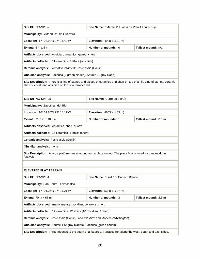
Site ID: NO-SPT-9 Site Name: "Mama 1" / Loma de Plan 1 / tin tú nuje
Municipality: Yutanduchi de Guerrero
Location: 17º 02.98’N 97º 17.40’W Elevation: 4988’ (1521 m)
Extent: 5 m x 5 m Number of mounds: 0 Tallest mound: n/a
Artifacts observed: obsidian, ceramics, quartz, chert
Artifacts collected: 11 ceramics, 8 lithics (obsidian)
Ceramic analysis: Formative (Winter); Postclassic (Gonlin)
Obsidian analysis: Pachuca (2 green blades), Source 1 (gray blade)
Site Description: There is a line of stones and pieces of ceramics and chert on top of a hill. Line of stones, ceramic sherds, chert, and obsidian on top of a terraced hill.
Site ID: NO-SPT-25 Site Name: Cerro del Fortín
Municipality: Zapotitlán del Río
Location: 16º 52.66’N 97º 14.17’W Elevation: 4603’ (1403 m)
Extent: 21.3 m x 18.3 m Number of mounds: 1 Tallest mound: 8.5 m
Artifacts observed: ceramics, chert, quartz
Artifacts collected: 36 ceramics, 4 lithics (chert)
Ceramic analysis: Postclassic (Gonlin)
Obsidian analysis: none
Site Description: A large platform has a mound and a plaza on top. The plaza floor is used for dances during festivals.
ELEVATED FLAT TERRAIN
Site ID: NO-SPT-1 Site Name: "Last 1" / Coquito Blanco
Municipality: San Pedro Teozacoalco
Location: 17º 01.37’N 97º 17.21’W Elevation: 5338’ (1627 m)
Extent: 70 m x 65 m Number of mounds: 3 Tallest mound: 2.5 m
Artifacts observed: mano, metate, obsidian, ceramics, chert
Artifacts collected: 17 ceramics, 12 lithics (10 obsidian, 2 chert)
Ceramic analysis: Postclassic (Gonlin); and Classic? and Modern (Whittington)
Obsidian analysis: Source 1 (2 gray blades), Pachuca (green chunk)
Site Description: Three mounds to the south of a flat area. Terraces run along the west, south and east sides.
26

There is evidence that two burials were looted.
Site ID: NO-SPT-4 Site Name: Santa Ana
Municipality: San Pedro Teozacoalco
Location: 17º 01.33’N 97º 16.92’W Elevation: 5207’ (1588 m)
Extent: 125 m x 70 m Number of mounds: 2 Tallest mound: 7.5 m
Artifacts observed: 2 manos, 2 metates, obsidian, ceramics, chert, quartz, lithic, burned clay
Artifacts collected: 112 ceramics, 6 lithics (3 obsidian-1 scraper, 2 chert, 1 yellow stone)
Ceramic analysis: Postclassic (Winter); Classic and Postclassic (Gonlin)
Obsidian analysis: Pachuca (green blade), Pachuca (green chunk), Source 1 (gray chunk)
Site Description: A 7.5 m high mound has a floor with red paint. The other mound is .75 m high. The site has a plaza and road.
Site ID: NO-SPT-24 Site Name: "Teozacoalco-Trinchera"
Municipality: San Pedro Teozacoalco
Location: 17º 01.00’N 97º 17.17’W Elevation: 5274’ (1608 m)
Extent: ? Number of mounds: 0 Tallest mound: n/a
Artifacts observed: ceramics, human bone, animal bone, obsidian
Artifacts collected: 12 ceramics, 2 lithics (obsidian), 2 bones (1 human, 1 animal)
Ceramic analysis: Formative and Postclassic (Gonlin)
Obsidian analysis: Source 1 (gray chunk)
Site Description: Artifacts came from a trench excavated around the town’s plaza in order to install a sewer.
Site ID: NO-SPT-41 Site Name: "Palacio"
Municipality: San Pedro Teozacoalco
Location: 17º 00.95’N 97º 17.17’W Elevation: ?’ (? m)
Extent: 28 m x 26 m Number of mounds: 1 Tallest mound: 0.5 m
Artifacts observed: none
Artifacts collected: none
Ceramic analysis: none
Obsidian analysis: none
27

Site Description: Platform with height of 50 cm. There is a stairway at the corner. Located in the place of the palace of the cacique.
Site ID: Site Name: San Mateo Sindihui
Municipality: San Mateo Sindihui
Location: ?N ?W Elevation: ?’ (? m)
Extent: ? Number of mounds: ? Tallest mound: n/a
Artifacts observed: none
Artifacts collected: none
Ceramic analysis: none
Obsidian analysis: none
Site Description: Continuously-inhabited estancia. Terraces exist on lower slopes of Cerro Tierra Negra near town. 18th century and 20th century church bells hang near the foundation of an old church.
ROLLING TERRAIN
Site ID: NO-SPT-5 Site Name: "Hornos" / "Palm Tree Paradise"
Municipality: Yutanduchi de Guerrero
Location: 17º 08.15’N 97º 19.24’W Elevation: 5911’ (1802 m)
Extent: ? Number of mounds: ? Tallest mound: ?
Artifacts observed: ceramics, chert, plaster
Artifacts collected: 95 ceramics, 1 plaster
Ceramic analysis: Postclassic (Winter); Postclassic (Gonlin)
Obsidian analysis: none
Site Description: This is part of a site running 6.7 km on both sides of the road between Mitlatongo and Teozacoalco. There are building walls, terraces and kilns.
Site ID: NO-SPT-12 Site Name: La Moría / tindo bini cuiti
Municipality: Yutanduchi de Guerrero
Location: 17º 03.97’N 97º 10.11’W Elevation: 4642’ (1415 m)
Extent: 70 m x 50 m Number of mounds: 1 Tallest mound: 7.5 m
Artifacts observed: ceramics, lithic
Artifacts collected: 12 ceramics, 1 lithic (green stone)
28

Ceramic analysis: Postclassic (Gonlin)
Obsidian analysis: none
Site Description: The site has a 7.5 m high mound with a plaza in front. On top is a terrace and walls of a building.
Site ID: NO-SPT-22 Site Name: "San Andres 1"
Municipality: Yutanduchi de Guerrero
Location: 17º 04.92’N 97º 19.51’W Elevation: 4032’ (1229 m)
Extent: 16 m x 8 m Number of mounds: 0 Tallest mound: n/a
Artifacts observed: bricks, tiles, mano, chert, quartz, ceramics, porcelain, glass, metate
Artifacts collected: 18 ceramics, 1 lithic (chert)
Ceramic analysis: Colonial or Modern (Gonlin)
Obsidian analysis: none
Site Description: There is a wall of stones, bricks and mortar with a pavement of stones and a stairway to the east. This is possibly part of a church. Possibly corresponds to estancia of San Andres.
Site ID: NO-SPT-45 Site Name: "Maze"
Municipality: Santiago Tilantongo
Location: 17º 08.12’N 97º 19.15’W Elevation: 5779’ (1761 m)
Extent: ? Number of mounds: ? Tallest mound: ?
Artifacts observed: ceramics, metate, mano, doughnut stone
Artifacts collected: none
Ceramic analysis: Postclassic and Modern (Whittington)
Obsidian analysis: none
Site Description: Part of a site that runs 6.7 km on both sides of the road bewteen Mitlatongo and Teozacoalco. There are building walls, terraces and kilns.
Site ID: NO-SPT-46 Site Name: La Loma Triga
Municipality: Santiago Tilantongo
Location: 17º10.61’N 97º 18.33’W Elevation: 7482’ (2281 m)
Extent: ? Number of mounds: ? Tallest mound: ?
Artifacts observed: ceramics, metate
Artifacts collected: none
29

Ceramic analysis: none
Obsidian analysis: none
Site Description: There are mounds west of the road and terraces east of the road. This is the most northerly part of a site that runs 6.7 km on both sides of the road bewteen Mitlatongo and Teozacoalco.
Site ID: NO-SPT-32 Site Name: "Terrace Overlook"
Municipality: San Miguel Piedras
Location: 16º 58.29’N 97º 13.01’W Elevation: 5401’ (1647 m)
Extent: 5 m x 5 m Number of mounds: 0 Tallest mound: n/a
Artifacts observed: ceramics, chert, quartz
Artifacts collected: 25 ceramics, 2 lithics (chert)
Ceramic analysis: Postclassic (Gonlin)
Obsidian analysis: none
Site Description: Sherd scatter.
Site ID: NO-SPT-10 Site Name: "Taylor"
Municipality: Zapotitlán del Río
Location: 16º 54.35’N 97º 12.82’W Elevation: 6412’ (1955 m)
Extent: 70 m x 25 m Number of mounds: 1 Tallest mound: 1.75 m
Artifacts observed: mano, ceramics, chert, quartz
Artifacts collected: 16 ceramics, 1 lithic (chert)
Ceramic analysis: Postclassic (Gonlin); and Modern (Whittington)
Obsidian analysis: none
Site Description: A mound is on top of a small hill surrounded by terraces.
ALLUVIAL LAND
Site ID: NO-SPT-43 Site Name: "San Juan" / Río Minas
Municipality: San Miguel Piedras
Location: 16º 55.87’N 97º 14.39’W Elevation: 4983’ (1519 m)
Extent: 17 m x 14 m Number of mounds: 0 Tallest mound: n/a
Artifacts observed: ceramics, chert, bricks
30

Artifacts collected: none
Ceramic analysis: none
Obsidian analysis: none
Site Description: Ruins of an old church with walls, floor, columns and remains of a vault. The ruins are composed of stone, brick and mortar. Corresponds to estancia of San Juan.
Site ID: NO-SPT-29 Site Name: Llano de la Primavera
Municipality: Zapotitlán del Río
Location: 16º 52.63’N 97º 14.59’W Elevation: 4685’ (1428 m)
Extent: 52.5 m x 40 m Number of mounds: 1 Tallest mound: 6 m
Artifacts observed: ceramics, manos, metates, obsidian, glass, chert
Artifacts collected: 17 ceramics, 2 lithics (1 chert, 1 obsidian), 1 glass
Ceramic analysis: Postclassic (Gonlin); and Modern (Whittington)
Obsidian analysis: Source 1 (gray blade)
Site Description: There is a large platform with a mound on top. Terraces surround the platform.
Site ID: NO-SPT-37 Site Name: "Cobre"
Municipality: Agencia de San Fernando de Matamoros
Location: 16º 50.79’N 97º 09.33’W Elevation: 4550’ (1387 m)
Extent: ? Number of mounds: 0 Tallest mound: n/a
Artifacts observed: none
Artifacts collected: none
Ceramic analysis: none
Obsidian analysis: none
Site Description: A smelter for copper and aquaduct are located near the river. Slag with traces of copper ore on the ground.
Site ID: Site Name: San Francisco Cahuacua
Municipality: San Francisco Cahuacua
Location: ?N?W Elevation: ?’ (? m)
Extent: ? Number of mounds: ? Tallest mound: n/a
Artifacts observed: none
31

Artifacts collected: none
Ceramic analysis: none
Obsidian analysis: none
Site Description: Continuously-inhabited estancia.
CAVE
Site ID: NO-SPT-36 Site Name: Cueva del Jazmín
Municipality: Yutanduchi de Guerrero
Location: 17º 01.43’N 97º 14.68’W Elevation: 6534’ (1992 m)
Extent: 25 m x ? Number of mounds: 0 Tallest mound: n/a
Artifacts observed: ceramics, glass
Artifacts collected: none
Ceramic analysis: Postclassic (Whittington)
Obsidian analysis: none
Site Description: Cave used by the people of Yutanduchi, who drink water and eat tacos in a ceremony on May 1. Ancient ceramics are inside.
Site ID: NO-SPT-3 Site Name: "Cueva de los Huesos Perditos"
Municipality: San Mateo Sindihui
Location: 16º 57.93’N 97º 22.18’W Elevation: 4998’ (1523 m)
Extent: 15 m x 10 m Number of mounds: 2 Tallest mound: n/a
Artifacts observed: ceramics, 2 metates
Artifacts collected: 17 ceramics
Other artifacts observed: none
Ceramic analysis: Formative (Gonlin)
Obsidian analysis: none
Site Description: Cave with ceramics.
Site ID: NO-SPT-18 Site Name: "Cueva de los Huesos"
Municipality: San Mateo Sindihui
Location: 16º 57.76’N 97º 22.18’W Elevation: 4642’ (1415 m)
32

Extent: 2.5 m x ? Number of mounds: 0 Tallest mound: n/a
Artifacts observed: ceramics, human bones
Artifacts collected: 1 ceramic
Ceramic analysis: Classic? or Postclassic? (Gonlin)
Obsidian analysis: none
Site Description: Cave with human bones and a ceramic sherd.
Site ID: NO-SPT-30 Site Name: "Cueva 2"
Municipality: San Francisco Cahuacua
Location: 16º 56.36’N 97º 12.56’W Elevation: ?’ (? m)
Extent: 7 m x 1.5 m Number of mounds: 0 Tallest mound: n/a
Artifacts observed: ceramics, obsidian
Artifacts collected: 2 ceramics, 1 lithic (obsidian)
Ceramic analysis: Postclassic (Gonlin)
Obsidian analysis: Source 1 (gray blade)
Site Description: This is a small cave with ceramics and obsidian in front of it, located in a cliff north of the Río Minas.
Site ID: NO-SPT-31 Site Name: "Cueva de los Murciélagos"
Municipality: San Francisco Cahuacua
Location: 16º 56.36’N 97º 12.45’W Elevation: ?’ (? m)
Extent: 60 m x 8 m Number of mounds: 0 Tallest mound: n/a
Artifacts observed: ceramics
Artifacts collected: 4 ceramics
Ceramic analysis: Postclassic (Gonlin)
Obsidian analysis: none
Site Description: This is a cave with some ceramics. It is located in a cliff north of the Río Minas.
Site ID: NO-SPT-56 Site Name: "Rock Shelter"
Municipality: San Francisco Cahuacua
Location: 16º 56.73’N 97º 12.56’W Elevation: ?’ (? m)
33

Extent: 10 m x 6 m Number of mounds: 0 Tallest mound: n/a
Artifacts observed: none
Artifacts collected: none
Ceramic analysis: none
Obsidian analysis: none
Site Description: Refuge in a cliff north of the Río Minas. No visible artifacts.
Site ID: NO-SPT-57 Site Name: "Cueva San Jerónimo"
Municipality: Zapotitlán del Río
Location: 16º 52.49’N 97º 14.83’W Elevation: 5278’ (1609 m)
Extent: 50 m x 3 m Number of mounds: 0 Tallest mound: n/a
Artifacts observed: none
Artifacts collected: none
Ceramic analysis: none
Obsidian analysis: none
Site Description: Cave excavated into the side of the ridge where San Jerónimo is located by people who lived there.
MINE
Site ID: NO-SPT-38 Site Name: "Minas"
Municipality: San Miguel Piedras
Location: 16º 55.47’N 97º 14.80’W Elevation: 4199’ (1280 m)
Extent: ? Number of mounds: 0 Tallest mound: n/a
Artifacts observed: none
Artifacts collected: none
Ceramic analysis: none
Obsidian analysis: none
Site Description: 10-15 Colonial period gold or silver mines, 2 or 3 of which can be entered. Liquid mercury is still found in the nearby Río Minas.
PETROGLYPH
Site ID: NO-SPT-39 Site Name: Perritos
34

Municipality: San Miguel Piedras
Location: 16º 59.45’N 97º 14.11’W Elevation: 6665’ (2032 m)
Extent: ? Number of mounds: 0 Tallest mound: n/a
Artifacts observed: none
Artifacts collected: none
Ceramic analysis: none
Obsidian analysis: none
Site Description: Two petroglyphs of animals with four legs high on a cliff.
NATURAL FEATURE
Site ID: Site Name: La Culebra
Municipality: San Mateo Sindihui
Location: 16º 58.21’N 97º 21.59’W Elevation: 4038’ (1231 m)
Extent: 41.5 m x 1 m Number of mounds: 0 Tallest mound: n/a
Artifacts observed: none
Artifacts collected: none
Ceramic analysis: none
Obsidian analysis: none
Site Description: Natural dark volcanic rock formation in form of snake up barramca near Sindihui. Forms a dyke across creek.
Site ID: Site Name: Zapotal
Municipality: San Miguel Piedras
Location: ?N ?W Elevation: ?’ (? m)
Extent: ? Number of mounds: 0 Tallest mound: n/a
Artifacts observed: none
Artifacts collected: none
Ceramic analysis: none
Obsidian analysis: none
Site Description: Natural dark volcanic rock formation in form of snake on cliff above entrance of Río Minas into territory of Teozacoalco. Shown on El Mapa.
35
Site ID: Site Name: La Cascada
Municipality: San Mateo Sindihui
Location: ?N ?W Elevation: ?’ (? m)
Extent: ? Number of mounds: 0 Tallest mound: n/a
Artifacts observed: none
Artifacts collected: none
Ceramic analysis: none
Obsidian analysis: none
Site Description: Waterfall over cliff south of San Mateo Sindihui. Shown on El Mapa.
Site ID: Site Name: Peña Colorada
Municipality: San Pedro Teozacoalco
Location: ?N ?W Elevation: ?’ (? m)
Extent: ? Number of mounds: 0 Tallest mound: n/a
Artifacts observed: none
Artifacts collected: none
Ceramic analysis: none
Obsidian analysis: none
Site Description: Cliff of red stone west of San Pedro Teozacoalco. Shown on El Mapa.
List of Figures
Figure 1. Plan of mountain peak site Iglesia Gentil. An acropolis-like area is at the north end, next to an I-shaped ball court. A palace-like structure and pyramid are to the south.
Figure 2. Defensive walls around mountain ridge site Peña de Pasle.
Figure 3. Steep mountain slope site Mirador Oriente. The curved double line represents the location of an ancient road.
Figure 4. Church ruins at gentle mountain slope site San Jerónimo.
Figure 5. Terraced hilltop sites Loma del Plan 1 and 2.
36

Figure 6. Ruins of palace in San Pedro Teozacoalco with modern houses on top. The edge of the mound is to the right of the truck. Ancient stairs are to the right of the mound’s corner.
Figure 7. Beehive-like structure at rolling terrain site Maze.
Figure 8. Church ruins at alluvial land site San Juan.
Figure 9. X-ray fluorescence trace element characterization of 30 pieces of obsidian. Source 1 is very similar to Pico de Orizaba in Veracruz near the Puebla border. Source 2 is probably related to Pachuca. Source 3 is similar to Paredon. The Pachuca source is in Hidalgo.
Figure 10. El Mapa de Teozacoalco, located at the Benson Latin American Collection, University of Texas at Austin.
Sources Cited Anders, Ferdinand, Maarten Jansen, and Gabina Aurora Pérez Jiménez 1992a Crónica Mixteca: El rey 8 Venado, Garra de Jaguar, y la dinastía de
Teozacualco-Zaachila. México City: Fondo de Cultura Económica. Anders, Ferdinand, Maarten Jansen, and Gabina Aurora Pérez Jiménez 1992b Origen e historia de los reyes Mixtecos. México City: Fondo de Cultura
Económica. Balkansky, Andrew K., Stephen A. Kowalewski, Verónica Pérez Rodríguez, Thomas J. Pluckhahn, Charlotte A. Smith, Laura R. Stiver, Dmitri Beliaev, John F. Chamblee, Verenice Y. Heredia Espinosa, and Roberto Santos Pérez 2000 "Archaeological survey in the Mixteca Alta of Oaxaca, México." In Journal of
Field Archaeology 27:365-389. Benson Latin American Collection 2000 "Relaciones Geográficas." Austin: The General Libraries. The University of
Texas at Austin. Byland, Bruce E., and John M. D. Pohl 1994 In the realm of 8 Deer: the archaeology of the Mixtec codices. Norman:
University of Oklahoma Press.
37

38
Caso, Alfonso 1949 "El mapa de Teozacoalco." In Cuadernos Americanos 8:145-181. Caso, Alfonso 1960 Interpretation of the Codex Bodley 2858. México City: Sociedad Mexicana de
Antropología. Coffman, Robert J. 1982 "San Pedro Teozacoalco: The political geography of a sixteenth century
pueblo." Seminar paper on file at the Benson Latin American Collection, University of Texas at Austin.
Lind, Michael 1987 The sociocultural dimensions of Mixtec ceramics. Publications in Anthropology
6. Nashville: Vanderbilt University. Mundy, Barbara E. 1996 The mapping of New Spain: indigenous cartography and the maps of the
Relaciones Geográficas. Chicago: University of Chicago Press. Shoemaker, David E. 2000 "El Mapa de Teozacoalco." Crystal River: Foundation for the Advancement of
Mesoamerican Studies, Inc. Retrieved November 28, 2000, from the World Wide Web:http://www.famsi.org/reports/98032/index.html.