emergency response service
TRANSCRIPT
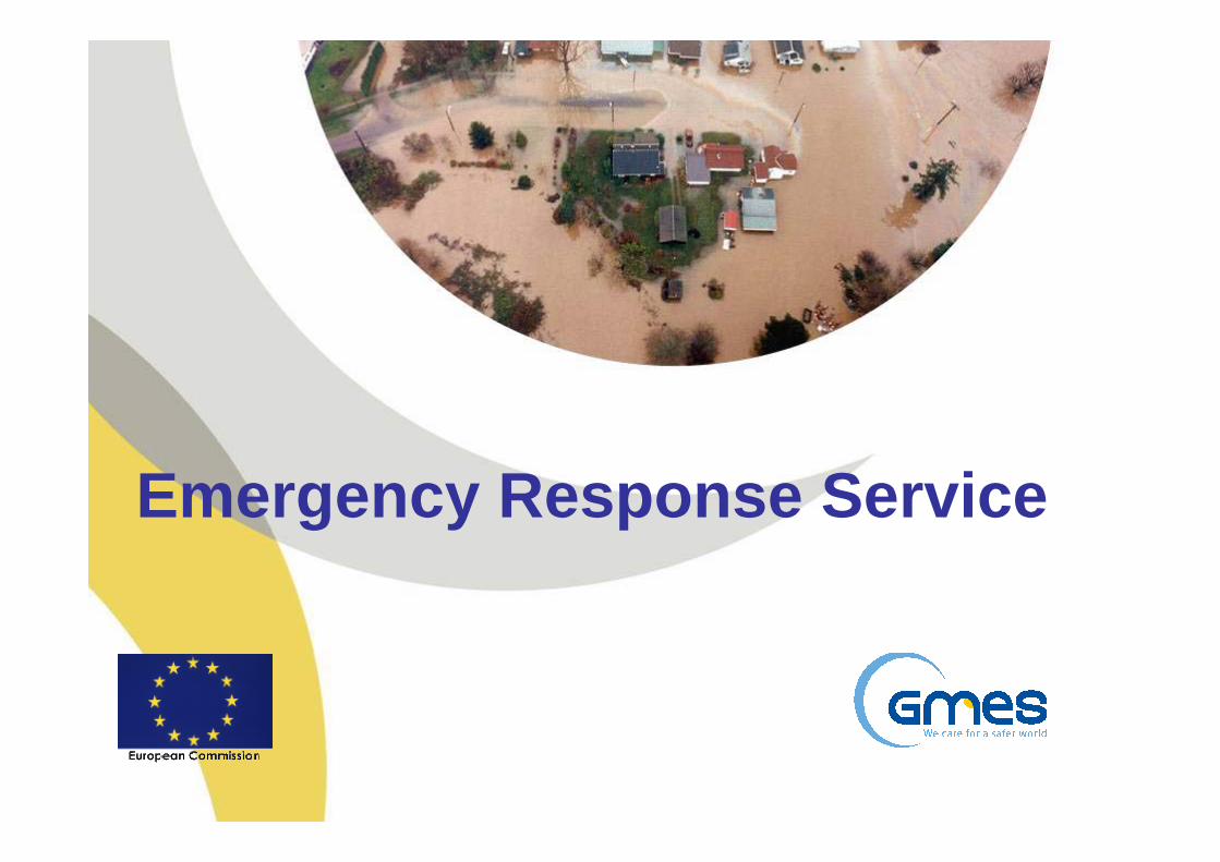
Emergency Response Service
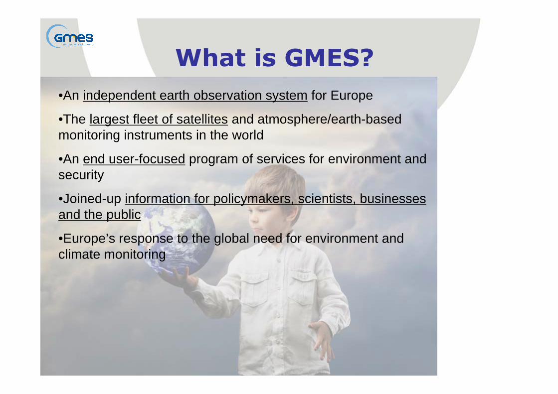
•An independent earth observation system for Europe
•The largest fleet of satellites and atmosphere/earth-based monitoring instruments in the world
•An end user-focused program of services for environment and security
•Joined-up information for policymakers, scientists, businesses and the public
•Europe’s response to the global need for environment and climate monitoring
What is GMES?

What is the objective?
EARTH OBSERVINGSYSTEMS
(space, airborne, in-situ)
PUBLICPOLICIES
(Environment & Security)
Information
Needs(policy driven)
Space AgenciesIn-situ Observing systems
Scientific CommunityEO Value Adding Industry
National Governments and AgenciesEuropean Union Institutions
Inter-Governmental Organisations (IGOs) Non Governmental Organisations (NGOs)
...to provide information services to policy-makers and other users

GMES Overall View
What is their need?
InformationServices
Oil Spill Tracking
Farming Flood
Land Marine Atmosphere Emergency
Policy Makers Public&
USERS
OBSERVATION
Space Infrastructure
In Situ Infrastructure&
Air Quality
Private, Commercial&
Sustainable observation
Surveillance
Example Services Provided
Security

GMES Services
Horizontal applications
Monitoring of Earth systemsLand
Marine
Atmosphere
Security Emergency Climate

EMERGENCY
Source : world bank – University of ColumbiaSource : world bank – University of Columbia

Climate change and natural hazards:new knowledge, new uncertainties, new risks
An increased emergency response capacity is needed to copewith the effects of global changes on natural disasters
and humanitarian crisis
Source : IPCC report 2007
Increasing drought
Food security issues
Hundreds of millionsof people exposedto water stress
Increased mortalityfrom heat waves
Increased damagesfrom coastal floods
and storms
Changed distribution
of disease vectors

• Full service expected to address entire emergency cycle
• Initial scope of service: rapid mapping
Disaster Management Cycle

Emergency Response Service
• The GMES Emergency Response Service will provide reinforced European capacity to respond to emergency situations within and outside Europe
Natural disasters : floods, fires, earthquakes, landslides, volcanic eruptions, tsunamis, storms…Man-made disasters : industrial and chemical hazardsHumanitarian crisis
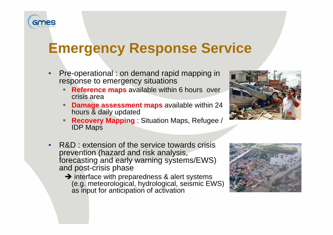
Emergency Response Service• Pre-operational : on demand rapid mapping in
response to emergency situationsReference maps available within 6 hours over crisis areaDamage assessment maps available within 24 hours & daily updatedRecovery Mapping : Situation Maps, Refugee / IDP Maps
• R&D : extension of the service towards crisis prevention (hazard and risk analysis, forecasting and early warning systems/EWS) and post-crisis phase
interface with preparedness & alert systems (e.g. meteorological, hydrological, seismic EWS) as input for anticipation of activation
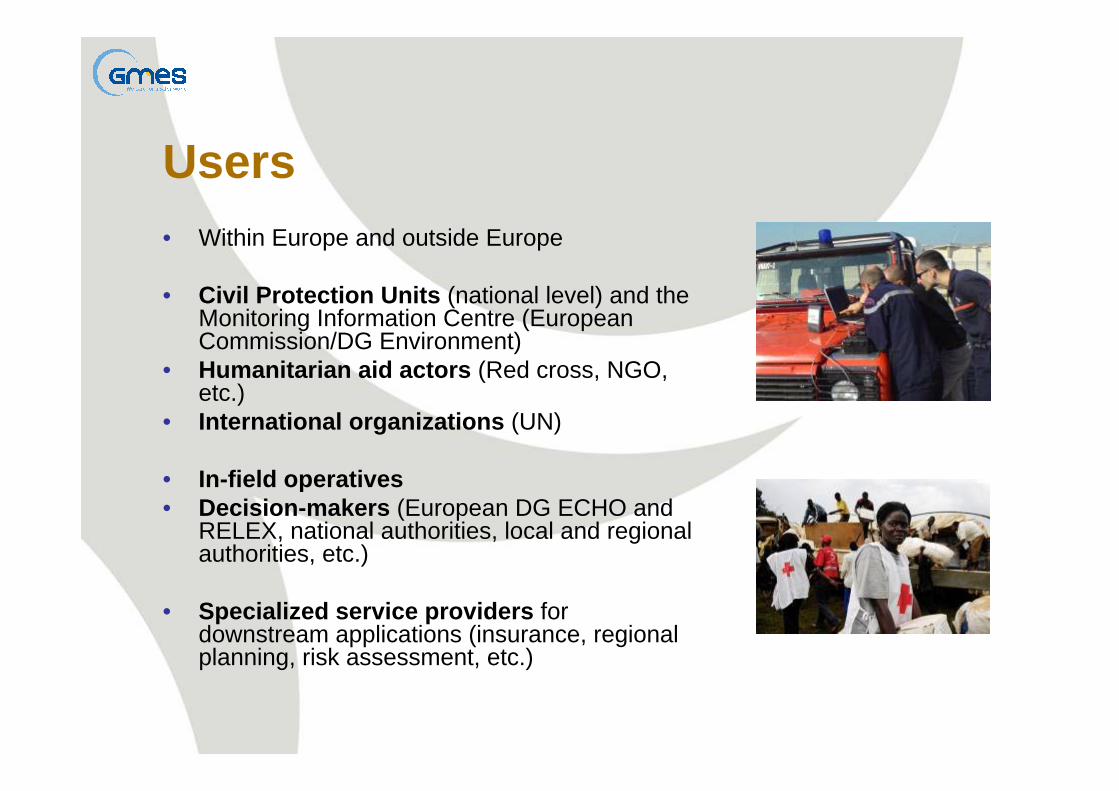
Users• Within Europe and outside Europe
• Civil Protection Units (national level) and the Monitoring Information Centre (European Commission/DG Environment)
• Humanitarian aid actors (Red cross, NGO, etc.)
• International organizations (UN)
• In-field operatives• Decision-makers (European DG ECHO and
RELEX, national authorities, local and regional authorities, etc.)
• Specialized service providers for downstream applications (insurance, regional planning, risk assessment, etc.)

: the link to Users
The linkER activity is a preparatory action for GMES / Kopernikus targeting the emergency responseservice (ERCS)
1. Information exchange:stimulate the dialogue among partners, users and other stakeholders by dedicated face-to-face meetings; collect, analyze, and use the gathered information relevant to ERCS activities.2. Procedural and IT development:design, implement, and validate interface and the information exchange protocols between national focal points and ERCS.3. Support to Operational Use of ERCS Products:verify the implemented interfaces and the operational use of ERCS products in real or simulated emergency situations.

Supporting:• Headquarters• Decision-makers • In-field operativesIn Europe and worldwide
GMES/ERS products in support to emergency response and early warning systems
Reference maps
Assessment maps
Thematic maps
Early warning
Pre-operational
R&D
R&D
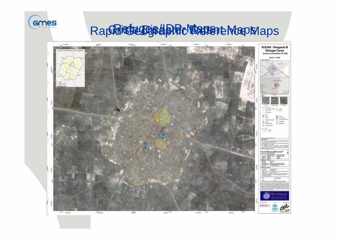
Rapid Geographic Reference MapsCrisis Disaster Extent MapsRefugee/IDP-Maps
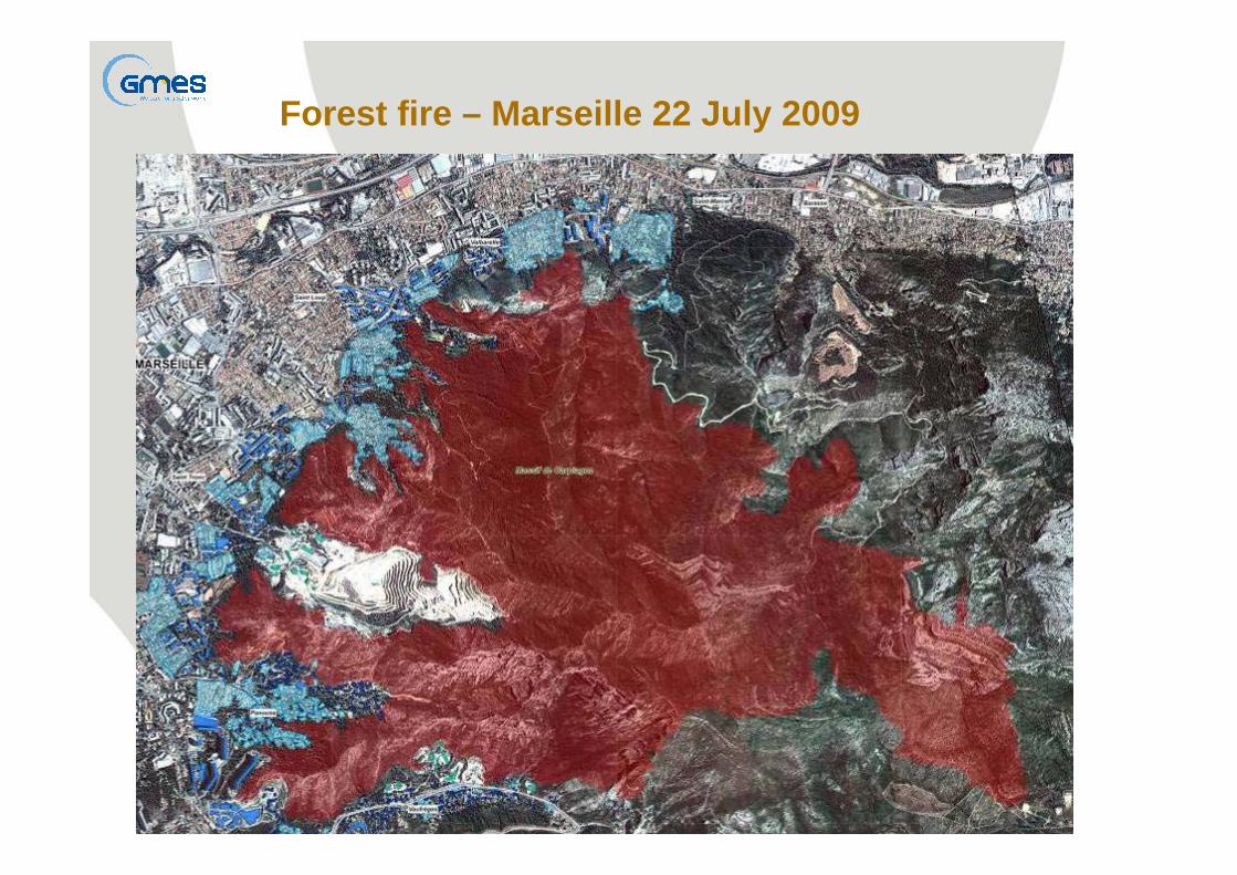
Forest fire – Marseille 22 July 2009
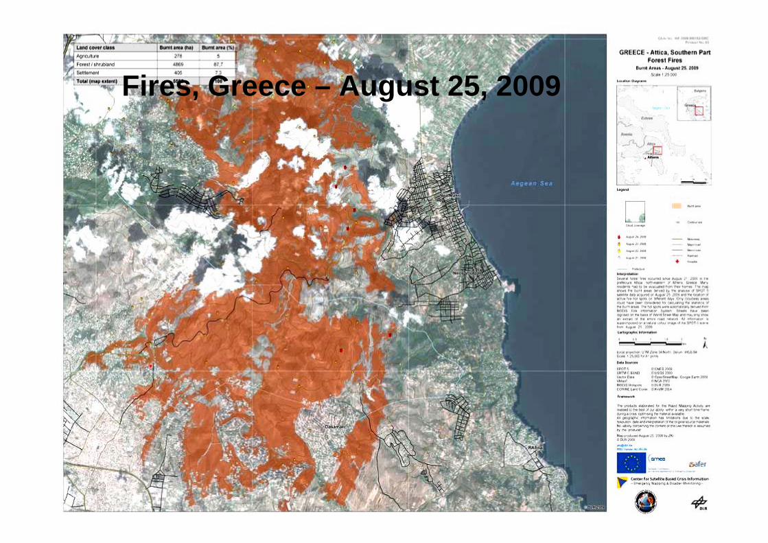
Fires, Greece – August 25, 2009
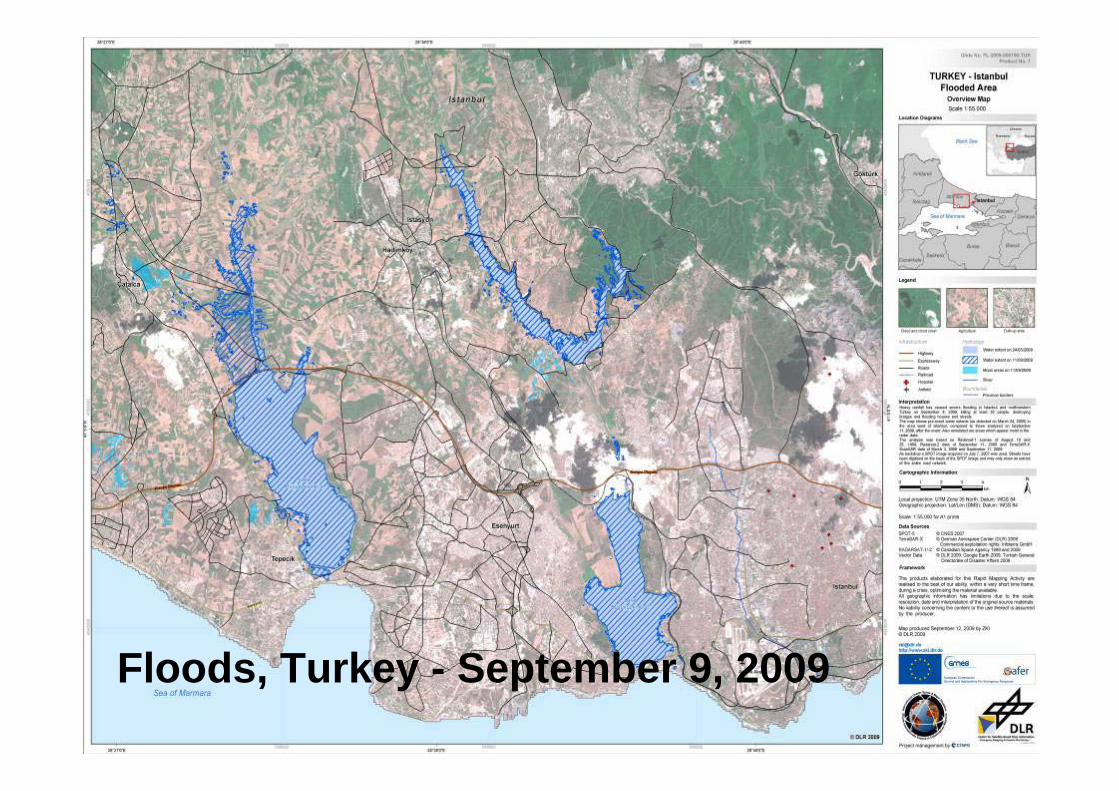
Floods, Turkey - September 9, 2009

Rapid Mapping Using Very High Resolution Sensors
Communication network
Vegetation
Buildings
Rapid mapping usingonly from Space Data
Simulation made using 22/04/2002 Quick Bird image

Image comparison =
Damage assessments with various
level
Impact Maps Using Pléiades ImagesSimulation made using Quick Bird images over Boumerdes
22/04/2002 image23/05/2003 image

Products currently under development relevant to EWS and risk assessment:
• Landslide mappingLandslide monitoring: mapping ground movements for single large landslides, using InSAR data (interferometry) and geological expertise
• Flood productsFlood risk maps based on hydraulic simulation and historical data based on RISKEOS approachPlain flood Early Warning based on EFASFlash Flood Early warning based on RISKEOS FFEW and PREVIEW, connected with meso-scale meteo forecasting
• Fire ProductsGlobal Fire Risk Index: fire danger mapping, daily deliveryFire Monitoring at Medium Resolution: NRT mapping of active fires
• Volcanoes - Earthquakes monitoring
Which products need further scientific developments ?


Landslide service1. Forecasting and Early Warning of
Shallow Rapid Slope Movements
This service delivers to the end-users: • Soil depth maps• Soil infiltration parameters maps• Vegetation indexes• Soil saturation maps• Radar rainfall maps• Self potential maps• and Safety Factor maps.
User Benefits• 1- Operational tool for activating civil protection
resources and short term countermeasures bothin early warning and crisis phases
• 2- Rapid decision support system for regional / local users able to quickly respond to crises and activate their resources.

Flood forecasting• Short-range plain flood forecasting and Risk management

Global Emergency Service Architecture
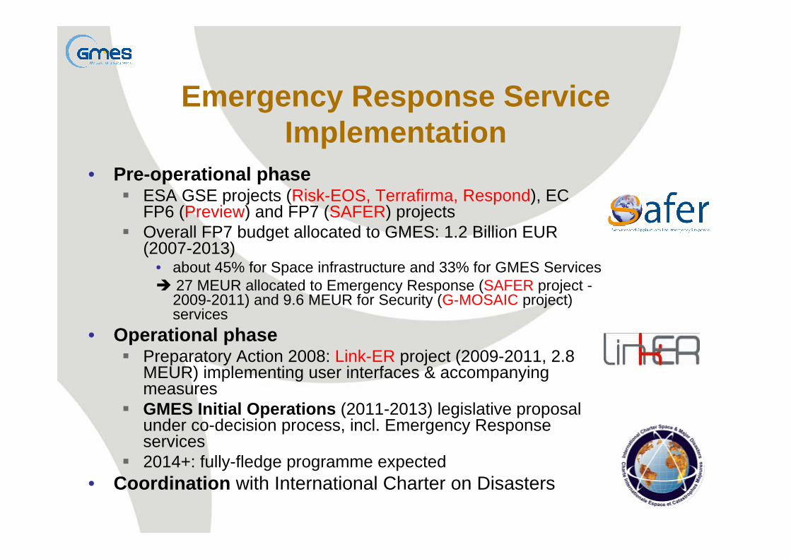
Emergency Response Service Implementation
• Pre-operational phaseESA GSE projects (Risk-EOS, Terrafirma, Respond), EC FP6 (Preview) and FP7 (SAFER) projectsOverall FP7 budget allocated to GMES: 1.2 Billion EUR (2007-2013)
• about 45% for Space infrastructure and 33% for GMES Services27 MEUR allocated to Emergency Response (SAFER project -2009-2011) and 9.6 MEUR for Security (G-MOSAIC project) services
• Operational phasePreparatory Action 2008: Link-ER project (2009-2011, 2.8 MEUR) implementing user interfaces & accompanying measuresGMES Initial Operations (2011-2013) legislative proposal under co-decision process, incl. Emergency Response services2014+: fully-fledge programme expected
• Coordination with International Charter on Disasters

2003 2004 2005 2006 2007 2008 2009 2010 2011 2012 European Space Agency projects
Floods and fires
Landslides
Humanitarian aid
European Commission Atmospheric, geophysical and man-
made disastersService sustainability
Preoperational validation
Service operations (first contracts)
RISK-EOS
TERRAFIRMA RESPOND
PREVIEW
BOSS4GMES
SAFER
Preparatory action Preparatory action
ERCS road map, heritage and schedule
Since November 2000 : International Charter
Since August 2005 : Google Earth
ERS

Conclusions• GMES aims at sustaining a European Earth observation capacity
• The GMES Emergency Service should be a flexible product available to various emergency response actors
adapted to the needs of Civil Protection Authorities within Europe and outside EuropeBe available outside Europe for the benefit of humanitarian aid interventions and crisis management operations.
• Investment is made available by the EUNeed to support the pre-operational services (R&D phase)Need to prepare the implementation of future activities within the operational service chain of authorised user authorities
• establishment of networks of focal points and associated procedures and specifications both for authorised users and service providers