environmental impact analysis · pdf fileen vironmental planning division ... appendix b -...
TRANSCRIPT

AD-A267 593
,4E S Ov ,
Environmental ImpactAnalysis Process
FINAL-, ENVIRONMENTAL ASSESSMENT
STARLAB PROGRAM
17 AUGUST 1990
DEPARTMENT OF THE AIR FORCE
93 8 3 307

" #Form ApprovedS REPORT DOCUMEOITATION PAGE OMB No 0704.0188
Daým. , Te" '204 ,'''m 22202 .43C2 ar'C I- " }'~ ¶33."''IC13C? 3e'.3 e t-" 72c -t 3 8) A s r. .
1. AGENCY USE ONLY (Leave blank) 2. REPORT DATE 3. REPORT TYPE AND DATES COVEREDA',•us,,T/7,_,/?' /S,•(_{ _____________
4. TITLE AND SUBTITLE 5. FUNDING NUMBER
rO, rkL S rt.L 4,3 i,,o74 _ ,*-
6. AUTHOR(S) 3
oA4 Z•dye .. ,,' 37' 7B3/
7. PERFORMING ORGANIZATION NAME(S) AND ADDRESS(ES) 8. PERFORMING ORGANIZATIONHo pREPORT NUMBER
('6' e~d9 ____&__ _
&joa-(dw,,.,-y' P,*_sA- e,,,'."
9. SPONSORING,'MONITORING AGENCY NAME(S) AND ADDRESS(ES) 10. SPONSORING i MONITORINGAGENCY REPORT NUMBER
- see f(e -(
11. SUPPLEMENTARY NOTES
1Za. DISTRIBUTION / AVAILABILITY STATEMENT 12b. DISTRIBUTION CODE
13. ABSTRACT (Maximum 200 words)
,A4 IL-i~~~~~~~~ 13p~9t d~c.-y~
14. SUBJECT TERMS 15. NUMBER OF PAGES
16. PRICE CODE
17. SECURITY CLASSIFICATION 18 SECURITY CLASSIFICATION 19 SECURITY CLASSIFICATION 20 LIMITATION OF ABSTRACTOF REPORT OF THIS PAGE OF ABSTRACT
hS%'( -- 0I Ia, _ 4f_ _ L_ 9298t Cý~ 9

DISCLAIMER NOTICE
THIS DOCUMENT IS BEST
QUALITY AVAILABLE. THE COPY
FURNISHED TO DTIC CONTAINED
A SIGNIFICANT NUMBER OF
PAGES WHICH DO NOT
REPRODUCE LEGIBLY.

FINAL ENVIRONMENTAL ASSESSMENT
STARLAB PROGRAM
17 August 1990
Prepared for
DEPARTMENT OF THE AIR FORCEHEADQUARTERS SPACE SYSTEMS DIVISION
EN VIRONMENTAL PLANNING DIVISIONDIRECTIORATE OF ACQUISITION CIVIL ENGINEERING
Point of Contact: HQ Space Systems Division/DEVATIN: John R. EdwardsP.O. Box 92960Woridway Postal CenterI.Ax Ageles, CA 90009
Prepared by
OAK RIDGE NATIONAL LABORATORYOak Ridge, Teanesce 37831
operated byMARTIN MARIEITA ENERGY SYSTEMS, IN-
for theUS. DEPARTMIENT OF ENERGY
unDerConttract No. DE-ACD-4R21400

CONTENTS
LIST OF FIGURES ................................................. ix
LIST OF TABLES .................................................. ix
ACRONYMS AND ABBREVIATIONS .................................. xi
SUM M ARY ....................................................... xiii
1. INTRODUCTION ................................................ 1-1
1.1 PURPOSE AND NEED ........................................ 1-1
1.2 SCOPE ..................................................... 1-1
2. PROPOSED ACTION AND ALTERNATIVES ......................... 2-1
2.1 DESCRIPTION OF THE PROPOSED ACTION ..................... 2-12.1.1 General Description of the Starlab ............................. 2-12.1.2 Ground Operations ........................................ 2-52.1.3 Starlab Experiments ........................................ 2-5
2.1.3.1 Passive Experiments .................................. 2-82.1.3.2 Space Test Objects and Retargeting
Experiments ........................................ 2-82.1.3.3 Ground Calibration Engagements ........................ 2-82.13.4 Starbird Engagement .................................. 2-82.1.3.5 Short Wave Adaptive Technology ........................ 2-15
2.1.4 Mitigation measures ........................................ 2-17
2.2 ALTERNATIVES TO THE PROPOSED ACTION ................... 2-172.2.1 No-action Alternative ....................................... 2-172.2.2 Alternative Ground Locations ................................ 2-17
3. AFFECTED ENVIRONMENT ...................................... 3-1
3.1 INTRODUCTION ............................................. 3-1
3.2 STARBIRD ENGAGEMENTS .................................. 3-13.2.1 W ake Island ............................................. 3-1
3.2.1.1 Physical setting ...................................... 3-13.2.1.2 Land use .......................................... 3-13.2.1.3 Ecological resources .................................. 3-23.2.1.4 Threatened and endangered species ...................... 3-432.1.5 Socioeconomic and cultural resources ..................... 3-4
v

3.2.2 Cape Canaveral ........................................... 3-43.2.2.1 Physical setting ...................................... 3-43.2.2.2 Land use .......................................... 3-53.2.2.3 Ecological resources .................................. 3-53.2.2.4 Threatened and endangered species ...................... 3-63.2.2.5 Socioeconomic and cultural resources ..................... 3-6
3.3 SHORT WAVE ADAPTIVE TECHNOLOGY EXPERIMENT .......... 3-63.3.1 Physical Setting ........................................... 3-63.3.2 Land Use ................................................ 3-93.3.3 Ecological Resources ....................................... 3-93.3.4 Threatened and Endangered Species ........................... 3-103.3.5 Socioeconomic and Cultural Resources ......................... 3-10
4. ENVIRONMENTAL CONSEQUENCES AND MITIGATION ............. 4-1
4.1 INTRODUCTION ............................................ 4-1
4.2 EFFECTS OF LASERS ......................................... 4-14.2.1 Potential Human Health and Safety Concerns .................... 4-14.2.2 Potential Laser Effects on Wildlife ............................ 4-3
4.3 IMPACTS OF STARBIRD ENGAGEMENTS ....................... 4-54.3.1 W ake Island .............................................. 4-5
4.3.1.1 Land use ........................................... 4-54.3.1.2 Ecological resources .................................. 4-64.3.1.3 Threatened and endangered species ...................... 4-74.3.1.4 Socioeconomic and cultural resources ..................... 4-84.3.1.5 Human health and safety .............................. 4-8
4.3.2 Cape Canaveral ........................................... 4-94.3.2.1 Land use ........................................... 4-943.2.2 Air quality .......................................... 4-943.2.3 Ecological resources .................................. 4-1043.2.4 Threatened and endangered species ...................... 4-114-3.2.5 Socioeconomic and cultural
resources .......................................... 4-114.3.2.6 Human health and safety .............................. 4-11
4.4 SHORT WAVE ADAPTIVE TECHNOLOGY EXPERIMENT .......... 4-124.4.1 Land Use ............................................... 4-124.4.2 Ecological Resources ...................................... 4-124.4.3 Threatened and Endangered Species ........................... 4-134.4.4 Socioeconomic and Cultural Resources ......................... 4-134.4.5 Human Health and Safety .................................... 4-14
4.5 CUMULATIVE IMPACTS ...................................... 4-15
vi

5. CONSULTATION AND COORDINATION ............................ 5-1
5.1 INTRODUCTION ............................................. 5-I
5.2 STARBIRD ENGAGEMENTS ................................... 5-I
5.3 SWAT EXPERIMENT ......................................... 5-1
5.4 AGENCIES CONSULTED ...................................... 5-2
6. REFERENCES .................................................. 6-1
7. LIST OF PREPARERS ............................................ 7-1
APPENDIX A - BIOLOGICAL SURVEY WAKE ISLAND STARLABPROJECT SITES ........................................... A-i
APPENDIX B - TRIP REPORT-WAKE ATOLL ......................... B-i
APPENDIX C - SEA TURTLE ASSESSMENT AT WAKE ISLAND ........... C-1
APPENDIX D - SEABIRD SURVEY OF PROJECT STARBIRDCONSTRUCTION SITES ON WAKE ATOLL .................... D-1
APPENDIX E - DESCRIPTION OF SHORT WAVE ADAPTIVETECHNOLOGY EXPERIMENT .............................. E-1
APPENDIX F - ANALYSIS OF LASER EFFECS. ......................... F-1
APPENDIX G - LETTERS OF CONSULTATION ......................... G-1
APPENDIX H - DRAFr LIGHT MANAGEMENT PLAN FOR LAUNCHCOMPLEX 20 ............................................. H-i
DtTIC QUAI.- r "- .3
, A ce:.••.• ?or
F]
vii

LIST OF FIGURES
Figure Pre
2-1 The Space Shuttle (Orbiter) ....................................... 2-2
2-2 Typical orbit and Starlab ground sites ................................ 2-3
2-3 The Starlab payload ............................................. 2-4
2-4 Starlab space test object .......................................... 2-9
2-5 Starbird launch sites on Wake Island ................................ 2-11
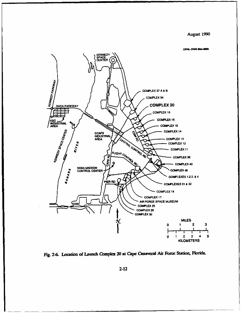
2-6 Location of Launch Complex 20 at Cape Canaveral AirForce Station, Florida ........................................... 2-12
2-7 Site layout at Launch Complex 20 .................................. 2-13
2-8 Starbird launch vehicle ........................................... 2-14
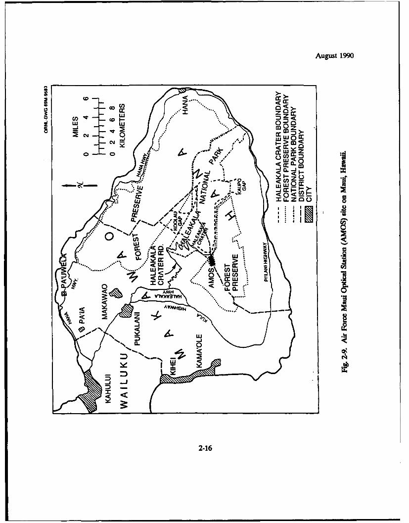
2-9 Air Force Maui Optical Station (AMOS) on Maui, Hawaii ................ 2-16
LIST OF TABLES
Table Pae
2-1 Characteristics of lasers to be used in Starlab experiments .................. 2-6
2-2 Summary of proposed Starlab experiments/engagements ................... 2-7
3-1 Bird species at the various Starlab sites on Wake Island ................... 3-3
3-2 Threatened and endangered species in Brevard County and their statuson Cape Canaveral Air Force Station ................................ 3-7
ix

August 1990
ACRONYMS AND ABBREVIATIONS
ACHP President's Advisory Council on Historic PreservationAFOSH Air Force Occupational Safety and HealthAFR Air Force RegulationAMOS Air Force Maui Optical StationANSI American National Standards InstituteATP aquisition, tracking, and pointingCCAFS Cape Canaveral Air Force StationCFP controlled firing processCFR Code of Federal Regulationscm centimeterdBA Decibels on the A-weighted scaleDOD U.S. Department of DefenseEA Environ -lental AssessmentEIAP Environmental Impact Analysis ProcessEIS Environmental Impact StatementETR Eastern Test RangeFAA Federal Aviation AdministrationFGFWFC Florida Game and Fresh Water Fish CommissionFONSI Finding of No Significant ImpactIED illuminator energy densityIR infraredIRPA International Radiation Protection AssociationJ Jouleskm kilometerLBD Laser Beam DetectorLC 20 Launch Complex 20 (at Cape Can'weral Air Force Station)LMP Light Man3gement PlanLMSC Lockheed Missile and Space CompanyLSS Laser Source Systemm meterMAB missile assembly buildingMPE Maximum permissible exposureprad microradianMRTS Mobile Real Time SystemmW milliwattNASA National Aeronautics and Space AdministrationNEPA National Environmental Policy ActNHPA National Historic Preservation Act
xi

August 1990
NMFS National Marine Fisheries ServicePEP Payload Experiment PackagePOCC Payload Operations Control CenterPSD Prevention of Significant Deterioratior,RME Relay Mirror Experiments secondsSDI Strategic Defense InitiativeSDIO Strategic Defense Initiative OrganizationSHPO State Historic Preservation Officesr SteradianSSD/DEV Space Systems Division/Environmental Planning BranchSTO Space Test ObjectSWAT Short Wave Adaptive TechnologyT&E threatened and endangered speciesTSP total suspended particulate matterUSAF U.S. Air ForceUSASDC U.S. Army Strategic Defense CommandUSFWS U.S. Fish and Wildlife ServiceUV ultravioletVTSP video tracker signal processorsW WattWHO World Health Organization
xii

August 1990
SUMMARY
This environmental assessment (EA) has been prepared by the U.S. Air Force (USAF) incompliance with the National Environmental Policy Act (NEPA) and Executive Order 12114 todetermine if significant environmental impacts would result from the Starlab program. Theproposed action is to conduct a set of engagements and experiments using electro.optical andlaser systems to be installed aboard a Space Shuttle flight. The purpose of these engagement,and experiments is to advance the research program of tbe Strategic Defense InitiativeOrganization (SDIO), particularly that involving the acquisition, tracking, and pointing !apabilitiesof the electro-optical and laser systems.
The activities involved in the Starlab program include (1) passive experiments forcollecting and analyzing ultraviolet and infrared data to calibrate the electro-optical systems;(2) experiments using small space test objects deployed from the orbiter to sight the lasers and todemonstrate the capability of rapidly changing from tracking one object to acquiring and trackinga second; (3) ground calibration engagements that locate and actively scan sites on Antigua andAscension Island with red and green lasers, which are then reflected back to the shuttle;(4) engagements with ground launched rockets (ie., Starbird vehicles) that actively identify andtrack Starbird vehicles launched from Cape Canaveral and Wake Island and their plumes usinggreen and red lasers; and (5) a Short Wave Adaptive Technology (SWAT) experiment thatactively links the orbiter with the Air Force Maui Optical Station (AMOS) in Hawaii using blueand green lasers from AMOS and red lasers from the Starlab.
The National Aeronautics and Space Administration (NASA) is the mission manager forthe proposed action, and the SDIO is the DOD sponsor for the Starlab program. The USAFSpace Systems Division and the U.S. Army Strategic Defense Commard (USASDC) are theexperiment program offices. As mission manager, NASA is responsible for overall operation andcoordination of the Space Shuttle. The USAF Space Systems Division is responsible for theStarlab payload in the orbiter and the SWAT experiment. The USASDC is responsible for theconstruction of the launch sites and the launch of the Starbird vehicles. The USAF SpaceSystems Division is the lead agency for preparing this EA, and NASA, SDIO, USASDC, and theDepartment of State are cooperating agencies.
A major issue addressed in this EA is the potential exposure of people and wildlife tolaser beams. The USAF has prepared extensive analyses of potential laser effects, which arereviewed and evaluated in this EA. Other issues that are discussed and evaluated in the EAinclude potential impacts of Starlab activities at Cape Canaveral and Wake Island (Starbird launchsites), and Maui (site of the SWAT engagement) on land use, ecological resources, endangeredand threatened species, and socioeconomic resources.
Detailed safety analyses of the effects of laser systems prepared by the USAF andindependent calculations and analyses made in preparing the EA indicate that no significantimpact to humans or wildlife would occur from exposure to lasers because of the low probability(1 x 10-') of people or wildlife seeing a pulse of 25 nanoseconds.
...

August 1990
Environmental impacts of construction and operation of the ground calibration sites onAntigua and Ascension Island will be considered in separate environmental review documentsprepared in compliance with Air Force Regulation 19-3.
Construction of facilities for Starbird launches at Wake Island and Cape Canaveral AirForce Station (CCAFS) have been completed. Environmental impacts of construction wereevaluated in an EA prepared by USASDC in 1987 (U.S. Army 1987). This EA includes anassessment of the changes that have occurred since the USASDC EA was published. TheUSASDC has recently prepared a light Management Plan (LMP) for the CCAFS launch site thatincludes mitigation measures to prevent significant impacts to endangered species of sea turtles atCCAFS. The U.S. Fish and Wildlife Service (USFWS) has reviewed the LMP and has concurredthat sea turtles will not be affected by operational activities at Launch Complex 20. No significantimpacts are likely to occur to endangered and threatened species, migrating sea birds, or historicand cultural resources at either Wake Island or CCAFS. Consultation required under theEndangered Species Act and the National Historic Preservation Act has been completed fordevelopment and use of the Starbird sites.
No construction would occur at the AMOS facility on Maui. Operations for the SWATexperiment have been evaluated and no significant adverse impacts are anticipated. The USFWShas reviewed the project and concurred with the findings of this EA that the project would beexpected to have little, if any, impact on any federally-listed endangered or threatened species.
xiv

August 1990
1. INTRODUC11ON
1-1 PURPOSE AND NEED
Former President Reagan announced on March 23, 1983, that he was directing a"comprehensive and intensive effort to define a long-term research and development program tobegin to achieve our ultimate goal of eliminating the threat posed by strategic nuclear missiles."To implement this directive, the President created the Strategic Defense Initiative Organization(SDIO), which was chartered to oversee activities of various U.S. Department of Defense (DOD)offices related to the Strategic Defense Initiative (SDI).
The Starlab program is an SDI activity that consists of a dedicated Space Shuttle missionhaving the objectives of demonstrating "proof-of-concept" for several space-based defenseexperiments and new concepts for performing strategic space experiments using the SpaceShuttle/Spacelab capability. Under a Memorandum of Agreement between the NationalAeronautics and Space Administration (NASA) and DOD, NASA will provide launch services forthe Space Shuttle and overall Starlab mission coordination and support SDIO is the DODsponsor for the Starlab program (NASA and DOD 1989), and the U.S. Air Force (USAF) isresponsible for developing the Starlab payload and conducting the experiments. The U.S. ArmyStrategic Defense Command (USASDC) is responsible for the ground launched vehicles(i.e., Project Starbird) associated with Starlab.
The Starlab program includes a series of experiments that use electro-optical and lasersystems aboard tha Space Shuttle and on the ground. These experiments are designed to(1) demonstrate acquisition, tracking, and pointing (ATP) of laser systems; (2) collect plume andbackground information to narrow phenomenology uncertainties; and (3) provide a basis formaking an informed decision on the design of a weapon ATP system. Starlab includesexperiments that use laser beams propagated by equipment from the orbiter and to and from theground. The laser experiments involve (1) calibration of the electro-optical systems, using objectsdeployed from the orbiter (Le., space test objects) and scoreboards at ground calibration sites onAntigua and Ascension Island; (2) ATP activities associated with Starbird test vehicle launchesfrom Wake Island and Cape Canaveral, Florida; (3) participation in the Short Wave AdaptiveTechnology (SWAT) experiments at the Air Force Maui Optical Station (AMOS), Hawaii; and(4) wavefront control experiments. In addition to these laser experiments, background data onthe composition of visible and other spectral radiation from planets and stars would be collectedduring the Starlab mission to assist in calibrating the electro-optical systems.
1.2 SCOPE
This environmental assessment (EA) has been prepared pursuant to Sect. 102 of theNational Environmental Policy Act (NEPA) of 1969 (Pub. L 91-190, as amended), as
i-1

August 1990
implemented by regulations promulgated by the President's Council on Environmental Quality(40 CFR Parts 1500-1508), Air Force Regulation (AFR) 19-2 (Environmental Impact AnalysisProcess), Executive Order 12114 (Environmental Effects Abroad of Major Federal Actions) andAFR 19-3 (Environmental Impact Analysis Process Overseas). The principal objectives of NEPAare to ensure that careful consideration is given to environmental aspects of proposed actions infederal decision-making processes and to make environmental information available to the publicbefore decisions are made and actions taken. The purpose of an EA is to briefly providesufficient information and analysis for determining whether to prepare an environmental impactstatement (EIS) or a finding of no significant impact (FONSI) (40 CFR Part 1508.9).
Executive Order 12114, which is implemented by the USAF under AFR 19-3, is applicablebecause the Starlab program involves activities in foreign countries and over international waters.Under AFR 19-3, an EA addressing USAF activities overseas should provide "enough informationto determine whether the proposed action is major and whether it significantly harms theenvironment of the global commons" (AFR 19-3, Attachment 1, §2.e.1). The global commonsincludes "geographic areas that are outside the jurisdiction of any nation, including the oceanoutside territorial limits...I (AFR 19-3, §1.f). USAF activities that affect the environment of aforeign nation must be carried out in a way that allows for consideration of the environment aswell as for existing international agreements and the sovereignty of other nations (AFR 19-3,§2.c). The environmental impacts for the proposed ground calibration sites on Antigua andAscension Islands will be reviewed separately under AFR 19-3 (Attachment 2, §6). SDIO hasdesignated the USAF, Space Systems Division, Environmental Planning Branch (SSD/DEV) asthe lead agency for preparing this EA. Cooperating agencies are SDIO, NASA, USASDC, andthe Department of State.
Six separate activities that together comprise the Starlab action are evaluated in thisreport. The document builds upon other NEPA documents, as well as presenting newinformation. Previous NEPA documentation that has been prepared to address environmentalconcerns associated with Starlab activities includes (1) an environmental impact statement (EIS)prepared by NASA on the Space Shuttle Program (NASA 1978) and supplemented by anenvironmental resources document (NASA 1986), (2) an EA prepared by the USASDC on theStarbird project (U.S. Army 1987), and (3) an EA and supplement prepared by the USAF on theproposed Relay Mirror Experiment (RME) (USAF 1987, 1988) conducted at AMOS. The NASAEIS and the environmental resources document address the environmental impacts of developingand operating the Space Shuttle Program. The USASDC's Starbird EA, FONSI, and LightManagement Plan (LMP) address the construction, operation, and decommissioning of launchfacilities at Wake Island and Launch Complex 20 (LC 20) at Cape Canaveral. The EA on theRME addresses the environmental effects of an experiment using lasers at AMOS that are verysimilar to those proposed for use during the Starlab mission.
In determining the range of issues that should be addressed in this EA, site visits weremade to Wake Island, Hawaii, and Cape CanaveraL As part of the site visit to Hawaii, discussionswere held with the U.S. Fish and Wildlife Service (USFWS) and the National Marine FisheriesService (NMFS) to obtain general information about fish and wildlife resources, including
1-2

August 1990
endangered and threatened species, at the AMOS and Wake Island sites in the Pacific. As aresult of these discussions, USFWS and NMFS staff visited Wake Island to collect additionalinformation on ecological habitat Reports of this site visit are included as Appendices A, B, andC of this EA. An additional survey of seabird nesting at construction sites on Wake Island wasconducted immediately prior to initiation of construction by the Pacific Division Naval FacilitiesCommand (Appendix D). Other agencies, organizations, and individuals contacted duringpreparation of the Starlab EA are identified in Sect. 5.7.
A major issue addressed in this EA is the potential exposure of people and/or wildlife tolaser light. The USAF has prepared extensive analyses of potential laser effects [PayloadExperiment Package (PEP)-20, LMSC 1989], which are summarized and evaluated in this EA.Independent calculations have also been made in preparing this EA to verify these results. Otherissues that are evaluated include potential impacts of operational phases of Starlab activities atWake Island, Cape Canaveral, and Maui on land use, ecological resources, endangered andthreatened species, and socioeconomic resources.
1-3

August 1990
2. PROPOSED ACTION AND ALTERNATIVES
2.1 DESCRIPTION OF THE PROPOSED ACTION
The proposed action would use the Space Shuttle (Fig. 2-1) to conduct and complete SDIexperiments within a scheduled 7-day mission in the second quarter of 1992. These experimentswould use Spacelab hardware located in the orbiter bay to interact with ground sites, missiles inflight, and space test objects (STOs) deployed from the orbiter.
The experiments are primarily designed to demonstrate the feasibility of using space-based,electro-optical and laser systems for the acquisition, subsequent tracking, and marking of missiesfrom space. Some of the proposed experiments use the electro-optical system in a passivefashion, while others use it in a mix of active and passive modes. A passive experiment uses theelectro-optical system cameras to capture images with available light (e.g., the calibration andbackground experiment described in Sect. 2.13.1). An active segment of an experiment useslasers to provide the necessary illumination [e.g., acquiring and tracking a ground launchedStarbird vehicle and its plume (Sect. 2.13.4)]. Approximately 20 separate events or engagementsare scheduled for Starlab as parts of six experiments.
Figure 2-2 shows a typical earth orbital path for the orbiter and indicates the ground sitesinvolved in the experiments. These sites include Wake Island, Cape Canaveral, and the HawaiianIsland of Maul, as well as Antigua and Ascension Island, which are to be evaluated in separatedocuments (Sect. 1.2).
2.1.1 General Description of the Starab
Figure 2-1 shows the orbiter with its bay doors open and the experimental Starlab payloadexposed. The major components of the payload (Fig. 2-3) include the Spacelab module and theSpacelab pallet. As shown in Fig. 2-3, the Spacelab module, located forward of the pallet, isaccessed by the crew via an umbilical connection (i.e., egress tunnel). Primary tasks of thepayload specialists include observing and evaluating the Starlab experiments and being ready tocorrect problems with the equipment should they arise. In this capacity, the specialist will serve assystems safety officer by having the ability to shut down any experiment or modify experimentaloperating parameters. The specialist will observe and control the experiments through devicescontained in the experiment control racks (Fig. 2-3).
The module will contain the optical bench that houses the marker laser and associatedelectronics (Fig. 2-3). The marker laser will be used to mark experimental objects once they havebeen identified and are being tracked. The Spacelab module and pallet are electro-opticallylinked and will function in a coordinated fashion during the experiments, with the marker beamtraveling through the optical viewpoint into the Spacelab pallet.
2-1

August 1990
Co
co
z0
NN
2-2

August 1990
II:
2-3

August 1990
Wr C I
00
ILI
IL;
2-4

August 1990
Major elements contained within the Spacelab pallet (Fig. 2-3) will be the illuminator laser;a 31.5-in. (80-cm) telescope; ultraviolet, acquisition video, and infrared cameras; a 5-ft (1.5-m)pointing mirror; and STOs. The Spacelab pallet will be open to space. The marker laser beampasses through the optical viewpoint, is routed through the telescope, and is subsequentlyreflected by the pointing mirror to its destination. All other optical beams and images arereflected by the pointing mirror. The cameras are used for initial acquisition and during thepassive portions of experiments to assist in identifying experimental test objects under a variety ofconditions. The illuminator laser will be used in an active mode to illuminate and trackexperimental objects. The retroreflector, located on the forward bulkhead, will return a laserbeam originating at AMOS to its source as part of the SWAT experiment (Sect. 2.13.5). TheSTOs, which are 18.5-in. (47-cm) diameter spheres, will be deployed as described in Sect. 2.1.3.2.
The two types of lasers that will be transmitted from the orbiter are the "marker" (red) and"illuminator" (green) lasers. A back-up to the illuminator laser will be provided. The SWATexperiment described in Sect. 2.1.3.5 will involve two ground-based lasers, a beacon (blue) and anuplink (green) laser, located at AMOS. The Starlab marker laser beam (red) will be modulatedwith data and pointed at AMOS to convey uplink beam characterization. Some generalcharacteristics of these four lasers are given in Table 2-1, and a more detailed technicaldescription is provided in Appendix E.
2.1.2 Ground Operations
Ground operations include (1) experiment command, control, and configuration;(2) experiment performance assessment; (3) data analyses; and (4) dedicated planning.Operations during the mission will be controlled from and coordinated with the NASA MarshallSpace Flight facility at Huntsville, Alabama. Ground control facilities will be located at CapeCanaveral and Wake Island for the Starbird engagements and at Maui for the SWAT experiment.These control facilities will be in continuous communication with NASA throughout the 7-daymission. Additional discussion of ground operations is provided in the following descriptions ofindividual experiments.
2Z1.3 Stariab Experiments
The experiments and engagements included in the proposed action (Table 2-2) can begrouped for discussion as passive and active experiments. Passive experiments do not involvelasers and are used to gather background data and calibrate equipment. Active experiments uselasers and include the Space Test Objects/Rapid Retargeting experiment, the Ground Calibrationengagements, the Starbird engagement, and the SWAT experiment.
2-5

August 1990
Table 2-1. Characteristics of lasers to be used in Starlab expeiments
On the shuttle At Mauib
Characteristic iluminator Marker Beacon Uplink
Wavelength 0.5321 Am 0.6328 pm 0.4880 Am 0.5145 Am
Color green red blue green
Beam energy(at laser aperture) 220 mJ/pulse <5 mW 4 W 5 mW
Mode of operation pulsed continuous continuous continuous
Maximum permissibleexposure to the eyee 3.34 x 10 6.36 x 10' 6.36 x 10⁴ 6.36 x 10
J/cm2 JIcm2 (for J/cm' (for J/cm2 (for025 sec) 025 sec) 0.25 sec)
*Table E-1 (Appendix E) presents more deta'led information on lawer characteristics.
bMaui is the location of the Air Force Maui Optical Station (AMOS), the ground location for the Short Wave
Adaptive Tecnology (SWAT) eaperimiets.
nternational Radiation Protection Association (1985).
2-6

August 1990
U 0
0- .C'-
0u -W 0
a --00-
'cc F; F
I ~.0
U0
0
.00
0 Cu
VU
Cu 0
.2-

August 1990
213.1 Passive experiments
Several experiments are designed to collect data and/or calibrate Starlab equipment withoutusing lasers. Star calibrations are required to update the Starlab gyros and to calibrate theelectro-optical system. Gyro updates are performed as required throughout the mission. Starcalibrations are performed initially and prior to each experiment that requires accurate pointing.Observations of planets are used to provide extended sources for wavefront control experiments,in which measurements are made on vibration effects so that data can be corrected during lateranalyses. Earth background experiments are designed to obtain data by passively scanning theearth's surface and collecting ultraviolet and infrared radiation data. Plume phenomenologyexperiments are designed to use Starlab's ultraviolet and infrared sensors to collect data on thecharacteristics and physical behavior of plumes from Starbird vehicles launched from CapeCanaveral and Wake Island (Sect 2.1.3.4).
2.13.2 Space Test Objects and Retargeting Experiments
Two small STOs (Fig. 2-4) are deployed from the orbiter and used in several experiments.The STOs weigh approximately 150 lbs (68 kg). They have diffuse white coatings to enhancepassive observation and return of the tracking illuminator laser beams directed at them.Retroreflectors on the STOs return the marker laser beam to the Spacelab.
A single STO is used for boresighting the illuminator laser to the marker laser. Scoringaccuracy on the STOs can be evaluated during the experiments. In a separate experiment, twoSTOs are used to demonstrate the capability of rapidly changing from tracking one object toacquiring and tracking a second.
2.1.33 Ground Calibration t
Ground calibration sites will be established so that the orbiting Starlab can calibrate itsoptical control system in flight prior to subsequent Starbird engagements involving the launchingof vehicles from Cape Canaveral and Wake Island (Sect. 2.13.4). The two ground calibrationsites that were selected are on Antigua and Ascension Island. As noted in Sect. 1.2, these sitesare evaluated in separate documents.
2.13.4 Starbird engagements
The USASDC has prepared sites at Cape Canaveral Air Force Station (CCAFS) in Floridaand at Wake Island in the North Pacific (near the Marshall Islands) for launching Starbirdvehicles. Six Starbird vehicles will be available for Starlab engagements, and a seventh will beused for a developmental launch from CCAFS to test the target vehicle prior to the Starlabmission. At each site, a maximum of three vehicles will be launched on a ballistic trajectory to
2-8

August 1990
ORNL-O 88-12007
DUST COVERS(REMOVED BEFORE
FLGHT)OCTANTTRADAR•
RETRO
OUST COVERC) (REMOVED BEFORE
FUGHT)DUST COVERS
(REMOVED BEFOREFLIGHT)
V - 18.5 in.
ft. 2-4. Starlab space test object.
2-9

August 1990
allow the Starlab to acquire and track the Starbird plume and hardbody (the body of the launchvehicle) through a series of events in the flight.
The Starbird launch sites are located at Peacock Point on Wake Island (Fig. 2-5) andLC 20 at CCAFS (Figs. 2-6 and 2-7). A description of the Starbird launch sites is given in theEA prepared by the U.S. Army (1987). Changes in project plans at Wake Island since the EAwas written include the following: (1) the wind tower, security fencing, two guardhouses, apyrotechnic storage building, and a small launch pad have been deleted; (2) an additional siteinvestigation revealed the presence of asbestos in Building 1644 that was subsequently removedand disposed of off Wake Island in compliance with EPA regulations (40 CFR Part 61); and(3) an area for the Mobile Real Tune System (MRTS) range safety vans, one mobile radar siteand one mobile telemetry site on Wilkes Island, and one mobile radar site approximately 200 ft(60 m) north of the MRTS site have been added. Changes in project plans at CCFAS since theStarbird EA was written include the following: (1) plans to build a new missile assembly building(MAB) were deleted; (2) an existing missile assembly building (MAB No. 3, Pershing Program)will be used; (3) the meteorological tower was deleted; and (4) a MRTS team would be presenton the site in a passivQ role (i.e., they would not be active participants in the launches).
The facilities and operations at the two Starbird launch sites will be essentially identical.Each site contains two launch pads, approximately 25 ft2 (2.3 mi) with 50-x 80-ft (15- x 24-m)work aprons, a launch equipment building, a payload assembly building, a launch operationcontrol center, and mobile ground support equipment. At Wake Island site, existing buildings arebeing modernized to use for missile assembly, motor storage, and the launch control center. TheWake Island facilities include a mobile range tracking support system transported by air fromWhite Sands Missile Range, New Mexico. Construction of the Wake Island facilities, involving awork force of approximately 60 persons, has been completed. Limited site preparation work isrequired for the mobile equipment. Approximately 120 additional personnel will be required atWake Island during the pre-operational and operational phases of the Starbird engagements(a 90 to 120 day period).
Modernizing the blockhouse and payload assembly buildings at CCAFS and theconstruction of two launch pads at LC 20 has been completed. Auout 25 additional personnelwill be added to the work force at CCAFS during the preoperational and operational phases ofthe Starbird engagements and for the preliminary development launch prior to the Starlabmission.
The Starbird launch vehicle is shown in Fig. 2-8. The Starbird payload that is covered by aprotective shroLd is a "scoreboard" laser target that is used to collect data for evaluating theengagement. The launch vehicle consists of four stages and measures approximately 57 ft (17 m)in length. The total weight of the vehicle is about 8 tons (7250 kg). The first stage will fall in theocean, approximately 1 mile (1.6 kin) frum the launch site (U.S. Army 1987).
For each engagement with Starlab, two Starbird vehicles will be readied for launch at eachof the sites, but only one will actually be launched. The second Starbird will be launched in theevent of a technical problem with the first vehicle. If it is not required on the first shuttleengagement, the second Starbird from each site will be launched during subsequent shuttle passes.
2-10

August 1990
a Ico Q...
zg oz
CO S
UAU
40 CD
2-1
August 1990
O0INLOWO 80M4US
KENNEDYSPACECENTER Q
0. COMPLEX 37 A & B
LUJ COMPLEX 34
NASA PARKWAY COMPLEX 20
-COMPLEX 1 4
RCOPE COMPLEX 1
AROUSSAEMSUAREAA COMPLEX 1 S
0COMPLEX 1 2
• CIT I ENDUTERIALSO AREA COMPLEXE 1.23.
J- R. COMPLEXS 1 &I3
At COMPLEX 36
GA V
KILOMETERS
Fig. 2-6. ]Location of Launch Complez 20 at Cape Caawa Air Force Station, Foia
2-12

August 1990
EASTERN TEST RANGE COMPLEX 20
1oo o 200 FT
BLDG DISTANCE P--- •O"'*A*
•-..'....... LAUNCHSUPPORT CENTER
• 2ND FLOOR OFBLOCKHOUSE
00
(PAYLOADASSEMBLYBLDG
EXISTINGREADY BLDG .
" PAD"'"
Fig. 2-7. Site layout at Launch Complex 20.
2-13

August 1990
STARBIRD LAUNCH VEHICLE AND UPPER STAGE746 156.6 188.630668.
STAGE 213 INTERSTAGE INTERSTAGE
t ~STAGE 9v31300
SHROUD ORDUS I FXDIN TG1 VIEW LOOKINGAND WITH AILERONS FXD FORWARD
PAYLOAD FIXED
G&C AVIONICS MODULE EUUIPMENT: IN
VEHICLE GUIDANCE AND CONTROL SYSTEMCOLD-GAS ATTITUDE CONTROL SYSTEM (ACS) COMPRESSION BANDTELEMETRY SYSTEMRADAR TRANSPONDER IEEHNGFLIGHT PROGRAMMERELECTRICAL POWER SYSTEM GCADAINCFLIGHT TERMINATION SYSTEM IFTSI OOL STAGE IV DRIUS IINERTIAL NAVIGATION SYSTEM IINSI ooUL ROCKET MOTOR
JO~ NT ACS NOZZLE ACS RESERVIOR
R&g 2-& Starbid launch vehicle. (Souw= USASC)p
2-14

August 1990
Each Starbird will be launched at a predetermined time as the orbiter approaches and thelaunch site comes within the Starlab field of view. A high intensity (at least 3000 W/sr) 60 x 100beam aimed Rt a point on the horizon where the shuttle will appear is required to aid the crew inquickly locating the launch site. This light will be on for only 15 min and will be turned off 5 sbefore launch. When the Starbird vehicle is launched, Starlab will acquire the image of theStarbird plume through the use of either the video camera during day launches or the infraredsensor during night launches. The flight computer, using the video tracker signal processors(VTSP), will then acquire the plume. The payload specialist will verify that the plume has beenproperly acquired and that the experiment is on track. Once this check takes place, the systemwill automatically transfer the image of the plume to the visible coarse tracker of the infraredsensor. Data from the coarse tracker will be fed to the VTSP to calculate a plume centroid,which is used to control the large pointing mirror. Each Starbird engagement will lastapproximately 3.75 min.
The next task for the Starlab will be to acquire and track the protective shroud (thehardbody) of the Starbird vehicle. The shroud position, relative to the plume, will be calculatedby a computer using a predetermined plume centroid-to-shroud distance and the range from theorbiter to the Starbird. The illuminator laser will then be pointed at the calculated position of theshroud and activated before burnout of the second stage of the Starbird. Tracking control willthen be transferred from the plume imaging to the illuminated shroud once it has been imagedand acquired on the fine tracker camera. The shroud will then be ejected, exposing thescoreboard. The Starlab marker laser will next be pointed at the scoreboard, where detectors onthe scoreboard receive the signal and use it to determine the accuracy and stability of the markeraimpoint. Self-scoring of the accuracy and jitter of the laser aimpoint will be accomplished by aretroreflector located in the center of the scoreboard. The retroreflector will return some of themarker laser to a detector in the Starlab electro-optical system through the pointing mirror andtelescope.
Z2.35 Short Wave Adaptive Technoky
The orbiting Starlab will participate in a SWAT laser experiment developed at AMOS inHawaii (Fig. 2-9). The purpose of the SWAT experiment is to determine corrections to laserbeams that are being distorted when travelling through the earth's atmosphere. This experimentinvolves a mirror at AMOS and employs three laser beams, two that originate from equipment atAMOS pointed at Starlab, and one from Starlab pointed at AMOS. Initially, a blue laser beamfrom AMOS will be pointed toward a reflector on Starlab. The reflected signal will be returnedto AMOS and used to calculate the amount of distortion in the laser beam resulting fromatmospheric influences. This information will be used to correct equipment settings. Next, agreen laser will be directed at Starlab from AMOS. Starlab will acquire and track this green laserbeam and measure "corrected" green beam characteristics. The information on the quality of thegreen beam will be transmitted over a red beam transmitted from Starlab back to AMOS.Additional technical information on this experiment is provided in Appendix E. The AMOS
2-15
August 1990
CD L <
2 cm o cc-w
4.. .i0c
CJ~ ell f
C) *1 z
Cl4
...- 0
(JJ~~~C CL.
:~~.CL C13)O.1
3 z9
;2J-016(

August 1990
facility has been used successfully for tests known as the Adaptive Control Experiment, whichinvolved identical laser engagements with high-flying aircraft.
2.1.4 Mitigation Measures
The proposed action includes the following mitigation measures to ensure that nosignificant impacts would occur:
1. Mitigation described in the Starbird EA (U.S. Army 1987) will beimplemented.
2. USASDC will implement a program to educate all personnel working on orvisiting Wake Island Atoll not to harm or harass any sea turtles found in near-
shore waters.3. USASDC will implement the Light Management Plan approved by the
USFWS at CCAFS to ensure that sea turtles are not disturbed during Starbirdlaunch activities.
2.2 ALTERNATIVES TO THE PROPOSED ACTION
This section discusses the no-action alternative and alternatives to the proposed action,focusing on alternative ground locations where impacts could occur.
2.2.1 No-Action Alternative
Under the no-action alternative, the Starlab experiments would not be conducted. The no-action alternative would not satisfy the DOD need for research and experimentation to supportthe SDI program. If the Starlab program were not implemented, no environmental impacts wouldresult from the proposed action, but Starlab program requirements and scientific objectives wouldnot be achieved.
2.2-2 Alternative Ground Locations
A number of potential sites were identified by the USAF when considering the objectivesof the Starlab program. Screening of site locations was first done on the basis of technicalcriteria. Environmental considerations were factored into the process during the selection ofspecific locations. To meet the maximum number of scientific objectives, the site selectionprocess was governed by three primary technical factors: (1) orbit criteria, (2) experimentfunction and scheduling, and (3) geographic location. Orbit criteria were determined by meeting
the launch and landing restrictions, orbit ephemeris (Le., known position of a body at regular
intervals), and the desired timing for various experiments. Meeting the objectives of the
2-17

August 1990
experiments ensures that the maximum amount of scientific information would be obtained fromeach activity. Specific geographic sites were selected because they fell within the view of theStarlab (Fig. 2-2) and because they could be used on repeat orbits to collect additional data andprovide data replication. Application of these technical criteria resulted in the identification offour potential locations for ground calibration sites; namely, Roi Namur, Maui, Antigua, andAscension Island.
Alternative locations for Starbird launch sites are discussed in Sect. 3.1 of the Starbird EA.The SWAT experiment was restricted to the Maui site because of the existing facilities andequipment at AMOS.
2-18

August 1990
3. AFFECTED ENVIRONMENT
3.1 INTRODUCIION
This section describes the environment that could be affected by the proposed action. Theresources that are evaluated include land use, terrestrial and aquatic ecological resources,threatened and endangered species, and cultural resources A general description of otherresources (e.g., air quality) is given as needed to prr de ac .iuate background for understandingthe evaluation of impacts in Sect. 4 of this EA. A. c detailed description of the affectedenvironment for the Starbird launch sites at Cape Can..veral and Wake Island is provided in theStarbird EA (U.S. Army 1987).
3.2 STARBIRD ENGAGEMENTS
Descriptions of the existing environment at Wake Island Atoll and CCAFS is provided inSects. 3.3 and 4.3 of the Starbird EA (U.S. Army 1987). The following sections summarize andupdate the information presented in that EA.
3.2.1 Wake Island
3±-1.1 Physical setting
Wake Island is a coral atoll, located midway between Guam and Hawaii at 19 18' NLatitude and 166* 38' E Longitude. The atoll consists of three smaller islands (Wilkes Island,Wake Island, and Peale Island), which together form the WV-shaped" atoll (Fig. 2-5). The islandsare joined by causeways or bridges and surround a shallow lagoon. Wake Island Atoll is about4.5-miles (7.2-kin) long and 2.0-mile (3.2-kin) wide with a total area of approximately 2600 acres(1050 ha). A bank reef completely circles the islands and varies in width from 30 to 1100 yds(27 to 1010 m). Water crosses the western reef to enter a lagoon, which has an area of 3.75 sqmiles (970 ha). The shoreline of the atoll is 21 miles (34 kim) long. Beaches surround the threeislands and range in width from 20 to 170 yds (18 to 155 m).
3.2.1.2 Land use
Wake Island proper is the largest of the three islets with a 150 x 9850 ft (46 x 3000 m)runway, refueling and support facilities, administrative offices, and quarters for personnel. Airoperations at Wake are normally conducted from 0800 to 1700 six days a week. Wake serves as amid-Pacific emergency landing site for all aircraft; however, routine transient traffic must obtainpermission from the USAF 15th Air Base Wing before utilizing Wake facilities. Electrical powerto Wake is provided by diesel generators located on the northwest end of Wake Island proper.
Peale Island is uninhabited and devoid of infrastructure, except for an access road thattraverses the island and ruins of the pre-Worid War II transpacific flying boat facilities and the
3-1

August 1990
post-World War II Coast Guard facilities. Peale is an unofficial bird sanctuary for nestingseabirds in the region. Wilkes Island is the site of a liquid fuel storage area and an abandonedFederal Aviation Administration (FAA) navigational facility. Wilkes is also an important nestingsite for seabirds.
3.213 Ecological resources
The vegetation on Wake and Wilkes islands consists of relatively few plant species. Adescription of species that were observed on the various Starbird sites during a recent survey bythe USFWS is provided in Appendix A. Most of the sites have relatively similar habitats that arecovered by shrubs and small trees interspersed with grass and bare ground. The proposed sitesfor the instrumentation vans, however, consist of grassy fields. The habitats on the sites appear tobe typical of those that occur throughout Wake Island, and none appear to be unusual or unique.Some of the Wake Island sites and the two Wilkes Island sites have already been partiallydisturbed by previous projects, although the Wilkes Island sites are relatively undistrubed andhave no existing structures. No wetlands are present on any of the sites (Appendix A).
Wake, Peale, and Wilkes islands provide nesting habitats for a variety of species ofmigratory seabirds (Table 3-1) that are widely distributed throughout the tropical Pacific (Pratt,Bruner, and Berrett 1987). Most of the nesting occurs on the relatively undisturbed Peale andWilkes islands, but some occurs on Wake Island. During a recent USFWS survey, four species(red-footed booby, brown booby, masked booby, sooty tern) were observed nesting on WilkesIsland, but none were reported for Wake Island (Appendix A). Three sooty tern colonies,including a total of about 143,000 chicks, were present on Peale Island, and a colony of about250,000 chicks was found at the west end of Wilkes Island. Smaller colonies of the other nestingspecies were also present at the west end of Wilkes Island and included 106 brown booby nests,two masked booby nests, and 41 red-footed booby nests (Appendix B). Nesting of these specieswas also observed immediately prior to the initiation of construction during a survey conducted bythe U.S. Navy (Appendix D). Although several other species may nest sporadically at some of theproposed Starbird sites, most of which provide suitable nesting habitat, the two surveys found noevidence of recent nesting at any of the sites.
The red-tailed tropicbird appears to be the most widespread species on the islands and themost likely to occur on the sites. The nesting season for this species is not consistent from yearto year and cannot be predicted. No nesting of this species was observed during the USFWSsurvey.
Several introduced animals that occur on the islands-including rats, numerous cats, and twodogs that roam the islands at will-prey on nesting birds and/or their eggs and, thus, reduce thepopulations of these birds. Although the extent to which predation by these animals limits thepopulations of seabirds is not known, it is a significant wildlife management concern because thebirds (being located on oceanic islands) are not adapted to mammalian predators and could beseverely affected.
Near-shore fishes are considered highly desirable for food and recreational purposes.Grouper (e.g., Cephalepholis argus), porgy (Monotois graducdis), jacks (Caranjidae), and sharksare abundant (Gooding 1971). No freshwater habitat occurs on Wake Island.
3-2

to
CCI
t I ---
911I''
;-; g ,-,
0I V1
aII E
i~~-/ . .8 .09 w 0 V-eu- up'V UA E o8
.?A
F-A
3-3
~ -. I

August 1990
3.2.1.4 Threatened and endangered species
The green turtle (Chelonia mydas), a threatened species under the Endangered Species Actof 1973, has been observed in the vicinity of Wake Atoll and in the lagoon (G. H. Balazs, NMFS,Honolulu, letter to Colonel S. N. Liberatore, USASDC, Huntsville, Alabama, 1987). A recentsurvey by the NMFS indicates that, at the least, a small re.,'ident population exists and there isavailable forage for turtles on the reef faces (Appendix C). Although turtle nesting habitat ispresent on the island, no nesting is known to occur.
Marine mammals protected under the Marine Mammal Protection Act of 1972 that may bepresent in waters around Wake Island include the Pacific bottlenose dolphin (Tursiops tiuncatusgil//), Spinner dolphin (Steneila longirostrs), Cuvier's beaked whale (Z4'hi-s cavirostri5), and theHawaiian monk seal (Monachus schauinslandi) (Appendix C). The monk seal is also listed by theUSFWS as an endangered species. No other threatened or endangered fishes, terrestrial plants,or animal species are known to occur on the islands.
3.2.15 Socioeconomic and cultural resources
Appeoximately 170 personnel are involved with Wake Island Air Station operations. Thework force consists of approximately 7 USAF personnel, 20 U.S. citizens, and 143 Thai nationals,under contract to the USAF to provide base support. All persons on Wake Island are associatedwith the operations of the Air Station and live in USAF housing.
Wake Island has many structures abandoned in place since World War II when the Islandwas the site of battles between the United States and Japan. In 1985, Wake Island wasdesignated a National Historic Landmark to preserve these resources (U.S. Army 1987). AllJapanese structures and fortifications and American ammunition magazines are specifically calledout as historic sites in the designation. Through an agreement with the Department of State, allJapanese remains were removed and returned to Japan.
3.2.2 Cape Canaveral
3.2.2.1 Physical sAting
The LC 20 site is adjacent to the Atlantic Coast on CCAFS, Brevard County, Florida(Fig. 2-6), and has recently been renovated by the U.S. Army for the Starbird project. CCAFSoccupies 15,800 acres (6400 ha), nearly the entire barrier island on which it is located. Theprimary function of CCAFS is to support DOD, NASA, and commercial users by providinglaunch, tracking, and other facilities.
The barrier island on which CCAFS is located comprises relict beach ridges (remnants ofancient beach structure formed by wind and waves) situated on a series of limestone formationsseveral thousand feet thick. Soils are generally well-drained sandy soils mixed with shellfragments. Permeability is rapid, and the available water capacity is low. The soils are not suitedfor agricultural purposes because they have low organic-matter content and poor natural fertility.
The climate at CCAFS is strongly moderated by its coastal setting. Variations intemperature and atmospheric moisture content are relatively slight. Average daily maximum
3-4

August 1990
temperatures range from 690F (21°C) in January to 880F (31°C) in July. Surface-basedtemperature inversions occur about 2% of the time. Relative humidity is usually between 70 and100%. Average annual precipitation is 45 in. (114 cm), with the monthly maximum occurring inSeptember and the monthly minimum occurring in April. A pattern of easterly sea breezes duringthe daytime and westerly land breezes at night is very common in the summer but less common inwinter. Easterly winds are the most frequent, followed by winds from the east-southeast,southeast, and south-southeast.
Rainfall and surface runoff from impermeable surfaces L. LC 20 pcrcolate into the soil, andsurface runoff over the site's soils generally does not occur. No wetlands, streams, or floodplainsare present near the site. Near-surface drainage in some locations at CCAFS is collected by aseries of man-made canals that drain into the Banana River.
Major inland water bodies near CCAFS are the Banana River (Fig. 2-6) and Indian Riverto the west and the Mosquito Lagoon to the north. These are shallow lagoons, except for theportions that are maintained as part of the Intracoastal Waterway between Jacksonville andMiami. Surface water quality at several monitoring stations in the Banana River near CCAFS isgood. The waters of Merritt Island Wildlife Refuge, Sebastian Inlet State Recreational Area,Canaveral National Seashore, and the Banana River Aquatic Preserve are classified asOutstanding Florida Waters as part of the Florida Surface Water Criteria and, as such, areafforded the highest degree of protection by the Florida Department of EnvironmentalRegulation. There are no freshwater bodies on the launch site itself.
3.2.2.2 Land ue
The pattern of developed land use on CCAFS consists of launch complexes along the base'seastern edge, with supporting facilities located in the base's central and western portions(Fig. 2-6). The launch complexes are the main use of the developed land and, with their supportfacilities, occupy approximately 30% of the land area of CCAFS: the remaining area isundeveloped (USAF 1989). More than 40 complexes line CCAFS' eastern edge. Other facilitiesinclude an Industrial Area, the Air Force Space Museum, Trident and Poseidon submarinewharfs, NASA Mission Control, and a skid airstrip. Numerous hangars, located mostly on thewestern portion of CCAFS, are used for assembling and testing purposes. No major changes areforeseen in the pattern of land use on CCAFS.
3.2.23 Ecokgical resource
SThe predominant vegetation on CCAFS consists of coastal scrub and coastal strand(George 1987, USAF 1986). Wetlands on CCAFS include 20 acres (8 ha) of fresh waterwetlands, 450 acres (180 ha) of mangrcve swamp, and 140 acres (60 ha) of salt marsh (George1987). Numerous wildlife species use the natural habitats provided by CCAFS (see USAF 1986).Various species of gulls, terns, sandpipers, other shorebirds, and endangered sea turtles(Sect. 3.2.2.4) use the beaches. Scrub habitats are inhabited by gopher tortoises, several speciesof snakes, and many species of birds and mammals. The LC 20 complex itself is inhabited by fewwildlife species and does not provide significant habitat for wildlife other than the gopher tortoise,
3-5

August 1990
which has burrows in the site's herbaceous habitat and is listed as a species of special concern inthe state of Florida (FGFWFC 1988).
3.2.2.4 Threatened and endangered species
Threatened and endangered (T&E) species that may potentially occur at CCAFS are thosethat have been observed in Brevard Courty or on CCAFS itself, as listed in Table 3-2. Residentspecies that are known to occur or probably occur in the immediate vicinity of LC 20 include theindigo snake, kestrel, and scrub jay. Suitable year-round habitats or nesting habitats for the otherspecies listed in Table 3-2 are not present, and there is little potential for these species to occurregularly near LC 20. The endangered West Indian manatee (Trichechus manatus) occurs in theBanana River, wdich is considered critical habitat for this mammal
Beaches near the launch complex are prime nesting habitat for several T&E species ofturtles including the loggerhead (Caretta caretta), green (Chelonia mydas), and hawksbill(Eretmochieys imbritcata). These turtles come on shore, mainly at night, to excavate nests in thesand above the high-tide line. Nesting occurs from April through September. Hatchlings emergein 50-75 days and normally move to the ocean (Dodd 1988, Murphy 1987). Many, however, canapparently be confused by onshore lighting and move inland, thus experiencing increased mortality(Sect. 4.42-4).
322.5 Soc•nomic and cultural resources
A recent general socioeconomic profile of the Cape Canaveral complex is given in the EAfor the Medium Launch Vehicle II (USAF 1989). Because of the small work force involved withthe Starbird project, no socioeconomic impacts are anticipated (Sect. 4.3.2.5).
Because the LC 20 site has been highly disturbed in the past, it is unlikely that any historicand archaeological resources remain (U.S. Army 1987). Consultation with the State HistoricPreservation Officer required under the National Historic Preservation Act has been completedby USASDC (U.S. Army 1987 and Appendix G).
3.3 SHORT WAVE ADAPT!VE TECHNOLOGY EXPERIMENT
33.1 Physical Setting
The SWAT experiment will take place at AMOS, located in Maui County on the southwestrim of Haleakala Crater at the summit of Mount Haleakala, the younger of two shield volcanoesmaking up the island of Maul The elevation at AMOS is approximately 10,000 ft (3050 m), withthe highest elevation on Maui being 10,023 ft (3055 m) on Red Hill adjacent to AMOS. Theland surface is comprised of a relatively barren desert of volcanic cinders with almost novegetation.
3-6

August 1990
Table 3-2. Threatened and endangered species in Brevard County and their status onCape Canaveral Air Force Station (CCAFS)'
Species Federal State CCAFS2
Status Status
Loggerhead (sea turtle) Threatened (T) T Occurs on beach
Green sea turtle Endandered (E) E Occurs on beach
Hawksbill (sea turtle) E E Not observed
Kemp's ridley (sea turtle) E E Occurs on beach, noknown nests
Leatherback (sea turtle) E E Occurs on beach
Eastern indigo (indigo) snake T T Resident
Atlantic salt marsh (Southern)water snake T T Resident not observed
American alligator T (similarity Residentof appearance)
Rothchild's magnificent(Magnificent) frigate-bird T Transient
Wood stork E E Visitor
Bald eagle E T Visitor
Arctic peregrine (Peregrine)falcon T E Transient
Southeastern American(American) kestrel T Visitor
Audubon's (crested)caracara T T Visitor not observed
3-7

August 1990
Table 3-2. (continued)
Species Federal State CCAFS2
Status Status
Florida sandhill (Sandhill)crane T Visitor not observed
Piping plover T T Transient
Least tern T Nests on beaches
Roseate tern T T Transient
Red-cockaded woodpecker E T Visitor not observed
Florida scrub (scrub) jay T T Resident
Kirtland's warbler E E Transient not observed
Dusky seaside (seaside)sparrow E E Probably extinct
West Indian manatee E T Resident in waters
Southeastern beach(oldfield) mouse T Resident
'The species are listed in the order presented by Banks, McDiarmid, and Gardner (1987), to which thereader is referred to obtain scientific names. For those species whose common names as listed bythe sources differ from those given by Banks, McDiarnd, and Gardner, the common names used byBanks, McDiarmid, and Gardner are indicated in parentheses.
"2Resident indicates a species that occurs on CCAFS year-round; Visitor - a resident bird species thatoccurs on CCAFS but does not nest there; Transient - a bird species that occurs at CCAFS only duringthe season of migration; Resident, Visitor, or Transient not observed - a species that is a resident,visitor, or transient, respectively, in the Brevard County area but has not been observed on CCAFS,or for sea turtles, not observed during for the past five yeas.
Sources FGFWFC (Florida Game and Fresh Water Fish Commission) 1988. Official Lists of Endangered andPotentially Endangered Fauna and Flora in Florida. GFC 88/9-022, Tallahassee, Fla.; George, D. H. 1987. Fishand Wildlife Management Plan for Cape Canveral Air Force Station. Florida, U.S. Air force, Cape Canaveral,Fla.; Pritchard, P. C. H., series ed. 1978. Rare and Endangered Biota of Florida, Vol. 1-4, Florida Game andFreshwater Fish Commission, University of Florida Press, Gainesviflle, Fla.; 50 CFR Pti. 17.11-17.12.
3-8

August 1990
3.3.2 Land Use
The SWAT experiments would take place at the existing AMOS facilities that wereconstructed during the 1960s for the purpose of making optical measurements in the atmosphere.AMOS is part of a loose organization of buildings known as "Science City." Important sites atScience City in addition to AMOS include a repeater station for Aeronautical Radio, Inc., theAirglow Observatory, and the University of Hawaii Institute of Geophysics Solar Observatory.Three television repeaters, a USAF building, an FAA site, repeater stations for Maui and HawaiiCounty police radio, and ML Haleakala National Park Red Hill Overlook are located nearScience City. The infrastructure, including electrical power supply, water, sewage treatment, andsolid waste disposal is established and in place. Access is provided by West Crater Rim Road.
The AMOS facilities include several separate buildings. The University of Hawaii has aseparate observatory building adjacent to the AMOS site. AMOS lies between HaleakalaNational Park to the northeast and east, privately-owned land to the north and northwest, and aforest preserve from the northwest to the southeast (Fig. 2-9). Forest preserves include primarilygovernment-owned land, about one-fourth of which is leased for pasture and sugarcane. AMOSis surrounded by a designated conservation district in which land uses are governed by the StateDepartment of Land and Natural Resources (University of Hawaii 1983).
3.33 FEoloia resources
The AMOS complex is located in a high-altitude desert comprised of volcanic boulders,stones, coarse cinders, and small, widely spaced clumps of plants or individual plants. Plant coveris about 1%. At lower elevations, stunted shrubby vegetation is more abundant. Common nativeplant species near AMOS include the shrub nina (Dubautia menzeisii), the herb tetramolopium(Tetramolopium humile), and two species of grasses (Deschampsi nubigena and Trisetumglomeratum). In comparison, the total native flora of vascular plants of Hawaii comprise 1000 to1500 species that evolved from less than 300 colonizing ancestors (Stone and Loope 1987).Various introduced species and a transplanted individual of the native silversword (Aljraiphiumsandwicense var. macrocephalum) are also located near the AMOS facilities (USAF 1988). Nowetlands are located in the area.
The native vertebrate terrestrial fauna of Hawaii includes no reptile or amphibian species,only one mammal species (the Hawaiian hoary bat), and many bird species. In addition tomigratory bird species and those native Hawaiian birds that also occur in other geographic areas,Hawaii has had about 110 endemic species or subspecies. Of these, about 40 became extinct afterthe islands were settled by Polynesians. Another 23 became extinct after the arrival of Europeanman in 1778, and 28 more are now threatened with extinction (Berger 1987, HAS 1986, Univ. ofHawaii 1983, van Riper and van Riper 1982). The causes of extinction appear to have been theloss of lowland forests to agriculture, the introduction of avian malaria to which endemic birdswere highly susceptible, and numerous other factors involving plant and animal introductions tothe islands (Pratt et aL 1987, Sakai 1988, Scott et al. 1987, Stone and Loope 1987).
Endemic species or subspecies that occur near AMOS include the Hawaiian dark-rumpedpetrel (Pierodroma phaeopjgia sandwichensis), the Hawaiian goose or nene (Nesochensandvicensis), and the Hawaiian hoary bat (Lasiurs cinereus semotus) (Berger 1987, HAS 1986,
3-9
August 1990
van Riper and van Riper 1982). However, because of its location in a barren desert at thesummit of Mount Haleakala, the AMOS site does not provide good habitat for these species.Other endemic birds occur at lower elevations, primarily in forests. A variety of introducedanimals also occur near AMOS, including chukar, roof rat, and mongoose. There is no aquatichabitat present at the AMOS site.
3.3.4 Threatened and Endangered Species
To obtain information on T&E species, consultation with the USFWS was initiated underSection 7 of the Endangered Species Act (Appendix G). The dark-rumped petrel, nene, andhoary bat populations in Hawaii are all listed by the USFWS as endangered (USFWS 1988a).Detailed discussions of the ecology of these species near AMOS were presented previously by theUSAF (USAF 1988). The petrel numbered about 900 pairs in the early 1980's and, although itoccurs on several islands, it is known to nest only on Mount Haleakala. The birds are presentprimarily from March through October and spend the remainder of the year at sea. Burrows inwhich the birds nest are at elevations ranging from 7000 ft (2130 m) to just over 9600 ft (2900 m),and most (77%) are located in three subcolonies along the inner crater wall of the west rim,0.6 mi (1 km) northeast of AMOS at the closest point. Petrels fly to and from their nests onlyafter dark. Young petrels fledge in October.
The nene inhabits lava flow habitats primarily above 4000 ft (1200 m) elevation on theislands of Hawaii and Maul The native Maul population was extirpated prior to 1900 and hasbeen reestablished through a captive breeding and reintroduction program. The birds arenonmigratory and are present year-round. Predation by mongoose and feral cats on eggs andyoung has been an important factor in limiting the populations of both the petrel and the nene.
The hoary bat resides primarily below elevations of 4000 ft (1200 m) on Kauai, Maul, andthe island of Hawaii (van Riper and van Riper 1982). They roost singly in trees and do not formcolonies.
3.3.5 Sodcconomic and Cultural Reurces
The Science City research complex in which AMOS is located in a remote area immediatelyoutside the Haleakala Crater JHistoric District. The area has been severely disturbed by pastconstruction activity. An archaeological survey of the AMOS facility found no cultural resources(USAF 1987).
3-10

August 1990
4. ENVIRONMENTAL CONSEQUENCES AND MITIGATION
4.1 INTRODUCTION
This section evaluates environmental impacts of the Starlab engagements aiid experimentsthat could occur if the proposed program were implemented and identifies mitigative measuresthat would be implemented to minimize or avoid significant impacts on the environment.
The environmental impacts associated with the Space Shuttle have been evaluated inseparate NEPA documents prepared by NASA and the USAF (NASA 1978, USAF 1983).Potential environmental impacts analyzed in these documents include effects of (1) acidicdeposition from the ground cloud formed by exhaust products from the rocket engines; (2) use ofhypergolic fuels; (3) sonic booms during the ascent of the Space Shuttle; (4) release of water,hydrogen chloride, chlorine, and aluminum oxide into the stratosphere; (5) release of exhaustproducts on the ionosphere during maneuvers and entry; (6) medical and biological effects fromthe Space Shuttle's impact on the stratosphere, including effects on the ozone layer; and(7) catastrophic failure. The programmatic EIS on the Space Shuttle considers the impacts oflaunch rates up to 40 per year from the Kennedy Space Center. No additional analysis ofenvironmental impacts is included in this EA because the programmatic documents cover therange of issues associated with the Space Shuttle activities and because the Starlab program doesnot involve new impacts that have not been previously considered.
No environmental impacts would occur as a result of passive experiments (Sect. 2.13.1)that did not involve lasers and were conducted in orbit to calibrate equipment and collectbackground information. In addition, no environmental impacts would be likely to result from theSpace Test Objects/Rapid Retargeting experiments (Sect. 2.13.2) that would deploy STOs forboresighting and testing the lasers because the engagements would take place in orbit and theStarlab lasers would be pointed into deep space. At the end of the Starlab mission, the smallsatellites deployed for the STOs experiment would remain in orbit for approximately six monthsand would, therefore, contribute a very small increment to the accumulation of space debris forthis short period of time. The STOs would eventually reenter the atmosphere, where they wouldmost likely burn up. Even if part of the STOs would survive reentry, the chances of themimpacting inhabited areas on land would be negligible. Therefore, no environmental impacts fromthese activities would be expected, and no additional discussion of them is included in this EA.
4.2 EFFECTS OF LASERS
4.2.1 Potential Human Health and Safety Concerns
For the purpose of this EA, safety concerns for lasers at AMOS and on the Starlab areconfined to potential eye or skin injuries from exposure to laser radiation in excess of definedmaximum permissible exposure (MPE) limits. Potentially, exposed persons may be on the ground,
4-1

August 1990
at sea, or in aircraft. Two of the laser systems to be used in the experimental program arecurrently located at AMOS. The uses of and safety analyses for these two systems haveundergone extensive study; these studies resulted in a conclusion that no significant impacts wouldoccur for the planned experiments (USAF 1988).
To illustrate the type of analyses performed for the SWAT and RME and to facilitate theunderstanding of important points about Starlab laser illumination of the ground surface,simplified calculations are provided in Appendix F. The illuminator and marker lasers on Starlabare used as examples. These examples use basic trigonometric relationships in conjunction withsafety guidelines and regulations [Air Force Occupational, Safety, and Health Standard (AFOSH)161-10 (USAF 1980), ANSI (1986), and IRPA (1984)].
An examination of the general nature of laser hazards for laser systems that would be usedin the Starlab experiment has been made (see Appendix F). The results suggest that, usinggenerally accepted methods described in IRPA (1984), ANSI (1986), and AFOSH 161-10 (USAF1980), laser hazards exist for humans in several situations. Because of safety systems andplanning, however, no situation has been identified for which the unaided eye would experiencean overexposure either at the earth's surface or in aircraft. For example, assuming an 8X lightgathering power for a binocular that might be used to view the illuminator laser, a rectangularzone roughly 130 x 230 ft (40 x 70 m) centered on the calibration site target exceeds the ANSIMPE for the human eye. This target zone would be protected, however, with physical boundaries[Le., a 6-ft (1.8-m) fence]. Thus, inadvertent intruders would be prohibited from entering theillumination zone. Higher power optical devices could be used just outside the target zone with aresult in exceedences of appropriate standards. The outer boundary of the calibration sites,roughly 3000 x 7600 ft (900 x 2300 m), would be posted with temporary signs and road blocks toprevent unauthorized entrance. Thus, all persons who might attempt to enter the sites for nakedeye or optically aided viewing would be prevented from so doing. Even with the most powerfuldevices available to the public, viewing the weak "edges" of the footprint outside of the calibrationsites would not result in exposure of exceedence levels. Further, while the blue illuminator atAMOS would be more intense than the MPE, the laser beam would always be pointed more than300 above the horizon, thereby precluding any actual exposure situation.
In the following sections on specific Starlab experiments, potential health andenvironmental effects are discussed further. Additional, specific discussions of potential laserhazards and incident scenarios are presented based on the material developed in Appendix F ofthis document and in detailed safety analyses prepared on the Starlab program [PEP-20(LMSC 1989)].
Most human experience with light is with conventional light sources that radiateisotropically (i.e., in every direction) or in slightly focused beams (e.g., as in automobileheadlights). For traditional beam sources, the light beam spreads out rather rapidly with distance.Hence, a person can be temporarily blinded by a high-beam car headlight even if the person ismany feet from the center of the road. Laser light beams do not spread like these conventionallight sources.
If a viewer (e.g., an amateur astronomer) is not directly in the "footprint looking "up thebeam," the beam is essentially invisible. The presence of the laser beam may be detected from
4-2

August 1990
light scattered when it passes through air containing dust or moisture particles, as observed duringlaser light shows. With scattered light from these laser beams, one literally sees the path of thelaser. The scattered light from the Starlab lasers would be so weak that, even with a highmagnification, the intensity would be reduced by factors of thousands to millions from the actualfootprint and no eye hazard could exist from this scattered lighL Likewise, light potentiallyreflected from a variety of unintended surfaces (i.e., in the case of misalignment or other error)would be degraded in reflection. In any case, the rate of Starlab travel would dictate that noreflection could be viewed for more than one pulse of 25 nanoseconds and would, therefore, notresult in any exceedence of the exposure guidelines.
A detailed accident analysis is contained in the Payload Hazard Report [PEP-20(LMSC 1989)] entitled "Inadvertent Exposure of Public or Orbiting Satellites to Laser Radiation."The scenario for the calibration sites includes persons using binoculars and postulates three levelsof failure. The probability of a person seeing one pulse was estimated to be about 1 x 10⁻⁹. Thislevel of failure is so small and the duration of exposure is so short that the hazard is considerednegligible.
4.2.2 Potential Laser Effects on Wildlife
Wildlife could be exposed to a laser beam in three ways: (1) birds could fly through abeam aimed from the shuttle to earth, (2) birds could fly through a beam aimed from the earth tothe shuttle, or (3) a beam from the shuttle could accidentally wander off the target or bemisdirected to areas inhabitated by terrestrial or marine wildlife (e.g., nesting areas).
In the most serious case that would result in maximum potential effect, an animal would bewithin a stationary laser beam, look directly at the laser source with both eyes, and have both eyesin focus on the source (except in the case of birds that can look directly at an object with onlyone eye). In the most serious case for animals, a portion of the laser beam would be focused to apoint on each eye's retinal fovea, which is the most important area of the retina for vision. Whenthe light energy of the laser beam is focused to a point in this manner, the energy is concentrated,and damage due to thermal heating of the retina or a photochemical change in the retina is mostlikely to occur (in the same way that a magnifying glass can be used to focus light energy from thesun to produce a hot spot) (Swope 1969). Damage to the fovea for whatever reason could resultin a severe visual handicap. If the eye is not focused on the laser source, the light energy will notbe focused to a point on the retina but would be spread out over a larger area of the retina andwould not be as likely to cause damage. Also, if the eye is pointed somewhere off to the siderather than directly at the source, any damage to the retina would be outside the fovea and wouldbe less likely to produce severe visual handicap.
Many bird species (hawks, eagles, terns, and swallows) have two foveae in each eye-onecentral fovea for monocular vision and one lateral fovea believed to be important for binocularvision (Sillman 1973, Martin 1985). Because no bird can point both eyes directly at the sameobject, light rays from the object cannot fall on the central foveae of both eyes simultaneously,which prevents binocular vision. It is believed, however, that a bird's lateral foveae may belocated such that light rays from a source may be focused on both simultaneously, thus allowing
4-3

August 1990
binocular vision. If this belief is true, both lateral foveae could be damaged simultaneously by apowerful laser beam if the bird were within the beam looking with both eyes toward the beamsource.
If a bird were to fly through a laser beam pointed from the shuttle to a target on theground, it would be exposed to the beam probably for no more than 5 to 7 s (depending on thediameter of the beam and the speed at which the bird is flying). It is highly unlikely that the birdwould be looking at the laser as it entered the beam because the laser light source on the shuttle(as well as a laser source at an earth-based station) could not be seen or detected prior toentering the beam. The laser light source itself could be seen only by a bird within the beam thatis looking into the exit lens and deep into the apparatus where the laser is located. For a birdoutside the laser beam on earth, no point of light due to operation of the laser would be visibleon the shuttle. Once a bird is within the laser beam, some time would pass before the bird coulddetect and focus on the laser source. Therefore, the time of eye exposure would be less than thetime it took for the bird to fly through the beam.
If a bird were to fly through a laser beam originating from a stationary point on earth,where the beam is very narrow (i.e., less than a few feet), it would pass through the beam veryquickly. For example, a bird flying at 30 mph (48 kph) would pass through a 2-ft- (0.6-m-) widebeam in less than 0.05 s. Near the earth, the light energy from an earth-based laser would be in anarrow beam and would thus be more concentrated than at a great distance from earth, where thebeam would be more spread out; thus an earth-based laser would be relatively dangerous for abird to view. As stated above, the bird would not be able to detect the laser source until it wasessentially already in the beam. Because the beam would be so narrow, it is highly unlikely that abird could detect and view or focus on the laser source in the very short time during which thebird would fly through the beam. Atmospheric scattering of light along the laser beam mightallow a bird to detect the beam from some distance. The bird, however, would still not be able todetect the laser source until it flew into the beam.
An accidentally misdirected laser beam from the shuttle would have virtually no potentialfor impact on any moving or stationary individual animal, either on land or in the sea. The lightenergy would be reduced (Le., less concentrated) and would be less able to cause injury becausethe beam's width would increase as it approached the earth's surface. For example, the beamfrom the red marker laser used in the SWAT experiment would be at least four orders ofmagnitude below the MPE of 2.5 mW/cm2 and would have no adverse effect on any exposedanimal, either moving or resting. The reflected beam from the blue laser in the SWATexperiment would be even less powerful than the marker laser and no impact would, therefore, beexpected. Exposure to the beam would be extremely short due to the rapidity with which thebeam would swing past the animal or would be shut off. There would be virtually no opportunityfor the animal to look directly at the beam and focus its eyes on the laser.
Although the sensitivity of birds' eyes to bright light is not known, the literature indicatesthat the visual physiology of birds is generally not greatly different from that of humans. Forexample, maximum image brightness on the retina is very similar in the diurnal pigeon, thenocturnal Tawny owl, humans, and other mammals, and varies by little more than sixfold across awide range of other nocturnal and diurnal vertebrate species (Martin 1985). Thus, optical
44

August 1990
functions (as opposed to cell functions) of the avian eye are apparently incapable of gathering andfocusing light energy to a significantly greater degree than those of the human eye, and the avianretina would not be subjected to significantly greater concentration of light energy and thermalheating. The remaining question is whether the cells and structures of the avian eye are moresusceptible to photochemical damage than those of the human eye (i.e., damage caused bychemical changes due to bright light rather than thermal effects). Although information toanswer this question is lacking, available literature shows no reason to expect that avian cellsinvolved in vision are much more sensitive than those of humans.
Evaluation of eye damage to a human viewing a shuttle laser source from within the beamindicates that such damage could occur only if binoculars were being used to look directly up thebeam towards the source (Sect. 421). The objective lenses of the binoculars are larger than theeye's pupil and, therefore, collect a much greater amount of light energy than the unaided eye,thus presenting greater potential for eye damage. Without the binocular light-gathering effect, itis considered highly unlikely that any damage could occur to the eyes of humans, other mammals,or birds exposed to a laser beam from Starlab.
4.3 "IPACrS OF STARBIRD ENGAGEMENTS
Sections 3.4 and 4.4 of the Starbird EA (U.S. Army 1987) address the environmentalimpacts of the Starbird project at Wake Island and at LC 20 at CCAFS, respectively. Changesthat have occurred in these plans since the Starbird EA was written are described in Sect. 2.1.3.4.Sections 3.5 and 4.5 of the Starbird EA describe the enforcement and monitoring measures toaccomplish the Starbird mission successfully. Construction at Wake Atoll and CCAFS has beencompleted. The following sections summarize and update the assessment of impacts ofconstruction prepared by USASDC in 1987 and address impacts of operation during the Starbirdengagements.
4.3.1 Wake Island
4.3.1.1 Land use
About 6 acres (2.4 ha) of land is being used for construction and renovation activities insupport of the proposed action. The development of this area represents an insignificant impactto land use because it is a small amount of the total undeveloped land on the islands and clearedareas will be allowed to return to native vegetation after completion of the project. Renovationof existing buildings represents a small impact to island land use because the general uses of theabandoned buildings are not being changed. Preparation of the radar and telemetry sites onWilkes involves minor clearing for an access way to the telemetry site in previously disturbed landareas. No construction of facilities is involved. The MRTS site requires only the addition of apower supply link adjacent to a softball field. The Wake Island radar site requires no site work.
4-5

August 1990
Impacts from Starbird operations on the use of nearby facilities would be minor, withimplementation of planned mitigation measures because facilities on the island are operated byUSAF and the protection of personnel and other activities can be coordinated with the proposedaction.
43.12 Ecological resources
Terrestrial resources. Construction has mainly taken place on areas that were alreadyoccupied by existing buildings, roads, and concrete aprons. In addition, a total of roughly 6 acres(2.4 ha) of vegetation was cleared for the various new facilities-4.4 acres (1.8 ha) on Wake Islandand 1.6 acres (0.6 ha) for the telemetry and radar sites on Wilkes Island. These acreages includeabout 3.8 acres (1.5 ha) being graded, of which about 1.9 acres (0.8 ha) are occupied by newfacilities (buildings, MRTS vans, roads, concrete aprons, and a telemetry pad). The types ofvegetation that were affected include shrubby habitats interspersed with areas of bare ground,grass, and scattered small trees. About 1.4 acres (0.6 ha) of this vegetation is adjacent to existingfacilities. No unique or unusual vegetation types or wetlands has been affected.
The nesting bird colonies on Wilkes and Peale islands are not located on or adjacent to anyof the proposed project sites and, thus, were not directly affected by construction of the proposedprojects. Few birds of solitary nesting species apparently nest on or in the immediate vcinity ofthe project sites on Wilkes and Wake islands. No evidence of recent nesting was observed at theproject sites during recent surveys (Appendices A and D). Although about 6 acres (2.4 ha) ofpotential seabird nesting habitat at the sites was cleared and a slight decrease in seabirdpopulation could have occurred as a result, it is anticipated that any effects have been minimal onWake Island due to the apparent lack of nesting at the sites and the presence of existing butabandoned facilities at five of the ten Wake Island sites.
On Wilkes Island, potential impacts from human activities in general could occur. Theisland has been little disturbed by military activities and facilities since World War II. The onlymajor facility is a liquid fuel storage area at the island's east end. A small radio transmitterfacility is located at the west end of the island. Large nesting bird colonies are present on thewest end of the island away from areas of relatively intense human activity and most existingbuildings and facilities. The mobile telemetry and radar facilities are being located at relativelyundeveloped sites adjacent to the northern shore at the center of the island. Increaseddevelopment and operations in this area could make the island a less attractive area to theseabirds that nest in large numbers at the west end of the island. Thus, it is possible that the birdcolonies could experience some adverse impacts. Human disturbance in numerous documentedcases, particularly human intrusion into nesting colonies, has had adverse impacts on seabirdpopulations (Anderson 1988, Manuwal 1978). The possibility of disturbance to the birds islimited, however, because the equipment is mobile and will be removed after the project, andpersonnel who are operating or using the facilities will be instructed to stay away from nestingbirds. Therefore, although impacts may occur, it is anticipated that adverse impacts on the birdswould not be significant.
4-6

August 1990
The increased work force on Wake Atoll during the Starbird activities could result inincreased human intrusion into important seabird nesting areas. Such impacts would be additiveto adverse impacts already occurring due to predation by rats and feral cats and dogs on Wilkesand Peale islands. Existing impacts have developed over time and are not related to the Starbirdproject.
No hazardous or toxic liquids are being used during construction except diesel fuel andgasoline, and large quantities of these substances are not being used or stored at the constructionsites. Spills of small quantities of these liquids would quickly soak into the permeable soils foundon the islands and would not spread out and affect a large area of terrestrial habitat. Anycontaminated soils would cleaned up immediately after a spill.
The operational phase of the project should have negligible effects on vegetation andwildlife habitat. Human disturbance of wildlife would minimized by precluding unauthorized entryto Wilkes and Peale islands. Any spills of hazardous materials used would be small, would becleaned up, and would not affect significant areas of terrestrial habitat. Air pollutants emitted bycombustion of the solid rocket fuel-primarily hydrogen chloride, aluminum oxide, and carbonmonoxide--would have little effect on air quality. The amounts of these air pollutants would beroughly 100 to 200 times smaller than those produced by Titan and space shuttle launches atCCAFS. It is unlikely that part of a launch vehicle would accidentally fall onto a nesting seabirdcolony or that launch vehicle engine noise would significantly impact nesting success. The launchpads are about 2 miles (3.4 kim) east-southeast and southeast of Wilkes and Peale islands,respectively (Fig. 2-5). The Starbird vehicle would be launched toward the northeast, a directionthat would preclude a launch vehicle from approaching or overflying Wilkes or Peale islands.Decommissioning the launch facilities after the completion of the Starlab project would also havenegligible impacts.
Fires, explosions, or inadvertent ordnance initiation could (if any occurred) eliminate someterrestrial biota in the vicinity of the launch pads. Following such accidents, vegetation wouldeventually become reestablished in the affected area.
Aquatic resources. The construction of the Starbird launch site and preparation of sites forinstrumentation vans, radar, and telemetry should not have any adverse affect on aquatic life.Likewise, launching of the Starbird vehicles would have no effect. It is highly unlikely that anydebris falling from the vehicles after launch would affect any resource of concern.
4.3.1.3 eatened and endangered p
No impacts on endangered and threatened species are likely to occur because only onefederally listed threatened species, the green sea turtle, is known to be present in the area, and itwould not be affected by either construction or operation activities. To ensure that sea turtlesare not disturbed, a program would be implemented to educate all personnel working on orvisiting the atoll not to harm or harass any sea turtles found in the near-shore waters.Consultation with the USFWS under Section 7 of the Endangered Species Act of 1973 has beencompleted (Appendix G).
4-7

August 1990
43.1.4 Socioeconomic and cultunl resources
No impacts to socioeconomic resources would be expected from construction or operationof Starbird project activities. Adequate existing housing and support services are available forwork crews and technical staff.
Potential impacts on historic resources during project construction activities could occurbecause Wake Island is designated a National Historic Landmark. USASDC has developedmitigation plans to avoid impacts on historic and cultural resources and has obtained concurrencefrom the National Park Service, Museum of the Marianas, and the President's Advisory Councilon Historic Preservation (Appendix G).
43.1.5 Human health and safety
Discussions in Sect. 4.2.1 relative to illumination laser intensity are applicable for Starbirdengagements. The nominal location of the laser footprint would be maintained 12 miles (20 kin)offshore. This location, combined with the safety controls discussed below, would ensure thatinadvertent illumination did not occur.
An examination was made for occurrences that could result in the light path crossingunrestricted areas. The practical possibilities described in PEP-20 (LMSC 1989) are limited to:
"* premature operation of laser systems"* inadvertent operation of laser systems"* malfunction or unplanned operation of laser systems (the laser pointing
outside of planned illumination zone).
Premature or inadvertent operation of the illuminator laser could occur from electricalfailure, software/firmware programming error, mechanical failure or operator error. In order toensure lasers would not lase in an unplanned manner, controls have been developed for timesprior to the engagement and after the engagement.
Prior to an engagement, deliberate payload crew actions would be required to openprotective enclosure doors; turn on the illuminator laser electronics; turn on the illuminator laserpump; enable the illuminator laser mechanical shutter to be opened and software command theilluminator to lase. The timing of these events would be controlled by a detailed procedural plan.After an engagement, a software timer closes the shutter and turns off the laser. The payloadcrew would manually command the shutter closed and turn off electrical power to the laser.Software would also close the laser shutter if the target moved out of the coarse tracker.
To ensure that the illuminator laser would not mispoint outside of the planned illuminationzones, restrictive provisions have been made. An automatic software shutoff would close theilluminator if the laser mispoints. A backup to this automatic shutoff would be provided so thepayload crew could monitor the target on the video monitor showing the coarse tracker. If thetarget image moved off the coarse tracker, the crew could manually close the illuminator lasershutter. The Space Test Objects engagement (Sect. 2.13.2) and the ground calibration
4-8

August 1990
experiments (Sect. 2. .3.3) would be performed prior to the Starbird engagements in order todetermine that the illuminator laser was properly boresighted.
Given the safeguards built into the laser and its pointing system, the minor size of theillumination zone, and the fact that the laser beams are only hazardous if illumination is directlyviewed using optical assistance, the likelihood of harm coming to any individual would be remote.
In addition to the precautions already mentioned, an added control is that the payload crewmust assure that the Starbird plume is a nnique target. The brightness of the plume is anticipatedto be unique, and there would be no similar light sources in the area that migh. be mistaken forthe plume. Because these engagements would be over the ocean surface, there is little likelihoodthat anyone, especially someone using optical assistance, would view the illuminating laser. Anadded safety feature relates to impact safety issues. Prior to launch, sea lanes would be clearedfor re-entering spent Starbird stages. This fact alone reduces the probability of optically aidedviewing. No adverse effects are foreseen.
The proposed launches of the Starbird vehicles would produce brief but intense soundevents. There could be as many as three separate launches at Wake Island during the Starlabmission. Typical noise and also several sonic booms would occur during each launch. Noise levelsfrom the relatively small engines to be used would be less than those associated with launches oflarger vehicles at other facilities (e.g., CCAFS). Routine measures would be used to protectpersonnel from the intense noise occurring near the launch pad. During the time that theStarbird vehicle exceeded the speed of sound, a sonic boom would be directed toward the front ofthe vehicle down range of Wake Atoll and over the ocean.
4.3.2 Cape Canaveral
43.2.1 Land use
The renovation of LC 20 for the Starbird project represents a continuation of a previousland use. The clearing of about 1 acre (0.4 ha) of vegetation around the perimeter of LC 20,however, has slightly increased the amount of developed land on CCAFS. Figure 2-7 shows thelocation of construction, modifications, and renovations for the Starbird activities at CCAFS.
4.3.2.2 Air quality
Sources of air pollutants frow. operation of the project would be a back-up electricalgenerator and the launch vehicle itself As discussed in Sect. 4.4.1.2, air pollutants emitted bycombustion of the solid rocket fuel would have little effect on air quality. All emissions would beinsignificant, and none would require a Prevention of Significant Deterioration (PSD) permit fromthe State of Florida or the U.S. Environmental Protection Agency. The air quality impacts ofLC 20 renovation and vehicle launches for the Medium Launch Vehicle H Program, a muchlarger program than the proposed Starbird activity at CCAFS, were addressed in more detail in aprevious EA (USAF 1989) and were also found to be insignificant.
4-9

August 1990
43.2.3 Ecological resources
Terrestrial resourc. Construction activities and laydown of construction materials havebeen completed and are documented in the Starbird EA (U.S. Army 1987). A small amount ofplant and animal habitat has been destroyed [about 1 acre (0.4 ha)], and impacts have beenminimal Some loss of gopher tortoise habitat resulted from construction, and a few tortoisefatalities may have occurred during construction. Noise associated with construction may havetemporarily disturbed wildlife. Wildlife near LC 20 should, however, be somewhat accustomed tohuman activities occurring at CCAFS and should not have experienced any significant populationdecline due to construction noise.
Starbird launches at LC 20 would result in noise and burnt propellant emissions to the air.Emissions from the launch vehicle exhausts would not significantly affect air quality and would notproduce high concentrations of toxic substances that would significantly damage vegetation orwildlife habitat. Emissions and effluents from other routine launches of much larger vehicles atCCAFS are not known to have had adverse long-term impacts on terrestrial biota. Launcheswould generate intense noise levels of short duration (ie., < 30 s) at CCAFS. These noise levelscould damage the hearing of animals near the launch complex. Although information is lackingfor animals exposed to launch vehicle noise, individual animals of several species have been shownto lose hearing ability when exposed to intense off-road vehicle noise of relatively short duration[e.g., 95 dBA for 8 min (Brattstrom and Bondello 1983)]. The survival of individual animals thatexperience hearing loss could be jeopardized (e.g., because of increased susceptibility topredators), and a small temporary decrease in population density could theoretically occur nearLC 20 after a launch.
Sonic booms would be expected to occur only over the Atlantic Ocean and to be inaudibleto wildlife at CCAFS or other coastal areas. The booms could produce a startle response incertain marine birds and mammals on or above the water surfac_- but would not be expected tohave any effect on the abundance or health of their populations. Sonic booms generally havebeen found to have no significant effect on wildlife populations (Jehl and Cooper 1980, Teer andTruett 1973, Runyan and Kane 1973).
Fires, explosions, or inadvertent ordnance initiation could eliminate some terrestrial biota inthe vicinity of LC 20. Following such accidents, vegetation and wildlife would eventually becomereestablished in the affected areas.
Impact minimization for the proposed project would include standard practices as necessaryfor the control of hazardous substances that could affect wildlife populations or their habitats(CCAFS, Operation Plan 19-1, Oil and Hazardous Substance Pollution Contingency Plan).Because the proposed project, including the above measures for impact prevention, should notresult in significant habitat loss or reductions in wildlife populations, no additional mitigation tocompensate for impacts on terrestrial biota is planned.
Aquatic resource. No impacts on marine or freshwater species or habitat are expected.
4-10

August 1990
43.2.4 Threatened and endangered species
Threatened and endangered species are not expected to be affected significantly by theproposed project because little loss of habitat has occurred. The hearing of scrub jays andpossibly other species near the launch pad might be affected adversely by intense launch vehiclenoise. A limited amount of mortality could result indirectly from hearing loss (e.g.; because ofincreased susceptibility to predators). This impact would be temporary, however, and should notcause a long-term decrease in population levels.
Illumination of the launch pad at night could exacerbate an existing problem affectingendangered sea turtles at CCAFS. Emerging sea turtle hatchlings have been shown to beattracted to artificial lighting inland from the beach, whereupon they experience increasedmortality due to desiccation and predation (Murphy 1987, Witham 1982). Lights at LC 20 couldcontribute to this impacL In response to general concerns about the potential effects of lights atCCAFS on sea turtles and in compliance with Section 7 of the Endangered Species At r ;•USASDC has consulted with the USFWS and submitted an LMP designed to prevent lightingimpacts of LC 20 on sea turtles. This LMP (Appendix H) was approved by the USFWS (D. J.Wesley, USFWS, letter to Colonel J. E. Green, Jr., U.S. Army, October 25, 1989) (Appendix G).The USASDC is committed to ensuring that LC 20 would not have the potential to cause seaturtle disorientation (Leonhard 1989).
In the Banana River that runs along the eastern boundary of CCAFS (Fig. 2-6), theendangered Caribbean manatee would not be affected adversely by this projecL No effluentswould enter the river from the interlocking canals, and no habitat degradation would be expectedto occur. Handling of all toxic and hazardous materials must conform to Air Force Manual 127-1,which is stringently enforced by the USAF.
43.2.5 Socioeconomic and cultural resources
The Starbird EA (U.S. Army 1987) determined that no significant impacts would occur tosocioeconomic resources from renovation and construction activities because a large number ofworkers would not be required. Impacts of operations would require a maximum workforce of 40people over a 1- to 2-month period. Operations would not significantly affect surroundingresidents or communities because they would be compatible with the normal types of activitiesassociated with CCAFS and because only a few launches would take place during the entireperiod. The USASDC has consulted with the State Historic Preservation Office (SHPO) toensure that no impacts to significant historic or archaeological resources would occur (AppendixG).
43.2.6 Human health and safety
The Starbird launch from CCAFS is qualitatively identical to that discussed for Wake Island(Sect. 4.3.1.5), and no significant impacts are anticipated. The major differences are the largerpopulations of humans on land and the proximity to the numerous launch complexes at CCAFS.
4-11

August 1990
This latter point requires that additional caution be taken in sighting on the Starbird plume toprevent sighting on other bright lights associated with a different function at CCAFS.
The proposed launches of the Starbird vehicles would produce brief but intense soundevents. There could be as many as three separate launches during the Starlab experiments.Typical noise and also several sonic booms would occur during each launch. Noise levels from therelatively small engines to be used would be less than those associated with many other launchesof larger vehicles at CCAFS. Routine measures would be used to protect personnel from theintense noise occurring near the launch pad. LC 20 is sufficiently isolated from public areas topreclude any impact of launch noise on public health. During the time that the Starbird vehicleexceeds the speed of sound, a sonic boom would be directed toward the front of the vehicle downrange of LC 20 and over the ocean.
4.4 IMPACTS OF SHORT WAVE ADAFPIVE TECHNOLOGY EXPERIMENT
4.4.1 Land Use
Because the SWAT experiment would use existing buildings at AMOS, no new constructionwould occur as a result of the Starlab program. No need exists to use any new land area atAMOS for the storage of any materials. The Starlab experiments that would be conducted aresimilar in nature of other laser beam experiments that have taken place at this site in the past.No land-use permits or changes in the terms of the existing USAF lease for use of this site wouldbe legally required (B. D. Bauer, Deputy Assistant General Counsel, USAF, memorandum toMr. Lindenhof, LEEXE, USA, July 17, 1990).
4.4.2 Ecological Remour
Terrestra resources. Because no construction activities are involved with the SWATexperiment at AMOS, there would not be any significant loss or damage of plant and animalhabitats. The rare silversword plant that has been transplanted at AMOS would not be affected.Operation of the facility woule involve the use of laser beams and the production of smallamounts of air pollutants, and would have no adverse impact on ecological resources. Potentialimpacts of lasers on wildlife in general are discussed in Sect. 422. Wildlife species of concern atAMOS are discussed in Sect. 33.3 and include the Hawaiian dark-rumped petrel, Hawaiian gooseor nene, and the Hawaiian hoary bat. Potential impacts on these species are discussed inSect. 4.4.3.
Aquatic resourc. No impacts to aquatic resources would occur because no such resourcesare present on the site.
4-12

August 1990
4.43 Threatened and Endangered Species
During the projection of laser beams back and forth between AMOS and the shuttle, it isunlikely that flying or resting nene (Hawaiian geese), dark-rumped petrels, or hoary bats would beexposed to laser beams for the following reasons: (1) a misdirected laser beam from the shuttle,which is unlikely to occur, would be turned off immediately; (2) it is unlikely that nene orHawaiian bats would be in the vicinity of AMOS during laser operation; and (3) if any nene,petrels, or bats were flying in the AMOS vicinity during laser operation, they would be unlikely tofly through the beam due to the narrowness of the beam and the short duration of theexperiment. Nene occur primarily in habitats located at elevations considerably lower thanAMOS (Sect. 3.3.4, USAF 1988), where no exposure to laser beams would occur except possiblyin the case of a misdirected beam. Petrels nest in deep burrows inside and outside the HaleakalaCrater (Sect. 3.3.4); the nearest burrow is reported to be about 114 m (375 ft) from the AMOSsite. Petrels in their burrows would not be exposed to lasers, but any bird resting near the burrowcould be exposed only if a beam were misdirected. A few sightings of the Hawaiian hoary batshave been made at the summit of Mount Haleakala, but this species resides primarily in lowlandforests (Sect. 3.3.3, USAF 1988) and is unlikely to be found resting near the AMOS site. Even ifan exposure of these species to a laser beam did occur, it would be highly unlikely to have anadverse effect on any individual bird or mammal, as discussed in Sect. 4.2.2. Any exposure timefor an individual animal would be extremely short (e.g., 25 nanoseconds, Sect. 4.2.1), and theexposure level would be orders of magnitude below the MPE (Sect. 4.2.2). Therefore, no adverseimpacts on the populations of nene, petrels, or bats would be likely to occur. Concurrence thatthreatened or endangered species will not be significantly affected has been obtained from theU.S. Fish and Wildlife Service, and formal consultation under the Endangered Species Act is thusnot required (Appendix G).
No additional exterior lighting would be associated with the proposed project. Also, thelaser source would not be visible except within the narrow beam of laser light, as explained inSects. 4.2.1 and 4.2.2, and the laser beam would nct create a significant amount of widespreaddiffused light around AMOS. Therefore, the general light level during the night at AMOS wouldnot be increased, and seabirds such as the petrel should not suffer mortality due to artificiallighting as they have on the island of Kauai (Telfer et aL 1987). Negligible quantities of airpollutants would be emitted by the proposed project.
4.4.4 Socioeonomic and Cultural Resources
The use of the AMOS for the SWAT experiments would have no adverse impacts onsocioeconomic resources because no significant increase in the number of personnel at AMOSwould occur and no new facilities would be built. In addition, no impacts on historical orarchaeological resources are anticipated at AMOS because no construction activities would occur.
4-13

August 1990
4.45 Hum Health and Safety
The SWAT experiment planned for the Starlab program is quite similar to the proposedRME, with the exception that in SWAT the two land-based lasers would be located at the samefacility rather than miles apart. All of the transmission and reception of laser beams during theStarlab experiment would take place at the AMOS facility, in contrast to the RME, in which twoseparate facilities would be involved that are miles apart. In addition to the placement of bothlasers at the same facility, the SWAT laser systems would operate at lower power levels thanthose that would be used during the RME laser operations.
From a health and safety point of view, the SWAT program has essentially the samemission as the RME. Each mission would involve sending a blue illuminator laser beam to aspace object, which would then reflect the laser beam back to earth. A green laser beam wouldthen be sent up to the space object. Although many of the specifics about the experimentscarried on within the beams are different, the health and safety issues, which relate to the beamintensities and the likelihood for human exposures to the beams, would be nearly identical.
Because of the similarity of the two experiments from the health and safety point of view,it is instructive to review the work performed for the RME as reported in the EnvironmentalImpact Analysis Process (ELAP) conducted for that experiment (USAF 1987, 1988). Thisassessment found that while human eye hazards exist, there is negligible risk related to actualexposures under any foreseeable conditions. Laser illumination from Starlab for safety purposeswould be essentially the same as discussed earlier in Sect. 4.2.1, except that only the marker laserwould be employed. The marker laser would be only two times the MPE at its exit point.Divergence plus absorption in the atmosphere would render the beam's power density at theearth's surface to well below the MPE, even with high-powered binoculars. No eye hazards wouldbe expected to result from Starlab lasers during the proposed experiments on MauL
Two lasers, a blue illuminator laser that would be reflected back to AMOS and a greenuplink laser, would be used at AMOS during the SWAT experiment. The blue laser wouldcontain information on the wavefront deformation caused by transmission through theatmosphere. The green laser would attempt to compensate for this measured deformation. Bothlasers would be directed to Starlab from the Laser Beam Director (LBD) at AMOS. The LBD isa beam expander and precision pointing device with a 24-in (60-cm) aperture. Its acquisition andcontrol system would be tied into a radar tracking system. This beam director has been used formany years to propagate various lasers through the atmosphere. The SWAT program is acontinuation of such laser propagation use. During the Starlab engagement, the LBD would notbe pointed below 30* above the horizon, thus precluding any inadvertent exposure of humans orland-based animals to laser lights.
MPE levels have been calculated for the blue illuminator laser and the green uplink laser(USAF 1987, 1988). The intensity of the green uplink laser is below the MPE, while the intensityof the blue illuminator laser is greater than the MPE. However, upon its return to ground, theblue illuminator laser beam would be well below the MPE.
In spite of the limited eye hazard, safety and operational procedures included in the SWATexperiment would ensure that laser operations would not harm the public or nearby wildlife. The
4-14

August 1990
LBD procedural, electro-mechanical and software mechanisms would not allow laser emissions tobe directed less than 300 above the horizon; therefore, the laser beams would pass above anyterrain outside the facility boundary. Protection would also be afforded to aircraft flying in thevicinity of Maui through coordination and cooperation with the FAA and other federal agencies.A four stage safety process would contain (1) a controlled firing process (CFP), (2) a posting ofnotices to airmen, (3) regular broadcasts of pilot advisories during laser operating periods, and(4) a posting of two observers with positive laser control during periods of operation. The CFP isan aircraft control technique used by the FAA and laser operators to ensure that: (1) laser firingsare contained within the designated area; (2) aircraft remain outside the laser firing area whenlasers may be operating; and (3) if aircraft do enter the designated area, laser operation would beterminated.
The long operating history of AMOS, using a wide variety of laser systems, some morepowerful than those to be used in the SWAT experiment, has demonstrated consistently thatoperational procedures, hardware, and software have resulted in safe operation of the facilityconsistent with mission accomplishment. Calculations show that hazards do exist-that is,conditions do occur within the facility boundaries that could result in harm to humans. However,exposure to humans is precluded by not projecting the laser beams lower than 300 above thehorizon. Therefore, no possibility exists for human or land-based animals to be exposed to laserbeams from AMOS because AMOS is already at the top of the mountain. Protection of peoplein aircraft would be provided by the four stage safety process described above. In conclusion, theSWAT experiment would add no significant impact to the existing level of minimal environmentalimpact at the AMOS facilities.
4.5 CUMULATIVE IMPACIS
No significant adverse cumulative impacts are anticipated from the Starlab program. Theprogrammatic EIS on the Space Shuttle (NASA 1978) discusses the impacts of up to 40 launchesper year from the Kennedy Space Center. The Starlab mission would use one of these launchesand would, therefore, contribute incrementally to the environmental impacts from the SpaceShuttle. These impacts, which have been addressed in the NASA EIS and can be adequatelymitigated, would occur with or without the Starlab program.
The only possible cumulative effects from exposure to laser light would be by repeatedexposure of the eye or skin to beams of greater intensity than the respective MPEs for theseorgans. There would be a maximum of three passes each at CCAFS and Wake Island. Exposurewould be precluded by operational parameters, especially the fact that the laser that could exceedthe MPEs (i.e., the illuminator laser) would always be pointed at least 300 above the horizon, thusavoiding any exposure to humans or wildlife on land.
When the Starlab mission is complete, the small satellites deployed for the STOsexperiment would remain in orbit no more than 6 months. These STOs would, therefore, add asmall increment to the accumulation of space debris [at least 7000 objects with diameters rangingfrom several meters to about 10 cm (Eberhart 1990)] for a short time. The STOs would
4-15

August 1990
eventually reenter the atmosphere, where they would most likely burn up. Even in the event thatsome pieces return to earth, it is highly unlikely (less than a 10' probability) that they wouldimpact land.
Construction impacts associated with the Starbird projects on Wake Island and CCAFS aretemporary, and when mitigated as discussed in the Starbird EA, the LMP, and the FONSI, shouldnot be significant. The cumulative impacts caused by the clearing of vegetation from the variousStarbird sites is a small fraction of the total area that has already been disturbed or that isoccupied by existing facilities. Because of the small size of the atoll, however, cumulative impactsare an important concern and should be minimized to the maximum extent feasible. The fact thatseabirds on Wake Atoll have located their colonies as far away as possible from existing facilitiesand human disturbance suggests that human developments are not compatible with these birds.Therefore, expansion of developed areas closer to these colonies could have adverse cumulativeimpacts. Although the mobile radar and telemetry facilities will be located near a bird colony onWilkes Island, construction activities are limited, and the facilities will be removed after theStarlab mission is completed. Therefore, it is not anticipated that the cumulative impacts on thebird colonies would cause a significant long-term population decline. Launches of Starbirdvehicles at Wake Island would not be expected to have any long-term impact because a maximumof three launches are planned, and no sensitive resources have been identified that would beaffected. Possible use of Starbird launch facilities on Wake Island after the Starlab engagementscould result in cumulative impacts.
No significant cumulative impacts from the Starbird project at CCAFS are expected on landuse, air quality, or surface water and groundwater quality. A small cumulative impact onvegetation and wildlife has occurred due to the clearing of less than 1 acre (0.4 ha) at LC 20.Although the cumulative impacts of the project would be very small and probably negligible,cumulative impacts at CCAFS are a concern because the Station supports important habitats for avariety of T&E species whose habitats in the areas surrounding CCAFS are becoming increasinglysmaller due to human development. The LMP (Appendix H) developed to prevent cumulativeimpacts on T&E sea turtles at LC 20 is, therefore, an important mitigation measure to preventcumulative impacts from occurring.
No cumulative impacts would occur at AMOS as a result of the SWAT engagements. Nonew facilities would be constructed outside of existing buildings, and use of lasers for the Starlabexperiment would not be expected to have any environmental impact.
4-16

August 1990
5. CONSULTATION AND COORDINATION
5.1 INTRODUCTION
The Starlab experiments and engagements would involve construction and operationactivities in the United States and its territories (Le., Florida, Hawaii, Wake Island), and onforeign countries (Antigua and Ascension Island). In compliance with AFRs 19-2 and NEPA, theUSAF has prepared this EA to evaluate potential environmental impacts associated with theStarlab activities and will comply with all other environmental requirements of federal and statelaws and regulations and treaty agreements with other countries. Separate environmentaldocumentation for the ground calibration sites on Antigua and Ascension Island is being preparedunder AFR 19-3 (Sect. 1.2).
5.2 STARBIRD ENGAGEMENTS
Construction and launch activities at Wake Island and CCAFS for the Starbird experimentsare the responsibility of USASDC. These activities require consultation with the USFWS andstate fish and wildlife agencies under the Fish and Wildlife Coordination Act and Section 7 of theEndangered Species Act and with the SHPO or, in the case of Wake Island, with the President'sAdvisory Council on Historic Preservation (ACHP) under the National Historic Preservation ActThe consultation process has been completed at both Starbird sites (Appendix G). The USASDCis complying with other environmental review or permit requirements required for construction,operation, and dismantling of the launch facilities as required by the Clean Air Act, the CleanWater Act, the Resource Conservation and Recovery Act, and other pertinent federal and statelaws and regulations.
53 SWAT EXPERIMENT
Activities associated with the SWAT experiment would utilize existing facilities at AMOSand will fall within the existing approvals for operating that facility. Consultation with theUSFWS under the Fish and Wildlife Coordination Act and Section 7 of the Endangered SpeciesAct has been completed and the USFWS has concurred with the findings of this EA and statedthat no additional consultation is required (Appendix G).
5-1

August 1990
5.4 AGENCIES CONSULTED
The following agencies were contacted during preparation of the Starlab EA. Consultationon the Starbird project is documented in the Starbird EA (U.S. Army 1987) and supplemented asappropriate in the present EA.
Hawaii Division of Forestry and Wildlife, Honolulu, Hawaii; Thaine Pratt
U.S. Fish and Wildlife Service, Honolulu, Hawaii; Stewart Fefer, William Kramer, andCraig Rowland
U.S. Fish and Wildlife Service, Atlanta, Georgia; David Fleming and Dennis Chase
U.S. National Marine Fisheries Service, Honolulu, Hawaii; Gene Nitta
U.S. National Marine Fisheries Service, Jacksonville, Florida
5-2

August 1990
6. REFERENCES
American National Standards Institute, Inc. (ANSI). 1986. American National Standard for theSafe Use of Lasers. New York.
Anderson, D. W. 1988. Dose-response relationship betweeen human disturbance and brownpelican breeding success. Wildlife Society Bulletin 16.339-345.
Banks, R. C., R. W. McDiarmid, and A. L Gardner. 1987. Checklist of Vertebrates of theUnited States, the U.S. Territories, and Canada. U.S. Fish and Wildlife Service ResourcePublication 166.
Berger, A. J. 1987. Bird Life in Hawaii. 6th ed. Island Heritage, Honolulu, Hawaii
Brattstrom, B. H., and M. C. Bondello. 1983. Effects of off-road vehicle noise on desertvertebrates. pp. 167-206 IN R. HL Webb and H. G. Wilshire (eds.). Environmental Effectsof Off-Road Vehicles: Impacts and Management in Arid Regions. Springer-Verlag, NewYork.
Dodd, Kenneth C. 1988. Synopsis of the Biological Data on the Loggerhead Sea Turtle [Carettacaretta (Linneaus 1758)]. Biological Report 88 (14). U.S. Fish and Wildlife Service.
Eberhart, J. 1990. Tallying orbital trash, a debris-tracking telescope may ride the shuttle.Science News 138(2):29 (July 14).
Florida Game and Fresh Water Fish Commission (FGFWFC). 1988. Official Lists ofEndangered and Potentially Endangered Fauna and Flora in Florida. GFC 88/9-=22Tallahassee.
George, D. H. 1987. Fish and wildlife management plan for Cape Canaveral Air Force Station,Florida. U.S. Air Force, Cape Canaveral.
Gooding, R. M. 1971. Oil Pollution on Wake Island from the Tankers. R. C. Stoner. SpecialScientific Report, Fisheries No. 636. National Marine Fisheries Service.
Hawaii Audubon Society (HAS). 1986. Hawaii's Birds. Honolulu.
International Radiation Protection Association (IRPA). 1985. Guidelines on Limits of Exposureto Laser Radiation of Wavelengths between 180 mm and 1 mm. Report of theInternational Non-Ionizing Radiation Committee of the IRPA. Health Physics 49:341-359.
6-1

August 1990
Jehl, J. R., Jr., and C. F. Cooper (eds.). 1980. Potential Effects of Space Shuttle Sonic Boomson the Biota and Geology of the California Channel Islands: Research Reports. Center forMarine Studies Technical Report 80-1, San Diego State University, San Diego, California.
Leonhard, W. E., Jr. 1989. Requirement for light Measurement Plans-Cape Canaveral AFS(CCAFS), Florida. Unpublished memorandum, USAF Headquarters, Space Division, LosAngeles, California. (April 12).
Lockheed Missile and Space Company (LMSC). 1989. Safety Compliance Data Package.LMSCQFO25454-3G. Sunneyvale, California.
Manuwal, D. A. 1978. Effect of man on marine birds: a review. pp. 140-160 IN C. M.Kirkpatrick (ed.). Wildlife and people. Proceedings of the 1978 John S. Wright ForestryConference. Purdue Research Foundation, West Lafayette, Indiana.
Martin, G. R. 1985. Eye. Pp. 311-373 IN A. S. King, and J. McLeiland (eds.). Form andFunction in Birds. Academic Press, New York.
Murphy, S. R. H. 1987. Sea turtle recovery efforts in the southeastern United States. Pp. 63-71in R. R. Odom, K. A. Riddleberger, and J. C. Ozier (eds.), Proceedings of the ThirdSoutheastern Nongame and Endangered Wildlife Symposium, August 8-10, 1987, Athens,Georgia. Georgia Department of Natural Resources, Atlanta.
National Aeronautics and Space Administration (NASA). 1977& Final Environmental ImpactStatement for the Space Shuttle Program. Washington, D.C.
National Aeronautics and Space Administration (NASA). 1986. Environmental ResourcesDocument, John F. Kennedy Space Center, NASA. Prepared for EngineeringDevelopment Directorate, Kennedy Space Center, Florida, by Edward E. Clark Engineers-Scientists, Inc., Miami, Florida (November 1986).
National Aeronautics and Space Administration (NASA) and Department of Defense (NASA andDOD). 1989. Memorandum of Agreement between the National Aeronautics and SpaceAdministration and the Department of Defense Concerning Air Force Program 513(STARLAB).
Nitta, G. 1989. Sea Turtle Assessment at Wake Island. National Marine Fisheries Service,Pacific Area Office, Southwest Region, Honolulu, Hawaii
Pratt, H. D., P. L Bruner, and D. G. Berrett. 1987. The Birds of Hawaii and the TropicalPacific. Princeton University Press, Princeton, New Jersey. 409 pp. plus plates.
6-2

August 1990
Pritchard, P. C. H. (series ed.). 1978. Rare and Endangered Biota of Florida. Florida Game andFresh Water Fish Commission). University of Florida Press, Gainesville.
Rowland, C. 1989a. Biological Survey of Wake Island Starlab Project Sites. Unpublished U.S.Fish and Wildlife Service Administrative Report. Honolulu, Hawaii.
Rowland, C. 1989b. Trip Report-Wake Atoll, April 4-11, 1989. Unpublished U.S. Fish andWildlife Service Administrative Report. Honolulu, Hawaii.
Runyan, L J., and E. J. Kane. 1973. Sonic Boom Literature Survey. Volume I. State of the Art.Federal Aviation Administration Report No. FAA-RD-73-129-I. 172 pp.
Sakai, H. F. 1988. Avian response to mechanical clearing of a native rainforest in Hawaii.Condor 90:339-348.
Scott, J. M., C. B. Kepler, P. Stine, H. Little, and K. Taketa. 1987. Protecting endangered forestbirds in Hawaii: The development of a conservation strategy. Trans. 52nd North AmericanWildl. & Nat Res. ConfL.348-363.
Sillman, A. J. 1973. Avian vision. Pp. 349-387 IN D. S. Farner and J. R. King (eds.). Avianbiology, Vol. HIL Academic Press, New York.
Stone, C. P., and L L Loope. 1987. Reducing negative effects of introduced animals on nativebiotas in Hawaii: What is being done, what needs doing, and the role of national parks.Environmental Conservation 14-.245-258.
Swope, C. H. 1969. The Eye-Protection. Arch. Environ. Health 18:428-433.
Teer, J. G, and J. C. Truett. 1973. Studies of the Effects of Sonic Boom on Birds. FederalAviation Administration Report No. FAA-RD-73-148. 81 pp.
Telfer, T. C., J. L Sincock, G. V. Byrd, and J. R. Reed. 1987. Attraction of Hawaiian seabirds tolights: Conservation efforts and effects of moon phase. Wildlife Society Bulletin15:406-413.
Thorp, Thomas E. 1960. Wake Island, A Library Brochure. Prepared for the Pacific MissileRange, Point Mugu, California by the University of California, Riverside.
U.S. Air Force (USAF). 1980. Health Hazards Control for Laser Radiation. Air ForceOccupational, Safety, and Health Standard (AFOSH). Headquarters, U.S. Air Force,Washington, D.C.
6-3

August 1990
U.S. Air Force (USAF). 1983. Supplement to the Final Environmental Impact Statement for theSpace Shuttle Program, Vandenberg Air Force Base, California. (July 1983)
U.S. Air Force (USAF). 1986. Environmental Assessment for the Complementary ExpendableLaunch Vehicle at Cape Canaveral Air Force Station, Florida. Headquarters SpaceDivision, Los Angeles, California.
U.S. Air Force (USAF). 1987. Environmental Assessment of the Relay Mirror Experiment(RME). U.S. Air Force.
U.S. Air Force (USAF). 1988. Supplement to Environmental Assessment, U.S. Air Force RelayMirror Experiment, Maui, Hawaii. U.S. Air Force (June 1988).
U.S. Air Force (USAF). 1989. Environmental Assessment for the Medium Launch Vehicle II(MLV H) Program at Cape Canaveral Air Force Station, Florida. Department of the AirForce Headquarters Space Division, Los Angeles, California.
U.S. Army. 1987. Environmental Assessment, Project Starbird. Strategic Defense Command,Huntsville, Alabama.
U.S. Fish and Wildlife Service (USFWS). 1988b. Endangered and threatened species of thesoutheastern United States. U.S. Fish and Wildlife Service Region 4 Office, Atlanta.
University of Hawaii. 1983. Atlas of Hawaii, Second Edition. University of Hawaii Press,Honolulu.
van Riper, S. G., and C. van Riper I3. 1982. A Field Guide to the Mammals in Hawaii.Oriental Publishing Company, Honolulu, Hawaii.
Witham, R. 1982. Disruption of sea turtle habitat with emphasis on human influence.Pp. 519-522 in K. A. Bjorndal (ed.), Biology and conservation of sea turtles, Proceedings ofthe World Conference on Sea Turtle Conservation, Washington, D.C., November 26-30,1979. Smithsonian Institution Press, Washington, D.C.
6-4
August 1990
7. LIST OF PREPARERS
U.S. Air Force
E. Zack, Space Systems Division Program Officer. Contribution: Project Description.
J. R. Edwards, Space Systems Division, Environmental Planning Division. Contribution:Environmental project manager.
Oak Ridee National Laboratory
C. E. Easterly, Ph.D., Physics, University of Tennessee; B.S., Physics, Mississippi State University;15 years' experience in environmental impact assessment. Contribution: Health and safetyeffects of lasers.
D. M. Evans, M.S., Urban and Regional Planning, University of Tennessee; B.A., PoliticalScience, Knox College; 6 years' experience in environmental impact assessment. Presentaffiliation: Environmental Solutions, Inc., Irvine, California. Contribution: Initial taskgroup leader, project descriptions, and socioeconomics and land use for Wake Island andAntigua.
R. L Kroodsma, Ph.D., Zoology, North Dakota State University; M.S., Zoology, North DakotaState University; B.A., Biology, Hope College; 17 years' experience in environmentalimpact assessment. Contribution: Terrestrial ecology for Wake Island, Maui, and CapeCanaveral.
E. J. Liebsch, M.S. Meteorology; 8 years' experience in environmental assessment; Presentaffiliation: HDR, Inc., Minneapolis, Minnesota. Contribution: Air quality reviewer.
R. B. McLean, Ph.D., Marine Biology, Florida State University; B.A., Biology, Florida StateUniversity; 15 years' experience in environmental impact assessment. Contribution:Aquatic ecology for all sites.
R. M. Reed, Ph.D., Botany/Plant Ecology, Washington State University;, A.B., Botany, DukeUniversity-, 14 years' experience in environmenta" anpact assessment. Contribution: taskgroup leader.
L D. Voorhees, Ph.D., Zoology, North Dakota State University; M.S., Zoology, North DakotaState University-, BA, Biology, University of Minnesota; 8 years' experience inenvironmental impact assessment. Contribution: Terrestrial ecology for Antigua andAscension Island.
7-1

APPENDIX A
BIOLOGICAL SURVEY
WAKE ISLAND STARLAB PROJECr SiE

APPENDIX A
BIOLOGICAL SURVEY
WAKE ISLAND STARLAB PROJECr SiTES

United States Department of the Interior TaK,
2. FISH AND WILDLIFE SERVICE M CA m
l°. PACIFIC ISLANDS OFFICE ____ I_
P 0. BOX 5016 7HONOLULU. HAWAII 96850 m U
Mr. John R. EdwardsEnvironmental Planning DivisionDepartment of Air ForceHeadquarters Space DivisionLos Angeles Air Force BaseP.O. Box 92960World Way Postal CenterLos Angeles, CA 90009
Dear John:
Enclosed please find 9 copies (1 original and 8 photocopies) ofthe report documenting the results of our survey of alternativesites for the Starlab Project on Wake Island. The survey wascompleted during April 5-12, 1989 by Mr. Craig Rowland of thisoffice. I have sent 10 copies of this report to Mr. Robert Reedand 2 copies to Mr. Daniel Evans under separate cover.
This report includes the information on terrestrial wildliferesources needed by the Air Force in preparing an EnvironmentalAssessment of the potential environmental impacts associated withthe Starlab Project.
We will be preparing an additional report on the wildliferesources present on Wake Island during this visit within thenext few weeks. This report will include the results of wildlifesurveys conducted on areas of Wake Atoll not included as StarlabProject sites. I will forward copies of this report to you andthe other offices receiving copies of the Starlab Project Report.
Thank you for providing the opportunity for us to assist you. Ifwe can be of further assistance or you require additional infor-mation, please feel free to contact Craig or me at 808-541-1201.
Sincerely yours,
/
Stewart I. FeferRefuge Complex ManagerHawaiian/Pacific Islands NWRs
cc: Mr. Robert ReedDaniel M. Evans

Biological SurveyWake Island Starlab Project Sites
Introduction:
A biological survey of the alternate project support sites for theStarlab Project on Wake Island was conducted from April 5 - 12, 1989 bypersonnel from the Honolulu office of the U.S. Fish and Wildlife Service.This survey covers the terrestrial habitat of the proposed Starbird Projectsites. The results from a survey of the marine habitat will be provided bythe National Marine Fisheries Service.
Methods:
The following project sites were examined during this survey:
Missile Assembly Building (Bldg. 1644)Missile Storage Building (Bldg. 1607)Barracks Buildings (Bldgs. 1175 and 1176)Payload and Launch Support Building (Bldg. 1601)Launch Site No. 1Launch Site No. 2Wind TowerPyrotechnic Storage Building (Bldg. 1642)Two GuardhousesRadar SiteTelemetry SiteMRTS Site
In addition to these sites, a survey of the entire atoll (Peale, Wilkesand Wake Islands) was conducted to determine existing wildlife populations.
The following information was collected at each site:
Current land use.Level of existing disturbance.Presence and description of any unique shoreline, intertidal or wetland
area.General description of plant and animal populations.Description of seasonal presence or absence of any animal species of
special concern.Presence of protected plant or animal species (including those listed
or proposed as threatened or endangered).Description of mitigation required at proposed site.
1

Results:
Site: Missile Assembly Building (Bldg. 1644)
Proposed action: Renovate existing Missile Assembly Building (Bldg. 1644)A: Clear vegetation within 50 feet of building; involves about 0.3 acres
and 70 trees 1-6 inches in diameter and 3-20 feet high.The building is surrounded on three sides by existing roads andpavement.
B: Remove several small structures.C: Possible installation of electric utility line.
Current use of land: Abandoned missile assembly building
Level of existing disturbance: No existing disturbance
Unique shoreline, intertidal or wetland area: None present
General description of plant and animal populations: Only two plant speciesare present at this site, the shrub Tournefortia argentea and the grassLepturus repens. There were no birds seen at this site and there was noevidence of recent nesting in this area. See photo 1.
Seasonal presence of animal species of special concern: The type ofvegetation present could provide suitable nesting habitat for the Red-tailedtropicbird (Phaethon rubricauda), White tern (Gyvis alba), Black noddy(Anous minutus) and Great frigatebird (Fregata minor). Whether thesespecies choose to nest in this area was not determined due to the fact thatthe survey did not coincide with their nesting seasons. This area alsocontains habitat that could possibly be used as nesting areas for otherbirds presently found on the atoll; Sooty tern (Sterna fuscata), Red-footedbooby (Sula sula), Brown booby (Sula leucogaster) and Masked booby (Suladactylatra). These birds were nesting elsewhere on the atoll at the time ofthe survey and have not been reported to nest in this location.
Presence of protected plant or animal species: Possible seasonal presence ofRed-tailed tropicbirds, White terns, Black noddies. and Great frigatebirdsduring nesting season. All of these bird species are protected under theMigratory Bird Treaty Act.
Description of on site mitization: The U.S. Fish and WildlifeService requires that the procedures outlined in section 3.4.1.6 of theStarbird Project Environmental Assessment be followed, with the additionthat the survey to be conducted just prior to commencement of construction,be performed by a qualified wildlife biologist.
2

Site: Missile Storage Building (Bldg. 1607)
Proposed action: Clearing and grading around existing Missile StorageBuilding (Bldg. 1607)
A: Cut and remove 9 trees.B: Clear and grub vegetation within 50 feet of the building (involves
about 0.5 acre.
Current use of land: Abandoned building with PCB warning signs posted
Level of existing disturbance: No existing disturbance
Unique shoreline, intertidal or wetland area: None present
General description of plant and animal populations: The plant speciespresent at this site are the following:
Beach heliotrope, (Tournefortia argentea)grass, (Lepturus repens)Ironwood trees (Casurina equisetifolia)various introduced weeds.
There were no birds seen at this site and there was no evidence ofrecent nesting in this area. See photo 2.
Seasonal presence of animal species of special concern: The type ofvegetation present could provide suitable nesting habitat for the Red-tailedtropicbird (Phaethon rubricauda), White tern (Gygris alba), Black noddy(Anous minutus) and Great frigatebird (Fregata minor). Whetherthese species choose to nest in this area was not determined due to the factthat the survey did not coincide with their nesting seasons. This area alsocontains habitat that could be used as nesting areas for other birdspresently found on the atoll; Sooty tern (Sterna fuscata), Red-footed booby(Sula sula) and Masked booby (Sula dactylatra). These birds were nestingelsewhere on the atoll at the time of the survey and have not been reportedto nest in this location.
Presence of protected plant or animal species: Possible seasonal presence ofRed-tailed tropicbird, White tern, Black noddy and Great frigatebird duringnesting season. All of these bird species are protected under the MigratoryBird Treaty Act.
Description of on site mitigation: The U.S. Fish and Wildlife Servicerequires that the procedures outlined in section 3.4.1.6 of the StarbirdProject Environmental Assessment be followed, with the addition that thesurvey to be conducted just prior to commencement of construction, beperformed by a qualified wildlife biologist.
3

Site: Barracks Buildings (Bldgs. 1175 and 1176)
Proposed action: Renovate existing Barracks (Bldgs. 1175 and 1176)A: Trim treesB: Remove portions of existing concrete walkwaysC: Install electric utility line.
Current use of land: Abandoned barracks
Level of existing disturbance: No existing disturbance
Unique shoreline, intertidal or wetland area: None present
General description of plant and animal populations: The plant species atthis site are:
grass, (Lepturus repens)Ironwood trees (Casurina equisetifolia)other introduced treesvarious introduced weeds
There were no birds seen at this site and there was no evidence ofrecent nesting in this area. See photo 3.
Seasonal presence of animal species of special concern: The type ofvegetation present could provide suitable nesting habitat for Red-tailedtropicbirds (Phaethon rubricauda) and White terns (Gyzis alba). Whetherthese species choose to nest in this area was not determined due to the factthat the survey did not coincide with their nesting seasons.
Presence of protected plant or animal species: Possible seasonal presence ofRed-tailed tropicbirds and White terns during nesting season. Both of thesebird species are protected under the Migratory Bird Treaty Act.
Description of on site mitigation: The U.S. Fish and Wildlife Servicerequires that the procedures outlined In section 3.4.1.6 of the StarbirdProject Environmental Assessment be followed, with the addition that thesurvey to be conducted just prior to commencement of construction, beperformed by a qualified wildlife biologist.
4

Site: Payload and Launch Support Building (Bldg. 1601)
Proposed action: Renovate existing Payload and Launch Support Building(Bldg. 1601)
A: Trim trees north of building.B: Remove several shrubs on east and west side of building.C: Clear vegetation other than trees in an area of about 0.25 acre
adjacent to building.D: Remove several existing structures.
Current use of land: Abandoned payload and launch support building
Level of existing disturbance: No existing disturbance
Unique shoreline, intertidal or wetland area: None present
General description of plant and animal populations: The plant species foundat this site are the following:
grass (Lepturus repens)Ironwood trees (Casurina equisetifolia)various introduced weeds
Two large ironwood trees (10 inch diameter) on the south side of thebuilding have been cut down contrary to what the plans call for.
There were no birds seen at this site and there was no evidence of recentnesting in this area. See photo 4.
Seasonal presence of animal species of special concern: The type ofvegetation present could provide suitable nesting habitat for Red-tailedtropicbirds (Phaethon rubricauda) and White terns (GyEis alba). Whetherthese species choose to nest in this area was not determined due to the factthat the survey did not coincide with their nesting seasons.
Presence of protected plant or animal species: Possible seasonal presence ofRed-tailed tropicbirds and White terns during nesting season. Both of thesebird species are protected under the Migratory Bird Treaty Act.
Description of on site mitigation: The U.S. Fish and Wildlife Servicerequires that the procedures outlined in section 3.4.1.6 of the StarbirdProject Environmental Assessment be followed, with the addition that thesurvey to be conducted just prior to commencement of construction, beperformed by a qualified wildlife biologist.
5

Site: Launch Site No. 1
Proposed action: Construct new launch facilityA: Clear vegetation within a circle of 100 foot radius (0.72 acre).
Grading will occur within an area of about 0.5 acre within the circle.B: Construct new building and concrete apron (total about 0.2 acre)
within the circle. Some of this area consists of an existingconcrete slab, a portion of which will be removed.
C: Outside the circle, remove existing berm and use berm material forconstruction within the circle. Grading may occur within an.area ofabout 0.35 acre East and North of the circle.
D: Install electric utilities.
Current use of land: Unused cement slab
Level of existing disturbance: No existing disturbance
Unique shoreline. intertidal or wetland area: None present
General description of plant and animal populations: The plant species foundat this site are the following:
grass. (Lepturus repens)Beach heliotrope, (Tournefortia argentea)Naupaka, (Scaevola taccada)Puka tree, (Pisonia grandis)Upland cotton, (Gossypium arboreum)Sour bush, (Pluchia odorata)various introduced weeds
Also found at this site were open patches of coral rubble and sand.There were no birds seen at this site and there was no evidence of
recent nesting in this area. See photo 5.
Seasonal presence of animal species of special concern: The type ofvegetation present could provide suitable nesting habitat for the Red-tailedtropicbird (Phaethon rubricauda), White tern (Gyvis alba). Brown noddy(Anous stolidus), Black noddy (Anous minutus) and Great frigatebird (Fregataminor). Whether these species choose to nest in this area was notdetermined due to the fact that the survey did not coincide with theirnesting seasons. This area also contains habitat that could possibly beused as nesting areas for other birds presently found on the atoll; Sootytern (Sterna fuscata), Red-footed booby (Sula sula), Brown booby (Sulaleuco-aster) and Masked booby (Sula dactylatra). These birds were nestingelsewhere on the atoll at the time of the survey and have not been reportedto nest in this location.
Presence of protected plant or animal species: Possible seasonal presence ofRed-tailed tropicbirds, White terns. Black noddies. Brown noddies and Greatfrigatebirds during nesting season. All of these bird spices are protectedunder the Migratory Bird Treaty Act.
Description of on site mitigation: The U.S. Fish and Wildlife Servicerequires that the procedures outlined in section 3.4.1.6 of the Starbird
6

Project Environmental Assessment be followed, with the addition that thesurvey to be conducted just prior to commencement of construction, beperformed by a qualified wildlife biologist.
7

Site: Launch Site No. 2
There was a discrepancy as to the location of Launch Site No. 2. Themap shows the site to be just southeast of the corner of the road leadingsouth from the Launch Support Building and the road leading east frombuilding 164J. Contrary to this information, there is a sign posted,indicating Launch Site No. 2 at the end of the cul-de-sac running south frombuilding 1640. Both of these sites were surveyed and found to have verysimilar habitat. The information given below is applicable to both of thesesites.
Proposed action: Construct new launch facilityA: Clear vegetation within a circle of 100 foot radius (0.72 acre).
Grading will occur within an area of about 0.6 acre within the circle.B: Construct new buildings and concrete apron (total about 0.22 acre)
within the circle.C: Outside the circle, an area of about 0.28 acre to the West of the
circle will be graded, and an area of about 0.06 acre to the Northand Northeast of the circle will be graded.
C: Install electric utilities.
Current use of land: None
Level of existing disturbance: No existing disturbance
Unique shoreline, intertidal or wetland area: None present
General description of plant and animal populations: The plant species foundat this site were the following:
Beach Heliotrope, (Tournefortia argentea)Sour bush, (Pluchia odorata)grass, (Lepturus repens)various introduced weedsNaupaka, (Scaevola taccada) *
Puka tree, (Pisonia Erandis) *
Found at the site at the end of the cul-de-sac.
There were no birds seen at this site and there was no evidence ofrecent nesting in this area. See photos 6A and 6B.
Seasonal presence of animal species of special concern: The type ofvegetation present could provide suitable nesting habitat for Red-tailedtropicbirds (Phaethon rubricauda), Great frigatebirds (Frezata minor). Blacknoddies (Anous minutus) and White terns (Gysis alba). Whether these specieschoose to nest in this area was not determined due to the fact that thesurvey did not coincide with their nesting seasons. This area also containshabitat that could be used as nesting areas for the Red-footed booby (Sulasula). This species was nesting elsewhere on the atoll at the time of thesurvey and has not been reported to nest in this location.
Presence of protected plant or animal species: Possible seasonal presence ofRed-tailed tropicbirds. Great frigatebirds. Black noddies and White terns
8

during nesting season. All of these bird spices are protected under the
Migratory Bird Treaty Act.
Description of on site mitigation: The U.S. Fish and Wildlife Servicerequires that the procedures outlined in section 3.4.1.6 of the StarbirdProject Environmental Assessment be followed, with the addition that thesurvey to be conducted just prior to commencement of construction, beperformed by a qualified wildlife biologist.
9

Site: Wind Tower
Proposed action: Construct new wind towerA: Construct tower road 315 feet long and 15 feet wide. The graded
area for the road will be 30 feet wide and about 0.22 acre.B: Remove two berms and grade berm sites (total area 0.2 acre).C: Construct wind tower on a site of about 0.02 acre.
Current use of land: None
Level of existing disturbance: No existing disturbance
Unique shoreline, intertidal or wetland area: None present
General description of plant and animal populations: The following plantspecies were found at this site:
Beach heliotrope, (Tournefortia argentea)Sour bush, (Pluchea odorata)Puka tree, (Pisonia grandis)grass. (Lepturus repens)various introduced weeds
There were no birds seen at this site and there was no evidence ofrecent nesting in this area. See photo 7.
Seasonal presence of animal species of special concern: The type ofvegetation present could provide suitable nesting habitat for the Red-tailedtropicbird (Phaethon rubricauda), Great frigatebird (Fregata minor). Blacknoddy (Anous minutus) and White tern (Gygis alba). Whether these specieschoose to nest In this area was not determined due to the fact that thesurvey did not coincide with their nesting seasons. This area also containshabitat that could provide nesting area for the Red-footed booby (Sulasula). This species was nesting elsewhere on the atoll at the time of thesurvey and has not been reported to nest in this area.
Presence of protected plant or animal species: Possible seasonal presence ofRed-tailed tropicbirds, Great frigatebirds. Black noddies and White ternsduring nesting season. All of these bird spices are protected under theMigratory Bird Treaty Act.
Description of on site mitigation: The U.S. Fish and Wildlife Servicerequires that the procedures outlined in section 3.4.1.6 of the StarbirdProject Environmental Assessment be followed, with the addition that thesurvey to be conducted just prior to commencement of construction, beperformed by a qualified wildlife biologist.
10

Site: Pyrotechnic Storage Building (Bldg. 1642)
Proposed action: Renovate existing building (Bldg. 1642)A: Clear and grub vegetation in about a 0.27 acre area around existing
building.B: Clear a vehicle path about 12 feet wide and 80 feet long to existing
concrete slab.
Current use of land: Abandoned auilding
Level of existinz disturbance: No existing disturbance
Unique shoreline, intertidal or wetland area: None present
General description of plant and animal populations: The following plantsare found at this site:
Beach heliotrope, (Tournefortia arEentea)Sour bush. (Pluchea odorata)Puka tree, (Pisonia zrand.s)grass, (Lepturus repens)various introduced weeds
There were no birds seen at this site and there was no evidence ofrecent nesting in this area. See photo 8.
Seasonal presence of animal species of special concern: The type ofvegetation present could provide suitable nesting habitat for the Red-tailedtropicbird (Phaethon rubricauda), Great frigatebird (Fregata minor), Blacknoddy (Anous minutus) and White tern (Gygis alba). Whether these specieschoose to nest in this area was not determined due to the fact that thesurvey did not coincide with their nesting seasons. This area also containshabitat that could provide nesting areas for the Red-footed booby (Sulasula). This species was nesting elsewhere on the atoll at the time of thesurvey and has not been reported to nest in this location.
Presence of protected plant or animal species: Possible seasonal p-esence ofRed-tailed tropicbirds, Great frigatebirds, Black noddies and White ternsduring nesting season. Both of these bird spices are protected under theMigratory Bird Treaty Act.
Description of on site mitization: The U.S. Fish and Wildlife Servicerequires that the procedures outlined in section 3.4.1.6 of the StarbirdProject Environmental Assessment be followed, with the addition thi.t -hesurvey to be conducted just prior to commencement of construction, beperformed by a qualified wildlife biologist.
11

Site: Guardhouses
Prouosed action: Construct two 4 by 6 foot guardhouses.
Current use of land: None
Level of existing disturbance: No existing disturbance
Unique shoreline, intertidal or wetland area: None present
General description of plant and animal populations: Both of the guardhousesites are located on grass fields with no other vegetation or bird lifepresent. See photos 9 & 10.
Seasonal presence of animal species of special concern: None
Presence of protected plant or animal species: None
Description of on site mitigation: None required
12

Site: Radar Site
Proposed action: Prepare radar siteA: Clear vegetation in an area of about 0.8 acre.B: Widen 270 feet of existing road.
Current use of land: None
Level of existing disturbance: No existing disturbance
Unique shoreline, intertidal or wetland area: None present
General description of plant and animal populations: Only two plant speciesare present at this site, the shrub Tournefortia argentea and the grassLepturus repens. Patches of bare ground were also present.
There were no birds seen at this site and there was no eviden., ofrecent nesting in this area. See photo 11.
Seasonal presence of animal species of special concern: The type ofvegetation present could provide suitable nesting habitat for the Red-tailedtropicbird (Phaethon rubricauda). Great frigatebird (Fregata minor), Blacknoddy (Anous minutus) and White tern (Gygis alba). Whether these specieschoose to nest in this area was not determined due to the fact that thesurvey did not coincide with their nesting seasons. This habitat couldprovide nesting areas for Sooty terns (Sterna fuscata) and Red-footedboobies (Sula sula). These birds were nesting el3ewhere on the atoll at thetime of the study and have not been reported to nest in this area.
Presence of protected plant or animal species: Possible seasonal presence ofRed-tailed tropicbirds, Great frigatebirds, Black noddies and White ternsduring nesting season. All of these bird species are protected under theMigratory Bird Treaty Act.
Description of on site mitigation: The U.S. Fish and Wildlife Servicerequires that the procedures outlined in section 3.4.1.6 of the StarbirdProject Environmental Assessment be followed, with the addition that thesurvey to be conducted just prior to commencement of construction, beperformed by a qualified wildlife biologist.
13

Site: Telemetry Site
Proposed action: Prepare telemetry siteGrade area for 380 foot access road and telemetry site (total areaabout 0.75 acre).
Current use of land: None
Level of existing disturbance: No existing disturbance
Unique shoreline, intertidal or wetland area: None present
General description of plant and animal populations: The following plantspecies are found at this site:
Beach heliotrope, (Tournefortia argentea)Shrub, (Pemphis acidula)grass, (Lepturus repens)
Patches of bare ground were also noted at this site.There were no birds seen at this site and there was no evidence of
recent nesting in this area. See photo 12.
Seasonal presence of animal species of special concern: The type ofvegetation present could provide suitable nesting habitat for Red-tailedtropicbirds (Phaethon rubricauda) and Brown noddies (Anous stolidus).Whether these species choose to nest In this area was not determined due tothe fact that the survey did not coincide with their nesting season.This area also contained habitat that could be used as nesting habitat forSooty terns (Sterna fuscata). This species was nesting elsewhere on theatoll at the time of the survey and has not been known to nest in this area.
Presence of protected plant or animal species: Possible seasonal presence ofRed-tailed tropicbirds and Brown noddies during nesting season. These birdsare protected under the Migratory Bird Treaty Act.
Description of on site mitigation: The U.S. Fish and Wildlife Servicerequires that the procedures outlined In section 3.4.1.6 of the StarbirdProject Environmental Assessment be followed, with the addition that thesurvey to be conducted just prior to commencement of construction, beperformed by a qualified wildlife biologist.
14

Site: .RTS Site
Proposed action: Prepare site for .RTS instrumentation vans.Clear and grade an area of about 0.5 acre.
Current use of land: Open grass field
Level of existinz disturbance: No existing disturbance
Unique shoreline, intertidal or wetland area: None present
General description of plant and animal populations: Open grass field.No other plant or animal life present. See photo 13.
Seasonal presence of animal species of special concern: None
Presence of protected plant nr animal species: None
Description of on site mitigation: None required
15

Summary of Results:
Most of the project sites contain very similar habitat; shrubs andsmall trees interspersed with grass and bare ground. This type of habitatcould provide nesting areas for a number of migratory seabirds known to neston the atoll. The following seabirds have been found to nest in habitatsimilar to that described above at various.locations around the atoll:
Tree and shrub nesters: Great frigatebird (Fregata minor)Red-footed booby (Sula sula)Red-tailed tropicbird (Phaethon rubricauda)Black noddy (Anous Minutus)White tern (Gyais alba)
Grass and bare ground nesters: Brown booby (Sula leucogaster)Masked booby (Sula dactylatra)Brown noddy (Anous stolidus)Sooty tern (Sterna fuscata)
No birds were found to be nesting in or around the Starbird Projectsites at the time of the survey. It is very possible that these areas areused for nesting by some of the above species at other times of the year.Red-tailed tropicbirds are the species that would be most likely be affectedby the proposed construction. Previous trips to Wake by this office andothers found Red-tailed tropicbirds to be nesting during the months of Marchand July. No sign of Red-tailed tropicbird nesting was observed during thismost recent trip. Nesting patterns of these birds are thought to be highlyvariable and from the data collected to date, it is not possible to predictwhat time of year they will start nesting.
Four of the above eight seabird species were found to be nesting at thetime of the survey at locations other than the Starlab Project sites. Thesebirds were the Red-footed booby, Brown booby, Masked booby and Sooty tern.They were nesting at various locations on Peale and Wilke's Islands.
In addition to the naturally occurring migratory seabirds. a number ofintroduced animals were also observed. Rats were seen on Wilke's Island andrat-predated Sooty tern eggs were seen on Peale as well as Wilke's Island.All three islands have large populations of feral cats and a number ofpeople on Wake Island keep cats as pets. Many freshly killed and partiallyeaten Sotty tern chicks were observed around the nesting colonies, and thebones of at least two bird spleces were found In abandoned buildings. Seephotos 14 and 15. Two dogs were noted, one is a pet and the other feralbut both roam the islands at will. A chicken coop with 14 chickens and apigeon coop with 28 pigeons was also found.
16

Recommendations:
Starbird Project sites:
The U.S. Fish and Wildlife Service finds no reason why construction ofthe proposed facilities should not take place as long as the recommendationsmade in this report are followed. A careful examination of the projectsites by a qualified wildlife biologist, one to two weeks prior to the startof construction and the strict adherence to the procedures outlined insection 3.4.1.6 of the Starbird Project Environmental Assessment for dealingwith any nests found, should minimize impact on any nesting species in oraround the project sites. In addition, because the sites for the StarlabProject provide potential habitat for nesting migratory seabirds. sufficienthabitat within Wake Atoll should be provided exclusively for migratory birdsthrough establishment of protected areas.
Other mitigation:
The addition of the construction crew (40 people) and operatingpersonnel (75 people) to the population of Wake Island will undoubtedly causeincreased disturbance to wildlife populations. In addition to this, thereis a remote possibility that the expended first stage of the Starbird vehiclecould land in a colony of nesting seabirds or that the light and noisegenerated by the launch of a Starbird vehicle could adversely affect nestingseabirds. Along with these factors is the constant predation pressurecaused by the rats and cats, the disruption caused by dogs and the possibletransmission of diseases by the chickens and pigeons. To mitigate theseeffects, it is recommended that a Fish and Wildlife Management Plan beproduced, detailing management objectives and methods for preserving andenhancing fish and wildlife resources on all three islands of the WakeIsland atoll. We recommend that this effort occur during FY 1990.
17

iL
IS .-. ~ a .
Photo 1. Missile Assembly Building (Bldg.1644).
Photo 2. Missile Storage Building (Bldg. 1607;.

Photo 3. Barracks Buildings (Bldgs. 1175 & 1176).
-_- -. * ... - -
,A.
S.- -•-o - _'- " -. . o -- -
Photo 4. Payl!oad and Launch Siipport Building (Build. 1601).
".0

Photo 5. Launch Site No. i.
Phot~o 6A. Launch Site No. 2.
20

Photo 6B. Launch Site No. 2.
Photo 7. Wind Tower.
2:

At~ C F A,
Photo 8. Pyrotechnic Storage Building (Build. 1642).
Photo 9. West Guardhouse Site.

| •
• .
Photo 10. East Guardhouse Site.
. =
t, •
ii.
Photo II. Radar S!•e.
i.. ,io
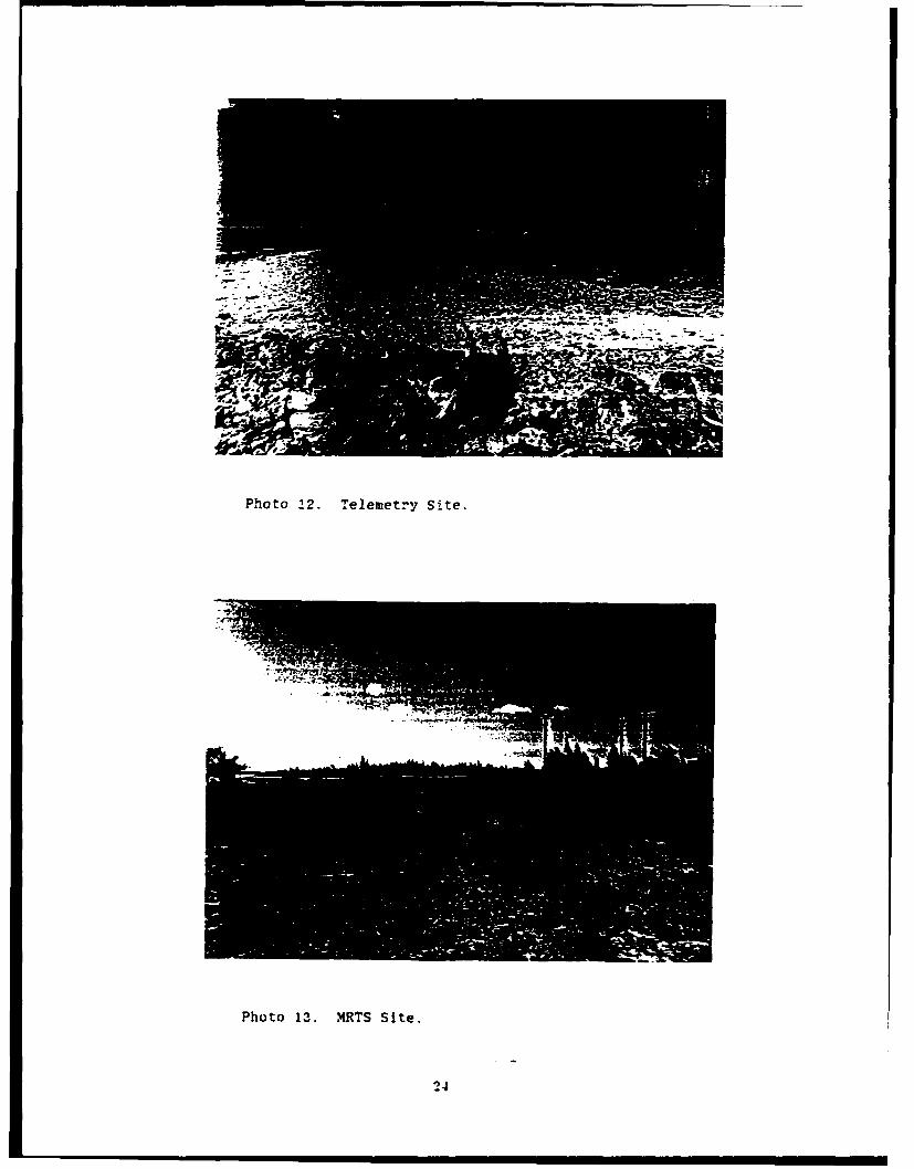
Ph'oto 22. Telemetry Site.
Photo 13. MRTS Site.
24

Photo 14. Cat-predated Sooty tern chick.
Photo 15. Bird bones found in abandoned bunker.
25

APPENDIX B
TRIP REPORT-WAKE ATOLL (APRIL 4-11, 1989)

United States Deparment of the Interior
FISH AND WILDLIFE SERVICE A1CAPACIFIC ISLANDS OFFICE
PO0 BOX 50167,l l
HONOULU. HAWAII 9685 1
June 1. 1989
Dr. Robert ReedEnvironmental Sciencesd DivisionOak Ridge National LaboratoryP.O. Box 2008Oak Ridge, Tennessee 37831-2008
Dear Dr. Reed,
Enclosed is a report of the wildlife present on Wake Atoll during myvisit there in April. This is the report that Stewart Fefer mentioned inhis letter of April 27. It covers areas other than the proposed StarlabProject sites. Copies of this report are being sent to John Edwards and DanEvans.
If you have any questions or comments, please give Stewart Fefer ormyself a call at (808) 541-1201.
Sicrely,~
Craig RowlandBiological Technician

TRIP REPORT - WAKE ATOLLApril 4 - 11. 1989
byCraig M. Rowland
INTRODUCTION:
The primary goal of this trip was to conduct a survey of proposedconstruction sites for the Starbird Project. The Starbird Project is aplanned test of Strategic Defence Initiative (SDI) technology using a lasershot from the space shuttle to track the launch of a land-based missile.The construction sites surveyed on this trip were proposed launch sites andother support facilities. Funding for this survey was provided by the AirForce and the results will be used to complete an environmental assessmentof the project. Detailed results of the project site survey can be found ina separate report entitled 'Biological Survey of Starbird Project Sites'.
In addition to the above work, a complete survey of the animal lifeatoll was conducted and the results are reported herein.
The results of a survey of the marine habitat will be compiled in areport by Eugen.. Nitta of the National Marine Fisheries Service
This reported may be cited as: Rowland, Craig M., 1989. Spring Surveyof Wake Atoll. U.S. Fish and Wildlife Service Administrative Report.
PERSONNEL:
Craig Rowland. Biological Technician - USFWSEugene Nitta. Fishery Biologist -NMFS

1TINERARY:
April 4: 0710 Leave Hickam AFB via MAC flight.April 5: 1450 Wake time arrive Wake after stopping at
Kwajalein enroute.April 6: Taken on tour of Wilkes and Wake Islands by Lt.
Bryan Scott. USAF. Started survey of Starbirdproject sites.
April 7: Conducted complete survey of Peale Island.April 8: Conducted surveys of marine habitat in area south
of harbor and areas inside edge of the western side of theatoll reef, between Wilkes and Peale Islands.
April 9: Conducted complete survey of Wilkes Island andcompleted surveys of Starbird project sites.
April 10: Worked on report and photographed Starbird projectconstruction sites.
April 11: Worked on report and surveyed abandoned housingand golf course areas for nesting s-abirds.
April 12: 1000 Depart Wake Island on Air Force KC-10.April 11: 1645 Honolulu time arrive Hickam AFB.
SURVEY METHODS:
All seabirds known to nest on Wake Atoll were searched for. Individualnests were counted for the following species: brown booby, masked booby andred-footed booby.
The number of nesting sooty terns was calculated by pacing off the areaof the colony, estimating the percent of this area occupied by adults andchicks and estimating the density of coverage. Most of the chicks couldfly, so it was not possible to get an accurate measure of density; anestimate had to be made. The sooty tern colonies of Peale Island wereparticularly difficult to estimate due to the patchy distribution of birdscaused by trees and irregular topography. An even more difficult colony otestimate was the colony inland of Flipper Point on Peale Island. The shapeof the colony was so irregular and the birds (chicks and adults) so flighty.that it was not possible to pace off the circumference of the colony withoutall the birds taking flight.
Peale and Wilkes Islands were surveyed by walking back and forth acrossthe islands so that the entire area was covered. Sooty tern colonies werecircumnavigated. Wake Island was surveyed by driving as much of the islandas possible and walking through areas not accessible to automobiles.
2

RESULTS:
Peale Island:
Sooty tern Sterna fuscataSooty terns were the only nesting birds observed on Peale
Island. They were found on Flipper Point ( 100,000 chicks estimated), in anarea inland of flipper point ( 3.000 chicks estimated) and in an area northof the road, Just west of the first beach house area ( 40,000 chicksestimated). These areas are marked A, B and C respectively on the map(figure 1.). As stated in the methods section, the sooty tern colonies ofPeale Island were difficult to estimate due to the uneven distribution ofbirds anid he fact that almost all the chicks were able to fly, makingdensity measurements impossible. Keeping these conditions in mind, thefigures mentioned above should be thought of as very rough estimates. About60 adult sooty terns were seen roosting on a small sand island, off the tipof Toki Point. This islet was investigated and no nests were present.
Other bird species:The following species were seen on Peale Island but were not nesting.
Brown noddy Anous stolidus - 18 roosting on a structure offshore.northwest of Flipper Point.
Red-tailed tropicbird Phaethon rubricauda - Birds seen in courtshipflight, three on windward side of island, two near Flipper Point.
White tern Gywis alba - Four flying around the tops of ironwoodtrees.
Great frigatebird Freata minor - Seven juveniles seen flyingoverhead.
Wandering tattler Heteroscelus incanus - Two seen feeding along theshoreline.
Feral cat Felis catusCat tracks and droppings were seen near the sooty tern colonies. There
are many abandoned structures on Peale Island that are sure to provide goodcover to feral cats.
Hermit crabsThese large orange hermit crabs were seen in great numbers all over the
island. They were usually found In abandoned structures or at the base oflarge trees. Under one Pisonia tree (Pisonia grandis), 20 hermit crabs,two to three inches across were found in an area of about one square meter.
3

Wake Island:
Wake Island is the most developed island of the atoll and the islandwith the most human activity. This might account for the paucity of nestingbirds here. In spite of the human activity, much of the habitat appears tobe suitable for red-tailed tropicbird and white tern nesting. These specieswere not nesting at the time of the survey, so it is unclear if this habitatis utilized.
The dump at Peacock Point is in an area exposed to strong winds, anddue to minimal coverage of refuse, provides good opportunities for plasticdebris to blow into the ocean (see photograph 2).
Pigeons Columba livia - The only nesting birds found on Wake Island werepigeons that were being kept as pets by some of the contract employees.28 adult pigeons were observed roosting on a pigeon coop from which thesound of begging chicks could be heard (see photograph 3).
Chicken Gallus ga§lus- At the same house, 14 chickens were found living ina pen.
White tern Gwis alba - White terns were seen flying around ironwood treesat many locations on the Island, but no nests were found and nocourtship behavior was observed.
Laysan albatross Diomedea immutabilis - Two laysan albutross were seen andphotographed flying over Peacock Point. The area where a Laysanalbatross nest was said to have been located last year. wasinvestigated but no signs of a nest were seen. A map of this locationcan be found in figure 2 so that on future trips, this area can besurveyed for any sign of nesting. A photograph in the Wake IslandMuseum, of the old Pan Am Hotel in 1936, shows an adult laysan albatrossand a number of downy albatross chicks on the lawn.
White-tailed tropicbird Phaethon lepturus - one seen in flight near thewest end of the runway.
Red-tailed tropicbird Phaethon rubricauda: - Four birds were seen incourtship flight over the missile storage building near Peacock Point.
Lesser golden-plover Pluvialis dominica - Lesser golden-plovers wereabundant at the many open grass fields on this island.
Feral cat Fells catusQuite a few cats were seen on Wake Island. Cat food as well as dogfood Is sold in the local store and many people keep cats as pets orfeed feral cats.
Dog Canis famillarlsThere are two dogs on Wake. one Is a pet and the other feral, but bothare free to wander the atoll at will.
4

Wilkes Island:
Sooty terns, brown boobies, red-footed boobies and masked boobies werefound to be nesting on this island.
Sooty tern Sterna fuscataSooty terns were nesting in the vortac field at the west end of the
island. They occupied an area (estimated by pacing two sides of the colony)of approximately 48,000 square meters. Similar to the sooty terns on PealeIsland, the chicks on Wilkes had fledged or were about to do so. They allcould either fly or run away if approached, making an accurate measurementof density difficult. A rough estimate of 250,000 chicks was made.
Brown booby Sula leucofasterBrown boobies were nesting around the western perimeter of the vortac
field at the west end of Wilkes. A total of 106 nests were found in threegroups with a few nests scattered between the groups (see figure 3). Thecontents of these 106 nests were:
13 - eggs (either 1 or 2 per nest)2 - chicks with down just appearing on back
(stage 2)7 - chicks with down beginning to cover entire
body (stage 3)12 - chicks all downy, approximately half adult
size (stage 4)19 - chicks all downy, approximately adult size (stage 5)25 - chicks with primaries and retrices visible,
scapulars not present (stage 6A)28 - chicks with scapulars visible and down still
present on back (stage 6B)
Masked booby Sula dactylatraTwo masked booby nests were found at the northwest perimeter of the
vortac field (see figure 3). One contained a stage 6B chick (scapularsvisible and down still present on back) and the other a stage 9 chick (fullyfeathered).
Red-footed booby Sula sulaA total of 41 red-footed booby nests were present in the tournefortia
trees at the northeast edge of the vortac field (see figure 3). Of these 41nests, three were stage 4 (all downy, approximately half adult size), twowere stage 5 (all downy, adult size) and the contents of the remaining nestswere unknown due the fact that they were located high in the trees and nochick could be seen in the nest. It is assumed that these nests containedeggs or small chicks that were not visible beneath the adult on the nest.
5

Great frigatebird Fregata minor40 great frigatebirds were seen roosting near the red-footed boobies
and flying overhead. Approximately 30 of these birds were juveniles. Nonests were seen.
Feral Cat Felis catusMany freshly killed sooty tern chicks were found in various locations
throughout the colony. These were undoubtedly killed by feral cats (seephotograph 4). Cat tracks and droppings were observed around the colony andthe bones from at least two different species of birds were found inabandoned bunkers. A healthy kitten was seen running through the vegetationon the perimeter of the colony.
RatsA rat was seen in the Tribulus of the vortac field and rat predated
sooty tern eggs were found nearby.
RECOMMENDATIONS:
The problems caused by introduced species need to be given attention toavoid possible depletion of wildlife populations. A naturally occurringdownswing in a population, combined with the stress caused by introducedspecies could have dramatic results. The stress caused by introducedspecies is in the form of constant predation pressure by cats and rats,disruption caused by dogs and possible transuittion of diseases by chickensand pigeons. It is recommended that a Fish and Wildlife Management Plan beproduced for Wake Atoll. This plan would address objectives and methods forpreserving and enhancing fish and wildlife resources on the atoll. It isrecommended that this plan be produced in FY 1990.
6

Photo 1. Wake Atoll.
" I I I I II I II V I k ~ "
Photo 2. Peacock Point Dump.
7
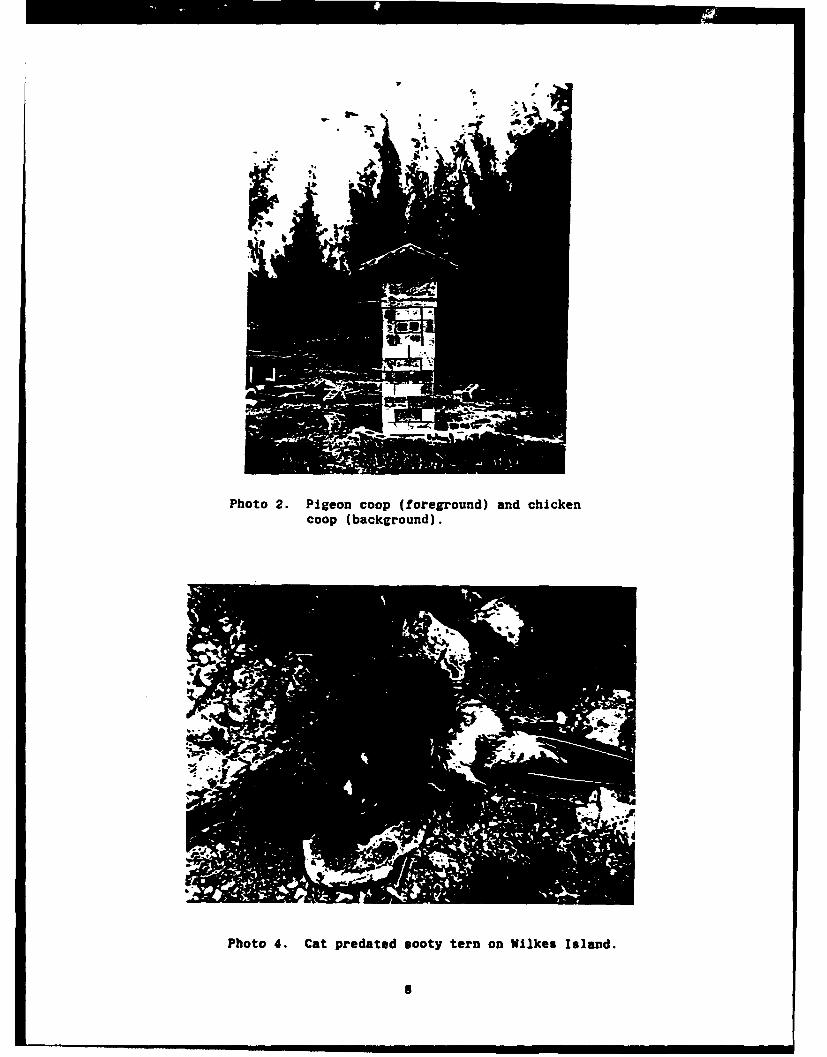
w V
Photo 2. Pigeon coop (foreground) and chickencoop (background).
Photo 4. Cat predated sooty tern on Wilkes Island.
8

--
- ---------------
.1674A4
4--
I [ 7 I-A
-'s
doSvI
fsMs
__D_ -J

z-
- . 2 0- %
>'-i-
LL--

APPENDIX C
SEA TURTLE ASSESSMENT AT WAKE ISLAND

U.S. DEPARTMENT OF COMMERCENational Oceanic and Atmospheric AdministrationNATIONAL MARINE FISHERIES SEaVICESouthwestRegion * Pacific Area Office2570 Dole St. 9 Honolulu, Hawaii 96822-2396
May 5, 1989 F/SWR14:ETN
Mr. John R. EdwardsU.S. Air Force Space Division/DEVP.O. Box 92960Los Angeles AFB, CA 90009-2960
Dear Mr. Edwards:
Enclosed is the Trip Report/Sea Turtle Assessment for Wake Islandas requested by the U.S. Air Force to aid in preparation of theEnvironmental Assessment for the STARLAB program. One originaland 20 copies are provided. One copy with photographs has beensent directly to Mr. Rob Reed at the Oak Ridge NationalLaboratory per your instructions. Although a one time survey canproduce only limited information, it should assist the U.S. AirForce in their e-vironmental evaluations and provide the basisfor any future turtle assessment work at Wake Island. Pleasecall me at (808) 955-8831 if there are any questions.
Sincer ly yours,
Eugene T. Nitta
Protected Species Branch
Enclosure
cc: Mr. Rob Reed, ORNL (w/enc.)
S!

SEA TURTLE ASSESSMENT AT WAKE ISLAND
Prepared for the U.S. Air Force Space Division/DEVin support of the STARLAB Program
Eugene T. NittaProtected Species Management Branch
Pacific Area OfficeSouthwest Region
National Marine Fisheries Service
May 1989
SEA TURTLE ASSESSMENT AT WAKE ISLAND
Introduction
During early discussions concerning the potential environmental
impacts of the Starbird Project at Wake Island, the presence of
listed sea turtles at Wake Island was pointed out to the U.S. Air
Force and U.S. Army. On the basis of available information it
could not be determined whether or not consultation under the
Endangered Species Act of 1973, as amended, would be be required
for the proposed Starbird Project. After reviewing environmental
assessments developed by the U.S. Air Force and U.S. Army for
Starbird, NOAA Fisheries recommended that an on-site inspection
be conducted at Wake Island to attempt to document the presence
of listed sea turtles, and the availability of suitable forage
and nesting beaches.
To carry out the recommended survey, the U.S. Air Force provided
transportation and per diem costs for a biologist from NOAA
Fisheries to travel to Wake Island during the same time as a
biologist from the U.S. Fish and Wildlife Service (FWS) was to
conduct migratory seabird surveys. This work was conducted at
Wake Island from April 5 through April 11, 1989. Support was
provided by Detachment 4, 15th Air Base Wing, Hickam Air Force
Base and Intelcom, the service contractor for Wake Island.
Backaround
Wake Island is a coral atoll, located midway between Guam and
Hawaii at lat 19*18' N, long 166038' E (Bryan 1959; Banner et al.
1969; Gooding 1971; Figure 1). The atoll consists of three
1

islets, Wake, Wilkes, and Peale, with a total land area of
approximately 6.5 km2 (2,600 acres). The use of Wake here refers
to the entire atoll, while Wake Island will refer to the islet.
All of the islets are connected by bridges or causeways. Wake
Island proper is the largest of the three islets with a 10,000
foot long runway, refueling and support facilities, and quarters
for the civilian contractor workforce and U.S. Air Force
administrators (Bryan 1959). The three islets form a "V" with
the open end facing northwest enclosed by a reef (Figure 2). The
atoll is about 7.2 km long from northwest to southeast and about
3.2 km wide. The total area of the lagoon is about 9.1 km2 with
a maximum depth of about 3-4 m (Gooding 1971).
Wake has a long and interesting history, from its initial
recorded discovery in the 16th century through its role in World
War II. It is well documented in other sources and reference
should be made to them for detailed information (Bailey 1951;
Bryan 1959).
Physical Description
Wake is a typical coral atoll with a fringing reef surrounding a
lagoon and three major islets enclosing the lagoon on two sides.
The reef fronting the islets is composed of the typical
structures of a tropical coral reef including the outer slope,
reef front, and outer and inner reef flat. The intertidal zone
is characterized by raised platforms of consolidated limestone,
behind which the seaward beach begins.
2

The reef which closes off the lagoon to the northwest is wide and
has no passage for even a small boat. The reef is wider on the
north and northwest and narrowest on the south of the atoll. The
northeast trades promote high energy wave action on the east and
northern faces of the reef.
Beaches
The composition of seaward beaches range from a combination of
hard limestone benches and medium sized limestone cobble to fine
coral sand. The lagoon beaches are coral sand or limestone
cobble interspersed with spurs and points of hard raised
limestone. Extensive, shallow sand flats characterize the inner
lagoon shoreline at the base of the "V" of Wake.
The seaward beaches were surveyed by walking the perimeter of the
islands. Beginning at Toki Point on Peale Island, the beach at
the Point consists of coral sand grading into small gravel and
larger cobble moving southeast toward Wake Island. The beach
slope also becomes steeper. Just before the vegetation line
begins at the beach crest there is a zone of small coral rubble
that appears to be deposited by storm surge. The beach crest is
usually covered with grass interspersed with shrubs and trees such
as heliotrope (Tournefortia argentea), naupaka (Scaevola
sericea), and beach morning glory (Ipomea tuba) (Fosberg 1959).
About midway along the north shore of Peale Island there is a
concrete seawall at the beach crest, approximately 200-250 m
long. The beach here is characterized by a raised limestone
bench backed by a cobble beach. From the end of the seawall to
the bridge between Peale and Wake Islands the beach becomes
3

sandier with less cobble and coral rubble. A wide sandy inlet
and beach just before the bridge with scattered ironwoods
(Casuarina sp.), inland appears to be suitable for turtle
nesting if high enough out of the high tide line. Further east,
closer to Wake Island, fishing shacks have been built on'the
shoreline by the residents of Wake. There is a sandy beach along
the margin of the channel between Wake and Peale Islands. A
wide sandy shoal fronts the channel and is exposed at low tide.
The coral sand beach gives way to a coral rubble beach of small
to medium sized cobble. The beach slope increases in steepness
toward Heel Point on Wake Island. The beach crest is vegetated
with grass, naupaka, heliotrope, and ironwood.
The intertidal zone is characterized by a hard, consolidated
limestone bench, raised in some areas with boulders scattered on
the bench and reef flat. From Heel Point southeast toward
Peacock Point, the beach consists mostly of small limestone
rubble over sand. The intertidal zone is dominated by a raised
limestone bench, undercut on the landward side of the beach.
Where there are breaks in the bench, open patches of sandy beach
occur, particularly opposite the abandoned antenna field. From
Peacock Point to the NOAA weather instruments, the beach consists
of a hard black limestone bench backed by a rubble beach. A
concrete revetment runs about half the length of the runway up to
the tank farm at the end of Wake Island.
The beach from the harbor channel to the submarine channel is
much the same as along the south shore of Wake Island. A hard,
4

blackened, limestone intertidal bench, uneven in many areas with
storm-deposited limestone boulders and horizontal and parallel
cuts characterize this section of beach. The upper beach
consists of coral sand and small coral rubble up to the beach
crest. Where it exists, the vegetation is similar to the rest of
the atoll. The reef flat here is very narrow in comparison to
other areas of the atoll. A few of the isolated coral heads
offshore of the reef face appear to have some macroalgal growth,
but the species or percentage cover could not be determined.
At Kuku Point the upper beach consists of coral rubble; the
intertidal zone and reef flat is characterized by limestone
boulders overlaying a hard irregular limestone bench. The width
of the reef flat narrows considerably from west to east. From
Kuku Point on Wilkes Island to Toki Point on Peale Island, a wide
reef closes the lagoon.
In general the lagoon beaches of the three islets are sandier and
less rocky than the seaward beaches. On Wilkes Island and Wake
Island some rocky outcroppings and scattered boulders with cobble
beaches occur. The beaches on the lagoon side of Peale Island
are composed mostly of coral sand and small-sized coral rubble.
The slopes are generally not steep and grade into a vegetation
with no discernible beach crest on Peale Island. Some of the
beach areas on Flipper Point and near the old Pan Am Hotel site
might be suitable for green turtle nesting because of the
composition of the sand/humus substrate.
On Wilkes Island the lagoon beaches face windward and have fairly
steep slopes accentuated by wartime modifications such as berms
5

and tank traps. The unfinished channel shows evidence of wave
erosion quite high up on the shore on the lagoon side. None of
the areas surveyed on the lagoon side of Wilkes Island or Wake
Island appear to have the requisite factors for turtle nesting.
Sea Turtle Resting Habitat
Resting habitat for green turtles is generally found in proximity
to their foraging areas, often within 1,000 m or less. These
underwater sites include coral recesses, the undersides of
ledges, depressions on the bottom, and caves, that are generally
free of strong currents or tidal action. In Hawaii these resting
areas are usually found in waters >20 m, but probably not deeper
than 50 m (Balazs 1980). On the southern edge of the atoll at
Wake Island the reef face drops off to a short sand shelf at
about 8 to 10 m, beyond which, the bottom drops off steeply to
oceanic depths. It appears that any turtle resting habitat
would be associated with the structures of the outer reef face
and deeper patch reefs. Strong wave and swell conditions
precluded small boat surveys of the reef on the windward side of
the atoll during this trip.
Sea Turtle Food Sources
Samples of macroalgae were collected from around Wake Island
atoll during the beach surveys and during small boat surveys to
the south shore and in the lagoon. The diversity and biomass of
macroalgae at Wake in general appears to be much lower than in
areas such as the Hawaiian Islands or the the northern Marshall
Islands (Taylor 1950; Balazs 1980). Fleshy green and red-brown
6

algae are almost nonexistent in the intertidal zones of the
atoll. The bulk of the growth probably occurs subtidally on the
outer reef face and in the spur and groove structures of the
reef. The reef flat may also support some growth of genera such
as Dyctosphaeria, Halimeda, and Caulerpa (Magruder and Hunt
1979; Table 1.). In Bryan (1959) there is a record of
Dyctosphaeria favulosa from Bailey and Harvey (1874) in U.S.
Exploring Expedition, Botany Cryptogamia 17:153-192. Of the
species collected at Wake during this survey, Caulerpa racemosa
and Dictyota acutiloba are the only ones on which green turtles
have been reported to feed (Balazs 1980). They were found on the
south shore of Wake Island off the outer reef face on a submerged
coral head. This area is also where most of the recent turtle
sightings for the atoll have been made.
Turtles have also been reported in the lagoon, presumably
feeding. A few days before our arrival on Wake a turtle was seen
by one of the civilian workers under the bridge between Peale and
Wake Island heading seaward. There may be some source of food
within the lagoon for turtles such as Caulerpa racemosa on the
scattered coral heads, which were not surveyed, but little else.
There was no evidence of sea grass or marine angiosperms, which
is consistent with observations from the northern Marshall
Islands of Rongelap, Rongrik, Bikar, and Taongi (Taylor 1950).
High winds and reduced visibility in the water resulted in poor
conditions for underwater and boat surveys in the lagoon, and
kept observations to a minimum. It should-be noted that there is
a probable seasonal variation in abundance and distribution of
7

the algal resources of Wake Island, which a one-time survey
cannot address.
Sea Turtles
According to Marshallese tradition Wake was used in the past as
a place to collect birds and turtles. The Marshallese refer to
it as Enen-Kio (Carter 1984). If turtles were abundant enough
to be worth a trip of several hundred miles by canoe to harvest,
then the turtle population at some point must have been fairly
substantial.
Recent information regarding sea turtles at Wake Island is
sparse. Balazs (1979) noted that both immature and mature green
turtles (Chelonia mydas) were "...regularly observed foraging in
the lagoon and along the outside perimeter of the atoll." During
the late 1960's and into the 1970's polished turtle shells were
given as gifts to dignitaries and retiring personnel at Wake (G.
Balazs, NOAA Fisheries, Honolulu Laboratory, pers. commun.).
Interviews with the current residents of Wake indicate that the
sea turtle population at Wake is very small and that nesting does
not occur. There is, however, apparently enough forage to
support the small number of sea turtles observed around Wake,
even accounting for seasonal variation in algal abundance.
Individual animals are occasionally seen off the south side of
the atoll during fishing trips or while conducting routine
maintenance on the mooring buoys. No green turtles were seen
during the period of our observations. The endangered hawksbill
turtle (Eretmochelys imbricata) may be an occasional visitor, but
8

there are no confirmed records from Wake and none were observed
during this survey.
Marine Mammals
Stranding records and anecdotal accounts of small whales and
dolphins from Wake indicate the presence of spinner dolphins
(Stenella longirostris) and beaked whales (Ziphius cavirostris).
Pacific bottlenose dolphins (Tursiops truncatus Silli) may also
occur, but there are no records of this species from Wake.
Because of the current configuration of the atoll and entrances
into the lagoon it appears unlikely that any small cetaceans
could easily enter the lagoon. An endangered Hawaiian monk seal
(Monachus schauinslandi) was observed hauled out on the south
shore of Wake Island in 1987. The animal had been tagged as a
weaned pup in 1984 at Pearl and Hermes Reef, Northwestern
Hawaiian Islands. It has not been seen since that initial
sighting (Doris Alcorn, NOAA Fisheries, Auke Bay Laboratory,
pers. commun.)
Other Marine Species
The species composition of marine fish and invertebrates found at
Wake is probably similar to that found at the northern atolls and
islands of the Marshall Islands. A list of fish families and
species identified at Wake during the grounding of the tanker,
R. C. Stoner and subsequent oil spill is provided in Table 2.
Surveys conducted in 1967 found the highest diversity and
greatest number of fish on the outer reef face, and that the
lagoon supported a large population of fish (Gooding 1971). A
brief snorkel survey of the R. C. Stoner wreck site and the outer
9

reef face reconfirmed these earlier observations.
Summary and Conclusions
While this extremely limited survey in no way provides a
definitive description of green turtle foraging and resting
habitat and potential nesting habitat, traditional Marshallese
lore indicates that some level of abundance sufficient to support
a subsistence harvest was present at one time. There is no
evidence of such a population now or in the recent past.
Although speculative, overharvesting of turtles for food by
Japanese bird poachers for the far east millinery trade at the
beginning of the twentieth century may have reduced the turtle
population considerably. Had there been any historic nesting
sites on any of the islets at Wake, extensive habitat
modification to accommodate and support early transpacific flying
boat service in the 1930's and later, wartime construction and
destruction during World War II would have essentially rendered
it unusable by turtles. Remaining areas that may be potential
nesting sites are used now extensively for recreational
activities. The turtles currently found at Wake appear to be
just a small remnant foraging population of relatively young
animals.
As described in the "Preliminary Draft Description of Proposed
Starlab Experiment and Maps of Proposed Construction" sites for
the Starlab Project at Wake are sufficiently inland and
removed from any potential sea turtle habitat (Figure 3).
Except for the highly remote possibility of contact with missile
10

components from a launch accident, sea turtles are not likely to
be affected by the project. The impact of the Starbird Project
at Wake Island on the small number of resident individual animals
is likely to be negligible.
Any marine mammals that may be found at Wake Island are not
likely to be affected by the proposed Starbird Project.
11

Table 1. Some macroalgae collected at Wake Island.------------------------------------------------------------Dyctosphaeria sp.Halimeda opuntiaCaulerpa serrulataCaulerpa racemosaDictyota acutilobaBornetella sphaericaLyngbya sp.(?)
12

Table 2. Some of the fishes identified from Wake Island(From Gooding 1971).
Serranidae (groupers) - At least two other unidentified speciesCephalopholis argus
Holocentridae (squirrelfish)Holocentrus lacteoguttatus
Scaridae (parrotfishes) - At least two other unidentified speciesScarus perspicillatusScarus sordidus
Mullidae (goatfish) - Unidentified
Acanthuridae (surgeonfishes)Acanthurus achillesAcanthurus nigricansAcanthurus triostegusCtenochaetus striatusZebrasorna flavescensZebrasoma veliferum
Chaetodontidae (butterflyfishes)Centropyge flaxnmeusChaetodon lunulaChaetodon semelon
Balistidae (triggerfishes)Melichthys viduaRhinecanthus rectangulus
Scorpaenidae (scorpionfish)Pterois volitans
Diodontidae (puffer)Diodon hystrix
Muraenidae (moray) -Unidentified
Mugilidae (mullets) -Unidentified
Pomacentridae (daniselfishes)Abudefduf imparipennisAbudefduf sordidusPomacentrus nigricans
Priacanthidae (bigeye, scad) - One specimen found unidentified
Cirrhitidae (hawkfish) - Unidentified
Carangidae (Jack) - Unidentified
Labridae (wrasse)
Thalassoma uznbrostigma
13

laz % 9
cC~l
C L
oZ 00
C--4
06)
ui uzol
1* z -14

' K.'O/
PEALE
ISLAND
IT, N.-
WILKES
FACWIC MISSILEFACILrrY
ISLAND
NER HARBOR
INACH AREAEARED
CHANNEL BY I"
Ito.
I S L A N 0
UMDERýWATER42 SURVEY AREA
Figure 2.--Wake Island(From Gooding 1971).
15

OZU-4CL0
Wa- a
0I.
0 Z
-IL
.iiL.
!F. .4 V Z Htoc-.t -H V
e~g 41~j~j
iIj 0 cd . cc
0 40 w
/~~b wV~LI4
Li
14
16.

wake Island
Told. Point, Peale island looking east in the lagoon
17

North shore of Peale Island looking toward Wake Island
North shore Peale Island south of the seawall
18

North shore of Peale Island; east end of the island near thesooty tern colony
South side of Peale Island toward Flipper Point from thechannel between Wake and Peale
19

Peale Island near the old Pan Am Hotel site
Causeway and bridge between Wake Island and Peale Island
"20

North shore of Wake Island looking toward the old antenna field
South shore of Wake Island near launch site no. 1
21

Revetmuent -south shore of Wake Island
Lagoon side of Wilkes Island at Kuku Point
22

Lagoon side of Wilkes Island looking toward Starbird radarsite and old quarry
South of Kuku Point, west end of Wilkes Island
23
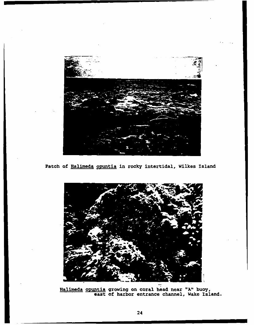
Patch ofHalimeda opuntia in rocky intertidal, Wilkes island
Halimeda opuritia growing on coral head near "All buoy,east of harbor entrance channel, Wake Island.
24

Halimeda opuntia and Gymnothorax javanicus fromthe outer reef face off the south shore of Wake Island
Halimeda opuntia and Caulerpa racemosa from thesouth side of Wake islard
25
References
Bailey, A.M., and R.J. Niedrach. 1951. Stepping stones acrossthe Pacific. Museum Pictorial. Denver Mus. Nat. History,Denver, CO. 64 pp.
Balazs, G.H. 1979. Status of sea turtles in the Central PacificOcean. In K.A. Bjorndal (ed.). Biology and Conservation ofSea Turtles. Smithsonian Inst. Press, Wash., D.C. pp. 243-252.
Balazs, G.H. 1980. Synopsis of biological data on the greenturtle in the Hawaiian Islands. NOAA-TM-NMFS-SWFC-7. NOAATechnical Memorandum. U.S. Dept. of Commerce, NationalOceanic and Atmospheric Administration, National MarineFisheries Service, Southwest Fisheries Center. 141 pp.
Banner, A.H., J.C. Nevenzel, and W.R. Hudgins. 1969. Marinetoxins from the Pacific II. The contamination of WakeIsland lagoon. Atoll Res. Bull. No. 122. Smithsonian Inst.Wash., D.C. 12 pp.
Bryan, E.H., Jr. 1959. Notes on the geography and naturalhistory of Wake Island. Atoll Res. Bull. No. 66. PacificScience Board, Nat. Acad. Sci. - Nat. Res. Council, Wash.,D.C. 22 pp.
Carter, J. (ed.). 1984. Pacific Islands Yearbook. PacificPublications, Sydney-N.Y. 557 pp.
Fosberg, F.R. 1959. Vegetation and flora of Wake Island. AtollRes. Bull. No. 67. Pacific Science Board, Nat. Acad. Sci. -Nat. Res. Council, Wash., D.C. 20 pp.
Gooding, R.M. 1971. Oil pollution on Wake Island from thetanker R. C. Stoner. Special Sci. Rep. - Fisheries No. 636.U.S. Dept. of Commerce, National Oceanic and AtmosphericAdministration, National Marine Fisheries Service. Seattle,WA. 12 pp.
Magruder, W.H., and J.W. Hunt. 1979. Seaweeds of Hawaii.Oriental Pub. Co., Honolulu, HI. 116 pp.
Taylor, R.T. 1950. Plants of Bikini and other Northern MarshallIslands. Univ. Mich. Press., Ann Arbor, MI. 227 pp.
26

APPENDIX D
SEABIRD SURVEY OF PROJECI STARBIRDCONSTRUCTION SITES ON WAKE ATOLL

-DEC, 14 2'8 03 ;:CEC :1. t$SE 0:S3-3CO .2 ý..
DEPARTMENT OF THE NAVYFACIO(C OIMSON
kAVAL F,.Qi.,T1E& C;NOIN'f•-WO COMMAND(IM, KAL•Ah. t4I)
PE~%L iAtsoc hv;A! s-AW30011015 4WSer 2632/122565! NOV io8
Mr. Jerry LeineckeComplex Refuge ManagerHawailan and Pacific IslandsU. S. Fish and Wildlife ServiceP. 0. Box 50167Honolulu. Hawaii 96850
Oear Mr. Leinecke
Enclosed is 4 copy of a Memorandum for the File documenting a survey forseabird nesting activities at constriction sites for the U. S. ArmyStrategic Defense Command's Project Starbird on Wake Atoll. The survey wasconducted by the Pacific Division, ,ftval Facilities Engineering Command'sFish and Wildlife Biologist from Octobor 25 to November 1, 1989.
NO seabirds were found nesting or us5ng any of the project sites, and therewere no wildlife concerns noted that would preclude clearing or constructionat any of the selected sites.
Should further assistance or information be required on this matter,PACHAVFACENGC(14's point of contact is Mr. T. Sutterfield at 471-3217.
Sincerely,
Fa¢i•is ftan~na•Dl~m
Encl:(1) PACNAVFACENGCOM Memio for the File
11015.4W 2432/56783 of 14 Nov 89
Copy to:ROI C PEARL (F-2)DCDRUSASDC (DASD-HTIF)v1SABW (LG DEEM)DET 4 15ABW

g. "%NDEPARTMEF T 0P Ti-E NAVY
NAVAL fACýýJIE! ,iNO COdMANO(MA KAL•UPA, pil
2432/S670314 Nov a9
MEM4ORANIDUM FOR THE FILE
Via:
Subj: SEABIRD SURVEY OF PROJECT STARBI.) COSTRUCTION SIT7S ON WAKE ATOLL
Ref: (a) Environmental Assessmeot f'or Project Starbird of Oct 87
Encl: (1) Wake Atoll Seabird Survey Project Starbird
1. In accordance with referance (e) the subject survey was perforamed onWake Atoll from 25 October to I Kove:mber 1989. The sites surveyed asdepicted on enclosure (1) were the radar and telemetry sites on WilkesIsland and the missile storage building, the payload launch supportbuilding, the pyrotechnic building, the missile assembly building, launchsites one and two, areas to be cleared i.nd grubbed for electrical trenching,buildings 1175 and 1176, and the ORTS site all of which were located on WakeIsland.
2. No protected seabird species were located on or within the areassurveyed for the project sites, and there are no fish or wildlife concernsthat would preclude clearing or construction at the selected sites. Theclosest seabird colony to any of the project sites was a red-footed booby(Sula sula) colony located approximittely 200 hundred meters west of thera-dr MTe on Wilkes Island.
3. An atoll-wide survey was performied to document and map, as depicted onenclosure (1), the seabird colonies on gake Atoll. The survey findings aresunmartzed as follows:
a. On Wilkes island, 274 great frlgatebirds (Frelat minor) werecounted sitting on old power lines .:rossing the unflTsuid-ca-Ene e; 148brown boobies (Sula leucogaster) were keginning construction of nests (twowere on eggs); "ro mas -•kbo•bies (Sul. dactatra) were on eggs; 48red-footed boobies were in the beac -•lltopeflournefortia 1.) (19 freshnests were occupied); 12 brown noddies (Anous stolduýs 'were sitting onrocks offshore; and numerous sooty terrs"_rna Týyhscata) were observedflying overhead. Lesser golden-plovers (PMvIals dominica) were co nmon inthe cleared VORTAC field and a lone cattle egrCt-TB!uul__c-uistbi.) was seen onthe western point of the island,
b. On the northwest point of Peale Island. approximately 10,000 sootyterns were present and a few eqgs were seen, and three white-tailedtropicblrds (Phaettion ef2r A) were seen flying overhead. On Wake Island,the only bird- seen weieIleT''r goldern plovers in grassy areas aroused tnerunways and oh the road shoulders, and a lone frcgatebird sitting on a powerpole near Peacock Point.

F 1 '-ea Ep,:17 A•OESPACE CORP 2 P. 4
SubJ; SEABIRD SURVEY OF PROJECT STARBIRIj L.ONSTRUCTION SITES ON WAKE ATOLL
c. No sea turtles were seen during -:his visit, and no evidence of seaturtle nesting was observed rn any of thie btehes visited.
d. Two dogs were seen near thc nmes hall or Wake Island, and numerousferal cats were observed on all three Islands.
4. Project Starbird should have mn'mal impact on the fish and wildliferesources of Wake Atoll.
T. SUTTERFIDFish and Wildlife Biologist
2

S...... P.5
"- D E C ,•4 e 9 9 : 1 7 A E-. _ P F . C O R P P .5 R . . _
E •:
woo
• "I ' 4
1 /
jI I I I I
0 ,
0~
-W ------- woo
q* o4 x
0 A*J It~ MU

APPENDIX E
DESCRIPTON OF SHORT WAVE ADAPTIVE TECHNOLO)GY EXPERIMENT

August 1990
APPENDIX E
The orbiting Starlab would parti•,pate in a Short Wave Adaptive Technology (SWAT) laserexperiment that has been developed at the Air Force Maui Optical Station (AMOS) in Hawaii(Fig. 2-11). Characteristics of the lasers used are given in Table E-1. The purpose of the SWATexperiment is to determine wavefront corrections to laser beams that are being distorted whentravelling through the earth's atmosphere. This experiment features a deformable mirror atAMOS whose shape can be modified in response to sensed, distorted beam wavefront shapes.The resulting beam, after passing through the atmosphere is a near-diffraction limited beam.
The experiment would employ three laser beams, two from AMOS pointed at Starlab, andone from Starlab pointed at AMOS. During the engagement between Starlab and AMOS, a blue(0.4880 pm) laser beam from SWAT would be pointed toward a retroreflector on Starlab. Thereflected signal would be detected at SWAT and its wavefront shape sensed. The sensed signalswould be used to correct the deformable mirror shape.
A green laser (0.5145 pm argon ion) laser would then be directed from AMOS toward theentrance aperture of the Starlab optical system. This laser beam's wavefront would have beencorrected by the deformable mirror. Starlab would acquire and track this green laser beam andalso measure "corrected" green beam characteristics of angle of arrival and centroid position.These measured data would be converted into digital signals that would be used to modulate theStarlab marker laser beam.
The red (0.6328 pm helium-neon) marker laser beam would be pointed toward the SWAToptical entrance aperture. The marker beam would be detected and its modulation data strippedfrom the beam. The demodulated data would then be used by SWAT as indications of in-spacegreen beam characteristics and also as signals to improve the tracking and focus of the SWATgreen beam. Similar tests involving the Relay Mirror Experiment (USAF 1987) have beenperformed successfully.
E-1

Table E-L. Laser dwacteristz for laes to be used in Starlab cperiments
On Shuttle At AMOSCharacteristic/Parameter Beacon Marker Illuminator U plmk
Type (material) Frequency doubled He-Neon Ar-ion Ar-ionNd-YAG
Wavelength 0.5321 pim 0.6328 jim .4880 im .5145 pIm(1.06 ILm)*
Mode of Operation Pulsed Continuous Continuous Continuous
Beam Energy at Laser 200 mJ/pulse >5.0 mW 4 W 10 mWAperture
Beam Diameter at 16 mm 17.4 mm 35 mm 340 mmLaser Aperture
Beam Divergence at 60 jIrad 60 prad 30 prad 1.7 pradLaser Aperture 50% point lie' point
Beam Energy off the 146 mJ/pulse 0.73 mWPointing Mirror
Beam Diameter off the 5.0 cm 80 cmPointing Mirror
Beam Divergence off the 23.07 pirad 1.9 jaradPointing Mirror l/e point
Maximum Energy/Power 9.2 mJ/cm2 0.37 jLW/cm2
Density at Laser single pulseAperture
Maximum Permissible 3.44x10"7 2.55 mW/cm2 7-55 mW/cm2 2.55 mW/cmrExposure to the eyeb J/cm2 multiple
pulse; 5xlO07
J/cm2 singlepulse
Pulse Width 25 nsec N/A N/A N/A
Pulse Frequency 20 Hz N/A N/A N/A
snared laser radiation is diverted by two beam splitters into a dump where it is absorbed before leaving the laser.
Approximetely 0.7 mJWl"se of the 1.06 #um WaVelnt radiation goo oUt.
bIRPA (Internatioal Radiation Protection Association). 1995. "Guidelines on Limits of Exposure to Lae Radiationof Wavelengths betwe 180 mm and 1 mm," repox of the International Non-Ionizing Radiation Committee of theIRPA, Health Phvsia 49.34-59.
E-2

APPENDIX F
ANALYSIS OF LASER EFFECTS

August 1990
APPENDIX F
F.1 INTRODUC'ION
The term "laser" stands for "light amplification by stimulated emission of radiation." A laserconverts light of mixed wavelengths into one or more discrete wavelengths of highly amplified andcoherent radiation. Thus laser light is usually only one color, and the light is contained in a "tightbeam". Lasers come in many different colors and intensities. In industry today, some lasers areused to cut or drill holes in metals. The use of low-power lasers for ground leveling andsurveying operations is fairly common today. The lasers to be carried aboard the Starlab arerelatively low powered, and would not burn or destroy objects on earth; in fact they could noteven measurably warm objects on the ground surface. Similarly, lasers to be used in the SWATexperiment at AMOS on the island of Maui are relatively low powered and present minimalpotential for hazard.
The principal reason to thoroughly evaluate potential effects of lasers is the possibleexposure to the eye or skin. Fortunately, several decades of biological studies have taken placeduring which the effects of light and laser light on the eye have become relatively wellunderstood. Adverse health effects of exposure to laser radiation are of particular concern in thevisible and near infrared (400 nm and 1400 nm) where retinal injury can occur, although adversebiological effects are theoretically possible across the entire optical spectrum.
Permissible exposure limits have been derived by a variety of organizations (ACGIH 1982,ANSI 1986, IRPA 1985). For the type of light produced by the Starlab lasers, these organizationshave arrived at essentially the same recommendations. A thorough review of the biologicaleffects reported from exposure to optical radiation from lasers was performed by the WorldHealth Organization (WHO 1982). Research summarized in the WHO report provides most ofthe scientific data base for the development of present day exposure limits developed by theabove named and other agencies.
Generally, when setting limits for exposure to a hazardous agent, various value judgmentsare made. Cost versus benefit is usually employed, including economic impact of controls to limitexposures. The development of guidelines for laser was based only on the scientific data. Noconsideration was given to economic impact or other nonscientific priorities (IRPA 1985). Thisappendix deals with the potential effects on or over territories belonging to the United States,foreign countries or territories, or over international waters, and has been based primarily onguidance from the IRPA.
F.2 LASERS TO BE USED IN STARLAB EXPERIMENT'S
Two types of lasers would be carried aboard the shuttle, 'markers" and "illuminators." Asecond laser of each type would be available as a backup. The SWAT experiment would involvethe most complex combination of lasers in that it would use two ground-based lasers located at
F-i

August 1990
AMOS, an illuminator laser (blue) and an uplink laser (green). Pertinent information related tothese four lasers is provided in Table 4.2-1.
To illustrate the type of analyses performed for the BOLT (USAF 1988a) and RME(USAF 1987; 1988b) and to understand important points about Starlab laser illumination of theground surface, simplified calculatins are provided in the remainder of this appendix. Theilluminator and marker lasers on Starlab are used in the examples. These examples use basictrigonometric relationships in conjunction with safety guidelines and regulations provided by theUSAF [AFOSH 161-10, (1980)], the ANSI (1986), and the IRPA (1985). To facilitateunderstanding, a variety of assumptions are made to keep the calculations straightforward. Forexample, although the laser light has a distribution of intensity across a propagating beam front,the light intensity is assumed to be the same across the defined beam diameter.
F.21 BEAM DWERGENCE
When laser light is coming from a great distance (b), it is assumed to be a point source.Even though every attempt is made to prevent laser beams from spreading out (i.e., diverging), alllasers have a measurable divergence. The beam spot of radius (a) is related to the beamdivergence (4) and the distance (b) (e.g., orbit altitude) by the familiar trigonometric relationship
tan @/2 = a/b
which for small values of 0/2 becomes
0/2 = a/b.
Therefore, to calculate the area of a laser beam projected from the Starlab-directly overheadonto the ground-only a knowledge of b and @ are required. The nominal altitude (b) is . 14 kmand the beam divergences off the pointing mirrors (1/2 point) are 23.07 prad and 1.9 prad for theilluminator and marker lasers respectively. For beams projected straight down from Starlab, thecorresponding illuminated areas on the earth are based on the area of a circle (A) or
A = x a2 = z (Ob)2/4;
therefore,
Illuminator Area = :/4 x (23.07 x 10' rads)2 x (324 x 10s cm) 2
= 4.4 x lW cm2
44 m2
F-2

August 1990
and
Marker Area = %/4 x (1.9 x 10i6 rads) 2 x (324 x t05 cm) 2
- 2.98 x 103 cm2
= 03 m.
The actual areas illuminating the earth's surface would vary in size and shape according tothe location of Starlab with respect to the target on the ground. At one calibration site that isnot directly under the flight path, there would be a crossing angle of 28" in addition to the anglefrom the zenith at which the beam was first transmitted. At the ground calibration sites, Starlabwould first send a signal when it came over the horizon and was at 60* to the zenith. At a zerozenith angle, the flight path would still not be directly overhead at one site. It would be 280 fromdirectly overhead. The compound angle from Starlab to this site is given by
e = Arctan (Tan2 28 + Tan2 zenith angle)'
which goes from 0 = 61 at a zenith angle of 60* to e = 28 at a zenith angle of 0°. As theStarlab continued its flight, the compound angle would increase again to 61* as it went over thehorizon out of sight.
As the laser projected on the ground, because it was not exactly overhead at one of thesites, the projected surface would actually be an ellipse instead of a circle. The size, shape, andorientation of the axes would change as Starlab passed from one horizon to another. The areailluminated at any time during the fly-over must be considered when examining the beamfootprint relative to the safe eye exposure limit. An approximate correction for the projection ofthe laser beam is made by considering that the circular laser beam projected at an angle on theground surface, would create an ellipse with the semiminor axis equal to the radius of the laserbeam circle (i.e., 0/2 x b) and the semimajor axis equal to the laser beam radius divided by thecosine of the angle of projection (i.e., 0/2 x b/cos 0).
F.22 Atmospheric attenuation
The last major factor which accompanies the description of laser illumination of the earth isthat of attenuation. Attenuation is a description of the collective absorption and reflectiveprocesses which decrease the beam's intensity. The inverse of attenuation may be consideredtransmission. In passing through the air, light may be absorbed or scattered by gaseous orparticulate materials in the atmosphere; thus, transmission is always less than 100%. Atmospherictransmission studies have resulted in the general relationship of transmission vs angle (0).Transmission is given by T = 0.68 1ý1, 4, and values vary from 46% at 60* zenith to 68% atr7zenith. The transmission factor is applied directly to the initial laser power coming from thepointing mirror because the transmission capacity of the atmosphere directly affects the fractionof laser light which ultimately gets through the atmosphere to illuminate the earth's surface.
F-3

August 1990
The overall energy/power density which would arrive at the calibration site that was notdirectly under the flight path wiykd be primarily a function of the atmospheric absorption and thedistance the laser beam had to expand. The energy/power densities of the two lasers at theground level at 600 and 0* to the zenith at this site are given by
Illuminator Energy Density = Laser energy x atmospheric transmission.
elliptical area covered by beam
Thus, the illuminator energy density (IED) becomes
IED (600) = 181 x 10 J/pulse x .68 1" 6n/4(23.07 x 10-" rads)2 x (668 km)2/cos 61
= 2.12 x 10" Joulescm2 pulse
LED (0) = 1.98 x 10⁻⁷ J/cm 2 pulse.
This latter value at zero zenith angle is only slightly below the MPE value of 3.44 x 10.7 J/cm2 forthe multiple pulse situation (ANSI 1986). At 60* to zenith when the laser was first turned on,the intensity on the ground would be about an order of magnitude below the MPE; the semi-major axis of the projected ellipse at 60* is 32 m and the semi-minor axis would be 15 m.
The result of these calculations is to show that, even when viewing the laser light directly inthe center of the beam, the light intensity would be below the MPE and thus would not beexpected to cause any harm. Likewise, anyone viewing the light from outside the beam wouldreceive much less exposure. Remembering that the laser light is only slightly diverging, the onlyway to see it if not viewed directly up its path from the space craft, is to see light scattered bymoisture or dust particles in the air. The amount of light seen this way would be reducedhundreds of times below that in the actual beam. Thus, even optically aided viewing would not behazardous for people not within the direct beam.
To determine an exclusion area outside of which safe viewing can take place even with 8Xbinoculars requires only a knowledge that an 8X optical assistance increases the light intensity byabout 64 times. Thus, for the case of Antigua, the illuminator energy density would be increasedfrom 2.12 x 10⁴ Joules/cm;-pulse to 1.4 x 10" Joules/cm 2-pulse. In order to reduce this energydensity to the MPE requires an additional area of 4 times the size of the 32 x 15 m ellipse isrequired. The resulting ellipse has semimajor and semiminor axes of about 60 x 30 m. Since theStarlab would be passing over one calibration site at a 27" angle, the 'safe* area on the groundwould consist of two ellipses (or footprints), one produced coming toward and one producedmoving away. They have a common geometric center and an angle of 27 between the long axes.The resulting area encompassed by a rectangle around the two ellipses is roughly 70 x 40m-essentially the area encompassed by the minimum inner laser safety fence (Fig. 2-7) and wellinside the outer laser safety boundary. Small differences resulting from pointing inaccuracies ofup to 3.9 lrad would amount to slight changes in the location of the footprint; however, even
F-4

August 1990
extremes in the event of pointing the beam in the wrong direction from the flare would becontained well within the outer laser safety boundary.
It is concluded that no hazard exists for unaided viewing of the laser beam under anycircumstances. Further, it would require viewing the last,, beam from within the footprint withbinoculars to exceed the MPE. This eventuality would be precluded by well-defined physicalboundaries. Conclusions based on this appendix are essentially identical to those described in thesafety analysis performed by members of the payload design team (PEP-20 1988).
F.3 REFERENCES
American Conference of Governmental Industrial Hygienists (ACGIH). 1982. Rationale for theThreshold Limit Values for Chemical Substances and Physical Agents in the WorkroomEnvironment, (ACGIH). Cincinnati, Ohio.
American National Standards Institute, Inc. (ANSI). 1986. American National Standard for theSafe Use of Lasers. New York.
International Radiation Protection Association (IRPA). 1985. Guidelines on Limits of Exposureto Laser Radiation of Wavelengths between 180 nm and 1 mm. Report of theInternational Non-Ionizing Radiation Committee of the IRPA Health Physics 49.341-359.
Lockheed Missile and space Corporation (LMSC). 1989. Inadvertent Exposure of Public orOrbiting Satellites to Laser Radiation. Payload Hazard Report LMSC/F025454-3G1, PhaseM, 1-12-89.
U.S. Air Force (USAF). 1980. Health Hazards Control for Laser Radiation. Air ForceOccupational Safety and Health Standard (AFOSH) 161-10. Headquarters, USAF,Washington, D.C.
U.S. Air Force (USAF). 1987. Environmental Assessment of the Relay Mirror Experiment(RME). USAF.
U.S. Air Force (USAF). 1988a. Environmental Assessment, U.S. Air Force BOLT Experiment.USAF (February 1988).
U.S. Air Force (USAF). 1988b. Supplement to Environmental Assessment, U.S. Air Force RelayMirror Experiment, Maui, Hawaii. USAF (June 1988).
World Health Organization (WHO). 1982. Lasers and Optical Radiation, Environmental HealthCriteria 23. Geneva.
F-5

APPENDIX G
LETTERS OF CONSULTATION

United States Department of the InteriorFISH AND WILDLIFE SERVICE
3100 University Blvd. SouthSuite 120
Jacksonville, Florida 32216
October 25, 1989
Colonel James E. Green, Jr.Chief, Test & Evaluation OfficeU.S. Army Strategic Defense CommandP.O. Box 1500Huntsville, Alabama 35807-3801
Dear Colonel Green:
This is in response to your October 5, 1989 letter, regarding the LightManagement Plan (LMP) for Launch Complex 20 at Canaveral Air Force Station.
On September 19, 1989, Mr. Earl Possardt, Southeastern Sea TurtleCoordinator, met on site with personnel from the U.S. Army StrategicDefence Command (SOC) to discuss Fish and Wildlife Service concerns aboutartificial lights at the launch complex and the potential for hatchlfngdisorientation and deterrence of nesting activities. Mr. Possardtsubsequently learned of two reports of hatchllng disorientation caused bylights at Pads A and B on August 8 and 9, in which an estimated 100hatchllngs died. This information was provided to lqr,..Pwl ofSDC.- .z-._
The LMP identifies the following lights associated with the launch complex
20:
Pad A - 2-1000 watt high pressure sodium lights on 40 foot pole
Pad B - 2-1000 watt high pressure sodium lights on 40 foot pole
Blockhouse - 1-70 watt wall mounted light
Payload Assembly Building 8-70 watt wall mounted lights
Security Gate 2-150 watt lights
Parking lot 2-250 watt lights
The pole mounted lights at Pads A and B will not be used during the nestingand hatching period (May 1 - October 31). In their place only portabletask oriented lights will be utilized. Lights associated with theblockhouse, payload assembly building, security gate, and parking lot areover 2,000 feet from the beach.

We believe that since the pole lights at Pads A and B will not be utilizedbetween May 1 - October 31 and all other lights are far enough from thebeach to prevent direct lighting, sea turtles will not be affected byoperational activities at Launch Complex 20. We recommend the followingmeasures to strengthen the lighting plan:
1) tasklights should be restricted to either hand held or those onportable stands less than 8 feet tall and 250 watts or less.
2) strict light conservation should be utilized for the operation ofall other lights associated with the Launch Complex 20 between May1 and October 31.
The Service is appreciative of the cooperative spirit of the Army inaddressing endangered species concerns. We remind the Army however, thatSection 7 Consultation under the Endangered Species Act of 1973, asamended, is required prior to initiating an action which may affectendangered or threatened species. For instance, the clearing of scrubhabitat for the upgrading of the security fence around the launch complexcould have adversely affected the threatened scrub jay. Fortunately thiswas not the case and we believe the Service concerns have been satisfied.With so many endangered and threatened species on Merritt Island werecommend you always check with this office prior to any action affectingthe environment. Early consultation will ensure requirements can be metwhile endangered or threatened species will not be put at risk.
Although this letter does not represent a biological opinion under Section7 of the Act it does fulfill your obligation under the Act and no furtheraction is necessary at this time. If modifications are made in thisproject, or if additional information becomes available relating toendangered species, initiation of consultation may be necessary.
Sincerely yours,
Field Supervisor

• 4.
FLORIDA DEPARTMEN T OF STATE \
IUSi~waY of Stas.DIVISION OFJi SitDIIIN FFSTORICAL RESOURCES ,j7
R.A. Cray Miidir4Tallaha&See Florida 32399-0250
(904) 48-1480
January 21, 1988 In Reply Refer to:
Louis D. TesdrMr. David Stone Historic Preservation 94pv.6550th ABG/DERP. (904) 487-2333Deprbmnt of the Air Force Project File No. 870655Patrick Air Force Base, Florida 32925
RE: July 10t 1987 letter and attachmemns and 9baequent TelephoneConservation with Louis D. Tesar of this Agency, Ojltural FesourceAssessment Request and Detemlination of Ineligibility Pequest,Complez 20 at Cape Canaveral Air !brce Bkevard County, Florida
Dear Wt. Stone:
In accordance with the procedures contained In 36 C.P.R., Part O0N("procedures for the Protection of Historic and iltursal Properties 3 ),w have reviewd the above referenced project for possible impact toarchaeological and historical sites or properties listed, or eligiblefor listing, in the wtional Register of Historic Places. It*authorities for these procedures are the rational Historic PreservationAct of 1966 (Public Law 89-665) an amended by P.L. 91-243# P.L; 93-54,P.L. 94-422, P.L. 94-458 and P.L. 96-515, and Presidential ExecutiveOrder 11593 ("Protection and ynhancenent of the Ql0tural Dwviromei•t).
We are sorry for the delay in our respose; howver, you requestarrived durinq a period of highwrk volume coupled with staff turnover.We have reviewed the conparative information whicb you provided in yourletter and supplemental tbelephone conversation on Oiplex 19 and Comples
* 20 and the proposed work to construct a new launch facility at Onmple20 to meet a portion of any SDI experiment concerning the effectivenessof space-based sensors.
WIN are aware of the fact that the 1984 study be Resourco Analyst, Inc.(RAI) of the cultural resburces identified several launch complexes,including Complexes 19 and 20, as potentially eligible for listirq Inthe National ILeister of Historic Plac-s (NRHP)/
In your letter you note that:
Complex 20 was const'ructed in 1957 to supot te" Titan :ILMissileProgran. It was the last of for ?itan II;la'-:nch complexes b'jild onthe Cape... The co-plexes ".e:e built frou the sv-e basic.des!;n,with Cm.pieves 19 a.-d 20 recelving the- most rocent nodIfica'.tins(FI-Jure 2, O'nple' 20 As-L:ld Dtawd-e, and Fig-its 3, 0o•rpie 19X-s-Bjlld Dr~w.N."'s) .
Arcka:.*'gcal Reva.h per-da CiL..ft Pmr+'pr- Hwiic frl-.&':on M.-l ?| Fl. #Ja U. " -IN4 l7 :Go Y4 .%J- 2e;.: 2C4 :0'i-% FO.A 1e0 56.4 *

Mr. David StoneJ-anuiry 21, 19A8Page Two
You further state that:
The integrity of the complex (20) has been compromised since it wasdeactivated in 1971. The majority of launch support components,including the service structure and umbilicial (sic) towr, havebeen removed for used at other complexes or salvaged through themilitary disposal system. In addition, no historically significantevents occurred at Complex 20 and the site is not associated withany famous individual.
Finally, w note that a National Park Services Congressional study team,concurrently with the RAI study, nominated six launch complexes,including Complex 19, for NRHP listing. Subsequently, those sixcomplexes and the Mission Control Center were given National HistoricLarnmark Status.
Since the integrity of Complex 19 is more intact than Complex 20, andsince Complex 19 of these two nearly identical properties was selectedfor NRIIP lU.tinq and inclusion ns a mition.l Historic tArwimark Property,we concur with the Air Force in concluding that Complex 20 is noteligible for listing in the National R"gister of Historic Places.Proposed project activities may therefore proceed at Complex 20 withoutfurther involvement with this agency.
If you have any questions concerning our cagnents, please do nothesitate to contact us. Your intprest and cooperation in helping toprotnct Florida's archaeological and historical resources areappreciated.
Sincerely,
gGeorge W. Percy, DirectorDivision of Historical Resources
andState Historic Preservation Officer
WP/ekjcc: Don George
Ron Anzalone
. United States Department of the Interior
FISH AND WILDLIFE SERVICE IN RE.PL REFR TO:
300 ALA MOANA BOULEVARDP.o BOX 50167 SEP 987
H ONOLULU. HAWAII 9685 SP O18
Colonel Samuel N. LiberatoreAir Defense Deputy for OperationsU. S. Army Strategic Defense CommandP. 0. Box 1500Huntsville, Alabama 35807-3801
Ref: DASD-H-TF
Dear Colonel Liberatore:
This responds to the referenced letter of August 26, 1987requesting our review of the draft environmental assessment forthe STARBIRD launch facilities project on Wake Island. Itincludes comments from both Refuges and Wildlife and ourEnvironmental Services offices.
We have reviewed those sections concerning resources within ourjurisdiction (animal and plant species) and concur with itsconclusions concerning endangered and threatened species; no suchspecies are in the vicinity of, or would be affected by, theproject. This assumes that uo listed species of sea turtles nestor bask on Wake; to the best of our knowledge, they do not.
The draft indicates that a survey for seabird nests in the areawill be conducted prior to construction. We request that such asurvey be conducted by a qualified biologist and that the work becoordinated with our Refuges and Wildlife office here. Mr. JerryLeinecke, District Supervisor for our refuge operations, shouldbe contacted in that regard. Further, to reduce the stress andharassment of seabirds, we request that personnel be generallyexcluded from the seabird colonies on Peale and Wilkes islands.
Although the remote possibility of a spent rocket falling on asea turtle at sea (a "one-in-a-million" chance, as stated in thedraft) is mentioned, the chances for and impact of a rocketexploding on the launching pad, adjacent land, or in the watersor on reefs surrounding Wake are not discussed. Such anoccurrence could have a devastating impact on both the speciesand the ecosystem on which they depend. These concerns should beaddressed in the final assessment.
Thank you for the opportunity to review the assessment.
Sincerely yours,
William R. Kramer
Deputy Project LeaderAMCMCA**Environmental Services
Pacific Islands Office
Save Energy and You Serve America!

U.S. DEPARTMENT OF COMMERCENational Oceanic and Atmospheric AdministrationNATIONAL MARINE FISHERIES SERVICE
, Southwest Region e Western Pacific Program Office"2570 Dole St. * Honolulu, Hawaii 96822-2396
September 24, 1987 F/SWR1:JJN
Colonel Samuel N. LiberatoreDeputy for OperationsU.S. Army Strategic Defense
Command - HuntsvilleP.O. Box 1500Huntsville, Alabama 35807
Dear Colonel Liberatore:
Subject: Draft Environmental Assessment (EA) for STARBIRDLaunch Facilities.
The National Marine Fisheries Service (NMFS) has reviewed thesubject Draft Environmental Assessment (EA) for Project STARBIRD,as requested in your letter of August 26, 1987. The proposedproject is part of the President's Strategic Defense Initiativeand is designed to test the ability of a sensor in space todetect and track ground-launched missiles immediately after theyare launched. We offer the following comments for yourconsideration.
We understand that project engineers have established therequirements for a launch site on the east coast of Florida andanother in the western Pacific. The Western Pacific ProgramOffice, NMFS has responsibility for living marine resources andtheir habitats in coastal waters of Pacific Islands under U.S.Flag. Consequently, we restrict our comments to the proposedwestern Pacific launch site.
Sites considered initially by the proponent in the westernPacific included Tinian, Roi-Namur, Barking Sands Hawaii, Guamand Wake Island. The site finally selected was Wake Island,because of its suitable location for launch trajectories, andbecause of potential disadvantages of the other sites, whichincluded environmental issues.
The EA states that Peacock Point on Wake Island has beenidentified as the specific launch site since a small, abandonedlaunch complex at the site can be adapted and expanded forSTARBIRD use. Consequently, the area has been previouslyaltered by construction, as well aa from scrap metal storage, awet garbage landfill, and two burn areas for disposal ofcombustible material.
The major concerns of NMFS are the potential for the proposedproject to impact nearshore marine resources. However, we feelthat the selected site and the planned erosion controls will
• ' . l l | I I I I

minimize any impacts to the marine environment. As stated in theEA, several threatened and endangered species (specifically thegreen and hawksbill turtle) and marine mammals (spinner porpoise)can be found in the lagoon or coastal waters of Wake. Again,because of the proposed site location and the other mitigatingmeasures, at this time we feel there will be no adverse impact tothese resources.
We appreciate the opportunity to comment on the western Pacificlaunch facility aspect of the proposed STARBIRD project at thisearly stage of development. Please keep us informed as theproject progresses. We look forward to receiving a copy of theFinal EA as soon as it becomes available.
Sincerely yours,
John J. NagtonActing Administrator
cc: F/SWR, Terminal Is., CAF/PR, Washington, D.C.FWS, HonoluluEPA, Region 9 (P-5)Corps of Engineers, Hon. District

405: SSH: sh
12 Sept 1989
MEMORANDUM
From: Shirley S. HiharaPACDIV Code 405, Civil Design Branch
To: Ron Vandagriff
USASDC (CSSD-H-TF)
Subj: USASDC Starbird Launch Complex, Wake Island
Ref: (a) 405:SSH:sh memo dtd 29 Aug 1989
Encl: (1) Advisory Council on Historic Preservation concurrence dtd30 Aug 1989
1. Ref (a) forwarded to you• a copy of PACNAVFACENGCOM letter Ser09P4/8812 dtd 7 Aug 1989. The letter was addressed to the AdvisoryCouncil on Historic Preservation requesting review of the DataRecovery Plan. Concurrence to the letter was made by the AdvisoryCouncil on Historic Preservation on 30 Aug 1989 and is provided to youas encl (1).
2. If you have any questions please call me at (808) 474-5374.
Copy to:
405: SSH
S ........ .. . . . • • i II II I I I I

'5. DEPARTMENT OF THE NAVYPACIFIC DIVISIONNAVAL FACILITIES ENGINEERING COMMAND
(MAKALAPA. HI)PE.AL HARBOR. HAWAII 96Wo-00 5750(P)
Ms. Claudia Nissley AlUG30j9ggAdvisory Council on Historic Preservation
SWestern Division of Project Review A0~'ISDRY CCI~c, I730 Simms Street, RP 450 IN H1511iC
co Golden, CO 80401 r
Dear Ms. Nissley: hg poL £ ýj"'
A planned construction project will take place within Wake Island Airfieldwhich has been designated the Wake Island National Historic Landmark, aproperty listed on the National Register of Historic Places (NRHP). Theproject, entitled 'U.S. Army Strategic Defense Command, STARBIRD LAUNCHCOMPLEX, Wake Island Airfield" provides modifications and construction asdescribed in the Data Recovery Plan (enclosure (1)). "
We believe, that in accordance with 36 CFR 800, that the proposed constructionin the vicinity of historical features which are contributing elements of theNational Historic Landmark would have no effect on the qualities for which theWake Island Airfield was designated a National Historic Landmark and listed onthe National Register of Historic Places, since they are to be avoided and amonitor shall be present during construction to ensure that they are notinadvertently damaged. We further believe, in accordance with 36 CFR Part800.9(c), that the affects of the proposed construction and modificationswithin the National Historic Landmark which might otherwise be found to :beadverse can be considered as being not adverse because archaeological orhistorical subsurface deposits which may be Identified during construction areconsidered of value for their potential contribution to archaeological andhistorical research and because this value can be preserved through theappropriate research conducted In accordance with applicable professionalstandards and guidelines. The proposed monitoring Is described In the DataRecovery Plan (enclosure (1)).
We request your review of the Data Recovery Plan at your earliestopportunity. Should you have any questions about this matter, please contactMs. Patricia Beggerly, Archaeologist, Pacific Division, Naval FacilitiesEngineering Command at 808/471-3088.
Sincerely,
.N. KAKU
Head, Facilities Planning DepartmentActing
Encl:(1) Data Recovery Plan
• ,IC0I

;II
-T F
L •, E. . - "" - "
DASD-H-TF
Dr. Tom KingAdvisory Council on Historic PreservationThe Old Post Office1100 Pennsylvania Ave, NWWashington, D.C. 20004
Dear Dr. King:
Request your comments on the enclosed draft environmentalassessment (EA) for STARBIRD launch facilities. This requestis made under the provisions of the National HistoricPreservation Act, the Endangered Species Act and the NationalEnvironmental Policy Act.
The draft EA has been prepared in accordance with ArmyRegulation 200-2 and contains information required by theCouncil on Environmental Quality Regulations. We believe thisdocument is sufficient for consultations under the EndangeredSpecies Act and the National Historic Preservation Act.
As we are committed to carrying out our responsibilitiesto preclude or minimize adverse effects on environmental andcultural resources, the planning for STARBIRD projects has beenconducted in an environmentally sensitive manner and variousaspects of the project already reflect accommodation ofenvironmental and historic preservation concerns.
Request your comments on the enclosed EA within 30 days.If you have questions, please contact Mr. Dan McCauley atAUTOVON 742-4624 or commercial (205) 895-4824.
Sincerely,
SAMUEL N. LIBERATOREColonel, Air DefenseDeputy for Operations
Enclosure

0United States Department of the Interior
FISH AND WILDLIFE SERVICEPACIFIC ISLANDS OFFICE
P.O. Box 50167HONOLULU. HAWAII 96850
OCT 2 5 199
Dr. John R. EdwardsEnvironmental Planning DivisionDirectorate of Acquisition Civil EngineeringHeadquarters Space DivisionLos Angeles Air Force BasePost Office Box 92960Los Angeles, California 90009-2960
Dear Dr. Edwards:
This replies to your October 19, 1989 request for our concurrence with yourdetermination that the Starlab Project will have little, if any, impact on anylisted species.
The project is to be located, in part, at the Air Force Maui Optical Stationon Mount Haleakala, Maui, Hawaii. In that three endangered species are knownto be found in the vicinity of the Station (Hawaiian hoary bat, Hawaiiangoose, and Hawaiian dark-rumped petrel), the Environmental Assessment enclosedwith your letter evaluated the potential that they would be affected by theproject; it concludes that the project would have little, if any impact onthem. Your letter further concludes that as a result of this determination,formal consultation as described in Section 7 of the Endangered Species Act isnot required.
We concur with your finding that the project would be expected to have little,if any, impact on any listed species. Formal consultation under Section 7 isnot required unless (1) significant changes are made in the scope or impact ofthe project, (2) new species are listed which may be affected by the project,or (3) additional pertinent information regarding the three species listedabove becomes available which demonstrates that the project may affect them inways or degrees not addressed in your Assessment.
Thank you for the opportunity to review the Environmental Assessment.
Sincerely yours,
Ernest KosakaField Office SupervisorOffice of Environmental Services

APPENDIX H
US. ARMY STRATEGIC DEFENSE COMMAND
LIGHT MANAGEMENT PLANVERTICAL LAUNCH COMPLEX 20
CAPE CANAVERAL AIR FORCE STATION
November 1989
PREPARED BY
TELEDYNE BROWN ENGINEERINGCUMMINGS RESEARCH PARK
300 HPARKMAN DRIVE NW.P.O. BOX 0700007
HUNTSVILLE, ALABAMA 35807-7007

U.S. ARM STRATEGIC DEFENSE COMMAND
LIGHT MANAGEMENT PLANVERTICAL LAUNCH COHPLEX 20
CAPE CANAVERAL AIR FORCE STATION
16 November 1989
PREPARED BY
TELEDYNE BRON ENGINEERINGCUMMINGS RESEARCH PAR300 SPAKMAN DRIVE NW.
P.O. BOX 070007RUNTSVILLE, ALABAMA 35807-7007

LIGHT MANAGEMENT PLAN
1.0 INTRODUCTION
1.1 PURPOSE
The purpose of this plan is to provide night specific guidelines
for the operation of lights at LC 20 by the U.S. Army Strategic Defense
Command. These lights are known to adversely aifect threatened and
endangered sea turtle nesting activity on the Cape Canaveral Air Force
Station (CCAFS) coastal beach. This action is required to reduce, to
the maximun extent practicable, the incidental take of the sea turtle
hatchlings resulting from disorientation caused by direct and indirect
lighting generated from various facilities on CCAFS. Development and
implementation of this plan is an obligatory action to comply with the
recommendations put forth by the U.S. Fish and Wildlife Service (USFWS)
during consultation with the Air Force in accordance with section 7 of
the Endangered Species Act of 1973, as amended. The directive described
in this Plan will be executed during the annual CCAFS sea turtle nesting
season (I May - 31 October). Sea turtle hatching usually does not occur
until late June. Research indicates that artificial lighting adjacent
to coastal nesting beaches deters nesting females from approaching the
affected section of beach; therefore, the initial effective date of the
plan was expanded to include early beach selection and next laying
activity. In addition, it is recommended that the directives included
in the operational plan be implemented throughout the year to facilitate
the Air Force Energy Conservation Program described in AFR 18-1, Air
Force Energy Management. Both programs, energy conservation and
endangered species protection, are mandated by federal law and all
directives., such as this plan, must be adhered to by all CCAFS tenants,
users and contractors.
1-1

1.2 OBJECTIVE
The objective of this plan is to reduce light sources that are
known to disorient sea turtle hatchlings migrating to the ocean after
emerging from the nest. Additionally, preliminary research indicates
that lights adjacent to sea turtle nesting beaches, may hinder the beach
and nest site selection of nesting females. Therefore, this plan will
describe light use methodologies directed toward reducing the adverse
impact of facility lighting on nesting and hatchling sea turtles.
The preferred method of reducing direct and indirect light on
the beach is to eliminate the light source. In most cases, this cannot
be entirely achieved due to safety, security and operational
requirements. A survey and evaluation was conducted to identify any
lights which could be eliminated without adversely affecting these
requirements.
Recommendations regarding the fate of each light surveyed at
Complex 20 are as follows:
1. elimination of the light
2. reduced intensity, directing lighting away from the beach
3. controlled use, and
4. no action
This plan also covers light operation requirements and/or pre-
launch situations where use of individual lights are authorized. The
plan will serve as a basis for developing an operations manual for
exterior lights foc building tenants and facility users. Compliance
with the guidelines for operation of lights will be a requirement of all
DoD and contractor personnel.
1-2

2.0 DESCRIPTION
2.1 LAUNCH PAD A
There are two manually switched high pressure sodium vapor 1000
watt, pole mounted, flood lights on the beach side of the pad directed
away from the beach with NEMA 2 light distribution. These are located
700 ft. from the beach.
2.2 LAUNCH PAD 3
There are two manually switched high pressure sodium vapor 1000
watt, pole mounted, flood lights on the beach side of the pad directed
away from the beach with NEMA 2 light distribution. These are located
1400 ft. from the beach.
2.3 BLOCKHOUSE (LAUNCH SUPPORT CENTER)
One high pressure sodium vapor 70 watt, wall mounted-light with
manual switch is located on the side of the building away from the beach
at the equipment room.
2.4 PAYLOAD ASSEMBLY BUILDING
There are eight high pressure sodium vapor 70 watt, wall mounted
lights, are located around the perimeter of the Payload Assembly
Buildings, with photocell switches. In addition, there are two 150 watt
directional lights at the security entrance gate into Complex 20 and two
250 watt, asymetrical light, distribution lights in the parking area
just outside the gate.
2-I

3.0 NODIFICAITOMS
Since the modification of Complex 20 facilities and construction
of the Launch Pads A and B considered light management during design, no
additional modifications are planned.
3-1

4.0 OPERATIONAL CONTRAINTS
4.1 LAUNCH SITES A AND B
The 40ft high exterior flood lights at both Launch Pads A and B
are directed away from the beach and operated by manual switches. Since
both launch pads are within the security fence around Complex 20, they
are not required for security purposes. Personnel will not be permitted
to utilize these aerial flood lights during the turtle nesting season of
1 May to 31 October. When lighting is required, it shall be portable
task lighting, pointed away from the beach and considerably lower to the
ground than the 40ft lights. Exterior lights will be used only when
necessary on an "as needed" basis and extinguished when no longer
required to support outdoor work or provide personnel safety.
4.2 BLOCKHOUSE (LAUNCH SUPPORT CENTER)
The exterior light at the mechnical equipment area will be used
on an "as needed" basis by maintenance personnel working in and around
the mechanical equipment room, since the manual switch is in the
mechanical room. Nor is it required for security, since the blockhouse
is within the security fence around Complex 20.
4.3 PAYLOAD ASSENDLY BUILDflE
The exterior lights around the perimeter of the building, the
security entrance gate and parking are of low intensity and being over
2000 ft. from the beach, these lights should have no threat to the
turtle disorientation.
4.4 GENERAL CONSTRAINTS
Research shows the most effective method of reducing the adverse
effect to sea turtles from artificial light is to remove the source. In
most cases, the lights curtintly existing on CCAFS buildings and
structures are periodically required to support night activities,
provide security visibility and/or enhance personnel safety. The launch
pads' exterior lighting was evaluated on providing minimum levels and
directing them away from the beach. For the lights which cannot be
eliminated, the second most effective method is the controlled use of
the light, restricting its operation to an "as needed" basis.
4-1

Therefore, the following operational constraints will be
implemented upon approval of this plan.
- Personnel access door lights will be turned on only for those
areas which will be utilized during a designated night shift.
- The access door lights will be extinguished by shift
personnel upon completion of the shift and checked by the
shift supervisor.
- Area floodlighting will be used only as required to support
activity in that immediate area. It will be the
responsibility of personnel requiring the use of these lights
to extinguish them upon completion of the activity.
- Mechanical equipment area lights will be used only when night
activities or inspections require that these areas be
lighted. Personnel working in these areas will be required
to extinguish the light(s) upon completion of their required
task.
- Launch pad 40ft high aerial lights will not be used during
the turtle nesting period of I May to 31 October and only
turned on as required to support operations in those areas
the remaining months. During the period of 1 May to 31
October and other time as needed, portable task lighting,
pointed away from the beach and considerably lower than the
4Oft lights, will be used. It will be the responsibility of
the site foreman and/or shift supervisor to ensure the lights
are extinguished upon completion of the operation.
- Wo launch pad or blockhouse exterior lights will be used for
security surveillance purposes. Any lights being used will
be extinguished by the user immediately upon completion of
their requirement for that light.
- Security lights at the Complex 20 entrance gate and the
adjacent parking lot will be turned on when night activities
in Complex 20 are required. It will be the responsibility of
the security guard to ensure the lights are extinguished when
the gate is secured.
4-2

5.0 COMPLIANCE VERIFICATION
Building custodians and the managers of the facility user
organization(s) will be ultimately responsible to ensure compliance by
site personnel. Site security officers will record non-compliance
during routine security inspection/patrols. The responsible persons
will be notified.
In addition, Launch Base Support (LBS) Contractor, Environmental
Engineering personnel will conduct unannounced evening inspections of
Complex 20 to ensure compliance with the plan and the OMEL. Further,
the U.S. Fish and Wildlife Service will be conducting onsite inspections
coordinated through the 6550th ABG/DEEV to verify compliance and make
recommendations for changes or revisions in this plan and/or the OMEL.
Revisions to this plan will be made as needed or required to further
reduce the incidental take of threatened or endangered sea turtle
hatchlings on the CCAFS coastal beach.
5-I
APPENDIX 1
List of Abbreviations
CCAFS Cape Canaveral Air Force Station
DoD Department of Defense
LBS Launch Base Support
OMEL Operations Manual for Exterior Lighting
USFWS United States Fish and Wildlife Service
A-1