environmental quality council l
TRANSCRIPT

Montana Department of Transportation Jim Lynch, Director
270 1 Prospect Avenue Brian Schweitzer, Governor
PO Box2OlOOI Helena MT 59620- 100 1
March 21, 2005
= =- "i
p i " "
Environmental Quality Council u : L. L--
Legislative Environmental Policy Office P.O. Box 201704 Helena MT 59620-1 704
Subject : SFCS 435 - 1(1)0 Augusta - South CN 5804000
This is notification that this proposed project qualifies as a Categorical Exclusion (CE) under the provisions of ARM 18.2.261 for the MONTANA DEPARTMENT OF TRANSPORTATION (MDT). This is being documented in compliance with the Montana Environmental Policy Act (MEPA, see Sections 75-1-103 and 75-1-201, M.C.A.). A copy of its Scope of Work Report is attached.
The following form provides the documentation required to demonstrate that of the following conditions are satisfied to categorically exclude this proposed project under the Montana Environmental Policy Act (MEPA), Sections 75-1-103 and 75-1-201, M.C.A., as amended.
(Note: An ' ' X ' i n the "N/A" column is "Not Applicable" to, while one in the "UNK" column is "Unknown" at the present time for this proposed project.)
N0TE:A response in a box will require additional documentation in accordance with ARM 18.2.239 .
YES NO NIA UhlK 1. An Environmental Assessment (EA), or an Environmental
Impact Statement (E) is not required for this proposed project as determined under ARM 18.2.237(5). - X u
2. This proposed project would have (a) significant environmental impact(s) as-defined under ARM 18.2.238 and ARM 18.2.237(5).
3. This proposed project involves one (or more) of the following situations where:
A. Right-of-way, easements, andlor construction permits would be required.
1. The context or degree of the Right-of-way action would have (a) substantial social, economic, or environmental effect(s).
2. There is a high rate of residential growth in this proposed project's area.
Environmental Services Bureau Phone: (406) 444-7228 FOX: (406) 444-7245
An Equal Opportunity Employer Engineering Division rrV: (800) 335-7592
Web Poge: www.mdt.mt.gov

Environmental Quality Council 312 1/05 Page 2
3. There is a high rate of commercial growth in this proposed project's area.
Augusta - South SFCS 435 - 1(1)0
CN 5804000
4. Work would be on andlor within approximately 1.6 kilometers ( I+ mile) of an Indian Reservation. -- X
5. There are parks, recreational, or other properties acquiredlimproved under Section 6(f) of the 1965 National Land & Water Conservation Fund Act (16 U.S.C. 460L, et seq.) on or adjacent to proposed the project area.
The use of such Section 6(f) sites would be documented and compensated with the appropriate agencies. (e.g.: MDFW&P, local entities, etc.).
6. Are there any sites either on, or eligible for the National Register of Historic Places with concurrence in determination of eligibility or effect under Section 106 of the National Historic Preservation Act ( I 6 U.S.C. 470, et seq.) by the State Historic Preservation Office (SHPO), which would be affected by this proposed project.
7. There are parks, recreation sites, schoolgrounds, wild-life refuges, historic sites, historic bridges, or irrigation that might be considered as defined under ARM 18.2.261 (2) (a) on or adjacent to the project area.
a. "Nationwide" Programmatic Section 4(f) Evaluation forms for these sites are attached.
b. This proposed project requires a full (ie.: DRAFT & FINAL) Section 4(f) Evaluation.
B. The activity would involve work in a streambed, wetland, andlor other waterbody(ies) considered as "waters of the United States" or similar (e.g.: "state waters").
1. Conditions set forth in Section 10 of the Rivers and Harbors Act (33 U.S.C. 4031 andlor Section 404 under 33 CFR Parts 320-33b of the Clean Water Act (33 U.S.C. 1251-1376) would be met.
2. Impacts in wetlands, including but not limited to those referenced under Executive Order (E.O.) # I 1990, and their proposed mitigation would be coordinated with the Montana Inter-Agency Wetland Group.
ox-
Environmental Quality Council 3/21/05 Page 3
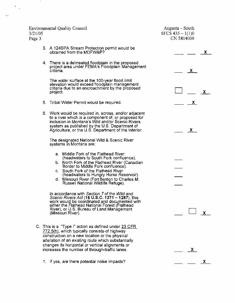
3. A 124SPA Stream Protection permit would be obtained from the MDFW&P?
4. There is a delineated floodplain in the proposed project area under FEMA's Floodplain Management criteria.
The water surface at the 100-year flood limit elevation would exceed floodplain management criteria due to an encroachment by the proposed project.
5. Tribal Water Permit would be required.
6. Work would be required in, across, and/or adjacent to a river which is a component of, or proposed for inclusion in Montana's Wild and/or Scenic Rivers system as published by the U.S. Department of Agriculture, or the U.S. Department of the Interior.
The designated National Wild & Scenic River systems In Montana are:
a. Middle Fork of the Flathead River (headwaters to South Fork confluence).
b. North Fork of the Flathead River Canadian Border to Middle Fork confluence .
c. South Fork of the Flathead River I
(headwaters to Hungry Horse Reservoir). d. Missouri River (Forf. Benton to Charles M.
Russell National W~ldlife Refuge).
In accordance with Section 7 of the Wild and Scenic Rivers Act (1 6 U.S.C. 1271 - 1287), this work would be coordinated and documented with either the Flathead National Forest (Flathead River), or U.S. Bureau of Land Management (Missouri River).
C. This is a "Type I" action as defined under 23 CFR 772.5(h), which typically consists-of highway construction on a new location or the physical alteration of an existing route which substantially changes its horizontal or vertical alignments or increases the number of through-traffic lanes.
1. If yes, are there potential noise impacts?
Augusta - South SFCS 435 - 1(1)0
CN 5804000

Environmental Quality Council 312 1/05 Page 4
2. A Noise Analysis would be completed.
3. There would be compliance with the provisions of both 23 CFR 772 for FHWA's Noise Impact analyses and MDT's Noise Policy.
D. There would be substantial changes in access control involved with this proposed project.
If yes, would they result-in extensive economic and/or social impacts on the affected locations?
E. The use of a temporary road, detour, or ramp closure having the following conditions when the action(s) associated with such facilities:
1. Provisions would be made for access by local traffic, and be posted for-same.
2. Adverse effects to through-traffic dependant businesses would be avoided or minimized.
3. Interference to local events( e.g.: festivals) would be minimized to all possible extent.
4. Substantial controversy associated with this pending action would be avoided.
F. Hazardous wastes /substances, as defined by the U.S. Environmental Protection Agency (EPA) and/or the Montana Department of Environmental Quality (MDEQ), and/or (a) listed "Superfund" (under CERCLA or CECRA) site(s) are currently on and/or adjacent to this proposed project.
All reasonable measures would be taken to avoid and/or minimize substantial impacts from same.
G. The Montana Pollutant Discharge Elimination System's conditions (ARM 16.20.1 314), including temporary erosion control features for construction would be met.
Augusta - South SFCS 435 - 1(1)0
CIV 5804000

Environmental Quality Council 312 1 I05 Page 5
H. Permanent desirable vegetation with an approved seeding mixture would be established on exposed areas.
I. Documentation of an "invasive species" review to comply with both E.O.#13112 and the County Noxious Weed Control Act (7-22-21, M.C.A.), including directions as specified by the county(ies) wherein its intended work would be done.
J. There are "Prime" or "Prime if Irrigated" Farmlands designated by the Natural Resources Conservation Service on or adjacent to the proposed project area.
If the proposed work would affect Important Farmlands, then an AD-1 006 Farmland Conversion Impact Rating form would be completed in accordance with the Farmland Protection Policy Act (7 U.S.C. 4201 , et seq. ).
K. Features for the Americans with Disabilities Act (P.L. 101 -336) compliance would be included.
L. A written Public Involvement Plan, would be completed in accordance with MDT's Public Involvement Handbook.
4. This proposed project complies with the Clean Air Act's Section 176(c) (42 U.S.C. 7521(a), as amended) under the provisions of 40 CFR 81.327 as it's either in a Montana air quality:
A. "Unclassifiablel'/attainment area. This proposed project is not covered under the EPA's September 15, 1997 Final Rule on air quality conformity.
B. "Nonattainment" area. However, this type of proposed project is either exempted from the conformity determination requirements (under EPA's September 15, 1997 Final Rule), or a conformity determination would be documented in coordination with the responsible agencies: (Metropolitan Planning Organizations, MDEQ1s Air Quality Division, etc.).
C. Is this proposed project in a "Class I Air Shed" (Indian Reservations) under 40 CFR 52.1 382(c)(3)?
Augusta - South SFCS 435 - 1(1)0
CIV 5804000

Environmental Quality Council 312 1 I05 Page 6
5. Federally listed Threatened or Endangered (TIE) Species:
A. There are recorded occurrences, and/or critical habitat in this proposed project's vicinity.
B. Would this proposed project result in a "jeopardv" opinion (under 50 CFR 402) from the Fish &Wildlife Service on any Federally listed TIE Species?
Augusta - South SFCS 435 - 1(1)0
CN 5804000
O x - The proposed project would not induce significant land-use changes, nor promote unplanned growth. There would be no significant effects on access to adjacent property, nor to present traffic patterns.
This proposed project would not create disproportionately high and/or adverse impacts on the health or environment of minority and/or low-income populations (E.O.#12898). It also complies with the provisions of Title Vl of the Civil Rights Act of 1964 (42 U.S.C. 2000d).
In accordance with the provisions of ARM 18.2.261, this pending action would not cause any significant individual, secondary, or cumulative environmental impacts. Therefore, MDT's concurrence is that this proposed project is properly classified as a MEPA Categorical Exclusion.
Engineering section Supervisor Environmental Services Bureau
Attachments
THIS DOCUMENT WILL BE PROVIDED ON REQUEST."
cc: Michael P. Johnson - District Administrator-Great Falls Paul R. Ferry, P.E. - Highway Engineer John H. Horton, - Chief, Right-of-way Bureau Suzy Althof - Chief, Contract Plans Bureau David W. Jensen - Supervisor, Fiscal Programming Section Jean A. Riley, P.E. - Chief, Environmental Services Bureau Environmental File

Montana Department of Transportation PO Box 201 001
Helena, MT 59620-1 001
Preliminary Field ReviewIScope of Work Report
SFCS 435-1(1)0 Augusta-S
UPN 5804000
I. INTRODUCTION
This report was developed fiom information taken fiom the preliminary field review conducted on January 25th and 26th 2005 with the following personnel in attendance:
January 25th: Steve Prinzing D.E.S.E. Great Falls Leonard Dueck Road Design Helena Jere Stoner Road Design, Project Manager Helena Wayne Effertz L. & C. Co. Road Supervisor Helena Eric Griffin L. & C. Co. Public Works Dir. Helena Ed Shea Surfacing Design Helena
January 26th: Mike Langenfus Road Design Leonard Dueck Road Design
Helena Helena
11. PROPOSED SCOPE OF WORK
The proposed project has been nominated as a preventative maintenance overlay. The intent is to overlay the existing roadway with 0.20' of plant mix bituminous surfacing (Grade S), and apply a seal and cover. A 24' overlay was considered; however, due to cost constraints and the fact that the xisting surfacing width averages -the overlay will be 22' wide with \ 4: 1 (secon ary standard) surfacing in-slopes. The Guidelines for Nomination and Development of Pavement Projects permit a 22' surface width on secondary routes with a current ADT less than 300.
The existing double-shot surface treatment requires that some remedial shoulder work be done before the overlay can be applied. It is proposed that Lewis and Clark County, forces provide the shoulder dressing in preparation for the pre-leveling, overlay, and seal and cover, which will be done under contract. The County currently maintains this route.
A. The plans for the proposed project will be in English units. The existing horizontal and vertical alignment will be used throughout the project.
B. Within the project limits there are two bridges that will be included in the overlay, seal and cover. The existing bridge rail is wood. No accident history

, Paul R. Ferry, P.E.
d m Page 2
February 15,2005
exists with regard to the rail or rail end sections, consequently, funding limitations will preclude upgrade of the bridge rail with t h s project.
C. The cost of the proposed project is estimated to be $945,000. This figure was determined by utilizing calculated quantities and District unit prices. The estimate includes mobilization (1 0%), traffic control (5%), construction engineering (5%), and contingency (5%). At a 3% rate of inflation, the cost would be $957,000 at an estimated July 2005 letting date.
D. The project is being designed in Headquarters and has a ready date of July 2005.
111. PROJECT LOCATION AND LIMITS
The project begins in Augusta at RP 0.00, the intersection with P-9 in downtown Augusta. It then proceeds 9.78 miles on secondary route 435 in a southern direction for approximately 9.78 miles, to RJ? 9.78?.
A. Begin: RJ? 0.00 - Section 17, T 20N.,R 6W
B. End: RP 9.782 - Section 35, T. 19 N., R. 7W
IV. PHYSICAL CHARACTERISTICS
The P.T.W. traverses rolling terrain and is classified as a rural major collector. The land adjacent to the project primarily consists of farm and rangeland.
A. Project History
1. A single as-built project, S 228(2), applies to this project.
2. In 1958, the roadway was built with a compacted select borrow base course placed at a depth of 0.85'. The surface consisted of a 0.15' cushion. The top finished width ranged from 44' in Augusta to 28.1' outside of the town area. The driving surface, a bituminous surface treatment (double shot), was applied 26.3' wide; however, all that remains is the 20' to 22' average width in the rural portion. Slopes were built according to the following table:
Slope Ratio I 5:l
I Slope Ratio I 5: 1 4: 1
3: 1
3: 1
2.5:l
2: 1
2: 1
1.5:l
1.5:l

Paul R. Ferry, P.E. Page 3 February 15,2005
B. Project Connections
The beginning of the project, (the south end of the intersection of S-435 and Mannix St.), will have a transition to the PTW. Some removal of the existing surfacing will be required. A gravel road connection will be built at the end of the project. Changes in the properties of the PTW throughout the project are as follows:
C. PvMS Index Numbers & Recommended Treatment for 2004
14+951 21+37.22 28+10.11 516+14.12 (End)
1. The recommended treatment in the Pavement Analysis Section's 2003 Pavement Conditions12004 Pavement Treatment Report is AC T h n Overlay for both maintenance and construction activities. The indices and condition levels for the 2003 survey year are given in the following table:
D. Horizontal Alignment
The existing horizontal alignment is composed of 11 simple curves. All of the horizontal curves exceed design standards at 50 mph minimum design speed. The following table give the properties of the existing horizontal alignment:
2 6 2 6 22 22
0.151 0.15f 0.151 0.151
0.85 ft 0.85 ft 0.85 ft 0.85 ft

Paul R. Ferry, P.E. Page 4 February 15,2005
E. Vertical Alignment
The existing vertical alignment consists of 26 vertical curves. All of the vertical curves provide desirable stopping sight distance for 50 mph.
F. Bridges
There are two existing bridges that fall within the limits of this project; they are summarized in the table below:
V. TRAFFIC DATA
The traffic data as provided by the Traffic Data and Collection Section is as follows:
S00435004t-0.235 1
S00435006t-0.975 1
VI. ACCIDENT ANALYSIS
Smith Creek Elk Creek
2004 ADT 2006 ADT 2026 ADT DHV T ESAL AGR
A. An accident analysis was completed for S-435, from RP 0.0 to RP 9.8, for the ten-year period fiom October 10, 1994 through September 30,2004. Within the analysis, there were seven reported accidents resulting in three injury accidents, which resulted in a total of eight injuries. The following table shows how the data in the study area compared to the statewide averages:
140 (Present) 150 (Letting Date) 250 (Future) 3 0 2.9% 1.92 2.6%
24
24
76
39
1958
1958
Timber Structure Timber Structure

Paul R. Ferry, P.E. . Page 5
February 15,2005
B. Variations from Average Occurrences
There was insufficient accident history for comparison to statewide average occurrences.
C. Accident Clusters and Safety Projects
There were no accident clusters identified and no safety projects within the 10-year study period.
D. Remarks
There were three injury accidents of the seven reported accidents on S-435 from RP 0.0 to 9.8 during the 10-year study period. Six of these crashes were single vehicle crashes and the one crash that involved two vehicles was due to the driver hitting a parked vehicle. There was a two-vehicle crash at the intersection with P-9. Both vehicles were turning left but in opposite directions. No injuries were reported for this accident.
VII. MAJOR DESIGN FEATURES
A. Design Speed
Design speed is not an applicable design criterion since this project is a preventative maintenance overlay.
B. Horizontal Alignment
The proposed horizontal alignment will follow the existing alignment.
C. Vertical Alignment
The existing vertical alignment meets design standards for secondary roads and will be followed by the current project.
D. Surfacing Design
1. Due to the nature of this project, no surfacing design was requested. Some pavement removal will be required on the beginning connection

I
Paul R. Ferry, P.E. Page 6 February 15,2005
to the P.T.W in Augusta and in the areas of the two bridges. The amount of material to be removed is minimal and shall be disposed of on the shoulders to augment the pre-leveling or to correct surface irregularities.
2. Pre-leveling is to be applied to the shoulders after preparatory grading as shown on the typical section (by county forces). The leveling and approach treatments total about 16% of the plant mix quantity.
E. Typical Sections
1. Under this project, the rural typical section will accommodate a 22' wide finished driving surface with 1 1 ' driving lanes. A 1.9' wide strip of leveling 0.15+ ft. deep will be added to the shoulders of the rural section of the project to provide a platform to accommodate the 0.2' of plant mix surfacing overlay.
STA. 2 8 t 1 0 TO 5 1 6 t 1 4 . 1
AVERAGE PPE-LEVELING WIDTH
5: I * 5: I t
0. 2 PL. MIX B I T SURF. '
GRADING B Y COUNTY FORCES ADlNG BY COUNTY FORCES
C CROWN AS-CONST. CROWN AS-CONST.
2. The cut and fill slopes will be "as constructed" (shown in section IV.A.2.)
3. There is no curb and gutter on this project that will be affected by the overlay. In Augusta the measured widths range from 30' to 26' wide fiom edge to edge of paved surface. These averages will be used in developing the typical sections for the project. The urban plant mix edge sections will have 6: 1 in-slopes and intersecting street approaches will be feathered to provide a smooth transition to the PTW as shown below:

Pdul R. Ferry, P.E. * . Page7
February 15,2005
STREET APPROACH 6:
C I T Y S T R E E T A P P R O A C H E S
STA. 1 4 t 9 5 TO 2 1 t 3 7
STA. 2 1 + 3 7 TO 2 8 + 1 0 TRANS TYP NO. 2 TO TYP NO. 3
14. 4 TACK' 14 . 4 TACK'
F. Geotechnical Considerations
4
13. 0 SEAL AND COVER'
6: 1
CROWN AS-CONST.
There were no geotechnical issues discovered at the preliminary review.
13. 0 SEAL AND COVER'
6 : 1
CROWN AS-CONST.
G. Grading
.: C
1. The project will involve ininimal grading, and it is proposed that Lewis and Clark County perform such grading on the shoulders to prepare a foundation for the shoulder treatment.
\
2. All cut and fill slopes shall be used as is. No slope work is proposed.
!
H. Hydraulics
0. 2 PL. MIX BIT SURF. '
No Hydraulic issues were discussed at the Field Review as the scope precludes any drainage or imgation work within the project limits.
I. Bridge
1. The existing bridges are listed in N.F. The Bridge Bureau has commented that, "Both (bridges) appear to be in good condition. Also, they only have 2-3" of cover currently. Therefore, they should handle an overlay without any problem."
2. We propose to remove the existing bituminous surfacing from the structures, replace it as leveling, and overlay them to affect a smooth transition fiom the roadway.
3. The existing bridge rail is sub-standard wooden rail; however, due to the limited funding, low traffic volume, and absence of accident history, we will not upgrade the bridge rail with this project.

Paul R. Ferry, P.E. Page 8 February 15,2005
J. Traffic and Safety
New pavement markings will be required. No signing or rumble strips are proposed on this project.
VIII. DESIGN EXCEPTIONS
A formal design exception will not be requested. Deviations fiom standards are identified in this report.
IX. RIGHT-OF-WAY
The right-of-way limits are not shown on the as-built plans for the urban area; however, it is assumed that they do not extend into the driving surface. The existing right-of-way in the rural portion is between 50 ft and 90 fi from existing centerline.
l\Jo new right-of-way will be required on the project.
A. Due to the nature of this project, no utility involvement is anticipated.
B. No railroad crossings occur within the project.
XI. ENVIRONMENTAL CONSIDERATIONS
No apparent significant environmental issues have been identified. It is anticipated that the project meets the criteria for the programmatic Categorical . . . . Exclusion. m e d with the Pr-ld
. -
CLE. (A\ . XII. PUBLIC INVOLVEMENT
Due to the limited scope of the project, a level "A" public involvement plan should suffice. This will include a news release to the local media.
XIII. TRAFFIC CONTROL
Traffic will be maintained throughout project construction through the use of appropriate signing, flagging, lane closures, etc. Local access will be maintained to the maximum extent possible. The MUTCD will be utilized to guide the application of the traffic control plan.

. SFCS 435-1(1)0
WORK TYPE: 181 RESURFACING-ASPHALT THIN LIFT
AUGUSTA-S
LEWIS & CLARK COUNTY UPN 5804
9.8 mi
5804000RDPRJ00 i . DGN