environmental spatial data analysis stefan falke [email protected] urbauer 319d 935-6099 ce/enve...
Post on 21-Dec-2015
217 views
TRANSCRIPT
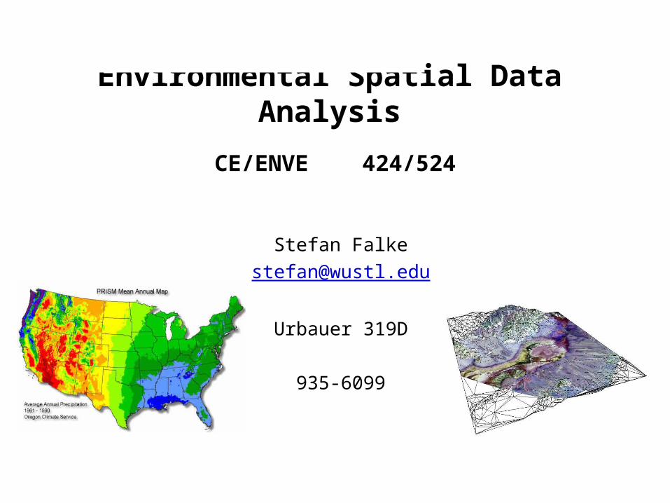
Environmental Spatial Data Analysis
Stefan Falke
Urbauer 319D
935-6099
CE/ENVE 424/524
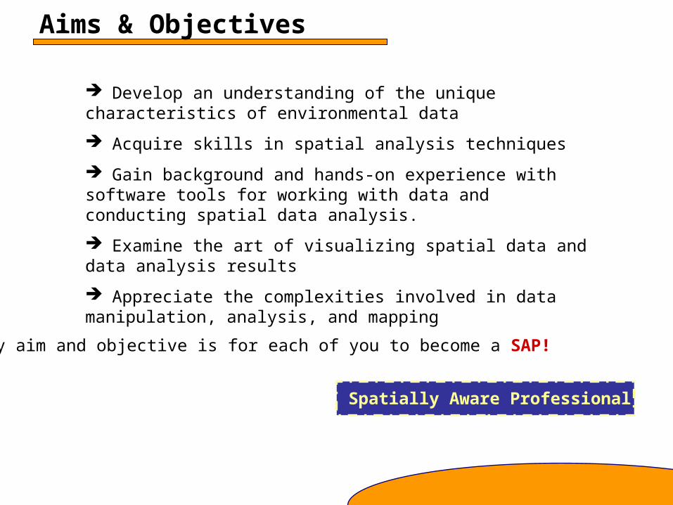
Aims & Objectives
Develop an understanding of the unique characteristics of environmental data
Acquire skills in spatial analysis techniques
Gain background and hands-on experience with software tools for working with data and conducting spatial data analysis.
Examine the art of visualizing spatial data and data analysis results
Appreciate the complexities involved in data manipulation, analysis, and mapping
My aim and objective is for each of you to become a SAP!
Spatially Aware Professional
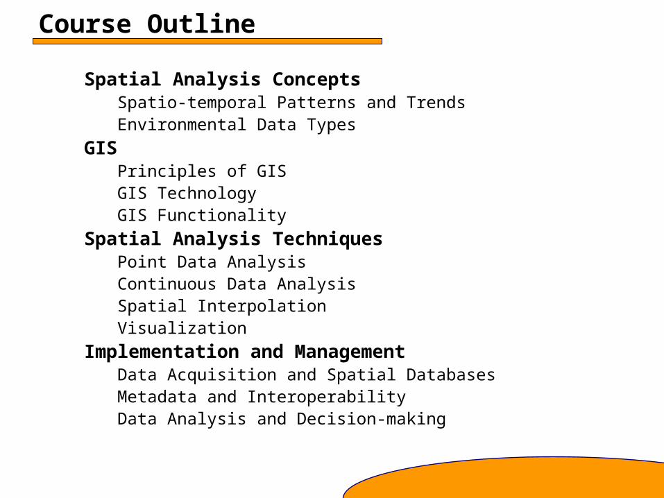
Course Outline
Spatial Analysis ConceptsSpatio-temporal Patterns and TrendsEnvironmental Data Types
GISPrinciples of GISGIS TechnologyGIS Functionality
Spatial Analysis TechniquesPoint Data AnalysisContinuous Data AnalysisSpatial InterpolationVisualization
Implementation and ManagementData Acquisition and Spatial DatabasesMetadata and InteroperabilityData Analysis and Decision-making
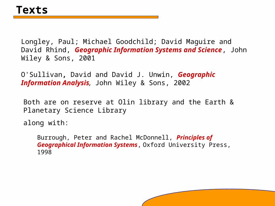
Texts
Longley, Paul; Michael Goodchild; David Maguire and David Rhind, Geographic Information Systems and Science, John Wiley & Sons, 2001
O'Sullivan, David and David J. Unwin, Geographic Information Analysis, John Wiley & Sons, 2002
Both are on reserve at Olin library and the Earth & Planetary Science Library
along with:
Burrough, Peter and Rachel McDonnell, Principles of Geographical Information Systems, Oxford University Press, 1998
Computer Lab Sessions
Labs will be held in Lopata 401
Tuesdays, approximately every other week
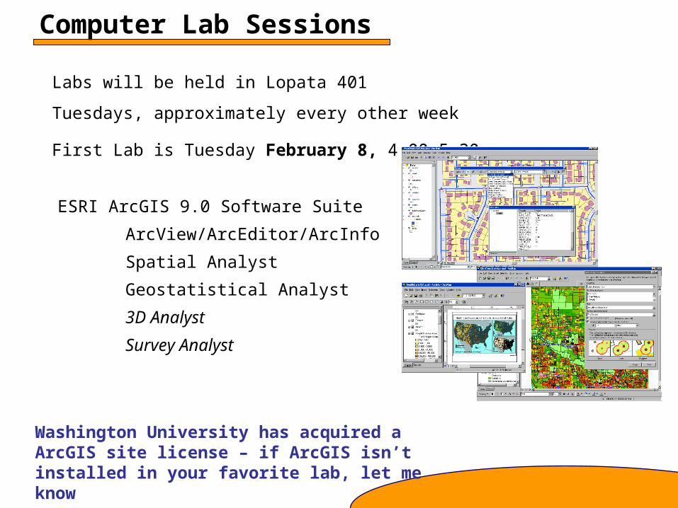
ESRI ArcGIS 9.0 Software Suite
ArcView/ArcEditor/ArcInfo
Spatial Analyst
Geostatistical Analyst
3D Analyst
Survey Analyst
First Lab is Tuesday February 8, 4:00-5:30.
Washington University has acquired a ArcGIS site license – if ArcGIS isn’t installed in your favorite lab, let me know
Journal Article Review
For this paper assignment you will select and review a journal article that describes a spatial analysis method from a topic area covered in class.
The paper should be a 2-3 page summary for ENVE 424 and approximately 4-5 page critical review for ENVE 524.
Please notify me of your article selection by Tuesday, March 29.
Paper reviews are due Thursday, April 7.
International Journal of Geographical Information Science
Environmetrics
Computers and Geosciences
Photogrammetric Engineering and Remote Sensing
Journals in your field
Example Journals:
Final ProjectThe project involves data analysis for a problem of interest to you. You will analyze your data using several of the techniques discussed in lectures and the GIS tools introduced in lab. A project consists of three components:
Proposal describing the problem and the data and methods to be used (up to two pages) Due March 24
Paper describing the project data, methods, tools, and results. (up to 12 pages)
Presentation summarizing the project. (up to 10 minutes)
Paper and Presentation are both due on the date and time assigned for our final exam period.
Two (of many) options for projects:
• Compare different methods
• Analyze your own data
Grading
Problem Sets 25%
Mid-term exam 25%
Journal article review 10%
Final project 30%
Class participation 10%
Late Policy:
Problem sets have due dates (usually) on Tuesdays. You are allowed to submit two problem sets during the following class period without penalty. Otherwise, the penalty is 5% per day. The Article review and project related materials may not be submitted late.
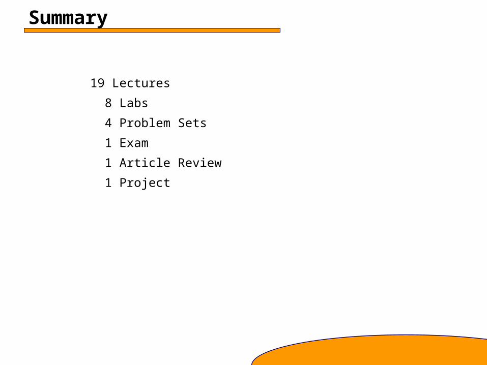
Summary
19 Lectures
8 Labs
4 Problem Sets
1 Exam
1 Article Review
1 Project
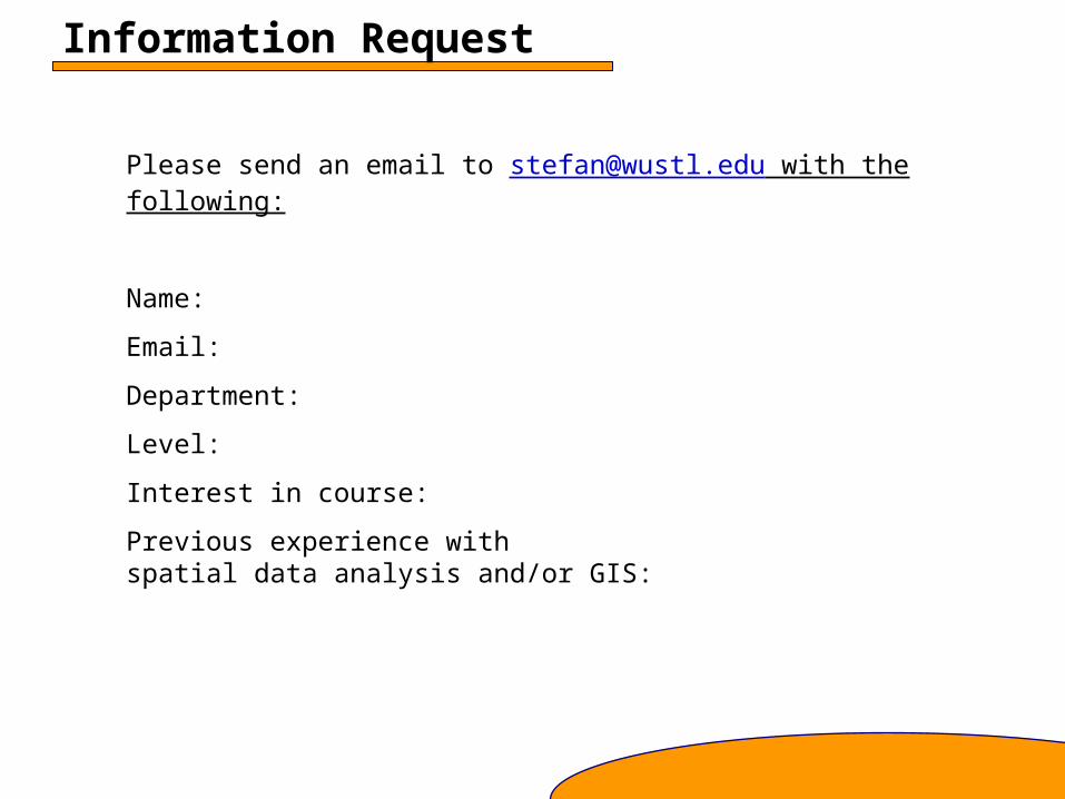
Information Request
Please send an email to [email protected] with the following:
Name:
Email:
Department:
Level:
Interest in course:
Previous experience with spatial data analysis and/or GIS:
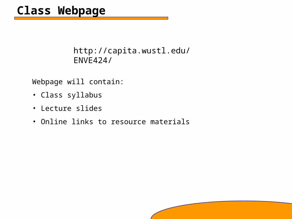
Class Webpage
http://capita.wustl.edu/ENVE424/
Webpage will contain:
• Class syllabus
• Lecture slides
• Online links to resource materials
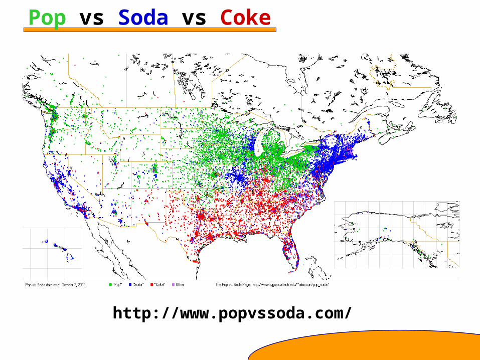
Pop vs Soda vs Coke
http://www.popvssoda.com/
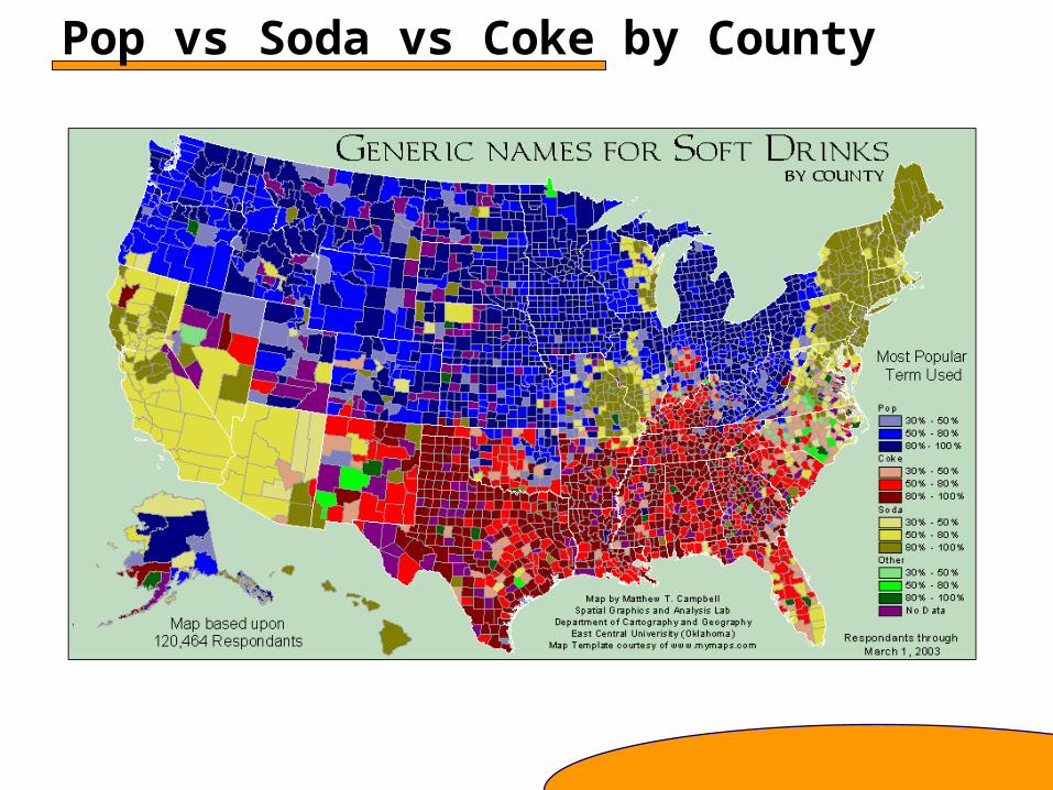
Pop vs Soda vs Coke by County
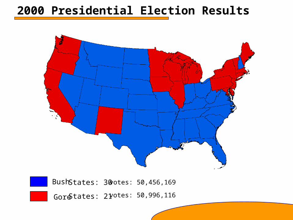
2000 Presidential Election Results
Bush
Gore
votes: 50,456,169
votes: 50,996,116
States: 30
States: 21
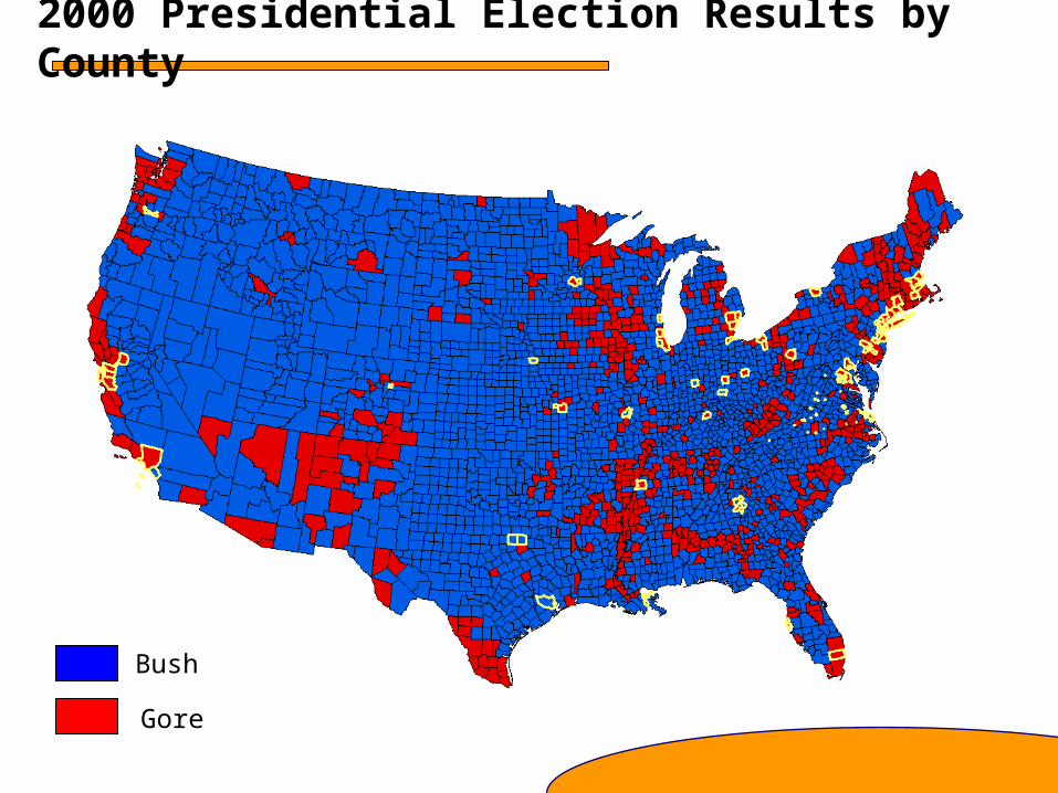
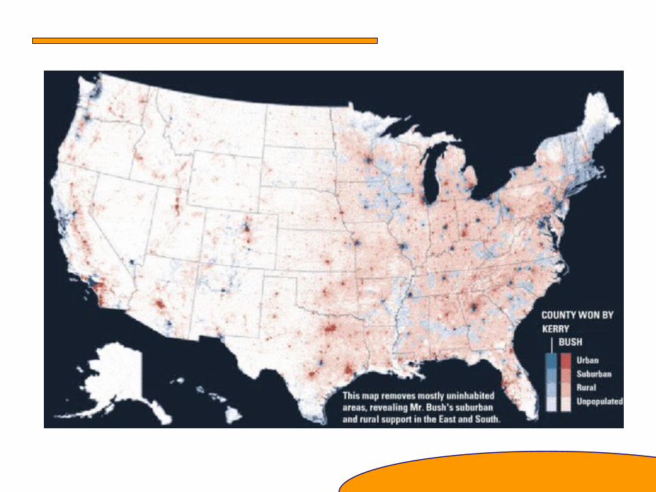
2000 Presidential Election Results by County
Bush
Gore
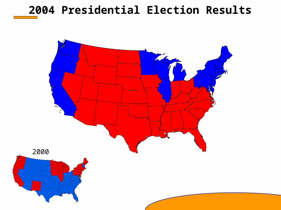
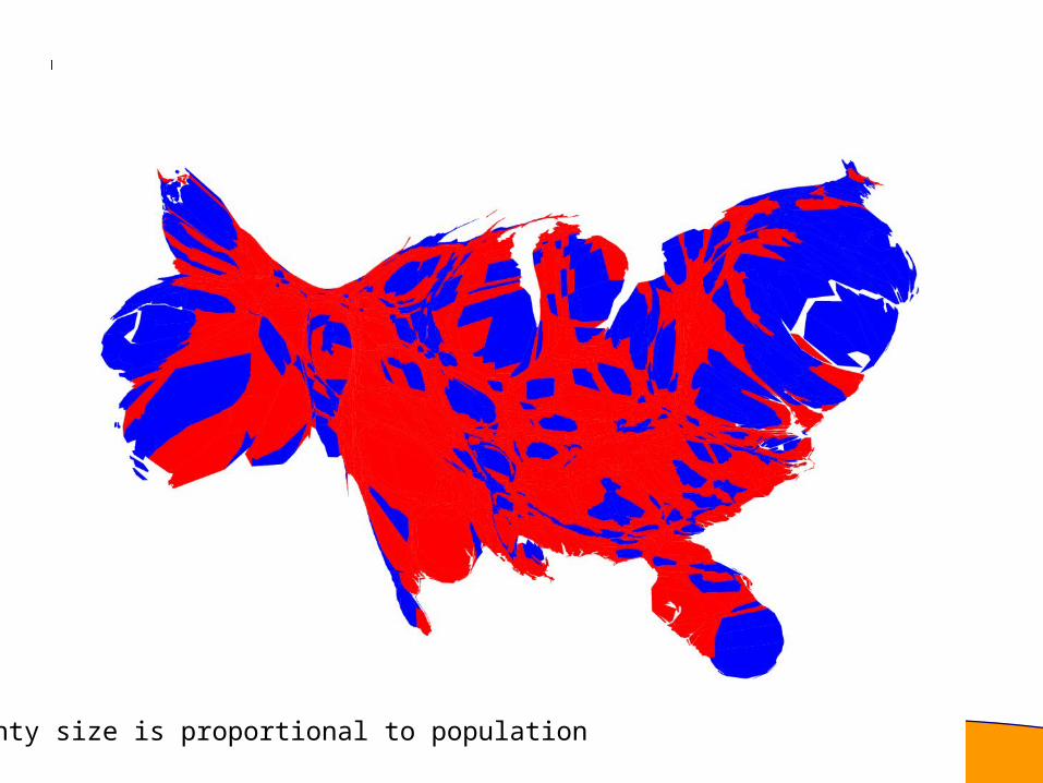
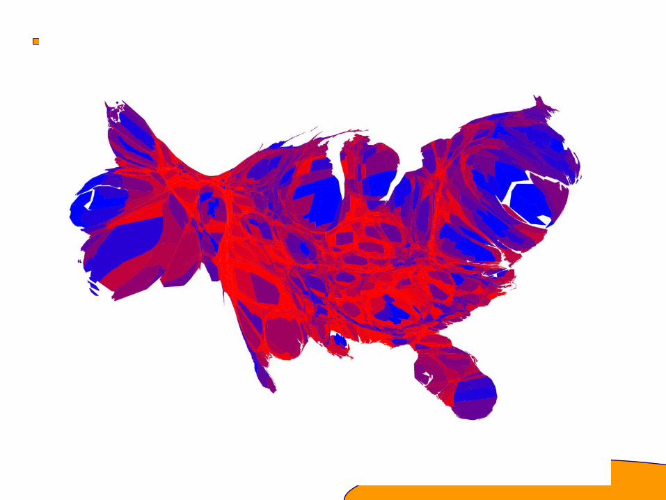
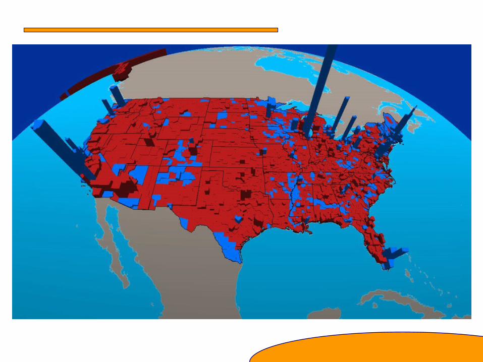
2004 Presidential Election Results
2000
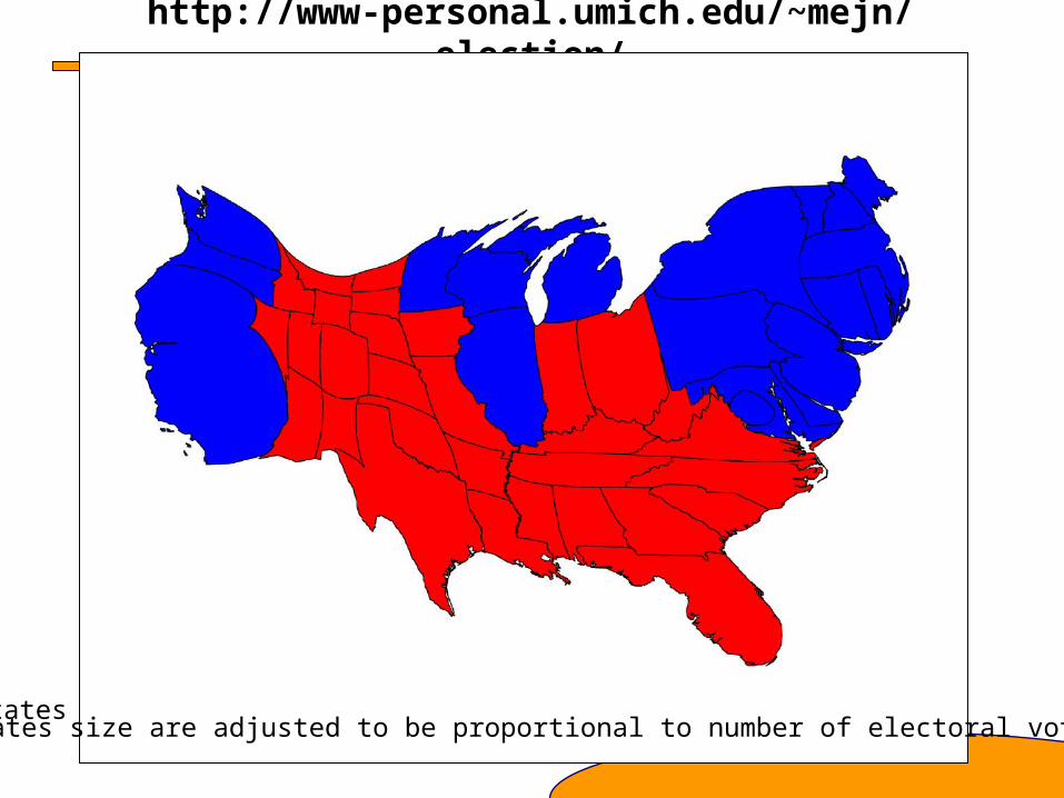
http://www-personal.umich.edu/~mejn/election/
States size are adjusted to be proportional to populationStates size are adjusted to be proportional to number of electoral votes
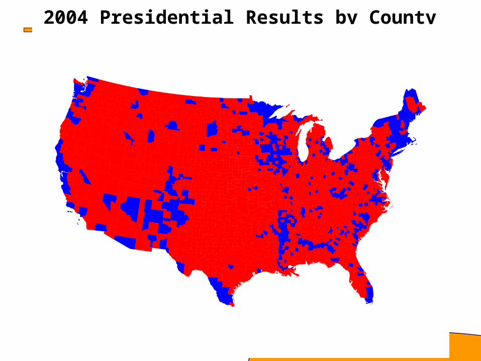
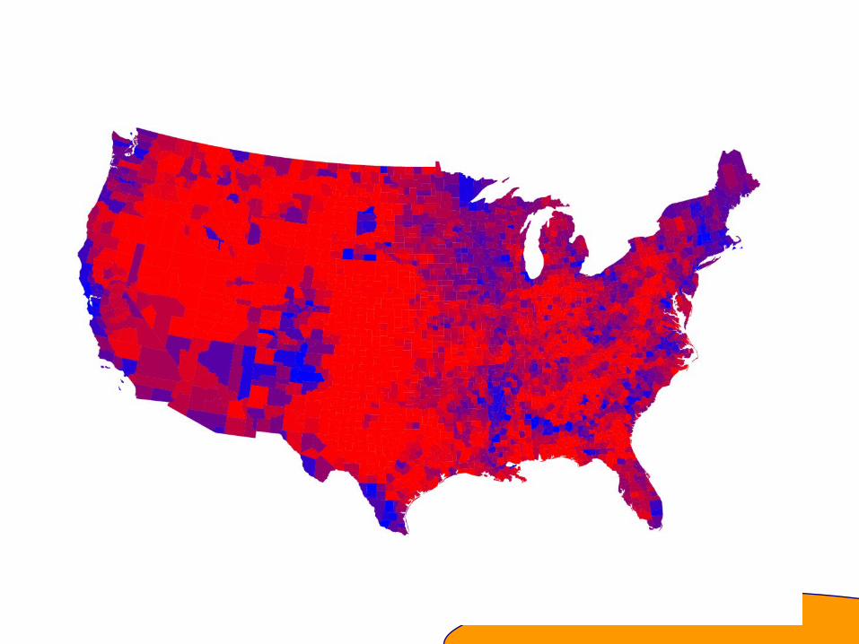
2004 Presidential Results by County
County size is proportional to population

What is Spatial Data Analysis?
• Spatial analysis is the quantitative and qualitative study of phenomena that are located in space.
• Environmental spatial data analysis describes characteristics and behavior of the environment
• Explores patterns, trends, and relationships in environmental data
• Seeks to explain these patterns, trends, and relationships
Differs from general data analysis in that it:– Spatial data are dependent on location and related by location (they do not
adhere to the independence assumption made in regular data analysis)– Have properties that require special analysis methods
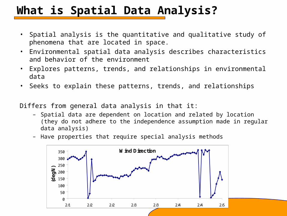
Wind Direction
0
50
100
150
200
250
300
350
2/1 2/2 2/2 2/3 2/3 2/4 2/4 2/5
(deg
N)
What is GIS?Traditional definition is that GIS is a set of computer tools for accessing, processing, visualizing, analyzing, interpreting, and presenting spatial data.
‘GIS’ is Geographical Information System OR IS IT
Geographical Information Science?
GISystems: Emphasis on technology and toolsGIScience: Fundamental issues raised by the use of GIS, such as
Spatial analysisMap projectionsAccuracyScientific visualization
Implementation and application of GIS covers a wide spectrum:
Simple mapsOverlaying multiple map “layers”Conducting proximity or cluster analysis based on distanceComparing data sets (simple spatial statistics)Complex statistical analysis

What’s the Difference?
The distinction between spatial data analysis and GIS becomes fuzzier every year
The distinction depends on your perspective:
Traditional GIS perspective:
Here are some tools, use them.
Import data into a GIS and what you see is what you get.
Traditional spatial analysis perspective:
Start with spatial analysis and use GIS as a tool.
Use GIS to help figure out what the data means
In many fields, the two perspectives appear to be merging as oneSpatial analysis is GISGIS is spatial analysis
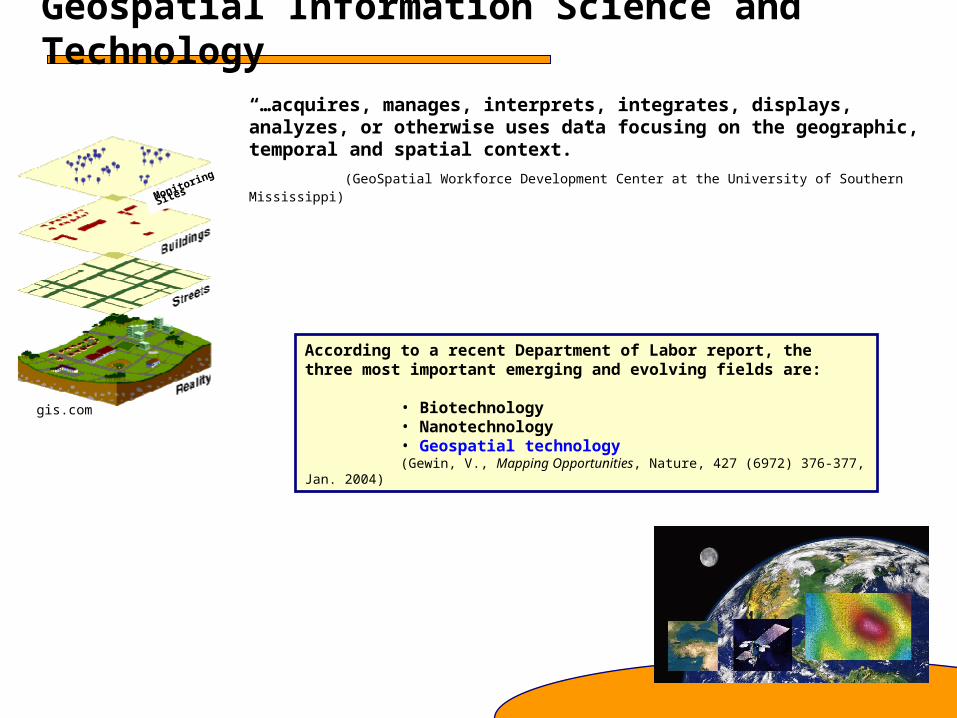
Geospatial Information Science and Technology
Monitoring
Sites
According to a recent Department of Labor report, the three most important emerging and evolving fields are:
• Biotechnology• Nanotechnology• Geospatial technology(Gewin, V., Mapping Opportunities, Nature, 427 (6972) 376-377, Jan. 2004)
“…acquires, manages, interprets, integrates, displays, analyzes, or otherwise uses data focusing on the geographic, temporal and spatial context.”
(GeoSpatial Workforce Development Center at the University of Southern Mississippi)
gis.com