envsci360 – computer and analytical cartography envsci 360 - lecture 7 17 image symbologyin arcmap...
TRANSCRIPT
EnvSci 360 –Computer and
Analytical Cartography
Lecture 7
Mapping Images,
Surfaces,
and 3-D Data
EnvSci 360 - Lecture 7 2
Brief Overview of Imagery
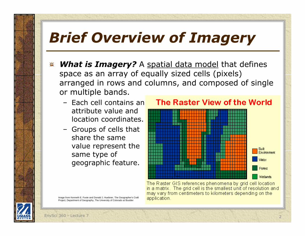
What is Imagery? A spatial data model that defines space as an array of equally sized cells (pixels) arranged in rows and columns, and composed of single or multiple bands.
– Each cell contains an attribute value and location coordinates.
– Groups of cells that share the same value represent the same type of geographic feature.
Image from Kenneth E. Foote and Donald J. Huebner, The Geographer's Craft Project, Department of Geography, The University of Colorado at Boulder
EnvSci 360 - Lecture 7 3
Brief Overview of Imagery
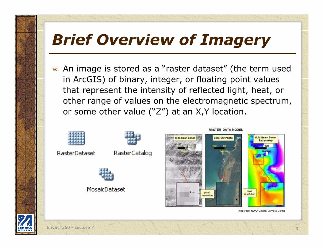
An image is stored as a “raster dataset” (the term used
in ArcGIS) of binary, integer, or floating point values
that represent the intensity of reflected light, heat, or
other range of values on the electromagnetic spectrum,
or some other value (“Z”) at an X,Y location.
Image from NOAA Coastal Services Center
EnvSci 360 - Lecture 7 4
Why Use Imagery?
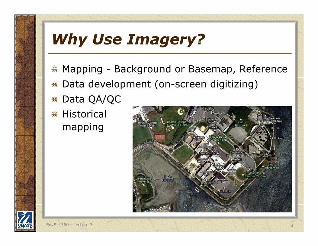
Mapping - Background or Basemap, Reference
Data development (on-screen digitizing)
Data QA/QC
Historical
mapping
EnvSci 360 - Lecture 7 5
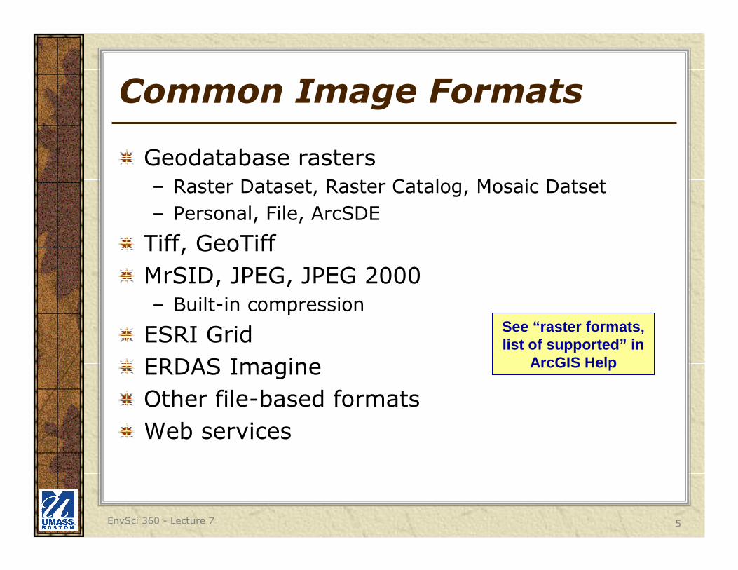
Common Image Formats
Geodatabase rasters
– Raster Dataset, Raster Catalog, Mosaic Datset
– Personal, File, ArcSDE
Tiff, GeoTiff
MrSID, JPEG, JPEG 2000
– Built-in compression
ESRI Grid
ERDAS Imagine
Other file-based formats
Web services
See “raster formats, list of supported” in
ArcGIS Help
EnvSci 360 - Lecture 7 6
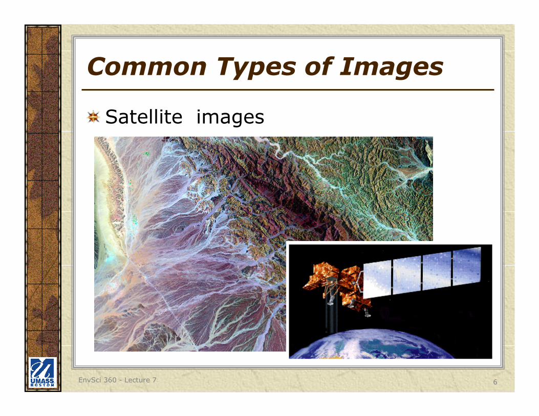
Common Types of Images
Satellite images
EnvSci 360 - Lecture 7 7
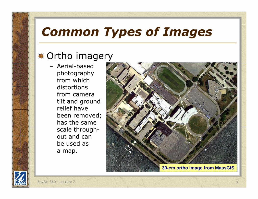
Common Types of Images
Ortho imagery– Aerial-based
photography from which distortions from camera tilt and ground relief have been removed; has the same scale through-out and can be used as a map.
30-cm ortho image from MassGIS
EnvSci 360 - Lecture 7 8
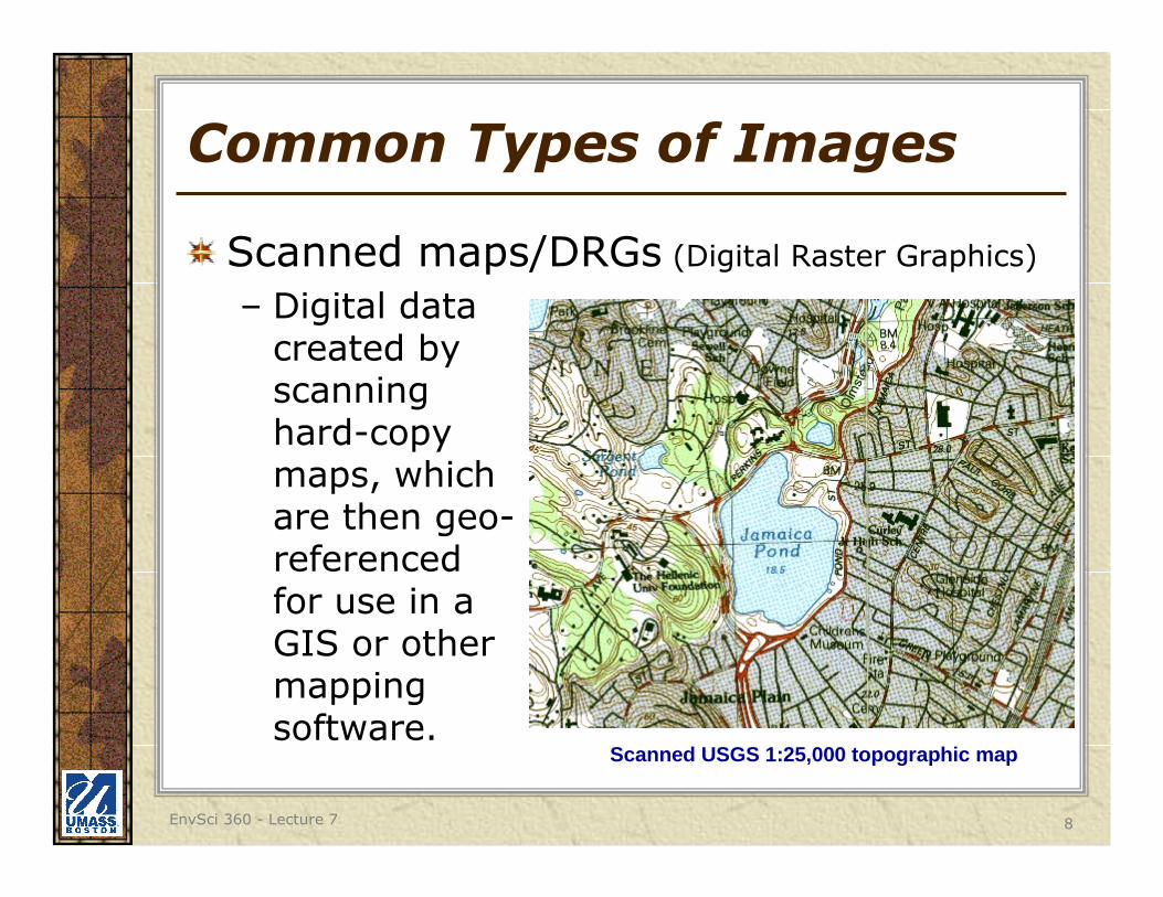
Common Types of Images
Scanned maps/DRGs (Digital Raster Graphics)
– Digital data created by scanning hard-copy maps, which are then geo-referenced for use in a GIS or other mapping software.
Scanned USGS 1:25,000 topographic map
EnvSci 360 - Lecture 7 9
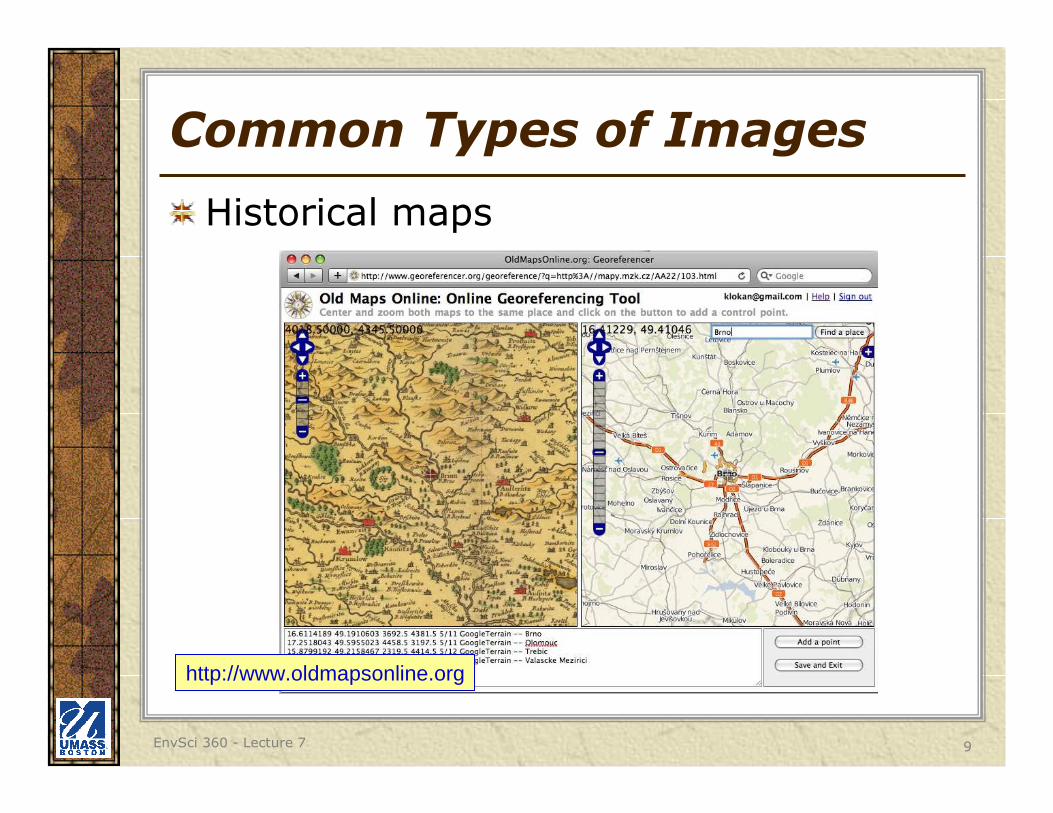
Common Types of Images
Historical maps
http://www.oldmapsonline.org
EnvSci 360 - Lecture 7 10
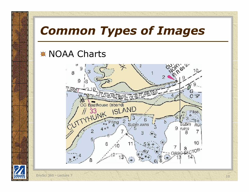
Common Types of Images
NOAA Charts
EnvSci 360 - Lecture 7 11
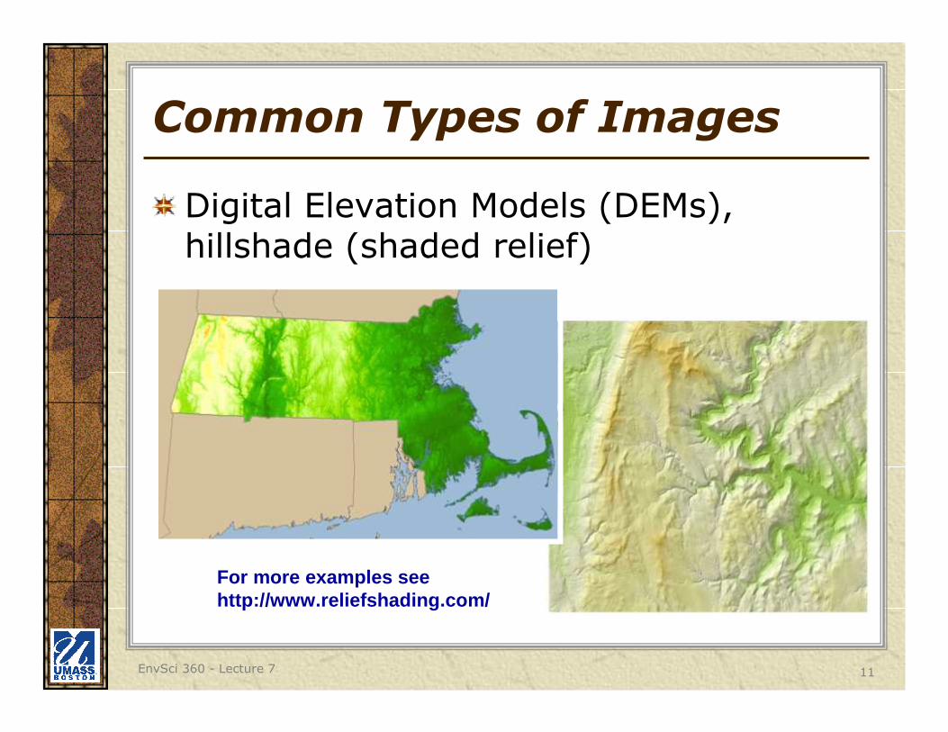
Common Types of Images
Digital Elevation Models (DEMs), hillshade (shaded relief)
For more examples seehttp://www.reliefshading.com/
EnvSci 360 - Lecture 7 12
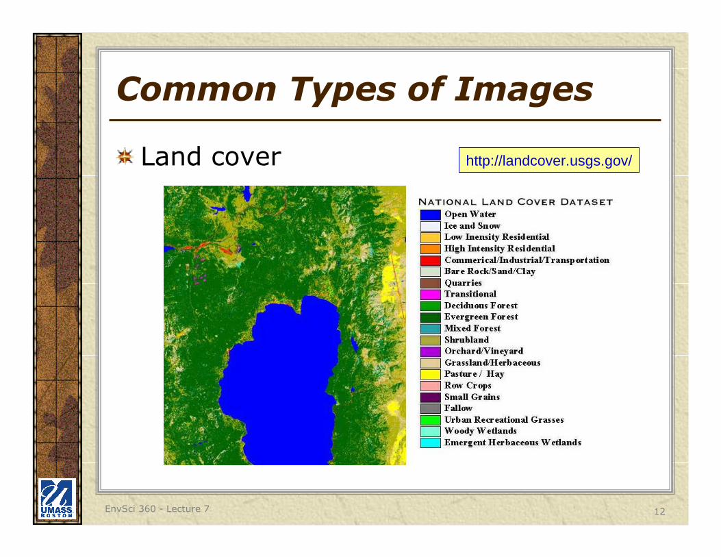
Common Types of Images
Land cover http://landcover.usgs.gov/
EnvSci 360 - Lecture 7 13
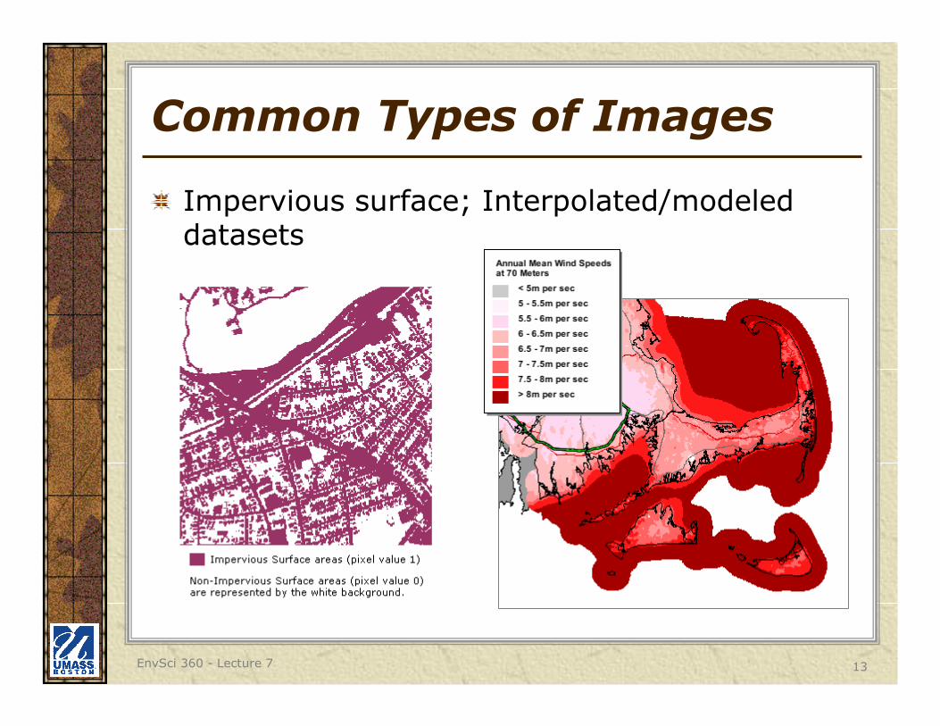
Common Types of Images
Impervious surface; Interpolated/modeled datasets
EnvSci 360 - Lecture 7 14
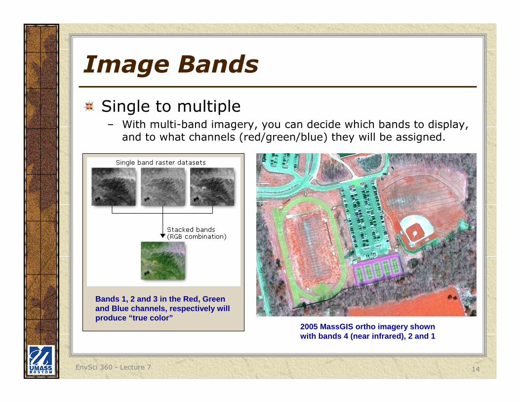
Image Bands
Single to multiple– With multi-band imagery, you can decide which bands to display,
and to what channels (red/green/blue) they will be assigned.
2005 MassGIS ortho imagery shown with bands 4 (near infrared), 2 and 1
Bands 1, 2 and 3 in the Red, Green and Blue channels, respectively will produce “true color”
EnvSci 360 - Lecture 7 15
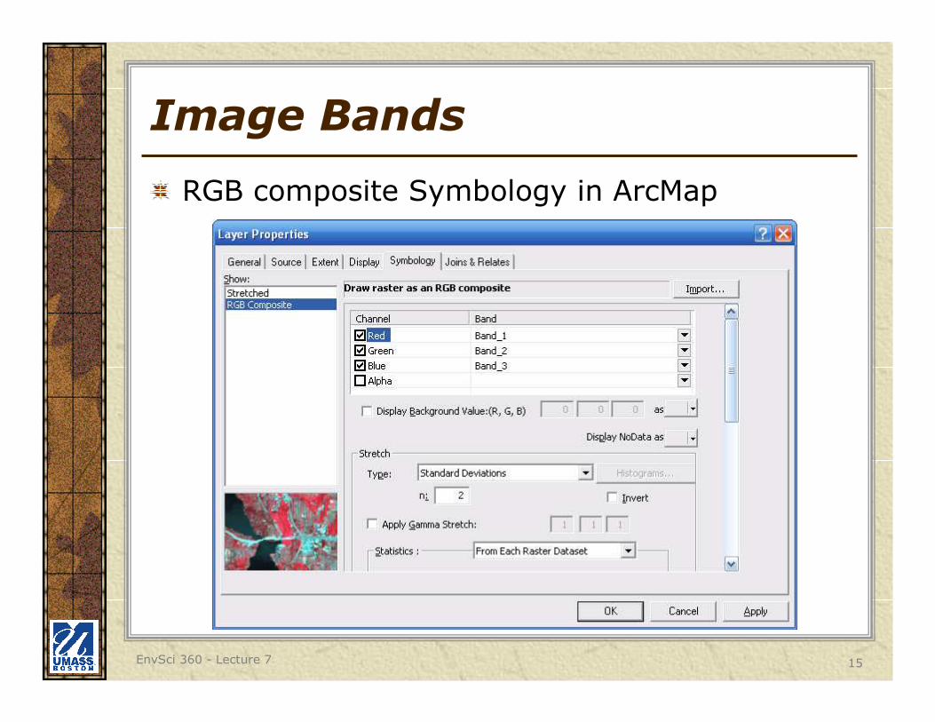
Image Bands
RGB composite Symbology in ArcMap
EnvSci 360 - Lecture 7 16
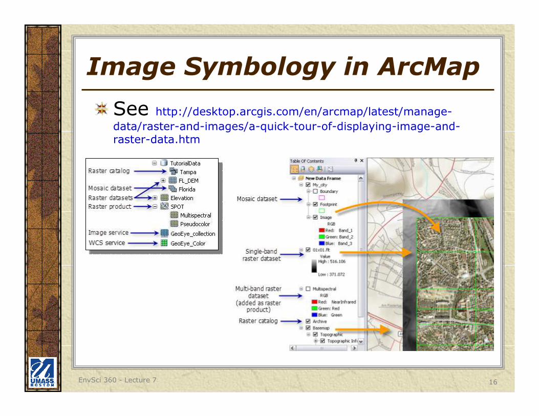
Image Symbology in ArcMap
See http://desktop.arcgis.com/en/arcmap/latest/manage-
data/raster-and-images/a-quick-tour-of-displaying-image-and-raster-data.htm
EnvSci 360 - Lecture 7 17
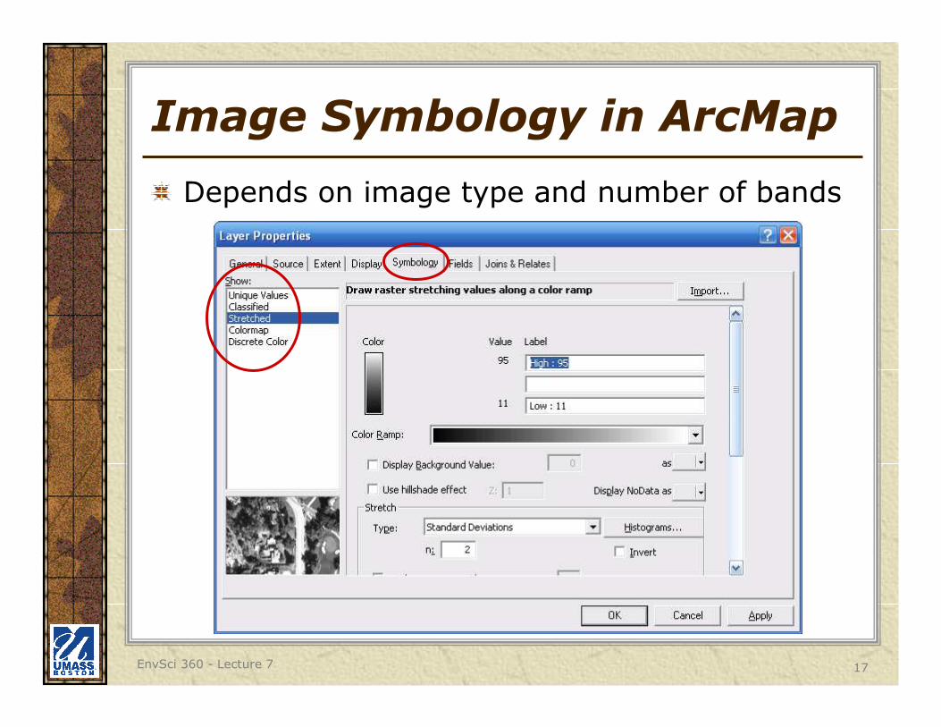
Image Symbology in ArcMap
Depends on image type and number of bands
EnvSci 360 - Lecture 7 18
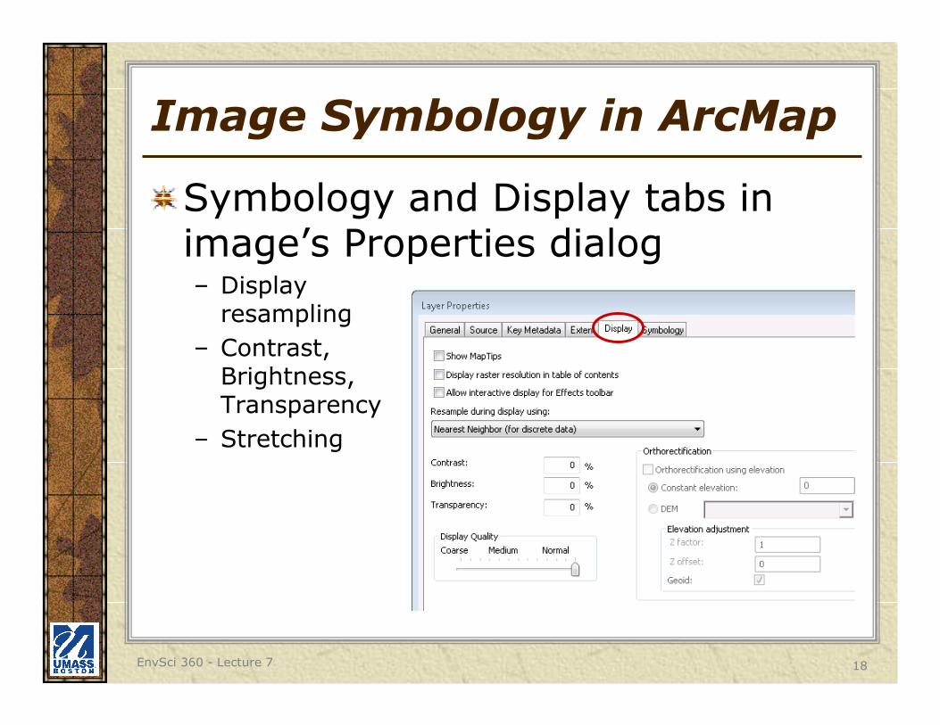
Image Symbology in ArcMap
Symbology and Display tabs in image’s Properties dialog– Display
resampling
– Contrast, Brightness, Transparency
– Stretching
EnvSci 360 - Lecture 7 19
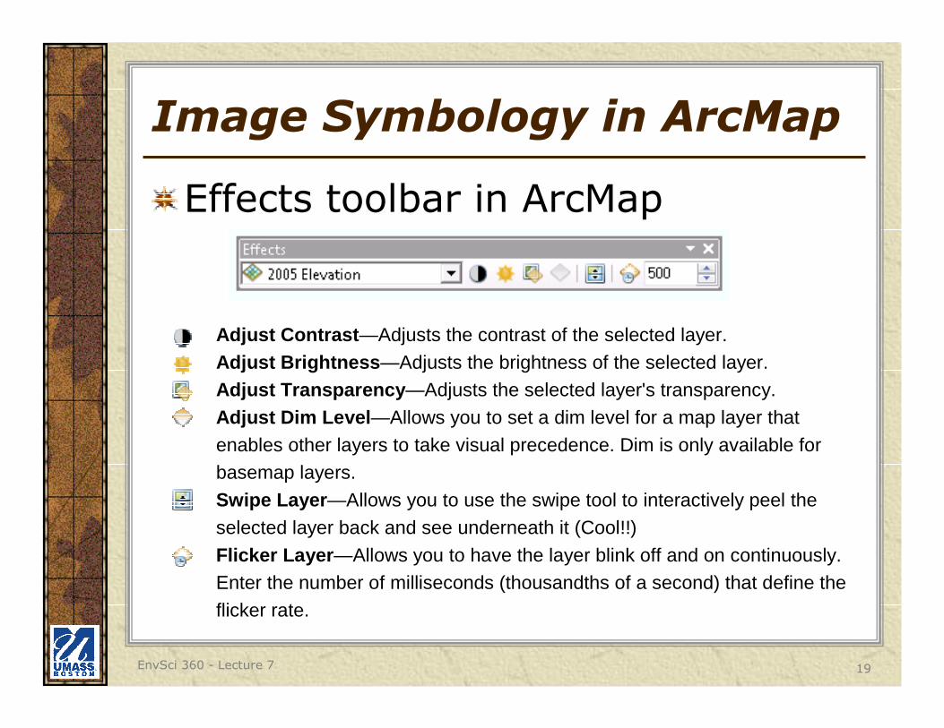
Image Symbology in ArcMap
Effects toolbar in ArcMap
Adjust Contrast —Adjusts the contrast of the selected layer.
Adjust Brightness —Adjusts the brightness of the selected layer.Adjust Transparency —Adjusts the selected layer's transparency.
Adjust Dim Level —Allows you to set a dim level for a map layer that
enables other layers to take visual precedence. Dim is only available for basemap layers.
Swipe Layer —Allows you to use the swipe tool to interactively peel the
selected layer back and see underneath it (Cool!!)
Flicker Layer —Allows you to have the layer blink off and on continuously. Enter the number of milliseconds (thousandths of a second) that define the
flicker rate.
EnvSci 360 - Lecture 7 20
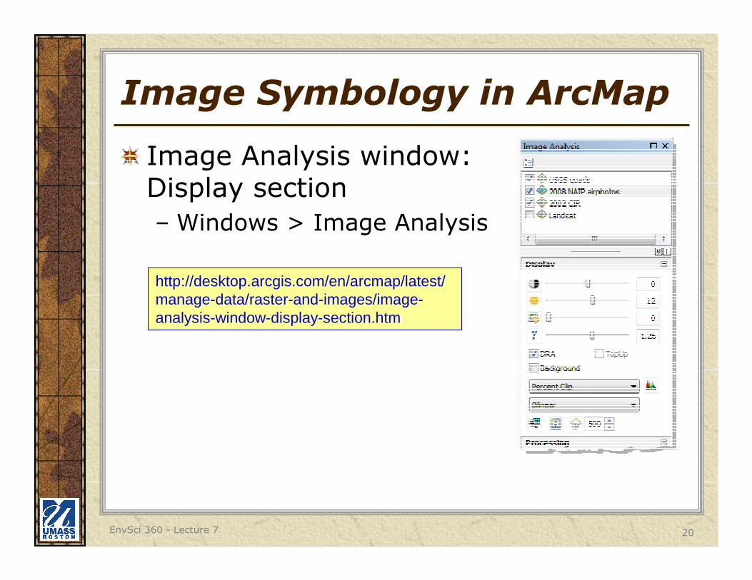
Image Symbology in ArcMap
Image Analysis window: Display section
– Windows > Image Analysis
http://desktop.arcgis.com/en/arcmap/latest/manage-data/raster-and-images/image-analysis-window-display-section.htm
EnvSci 360 - Lecture 7 21
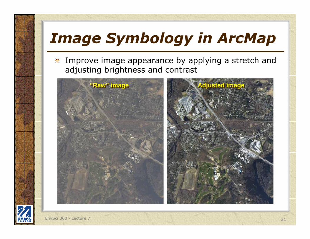
Image Symbology in ArcMap
Improve image appearance by applying a stretch and adjusting brightness and contrast
“Raw” image“Raw” image Adjusted imageAdjusted image
EnvSci 360 - Lecture 7 22
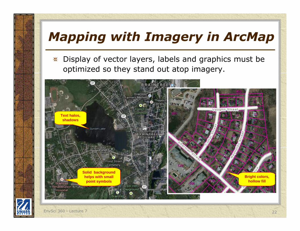
Mapping with Imagery in ArcMap
Display of vector layers, labels and graphics must be
optimized so they stand out atop imagery.
Bright colors, hollow fill
Text halos, shadows
Solid background helps with small point symbols
EnvSci 360 - Lecture 7 23
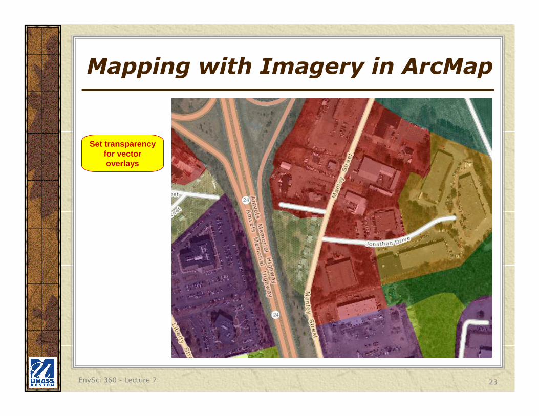
Mapping with Imagery in ArcMap
Set transparency for vector overlays

EnvSci 360 - Lecture 7 24
Mapping with Imagery in ArcMap
Use line fill or other pattern
symbols
EnvSci 360 - Lecture 7 25
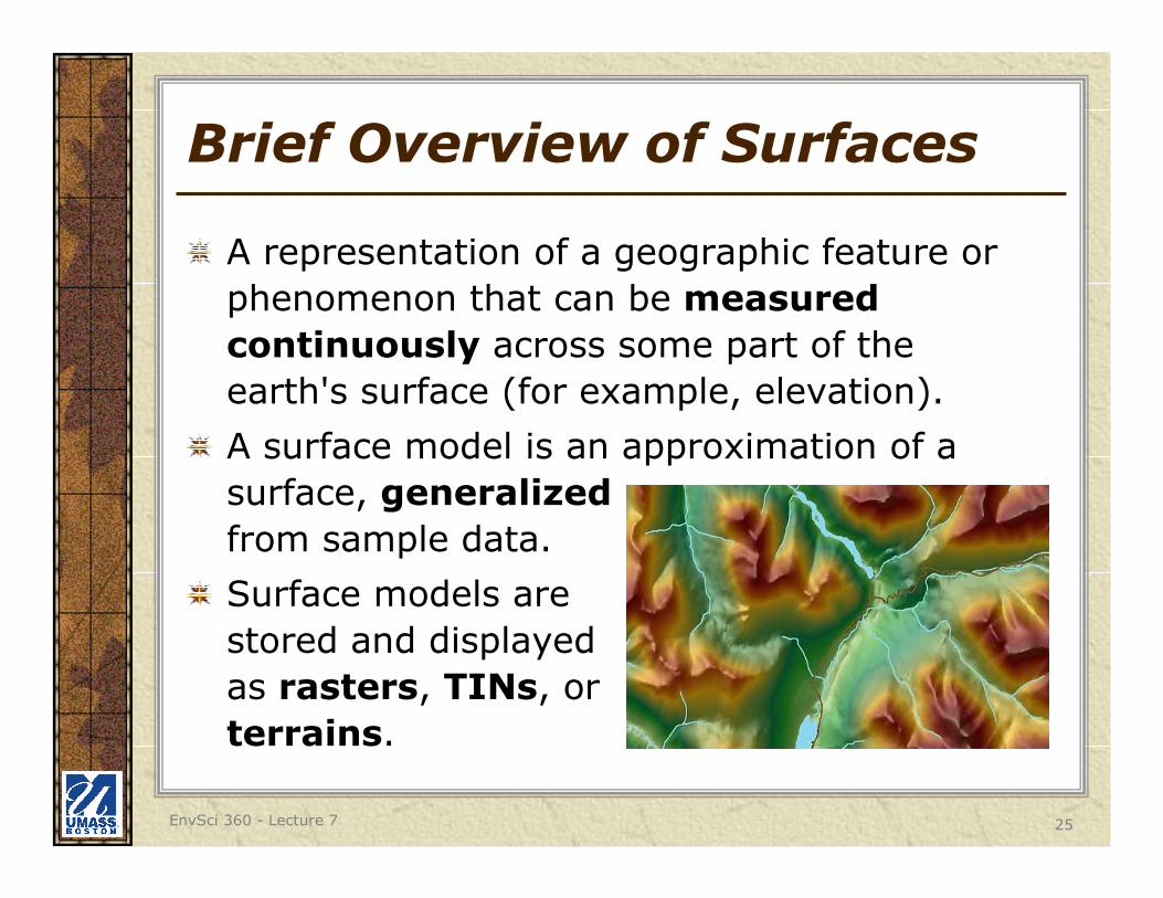
Brief Overview of Surfaces
A representation of a geographic feature or
phenomenon that can be measured
continuously across some part of the
earth's surface (for example, elevation).
A surface model is an approximation of a
surface, generalized
from sample data.
Surface models are
stored and displayed
as rasters, TINs, or
terrains.
EnvSci 360 - Lecture 7 26
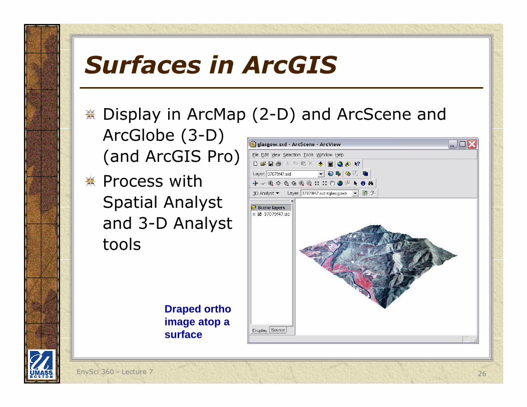
Surfaces in ArcGIS
Display in ArcMap (2-D) and ArcScene and
ArcGlobe (3-D)
(and ArcGIS Pro)
Process with
Spatial Analyst
and 3-D Analyst
tools
Draped orthoimage atop a surface
EnvSci 360 - Lecture 7 27
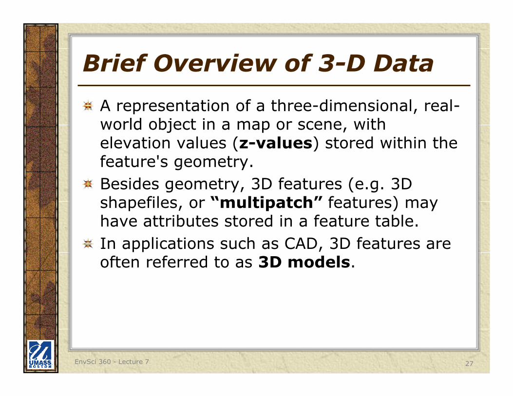
Brief Overview of 3-D Data
A representation of a three-dimensional, real-world object in a map or scene, with elevation values (z-values) stored within the feature's geometry.
Besides geometry, 3D features (e.g. 3D shapefiles, or “multipatch” features) may have attributes stored in a feature table.
In applications such as CAD, 3D features are often referred to as 3D models.
EnvSci 360 - Lecture 7 28
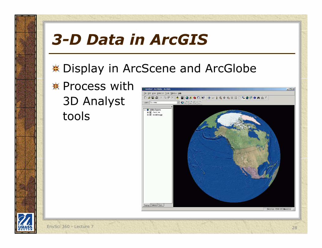
3-D Data in ArcGIS
Display in ArcScene and ArcGlobe
Process with
3D Analyst
tools
EnvSci 360 - Lecture 7 29
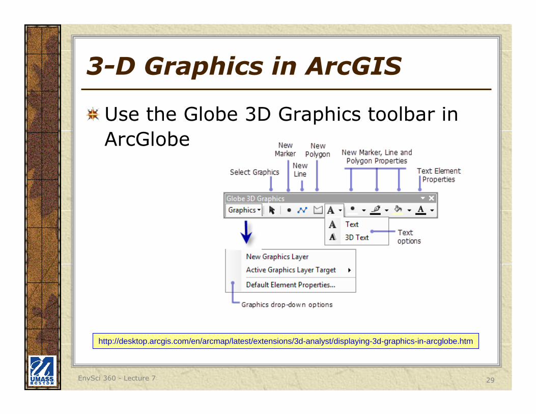
3-D Graphics in ArcGIS
Use the Globe 3D Graphics toolbar in
ArcGlobe
http://desktop.arcgis.com/en/arcmap/latest/extensions/3d-analyst/displaying-3d-graphics-in-arcglobe.htm
EnvSci 360 - Lecture 7 30
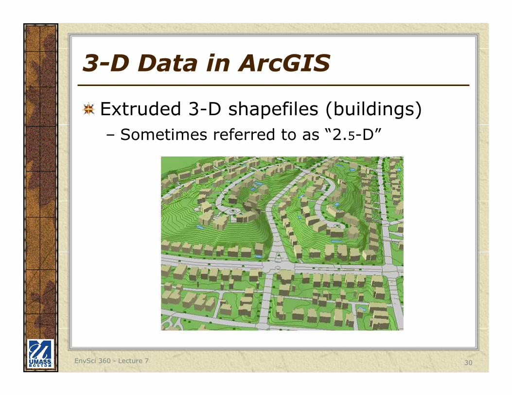
3-D Data in ArcGIS
Extruded 3-D shapefiles (buildings)
– Sometimes referred to as “2.5-D”
EnvSci 360 - Lecture 7 31
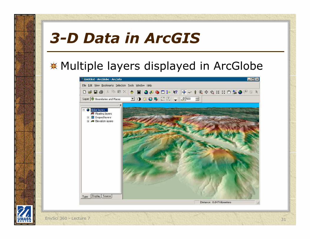
3-D Data in ArcGIS
Multiple layers displayed in ArcGlobe
EnvSci 360 - Lecture 7 32
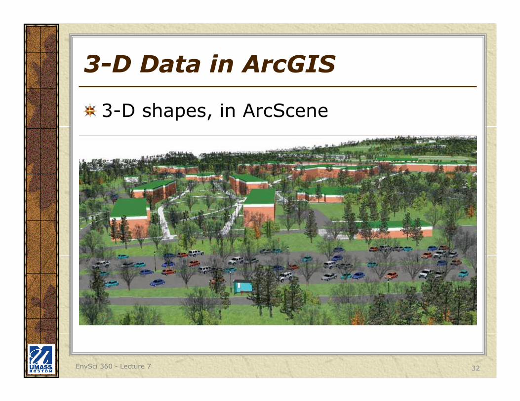
3-D Data in ArcGIS
3-D shapes, in ArcScene
EnvSci 360 - Lecture 7 33
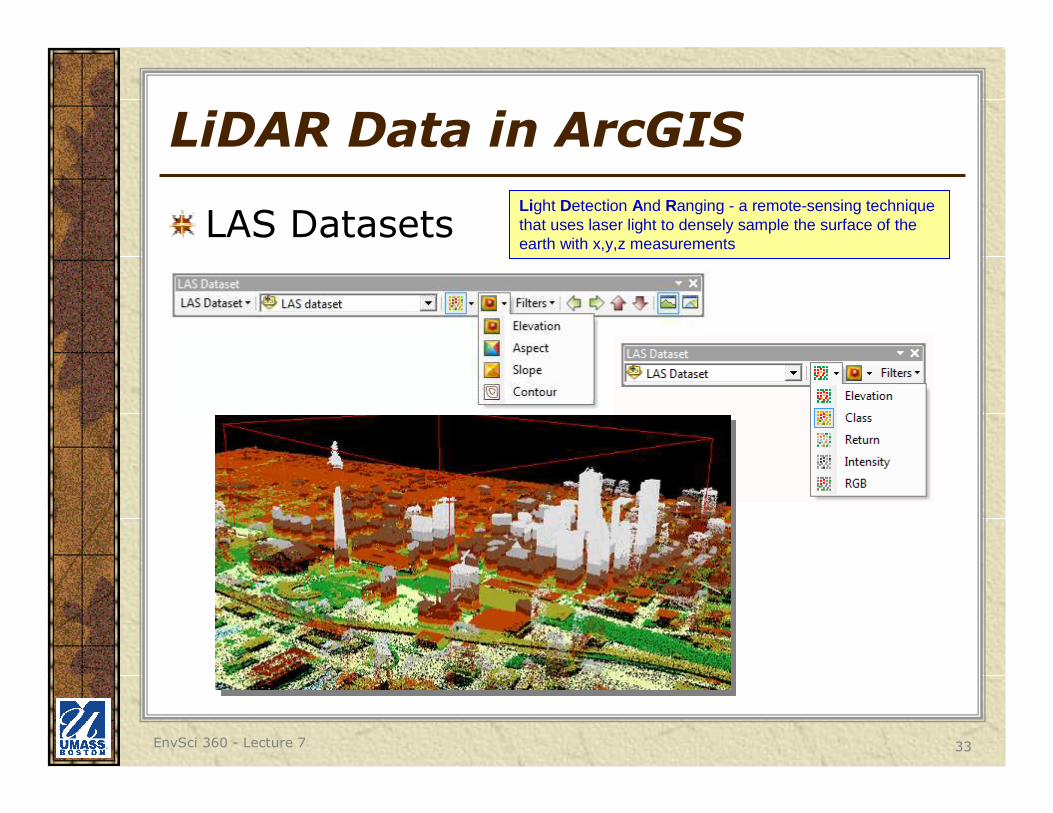
LiDAR Data in ArcGIS
LAS DatasetsLight Detection And Ranging - a remote-sensing technique that uses laser light to densely sample the surface of the earth with x,y,z measurements
EnvSci 360 - Lecture 7 34
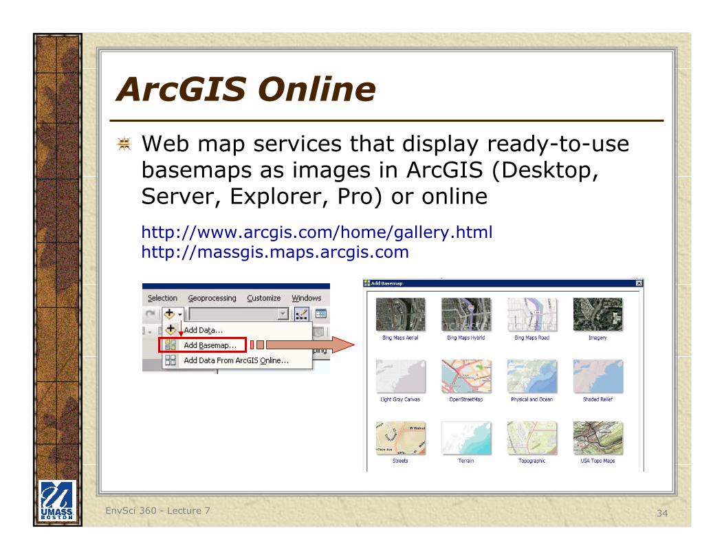
ArcGIS Online
Web map services that display ready-to-use basemaps as images in ArcGIS (Desktop, Server, Explorer, Pro) or online
http://www.arcgis.com/home/gallery.htmlhttp://massgis.maps.arcgis.com
EnvSci 360 - Lecture 7 35
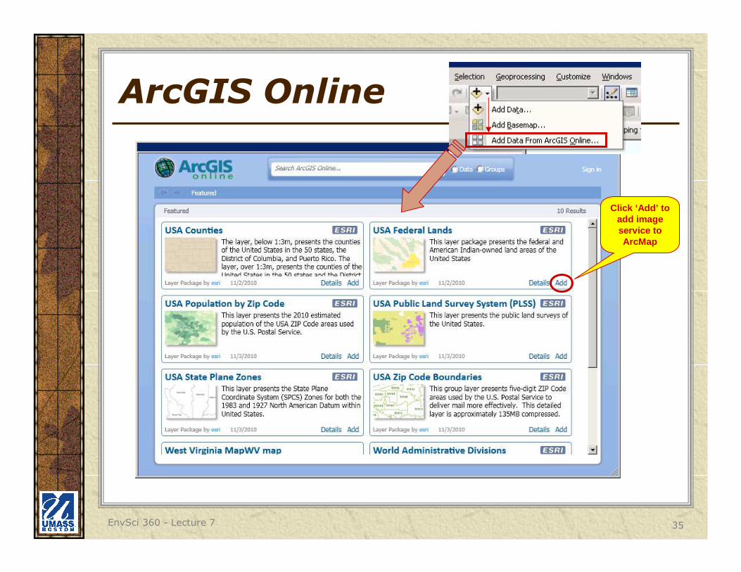
ArcGIS Online
Click ‘Add’ to add image service to ArcMap
EnvSci 360 - Lecture 7 36
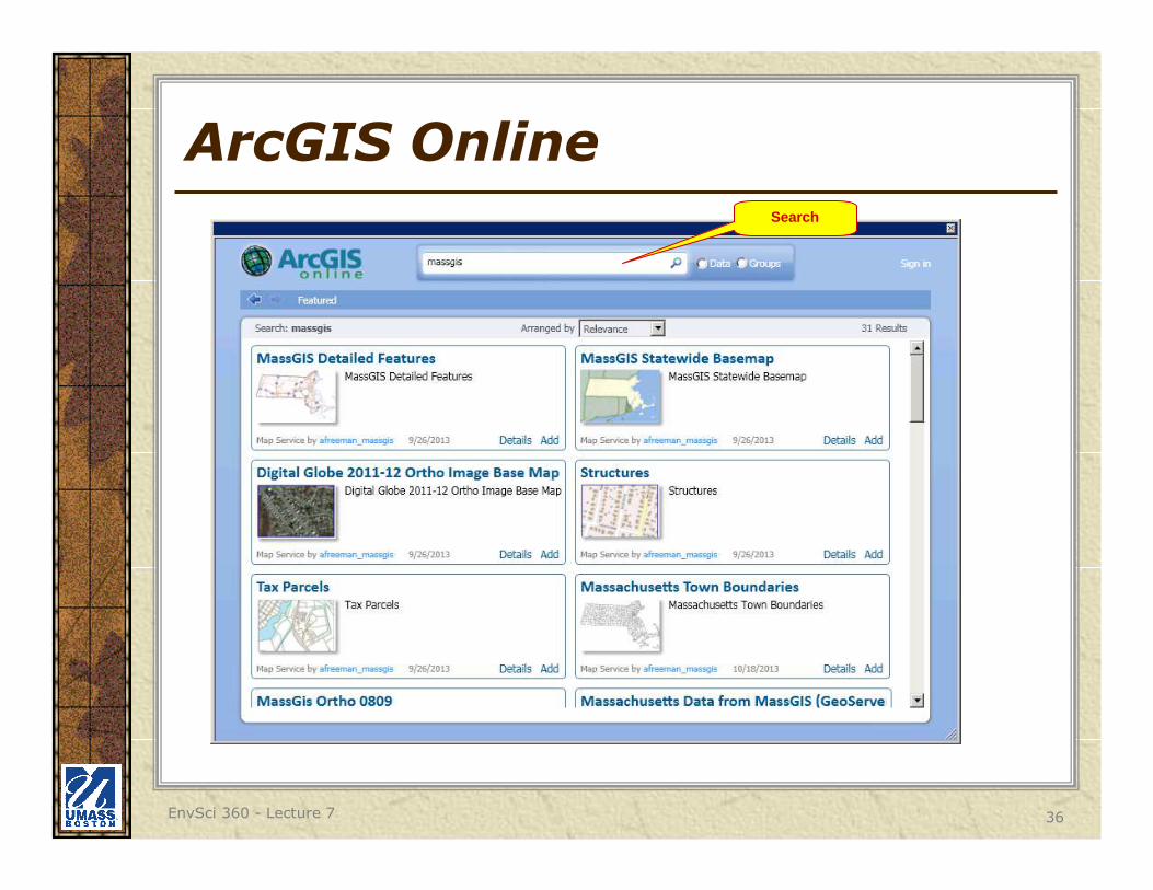
ArcGIS OnlineSearch
EnvSci 360 - Lecture 7 37
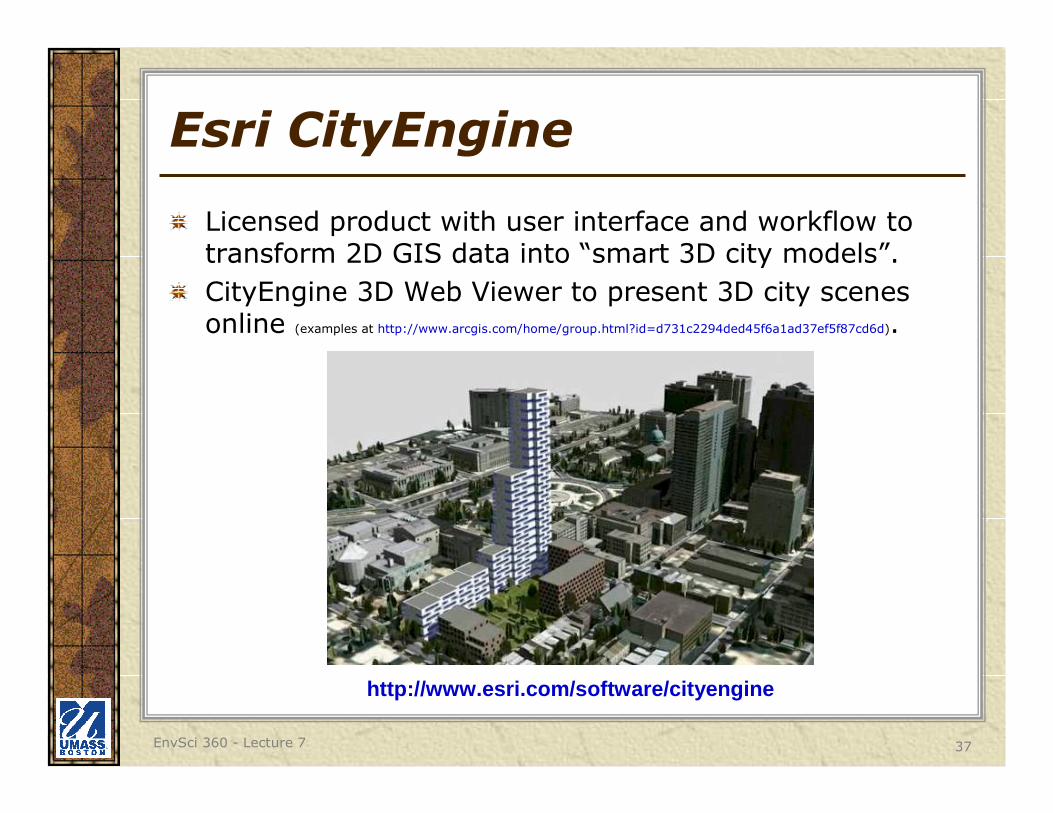
Esri CityEngine
Licensed product with user interface and workflow to transform 2D GIS data into “smart 3D city models”.
CityEngine 3D Web Viewer to present 3D city scenes online (examples at http://www.arcgis.com/home/group.html?id=d731c2294ded45f6a1ad37ef5f87cd6d).
http://www.esri.com/software/cityengine
EnvSci 360 - Lecture 7 38
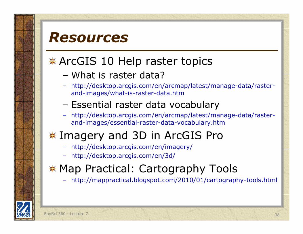
Resources
ArcGIS 10 Help raster topics
– What is raster data?– http://desktop.arcgis.com/en/arcmap/latest/manage-data/raster-
and-images/what-is-raster-data.htm
– Essential raster data vocabulary – http://desktop.arcgis.com/en/arcmap/latest/manage-data/raster-
and-images/essential-raster-data-vocabulary.htm
Imagery and 3D in ArcGIS Pro– http://desktop.arcgis.com/en/imagery/
– http://desktop.arcgis.com/en/3d/
Map Practical: Cartography Tools– http://mappractical.blogspot.com/2010/01/cartography-tools.html