esri production mapping advanced cartography · arcgis 10.x - tds generalization in esri defense...
TRANSCRIPT

Esri Production MappingAdvanced CartographyBo King & G.C. Rice
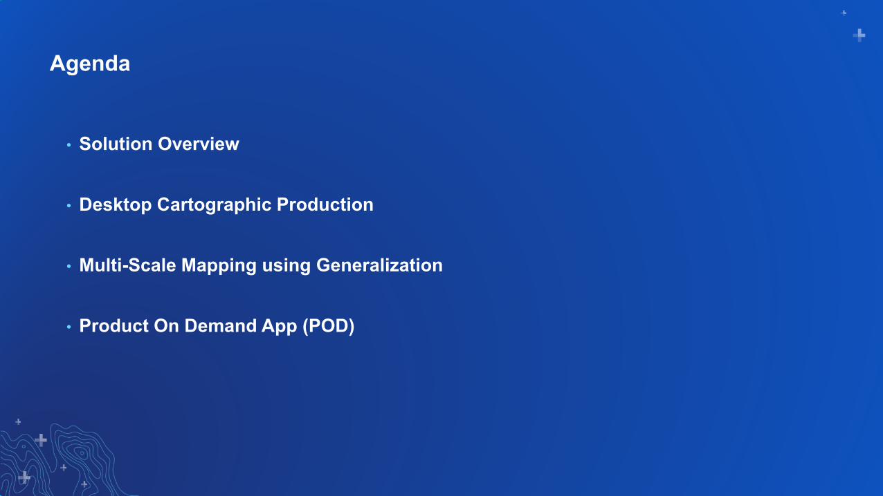
Agenda
• Solution Overview
• Desktop Cartographic Production
• Multi-Scale Mapping using Generalization
• Product On Demand App (POD)

Esri Production MappingSolution Overview
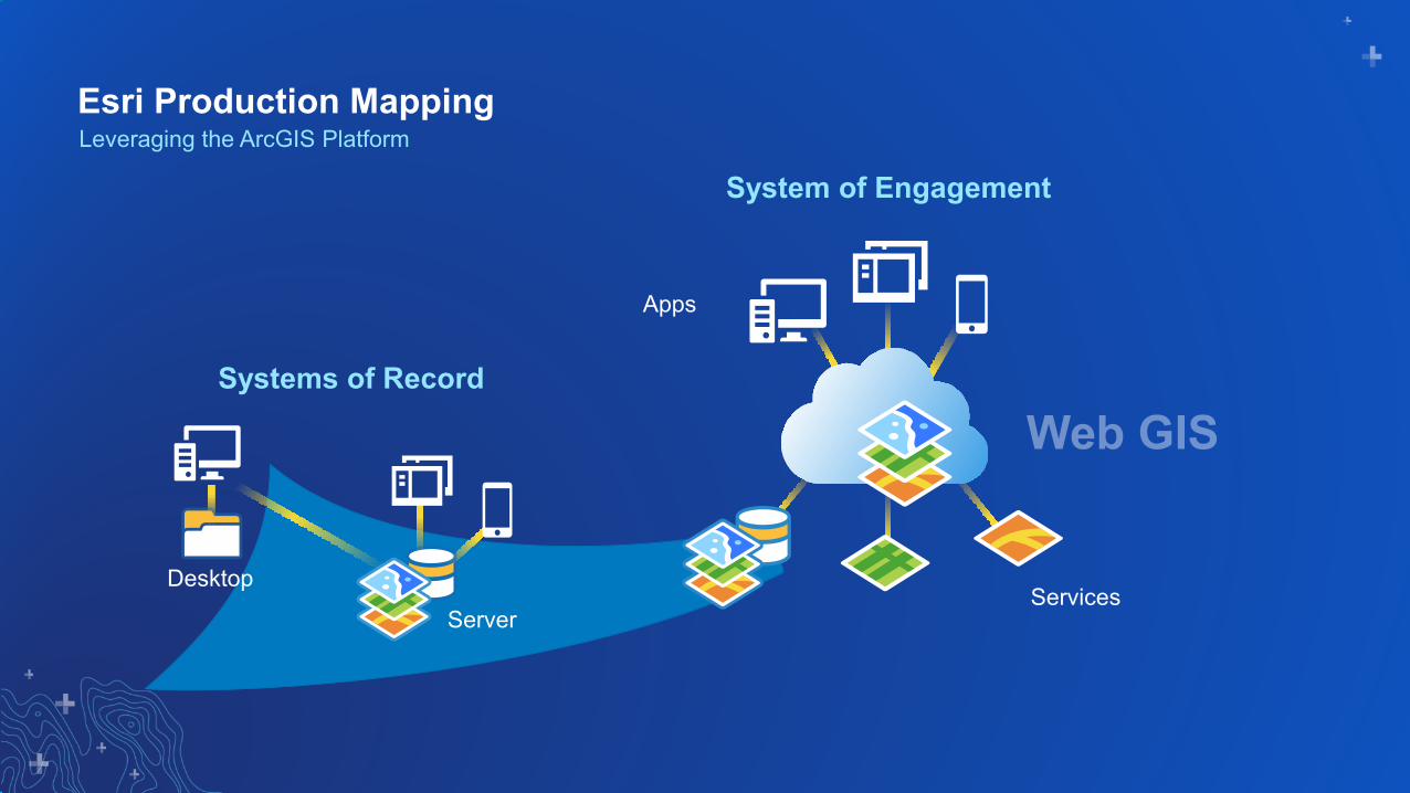
Esri Production MappingLeveraging the ArcGIS Platform
Apps
Server
Systems of Record
System of Engagement
ServicesDesktop
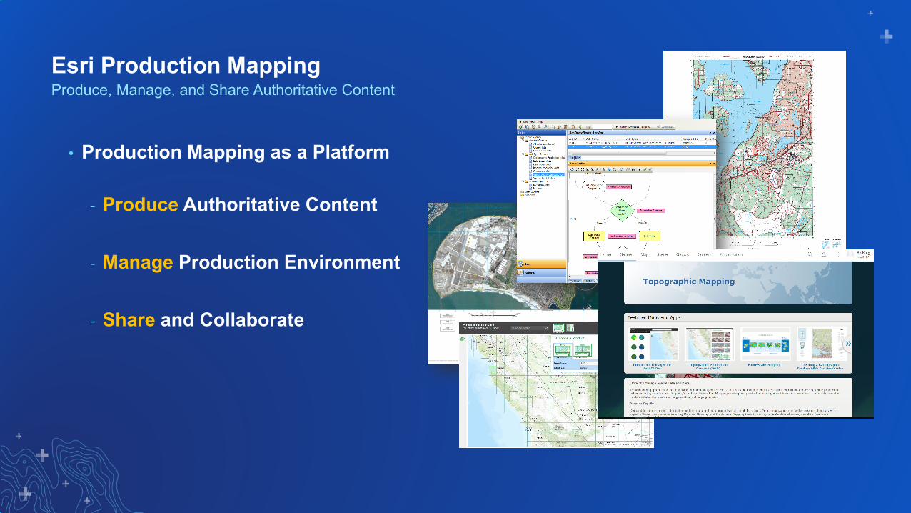
Esri Production Mapping
• Production Mapping as a Platform
- Produce Authoritative Content
- Manage Production Environment
- Share and Collaborate
Produce, Manage, and Share Authoritative Content
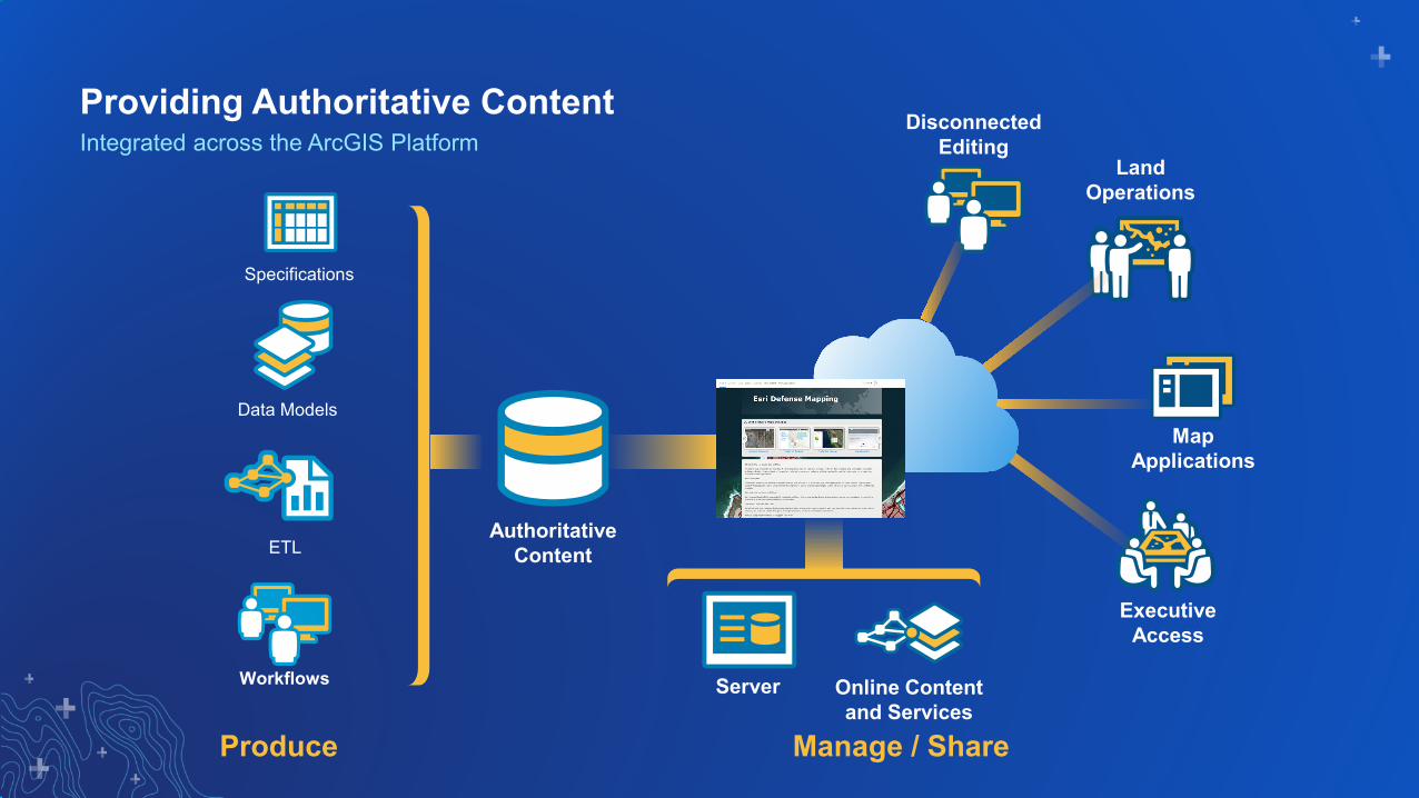
Server Online Content and Services
Authoritative Content
DisconnectedEditing
Executive Access
Map Applications
Land Operations
Produce Manage / Share
Workflows
Data Models
ETL
Specifications
Integrated across the ArcGIS PlatformProviding Authoritative Content

Esri Production Mapping
• Custom Products
• Geoprocessing Toolsets
• Quality Assurance / Control
• Cartographic Symbology
An Extension to the ArcGIS Platform

Esri Production Mapping for ArcGIS ProCartographic Production

Cartographic ProductionExpediting the Map Creation Process

ArcGIS Pro
• Production Mapping Extension - Edit Tools
- Modify Features - Create Features
• Topographic Production Toolbox- Cartography- Data Management- Workflow
Esri Production Mapping for ArcGIS Pro

Edit Tools
• Populate Angle
• Geoname to Feature
• Buildings
• Difference Polygon
Esri Production Mapping for ArcGIS Pro
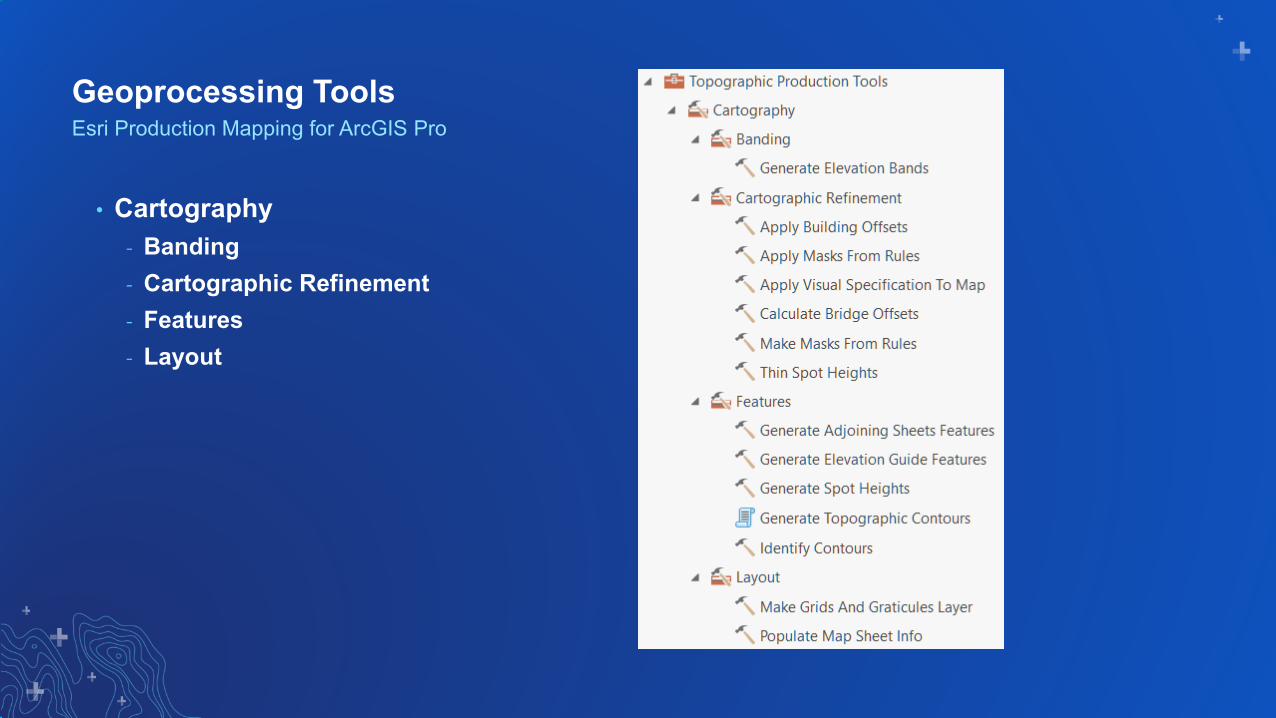
Geoprocessing Tools
• Cartography- Banding- Cartographic Refinement- Features- Layout
Esri Production Mapping for ArcGIS Pro

Geoprocessing Tools
• Data Management- Features- Generalization- Geodatabase- Topology- Validation
Esri Production Mapping for ArcGIS Pro

Geoprocessing Tools
• Workflow- Properties- Tasks
Esri Production Mapping for ArcGIS Pro
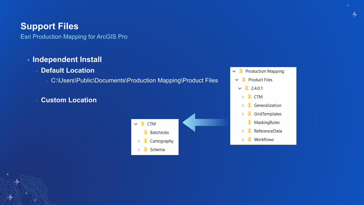
Support Files
• Independent Install- Default Location
- C:\Users\Public\Documents\Production Mapping\Product Files
- Custom Location
Esri Production Mapping for ArcGIS Pro
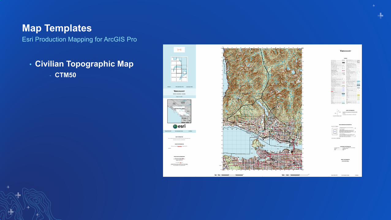
Map Templates
• Civilian Topographic Map- CTM50
Esri Production Mapping for ArcGIS Pro

Dynamic Elements
• Topo North Arrow• US National Grid Box
Esri Production Mapping for ArcGIS Pro

Labels & Symbols
• Label Expressions (Python)• Symbol Expressions (Arcade)
Esri Production Mapping for ArcGIS Pro

Demo
Map Production in ArcGIS Pro

Data Generalization for Multi-Scale Mapping
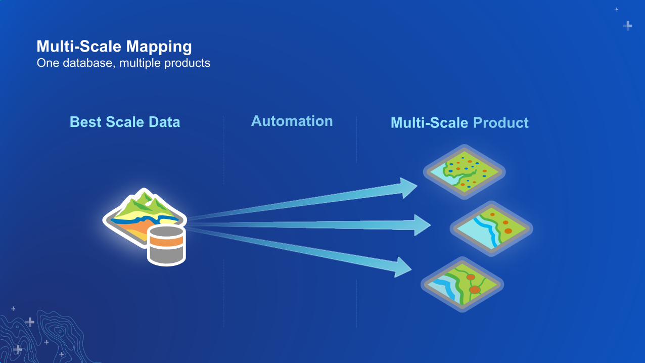
Multi-Scale Mapping
Multi-ScaleBest Scale Data
One database, multiple products
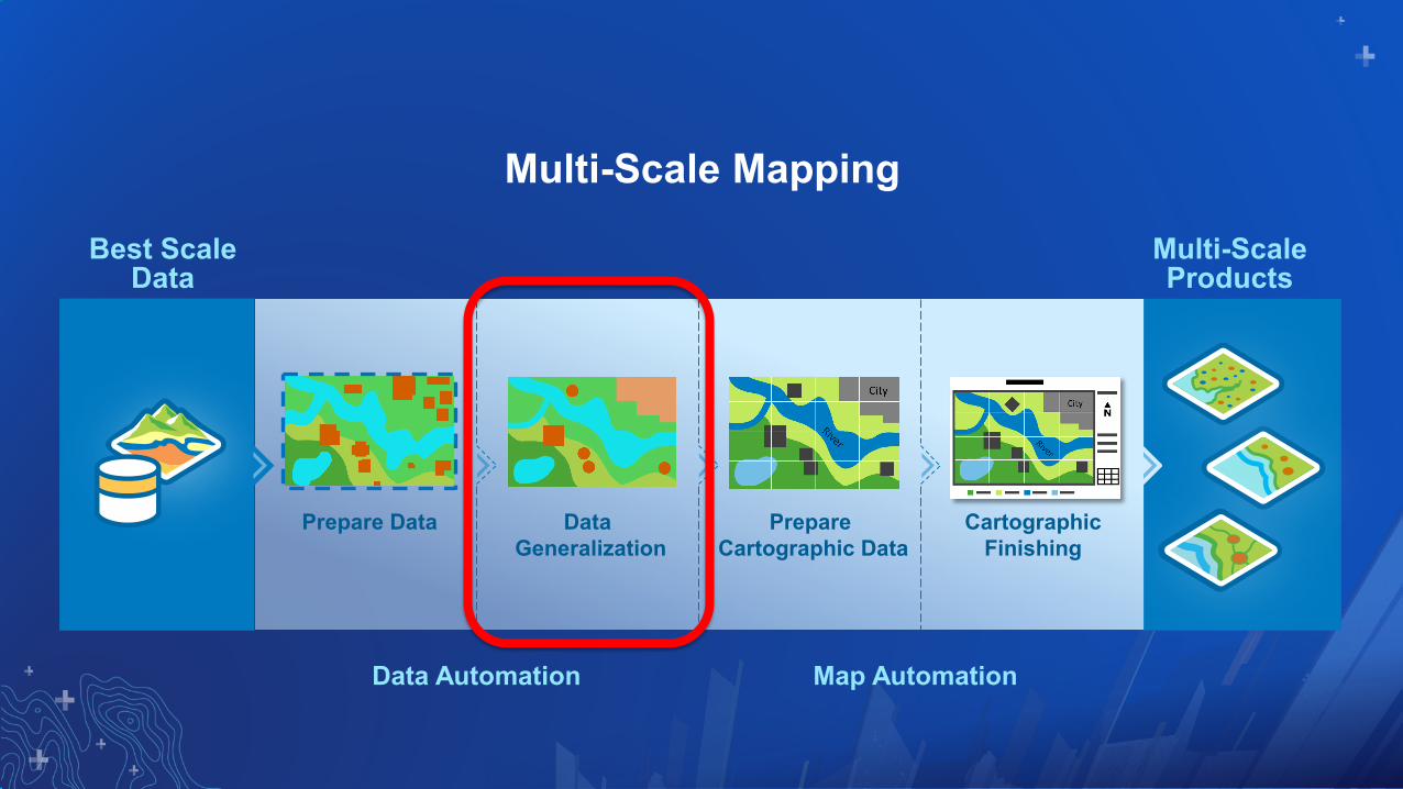
Multi-Scale Mapping
Best Scale Data
Prepare Data Data Generalization
PrepareCartographic Data
CartographicFinishing
Multi-Scale Products
Data Automation Map Automation

Generalization Techniques
• Simplify• Smooth• Eliminate• Amalgamate (Aggregate)• Collapse• Thin• Exaggerate
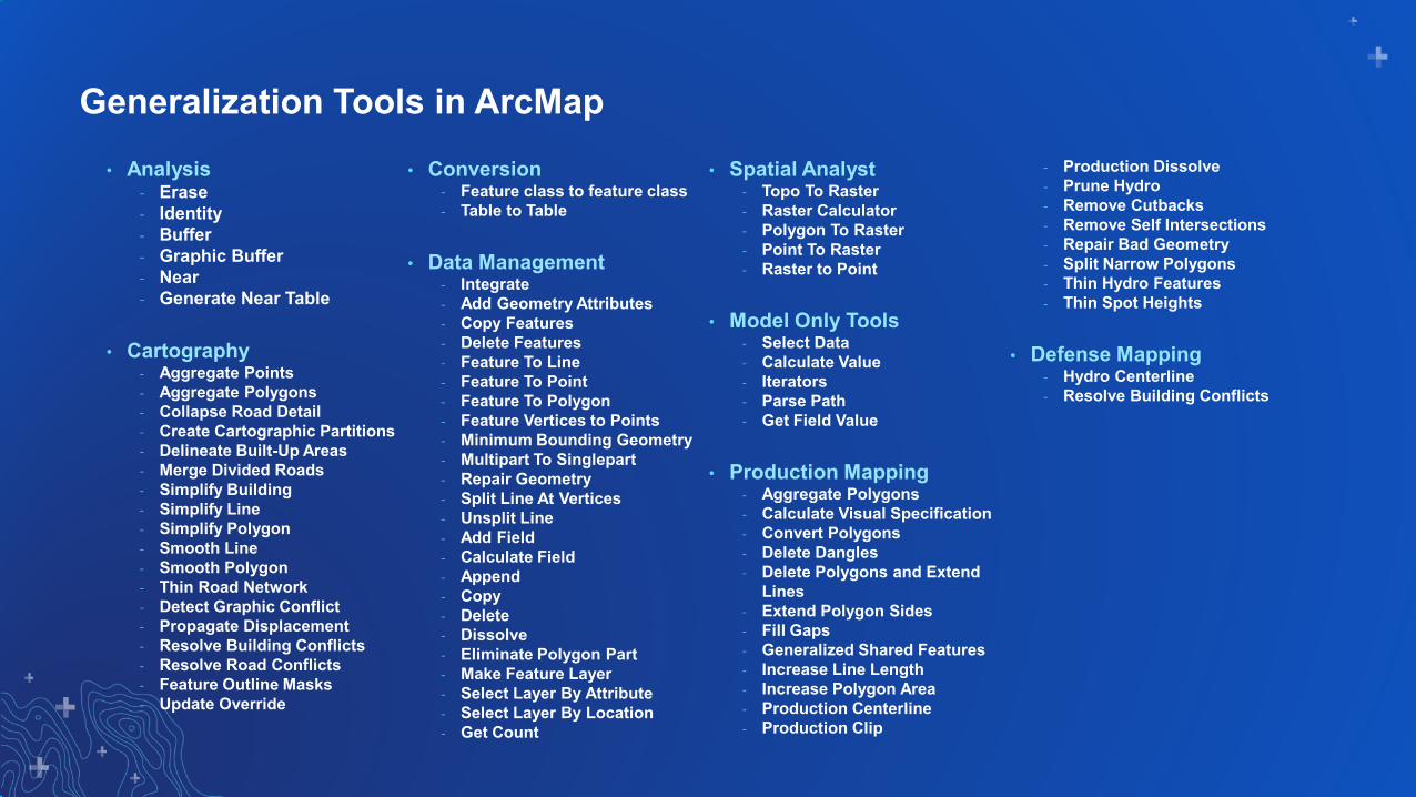
Generalization Tools in ArcMap• Analysis
- Erase- Identity- Buffer- Graphic Buffer - Near- Generate Near Table
• Cartography- Aggregate Points- Aggregate Polygons- Collapse Road Detail- Create Cartographic Partitions- Delineate Built-Up Areas- Merge Divided Roads- Simplify Building- Simplify Line- Simplify Polygon- Smooth Line- Smooth Polygon- Thin Road Network- Detect Graphic Conflict- Propagate Displacement- Resolve Building Conflicts - Resolve Road Conflicts- Feature Outline Masks- Update Override
• Conversion- Feature class to feature class- Table to Table
• Data Management- Integrate- Add Geometry Attributes- Copy Features- Delete Features- Feature To Line- Feature To Point- Feature To Polygon- Feature Vertices to Points- Minimum Bounding Geometry- Multipart To Singlepart- Repair Geometry- Split Line At Vertices- Unsplit Line- Add Field- Calculate Field- Append- Copy- Delete- Dissolve- Eliminate Polygon Part- Make Feature Layer- Select Layer By Attribute- Select Layer By Location- Get Count
• Spatial Analyst - Topo To Raster- Raster Calculator- Polygon To Raster- Point To Raster- Raster to Point
• Model Only Tools- Select Data- Calculate Value- Iterators- Parse Path- Get Field Value
• Production Mapping- Aggregate Polygons- Calculate Visual Specification- Convert Polygons- Delete Dangles- Delete Polygons and Extend
Lines- Extend Polygon Sides- Fill Gaps- Generalized Shared Features- Increase Line Length- Increase Polygon Area- Production Centerline- Production Clip
- Production Dissolve- Prune Hydro- Remove Cutbacks- Remove Self Intersections- Repair Bad Geometry- Split Narrow Polygons - Thin Hydro Features- Thin Spot Heights
• Defense Mapping- Hydro Centerline- Resolve Building Conflicts

Generalization Tools in ArcGIS Pro• Analysis
- Erase- Identity- Buffer- Graphic Buffer - Near- Generate Near Table
• Cartography- Aggregate Points- Aggregate Polygons- Collapse Road Detail- Create Cartographic Partitions- Delineate Built-Up Areas- Merge Divided Roads- Simplify Building- Simplify Line- Simplify Polygon- Simplify Shared Edges- Smooth Line- Smooth Polygon- Smooth Shared Edges- Thin Road Network- Detect Graphic Conflict- Propagate Displacement- Resolve Building Conflicts - Resolve Road Conflicts- Feature Outline Masks
• Conversion- Feature class to feature class- Table to Table
• Data Management- Integrate- Add Geometry Attributes- Copy Features- Delete Features- Feature To Line- Feature To Point- Feature To Polygon- Feature Vertices to Points- Minimum Bounding Geometry- Multipart To Singlepart- Repair Geometry- Split Line At Vertices- Unsplit Line- Add Field- Calculate Field- Append- Copy- Delete- Delete Identical- Dissolve- Eliminate- Eliminate Polygon Part- Make Feature Layer- Select Layer By Attribute
- Select Layer By Location- Get Count
• Spatial Analyst - Topo To Raster- Raster Calculator- Polygon To Raster- Point To Raster- Raster to Point
• Model Only Tools- Select Data- Calculate Value- Iterators- Parse Path- Get Field Value
• Topographic Production- Aggregate Polygons- Eliminate Polygon- Export Generalized Data- Import Generalized Data- Extract Data- Load Data- Remove Small Lines- Delete Polygons and Extend
Lines- Extend Polygon Sides- Fill Gaps
- Generalize Shared Features (now in Cartography Toolbox)
- Increase Line Length- Increase Polygon Area- Polygon To Centerline
Production Clip- Production Dissolve- Thin Hydrology Lines - Remove Cutback Vertices- Remove Self Intersection- Repair Bad Geometry- Identify Narrow Polygons - Thin Hydrology Lines- Thin Spot Heights- Apply Building Offsets
Color Scheme:Available in Pro (2.4)In Pro - Renamed/MovedNew in ProNot yet in Pro

Leverage Tools Within Models…

…and Submodels
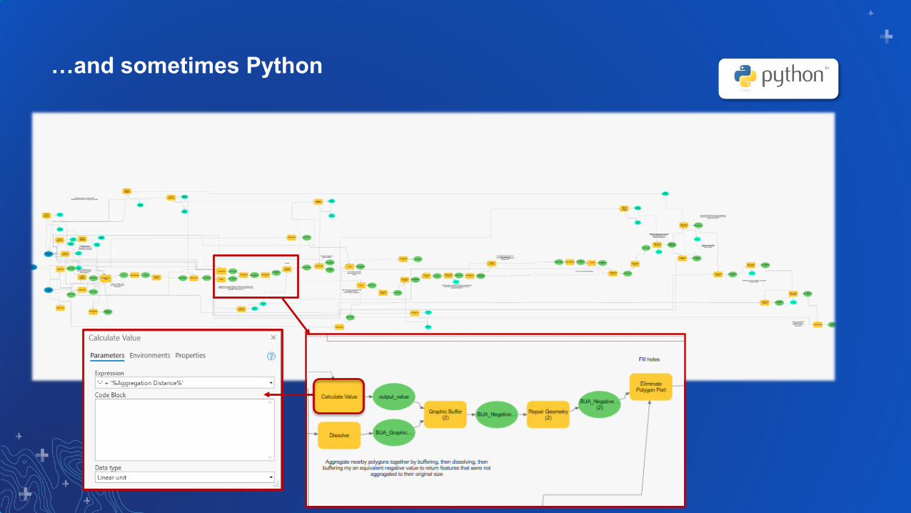
…and sometimes Python

ArcGIS 10.x - TDS Generalization in Esri Defense Mapping
50K to 250K Generalization of TDS 6.1 Data Schema• Output Intended for 250K Product Creation• Stand-alone toolbox with models and scripts

Generalization in Pro
• One set of geoprocessing models
• Not dependent on data schema
• Not dependent on input or output scale
Development Approach for Defense and Production Mapping
CTM25K
TDS50K
Your DataSource Scale
CTM50K
TDS250K
Your DataOutput Scale
Rule File

Production Mapping and Defense Mapping - Pro 2.4
Included with Product Data Installers
Generalization Rules CTM 25K to 50K
(Production Mapping)
TDS 50K to 250K(Defense Mapping)
In the Box
Topographic Production GP ToolsTheme-Based Models

G.C. Rice
Generalization in ArcGIS Pro

Topo Product On Demand (POD)
• Installed with Esri Defense Mapping for Server
• Cartographic Production App
• Self-service - Defense Products- Civilian Products- Custom Products- Both Maps and Data
Esri Defense Mapping Web Application

G.C. Rice
Product on Demand Application

Additional Sessions
• Showcase Locations- Mapping & Visualization- Mapping & Statistics- Defense & Intelligence

Please Share Your Feedback in the App
Download the EsriEvents app and find
your event
Select the session you attended
Scroll down to “Survey”
Log in to access the survey
Complete the survey and select “Submit”
