examples of effective techniques for improving the...
TRANSCRIPT

Examples of Effective Techniques for Improving the Quality of Environmental Documents
Appendices
www.environment.transportation.org

Table of Contents
A. Techniques for Improving Overall Document Quality
Chapter 1. Page Layout Chapter 2. Writing Style Chapter 3. Document Structure Chapter 4. Navigation Chapter 5. Abstracts Chapter 6. Presentation of Data Chapter 7. Figures Chapter 8. Visualization Chapter 9. Appendices Chapter 10. References to Supporting Materials
B. Techniques for Demonstrating Compliance with NEPA and Related Requirements
Chapter 11. Purpose and Need Chapter 12. Alternatives Analysis
Chapter 13. Methodologies Chapter 14. Mitigation/Commitments Chapter 15. Regulatory Compliance Chapter 16. Responses to Comments on DEIS Chapter 17. Changes During the NEPA Process
- 2 -
Examples of Effective Techniques for Improving the Quality of Environmental Documents

ExamplesofEffectiveTechniquesforImprovingtheQualityofEnvironmentalDocuments
Chapter1.PageLayout
ThereadabilityofaNEPAdocumentdependsnotonlyonthecontent,butalsoonthewaythatcontentispresented.Forexample,areader’sabilitytoabsorbcomplexinformationcanbeenhancedbytechniquessuchaswhitespace,useofcolor,andcarefulplacementofgraphicsinrelationtothetext.Theexamplesinthissectionillustrateseveralpagelayouttechniques,whichcanbeusedseparatelyorincombination.Theyinclude:
Useofwhitespaceandcolor.Colorcanbeusedinheadings,footers,tables,andeveninthebodytexttoaddvisualinterestandalertthereadertonavigationaids(e.g.,sectionnumbers).Whitespacemakesiteasierforthereadertoabsorbcomplexinformationbypresentingthecontentinmoredigestiblechunksratherthaninlong,denseblocksofuninterruptedtext,whichcanbeoverwhelmingtothereader
Integrationofgraphicsandtext.Theselectionofphotosandothervisualelementscanbeusedtodrawthereader’sattentiontospecificconclusionsinthetext,ortohighlightcertainresourcesthatareespeciallyimportanttotheanalysis.Forexample,asshowninthischapter,aSection4(f)chapterforatransitprojectincludedaninsetphotoshowingahistoricbuildingthatwouldberemovedaspartofconstructionofthepreferredalternative.
Usingthesetechniquesmayrequiretheinvolvementofteammemberswithexpertiseindocumentlayoutanddesign.Italsomayrequireusingspecialsoftwareprogramsthatallowmoreflexibilityincombininggraphicsandtext,whichinturnmayrequiremoretimefordocumentproduction.Therefore,whilelayouttechniquesmayimprovethequalityoftheNEPAdocument,theydonotnecessarilysimplifypreparation.Itisimportanttotaketheseadditionaleffortsintoaccountwhenpreparingprojectschedulesandbudgets.
Examples of Effective Techniques for Improving the Quality of Environmental Documents

(Thispageisintentionallyleftblank.)

www.environment.transportation.org
White Space, Use of Color
OH: Opportunity Corridor DEIS
OR: OR 62 FEIS
CO: I-70 PEIS

the CLEVELAND OPPORTUNITY CORRIDOR
PROJECT
Draft EnvironmentalImpact StatementAUGUST 2013
Techniques to note:- use of color- use of white space

Chapter 2 PURPOSE and NEED
DRAFT ENVIRONMENTAL IMPACT STATEMENT
p=2-1
WHAT ARE PURPOSE AND NEED?
The purpose and need for a project define the transportation problems that the project must solve. The purpose and need also act as “measuring sticks” for the project alternatives, helping determine to what extent each alternative meets each project need (Figure 2-1). Alternatives that do not meet the basic needs of a project are not studied further. Assuming all other concerns are equal, if one alternative meets the project purpose and need better than another, then that alternative is favored as the project progresses. And as alternatives are developed,
the purpose and need can help determine if an impact is necessary.
The purpose and need also help decide where a project will begin and end by defining the “who, what, where, when and why” of the transportation needs. This allows an agency to create alternatives that satisfy the project’s needs completely – no more, no less. The beginning and end points of the project are also called “logical termini.” Logical termini for roadway projects are usually interchanges or intersections where travel demand changes.
The purpose and need are updated throughout the planning and engineering stages as the project team learns more. The purpose and need are not final until they are approved in the Final Environmental Impact Statement (FEIS).
The purpose and need for the Cleveland Opportunity Corridor project are documented in the project’s Purpose and Need Statement1 (May 2011), which can be found on the CD included with this Draft Environmental Impact Statement (DEIS). Since 2011, the purpose and need have been updated with new population data from the 2010 U.S. census. These changes are included in the following sections.
1 This document is incorporated by reference into this DEIS.
PU
RP
OS
E A
ND
NE
ED
The amount of impacts is often a deciding factor whentwo alternatives meet the project purpose and need equally.
Alternatives thatdo not meet basicpurpose and needare not studiedfurther.
Alternatives that meet purposeand need better than othersare given preference.
A L T E R N A T I V E S
Figure 2-1: Measuring Alternatives Using Purpose and Need
Techniques to note:- use of color in section headings, pagenumbers, and charts.- use of white space - e.g., large left margin
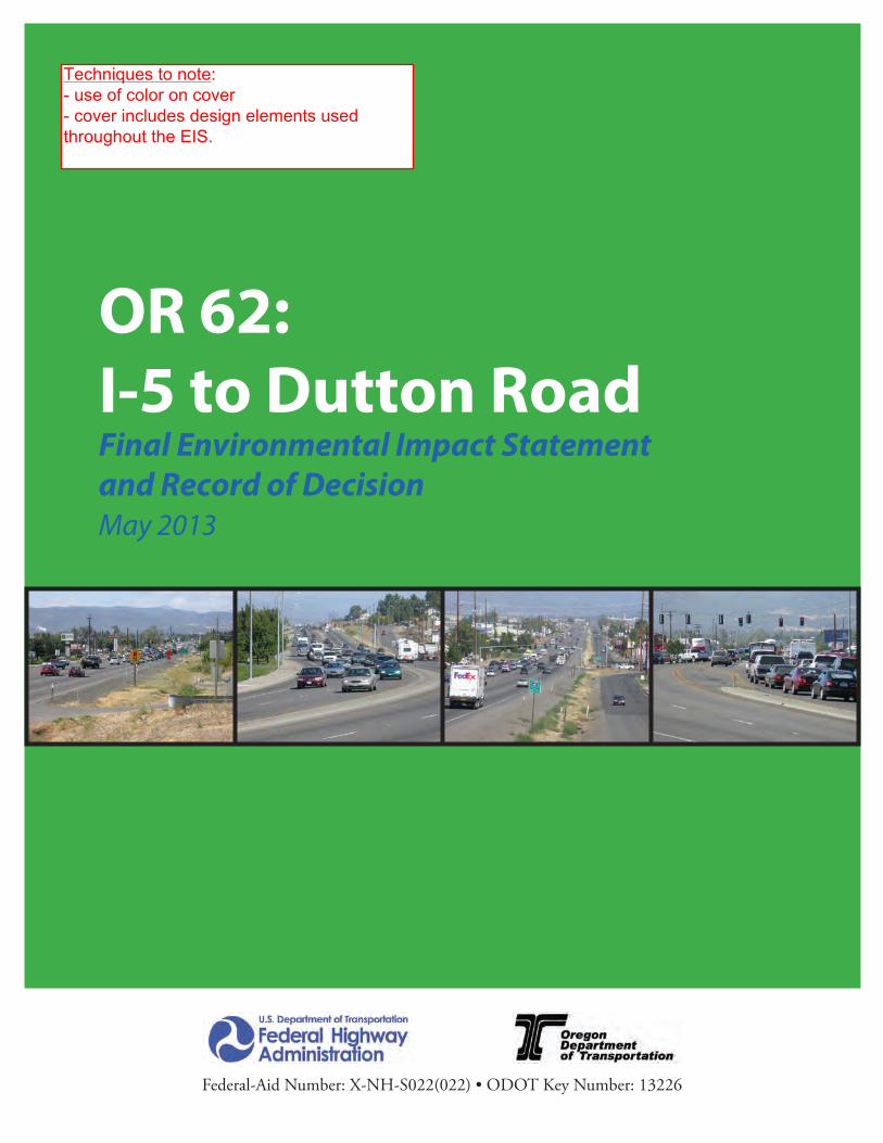
OR 62:I-5 to Dutton Road Final Environmental Impact Statementand Record of DecisionMay 2013
Federal-Aid Number: X-NH-S022(022) • ODOT Key Number: 13226
Techniques to note:- use of color on cover- cover includes design elements usedthroughout the EIS.

OR 62: Interstate 5 to Dutton Road Final Environmental Impact Statement ES - 1
ESExecutive Summary
How To Use This Executive SummaryIn the FEIS and this Executive Summary:
• Text from the DEIS that remains substantially unchanged from the DEIS, including minor edits, such as corrections of typos and numerical errors and rewording to clarify meaning, is printed in black.
• New text is printed in burnt orange, which is the color of this text.• Figures from the DEIS are reprinted. Where the content of a DEIS figure has
changed, such as to show a change in design or impacts, the DEIS figure is immediately followed by a new figure with the same figure number, but with “FEIS” added.
• Where impact numbers or text in a table have changed because of a change in design or impacts, the numbers or text from the DEIS remain in the table and the new numbers or text are added in burnt orange immediately below the original numbers or text from the DEIS.
• The DEIS text on mitigation measures is retained, followed by the mitigation measure commitments that are incorporated into the action.
The FEIS contains new numbers and text because of changes from the DEIS in the roadway projects expected to be built under the No Build Alternative, in the design and impacts of the Preferred Alternative, and in information and circumstances. The design of the alternative and the design options that were not identified as the Preferred Alternative have not been changed and the FEIS does not contain changes to those impacts.
This Executive Summary provides an overview of the project and its potential impacts. The OR 62: I-5 to Dutton Road Project Environmental Impact Statement (EIS) provides the information in greater detail.
IntroductionThe Oregon Department of Transportation (ODOT) and the Federal Highway Administration (FHWA) propose building the Oregon Highway 62 (OR 62): I-5 to Dutton Road Project, a 7.5-mile, four-lane, access-controlled expressway to serve as a bypass of existing OR 62 from Medford to north of White City in Jackson County, Oregon. The project includes the bypass, four interchanges, and changes to local streets and roads to accommodate the bypass. The project would reduce congestion and improve safety on existing OR 62 in Medford and north through White City by redirecting traffic to the bypass. The Bypass would provide faster travel and improved safety for vehicles traveling within and through the region. Figure ES-1 shows the general location of the project.
Techniques to note:- use of color in headings, sectionnumbers- use of color to highlight text that haschanged since DEIS- use of white space

OR 62: Interstate 5 to Dutton Road Final Environmental Impact Statement ES - 3
A Section 4(f ) de minimis finding for the historic Cingcade Complex, was made by FHWA on December 16, 2011. The DEIS proposed a Section 4(f ) de minimis use of the Denman Wildlife Area by both build alternatives, and Section 4(f ) de minimis uses of the Bear Creek Greenway path and the planned Midway Park by the SD Alternative. These three are recreational Section 4(f ) resources in the project area. A de minimis use of a Section 4(f ) resource is a use that does not adversely affect the activities, features, and attributes that qualify a park or historic resource for protection under Section 4(f ) of the U.S. Department of Transportation Act of 1966 (referred to below as Section 4(f ).
FHWA has made final Section 4(f ) de minimis determinations for impacts to the Denman Wildlife Area, the Bear Creek Greenway path, and the planned Midway Park by the Preferred Alternative and those are included in Appendix E.
If the SD Alternative is selected, 1.3 acres of land purchased with Land and Water Conservation Fund (LWCF) grants and protected by Section 6(f ) would be converted to transportation use. The location of replacement land for this use would be identified prior to issuing the Final Environmental Impact Statement (FEIS).
Because ODOT’s and Jackson County’s records differ from those of National Park Service (NPS) and Oregon Parks and Recreation Department (OPRD), two additional parcels of land could also be protected by Section 6(f ). This would result in an additional conversion of 0.3 acres of land protected by Section 6(f ). ODOT will continue to work with NPS and the OPRD to resolve the status of these parcels. This resolution will occur as part of final design and property acquisition.
ODOT and FHWA invite review of the proposed project. Giving citizens, stakeholders, and public agencies the opportunity to review and comment on the proposed project is a vital part of the National Environmental Policy Act (NEPA) process. The process helps decision-makers evaluate project alternatives. All substantive comments submitted will be considered.
The publication of the FEIS and ROD concludes the NEPA process. Comment is no longer being invited.
To learn more about the proposed project or to submit comments on the DEIS and proposed Section 4(f ) de minimis findings for the use of the Bear Creek Greenway, planned Midway Park, and Denman Wildlife Area, please visit the OR 62 project website at http://www.oregon.gov/ODOT/HWY/REGION3/hwy62_index.shtml.
Section 4(f ) de minimis findings have been completed. The publication of the FEIS and ROD concludes the NEPA process. Comment is no longer being invited.
Agencies and the public may send written and e-mail comments to:
Anna Henson Oregon Department of Transportation ODOT Region 3 100 Antelope Road White City, OR 97503 [email protected]
Comments may also be given at a public hearing held during the review of the DEIS. Following the public hearing, ODOT and FHWA will review, consider, and address all substantive comments. Responses to comments will be provided in the FEIS. Comments on the DEIS must be received within 45 days from the date on the cover of this document.
The publication of the FEIS and ROD concludes the NEPA process. Comment is no longer being invited.
NEPA, enacted in 1970, requires disclosure of the environmental impacts of federally-funded projects and opportunity for public comment.

T A B L E O F C O N T E N T S
Table of Contents
Techniques to note:- use of color 'tab' on right side of section dividersto assist in navigation

Chapter 1. Purpose and Need
I-70 Mountain Corridor Final Programmatic Environmental Impact StatementMarch 2011 Page 1-1
Chapter 1. Purpose and Need
1.1 What’s in Chapter 1?Chapter 1 describes the transportation problems that exist in the Interstate 70 (I-70) Mountain Corridor (the Corridor) today and are forecast to occur in the future. These problems lead to the definition of the project purpose and need. Chapter 1 documents the transportation problems and the need for a solution to these problems. The purpose and need provides the basis for defining reasonable alternatives and the foundation for eliminating alternatives in Chapter 2, Summary and Comparison of Alternatives.Chapter 1 also describes the study limits, briefly describes the Corridor, and summarizes background information from other studies that contribute to an understanding of the Corridor and its transportation problems. Other related project information presented in Chapter 1 includes a description of the 2035 and 2050 forecast years used to examine potential future growth and the associated travel demand,including the various types of trips that are likely to occur. For more detailed information on the travel demand forecasts, see the I-70 Mountain Corridor PEIS Travel Demand Technical Report (Colorado Department of Transportation [CDOT], March 2011).
1.2 Why was this Corridor study initiated?Interstate 70 is the only east-west interstate to cross Colorado and the only continuous east-west highway in the study area. It is the major corridor for access to established communities and recreational areas that are important contributors to the quality of life and the economic base in the state. This Corridor provides access to the White River National Forest and the Arapaho and Roosevelt National Forests, the two most visited National Forests in the United States. Destinations along the Corridor include a number of major ski resorts that attract local, national, and international visitors. Recreational travel is the most predominant contributor to peak I-70 highway traffic, especially during summer and winter weekends and holidays. Existing traffic during peak travel times is characterized by congestion that noticeably affects local travel, suppresses the number of skier and other recreational visits, and affects the tourism economy.
In addition to recreational travel, the Corridor is important to freight movement in Colorado. Heavy vehicles—trucks, buses, and recreational vehicles—represent about 10 percent of traffic along the Corridor. The variation in speeds between these vehicles and faster moving automobiles, particularly on the steep grades, contributes to safety, mobility, and congestion in the Corridor. Figure 1-1 displays Colorado and the I-70 Mountain Corridor.
Growth in the Corridor and the Denver metropolitan region has resulted in an increase in the number of trips along the Corridor. Travelers currently experience congestion, and in the future will experience substantial travel time delays, which restrict mobility and accessibility along the Corridor. Projected travel demands in this Corridor exceed the design capacity of the facility and will result in severe congestion for extended periods of time.
The Corridor traverses the Rocky Mountains of Colorado. The portion of the I-70 highway examined in this document extends for 144 miles and traverses the rugged terrain and outstanding scenery of central Colorado, including the steep grades leading up to the Continental Divide and VailPass, and the narrow, steep walled Clear Creek and Glenwood Canyons. Tight curves, steep grades, deficient interchanges, and the lack of climbing and passing lanes contribute to capacity limitations throughout the Corridor’s 144 miles.
The lead agencies prepared this document to identify transportation solutions at the Corridor level and to provide a foundation for future project-level analysis of specific improvements. This document recommends the general location, mode types, and capacity for future transportation improvements in the Corridor.
The I-70 Mountain Corridor (referred to as the Corridor) extends 144 miles from Glenwood Springs in western Colorado to C-470/Jeffco Government Center light rail on the western edge of the Denver metropolitan area(Figure 1-1). The Corridor includes both the I-70highway and the associated infrastructure.
Techniques to note:- use of color in headings and text boxes- use of color in header

www.environment.transportation.org
Integration of Text and Photos
OH: Opportunity Corridor DEIS
MD: Purple Line FEIS
MD: Baltimore Red Line FEIS
WA: 520 FEIS
WA: I-90 Snoqualmie Pass FEIS

CH
AP
TE
R 4
Env
iron
men
tal R
esou
rces
and
Impa
cts
p=
4-37
the CLEVELAND OPPORTUNITY CORRIDOR PROJECT
is a high possibility of pollution, a Phase II ESA is done to test the site and determine how much pollution may exist. The primary focus of these efforts is to identify potential liability from buying polluted properties, determine if there is any pollution that will need to be specially managed and identify related costs.
The ESA studies also help protect the public and construction workers. In some cases, contaminated material such as soil may need to be removed from a property. If this type of work is required, the details would be included in the final design plans.
ODOT completed an ESA screening and 29 Phase I ESAs for the project. Due to the large number of properties that need to be studied, ODOT could not complete all the Phase I ESAs prior to publication of this DEIS. No Phase II studies have been completed yet. Of the 29 properties studied, 16 would be affected by the preferred alternative and will require Phase II studies. An additional 26 properties will require Phase I studies. The properties requiring further study are shown on Figure 4-33, page 4-38.
All remaining Phase I and Phase II ESA studies will be completed during the final design of
the project. The results of those ESAs and any requirements for material handling and disposal and worker protection would be included in the design plans for the project.
For additional details about the industrial properties in the area of the project, refer to the Environmental Site Assessment Screening (November 2009) and the Phase I Environmental Site Assessment Opportunity Corridor Project Area (April 2011). These reports are on the CD included with this DEIS.
As part of a separate project, the City of Cleveland received a grant from EPA to develop a plan to assess, clean up, and reuse existing brownfield sites in the study area. This grant is part of a partnership between the U.S. Department of Housing and Urban Development (HUD), USDOT and EPA. This partnership, called the Partnership for Sustainable Communities, helps communities meet their housing, transportation and environmental goals. The City’s plan for brownfields redevelopment is being coordinated closely with the Cleveland Opportunity Corridor project. This coordination would continue during final design.
The No-Build Alternative would not affect land from industrial properties.
HOW WOULD CONSTRUCTION ACTIVITIES AFFECT THE SURROUNDING COMMUNITY?
Short-term impacts to the community likely would occur while the Cleveland Opportunity Corridor project is built, and then stop after construction is finished. Construction activities in any one area could last for 24 months or more. Potential temporary construction effects could include the following:
•Temporary use of land to build the new boulevard and other features;
•Temporary increase in noise from construction equipment and activities;
6 Figure 4-32: The study area includes industrial properties that are vacant or no longer in use but that could contain polluted soil or groundwater.
Techniques to note:- inset photo, in close proximity torelated text; highlights importantresource in affected environment

CH
AP
TE
R 4
Env
iron
men
tal R
esou
rces
and
Impa
cts
p=4-5
the CLEVELAND OPPORTUNITY CORRIDOR PROJECT
several factors, including the loss of local manufacturing jobs and the overall shift from railroads to trucks to move goods and products. Also, the rail lines – which once served the industries in the area – and the Kingsbury Run Valley are now barriers to local access.
These changes caused local businesses to leave the area for locations with better access to the Interstate and new roads to support their needs. As businesses closed or relocated, job opportunities declined. Residents also began moving to other areas.
The decrease in population, combined with the recent economic recession, has led to a number of other trends affecting the area. Overall, approximately 29 percent of the land in or near the project area is currently vacant (Figure 4-6), and the City of Cleveland has increased its efforts to demolish vacant and abandoned structures. The increased number of vacant lots has left areas where only a few houses remain. Industrial
sites no longer in use are not maintained. Lack of maintenance and abandonment have led to the demolition of some local cultural and historic resources. Property values and the tax base have also fallen, and there has been limited economic development and outside investment in the area. Declining populations and challenging economic conditions have also caused area churches and schools to close.
WOULD THE PROJECT BE CONSISTENT WITH PLANNED DEVELOPMENTS AND LOCAL LAND USE PLANS?
The City of Cleveland is working on an overall strategy to promote redevelopment and renewal in southeast Cleveland, including the area known as the “Forgotten Triangle” – an area bordered roughly by Kinsman Road, Woodland Avenue and Woodhill Road (Figure 4-5, page 4-4). The No-Build Alternative would not result in any changes to land use.
6 Figure 4-6: Approximately 29 percent of the land in or near the project area is currently vacant.
Techniques to note:- inset photo, in close proximity torelated text; highlights an importantfeature of the study area

December 2012
ES-33 Red Line FEIS – Executive Summary
impact determinations would be made following continued coordination with the officials with jurisdiction over the resource(s). Pursuant to 23 CFR 774.5(b)(2), all potential de minimis impacts are being presented for public review and comment with the FEIS, in conjunction with the requirements of NEPA. The 45-day comment period for the FEIS also applies to comments on the proposed de minimis impact findings. The proposed Inner Harbor Station has the potential to result in a permanent, non-de minimis use of land within the Business and Government Historic District, as a result of the demolition of two historic resources that would be required for the construction of the station ancillary building (see photo below). In accordance with Section 106 of the National Historic Preservation Act, as amended, and its implementing regulations at 36 CFR Part 800, the undertaking would result in an “adverse effect“ to the Business and Government Historic District, so a finding of de minimis impact cannot be made. Therefore, an avoidance alternative evaluation and least overall harm analysis for the properties was conducted and is included the Draft Section 4(f) Evaluation (FEIS Chapter 6). A final analysis and conclusion would be included in the Final Section 4(f) Evaluation, based on the views of the official with jurisdiction, Section 106 consulting parties, and comments on the Draft Section 4(f) Evaluation. The Final Section 4(f) Evaluation will be completed and included as part of the ROD.
Table ES-4 below summarizes the long-term effects to resources that would result from the Preferred Alternative. Specific commitments and mitigation measures for the effects from the Preferred Alternative are identified in Chapters 4 and 5, when applicable and summarized in Sections 4.7 and 5.27 of the FEIS.
Table ES-4: Summary of Preferred Alternative Long-Term Effects
Summary of Preferred Alternative Long-Term Effects Land Use Minimal because the current land use plans and zoning for Baltimore County and Baltimore City
have been developed to anticipate the Red Line project, and to maximize the potential benefits from the project.
Proposed Section 4(f) permanent use of two contributing properties within the Business and Government Historic District
Techniques to note:- inset photo, in close proximity to relatedtext; highlights an important resource thatwould be impacted by the project

6.0 Section 4(f) Evaluation August 2013
6-62 Purple Line Final Environmental Impact Statement and Draft Section 4(f) Evaluation
Table 6-7. Summary of Preferred Alternative Historic Sites Uses/Impacts
Section 4(f) Property Section 106
Effect
Permanent Use, Not
De minimis
Permanent Use,
De minimis
Existing Property Acreage
Permanent Use Acreage
Percent of Property
Permanently Used
M: 35-140—Columbia Country Club No Adverse Effect
● 146.00 0.55 <1%
M:36-87 – Rock Creek Park Montgomery County Survey Area
No Adverse Effect
500.00 0.00 0
PG: 69-26—Baltimore-Washington Parkway (Gladys Noon Spellman Pkwy)/Riverdale Road Bridges
No Adverse Effect
● 1,353.00 0.54 <1%
M: 32-15—Sligo Creek Parkway No Adverse Effect
● 181.80 0.24 <1%
M: 36-30—Bridge No. M-0085, Talbot Avenue Bridge Adverse Effect ● 0.04 0.04 100% M: 37-16—Metropolitan Branch, B&O Railroad Corridor Adverse Effect ● 3,960.00 2.40 <1% M:36-12—Falkland Apartments Adverse Effect ● 19.61 0.52 <1% PG:66-35—University of Maryland Historic District No Adverse
Effect ● 1,250.00 14.19 <1%
• Prepare web-based map providing
documentation and educational information on historic properties within the APE
• Develop an interpretive plan that will include historically themed signage or incorporation of historic images at stations
• Provide Consulting parties with the opportunity to review and comment on project plans during engineering design phases
• Develop a plan to monitor impacts to historic properties during construction
• Continue coordination with Consulting Parties throughout design and construction
Columbia Country Club (M: 35-140)
Section 4(f) Property Description The Columbia Country Club (Club) (Figure 6-39) is historically significant for the period from its founding in 1911 through 1962. It is locally significant under NRHP Criterion A as an excellent example of a recreational and social complex in the suburban development of the surrounding Chevy Chase area and for its contributions, both directly and indirectly, to development of the Chevy Chase area. It is also locally significant under Criterion C for the landscape design of its golf course and the Spanish Revival-style design of its clubhouse.
Figure 6-39. Columbia Country Club Clubhouse
The boundaries of the Columbia Country Club as a National Register-eligible property generally follow the Club’s existing property boundaries. The Club property is made up of two irregular parcels of land which are separated by the 100-foot-wide Georgetown Branch right-of-way. This 100-foot-wide right-of-way is the former Georgetown Branch of the B&O Railroad, which operated as a freight line from 1909 until 1985 between Silver Spring, Maryland and Georgetown, Washington DC. The Georgetown Branch predated the Columbia Country Club. The right-of-way was previously determined to be not eligible for the NRHP on April 11, 2002. An interim trail is now located in a
Techniques to note:- use of color accent in table- Inset photo in close proximity to related text

Chapter 4: The Project Area’s Environment
SR 520, I-5 TO MEDINA: BRIDGE REPLACEMENT AND HOV PROJECT | FINAL EIS AND FINAL SECTION 4(F) AND 6(F) EVALUATIONS 4-1
Chapter 4: The Project Area’s Environment
The SR 520, I-5 to Medina: Bridge Replacement and high-occupancy vehicle (HOV) Project area encompasses one of the most diverse and complex human and natural landscapes in the Puget Sound region. It includes areas in Seattle from I-5 to the Lake Washington shore, the waters of Lake Washington, and a portion of the Eastside communities and neighborhoods from the eastern shoreline of the lake to Evergreen Point Road. It also includes densely developed urban and suburban areas and some of the most critical natural areas and sensitive ecosystems that remain in the urban growth area. The project area includes the following:
▪ Seattle neighborhoods—Eastlake, Portage Bay/Roanoke, North Capitol Hill, Montlake, University District, Laurelhurst, and Madison Park
▪ The Lake Washington ecosystem and the bays, streams, and wetlands that are associated with it
▪ The Eastside community of Medina ▪ Usual and accustomed fishing areas of the Muckleshoot Indian Tribe, who
have historically used the area’s fisheries resources and have treaty rights for their protection and use
This chapter describes what the project area is like today, setting the stage for the project’s effects described in Chapters 5 and 6.
Traffic on Evergreen Point Bridge
Techniques to note:- use of color in headers and headings- photos used to 'set the scene' in theintroduction to the chapter- use of white space

EIS Summary August 2008
I-90 Snoqualmie Pass East Project ES–1
EIS SummaryIntroduction
Interstate 90 (I-90) is a critical link connecting Puget Sound’s large population and business centers with the farmlands, diverse industries, and extensive recreational areas of Eastern Washington. The uninterrupted movement of people, freight, and business over Snoqualmie Pass is essential to our quality of life and the economic vitality of Washington State.
The I-90 Snoqualmie Pass East Project is located on the east side of Snoqualmie Pass between Hyak, at milepost (MP) 55.1, and Easton (MP 70.3). This 15-mile stretch of I-90 is in Kittitas County, Washington, and passes through the Okanogan-Wenatchee National Forest. The beginning point at Hyak is located where the existing highway narrows from six lanes to four lanes. The end point at Easton is just outside the Okanogan-Wenatchee National Forest boundary, where the terrain becomes flatter and the highway is straighter.
This project would build a safer, more efficient, and more reliable highway from Hyak to Easton, adding capacity and ensuring the continued availability of I-90 as a primary statewide transportation corridor. The Washington State Legislature has funded the first phase (Phase 1) of the project: the five miles between Hyak and Keechelus Dam.
Why is this project unique?
The project presents many unique environmental and design challenges due to its location along a high mountain pass in the Central Cascades. The project area receives high levels of rain and snow, requiring specialized designs to manage stormwater runoff and snow storage. In some parts of the project area, the highway exists in a narrow corridor between the eastern shore of Keechelus Lake and steep cliffs, making the area susceptible to rockfall and avalanches. Large areas of protected state, federal, and conservation lands north and south of I-90 support a broad range of habitats and a diverse array of plants and wildlife that have been separated by the highway.
I-90 at Gold Creek valley looking north.
Gold Creek bridges. (Design visualization)
Techniques to note:- use of color in headers and headings- "sidebar" photos, in close proximity torelated text- use of white space

ES–2 EIS Summary
What is the project purpose and need?
The purpose of the project is to meet projected traffic demands, improve public safety, and meet the identified project needs for a 15-mile stretch of I-90 between the communities of Hyak and Easton, in Kittitas County, Washington.
Avalanches
I-90 is frequently closed due to avalanches and associated control work. These closures strand motorists and freight on Snoqualmie Pass, resulting in substantial safety hazards to the traveling public, travel delays, and impacts to the state’s economy. The traveling public and movement of goods remain at risk as long as the avalanche problem is not resolved. The risk will increase with growth in traffic volumes.
Slope Instability
I-90 has several unstable slopes, which results in rock and debris falling onto the roadway, causing damage to property and loss of life. These slopes will continue to pose a threat to property and safety if they are not stabilized or if the highway is not realigned to avoid areas of slope instability.
Structural Deficiencies
The pavement on I-90 is beyond its design life and the roadway is rapidly deteriorating. If it is not repaired or replaced, continued deterioration of the roadway will result in unsafe driving conditions, increased vehicle damage, travel delay, and eventual failure of the roadway.
Traffic Volumes
Traffic volumes on I-90 are increasing at an estimated rate of 2.1 percent per year and are expected to increase at a similar rate well into the future. Traffic volumes already exceed the highway’s design capacity during peak travel periods. The worsening traffic situation may lead to higher numbers of accidents, adverse economic impacts, and increased travel times.
Avalanches in the project area regularly close I-90.
Recreational vehicles and freight travel I-90 during a holiday weekend.
Unstable slopes in the project area regularly lead to rock fall.
Cracked and deteriorated pavement on I-90.