executive pr 304 to berens river all-season road … · the full environmental impact assessment is...
TRANSCRIPT

EXECUTIVE SUMMARY
PR 304 to Berens River All-Season Road
Environmental Impact Assessment

PR 304 To Berens River All-Season Road
Environmental Impact Assessment
Executive Summary Page ES - i
EXECUTIVE SUMMARY
Note to Readers Readers are referred to the full Environmental Impact Assessment and supporting documents for a complete understanding of the subjects and matter contained in this Executive Summary. The full Environmental Impact Assessment is comprised of five (5) Volumes. Volume 1 contains the Main EIA Report, while Volumes 2 through 4 contain Technical Supporting Documents that are presented in a total of 7 Appendices. Volume 5 provides a separate Consolidated Figure/Map Portfolio to cross-reference various materials presented in Volumes 1 through 4 of the EIA.


PR 304 To Berens River All-Season Road
Environmental Impact Assessment
Executive Summary Page ES - ii
TABLE OF CONTENTS
1.0 INTRODUCTION....................................................................................................1
2.0 PROJECT ..............................................................................................................5
2.1 ROUTE SELECTION PROCESS ...............................................................................5 2.2 PROJECT DESCRIPTION ........................................................................................7
3.0 REGULATORY FRAMEWORK...........................................................................11
4.0 ENVIRONMENTAL ASSESSMENT ENGAGEMENT PROGRAM......................13
5.0 ENVIRONMENTAL SETTING .............................................................................17
6.0 ENVIRONMENTAL EFFECTS ASSESSMENT...................................................22
6.1 OBJECTIVES.......................................................................................................22 6.2 FACTORS CONSIDERED IN THE ENVIRONMENTAL EFFECTS ANALYSIS ...................23 6.3 ENVIRONMENTAL EFFECTS AND MITIGATION MEASURES......................................24
6.3.1 Environmental Effects on the Physical Environment .................................26 6.3.2 Environmental Effects on the Aquatic Biology Environment .........................27 6.3.3 Environmental Effects on the Terrestrial Biology Environment .................29
6.4 ENVIRONMENTAL EFFECTS ON THE SOCIO-ECONOMIC ENVIRONMENT..................32 6.5 ENVIRONMENTAL EFFECTS TO CULTURAL AND HERITAGE RESOURCES ................35 6.7 ENVIRONMENTAL EFFECTS TO ARCHAEOLOGICAL RESOURCES............................36 6.8 CUMULATIVE EFFECTS ANALYSIS ........................................................................36 6.9 EFFECTS OF THE ENVIRONMENT ON THE PROJECT ..............................................37
7.0 MITIGATION AND MONITORING .......................................................................39
8.0 CONCLUSIONS...................................................................................................43
LIST OF FIGURES
FIGURE ES - 1: STUDY AREA..............................................................................................4 FIGURE ES - 2: PREFERRED ALIGNMENT.............................................................................8

PR 304 To Berens River All-Season Road
Environmental Impact Assessment
Executive Summary Page ES - 1
1.0 INTRODUCTION This Executive Summary presents a summary of the findings of the Environmental Impact Assessment (EIA) for the proposed All Season Road (ASR) Project from PR 304 to Berens River in Manitoba. The EIA was prepared by SNC-LAVALIN Inc. and AECOM Consultants and supporting technical specialists in consultation with the East Side Road Authority (ESRA), for submission to Manitoba and Canada regulatory agencies. Further detail is available in the Project EIA and supporting appendices.
Background The area to the east and north of Lake Winnipeg is one of the last major areas in Manitoba not served by an all-season road. The size of the communities in this area, their remoteness, and the lack of major economic enterprises has resulted in a high cost transportation system that provides marginal and uncertain service to local residents.
In 2000, following on its acceptance of the Consultation on Sustainable Development Implementation Report (COSDI), the Manitoba Government, through Manitoba Conservation, initiated development of a Broad Area Plan (Plan) for the east side of Lake Winnipeg. The Plan recognized the need for sustainable planning, the uniqueness of the Region, the importance and abundance of natural resources in the Area, and followed-up on conclusions of the Climate Change Task Force Report. It also identified some of the dramatic effects of climate change on winter roads (e.g. decreased lifespan due to warmer temperatures) and the corresponding effect on supply distribution systems, which the remote communities in the Area have historically relied on.
The East Side Planning Initiative (ESPI) was launched in 2000 to bring together local communities, First Nations, industry and environmental organizations to develop a vision for the East Side of Lake Winnipeg. In November 2004, ESPI, on behalf of the East Side Round Table and the East Side First Nations Council, issued a Status Report, entitled Promises to Keep, on the progress being made in advancing the ESPI and the Broad Area Plan for the east side of Lake Winnipeg. An important conclusion of this Report pertaining to transportation initiatives on the east side, stated:
“While roads can have both positive and negative implications relative to economic, social and environmental considerations, it can generally be concluded that there is support for upgrading the existing Rice River Road and its extension to the community of Bloodvein, as well as support from most communities for a regional all-weather road network beyond Bloodvein.”
(Source: Status Report “Promises to Keep”, East Side Planning Initiative, November 2004)
As identified in the Promises to Keep (2004) document, the establishment of an all-weather road to link the remote communities on the east side of Lake Winnipeg would result in a number of benefits to communities, including:
• Reduced transportation costs;
• Reduced costs of living;
• Improved social interactions between linked communities;

PR 304 To Berens River All-Season Road
Environmental Impact Assessment
Executive Summary Page ES - 2
• Improved access to goods and services;
• Reduced reliance on the increasingly unreliable winter road system; and
• Reduced reliance on costly air transportation services.
The Province of Manitoba (Province) committed to undertake a Large Area Transportation Network Study to confirm basic corridor concepts for all season road development to service communities on the east side of Lake Winnipeg. The Province and the Wabanong Nakaygum Okimawin (WNO) First Nations signed an accord to develop a shared vision for the East Side of Lake Winnipeg. In April 2007, the Province announced the first segment of the ASR will be developed by upgrading the existing Rice River Road with an extension to Bloodvein, and construction of an ASR from Bloodvein to Berens River.
The engagement with local First Nations communities and Northern Affairs communities in this area provided a framework to this project. The Province established the East Side Road Authority (ESRA) and charged it with the responsibility to manage the ASR Project, which involves upgrading the portion of the existing Rice River Road from PR304 to the Bloodvein River, and a new road alignment onwards to the Berens River First Nation.
Berens River Community Meeting
Objective and Scope The objectives of the PR 304 to Berens River ASR project (Project) are:
• Upgrading of the existing 76 km Rice River forestry road northwards to Bloodvein;
• Construction of an extension of Rice River road by 12 km to Bloodvein, utilizing the winter road or the hydro alignment; and
• Construction of a 56km ASR extension from Bloodvein to Berens River.
The scope of the project includes the identification and comparison of various route options considering the financial, technical (constructability), environmental and socio-economic aspects; to select the preferred alignment and to prepare an Environmental Impact Assessment for the preferred route.
To achieve the objectives of the Project, the following have been undertaken:
PR 304 To Berens River All-Season Road
Environmental Impact Assessment
Executive Summary Page ES - 3
• Engagement and dialogue with Aboriginal peoples including First Nations, Métis , and non-aboriginal communities within the study area and beyond;
• Aboriginal Traditional Ecological Knowledge studies (TEK Studies);
• Discussions with provincial and federal government agencies;
• Identification of opportunities and benefits created by an all-season road;
• Identification and comparison of various route options to select the preferred alternative;
• Characterization and description of existing environmental setting;
• Identification of environmental and socio-economic effects, and mitigation measures; and
• Preparation of an EIA for the preferred route, consistent with the requirements of the Manitoba Environment Act (MEA) and the Canadian Environmental Assessment Act (CEAA).
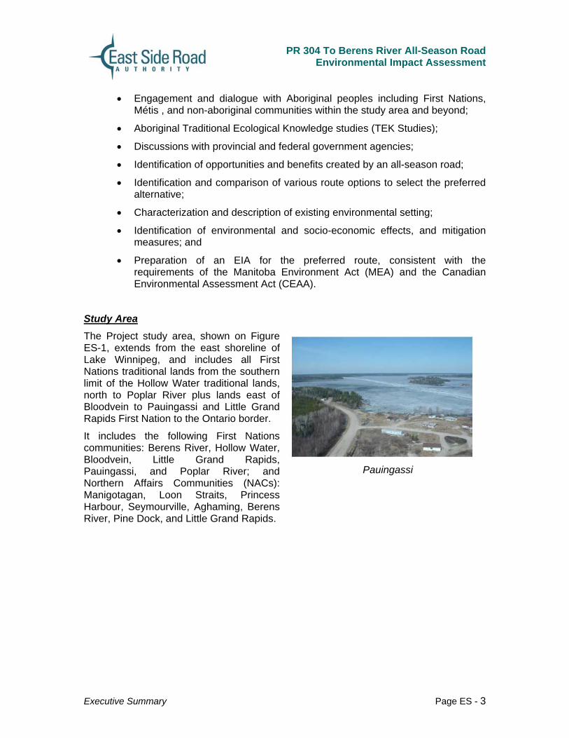
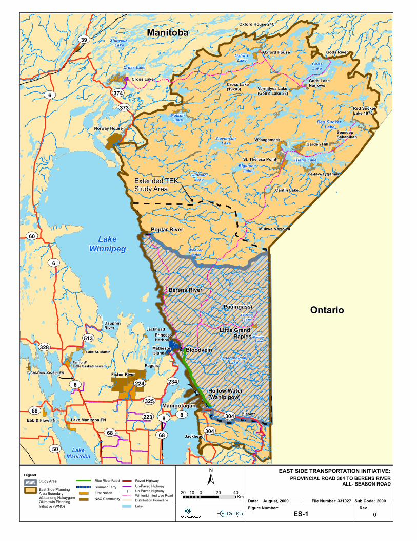
Study Area The Project study area, shown on Figure ES-1, extends from the east shoreline of Lake Winnipeg, and includes all First Nations traditional lands from the southern limit of the Hollow Water traditional lands, north to Poplar River plus lands east of Bloodvein to Pauingassi and Little Grand Rapids First Nation to the Ontario border.
It includes the following First Nations communities: Berens River, Hollow Water, Bloodvein, Little Grand Rapids, Pauingassi, and Poplar River; and Northern Affairs Communities (NACs): Manigotagan, Loon Straits, Princess Harbour, Seymourville, Aghaming, Berens River, Pine Dock, and Little Grand Rapids.
Pauingassi
UV304
UV304
UV8UV325
UV223
UV224
UV68
UV8
UV68
UV234
UV373UV374UV6
UV39
UV6
UV68
UV50
UV513
UV60
UV6
UV328
Sipiwesk Lake
Molson Lake
Oxford Lake Gods
Lake
Island Lake
Red Sucker Lake
Vermilyea Lake(God's Lake 23)
Oxford House 24C
Oxford House
Cross Lake (19x03)
Gods River
Vermilyea Lake(God's Lake 23)
Red Sucker Lake 1976
Wasagamack
Gods Lake Narrows
St. Theresa Point
Garden Hill
Pe-ta-waygamak
SeeseepSakahikan
Cantin Lake
Mukwa NarrowaPoplar River
Berens River
Pauingassi
Little Grand Rapids
Bloodvein
Hollow Water (Wanipigow)
Manigotagan
Jackhead
Matheson Island
PrincessHarbour
Jackhead
Fisher RiverPeguis
Dauphin River
Bissett
Norway House
Cross Lake
Cross Lake
Stevenson Lake
Bigstone Lake
Gunisao Lake
Weaver Lake
Fishing Lake
Family Lake
Sasaginnigak LakeFairford/
Little Saskatchewan
Lake Manitoba FNEbb & Flow FN
O-Chi-Chak-Ko-Sipi FN
Lake St. Martin
LakeWinnipeg
LakeManitoba
Ontario
Manitoba
UV304
UV304
UV8UV325
UV223
UV224
UV68
UV8
UV68
UV234
UV373UV374UV6
UV39
UV6
UV68
UV50
UV513
UV60
UV6
UV328
Sipiwesk Lake
Molson Lake
Oxford Lake Gods
Lake
Island Lake
Red Sucker Lake
Vermilyea Lake(God's Lake 23)
Oxford House 24C
Oxford House
Cross Lake (19x03)
Gods River
Vermilyea Lake(God's Lake 23)
Red Sucker Lake 1976
Wasagamack
Gods Lake Narrows
St. Theresa Point
Garden Hill
Pe-ta-waygamak
SeeseepSakahikan
Cantin Lake
Mukwa NarrowaPoplar River
Berens River
Pauingassi
Little Grand Rapids
Bloodvein
Hollow Water (Wanipigow)
Manigotagan
Jackhead
Matheson Island
PrincessHarbour
Jackhead
Fisher RiverPeguis
Dauphin River
Bissett
Norway House
Cross Lake
Cross Lake
Stevenson Lake
Bigstone Lake
Gunisao Lake
Weaver Lake
Fishing Lake
Family Lake
Sasaginnigak LakeFairford/
Little Saskatchewan
Lake Manitoba FNEbb & Flow FN
O-Chi-Chak-Ko-Sipi FN
Lake St. Martin
LakeWinnipeg
LakeManitoba
Ontario
Manitoba
Date: File Number: Sub Code:Figure Number: Rev.
0
August, 2009 331027 2000
ES-1
EAST SIDE TRANSPORTATION INITIATIVE:PROVINCIAL ROAD 304 TO BERENS RIVER
ALL- SEASON ROAD±20 0 20 4010
Km
Extended TEK Study Area
Legend
First NationNAC Community
Rice River RoadSummer FerryEast Side Planning
Area BoundaryWabanong Nakaygum Okimawin Planning Initiative (WNO)
Study Area
Lake
Un-Paved Highway
Winter/Limited Use RoadDistribution Powerline
Paved Highway
Un-Paved Highway
PR 304 To Berens River All-Season Road
Environmental Impact Assessment
Executive Summary Page ES - 5
2.0 PROJECT
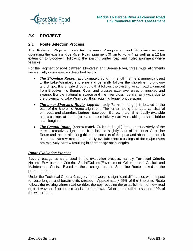
2.1 Route Selection Process The Preferred Alignment selected between Manigotagan and Bloodvein involves upgrading the existing Rice River Road alignment (0 km to 76 km) as well as a 12 km extension to Bloodvein, following the existing winter road and hydro alignment where feasible.
For the segment of road between Bloodvein and Berens River, three route alignments were initially considered as described below:
• The Shoreline Route: (approximately 75 km in length) is the alignment closest to the Lake Winnipeg shoreline and generally follows the shoreline morphology and shape. It is a fairly direct route that follows the existing winter road alignment from Bloodvein to Berens River, and crosses extensive areas of muskeg and swamp. Borrow material is scarce and the river crossings are fairly wide due to the proximity to Lake Winnipeg, thus requiring longer bridge spans.
• The Inner Shoreline Route: (approximately 71 km in length) is located to the east of the Shoreline Route alignment. The terrain along this route consists of thin peat and abundant bedrock outcrops. Borrow material is readily available and crossings at the major rivers are relatively narrow resulting in short bridge span lengths.
• The Central Route: (approximately 74 km in length) is the most easterly of the three alternative alignments. It is located slightly east of the Inner Shoreline Route and the terrain along this route consists of thin peat and abundant bedrock outcrops. Borrow material is readily available and crossings of the major rivers are relatively narrow resulting in short bridge span lengths.
Route Evaluation Process Several categories were used in the evaluation process, namely Technical Criteria, Natural Environment Criteria, Social/Cultural/Environment Criteria, and Capital and Maintenance Costs. Based on these categories, the Shoreline Route ranked as the preferred route.
Under the Technical Criteria Category there were no significant differences with respect to route length, and terrain units crossed. Approximately 65% of the Shoreline Route follows the existing winter road corridor, thereby reducing the establishment of new road right-of-way and fragmenting undisturbed habitat. Other routes utilize less than 10% of the winter road.

PR 304 To Berens River All-Season Road
Environmental Impact Assessment
Executive Summary Page ES - 6
Existing Distribution Line and Winter Road,
South of Berens River
The evaluation of the Natural Environment Criteria Category identified little significant difference in the actual number of water courses crossed by the three routes. Each route crosses three rivers requiring bridge structures more than 30 m in length. The Inner Shoreline requires the largest number of moderate-sized bridge structures ranging between 15 and 30 m in length. The Shoreline Route has the greatest number of bridges with multiple spans that require piers to be placed in the watercourse. The Central Route crosses the most wetland (shrub & herb) habitat and more open coniferous forest that presents habitat conditions favourable to woodland caribou. The Central Route would result in the highest disturbance to caribou habitat. Overall, despite the potential for more bridge spans, the Shoreline Route was favoured from the natural environment perspective as it does not cross critical caribou habitat, and any adverse effects to fish habitat from waterway crossings are considered to be mitigable.
In the Social/Cultural/Environment Criteria Category, approximately 65% of the Shoreline Route follows the existing winter road corridor, minimizing habitat fragmentation with access to established trapping areas not hindered.
The Capital and Maintenance Cost Estimates indicated that the Shoreline Route is more expensive than the other two route options. However, the difference between the three options was less that 10%, which is not significant for the level of design; thus the three routes were ranked equally.
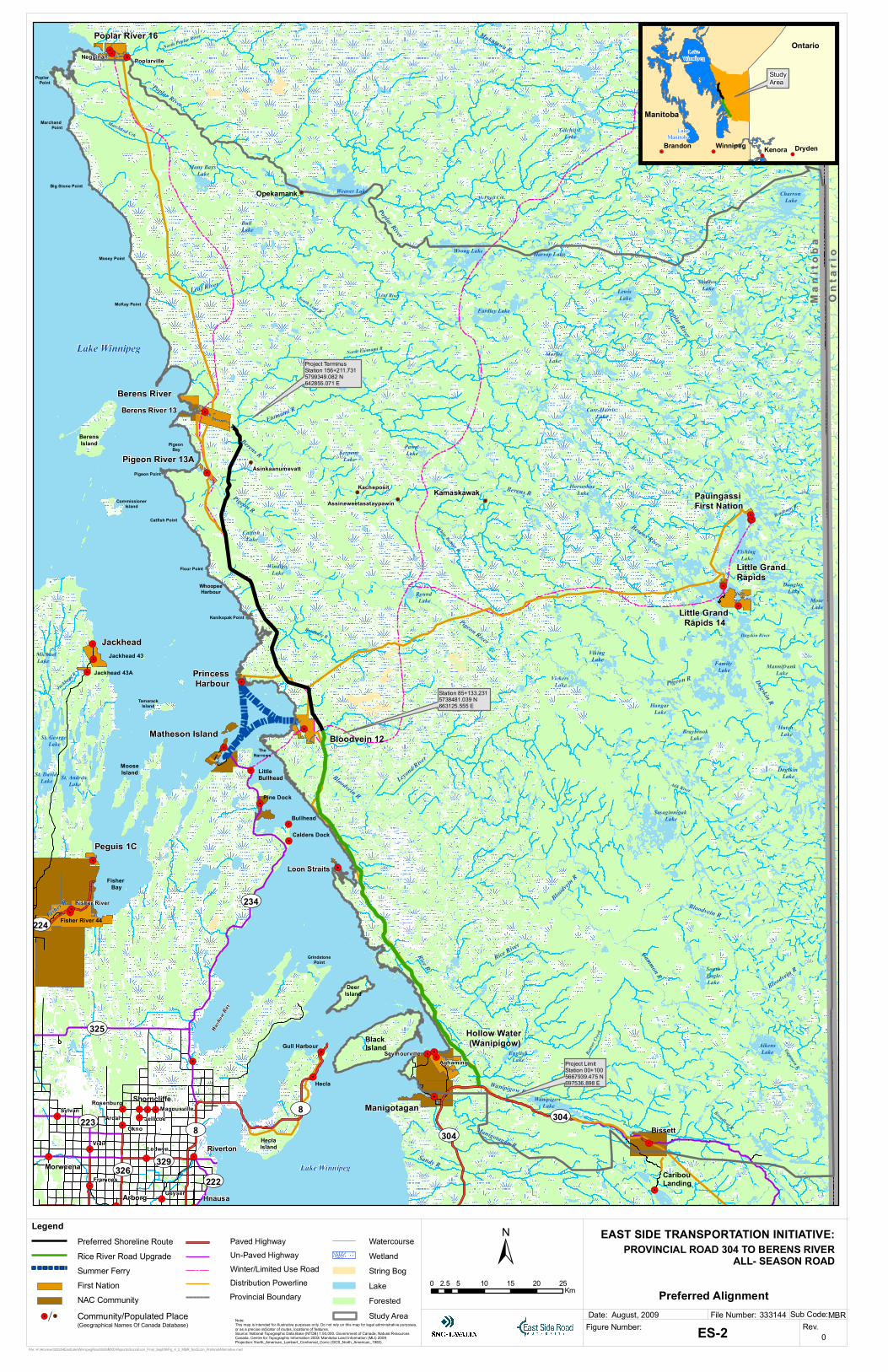
Revised Shoreline Route The Shoreline Route has been further refined following input from community meetings and further reviews of soils and constructability, and is referred to as the Revised Shoreline Route and was selected as the Preferred Route Alignment. Figure ES-2 shows the preferred alignment to be assessed during the detailed design phase.

PR 304 To Berens River All-Season Road
Environmental Impact Assessment
Executive Summary Page ES - 7
2.2 Project Description Project Overview As shown on Figure ES-1, the Project is located on the east side of Lake Winnipeg in Manitoba, extending from Provincial Road PR 304 east of Manigotagan, north, approximately 155 km to Berens River. As shown on Figure ES-2, the Preferred Route Alignment selected is the segment of the road between Manigotagan and Bloodvein that follows the Rice River Road alignment, and the existing winter road/seasonal road. The segment of the road between Bloodvein and Berens River follows the Revised Shoreline Route option.
The primary Project components include:
• An All-Season Road from PR 304 to Berens River (not including access roads on Reserve Lands);
• Water course crossing structures; and
• Borrow and quarry areas to support both construction and operations and maintenance requirements.
Project components during construction will include:
• Staging areas;
• Maintenance areas;
• Temporary construction camp facilities; and
• Temporary construction access roads to quarry, borrow, staging and camp sites.
The Project also includes the realignment of a 12 ha segment of Atikaki Provincial Park boundary on the northwest section of the park on the Bloodvein River in order to accommodate construction of the crossing.
!.
!.
!.
!.!. !.
!.
!.
!.
!.
!.!. !.
!.
!. !.
!.
!.
!.
!.
!.!.
!.
!.
!.
!.!.!.!.
!.
!.
!.
!.
!.
!.
!.
!.
!.
!.!.
!.
!.
!.
!.
!.
!.
!.
!.
!.
!.
!.
!.
!.
!.
!.
!.!.!.
!.
!.
!. !.
!.
!.
!.!.!.
!.
!.
!.
!.
Sasaginnigak Lake
Braybrook Lake
Family Lake
Vickers Lake
Viking Lake
Hangar Lake
Dogskin Lake
Hutch Lake
Mannifrank Lake
Moar Lake
Douglas Lake
Catfish Lake
Windigo Lake
Round Lake
Serpent Lake
Pawn Lake
Carr-Harris Lake
Horseshoe Lake
Eardley Lake
Harrop LakeWrong Lake
Morfee Lake
Gilchrist Lake
Weaver Lake
Many Bays Lake
Bull Lake
Wakus Lake
Slemon Lake
Elliot Lake
Lily Pad Lake
Charron Lake
Lewis Lake
Shallow Lake
Fishing Lake
St. Andrew Lake
St. George Lake
St. David Lake
St. Michael Lake
Lake Winnipeg
Wendigo Lake
Lake Winnipeg
Washow
Bay
Black Island
DeerIsland
GrindstonePoint
HeclaIsland
Wanipigow Lake
EnglishLake
AikensLake
Quesnel Lake
SouthEagleLake
MooseIsland
TamarackIsland
BerensIsland
CommissionerIsland
McKay Point
Mosey Point
Big Stone Point
Marchand Point
Poplar Point
Pigeon Point
Pigeon Bay
Catfish Point
Flour Point
WhoopeeHarbour
Kanikopak Point
TheNarrows
Hecla
Silver
Peguis
Hnausa
Dallas
Arborg
Hodgson
Bissett
Riverton
Red Rose
Morweena
Aghaming
Fisher Bay
ShorncliffeManigotagan
Loon Straits
Black River 9
Fisher River 44Fisher
River 44A
Fisher River
Hollow Water (Wanipigow)
Jackhead
Peguis 1C
Peguis 1B
Jackhead 43
Poplarville
Jackhead 43A
Bloodvein 12
Seymourville
Berens River
Poplar River 16
Berens River 13
Matheson Island
Big Black River
Pigeon River 13A
Princess Harbour
Little Grand Rapids
Little Grand Rapids 14
Pauingassi First Nation
Kettle Falls
Ridley
Mukwa Narrowa
KamaskawakAssineweetasataypawin
Kacheposit
Opekamank
Asinkaanumevatt
Little Bullhead
Pine Dock
Bullhead
Calders Dock
Caribou Landing
Peguis 1DFinns
Valhalla
Gull Harbour
Jaroslaw
Bifrost
Geyser
Ledwyn
Framnes
Vidir
OknoJellicoe
MagnusvilleRosenburg
ArdalSylvan
Zbaraz
Fisher
Wadhope
Ont
ario
On t
a ri o
Ma n
i to b
aM
a ni t
o ba
Negginan
Rice R
Leaf River
Atik River
Sandy R
Poplar River
Pigeon R
Palsen River
Leyond River
Gammon R
Fisher R
McPhail Crk.
Berens R
Etomami R
Dogskin River
Jackhead R
Poplar River
Bradbury R
Bradburn R.
Broadleaf R
Bloodvein R
South Leaf R
Leaf River
Manigotagan R
East Fisher River
White Beaver R
Berens River
Pigeon R
North Poplar River
North Etomami R
Bloodvein R
Poplar River
Dogskin R
Beave
r Cree
k
Gammon R
Wanipigow R
Mukutawa R.
Berens R
Pigeon River
Rice River
Bloodvein
R
Bloodvein R
Black R
Marchand Crk
UV304
UV304
UV8
UV222UV329
UV326
UV325
UV223
UV224
UV68
UV8
UV234
Preferred Alignment
File: H:\Arcview\020254EastLakeWinnipegRoad\GIS\MXD\Reports\SocioEcon_Final_Sept09\Fig_4_2_MBR_SocEcon_PreferedAlternative.mxd
!.!.!.
!. Kenora DrydenBrandon Winnipeg
StudyArea
Manitoba
OntarioLake
Winnipeg
LakeManitoba
Legend
Project Limit Station 00+100 5667939.475 N 697536.898 E
Station 85+133.231 5738481.039 N 663125.555 E
Project TerminusStation 156+211.731 5799349.082 N 642855.071 E
Note:This map is intended for illustrative purposes only. Do not rely on this map for legal administrative purposes, or as a precise indicator of routes, locations of features.Source: National Topographic Data Base (NTDB) 1:50,000. Government of Canada, Natural Resources Canada, Centre for Topographic Information 2003/ Manitoba Land Information (MLI) 2009.Projection: North_American_Lambert_Conformal_Conic (GCS_North_American_1983)
Preferred Shoreline Route
First NationNAC Community
Rice River Road UpgradeSummer Ferry
Community/Populated Place!. !.
(Geographical Names Of Canada Database)
Forested
String BogLake
WetlandWatercourse
Study AreaProvincial BoundaryDistribution PowerlineWinter/Limited Use RoadUn-Paved HighwayPaved Highway EAST SIDE TRANSPORTATION INITIATIVE:
Date: File Number: Sub Code:Figure Number: Rev.ES-2
August, 2009
0
333144 MBR
PROVINCIAL ROAD 304 TO BERENS RIVERALL- SEASON ROAD±
0 5 10 15 20 252.5Km

PR 304 To Berens River All-Season Road
Environmental Impact Assessment
Executive Summary Page ES - 9
The primary Project components are discussed further below: All-Season Road - The ASR is intended to be gravel surfaced roadway for the foreseeable future and will be centered within a 100 metre right-of-way. The cleared limit for the roadway will be 60 metres with additional clearing as required to maintain sight distances. The roadway right-of-way will be combined with the existing winter road right-of-way and Manitoba Hydro distribution line right-of-way where applicable to reduce clearing requirements. The 10 metre(m) wide roadway will be constructed with two 3.7 m lanes, 1.0 m shoulders and a 0.3 m shoulder rounding allowance. Watercourse Crossings and Bridge Structures - The proposed all-season road will pass through localized rock areas, low-lying lacustrine and marsh environment areas and cross a number of continuously flowing watercourses. There are seven rivers and several creeks, as well as several unnamed watercourses located within the immediate ASR Preferred Route Alignment.
The crossing structures will be constructed using a combination of corrugated steel pipe (CSP) culverts, box culverts, clear span and multi-span bridges, where applicable. The culverts may involve either closed or open bottom designs depending on fisheries sensitivities. Where they cross fish habitat, culverts will be sized to accommodate fish passage requirements as specified in the Manitoba Stream Crossing Guidelines for the Protection of Fish and Fish Habitat.
Quarries and Borrow Areas - Aggregate for the road bed will be derived from local borrow sources and rock quarries established for the project. It is assumed that the supply of this construction material will be through third-party and local Aboriginal suppliers.
Potential borrow areas identified for local fill, sand, aggregate and crushed rock have been identified, and will be confirmed during detailed design. It is intended that many borrow pits and quarries, established for the supply of construction materials, will be closed and rehabilitated prior to road operation with only a select number remaining operational for maintenance purposes..
Access Routes – Approximately 80% of the Preferred ASR Alignment is situated on the alignment of the existing Rice River, winter road, and hyrdo distribution line reducing the fragmentation of the existing natural areas by limiting the establishment of new rights-of-way in previously undisturbed areas. The existing winter road will also provide a means of accessing the right-of way during the early stages of construction. Other access roads will be identified and built for the construction period only.
Project Activities Detailed design of the PR 304 to Berens River ASR is scheduled to take place in winter/spring of 2010 and tendering in the spring of 2010. Project approvals are anticipated to enable the start of construction in the fall of 2010. Construction is expected to extend over a period of approximately 42 months, with substantial

PR 304 To Berens River All-Season Road
Environmental Impact Assessment
Executive Summary Page ES - 10
completion by March 2014. However, it is anticipated there will be segments of the ASR completed and operational prior to March 2014.
The detailed road design and preliminary bridge design for the segment from Loon Straits (km 48) to the Bloodvein First Nation (km 88) is underway. The proposed functional alignment from the Bloodvein FN to Berens River (km 88 to km 158) crosses a variety of rivers and creeks and has been developed identifying the location of the road right-of-way, bridge crossings and large culverts.
The material for the road will consist of blasting and crushing of granite materials in sufficient quantities to maximize the cut/fill balance while minimizing overhaul distances. Typical equipment used in the quarry operations include primary and secondary crushers fed using large front end loaders and stockpiled using a combination of loaders and trucks.
Large excavation equipment will be utilized to remove the unsuitable material to competent subgrade. In some areas that are difficult to access, large drag lines may be used to cast and remove unsuitable material. The road is then advanced using blast rock hauled by large trucks and moved into place with dozers. These operations may involve up to 50 or more people per shift for a given location.
Final road topping consists of a crushed rock subgrade (maximum aggregate size of 150mm), a sand layer and a surface graded aggregate. The crushed rock and graded aggregate will be provided by the various quarries along the alignment. Blasting will occur at these locations. Sand will be acquired from borrow areas. These materials are hauled, placed, graded and compacted using various loaders, trucks, graders, dozers and compaction equipment. Typically these operations may involve up to 50 people per shift.
ESRA is working with Manitoba Conservation regarding an adjustment to the Atikaki Provincial Park boundary to facilitate the construction of the ASR. It is proposed to remove 12 ha of boreal forest and riparian zone along the Bloodvein River and to add a comparable 12 ha area to the park. The proposed 12 ha area identified for compensatory adjustment is situated within 10km of the area proposed for removal. The intent of the proposed changes will not result in any significant environmental effects

PR 304 To Berens River All-Season Road
Environmental Impact Assessment
Executive Summary Page ES - 11
3.0 REGULATORY FRAMEWORK Canadian Environmental Assessment Act – CEAA The Canadian Environmental Assessment Act (CEAA) provides the legal basis for the federal environmental assessment process and sets out the responsibilities and procedures for carrying out the environmental assessment of projects which involve federal government decision making or funding. Other federal environmental legislation that are applicable to the Project include:
• Fisheries Act;
• Navigable Waters Protection Act;
• Migratory Birds Convention Act;
• Canada Wildlife Act;
• Species at Risk Act (SARA); and
• The Dangerous Goods Handling and Transportation Act
It is anticipated that the PR 304 to Berens River All-Season Road will require permits and authorizations under the Fisheries Act and the Navigable Waters Protection Act. The requirement for these permits and authorizations “triggers” the requirement to conduct an environmental assessment under the Law List Regulation.
The Responsible Authorities will complete their screening and prepare a report of their findings that will include environmental effects associated with the project, residual effects with the application of mitigation measures and their significance.
Manitoba Environment Act The intent of the Manitoba Environment Act is to develop and maintain an environmental management system in Manitoba which will ensure that the environment is kept in such a manner as to sustain a high quality of life, including social and economic development, recreation and leisure for this and future generations.
The PR 304 to Berens River ASR Project constitutes a Class 2 Development; a two lane road in new location which also involves widening of an existing road in areas sensitive to environmental disturbance as defined by the Classes of Development Regulation under the Manitoba Environment Act. In January 2009, ESRA submitted an Environment Act Proposal Form for the Project to Manitoba Conservation which was placed on the Public Registry.
Other Manitoba environmental legislation applicable to the Project includes:
• The Sustainable Development Act;
• The Wildlife Act;
• The Endangered Species Act;
• Crown Lands Act;

PR 304 To Berens River All-Season Road
Environmental Impact Assessment
Executive Summary Page ES - 12
• Mines and Minerals Act;
• Water Rights Act;
• The Parks Act;
• Ecological Reserves Act;
• Heritage Resources Act;
• Forestry Act; and
• Manitoba Water Quality Standards, Objectives, and Guidelines
Canada / Manitoba Agreement on Environmental Assessment The Project will be reviewed under the provisions of the March 2007 Canada/Manitoba Agreement on Environmental Assessment Cooperation.
The province will be the lead jurisdiction and the federal authorities will provide comment through the provincial process. The province will establish a Technical Advisory Committee to provide input into the EIA process.

PR 304 To Berens River All-Season Road
Environmental Impact Assessment
Executive Summary Page ES - 13
4.0 ENVIRONMENTAL ASSESSMENT ENGAGEMENT PROGRAM An Environmental Assessment Engagement Program (EAEP) was developed to provide meaningful opportunities to engage in dialogue and exchange information about the project with interested and affected parties. These comprised First Nations and Northern Affairs communities (NAC), other interested parties such as Aboriginal organizations (including the Assembly of Manitoba Chiefs, Manitoba Keewatinowi Okimakanak Inc., Manitoba Métis Federation), government agencies, non-government organizations (NGOs), and the Manitoban public.
The EAEP was also developed based on previous engagement initiatives undertaken for earlier east side transportation studies. The results of these previous initiatives showed residents’ support for the construction of a road on the east side of Lake Winnipeg, which is consistent with the finding of the engagement undertaken for the EIA.
The EAEP included:
• Community Engagement Program (CEP);
• Public Interest and Stakeholder Engagement Program (PISEP); and
• Traditional Ecological Knowledge (TEK) Studies.
The purpose of the EAEP is to disseminate information, gather feedback, and identify issues, opinions and concern about the Project, its potential environmental effects and possible mitigation measures. The EAEP activities were factored in the planning of the Project and the EIA, and are independent of the Crown’s Duty to Consult under Section 35 of the Canada Constitution Act.
Engagement initiatives have been designed and implemented in accordance with the Wabanong Nakaygum Okimawin (WNO) (formerly the East Side Planning Initiative) “Promises to Keep” Towards a Broad Area Plan for the East Side of Lake Winnipeg (2004) planning initiative document guidelines and recommendations. The CEP and PISEP were developed with a focus on engaging the people who were most likely to be affected by the project – those living in local communities, stakeholders with an interest in the area including resource users and public input including the NGO community.
The CEP included meetings and discussions with community leadership, elders, youth, hunters and trappers and resource associations. The CEP for the Project consists of two rounds of community meetings/open-houses in addition to the incorporation of previous engagement or involvement initiatives and/or programs undertaken by the East Side Road Authority (ESRA) or predecessor agencies.
The format of the First Nations community meetings generally consisted of a leadership meeting preceding a community meeting/open-house, whilst for the NAC communities; it was a community meeting with leadership in attendance.

PR 304 To Berens River All-Season Road
Environmental Impact Assessment
Executive Summary Page ES - 14
Round One (April to July 2009) initiated dialogue about the proposed Project, introduced ESRA as the project proponent and the EIA process. A description of the proposed Project and routing options was provided and input was obtained on the proposed Project for the EIA. Communities engaged, included:
Poplar River Community Meeting
• Manigotagan;
• Seymourville;
• Loon Straits;
• Aghaming;
• Hollow Water First Nation;
• Bloodvein First Nation;
• Poplar River First Nation;
• Berens River First Nation and Berens River NAC;
• Little Grand Rapids First Nation and Little Grand Rapids NAC; and
• Pauingassi First Nation.
Round Two (Fall 2009) will present the findings of the EIA, including results of the routing options evaluation, benefits, environmental effects and mitigation measures developed and incorporated.
As part of the PISEP, meetings were held as follows:
• June 2009 - Public Open-House in Winnipeg presented Project ASR alignment options, Traditional Knowledge studies and EIA process. Varying backgrounds of attendees, with concerns that ranged from the public disbursement of funds to link communities with low population, to support of an all-season road network.
• July 2009 - Meeting with Gord Jones, Project Manager for Pimachiowin Aki Corporation was held relating to coordination with proposed UNESCO World Heritage Initiative Agreement to ensure further coordination as both initiatives proceed.

PR 304 To Berens River All-Season Road
Environmental Impact Assessment
Executive Summary Page ES - 15
Aboriginal TEK Studies TEK Studies (April to July 2009), an important component of the Environmental Assessment, were inclusive of all Aboriginal people within the study area, including First Nations, Métis and non-status First Nations, residing in the local community areas, as follows:
• Poplar River;
• Berens River;
• Bloodvein;
• Little Grand Rapids;
• Pauingassi; and
• Hollow Water/Manigotagan.
TEK Studies informed and verified terrestrial and aquatics field data collection and research and helped to identify elements of the landscape and ecosystem that are of importance to local communities. The TEK studies also provided those aboriginal respondents from the area with additional opportunity to comment on the Project and the environmental effects that may be created. From the TEK surveys, the majority of respondents did not have significant concerns with the ASR Project, but did identify potential effects of interest as it relates to traditional use activities.
Local communities place a high value on the traditional activities of hunting (all game), trapping and fishing, and the majority of TEK survey respondents are active participants in all of these activities. High use areas for traditional activities were identified in the engagement initiatives. The majority of respondents stated they are of the opinion that the road will not cause significant effects to traditional activities.
Some TEK respondents noted that the development of the proposed Project may result in some changes, including a potential reduction in the number of animals in the immediate area, with possible implications on the number of animals available in the immediate vicinity to trap and hunt. Respondents cited a number of road characteristics that could cause this effect, including:
• Disturbances to animal habitat causing the animals to migrate elsewhere (e.g., construction noise, traffic noise, clearing, etc.);
• Accidents between animals and vehicles on the road resulting in animal fatalities;
• Contamination of soils and water, causing animals to become ill and/or to migrate elsewhere; and
• Improved access to the community’s traditional lands by outsiders, increasing hunting and trapping pressure, and reducing the number of animals available to local community members.
Respondents also expressed interest in concerns for the protection of water quality, from effects arising from potential contamination during the construction phase, from oil and

PR 304 To Berens River All-Season Road
Environmental Impact Assessment
Executive Summary Page ES - 16
fuel spills; dust generation during construction; and litter and uncontrolled dumping during operations. Respondents further identified the protection of fish spawning areas in relation to the construction of bridges and culverts over creeks and rivers as an aspect of importance.
Summary of Current and Future Engagement Activities Issues, concerns and perspectives raised during the public engagement program have been considered and where appropriate, have been incorporated into Project design and the environmental assessment process.
ESRA is committed to continue communication and open dialogue with community members, stakeholders, and the public through the environmental assessment and design process and beyond.. Ongoing communication will continue through a variety of communication media including the ESRA website, Project newsletters and other correspondence, local community coordinators and round two of the EAEP to discuss the findings of the EIA and the project design to date.
PR 304 To Berens River All-Season Road
Environmental Impact Assessment
Executive Summary Page ES - 17
5.0 ENVIRONMENTAL SETTING Physical Environment The surface geology in the Project area is composed of a mixture of quaternary and pre-quaternary sediments. Surface deposits consist of clay textured lacustrine sediments broken with occasional bedrock outcrops, typical of the Precambrian Shield.
The soils of the Project area are characterized by the Lac Seul Upland Ecoregion and are relatively young, containing between 10 and 90% organic content, developed on poorly drained peatlands (Mesisols - moderately decomposed peat, and Fibrisols - weakly decomposed peat). Soil drainage varies from very poor to rapid to well drained, with much of the northern and west-central areas composed of very poor to poor with tracts of rapid to well drained soils.
Surface waters flow in a general east-to-west direction towards Lake Winnipeg, moving as diffuse flow through wide, densely vegetated fens, with occasional consolidation in defined channels. These surface waters are characteristically acidic and low in dissolved oxygen.
Larger streams and rivers within the area tend to be slightly acidic with oxygen levels near saturation and do not undergo wide variation in these parameters, as photosynthetic activity is limited by low light penetration into the water column. These “tea-stained” waters are low in suspended sediments, but high in colour due to the tannins released by decomposing peat in the headwaters.
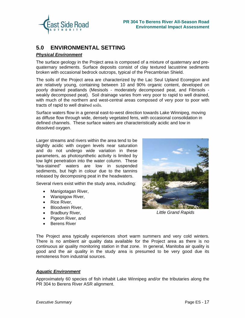
Several rivers exist within the study area, including:
• Manigotagan River, • Wanipigow River, • Rice River, • Bloodvein River, • Bradbury River, • Pigeon River, and • Berens River
Little Grand Rapids
The Project area typically experiences short warm summers and very cold winters. There is no ambient air quality data available for the Project area as there is no continuous air quality monitoring station in that zone. In general, Manitoba air quality is good and the air quality in the study area is presumed to be very good due its remoteness from industrial sources.
Aquatic Environment Approximately 60 species of fish inhabit Lake Winnipeg and/or the tributaries along the PR 304 to Berens River ASR alignment.

PR 304 To Berens River All-Season Road
Environmental Impact Assessment
Executive Summary Page ES - 18
Currently, no fish species are listed under the Manitoba Endangered Species Act (Manitoba Conversation, 2009b). However, the following five species have been listed federally:
• Silver chub (Macrhybopsis storeriana). The silver chub is listed as a species of Special Concern on Schedule 1 of the federal Species at Risk Act (SARA). It generally inhabits slow to moderate-flowing rivers, is common in the Red and lower Assiniboine Rivers, and has been collected from various locations in the south basin of Lake Winnipeg. Its Manitoba population appears secure, and no local recovery strategy exists for the species.
• Shortjaw cisco (Coregonus zenitticus). The shortjaw cisco has been listed as Threatened by the Committee on the Status of Endangered Wildlife in Canada (COSEWIC), and is listed as Threatened on Schedule 2 of SARA. The shortjaw cisco inhabits deepwater lake habitats, and individual populations are known to spawn in early spring or late fall, possibly ascending large rivers during this period (Stewart and Watkinson 2004). No local action plan exists for the recovery strategy for this species.
• Lake sturgeon (Acipenser vulvescens). The Red-Assiniboine Rivers – Lake Winnipeg population of lake sturgeon has been listed as Endangered by COSEWIC, but it has not been listed under SARA. Lake sturgeon utilizes fast, turbulent waters in medium to large rivers for spawning, and is known to inhabit the large rivers on the east side of Lake Winnipeg.
• Chestnut lamprey (Ichthyarozon castaneus). The chestnut lamprey has been listed as a species of Special Concern by COSEWIC, but it is not listed under SARA. The species occurs in low densities in the Lake Winnipeg watershed. Chestnut lamprey spawn in clean, sand-gravel substrate in small streams and develop in a filter-feeding larval stage for several years in these habitats before becoming the adult stage that is parasitic on a variety of host fish species. The streams on the east side of Lake Winnipeg in the vicinity of the ASR alignment are unlikely to provide spawning or rearing habitat for chestnut lamprey, due to a lack of sand and gravel substrate.
• Bigmouth buffalo (Ictiobus cyprinellus). The bigmouth buffalo has been listed as a species of Special Concern by COSEWIC, but is not listed under SARA. Its preferred habitats are large, turbid, slow-moving rivers, and it is fairly common in the Red and lower Assiniboine Rivers in Manitoba. A single specimen has been captured in the Icelandic River on the west side of Lake Winnipeg (Stewart and Watkinson 2004), suggesting its possible presence in the south basin of the lake. The clear (non-turbid, albeit tea-stained) tributaries that cross the ASR alignment and flow into the east side of Lake Winnipeg do not likely provide preferred habitat for this species. Therefore, the potential for its presence at the ASR crossing locations is low.
An abundance of fen and beaver-pond habitats exist in close proximity east of Lake Winnipeg in the vicinity of the ASR alignment. These habitats have the potential to be readily accessible to fish residing in the lake, although abundant beaver dams pose barriers to fish passage and potential for stranding.

PR 304 To Berens River All-Season Road
Environmental Impact Assessment
Executive Summary Page ES - 19
Terrestrial Environment The landscape on the east side of Lake Winnipeg is a part of the boreal shield ecozone as defined by Environment Canada. The study area is located within the Lac Seul Upland Ecoregion, an area that extends from Lake Winnipeg to the Albany River in Ontario. The portion of this Ecoregion, within Manitoba from Lake Winnipeg to the Ontario border, contains three (3) ecodistricts; Berens River, Wrong Lake, and Nopiming.
The area east of Lake Winnipeg is dynamic in terms of rapid vegetation changes due to fire, as well as slow processes that build up large deposits of organic material and change the landscape over time. Wetlands in the study area are primarily fens with slow flowing ground water moving in a generally northwest direction (horizontal fens).
The most common natural disturbance in the study area is wildfire, which is typical of all boreal areas. Forest harvesting has taken place south of the study area since 1927.
The only species listed under SARA that is known to occur in the study area is woodland caribou. Piping plover are known to occur on the shores of Lake Winnipeg along sandy beaches on the east side of the lake. However, this area is well outside the preferred alignment area for the Project. Of the eight (8) vertebrate animals listed by the Manitoba Conservation Data Centre, the American white pelican (Pelecanus erythrorhynchos) occurs widely throughout the study area.
The study area is considered low quality for nesting waterfowl according to the Canada Land Inventory classifications. The exception is the Canada goose (Branta Canadensis), a species that nests in a wide variety of habitats.
Both Wood Frogs (Rana sylvatica) and Northern Leopard Frogs (Lithobates pipiens) were observed at most plant survey sites and crossing points along the road alignment.
Moose (Alces alces) are the most common large mammal in the study area (Manitoba Conservation data), and the east side of Lake Winnipeg area in general. Black bears (Ursus americanus) and other fur baring species such as beaver (Castor casadensis), fox (Vulgesvulges), coyote (Caris latrans), martin (martes martes), mink (Mustela vision) ect. occur in this region and are ubiquitous to the study area.
Moose
Socio-Economic Environment According to Statistics Canada (2006), the largest community within the study area is Little Grand Rapids First Nation with a population of 796 residents, followed by Berens River First Nation with 736 inhabitants.
PR 304 To Berens River All-Season Road
Environmental Impact Assessment
Executive Summary Page ES - 20
Land Use Status The study area is predominately covered by Treaty 5, which was first established in September 1875. The traditional territory boundaries divide the study area into six communities, including (from north to south): Poplar River, Berens River, Pauingassi, Little Grand Rapids, Bloodvein, and Hollow Water.
In the northern parts of the study area is the park reserve (i.e., the East Side traditional lands and special protected area). Atikaki Provincial park is within the study area as is the Chief George Barker Wildlife Reserve. Additional parks and wildlife reserves exist along the periphery of the study area. The Bloodvein River has been designated as a national Heritage River.
Commercial Activities Commercial Resource activities include:
• Wild Rice Activity: Wild rice harvesting is an activity that has traditionally been carried out by First Nations community members throughout the study area, either as a source of food or cash income, or both.
• Commercial Trapping Activity: Manitoba created the Registered Trapline (RTL) system in 1940 to allow local people to continue trapping on their traditional lands. Also enables local residents to be stewards of their trapline by providing exclusive rights to trapline holders to trap within designated areas.
• Commercial Forestry: Commercial forestry activities are managed by Manitoba Conservation, who is responsible for issuing forest management licenses, quotas and timber permits. Commercial harvesting activities currently occur in the southern most portion of the study area.
• Mining: According to the Manitoba Science, Technology, Energy and Mines, the area in the region of the proposed project area includes both surveyed and unsurveyed territory in the Winnipeg Mining District (2009a). Several mining claims cover the area around Manigotagan to north of Black Island on Lake Winnipeg. There is also one (1) mining claim east of Deer Island on the east side of Lake Winnipeg near Rice River (Manitoba Science, Technology, Energy and Mines 2009b). South of the Wanipigow River, gold mining has been active as early as 1911 with claims being staked around Rice Lake (Woo et al. 1977).
• Commercial Fishing / Fishing Management: Manitoba has a vibrant and valuable commercial fishing industry that coincides with recreational and domestic subsistence fishing activities. The majority of commercial fishing activity takes place on Lake Winnipeg in the study area.
Transportation With increased population growth and climate change, small communities within northern Canada are more than ever faced with the challenge of self-sustainability. Within Manitoba, there are currently sixty-three First Nations communities, approximately twenty-three of these communities are not accessible by an all-weather road (INAC, 2009). Within the study-area, the communities of Bloodvein, Berens River

PR 304 To Berens River All-Season Road
Environmental Impact Assessment
Executive Summary Page ES - 21
First Nation, Berens River NAC, Little Grand Rapids FN, Little Grand Rapids NAC and Pauingassi have only seasonal winter road access. These communities all rely on air transport and ferry service to supplement the winter road system The communities of Hollow Water First Nation, Manigotagan NAC, Seymourville NAC, Aghaming NAC, Pine Dock NAC and Matheson Island NAC are connected to the provincial highway system. Loon Straits can be accessed seasonally via the Rice River Road from PR# 304.
According to the Promises to Keep (2004), there is a general consensus among communities of the WNO that there is a high potential for eco-tourism and recreation on the East Side of Lake Winnipeg in the study area. However, this development must be regulated and approved by east side communities. Recreational opportunities are especially high for wilderness and ecotourism, cultural tourism, and backcountry camping and canoeing. There are various locations of campgrounds, outfitter camps and caches, and numerous commercial lodges throughout the southern portion of the study area.
Cultural Environment - Heritage Resources
Archaeological sites have been predominantly found along waterways and well-travelled trails in the region. In the region, as well as the project area, more sites have been found in the south and east as the northern areas are generally less accessible. North and east of Berens River, 11 pictographs, two (2) campsites and one (1) historic site have been found. In the general area from Bloodvein First Nation to Hollow Water First Nation, two petroforms, one (1) campsite and one (1) isolated find have been recorded. (Bulloch et al. 2002)
Pow Wow, Little Grand Rapids
PR 304 To Berens River All-Season Road
Environmental Impact Assessment
Executive Summary Page ES - 22
6.0 ENVIRONMENTAL EFFECTS ASSESSMENT
6.1 Objectives Specific objectives of the environmental effects assessment were to:
• Provide a description of potential linkages and/or interaction(s) between the Project, existing environmental conditions and valued ecosystem components (VECs);
• Provide sufficient information to understand the nature, extent, and significance of potential effects to VECs within the physical and biological environment resulting from the construction, operation, and maintenance of the Project, as well as effects to the socio-economic, and cultural environments that might arise from those physical and biological effects;
• Describe mitigation measures that can be applied to reduce, minimize or eliminate the potential environmental effects;
• Describe residual effects to VECs that are expected following consideration of mitigation and remedial measures are applied, and provide an assessment of the significance of each residual effect;
• Provide an assessment of the effects that could be caused by accidents and malfunctions;
• Provide a prediction of the effects the environment could have on the Project; and
• Identify and assess the cumulative effects of the Project that may be anticipated to occur in combination with other projects or planned activities in the study area.
In addition to providing an understanding of the potential Project interactions with the environment in the study area, the environmental effects analysis also provides other benefits:
• Provides a basis for evaluation of the sustainability of the Project;
• Assists with the identification of environmental monitoring and follow-up activities to be undertaken during the construction and operations phases of the Project in order to determine the actual effects of the Project compared to the predicted effects (verification of predictions), and to assess the effectiveness of mitigation measures;
• Assists the Project proponent with decision-making and design;
• Provides an understanding of the Project, the environment that could be affected by the Project, potential effects of the Project, mitigation measures the Proponent has agreed to implement to reduce the significance of environmental effects;

PR 304 To Berens River All-Season Road
Environmental Impact Assessment
Executive Summary Page ES - 23
• Demonstrates how issues raised by local residents and study area communities, the wider public and stakeholder/ interest groups have been considered through the development of the Project; and
Two phases of Project development were examined in this environmental effects assessment; construction, and operations and maintenance. The operational phase of the Project refers to the post-construction period during which the road is being used. Decommissioning of the ancillary construction related components required during construction such as access roads, camps and quarries, was considered. However the environmental effects of decommissioning the entire Project were not considered as the road is expected to be operational for a long period of time and there are no foreseeable plans for decommissioning. The effects of decommissioning will be considered at the time a decision is made to decommission the road.
The environmental impact assessment (EIA) process includes input from a comprehensive community engagement program that facilitated the exchange of information and opinions with local community members, stakeholders and the public. Opinions and comments received were considered and addressed during the environmental effects assessment. Traditional Ecological Knowledge (TEK) studies were also conducted within the study area. TEK was conducted to develop a comprehensive understanding of aboriginal traditional uses of the land potentially affected, as well as cultural and spiritual aspects. Information from the TEK studies was used to corroborate information from the western science environmental baseline to ensure a balanced and detailed analysis of the environmental effects of the Project.
Environmental effects were categorized as follows:
• Physical environment – land (physiography, geology and soils), water (surface and groundwater resources), and air( climate, air quality, and noise);
• Biological environment – aquatic and terrestrial habitats and species; and aquatic or terrestrial species at risk;
• Socio-economic environment in terms of present and planned land and resource uses, traditional land uses, and any site or feature of historical significance that could be affected by a physical aspect of the project;
• Cultural environment – archaeological, cultural and heritage features.
6.2 Factors Considered in the Environmental Effects Analysis The environmental effects analysis was conducted on the basis of potential effects to VECs. VECs are those aspects or elements of the existing environment that are considered valuable and important to protect against the potential effects of the Project.
VECs were used to focus the assessment on important elements of the physical, biological, socio-economic, and cultural environments that have the potential to be affected by the Project, or conversely might exert an effect on the Project.

PR 304 To Berens River All-Season Road
Environmental Impact Assessment
Executive Summary Page ES - 24
6.3 Environmental Effects and Mitigation Measures Environmental Effects
The physical environment analysis of the proposed route alignment focused on:
The effects of the road design on the need for cut and fill on soils and bedrock.
• The effects of the road design on the need for cut and fill on soils and bedrock;
• The effects of construction and operation on surface water supply and water quality;
• The effects of construction and operation on ground water supply and water quality; and
• The effects of construction and operation on air quality (noise and dust).
Proposed Steeprock Creek Crossing Location Near Hollowater First Nation
The aquatic biology assessment focused on the evaluation of the fisheries habitats and fisheries resources with respect to:
• Effects from the construction of watercourse crossings;
• Effects from other road construction activities;
• Effects from the operation of the all-season road; and
• Effects to SARA (species at risk) fish species.
The terrestrial biology analysis focused on the effect of construction and road operations activities on:
• Effects to high value habitats and populations, features or attributes (flora and fauna);
• Effects to migration or movement of caribou and other animals; and
• Effects to SARA species (flora and fauna).
The socio-economic analysis addressed issues pertaining to the indirect environmental effects on the human environment, including aboriginal traditional uses of land, human health and well-being and the local economy.
PR 304 To Berens River All-Season Road
Environmental Impact Assessment
Executive Summary Page ES - 25
The cultural environment analysis focused on the potential for the project to affect known or high potential archaeological or heritage resources, primarily traditional areas of cultural or spiritual significance.
Mitigation Measures Mitigation measures are Project design elements, controls and preventative measures that are implemented to eliminate or reduce the significance of a potential effect to a valued ecosystem component. These are typically:
• Project design elements that add to, or alter the design of a particular component of the Project to reduce the potential severity of an effect. An example would include drainage ditches along the roadside to capture and control surface water runoff, thereby reducing the severity of water quality effects to watercourses resulting from erosion and the deposition of sediment, both during the construction and operations phases of the Project.
• Project controls that can be implemented to ensure that Project construction or operations are implemented in an environmentally acceptable manner. An example would include restricting the re-fuelling of construction equipment to designated re-fuelling areas which are established to prevent the contamination of water and soils by providing low permeability barriers, double-walled fuel storage containers, and management controls to ensure that any accidental spills are contained and cleaned up, thereby minimizing the potential severity of contamination to soils resulting from construction activities.
• Preventative measures that can be implemented to avoid the occurrence of an effect, and/or reduce the frequency that an effect will occur. An example would include constructing watercourse crossing structures in the winter season to prevent or reduce the potential for effects to fish habitat, thereby reducing the potential severity of the effect of Project construction to the local fishery.
The mitigation measures applied in the assessment of effects of the PR 304 to Berens River All-Season Road Project are considered to be viable, have been previously applied on other Projects (i.e., are not experimental), are straight-forward to implement, are cost-effective, and are generally within the control of those responsible for construction and operations/maintenance of the Project. Where changes to land use designations provide mitigative measures (i.e. changes to Atikaki Park boundary), the provincial Crown will be responsible.
Environmental Effects Analysis – Significance Determination
The environmental effects analysis and resulting determination of the significance of environmental effects to VECs, was conducted in three steps:

PR 304 To Berens River All-Season Road
Environmental Impact Assessment
Executive Summary Page ES - 26
• Identification of potential interaction between project activities and the environment;
• Assessment of the potential effects of Project activities on the environment, prior to the consideration of mitigation measures; and
• Assessment of the residual changes to the environment caused by Project activities, after the consideration of mitigation measures, to demonstrate the significance of potential changes to the environment, and to demonstrate the expected effectiveness of the mitigation measures considered. Effects were assessed considering Project activities undertaken during both the construction and operations phases of the Project.
6.3.1 Environmental Effects on the Physical Environment Effects of the Project on the physical environment will depend upon the nature of construction activities in specific segments of the Project study area. The assessment of environmental effects in areas previously disturbed by an existing road or a power distribution line will generally result in environmental effects that have a more limited geographic extent than areas where the new all-season road will be established through greenfield areas that have not been previously disturbed.
Environmental Effects on Soils and Bedrock Environmental effects to surface and subsurface soils are limited to areas that are physically disturbed by the Project (right-of-way, quarry locations, etc.) and are expected to be limited to removal and relocation of subsurface soils and bedrock within the Project area. The expected effects are minor and can be mitigated through road design and layout that minimizes cut and fill requirements and reclamation of decommissioned facilities through such measures as slope texturing and revegetation. The overall residual effect is minor and deemed to be insignificant. Effects on soils affected by activities to develop quarries and road foundation through muskeg/peatland/swamp areas will be monitored during construction and as part of the on-going road maintenance monitoring program.
Environmental Effects on Air Quality The Project will generate noise and dust within the road alignment and at quarry locations. During construction these effects will result from blasting, fill placement and grading, and potential dust generation (fugitive emissions) from stockpiled materials. It is not expected that the effects from quarries and the construction along the main alignment will reach settlement areas/communities due to the distance. These effects will be short-term in nature (construction period), and are expected to have limited geographic extent. These effects will be reversed by closure and rehabilitation of the access roads and quarry sites once the all-season road is constructed. During the construction period, some of these effects, especially noise and dust emitted from vehicle movements, can be mitigated through the application of water or dust suppressing surfactants on the road. Dust and noise from excavation cannot be
PR 304 To Berens River All-Season Road
Environmental Impact Assessment
Executive Summary Page ES - 27
mitigated as easily, but the construction period in areas close enough to affect communities will be brief.
Environmental Effects on Ground and Surface Water Quality Suspended Sediments The Project has the potential to generate suspended sediment through erosion as a result of the disturbance to surface vegetation and spoils through road construction and quarry activities. The effects caused by erosion and sedimentation can be effectively mitigated by adhering to Environmental Protection Guidelines and Best Management Practices (BMPs). A Project Erosion and Sediment Control Plan will be developed during detailed design. With the application of these measures the potential of increased suspended sediment concentrations in both types of habitats (low-gradient streams and larger rivers), is expected to be low and residual effects determined to be not significant.
Contamination from Spills of Hazardous Substances With implementation of the Environmental Protection Guidelines BMPs to prevent and manage/control/contain spills, the likelihood of an uncontained spill into or adjacent to a watercourse or aquifer is considered minimal. As a result, the potential for contamination of ground or surface water is also considered to be minimal.
It is expected that the effects will be localized to the immediate working areas of the construction activities, and are expected to be short-term in nature. The proposed road Project is sufficiently removed from the local NAC and First Nations communities that there should be no effect on either surface or ground water supplies (either quantity or quality). The effects from spills can largely be prevented through the adoption of BMPs for fuel and hazardous material handling, and by the Project Emergency Response Plan.
Environmental inspection and monitoring of surface and ground water will be required during construction and operation to ensure that mitigation is effective. Overall residual effect is considered low and overall significance is rated as not significant.
6.3.2 Environmental Effects on the Aquatic Biology Environment The PR 304 to Berens River ASR alignment will cross a variety of aquatic habitat types, from headwater fens and beaver ponds to large rivers with rapids and rock substrate. A total of eighty four (84) watercourse crossings were assessed along the alignment. Eighteen (18) of the eighty four (84) watercourses along the alignment were determined to provide No Fish habitat; forty five (45) watercourses were assessed to be Marginal habitat and twenty one (21) watercourses were assigned fish habitat values of Important. No Critical habitats were identified in the course of the study.

PR 304 To Berens River All-Season Road
Environmental Impact Assessment
Executive Summary Page ES - 28
Environmental Effects on Fisheries and Fish Habitat Habitat Sedimentation Erosion control measures for the Project are implemented from the earliest stages of planning, including selection of a corridor which minimizes the potential for erosion, refinement of the corridor during design to ensure watercourse crossings are located at optimal locations to minimize erosion (including buffers and setbacks), during highway and watercourse crossing structure design to ensure that control measures are incorporated such as run-off and stormwater management control facilities (e.g., collection/conveyance ditches and stormwater collection ponds); through construction with the implementation of erosion controls such as proper isolation of in-stream working areas, surface treatments such as silt geotextile fabrics, sediment barriers such as silt fences and turbidity curtains, energy dissipation at pump and culvert outlets; re-vegetation, etc.; and on a continuous basis during operations and maintenance (eg., ensuring routine culvert and stormwater pond clean-out; re-vegetation of exposed soils/slopes,etc.).
Because of the potential magnitude, duration and geographic extent of erosion and sedimentation, it is estimated that the potential effect would be moderate. However, given the availability, proven effectiveness and reliability of mitigation measures, the residual effect following mitigation is considered to be low, with an overall determination of not significant. Ongoing monitoring during and following construction will provide for adaptive management measures should they be required.
Loss of Fish Habitat Based on the assessment of the potential for the loss of fish habitat resulting primarily from construction of the ASR, it is considered that there is a moderate potential for loss of fish habitat prior to consideration of mitigation. It has also been estimated, due to the expected success of mitigation measures during alignment refinement and crossing design to avoid direct effects on important habitat, together with the opportunity for developing high quality fish habitat through compensation plans. The residual effect of the Project on the loss of fish habitat is considered to be low. Overall significance of this effect is considered to be not significant.
Blockage of Fish Passage/Migration Structures installed at watercourse crossings, particularly culverts, have the potential to create barriers to fish passage by constricting streamflows and a corresponding increase in water velocities that exceed the swimming capabilities of some fish species. Velocity criteria have been developed by DFO to ensure that watercourse crossings downstream of fish habitat allow upstream fish movements at critical times (e.g., during periods of spawning/migration). These criteria will be adhered to in the design of all watercourse crossings along the ASR alignment to prevent effects to fish movements. The potential effect of ASR construction and operation on fish passage is considered to be low as the frequency is expected to be low and effects will tend not to be permanent. Mitigation including design features of watercourse crossings to meet DFO standards, and routine maintenance of culverts, is expected to result in a low residual effect and overall determination that is not significant.
PR 304 To Berens River All-Season Road
Environmental Impact Assessment
Executive Summary Page ES - 29
Reduced Fish Populations It is estimated there is a low potential to reduce fish populations as a result of increased fishing and destruction as a result of blasting, beaver dam removal, culvert clean-out, etc. The effect of fishing on the overall population within the study area is considered to be low. The frequency of fish destruction from other sources is expected to be low, due to low frequency, high degree of reversibility and DFO standards that ensure protection and compliance. The residual effect of the Project on fish populations is expected to be low, with an expected overall significance rating of not significant.
Rare and Endangered Species The potential for construction and operations/maintenance activities to affect rare and endangered aquatic species is considered low; it is no more severe than the potential effect of the Project on other aquatic species, recognizing that the size of populations is much smaller for a species that is rare or endangered, so the effect of Project activities on the species will be more significant should it occur. As discussed in the paragraphs above, mitigation measures available to minimize, and eliminate the effects of the Project on fish, including rare and endangered species, are considered to be readily available and effective. Any effects of the Project are not considered to be threatening to any species over the life of the Project. As a result, the residual effect of Project activities on rare and endangered species is considered low, and the overall significance rating is considered to be not significant.
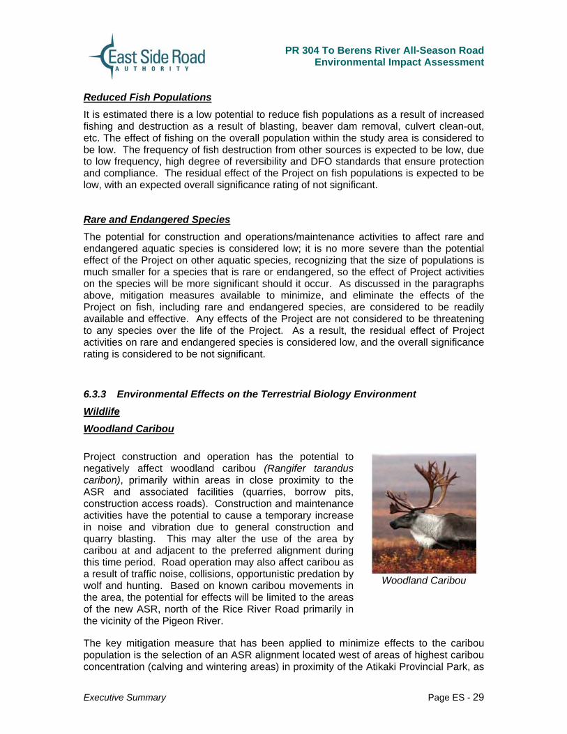
6.3.3 Environmental Effects on the Terrestrial Biology Environment Wildlife Woodland Caribou Project construction and operation has the potential to negatively affect woodland caribou (Rangifer tarandus caribon), primarily within areas in close proximity to the ASR and associated facilities (quarries, borrow pits, construction access roads). Construction and maintenance activities have the potential to cause a temporary increase in noise and vibration due to general construction and quarry blasting. This may alter the use of the area by caribou at and adjacent to the preferred alignment during this time period. Road operation may also affect caribou as a result of traffic noise, collisions, opportunistic predation by wolf and hunting. Based on known caribou movements in the area, the potential for effects will be limited to the areas of the new ASR, north of the Rice River Road primarily in the vicinity of the Pigeon River.
Woodland Caribou
The key mitigation measure that has been applied to minimize effects to the caribou population is the selection of an ASR alignment located west of areas of highest caribou concentration (calving and wintering areas) in proximity of the Atikaki Provincial Park, as
PR 304 To Berens River All-Season Road
Environmental Impact Assessment
Executive Summary Page ES - 30
defined by habitat suitability indices and confirmed with surveys and tracking information. Further analysis identified the Recommended Revised Shoreline Route to have the least potential to cause adverse effects to caribou. The Habitat Suitability Index (HSI) analysis shows a marginal amount of rated habitat lost to the project (28.74 km2), none of which is optimal habitat.
While known calving occurs well away from the proposed Project, suspension of quarry blasting and other construction activities during spring months when calving occurs, will further minimize the potential for effects. Other mitigation measures include access restrictions to the right-of-way during construction, and reclamation of decommissioned access roads and access points on abandoned portions of the winter road to limit hunting access and potentially deter wolf movements in the area.
With proper use of mitigation and monitoring measures, including timing of activities, it has been determined that the residual effects to the woodland caribou are considered low. The preferred alignment is located west of the caribou calving grounds which are considered to be the most sensitive habitat for the species. In general, the caribou will avoid the area during construction, but will readily return to the area following completion of construction. A caribou monitoring program has been developed in consultation with Manitoba Conservation, Wildlife Branch and the Eastern Woodland Caribou Advisory Committee to provide the opportunity for adaptive management measures if required.
Moose Project construction and operation has the potential to negatively affect moose populations, a keystone species, primarily within areas in close proximity to the ASR and associated facilities (quarries, borrow pits, construction access roads). Moose are an important resource in the study area and are generally considered ubiquitous throughout the region. Construction activities (disturbance and habitat loss), operational activities (traffic disturbance and collisions) and indirect affects associated with improved hunting have the potential to effect the local moose populations or behaviours in the study area. Effects will remain unchanged for the Rice River Road portion of the project and the analysis pertains to the section of road north of the Rice River Road through to Bloodvein and Berens River.
Measures to mitigate the potential effects on moose populations include:
• suspension of quarry blasting and other construction activities during spring months (May - June) when calving occurs;
• rrestrictions on access to the right-of-way during construction, and reclamation of decommissioned access roads and access points on abandoned portions of the winter road to deter non-local hunters;
• extension of the Chief Barker Reserve from the existing Rice River Road through the new ASR alignment to inhibit opportunistic hunting activity directly along the right-of-way particularly by non-locals; and
• Fencing and other deterrents in collision prone areas.

PR 304 To Berens River All-Season Road
Environmental Impact Assessment
Executive Summary Page ES - 31
Other Wildlife Other Wildlife including furbearers, song birds, mammals, etc are expected to be potentially negatively affected in terms of disturbances from construction activity, and traffic, habitat fragmentation, harvest increase, and traffic effects. Although there is significant habitat for migratory birds along the Lake Winnipeg shoreline, migratory birds are not expected in any concentrations in the area of the Project.
Project construction and operation has the potential to negatively affect other wildlife populations and behaviours, including fur bearers, song birds and mammals, primarily within areas in close proximity to the ASR and associated facilities (quarries, borrow pits, construction access roads)
Pine Martin
Construction activities (disturbance and habitat fragmentation), operational activities (traffic disturbance and collisions) and indirect effects associated with increased harvesting have the potential to effect the local populations or behaviours in the study area. Generally, with the exception of some short term construction implications, effects will remain unchanged for the Rice River Road portion of the project and the analysis pertains to the section of road north of the Rice River Road through to Bloodvein and Berens River.
Measures to mitigate the potential effects on wildlife populations include:
• clearing the right-of-way only during the winter months to avoid disruptions to nesting and denning activities;
• suspension of quarry blasting and other construction activities during spring months (May-June); and
• development, during detailed design, of confirmatory field investigations pre-construction inventory, and on-going monitoring procedures for construction.
However, given the availability, proven effectiveness and reliability of mitigation measures, the residual effect on wildlife following mitigation is considered to be low, with an overall determination of not significant. Ongoing monitoring during and following construction will provide for adaptive management measures should they be required. Forest/ Habitat There are two primary vegetative communities within the project area which provide wildlife habitat; forests and wet vegetative communities classified as bog and fens. The forest community is classified as Boreal. Bogs are generally acidic, limiting the species of vegetation that can grow in the environment. Fens also provide limited habitat. The
PR 304 To Berens River All-Season Road
Environmental Impact Assessment
Executive Summary Page ES - 32
related effects on vegetative communities associated with the Project are principally loss of area and the potential loss of function associated specifically with invasive species. Generally, with the exception of some short term construction implications, effects will remain unchanged for the Rice River Road portion of the project. The analysis pertains to the section of road north of the Rice River Road through to Bloodvein and Berens River.
The primary measure to minimize effects to forest habitats is to reduce disturbance to the vegetative community by locating the road along the existing winter road or hydro distribution right-of-ways and limit clearing within the Project right-of-way to 60 m. Measures to encourage re-vegetation of and discourage access to discontinued portions of the winter road will also result in re-growth. The residual effects following mitigation is considered to be low, with an overall determination of not significant.
Environmental Effects on Rare and Endangered Species Currently there is one terrestrial species identified within the study area listed under the Manitoba Endangered Species Act (Manitoba Conservation, 2009b) and SARA which is the woodland caribou (Rangifer tarandus caribou). In the study area no rare or endangered vegetative species were identified.
Woodland caribou are known to occur in the study area and the east side of Lake Winnipeg is an important habitat for this species in Manitoba. No protection measures specific to the woodland caribou are currently legislated although the species is protected through the general protection measures afforded to them set out in SARA.
6.4 Environmental Effects on the Socio-Economic Environment Food Supply The ways in which food supplies could potentially be affected by construction and operations/maintenance include:
• Reduction in the supply of moose, caribou, small game and other wildlife (e.g., birds, waterfowl) due to disturbance from ASR construction and operations activities such as noise and dust; over-hunting by non-community members as a result of increased access into previously inaccessible areas, and fatalities along the roadway;
• Reduction in community fish supply as a result of reduced fish populations from over-fishing, altered/disturbed/destroyed habitat sedimentation, erosion and spills of hazardous materials; and
• Reduction in berry supply as a result of removal of plants in the cleared right-of-way, as well as camp locations, construction staging areas and quarries/pits; contamination of berry plants by dust during construction and operations; potential over-harvesting by non-community members.
Several mitigation measures have been identified in Section 6.3 to protect wildlife and fish populations their habitats which will also serve to minimize effects to local food

PR 304 To Berens River All-Season Road
Environmental Impact Assessment
Executive Summary Page ES - 33
supply. The alignment of the ASR along existing rights-of-way will reduce the effect on food supply including berry supply by limiting forest habitat disturbance. Given the availability, proven effectiveness and reliability of mitigation measures, the residual effects following mitigation is considered to be low, with an overall determination of not significant. Ongoing monitoring during and following construction will provide for adaptive management measures should they be required. Community Water Supply Activities which could generate potential sources of contamination to the waterways include:
• Soil erosion and sediment caused by runoff from exposed surfaces during road construction and quarry activities and from the road surface during operations and maintenance; and
• Spills of contaminants (primarily fuel and engine oil) during construction.
The frequency, magnitude and likelihood of events causing contamination in close proximity to water supply sources during any stage of the Project is considered to be low, since:
• The majority of the Project is not in close proximity to communities and their water supplies;
• Best Management Practices are available to control erosion and sedimentation, including sediment barriers such as silt fencing and turbidity curtains, isolation of in-stream working areas, and energy dissipation during construction; surface treatments such as rip rap and vegetation during operations, as well as water management systems such as roadside drainage and collection ponds during operations and maintenance; and
• Best Management Practices are available to prevent and control contamination from fuel and engine oil spills, such as dedicated re-fuelling areas during construction that include barriers and collection systems, spill clean-up kits and proper fuel storage facilities. A Hazardous Materials Management Plan and Emergency Response Plan will be in place to ensure that accidental spills are addressed quickly, and contaminants are removed from the site before severe contamination can occur.
With the application of mitigation measures, the residual effects are determined to be low and not significant.
Medicinal Plants There is a potential for plants used by community members for medicinal or therapeutic purposes to become affected by construction and operations/maintenance of the ASR, as a result of displacement during right-of-way clearance and/or disturbance by dust. However limiting clearing to 60 metres within the right-of-way reduces the potential for
PR 304 To Berens River All-Season Road
Environmental Impact Assessment
Executive Summary Page ES - 34
effect. With these mitigation measures, the residual effect is considered low and not significant.
Human Health Effects from Noise and Dust Potential effects to air quality that could result in health effects to residents within settlement areas/communities in the study area as a result of dust during construction and operations/maintenance activities, are expected to be low as the communities are located a long distance from the Project site and dust from the ASR is not expected to travel that distance. The residual effect is considered to be not significant.
Environmental Effects to the Local Wage Economy Tourism and Recreation
There is potential for reduced watercourse navigability as a result of construction of structures such us culverts or bridges at watercourse crossings. Although Transport Canada has not yet identified navigable waters along the entire length of the road alignment, it is assumed that several watercourses are navigable, and subject to the provisions of the Navigable Waters Protection Act, requiring that crossing structures meet the design standards established to protect navigation. With the application of appropriate design, the residual effect on navigation is considered to be not significant.
Commercial Trapping Potential effects may be caused to commercial trapping activities as a result of ASR construction, operations and maintenance activities. Traplines registered to both aboriginal and non-aboriginal trappers cover the entire study area. Trapping activities could be affected by construction, operations and maintenance activities through disturbance of animals directly adjacent to the right-of-way causing the displacement of mammals in the immediate vicinity of the Project due to the removal of habitat along the right-of-way as well as noise and dust disturbance.
The magnitude of the effect on trapping is considered low and can be controlled through standard Best Management Practices such as dust and noise control, including dust suppressants and timing construction activities so as not to affect calving and nesting seasons in May and June. Mammals are expected to avoid areas of disturbance, but likely will relocate in areas not far from the right-of-way, beyond the influence of noise and dust and in similar habitat areas. The residual effect of these effects to wildlife, causing a reduction in trapping success, is considered not to be significant.
Commercial Fishing All known commercial fishing activity occurs in Lake Winnipeg, a long distance from construction and operations/maintenance activities for the all-season road. Due to the distance, potential effects of construction and operations/maintenance of the ASR on commercial fishing activities with the application of measures to protect fish and fish habiat are expected to be low to non-existent. Residual effects are similarly estimated to be low with an overall significance which is considered to be not significant.
PR 304 To Berens River All-Season Road
Environmental Impact Assessment
Executive Summary Page ES - 35
Commercial Forestry During construction, timber will be cleared within the Project right-of-way. Because the area of the cleared right-of-way is small in comparison to the available area with potential for commercial forestry, the effect of timber removal during construction is considered not to be significant. In addition, trees of commercial value that are cut during construction will be utilized for commercial or local harvest purposes. The effect on commercial forest opportunities is low. Mitigation measures include surveying to maintain construction activities within the Project right-of-way and alignment with the existing winter road where feasible. Residual effects are determined to be insignificant.
Wild Rice Harvesting Wild rice (Zizania aquatic L) harvesting exists on a limited scale within the study area, primarily along the shoreline of some small lakes, well inland of the Lake Winnipeg shoreline. Because of the distance of the all-season road alignment from these areas, no effects from noise and dust are anticipated. Similarly, water quality effects are not anticipated as known rice harvest areas are all located upstream of the Project. Increased access to rice areas as a result of the all-season road is also not considered a significant effect as 1) very few families continue to conduct commercial rice harvesting; and 2) rice areas are still a long way from the road, making access difficult and not likely attractive to opportunistic rice harvesters from outside the local communities. Overall, no mitigation is considered necessary, and residual effects are considered to be low and not significant.
6.5 Environmental Effects to Cultural and Heritage Resources The highest potential for affecting cultural heritage resources is in locations where the right-of-way intersects traditional transportation corridors such as watercourses, lakes, trails, etc. Locations with the highest potential are at crossing locations of the primary rivers including the Bloodvein River, Bradbury River, Pigeon River, and Berens River. All crossings of these major rivers have a high potential to affect heritage resources. The right-of-way of the road segment that is located adjacent to the Berens River in the northernmost section of the ASR also has a high potential to affect cultural heritage resources as it is located on high ground overlooking a major traditional transportation corridor (the Berens River). There is also high potential for effects to cultural resources where the alignment traverses adjacent to an unnamed lake, located about four kilometres south of the Pigeon River. Crossings of the larger streams including Long Body Creek, Petopeko Creek and Taskopekawe Creek, and unnamed tributaries of the larger rivers, have a moderate potential for effects to heritage resources,
Given the small footprint of the Project, the likelihood of encountering heritage resources of significant value is low. If significant heritage resources are identified / disturbed, they will be catalogued, documented and relocated. A targeted field investigation will be conducted prior to construction to confirm the full extent of archaeological sites along the proposed ASR alignment and will include a visual survey of the proposed alignment, crossings and right-of-way, and shovel testing areas of potential sites.

PR 304 To Berens River All-Season Road
Environmental Impact Assessment
Executive Summary Page ES - 36
6.7 Environmental Effects to Archaeological Resources There has been little archaeological investigation in the study area and very few sites with identified archaeological resources have been recorded. The review of recorded archaeological sites listed in the Manitoba Archaeological Sites Database, maintained by Historic Resources, yielded four sites in the entire area. None of these sites will be affected by the Project. Other than conducting pre-construction field surveys and monitoring construction progress, no other mitigation is required.
6.8 Cumulative Effects Analysis The Cumulative Effects Assessment (CEA) associated with the proposed Project was undertaken in accordance to the Cumulative Effects Assessment Practitioners Guide (CEAA, 1999). For the purposes of the cumulative effects analysis, the spatial and temporal boundaries are the same as defined for the Study Area of the Project. Construction will occur over a 5 year time horizon and operation over the lifetime of the Project. Other projects and activities in the Study Area are reviewed over the next 5 to 10 years. Any activity beyond this is outside of the available planning horizon.
Based on the above noted considerations, it has been determined that:
• The existing Rice River Road, winter roads, and local power distribution lines linking the local communities represent infrastructure initiatives in the study area that are duly considered in the environmental effects analysis in this EIA.
• There are currently no major new resource development projects proposed within the Project Study Area related to mining, hydro-electric, power transmission, tourism.
• Tembec Forest Management License No. 1 is in the study area. Active forestry operations are located to the east of Hollow Water FN.
• The ASR Project is outside of the proposed boundary for the UNESCO World Heritage Site and is not anticipated to result in cumulative effects.
• East Side Road Transportation Study is currently in progress, however no specific projects have been identified or planned. Potential road projects well outside the ASR study area are under consideration, and these are expected to result in cumulative effects with this project in the future.
Potential environmental effects associated with the existing and planned projects/activities in the Project area are:

PR 304 To Berens River All-Season Road
Environmental Impact Assessment
Executive Summary Page ES - 37
• Habitat fragmentation as a result of forestry activities and the existing winter road and hydro distribution right-of-ways;
• Adverse effects to keystone species as a result of the creation of movement corridors for predators (wolves) and improved hunting access; and
• Surface water quality effects from forestry activities (erosion, sedimentation and spills of hazardous materials) and winter road operations (spills).
Wolf
Potential adverse effects of habitat fragmentation have been minimized by upgrading the existing Rice River Road, and following the existing winter road or power distribution line, where practical. Measures have also been identified to close access and allow for vegetative regeneration along the winter and to minimize the effects of predator movements and hunting access on key stone species. The cumulative effect of these existing developments with the Project is identified as minor.
Potential adverse effects of forestry operations in relation to habitat fragmentation with the Project are identified as minor. Most forestry harvesting occurs in the eastern portion of the traditional land areas of the Hollow Water community. The potential for cumulative effects on water quality are minor as Tembec is subject to extensive water quality protection regulations and protection requirements as will this Project.
The route selection study for the ASR acknowledged the location of the proposed Pimachiowin Aki World Heritage Site in the development of route alternatives. The proposed ASR route alignment lies outside of the proposed Pimachiowin Aki WHS and avoids conflicts with the resource and traditional use of this area. No cumulative effects are anticipated to be created by these two projects
Significance and Follow-up The cumulative environmental effects of the project in combination with the effects of other projects or activities that have been and will likely be carried out within the Project Study area in the foreseeable future were determined to be insignificant.
Follow-up in the form of environmental monitoring of keystone species and predator species for the Project will also identify potential cumulative effects related to habitat fragmentation. Follow-up water quality monitoring for cumulative effects is not required.
6.9 Effects of the Environment on the Project Determination of possible effects of the environment on Project activities is based on potential magnification of Project related effects due to weather conditions; the

PR 304 To Berens River All-Season Road
Environmental Impact Assessment
Executive Summary Page ES - 38
environmental effects associated with poor weather conditions, and induced environmental conditions or factors associated with flood events or forest fires.
The proposed Project may be at risk of flooding due to seasonal flood events. However, the Project design standard of 1:100 year flood event for crossings is intended to limit the potential for flood damage and washouts at crossings and along the road network. In addition, the road will also include regular road side drains and culverts to accommodate seasonal drainage.
Berens River Bridge Site South Side
Local beaver (Castor casadensis) populations within the immediate area of the ASR may cause damage due to the construction of beaver dams and the plugging of road culverts that may result in blockage of the established drainage system and localized flooding. Regular maintenance activities such as culvert clean-outs will serve to address the potential for damage to the road and culvert crossings. With design and maintenance related mitigation measures, the potential environmental effects from flooding are localized and deemed to be minor and not significant.
It is likely that the portions of the proposed ASR will experience forest fires during construction and operation. The ASR will be constructed from materials not easily affected by fire (rock and concrete). Fires may result in periodic road closures and possible damage to bridges, maintenance yards and equipment. The road alignment passes through wetland areas and away from upland forest areas, which reduces the risk of forest fires.
The regional area is in a low seismic hazard area in Canada; as such consideration of the effects of an earthquake is not warranted in the EIA.
During construction and operation, there will be a short term minor increase in Greenhouse Gas (GHG) Emissions attributed to the construction vehicles and associated equipment. The increase is not significant in the context of the provincial transportation sector GHG emissions.

PR 304 To Berens River All-Season Road
Environmental Impact Assessment
Executive Summary Page ES - 39
7.0 MITIGATION AND MONITORING Mitigation measures will be implemented through detailed design as well as through procedures to be developed in a series of implementation plans to be developed during detailed design that will provide detailed, step-by-step guidelines, tasks and activities to be conducted during construction and operation.
An Environmental Management Plan (EMP), a key mitigation measure, will be developed during detailed design of the Project, for the construction and operational phases of the Project. The implementation of the EMP will be reinforced by the application and use of Best Management Practices during construction, and the strict adherence to the Permitting and Authorization Process.
The EMP will define plans and procedures to prevent or mitigate all the potential effects of the Project, and will be submitted to the Responsible Authority (RA) for review and approval prior to construction. The EMP will provide specific and unique procedures for the construction and operations phases, and will include the following components:
• Emergency Response Plan;
• Environmental Protection Plan;
• Erosion and Sediment Control Plan;
• Dust Control Plan;
• Health and Safety Plan;
• Waste Management Plan;
• Hazardous Materials Management Plan;
• Monitoring Plan; and
• Decommissioning Plan.
A summary of the EIA mitigation in relation to project phases is presented below:
Design Phase The detailed design phase of the ASR will commence in 2009 and will be conducted in accordance with all applicable Manitoba Infrastructure and Transportation (MIT) standards. Design will incorporate:
• Bridges and culverts designed to 1 in 100 year storm event;
• Geotextile matting and scrub trees/brush to reduce the effect of peat compression;
• Alignment refinement including utilization of existing right-of-ways;
• Clear-span bridges over wide spans;

PR 304 To Berens River All-Season Road
Environmental Impact Assessment
Executive Summary Page ES - 40
• Compensation plans developed in collaboration with the Department of Fisheries and Oceans (DFO) for potential Harmful Alteration, Disturbance or Destruction (HADD) of fish habitat;
• Watercourse crossing structures designed to meet DFO criteria for fish passage;
• Wildlife fences and under-road access may be considered in limited areas where migratory species are known to cross the right-of-way; and
• Traffic speed and other warnings routinely posted along the roadway.
Construction Phase
Construction phase activities are expected to commence in the fall of 2010, and should last approximately 42 months, with substantial completion targeted for March 2014.
Berens River Bridge Site North Side
Mitigation measures during the construction phase include:
• Implementation of Best Management Practices (BMP) for:
o slope degradation, sediment and erosion;
o long term/final erosion and sediment control/rehabilitation measures (such as mulching, seeding, planting trees and shrubs);
o dust control;
o noise control ;
o blasting and notification;
o spill prevention; and
o wastewater storage and handling.
• Scheduling of construction activities to
o respect all permit requirements;
o limit clearing of right-of way work to winter months to avoid disruption to nesting and denning activities; and
o suspend blasting activity during spring periods when calving occurs;
• HADDs limited to the permanent alteration or destruction of habitat associated with the installation of permanent crossing structures;

PR 304 To Berens River All-Season Road
Environmental Impact Assessment
Executive Summary Page ES - 41
• Restriction of winter trail access and access to areas adjacent to the ASR for hunting and fishing; and
• Establish a caribou monitoring program in consultation with Manitoba Conservation and Eastern Woodland Caribou Advisory Committee.
Reclamation Facilities no longer required upon cessation of construction activities will be decommissioned and the areas rehabilitated. They include access roads; camps, staging areas and selected quarries. Rehabilitation will also be carried out on the ASR segments such as roadside slopes, streambanks, streambeds, and stockpile areas. Specific details of rehabilitation will be defined during detailed design, and all applicable permits and approvals will be obtained prior to implementation.
Operations Phase The operations and maintenance phase is expected to start in 2014. The Project is committed to ensuring that the following mitigation measures are implemented:
• Maintain road surface in good condition, through regular maintenance;
• Spill response plans and spill prevention using best management practices;
• Proper wastewater storage and handling;
• Restrict access to side roads by physical means or destroy access roads;
• Gated access to be installed on routes that cannot be destroyed;
• Installation of signs to warn vehicles of potential moose concentration;
• Regular maintenance to the roadway (including snow and ice clearing); and
• Policing.
Side roads necessary for on-going maintenance of the ASR will be gated and securely locked to restrict access.
7.1 Implementation of Monitoring Measures Monitoring activities will be conducted to ensure that the mitigation measures are effective, with monitoring programs to be implemented during construction and operation. Monitoring will provide for adaptive mitigation measures to be implemented in consultation with applicable government agencies if required.
Several monitoring programs in relation to mitigation measures have been proposed for implementation through the Environmental Management Plan (EMP) for the Project and include the following:
• Air quality in relation to dust;

PR 304 To Berens River All-Season Road
Environmental Impact Assessment
Executive Summary Page ES - 42
• Complaint monitoring as it relates to dust, noise and vibrations from construction activities near communities;
• Noise protection monitoring for workers;
• Soil disturbance, quality and erosion during and following construction;
• Aquatic habitats in relation to erosion, sedimentation and water quality contamination from spills;
• Vegetation and ground cover restoration and reclamation of construction access roads quarry sites and entrance points to the winter road;
• Responses of wildlife (caribou, moose and predation by wolves) to construction activities and operation; and
• Heritage and archaeological features, food supply/trap line and traffic injuries.
A Monitoring Plan will be developed as part of the EMP and implemented by ESRA. Construction activities will be monitored as necessary to ensure that contractor(s) and project workforce adhere to the contract provisions and implement all mitigation measures.

PR 304 To Berens River All-Season Road
Environmental Impact Assessment
Executive Summary Page ES - 43
8.0 CONCLUSIONS
The key conclusion of this EIA is that with the implementation of mitigation measures the Project will have No Significant Environmental Effects. As discussed in the EIA report, effects are significantly eliminated or reduced by:
• selecting the ASR Preferred Alignment route based on community input (from EA Engagement Program) and environmental and related socioeconomic factors;
• minimizing the Project footprint by upgrading the existing Rice River Road and aligning the new segment of the ASR closely with the existing winter road and power distribution line;
• undertaking Project activities in accordance with federal and provincial environmental regulations and guidance materials;
• using industry and provincial standards for design of the Project and its various components; and
• Environmental Management Planning during the life of the Project that:
o employs mitigation measures based on Environmental Protection Guidelines, Best Management Practices, and guidance materials such as DFO Operational Statements; and
o is based on monitoring of Project activities such as specific programs for caribou monitoring developed in consultation with Manitoba Conservation, Wildlife Branch and the Eastern Woodland Caribou Advisory Committee; and
o plans for emergency situations.
A communications program is being developed so that communities within the study area remain informed about the Project through each phase of development and are provided an opportunity to provide comments. ESRA will also continue to explore opportunities to involve local communities and community members in the project through employment and contracting opportunities, providing training and capacity building in support.
Through policy and legislation, Manitoba has adopted principles and guidelines of sustainable development. The Project is considered a sustainable undertaking that will provide significant local benefits by meeting the needs of local communities for improved transportation access and, with the implementation of mitigation and monitoring measures, the PR 304 to Berens River All-Season Road project will not result in significant environmental effects. The Project will increase local economic opportunities (such as providing services and materials during construction and operation) and also provide long-term benefits associated with increased transportation options and reliability with lower transportation costs.