exhibit 1: project location maps - california state coastal...
TRANSCRIPT

Milagra-Battery Ridge Trail
Pier 70 – Crane Cove Park
SF Bay Trail: Buchanan to Gilman
SF Bay Trail: Pinole Shores to Bayfront Park
Berkeley Bay TrailExtension
Brentwood Wallace Ranch Easement
Pinole Creek Fish Passage
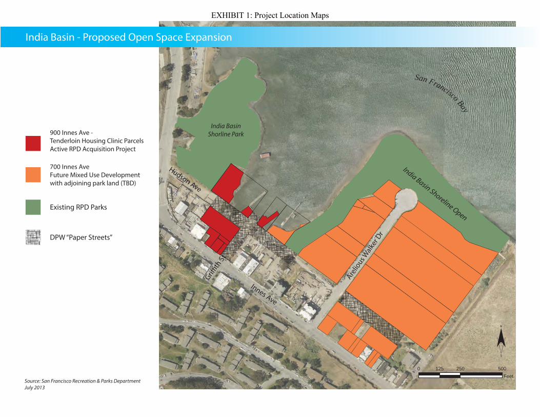
900 Innes Park
Coyote Creek Trail: Brokaw to UPRR
Twin Peaks
Loma Mar Acquisition
Skyline Ridge Trail Extension
Breuner Marsh
EXHIBIT 1: Project Location Maps

Sources: Esri, DeLorme, NAVTEQ, USGS, Intermap, iPC, NRCAN, Esri Japan, METI, Esri China(Hong Kong), Esri (Thailand), TomTom, 2013, Copyright: ©2013 Esri, DeLorme, NAVTEQ±
MCLAREN PARK
CANDLESTICKPARK
GLENPARK
GOLDENGATEPARK
0 0.5 1 1.50.25Miles
India Basin Shoreline Park
PCA Grant Application: 900 Innes Project Regional Map
RPD Park Property
Other Agency Land
Existing Bay Trail
MAP KEY
900 Innes: Project Site
Planned Bay Trail
EXHIBIT 1: Project Location Maps

EXHIBIT 1: Project Location Maps
0 250 500125Feet
DPW “Paper Streets”
900 Innes Ave - Tenderloin Housing Clinic ParcelsActive RPD Acquisition Project
700 Innes AveFuture Mixed Use Developmentwith adjoining park land (TBD)
Existing RPD Parks
Source: San Francisco Recreation & Parks DepartmentJuly 2013
Hudson Ave
Innes Ave
Arelio
us Walk
er D
r
India Basin - Proposed Open Space Expansion
San Francisco Bay
India Basin Shorline Park
India Basin Shoreline Open
EXHIBIT 1: Project Location Maps