exhibit 46 in support of plaintiffs’ motion for a ... payne, wildlife technician, grand canyon...
TRANSCRIPT
Exhibit 46 in support of
Plaintiffs’ Motion for a Preliminary Injunction Ctr. for Biological Diversity, et al. v. Salazar, et al., 3:09-cv-08207-DGC
National Park Service Potential Impacts of Uranium Mining on Wildlife Resources
(January 2010) (excerpts)
National Park Service U.S. Department of the Interior Natural Resource Program Center Natural Sounds Program
Potential Impacts of Uranium Mining on the Wildlife
Resource of Grand Canyon National Park Kevin Payne, Wildlife Technician, Grand Canyon National Park, Grand Canyon, Az 86023 Jeremy White, Lead Wildlife Technician, Grand Canyon National Park, Grand Canyon, Az 86023 R.V. Ward, Wildlife Biologist, Grand Canyon National Park, Grand Canyon, Az 86023
January 2010
AREA OF ANALYSIS The area of analysis falls mostly within Grand Canyon National Park (GCNP or Grand Canyon); however, since wildlife and water resources are not confined within the boundaries of the park, the area also includes lands within the Kaibab National Forest, BLM Arizona Strip District, and the Navajo, Havasupai, and Hualapai Reservations (Appendix A). Designated as a world heritage site in 1979, the Grand Canyon is perhaps the most spectacular river gorge in the world. The rock strata exposed by the down-cutting of the river provides a unique view of the evolutionary history of the earth’s crust over approximately two billion years. The ongoing geologic processes at work in the canyon are essential to the development of important ecosystems in both the terrestrial and aquatic realms, supporting significant habitat for threatened and endangered species. GENERAL IMPACTS The following information on the number of mining claims was taken from two GIS layers provided by the Environmental Working Group (2008). The numbers regarding new road construction were generated using a proximity tool in ArcMap (ESRI, Redlands, CA) that determines the distance from an existing road to each mine site. It is important to understand that this tool draws a straight line from the site to the nearest road and does not factor in topography or other environmental determinants, resulting in an underestimate of the actual road length. Conversely, while the proximity tool is creating a straight line from each site to the nearest road it does not consider adjacent mine sites, which results in an overestimate of actual road length. It is unlikely that every claim will have its own road leading to it. Many claims are spaced 400m apart and will likely have one road connect multiple claims. GIS files containing road information were retrieved from the BLM GIS website (2007) and the USFS GIS website (2008). Area calculations for road associated habitat destruction assumed a mean road width of 10m. Within the withdraw areas there are 3766 mining claims at 2237 sites. Many of these claims are suspected to have an interest in uranium mining (EWG 2009). Sites outside of the withdraw areas were not considered in any analysis. Of the 556 mining claims (at 344 sites) adjacent to the south rim of the Grand Canyon, the average distance from an existing road is 305m. Assuming claims are to be used and accessible, a minimum of 96km of roads would be established, eliminating approximately 1 km2 of habitat (see above for data caveats). There are 3210 mining claims (at 1893 sites) on the BLM land within the withdraw areas northwest and northeast of the Grand Canyon. These claims average 459m from established roads. Assuming claims will be accessible via new roads, approximately 770km of road would need to be created, eliminating 7.7 km2 of habitat (see above for data caveats). In addition to the construction of roads, each mine would require a clearing for the placement of the mine complex. Assuming the development of each site, and a mine site

footprint of ~8.1 ha (Patton 2007), the total area of habitat removed at all mining sites (not including roads) would total approximately 160 km². The total area cleared, while important, is not the only factor to consider. The habitat fragmentation caused by road and mine complex installations will decrease the value of neighboring land to some species. The results of this disturbance are difficult to predict so the wildlife impacts in the following sections are somewhat speculative. NATURAL RESOURCES Grand Canyon National Park (GCNP or Grand Canyon) contains a variety of habitats due primarily to significant elevation changes and differing precipitation regimes. The park varies in elevation from approximately 400 to 2750 meters above mean sea level while the average annual precipitation varies from 21.4 cm in the canyon to 64.1 cm on the north rim. Precipitation comes in the form of summer showers and winter rains or snow. Inner canyon temperatures are significantly warmer than temperatures at the rim. The average annual high at the north rim is 13.4ºC while it approaches 27.7ºC in the inner canyon. GENERAL HYDROLOGY Surface water resources in Grand Canyon consist of the Colorado River, tributary side streams, and seeps and springs. Colorado River flows entering the Grand Canyon are controlled through Glen Canyon Dam. Through the canyon the river gains water from perennial tributaries, flash flood flows in side canyons, and groundwater discharge through springs and seeps. Colorado River Main Stem Since the Glen Canyon Dam was finished in 1963, Colorado River flows through Grand Canyon have averaged about 13,700 cfs, with winter flows averaging less than summer flows. The maximum flow since 1963 was 92,600 cfs released during the unusually wet year of 1983; the minimum flow was 700 cfs, released when Lake Powell was filling (USGS 2003). Under normal operating criteria in effect since 1996, releases cannot exceed 25,000 cfs except during habitat maintenance or other experimental flows, under emergency conditions, or when required for flood control. Tributaries Of the 750+ tributary canyons in the Grand Canyon, the majority are ephemeral watercourses flowing only during local storm events. The Paria and Little Colorado Rivers and Kanab, Havasu, Diamond, and Spencer Creeks originate outside the canyon, drain large plateau areas, and are major drainage features in the park. These tributaries derive flow from perennial runoff and perennial spring sources as well as intermittent runoff events. Perennial tributaries, in general, are popular attraction sites for river runners. Many offer clear water, lush vegetation, cascades, pools, and waterfalls. Angling is popular at cool-water tributaries like Bright Angel and Tapeats Creeks, which can be accessed by backcountry hikers. Two of the larger tributaries with perennial flow, Kanab
and Havasu Creeks, are shown (Appendix B) because of their proximity to mining claim areas. Over 225 perennial seeps and springs issue from thick sections of sedimentary rocks as the groundwater emerges into the canyon. Seeps and springs occur usually at the contact between a permeable rock unit and an impermeable rock layer. Most of the springs issue from the Muav and Redwall limestones, although a few small springs issue from the Tapeats sandstone. If the seep or spring emerges on a cliff face, waterfalls and hanging gardens may develop. The largest springs in the canyon, Blue, Havasu, Thunder River, and Roaring springs, provide base flow for the Little Colorado River, Havasu Creek, Tapeats Creek, and Bright Angel Creek, respectively. Other large springs accessible from the river include Vasey’s Paradise (which contains the only naturally occurring population of the endangered Kanab ambersnail in Arizona), Upper and Lower Deer Springs, and Pumpkin Spring. River runners generally make use of the streams and riparian areas downstream of the large springs rather than the point of emergence itself, which is often difficult to access. A major exception is Pumpkin Spring, which is a highly mineralized spring that fills a travertine bowl at the river’s edge and was once commonly used as a warm-water swimming hole; it is now generally avoided because of high arsenic levels. Potential Impacts on Water Resources Water Resource issues are more fully addressed in the Hydrology report prepared by the Grand Canyon hydrologist, but wildlife considerations will play a part in that analysis. In August 2009 several springs which could be impacted by uranium extraction activities were sampled by USGS and NPS personnel. The springs sampled were Clear Water, Rock, Slide, Upper Jumpup, Mountain Sheep, Lower Jumpup, 27 Mule, Kanab, Showerbath, Willow, Side Canyon, Hotel and Schmutz. The springs were surveyed for the endangered Kanab ambersnail with negative results, however several of the springs may be suitable to support introduced populations. The springs were also sampled for relict and northern leopard frogs with negative results. Kanab Creek supports suitable habitat for northern leopard frogs and they have been recorded from that drainage (Drost et al. 2008). Activities which reduce the quantity or quality of water in Kanab Creek could have negative impacts on these species (Appendix B). The springs were also evaluated for the presence of suitable riparian habitat which would support the endangered southwestern willow flycatcher. None of the springs exhibited the necessary density of riparian vegetation to support this species, however Kanab Creek has suitable but presently unoccupied southwestern willow flycatcher habitat. From September 7, 2009 to September 19, 2009 five springs in Grand Canyon National Park were sampled for the presence of Kanab Ambersnail and southwestern willow flycatcher habitat. These springs were Fence Fault, Vasey’s Paradise, No Name Spring, Hanging Spring and Buck Farm Spring. Only Vasey’s Paradise was found to support the Kanab ambersnail. None of the springs were suitable for southwestern willow flycatchers, but 10 sites along the Colorado River from Phantom Creek to Diamond Creek were deemed suitable to support the species, if recovery efforts are successful.
For instance, the development of all of the 921 mine sites within the Great Basin Conifer Woodland (Pinyon/Juniper) would result in the loss 75 km² of pinyon-juniper habitat. This figure does not include the roads required to service the mines. If we assume that the impacts of the potential development affect each sub-habitat type evenly and average the density of each species across sub-habitat type then the resulting loss of 75 km² of contiguous pinyon-juniper habitat would result in the loss of approximately 75,000 birds. This loss is calculated from the density estimates in Table 6 and does not include resident birds for which densities were not calculated. The negative impacts on migrants and the effects of habitat fragmentation are incalculable. The development of 93 sites within the ponderosa pine habitat of the Tusayan Ranger District would result in the destruction of approximately 7.4 km² of ponderosa pine forest. If this area was contiguous and we used the density estimates of Willey (2003) for this habitat type; the resulting loss of 7.4 km² of ponderosa pine habitat would mean the loss of approximately 14,600 birds. Impacts for the other habitat types can not be estimated because data regarding the density of the resident avian communities was not available. An additional concern for passerines is the potential for increased brown-headed cowbird parasitism. Brown-headed cowbirds, an obligate brood parasite, tend to avoid large patches of dense forest and prefer edge habitat. This edge habitat, provided by the construction of roads and mine instillations, may allow greater infiltration of brown-headed cowbirds into previously unpressured areas. The presence of cowbirds may have especially adverse effects on native bird species in riparian habitats (Drost et al. 1998). Some of the most vulnerable and negatively affected host species include the Bell's Vireo (Vireo bellii), Yellow Warbler (Dendroica petechia), Blue Grosbeak (Guiraca caerulea), Common Yellowthroat (Geothlypis trichas), and the federal and state of Arizona Endangered Southwestern Willow Flycatcher (Drost et al. 1998). Birds that are considered endangered, threatened, or sensitive species including the, American peregrine falcon, bald eagle, California brown pelican, California condor, Mexican spotted owl, and southwestern willow flycatcher are described more fully and potential impacts addressed below. Special Status Avian Species
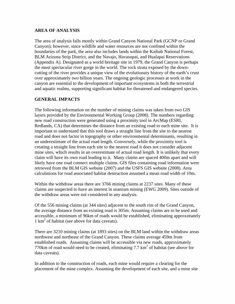
American Peregrine Falcon – The American peregrine falcon was listed as endangered in 1970; however, recovery efforts were successful, and the species was removed from the list in 1999. It is now considered an Arizona species of special concern. To ensure the peregrine falcon's recovery in Grand Canyon, the park treated the species as endangered until 2004. Currently, over 50 pairs nest in the park from Lees Ferry to Lake Mead and a monitoring program is in place (Ward 2000; Appendix I). Peregrines use areas with high massive cliffs, preferably near water, where bird concentrations (food source) are relatively high.
Potential Impacts to American Peregrine Falcon Peregrine falcons are widely known to be sensitive to human disturbance. Within the park, peregrine falcons establish eyries immediately below the rim area and forage both within the canyon and on the plateau areas. At least three peregrine falcon eyries on the south rim are within three miles of mining claims on the southern withdrawal area and eight are within 5 – 10 miles of claims (Appendix I). These claims could be within the foraging area of this species and any reduction of avian species as discussed in the previous section could result in reductions in the peregrine falcon forage base. The park does not have survey data from outside GRCA but since similar canyon habitat occurs outside the park it is reasonable to assume that peregrine falcon pairs could also utilize that habitat. Canyon habitat outside Grand Canyon National Park is most extensive along Kanab Canyon and its multiple side canyons where numerous mining claims occur. Significant localized impact ( i.e., nest failure from human disturbance) could occur in these areas. Bald Eagle. – The bald eagle, which was listed as endangered in 1967, was reclassified as threatened in the lower 48 states in 1995, and was proposed for delisting in 1999. The bald eagle is listed by the Arizona Game and Fish Department as a wildlife species of special concern. Bald eagles are found in all counties of Arizona, typically near lakes and rivers where they forage for fish (AGFD 2002b). They arrive in Grand Canyon as early as the last week of October and typically leave by the third week of March. Bald eagles roost and nest in large trees or on cliffs or pinnacles near the water, but nesting does not occur in the canyon (Brown and Stevens 1992). In the 1980s and early 1990s many bald eagles congregated at the mouth of Nankoweap Creek to feed off spawning rainbow trout. Their numbers have been greatly reduced in recent years since changes in stream morphology have hampered movement of trout into the creek and reduced foraging opportunities for eagles. Despite the diminished use of Nankoweap Creek, bald eagles remain the most frequently seen raptor along the river in winter (Ward 2004). Bald eagles have been observed along the river corridor from Lees Ferry to RM 105. They are frequently observed over the Tusayan District of the Kaibab National Forest and have been observed to roost near Boggy Tank. Potential Impacts to Bald Eagles There is insufficient data to accurately asses the potential impacts to bald eagle populations within Grand Canyon National Park. Since bald eagles winter in the inner canyon, population level impacts are unlikely within the Park, but their likelihood is unknown on the withdrawal areas. 167 California Brown Pelican – The federally endangered brown pelican is a subspecies of the brown pelican that is found mostly along the California and Mexico coasts (USFWS 2001); however, it has been observed inland in Arizona along the Colorado River, near Lake Mead and in Gila Valley, and near other bodies of water throughout the state. Until recently, the California brown pelican was considered an infrequent winter migrant and
winter sightings were only occasionally recorded. However, in 2004, a number of pelicans were observed in the river corridor. No subsequent observations have been recorded. Potential Impacts to California Brown Pelicans The California brown pelican is seldom recorded within the park or area of analysis. Significant impacts are unlikely. California Condor – The federally endangered California condor has critical habitat designated in California. An experimental, nonessential population was reintroduced into northern Arizona and southern Utah in December 1996, and the Arizona Game and Fish Department now lists this species as a species of special concern. Experimental populations in national parks are managed as a threatened species. As of July 2009, there were 180 free-flying condors, 75 of these birds are in Arizona. The first wild reared chick in the program’s history and likely the first chick in Arizona in 100 years fledged in November 2003. Since then, additional chicks have been born in Grand Canyon National Park. Four nesting caves are known from Grand Canyon National Park. Condors are known to create nesting sites in various rock formations, such as caves, crevices, and potholes (USFWS 2002a). Their preferred roosting habitat consists of rock cliffs, snags, and live conifer stands, where they can rest, preen, and socialize. Condors are known to prefer the river corridor in the winter months. California condor distribution within GCNP (Appendix J) was mapped from data collected in 2008 and areas of high, medium and low frequency were plotted. Point data from 2008 illustrating the use by condors of the Kanab Creek area are presented in Appendix K Potential Impacts to California condors The California Condor, classified as endangered by the U.S. Fish and Wildlife Service, was established in Arizona under a special provision of the Endangered Species Act. This provision (known as the 10(j) rule) allows for greater flexibility in the reintroduction efforts. Since condors spend a majority of the daylight hours flying in search of food and generally roost in inaccessible areas, the radiological effects of uranium mining in the withdraw areas is of minor concern when compared to the potential for toxicological poisoning caused by the consumption of mining waste water and contaminated carrion. Waste water associated with uranium mining operations contains high concentrations of a variety of metals and other chemicals associated with the mining process (Kaufman et al. 1976). These waste waters are usually stored in nearby evaporation ponds for remediation. The surface evaporation ponds will serve as an attractant and may represent a significant hazard to wildlife. The map in Appendix K clearly illustrates that condors use the northwest mining withdrawal area as a foraging site and as a travel corridor.
The California condor has demonstrated behavior that may make it particularly susceptible to exposure to contaminated waters. California condors are not especially wary of people or human structures and will drink from a variety of water sources (Snyder and Schmitt 2002). This lack of fear and propensity to gather at water sources prompted federal agencies to cover helicopter dip tanks when not actively being used in fire suppression operations within the condor range. Female condors, both in the wild and in captivity, will commonly take on a full crop of water within a day or two of egg-laying (Snyder and Snyder 2000). The reason for this behavior is unknown but the intake of contaminated water at this stage of the breeding cycle could be particularly harmful. Condors are exclusively carrion consumers who usually feed on mammalian carcasses (Snyder and Schmitt 2002). During the hunting seasons they seem to favor gut piles or other easy sources of soft tissue. (Feltes 2009). Unfortunately, different metal compounds have different affinities for particular tissues and may accumulate in relatively high concentrations. In animal studies, observations in acute- and intermediate-duration exposures to uranium compounds conclusively demonstrate that high doses of uranium are nephrotoxic (U.S. Department of Health and Human Services 1999). Additionally, soft tissues are relatively low in calcium so condors also readily ingest bone materials to satisfy their calcium requirements (Snyder and Schmitt 2002). Bone also absorbs a higher proportion of bioavailable metals than many other tissues and could be a secondary source of dietary metal intake. Mexican Spotted Owl – The federally threatened Mexican spotted owl has critical habitat designated within Grand Canyon National Park. Also listed as a species of concern by Arizona and the Navajo Nation, Mexican spotted owls are typically associated with mature forest habitat, and their presence has been confirmed within arid canyon lands scattered across southern Utah and northern Arizona (Willey 1995). Surveys within the park have recorded spotted owls within the upper reaches of several large, steep-walled tributary side canyons (Willey and Ward 2000). Subsequent work within the park resulted in the establishment of 41 protected activity centers (Appendix L). Spotted owls utilize the rocky canyon tributaries and the flat Tonto Plateau to forage, feeding primarily on desert woodrat (Neotoma lepida). While it is thought that owls obtain a majority of their water through prey, spotted owls in the park have been observed drinking directly from spring sources within the Redwall limestone layer of the canyon. While adult spotted owls are thought to infrequently use the rim to hunt, they have been documented using the rim to vocalize and defend territory. Within the park spotted owls generally show strong site fidelity, returning to established territories each year. The breeding season begins in mid-march when owls re-establish pair bonds, and continues through mid-October as juveniles disperse from their natal territory. According to Bowden and Ward (2009) the Grand Canyon population of Mexican spotted owls may serve a critical role in connecting populations via juvenile dispersal:
Due to its location roughly equal distance between critical habitat units in rocky canyons of southern Utah and forested units in north-central Arizona, the park