expansion of gravel pit road quarry -...
TRANSCRIPT

ENVIRONMENTAL ASSESSMENT REPORT
Expansion of Gravel Pit Road Quarry
Gravel Pit Road, Nook, Tasmania
A.G. & B.J. Riley
Report and recommendations of the Environment Division Department of Environment, Parks, Heritage and the Arts to the Board of the Environment Protection Authority May 2009

Environmental Assessment Report – Expansion of Gravel Pit Road Quarry, Nook
II
Environmental Assessment Report
Proponent A.J. & B.J. Riley trading as Riley Quarry Products
Proposal Upgrade of gravel extraction permit
Location Gravel Pit Road, Nook Tasmania 7306
NELMS no. 7698
DA number 2008/122
File 10 03 11
Document G:\EEO_EO\EAS_Ass\EAS_P\RQPS\AssRep\EAR Riley
Class of Assessment
2B
Assessment process milestones
3 December 2007 Notice of Intent submitted
14 January 2008 DPEMP Guidelines issued
7 October 2008 Permit application submitted to Council
9 October 2008 Application received by Board
18 October 2008 Start of public consultation period
17 November 2008 End of public consultation period
28 April 2009 Supplementary information submitted to Board
Acronyms
Board Board of the Environment Protection Authority
DPEMP Development Proposal and Environmental Management Plan
DEPHA Department of Environment, Parks, Heritage and the Arts
DPIW Department of Primary Industries and Water
EIA Environmental impact assessment
EMPC Act Environmental Management and Pollution Control Act 1994
EPBC Act Environment Protection and Biodiversity Conservation Act 1999 (Cth)
LUPA Act Land Use Planning and Approvals Act 1993
SD Sustainable development
Environmental Assessment Report – Expansion of Gravel Pit Road Quarry, Nook
III
Report summary
This report contains an environmental assessment and recommendations to the Director, Environment Protection Authority in relation to A.G. & B.J. Riley’s proposed expansion of the gravel extraction pit at Gravel Pit Road.
The proposal involves increasing production from less than 5,000 cubic metres to 25,000 cubic metres of gravel processed per annum.
This report has been prepared by the Environment Division of the Department of Environment, Parks, Heritage and the Arts based on information provided by the proponent in the Development Proposal and Environmental Management Plan (DPEMP) and DPEMP Supplement. The advice of relevant Government Agencies and the public has also been sought and considered as part of this assessment.
On 11 December 2008, the Director requested that the applicant submit supplementary information to address the government agency and Council comments on the DPEMP. The DPEMP supplementary information was submitted by the applicant on 28 April 2009.
Background to the proposal and details of the assessment process are presented in Section 1 of this report. Section 2 describes the context of this assessment. Details of the proposal are contained in Section 3. Section 4 reviews the need for the proposal and considers the project, site and design alternatives. Section 5 summarises the public and Agency consultation process and the key issues raised in that process. The detailed evaluation of key issues is contained in Section 6. Section 7 identifies other environmental issues and the report conclusions are contained in Section 8.
Appendix 1 contains a tabular evaluation of other environmental issues referred to in Section 7. Appendix 2 contains a summary of issues raised in the consultation process. Appendix 3 contains recommended environmental permit conditions for the proposal. Attachment 2 of the recommended permit conditions contains the table of commitments from the DPEMP.

Environmental Assessment Report – Expansion of Gravel Pit Road Quarry, Nook
V
Table of Contents
1 Approvals process .................................................................................... 6
2 SD objectives and EIA principles .............................................................. 6
3 The proposal ............................................................................................ 7
4 Need for proposal and alternatives ......................................................... 11
5 Public and agency consultation .............................................................. 11
6 Evaluation of key issues ......................................................................... 12
6.1 Blasting ................................................................................................................. 12
6.2 Operational Noise ................................................................................................. 13
6.3 Rehabilitation ........................................................................................................ 15
7 Other environmental issues .................................................................... 18
8 Conclusions ........................................................................................... 18
9 References ............................................................................................. 18
10 Summary of appendices ...................................................................... 19
Environmental Assessment Report – Expansion of Gravel Pit Road Quarry, Nook
6
1 Approvals process
An application for a permit under the Land Use Planning and Approvals Act 1993 (LUPA Act) in relation to the proposal was submitted to Kentish Council on 7 October 2008.
The proposal is defined as a ‘level 2 activity’ under Schedule 2 Subsections (5)(a) and (6)(a)(ii) of the Environmental Management and Pollution Control Act 1994 (EMPC Act), being both an extractive industry (quarry) and materials handling activity (crushing/screening). Section 25(1) of the EMPC Act required Council to refer the application to the Board of the Environment Protection Authority (the Board) for assessment under the Act. The application was received by the Board on 9 October 2008.
The assessment has been undertaken by the Director, Environment Protection Authority under delegation from the Board.
The Board required that additional information to support the proposal be provided in the form of a Development Proposal and Environmental Management Plan (DPEMP) prepared in accordance with guidelines jointly issued by the Board and Kentish Council. The final guidelines were issued to the proponent on 14 January 2008.
Several drafts of the DPEMP were submitted to the Department for comment prior to its formal submission. A final DPEMP was submitted to Council with the permit application. The DPEMP was released for public inspection for a 28-day period commencing on 18 October 2008. Advertisements were placed in The Mercury, The Advocate and on the EPA web site. The DPEMP was also referred at this time to relevant government agencies for comment. No public submissions were received.
On 11 December 2008, the Director requested that the proponent prepare a DPEMP Supplement to address DPEMP comments made by government agencies (including DEPHA) and Council. The DPEMP Supplement was submitted by the proponent on 28 April 2009.
2 SD objectives and EIA principles
The proposal must be considered by the Director in the context of the sustainable development objectives of the Resource Management and Planning System of Tasmania (RMPS), and in the context of the objectives of the Environmental Management and Pollution Control System (EMPCS) established by the EMPC Act. The functions of the Board are to administer and enforce the provisions of the Act, and in particular to use its best endeavours to protect the environment of Tasmania, and to further the RMPS and EMPCS objectives.
The Director must undertake the assessment of the proposal in accordance with the Environmental Impact Assessment Principles defined in Section 74 of the EMPC Act.
Environmental Assessment Report – Expansion of Gravel Pit Road Quarry, Nook
7
3 The proposal
A.G. & B.J. Riley (trading as Riley Quarry Products) are applying for a permit upgrade to increase gravel extraction operations at Gravel Pit Road, Nook. Production is currently limited to below 5,000 cubic metres per annum and the proponents are seeking approval to extract and crush 25,000 cubic metres per annum. The quarry currently operates under two mining leases (1M/2002 and 3M/2009) and a Level 1 permit issued by the Kentish Council in 2002 (DA 02/10).
The main characteristics of the proposal are summarised in Table 1. A detailed description of the proposal is provided in Section 2 of the DPEMP.
Table 1: Summary of key proposal characteristics
Characteristic Description/quantities
Activity description The site processes quartz-conglomerate rock, which is used as a gravel base in road and general civil construction. Product is processed on site via blasting, hauling, crushing, screening and stockpiling of material.
The proposal is to quarry the Mining Leases in three stages. Stage 1 (2009-2010) incorporates current operations in the Southern region (shown in Fig.2) and includes active rehabilitation of this section. Stage 2 (2011-2013) and Stage 3 (2014-2018) are located in the Northern Section (shown in Fig. 3). The Northern and Southern sections are represented in Attachment 2 of Appendix 4 (proposed permit conditions).
Location The site is located off Gravel Pit Road, Nook in the Kentish Municipality. The quarry is 7 kilometres north of Sheffield and 15 kilometres south of Devonport.
Land zoning The area is zoned Natural Resources under the Kentish Council Planning Scheme (2005). Mining and quarrying are listed as acceptable activities in the zone.
Land tenure The area incorporates combined tenure. Mining activity is conducted on the land under mining leases 1M/2002 (40 hectares) and 3M/2009 (2 hectares). Land north of the leases is Crown Land. Land south of the leases is State Forest. Privately owned land also adjoins the site.
Site overview The area is part of the northern end of the Badgers Range group. Runoff from the site drains into three main catchments: Marine Creek (to east of site), Aitken Creek (southwest of site) and Ray Creek (northwest of site).
The site has previously been classified as a Gravel Reserve, with prominent evidence of historical activity on the site prior to granting the current mining lease 2002. Current quarrying activity at the site is extensive, with large areas of exposed white rock.
Surrounding area overview
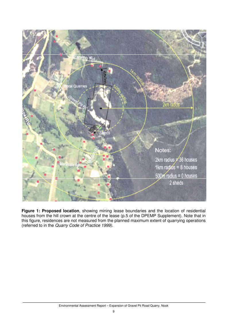
The site is largely surrounded by forest as well as a number of rural residential properties. At the Southern Site, eight houses are located within 1 kilometre of the site, and the nearest neighbour is located approximately 350 metres away (Fig. 1). At the Northern site, three residences are located within 1 kilometre, and the nearest neighbour is located approximately 400 metres away.
Major equipment Fixed primary and secondary crushers, conveyers and screens are located at site. Vehicle use is limited to two wheeled-loaders with bucket scales on the 20 tonne excavator and two trucks. A mobile 275kwa diesel generator provides electricity for the site.
Other infrastructure A 40 foot insulated container is used for amenities, including washing and toiletry facilities.
Inputs
Water Water for dust suppression will be obtained from the settling ponds and

Environmental Assessment Report – Expansion of Gravel Pit Road Quarry, Nook
8
Characteristic Description/quantities
applied using a water tanker.
Energy Diesel used by mobile equipment and vehicles. No fuel is stored onsite.
Other raw materials Nil
Wastes
Liquid Stormwater is captured onsite through drains and settling ponds. Run off to the southwest is redirected via a cut-off drain to a settling pond, and a further two settling ponds capture run-off from the west and northwest slopes (further information in Section 4.9 of the DPEMP). All settling pond outflow is directed to Ray Creek to the northwest of the site.
Atmospheric Dust is generated by material handling, drilling, crushing/screening and truck movements within the site. Blasting will also generate dust.
Solid No solid waste is generated from the quarrying operations. Minor rubbish is placed in animal-proof bins.
Noise Noise is generated from the drilling, crushing and screening of material and by mobile equipment. Blasting is an intermittent but significant source of noise and ground vibration, and will occurring up to eight times per annum. Blasting will be conducted by private contractors.
Operating hours The proponent has requested operating hours to be from 0700 to 1900 on weekdays and from 0800 to 1700 on Saturdays. The site will not operate on Sundays unless in situations of high demand, and will not operate on Public Holidays.
Project timetable The quarry is currently operational in the Southern section. Increased production would commence immediately with the granting of the land use permit.
Environmental Assessment Report – Expansion of Gravel Pit Road Quarry, Nook
9
Figure 1: Proposed location, showing mining lease boundaries and the location of residential houses from the hill crown at the centre of the lease (p.5 of the DPEMP Supplement). Note that in this figure, residences are not measured from the planned maximum extent of quarrying operations (referred to in the Quarry Code of Practice 1999).

Environmental Assessment Report – Expansion of Gravel Pit Road Quarry, Nook
10
Figure 2: Proposed site plan of north section (from p.9 of the DPEMP Supplement).
Figure 3: Proposed site plan of south section (from p.8 of the DPEMP Supplement).

Environmental Assessment Report – Expansion of Gravel Pit Road Quarry, Nook
11
4 Need for proposal and alternatives
The proposal involves expanding operations at the Gravel Pit Road quarry to process 25,000 cubic metres of gravel processed per annum. The quarry processes quartz-conglomerate rock, which is used in road construction and provides an alternative product supply to the local building and construction industries. There is increasing demand for the material, which is of a desirable quality and satisfies the DIER R40 specification in its unblended state. The DPEMP highlights the quarry’s capacity to employ local citizens. The quarry is staffed entirely by local workers, and increasing production will create further opportunities for employment. Should the project not proceed, these opportunities would be lost and quarrying operations at the site would not expand. An alternative to the proposed quarrying plan is to quarry on top of the adjacent hill instead of targeting the resource at its base. The proponent previously indicated an intent to quarry at the hill top, however this is not a viable option due to the increased environmental impacts associated with such a proposal. As there would be no vegetation or topography in which to provide attenuation, operating higher on the hill would increase the likelihood of surrounding residences being impacted upon by blasting and operational noise, and would intensify the visual impact of the site at surrounding areas. In addition, the crown of the hill has not been disturbed by previous quarrying activity and surveys for threatened flora and fauna or cultural heritage have not been conducted. It is considered less environmentally harmful for quarrying activity to be limited to areas of historical disturbance at the base of the hill.
5 Public and agency consultation
A summary of the public representations and government agency/body submissions is contained in Appendix 2 of this report. The proponent’s response to those issues is contained in the DPEMP Supplement.
No public representations were received.
The DPEMP was referred to a number of government agencies/bodies with an interest in the proposal. Responses were received from the following:
• Mineral Resources Tasmania, Department of Infrastructure, Energy and Resources;
• Public and Environmental Health Service, Department of Health and Human Services;
• Forestry Tasmania;
• Resource Management and Conservation, Department of Primary Industries and Water.
The following Divisions/Areas of the Department of Environment, Parks, Heritage and the Arts also provided submissions on the DPEMP:
• Aboriginal Heritage Tasmania;
• Noise Specialist, Environment Division; and
• Mining and Extractives Specialist, Environment Division.
The DPEMP Supplement prepared by the proponent provides a response to each of the relevant environmental issues raised by government agencies/bodies.
Environmental Assessment Report – Expansion of Gravel Pit Road Quarry, Nook
12
6 Evaluation of key issues
The key environmental issues relevant to the proposal that were identified for detailed evaluation in this report were:
• Blasting
• Operational Noise
• Rehabilitation
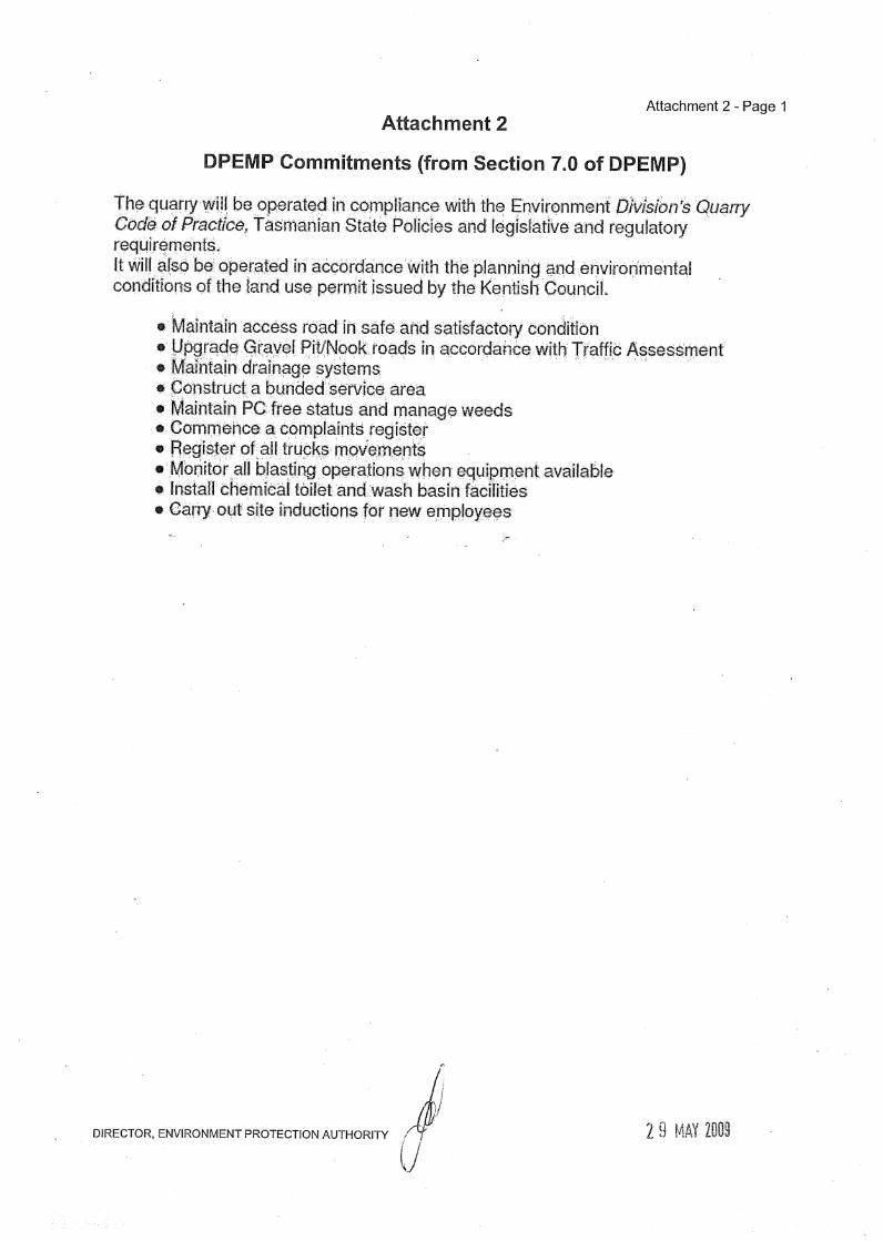
These issues are discussed individually in the following Sections. The table of commitments from Section 7.0 of the DPEMP is included in Attachment 2 of the permit conditions.
6.1 Blasting
Description
Blasting of conglomerate rock is conducted approximately four times per year under the current regime and is proposed to intensify to eight times per year with the expansion. Blasting is carried out by a private contractor on a campaign-style basis. There is potential for local residences to be affected by ground vibration, noise and dust emissions due to their close proximity to quarrying operations. Nine residences are located within one kilometre of the quarry, with the nearest neighbour situated 350 metres from the quarry. The proponent has monitored two blast events, and measured air blast as ground vibration peak particle velocity as 0.685mm/s and 1.12mm/s, and air blast over pressure at 112.0dB(A) and 114.2dB(A). No complaints have been received about noise, blasting or any other issue since the recommencement of operations in 2003.
Management measures
Section 4.1 of the DPEMP states that ‘each blasting activity will have an acceptable explosive loading and will be monitored for air blast and vibration so as to not exceed acceptable standards under the Tasmanian Quarry Code of Practice.’
The DPEMP states that blasting will be limited to four to eight times per year.
A commitment of Section 7.0 of the DPEMP states that all blasting events will be monitored. All blast monitoring data will be stored for historical evidence.
Submissions
No public submissions were received.
Comments received from the Environment Division’s Noise Specialist requested that predicted values for vibration and air blast over pressure be provided for residences within one kilometre of the site. Comments also noted that should these values exceed guideline levels, mitigation measures should also be provided. All comments were noted in a request for a DPEMP Supplement.
Evaluation
Blasting has the potential to negatively impact residences. To demonstrate the scale of this impact, the proponent provided a blast survey for two recent blasting events as a Supplement to the DPEMP. The survey was conducted by a consulting engineer, and measured air blast over pressures and ground vibration peak particle velocity at the nearest residence 350 metres away.
Environmental Assessment Report – Expansion of Gravel Pit Road Quarry, Nook
13
The values of these parameters measured during the tests complied with the defined standards of the Quarry Code of Practice 1999 (the Code). Over the two blast events, air blast over pressure measured 112 dB(Lin) and 114.2 dB(Lin), respectively, which complies with the recommended limit of 115 dB(Lin) at the nearest sensitive use. Ground vibration peak particle velocity measured 0.685 mm/s and 1.12mm/s for each blast event, which also comply with the specified limit of 5 mm/s peak particle velocity at the nearest sensitive use. Both these measurements and the measurements recorded previously in the DPEMP, have complied with the recommended values for air blast over pressure and ground vibration peak particle velocity defined in the Quarry Code of Practice. Residences at greater distances from the quarry can be expected to receive air blast over pressure and ground vibration of a reduced magnitude, and hence blasting management is considered adequate at the site. It is considered that the proponent has adequately responded to the submissions made by Specialists from the Environment Division.
Several permit conditions are required to ensure blasting at the site is effectively regulated. To prevent environmental impacts of blasting on surrounding residences and environmental use, it is recommended that the permit contain Condition B1 which defines limits for air blast over pressure and ground vibration for each blast. Condition B2 defines the time constraints in which blast can occur, and it recommended that blasting only occur between 1100 hours and 1500 hours on weekdays. Under Condition B3, it is recommended that all residences within 1 kilometre of the site be notified prior to each blasting event.
A site-specific condition is recommended to monitor the impacts of blasting at the nearest residence. Condition B4 recommends that a register of key parameters be maintained for each blasting event, which can be requested by an Authorised Officer. With the implementation of these conditions, blasting is considered adequately managed at the site.
Recommendations
It is recommended that relevant management commitments outlined in the DPEMP and summarised above are included in the permit. The following standard (generic) conditions are recommended for inclusion in the permit: B1 Blasting is to limit air blast over pressure to 115 dB(Lin Peak) for 95% of blasts (no blasts
above 120dB(L)), limit ground vibration to 5mm/sec peak particle velocity for 95% of blasts (no ground vibration greater than 10mm/sec), and be measured in accordance with ANZEC guidelines.
B3 All residents within 1 kilometre are to be notified 24 hours prior to each blasting event. The following site-specific conditions are recommended for inclusion in the permit: B2 Blasting is to be limited to weekdays between 1100 hours and 1500 hours. B4 A register of blast monitoring is to be maintained for up to three years.
6.2 Operational Noise
Description
Operational noise is generated by the crushing and screening of rock, and the operation of transportation equipment. Blasting will intermittently contribute to noise emissions. A significant
Environmental Assessment Report – Expansion of Gravel Pit Road Quarry, Nook
14
additional noise source is the fan on the diesel powered generator, which the DPEMP states is the predominate noise source.
Operational noise has been identified as an issue due to the close proximity of several local residences (nearest neighbour is located 350 metres away). It is stated DPEMP that operations are barely audible above the surrounding background noise, and that there have not been any complaints or representations about noise issues since the recommencement of operations in 2003.
Management measures
The proponent has indicated that the surrounding environment will help reduce the impact of operational noise, as local tree cover and topography will provide some sound attenuation.
To minimise the risk of noise nuisance to others, the proponent has provided noise management measures in Section 4.1 of the DPEMP. These are to:
• Minimise clearing of existing tree cover plus revegetate where possible;
• Maintain the diesel motor(s), plant and equipment to the manufacturer’s specifications to minimise the emission of engine and exhaust noises;
• Seek a buffer zone that will minimise impact on resident neighbours;
• Adopt a 40kph speed limit along the access road;
• Ensure transport operators do not use exhaust breaks unnecessarily;
• Blast only 4 to 8 times per year;
• Monitor blasting operations; and
• Limit crusher use to 4 days per week.
Submissions
No public submissions were received.
Comments from the Environment Division’s Noise Specialist were that further information is required in order to assess noise at the site. A list of all current on-site operational equipment; a map of all residences within two kilometres; measurements of background noise; and detailed modelling of noise levels was requested in the form of a DPEMP Supplement.
Evaluation
The quarry operator has satisfactorily determined that operational noise is able to be adequately controlled, and that noise is not likely to be of a level that will impact upon nearby residences. As part of the DPEMP Supplement, the proponent provided a noise report that was prepared by a consultant engineer. In the report, it states that crusher and general quarry noise, when measured at the nearest residence 350 metres away, is estimated to be 37.3 dB(A) (Leq) with little or no wind, and 45.3 dB(A) (Leq) with wind towards the nearest residence. Ambient levels whilst the quarry was closed were 34.1 dB(A), with background L90 noise of 26.3dB(A). The report concludes that quarry noise, when measured 350 metres away, is not likely to exceed ambient noise levels by 10dB(A) during daytime operations, and is therefore compliant with the acceptable standard proposed in the Quarry Code of Practice.
Nearby vegetative screening and topography will contribute to noise management by providing some attenuation of operational noise. The management measures proposed in Section 4.1 of the DPEMP will further contribute to preventing unacceptable noise emissions. The DPEMP is called up under Condition G2 of the permit.

Environmental Assessment Report – Expansion of Gravel Pit Road Quarry, Nook
15
Modelling of operational noise was reliant on operations being limited to daylight hours, and it is necessary that quarrying activity be limited to daytime hours to prevent noise disturbance to nearby residences during sensitive hours. It is recommended that the permit contain Condition N1 which prevents quarrying activity from occurring outside the hours of 0700 hours and 1900 hours on weekdays, and 0800 hours and 1600 hours on Saturdays. To assist in noise management, it is recommended that the permit define noise emission limits in Condition N2. Noise is to be limited to 48 dB(A) between 0700 hours and 1800 hours; 40 dB(A) between 1800 hours and 1900 hours; and 35 dB(A) between 1900 hours and 0700 hours. Prior to operations moving to the Northern section, it is recommended that predicted values for noise emissions, air blast over pressure and ground vibration are provided for the Northern section (Condition G10), to provide some indication of operation noise generated at this area. With the implementation of these conditions, operational noise is considered to be adequately managed.
Recommendations
It is recommended that relevant management commitments outlined in the DPEMP and summarised above are included in the permit. The following standard (generic) noise conditions are recommended for inclusion in the permit: G2 The activity must be carried out in accordance with the management measures proposed in
the EMP and Best Practice Environment Management. N1 Quarrying activity is to be limited between 0700 hours and 1900 hours weekdays, and 0800
hours and 1600 hours Saturdays. The following site-specific noise conditions are recommended for inclusion in the permit: N2 Noise is to be limited to 48 dB(A) during daytime hours; 40 dB(A) during evening hours; and
35 dB(A) during night time hours. G10 Predicted values for noise emissions, air blast overpressure and ground vibration are to be
provided for the nearest sensitive use prior to quarrying in the Northern Section
6.3 Rehabilitation
Description
The mining leases currently have very large areas of disturbance from historical operations which will potentially lead to erosion and degradation. Much of the South section has been subject to recent quarrying activity, whilst the North section has undergone some rehabilitation efforts after quarrying activities in the area ceased. Rehabilitation trials conducted at the site have been successful. An associated Phytophthora report conducted by Forestry Tasmania consultants stated that the trial areas have a number of plant species which are healthy and are regenerating well on the disturbed areas.
Management measures
As stated in the DPEMP, the proponent intends to undertake progressive rehabilitation following the decommissioning of benches and quarry areas. Once an area has been worked, the proponent intends to rehabilitate via deep ripping, topsoiling and seeding and/or planting of native seedlings. Approximately 150mm of topsoil will be spread over benched areas. This material contains ground-stored seeds of native species that will assist in revegetation. As stated in the DPEMP, topsoil will
Environmental Assessment Report – Expansion of Gravel Pit Road Quarry, Nook
16
be readily available, as there is a current stockpile of topsoil material at the site, and all topsoil from future quarry operations will be retained. The DPEMP states that all topsoils will be local and that no imported materials will be carted to the site.
As stated in Section 6.0 of the DPEMP, for slopes greater than 30 degrees, native endemic species will be planted, and native species mulch may also be spread to protect the slopes whilst seedlings establish. All benches will conform in height and width with the Section 6.6 of the Quarry Code of Practice 1999. Rehabilitation efforts will be monitored at 12 monthly intervals for the first five years, and then at three year intervals thereafter.
The proponent has outlined the rehabilitation schedule for the proposal.
• Stage 1 (2009 - 2010): Bench 334m will be completed, benches 322m and 327m will be developed; and the remaining South section, including ramps, will be rehabilitated.
• Stage 2 (2011 – 2013): In the North section, extraction will commence on benches 290m, 280m, 270m and 260m. Upon completion of extraction, these benches will be rehabilitated with topsoil and local seed.
• Stage 3 (2014-2018): The 255m bench will be progressively extracted to form a base floor area in contour with the 255m bench. Future developments will be assessed whether to extract further or to rehabilitate via deep ripping, mound creation and/or broad area topsoiling.
A commitment is included in the DPEMP Supplement that all rehabilitation will be carried out in accordance with the Quarry Code of Practice 1999 and the PC report by Forestry Tasmania’s Biology and Conservation Branch (Appendix G of the DPEMP).
Submissions
No public submissions were received.
Comments received from the Environment Division’s Mining and Extractive Industry Specialist were that benches in the South section should be satisfactorily rehabilitated prior to moving to the Northern section, and that no operations should occur outside the current disturbed quarrying area.
Evaluation
A strategy to rehabilitate the site is required due to the scale of current and historical operations. Quarrying has occurred over approximately 10 hectares of the site and previous rehabilitation efforts have not been adequately incorporated into the mining plan, resulting in large unvegetated areas that are prone to erosion. The management measures and commitments for rehabilitation and decommissioning proposed in this proposal are considered adequate, and if appropriately applied, should successfully contribute to the restoration of the site.
It is recommended that the permit include four standard conditions relating to decommissioning and rehabilitation, in which the Director is notified within 14 days of becoming aware of cessation of the activity (Condition DC1); the land must be rehabilitated to include stabilisation removal and mitigation of potential environmental hazards (Condition DC2); a draft Decommissioning and Rehabilitation Plan be submitted following cessation of the activity (Condition DC3); and the land must be adequately managed during temporary suspension of the activity (Condition DC4). To ensure that rehabilitation is adequately conducted, it is recommended that a non-standard condition be included that states that quarrying operations must not occur in the North section until the South section has been satisfactorily rehabilitated (Condition G10). To ensure that topsoil is retained for later rehabilitation efforts, it is recommended that a standard condition is included which states that surface soil is removed and adequately stockpiled (Condition DC5). To ensure that rehabilitation is suitable and conducted according to Best Practice and the satisifaction of the Director, it is recommended that the permit contain the non-standard condition requesting that a Mining and Rehabilitation Plan be submitted within six months (Condition DC7). To assist in the
Environmental Assessment Report – Expansion of Gravel Pit Road Quarry, Nook
17
decommissioning and rehabilitation of the site, and to limit the disturbance footprint of the quarry, it is recommended that a non-standard condition is included which limits quarrying activity to only those areas of current disturbance (Condition G9). With the implementation of these conditions, decommissioning and rehabilitation is considered adequate.
Recommendations
It is recommended that relevant management commitments outlined in the DPEMP and summarised above are included in the permit. The following standard (generic) decommissioning and rehabilitation conditions are recommended for inclusion in the permit: DC1 The Director must be notified within 14 days of becoming aware of permanent cessation of
the activity. DC2 The land must be rehabilitated following cessation to include stabilisation, removal or
mitigation of potential environmental hazards, and decommissioning of equipment. DC3 A draft Decommissioning and Rehabilitation Plan must be submitted to the Director within
30 days of the Director being notified of the cessation of operations. DC4 The land must be managed and monitored during temporary suspension of the activity. The following site-specific decommissioning and rehabilitation conditions are recommended for inclusion in the permit: G10 Quarrying must not take place within the North section until the Director is satisfied that the
south section has been adequately rehabilitated. DC5 Topsoil must be retained for rehabilitation. DC7 A Mining and Rehabilitation Plan must be submitted with six months. G9 Quarrying must be limited to within the areas labelled North and South.
Environmental Assessment Report – Expansion of Gravel Pit Road Quarry, Nook
18
7 Other environmental issues
In addition to the key issues, the following environmental issues are considered relevant to the proposal and have also been evaluated.
• Pests and Diseases
• Water Quality
• Dust emissions
• Heritage
• Flora and Fauna
Details of this evaluation, along with recommended permit conditions, are contained in Appendix 1.
8 Conclusions
The Environment Division is of the view that:
(i) the RMPS and EMPCS objectives have been duly and properly pursued in the assessment of the proposal; and
(ii) the assessment of the proposal has been undertaken in accordance with the Environmental Impact Assessment Principles; and
(iii) the recommendations set out in this report accord with the Board’s responsibilities in relation to these objectives and principles.
This assessment has been based upon the information provided by the proponent in the permit application, DPEMP and DPEMP Supplement.
This assessment has incorporated specialist advice provided by Divisions of DEPHA, DIER and DPIW in relation to a number of key issues.
It is concluded that the proposal is capable of being managed in an environmentally acceptable manner such that it is unlikely that the RMPS and EMPCS objectives would be compromised, provided that the recommendations made in this report are satisfactorily implemented, including the commitments made by the proponent in the DPEMP and DPEMP Supplement.
9 References
DPIWE (1999). Quarry Code of Practice 1999.
Kentish Council (2005). Kentish Planning Scheme 2005.
Terts, Pearu (2009). Riley’s Quarry, Gravel Pit Road, Nook.
Vlasich, Paul (2008). Proposed Development and Environmental Management Plan: Quarry Site - Gravel Pit Road, Nook, Tasmania.
Vlasich, Paul (2009). Riley Quarry Nook – DPEMP Supplement.

Environmental Assessment Report – Expansion of Gravel Pit Road Quarry, Nook
19
10 Summary of appendices
Appendix 1 Assessment of other environmental issues
Appendix 2 Summary of issues raised by public and agency submissions
Appendix 3 Proposed permit conditions, includes DPEMP Commitments at Attachment 2

Environmental Assessment Report – Expansion of Gravel Pit Road Quarry, Nook
Appendix 1
Appendix 1 Assessment of other environmental issues
Issue 1
Pests and Diseases
Description of potential impacts
Truck movements could spread weeds and Phytophthora cinnamomi to and from the site.
Management measures proposed in DPEMP
The DPEMP includes a commitment to maintain the Phytophthora free status of the site and that weeds will be managed. A Phytophthora survey was conducted in August 2008 by Forestry Tasmania staff which found that drainage at the site was considered excellent, that no field symptoms for Phytophthora were observed, and that the quarry was considered Phytophthora free. The DPEMP Supplement includes a commitment that all rehabilitation will be carried out in accordance with the report by Forestry Tasmania.
Public and agency comment
No public representations were received. Forestry Tasmania commented that the Phytophthora survey previously conducted is out of date and should be revisited. Resource Management and Conservation commented that a specified Weed and Disease Management Plan be developed for the quarry.
Evaluation
In assessing the comments of Forestry Tasmania (the landowner of adjacent titles) and acknowledging the capacity of the site to spread diseases such Phytophthora via the transport of resources, a further Phytophthora survey is considered justified. Weeds are not a current issue at the site, but with increasing traffic activity, it is necessary the any weeds be adequately controlled. A weed and plant pathogen management plan is recommended is necessary to assess the status of weeds are the quarry and monitor the effectiveness of control measures.
Recommendation
It is recommended that the permit contain a standard condition which ensures the activity is carried out in accordance with the commitments specified in the DPEMP (Condition G8). To manage weed dispersal and proliferation, it is recommended that the permit include Condition FF1 which specifies that weeds are to be managed using weed control measures to the satisfaction of the Director, and Condition DC6 which states that imported topsoil must not be dumped at the quarry. To assess the current status of Phytophthora and weeds at the site, it is recommended that a Phytophthora and weed survey be conducted, and that a weed and plant pathogen management plan be provided within six months (Condition FF2).
Issue 2
Water Quality
Description of potential impacts
Water quality is a potential issue at the site, with stormwater run-off likely to contain sedimentary loads resulting in loss of water quality in surrounding waterways and negative impacts to adjacent properties.
Management measures proposed in DPEMP
The DPEMP states that ‘existing and future settling ponds are/will be regularly cleaned out and inspected’. A commitment made in the DPEMP is that drainage systems will be maintained. Pages 11 and 12 of the DPEMP Supplement show the location of the ponds.
Environmental Assessment Report – Expansion of Gravel Pit Road Quarry, Nook
Appendix 1
Public and agency comment
No public or agency comments were received on this issue.
Evaluation
This issue can be adequately controlled via the maintenance of perimeter drains and settling ponds in the current Southern site and the proposed Northern site. With the inclusion of these conditions, water quality is considered to be adequately managed at the site.
Recommendation
It is recommended that the permit contain the standard conditions specifying perimeter drains be constructed and maintained to prevent run-off from entering the quarrying area (Condition E1); that stormwater be collected and treated prior to discharge (Condition E2); and that settling ponds are maintained (Condition E3). It is recommended the permit contain a standard condition to ensure that the activity is carried out in accordance with the DPEMP commitments (Condition G8).
Issue 3
Dust emissions
Description of potential impacts
Dust generated from quarrying activity and truck movements may impact on neighbouring residences and the environment.
Management measures proposed in DPEMP
As stated in the DPEMP, the proponent intends to control dust emissions by controlling speed limits on-site, keeping a water tanker on-site to dampen road surfaces, wetting down or putting tarpaulins on loads, maintaining roads and laying fresh gravel surfacing as required.
Public and agency comment
No public comments were received on this issue. Public Health recommended that regular monitoring be conducted given the potential dust impacts that may arise as a result of on-site activities and truck movements.
Evaluation
Dust is likely to be a minor issue at the site and can be adequately controlled via the management measures proposed in the DPEMP.
Recommendation
It is recommended that the permit contain the standard conditions that vehicles loads must be equipped with effective control measures such as tarpaulins or load dampening to prevent escape of materials (Condition A1); that dust emissions for crushing and screening plant be controlled by water suppression to prevent environmental nuisance (Condition A2); and that dust from roads, disturbed areas, storage heaps and machinery be controlled to prevent environmental nuisance (Condition A3).
Issue 4
Aboriginal Heritage
Description of potential impacts
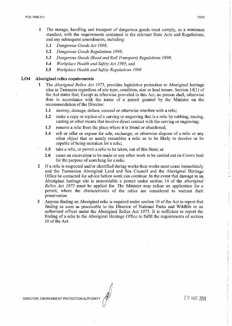
Loss of items or sites of Aboriginal heritage significance
Management measures proposed in DPEMP
The DPEMP states that all existing and future operations are within the existing dedicated gravel
Environmental Assessment Report – Expansion of Gravel Pit Road Quarry, Nook
Appendix 1
reserves, and that the proponent is unaware of any heritage listings within the lease area.
Public and agency comment
No public representations were received. Comments received from Aboriginal Heritage Tasmania stated that there are no Aboriginal heritage issues associated with the project.
Evaluation
The site is an area of historical extractive activity and the majority of the proposal involves utilising resources contained in historically disturbed areas. On the basis of the site’s history and comments from Aboriginal Heritage Tasmania, Aboriginal heritage is unlikely to be an issue at the site, and is considered adequately managed.
Recommendation
It is recommended that the permit include information regarding legislative requirements under the Aboriginal Relics Act 1975 (Condition LO4). To prevent unsurveyed areas being disturbed, is recommended that the permit contain a non-standard condition that quarrying be confined to the North and South sections (Condition G9).
Issue 5
Impacts to Threatened Species
Description of potential impacts
Destruction of threatened species and their habitat.
Management measures proposed in DPEMP
The DPEMP states that all operations fall within the footprint of old abandoned gravel pits, and that should operations advance towards areas of undisturbed biodiversity, appropriate surveys will be conducted.
Public and agency comment
No public representations were received. Resource Management and Conservation did not make comment on this issue.
Evaluation
In considering the nature of current quarrying activity and that quarrying activity will be located within areas of previous disturbance (as per Condition G9), it is unlikely that the project will impact upon any threatened species. In the event that threatened species are discovered, the legislative requirements of the Nature Conservation Act 2002 will apply.
Recommendation
No recommendations are proposed.
Environmental Assessment Report – Expansion of Gravel Pit Road Quarry, Nook
Appendix 2
Appendix 2 Summary of issues raised by public and agency submissions
Public submissions
No public submissions were received.
Agency submissions
Issues raised by agency submissions are summarised in the following table.
Referral Agency Issues Mineral Resources Tasmania (DIER)
• Property boundaries are incorrectly referred to as Gravel Reserves and create unnecessary confusion. The three land parcels on the south end of Mining Lease 2M/2002 are no longer Gravel Reserves, they are land parcels managed by Forestry Tasmania and have been brought under the MRDA. The land parcel at the northern end of the Mining Lease is also no longer a Gravel Reserve but under the control of the Department of Primary Industries and Water.
• It should be noted that extractive activities have been undertaken off the south eastern corner of the Mining Lease. Additionally Mr Riley has exceeded the extraction threshold of 5,000 cubic meters significantly from 2004 through to 2008.
• In general there are a lot of unsupported statements as to the environmental and visual impacts.
• Extraction quantities in the range of 56,000 tonnes are already occurring and initial Level 1 Lease extraction quantities have been systematically ignored.
• Diagrams and descriptions are inadequate to form a mining plan of an acceptable standard. An annotated aerial image/topographic map needs to be provided to show the development of the quarry during the 1
st, 2
nd 3
rd, 4
th
and 5th year. Distances from the boundary of the Mining Lease and or
Property boundary needs to be provided to ensure these plans are followed. Rehabilitation of old faces near the stockpile area needs to shown diagrammatically and rehabilitation measures planned addressed in more detail.
• As the proposed Stage 1 works, includes extraction within an area outside the existing Mining Lease 1M/2002, Mineral Resources Tasmania seek clarification on what is proposed to rectify this oversight, as the South eastern corner is in close proximity to sensitive receptors and an additional Mining Lease may not be an acceptable option.
• Land use requires substantial revision. Since all of their current operations are restricted to State Forest, consultation should be undertaken between the proponent and Forestry Tas to determine final land use which could then be incorporated in the rehabilitation section of the EMP.
• A letter kept within the file of ML 1M/2002 states that Forestry Tasmania have a protection zone for landscape covering a large proportion of the ML. Further information should be sought from Forestry Tasmania on this issue.
• Under the present Kentish council planning scheme, an attenuation distance of 1000m is required around the Extractive operations, not the 300m stated.
• Decommissioning and Rehabilitation - This section requires additional information and should be addressed in separate section, i.e., existing rehabilitation commitments (which includes areas marked out during the initial discussions with MRT and Environment), progressive rehabilitation – option 1, progressive rehabilitation – option 2. I gather that a final rehabilitation plan would not be required until the site is near closure. The bench heights, widths and locations should be clearly represented in a diagram
• In order to assess the option of quarrying away the ridgeline, presented in

Environmental Assessment Report – Expansion of Gravel Pit Road Quarry, Nook
Appendix 2
both option 1 and option 2, a visual impact assessment using a viewshed analysis would be an ideal way of assessing these options.
(Noise Specialist) Environment Division (DEPHA)
• A detailed site plan is required showing the specific areas targeted by current and future operations.
• A comprehensive list of all current on-site equipment including vehicles and crushing and screening equipment is required. This needs to detail make, model, size and tonnage/capacity.
• A detailed map identifying all residences within 2 kilometres of the site is required. This needs to be to scale, and show the relevant distance of each property in relation to any quarry activity.
• Measurements of background noise levels need to be carried out by a suitably qualified person at sites approved by the Director.
• Detailed modelling of noise levels need to be carried out by a suitably qualified person. Noise modelling needs to be conducted using actual noise levels from the machinery proposed for the activity.
• Predicted values of vibration and airblast overpressure are required for all residences within 1 kilometre of the site. Mitigation measures are also required should these values exceed guideline levels.
Forestry Tasmania, Mersey District
• There needs to be some agreement/assessment of timber values lost/impacted (if applicable) and potentially a discussion of offsets and values. The majority of the existing lease and the area of current activity are on State Forest. Removal of timber/vegetation may require an FPP.
• The area of activity is as stated outside the MRT lease area, there is no proposed extent of this expanded area. All works should be bounded within the lease area. Once a boundary of the lease is proposed Forestry Tasmania as one of the underlying land managers should be consulted.
• Forestry Tasmania has zoned the area immediately east of the lease, including the area of current activity outside the lease area as protection for landscape values.
• After mining is completed the sites must be rehabilitated with vegetation species reflecting the original communities. Rehabilitation standards need to comply with Forestry Tasmania’s regeneration standards (refer Technical Bulletin No. 6: Regeneration Surveys and Stocking Standards).
Resource Management and Conservation (DPIW)
• References to erosion and sediment control suggest these issues have not received sufficient attention. An approved Erosion and Sedimentation control plan for new and existing parts of the site is strongly recommended.
• Potential impact on geoconservation values from this activity has not been addressed. It is recommended that this issue be reviewed.
• A natural values assessment (natural values report) is recommended for the lease area to assist consideration of the management of the lease area eg. weeds, tracks and fire management activities.
• It is recommended that a hygiene plan is put in place to manage the Phytophthora cinnamomi risk; Appendix G does not constitute a hygiene plan. How will machinery brought into the pit be managed etc?
• Details on proposed rehabilitation methods are not provided, for example depth of top soil to be spread. Given the potential long time-frame prior to commencement of rehabilitation works information on height of topsoil stockpiles to ensure it remains biologically active and remain uncontaminated should be provided in the DPEMP. The document states that “native species may be the most economical...” but it does not specify if only native species will be used in rehabilitation works. There are no details on how weeds will be managed within the quarry.
• Information on the rehabilitation standards and how the rehabilitation will be monitored and managed is recommended.
• Information on how the weed management program will be managed is recommended.
• It is recommended that more information is provided to make comments about the impacts on wildlife, and runoff issues.
• The DPEMP states that it will adopt the Quarry Code of Practice, however this

Environmental Assessment Report – Expansion of Gravel Pit Road Quarry, Nook
Appendix 2
document is now out of date with regards to the regulatory control of weed species. It is recommended that the DPEMP be revised to make reference to the current Weed Management Act 1999 and associated requirements of the legislation.
• There is potential for impact on the Spotted Tail Quoll and Tasmanian Devil through increased traffic movement. It is recommended that the DPEMP propose mitigation strategies in order to reduce potential impact to these species.
Public and Environmental Health Service (DHHS)
• Given the potential noise and dust impacts that may arise as a result of activities on-site and from truck movements to and from the site, regular monitoring is recommended.
Aboriginal Heritage Tasmania (DEPHA)
• AHT can inform that there are no Aboriginal heritage issues for the proposed gravel extraction project.

Environmental Assessment Report – Expansion of Gravel Pit Road Quarry, Nook
Appendix 3
Appendix 3 Proposed permit conditions