final report - usda
TRANSCRIPT

Technology-Based Benchmarking for Efficient Water Use and Conservation in Southwest Georgia:
Implementing the Farmer Portal
FINAL REPORT

Albany State University
Final Report Introduction and Overview
During the FY 2003 legislative session, the Georgia legislature established a mandate for the
metering of agricultural water use. By 2004 meters were being installed across the state based
upon the Department of Natural Resources Georgia Environmental Protection Division
agricultural permit database. It became evident that the data collected from the metering program
offered analyses of agricultural water use that could benefit many from policy makers to state
agencies and certainly individual farm operators. For example, agricultural water use can be
summarized and reported based on crop type, soil type, tillage practice or other agronomic
factors as well as by county, watershed or other geographic region. Over time, these data can be
helpful in forecasting potential water needs under varying climatic conditions. For farmers, the
ability to verify irrigation application depth and accurately track seasonal usage will aid in water
conservation. Further, many agricultural producers view the metering program as a state-
sanctioned means of documenting their “reasonable use” should water conflicts escalate to the
point of rationing.
While the output described above will yield useful tools for everyone, the value-added data
(crops, soils, seed type, BMP implementation, etc…) must first be collected and managed before
analyses can take place. The Georgia Farmer Portal (Portal) was designed to perform this task.
During FY 2005 and 2006, with financial assistance provided by the U.S. Department of
Agriculture (USDA) and the State of Georgia, the Georgia Water Planning and Policy Center
(Center) at Albany State University (ASU) initiated the Portal as a data collection program
designed to develop a data set that would allow for meaningful analysis of water use data
generated by the state metering program coupled with farmer provided data that producers find
useful in their efforts to improve the management of water resources used for irrigation.
At its core, the Portal is a data collection system with a web-based interface designed to capture
farmer input and link it directly to water use data collected on a field-by-field, meter-by-meter
basis. Creation of the Portal framework required a significant amount of field work and
secondary Geographic Information Systems (GIS) analysis to establish the geographic basis for
which the farmer data would be housed. Data collected by the Center for these purposes
included specific information such as soil texture, source of water (ground or surface, and if
Page 1 of 12

Albany State University
Final Report surface, whether or not the source was a perennial stream or a non-perennial stream or pond,
rainfall, crops planted and harvested (by acreage and field) and yields. The true value of the
Portal, however, lies in the analysis engine designed to report water use information on a wide
range of user-defined criteria. Georgia law prohibits making farmer specific data available to the
public, thus, access to secure data is protected by requiring unique identification and passwords
that are provided to farmers upon request. Methods detailing Portal construction and analyses of
initial data trials are reported in our Water Policy Working Papers #2005-006 and #2006-011
available in the Research section at http://www.h2opolicycenter.org. A sample of screenshots
from the Portal are included in Appendix 1, and the Portal site may be accessed by visiting
https://www.gafarmerportal.org.
In FY 2008, the Center was awarded a USDA-NRCS Conservation Innovation Grant to promote
the use of the Portal to local farm operators. This multi-year project was designed to secure
farmer participation in the Portal in two heavily irrigated sub-basins in Southwest Georgia’s
Lower Flint River Basin (Figure 1). This is an area where water conservation is a primary
concern, not just for individual farmers, but in a larger context due to issues with endangered
species and as a piece of the litigation between Georgia, Florida and Alabama. For producers, it
has been demonstrated that conservation adoption is more likely when potential adopters
understand their performance relative to others. The Portal provides such relative performance
data to encourage the adoption of conservation practices. After entering data, users can access
reports that provide feedback on their production and water use against benchmark averages
from the data of other farmers growing similar crops under similar conditions. These reports can
be queried by county, watershed, or statewide, but do not reveal confidential individual farmer
data. The Portal also provides farmers access to information on water conservation practices and
related government programs.
Project Objectives
The primary objective of this project was to recruit participants to adopt the Farmer Portal as a
tool for production management and water conservation on at least 40,000 acres of irrigated
farmland. By achieving this objective, our aim was to:
Page 2 of 12

Albany State University
Final Report
Figure 1: Target Area
Page 3 of 12

Albany State University
Final Report
(a) accelerate producer interest in use of the Portal;
(b) demonstrate the cost-savings and knowledge delivery benefits of the Portal;
(c) adjust the Portal, if necessary, to meet user needs;
(d) increase the agricultural community’s contribution to water conservation in two
water-stressed sub-basins of Georgia;
(e) build participation to the level necessary to support a reliable database; and
(f) provide results transferable to the rest of Georgia as well as to other states.
Methods
As discussed above, the Portal was fully functioning at the start of the CIG so from the outset our
focus was on awareness and outreach. To induce participation, the Center initiated several
notification programs to present the existence and encourage participation in the Portal. First, a
mass mailing was sent to each permit holder in the two target sub-basins. This correspondence
informed producers about the Portal, let them know eligibility requirements and informed them
about the incentive payments made available as a result of the CIG grant. A copy of the letter
can be viewed in Appendix 2. A subsequent mailing provided a means for additional follow-up.
The Center also relied on several private partner organizations to assist in project
implementation, including the Flint River Regional Water Council, the Georgia Cotton
Commission, the Georgia Peanut Producers Association and the Georgia Farm Bureau. These
organizations assisted by identifying potential participants, recruiting participants and
distributing outreach materials. The Georgia Farm Bureau provided print and television media
including features on the Georgia Farm Monitor.
Operators were also invited to a series of evening workshops held throughout the target area
where attendees were introduced to the Portal. For those without Internet access, kiosks were
installed at key locations within the cropping region including University of Georgia Extension
offices at Dawson, Morgan, and Donalsonville, and the Farm Bureau office in Colquitt (Figure
2). A computer with internet access was setup in each office with a default connection to the
Center’s Portal web site.
Page 4 of 12

Albany State University
Final Report
Figure 2: Kiosk locations in Southwest Georgia.
Page 5 of 12

Albany State University
Final Report Once an account was established, the operator could then access the account and claim a meter
using the meter serial number. The operator would then associate a meter with a field or fields.
Each field would then have its own records as to irrigation hardware, crop, seed, plant/harvest
date, irrigation amounts/dates, rainfall amounts/dates, and conservation practices. Once the
information was entered, the operator could then evaluate their efficiencies against regional
averages calculated with data from other users. It was intended that this information would
provide a measure that the operator could use to better agricultural efficiency. The Center
employed the services of a field agent whose sole task was to aid in the creation of accounts and
data entry. This person acted as liaison between the Center and cooperating farmers.
Results and Discussion
The first, and perhaps most logical, way to evaluate the success of this project is by a measure of
participation. Unfortunately, participation numbers were not as desired or expected, as expressed
in the objectives. In total, the Portal gained eight new accounts from which there was full
participation and four additional accounts from which there was partial participation. A list of
operators receiving incentive payments can be found in Appendix 3. These accounts included
191 meters, 221 fields; for a total of 19,125 acres (Figure 3). The list of operations range from
single meter, single field farms to large operators managing dozens of meters and fields. While
the experiences of each operator with the Portal were different, it was found that the smaller
operations were more complete in providing data than the larger operations. This was not
unexpected given that some large operations had as many as four dozen meters. Entering data for
each field for each year was a task
that turned out to be more difficult
than expected. Errors were made
in data entry that required later
clarification. As these
clarifications were made the
averages became more stable.
Table 1 shows the average crop
production over a two year period.
Crop Acres Yield (avg/acre)
Corn 987 185 bu/acre
Cotton 1745 3191 lb/acre
Forage 53 ≈ 5 bales
Peanuts 669 4705 lb/acre
Soybean 223 38 bu/acre
Table 1: Average crop production
Page 6 of 12

Albany State University
Final Report Figure 3: Participating field locations
Page 7 of 12
Albany State University
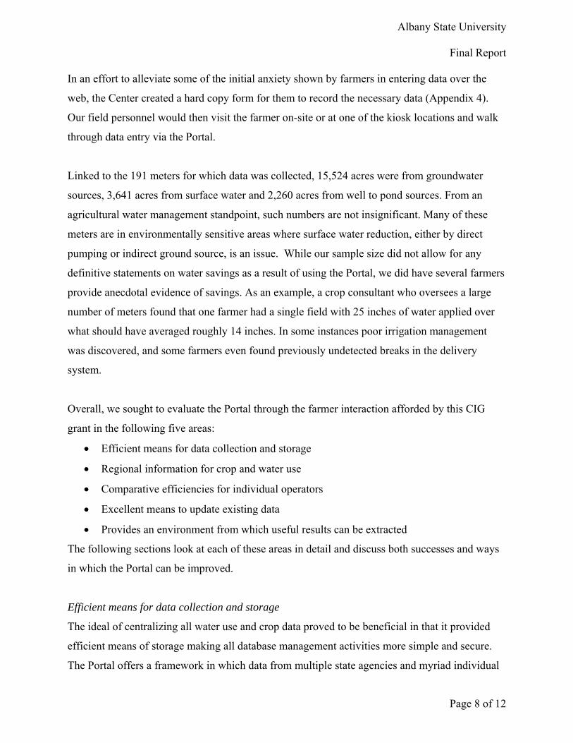
Final Report In an effort to alleviate some of the initial anxiety shown by farmers in entering data over the
web, the Center created a hard copy form for them to record the necessary data (Appendix 4).
Our field personnel would then visit the farmer on-site or at one of the kiosk locations and walk
through data entry via the Portal.
Linked to the 191 meters for which data was collected, 15,524 acres were from groundwater
sources, 3,641 acres from surface water and 2,260 acres from well to pond sources. From an
agricultural water management standpoint, such numbers are not insignificant. Many of these
meters are in environmentally sensitive areas where surface water reduction, either by direct
pumping or indirect ground source, is an issue. While our sample size did not allow for any
definitive statements on water savings as a result of using the Portal, we did have several farmers
provide anecdotal evidence of savings. As an example, a crop consultant who oversees a large
number of meters found that one farmer had a single field with 25 inches of water applied over
what should have averaged roughly 14 inches. In some instances poor irrigation management
was discovered, and some farmers even found previously undetected breaks in the delivery
system.
Overall, we sought to evaluate the Portal through the farmer interaction afforded by this CIG
grant in the following five areas:
• Efficient means for data collection and storage
• Regional information for crop and water use
• Comparative efficiencies for individual operators
• Excellent means to update existing data
• Provides an environment from which useful results can be extracted
The following sections look at each of these areas in detail and discuss both successes and ways
in which the Portal can be improved.
Efficient means for data collection and storage
The ideal of centralizing all water use and crop data proved to be beneficial in that it provided
efficient means of storage making all database management activities more simple and secure.
The Portal offers a framework in which data from multiple state agencies and myriad individual
Page 8 of 12

Albany State University
Final Report farmers can be housed in one location. For the first time, permit data from the Georgia EPD,
meter data from the Georgia Soil and Water Conservation Commission and crop data from the
farmers were all compiled into one comprehensive database focused on agricultural water use.
Utilizing the web as a means of collecting the farmer data is far more efficient than field visits or
surveys. The design of the Portal simplified changes and addition of meters and fields by
presenting the operator with the latest available imagery of the area in question. This proved to
be an extremely desirable aspect based on feedback from cooperators.
One of the primary concerns with the Portal, however, is the fact that the data gleaned from its
use is primarily self-reported. Many take issue with self-reporting in that it leads to errors in the
system and the reliability of information may be suspect. Of course, to achieve anything like
cost-effectiveness in data collection on such a large scale, self-reporting must be part of the
solution. Errors associated with this type of system will occur but thorough documentation can
minimize erroneous data from biasing results. A concern we heard from several farmers was the
method of actually entering data on individual fields was somewhat cumbersome. Many farmers
are entering the same types of data for other applications such as irrigation scheduling. The
Center is presently working to try and integrate our design with others such that farmers need
only enter data once. Also, we have been working with researchers on incorporating data
collected via telemetry (rainfall, meter reading, soil moisture) which would virtually eliminate
errors from data entry. Finally, from a data management standpoint, the volume and type of
information being collected, processed and served to users requires specialized training in GIS,
database management and web design. The costs associated with keeping such a system up and
running are significant.
Regional information for crop and water use
As discussed previously, one of the functions of the Portal was to present regional averages of
crop production and water use. These values were mostly geared toward researchers and state
agency officials for regional water planning. This grant did not specifically target these officials
as users though the Center always recognized the value to them. However, we were able to
utilize data retrieved during this process as a benchmark to compare crop water numbers being
used in modeling to support development of the Statewide Water Management Plan. Further,
Page 9 of 12

Albany State University
Final Report these sums and averages were an integral part of the comparative efficiencies for producers
discussed below.
A significant drawback to the regional data compiled is it is only as good as the number and
quality of entries in a given region. Unfortunately, we had too few data points to make definitive
statements on water use by crop in each of our target basins. However, data collected via this
project and that collected by the GSWCC during the project years were comparable at the mean.
It became clear that the incentive offered as part of this CIG ($100 per meter) was not significant
enough to prompt wide-spread participation. Some farmers did not view the benefit of using the
Portal worth the time, cost and “headache” of entering data. Others viewed the program as
duplicative with reporting requirements associated with the USDA Farm Service Agency and,
although totally voluntary, as yet another layer of “bureaucracy.”
Comparative efficiencies for individual operators
Comparative efficiencies with applicable results was one of the selling points of the Portal and
likely the most significant way in which true water conservation will be realized. Operators liked
the idea of being presented with both field totals and the ability to compare with regional
(county, basin, state, etc…) averages. It let them gain some insight as to how their operations
compared to regional statistical averages, and that perhaps better practices could result in more
efficiencies. However, while sound in theory, farmers recognized the limitations of this
information based on the small sample size of this pilot project. It was believed that there simply
was not enough data collected to provide meaningful analyses. Over time, we still feel this
functionality will be the greatest benefit to individual producers.
Excellent means to update existing data
The Portal was found by cooperators to be an excellent method for collecting and updating
cropping information, both current and historical. Farmers liked the ability to customize meter
sites and field names to be consistent with other applications. The Center received its most
positive feedback on functionality that allowed farmers to modify their fields via a GIS tool. For
example, as new meters or irrigation systems are added, producers can pan, zoom and select new
fields visually which are immediately added to their account. During this project, 12 new fields
Page 10 of 12

Albany State University
Final Report were added for 577 acres and seven new meters were added for an additional 378 acres. These
changes do not include modifications to existing irrigation systems and configurations. By giving
farmers this ability, the Center was able to fix problems in our own database and pass corrections
on to EPD or GSWCC.
Provides an environment from which useful results can be extracted
The data presentation in the Portal provided our operators with a summation of the data entered.
The idea of having all their agronomic information, both current and historical, on a field-by-
field basis at the operator’s fingertips was appealing. The ability to modify historical data and
generate reports was also attractive. We have discussed the benefits to the state at large, but it is
worth repeating here that the Portal offers the most efficient way of linking together all the
pieces necessary for meaningful agricultural water management. The sheer size and scope of
information related to water use by agriculture has hindered decision makers as they craft
policies to manage our water resources. The Portal also could provide federal and state agencies
that offer other conservation incentives an efficient means of benchmarking success. In brief, the
Portal is the best chance we have to reach the holders of the true information needed for
meaningful water planning, the individual farmer.
Conclusion and Transferability
The capabilities of the Georgia Farmer Portal are many. It offers advantages in data collection
and storage, user provided data not available elsewhere, comparative measures of water use for
conservation, regional agricultural water statistics and the ability to update and enhance
agricultural data in general. Results and reaction from cooperators engaged during this CIG
process generally support these statements. However, to fully realize the range of potential
benefits from the Portal at both the individual and regional level, much more farmer adoption
must take place.
We see the benefits of Portal adoption readily transferable to other regions outside the target area
or even to other states with large agricultural water use. The Portal framework was built to be
easily updated with new data and can be readily applied to any geographic region. Thus far, we
have only been able to generate interest and use via incentive payments and other grant
Page 11 of 12

Albany State University
Final Report
Page 12 of 12
sponsored outreach. The Center has incorporated suggestions from users to improve the Portal
approach and structure, especially from a data entry perspective. As technology develops around
remote data collection and irrigation scheduling, we intend to incorporate that functionality as
well. We do recognize, however, that widespread adoption will only come through significantly
higher incentive payments or as a result of mandated reporting requirements from federal or state
entities.

AP
ThThe Gintrodand oand afarmeotherthe abfor otinforminto t
Hal HChairon waa busmost links Hadd The Gfarmeevalunewsuse borganstreamallow By gigoalsdata fmy wCounof mywater
PPENDI
e FarmGeorgia Watduced a newother farm daavailable on ers an easy wr Georgia farbility to creather farmers mation abouthe Portal is
Haddock of Erman of the Fater resource
sinessman animportant reto weather i
dock.
Georgia Waters to use theuate their ow. The Center
by involving nizations. Fomline manag
wing for hom
iving farmers for crop yiefrom other fa
whole operatinty farmer. “y water use sr wisely - an
IX 1
mer Porter Planning
w tool that heata. This newthe Internet
way to track rms. The Porate instant rein their cou
ut water-saviconfidential
Early CountyFlint River Re managemend farmer, I nesources – winformation,
ter Planning e Farmer Po
wn operationsr is exploringthe USDA a
or example, tgement of co
me-based regi
rs useful andelds and watfarmers. “Theion field by It can show should I nee
nd save mone
rtal
and Policy Celps farmers w tool, the Fat: https://wwater use ag
rtal provideseports that county or watering practicesl.
y was the firRegional Waent. He sees tneed practic
water. The w governmen
and Policy Crtal to manas, and to accg ways to exand other agthe Portal haonservation pistration and
d timely infoter use. Theye Farmer Pofield with jume how I’md it. Pumpiney."
Center recentrack their warmer Portal
www.gafarmegainst real-tis a wealth ofompare theirrshed. Farmes and current
rst farmer to ater Councilthe Portal asal and timely
web site is eant programs,
Center encouage water usecess agricultuxpand the Poencies and
as the potentprograms byd reporting.
rmation, they can evaluatortal is easy tust a few clicm doing compng water is co
ntly water use l, is free erportal.org/ime benchmf informationr water and cers can also ut agricultural
log-in to the, Mr. Haddos an importany informatio
asy to use, coand agricult
urages e, to ural ortal’s
ial to y
e Portal can hte their own to use. I’ll becks,” said Jimpared to othostly - this s
/ The Portal marks based o
n to farmers,crop data wituse the Portal news. All d
e Portal. As ock is a leadent tool for fa
on regardingonfidential, atural news,”
help farmerspractices wie able to usemmy Webb, ers and give
system will h
The follopages areshots froFarmer Pdemonstrparticipatool.
gives on data from, including th averages al to access data entered
the foundinger in Georgiaarmers. “As one of my and containssaid Hal
s to achieve ith real-timee it to track
a Calhoun e me a recordhelp me use
owing four e screen
om the Portal that rate how
ants use this
m
g a
s
e
d


Reports page allows farmers to query dataset to compare their production to that of others with similar circumstances. For example, a farmer may compare his Georgia Green peanut yield on sandy loam soil to the county average. In the above example a farmer compares his water use on cotton to the average waterabove example, a farmer compares his water use on cotton to the average water use on cotton in the Ichaway Basin. Reports are displayed in table or graph format depending on the query and “printer friendly” reports are available.
