floodplains and your treatment plant how hurricane katrina is changing your floodplain in michigan...
TRANSCRIPT

Floodplains and your Treatment Plant
How Hurricane Katrina Is Changing Your Floodplain in Michigan
Daniel Schechter, P.E.Greeley and Hansen
1
2
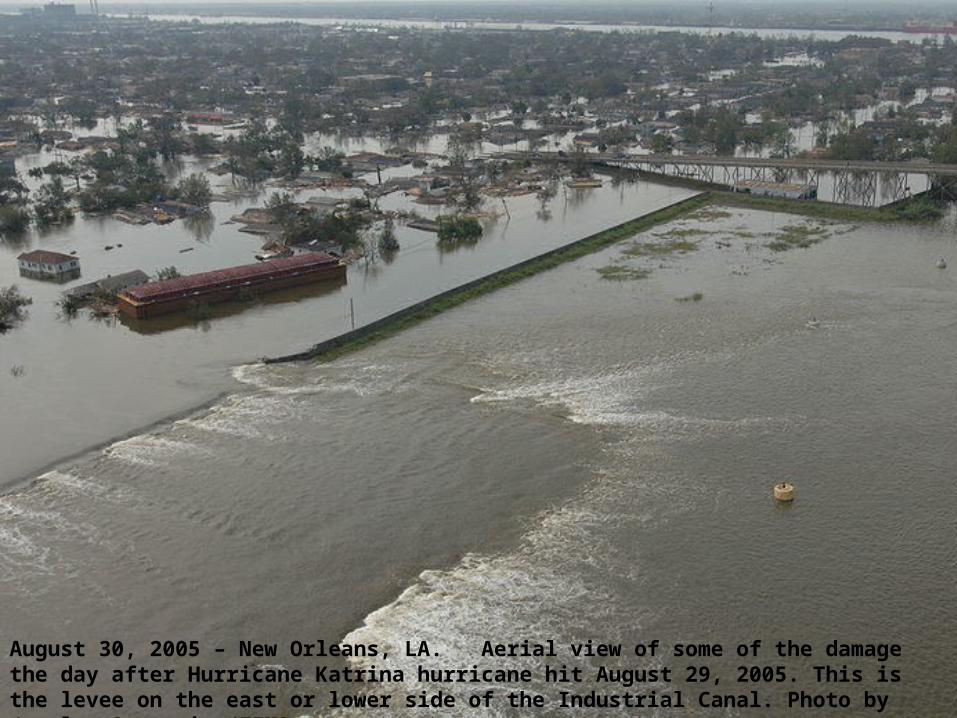
August 30, 2005 – New Orleans, LA. Aerial view of some of the damage the day after Hurricane Katrina hurricane hit August 29, 2005. This is the levee on the east or lower side of the Industrial Canal. Photo by Jocelyn Augustino/FEMA

3
What Does Hurricane Katrina Have To Do With My Facility?
As a Result of Hurricane Katrina,
1.FEMA is modifying, digitizing nearly all floodplain maps over 2008 – 2015
2. Increased attention to construction in floodplains
3.Levees and flood control structures are requiring inspection
4.Some levees and flood control structures are being decertified

Importance of Floodplains
100-yr and 500-yr floodplains affect what structures can be built on site and how they are protected
Will affect flood insurance requirements for residents, business, municipalities
4

Construction Permit Application
5
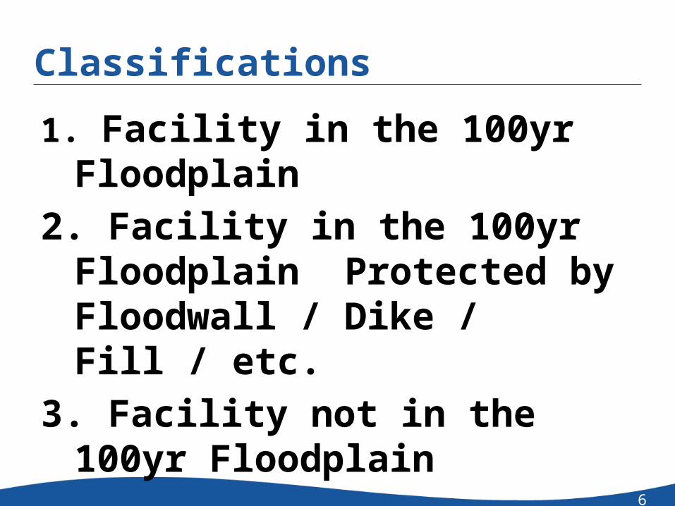
Classifications
1. Facility in the 100yr Floodplain2. Facility in the 100yr Floodplain
Protected by Floodwall / Dike / Fill / etc.
3. Facility not in the 100yr Floodplain
6

Facility in a Floodplain
7
Facility In the 100yr Floodplain - Protected
Proposed Floodwall
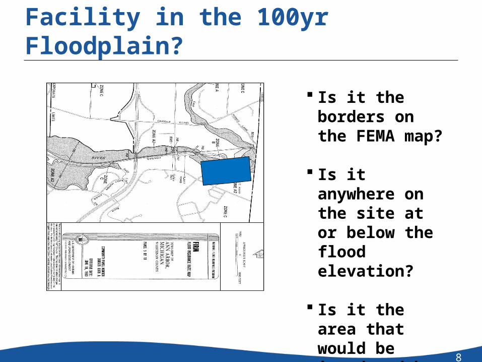
Facility in the 100yr Floodplain?
8
Is it the borders on the FEMA map?
Is it anywhere on the site at or below the flood elevation?
Is it the area that would be inundated by a flood?
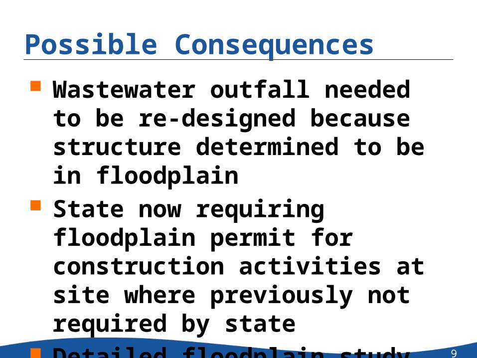
Possible Consequences Wastewater outfall needed to be re-
designed because structure determined to be in floodplain
State now requiring floodplain permit for construction activities at site where previously not required by state
Detailed floodplain study required before construction can be permitted at site
9

Possible Consequences, cont’d Portion of site no longer buildable Buildings with “substantial improvement”
will need flood protection Need to submit Letter of Map Revision
(LOMR) to FEMA Delays associated with obtaining permits,
conducting studies
10

Who Is In Charge? Local Government MI Department of Natural Resources and
Environment (DNRE) Federal Emergency Management Agency
(FEMA) US Army Corps of Engineers (USACE)
11

Flood Insurance Rate Maps (FIRM)
What year were they issued? What revisions have been made? When will they be updated? How can I submit data for the next
revision? What datum is used?
12
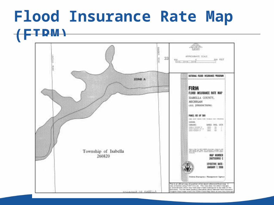
Flood Insurance Rate Map (FIRM)
13
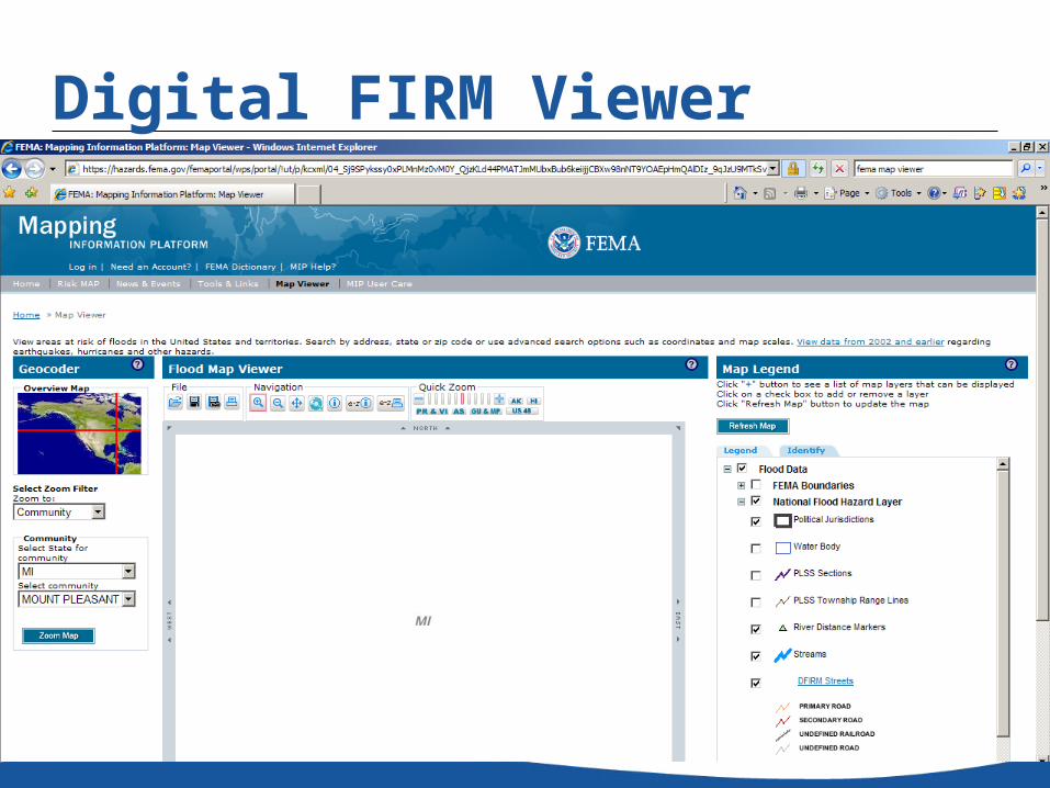
Digital FIRM Viewer
14
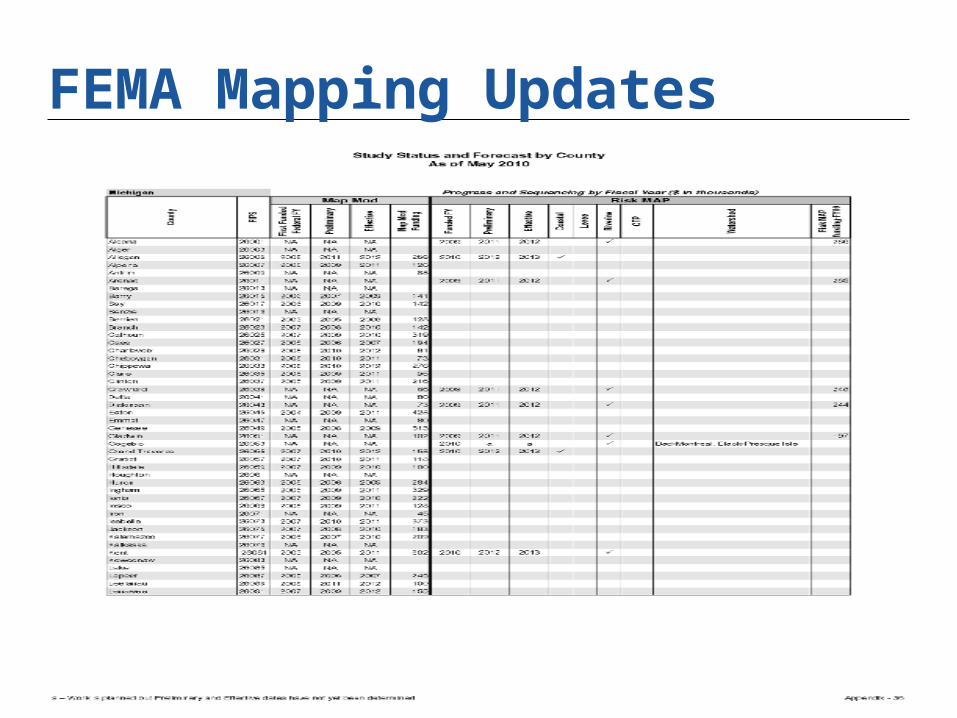
FEMA Mapping Updates
15

General Flood Standards Protective structures need to be 3 feet
above 100 year floodplain elevation “New” structures need to be outside of
floodplain Flood protection for structures in
floodplain “Critical” structures outside of 500yr
floodplain Wide variation in application
16

Possible Endpoints Floodplain Permit (MDNRE / ACOE Joint
Permit) Floodproofing of Structures Letter of Map Amendment (LOMA) Letter of Map Revision (LOMR)
Investigate Ahead of Time!!
17

Important Resources
MI DNRE Floodplain Managementwww.michigan.gov/deq
FEMA Map Service Center www.fema.gov
U.S. Army Corps of Engineerswww.lre.usace.army.mil
18

Questions?
Daniel Schechter, P.E.Greeley and Hansen211 W Fort St., Suite 710Detroit MI 48226Tel (313) 628‐0730Email: dschechter@greeley‐hansen.com
19