fme world tour 2015 dublin - ordnance survey ireland - martin creaton
TRANSCRIPT
National Map Production with Mapnik Rasterizer
&
Ordnance Survey Ireland
Vector to Raster
1:5000 Composite Raster Production using FME
IMGS
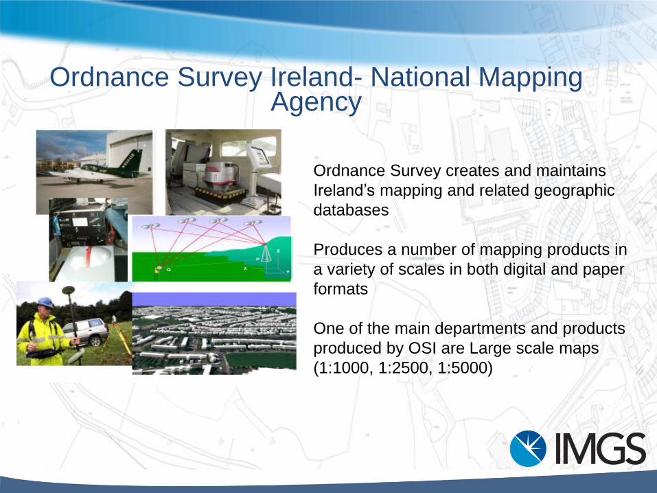
Ordnance Survey Ireland- National Mapping Agency
Ordnance Survey creates and maintains
Ireland’s mapping and related geographic
databases
Produces a number of mapping products in
a variety of scales in both digital and paper
formats
One of the main departments and products
produced by OSI are Large scale maps
(1:1000, 1:2500, 1:5000)
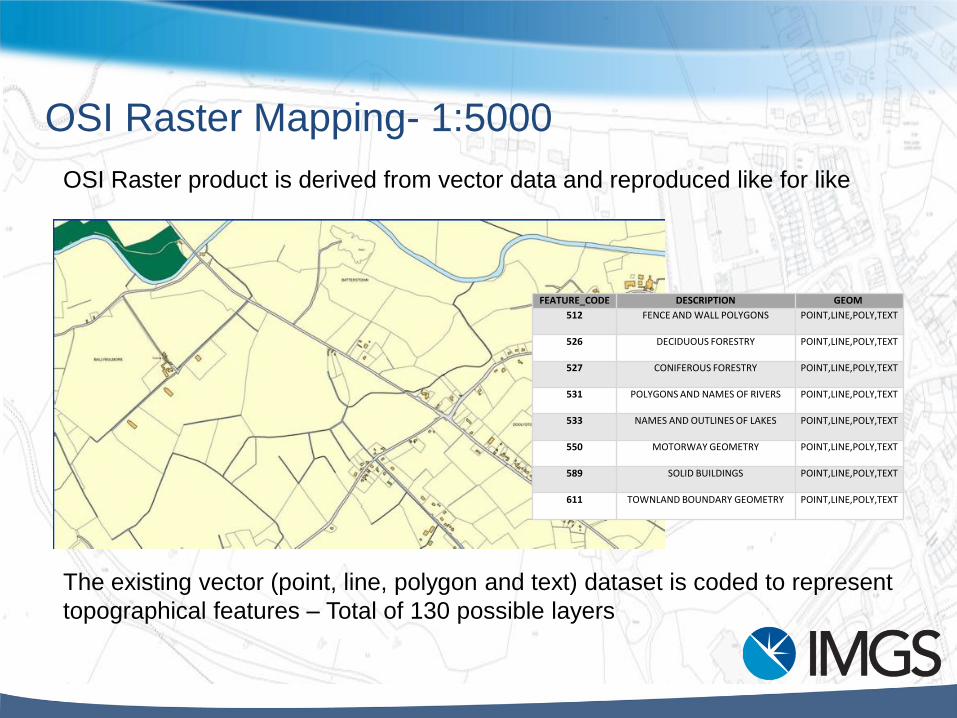
OSI Raster Mapping- 1:5000
OSI Raster product is derived from vector data and reproduced like for like
The existing vector (point, line, polygon and text) dataset is coded to represent
topographical features – Total of 130 possible layers
FEATURE_CODE DESCRIPTION GEOM
512 FENCE AND WALL POLYGONS POINT,LINE,POLY,TEXT
526 DECIDUOUS FORESTRY POINT,LINE,POLY,TEXT
527 CONIFEROUS FORESTRY POINT,LINE,POLY,TEXT
531 POLYGONS AND NAMES OF RIVERS POINT,LINE,POLY,TEXT
533 NAMES AND OUTLINES OF LAKES POINT,LINE,POLY,TEXT
550 MOTORWAY GEOMETRY POINT,LINE,POLY,TEXT
589 SOLID BUILDINGS POINT,LINE,POLY,TEXT
611 TOWNLAND BOUNDARY GEOMETRY POINT,LINE,POLY,TEXT
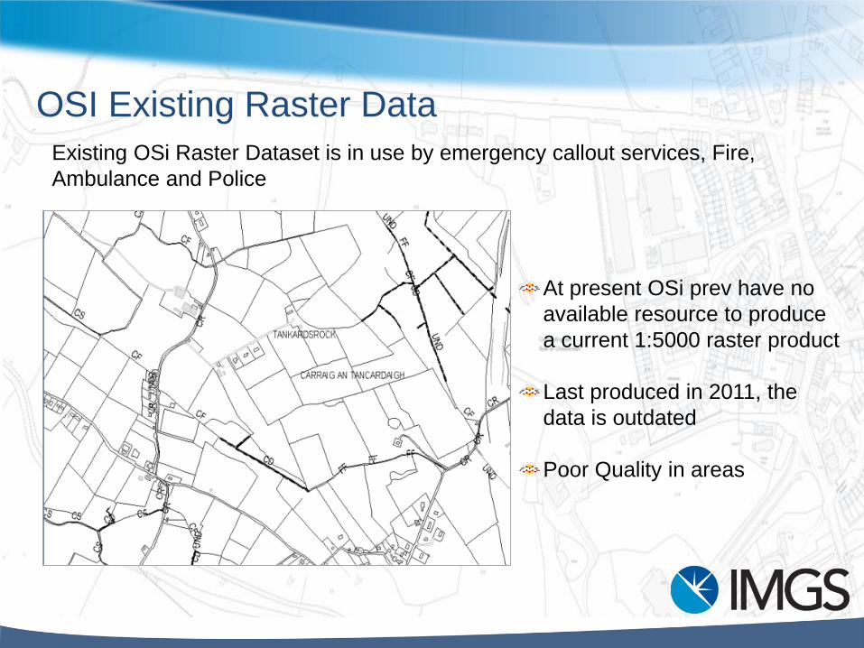
OSI Existing Raster Data
At present OSi prev have no
available resource to produce
a current 1:5000 raster product
Last produced in 2011, the
data is outdated
Poor Quality in areas
Existing OSi Raster Dataset is in use by emergency callout services, Fire,
Ambulance and Police
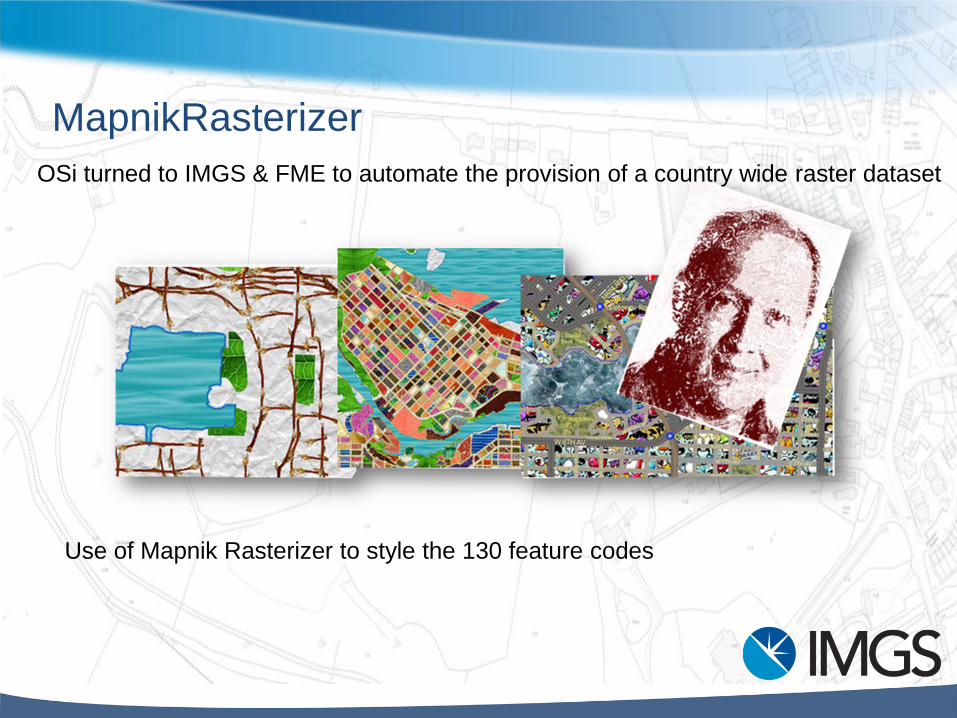
MapnikRasterizer
OSi turned to IMGS & FME to automate the provision of a country wide raster dataset
Use of Mapnik Rasterizer to style the 130 feature codes
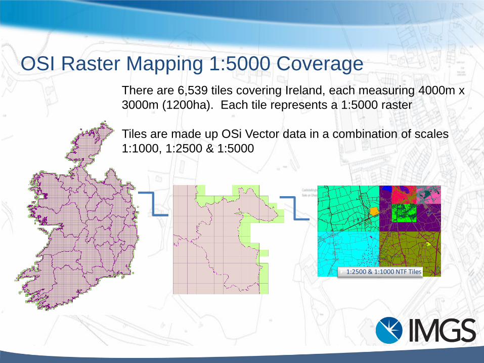
There are 6,539 tiles covering Ireland, each measuring 4000m x
3000m (1200ha). Each tile represents a 1:5000 raster
Tiles are made up OSi Vector data in a combination of scales
1:1000, 1:2500 & 1:5000
OSI Raster Mapping 1:5000 Coverage
1:2500 & 1:1000 NTF Tiles
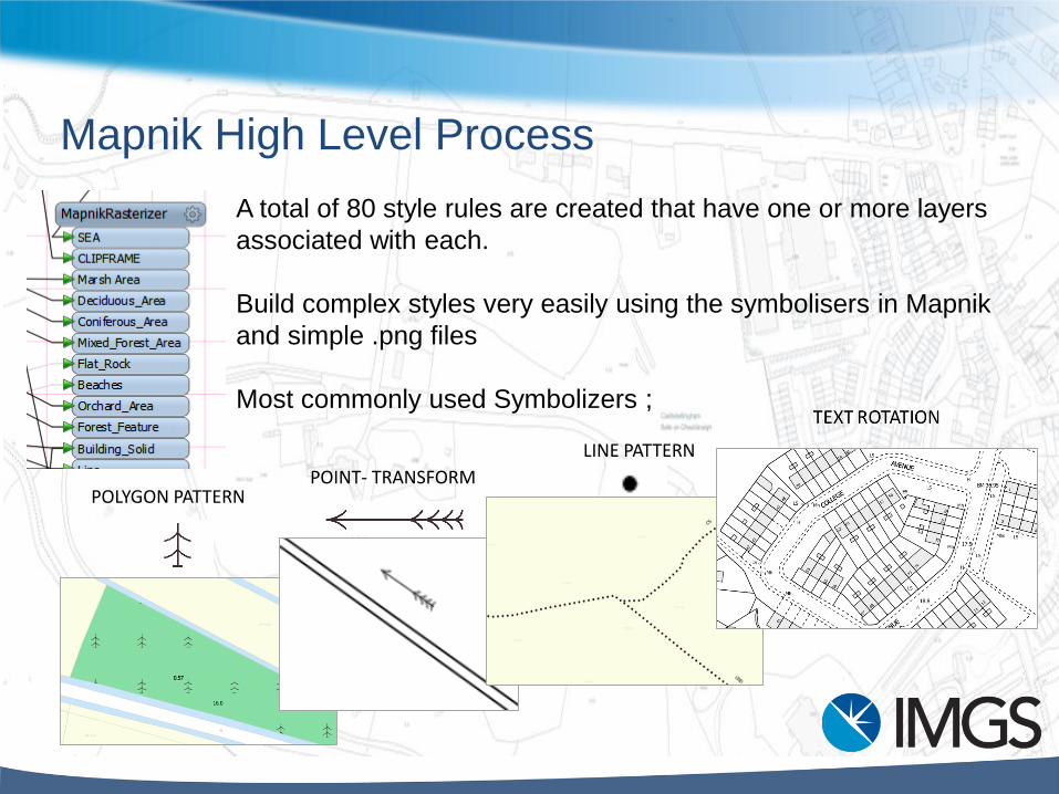
Mapnik High Level Process
A total of 80 style rules are created that have one or more layers
associated with each.
Build complex styles very easily using the symbolisers in Mapnik
and simple .png files
Most commonly used Symbolizers ;
LINE PATTERN
POLYGON PATTERNPOINT- TRANSFORM
Demonstration
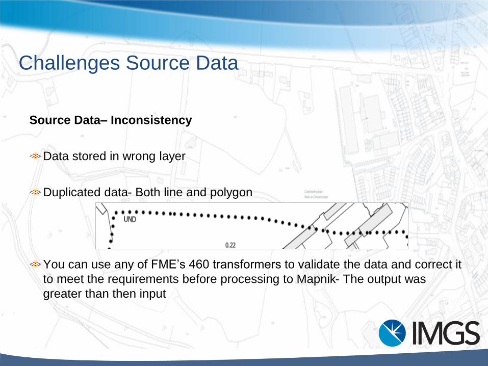
Challenges Source Data
Source Data– Inconsistency
Data stored in wrong layer
Duplicated data- Both line and polygon
You can use any of FME’s 460 transformers to validate the data and correct it
to meet the requirements before processing to Mapnik- The output was
greater than then input

Challenges- Running the data
The volume of data required to be processed needed a automation workspace and
run on Server
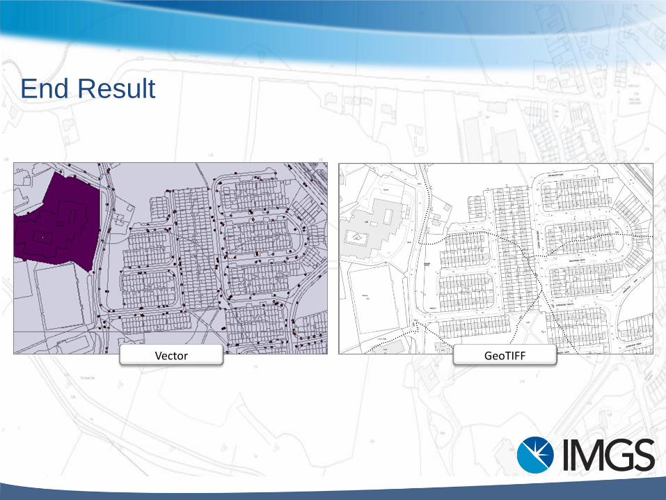
End Result
Vector GeoTIFF

Why is this transformer so powerful?
Graphic interface for
Mapnik
Sophisticated symbols &
Shading
Transformation
Possibilities
Automation