forty mile cultural resource management plan volume i · 2019-07-25 · 6 forty mile cultural...
TRANSCRIPT

Keay & Associate, Architecture, Ltd. / Robert M. Patterson & Associates
p. (250) 382-3823 e. [email protected]
Forty Mile Cultural Resource
Management Plan2014
VOLUME I

Keay & Associate, Architecture Ltd. / Robert M. Patterson & Associates 1
TABLE OF CONTENTS
VOLUME I1. EXECUTIVE SUMMARY................................................................................................................. 3
2. HISTORY OF THE TOWNSITE ........................................................................................................ 4
3. PLAN OBJECTIVES ....................................................................................................................... 6 i. application of the ‘Canadian Standards and Guidelines for Conservation of Historic Places’ to the forty mile site ii. standards and guidelines
4. SITE ZONES AND SITE MANAGEMENT ........................................................................................ 10 i. flooding ii. vegetation iii. artifacts and archeology iv. the buildings
5. SITE DEVELOPMENT .................................................................................................................. 14 i. the historic townsite ii. design guidelines iii. access and fish camp iv. visitor camping v. Mission Island access vi. work camp: staff, workers, elders accommodation vii. site: access, tails, historic elements viii. interpretation ix. protection x. security
6. METHODOLOGY ....................................................................................................................... 23 i. changes to existing construction ii. contemporary construction iii. building code compliance iv. future work on the site v. maintenance guidelines vi. inspection program vii. repair program
7. BUILDING DOCUMENTATION .................................................................................................... 28
8. APPENDIX ................................................................................................................................ 30 i. graveyard conservation
Credits - assistance of Bruce Barrett, Barbara Hogan, Alex Brook, Sue Parsons, Joe Flynn, and Madeline DeRepentigny is gratefully acknowledged.

2 Forty Mile Cultural Resource Management Plan
TABLE OF CONTENTS
VOLUME II9. UPDATED BUILDING CONDITION SURVEYS i. bldg 1, Fish House ii. bldg 3, ACC warehouse iii. bldg 8, Swanson’s store iv. bldg 10, Roadhouse v. bldg 11, Telegraph station vi. bldg 12, NWMP post vii. bldg 13, St James Anglican Church vii. bldg 14, two storey workshop ix. bldg 15, two storey cache x. bldg 16, deWolfe cabin 10. BUILDINGS NO LONGER EXTANT i. bldg 2 ii. bldg 4 iii. bldg 5 iv. bldg 6 v. bldg 7, ACC cabin (ruin) vi. bldg 9 vii. bldg 17, Swanson Cabin (ruins) ix. bldg 18, Swanson Barn (ruins)

Keay & Associate, Architecture Ltd. / Robert M. Patterson & Associates 3
Forty Mile, at the confluence of the Yukon and Forty Mile Rivers, was the first townsite in the Yukon, providing a variety of services only until administrative and commercial activities were moved to Dawson. The site continued to service the local area, with population and infrastructure slowly declining. The site includes the Forty Mile townsite with its remaining buildings and archeological resources, and the adjoining sites of Mission Island, Fort Cudahy, and Fort Constantine; these were not within the scope of the project. The Forty Mile townsite is within the Tr’ondek Hwech’in First Nation lands, and is jointly administered by the First Nation and YTG. The site may be included within the territory being nominated for World Heritage Site status.
The objectives of the plan are:
i. description and analysis of the site, context, character, and landscapeii. review and description of all extant structures: photographs, drawings, existing informationiii. condition report and recommendations for each buildingiv. recommendations for infrastructure which could include signage, staff accommodations, storage and artifactsv. recommendations for the potential adaptive reuse of existing buildings or reconstruction of previously recorded buildings
The plan is based on the ‘Canadian Standards and Guidelines for Conservation of Historic Places’ with the intention of providing a template for preservation, management, and use.
The site was reviewed from the aspects of environmental conditions, visitor access, existing buildings and structures, site maintenance and servicing, and future work on the site. An unusual aspect of the site is periodic flooding, and occasional ice dams which can be of a size to destroy or move buildings on the site.
Access is by water or a rough road which terminates at the south end of the site. This is also one of the boat landings, there are others, at Mission Island and the other at the north end of the site. All have drawbacks, the south access is some considerable distance, the others can be quite inaccessible depending on water levels. Access and camping facilities are adequate for the current level of visitor use.
Ability to maintain the site depends on the provision of accommodation for crews, and storage for materials and equipment. It was felt that the current occupation of heritage buildings should be phased out over time, and that a purpose built work camp should be established. This would free up buildings for interpretation, and clarify the public/private interface.
The buildings which are extant have for the most part been repaired, using techniques and systems which are appropriate. The plan provides a summary of previous work, current condition, updated drawings from the Yukon Waterways Survey, and a comprehensive archive of historic and current photographs. Altered or missing design elements are reviewed from the position of their suitability for replication.
Aside from the work camp, future work could include the reconstruction of buildings previously recorded but now demolished. This is feasible due to the extensive documentation of the Yukon Waterways Survey of 1972. There are six buildings which could be considered.
The report provides a methodology for conservation, reconstruction, and maintenance.
1. EXECUTIVE SUMMARY
4 Forty Mile Cultural Resource Management Plan
2. HISTORY OF THE TOWNSITE
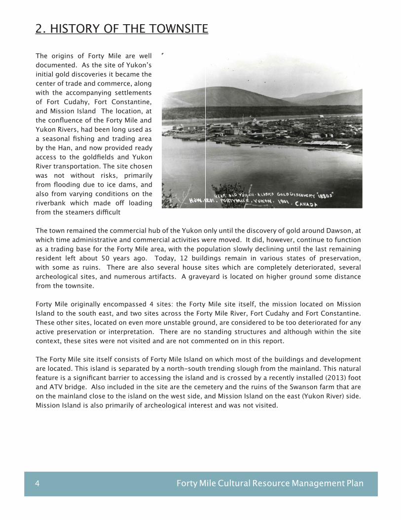
The origins of Forty Mile are well documented. As the site of Yukon’s initial gold discoveries it became the center of trade and commerce, along with the accompanying settlements of Fort Cudahy, Fort Constantine, and Mission Island The location, at the confluence of the Forty Mile and Yukon Rivers, had been long used as a seasonal fishing and trading area by the Han, and now provided ready access to the goldfields and Yukon River transportation. The site chosen was not without risks, primarily from flooding due to ice dams, and also from varying conditions on the riverbank which made off loading from the steamers difficult
The town remained the commercial hub of the Yukon only until the discovery of gold around Dawson, at which time administrative and commercial activities were moved. It did, however, continue to function as a trading base for the Forty Mile area, with the population slowly declining until the last remaining resident left about 50 years ago. Today, 12 buildings remain in various states of preservation, with some as ruins. There are also several house sites which are completely deteriorated, several archeological sites, and numerous artifacts. A graveyard is located on higher ground some distance from the townsite.
Forty Mile originally encompassed 4 sites: the Forty Mile site itself, the mission located on Mission Island to the south east, and two sites across the Forty Mile River, Fort Cudahy and Fort Constantine. These other sites, located on even more unstable ground, are considered to be too deteriorated for any active preservation or interpretation. There are no standing structures and although within the site context, these sites were not visited and are not commented on in this report.
The Forty Mile site itself consists of Forty Mile Island on which most of the buildings and development are located. This island is separated by a north-south trending slough from the mainland. This natural feature is a significant barrier to accessing the island and is crossed by a recently installed (2013) foot and ATV bridge. Also included in the site are the cemetery and the ruins of the Swanson farm that are on the mainland close to the island on the west side, and Mission Island on the east (Yukon River) side. Mission Island is also primarily of archeological interest and was not visited.

Keay & Associate, Architecture Ltd. / Robert M. Patterson & Associates 5
The Forty Mile Historic Site is jointly owned and managed by the Yukon Government and Tr’ondek Hwech’in First Nation since 2006 as part of the Tr’ondek Hwech’in Final Agreement. The conservation and operational program for the site agreed at that time was in accordance with the Forty Mile, Fort Cudahy and Fort Constantine Historic Site Management Plan 2006 which set out the standards and proposed timelines for recommended interventions and activities on the site. In the last eight years a substantial amount of preservation, rehabilitation and interpretation work has taken place. Seasonal work crews have stabilized several buildings and cleared large areas, with their accommodation generally in either Swanson’s store or the Roadhouse. Two new wall tents, designated primarily for Elders, are now located between Swanson’s store and the ACC warehouse. Outhouses have been constructed near the camping area, and between the NWMP building and the Telegraph office. Visitors camp at either of two campsites, and occasionally seek shelter in either of the two warehouse buildings.
The current level of visitor traffic according to the sign in guest book is about 500 per year, mostly in the summer. Additional winter use, which is quite intensive, occurs during the dog team races with teams passing through in some events, or camping over. Generally, the use of the site at its current level is fairly low impact. There is however some confusion around private and public space, and the extent to which workers and staff are encouraged to interact with visitors.
The site currently consists of 10 buildings which have been either restored, reconstructed, or stabilized. These structures are the basis of the site in physical and interpretive terms. There are another two which are ruins, and there are archeological sites of several other buildings. In addition, there are six buildings which are no longer extant but which were extensively documented and photographed by the 1972 Yukon Waterways survey. In our view there is sufficient information regarding the location, appearance, and construction of these buildings that reconstruction is a viable option.
The Forty Mile townsite may be included in the application for World Heritage Site classification. Within the context of increased visitor use and the opportunity to better explain the town and its significance, a case can be made for the reproduction of buildings which, although not extant, have been accurately recorded and which can contribute to the interpretation of the site.
2. HISTORY OF THE TOWNSITE (continued)
Photo: Ice Dam (no date or reference)
6 Forty Mile Cultural Resource Management Plan
3. PLAN OBJECTIVES
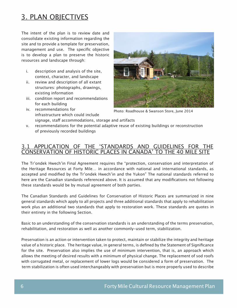
The intent of the plan is to review date and consolidate existing information regarding the site and to provide a template for preservation, management and use. The specific objective is to develop a plan to preserve the historic resources and landscape through:
i. description and analysis of the site, context, character, and landscapeii. review and description of all extant structures: photographs, drawings, existing informationiii. condition report and recommendations for each buildingiv. recommendations for infrastructure which could include signage, staff accommodations, storage and artifactsv. recommendations for the potential adaptive reuse of existing buildings or reconstruction of previously recorded buildings
3.1 APPLICATION OF THE ‘STANDARDS AND GUIDELINES FOR THE CONSERVATION OF HISTORIC PLACES IN CANADA’ TO THE 40 MILE SITE
The Tr’ondek Hwech’in Final Agreement requires the “protection, conservation and interpretation of the Heritage Resources at Forty Mile… in accordance with national and international standards, as accepted and modified by the Tr’ondek Hwech’in and the Yukon” The national standards referred to here are the Canadian standards referenced above. It is assumed that any modifications not following these standards would be by mutual agreement of both parties.
The Canadian Standards and Guidelines for Conservation of Historic Places are summarized in nine general standards which apply to all projects and three additional standards that apply to rehabilitation work plus an additional two standards that apply to restoration work. These standards are quotes in their entirety in the following Section.
Basic to an understanding of the conservation standards is an understanding of the terms preservation, rehabilitation, and restoration as well as another commonly-used term, stabilization.
Preservation is an action or intervention taken to protect, maintain or stabilize the integrity and heritage value of a historic place. The heritage value, in general terms, is defined by the Statement of Significance for the site. Preservation also implies the use of minimum intervention, that is, an approach which allows the meeting of desired results with a minimum of physical change. The replacement of sod roofs with corrugated metal, or replacement of lower logs would be considered a form of preservation. The term stabilization is often used interchangeably with preservation but is more properly used to describe
Photo: Roadhouse & Swanson Store, June 2014

Keay & Associate, Architecture Ltd. / Robert M. Patterson & Associates 7
where the building is kept in its present, often ruinous form but protected from rapid deterioration, for example the ACC cabin ruins, protected by a recently-constructed roof. Preservation in the long term requires ongoing maintenance and repair.
Rehabilitation means taking actions to allow a compatible contemporary use of a historic place, through alterations and/or additions, while protecting heritage values. The installation of new floors, entry decks and interior refurbishments to some of the cabins would fall under this category. Care must be taken to ensure that the new use is compatible with both the appearance and the long-term preservation of the building. Storage use might overload some fragile structures, or cause unnecessary fire risk, and some uses might conflict with interpretation goals.
Restoration is the act of making a building represent the appearance of a particular period in its history, again keeping in mind its heritage value. This can involve removal of later additions, but also can mean the replacement of missing elements. It is in this latter context that we see most examples on site: the replacement of missing windows, doors, siding, etc. and the possibility of partial interior restoration of some buildings. Decisions regarding restoration require the balancing of cost and long-term maintenance implications, on the one hand and en enhanced visitor experience on the other.
An important aspect of restoration is the establishing of the restoration date. There are a number of factors that need to be considered in determining an appropriate date or era to which the appearance of historic building and site are consistently restored:
- Availability of enough documentary information such as photographs and drawings to support an authentic restoration.- The significance of the date or era in the history of the site.- Existence of a substantial amount of historical resource from that date.- The architectural and visual interest of a particular era - this particularly applies to the less durable components of structure, such as porches, landscape details etc. which did not survive to later eras.- Practical considerations of maintenance and cost.
Important to these processes is the careful repair or reproduction of various parts of the buildings. This may mean the duplication of deteriorated elements from samples, or the use of research, using old photographs, drawings or written and oral evidence, to produce the descriptions for new replacement work. The required work is often defined by drawings and specifications, usually prepared by the Historic Sites Unit. There needs to be mutual respect for the care and detail that goes into this work, both by the researcher/designer and the craftsman. The long-term authenticity of the historic place depends on careful attention to these details. Another aspect of good conservation procedure is the keeping of complete and accurate records
3. PLAN OBJECTIVES (continued)

8 Forty Mile Cultural Resource Management Plan
through photographs and other means of the work that occurs on site. Consideration should be given to developing guidelines to ensure better coverage of this aspect, such as a requirement for progress photos as defined stages of the work as part of the contracted work. It is advisable to develop guidelines for the kind of documentation required and provide examples of satisfactory documentation.
It is also recommended that the Historic Sites Unit keep general and individual building files that contain all documentation or construction and other site interventions along with site inspection reports, contract information and communications.
3.2 STANDARDS AND GUIDELINES
Conservation work is based on the Standards and Guidelines for the Conservation of Historic Places in Canada as issued by Parks Canada:
The standards are quotes as follows:
1. Conserve the heritage value of a historic place. Do not remove, replace or substantially alter its intact or repairable character-defining elements. Do not move a part of a historic place if its current location is a character defining element.
2. Conserve changes to a historic place that, over time, have become character defining elements in their own right.
3. Conserve heritage value by adopting an approach calling for minimal intervention.
4. Recognize each historic place as a physical record of its time, place and use. Do not create a false sense of historical development by adding elements from other historic places or other properties, or by combining features of the same property that never coexisted.
5. Find a use for a historic place that requires minimal or no change to its character defining elements.
6. Protect and, if necessary, stabilize a historic place until any subsequent intervention is undertaken. Protect and preserve archaeological resources in place. Where there is potential for disturbing archaeological resources, take mitigation measures to limit damage and loss of information.
7. Evaluate the existing condition of character-defining elements to determine the appropriate intervention needed. Use the gentlest means possible for any intervention. Respect heritage value when undertaking an intervention.
3. PLAN OBJECTIVES (continued)
Photo: Swanson Cabin, June 2014

Keay & Associate, Architecture Ltd. / Robert M. Patterson & Associates 9
3.2 STANDARDS AND GUIDELINES (continued)
8. Maintain character-defining elements on an ongoing basis. Repair character defining elements by reinforcing their materials using recognized conservation methods. Replace in kind any extensively deteriorated or missing parts of character-defining elements, where there are surviving prototypes.
9. Make any intervention needed to preserve character-defining elements physically and visually compatible with the historic place and identifiable on close inspection. Document any intervention for future reference.
Additional Standards Relating to Rehabilitation
1. Repair rather than replace character-defining elements. Where character defining elements are too severely deteriorated to repair, and where sufficient physical evidence exists, replace them with new elements that match the forms, materials and detailing of sound versions of the same elements. Where there is insufficient physical evidence, make the form, material and detailing of the new elements compatible with the character of the historic place.
2. Conserve the heritage value and character-defining elements when creating any new additions to an historic place or any related new construction. Make the new work physically and visually compatible with, subordinate to and distinguishable from the historic place.
3. Create any new additions or related new construction so that the essential form and integrity of a historic place will not be impaired if the new work is removed in the future.
4. When restoration is contemplated, replace missing features from the restoration period with new features whose forms, materials and detailing are based on sufficient physical, documentary and/or oral evidence.
3. PLAN OBJECTIVES (continued)

10 Forty Mile Cultural Resource Management Plan
4. SITE ZONES AND MANAGEMENT
The site, as shown on the accompanying maps, can be divided into six zones:
i. the historic building precinctii. the First Nations encampment site on the confluence of the Yukon and Forty Mile Rivers, currently visitor camping iii. proposed work camp and service facilitiesiv. the Fish Camp visitor access at the south end which is technically not part of the site.v. remainder of the site, including the west site of the slough, the farm, trails and access roads, and the graveyard. vi. Fort Constantine, Fort Cudahy, and Mission Island
4.1. FLOODING
A primary concern for management of the Forty Mile site is the expectation of flooding. This results from ice dams forming on either the Forty Mile or the Yukon Rivers, and can be extremely destructive. Several buildings have been moved around on the site, or destroyed, by the combination of high water levels, strong currents, and large ice blocks. The notion of anchoring the buildings to the site is not realistic, as the ice has the capacity to demolish anything in its path. Any new facilities should be designed and located so as to minimize the impact of the inevitable flooding and ice movement.
4.2. VEGETATION
Located on an alluvial plain, and with a high water table, vegetative growth is rapid, at least by Yukon standards. Mixed stands of cottonwood, alder, and birch predominate, depending on moisture, with stands of mature spruce. Understory can be dense, with rose, high bush cranberry, soapberry, and Labrador tea. Willow predominates in damp areas. Both the tree cover and the understory have the effect of reducing ice movement across the site, and thus thinning for view corridors, fire protection, and the removal of vegetation around buildings needs to be balanced against protection from the ice.
At the same time, however, because of the rapid growth rates, as well as windfalls, a continuous thinning program is required. This should include determining the best use of staff resources, site protection, and views.
Photo: K.N.H.S #1-30-4 (May 16, 1979)
Keay & Associate, Architecture Ltd. / Robert M. Patterson & Associates 11
4. SITE ZONES AND MANAGEMENT (continued)
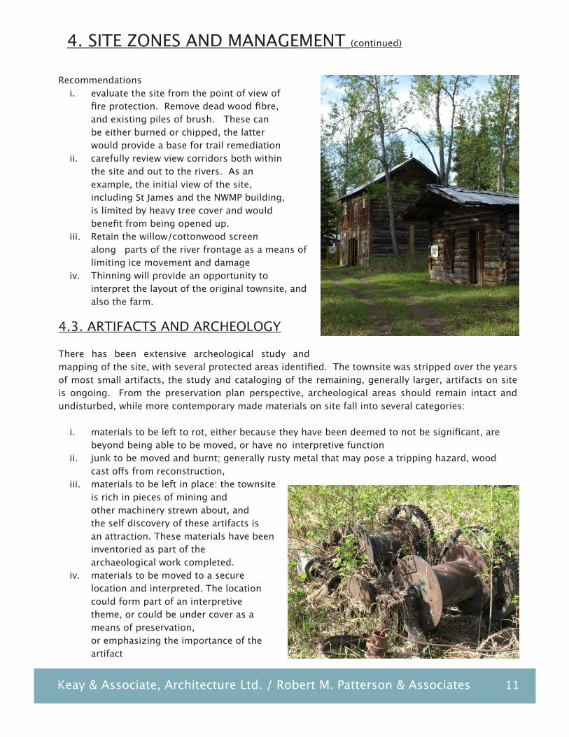
Recommendationsi. evaluate the site from the point of view of fire protection. Remove dead wood fibre, and existing piles of brush. These can be either burned or chipped, the latter would provide a base for trail remediationii. carefully review view corridors both within the site and out to the rivers. As an example, the initial view of the site, including St James and the NWMP building, is limited by heavy tree cover and would benefit from being opened up.iii. Retain the willow/cottonwood screen along parts of the river frontage as a means of limiting ice movement and damageiv. Thinning will provide an opportunity to interpret the layout of the original townsite, and also the farm.
4.3. ARTIFACTS AND ARCHEOLOGY
There has been extensive archeological study and mapping of the site, with several protected areas identified. The townsite was stripped over the years of most small artifacts, the study and cataloging of the remaining, generally larger, artifacts on site is ongoing. From the preservation plan perspective, archeological areas should remain intact and undisturbed, while more contemporary made materials on site fall into several categories:
i. materials to be left to rot, either because they have been deemed to not be significant, are beyond being able to be moved, or have no interpretive functionii. junk to be moved and burnt; generally rusty metal that may pose a tripping hazard, wood cast offs from reconstruction, iii. materials to be left in place: the townsite is rich in pieces of mining and other machinery strewn about, and the self discovery of these artifacts is an attraction. These materials have been inventoried as part of the archaeological work completed.iv. materials to be moved to a secure location and interpreted. The location could form part of an interpretive theme, or could be under cover as a means of preservation, or emphasizing the importance of the artifact
12 Forty Mile Cultural Resource Management Plan
4. SITE ZONES AND MANAGEMENT (continued)
4.3. ARTIFACTS AND ARCHEOLOGY (continued)
v. ensure that any future site development will not impact archeological values.vi. develop recommendations of what type of activities ad where on the site will require further archeological assessment in advance.
Recommendations:i. confirm archeological sites which are to be protected, determine appropriate means of identification and protection. Identify any threats to archeological sites.ii. continue the artifact evaluation, which will provide guidance on prioritization, conservation, interpretation, and zoning of the site into protected areas as appropriateiii. co-ordinate clearing and thinning programs with artifacts and archeological sites which are to remain in situiv. determine which buildings have interpretive themes which the artifacts can support. The deWolfe cabin, which has most of its furniture intact, is an example, as recommended in the 2006 Management Plan.
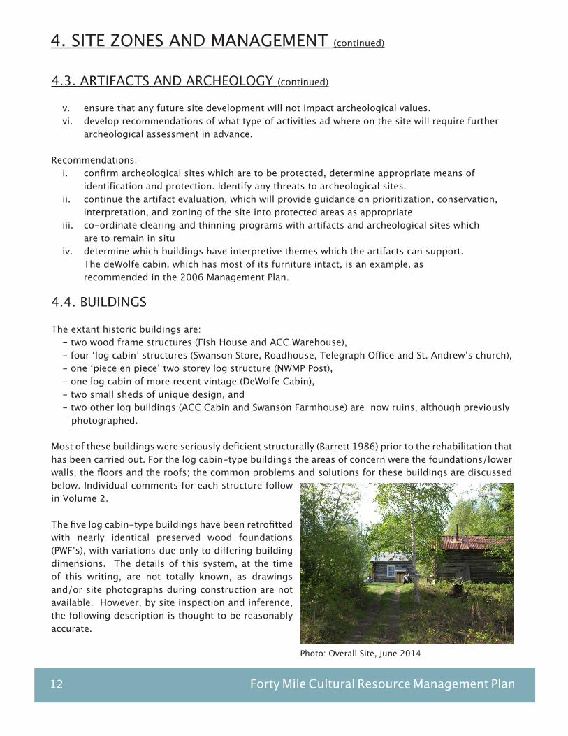
4.4. BUILDINGS
The extant historic buildings are:- two wood frame structures (Fish House and ACC Warehouse), - four ‘log cabin’ structures (Swanson Store, Roadhouse, Telegraph Office and St. Andrew’s church), - one ‘piece en piece’ two storey log structure (NWMP Post), - one log cabin of more recent vintage (DeWolfe Cabin), - two small sheds of unique design, and - two other log buildings (ACC Cabin and Swanson Farmhouse) are now ruins, although previously photographed.
Most of these buildings were seriously deficient structurally (Barrett 1986) prior to the rehabilitation that has been carried out. For the log cabin-type buildings the areas of concern were the foundations/lower walls, the floors and the roofs; the common problems and solutions for these buildings are discussed below. Individual comments for each structure follow in Volume 2.
The five log cabin-type buildings have been retrofitted with nearly identical preserved wood foundations (PWF’s), with variations due only to differing building dimensions. The details of this system, at the time of this writing, are not totally known, as drawings and/or site photographs during construction are not available. However, by site inspection and inference, the following description is thought to be reasonably accurate.
Photo: Overall Site, June 2014
Keay & Associate, Architecture Ltd. / Robert M. Patterson & Associates 13
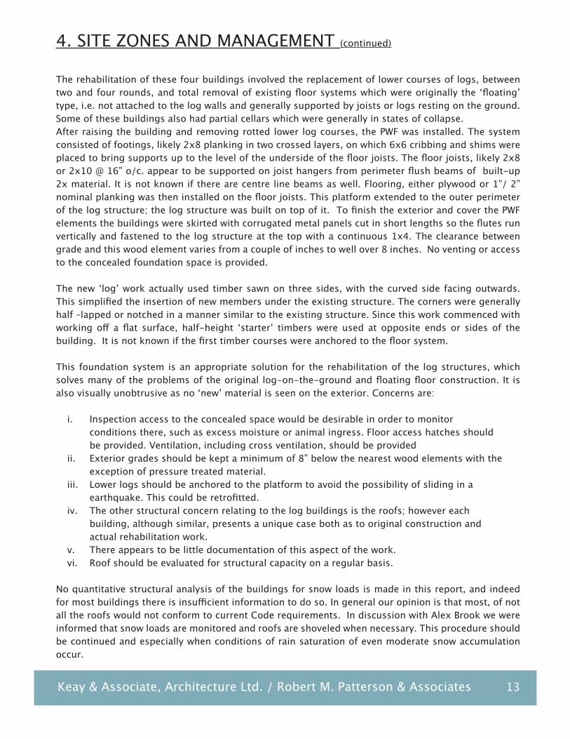
The rehabilitation of these four buildings involved the replacement of lower courses of logs, between two and four rounds, and total removal of existing floor systems which were originally the ‘floating’ type, i.e. not attached to the log walls and generally supported by joists or logs resting on the ground. Some of these buildings also had partial cellars which were generally in states of collapse. After raising the building and removing rotted lower log courses, the PWF was installed. The system consisted of footings, likely 2x8 planking in two crossed layers, on which 6x6 cribbing and shims were placed to bring supports up to the level of the underside of the floor joists. The floor joists, likely 2x8 or 2x10 @ 16” o/c. appear to be supported on joist hangers from perimeter flush beams of built-up 2x material. It is not known if there are centre line beams as well. Flooring, either plywood or 1”/ 2” nominal planking was then installed on the floor joists. This platform extended to the outer perimeter of the log structure; the log structure was built on top of it. To finish the exterior and cover the PWF elements the buildings were skirted with corrugated metal panels cut in short lengths so the flutes run vertically and fastened to the log structure at the top with a continuous 1x4. The clearance between grade and this wood element varies from a couple of inches to well over 8 inches. No venting or access to the concealed foundation space is provided.
The new ‘log’ work actually used timber sawn on three sides, with the curved side facing outwards. This simplified the insertion of new members under the existing structure. The corners were generally half –lapped or notched in a manner similar to the existing structure. Since this work commenced with working off a flat surface, half-height ‘starter’ timbers were used at opposite ends or sides of the building. It is not known if the first timber courses were anchored to the floor system.
This foundation system is an appropriate solution for the rehabilitation of the log structures, which solves many of the problems of the original log-on-the-ground and floating floor construction. It is also visually unobtrusive as no ‘new’ material is seen on the exterior. Concerns are:
i. Inspection access to the concealed space would be desirable in order to monitor conditions there, such as excess moisture or animal ingress. Floor access hatches should be provided. Ventilation, including cross ventilation, should be providedii. Exterior grades should be kept a minimum of 8” below the nearest wood elements with the exception of pressure treated material. iii. Lower logs should be anchored to the platform to avoid the possibility of sliding in a earthquake. This could be retrofitted.iv. The other structural concern relating to the log buildings is the roofs; however each building, although similar, presents a unique case both as to original construction and actual rehabilitation work. v. There appears to be little documentation of this aspect of the work.vi. Roof should be evaluated for structural capacity on a regular basis.
No quantitative structural analysis of the buildings for snow loads is made in this report, and indeed for most buildings there is insufficient information to do so. In general our opinion is that most, of not all the roofs would not conform to current Code requirements. In discussion with Alex Brook we were informed that snow loads are monitored and roofs are shoveled when necessary. This procedure should be continued and especially when conditions of rain saturation of even moderate snow accumulation occur.
4. SITE ZONES AND MANAGEMENT (continued)

14 Forty Mile Cultural Resource Management Plan
5. SITE DEVELOPMENT
5.1. THE HISTORIC TOWNSITE
The remaining buildings constitute a limited, but very valuable resource. Their current condition, and how this has altered from the 1972 Waterways survey, is in the individual building descriptions and annotated drawings. All of the buildings, with the exception of the two storey cache and the deWolfe cabin, are in stable condition. The Swanson and ACC cabins are clearly ruins at this point.
Over the course of stabilizing the buildings, they have tended to be occupied in various ways, in accordance with the initial recommendations of the 2006 Management Plan. At present some buildings are artifact storage, some have dog team equipment, provide cooking facilities, and/or worker accommodation. Some are used as emergency accommodation by visitors in bad weather. This mix of building use has several problems; the buildings are not available for interpretation, the public/private interface is not clearly defined, and there is the potential for damage or loss.
It is appropriate to utilize the buildings for interpretive display. While little remains of the interiors of each of the buildings, there is more than enough information on Forty Mile and the activities in the area to inform the site. This would augment the excellent information panels already installed. Another option is restoration, and buildings should be stabilized pending decisions regarding how, or if, to undertake restoration. A substantial amount of information from the 1986 evaluations, including samples of interior finishes, is available and would allow for reasonably accurate interior restoration.
The lack of documentation as the level of activity decreased over the years make the selection of a restoration date subjective. One option is to simply choose the date when the townsite was fully recorded, 1972. However at this point the town was more or less abandoned, with no clear function remaining. Another option is the 1930’s, when Forty Mile still had a residual population, and most of the buildings currently extant were in use. There are a few photographs of this era, which are helpful in providing context in terms of vegetation and architectural elements such as fencing. Further research, in particular if archival photographs can be sourced, would be necessary to provide a reasonable time frame for restoration.
Photo: Camp below Forty Mile ca 1932 YW 7256
Keay & Associate, Architecture Ltd. / Robert M. Patterson & Associates 15
5. SITE DEVELOPMENT (continued)
Recommendations, historic townsitei. clarify the intent and use of the historic buildings, and whether staff accommodation should be relocatedii. Continue the program of preserving the buildings, review and modify as necessary in accordance with the findings for each building, including restoration of specific elements where appropriate, for example the NWMP Post verandah and the fence and gate at the Roadhouse.iii. Develop options for accommodating the current uses of these buildings elsewhere on siteiv. Develop interpretive plans and displays for the historic buildings as appropriate, using relevant artifacts where possiblev. define the role of the various ruins located within the townsite, confirm program for ruins: stabilize/rebuild/leave to deterioratevi. evaluate buildings as suitable for restoration, depending on the extent of original fabric, original use, and available information regarding finishes vii. relocate contemporary structures which conflict with the townsite, such as outhousesviii. review landscape vistas and view corridors, see map for recommendationsxi. continue research into the establishment of an appropriate restoration date
5.2. DESIGN GUIDELINES
When considering new construction, it is appropriate to refer to design guidelines. The intent is that new construction not predominate in terms of design or scale over the existing heritage townsite, but also that materials and proportions be used that reflect the existing buildings. At the same time, new construction should be clearly identifiable, and should not “mimic”.
Basic design guidelines would include:i. roof pitch: similar to existing buildings, generally 4:12. For small service buildings, shed roofs are acceptableii. construction, buildings: log, from locally available timber. Currently, the system used on site employs peeled logs, sawn on three sides for ease of assembly and to differentiate from the original buildings. It would be more appropriate from this point on to use logs peeled and sawn on two sides. If information regarding the original form of construction is available, or as the life cycle replacement of logs comes due, replace the current system with a more historically accurate approach. Logs could use modern methods of limiting gaps between, ie by running a chain saw between the logs, and chinking materials that do not show. Perma chink should not be used.iii. construction, open shelters: log timber frame construction is appropriate. The use of sawn lumber should be avoided for structural elements, but instead used for decking, interior partitions, and flooring. Sawn lumber should not be dressed.iv. Construction, small service storage buildings: rough sawn lumber is acceptablev. building size will be limited by the available timber, and should be in scale with the historic single storey buildings.
16 Forty Mile Cultural Resource Management Plan
vi. window and door openings should be scaled to suit normal good log building practices. Windows can be single light, not multi paned, with wood frames, doors should be wood, with or without glazing.vii. floors: the flooring system in use at the site is appropriate, ensuring the lower logs are attached to the platform.viii. roof materials: galvanized corrugated roofing is appropriateix. porches and verandahs: appropriate if kept simple and small in scale
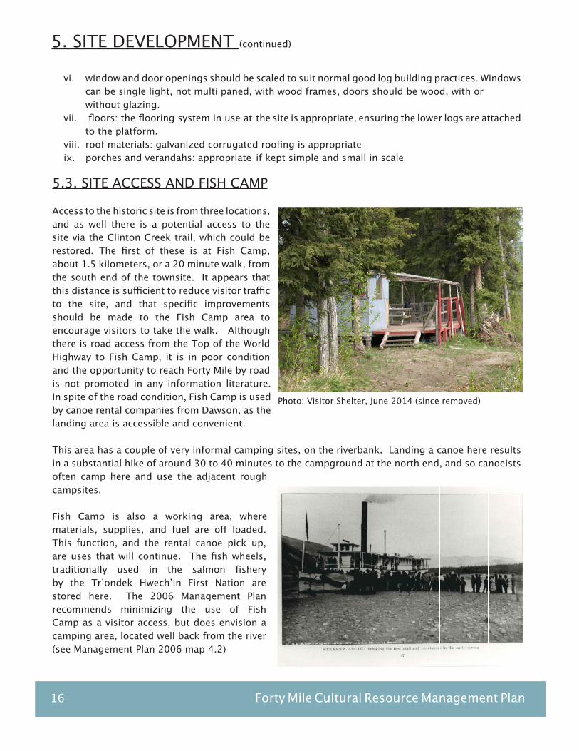
5.3. SITE ACCESS AND FISH CAMP
Access to the historic site is from three locations, and as well there is a potential access to the site via the Clinton Creek trail, which could be restored. The first of these is at Fish Camp, about 1.5 kilometers, or a 20 minute walk, from the south end of the townsite. It appears that this distance is sufficient to reduce visitor traffic to the site, and that specific improvements should be made to the Fish Camp area to encourage visitors to take the walk. Although there is road access from the Top of the World Highway to Fish Camp, it is in poor condition and the opportunity to reach Forty Mile by road is not promoted in any information literature. In spite of the road condition, Fish Camp is used by canoe rental companies from Dawson, as the landing area is accessible and convenient.
This area has a couple of very informal camping sites, on the riverbank. Landing a canoe here results in a substantial hike of around 30 to 40 minutes to the campground at the north end, and so canoeists often camp here and use the adjacent rough campsites.
Fish Camp is also a working area, where materials, supplies, and fuel are off loaded. This function, and the rental canoe pick up, are uses that will continue. The fish wheels, traditionally used in the salmon fishery by the Tr’ondek Hwech’in First Nation are stored here. The 2006 Management Plan recommends minimizing the use of Fish Camp as a visitor access, but does envision a camping area, located well back from the river (see Management Plan 2006 map 4.2)
5. SITE DEVELOPMENT (continued)
Photo: Visitor Shelter, June 2014 (since removed)

Keay & Associate, Architecture Ltd. / Robert M. Patterson & Associates 17
Photo: View to North, June 2014
5. SITE DEVELOPMENT (continued)
Recommendations, south end access: i. organize and define the parking area, work/storage area, and trailhead.ii. Replace the current shelter with one of higher quality, log or timber frame to better reflect the quality of the extant buildings in the historic townsite.iii. Clearly identify the facilities, distance and walking time to the historic site and to the campsiteiv. Expand on the nature of the townsite through the interpretive panels. Have the brochure available at the trail head.v. Improve the road to Fish Camp as required to allow normal vehicle accessvi. Provide a minimal number of campsites, 3 or 4, while encouraging the use of the north end campsitevii. Provide a separate ATV trail from the north end of the bridge to the proposed work campsite.viii. Consider archeological sites during any development of the visitor campsites. Avoidance or further assessment may be required.
5.4. VISITOR CAMPSITE
The second access is at the north end of the Forty Mile Site, at the confluence of the Yukon and Forty Mile Rivers, and the camping area has been located here. The views are dramatic and the open site reduces the insect impact. The issue here is the constantly changing river elevation, with access when levels are low through a very silty and unstable crossing to firm ground. A modular demountable wharf system is available on site, but is considered too unstable for use unless as flotation for a wood deck design. Any system would of course have to be completely removed during winter.
The area in front of the townsite, ie to the east, has a large gravel bar which dries during periods of low water, but of course can quickly become covered from changing conditions upstream. It is not secure enough for canoe storage unless the canoe was portaged to the beach, although it appears that steamboats used the gravel bar for unloading.This area is identified as having had ongoing seasonal occupation by First Nations as the location of their grayling fishery, and also as a caribou interception point, as noted in the 2006 Management Plan. A communal fire pit should be constructed, as a focal point for visitors and also as a reflection of the traditional use made of the site by the Han as the location of their seasonal fishing encampment.

18 Forty Mile Cultural Resource Management Plan
5. SITE DEVELOPMENT (continued)
Recommendations, visitor campsite: i. encourage use of this campsite in information materials, including at Fish Campii. construct the dock/ramp to account for fluctuating water levels and facilitate elder accessiii. provide water for visitors, through shallow wellsiv. clarify location of campsite by signage visible from the riverv. avoid the archeological sites, ensure no damage to archeological sites
5.5. MISSION ISLAND ACCESS
A third access to the site has been identified at the north end of Mission Island. This is a stable beach area, readily accessible for canoes and watercraft. It had good access to the proposed work camp location, but will require a pontoon bridge as a means of crossing the slough. The stability of the landing and the access to the central part of the site suggest that this area be identified as the prime landing area from the river.
5.6. WORK CAMP: ELDERS, STAFF, WORKER ACCOMMODATION
If the uses of the existing buildings are reconfigured, then alternate facilities will have to be constructed for staff, part time workers, and Elders. Relocation of facilities would reduce the impact on the historic buildings, and would allow a higher level of amenity. Current conditions are primitive at best, with no fresh water on site, and only very limited power. Private accommodation for Elders who may wish to come on site is limited to two tent frames, with outhouses several hundred feet away. It would seem that the rustic facilities limit the interest of work crews, as well as Elders, from working on or visiting the site, and it has been difficult to find a site “greeter” or interpreter.
The 2006 Management Plan suggests a service access road, presumably for pick up trucks; since the washout this is no longer an option without major reconstruction across the slough, including a larger bridge. The plan also suggests year round accommodation for a caretaker, and the reconstruction of the ACC/NCC buildings as staff facilities.
A provisional work camp site was identified during the field work, as shown. It provides good ATV access which can be separated from the walking trail, is close to the townsite so that supervision is possible, and does not conflict with the historic townsite. It also has the ability to provide definition between private and public space At the same time it is less prone to flooding, and is likely immune to ice damage.
In developing a facilities program the camp must be scaled to the size of the seasonal work parties and staffing Tr’ondek Hwech’in First Nation accommodation would appear to be comprised of four categories:
Photo: June 2014, Slough at Mission Island
Keay & Associate, Architecture Ltd. / Robert M. Patterson & Associates 19
Photo: Graveyard, June 2014
Photo: Trail and view corridor, June 2014
i. site manager/greeter: seasonal full time for 1 or 2 peopleii. grounds maintenance: grass mowing, brush thinning and clean up: full time for 1 to 4 peopleiii. building conservation and maintenance; part time, 2 to 4 peopleiv. visits by Elders: part time, 2 to 4 persons
Following several discussions, a facilities program evolved:i. central building for cooking/dining/cook accommodation, centered around a firepit and facing the riverii. service building associated with the above: washhouse laundry/wood storage/generator/fuel storage/equipment storage/solar panelsiii. accommodation for 2 to 4 Elders, separated somewhat from work crewiv. accommodation for 1 or 2 full time staff: interpretation/site managerv. accommodation for 2 to 6 workersvi. Phasing of construction of the buildings, depending on need and available fundingvii. Sufficient storage for materials currently stored in the Telegraph office and NWMP Building.
One possible conceptual design layout is shown. The extent and timing of construction would be phased to match the work programs, an under utilized facility would simply result in more maintenance and higher initial costs.
Elements of the design of the buildings:i. utilize the construction of the new buildings for crew trainingii. log construction for appearance, longevity, and training iii. pressure treated wood foundationsiv. pitched corrugated metal roofs similar in shape to the historic buildings, ie 4:12 or similar pitchv. wood stoves with screened chimneysvi. able to withstand flooding without significant damagevii. shed roofs for small service and storage buildingsviii. gable roofs for larger buildings including residential buildings.
5. SITE DEVELOPMENT (continued)

20 Forty Mile Cultural Resource Management Plan
5. SITE DEVELOPMENT (continued)
Recommendations, work camp:i. confirm appropriate location for work campii. confirm requirements as outlined in the facilities program above: staff, equipment storage, servicing, phasingiii. adopt guidelines for building design and construction iv. off grid and energy conservation technology to be considered: photo voltaics, solar water heating green technology, composting toilets with the potential of increased green technology over time.v. design buildings to emphasize training componentvi. sand point water well system, with storage
5.7. SITE, INCLUDING ACCESS, TRAILS, AND HISTORIC ELEMENTS
The remainder of the site has a variety of elements which can be interpreted, including previously cleared farmland and the graveyard. There are also several trails, including the main trail from Fish Camp to the historic town, others, generally unmarked, lead around the rear of the site. These could be opened up to provide a greater sense of the scale of the original town. There are also several archeological sites which have been identified and which should be protectedOne evolving issue is site access. A new bridge suitable for pedestrians and AT vehicles has been constructed, while a recent washout has made access across the slough and to the site by truck impossible. Thus building supplies will have to be transported to the site either during the winter by sled down the Forty Mile River, or by helicopter. While both are more expensive than trucking, the result will be less impact on the site. Access by boat may be possible at certain times but will require equipment on shore to move materials once they are unloaded.
The general concept for the use of equipment on site is that hand tools be used as much as possible with the intent of creating employment and training opportunities.
Photo: Site access trail view to St. James Church View corridors should be reviewed, photo June 2014
Photo: Pedestrian / ATV Bridge Constructed in 2013, photo June 2014
Keay & Associate, Architecture Ltd. / Robert M. Patterson & Associates 21
5. SITE DEVELOPMENT (continued)
Recommendations for remainder of the site:i. review condition of main trail to the townsite, including the footings for the new bridgeii. review means of access for supplies and equipment: new ATV road, other optionsiii. fields, trails, and townsite grid: review and implement options for preservation, stabilization, and interpretation, as noted in the 2006 Management Plan.iv. graveyard: confirm preservation and stabilization, and appropriate level of public access. Note that the 2006 Management Plan recommendation is to discourage public access until paths were defined to prevent damage to unmarked graves, and until fences were stabilized. The trail to the cemetery has now been upgraded with boardwalks.v. continue the current low impact/low noise approach to site maintenance, but combine with appropriate levels of equipment.vi. consider archeological sites during any development within these areas. Avoidance or further assessment may be required.
5.8. INTERPRETATION
The 2006 Management Plan identifies several reasons for the significance of Forty Mile as a heritage site, these in turn lead to suggested interpretive themes. These themes are correlated with three trails (page 90) which lead across the site in particular routes. On these routes appropriate locations are suggested for the placement of interpretive materials. For instance, trail 2 includes the NWMP post, where the role of the force would be explained. Specific buildings to be used for interpretation are identified in the individual building files, which follow.
There are as well other themes which work to assist in explaining the current use of the site and the surrounding environment:
i. the dog teams: three races now pass through or stay over at the townsiteii. steamboats and how they accessed and impacted the siteiii. native and fauna plants in the area, and how the First Nations used themiv. the power of ice movement and flooding, and their influence on the sitev. the fish wheels, and what has happened to the fisheryvi. mining activity on the Forty Mile Rivervii. native traditional watercraftviii. contemporary management of the site: how is it shared between TYG and Tr’ondek Hwech’in First Nationix. Han use of the site for fishing and caribou hunting.
It is not within the scope of this report to provide analysis of interpretation opportunities and requirements. It is appropriate however to comment on the relationship between building use and interpretation and that themes respond to the original function and purpose of the building as much as possible. Themes will be developed which would provide insight into the history of Forty Mile and the region. In terms of site management, limiting the amount of signage, as at present, and providing a self guided tour booklet, is the recommended approach to interpretation.
22 Forty Mile Cultural Resource Management Plan
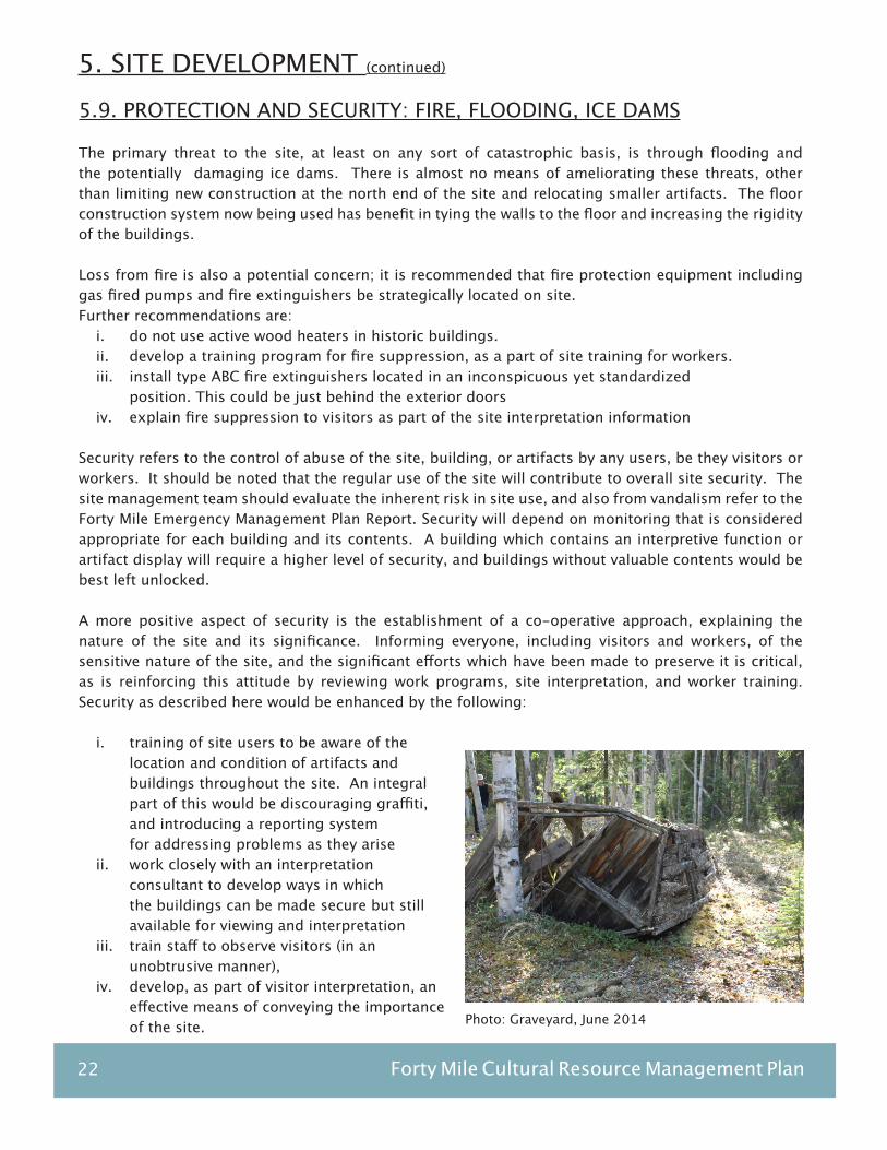
5.9. PROTECTION AND SECURITY: FIRE, FLOODING, ICE DAMS
The primary threat to the site, at least on any sort of catastrophic basis, is through flooding and the potentially damaging ice dams. There is almost no means of ameliorating these threats, other than limiting new construction at the north end of the site and relocating smaller artifacts. The floor construction system now being used has benefit in tying the walls to the floor and increasing the rigidity of the buildings.
Loss from fire is also a potential concern; it is recommended that fire protection equipment including gas fired pumps and fire extinguishers be strategically located on site. Further recommendations are:
i. do not use active wood heaters in historic buildings.ii. develop a training program for fire suppression, as a part of site training for workers.iii. install type ABC fire extinguishers located in an inconspicuous yet standardized position. This could be just behind the exterior doorsiv. explain fire suppression to visitors as part of the site interpretation information
Security refers to the control of abuse of the site, building, or artifacts by any users, be they visitors or workers. It should be noted that the regular use of the site will contribute to overall site security. The site management team should evaluate the inherent risk in site use, and also from vandalism refer to the Forty Mile Emergency Management Plan Report. Security will depend on monitoring that is considered appropriate for each building and its contents. A building which contains an interpretive function or artifact display will require a higher level of security, and buildings without valuable contents would be best left unlocked.
A more positive aspect of security is the establishment of a co-operative approach, explaining the nature of the site and its significance. Informing everyone, including visitors and workers, of the sensitive nature of the site, and the significant efforts which have been made to preserve it is critical, as is reinforcing this attitude by reviewing work programs, site interpretation, and worker training. Security as described here would be enhanced by the following:
i. training of site users to be aware of the location and condition of artifacts and buildings throughout the site. An integral part of this would be discouraging graffiti, and introducing a reporting system for addressing problems as they ariseii. work closely with an interpretation consultant to develop ways in which the buildings can be made secure but still available for viewing and interpretationiii. train staff to observe visitors (in an unobtrusive manner),iv. develop, as part of visitor interpretation, an effective means of conveying the importance of the site.
5. SITE DEVELOPMENT (continued)
Photo: Graveyard, June 2014

Keay & Associate, Architecture Ltd. / Robert M. Patterson & Associates 23
6.1. CHANGES TO EXISTING CONSTRUCTION
It is appropriate to determine which alterations, if any, to original construction techniques and materials are beneficial. Refer to 3.2 the Standards & Guidelines. Generally, if there is any doubt as to the benefits of changing the existing construction, the change should not be made. Any changes to original construction techniques should be based on the following:
i. contemplate changes only after a thorough recording of original/as found conditionsii. make changes visually unobtrusiveiii. improvement in life cycles, through better moisture control, increased air flow/ movement etc.iv. reversibility of the processv. use of sympathetic materials, readily availablevi. consideration of the status of the building, for instance the NWMP building would have more frequent reviews of its conditions and more active maintenance program then for example the Swanson Store which has been extensively reconstructed. vii. review of traditional construction practices, such as roof overhangs, types of log joints, log handling and finishing techniques.viii. document any changes to the building, prior to undertaking the work, during the work and after the work.ix. Thorough research of all building elements, including reviewing finishes and building fabric, including windows, doors and hardware.
At the same time, there are certain design parameters which will influence the restoration process:i. it has been assumed that the buildings will be used seasonally ii. foundation design should accommodate permafrost and flooding conditions. iii. handicapped access is to be provided where feasible. iv. continue research into archival photographs and building use.
6. METHODOLOGY
24 Forty Mile Cultural Resource Management Plan
6.2. CONTEMPORARY CONSTRUCTION MATERIALS AND TECHNIQUES
Repair of building fabric will involve several issues. In order to lengthen the life cycle of materials used, choices may have to be made as to the extent to which the original form of construction will be followed. It should be noted in this regard that the ongoing repair and replacement of materials in a structure will inevitably result in damage, increased wear, and the loss of some of the historic fabric. On the other hand, a loss of historical accuracy through the use of modern building techniques will be offset by less frequent disruption of those original materials which remain. The decision as to whether to significantly change a structural system or architectural detail should be based on a clear analysis of the impact of the change on the building’s value as an archival resource.
6.3. BUILDING CODE COMPLIANCE
Given the remote location, Building Code compliance is to be expected only where feasible including handicapped access and structural integrity.Resolution of particular Code issues may well depend on occupancy, staff presence on site, and interpretation requirements. It is appropriate to clarify and resolve the approach to be taken to overall Code issues.
6.4. FUTURE WORK ON THE SITE
As part of the commentary regarding recommendations for individual buildings, it should be noted that future work will move beyond structural rehabilitation and involve more detailed elements. For example, this has started with the rebuilding of windows and doors. With the view of historical accuracy in mind, care is needed in the research, design, construction, installation, and finishing of these features.
As part of this, more accurate recording of work which is being done, and of existing conditions prior to starting work. It may be appropriate that a heritage consultant be engaged to review issues such as colors, doors, windows, and hardware. This would apply in particular if interior restoration is involved, or if the reconstruction of a major exterior element is contemplated.
6. METHODOLOGY (continued)
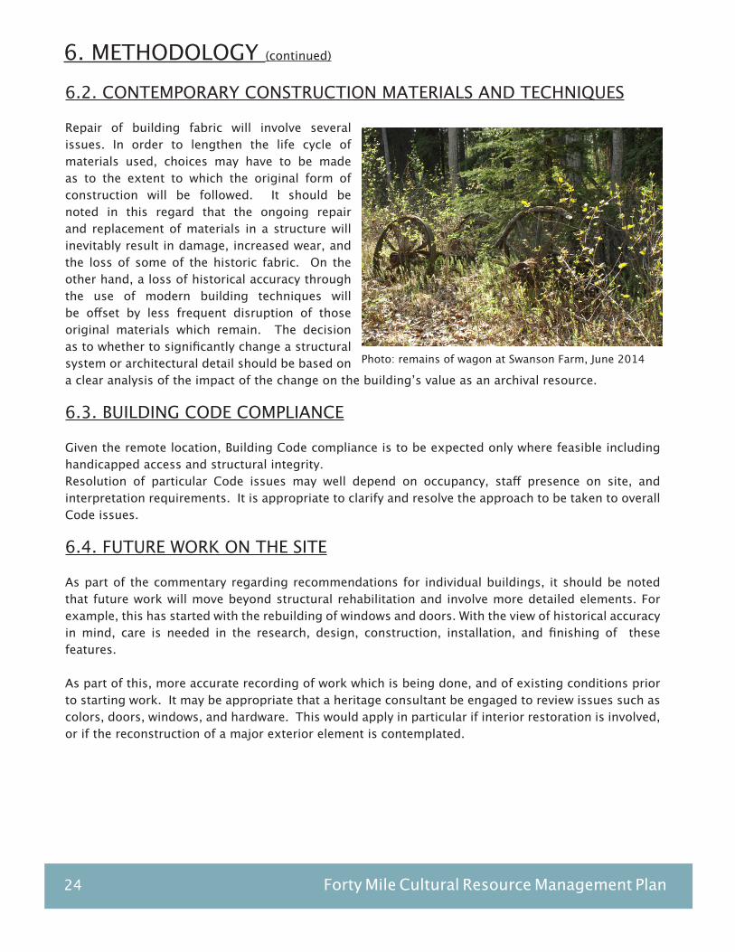
Photo: remains of wagon at Swanson Farm, June 2014

Keay & Associate, Architecture Ltd. / Robert M. Patterson & Associates 25
Photo: Building 7, the ACC Cabin and tent frames, June 2014
6. METHODOLOGY (continued)
6.5. MAINTENANCE GUIDELINES
The intent of a maintenance program is to provide predictability in ongoing work programs and funding requirements. If this is correctly implemented, crisis situations and patch up repairs should, for the most part, be avoided. Generally speaking, this will depend on two factors - ongoing visual examination of the site by those that are working in it, and periodic reviews by people trained in building conservation techniques. In the former instance the operators of the building can be trained to observe the site and to report any signs of change or deterioration; this would be based on a checklist. Periodic reviews and sampling of particular components, on an annual basis, would indicate developing problem areas. Generally speaking, the roles on site will tend to require a closer relationship between the initial stabilization of the buildings, and a new curatorial role, responsible for site and artifact management.
It is important to note that regular preventive maintenance and preservation is far more cost effective than crisis management of problems which suddenly, and inevitably, appear. Even now, as the restoration and stabilization of the site is being undertaken, this maintenance function should become continuous, with a regular program of inspection and repair. It is recommended that the approach taken provide for regular inspections as the basis for necessary maintenance. To be successful, this program should be performed by someone who is familiar with the site, with the work carried out to date, and who is committed to the site on an ongoing basis.
The implementation of proper maintenance procedures is no less skilled than restoration work, and should be viewed in the same context. The use of unskilled workers or inappropriate repair techniques can seriously affect the accuracy and durability of work already done and can lead to more frequent repair cycles. The objectives of a maintenance program have been defined by the Department of the Environment in England as: to keep, restore, or improve every facility in every part of a building, its services and surroundings to an acceptable standard and to sustain the utility and value of a facility. Photo: Graveyard, June 2014
26 Forty Mile Cultural Resource Management Plan
They go on to state that the main points in achieving this are as follows:
i. the amount of funding available for maintenance will influence the standards to be set, and the amount of work that can be successfully undertakenii. the acceptable standard may alter over the life of the building, which may in turn alter the amount of maintenance work which is requirediii. efficiency in the execution of maintenance work depends on correct diagnosis, followed by effective remedies performed with good workmanship and guided by good managementiv. maintenance is divided into planned and unpredictable work, the former being divided into preventive and corrective maintenance, while the latter could be defined as emergency maintenance. The less emergency maintenance, the better the maintenance plan.v. adequate records and data should be kept to allow forecasting of budgetary and task requirementsvi. maintenance should involve everyone connected with the site: maintenance management, supervisors, and workersvii. it must be accepted that more rather than less work is necessary if the value and amenity of a cultural property is to be maintained
6.6. INSPECTION PROGRAM
Inspection relies on a variety of people to be successful, with regular inspections by staff according to their knowledge and competence. Of primary importance is a custodian, locally based, who can examine the site on a regular basis and document any problems. This role could be assisted by interpretive and/or cleaning staff, who would be trained to routinely examine all buildings and their surroundings during their normal course of duty. These regular inspections should culminate in a full professionally based inspection every five years.
An inspection program would include the following:1. daily
-security check of site-check of any wood stoves, fires-ask staff for indications of any problem areas-check any areas specifically where work is in progress
2. weekly-broom clean cabins and buildings-check signage, display material-check fire equipment
3. monthly-check buildings for water leakage or damage-fire training and drill-test security systems-window glass cleaning and inspection
6. METHODOLOGY (continued)
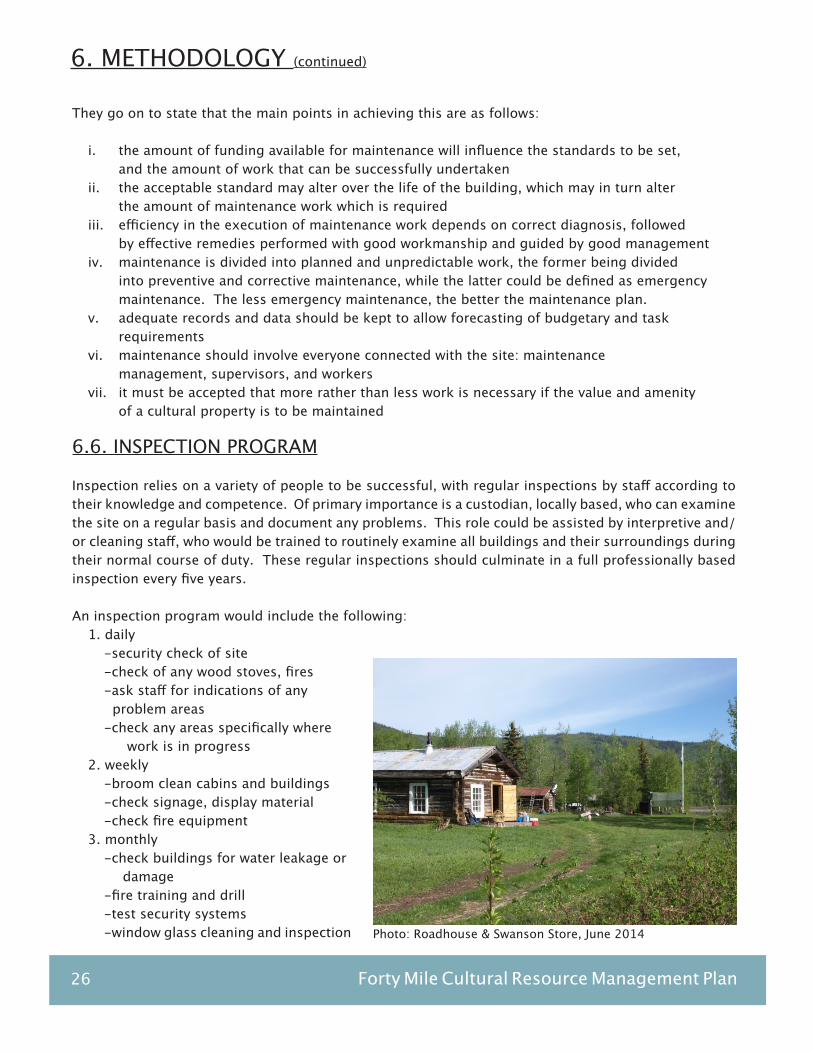
Photo: Roadhouse & Swanson Store, June 2014

Keay & Associate, Architecture Ltd. / Robert M. Patterson & Associates 27
Photo: NWMP Post, Archival Photo 1972
4. annually-recharge fire extinguishers as necessary-examine all exterior materials, touch up or place on work program as required-thoroughly examine the interiors of all buildings-examine any temporary repairs, such as plastic window films. Replace or repair as necessary-complete maintenance log, review inspections reports-confirm any work has been documented with photographs and a written description-develop a work program for the year following
5. every 5 years-professional inspection
6.7. REPAIR PROCEDURES
As mentioned, repair is no less skilled a task than the original restoration, requiring a clear understanding of the concept, as well as the reasons for the repair and the technical skills to carry it out. The extent and scope of a repair should thus be clearly defined and understood by the person who is to do the work. Beyond this, the worker, once given responsibility for a repair, should document the actual extent of the work, and should in particular itemize any other related problems or any aspects of the repair which do not seem to have been successful. Thus the worker who is doing the work contributes to the condition assessment of the building, and where problems are likely to occur. The procedures for maintenance may seem complicated and expensive, however it should be noted that the objective is to maintain the site in good condition, with its historic values intact.
Specific recommendations include:i. Collect and store galvanized metal panels for re-use on existing buildingsii. Remove grass and soil build up around buildings on a regular basisiii. Inspect stoves and chimneysiv. Provide drainage for spring run off as required
6. METHODOLOGY (continued)
Photo: Swanson Cabin, June 2014

28 Forty Mile Cultural Resource Management Plan
7. BUILDING DOCUMENTATION
This report, with its accompanying documentation, provides an overall framework for working with the buildings. Reference should be made to the Standards and Guidelines for the Conservation of Historic Places in Canada, which has been summarized in Section 3.
In any building analysis, the following are usually taken as a basis for decision making
i. restoration time frameii. comprehensive photo archive: which assists in making decisions regarding restoration and interpretation. iii. framework for use: the intensity of use will directly affect wear of components, particularly doors and flooring materials, and more intensive use will require more frequent maintenance and replacement of these items. iv. concept for protection v. present (as found) condition: current condition of both the original structures and any additions and changes, will impact all aspects of restoration and use. Decisions as to the retention or replacement of building components, and how these will be explained and interpreted in the context of both the original and restored building, will result largely from the condition of the building at the time stabilization is done.
In assembling information for the analysis, the process has been:i. review and photograph the buildings and site over a period of several days in June, 2014. Current photographs of the buildings taken in a digital format, and selected for a general overview, architectural features and details, details of reconstruction where appropriate, and potential problems of stability or maintenance ii. The YTG photo archives were reviewed, and relevant photographs are either referenced or incorporated into the report. Research should continue into other sources for archival photographs iii. The 1972 YWS drawings were used as base drawings, with changes made to illustrate current conditions. The drawings were then scanned and the information put onto an updated drawing and rescanned.iv. Clarifying the naming system for each building In identifying the buildings, there are at least four systems in use. In the report, each structure has all descriptors noted in the individual building files. The building name tends to be the most usual means of identification:
a. by number, per the 1972 Yukon Waterways Surveyb. by name, per “Forty Mile Townsite Recording Project and Concept Plan”, Bruce Barrett 1986c. by number, the archeological study: “Inventory of Standing, Partially Collapsed, and Collapsed Buildings at Forty Mile”, T.J. Hammer, 2002d. by number, the Yukon Heritage Sites Inventory database

Keay & Associate, Architecture Ltd. / Robert M. Patterson & Associates 29
v. Collate the existing maps for the site, and combine the most pertinent. There is a variety of maps for the site, including:
a. management plan: Building remains, pg 27b. management plan: interpretive trails, pg 90c. townsite survey: no dated. townsite survey with archeological informatione. Forty Mile Townsite, YG Historic Sites Unitf. Forty Mile and environs, showing settlement lands
There is also a comprehensive bibliography, “The Forty Mile Bibliography” compiled by Helene Dobrowolsky in 2002.
It is recommended that a library of historic photographs, copies of archival maps, and some current books, photographs, and reports,be kept in a supervised location accessible to visitors and Tr’ondek Hwech’in First Nation staff. This would provide a resource for more accurate decision making regarding restoration/reconstruction, and for visitors who wish to understand the site in greater detail.
Photo: NWMP Post Building and Telegraph Station, June 2014
7. BUILDING DOCUMENTATION (continued)

30 Forty Mile Cultural Resource Management Plan
CEMETERY AND GRAVE SITE STABILIZATION GUIDELINES
8. APPENDIX

- 1 -
CEMETERY AND GRAVE SITE STABILIZATION GUIDELINES Prepared by Yukon Government Historic Sites Unit Introduction The Yukon has many remote cemeteries and gravesites that, while potentially very significant, have deteriorated over the years and are in need of preservation. This guide has been produced to assist interested groups and individuals to plan and carry out successful stabilization projects on these important links with our past. In many cases a few simple activities can make a big difference in slowing the rate of deterioration in a cemetery or gravesite. For example, brushing a site out and removing overhanging trees will lower the moisture level in the wooden graves and prevent damage from the inevitable windfalls. Another benefit from this is that graves that appear to be tended are less likely to be robbed or vandalized. In most cases, stabilizing a gravesite or cemetery means working on structures, such as headstones, wooden fences, grave houses and monuments. When activities go beyond those outlined above into physical intervention, where delicate structures could be permanently altered, it becomes essential to record the resource and plan the steps to be taken for its preservation. The procedures outlined below will help the reader to understand and implement the most effective and appropriate stabilization measures, in the proper sequence. If possible, seek the advice of a professional conservator before any intervention to historic material. All interventions should respect the Standards and Guidelines for the Conservation of Historic Places in Canada: http://www.historicplaces.ca/en/pages/standards-normes.aspx. General guidelines for conserving culturally sensitive places can be found in Section 4.3.8 on page 123 of this document. Site Recording Site recording should be done first, unless the area to be recorded is so overgrown that the graves themselves are hidden. In this case some minimal brushing out can be done, but no tree removal. The idea is to provide a view of the graves, with a minimum of site disturbance. Equipment 1) Digital Single Lens Reflex cameras of at least 6 megapixel resolution, with wide angle zoom
lenses (28 mm or wider to 80mm) are recommended for their ability to work effectively in low light, and to produce detailed, low noise images. Note: digital files are not an adequate means of archival storage of grave photos. Ensure that important photos are printed on archival quality paper. As well, ensure that all digital files have been backed up to a remote site.
2) Electronic flash and a sturdy tripod. Built in flash units may be acceptable for smaller areas. The
lighting conditions are often poor in heavily treed areas. 4) Clipboard and pad. A careful record of all photos must be made including the name and/or for
number of the grave and direction of view, i.e. northwest corner. 5) Large dimension grid paper for drawing a rough site map, and a backing for the paper, i.e. stiff cardboard or 1/4" plywood. If a larger drawing surface is not available, a larger plan can be broken up into smaller components and tied to a smaller scale key plan.
- 2 -
6) Tape measures. A 30 m (100') tape is required for the overall dimensions of the site and a
smaller 5 m tape can be used for shorter distances, such as grave dimensions and the spaces between graves.
7) Stepladder (optional). This can be handy for general site shots, photos in crowded areas and
other difficult picture taking situations. Procedure 1) Plot the cemetery, or gravesite. It is best to try to get the whole cemetery on one sheet of paper if
possible. Assign a scale to the gridded paper that is appropriate to the size of the site. For example, if the area to be plotted measures 20m by 30m and there are 25 x 35 squares on the paper, then the scale would be, one square equals one metre. If the squares are much smaller, e.g. 50 x 70 squares on a sheet, then the length of two squares could equal one metre. The squares are a known size, e.g. 1" or 1 cm., from which the scale is derived. First, measure the outside dimensions of the site and plot them, including any natural features of note, including large trees, rock outcrops, and escarpments etc. Remember to include the location, an arrow to indicate north, the scale, the date and names of those doing the measuring and mapping. Next, draw in the graves in their approximate locations. If there is room, note the type of grave, e.g. single, double, picket fence, with or without headstone and so on. For convenience, use a key, where different symbols can represent grave types.
2) Assign numbers to the graves. If they are laid out in rows, this is fairly simple, but if they are not,
it is important to be as systematic as possible. It is often easiest to draw up the site plan and then assign the numbers to the graves on the plan. Then the graves can be numbered based on the plan. The graves should have numbers put on them, ideally with stamped aluminum or stainless steel tags attached with copper or stainless steel wire. These are available at any locksmith services.
3) Take photographs of the graves and the gravesite or cemetery as a whole, including prominent
natural features. Take four photos, one at each corner of the grave. Use the highest resolution available on the camera. Take one photo of any monument or totem. If the grave only consists of a monument, two photos will do. If the fence or house has collapsed, take two photos from opposite corners. A few shots should also be taken of the general area. Remember that a new set of photos should be made after stabilization.
Hints: When photographing collapsed remains of fences or grave houses, use a wide-angle view and try to look down on the subject as much as possible when photographing it. This will provide the most information. A ladder is useful. Photograph any important details close up.
Try to avoid pointing the camera into the sun or photographing when there are strong shadows.
Ways to overcome this problem include: shooting on cloudy days (but not heavy overcast) or shortly after the sun has set; using a flash to fill in the shadows; using a lens hood and your hand to shade the lens from the sun; or shooting around noon, when the sun is high.
Experiment with the camera to obtain the best exposure, colour balance and composition.
Practice with the camera before you are in the field! When framing the subject, always leave a margin around the edges. The processors usually cut
off the edges of photographic prints.
- 3 -
4) Describe condition of graves. This applies to aspects of condition not indicated in the
photographs, such as the buried parts of fences, the sturdiness of structure, the degree of rot, special problems, and so on. This record is an important supplement to the photos. If possible, prepare a sketch of the graves showing all of their components including dimensions. Record the height, width, length and component dimensions, including posts, pickets, headboards, windows (if applicable), monuments and totems. Notes regarding condition can often be put on the same sheet as the sketches, with arrows to indicate the part of the grave being referred to.
5) Assemble information. Prepare two duplicate sets of information in binders, one set for project
use, ongoing maintenance, and as a permanent record and the other set as a backup copy to be kept for safekeeping at an archival institution. Include digital records on high quality DVDs in both set. Use numbered dividers with tabs for each grave. Include pre and post-stabilization photos (placed in archivally permanent sleeves and captioned), the descriptions and the dimensioned sketch. At the front of the binders, include a copy of the site map, which will show all the numbered graves. A short project description should also be prepared including the date, location, personnel, project goals, time frame, sponsors and so on. Notes on stabilization activities should also be included (see Post Stabilization Recording).
Stabilization Planning 1) Planning for any stabilization project should be driven by broadly based input from the
community, including descendants. For example, it may well be that intensive intervention with full restoration of graves would be felt to be too intrusive, and that minimal stabilization would be more appropriate. The research phase of the project should include the opportunity for community and stakeholder input.
2) Based on available labour, resources and time, determine what level of intervention can
realistically be carried out. Remember that removal of brush, site recording and camp set-up (if applicable) are all activities to be completed before the actual business of grave stabilization can start.
Common sense should be used when planning a project so that the amount of work and the
difficulty of that work do not exceed the capabilities of the available workers. When in doubt about being able to handle a given grave, delay work on it until near the end of the project. This will allow the crew to gain skills during the project that can be put to use on these more difficult graves. Delaying the work will enable the project supervisor to decide whether preservation of a particular grave is within the capabilities of the crew.
3) In most cemeteries, the condition of graves can vary from excellent, with all features in sound
condition, to very poor with few traces remaining. Between these extremes there are the graves which would most benefit from stabilization or restoration. The graves should be evaluated, put into categories and strategies devised for the treatment (or non-treatment) of each one. Put together, these strategies form the stabilization plan, which is used to determine the approximate time, money and crew requirements for the project.
The graves can be classified as follows:
Type A These graves are complete, reasonably sound, structurally and free of rot above the ground.
The range of treatments for these graves includes application of the correct solid colour stain
(more on this subject to follow), replacement of below grade components of fence posts and

- 4 -
reattachment or consolidation of corner posts, pickets etc. Type B These graves are in poorer condition and may be partly or completely collapsed, may be
missing elements and may show substantial deterioration through weathering, rot, vandalism animal or insect attack. Parts of the grave fence may be scattered around.
Basic treatment for these graves could be to stand them up if they have collapsed and, where
there is no doubt about their layout or which components belong to which grave, reassemble them. It is better to leave the graves untouched than to guess about how they should be reassembled. In situations where the fences cannot be reassembled, any remaining pieces should be raised off the ground slightly by placing them laid out flat on pressure treated wood 2"x4" as close as possible to their original locations. This will allow them to dry out, which will slow the deterioration process. If they are already quite rotten, there is no point in moving them and they should be left as is. Copper or stainless steel wire can be used for temporary reassembly of the fences. Stainless steel or brass screws should be used for permanent reassembly. If there are missing fence components, one option is to replicate them using existing pieces as models. If the existing fence is very weathered, placing new pieces alongside old ones creates a visual imbalance. In this case, replacement is not recommended unless it is required for the structural integrity of the grave.
At this point, the decision must be made whether to stain the reassembled fence. If there is absolutely no trace of colour on the wood, it was probably never painted and should be left bare.
If there are traces of white, the wood may be stained with a solid colour, linseed oil based stain such as Olympic brand Outside White. If there is evidence of colours other than white, a sample should be analysed to determine the appropriate stain colour to use. Many paint suppliers have equipment that can duplicate paint colours accurately. Clean the sample and wet it prior to analysis for a more accurate reading. The sample taken should be from the most protected area to be found, for example under a horizontal surface or in a crack. Samples should be between 1 and 3 square centimeters in size. Graves were often painted two or more colours, so a careful check of different areas of each grave is important. A close look at the paint samples should reveal whether there was more than one coat of paint, and in which order the colours were applied. The earliest layer of paint is usually the one to be duplicated, but on-site judgment is needed to make the most appropriate choices. Care must be taken at this point not to remove evidence during the too aggressive preparation of the surface for painting/staining.
New paints used should be kept on sample boards for future reference, as paint colour names,
formulas etc. can change over time. Wooden grave markers may have new bases spliced onto them, be treated with preservative and
put back into the ground. Metal grave fences, if significant rust is present, should be wire-brushed, painted with rust preventative primer and painted the original colour. Softer, non-ferrous metals should be brushed with a softer brush, with brass or bronze bristles. Cleaning of the surface will then be required prior to painting. Samples of the original paint, if any, should be kept with the recording information. Again, if there are no paint traces on the fence, it was probably never painted and should remain that way. Stone conservation is a very complex subject. There are various problems that can occur with stone and many different possible solutions. Before attempting to repair stone monuments, advice should be sought regarding the most appropriate techniques.
Type C Graves in this condition could be described as a jigsaw puzzle still in the box, missing a
few pieces. Most components are still in the area, but their condition does not allow them to be reassembled because of severe deterioration. Careful judgment is called for in determining if a

- 5 -
grave can be reassembled or whether it should just be recorded and left alone. A failed attempt at preservation is worse than benign neglect because it removes the last clues as to what the grave was like, and it can harm the fragile link with the past that undisturbed cemeteries provide. Another option is to use the existing material as a template for reproducing the grave. The decision to undertake something of this scope would be affected by the conditions of the surrounding graves or the desire for a specific end result in the particular graveyard.
Type D These are graves with no or virtually no remaining fence, or marker, which may only be
visible due to a mound or depression. The most common treatment of these graves is installation of some kind of monument, marker or fence or combination, as is appropriate for compatibility with the rest of the cemetery.
Post Stabilization Recording After any form of intervention, a photo record should be made of all changes. A brief written record of the work done to the site and to individual graves should also be included in the report. A list should be made of the paints or stains used on each grave (including creation of sample boards), what type of glues might have been used, and so on. In order to facilitate future maintenance, good records of the work must be made. Continuing Maintenance Once a cemetery or gravesite has been stabilized, the most important action to be taken to ensure its long-term preservation is regular maintenance. This involves keeping the site clear of vegetation and litter, removing fallen trees, reapplying stain, monitoring the sturdiness of grave fences, replacing broken window panes and so on. It should occur at least on an annual basis. It has been shown that maintenance involves less work and expense than the alternative, which are periods of neglect followed by large stabilization projects. Rigorous maintenance reduces long term costs as well as the frequency of major interventions. Any intervention at a historic place is going to be intrusive. Finally, any efforts to preserve these sites will at best delay the inevitable disappearance of the original structures. When they ultimately return to nature, we must rely on the quality and completeness of our recording techniques to enable the accurate reconstruction of those graves that we wish to retain. As well, a record of our cultural resources is an important tool for understanding our past. Government Assistance The Historic Sites Unit of the Government of Yukon makes financial and technical assistance available to groups and individuals involved in heritage preservation through the Historic Properties Assistance program. Once the scope of the project is known, application can be made for matching funding under this program. For further information contact: Historic Sites Project Officer Historic Sites Unit, Department of Tourism & Culture Box 2703 Whitehorse, YT Y1A 2C6 (867) 667-3463 Fax (867) 667-8023 Email: [email protected]
08/88 Rev. 06/93 Rev. 09/09 Rev. 09/13