foundations of earth science - login · pdf filefoundations of earth science ... •shake...
TRANSCRIPT
© 2014 Pearson Education, Inc.
Restless Earth: Earthquakes, Geologic Structures, and Mountain Building
Chapter 6 Lecture Outline
Natalie BursztynUtah State University
Foundations of Earth ScienceSeventh Edition

© 2014 Pearson Education, Inc.
Focus Question 6.1
• What is the mechanism that generates large earthquakes?
© 2014 Pearson Education, Inc.
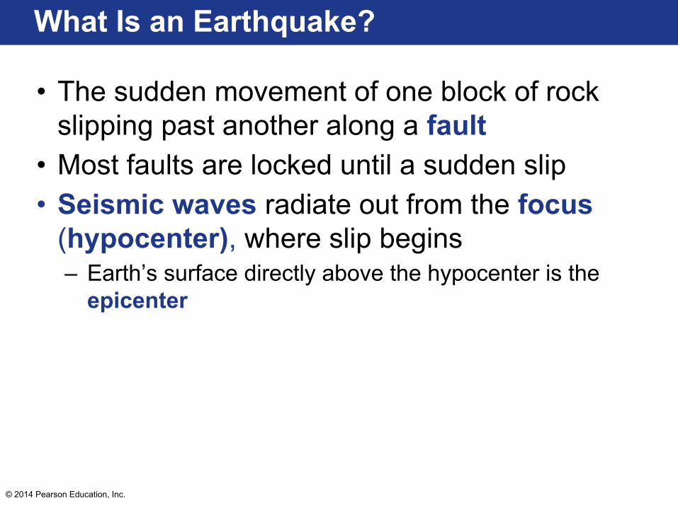
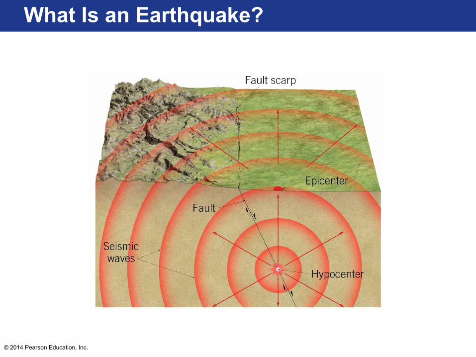
What Is an Earthquake?
• The sudden movement of one block of rock slipping past another along a fault
• Most faults are locked until a sudden slip• Seismic waves radiate out from the focus
(hypocenter), where slip begins– Earth’s surface directly above the hypocenter is the
epicenter
© 2014 Pearson Education, Inc.
What Is an Earthquake?

© 2014 Pearson Education, Inc.
What Is an Earthquake?
• Weak earthquakes can be generated by – Volcanoes, landslides, and meteorite impacts
• Destructive earthquakes occur because tectonic motion builds up stress– Friction keeps the fault from slipping– Slip initiates when stress overcomes friction– Elastic rebound causes deformed rock to spring
back to undeformed position

© 2014 Pearson Education, Inc.
What Is an Earthquake?

© 2014 Pearson Education, Inc.
What Is an Earthquake?
• Transform faults have many branches and fractures– Offset occurs in distinct segments
• Some segments displace slowly with little shaking during fault creep
• Some segments produce numerous small earthquakes• Some segments are locked for hundreds of years and
rupture in large earthquakes– Earthquakes occur in repetitive cycles– Rupture propagates in a discrete time period

© 2014 Pearson Education, Inc.
What Is an Earthquake?
© 2014 Pearson Education, Inc.
What Is an Earthquake?
• Convergent plate boundaries generate compressional forces– Mountain building and faulting associated with large
earthquakes– Subducting plates form a megathrust fault
• Produce the most powerful earthquakes • Vertical motion underneath the ocean generates tsunamis

© 2014 Pearson Education, Inc.
What Is an Earthquake?
• Are there any local faults? If so, what type are they?
• Have you ever experienced an earthquake? If so, describe it.
© 2014 Pearson Education, Inc.
Focus Question 6.1
• What is the mechanism that generates large earthquakes?– Stress (from movement of tectonic plates)
accumulates in a block of crust until it overcomes frictional resistance and slip occurs
– Seismic waves propagate out from the hypocenter

© 2014 Pearson Education, Inc.
Focus Question 6.2
• What are the different types of seismic waves?
© 2014 Pearson Education, Inc.
Seismology: The Study of Earthquake Waves
• The study of earthquake waves is known as seismology
• Waves are measured by seismometers– Intertia keeps a weighted arm from moving
while ground motion moves the instrument– Amplifies ground motion– Generates seismograms

© 2014 Pearson Education, Inc.
Seismology: The Study of Earthquake Waves

© 2014 Pearson Education, Inc.
Seismology: The Study of Earthquake Waves
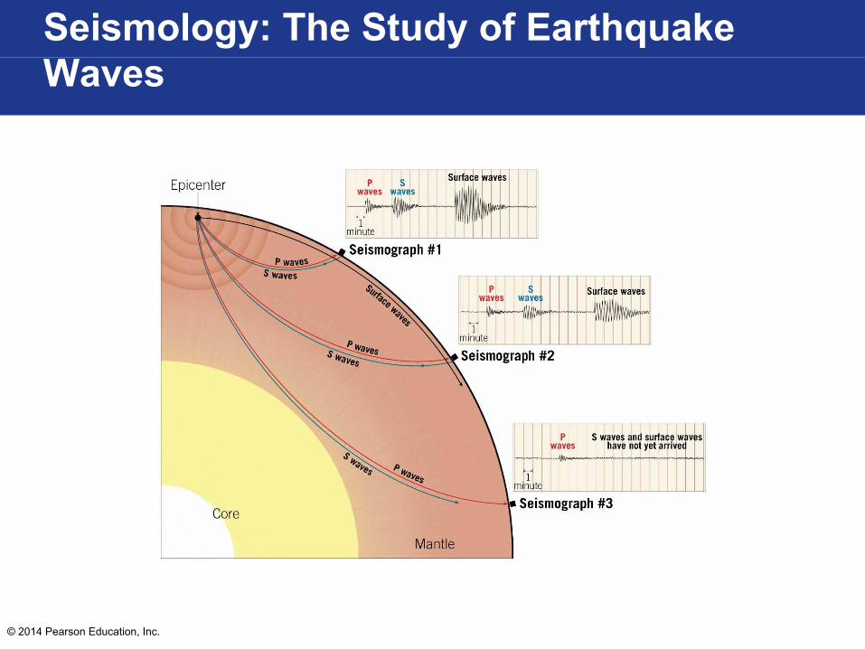
• Two main types of seismic waves generatedby earthquakes:– Surface waves travel in rock layers just below
Earth’s surface– Body waves travel through Earth’s interior
© 2014 Pearson Education, Inc.
Seismology: The Study of Earthquake Waves

© 2014 Pearson Education, Inc.
Seismology: The Study of Earthquake Waves
• Two types of body waves:– Primary or P waves
• Push/pull rocks in direction that wave is traveling• Temporarily change volume of material• Travel through solids, liquids, and gasses
– Secondary or S waves• Shake particles at right angles to direction that
wave is traveling• Change shape of material• Do not travel through liquids or gasses

© 2014 Pearson Education, Inc.
Seismology: The Study of Earthquake Waves
© 2014 Pearson Education, Inc.
Seismology: The Study of Earthquake Waves
• Two types of surface waves:– Some travel along Earth’s surface like rolling
ocean waves– Others move Earth materials from side to side
• Most damaging type of ground motion

© 2014 Pearson Education, Inc.
Seismology: The Study of Earthquake Waves
© 2014 Pearson Education, Inc.
Seismology: The Study of Earthquake Waves
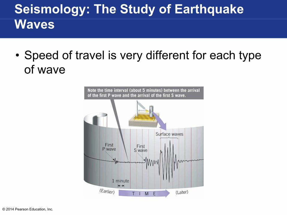
• Speed of travel is very different for each type of wave

© 2014 Pearson Education, Inc.
Focus Question 6.2
• What are the different types of seismic waves?– Surface waves travel at Earth’s surface and body
waves travel through the interior– Surface waves roll or move side to side– Body waves include P waves and S waves
• P waves travel faster and push/pull material• S waves move material from side to side
© 2014 Pearson Education, Inc.
Focus Question 6.3
• How are seismographs used to locate an earthquake epicenter?

© 2014 Pearson Education, Inc.
Locating the Source of an Earthquake
• P waves travel faster than S waves• Difference in arrival time is exaggerated by
distance– Greater interval between P and S wave arrivals
indicates greater distance to epicenter
• Seismographs can be used to triangulate the epicenter of an earthquake

© 2014 Pearson Education, Inc.
Locating the Source of an Earthquake

© 2014 Pearson Education, Inc.
Locating the Source of an Earthquake

© 2014 Pearson Education, Inc.
Locating the Source of an Earthquake
© 2014 Pearson Education, Inc.
Focus Question 6.3
• How are seismographs used to locate an earthquake epicenter?– Difference between P wave and S wave arrival time
increases with distance from epicenter– Multiple seismographs are used to triangulate the
epicenter

© 2014 Pearson Education, Inc.
Focus Question 6.4
• What scales are used to measure earthquakes?

© 2014 Pearson Education, Inc.
Determining the Size of an Earthquake
• Intensity measures the amount of ground shaking based on property damage– Used for historical records– Modified Mercalli Intensity Scale developed in
California in 1902• Magnitude is a quantitative measure of energy
released in an earthquake – Richter scale is related to the amplitude of the
largest seismic wave– Moment magnitude measures total energy released
based on amount of slide, area of rupture, and strength of faulted rock

© 2014 Pearson Education, Inc.
Determining the Size of an Earthquake

© 2014 Pearson Education, Inc.
Determining the Size of an Earthquake
© 2014 Pearson Education, Inc.
Focus Question 6.4
• What scales are used to measure earthquakes?– Intensity scales based on property damage
• Modified Mercalli Intensity Scale
– Magnitude scales based on measure of energy released
• Richter scale• Moment magnitude

© 2014 Pearson Education, Inc.
Focus Question 6.5
• What destructive forces are triggered by earthquake vibrations?

© 2014 Pearson Education, Inc.
Earthquake Destruction
• Magnitude and other factors determine degree of destruction
• Area 20-50 km surrounding the epicenter experiences equal shaking
• Ground motion diminishes rapidly outside of 50 km
• Earthquakes in stable interiors are felt over a larger area
© 2014 Pearson Education, Inc.
Earthquake Destruction
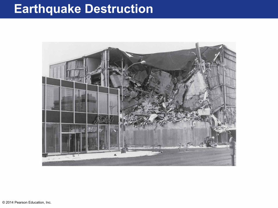
• Earthquake damage depends on:– Intensity– Duration– Nature of surface materials– Nature of building materials– Construction practices
• Flexible wood and steel-reinforced buildings withstand vibrations better
• Blocks and bricks generally sustain the most damage
© 2014 Pearson Education, Inc.
Earthquake Destruction
© 2014 Pearson Education, Inc.
Earthquake Destruction
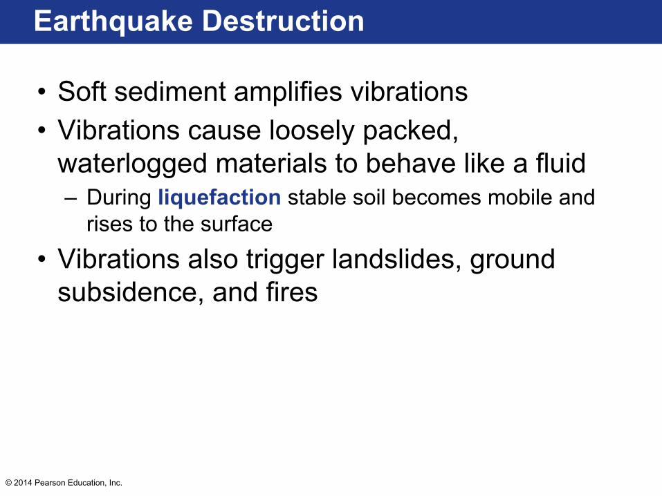
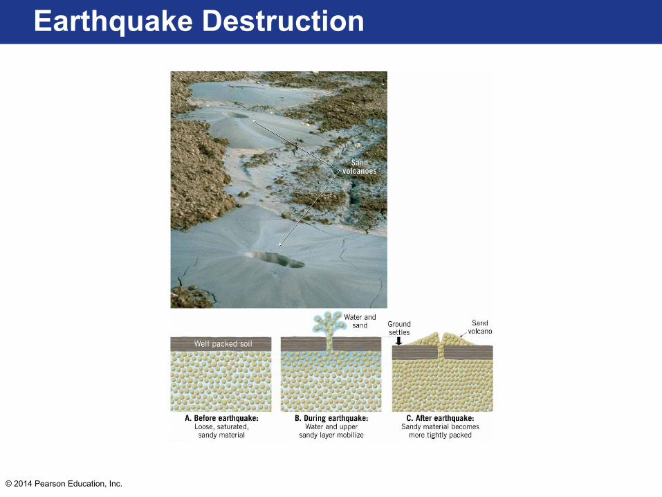
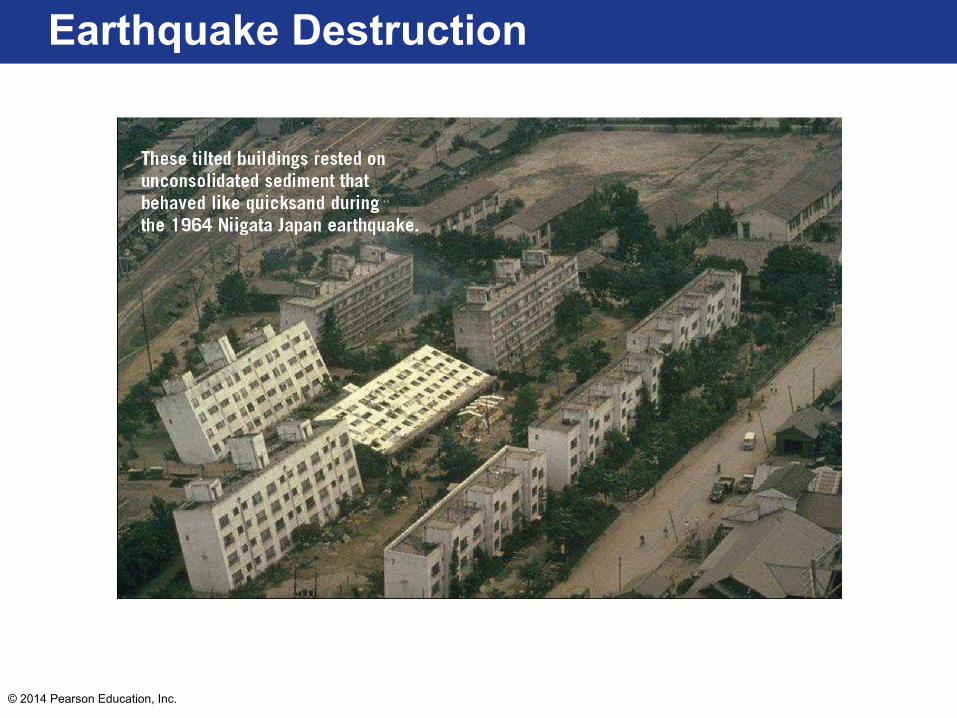
• Soft sediment amplifies vibrations• Vibrations cause loosely packed,
waterlogged materials to behave like a fluid– During liquefaction stable soil becomes mobile and
rises to the surface
• Vibrations also trigger landslides, ground subsidence, and fires
© 2014 Pearson Education, Inc.
Earthquake Destruction
© 2014 Pearson Education, Inc.
Earthquake Destruction

© 2014 Pearson Education, Inc.
Earthquake Destruction
• Megathrust displacement lifts large slabs of seafloor, displaces water, and generates a tsunami– Low amplitude wave travels at very high speed in
open ocean– Amplitude can reach tens of meters in shallow coastal
waters– Arrival on shore is preceded by a rapid withdrawal of
water from beaches, followed by what appears as a rapid rise in sea level with a turbulent surface

© 2014 Pearson Education, Inc.
Earthquake Destruction

© 2014 Pearson Education, Inc.
Focus Question 6.5
• What destructive forces are triggered by earthquake vibrations?– Ground motion– Liquefaction– Landslides– Ground subsidence– Fires– Tsunamis
© 2014 Pearson Education, Inc.
Focus Question 6.6
• Where are the major earthquake belts?

© 2014 Pearson Education, Inc.
Earthquake Belts and Plate Boundaries
• Circum-Pacific belt convergent boundaries experience 95% of earthquakes – Megathrust faults generate largest earthquakes
• Earthquakes along Alpine-Himalayan belt because of continental collision
• Weak earthquakes along oceanic ridge system because tension pulls plates apart
• Transform and strike-slip faults generate large, cyclical earthquakes

© 2014 Pearson Education, Inc.
Earthquake Belts and Plate Boundaries

© 2014 Pearson Education, Inc.
Focus Question 6.6
• Where are the major earthquake belts?– Subduction zones around the Pacific ocean– Alpine-Himalaya belt– Oceanic ridge systems
© 2014 Pearson Education, Inc.
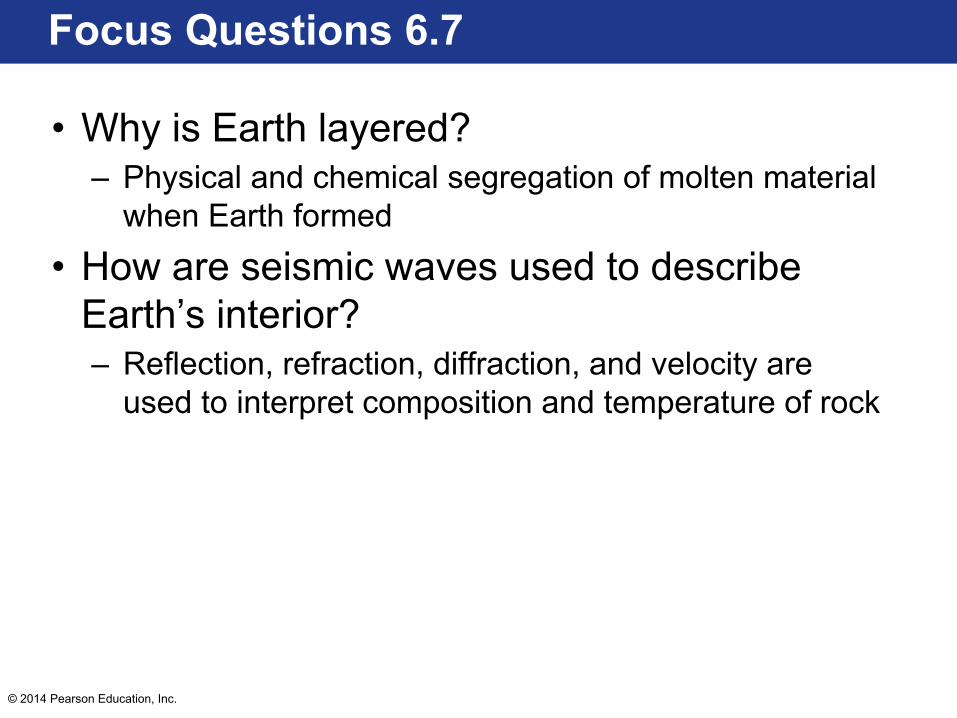
Focus Questions 6.7
• Why is Earth layered?• How are seismic waves used to describe
Earth’s interior?

© 2014 Pearson Education, Inc.
Earth’s Interior
• Earth has distinct layers:– Heaviest material at the center, lightest at top– Iron core, rocky mantle and crust, water ocean,
gaseous atmosphere
• Interior is dynamic– Mantle and crust are in motion– Material is recycled from surface to deep interior
© 2014 Pearson Education, Inc.
Earth’s Interior
• Temperature increased as material accumulated to form Earth– Iron and nickel melted and sank to the center to
produce iron-rich core– Buoyant rock rose to the surface and formed crust
rich in O, Si, and Al (+ Ca, Na, K, Fe, and Mg)– Chemical segregation led to iron-rich core, primitive
crust, and mantle

© 2014 Pearson Education, Inc.
Earth’s Interior
• Seismic waves are the only way to “see” inside the interior– Waves are reflected at boundaries– Refracted through layers– Diffracted around obstacles– Velocity increases with depth as stiffness and
compressibility of rock change• Can be used to interpret composition and temperature of
rock

© 2014 Pearson Education, Inc.
Earth’s Interior
© 2014 Pearson Education, Inc.
Focus Questions 6.7
• Why is Earth layered?– Physical and chemical segregation of molten material
when Earth formed
• How are seismic waves used to describe Earth’s interior?– Reflection, refraction, diffraction, and velocity are
used to interpret composition and temperature of rock

© 2014 Pearson Education, Inc.
Focus Question 6.8
• What is each of Earth’s layers like?

© 2014 Pearson Education, Inc.
Earth’s Layers
• Earth is divided into three compositionally distinct layers:– Crust– Mantle– Core
• Can be further subdivided into zones based on physical properties– Solid or liquid– Strength
© 2014 Pearson Education, Inc.
Earth’s Layers
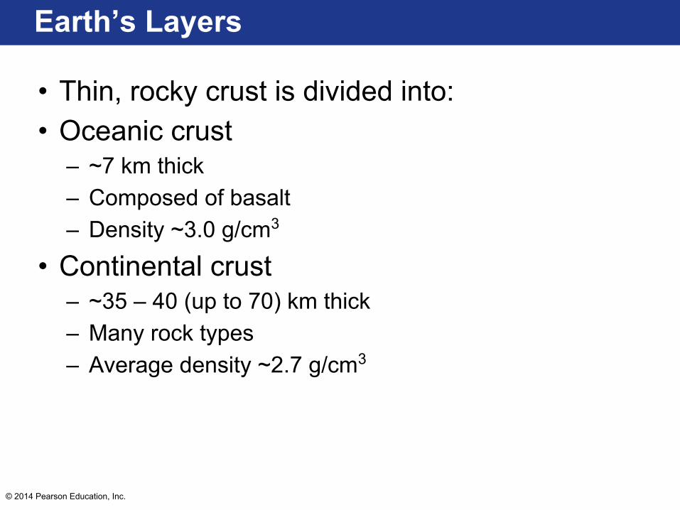
• Thin, rocky crust is divided into:• Oceanic crust
– ~7 km thick– Composed of basalt– Density ~3.0 g/cm3
• Continental crust– ~35 – 40 (up to 70) km thick– Many rock types– Average density ~2.7 g/cm3
© 2014 Pearson Education, Inc.
Earth’s Layers
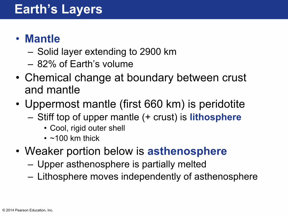
• Mantle – Solid layer extending to 2900 km– 82% of Earth’s volume
• Chemical change at boundary between crust and mantle
• Uppermost mantle (first 660 km) is peridotite– Stiff top of upper mantle (+ crust) is lithosphere
• Cool, rigid outer shell• ~100 km thick
• Weaker portion below is asthenosphere– Upper asthenosphere is partially melted– Lithosphere moves independently of asthenosphere
© 2014 Pearson Education, Inc.
Earth’s Layers
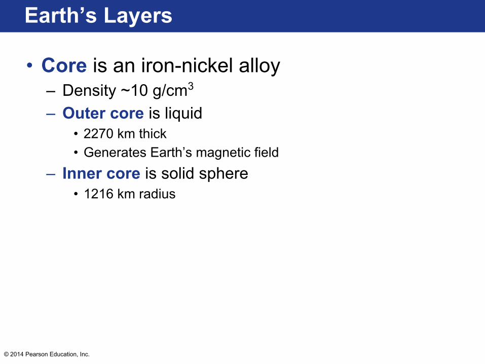
• Core is an iron-nickel alloy– Density ~10 g/cm3
– Outer core is liquid• 2270 km thick• Generates Earth’s magnetic field
– Inner core is solid sphere • 1216 km radius

© 2014 Pearson Education, Inc.
Earth’s Layers
© 2014 Pearson Education, Inc.
Focus Question 6.8
• What is each of Earth’s layers like?• Crust is thin, solid
– Oceanic (thin, basaltic) and continental (thicker, granodiorite)
• Mantle is solid• Crust + upper mantle = lithosphere• Core is divided into outer liquid and inner solid cores
© 2014 Pearson Education, Inc.
Focus Questions 6.9
• What is brittle deformation?• What is ductile deformation?

© 2014 Pearson Education, Inc.
Rock Deformation
• Deformation – All changes in shape, position, or orientation of a rock
mass– Bending and breaking occurs when stress exceeds
strength

© 2014 Pearson Education, Inc.
Rock Deformation
• Elastic deformation – Stress is gradually applied– Rocks return to original size and shape when stress is
removed– Ductile or brittle deformation occurs when elastic limit
is surpassed• Strength of a rock is influenced by temperature,
confining pressure, rock type, and time
© 2014 Pearson Education, Inc.
Rock Deformation
• Brittle deformation – Results in fractures– Common at/near surface
• Ductile deformation – Solid-state flow at great depths – Produces a change in the size and shape of a rock– Some chemical bonds break and new ones form
© 2014 Pearson Education, Inc.
Focus Questions 6.9
• What is brittle deformation?– Fracturing of rock when the elastic limit of a rock is
surpassed that occurs at or near the surface
• What is ductile deformation?– Change in the size and shape of a rock that occurs at
depth
© 2014 Pearson Education, Inc.
Focus Question 6.10
• What are the major types of folds?

© 2014 Pearson Education, Inc.
Folds: Structures Formed by Ductile Deformation
• Folds are wavelike undulations that form when rocks bend under compression
• Compressional forces result in shortening and thickening of the crust

© 2014 Pearson Education, Inc.
Folds: Structures Formed by Ductile Deformation
• Anticlines – Upfolded or arched layers
• Synclines– Associated downfolds or troughs
• Symmetrical – Limbs are mirror images
• Asymmetrical – Limbs are different
• Overturned– One or both limbs are tilted beyond the vertical
• Recumbant– Axis is horizontal

© 2014 Pearson Education, Inc.
Folds: Structures Formed by Ductile Deformation
• Circular or elongated upwarping structures are called domes– Upwarps in basement rocks deform overlying
sedimentary strata• Downwarping structures are called basins

© 2014 Pearson Education, Inc.
Folds: Structures Formed by Ductile Deformation
© 2014 Pearson Education, Inc.
Focus Question 6.10
• What are the major types of folds?– Anticlines, synclines, overturned, recumbent
© 2014 Pearson Education, Inc.
Focus Question 6.11
• What is the relative motion on normal, reverse, and strike-slip faults?
© 2014 Pearson Education, Inc.
Faults: Structures Formed by Brittle Deformation
• Faults – Fractures in the crust with appreciable displacement– Movement parallel to dip are dip-slip faults
• Rock surface above the fault is the hanging wall block
• Surface below the fault is the foot-wall block• Fault scarps
– Long, low cliffs produced by vertical displacement

© 2014 Pearson Education, Inc.
Faults: Structures Formed by Brittle Deformation
© 2014 Pearson Education, Inc.
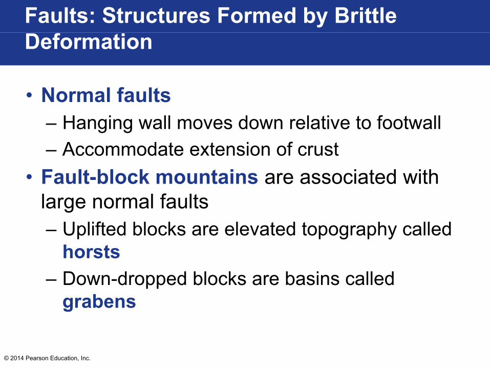
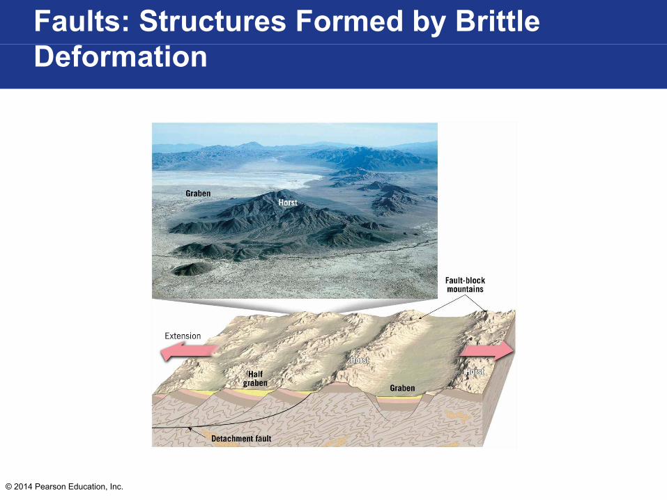
Faults: Structures Formed by Brittle Deformation
• Normal faults – Hanging wall moves down relative to footwall– Accommodate extension of crust
• Fault-block mountains are associated with large normal faults– Uplifted blocks are elevated topography called
horsts– Down-dropped blocks are basins called
grabens
© 2014 Pearson Education, Inc.
Faults: Structures Formed by Brittle Deformation

© 2014 Pearson Education, Inc.
Faults: Structures Formed by Brittle Deformation
• Reverse faults – Hanging wall moves up relative to footwall– Thrust faults
• Reverse faults with a dip of less than 45º– Result from compressional stress– Accommodate crustal shortening

© 2014 Pearson Education, Inc.
Faults: Structures Formed by Brittle Deformation
• A strike-slip fault – Exhibits horizontal displacement – Parallel to strike

© 2014 Pearson Education, Inc.
Faults: Structures Formed by Brittle Deformation

© 2014 Pearson Education, Inc.
Focus Question 6.11
• What is the relative motion on normal, reverse, and strike-slip faults?– Hanging wall block down relative to footwall
block = normal fault– Hanging wall block up relative to footwall
block = reverse fault– Horizontal displacement = strike-slip fault

© 2014 Pearson Education, Inc.
Focus Question 6.12
• Where are Earth’s major mountain belts?

© 2014 Pearson Education, Inc.
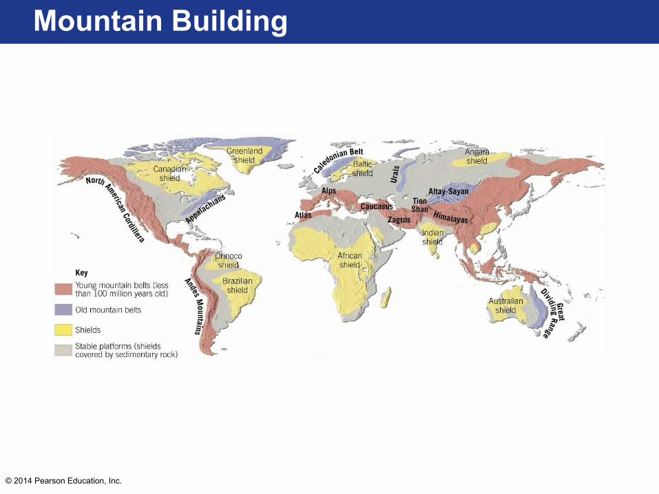
Mountain Building
• Orogenesis is the set of processes that forms a mountain belt
• Older mountain chains are eroded and less topographically prominent
• Compressional mountains – Large quantities of preexisting sedimentary and
crystalline rocks that have been faulted and folded
© 2014 Pearson Education, Inc.
Mountain Building

© 2014 Pearson Education, Inc.
Focus Question 6.12
• Where are Earth’s major mountain belts?– Young mountain belts at convergent boundaries

© 2014 Pearson Education, Inc.
Focus Question 6.13
• What are the major features of an Andean-type mountain belt and how are they generated?
© 2014 Pearson Education, Inc.
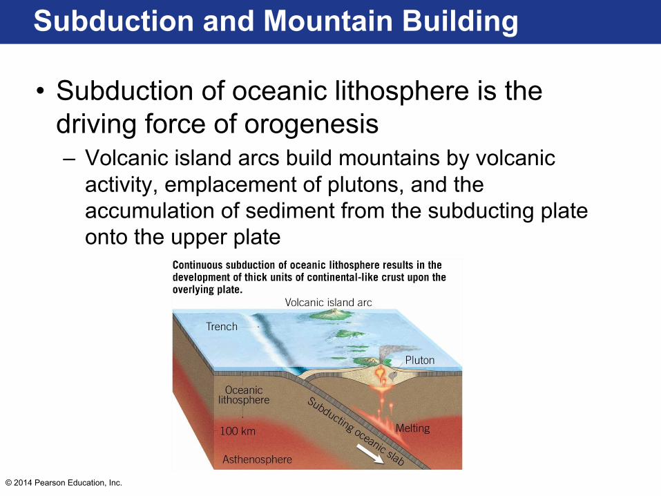
Subduction and Mountain Building
• Subduction of oceanic lithosphere is the driving force of orogenesis– Volcanic island arcs build mountains by volcanic
activity, emplacement of plutons, and the accumulation of sediment from the subducting plate onto the upper plate
© 2014 Pearson Education, Inc.
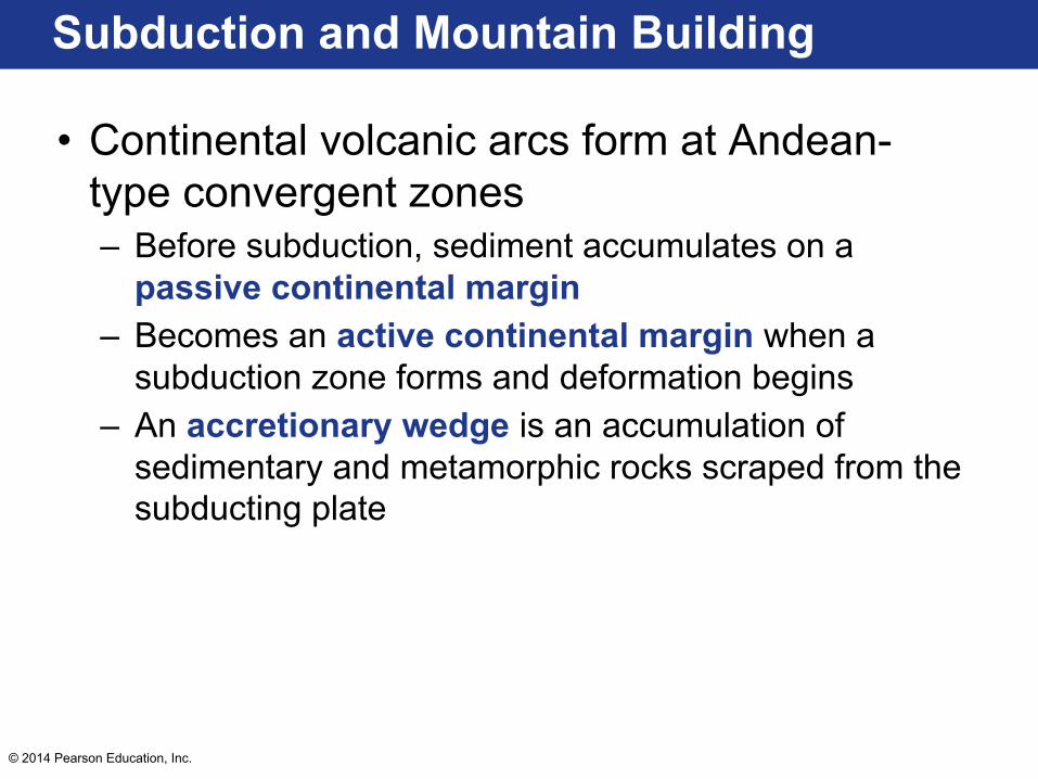
Subduction and Mountain Building
• Continental volcanic arcs form at Andean-type convergent zones– Before subduction, sediment accumulates on a
passive continental margin– Becomes an active continental margin when a
subduction zone forms and deformation begins– An accretionary wedge is an accumulation of
sedimentary and metamorphic rocks scraped from the subducting plate

© 2014 Pearson Education, Inc.
Subduction and Mountain Building

© 2014 Pearson Education, Inc.
Focus Question 6.13
• What are the major features of an Andean-type mountain belt and how are they generated?– Continental volcanic arc– Accretionary wedge

© 2014 Pearson Education, Inc.
Focus Question 6.14
• What are the stages of development in a collisional mountain belt?

© 2014 Pearson Education, Inc.
Collisional Mountain Belts
• Cordilleran-type mountain building occurs in Pacific-like ocean basins– Rapid seafloor spreading is balanced by rapid
subduction– Island arcs and crustal fragments (terranes) collide
with a continental margin• Some terranes may have been microcontinents• Small terranes are subducted• Larger terranes are thrust onto the continent

© 2014 Pearson Education, Inc.
Collisional Mountain Belts

© 2014 Pearson Education, Inc.
Collisional Mountain Belts
• Alpine-type orogenies result from continental collisions– Himalayas – Collision between Indian and Eurasian plates
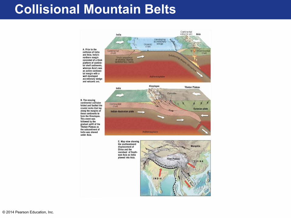
© 2014 Pearson Education, Inc.
Collisional Mountain Belts

© 2014 Pearson Education, Inc.
Focus Question 6.14
• What are the stages of development in a collisional mountain belt?– Large terranes are thrust onto a continental block
during subduction