fundamentals of photographic interpretation
TRANSCRIPT
1
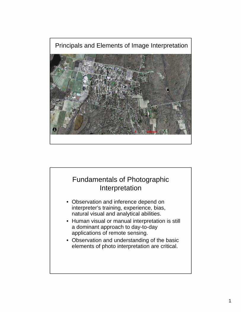
Principals and Elements of Image Interpretation
Fundamentals of Photographic Interpretation
• Observation and inference depend on interpreter’s training, experience, bias, natural visual and analytical abilities.
• Human visual or manual interpretation is still a dominant approach to day-to-day applications of remote sensing.
• Observation and understanding of the basic elements of photo interpretation are critical.

2
Why photo/image interpretation?
• Aerial/Regional Perspective:– Examination of the Earth from an aerial
perspective allows us to identify objects, patterns, and man-land interrelationships.
– Remotely sensed image provides “spatial terrain” information.
Why photo/image interpretation?
• The ability to obtain a historical image record to document change:– The photographs or images are valuable historical
records of the spatial distribution of natural and man-made phenomena.
– The study of change increases our understanding about the natural and human-induced processes in the landscape.
3
Why photo/image interpretation?
• Three-Dimensional Depth Perception:– We can obtain a 3-dimensional view of the terrain by
viewing the two images of the terrain from two slightly different vantage points at the same time.
– Stereoscopic analysis process provides us the information of object’s height, depth, and volume.
Deriving Information from Data
Heads-up digitizing
- Visual interpretation and manual delineation
Digital image classifications– Unsupervised
– Supervised
4
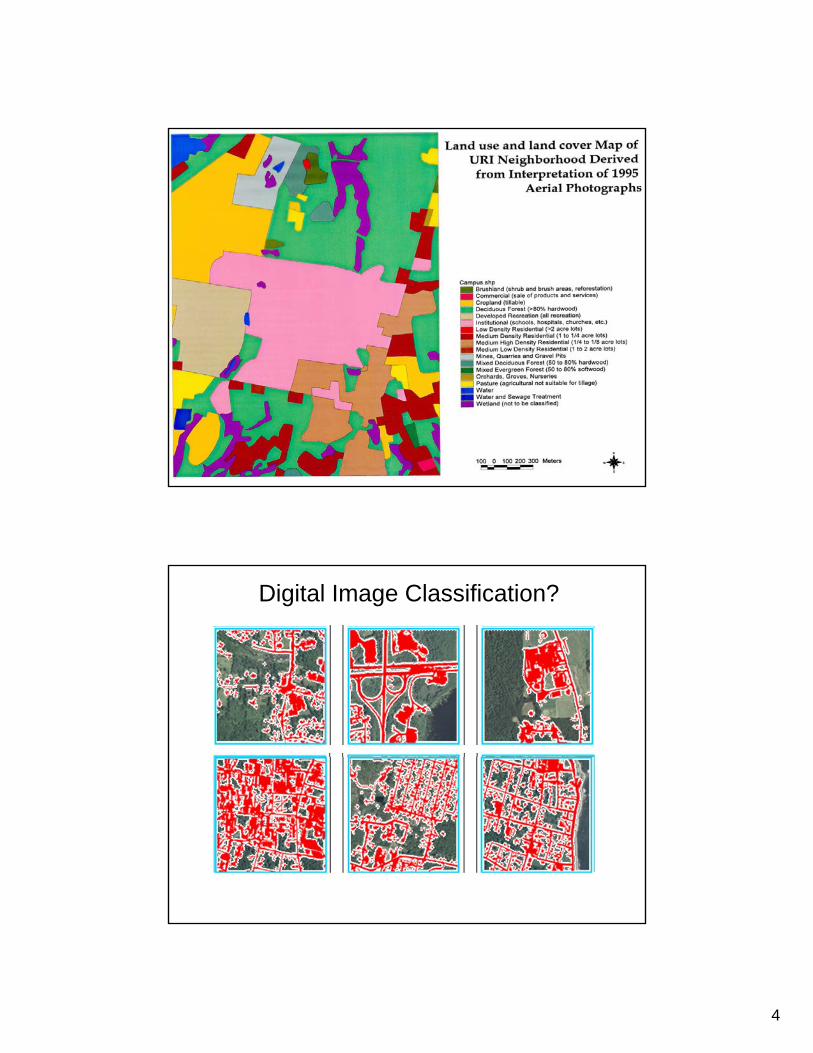
Digital Image Classification?

5
Information Extraction from Pixels
Principals and Elements of Visual Image Interpretation
6
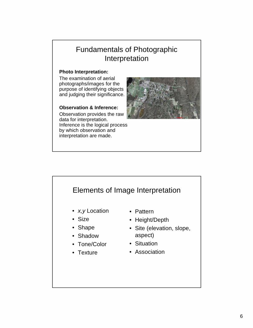
Fundamentals of Photographic Interpretation
Photo Interpretation:The examination of aerial photographs/images for the purpose of identifying objects and judging their significance.
Observation & Inference:Observation provides the raw data for interpretation. Inference is the logical process by which observation and interpretation are made.
Elements of Image Interpretation
• x,y Location
• Size
• Shape
• Shadow
• Tone/Color
• Texture
• Pattern
• Height/Depth
• Site (elevation, slope, aspect)
• Situation
• Association
7
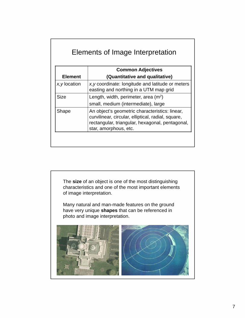
Elements of Image Interpretation
Element
Common Adjectives
(Quantitative and qualitative)
x,y location x,y coordinate: longitude and latitude or meters easting and northing in a UTM map grid
Size Length, width, perimeter, area (m2)
small, medium (intermediate), large
Shape An object’s geometric characteristics: linear, curvilinear, circular, elliptical, radial, square, rectangular, triangular, hexagonal, pentagonal, star, amorphous, etc.
The size of an object is one of the most distinguishing characteristics and one of the most important elements of image interpretation.
Many natural and man-made features on the ground have very unique shapes that can be referenced in photo and image interpretation.

8
Elements of Image Interpretation
Element
Common Adjectives
(Quantitative and qualitative)
Shadow Caused by solar illumination from the side
Tone/color Gray tone: light (bright), intermediate (gray), dark (black)
Color: HIS = intensity, hue (color), saturation;
RGB = red, green, blue
Texture Characteristic placement of objects on the ground: systematic, random, linear, curvilinear, rectangular, circular, etc.
Pattern Spatial arrangement of objects on the ground: systematic, random, linear, curvilinear, rectangular, circular, etc.
The shadow in the image provides real clue to an object’s identification, e.g., height.
The ability to visually appreciate or measure the height (elevation) or depth (bathymetry) of an object or landform is one of the most diagnostic elements of image interpretation.

9
Gray Tone Pseudo Color Image
The electromagnetic radiation (EMR) recorded byremote sensing system can be displayed in shades of gray ranging from black to white – tone.
We may use additive color-combining techniques to create color composite images.
Texture Pattern
Texture is the characteristic placement and arrangement of repetitions of tones or color in an image.
Pattern is the spatial arrangement of objects in the landscape.
Both texture and pattern are scale independent.
10
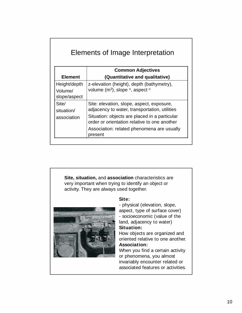
Elements of Image Interpretation
Element
Common Adjectives
(Quantitative and qualitative)
Height/depth
Volume/ slope/aspect
z-elevation (height), depth (bathymetry), volume (m3), slope o, aspect o
Site/
situation/
association
Site: elevation, slope, aspect, exposure, adjacency to water, transportation, utilities
Situation: objects are placed in a particular order or orientation relative to one another
Association: related phenomena are usually present
Site, situation, and association characteristics are very important when trying to identify an object or activity. They are always used together.
Site:- physical (elevation, slope, aspect, type of surface cover) - socioeconomic (value of the land, adjacency to water)Situation:How objects are organized and oriented relative to one another.Association:When you find a certain activity or phenomena, you almost invariably encounter related or associated features or activities.
11
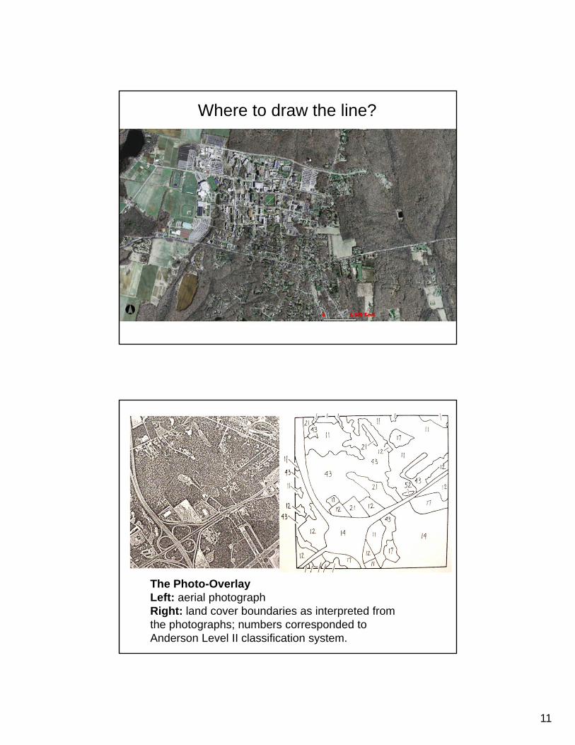
Where to draw the line?
The Photo-OverlayLeft: aerial photograph Right: land cover boundaries as interpreted from the photographs; numbers corresponded to Anderson Level II classification system.

12
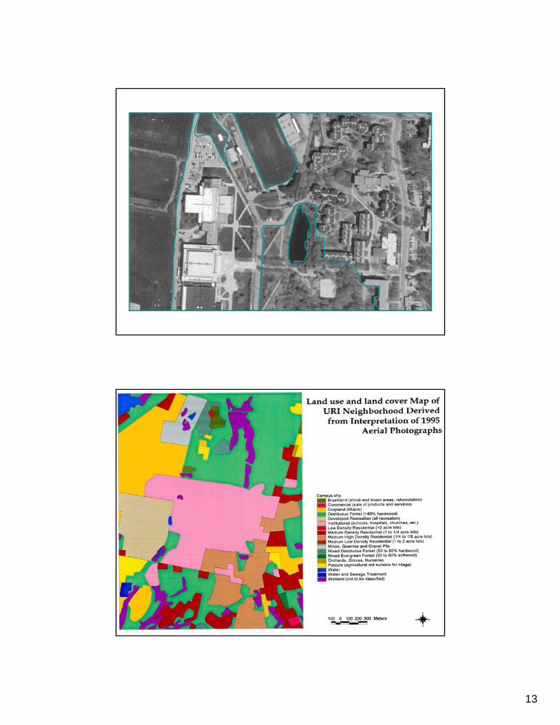
The delineation of a land use polygon includes the entire area devoted to a particular use. In this example the entire area inside the boundaries of an airfield is represented on the land use map as a single polygon, even though it is composed of several recognizable components.
13
14
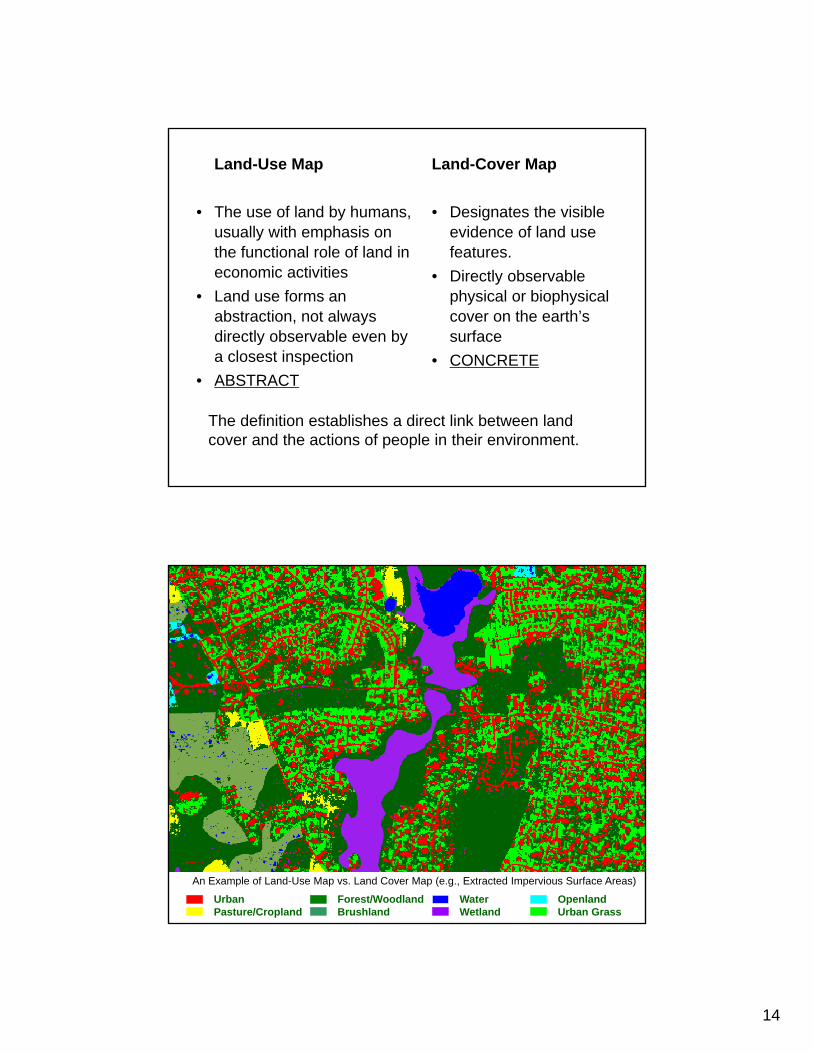
Land-Cover Map
• Designates the visible evidence of land use features.
• Directly observable physical or biophysical cover on the earth’s surface
• CONCRETE
Land-Use Map
• The use of land by humans, usually with emphasis on the functional role of land in economic activities
• Land use forms an abstraction, not always directly observable even by a closest inspection
• ABSTRACT
The definition establishes a direct link between land cover and the actions of people in their environment.
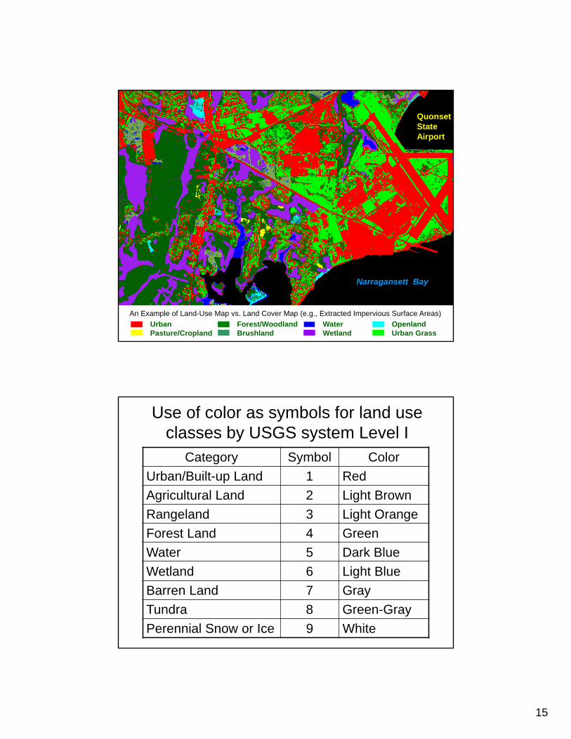
An Example of Land-Use Map vs. Land Cover Map (e.g., Extracted Impervious Surface Areas)
OpenlandUrban Grass
WaterWetland
Forest/WoodlandBrushland
UrbanPasture/Cropland
15
OpenlandUrban Grass
WaterWetland
Forest/WoodlandBrushland
UrbanPasture/Cropland
Quonset StateAirport
Narragansett Bay
An Example of Land-Use Map vs. Land Cover Map (e.g., Extracted Impervious Surface Areas)
Use of color as symbols for land use classes by USGS system Level I
Category Symbol Color
Urban/Built-up Land 1 Red
Agricultural Land 2 Light Brown
Rangeland 3 Light Orange
Forest Land 4 Green
Water 5 Dark Blue
Wetland 6 Light Blue
Barren Land 7 Gray
Tundra 8 Green-Gray
Perennial Snow or Ice 9 White
16
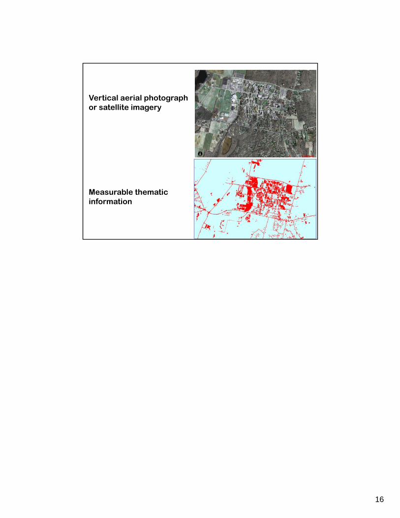
Vertical aerial photograph or satellite imagery
Measurable thematic information