g-i-a-116 maust barn (truman j. maust farm,galen maust farm)
TRANSCRIPT

G-I-A-116
Maust Barn (Truman J. Maust Farm,Galen Maust Farm)
Architectural Survey File
This is the architectural survey file for this MIHP record. The survey file is organized reverse-
chronological (that is, with the latest material on top). It contains all MIHP inventory forms, National
Register nomination forms, determinations of eligibility (DOE) forms, and accompanying documentation
such as photographs and maps.
Users should be aware that additional undigitized material about this property may be found in on-site
architectural reports, copies of HABS/HAER or other documentation, drawings, and the “vertical files” at
the MHT Library in Crownsville. The vertical files may include newspaper clippings, field notes, draft
versions of forms and architectural reports, photographs, maps, and drawings. Researchers who need a
thorough understanding of this property should plan to visit the MHT Library as part of their research
project; look at the MHT web site (mht.maryland.gov) for details about how to make an appointment.
All material is property of the Maryland Historical Trust.
Last Updated: 02-07-2013

MARYLAND HISTORICAL TRUST DETERMINATION OF ELIGIBILITY FORM
NR Eligible: yes no
I Property Name: Truman J. Maust Farm (Maust Barn) Inventory Number: G-I-A-116
Address: 4875 Chestnut Ridge Road (U.S. 219) Historic district: yes X no
City: Grantsville vicinity Zip Code: 21536 County: Garrett
USGS Quadrangle(s): Avilton
Property Owner: Bryan and Brandi Palmer Tax Account ID Number: 1203011437
Tax Map Parcel Number(s): 003 Tax Map Number: 09
Project: U.S. 219 Improvements, Meyersdale (Pa.) to 1-68 Agency: FHWA, SHA
Agency Prepared By: Heberling Associates for SHA
Preparer's Name: William Hunter Date Prepared: 6/15/2005
Documentation is presented in: W.M. Hunter 2003 [2005] Historic Structures Survey/Determination of Eligibility Report, U.S. 219 Improvements Project. Prepared for the FHWA and SHA by Heberling Associates, Inc.
Preparer's Eligibility Recommendation: X Eligibility recommended Eligibility not recommended
Criteria: _ A _ B _X_C _ D Considerations: _ A _ B _ C _ D _ E _ F _ G
Complete if the property is a contributing or non-contributing resource to a NR district/property:
Name of the District/Property:
I Inventory Number: Eligible: yes Listed: yes
Site visit by MHT Staf yes X no Name: Date:
Description of Property and Justification: (Please attach map and photo)
Built by C. M. Beachy for Truman Maust in 1898, the Maust Bam represents the early embrace of popular "scientific" building forms by the region's progressive farmers. The five-bay three-unit structure is larger than the Pennsylvania bams of the previous generation. The barn's height, accented by the steep pitch of the roof, tile basement walls, and cupola vents, testifies to its light frame construction. Built to function primarily as a dairy bam, the foundation materials included carefully hewn sandstone blocks for the basement walls, with glazed terra cotta tile, brick and poured concrete on the balance. Similarly, the wall and vent materials reflect the use of modem machinery to fashion the tight vertical plank siding and louvered vents, found five to a gable end. The roof is covered with standing seam metal and asphalt shingles.
The loss of important features and the subdivision of the property have cost the property the associative and material integrity necessary for us to consider the larger farm property for the National Register under Criterion A. Further, though relatively successful farmers, none of the persons associated with the extant features are important to our past in a manner that qualifies the property for inclusion on the National Register under Criterion B. However, the Maust Bam is eligible for the National Register of Historic Places under Criterion C as an important example of turn-of-the-century bam architecture. This property was not
MARYLAND HISTORICAL TRUST REVIEW
Eligibility recommended Eligibility not recommended
Criteria: A B } ^ C D Considerations: A _ B _ C _ D _ E _ F _ G
MHT Comments:
•"Reviewer, National Register ^-ogram / l)ate

NR-ELIGIBILITY REVIEW FORM
G-l-A-116 Truman J. Maust Farm (Maust Bam)
Page 2
evaluated under Criterion D because it is unlikely to yield any further information important to our past.
The extant material characteristics of the buildings, particularly the form, materials, and methods of construction, clearly represent a shift from traditional to modem forms of bam construction and use in Garrett County's tableland. Much of the immediate setting of the bam is altered; the loss of the primary residence, the deterioration and loss of outbuildings and the addition of modem structures require a historic property boundary that accounts for these changes in the landscape. Therefore, the historic property boundary for the Maust Bam includes the barn proper, all contiguous structures (silos, milk houses) and the immediate setting, including approximately 8 acres of croplands in the hollow north and west of the bam. An earthen mound, rock caim and small square sandstone marker (G-I-A-192), installed during the resurvey of the Mason-Dixon line, is located on the historic property boundary, northwest of the bam.
MARYLAND HISTORICAL TRUST REVIEW
Eligibility recommended Eligibility not recommended
Criteria: A _ B _ C _ D Considerations: A _ B _ C D _ E _ F _ G
MHT Comments:
Reviewer, Office of Preservation Services Date
Reviewer, National Register Program Date

G-I-A-116
Truman J. Maust Farm (Maust Barn) 1898
4875 Chestnut Ridge Road (U.S. 219)
Grantsville
Private
The Truman J. Maust Barn is the centerpiece of a farm remnant now located on a
five-acre tract. The 95-acre Palmer Farm, comprised of agricultural land, pasture and
woodlot, surrounds the barn. The south-facing barn is joined on its' five-acre parcel by a pair
of tile block milk houses and four silos. The original house on the property is long
demolished, replaced by a 1936 stone-veneer house that has, in turn, been razed and replaced
by a ranch house in 1996. Several related elements are located on the adjacent 95-acre tract,
including a frame equipment shed, a modern pole barn and a derelict I-house known as the
"washhouse," and a few ruins. The loss of important features and the subdivision of the
property have cost the property the associative and material integrity necessary for us to
consider the larger farm property for the National Register under Criterion A. Further, though
relatively successful farmers, none of the persons associated with the extant features are
important to our past in a manner that qualifies the property for inclusion on the National
Register under Criterion B. However, the Maust Barn is eligible for the National Register of
Historic Places under Criterion C as an important example of turn-of-the-century barn
architecture. The historic property boundary for the Maust Barn includes the barn proper, all
contiguous structures (silos, milk houses) and the immediate setting.

Maryland Historical Trust Inventory No. G-I-A-116
Maryland Inventory of Historic Properties For
1. Name of Property (indicate preferred name)
historic Truman J. Maust Farm
other Maust Barn (preferred)
2. Location street and number 4875 Chestnut Ridge Road not for publication
city, town Grantsville X vicinity
county Garrett
3. Owner of Property (give names and mailing addresses of all owners)
name Bryan and Brandi Palmer
street and number 4875 Chestnut Ridge Road telephone N/A
city, town Grantsville state Md. zip code 21536
4. Location of Legal Description courthouse, registry of deeds, etc. Courthouse, deeds and assessments liber 659 folio 292
city, town Grantsville tax map 3 tax parcel 9 tax ID number 1
5. Primary Location of Additional Data Contributing Resource in National Register District Contributing Resource in Local Historic District Determined Eligible for the National Register/Maryland Register Determined Ineligible for the National Register/Maryland Register Recorded by HABS/HAER
x Historic Structure Report or Research Report at MHT Other:
6. Classification
Category Ownership district public
_x building(s) x private structure both site object
Current Function Resource Count x agriculture landscape Contributing Noncontributing
commerce/trade recreation/culture 5 2 buildings defense religion _ 1 sites domestic social 4 structures education transportation 1 objects funerary work in progress 10 3 Total government unknown health care vacant/not in use Number of Contributing Resources industry other: previously listed in the Inventory
1

7. Description Inventory No. G-I-A-116
Condition
_x excellent deteriorated good ruins
_ fair _ altered
The Truman J. Maust Barn is the centerpiece of a farm remnant now located on a five-acre tract. The parent 95-acre Palmer farm, comprised of agricultural land, pasture and woodlot, surrounds the barn. The south-facing barn, a-turn-of-the-century example of local progressive agriculture, is joined on its' five-acre parcel by a pair of tile block milk houses and four silos. The original house on the property is long demolished, replaced by a 1936 stone-veneer house that has, in turn, been razed and replaced by a ranch house in 1996. Several related elements are located on the adjacent 95-acre tract, including a frame equipment shed, a modem pole barn and a derelict I-house known as the "washhouse," a few ruins, and a marker from the resurvey of the Mason-Dixon Line that is listed on the National Register of Historic Places. The ruins of a twentieth century sugar camp, consisting of rough cut stone, concrete blocks and sheet metal scraps, are located at the eastern margin of the Palmer property.
Built by CM. Beachy for Truman J. Maust in July 1898, the barn represents the fusion of traditional forms with the progressive innovations drawn from the agricultural press and organizations such as the Grange. The five-bay three-unit structure is larger than the Pennsylvania barns of the previous generation (Photo 1). The barn's height, accented by the steep pitch of the roof, tile basement walls, and cupola vents, testifies to its light frame construction (Photo 2). Built to function primarily as a dairy barn, the foundation materials included carefully hewn sandstone blocks for the basement walls, with glazed terra cotta tile, brick and poured concrete on the balance (Photo 3). Similarly, the wall and vent materials reflect the use of modern machinery to fashion the tight vertical plank siding and louvered vents, found five to a gable end. The roof is covered with standing seam metal and asphalt shingles.
The walls of the barn are pierced on the front by a pair of doors flanking the central bay, served by a broad earthen ramp. Doors on either gable end access the basement level. The aforementioned louvered vents, which also mark the bays on the front of the barn, set into the decorative frame that includes a sparrow hole as star motifs, also found at the peak of the gable (Photo 4). Other decorative features include barge and corner boards, and lapped siding on the gable ends. The cupola vents are both decorative and functional, reflecting the sanitary concerns of the progressive dairy farmer. A single central bay enters into the loft on the front of the barn, below the modest roof eave. The basement level is well lighted by a series of 16 bays of six-pane stationary windows set into brick frames.
As a modern agricultural facility, the barn is but the center of a complex of related structures. Both the tile on the foundation and the arrangement of the basement pens signify the function of the structure, as do the pair of tile milk houses and the series of silos. Both milk houses speak to the influence of sanitary regulations on the production of fluid milk. The earlier of the two is a square tile block structure resting on a poured concrete foundation and topped with a low pyramidal roof (Photo 5). The structure is pierced by large stationary two pane windows and an off center doorway on the north side. The newer (c. 1950) milk house is constructed of smaller, lighter tile blocks, and is founded on poured concrete (Photo 6). This larger structure, lighted by large two-by-two windows, has a frame side gable roof cantilevered to the barn and is enlarged by a frame addition to the south elevation. The south-west corner of the barn is obscured by the series of silos that also chart the evolution of the dairy industry in the region (Photo 7). The small clay tile silo is found closest to the barn, followed by an early metal and stave silo and a pair of large metal silos. The footprint of a third metal silo is also plainly visible.
The barn and its outbuildings are set off from the equipment sheds and "washhouse," now on the adjacent tract, by the dirt farm lane. The older equipment shed rests on a rough sandstone foundation and is clad with both vertical and horizontal plank siding (Photo 8). The low corrugated metal side gable roof covers six large bays for farm equipment, a characteristic feature of farms that embraced mechanization and scientific management. The sliding doors on the front (south) elevation access the interior bays and cribs; the rear is broken only by a series of six-pane stationary windows. In contrast is the modern equipment shed, a prefabricated metal pole barn.
Other than the barn, the most important material element in the collection of buildings is the severely deteriorated I-house known as the "washhouse." Unusual in both its form and function, this light farm structure rests on a foundation of irregular sandstone blocks. The irregular window and door placement belies the absolute symmetry of the two-room plan (Photo 9). The doorways, found on the facade and west gable end, provide access to an interior workspace lit by regular two-over-two light windows set in plain wooden frames. The regular window placement on the eastern gable end contrast with other wall piercings (Photo 10). The exterior is clad with machined false-shiplap siding and framed with corner and bargeboards. The low side gable roof, with modest eaves and overhangs, is covered with standing seam metal. The roofline is broken on the north elevation by a small brick stove chimney. The material elements all suggest an early 20th century date of construction.

8. Significance Inventory No. G-I-A-116
Period
_ 1600-1699 _ 1700-1799 x_ 1800-1899 _ 1900-1999
2000-
Areas of Significance
x. agriculture archeology
x. architecture _ art x. commerce
communications community planning conservation
Check and justify below
economics health/medicine performing arts education industry philosophy engineering invention politics/government entertainment/ landscape architecture religion
recreation law science ethnic heritage literature social history exploration/ maritime history transportation settlement military other:
Specific dates 1898 Architect/Builder C M . Beachy and T.J. Maust
Construction dates 1898
Evaluation for:
National Register _Maryland Register not evaluated
The Maust Bam is located on a property long associated with several other nearby farms, most notably the adjacent "Brown Farm." Prior to its reduction to five acres in the summer of 1995, the roughly lOO-acre property was associated with the Maust family for generations. In August, 1863, the heirs of Samuel and Amy Brown, namely Jacob and Elizabeth Brown, sold "that part of the farm of the late Samuel Brown which lies immediately on the Maryland Side of the province line and on the public road to Salisbury" to Basil and Elizabeth Garlitz. Never occupying the property, the Garlitz family rented the farm to tenant John Wright (Allegany County Deed Book 21:3). Four years later, Garlitz sold 103 acres to Joseph Maust, owner of the property until the turn of the century.
Maust was the owner of the farm when his son Truman constructed the bam on the high ridge above the Casselman River. The specialization of agriculture spurred by the arrival of railroads continued through the turn of the century, and the region's farms adapted to new market realities by focusing on stock raising and dairying. The Maust Bam reflects a regional practice of adapting traditional bams to the shifting focus of the regional agriculture. In many cases, the sale of coal rights and timber would finance the construction of a modem bam.
The conservatism of the local architectural repertoire and the relatively late arrival of the railroad allowed traditional plans and techniques to linger, though some farmers like Truman Maust demonstrated their strengthening ties to the external market through the adoption of modern forms and fashionable architectural details. Built by C. M. Beachy for Truman Maust in 1898, the Maust Barn represents the early embrace of popular "scientific" building forms by the region's progressive farmers. The extant material characteristics of the buildings, particularly the form, materials, and methods of construction, clearly represent a shift from traditional to modem forms of bam construction and use in Garrett County's tableland.
Curiously, the property was sold out of the Maust name soon after completion of the barn, purchased by Samuel D. Glotfelty in the spring of 1900 (Garrett County Deed Book 64:406). In 1913, following the passing of Sam Glotfelty, the property reverted to the Maust name, being purchased by Ivan J. Maust, occupant of the farm until his death in 1969. We suggest Ivan Maust improved the property with the construction of the washhouse and the later stone farmhouse. In the summer of 1969, the heirs of Ivan Maust quit claim on the property, allowing full ownership to transfer to Galen and Margaret Maust, owners until its dissolution in 1995.

9. Major Bibliographical References Inventory No. G-I-A-116
Besley, F.W. 1913. Map of Garrett County. Maryland Board of Forestry, Annapolis, Md. Brown, J. 1896. Brown's Miscellaneous Writings. Jacob Brown, Cumberland, Md.Garrett and Allegany County Tax and Deed Records. Hoye, C.E. 1988. Hoye's Pioneer Families of Garrett County. McLain Printing Company, Parsons, WVa. McLennan, J. 1973. 1949 Topographic Map of Garrett County. Maryland Geological Survey. Annapolis. Md. Scharf. J. T. 1882. History of Western Maryland.Louis H. Everts, Philadelphia. Schlosnagle. S 1978. Garrett County. A History of Maryland's Tableland. McClain Printing Co. Parsons, WVa. Stone, K. M. and E. D. Matthews. 1974. Soil Survey of Garrett County, Maryland. USDA Soil Conservation Service. USGPO, Washington. DC. USGS. 1904. 15' Topographic Map, Grantsville Quadrangle. USGS, Washington. D.C Ware. D.M. 1984. Green Glades & Sooty Gob Piles. Maryland Historical Trust, Crownsville, Md. Whitney, M. 1927. Map of Garrett County Showing the Agricultural Soils. Maryland Geological Survey, Annapolis. Md.
10. Geographical Data
Acreage of surveyed property l.OO Acreage of historical setting app. 8.0 Quadrangle name Avilton Quadrangle scale: l :24.000
Verbal boundary description and justification
Much of the immediate setting of the barn is altered: the loss of the primary residence, the deterioration and loss of outbuildings and the addition of modern structures require a historic property boundary that accounts for these changes in the landscape. Therefore, the historic property boundary for the Maust Barn includes the barn proper, all contiguous structures (silos, milk houses) and the immediate setting, including approximately 8 acres of croplands in the hollow north and west of the barn. An earthen mound, rock cairn and small square sandstone marker (G-I-A-192), installed during the resurvey of the Mason-Dixon line, is located on the historic property boundary, northwest of the barn.
11. Form Prepared by
name/title William M. Hunter
organization Heberling Associates, Inc.
street & number 904 Main Street
city or town Alexandria
date
telephone
state
October 2003, June 2005
814 669-1280
Pennsylvania
The Maryland Inventory of Historic Properties was officially created by an Act of the Maryland Legislature to be found in the Annotated Code of Maryland, Article 41, Section 181 KA, 1974 supplement.
The survey and inventory are being prepared for information and record purposes only and do not constitute any infringement of individual property rights.
return to: Maryland Historical Trust DHCD/DHCP 100 Community Place Crownsville, MD 21032-2023 410-514-7600

TRUMAN J. MAUST FARM (MAUST BARN) (G-l-A-116)
Site Plan and Photo Key

G-l-A-116 Truman J. Maust Farm (Maust Barn)
4875 Chestnut Ridge Road (U.S. 219) Grantsville Vicinity
Garrett County Avilton MD.-RA.


G-I-A-116
Truman J . Maust Farm Grantsville Private 1937
The Truman J. Maust Farm consists of a 1937 stone veneer house, an 1898 frame bank barn, an early twentieth century frame summerhouse, three frame machine sheds of recent data, and the ruins of a hog pen.
A wooden plaque on the southeast gable end of the barn bears the date July 7, 1898 and the name T.J. Maust. CM. Beachy is identified as the builder and a name which is now illegible notes the painter. The building has a circular sawn frame that is covered with vertical board siding and pierced by louvered ventilation panels. A pierced star ornaments the southeast gable and three octagonal metal ventilators sit on the ridgeline. The original foundation was coursed, dressed stone, however, most of it has been replaced with brick.

MARYLAND HISTORICAL TRUST G-I -A-116
INVENTORY FORM FOR STATE HISTORIC SITES SURVEY
NAME HISTORIC
Truman J. Maust Farm AND/OR COMMON
Galen Maust Farm
LOCATION STREET & NUMBER
U.S. Route 219 N, W side, .3 mile S of MD-PA Border CITY. TOWN CONGRESSIONAL DISTRICT
Maryland J L VICINITY OF 6 t n
STATE COUNTY
Grantsville Garrett County
CLASSIFICATION
CATEGORY OWNERSHIP STATUS PRESENT USE _DISTRICT _PUBLIC ^OCCUPIED ^AGRICULTURE _MUSEUM
XBUILDINGISI ^PRIVATE —UNOCCUPIED —COMMERCIAL —PARK
—STRUCTURE _BOTH —WORK IN PROGRESS —EDUCATIONAL ^PRIVATE RESIDENCE
—SITE PUBLIC ACQUISITION ACCESSIBLE —ENTERTAINMENT —RELIGIOUS —OBJECT —IN PROCESS —YES RESTRICTED —GOVERNMENT —SCIENTIFIC
—BEING CONSIDERED —YES: UNRESTRICTED —INDUSTRIAL —TRANSPORTATION
& N O —MILITARY —OTHER
OWNER OF PROPERTY NAME
Galen N. Maust T e l e p h o n e # ; 30l-895-5403 STREET & NUMBER
CITY. TOWN STATE , Z i p C o d e
VICINITY OF
LOCATION OF LEGAL DESCRIPTION Liber #: 160 COURTHOUSE. Fol io #: 689 REGISTRY OF DEEDS,ETC G a r r e t t County C o u r t h o u s e STREET* NUMBER
Third and Alder Streets
CITY, TOWN STATE
O a k l a n d Marv land 2 1 S S 0
REPRESENTATION IN EXISTING SURVEYS TITLE
None DATE
—FEDERAL _STATE —COUNTY —LOCAL
DEPOSITORY FOR SURVEY RECORDS
CITY. TOWN STATE

G-I-A-116 DESCRIPTION
CONDITION CHECK ONE CHECK ONE
—EXCELLENT —DETERIORATED —UNALTERED ^ORIGINAL SITE
XGOOD —RUINS ^ALTERED —MOVED DATE_
_FAIR —UNEXPOSED
DESCRIBE THE PRESENT AND ORIGINAL (IF KNOWN) PHYSICAL APPEARANCE
The Truman J. Maust Farm consists of a 1937 stone veneer house, an 1898 frame bank barn, an early twentieth century frame summerhouse, three frame machine sheds of recent date, and the ruins of a hog pen.
The house is a two story, pyramidal-roofed building following a square plan. It occupies the same site of the late nineteenth century, two story, frame residence that burned in February 1936.
A wooden plaque on the southeast gable end of the barn bears the date July 7, 1898, and the name T. J. Maust. C. M. Beachy is identified as the builder and a name which is now illegible notes the painter. The building has a circular sawn frame that is covered with vertical board siding and pierced by louvered ventilation panels. A pierced star ornaments the southeast gable and three octagonal metal ventilators sit on the ridgeline. The original foundation was coursed, dressed stone, however, most of its has been replaced with brick.
The summer house is a two story, gable-roofed, frame building on a stone pier foundation. It measures four bays by two bays and is sheathed with German siding. 2/2 sash windows with plain board surrounds and simple dripboards light the house. An interior brick stove chimney is located in the eastern corner of the basement.
CONTINUE ON SEPARATE SHEET IF NECESSARY

SIGNIFICANCE G-I-A-116
PERIOD
—PREHISTORIC
_ 1400-1499
_1500-1599
— 1600-1699
— 1700-1799
2^1800 1899
2^1900-
AREAS OF SIGNIFICANCE - CHECK AND JUSTIFY BELOW
—ARCHEOLOGY-PREHISTORIC
—ARCHEOLOGY-HISTORIC
^AGRICULTURE
^ARCHITECTURE
—ART
—COMMERCE
—COMMUNICATIONS
—COMMUNITY PLANNING
—CONSERVATION
—ECONOMICS
—EDUCATION
—ENGINEERING
—EXPLORATION/SETTLEMENT
—INDUSTRY
—INVENTION
—LANDSCAPE ARCHITECTURE
—LAW
— LITERATURE
—MILITARY
—MUSIC
—PHILOSOPHY
—POLITICS/GOVERNMENT
— RELIGION
—SCIENCE
—SCULPTURE
_ SOCIAL/HUMANITARIAN
—THEATER
—TRANSPORTATION
—OTHER (SPECIFY)
SPECIFIC DATES Barn: 1898 House: 1937 BUILDER/ARCHITECT b a r n : C.M. Beachy
STATEMENT OF SIGNIFICANCE Truman James Maust
The s i g n i f i c a n c e of t h i s s i t e l i e s with the b a r n , cons t ruc ted in 1898 by Truman James Maust and C. M.Beachy.
CONTINUE ON SEPARATE SHEET I F NECESSARY

G-I-A-116
MAJOR BIBLIOGRAPHICAL REFERENCES
CONTINUE ON SEPARATE SHEET IF NECESSARY
GEOGRAPHICAL DATA ACREAGE OF NOMINATED PROPERTY
VERBAL BOUNDARY DESCRIPTION
LIST ALL STATES AND COUNTIES FOR PROPERTIES OVERLAPPING STATE OR COUNTY BOUNDARIES
STATE COUNTY
STATE COUNTY
FORM PREPARED BY NAME /TITLE
Valerie Cesna, Historic Sites Surveyor ORGANIZATION
Maryland H i s t o r i c a l Trust/Riireau of Mines
DATE
February 1982 STREET & NUMBER
Shaw House, 21 State Circle TELEPHONE
301-269-2438 CITY OR TOWN
Annapolis Maryland 21401
The Maryland Historic Sites Inventory was officially created by an Act of the Maryland Legislature, to be found in the Annotated Code of Maryland, Article 41, Section 181 KA, 1974 Supplement.
The Survey and Inventory are being prepared for information and record purposes only and do not constitute any infringement of individual property rights.
RETURN TO: Maryland Historical Trust The Shaw House, 21 State Circle Annapolis, Maryland 21401 (301) 267-1438
PS- 1 106

Avilton, MD-PA USGS 7.5 Minute Series Scale 1:24,000 1947; photorevised 1974
Site #: G-I-A-116
Truman J. Maust Farm U.S." Route 219 N. W side, .3 mile S of MD PA Border

116


G-I-A-116 Truman J. Maust Farm Garrett Co., MD Valerie Cesna 6/11/81 Looking NW from driveway

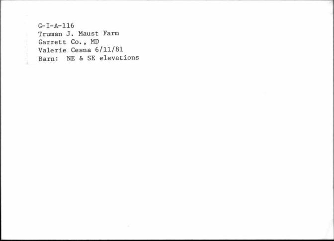
G-I-A-116 Truman J. Maust Farm Garrett Co. , MD Valerie Cesna 6/11/81 Barn: NE & SE elevations