g oaks baseline park analysisaug 30, 2016 · (248) 851-8356 . . township and range . t1n r9e...
TRANSCRIPT

UPDATED: 8/30/2016 7:57:00 PM
GLEN OAKS BASELINE PARK ANALYSIS

GLEN OAKS COUNTY PARK BASELINE PARK ANALYSIS
Page 2 of 34
UPDATED: 8/30/2016 7:57:00 PM
CONTENTS
Park Location ................................................................................................................................................................. 4
Community Context ....................................................................................................................................................... 4
Oakland County ......................................................................................................................................................... 5
City of Farmington Hills ............................................................................................................................................. 5
Drive-Time Service Area ............................................................................................................................................ 6
Site Analysis ................................................................................................................................................................. 10
Physical Characteristics............................................................................................................................................ 11
Regional Context ...................................................................................................................................................... 11
Land Use .................................................................................................................................................................. 12
Park History ................................................................................................................................................................. 13
Early History ............................................................................................................................................................. 13
Park History ............................................................................................................................................................. 15
Past Master Plans .................................................................................................................................................... 15
Grant History ........................................................................................................................................................... 15
Park-Wide Planning Units ............................................................................................................................................ 16
1. Natural Resources ................................................................................................................................................ 16
2. Park Entrances, Roadways and Parking ............................................................................................................... 19
3. Maintenance, Utilities and Security ..................................................................................................................... 19
4. Technology ........................................................................................................................................................... 19
5. Non-Recreational Features .................................................................................................................................. 19
6. Park Trails and Regional Connectivity .................................................................................................................. 20
Location-Specific Planning Units .................................................................................................................................. 21
7. Clubhouse ............................................................................................................................................................ 22
8. Golf Course .......................................................................................................................................................... 23
Park Operation Planning Units .................................................................................................................................... 24
9. Organized Programs and Events .......................................................................................................................... 24
10. Data Collection and Management ..................................................................................................................... 24
Park Maps .................................................................................................................................................................... 25
References ................................................................................................................................................................... 32
Notes ........................................................................................................................................................................... 33

GLEN OAKS COUNTY PARK BASELINE PARK ANALYSIS
Page 3 of 34
UPDATED: 8/30/2016 7:57:00 PM
TABLES
Table 1: Population Trends - 10-minute drive-time of Glen Oaks ................................................................................. 7 Table 2: Race and Ethnicity - 10 minute drive-time of Glen Oaks ................................................................................. 7 Table 3: Market Potential – 10-minute drive-time of Glen Oaks .................................................................................. 8 Table 4: Parcel Table for Glen Oaks ............................................................................................................................. 10 Table 5: Natural Features at Glen Oaks ....................................................................................................................... 16
FIGURES
Figure A: Golf Course Median Drive-Time Map ............................................................................................................. 6 Figure B: Population by Age – 10-minute drive-time of Glen Oaks ............................................................................... 7 Figure C: 1817 Survey of Farmington Township, Section 2 (BLM) ............................................................................... 13 Figure D: Glen Oaks Natural Features Map ................................................................................................................ 18 Figure E: Park map showing locations of Planning Units ............................................................................................. 21 Figure F: Golf Course Map ........................................................................................................................................... 26 Figure G: Acquisition Grant Map ................................................................................................................................. 27 Figure H: Farmington Section 2 Historic Plat Maps ..................................................................................................... 28 Figure I: Harmon Oaks Park (City of Farmington Hills) ................................................................................................ 31

GLEN OAKS COUNTY PARK BASELINE PARK ANALYSIS
Page 4 of 34
UPDATED: 8/30/2016 7:57:00 PM
Park Location Glen Oaks Golf Course is a 122-acre park located in southern Oakland County in Farmington Hillsi.
Park Contact Information 30500 13-Mile Road Farmington Hills, MI 48334 (248) 851-8356 www.DestinationOakland.com
Township and Range T1N R9E Section 2, SW 1/4
Community Context The characteristics of Glen Oaks are unique and reflect the character of the local communities. It is important to understand the park within the context of its communities – Michigan, Oakland County, and the City of Farmington Hills – for multiple reasons:
To convey a ‘sense of place’ that is harmonious and complementary to the local environment
To ensure that Oakland County Parks is not duplicating services provided by local recreational authorities or by the private, non-profit, or larger regional/state providers
To collaborate with units of governments and organizations related to the Oakland County Parks mission to manage open space and natural areas and provide recreational facilities and programs on an inter-community, county and/or multi-county basis
To develop facilities and programs that contribute to the implementation of local and county plans To ensure compliance with local and county regulations
i See Planning Map Set, page 3 – Location Map

GLEN OAKS COUNTY PARK BASELINE PARK ANALYSIS
Page 5 of 34
UPDATED: 8/30/2016 7:57:00 PM
Oakland County Oakland County is located in southeast Michigan, approximately 20 miles northwest of Detroit and covers 910 square miles (SEMCOG, 2015). Within the county there are 30 cities, 21 townships, and 11 incorporated villages in urban, suburban, and rural landscapes. The county’s estimated population in 2015 was approximately 1.2 million persons and the median household income in 2013 was $65,594. An estimated 10% of the population lives in poverty1 (U.S. Census Bureau, 2015).
According to Advantage Oakland, Oakland County employs nearly 690,000 workers with more than 260,000 commuting from outside the county. The top three employment sectors are Professional and Business Services (26%), Trade, Transportation and Utilities (18%), and Private Education and Health Services (16%). The county is home to nearly 1,000 firms from 39 foreign countries (EDCA).
Within the county, there are 30 cities, 21 townships, and 11 incorporated villages, in urban, suburban, and rural landscapes. The county is home to the headwaters of five major rivers, the Clinton, Flint, Huron, Rouge, and Shiawassee Rivers, all of which are important to the long-term health of the Great Lakes Ecosystem. Many diverse ecosystems are located in the county due to the area’s complex topography and geological history and are an important element in the character of the county.
Oakland County Parks and Recreation Oakland County Parks and Recreation (OCPR) provides parks and recreation services within the geographic boundaries of Oakland County and are open to both residents and visitors to the county. Since 1966, OCPR has expanded and diversified the park system from four parks to thirteen, now totaling over 6,700 acres. Key attractions include managed natural areas, nature centers, waterparks, golf courses, conference centers, campgrounds, fairgrounds and over 65 miles of park trails. OCPR also offers a variety of entertaining and educational recreation programs and services for various ages and abilities.
City of Farmington Hills Glen Oaks County Park is located in Farmington Hills in the south central area of Oakland County. The city covers 33.28 square miles. The estimated population in 2015 was 81,330 and the median household income was $71,061. An estimated 8% of the population lives in poverty (U.S. Census Bureau, 2015).
Description from Advantage Oakland: “Welcome to Farmington Hills, the 29th Best Place to Live in America as rated by Money Magazine in 2006. Incorporated in 1973, the City of Farmington Hills quickly grew from its rural roots, and today offers a unique blend of historic charm, international diversity, and cutting-edge commerce. The city boasts unsurpassed office and light industrial sites, and exceptional public service. The city is comprised of 33.4 square miles and is located within 30 minutes of two airports, Detroit and Ann Arbor. Farmington Hills has been nationally recognized for its innovative and highly successful Youth and Families Program which serve the needs of middle school children during afterschool hours. The City has over 500 acres of open space designated specifically as public use parks. Founders Sports Park offers a variety of sports recreation including a dual ice rink. Heritage Park offers hiking and nature study trails, and weekly summer concerts”. (Oakland County, 2012)

GLEN OAKS COUNTY PARK BASELINE PARK ANALYSIS
Page 6 of 34
UPDATED: 8/30/2016 7:57:00 PM
Drive-Time Service Area This purpose of this section is to outline the geographic area that draws the majority of visitors to a specific park or facility (drive-time service area) and describe the demographic and socio-economic characteristics of the people who live there.
The drive-time analysis is conducted using park visitor home zip codes that are collected at point-of-sale. Please see the 2015 Annual Dashboard and Data Book for a detailed description of drive-time analysis methods (OCPRC, 2015). The median drive-time – indicating that half of all visitors drive for a specific length of time or less – is used to approximate the service area for each park and facility. In 2015, the median drive-time for Glen Oaks was 10 minutes.
Figure A: Golf Course Median Drive-Time Map

GLEN OAKS COUNTY PARK BASELINE PARK ANALYSIS
Page 7 of 34
UPDATED: 8/30/2016 7:57:00 PM
Population and Income Trendsi The estimated population in the drive-time service area in 2015 was 101,612 with a 0.50% annual increase in population forecast between 2015 and 2020. The population is becoming more diverse in race and ethnicity. The population profile and forecast reflects an aging population with the population 65 and older increasing by 17% from 2015 to 2020. Median age is 45.9 in 2015 and forecast to be 47.1 in 2020. The median household income in 2015 is estimated at $74,514 and is forecast to increase at an annual rate of 3.06% between 2015 and 2020. An estimated 9% of the population lives in poverty.
Table 1: Population Trends - 10-minute drive-time of Glen Oaks Summary Census 2010 2015 2020
Population 100,419 101,612 104,192 Households 41,868 42,882 44,141 Families 27,158 27,359 27,884 Average Household Size 2.38 2.35 2.34 Owner Occupied Housing Units 28,368 28,481 29,239 Renter Occupied Housing Units 13,500 14,401 14,902 Median Age 44.6 45.9 47.1
Trends: 2015 - 2020 Annual Rate Area State National Population 0.50% 0.15% 0.75% Households 0.58% 0.21% 0.77% Families 0.38% 0.06% 0.69% Owner Occupied Housing Units 0.53% 0.19% 0.70% Median Household Income 3.06% 2.79% 2.66%
Figure B: Population by Age – 10-minute drive-time of Glen Oaks
Table 2: Race and Ethnicity - 10 minute drive-time of Glen Oaks Census 2010 2015 2020 Race and Ethnicity Number Percent Number Percent Number Percent
White Alone 67,007 66.7% 64,346 63.3% 62,149 59.6% Black Alone 23,018 22.9% 25,314 24.9% 28,303 27.2% American Indian Alone 151 0.2% 153 0.2% 153 0.1% Asian Alone 7,545 7.5% 8,784 8.6% 10,251 9.8% Pacific Islander Alone 18 0.0% 19 0.0% 19 0.0% Some Other Race Alone 449 0.4% 476 0.5% 507 0.5% Two or More Races 2,230 2.2% 2,519 2.5% 2,811 2.7%
Hispanic Origin (Any Race) 1,617 1.6% 1,842 1.8% 2,112 2.0%
i Population and income profiles are generated for the drive-time service area using Esri ArcGIS Business Analyst Online. Demographic data is compiled by Esri from US Census Bureau data. Esri builds ArcGIS, which “connects people with maps, data, and apps through geographic information systems (GIS). It is a location platform that’s accessible to anyone, anywhere, anytime”. http://www.esri.com/about-esri#what-we-do

GLEN OAKS COUNTY PARK BASELINE PARK ANALYSIS
Page 8 of 34
UPDATED: 8/30/2016 7:57:00 PM
Market Potential Index – Recreation and Pet-Related Expenditures ESRI's Market Potential Index (MPI) measures the relative likelihood of the adults or households in the specified trade area to exhibit certain consumer behavior or purchasing patterns compared to the U.S. An MPI of 100 represents the U.S. average.
Table 3: Market Potential – 10-minute drive-time of Glen Oaks
Product / Consumer Behavior Percent of Population MPI
Walking for Exercise in past 12 months 33.1% 118 Households owning 1 dog 23.6% 99 Jogging/Running in past 12 months 16.1% 118 Households owning 2 or more dogs 13.1% 82 Hiking in past 12 months 12.8% 128 Bicycling (Road) in past 12 months 12.6% 128 Golf in past 12 months 12.3% 130 Overnight Camping Trip in past 12 months 12.2% 95 Fishing (Fresh Water) in past 12 months 11.0% 89 Canoeing/Kayaking in past 12 months 6.6% 122 Horseback Riding in past 12 months 2.5% 102
Tapestry Segmentationi Tapestry Segmentation classifies neighborhoods into 67 unique segments based not only on demographics but also socioeconomic characteristics. It describes US neighborhoods in easy-to-visualize terms to help understand residents’ lifestyle choices, what they buy, and how they spend their free time and help identify best customers, optimal sites, and underserved markets.ii
The Esri Dominant Tapestry Map shows the tapestry segments within and surrounding the drive-time radius and provides a list of the Tapestry segments with hyperlinks to detailed descriptions. See Planning Map Set, pages 21-22 – Esri Dominant Tapestry Map.
The top five Tapestry segments within the drive-time radius are shown below. Each segment name is hyper-linked to the detailed Esri profile. After the name, we show the percentage of households that are included in each segment – within the drive-time radius and nationally. The Tapestry segment summary from the Esri profile is included with each entry.
Savvy Suburbanites (1D)
Describes 17.3% of households within the drive-time radius; 3.0% of households in the U.S.
Savvy Suburbanites residents are well educated, well read, and well capitalized. Families include empty nesters and empty nester wannabes, who still have adult children at home. Located in older neighborhoods outside the urban core, their suburban lifestyle includes home remodeling and gardening plus the active pursuit of sports and exercise. They enjoy good food and wine, plus the amenities of the city’s cultural events.
Exurbanites (1E)
Describes 15.3% of households within the drive-time radius; 1.9% of households in the U.S.
i See Planning Map Set, page 21 – Dominant Tapestry Map ii http://www.esri.com/data/tapestry

GLEN OAKS COUNTY PARK BASELINE PARK ANALYSIS
Page 9 of 34
UPDATED: 8/30/2016 7:57:00 PM
Ten years later, Exurbanites residents are now approaching retirement but showing few signs of slowing down. They are active in their communities, generous in their donations, and seasoned travelers. They take advantage of their proximity to large metropolitan centers to support the arts, but prefer a more expansive home style in less crowded neighborhoods. They have cultivated a lifestyle that is both affluent and urbane.
Retirement Communities (9E)
Describes 9.4% of households within the drive-time radius; 1.2% of households in the U.S.
Retirement Communities neighborhoods are evenly distributed across the country. They combine single-family homes and independent living with apartments, assisted living, and continuous care nursing facilities. Over half of the housing units are in multiunit structures, and the majority of residents have a lease. This group enjoys watching cable TV and stays up-to-date with newspapers and magazines. Residents take pride in fiscal responsibility and keep a close eye on their finances. Although income and net worth are well below national averages, residents enjoy going to the theater, golfing, and taking vacations. While some residents enjoy cooking, many have paid their dues in the kitchen and would rather dine out.
Top Tier (1A)
Describes 8.9% of households within the drive-time radius; 1.7% of households in the U.S.
The residents of the wealthiest Tapestry market, Top Tier, earn more than three times the US household income. They have the purchasing power to indulge any choice, but what do their hearts’ desire? Aside from the obvious expense for the upkeep of their lavish homes, consumers select upscale salons, spas, and fitness centers for their personal well-being and shop at high-end retailers for their personal effects. Whether short or long, domestic or foreign, their frequent vacations spare no expense. Residents fill their weekends and evenings with opera, classical music concerts, charity dinners, and shopping. These highly educated professionals have reached their corporate career goals. With an accumulated average net worth of over 1.5 million dollars and income from a strong investment portfolio, many of these older residents have moved into consulting roles or operate their own businesses.
Comfortable Empty Nesters (5A)
Describes 7.6% of households within the drive-time radius; 2.5% of households in the U.S.
Residents in this large, growing segment are older, with more than half of all householders aged 55 or older; many still live in the suburbs where they grew up. Most are professionals working in government, health care, or manufacturing. These Baby Boomers are earning a comfortable living and benefitting from years of prudent investing and saving. Their net worth is well above average (Index 363). Many are enjoying the transition from child rearing to retirement. They value their health and financial well-being.

GLEN OAKS COUNTY PARK BASELINE PARK ANALYSIS
Page 10 of 34
UPDATED: 8/30/2016 7:57:00 PM
Site Analysis Parcel Analysis Glen Oaks County Park is composed of 3 parcels totaling 122 acresi. Copies of all documents cited in the Parcel Analysis are maintained in the Park Planning files. Table 4: Parcel Table for Glen Oaks Parcel ID Acres Deed/ Lease/ Easement / Agreement Liber and Page
23-02-177-033 (from -027) Glen Acres lots 21-27
6.96
1978- Recreational Bond PA475 Grant for 137.5 acres 1978- Deed for 137.5 acres 1981- Bill of Sale for 137.5 acres
* 07375/550 07979/400
1991- R-O-W to Pebble Creek Drain (plus -034; 376-001) 11982/065 1995- DTE overhead Easement 15183/800 2002- 12’ Access Easement- North Orchard Plaza (plus -034) 25313/001
23-02-177-034 (from -027) Glen Acres lots 28, 29, 30
3.26
1978- Recreational Bond PA475 Grant for 137.5 acres 1978- Deed for 137.5 acres 1981- Bill of Sale for 137.5 acres
* 07375/550 07979/400
1985- Joint Use of Water Retention Agreement 9169/658 1991- R-O-W to Pebble Creek Drain (plus -033; 376-001) 11982/065 1995- DTE overhead Easement 15183/802 2002- 12’ Access Easement- North Orchard Plaza (plus -033) 25313/001
23-02-376-001 111.6
1978- Recreational Bond PA475 Grant for 137.5 acres 1978- Deed for 137.5 acres 1981- Bill of Sale for 137.5 acres
* 07375/550 07979/400
1979- Drain easement to RCOC 07653/52 1986- Affidavit, FH Historic District designation 09695/664 1991- R-O-W to Pebble Creek Drain (plus 177-033 and 177-034) 11982/065
1995- DTE overhead Easement 15183/789 2002- Deed to Farmington Hills 25516/259 2012- DTE underground easement 44172/170
23-02-251-001
12.89
1978- Recreational Bond PA475 Grant for 137.5 acres 1978- Deed for 137.5 acres 1981- Bill of Sale for 137.5 acres
* 07375/550 07979/400
(12.89) 1985- Deed to TriAtria Company 09073/220 * Contact Planning and Resource Development Unit for grant files
i Total park acreage is determined using Oakland County’s GIS-based parcel database; this acreage may differ from the sum of acreages listed on individual deeds.

GLEN OAKS COUNTY PARK BASELINE PARK ANALYSIS
Page 11 of 34
UPDATED: 8/30/2016 7:57:00 PM
Physical Characteristics Geologyi The property lies within the Washtenaw Subsection Ecoregion2 and the Jackson Interlobate Subsubsection3. This area is found between three glacial lobes and is characterized by ice-contact topography4 and glacial deposits5 (Albert, 1995). The landscape of the park was influenced by the area’s glacial history, consisting mostly of outwash plain of stratified sand and gravel, with end moraine till on the southern portion.
Soilsii Soil maps indicate nine soil types on the property, ranging from very poorly-drained hydric soils of the floodplain Pebble Creek to moderately well-drained soils on the uplands. Notable soils include Glynwood Loam over the majority of the property. This moderately well-drained soil is found on gentle slopes and knolls.
Topographyiii The property is nearly level with some rolling terrain, with a rise of 28’. Elevations range from 836’ along Pebble Creek near the south boundary to 864’ at the northeast corner. There is a steep slope along the south side of the pond north of the parking lot.
Hydrographyiv The main water feature of the park is two sections of the Pebble Creek Drain. One section runs along the north boundary and another along the west and south boundaries. National Wetlands Inventory (NWI) has identified potential wetlands along the creek. There are six natural and/or retention ponds around the golf course. Areas of woodlands (floodplain forest/mesic southern forest) and wetlands (emergent marsh, southern shrub-carr) are along the boundary and scattered around the course. There are no-mow ‘naturalized’ zones along some ponds and along the north end of Pebble Creek. Restoration programs have been conducted along three of the largest ponds.
Presettlement Plan Communitiesv Presettlement plant community information gives a landscape level perspective based on the federal General Land Office6 surveys conducted in the mid-1800s. The Presettlement vegetation in Glen Oaks is predominantly Beech-Sugar Maple Forest with Black Oak Barren in the northeast corner (Comer & Albert, 1997).
Regional Context Potential Natural Areasvi There are no Michigan Natural Features Inventory (MNFI) Natural Areas identified on or near the property.
Watershedvii Glen Oaks is within the Rouge River Watershed and Rouge Main 1-2/Pebble Creek subwatershed.
i See Planning Map Set, page 4 – Surface Geology ii See Planning Map Set, page 5 – Soils iii See Planning Map Set, page 6 – Ten Foot Contours iv See Planning Map Set, page 7 – Hydrography v See Planning Map Set, page 8 – Presettlement Vegetation vi See Planning Map Set, page 9 – MNFI Potential Natural Area vii See Planning Map Set, page 10 – Oakland County Subwatersheds

GLEN OAKS COUNTY PARK BASELINE PARK ANALYSIS
Page 12 of 34
UPDATED: 8/30/2016 7:57:00 PM
Green Infrastructurei The majority of Glen Oaks Golf Course is included in Oakland County’s Green Infrastructure Vision. Excluded areas include the developed areas (parking lots, clubhouse and maintenance buildings) along the south boundary.
The wooded area at the northwest corner of the property is connected to a 34-acre woodland owned by the City of Farmington Hills. Other adjacent naturalized areas include an old field on a vacant parcel to the northwest, and an extension of the wooded wetland along Pebble Creek to the southeast.
Land Useii Zoning The park is zoned One-Family Residential--RA-1 (majority) and RA-4 (north parcels).
Current Land Use Current land use is focused on recreation. See Parcel Analysis section for information about easements and rights-of-way to which the property may be subject.
Surrounding Land Use The majority of the properties surrounding Glen Oaks are single-family residential with some adjacent multi-family residential, commercial, and vacant property.
Harmon Oaks Parkiii is a Farmington Hill park located on the east side of Glen Oaks. It is described as follows: “A quarter- mile path winds through this 1.7-acre nature preserve of mature hardwoods and wild flowers.” iv
Past Land Use Historical aerial photographs provide a snapshot of past land uses and of the development of the park over the decades. The 1940 aerial photograph reveals the club house along the south boundary and an open golf course with some woodlands in the north half. Open fields surround the park. Pebble Creek is notably ditched along the north and west boundary with ponds created along the creek by 1963. Residential homes start to surround the park. A decrease in the northeast woodlands, additional ponds, and expanded parking lot noted in 2000 aerial photograph. Ponds/wetlands noted in middle of park by 2012.
i See Planning Map Set, page 11 – Green Infrastructure ii See Planning Map Set, page 12 – 2015 Land Use iii See Figure I: Harmon Oaks Park (Farmington Hills) iv http://fhgov.com/Activities/Parks-Facilities/Other-Parks.aspx

GLEN OAKS COUNTY PARK BASELINE PARK ANALYSIS
Page 13 of 34
UPDATED: 8/30/2016 7:57:00 PM
Park History Below: Golf Course Clubhouse – circa 1930’s
Early Historyi The majority of Glen Oaks (114 acres) is located in the southwest quadrant of Section 2 in Farmington. An additional 18 acres is located in the east half of the northwest quadrant.
The General Land Office (GLO)7 survey for Section 2 of Farmington Township, Michigan Territory was filed at the Surveyors General Office Ohio on September 13, 1817. The land on the section lines around Section 2 is described in the surveyor’s notes are described as “level and rich”, “very wet” in places and stony and gravelly in one area. A diverse list of tree species noted included lime, ash, elm, redbud, sugar maple, cherry, beach and oak.
Figure C: 1817 Survey of Farmington Township, Section 2 (BLM)
Two land patents were recorded on January 3, 1831 at the Detroit office of the GLO for the southwest quarter of Section 2. Cash sales were
documented for the east half (80 acres) to James Benjamin and for the west half (80 acres) to Daniel Benjamin, both of Monroe County, New York (BLM). In the east half of the northwest quarter, George Case of Oakland County, Michigan Territory acquired the land patent for 80.85 acres.
A survey of historic atlases shows the east half of the southwest quarter of Section 2 continuing to be owned by J. Benjamin in 1872, with a building indicated on 13-Mile Road. The west half is shown under the ownership of Walstid with a building shown on 13-Mile Road. By 1898, the atlases identify Milton Benjamin as the owner of 119 acres, which includes the original 80-acre Benjamin property and the eastern half of the former Walstid property. The westernmost 41 acres have been split off. One structure is indicated on 13-Mile Road.
i See Figure 7: Farmington Section 2 Historic Plat Maps

GLEN OAKS COUNTY PARK BASELINE PARK ANALYSIS
Page 14 of 34
UPDATED: 8/30/2016 7:57:00 PM
In the northwest quarter, the atlases indicate that the east half (80.85 acres) was owned by G.W. Benjamin in 1872 and by C.E. Benjamin in 1896, 1908, and 1925.
A structure is shown on the C.E. Benjamin property fronting on 14-Mile Road.
In 1937, the Rural Property Inventories8 documented the C.E. Benjamin property bisected by the paved Northwestern Highway. The house on 14-Mile Road is described as a one and a half story home built in 1834, in poor condition.
The Rural Property Inventories documented the eastern three quarters of the southwest quarter (114 acres) as owned by Briggs Comm. and Dev. Co. of Detroit. The club house facing 13-Mile Road was described as a stone structure with 20 rooms built in 1924.
Left: Ad for Oaklands in the Farmington Enterprise on June 19, 1925
The Briggs Company was a major manufacturer of automobile bodies and was founded by was owned by Walter Owens Briggs in 1909. Briggs was the sole owner of the Detroit Tigers from 1935 until his death in 1952 (NYT, 1952).
The 1925 atlas shows the Oaklands Subdivision platted in the southeast quadrant of Section 3 (across Orchard Lake Road) and the southwest quadrant of Section 2 (west of the golf course). The 119-acre Glen Oaks Golf Course was not a part of the subdivision but was promoted by the developers. A 1925 newspaper article stated: “The advantages of a fine golf course so favorable located cannot fail to appeal to the class of people, desired as residents for the new subdivision”. The developers, the Great Lakes Land Corp., had ambitious plans for luxury estates fronting on two streets. Several model homes were built from 1927-1929. Construction ceased with the Great Depression, with the property reverting to the former owner, Isaac Bond, who farmed the land until 1952 (Oaklands Sub, n.d.).
The 1940 aerial photograph shows a rough layout of tees and greens. The Clubhouse is located on a circular drive with the parking lot located east of the Clubhouse. In 1963, the aerial shows that the parking lot has been expanded across the front of the Clubhouse as it is todayi.
As of 1947, Glen Oaks had not yet added the two parcels in Section 3 that were part of the Golf Course when it was acquired in 1978. The 1963 aerial shows that a subdivision street had been constructed along the northern boundary of these parcels and houses beginning to be built. In the 2012 aerial this residential area has been replaced with big box storesii.
A park owned by the City of Farmington Hills is located on the northwest corner of Glen Oaks. According to a 1929 newspaper article, Harmon Park was dedicated in 1929 when five acres was donated by the Great Lakes Land Corporation to Farmington Township and a $20,000 grant from the Harmon Foundation established a permanent play area (Oaklands Sub, n.d.). The 1947 atlas shows Glen Oaks Golf Club to be 114 acres (less than the 1925 plat by 5 acres).
i See Planning Map Set, page 13-14 – 1940 and 1963 Aerials ii See Planning Map Set, page 13-19 – 1940-2012 Aerials

GLEN OAKS COUNTY PARK BASELINE PARK ANALYSIS
Page 15 of 34
UPDATED: 8/30/2016 7:57:00 PM
Park History Glen Oaks became an Oakland County Park in 1978 when the property was purchased by Oakland County from Billy D. Semansoni of Moslem Temple Corporationii. In 1985, Oakland County Parks and Recreation Commission sold a 12.9-acre parcel located at the northeast corner of the park property to a developeriii. A Joint Use of Water Retention Site agreement stipulating shared use of a pond in the northern part of the park was also executed in 1985iv v.
The State of Michigan Historical Commission marker at the front of the clubhouse has the following text: “This graceful English-style stone clubhouse, completed in 1925 was designed by Butterfield and Butterfield of Farmington. In 1923 developers began the Oakland Subdivision housing development. The clubhouse and its adjoining nine-hole public golf course were part of that development. During the 1925-26 school year, the clubhouse was used as a school while a new district school for the area was being completed. The original dining room was extended in 1952 and again in 1968. After passing through several owners, the golf course and clubhouse were purchased by the Oakland County Parks and Recreation Commission in1978. The commission has restored much of the imposing slate-roofed clubhouse, the focal point of the Glen Oaks County Park.”
Past Master Plans There are no past master plans for this park.
Grant History Glen Oaks County Park was established with support from a Recreational Bond grant in 1978. Grant funding administered by the State of Michigan Department of Natural Resources is accompanied by a grant agreement that stipulates certain restrictions on the subject property.
In addition, OCPR was awarded 2011 ARC Green Infrastructure Grant through Rouge Project9 for establishment of no-mow zones in the golf course. The project was implemented in the 2011 – 2012 growing season. The purpose of the grant was to promote actions that enhance water quality in the Rouge River watershed. Natural Resources Management staff are still actively maintaining the no-mow zones.
Acquisition Grantsvi 1978: Recreation Bond PA475 Project Scope: Acquisition of 137.5 acres to establish park Final Grant Amount: $1,200,000 Purchase Price: $2,400,000
i 1978 Potentate of the Detroit Moslem Shriners: https://detroitshriners.com/detroit_moslem_shriners_pp.htm ii Liber 07375 Page 550 and Liber 007979 Page 400 iii Liber 09073 Page 220 iv Liber 9169 Page 658 v Liber 25516 Page 259 – acreage unknown, needs to be mapped vi See Figure E: Acquisition Grant Map
GLEN OAKS COUNTY PARK BASELINE PARK ANALYSIS
Page 16 of 34
UPDATED: 8/30/2016 7:57:00 PM
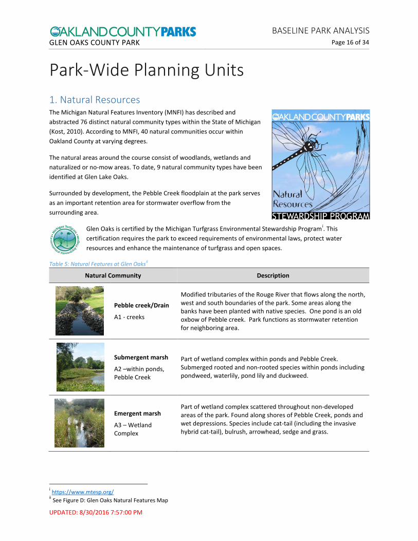
Park-Wide Planning Units 1. Natural Resources The Michigan Natural Features Inventory (MNFI) has described and abstracted 76 distinct natural community types within the State of Michigan (Kost, 2010). According to MNFI, 40 natural communities occur within Oakland County at varying degrees.
The natural areas around the course consist of woodlands, wetlands and naturalized or no-mow areas. To date, 9 natural community types have been identified at Glen Lake Oaks.
Surrounded by development, the Pebble Creek floodplain at the park serves as an important retention area for stormwater overflow from the surrounding area.
Glen Oaks is certified by the Michigan Turfgrass Environmental Stewardship Programi. This certification requires the park to exceed requirements of environmental laws, protect water resources and enhance the maintenance of turfgrass and open spaces.
Table 5: Natural Features at Glen Oaksii
Natural Community Description
Pebble creek/Drain
A1 - creeks
Modified tributaries of the Rouge River that flows along the north, west and south boundaries of the park. Some areas along the banks have been planted with native species. One pond is an old oxbow of Pebble creek. Park functions as stormwater retention for neighboring area.
Submergent marsh
A2 –within ponds, Pebble Creek
Part of wetland complex within ponds and Pebble Creek. Submerged rooted and non-rooted species within ponds including pondweed, waterlily, pond lily and duckweed.
Emergent marsh
A3 – Wetland Complex
Part of wetland complex scattered throughout non-developed areas of the park. Found along shores of Pebble Creek, ponds and wet depressions. Species include cat-tail (including the invasive hybrid cat-tail), bulrush, arrowhead, sedge and grass.
i https://www.mtesp.org/ ii See Figure D: Glen Oaks Natural Features Map

GLEN OAKS COUNTY PARK BASELINE PARK ANALYSIS
Page 17 of 34
UPDATED: 8/30/2016 7:57:00 PM
Natural Community Description
Southern shrub-carr A3 – Wetland Complex
Part of wetland complex scattered throughout non-developed areas of the park. A shrub-dominated wetland including dogwood, willow, buckthorn, horsetail, boneset and goldenrod.
Floodplain forest
A3 – Wetland Complex
Part of wetland complex scattered throughout non-developed areas of the park. The forested wetlands along the creek include silver maple, green ash, American elm, box-elder, basswood, and cottonwood.
Mesic southern forest
A4 – Woodland Complex
Found on lower slopes and edges of creek and wetlands. Also known as mixed-deciduous woods or beech-maple forest. Species include sugar maple, American beech, red and white oak, white ash, elm and basswood.
No-mow/ naturalized area
A5 – No Mow
Old field habitat. Species include goldenrod, aster, Queen-Anne’s-lace, honeysuckle, multi-flora rose, and grass.
Native plant restoration
A6 – Restoration
Native plant seeding with perennial plugs and grass seed, on slopes of southern pond. Planted in 2011. Species include sedge, grass, aster, Joe-Pye weed, foxglove, bergamot and golden Alexander.

GLEN OAKS COUNTY PARK BASELINE PARK ANALYSIS
Page 18 of 34
UPDATED: 8/30/2016 7:57:00 PM
Figure D: Glen Oaks Natural Features Map

GLEN OAKS COUNTY PARK BASELINE PARK ANALYSIS
Page 19 of 34
UPDATED: 8/30/2016 7:57:00 PM
2. Park Entrances, Roadways and Parking The main entrance to the park is located off 13-Mile Road between Orchard Lake Road and Middlebelt Road. There is a smaller east entrance. Both entrances lead to the main parking lot, which is located between the clubhouse and 13-Mile Road.
The gated maintenance drive is located in the southeast corner of the park off 13-Mile Road and leads to the Maintenance Yard, with a parking area located between the two maintenance buildings.
Photos from left: Parking lot on 13-Mile Road; maintenance entrance gate: Maintenance Building
3. Maintenance, Utilities and Security The Glen Oaks Maintenance Building is located in the east section of the park. Access is from 13-Mile Road. It was built in the southwest section in 2007, and located next to the former maintenance building. Additions were built in 2009; the maintenance parking lot now connects the two buildings. A chemical building is located in this vicinity as well. The former maintenance building is used as additional storage.
A Joint Use of Water Retention Site agreement stipulated shared use of a pond in the northern part of the park with an adjacent commercial developmenti.
The following utility easements and rights-of-way (ROW) are in place on the property: ROW to Pebble Creek Drain (Liber 11982 Page 065) DTE Overhead Easement (Liber 15183 Page 800) DTE Underground Easement (Liber 44172 Page 170) Drain Easement to Road Commission of Oakland County (Liber 11982 Page 065)
4. Technology There is one T-1 line into the park. Public Wi-Fi is available in the Conference Center and Grill Room.
5. Non-Recreational Features Not applicable at this park
i Liber 9169 Page 658

GLEN OAKS COUNTY PARK BASELINE PARK ANALYSIS
Page 20 of 34
UPDATED: 8/30/2016 7:57:00 PM
6. Park Trails and Regional Connectivity Cart paths are placed strategically throughout the course to ensure accessibility to each hole. “Tee to Green” paths allow for play in wet weather. The total length of cart paths is 23,519 feet. Golf carts are housed and maintained in a shelter located underneath the clubhouse.
Photo left: cart path

GLEN OAKS COUNTY PARK BASELINE PARK ANALYSIS
Page 21 of 34
UPDATED: 8/30/2016 7:57:00 PM
Location-Specific Planning Units Figure E: Park map showing locations of Planning Units
7. Clubhouse
3. Maintenance, Utilities and Security: Maintenance Yard
8. Golf Course: Restroom #1
3. Maintenance, Utilities and Security: Pump House
8. Golf Course: Restroom #2
8. Golf Course
2. Entrances, Roadways and Parking: Main Parking Lot
8. Golf Course: Training Facility
8. Golf Course: Greens Nursery

GLEN OAKS COUNTY PARK BASELINE PARK ANALYSIS
Page 22 of 34
UPDATED: 8/30/2016 7:57:00 PM
7. Clubhouse The Glen Oaks Clubhouse sits on the grounds of the golf course. Designated as a Michigan Historical Buildingi, the 1920’s English-style stone clubhouse serves as a backdrop for weddings, banquets, and golf outings. In addition to the Conference Center, the Clubhouse features a Pro Shop for golfers, a Grill Room for casual dining, and outdoor patio. The foyer, banquet room, ladies’ lounge and men’s restroom on the first floor were updated in 2013-14.
The grounds surrounding the Clubhouse are another element of the historic and elegant ambiance of the site. Outdoor weddings can be hosted in the formal garden on the west side of the Clubhouse. Cherry trees were planted to commemorate international understanding with Japan (details needed).
The second floor of the clubhouse has an apartment that is no longer in use, a bridal suite, and an attic storage area.
Bride’s Room: 250 square feet. It has two rooms – a lounge and a bathroom. Has original flooring. The furniture and décor were designed reflect the historic nature of the building, but now need updating.
Former Apartment: 675 square feet. Rooms include sitting room, bathroom, kitchen and bedroom. Has original flooring. Leasing of the apartment ceased in FY2011. Average rental revenue from FY2003-FY2010 was $2,768 (per Oakland County Fiscal Services documents). Resuming rental of the apartment is not recommended due to the expense of managing rental units, awkwardness of having an apartment in a banquet facility with no separate entrance, and potential security concerns. The apartment does not have a laundry; investment in upgrades would be necessary to enable leasing of the apartment.
Storage Attic: large open area with exposed rafters. It is used for storage of seasonal decorations and other items and provides access to the roof for maintenance.
Photos from left: clubhouse front entrance; Bride’s Room sitting area (2 photos)
i Affidavit, Farmington Hills Historic District (Liber 09605 Page 664)

GLEN OAKS COUNTY PARK BASELINE PARK ANALYSIS
Page 23 of 34
UPDATED: 8/30/2016 7:57:00 PM
Photos from left: former Apartment (2 photos); and Storage Attic
8. Golf Course Glen Oaks Park features an 18-hole, Par 70 course. The golf course includes a variety of settings to create a challenging course environment, from streams to sand lots. During the winter, the park is open to cross-country skiing and other activities depending on weather conditions. On-course restrooms/pit toilets are located in the vicinity of holes 4 and 13.
A training facility used for youth golf camps has been created at the north side of the golf course in a formerly unused area (hole #3 was located here before it was moved farther north). This area is being continually improved by staff and has created an opportunity to expand junior programming at a course with limited space.
Photos from left: Clubhouse (rear view, looking south); golf course; on-course restroom
Photos from left: views of training facility

GLEN OAKS COUNTY PARK BASELINE PARK ANALYSIS
Page 24 of 34
UPDATED: 8/30/2016 7:57:00 PM
Park Operation Planning Units 9. Organized Programs and Events
Putting, Chipping and Pitching Clinics Clinics are conducted by an Oakland County Parks and Recreation Golf Instructor. Class reservation and payment is made directly to the golf course at Glen Oaks.
Youth Golf Camps The southeast Michigan chapter of TGAi conducts 3-day and 5-day premier junior golf camps for a range of ages at Glen Oaks. Camps are offered 4-6 times per year. Each day of camp includes:
Station-based morning instruction (full swing, chipping and putting) Rules & etiquette and character development lessons Fun games and contests 9 holes of golf every afternoon, with an instructor accompanying each foursome. Lunch, green fees, collared golf shirt and three TGA logo golf balls
Parent/Child Tournaments This TGA program is for an adult over 18 years old and a junior golfer. It includes nine holes of golf for players, cart, clinic, golf balls and dinner. Additional family members can attend the dinner for an additional fee. The event runs from 2-6pm.
10. Data Collection and Management Estimates for monthly and annual numbers of park visits to Glen Oaks are compiled from two data sources: Golf Course point-of-sale data, and Conference Center head counts.
Number of rounds of golf, league players, and event/program participants are compiled monthly using information collected at point-of-sale.
Number of people who attend events and functions at the Conference Center are counted by Oak Management staff and reported to OCPR staff.
i TGA stands for “Teach.Grow.Acheive.”http://playtga.com/semichigan/

GLEN OAKS COUNTY PARK BASELINE PARK ANALYSIS
Page 25 of 34
UPDATED: 8/30/2016 7:57:00 PM
Park Maps A standard set of planning maps are provided in a separate document - the Planning Map Set. This section provides other park maps, such as trails, campsites, and golf course features, which are specific to this park.

GLEN OAKS COUNTY PARK BASELINE PARK ANALYSIS
Page 26 of 34
UPDATED: 8/30/2016 7:57:00 PM
Figure F: Golf Course Map

GLEN OAKS COUNTY PARK BASELINE PARK ANALYSIS
Page 27 of 34
UPDATED: 8/30/2016 7:57:00 PM
Figure G: Acquisition Grant Map
Parc
el p
art o
f orig
inal
par
k pr
oper
ty so
ld in
198
5
Not
map
ped:
Are
a de
eded
to
Farm
ingt
on H
ills i
n 20
02

GLEN OAKS COUNTY PARK BASELINE PARK ANALYSIS
Page 28 of 34
UPDATED: 8/30/2016 7:57:00 PM
Figure H: Farmington Section 2 Historic Plat Maps
1872 Plat Map (F.W. Beers and Co, 1872); 1896 Plat Map (Kace Publishing Company, 1896)
1908 Plat Map (Geo A. Ogle and Co., 1908); 1925 Plat Map (W.S. McAlpine Map Company, 1925)

GLEN OAKS COUNTY PARK BASELINE PARK ANALYSIS
Page 29 of 34
UPDATED: 8/30/2016 7:57:00 PM
1947 Plat Map (W.S. McAlpine Map Company, 1947); 1975 Plat Map (Rockford, 1975)
1982-83 Plat Map (Rockford, 1982-83); 1985 Plat Map (Rockford, 1985)

GLEN OAKS COUNTY PARK BASELINE PARK ANALYSIS
Page 30 of 34
UPDATED: 8/30/2016 7:57:00 PM
1988 Plat Map (Rockford, 1988)

GLEN OAKS COUNTY PARK BASELINE PARK ANALYSIS
Page 31 of 34
UPDATED: 8/30/2016 7:57:00 PM
Figure I: Harmon Oaks Park (City of Farmington Hills)
Glen Oaks County Park

GLEN OAKS COUNTY PARK BASELINE PARK ANALYSIS
Page 32 of 34
UPDATED: 8/30/2016 7:57:00 PM
References Albert, D. A. (1995). Gen. Tech. Rep. NC-178. Regional Lanscape Ecosystems of Michigan, Minnesota and
Wisconsin: a working map and classification, Tech. Rep. NC-178. St. Paul, MN: U.S. Department of Agriculture, Forest Service, North Central Forest Experiment Station.
BLM. (n.d.). General Land Office Records. Retrieved from US Department of the Interior Bureau of Land Management: http://www.glorecords.blm.gov/
Comer, P., & Albert, D. (1997). Vegetation circa 1800 Maps. Michigan Natural Features Inventory.
EDCA. (n.d.). Facts & Stats. Retrieved from Advantage Oakland - Economic Development & Community Affairs: https://www.oakgov.com/advantageoakland/business/Pages/county-profile-default.aspx
F.W. Beers and Co. (1872). Oakland County . Retrieved from http://www.historicmapworks.com/Atlas/US/7617/Oakland+County+1872/
Geo A. Ogle and Co. (1908). Standard Atlas of Oakland County, Michigan . Geo A. Ogle and Co. Retrieved from http://www.historicmapworks.com/Atlas/US/7659/
Kace Publishing Company. (1896). Illustrated Atlas of Oakland County . Retrieved from http://www.historicmapworks.com/Atlas/US/32464/Oakland+County+1896/
Kost, M. (2010). Report Number 2007-21. Version 1.2. Natural Communities of Michigan: Classification and Description. Lansing, MI: Michigan Natural Features Inventory.
NYT. (1952, January 18). Walter O. Briggs Dies at Age of 74. New York Times.
Oakland County. (2012). Advantage Oakland Community Profiles.
Oaklands Sub. (n.d.). Retrieved from Oaklands Subdivision, Farmington Hills, MI: http://oaklandssub.org/1194.html#top
OCPRC. (2015). Annual Dashboard and Data Book. Waterford, MI: Oakland County Parks and Recreation Commission.
Rockford. (1975). Oakland County Michigan Atlas and Plat Book. Rockford, IL: Rockford Map Publishers, Inc. .
Rockford. (1982-83). Oakland County Michigan Land Atlas and Plat Book. Rockford, IL: Rockford Map Publishers, Inc.
Rockford. (1985). Oakland County Michigan Land Atlas and Plat Book. Rockford, IL: Rockford Map Publishers, Inc. .
Rockford. (1988). Oakland County Michigan Land Atlas and Plat Book. Rockford, IL: Rockford Map Publishers, Inc. .
SEMCOG. (2015). Community Profiles. Retrieved from Southeast Michigan Council of Governments: http://semcog.org/Data-and-Maps/Community-Profiles
U.S. Census Bureau. (2015). Quick Facts. Retrieved August 30, 2016, from United States Census Bureau: http://www.census.gov/quickfacts/

GLEN OAKS COUNTY PARK BASELINE PARK ANALYSIS
Page 33 of 34
UPDATED: 8/30/2016 7:57:00 PM
W.S. McAlpine Map Company. (1925). Atlas of Southeastern Oakland County. Retrieved from http://www.historicmapworks.com/Atlas/US/27818/Oakland+County+1925/
W.S. McAlpine Map Company. (1947). Oakland County . W.S. McAlpine Map Co. Retrieved from http://www.historicmapworks.com/Atlas/US/10602/Oakland+County+1947/
Notes 1 How the Census Bureau Measures Poverty: “Following the Office of Management and Budget's (OMB) Statistical Policy Directive 14, the Census Bureau uses a set of money income thresholds that vary by family size and composition to determine who is in poverty. If a family's total income is less than the family's threshold, then that family and every individual in it is considered in poverty. The official poverty thresholds do not vary geographically, but they are updated for inflation using Consumer Price Index (CPI-U). The official poverty definition uses money income before taxes and does not include capital gains or noncash benefits (such as public housing, Medicaid, and food stamps).” (U.S. Census Bureau, 2015) 2 Ecoregion: An ecoregion (ecological region), sometimes called a bioregion, is an ecologically and geographically defined area that is smaller than an ecozone and larger than an ecosystem. Ecoregions cover relatively large areas of land or water, and contain characteristic, geographically distinct assemblages of natural communities and species. 3 Sub-subsection: Based on differences in climate, bedrock geology, glacial landform, and soils, the section, subsection, and sub-subsection levels of an ecoregion represent areas with distinctive natural conditions affecting species composition and productivity). 4 Ice-Contact Topography: This is a general term that refers to glacier-modified landscapes and includes many specific types of landforms, such as kames, eskers, moraines, kettles and outwash, among others. 5 Glacial Deposits: This refers to the rock and soil that is picked up and transported by glaciers as they create new landscapes and are eventually deposited by melting and retreating glaciers. 6 General Land Office: On April 25, 1812, by an Act of Congress the General Land Office was created within the Treasury Department. In creating the General Land Office, Congress combined the functions previously scattered among three Federal agencies—Treasury, War, and State. The Secretary of the Treasury had directed the survey and sale of public lands. Treasury also maintained records and accounts. The Secretary of War administered military bounties and bounty lands. Patents were issued by the Secretary of State. As of 1949, the General Land Office is part of the Bureau of Land Management within the Interior Department, which manages the archive of public land records (BLM). 7 See note 6. 8 Rural Property Inventories: During the Great Depression, the Michigan Department of Treasury collaborated with the Works Progress Administration to undertake an extensive survey of nearly all land parcels in the state (excluding Wayne County). The survey served two purposes: it provided jobs for unemployed engineers, land surveyors, and appraisers while giving the state a basis for assessing property taxes. The project started late in 1935 and continued until 1942 (Michigan Historical Center).

GLEN OAKS COUNTY PARK BASELINE PARK ANALYSIS
Page 34 of 34
UPDATED: 8/30/2016 7:57:00 PM
9 The Rouge River National Wet Weather Demonstration Project (Rouge Project) demonstrated development and implementation of a systematic watershed approach to pollution management. This cost-effective, holistic approach was shared in order to provide solutions to other urban watersheds throughout the country on how to restore a polluted urban waterway. The Rouge Project was initiated in 1992 by the Department of the Environment, Wayne County, Michigan. The Rouge River Watershed located in Southeast Michigan is largely urbanized, spans approximately 466 square miles, is home to more than 1.5 million people in 48 communities and three counties, and is a tributary to the Detroit River. Multi-year federal grants from the United States Environmental Protection Agency and additional funding from local communities support this cooperative effort between federal, state and local agencies. These grants were managed by Wayne County. http://www.waynecounty.com/doe/rouge/index.htm